| | Thumbnail | | Creator | Date | Title / Author / Date / Location | Price | | | Description |
| 6616 | 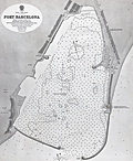 | Details | British Admiralty Hydrographical Office | |
| Original Admiralty harbor chart for Port Barcelona |
|
British Admiralty Hydrographical Office |
|
|
| LOC:57 |
| $900.00 | British-Admiralty-Hydrographical-Office | Original-Admiralty-harbor-chart-for-Port-Barcelona | Scarce original 1873 British Admiralty nautical harbour chart for the Port of Barcelona, Spain based on an earlier Spanish Survey. Chart number 1195.
<br><br>
Includes numerous soundings and shows a wide, long section at the west of the harbor "being reclaimed" as well as other construction then underway. Key features on the nautical chart include:
<div class="indenttextblocksingle">
<ul style="list-style-type: circle;">
<li>Barcelonnette, </li>
<li>Montjuich, </li>
<li>the Arsenal, </li>
<li>Punta de la Paz, </li>
<li>Vista Alegro, </li>
<li>Huertas de S. Beltran (orchards or vegetable gardens), </li>
<li>and the Old Mole light which was planned to be demolished.
</ul>
</div>
Published at the Admiralty, London on November 12, 1873 under the Superintendence of Rear Admiral G.H. Richards, Hydrographer from a Spanish chart of 1871.
<br><br>
Sold by J.D. Potter, agent for the sale of Admiralty charts, Tower Hill. Engraved by Edward Weller. Drawn by H. Stafford of the British Admiralty Hydrographical Office |
| 1017 | 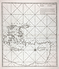 | Details | Anonymous | |
| Anonymous French chart of the east Mediterranean sea Sheet III |
|
Anonymous |
|
|
| LOC:58 |
| $800.00 | Anonymous | Anonymous-French-chart-of-the-east-Mediterranean-sea-Sheet-III | Interesting possibly unrecorded chart of the eastern Mediterranean Sea labeled "Feuille III" (Sheet 3.) Labels the key regions "Romanie, Caramanie, Natolie, Syrie". The regional naming and the area covered are generally consistent with those on the third (eastern) sheet of Bellin's "Carte de la Mer Mediterranee en Trois Feuilles" published in 1745 (based on Grognard's survey). This chart is nicely engraved and is printed on heavy wove paper, all signs of a quality in a published chart of that era.
<br></br>
However, although this chart bears the designation "Feuille III" and uses the French language, it is different in many ways. This chart is untitled, uses portrait format rather than landscape format, and displays very different geography- omits many key geographic features and places other features in different locations (e.g.. Isle Provencale near Alexandrette). Also significant is the absence of a distance scale and in the location where the title block is typically found, a list of eight islands with the comment that the list is of islands between the meridian of Cape St. Ange and Alexandrette (Iskenderun, Turkey). |
| 6350 | 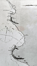 | Details | Fitz Roy, Robert | |
| Admiralty chart from 2nd Beagle Voyage along coastal Peru. |
|
Fitz Roy, Robert |
|
|
| LOC:67 |
| $365.00 | Fitz-Roy--Robert | Admiralty-chart-from-2nd-Beagle-Voyage-along-coastal-Peru- | Scarce original antique nautical chart of a portion of the coast of Peru between the Chicama River and Port Payta (Paita). A copper-plate engraving of a sea chart made under the auspices of Captain Robert Fitz Roy, R.N. (1805-1865) and the Officers of HMS Beagle.
<b>An important artifact from the hydrographic survey of the west coast of Peru made aboard the HMS Beagle on its second voyage, accompanied by Charles Darwin (1809 – 1882) as Naturalist. </b>
<br></br>
Traces of use at sea include manuscript track and bearing lines in pencil below Sechura Bay from the island of Lobos de Tierra to the island of Lobos de Afuera. Five finely engraved attractive inset elevation coastal views as seen from offshore.
<br></br>
Inset map of Point Eten based on an 1870 survey by a group including the H.M.S. Cameleon. A small warning that Eten Point is laid down on the map six miles east of its actual position.
<br></br>
Survey was conducted in 1836. First published by the British Admiralty on January 26, 1841 Last correction in December 1870. Engraved by J&C Walker. Sold by Potter. Chart # 1335. |
| 5163 |  | Details | Mentelle and Chanlaire | |
| Carte de la Caroline Meridionale et Septentrionale et de la Virginie |
|
Mentelle and Chanlaire |
|
|
| LOC:10 |
| $400.00 | Mentelle-and-Chanlaire | Carte-de-la-Caroline-Meridionale-et-Septentrionale-et-de-la-Virginie | Antique engraved map of the Southeast U.S.A. from Mentelle & Chanlaire's "Atlas Universel". Identifies some of the early roads in the Carolinas and Virginia, early western trade routes and settlements. Covers from the Delaware Bay to the Savannah River and inland as far as modern-day Iowa.
<br></br>
This finely engraved original map was published from Paris, France in 1795, shortly after the end of the Revolutionary war. Engraved by Tardieu |
| 6848 | 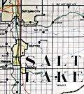 | Details | Utah Railway Chief Engineer | |
| Manuscript engineer's trace |
|
Utah Railway Chief Engineer |
|
|
| LOC:68 |
| $675.00 | Utah-Railway-Chief-Engineer | Manuscript-engineer-s-trace | Singular engineer's presentation trace for the Utah Railway. With this engineer's inked trace map the engineer's office could create numerous blueprint copies for distribution. Produced for the Utah Railway Chief Engineer's office and drawn by Elwood B. Stockman in Feb. 1927. Updated on June 1, 1934. Crisp artwork and lettering. Colors bright.
<br><br>
Shows Salt Lake City with the Salt Lake Base Line at upper left and extends well past Huntington, Utah at bottom right. Shows Park City.
<br><br>
The Utah Railway Company, originally named the Utah Coal Railway, was incorporated on January 24, 1912, and later shortened its name to Utah Railway in May of the same year. The company was founded to transport coal from its mines to Provo, Utah, due to an opening in the competitive landscape caused by dissatisfaction with the existing Denver and Rio Grande Railroad's service and route in the area.
<br><br>
During the 1930s, the Utah Railway faced challenges brought on by the Great Depression, which lowered demand for coal and, consequently, the railroad's business. However, the company managed to maintain its operations and even make some improvements during this difficult period. |
| 922 | 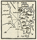 | Details | Bordone, Benedetto | 1534 |
| Very early chart of Lesbos or Lesvos, Greece |
|
Bordone, Benedetto |
|
| 1534 |
| LOC:2 |
| $375.00 | Bordone--Benedetto | Very-early-chart-of-Lesbos-or-Lesvos--Greece | One of the earliest printed maps of <b>Lesbos / Lesvos</b>, a Greek island in the northeastern Aegean Sea on a full page of text. Oriented with the east at the top, coverage includes Lesbos, and across the Edremit Gulf ("Colpho Adramatino"), the Ayvacik district of the Çanakkale Province of Turkey.
<br></br>
Perhaps the most interesting feature is that Bordone's map may be the earliest printed map to locate and name the Homeric <b>Bronze-age city of Troy</b>, although Bordone places Troy a bit farther south than its true location. On the mainland, in Turkey, near "Capo S. Maria" or present-day Babakale, the map shows a site "troia" with broken columns indicating ruins. Sonetti published an earlier map of Lesbos which inspired Bordone's map but there is no indication of ruins in that location, nor are there place names.
<br></br>
Shows the capital of <b>Mitilini / Mytilene ("Metelini")</b> somewhat misplaced to the northeast of the island. A bit to the west (on Bordonne's map) of Mitilini "la tore in mare" denotes a lighthouse in the sea. Nearby Mitilini, Bordone locates a hilltop church "Saint Theodoro". Saint Theodore is the patron saint of Mytilini.
<br></br>
Published from Venice in 1534 in the second edition of Benedetto di Bordone's 'Isolario', or "Island Book". The various editions of the Isolario were published using the same wood-block plates and each edition is differentiated from the other by the location of the page breaks within the text. The Isolario provided nautical-chart inspired maps of islands alongside information for travellers on their culture, myths, climate, and history.
<br></br>
Bordone (1460-1531) was a Paduan cartographer, and an illustrator of manuscripts, best known for his 'Isolario' or book of islands. Bordone's work was only the second isolario ever printed, the first being that of Bartolommeo Dalli Sonneti published in 1485. Text in Italian. |
| 978 | 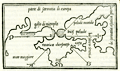 | Details | Bordone, Benedetto | 1534 |
| 16th century wood-cut map of Crimea and the Sea of Azov |
|
Bordone, Benedetto |
|
| 1534 |
| LOC:7 |
| $750.00 | Bordone--Benedetto | 16th-century-wood-cut-map-of-Crimea-and-the-Sea-of-Azov | Very scarce antique map of the <b>Crimean Peninsula</b> by Paduan cartographer Benedetto Bordone in 1534. Includes southern Ukraine labeled "parte di sarmatia di europa". With the Sea of Azov as "palude meotide" (<b>the Maeotis Swamp</b>) or "bicis palude". These names were applied in antiquity dating to Greek and Roman times.
<br></br>
The Strait of Kerch is labeled "bosphoro crinerico" and on the west side of Crimea "golfo di nigropila" is applied to Karkinitski or Karkinitsky Bay. An unnamed city is shown in the location held today by <b>Yalta</b>. The body of water we today call the Black Sea is labeled "mar maggiore" by Bordone.
<br></br>
This scarce antique map was published from Venice in 1534, just 42 years after Christopher Columbus first landed in the New World. From the second edition of Benedetto di Bordone's "Isolario" which provided nautical-chart inspired maps of islands alongside information for travellers on their culture, myths, climate, and history.
<br></br>
Bordone (1460-1531) was an illustrator of manuscripts, best known for his 'Isolario' or book of islands. Bordone's work was only the second isolario ever printed, the first being that of Bartolommeo Dalli Sonneti published in 1485. Text on verso in Italian. |
| 906 | 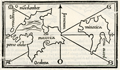 | Details | Bordone, Benedetto | 1534 |
| Very early Balearic Island charts with Ibiza and Majorca |
|
Bordone, Benedetto |
|
| 1534 |
| LOC:4 |
| $1,250.00 | Bordone--Benedetto | Very-early-Balearic-Island-charts-with-Ibiza-and-Majorca | Two of the earliest obtainable maps of Spain's Balearic Islands: Majorca / Mallorca, Minorca / Menorca, Ibiza / Eivissa, and Formentera. A single sheet containing two antique woodcut maps (one map on each side). Published from Venice in 1534 in the second edition of Benedetto di Bordone's 'Isolario', or "Island Book". The Isolario provided nautical-chart inspired maps of islands alongside information for travellers on their culture, myths, climate, and history.
<br></br>
Recto contains a map with a portion of the eastern coast of Spain, at that time part of the "Regno de Catelogna", with five un-named settlements near "C. Martino" (today a diving spot kown as Cabo de San Martin) that may include Gandia, Javea / Xàbia, or Alicante. Offshore of the coast are the Balearic islands of Ibiza ("Ieuiza") and Formentera ("Formentazia") with the smaller surrounding islets of Tagomago, "Famolaria" (Santa Eulalia ?), and "Dragoneza" in the vicinity of Illa Sa Conillera. The last may be a error on the part of Bordone as there is an island "Illa Sa Dragonera" but it is located off the coast of Mallorca in roughly the same relative location to the west of the island.
<br></br>
Verso contains a map with Majorca ("Maiorica") with "Porto Colobo" or the Bay of Palma, and Minorca ("Minorica") with " Porto Mao" or Port Mahon. Two islets shown are Illa de l'Aire ("Cabrera") and "Dragonera".
<br></br>
Bordone's directional symbols correspond to many of the Italian names for the principal Mediterranean winds including, [G]reco; a cross denoting East ; [S]irocco; [O]stro or South; [P]onente or West; and [M]aestro.
<br></br>
Bordone (1460-1531) was a Paduan cartographer, and an illustrator of manuscripts, best known for his 'Isolario' or book of islands. Bordone's work was only the second isolario ever printed, the first being that of Bartolommeo Dalli Sonneti published in 1485. Text in Italian. |
| 977 | 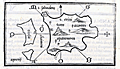 | Details | Bordone, Benedetto | 1534 |
| Very old wood-cut map of the island of Santorini, Greece |
|
Bordone, Benedetto |
|
| 1534 |
| LOC:2 |
| $600.00 | Bordone--Benedetto | Very-old-wood-cut-map-of-the-island-of-Santorini--Greece | An early map of the Greek Aegean Island of Santorini ("S. Erini") in the Cycladic Island group. Opposite the caldera from Thira is the smaller island of Thirasia ("Tiresia"). Shows four villages: Oia ("San Salvadore"), Pyrgos ("Scaro"), Akrotiri ("Acortiri") and "Apanomerca".
<br></br>
Shows a jagged set of lines on the west coast of the island similar to the letter "M" set on its side. From the location it almost certainly represents the switchback road leading down the cliff face to the beach and ferry station; a feature most tourists to the island who arrive by boat will well remember.
<br></br>
Map is inset onto a full page of Italian text. Verso contains another similar-sized map of the Cycladic island of "Namphio" (present-day Anafi) which lies just a few miles to the east of Santorini.
<br></br>
This scarce antique map was published from Venice in 1534, just 42 years after Christopher Columbus first landed in the New World. From the second edition of Benedetto di Bordone's "Isolario" which provided nautical-chart inspired maps of islands alongside information for travellers on their culture, myths, climate, and history.
<br></br>
Bordone (1460-1531) was a Paduan cartographer, and an illustrator of manuscripts, best known for his 'Isolario' or book of islands. Bordone's work was only the second isolario ever printed, the first being that of Bartolommeo Dalli Sonneti published in 1485. Text on verso in Italian. |
| 1037 |  | Details | Bordone, Benedetto | 1534 |
| Early maps of the Greek Cycladic islands of Tinos and Andros |
|
Bordone, Benedetto |
|
| 1534 |
| LOC:2 |
| $325.00 | Bordone--Benedetto | Early-maps-of-the-Greek-Cycladic-islands-of-Tinos-and-Andros | One of the earliest printed maps of the Greek islands of Tinos and Andros, both located in the northern Cyclades archipelago. Two maps on a single page. The map of Andros shows a fortified Andros town perched on a peninsula at the western side of the island.
<br></br>
Published from Venice in 1534 in the second edition of Benedetto di Bordone's 'Isolario', or "Island Book". The various editions of the Isolario were published using the same wood-block plates and each edition is differentiated from the other by the location of the page breaks within the text. The Isolario provided nautical-chart inspired maps of islands alongside information for travelers on their culture, myths, climate, and history.
<br></br>
Bordone (1460-1531) was a Paduan cartographer, and an illustrator of manuscripts, best known for his 'Isolario' or book of islands. Bordone's work was only the second isolario ever printed, the first being that of Bartolommeo Dalli Sonneti published in 1485. Text in Italian. |
| 923 | 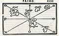 | Details | Bordone, Benedetto | 1534 |
| Very early map of Cadiz, Spain and the Azores, Portugal |
|
Bordone, Benedetto |
|
| 1534 |
| LOC:4 |
| $575.00 | Bordone--Benedetto | Very-early-map-of-Cadiz--Spain-and-the-Azores--Portugal | One of the earliest printed Azore Island maps (and another map of Cadiz, Spain) on a single sheet. Published from Venice in 1534 in the second edition of <b>Benedetto di Bordone's</b> nautical "Isolario", or Island Book.
<br></br>
The Isolario provided nautical-chart inspired maps of islands alongside information for travellers on their culture, myths, climate, and history.
<br></br>
A fine and original early nautical map of the <b>Azores islands</b>, in the Atlantic Ocean about 850 miles west of Portugal. Three islands on Bordonne's Azores map can be traced to their present-day equivalents: "S. Maria" (Santa Maria), "S. Georgio" (Sao Jorge), and "Samguimi" (Sao Miguel). Also shows the <b>mythical islands</b> of "Asmaida" and "Brasil" or Hy-Brazil as is is called in modern cartographic literature. Brasil island was long imagined to be located somewhere in the Atlantic Ocean to the west of Ireland. Brasil appears on several manuscript Portolani from the 14th and 15th century by Angelino Dulcert (1325), Andrea Bianco (1436) and others. Over almost 200 years several expeditions to find the Brasil were conducted by John Cabot, John Jay and others but as it was only an imaginary island the explorations failed.
<br></br>
Bordone's map of <b>Cadiz, Spain</b> (verso) is very interesting for its early place in the evolution of the cartography of that region. This map is almost cartoon-like in its simplicity. With the "Stretto de Gibilterra" defining the right limit of the map, and the "Regno de Castiglia" above, Cadiz is shown as a simple crescent shape slightly separated from the mainland. Towns that Bordone noted include "Gades" (Cadiz) , Turs, Tola, and S. Maria.
<br></br>
Bordone (1460-1531) was a Paduan cartographer, and an illustrator of manuscripts, best known for his 'Isolario' or book of islands. Bordone's work was only the second isolario ever printed, the first being that of Bartolommeo Dalli Sonneti published in 1485. Text in Italian. |
| 924 | 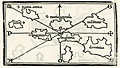 | Details | Bordone, Benedetto | 1534 |
| Very early map of the Leeward Islands of the Lesser Antilles |
|
Bordone, Benedetto |
|
| 1534 |
| LOC:5 |
| $940.00 | Bordone--Benedetto | Very-early-map-of-the-Leeward-Islands-of-the-Lesser-Antilles | The first printed maps of the Caribbean islands of St. Martin and Guadeloupe, published just 42 years after Christopher Columbus first landed in the New World. An attractive group of three antique maps inset on a single sheet with Italian text on verso and recto.
<br></br>
The recto includes a small-scale chart of the Leeward Islands. Here the geographical relationship of the islands bears little resemblance to present-day maps. Bordonne names the islands: "S. Maria Rotonda"; "Moserato" or Montserrat; "Buchima" or "Barbuda"; "Dominica"; S. Maria Antica" or Antigua; "Santa" or "Saint Kitts?; and "C. Martino" or St. Martin.
<br></br>
Two additional maps on the verso show the islands of "Guadalupe" Guadeloupe and "Matinina" or St. Martin. Each island is decorated with features that Bordonne addresses in the text. Guadeloupe is shown covered with a low leafy vegetation. St. Martin sports numerous caves set into small hills.
<br></br>
Published from Venice in 1534 in the second edition of Benedetto di Bordone's "Isolario", or Island Book. The Isolario provided nautical-chart inspired maps of islands alongside information for travellers on their culture, myths, climate, and history.
<br></br>
Bordone (1460-1531) was a Paduan cartographer, and an illustrator of manuscripts, best known for his 'Isolario' or book of islands. Bordone's work was only the second isolario ever printed, the first being that of Bartolommeo Dalli Sonneti published in 1485. Text in Italian. |
| 925 | 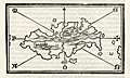 | Details | Bordone, Benedetto | 1534 |
| First printed map of the Caribbean island of Hispaniola |
|
Bordone, Benedetto |
|
| 1534 |
| LOC:5 |
| $900.00 | Bordone--Benedetto | First-printed-map-of-the-Caribbean-island-of-Hispaniola | The first printed large-scale map of the Caribbean island of <b>Hispaniola</b> which is shared by two nations: the Dominican Republic and Haiti. Also the first printed map to show the earliest settlement in the New World (other than a Viking settlement)- <b>La Isabela</b> ("Isabella"). During his second voyage in 1493 Christopher Columbus founded La Isabela on the central north coast of Hispaniola, in what is today the Dominican Republic. Map is inset onto a full page of Italian text.
<br></br>
This scarce antique map was published from Venice in 1534, just 42 years after Christopher Columbus first landed in the New World. From the second edition of Benedetto di Bordone's "Isolario di Benedetto Bordone Nel qual si ragiona di tutte l'Isole del mondo, con li lor nomi antichi & moderni, historie, favole, & modi del loro vivere, & in qual parte del mare stanno, & in qual parallelo & clima giaciono. Con la gionta del Monte del Oro novamente ritrovato". The Isolario provided nautical-chart inspired maps of islands alongside information for travellers on their culture, myths, climate, and history. Bordonne depicts the interior of the island as mountainous with numerous rivers flowing to the sea.
<br></br>
Bordone (1460-1531) was a Paduan cartographer, and an illustrator of manuscripts, best known for his 'Isolario' or book of islands. Bordone's work was only the second isolario ever printed, the first being that of Bartolommeo Dalli Sonneti published in 1485. Text on verso in Italian. |
| 926 | 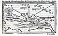 | Details | Bordone, Benedetto | 1534 |
| Early printed map of South America with Hispaniola and Jamaica |
|
Bordone, Benedetto |
|
| 1534 |
| LOC:5 |
| $800.00 | Bordone--Benedetto | Early-printed-map-of-South-America-with-Hispaniola-and-Jamaica | One of the earliest printed maps and the first obtainable map of the <b>South American continent</b>. South America is not recognizable as such but it closely compares to Rosselli's world map of 1508 from which Bordonne derived the shape.
<br></br>
Includes the Caribbean islands of <b>Jamaica</b> ("Iamaiqua") and <b>Hispaniola</b> ("Spagnola"). Within the truncated area of South America, Bordonne names four major regions which he discussed in the text: "Chanchite", (in the vicinity of present-day Colombia), "Cuztana", "Maziatombal" (associated with the Amazon River), and "Paria" (which may be related to the eastern portion of Venezuela).
<br></br>
This scarce antique map was published from Venice in 1534, just 42 years after Christopher Columbus first landed in the New World. From the second edition of Benedetto di Bordone's "Isolario di Benedetto Bordone Nel qual si ragiona di tutte l'Isole del mondo, con li lor nomi antichi & moderni, historie, favole, & modi del loro vivere, & in qual parte del mare stanno, & in qual parallelo & clima giaciono. Con la gionta del Monte del Oro novamente ritrovato". The Isolario provided nautical-chart inspired maps of islands alongside information for travellers on their culture, myths, climate, and history. Bordonne depicts the interior of the island as mountainous with numerous rivers flowing to the sea.
<br></br>
Bordone (1460-1531) was a Paduan cartographer, and an illustrator of manuscripts, best known for his 'Isolario' or book of islands. Bordone's work was only the second isolario ever printed, the first being that of Bartolommeo Dalli Sonneti published in 1485. Text on verso in Italian. |
| 927 | 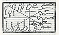 | Details | Bordone, Benedetto | 1534 |
| Early map of the Canary Islands and Cape Verde Islands |
|
Bordone, Benedetto |
|
| 1534 |
| LOC:7 |
| $950.00 | Bordone--Benedetto | Early-map-of-the-Canary-Islands-and-Cape-Verde-Islands | The first small-scale printed map to name the individual <b>Canary Islands</b> now part of Spain, and the Portugese <b>Cape Verde Islands</b>. Both groups of islands are shown in the Atlantic Ocean on a single map with part of Africa.
<br></br>
At right Bordonne shows the coast of Africa and names the on-shore regions "Getulia", "Argin" (Arguin ?), and "Libya di Sotto". Bordonne's names for the main Canary Islands and their modern equivalents are: "Palma" (La Palma), "Agore" (La Gomera), "Tinerif" (Tenerife), "Canaria" (Gran Canaria), "Forte Ventura" (Fuerteventura), and "Lazazoto" (Lazarote).
<br></br>
At bottom left are the most northern of the Cape Verde Islands, or the Ilhas de Barlavento:
"S. Antonio" ( Santo Antão),"S. Vincenzio" (São Vicente), "S. Jacopo" ("Santa Luzia"), "S. Nicolo" (São Nicolau). Some islands shown close to the coast are more difficult to account for: "I. Bianca" (Sal ?), "I. delle Gaze" (Boa Vista ?) and "Cuori".
<br></br>
From the second Zoppino edition of Benedetto di Bordone's "<b>Isolario di Benedetto Bordone</b> Nel qual si ragiona di tutte l'Isole del mondo, con li lor nomi antichi & moderni, historie, favole, & modi del loro vivere, & in qual parte del mare stanno, & in qual parallelo & clima giaciono. Con la gionta del Monte del Oro novamente ritrovato". This scarce antique map was published from Venice in 1534, just 42 years after Christopher Columbus first landed in the New World. The Isolario provided nautical-chart inspired maps of islands alongside information for travellers on their culture, myths, climate, and history.
<br></br>
Bordone (1460-1531) was a Paduan cartographer, and an illustrator of manuscripts, best known for his 'Isolario' or book of islands. Bordone's work was only the second isolario ever printed, the first being that of Bartolommeo Dalli Sonneti published in 1485. Text on verso in Italian. |
| 928 |  | Details | Bordone, Benedetto | 1534 |
| Early maps of Madeira and Ptolemaic Canary Islands |
|
Bordone, Benedetto |
|
| 1534 |
| LOC:7 |
| $950.00 | Bordone--Benedetto | Early-maps-of-Madeira-and-Ptolemaic-Canary-Islands | Two antique maps, one of Madeira, an island of Portugal in the Atlantic Ocean, and a curious map of the Atlantic islands on Africa's west coast based on the names and locations used by the Greeks and Romans. On the recto is the first printed map of the Portugese island of Madeira, by Benedetto Bordonne. Bordonne depicts the island as mountainous with numerous trees, and names four villages: "Camera de Lioni" (Câmara de Lobos); Fonzal" (Funchal); "Santa" (Sao Vincente); "Monerico" (Machico).
<br></br>
In his "Geography", Claudius Ptolemy, the Greco-Egyptian geographer lists a number of islands and their geographic coordinates. The verso contains one of the first printed maps showing the location of the Atlantic islands with Ptolemy's place names or that of the of the Roman geographer Pliny including: "Autolala" (Madeira), "Ninguaria" (Tenerife), "Canaria" (Gran Canaria), "Iunone" (Lanzarote or Fuerteventura), "Ombrio" (Ferro), and "Cisperia" (La Gomera). (Smith, William. <B>Dictionary of Greek and Roman Geography</b>. London. 1869. <a href="https://books.google.com/books?id=xgtAAQAAMAAJ&pg=PA906&lpg=PA906&dq=roman+names+for+canary+islands&source=bl&ots=2tZo3281lY&sig=rABlSnYBibeSpYSIR0SmvJp67Ms&hl=en&sa=X&ved=0CEMQ6AEwCDgKahUKEwjR28e1zerIAhXBJCYKHQ7VClc#v=onepage&q=906&f=false" target="_blank">Internet.)</a>
<br></br>
From the second Zoppino edition of Benedetto di Bordone's "<b>Isolario di Benedetto Bordone</b>" . This scarce antique map was published from Venice in 1534, just 42 years after Christopher Columbus first landed in the New World. The Isolario provided maps of islands alongside information for travellers on their culture, myths, climate, and history.
<br></br>
Bordone (1460-1531) was a Paduan cartographer, and an illustrator of manuscripts, best known for his 'Isolario' or book of islands. Bordone's work was only the second isolario ever printed, the first being that of Bartolommeo Dalli Sonneti published in 1485. |
| 929 |  | Details | Bordone, Benedetto | 1534 |
| Early map of Porto Santo Island in the Madeira archipelago |
|
Bordone, Benedetto |
|
| 1534 |
| LOC:7 |
| $350.00 | Bordone--Benedetto | Early-map-of-Porto-Santo-Island-in-the-Madeira-archipelago | Antique woodcut printed map of Porto Santo off the west coast of Africa in the Atlantic ocean. One of the earliest printed maps solely devoted to Porto Santo island, in the Portugese Madeira island group. By Benedetto Bordonne, who shows Porto Santo, Portugal in its geographical context with Madeira to the south and the west coast of Africa or "Getulia" to the east. Show several villages scattered around the island.
<br></br>
On a full sheet of Italian text. From the second Zoppino edition of Benedetto di Bordone's "<b>Isolario di Benedetto Bordone</b>" . This scarce antique map was published from Venice in 1534, just 42 years after Christopher Columbus first landed in the New World. The Isolario provided maps of islands alongside information for travellers on their culture, myths, climate, and history.
<br></br>
Bordone (1460-1531) was a Paduan cartographer, and an illustrator of manuscripts, best known for his 'Isolario' or book of islands. Bordone's work was only the second isolario ever printed, the first being that of Bartolommeo Dalli Sonneti published in 1485. |
| 1062 |  | Details | Fries, Laurent | 1541 |
| Tabula Nova Asiae Minoris |
|
Fries, Laurent |
|
| 1541 |
| LOC:9 |
| $900.00 | Fries--Laurent | Tabula-Nova-Asiae-Minoris | Attractive, scarce, very-early woodcut map of Asia Minor (Turkey, Syria, Iraq) by Laurent Fries. With the islands of Cyprus, Tenedos, Mitilini, Chios, and Rhodes clearly identified. Also easily identified by name are the location of Constantinople, Ephesus, Aleppo, and Damascus.
<br></br>
Published in 1541 in the second edition of Michael Servetus' "Ptolemy 's Geographia", published from Vienna by Gaspar Treschel. This guide to geography, written in the 2nd century A.D. by Claudius Ptolemy, a Greco-Egyptian writer became the standard work until the 16th century, and remained influential in the 18th century, in spite of its inaccuracies. In this edition Servetus makes use of the same maps produced by Laurentius Fries for his 1522 edition of Ptolemy.
<br></br>
Latin text on verso titled: "De Mahometo et Turcarum Origine & Moribus." |
| 2507 | 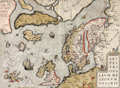 | Details | Ortelius, Abraham | 1570 |
| Scarce map of the Arctic and Scandinavia |
|
Ortelius, Abraham |
|
| 1570 |
| LOC:10 |
| $2,200.00 | Ortelius--Abraham | Scarce-map-of-the-Arctic-and-Scandinavia | Ortelius' map of the Arctic, including Scandinavia, Iceland, Greenland and part of the North American continent, includes the legendary islands of Drogeo, Frisland and Icaria. This fine map, with original color, is adorned with a variety of very inventive creatures including a half-man, half-sea creature with bird feet playing a lute. Second state with a triangular dot added at the end of the title. |
| 851 | 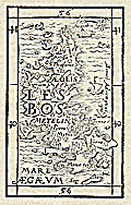 | Details | Munster, Sebastien | 1571 |
| Antique wood cut of the island of Lesbos, Greece |
|
Munster, Sebastien |
|
| 1571 |
| LOC:2 |
| $150.00 | Munster--Sebastien | Antique-wood-cut-of-the-island-of-Lesbos--Greece | Antique wood block printed map of the island of Lesbos ( Lesvos ), Greece in the northeastern Aegean Sea.
<br></br>
From "Strabonis rerum geographicarum libri septemdecim" authored by Sebastien Munster and published by Heinrich Petri. Map is inset in a 8"x11" full page of text, both in Greek and Latin. Text on verso. |
| 832 | 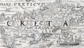 | Details | Munster, Sebastien | 1571 |
| Antique wood cut of the island of Crete, Greece |
|
Munster, Sebastien |
|
| 1571 |
| LOC:2 |
| $150.00 | Munster--Sebastien | Antique-wood-cut-of-the-island-of-Crete--Greece | Antique map of Crete ( "Creta" ), Greece in the southern Aegean Sea. In this decorative map from 1571 numerous towns are identified including Heraklion ( "Heraclea" ) , Chania ( "Candia" ), Rethymno ( "Rhithymna" ), and "Minoa". Crete was home to the Bronze age Minoan civilization. Today remains of the Minoan civilization are found across the island, particulary at the archaeological sites of Knossos, Phaistos, Malia, and Kato Zakros.
Several mountain chains and rivers are shown on this rare wood cut map of Crete. In the bottom right corner Munster has placed a large oared galley, with the Lion of St. Marks painted on its lateen sail, signifying Venice's rule over the island for more than four centuries.
<br></br>
From "Strabonis rerum geographicarum libri septemdecim" authored by Sebastien Munster and published by Heinrich Petri. Map is inset in a 8"x11"full page of text, both in Greek and Latin. Text on verso. |
| 728 |  | Details | Braun and Hogenberg | 1571 |
| Plan of Enkhuizen, Netherlands |
|
Braun and Hogenberg |
|
| 1571 |
| LOC:89 |
| $440.00 | Braun-and-Hogenberg | Plan-of-Enkhuizen--Netherlands | Very special and much underappreciated plan of Enkhuizen, Netherlands published by Braun and Hogenberg but probably drawn by famous cartographer Lucas Janszoon Wagenhaer, pre-dating his famous atlas the "Spiegel der Zeevaerdt". This is to our knowledge the first readily available work by Waghenaer who was born and raised in Enkhuizen, Netherlands |
| 4727 | 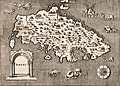 | Details | Porcacchi, Tomasso | 1572 |
| Very old antique map of Rhodes, Greece |
|
Porcacchi, Tomasso |
|
| 1572 |
| LOC:2 |
| $275.00 | Porcacchi--Tomasso | Very-old-antique-map-of-Rhodes--Greece | Authentic copperplate-engraved antique map (1572) of the Greek Dodecanese island of Rhodes (Rhodi) engraved by Girolamo Porro and drawn by Tomasso Porcacchi. Numerous fantastical sea serpents and monstrous fishes fill empty areas in the finely stippled seas. A few of the key features include smaller islands of Carchi, Limona, San Nicolo, and Tranquilla. Detail in the interior of Rhodes includes towns or villages of Villanova, Camira, Aganca, Zalfo, Sorini, Fiando, Rufarcangeli Farado, and more. The port of Rhodes or Rhodos is shown surrounded by fortified walls with several guard towers.
<br></br>
Printed in Tomasso Porcacchi's "Isolario" or island book "L'Isol Piu Famose Del Mondo". That work contains a number of finely engraved maps of islands and the continents at a reduced scale. Porcacchi (1530-1585) was born in Tuscany to a poor family and first settled in Florence. He wrote about history, geography, and archaeology and later published the Isolario from Venice, Italy in three editions beginning in 1572. |
| 916 | 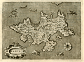 | Details | Porcacchi, Tomasso | 1572 |
| Greek Island of Zakynthos or Zante in the Ionian Sea |
|
Porcacchi, Tomasso |
|
| 1572 |
| LOC:2 |
| $175.00 | Porcacchi--Tomasso | Greek-Island-of-Zakynthos-or-Zante-in-the-Ionian-Sea | Copperplate-engraved antique map (1576), engraved by Girolamo Porro and drawn by Tomasso Porcacchi, of the Greek Ionian island of Zante or Zakynthos, the third largest of the Ionian Islands. A few of the key features Porcacchi notes on this old map of Zakynthos are: Plomati, Ambello, Zero Castelli, la Madonna, Santa Maria de Piscopo, and a large saline or salt marsh in a large bay to the north. Fantastical sea serpents fill empty areas in the finely stippled seas.
<br></br>
On a full page with text on recto and verso. Woodcut capital letter "I" at the beginning of the textual desription of Zante, in Italian, just below the map. Woodcut headpiece and a scrollwork title cartouche with simply "Zante".
<br></br>
Printed in Tomasso Porcacchi's "Isolario" or island book "L'Isol Piu Famose Del Mondo". That work contains a number of finely engraved maps of islands and the continents at a reduced scale. Porcacchi (1530-1585) was born in Tuscany to a poor family and first settled in Florence. He wrote about history, geography, and archaeology and later published the Isolario from Venice, Italy in three editions beginning in 1572. Page 98. |
| 5197 | 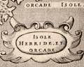 | Details | Porcacchi, Tomasso | 1572 |
| Isole Hebride et Orcade Scotland |
|
Porcacchi, Tomasso |
|
| 1572 |
| LOC:7 |
| $375.00 | Porcacchi--Tomasso | Isole-Hebride-et-Orcade-Scotland | Authentic copperplate-engraved antique map (1572) of the Hebrides and Orcades Islands off the mainland of Scotland. This map of the Orcades and Hebrides was drawn by Tomasso Porcacchi and was engraved by Girolamo Porro.
<br></br>
Printed in Tomasso Porcacchi's "Isolario" or island book "L'Isol Piu Famose Del Mondo". That work contains a number of finely engraved maps of islands and the continents at a reduced scale. Porcacchi (1530-1585) was born in Tuscany to a poor family and first settled in Florence. He wrote about history, geography, and archaeology and later published the Isolario from Venice, Italy in three editions beginning in 1572. |
| 5170 | 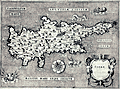 | Details | Porcacchi, Tomasso | 1572 |
| Antique map of Cyprus Cipro by Porcacchi |
|
Porcacchi, Tomasso |
|
| 1572 |
| LOC:2 |
| $375.00 | Porcacchi--Tomasso | Antique-map-of-Cyprus-Cipro-by-Porcacchi | Authentic copperplate-engraved antique map of the Mediterranean island of Cyprus (Cipro) by Tomasso Porcacchi.
<br></br>
Printed in Tomasso Porcacchi's "Isolario" or island book "L'Isol Piu Famose Del Mondo". That work contains a number of finely engraved maps of islands and the continents at a reduced scale. Porcacchi (1530-1585) was born in Tuscany to a poor family and first settled in Florence. He wrote about history, geography, and archaeology and later published the Isolario from Venice, Italy in three editions beginning in 1572. |
| 115 | 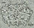 | Details | Thevet, Andre | 1575 |
| Palimbotre |
|
Thevet, Andre |
|
| 1575 |
| LOC:6 |
| $150.00 | Thevet--Andre | Palimbotre | Attractive antique woodblock engraving by Andre Thevet of a perhaps mythical island 'Palimbotre' that he places south of the Ganges River in the Bay of Bengal. About Palimbotre Thevet writes " in this island most of the inhabitants idolize and respect their idols which are made of decorous ebony, where their neighbors of the continent fashion them from marble, stone, sandalwood and other materials" (Conley, Tom. P. 195).<BR> </BR>
Thevet, born around 1516, became a Franciscan friar and wrote extensively about his travels in both the old world and new, widely embellishing the stories and images with myth and fiction. |
| 915 | 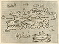 | Details | Porcacchi, Tomasso | 1576 |
| Greek Island of Karpathos or Scarpanto in the Aegean |
|
Porcacchi, Tomasso |
|
| 1576 |
| LOC:2 |
| $250.00 | Porcacchi--Tomasso | Greek-Island-of-Karpathos-or-Scarpanto-in-the-Aegean | Interesting antique map from 1576, by Tomasso Porcacchi, of the Greek Aegean island of Scarpanto or Kárpathos, about 30 miles southwest of Rhodes. Karpathos is part of the Dodecanese island group. A few of the key features Porcacchi notes on this old map are: Porto Grato, Porto Tristano, Capo Bonadrea, Castro Calamo, and Fianti. The walled village of Scarpanto is depicted on the East end of the island with three mountains directly to the west: M. St. Elya, M. Ores, and M. Anchinara.
<br></br>
On a full page with text. Wood-cut capital letter "P" at the beginning of the textual desription of Candia, in Italian, just below the map.
<br></br>
Printed in Tomasso Porcacchi's "Isolario" or island book "L'Isol Piu Famose Del Mondo". That work contains a number of finely engraved maps of islands and the continents at a reduced scale. Porcacchi (1530-1585) was born in Tuscany to a poor family and first settled in Florence. He wrote about history, geography, and archaeology and later published the Isolario from Venice, Italy in three editions beginning in 1572. Page 113. |
| 1222 | 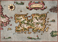 | Details | Porcacchi, Tomasso | 1576 |
| Scarce map of Puerto Rico, San Giovanni or Borichen |
|
Porcacchi, Tomasso |
|
| 1576 |
| LOC:5 |
| $350.00 | Porcacchi--Tomasso | Scarce-map-of-Puerto-Rico--San-Giovanni-or-Borichen | Fine sixteenth-century map of the Caribbean island of Puerto Rico, or Borichen as it was known by the indigenous Taino Indians. One of the earliest available maps specifically of Puerto Rico. San Juan is noted as S. Giovanni.
<br></br>
Contains the eastern coast of Cuba and a scattering of islands ( Le Vergini ) representing the British Virgin Islands. At bottom left is seen S. Croce (St. Croix). A large island off the southeast coast of Puerto Rico, "El Bacan" is probably the nearby island of Vieques. Numerous sea serpents swim in the offshore waters.
<br></br>
Printed in Tomasso Porcacchi's "Isolario" or island book "L'Isol Piu Famose Del Mondo". That work contains a number of finely engraved maps of islands and the continents at a reduced scale. Porcacchi (1530-1585) was born in Tuscany to a poor family and first settled in Florence. He wrote about history, geography, and archaeology and later published the Isolario from Venice, Italy in three editions beginning in 1572. Italian text on verso. |
| 913 | 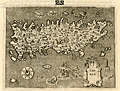 | Details | Porcacchi, Tomasso | 1576 |
| Island of Candia (Crete) in Greece |
|
Porcacchi, Tomasso |
|
| 1576 |
| LOC:2 |
| $275.00 | Porcacchi--Tomasso | Island-of-Candia-(Crete)-in-Greece | Very interesting early antique map of the Greek Mediterranean island of Candia (Crete or Kriti), the largest island in Greece. This late 16th century map, by Tomasso Porcacchi, shows some of the largest towns on the island at that time: Cania (Chania), Retimo (Rethimno), and Candia (Iraklio). Numeous small islands and islets are named offshore including Morena, Farioni, Paxmando, and Standia. In the stippled sea, empty space is filled with fanciful sea creatures, huge sea snails, crabs, and a three-masted galleon.
<br></br>
At the center of the map is a cicular design of a maze south of the town of Candia (Iraklio or Heraklion). That maze is a reference to the labyrinth of King Minos of Crete that was believed to be located at the palace at Knossos. Since classical times that site was believed to be the location where Daedalus built the labyrinth for King Minos to hold the mythical Minotaur.
<br></br>
The entrance to three caves is depicted near the southwest coast in the general vicinity of the well-known Samaria Gorge. At that spot Porcacchi has noted: "Habitation d' homini e bestiami nelle chuerne" or the dwelling of men and cattle in ?chuerne.
<br></br>
Printed in Tomasso Porcacchi's "Isolario" or island book "L'Isol Piu Famose Del Mondo". That work contains a number of finely engraved maps of islands and the continents at a reduced scale. Porcacchi (1530-1585) was born in Tuscany to a poor family and first settled in Florence. He wrote about history, geography, and archaeology and later published the Isolario from Venice, Italy in three editions beginning in 1572. Page 108. |
| 2506 | 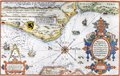 | Details | Waghenaer, Lucas Jansz | 1584 |
| Rare Dutch Sea chart of Belgium, Picardie, and France |
|
Waghenaer, Lucas Jansz |
|
| 1584 |
| LOC:9 |
| $1,800.00 | Waghenaer---Lucas-Jansz | Rare-Dutch-Sea-chart-of-Belgium--Picardie--and-France | A treasure! Chart of the English Channel printed in 1584, four years before the "Invincible Armada" of Spain was defeated in their attempt to conquer England. Extends from Nieuwpoort to Dieppe. With two coastal profiles. French text edition. Published in Leiden by Plantin. |
| 2572 | 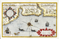 | Details | Waghenaer, Lucas Jansz | 1586 |
| Rare Dutch Sea Chart of The East Coast of England; Newcastle |
|
Waghenaer, Lucas Jansz |
|
| 1586 |
| LOC:9 |
| $2,400.00 | Waghenaer---Lucas-Jansz | Rare-Dutch-Sea-Chart-of-The-East-Coast-of-England;-Newcastle | Rare. Beautiful antique chart of the English North East Coast with the Tyne and Tees Rivers. This fine orginal Dutch chart was printed in 1586, two years before the "Invincible Armada" of Spain was defeated in Spain's attempt to conquer England. The chart is profusely decorated with sailing ships and sea monsters and beautifully engraved by Deutecum.
<br></br>
Includes the Tyne River with Tynemouth and Newcastle; the Tees River with Stockton; Hartlepool, and Sunderland.
<br></br>
With two coastal profiles. From the 1586 Latin edition of Wagenhaers Sphieghel der Zeevaerdt: "Speculum Nauticum". |
| 688 |  | Details | Magini, Giovanni Antonio | 1598 |
| Asia and U.S. West Coast- Tartariae Imperium |
|
Magini, Giovanni Antonio |
|
| 1598 |
| LOC:6 |
| $450.00 | Magini--Giovanni-Antonio | Asia-and-U-S--West-Coast--Tartariae-Imperium | Very old antique map of China, Japan, Russia, and the West Coast of the United States : "Americae vel Novi Orbis Pars" by G.A. Magini ca. 1598. California is identified by name and is shown attached to the continent. Alaska and Canada are truncated with the coast of North America shown trending to the North rather than to the West. Above North America the Scythian Ocean "Oceanus Scythicus" extends to the Arctic Circle. There is a hint of the Mississippi River drainage but it is greatly misplaced to the West and empties into the "Mar Vermeio" or Vermillion Sea. Also mis-identified is the "Stretto di Anian", part of the much sought after but elusive Northwest Passage. North of Japan, in the vicinity of the Bering Sea, not discovered at that time, the author identifies "Mare Cin".
<br></br>
This old map of Asia is characterized by careful, neat engraving and lettering with the continents set apart from the sea by a finely stippled background.
<br></br>
Coverage includes Cazones, Y. de Cedri (Cedros Island) off the coast of Baja California, "Y delle Perle" or Pearl Islands off the coast of Panama. Cartouches contain Latin inscriptions while the surrounding text is in Italian. After an earlier map by Abraham Ortelius ca. 1570. Page 167. Plate XXVIII (28). |
| 284 |  | Details | Magini, Giovanni Antonio | 1598 |
| Descrittione di Tutto'l Mondo, Secondo la prattica de' Marinari |
|
Magini, Giovanni Antonio |
|
| 1598 |
| LOC:6 |
| $850.00 | Magini--Giovanni-Antonio | Descrittione-di-Tutto-l-Mondo--Secondo-la-prattica-de--Marinari | Exquisitely-engraved small antique chart of the entire world by Tolomeo Magini executed in the style one would find in larger sea charts of the late 16th century, with rhumb lines. At the time the copperplate engraving was made the outlines of the continents were becoming more accurate. This chart reflects those cartographic achievements with the glaring exception of a large southern landmass "Terra Australis Nondum Cognita", which stretches from West to East at the chart bottom. Much finely engraved detail and calligraphy by Porro with stippling throughout all the world's oceans and seas.<BR> </BR>
5" x 7" engraving set in a larger sheet of Italian text measuring 8" x 12". <BR> </BR>
Verso contains text descriptions of Caribbean islands with large woodcut capitals. These descriptions include the islands of Jamaica (L' Isola Iamaica, o di S. Iacomo), Cuba (L' Isole Cuba, o Fernandina) and Canibalori (L'Isole de Canibalori, o de Caribi). Overall a very interesting piece. Chapter 35. |
| 123 |  | Details | Braun and Hogenberg | 1598 |
| Caletum |
|
Braun and Hogenberg |
|
| 1598 |
| LOC:89 |
| $850.00 | Braun-and-Hogenberg | Caletum | A decorative antique view / plan of Callais, France by Braun and Hogenberg. The engraving records a brief moment in history 1596 - 1598 during which Callais was taken from the French and occupied by Spain. This was a tumultuous time, less than a decade after the failed "invincible armada" in which Spain attempted to invade and occupy England. Shown in the foreground near the landward drawbridge are two Spanish soldiers- a pike man and an arquebusier. The depiction of Dover, England at the far top of the engraving is a reminder of Callais' strategic position on the English Channel. |
| 4741 | 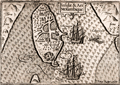 | Details | Langenes, Barent | 1598 |
| Rare antique map of Mozambique Island, Mozambique |
|
Langenes, Barent |
|
| 1598 |
| LOC:77 |
| $150.00 | Langenes--Barent | Rare-antique-map-of-Mozambique-Island--Mozambique | Very fine early miniature map of <b>Mozambique Island</b>, nearby the coast of Mozambique between the Mozambique Channel and Mossuril Bay. Prior to 1898, Mozambique Island was the capital of colonial Portuguese East Africa. There the Portuguese established a port in 1507 and built the Chapel of Nossa Senhora de Baluarte in 1522, now considered the oldest European building in the Southern Hemisphere. North is oriented to the right.
<br></br>
Title cartouche on the upper right side. Two anchored ships and three men fishing with a seine on a small boat are depicted. Latin text on verso. Page 498. |
| 1294 | 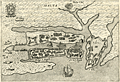 | Details | Bertelli, Pietro | 1599 |
| Early antique birds-eye plan of Valetta, Malta |
|
Bertelli, Pietro |
|
| 1599 |
| LOC:4 |
| $575.00 | Bertelli--Pietro | Early-antique-birds-eye-plan-of-Valetta--Malta | A charmingly detailed birds-eye plan of the area around <b>Valletta, Malta</b> which appeared in the scarce first edition of Pietro Bertelli's "Theatrum Urbium Italicarum", Venice, 1599. Features that Bertelli noted by name on the copper-engraved plan include Malta Citta, Castel di S. Angelo, Castel S. Elmo, Borgo S. Angelo, and Borgo S. Michel. Some experts consider this to be "one the earliest obtainable plans of Malta". With a Maltese-cross cartouche and numerous galleys shown in the harbor.
<br></br>
Produced less than forty years after the Siege of Malta in May 1565, when the Ottoman Empire invaded Malta, then held by the Knights Hospitaller (also known as the Knights of Malta or Knights of Rhodes).
<br></br>
The years leading up to the Siege in 1565 saw the Islands under constant threat from the Ottoman Turks. In 1551, the Ottomans carried out an audacious raid, which saw most of Gozo's population taken into slavery. In 1559, the Knights responded, but with a disastrous attack on Djerba, the Ottoman stronghold on the Tunisian coast.
<br></br>
The Knights knew they were vulnerable in Malta despite the harbours and their two forts, St. Angelo, in what is now Vittoriosa, and newly-built St. Elmo, on the open peninsula of Mount Sciberras overlooking the harbours (later known as Grand Harbour and Marsamxett Harbour). The heroic Knights and Maltese citizens stuggled for many weeks and at the beginning of September, the Ottomans were concerned about having to remain in Malta during the winter, with a long supply-line, and their morale began to fade. Long-awaited relief forces appeared at Mellieħa Bay and the Ottoman troops retreated, but not before losing thousands more men. Today Malta's capital Valetta is named after the Knight's Grand Master Jean de la Valette. (<a href="http://www.visitmalta.com/en/great-siege-1565" target="_blank">Internet</a>) |
| 4750 | 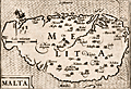 | Details | Bertius, Petrus | 1603 |
| 16th century map of Malta |
|
Bertius, Petrus |
|
| 1603 |
| LOC:77 |
| $380.00 | Bertius--Petrus | 16th-century-map-of-Malta | Attractive antique copper engraved map of the island of Malta (Melita), by Petrus Bertius. Contains a small vignette of St. Paul's shipwreck on the north of the island.
<br></br>
From "Tabularum Geographicarum Contractarum Libri Quinque", the finest and most important edition of the "Caert Thresoor", the famous miniature atlas of Barent Langenes, 1598.
<br></br>
The map is engraved by Petrus Koerius , or Pieter Van Den Keere (1571-1646). Amsterdam: Cornelium Nicolai; Latin edition of 1603. |
| 4816 |  | Details | Mercator-Hondius | 1608 |
| Miniature version of Mercator's Iceland |
|
Mercator-Hondius |
|
| 1608 |
| LOC:77 |
| $350.00 | Mercator-Hondius | Miniature-version-of-Mercator-s-Iceland | Original antique map of Iceland from the French-text edition of Jodocus Hondius' Atlas Minor, published from Amsterdam.
<br></br>
Decorative title cartouche with title "Island" and a different title "Islandia" above. Page 27. French text on verso.
<br></br>
A fine smaller version of Mercator's earlier and larger map of Iceland based on the cartography of the Bishop of Hólar, Gudbrandur Thorláksson. Thorlaksson (1541-1627) is credited with producing the first somewhat accurate map of Iceland, published in 1590 by Abraham Ortelius in his Theatrum Orbis Terrarum.
<br></br>
A spouting sea creature is shown in the sea at upper right, while ashore Mount Hekla "Hekla Mons" is shown erupting with massive flames and boulders. Partly legible notation at Mount Hekla appears to read "perpetus" suggests the volcano erupted constantly at the time. |
| 5237 | 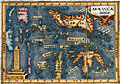 | Details | Bertius, Petrus | 1609 |
| Antique map of the East Indies or Moluccas |
|
Bertius, Petrus |
|
| 1609 |
| LOC:6 |
| $190.00 | Bertius--Petrus | Antique-map-of-the-East-Indies-or-Moluccas | Interesting original miniature antique map of the Maluku Archipelago or Moluccas near the Banda Sea ca. 1609 by Petrus Bertius. Includes Sulawesi, Timor, Seram and numerous other islands in the Malaku province of Indonesia. |
| 6515 | 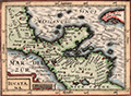 | Details | Bertius, Petrus | 1616 |
| Fine 1616 map of Mexico, Yucatan, Nicaragua and offshore islands |
|
Bertius, Petrus |
|
| 1616 |
| LOC:78 |
| $275.00 | Bertius--Petrus | Fine-1616-map-of-Mexico--Yucatan--Nicaragua-and-offshore-islands | Attractive original engraved map of the Yucatan Peninsula (Iucatana), Southern Mexico and Nicaragua by Petrus Bertius.
<br><br>
Petrus Bertius' 1616 map of the Yucatan Peninsula (Iucatana) and a portion of Central America is hand colored with attractive hachuring in the oceans that provides an interesting dimensionality to this scarce artifact.
<br><br>
Very scarce original reduced-size version created by Bertius in 1616 to meet the demands of a growing and cost conscious market. This very fine map covers a wide area that includes the western portion of Cuba, northern Nicaragua, Honduras, the Yucatan Peninsula and southern Mexico (Nova Hispanie Pars). |
| 1074 | 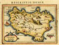 | Details | Bertius, Petrus | 1616 |
| Antique map of the island of Ischia in the Bay of Naples |
|
Bertius, Petrus |
|
| 1616 |
| LOC:4 |
| $150.00 | Bertius--Petrus | Antique-map-of-the-island-of-Ischia-in-the-Bay-of-Naples | Small detailed, 400 year-old map of the volcanic island of Ischia which lies off the coast of Naples, Italy. Ischia is the largest of three islands that lie in or near the Gulf of Naples: Ischia, Capri, and Procida. At the east end of the island is shown the Aragonese Castle built in the year 474.
<br></br>
From the Latin edition of Bertius' 'Tabularum geographicarum contractarum..' |
| 4700 | 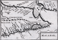 | Details | Bertius, Petrus | 1616 |
| Malabar |
|
Bertius, Petrus |
|
| 1616 |
| LOC:13 |
| $225.00 | Bertius--Petrus | Malabar | Very beautiful early antique miniature map of southern India and a part of Sri Lanka (Ceilon or Ceylon) by Bertius. Numerous towns and villages in India are identified. Important locations within India that are noted by Bertius include: Coromandel, Bisnagor, Goa, Negapatam, Cananor, Calicut (Kozhikode), and Mangalor (Mangaluru),
<br></br>
This lovely copper-plate engraved map is from a Latin edition of Petrus Bertius' <b>Tabularum Geographicarum Contractarum</b>. The basis of the "Tabularum" was the atlas Caert Thresoor by Barent Langenes, first published in 1598.
<br></br>
Latin text on verso. Plate 586. |
| 4696 | 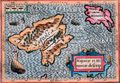 | Details | Bertius, Petrus | 1616 |
| Descriptio Maioricae et Minoricae |
|
Bertius, Petrus |
|
| 1616 |
| LOC:13 |
| $350.00 | Bertius--Petrus | Descriptio-Maioricae-et-Minoricae | Colorful miniature antique map of the <b>Balearic Islands</b> (Baleares) of Majorca and Minorca, Spain in the Mediterranean Sea. This lovely copper-plate engraved map is from a Latin edition of Petrus Bertius' <b>Tabularum Geographicarum Contractarum</b>. The basis of the "Tabularum" was the atlas Caert Thresoor by Barent Langenes, first published in 1598. Key named features include Porto Pin, Calafigur, Calalonga, Menacor, Cabo Formentelli, Porto Fornelle, and San Catharina.
<br></br>
Sea monsters and a lateen-rigged sailing ship beautifully decorate the map while filling empty areas in the sea. In the crow's nest high above the deck a sailor is depicted throwing objects overboard, a detail perhaps related to a ritual of good fortune.
<br></br>
Latin text on verso. |
| 5196 |  | Details | Bertius, Petrus | 1616 |
| Majorcae Et Minorcae Descrip |
|
Bertius, Petrus |
|
| 1616 |
| LOC:77 |
| $325.00 | Bertius--Petrus | Majorcae-Et-Minorcae-Descrip | Uncolored miniature antique map of the <b>Balearic Islands</b> (Baleares) of Majorca and Minorca, Spain in the Mediterranean Sea. Key named features include Porto Pin, Calafigur, Calalonga, Menacor, Cabo Formentelli, Porto Fornelle, and San Catharina. Sea monsters and a lateen-rigged sailing ship beautifully decorate the map while filling empty areas in the sea. In the crow's nest high above the deck a sailor is depicted throwing objects overboard, a detail perhaps related to a ritual of good fortune.
<br></br>
This fine copper-plate engraved map of Mallorca from a <b>French edition</b> of Petrus Bertius' <b>Tabularum Geographicarum Contractarum</b>. The basis of the "Tabularum" was the atlas Caert Thresoor by Barent Langenes, first published in 1598.
<br></br>
French text on verso.
<br></br>
[ Mallorca, Majorca, Majorcae, Minorca, Menorca, Minorcae ] |
| 1079 | 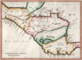 | Details | Herrera y Tordesillas, Antonio de | 1622 |
| Scarce 1622 map of Central America including Costa Rica |
|
Herrera y Tordesillas, Antonio de |
|
| 1622 |
| LOC:10 |
| $600.00 | Herrera-y-Tordesillas--Antonio-de | Scarce-1622-map-of-Central-America-including-Costa-Rica | Scarce map of the "Audiencia" or province of "Guatimala", then comprised of southern Mexico, Honduras, El Salvador, Nicaragua, Costa Rica, and Belize. From "Descripción de la Audiencia de Guatemala, compuesta por el Licenciado Don Antonio de Remesal, del Consejo de Su Majestad, su Oidor y Relator, año de 1618" by Antonio de Herrera y Tordesillas. In the "Descripción de la Audiencia de Guatemala," Herrera y Tordesillas covers a wide range of topics, including the geography and climate of the region, the indigenous peoples who lived there, and the Spanish efforts to establish colonial rule. He also provides detailed accounts of the major cities and towns, as well as the various institutions that made up the colonial administration.
<br></br>
Some of the locations noted on the map include: the Gulf of Fonseca, San Miguel, San Salvador, Santiago de Guatemala, Chiapa de Corzo, Soconusco, the Gulf of Honduras, Puerto Cortes (Puerto de Caballos); Trujillo; and the islands of Coiba and Cébaco, Panama. In Costa Rica, Herrera y Tordesillas identifies among other features: Nicoya, Isla de Chira, Cartago (16 mi. east of San Jose), and El Castillo (near the Arenal volcano). |
| 891 | 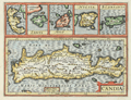 | Details | Jansson, Jan | 1630 |
| Antique map of Crete, Corfu, Zante, Milo, Naxos, Scarpanto |
|
Jansson, Jan |
|
| 1630 |
| LOC:2 |
| $315.00 | Jansson--Jan | Antique-map-of-Crete--Corfu--Zante--Milo--Naxos--Scarpanto | Antique map of several of the <b>Cycladic Greek islands</b> plus Corfu. A reduced-size copperplate engraving of Mercator's map of Crete ( "Candia" ) with inset maps above for the Greek isles of Corfu, Zante, Milos, Naxos ( "Nicsia" ), and Scarpanto.
<br></br<
Published 1630 by Jan Jansson from Amsterdam for Gerard Mercator's "Atlas Minor". Latin text on verso. |
| 1205 | 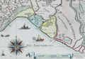 | Details | Tassin, Christophe Nicholas | 1634 |
| Antique coastal map of the Captainerie de Agde and Coast of Languedoc |
|
Tassin, Christophe Nicholas |
|
| 1634 |
| LOC:7 |
| $480.00 | Tassin--Christophe-Nicholas | Antique-coastal-map-of-the-Captainerie-de-Agde-and-Coast-of-Languedoc | Scarce antique engraved, 380 year-old map of the <b>Languedoc</b> region (coastal areas of France including the Camargue with villages of Montpellier, Aigues-Mortes, and La Motte) by French cartographer Christophe Nicholas Tassin. Contains a beautifully designed and intricately engraved compass rose with 32 points. Decorated with small sailing vessels (including a galley) and a <b>fantastical sea monster</b>. Scrollwork distance scale in French lieue.
<br></br>
This rare antique map is not from the common series of town views in pocket atlas format published by Tassin but from the earliest atlas of charts specifically of coastal areas published by Tassin in France ca. 1634: "Cartes Generale et Particulieres de toutes le costes de France Tant de la Mer Oceane que Mediterranee"...
<br></br>
See
<a href="http://gallica.bnf.fr/ark:/12148/btv1b77100033. " target="_blank">this page</a> at the Bibliotheque national de France for all the maps in Tassin's scare coastal atlas.
<br></br>
Attribution at bottom reads: "Par Sieur Tassin Geographe ordinaire de ca Majeste. Par Privilege du Roy." Tassin's background was as a military engineer and his works often show militarily important sites, either sketched on site, composed from firsthand drawings by military engineers, or sometimes borrowed from other mapmakers. Additionally, Christophe Tassin also published several small sized atlases with profiles of French towns and maps of the provinces.
<br></br>
Published in Paris by Chez Melchior Tavernier, en lisle du Palais, vis à vis la quay de la Megisserie. |
| 656 | 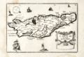 | Details | Tassin, Christophe Nicholas | 1634 |
| Carte de l'Isle de Oleron |
|
Tassin, Christophe Nicholas |
|
| 1634 |
| LOC:4 |
| $160.00 | Tassin--Christophe-Nicholas | Carte-de-l-Isle-de-Oleron | Small, attractive map of the island of Oleron in the Bay of Biscay in Western France, just off the coast in the Atlantic Ocean. Oleron is France's second largest island, after Corsica.
<br></br>
Shows a great deal of interior detail as small as individual buildings, churches, windmills, and gardens. This map is a variant similar to but substantially different from the version published by Tassin in "Les Plans et profils de toutes les principales villes et lieux considerables de France" . This more scarce version contains a compass rose, the cartouche appears at bottom right, and the ships and interior island details are different.
<br></br>
Published by Tavernier in one of the many small-sized atlases created by Christophe Nicholas Tassin (d. 1660) . Tassin's background was as a military engineer, and he is best known for his nautical atlas of 30 sheets, dedicated to Richelieu, documenting France's coastline. Tassin's works contain topographic maps, often of militarily important sites, either sketched on site, composed from firsthand drawings by military engineers, or sometimes borrowed from other mapmakers. Plate 30. |
| 141 | 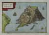 | Details | Tassin, Christophe Nicholas | 1636 |
| Fort de Brigancon |
|
Tassin, Christophe Nicholas |
|
| 1636 |
| LOC:4 |
| $195.00 | Tassin--Christophe-Nicholas | Fort-de-Brigancon | Scarce antique island map by Christophe N. Tassin from 1636. Depicts the Fort of Bregancon near Toulon which is the official retreat for the President of France. The island today looks very much the same as this copperplate engraved view created more than 360 years ago .
<br></br>
Published in the small-sized atlas "Les Plans et profils de toutes les principales villes et lieux considerables de France" by Christophe Nicholas Tassin (d. 1660) . Tassin's background was as a military engineer, and he is best known for his nautical atlas of 30 sheets, dedicated to Richelieu, documenting France's coastline. Tassin's work contains topographic maps, often of militarily important sites, either sketched on site, composed from firsthand drawings by military engineers, or sometimes borrowed from other mapmakers. |
| 1359 | 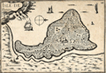 | Details | Tassin, Christophe Nicholas | 1636 |
| Antique map of the Isle de Bouin, France |
|
Tassin, Christophe Nicholas |
|
| 1636 |
| LOC:0 |
| $80.00 | Tassin--Christophe-Nicholas | Antique-map-of-the-Isle-de-Bouin--France | Decorative antique island map of Bouin, France- an island, located in the Breton marshes that exists no more. Created by Nicolas Tassin in 1636, this neat small map shows what was the <b>Isle of Bouin</b> , a commune in the western Pays de la Loire region of France. At the time of our map Tassin shows almost every square foot covered with houses, roads, or ponds.
<br></br>
Archivally matted. With mat measures 12" W x 10" H.
<br></br>
The isle of Bouin no longer exists as such because over time the narrow channel separating the island from the mainland silted up, and the island became part of the mainland. The town of Bouin still exists.
<br></br>
Published in the small-sized atlas "Les Plans et profils de toutes les principales villes et lieux considerables de France" by Christophe Nicholas Tassin (d. 1660) . Tassin's background was as a military engineer, and he is best known for his nautical atlas of 30 sheets, dedicated to Richelieu, documenting France's coastline. Tassin's work contains topographic maps, often of militarily important sites, either sketched on site, composed from firsthand drawings by military engineers, or sometimes borrowed from other mapmakers. |
| 983 | 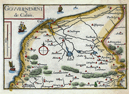 | Details | Tassin, Christophe Nicholas | 1636 |
| Antique map of the Calais, France environs by Tassin |
|
Tassin, Christophe Nicholas |
|
| 1636 |
| LOC:7 |
| $110.00 | Tassin--Christophe-Nicholas | Antique-map-of-the-Calais--France-environs-by-Tassin | Antique map by Nicolas Tassin of the vicinity around Calais, France on the English Channel. Key features include the towns of Calais and Ardres and the Riviere de Graveline. The map is dotted with numerous smaller villages. Sailing ships cruise offshore, a typical decorative feature of Tassin's maps.
<br></br>
Published in the small-sized atlas "Les Plans et profils de toutes les principales villes et lieux considerables de France" by Christophe Nicholas Tassin (d. 1660) . Tassin's background was as a military engineer, and he is best known for his nautical atlas of 30 sheets, dedicated to Richelieu, documenting France's coastline. Tassin's work contains topographic maps, often of militarily important sites, either sketched on site, composed from firsthand drawings by military engineers, or sometimes borrowed from other mapmakers. |
| 152 | 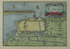 | Details | Tassin, Christophe Nicholas | 1636 |
| Calais |
|
Tassin, Christophe Nicholas |
|
| 1636 |
| LOC:7 |
| $110.00 | Tassin--Christophe-Nicholas | Calais | Antique engraved view of the town and harbor of Calais, France by the author of an atlas on French towns and villages- Christophe Nicolas Tassin. This small copperplate engraving focuses on the nearby area surrounding the town of Calais, its fortifications, and hydraulic plan. With a decorative title cartouche of two sea serpents.
<br></br>
Published in the small-sized atlas "Les Plans et profils de toutes les principales villes et lieux considerables de France" by Christophe Nicholas Tassin (d. 1660) . Tassin's background was as a military engineer, and he is best known for his nautical atlas of 30 sheets, dedicated to Richelieu, documenting France's coastline. Tassin's work contains topographic maps, often of militarily important sites, either sketched on site, composed from firsthand drawings by military engineers, or sometimes borrowed from other mapmakers. |
| 1481 | 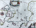 | Details | Blaeu, Johannes | 1645 |
| North Polar Region or Regiones Sub Polo Arctico |
|
Blaeu, Johannes |
|
| 1645 |
| LOC:52 |
| $1,900.00 | Blaeu--Johannes | North-Polar-Region-or-Regiones-Sub-Polo-Arctico | Beautiful engraved map of the North Polar region with fine color. With rhumb lines radiating from the North Pole, a large title cartouche, two figures and numerous wind heads, compass roses, ships and an additional vignette of explorers. Arctic animals shown include a polar bear and foxes. With Backer's coat-of-arms in "Nova Britannia." French text on verso regarding the "Pole Arctique".
<br></br>
Blaeu's map of the North Pole region is a close copy of Jansson's Nova et Accurata Poli Artici based on the arctic map of Barentsz, Baffin, and others. This is state two of the map with Willem Backer's coat-of-arms. |
| 905 | 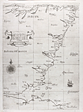 | Details | Dudley, Robert | 1646 |
| Fine Antique Nautical Chart of Scotland with Edinburgh |
|
Dudley, Robert |
|
| 1646 |
| LOC:89 |
| $2,400.00 | Dudley--Robert | Fine-Antique-Nautical-Chart-of-Scotland-with-Edinburgh | Rare and extremely desirable first edition nautical chart of the east coast of Scotland including coastline for all or part of the following Scottish council areas : the Lothians, Fife, Angus, Aberdeenshire, Moray ("Costa di Muray"), and Highland.
<br></br>
This antique sea chart is from the <b>Dell' Arcano del Mare</b> published from Florence in 1646 by Sir Robert Dudley, the illegitimate son of Robert Dudley, 1st Earl of Leicester and a close friend of Elizabeth I. Dudley was an adventurer, explorer, naval advisor to the Grand Duke of Tuscany, and publisher. The charts have a unique sparse Baroque style that is complemented by very high quality calligraphy and engraving (by Lucini). In addition to the quality of execution, charts from the Arcano del Mare are highly sought after for their singularity- as the <b>first maritime atlas to cover the entire globe</b>, the first world atlas published by an Englishman, and the first maritime atlas to use the Mercator projection.
<br></br>
There are many named settlements in Scotland on this old chart including: Dunbar, Edinburgh ("Edenburgh"), Dundee ("Donde"), <b>St. Andrews or "S. Andrea" (of golfing legend)</b> , Aberdeen ("Alberden"), Peterhead ("Peter Polle"), Spey Bay ("Spyn"), Rosemarkie ("Rosemark") . Kinloss ("Killos"). At the far north the chart ends at Cromarty ("C. di Comar").
<br></br>
In much the same way as Wagenhaer exaggerated certain features on his charts, so too the mouths of firths, bays, and rivers are not to scale. By depicting them at a larger scale, Dudley is able to obtain some of the benefits of a large-scale chart in what is otherwise a small-scale chart of the area. |
| 654 | 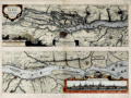 | Details | Jansson, Jan | 1648 |
| Elbe River with Hamburg Germany |
|
Jansson, Jan |
|
| 1648 |
| LOC:89 |
| $600.00 | Jansson--Jan | Elbe-River-with-Hamburg-Germany | Beautiful, hand-colored map of the Elbe ( Albis ) River by Jan Jansson (Johanne Jansonnious) from 1648. Attractive inset profile of Hamburg, Germany "Emporium Hamburgum" with 17 referenced buildings tied to explantory notes. Traces the course of the Elbe River from "De Noordt Zee" past Brokdorf, Gluckstadt, Stade, Buxtehude, past Hamburg, and ends at Geesthact. Numerous towns, chuches, windmills and other structure are noted by name. Latin text. Published from Amsterdam. |
| 755 | 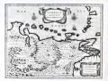 | Details | Blaeu, William Janszoon | 1650 |
| Venezuela cum parte Australi Novae Andalusiae |
|
Blaeu, William Janszoon |
|
| 1650 |
| LOC:200 |
| $695.00 | Blaeu--William-Janszoon | Venezuela-cum-parte-Australi-Novae-Andalusiae | Antique map of Venezuela with the Leeward Antilles and the Windward Islands from the Latin edition of William Blaeu's "Le theatre du monde, ou Nouvel atlas" published in Amsterdam ca. 1650. Islands (not engraved to scale, apparently) include from west to east: Aruba, Curacao, Bonaire, los Rocques, las Aves, la Orchilla, Tortuga, la Blanquilla, Margarita, Grenada, Trinidad, Tobago, , St. Vincent , St. Lucia, Martinique, and Dominica.
<br></br>
Geographic coverage includes the Gulf of Paria, Nuestra Senora de los Remedios, Provincia de los Caracas, Nueva Valencia, Portilla de Carara, Maracapana, Nuestra Senora de Carvalleda, St. Iago de Leon, Nueva Segovia, and the settlement of St. Thomas along the lower Orinoco River.
<br></br>
Cartographic elements include mountains, forests, locations of settlements, bays, and rivers, degrees of latitude and longitude, two compass roses oriented with North at top of plate, and numerous topographical details. Decorative elements include birds, ship, sheep, angels, and monkeys. With two decorative scrollwork cartouches.
<br></br>
This map is one of five maps of South America in Blaeu's atlas which are taken from other Dutch sources. The plates for this map were orignally made by the younger Jodocus Hondius sometime before his death in 1629. Hondius' plates were bought by Willem Janszoon Blaeu who replaced Hondius' name with his own. Single vertical fold, as issued. |
| 823 | 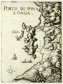 | Details | Boschini, Marco | 1651 |
| Spinalonga Peninsula and Elounda in Crete, Greece |
|
Boschini, Marco |
|
| 1651 |
| LOC:2 |
| $450.00 | Boschini--Marco | Spinalonga-Peninsula-and-Elounda-in-Crete--Greece | Very scarce and attractive copper-plate engraved view of the entire Spinalonga Peninsula and surrounding area on the island of Crete, Greece. Includes the island of Kalydon (shown with a fortress dominating the bay); the island of "Colochita" ( Kolokythas ); and structures in the vicinity of today's villages of Elounda and Plaka. The southern-most of these structures at the bottom of the Bay of Elounda are referred to as "Culata". The view shows a signal fire burning at the headland of Cape Agios Ioannis, overlooking the entire Mirambellos Gulf. Numerous galleys are shown at sea headed to shore, and interestingly none of the galleys are under sail.
<br></br>
By Marco Boschini (1613-1678) from Venice in 1651. Published in Boschini's atlas of 59 engraved views and city plans and 2 maps of Crete at a time when the island of Crete, then a Venetian territory, was under siege from Ottoman forces.
<br></br>
Boschini derived his engravings from the manuscript works of others including Angelo degli Oddi, Francesco Basilicata, and especially Georgio Corner. Although he never visited Crete, Marco Boschini's unique contribution is that his atlas was the first published atlas to focus solely on Crete and it provided information about that embattled island to a thirsty public. (Porfyriou, Heleni. The Cartography of Crete in the First Half of the 17th Century: a Collective Work of a Generation of Engineers, Web: http://ine-notebooks.org/index.php/te/article/viewFile/109/165) |
| 4825 | 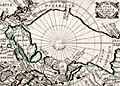 | Details | Picart, Jean | 1657 |
| Scarce original engraving of the North Polar Region |
|
Picart, Jean |
|
| 1657 |
| LOC:13 |
| $480.00 | Picart--Jean | Scarce-original-engraving-of-the-North-Polar-Region | Picart's map of the North Pole (second state) based on Jansson's Septentrionalium Terrarum Descript from the Atlas Minor. An early map of the Arctic region seldom found in this fine condition. |
| 357 |  | Details | Blaeu, Johannes | 1663 |
| Milazzo ou Melazzo ville en Sicile |
|
Blaeu, Johannes |
|
| 1663 |
| LOC:8 |
| $350.00 | Blaeu--Johannes | Milazzo-ou-Melazzo-ville-en-Sicile | Sizable map of the fortress at Milazzo, Italy published by Blaeu in 1663. Source was “Theatrum Civitatum et admirandorum Italiae” published from Amsterdam. This scarce antique map depicts the fortress walls in great detail but with no interior detail. The single decorative element is the depiction of a galley in the left bottom corner from which a sailor can be seen fishing. Plate 33. |
| 2486 | 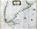 | Details | Doncker, Hendrick | 1664 |
| Rare Dutch chart of lower South America and the Strait of Magellan |
|
Doncker, Hendrick |
|
| 1664 |
| LOC:10 |
| $1,850.00 | Doncker--Hendrick | Rare-Dutch-chart-of-lower-South-America-and-the-Strait-of-Magellan | Nice! Very scarce old Dutch nautical chart of Patagonia, the southern portion of the South American continent by Doncker. Includes Patagonia, the Strait of Magellan and Tierra del Fuego. With Spanish place names in portolano style. Includes The Plate River with "Buenos Ayr" or Buenos Aires. Fine, striking graphics.
<br></br>
Hendrick Doncker (1626-1699) was an Amsterdam printer, bookseller, and cartographer residing in the Nieuwebrugsteeg. Johannes Loots, an important contemporary Dutch cartographer, was an apprentice to Doncker. In 1693, upon completion of his apprenticeship to Doncker, Loots was accepted into the Guild of Booksellers and bought a home near Doncker in Nieuwebrugsteeg. |
| 358 | 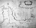 | Details | Levanto, Francesco M. | 1664 |
| Carta Maritima del Golfo di Smirne |
|
Levanto, Francesco M. |
|
| 1664 |
| LOC:8 |
| $1,225.00 | Levanto--Francesco-M- | Carta-Maritima-del-Golfo-di-Smirne | Rare, original antique portolan-style sea chart of east coast of Chios, Greece and the coast of Turkey around Izmir by Genoan cartographer Francesco Maria Levanto. Charming oblique profile depictions of Smirne (Izmir) and Soi (Chios, Greece). Charts of Turkey from the mid 17th century are quite scarce.<BR> </BR>
From Levanto's "La Prima Parte dello Specchio del Mare" (Sea Mirror). Probably based on earlier Dutch charts, possibly influenced by Jacobsz. Place names and notes in Dutch and Italian. With an inset coastal profile and an elaborate decorative cartouche.<BR> </BR>
This chart was reissued about 40 year later by Coronelli. Charts from the Specchio del Mare are quite scarce. |
| 1292 | 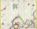 | Details | Doncker, Hendrick | 1664 |
| Antique nautical chart of Norway, Spitsbergen, Greenland, and Russia |
|
Doncker, Hendrick |
|
| 1664 |
| LOC:200 |
| $1,500.00 | Doncker--Hendrick | Antique-nautical-chart-of-Norway--Spitsbergen--Greenland--and-Russia | Scarce copper-engraved sea chart of Spitsbergen, Norway and to the west, the largely unknown shores of Greenland. by cartographer Hedrick Doncker, Amsterdam. Coverage on this very attractive antique sea chart includes "Finnmarken" (Norway), "Lapland", "Nieu Groenlandt", Jan Mayen Island, Svalbard ("Spitsbergen"), "Nova Zemla", and Russia with Arkhangelsk ("Archangel"). Shows a longer coastline for Greenland than later editions of the same map by Doncker. Dated within to 1664.
<br></br>
Hendrick Doncker (1626-1699) was an Amsterdam printer, bookseller, and cartographer residing in the Nieuwe Bruchsteegh in Stuurmans Gereetschap. |
| 368 | 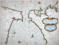 | Details | Goos, Pieter | 1664 |
| Cuft van Hispagnien vande Rivier Sivilien |
|
Goos, Pieter |
|
| 1664 |
| LOC:8 |
| $1,450.00 | Goos--Pieter | Cuft-van-Hispagnien-vande-Rivier-Sivilien | Attractive and desirable small-scale antique nautical chart covers the Atlantic approaches to the Strait of Gibraltar with Cadiz, Spain, Algeciras ("Out Gibralter"), Sanlucar de Barrameda , Xeres, Rota, Cape Trafalgar, and the Guadalquivir River to just past the small stream of Brazo de la Torre. Inside the strait and in the Mediterranean are Tangier, Ceuta, Tetuan, and Penon de Velez on the north coast of Africa. On the south coast of Spain Gibraltar, Algeciras, Tarifa, Marbella, and Malaga are featured. <BR> </BR>
A fine antique chart of the historically important area surrounding the Strait of Gibraltar and Cadiz, Spain. With an elaborate strapwork cartouche, two compass roses, and depictions of a galley and a square-rigged sailing vessel, the two predominant sea-going vessels of that era. Produced by Dutch cartographer Pieter Goos in Amsterdam in 1664. North oriented to the right. Plate number 3. <BR> </BR> |
| 21 |  | Details | Levanto, Francesco M. | 1664 |
| La Costa di SPAGNA |
|
Levanto, Francesco M. |
|
| 1664 |
| LOC:8 |
| $900.00 | Levanto--Francesco-M- | La-Costa-di-SPAGNA | Rare nautical chart of the Mediterranean coast of southern Spain including Alicante and Cartagena Spain and of the North African coastline including Oran and Cape Ferrat. Portolan-style central compass rose surrounded by a concentric grouping of rhumb lines. <BR> </BR>
Produced by the Genoan cartographer Francesco Maria Levanto in 1664 in "La Prima Parte dello Specchio del Mare…" (Sea Mirror) probably from earlier Dutch charts, possibly by Jacobsz. This antique sea chart was reissued later by Coronelli in 1697. Charts from Levanto's Specchio del Mare are quite scarce. Plate 5. Chain laid paper. |
| 18 | 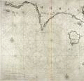 | Details | Levanto, Francesco M. | 1664 |
| Carta Maritima della Meridionale Costa di MOREA |
|
Levanto, Francesco M. |
|
| 1664 |
| LOC:8 |
| $900.00 | Levanto--Francesco-M- | Carta-Maritima-della-Meridionale-Costa--di-MOREA | Rare Genoan antique nautical chart of the Greek coast including the named islands of Sapienza, Schiza, I. Cervij ( Elafonisos ), Serigo (Kythera), and Serigotto (Antikythera), Greece. Antikythera is best known for being near the site at which the so-called <b>Antikythera mechanism</b> was recovered by sponge divers in 1900. That mechanism is an early clockwork device with meshed bronze gears that allowed the user to calculate the position of astronomical objects, eclipses, and lunar phase by rotating a hand crank. The significance of the device is that it is believed to date from antiquity- 67 BC and is by far the oldest analog computer ever discovered.
<BR> </BR>
Coverage includes a long stretch of the southern coast of the <b>Peloponnese peninsula</b>, known in earlier times as the Morea. Primary geographic features include Cape Matapan and Cape Maleo ( Cap San Angelo) with the following settlements identified by name: Modon ( Methoni ), Coron ( Koroni ), Vitulo ( Porto Vitilo ). Porto Rapini is a bit more difficult to identify but based on 19th century works only present-day Marathias fits the location. Almost 2 centuries after this chart was published, Norie described Porto Rapina: <div class="indenttextblock"> "you will see a long even point of land and behind it two round hills" . . . "there are two small islands before the northern entrance to the port" and noted that the Island of Cervi was "7 miles southward". </div> That description fits only Marathias. (Norie, John William. New Mediterranean Pilot. 1817, p 140.)
<BR> </BR>
This old sea chart was produced by Genoan cartographer <b>Francesco Maria Levanto</b> in 1664. Levanto's "La Prima Parte dello Specchio del Mare" (Sea Mirror) was probably based on earlier Dutch charts, possibly by Jacobsz.
<BR> </BR>
This chart was reissued about 40 year later by Coronelli. Charts from the Specchio del Mare are quite scarce. Plate 17. Oriented North at top. Chain laid paper. |
| 556 | 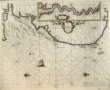 | Details | Goos, Pieter | 1667 |
| Pascaarte van Engelant |
|
Goos, Pieter |
|
| 1667 |
| LOC:57 |
| $1,300.00 | Goos--Pieter | Pascaarte-van-Engelant | Lovely copperplate engraved sea chart of the East Coast of England with the Thames estuary by Dutch cartographer Pieter Goos. Inset of the Thames River including London. The date of publication was just one year after the great fire that destroyed London in 1666. Place names and feature desriptions are in Dutch.<br><br/>
From Pieter Goos' De Zee-Atlas, Ofte Water-Weereld, Waer in vertoont werden alle de Zee-Kusten Van het bekende des Aerd-Bodems. 1667. |
| 2577 |  | Details | Goos, Pieter | 1669 |
| 17th century woodblock chart of Marseilles, France |
|
Goos, Pieter |
|
| 1669 |
| LOC:77 |
| $185.00 | Goos--Pieter | 17th-century-woodblock-chart-of-Marseilles--France | Two woodblock charts (verso and recto) of the Bay of Marseille, France and of the coast and islands of the Bay of Hyeres: Porquerolles, Port Cros, Ile du Levant. Scarce.
<br></br>
Produced by Dutch cartographer Pieter Goos from Amsterdam in 1669. |
| 526 |  | Details | Ogilby, John | 1671 |
| Tabula Magellanica |
|
Ogilby, John |
|
| 1671 |
| LOC:50 |
| $800.00 | Ogilby--John | Tabula-Magellanica | Very decorative, finely engraved antique map of Cape Horn ( Hoorn ), the southern-most point in South America and the Strait of Magellan, published ca. 1671, about 150 years after Magellan's discovery of the passage.
<br></br>
This original copper-plate engraved map is enlivened by two compass roses, four cartouches and numerous fanciful vignettes including mermaids, ostriches, penguins, and the scene of a sea battle.
<br></br>
This map was published in "America: Being an Accurate Description of the New World…" by John Ogilby, a Scottish cartographer, who was appointed "His Majesty's Cosmographer and Geographic Printer" in 1675. |
| 881 |  | Details | Dapper, Olfert (Olivier) | 1672 |
| Antique engraved chart or map of the Caspian Sea |
|
Dapper, Olfert (Olivier) |
|
| 1672 |
| LOC:8 |
| $250.00 | Dapper--Olfert-(Olivier) | Antique-engraved-chart-or-map-of-the-Caspian-Sea | Interesting antique chart of the <b>Caspian Sea</b>, considered by many to be the world's largest lake, located between Europe and Asia. This 340 year old copper-plate engraving by Olivier Dapper (d. 1690) is presented in the <b>style of a nautical chart </b>with numerous rhumb lines and a central compass rose at center. No soundings, aids-to-navigation or danger areas are identified, which is consistent with the intended use of the work to inform the general reader, and definitely not intended for navigation of the Caspian Sea.
<br></br>
This old map is filled with images of sailing ships and shows limited detail of the interior areas of the countries along the Caspian coast: Russia, Kazakhstan, Turkmenistan, Iran, and Azerbaijan. Text is in both Cyrillic and Dutch. |
| 872 | 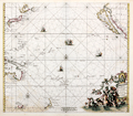 | Details | de Wit, Frederick | 1675 |
| Magnum Mare del Zur cum Insula California |
|
de Wit, Frederick |
|
| 1675 |
| LOC:0 |
| $3,100.00 | de-Wit--Frederick | Magnum-Mare-del-Zur-cum-Insula-California | This beautiful antique sea chart of the Pacific Ocean from 1675 is one of the earliest obtainable nautical charts of Oceana. The chart extends eastward from Japan, Korea and New Guinea to the newly explored west coast of North America with California shown as an island. The incomplete outline of landforms in Australasia reflect the limited exploration of that area.
<br></br>
This chart is the first and most desirable state, engraved by Frederick de Wit, with the imprint: "Gedruckt't Amsterdam by Frederick de Wit inde Calverstraet. " Published in de <b>Wit's Orbis Maritimus ofte Zee Atlas</b>, comprised of twenty-seven nautical charts of the world's oceans.
<br></br>
The concept that <b>Baja California was an island</b> rather than a peninsula dates back to the early 1500's. In 1701 Jesuit priest and cartographer Eusebio Francisco Kino published a map based on his explorations of the area showing Baja California to be a peninsula, but despite that work the question was not finally accepted by all cartographers until the mid-eighteenth century.
<br></br>
<b>Hollandia Nova</b>, or New Holland was the name given to the vast continent of Australia. On this early chart only the north coast of Australia and the Gulf of Carpentaria are depicted, with an incomplete outline of western New Guinea drawn above. Below, the outline of the southern half of Tasmania ( " Anthoni van Diemens Landt" ) and a portion of the east coast of New Zealand with the Cook Strait shown as a bay.
<br></br>
A very attractive decorative cartouche at bottom right features a portrait of Ferdinand Magellan gazing over a tableau of Poseidon and his consort Amphitrite riding a chariot through the sea while putti drape garland over the scene. Empty areas in the chart are filled with depictions of square-rigged warships under sail and firing cannon. Title is in Latin and Dutch. |
| 381 |  | Details | Anonymous | 1675 |
| Plan de la Ville de Rode |
|
Anonymous |
|
| 1675 |
| LOC:2 |
| $950.00 | Anonymous | Plan-de-la-Ville-de-Rode | Scarce engraving of the port of Rode (Rhodes), Greece decorated with a bat-form title cartouche, a square-rigged warship, and three galleys. References on the plan to the 'Grand Master' and 'Sultan Suleiman' suggest that the map was intended to illustrate the Siege of Rhodes in 1522 when the Knights of Rhodes were defeated and driven out by the Ottomans. That order later became known as the 'Knights of Malta' after they established residence on the island of Malta in 1530.
<BR> </BR>
We cannot locate an identical copy of this anonymous work anywhere on-line but the topographic details are nearly identical to those in a map by Dapper from 1687. This example probably dates from a period between 1650 - 1675 because this map contains more explanatory detail (in French) than Dapper's map and the strapwork cartouche points to an earlier style.<BR> </BR>
Numerous geographic descriptions include: the palace of the Grand Master; port des galeres; Tour de St. Jean; port des vaisseaux; the old walled village of Rhodes, and two long breakwaters, each protected by a tower at the end. Strapwork mileage scale. |
| 404 |  | Details | Roggeveen, Arent | 1675 |
| Paskaert vande Cust van Westindien |
|
Roggeveen, Arent |
|
| 1675 |
| LOC:51 |
| $4,500.00 | Roggeveen--Arent | Paskaert-vande-Cust-van-Westindien | This rare antique chart is the earliest available detailed sea-chart of this portion of the Guyana coastline. On this fine Dutch foundational sea chart from ca. 1675 coverage stretches from Rio Soronama (Suriname River) and Paramaribo, Suriname in the east to the west past Rio Demerary (Demerara River) and Georgetown, Guyana. Fort Paramaribo is the sole noted habitation, reflecting both the early date of the chart and the fort's importance for trading. The course of the Demerara River is shown with soundings to past St. Iohannes Island (St. John's Island), about 15 miles from the river's mouth.<br></BR>
This old nautical chart appears in the First Part of the Burning Fen or "Het Brandende Veen" created by Arent Roggeveen and published by <a rel="nofollow" href="/creator/Goos--Pieter/" >Pieter Goos</a> . Dr. C. Koeman described the significance of this work as of the same order as Waghenaer's Der Spieghel der Zeevaerdt: <br>
<dir class="indenttextblock">"The First Part of the Burning Fen rates as one of the most important printed Pilot Books. The First Part of the Burning Fen, published by Pieter Goos in 1675, is the first pilot book containing charts of the Central American coasts and islands that ever appeared in print."</dir> </BR>
Unlike Waghenaer, Arent Roggeveen was not a sea captain but rather a trained land-surveyor who taught navigation in the town of Middelburg to pilots of the Dutch West India Company which was headquartered there. Roggeveen likely had access to manuscript charts from Guyana and possibly to early Spanish portolan charts through his connections with the West India Company.<BR> </BR> |
| 4698 |  | Details | Pontault, Sébastien Beaulieu de | 1678 |
| Antique view of Montjuïc at Barcelona, Spain |
|
Pontault, Sébastien Beaulieu de |
|
| 1678 |
| LOC:13 |
| $225.00 | Pontault--Sébastien-Beaulieu-de | Antique-view-of-Montjuïc-at-Barcelona--Spain | Antique view of Montjuïc, a broad, low hill in Barcelona, Catalonia, Spain to the west of the old quarter. The top of Montjuïc (Castell de Montjuic) at about 550' is the site of several fortifications dating from the 17th century. These served as a prison, often holding political prisoners, until the time of General Franco.
<br></br>
Here, cannon are shown firing from the Castell while a marine semaphore atop a tall tower relays signals to nearby vessels. Montjuïc became a key element in the defence of Barcelona. By controlling the mountain and its communication with the rest of the city, the defenders of Barcelona could keep attacking troops further from the eastern perimeter of the city walls and the coastline.
<br></br>
This antique copper engraving is from <b>Pontault de Beaulieu's</b> "Plans et profils des villes des Pays-Bas, Lorraine, Alsace, Catalogne et Franche-Comté".
<br></br>
According to the Atlas de Barcelona
<div class="indenttextblock"> Beaulieu drew the part of the small fort built during the Reapers’ War – which he might have known – and hints at the citadel which should surround it, in what could be considered to be a “future project”. French interest in the strategic Catalonian capital meant that even Beaulieu drew what could be the defenses of Barcelona. The French National Library keeps an ink drawing that Beaulieu himself drew of the layout of Montjuïc castle with the same framing as the engraving. (http://www.atlesdebarcelona.cat/gravats/comments/38-beaulieu-sebastien-de-pontault-de/). </div> |
| 4699 |  | Details | Pontault, Sébastien Beaulieu de | 1678 |
| Antique view of the citadel on Montjuïc at Barcelona, Spain |
|
Pontault, Sébastien Beaulieu de |
|
| 1678 |
| LOC:13 |
| $185.00 | Pontault--Sébastien-Beaulieu-de | Antique-view-of-the-citadel-on-Montjuïc-at-Barcelona--Spain | Antique view of the fort or citadel at Montjuïc, a broad, low hill in Barcelona, Catalonia, Spain to the west of the old quarter. The top of Montjuïc (Castell de Montjuic) at about 550' is the site of several fortifications dating from the 17th century. The steep and rocky sides of Montjuic are apparent where the land meets the Mediterranean Sea.
<br></br>
In a key to the upper right, five important entrances and fortifications at the citadel are identified.
<br></br>
According to the Atlas de Barcelona
<div class="indenttextblock"> Beaulieu drew the part of the small fort built during the Reapers’ War – which he might have known – and hints at the citadel which should surround it, in what could be considered to be a “future project”. French interest in the strategic Catalonian capital meant that even Beaulieu drew what could be the defenses of Barcelona. The French National Library keeps an ink drawing that Beaulieu himself drew of the layout of Montjuïc castle with the same framing as the engraving. (http://www.atlesdebarcelona.cat/gravats/comments/38-beaulieu-sebastien-de-pontault-de/). </div> |
| 558 |  | Details | de Wit, Frederick | 1680 |
| Tractus Littorales Guineae |
|
de Wit, Frederick |
|
| 1680 |
| LOC:54 |
| $1,100.00 | de-Wit--Frederick | Tractus-Littorales-Guineae | Beautiful antique sea chart of north-west Africa. 1680. This chart was created by Frederick de Wit (1630-1706) a Dutch cartographer residing at the time in Amsterdam. A large cartouche at the top shows what is apparently a slave market with captive Africans bound kneeling as strange lizards roam the foreground.
<br></br>
The chart is decorated with images of sailing vesels and with numerous rhumb lines. Coverage extends from Cabo Blanco past cape Verde to the Congo River and beyond. |
| 1356 |  | Details | Sanson, Nicolas | 1680 |
| Fine antique map of the Canary Islands and Madeira ca. 1680 |
|
Sanson, Nicolas |
|
| 1680 |
| LOC:7 |
| $325.00 | Sanson--Nicolas | Fine-antique-map-of-the-Canary-Islands-and-Madeira-ca--1680 | Very attractive early map of the <b>Canary Islands by Nicolas Sanson</b>. Inset map of Madeira ("Isle Madere"). This fine copper-plate engraved map is dominated by a large scroll-work title cartouche, which is decorated with an elaborate garland of fruit. Nice details of towns and geography for each island.
<br></br>
Nicolas Sanson (1600 – 1667) was a French cartographer, termed by some as the "father of French cartography". Nicholas Sanson was born in the town of Abbeville in Picardy. He became become Royal Geographer to Louis XIII in 1630 and maintained the position upon the ascension of the "Sun King" Louis XIV in 1643. Sanson later served as tutor to the ambitious young monarch. From 1648 Nicolas Sanson produced a series of four quarto atlases on the continents. That atlas of Africa was first published in 1656 and included this map.
<br></br>
The Canary Islands are a Spanish archipelago that lies off the coast of northwestern Africa. Sanson's names for the main Canary Islands and their modern equivalents are: "Isle de Palme" (La Palma), "Isle de Gomer" (La Gomera), "Isle Teneriffe" (Tenerife), "Isle Canarie" or "Grande Canarie" (Gran Canaria), "Isle de Forte" (Fuerteventura), and "Isle de Lancelotte" (Lazarote). |
| 984 |  | Details | Anonymous | 1680 |
| Old map of Ostend, Belgium. |
|
Anonymous |
|
| 1680 |
| LOC:7 |
| $60.00 | Anonymous | Old-map-of-Ostend--Belgium- | Small anonymous antique map of Ostend / Ostende / Oostende, Belgium (ca. 1680) which today is located in the province of West-Flanders. The old map shows numerous water features, redoubts, and defensive walls with bastions surrounding the city.
<br></br>
A legend at top left is keyed alphabetically to several major features including: the Kerck (Church), Kyasenest, Strand, Nieuwe Haven, and city gates (Poorte). This map bears a strong resemblance to a map of Ostende published by Blaeu in 1647. |
| 4777 |  | Details | Baur, Johann Wilhelm and Küsell, Melchior | 1680 |
| Extremely fine antique engraving of the Grand Canal at Venice, Italy |
|
Baur, Johann Wilhelm and Küsell, Melchior |
|
| 1680 |
| LOC:88 |
| $450.00 | Baur--Johann-Wilhelm-and-Küsell--Melchior | Extremely-fine-antique-engraving-of-the-Grand-Canal-at-Venice--Italy | The Grand Canal at Venice, Italy. A finely-engraved and very decorative antique view of Venice's Grand Canal. Against a dramatic, cloudy sky numerous gondolas and, far in the background, lateen-rigged vessels. From the late 17th century.
<br></br>
With a very fine manuscript calligraphic title : "Canal Grando zu Venedig allivo die Gondoli Al Fresco fahren"
<br></br>
Drawn by J. Baur and engraved by Melchior Kussell. Plate 132. With privilege.
<br></br>
Johann Wilhelm Baur (1607-1640) was a German painter, engraver, and etcher. |
| 935 | 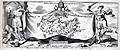 | Details | Peeters, Jan | 1680 |
| Decorative antique map of Crete, Greece |
|
Peeters, Jan |
|
| 1680 |
| LOC:2 |
| $190.00 | Peeters--Jan | Decorative-antique-map-of-Crete--Greece | Antique frontispiece with the island of Crete, Greece (Candia) published from Antwerp by Peeters in a volume with several prints of views of key cities on Crete. Map of the key Greek island of Crete with the labyrinth ("laberinta") of King Minos identified in the middle of the island. Names several important cities including "Canea" (Chania), "Candia" (Iraklio), "Fenice", "Penico" and "Matoli".
<br></br>
Set among a scene depicting the aftermath of a battle with two figures holding a sheet with the coat of arms of Pope Innocent XI ("Innocentius XI Pontifex Maximus"). One of the figures appears to be a representation of a Turk with a scimitar standing on the holy Christian cross, representing the conflict between the Ottoman Empire and Venice for control of Crete in the 17th century.
<br></br>
Attribution reads: "I. Peeters excudit- Antverpi." Conrad Lauwers sculp. |
| 1392 | 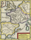 | Details | Mallet, Allain Manesson | 1683 |
| Antique map of the ancient Gaul |
|
Mallet, Allain Manesson |
|
| 1683 |
| LOC:7 |
| $120.00 | Mallet--Allain-Manesson | Antique-map-of-the-ancient-Gaul | Original antique engraved map of the ancient area controlled by the Gauls ca 1st century BC with territory identified for the Gallic tribes including Belgica, Aquitania, and Celtica. French text on verso.
<br></br>
From Mallet's "Description de l'Univers, contenant les differents systemes du Monde, les Cartes generales & particulieres de la Geographie Ancienne & Moderne . . . " By Allain Manesson Mallet. Paris, Chez Denys Thierry, Rue S. Jacques. Figure 55. Page 135. |
| 5278 | 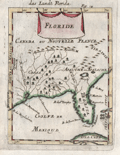 | Details | Mallet, Allain Manesson | 1683 |
| Decorative antique map of the Florida Territory |
|
Mallet, Allain Manesson |
|
| 1683 |
| LOC:11 |
| $250.00 | Mallet--Allain-Manesson | Decorative-antique-map-of-the-Florida-Territory | Unusual and somewhat primitive antique engraved map "Floride" of the eastern Gulf Coast including Florida ca. 1683. From Mallet's "Description de L'Univers". Printed from a copper-plate engraving onto chain-laid paper. Figure 18.
<br></br>
Mallet uses the names of native American Indians as place names. Florida is shown labeled as <b>Tegesta</b>. The Tegesta or Tequesta was a Native American tribe located mainly in southeastern Florida. Explorer, cartographer, and seafarer Bernard Romans used that label on his map of Florida as late as 1794.
<br></br>
Also shown is the area of the SW Florida coast inhabited by the Cossa or Calussa Indians and the area of the Apalachee Indians shown much too far to the north. |
| 5235 | 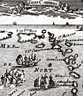 | Details | Mallet, Allain Manesson | 1683 |
| Antique Map of the Lesser Antilles or Isles Caribes |
|
Mallet, Allain Manesson |
|
| 1683 |
| LOC:5 |
| $250.00 | Mallet--Allain-Manesson | Antique-Map-of-the-Lesser-Antilles-or-Isles-Caribes | Small, fine antique map of the Lesser Antilles. Very decorative map of the islands of the Lesser Antilles from Puerto Rico all the way to the coast of Venezuela. Includes St. Martin, St. Barths, St. Kitts, Guadalupe, Trinidad, Aruba, Curacao, Bonaire and more. Depicts square-rigged sailing vessels battling at sea.
<br></br>
By A.M. Mallet in "Description de l' Univers", first published in Paris in 1683. Allain Mallet (1630-1706) was a French engineer, soldier, and cartographer. He served in the court of King Louis XIV as a teacher of mathematics. French text on the verso. |
| 988 | 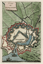 | Details | Mallet, Allain Manesson | 1684 |
| Plan of Dunkirk, France by Mallet |
|
Mallet, Allain Manesson |
|
| 1684 |
| LOC:7 |
| $60.00 | Mallet--Allain-Manesson | Plan-of-Dunkirk--France-by-Mallet | Small antique hand-colored plan of Dunkirk / Dunkerque, France. The plan shows the town with moats and surrounded by at least three walls. At the port Mallet shows several ships entering from offshore.
<br></br>
From "Les Travaux de Mars ou l'Art de la Guerre " in 3 volumes. Paris, 1684. Figure LXVII . French text on verso. Page 213. |
| 1424 |  | Details | Mallet, Allain Manesson | 1685 |
| Antique Northern Hemisphere Polar Map |
|
Mallet, Allain Manesson |
|
| 1685 |
| LOC:0 |
| $90.00 | Mallet--Allain-Manesson | Antique-Northern-Hemisphere-Polar-Map | Small, hand-colored antique view of the northern hemisphere from a north polar perspective. Shows the so-called "Arctic Lands" with Greenland connected to northern Canada. Shows Iceland, Spitsbergen, and the "Terre de Iesso" or the Japanese island of Hokkaido . Fig 16.
<br></br>
By Allain Mallet, Paris, 1683 in a German edition of "Description de l'Univers" . Allain Mallet (1630-1706) was a French engineer, soldier, and cartographer. He served in the court of King Louis XIV as a techer of mathematics. In addition to "Description de l'Univers" Mallet also published "Les Travaux de Mars ou l'Art de la Guerre". |
| 1416 |  | Details | Coronelli, Vincenzo | 1686 |
| 17th century map of the Bohali fortress at Zakynthos, Greece |
|
Coronelli, Vincenzo |
|
| 1686 |
| LOC:2 |
| $160.00 | Coronelli--Vincenzo | 17th-century-map-of-the-Bohali-fortress-at-Zakynthos--Greece | Attractive 17th-century plan of the Venetian castle fortress on the island of Zakynthos or "Zante", Greece. Set atop a hill in the Bohali region of Zakynthos, the Bohali Castle is estimated to have been built in 1480 on the site of the ancient Acropolis. During the period of Venetian rule, the Castle was the capital of Zakynthos island, destroyed and repaired several times. In 1646 the walls were completed with help from the Venetians and their presence is apparent on the main outer gate where the wall bears the emblem of the famous Venetian 'Lion of St.Mark'.
<br></br>
Recent archaeological excavations at the Bohali Castle have found monuments from the Byzantine period, including a church dated to the 12th century.
<br></br>
This scarce wood-cut map was published by father Vincenzo Coronelli from Venice, Italy ca 1686 in "Memorie istoriografiche delli regni della Morea e Negroponte…".
<br></br>
Vincenzo Maria Coronelli (1650-1718) was an Italian Franciscan friar, cartographer, cosmographer and encyclopedist. Coronelli, a trained wood engraver, studied astronomy, Euclidean geometry and ancient philosophy and was named cosmographer for the Republic of Venice. He became most famous for his very large globes built in Paris from 1681-1683 at the order of King Louis XIV. His terrestrial and celestial globes measured 3.9 meters in diameter and were not equaled for more than 200 years. |
| 1255 |  | Details | Coronelli, Vincenzo | 1686 |
| 17th century map of the Island of Corfu, Greece |
|
Coronelli, Vincenzo |
|
| 1686 |
| LOC:2 |
| $210.00 | Coronelli--Vincenzo | 17th-century-map-of-the-Island-of-Corfu--Greece | Fine antique map of the Greek island of Corfu which lies in the Ionian sea off Greece's northwest coast.
Key features on this attactive map of Corfu include the Canale di Corfu, the Fortezza (Fortress) di Corfu, and the villages of Agios Stefanos (s. Stefano), Scarpero (Skripero), Cauadales, Corissia (Lake Korission), and Neocon (Neochori).
<br></br>
This scarce wood-cut map was published by father Vincenzo Coronelli from Venice, Italy ca 1686 in "Memorie istoriografiche delli regni della Morea e Negroponte…".
<br></br>
Vincenzo Maria Coronelli (1650-1718) was an Italian Franciscan friar, cartographer, cosmographer and encyclopedist. Coronelli, a trained wood engraver, studied astronomy, Euclidean geometry and ancient philosophy and was named cosmographer for the Republic of Venice. He became most famous for his very large globes built in Paris from 1681-1683 at the order of King Louis XIV. His terrestrial and celestial globes measured 3.9 meters in diameter and were not equaled for more than 200 years. |
| 1256 | 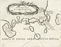 | Details | Coronelli, Vincenzo | 1686 |
| 17th century map of Saronic Islands and Athens, Greece |
|
Coronelli, Vincenzo |
|
| 1686 |
| LOC:2 |
| $230.00 | Coronelli--Vincenzo | 17th-century-map-of-Saronic-Islands-and-Athens--Greece | Attractive map from 1686 of the Attic region and islands of the Saronic Gulf in the neighborhood of Athens, Greece. Major islands shown include Kea, Salamina, Egina, Makronisos, and Patroklos (Patrocleia). Other features Coronelli deemed important were Porto Rafti and the Temple of Minerva. Athens is shown as "Atene" just to the north of a very shrunken Athenian Peninsula. In the vicinity of today's port of Pireas, Greece only a single tower "torre" is shown along with a depiction of dots and crosses in the water signifying rocks or other low-lying navigational hazard.
<br></br>
This scarce wood-cut map was published by father Vincenzo Coronelli from Venice, Italy ca 1686 in "Memorie istoriografiche delli regni della Morea e Negroponte…".
<br></br>
Vincenzo Maria Coronelli (1650-1718) was an Italian Franciscan friar, cartographer, cosmographer and encyclopedist. Coronelli, a trained wood engraver, studied astronomy, Euclidean geometry and ancient philosophy and was named cosmographer for the Republic of Venice. He became most famous for his very large globes built in Paris from 1681-1683 at the order of King Louis XIV. His terrestrial and celestial globes measured 3.9 meters in diameter and were not equaled for more than 200 years. |
| 687 | 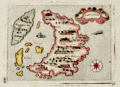 | Details | Porcacchi, Tomasso | 1686 |
| Antique map of Santorini, Greece |
|
Porcacchi, Tomasso |
|
| 1686 |
| LOC:2 |
| $300.00 | Porcacchi--Tomasso | Antique-map-of-Santorini--Greece | Old antique copperplate-engraved map of the Greek island of Santorini, Greece in the Aegean Sea. Noted points of interest include the islands of Apronisi and Therasia, nearby Santorini, along with the Santorinan habitations of S. Salvador, Akrotiri ("Acortiri") , Scaro, and Nebrio. The colorful map was printed in 1686 in one of the last editions of Tomasso Porcacchi's "Isolario" or island book " L'Isol Piu Famose Del Mondo" which was first published in Venice ca. 1572. This 1686 edition is differentiated from earlier versions of Porcacchi's atlas in that 1) it is the only edition where the maps are not set within printed text, and 2) the chart was re-engraved for this edition and the compass rose is less elaborate.
<br></br>On the compass rose Porcacchi identifies eight points that correspond to the classical eight-point naming convention for Mediterranean winds that dates back at least 2000 years. The octagonal "Tower of the Winds" of the Roman Agora in Athens, Greece contains friezes on each wall depicting the principal wind deities and was once capped with a weathervane. Porcacchi's compass rose symbols "T", "G", "+" , "S", "O", "L", "P", "M", correspond to the Italian names for the principal Mediterranean winds: Tramontana ( North ), Greco, Levante ( with a cross denoting East ), Sirocco, Ostro ( South ), Libeccio. Ponente ( West ), and Maestro. ( Taylor, E.G.R., "The Haven Finding Art: A History of Navigation from Odysseus to Captain Cook". New York. 1957 (pp. 6-8)
<br></br>
Simple design as is common in the Isolario maps with depictions of two mythical sea monsters and a scrollwork title cartouche labeled simply: "Santorini". Seas are stippled
<br></br>
Ample margins and hand-coloring make this antique map of Santorini a fine candidate for framing. |
| 695 | 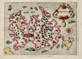 | Details | Porcacchi, Tomasso | 1686 |
| Antique map of Majorca, Balearic Islands, Spain |
|
Porcacchi, Tomasso |
|
| 1686 |
| LOC:4 |
| $325.00 | Porcacchi--Tomasso | Antique-map-of-Majorca--Balearic-Islands--Spain | Numerous fantastical sea monsters fill the empty spaces on this antique copperplate-engraved map of Majorca ( Mallorca ) , Spain the largest of the Balearic Islands. Majorca is nearly five times the size of its sister island Menorca. Majorca's history is closely tied to seafaring- the first people to colonize the island are believed to be Phonecian traders who arrived around the 8th century B.C.
<br></br>
This decorative old map was printed in 1686 in one of the last editions of Tomasso Porcacchi's "Isolario" or island book "L'Isol Piu Famose Del Mondo". This 1686 edition is differentiated from earlier versions in that: 1) it is the only edition where the maps are not set within printed text, and 2) the chart was re-engraved for this edition and the compass rose is less elaborate.
<br></br>On the compass rose Porcacchi identifies eight points that correspond to the classical eight-point naming convention for Mediterranean winds that dates back at least 2000 years. The octagonal "Tower of the Winds" of the Roman Agora in Athens, Greece contains friezes on each wall depicting the principal wind deities and was once capped with a weathervane. Porcacchi's compass rose symbols: "T", "G", "+" , "S", "O", "L", "P", "M", correspond to the Italian names for the principal Mediterranean winds: Tramontana ( North ), Greco, Levante ( with a cross denoting East ), Sirocco, Ostro ( South ), Libeccio. Ponente ( West ), and Maestro. ( Taylor, E.G.R., "The Haven Finding Art: A History of Navigation from Odysseus to Captain Cook". New York. 1957 (pp. 6-8)
<br></br>
Scrollwork title cartouche labeled simply: "Maiorica". Noted points of interest include islands of Cabrera and Dragonara, along with the Majorcan headlands of Capo Salime, P. Colombo, Monacur, Capo della Prea, Capo Formentar, Capo Baiol. Noted habitations include Maiorica ( Palma ), Cala Figera, Aliendia, Soller, Palomera, and Prementor.
<br></br>
Ample margins. Later attractive hand-coloring. |
| 904 | 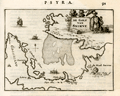 | Details | Dapper, Olfert (Olivier) | 1688 |
| The Gulf of Izmir, Turkey on the Aegean Sea |
|
Dapper, Olfert (Olivier) |
|
| 1688 |
| LOC:2 |
| $170.00 | Dapper--Olfert-(Olivier) | The-Gulf-of-Izmir--Turkey-on-the-Aegean-Sea | Antique copper-plate engraved chart of the Gulf of Izmir (Smyrna or Smyrne) in Turkey from 1688. Coverage includes the Karaburun peninsula ("Calaberno") with windmills depicted at the tip of the peninsula near "C. Calaberno". Moving westward the author depicts and names several settlements including: "Clazomene", "Laberno", "Chipa", and very close to a point of land "Vlakke Punt" lies "Sevafato". The city of Izmir, Turkey is depicted with a small fortress near the coast and a larger fortress in the nearby hill, at present Kadifekale, noted as "Castro Vechio oft Oude Cafteel". Near the present neighborhood of Laka, Dapper identifies a small settlement he calls "Lauro".
<br></br>
The chart is decorated with a square-rigged sailing ship and galleys; in the title cartouche a gentleman in Turkish period attire is shaded by a parasol carried by a servant.
<br></br>
From Olfert Dapper's 1688 edition of his Descripion of the Mediterranean Islands or "Naukeurige beschryving der Eilanden, in de Archipel der Middelantsche Zee, en omtrent dezelve, gelegen: waer onder de voornaemste Cyprus, Rhodus, Kandien, Samos, Scio, Negroponte ...". Dapper was a Dutch writer and self-described physician best known for his books on Africa, China, Persia and Arabia.
<br></br>
Dutch text on verso . Page 91. |
| 903 | 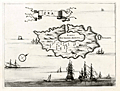 | Details | Dapper, Olfert (Olivier) | 1688 |
| Cycladic Greek Island of Kea |
|
Dapper, Olfert (Olivier) |
|
| 1688 |
| LOC:2 |
| $130.00 | Dapper--Olfert-(Olivier) | Cycladic-Greek-Island-of-Kea | Antique copper-plate engraved chart / plan of Kea ("Zea") or Tzia , an island in the Cyclades Archipelago of Greece, less than 40 miles from Athens. The attractive old map greatly overstates the size of the main port Korissia or "Porto per Grande Armata" relative to the rest of the island and understates the remaining area on the island to the west of the main settlement of Zea near the capital of Ioulis. Other areas noted by Dapper are the tiny island of "Scoglieto" and the "Fonte della Pazzia".
<br></br>
From Olfert Dapper's 1688 edition of his Descripion of the Mediterranean Islands or "Naukeurige beschryving der Eilanden, in de Archipel der Middelantsche Zee, en omtrent dezelve, gelegen: waer onder de voornaemste Cyprus, Rhodus, Kandien, Samos, Scio, Negroponte ...". Dapper was a Dutch writer and self-described physician best known for his books on Africa, China, Persia and Arabia.
<br></br>
Verso is blank. |
| 1434 | 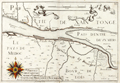 | Details | de Fer, Nicolas | 1690 |
| Scarce French chart of Medoc Bordeaux wine region |
|
de Fer, Nicolas |
|
| 1690 |
| LOC:7 |
| $450.00 | de-Fer--Nicolas | Scarce-French-chart-of-Medoc-Bordeaux-wine-region | For the lover of <b>Bordeaux wines</b>, this fine antique French map encompasses the Bordeaux wine region along France's Gironde, Garonne and Dordogne Rivers. Our 17th-century coastal map is Nicolas de Fer's re-issue of N. Tassin's original engraved map / chart (ca. 1640) of the area. Landmarks of the Bordeaux region noted on the map include le Pays de Medoc, Partie de Xaintonge, Margos (Margaux), Macan, Saint-Julien, Petit Bordeaux, S. Estienne (Saint-Estephe ?), Bourg de Blaye, Pauilliac, Listra (Listrac-Medoc ?). Number 23.
<br></br>
Originally published circa 1640 by N. Tassin whose engravings are of special interest as the first French atlas to focus solely on France's coastal margins. Tassin has a distinctive style characterized by his use of images of numerous sailing vessels, and his large, elaborate compass roses.
<br></br>
This map was produced with royal privilege by the well known French geographer and cartographer, Nicolas de Fer (1646 - 1720). De Fer was a prolific producer of maps and prints who among other honors, was appointed as official geographer to the Spanish King in 1702.
<br></br>
de Fer bought rights to Tassin's atlas- "Cartes Generale et Particulieres de toutes le costes de France" added his imprint and title page, and re-issued the work. Published in de Fer's atlas: "Les Costes de France sur l'Océan et la Mer Mediterranee..." with 32 engraved charts. That work was a re-issue of Christophe Tassin's 1634 work "Cartes Generale et Particulieres de toutes le costes de France tant de la mer Oceane que Mediterranee". |
| 1425 | 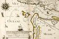 | Details | de Fer, Nicolas | 1690 |
| Scarce French chart of Bordeaux region with Pauilliac Grand-Cru |
|
de Fer, Nicolas |
|
| 1690 |
| LOC:7 |
| $500.00 | de-Fer--Nicolas | Scarce-French-chart-of-Bordeaux-region-with-Pauilliac-Grand-Cru | For the lover of Bordeaux wines, this fine antique French map encompasses the northwestern Bordeaux region of France including the area now occupied with the village of Pauilliac and three of the Grand-Crus vineyards of Bordeaux: Lafite-Rothschild, Mouton-Rothschild, and Latour. Our 17th-century coastal map is Nicolas de Fer's re-issue of N. Tassin's original engraved map / chart (ca. 1640) of the Gironde River mouth. Other landmarks of the Bordeaux region (not drawn anywhere close to scale) include Coste de Medoc (appellee Coste Sauvage) , I. Cordouan, Royan, Soulac-sur-Mer, Carcans, and Lacanau. Number 22.
<br></br>
Checking Google Maps along the estuary of the Gironde River we find an area of the left bank with several river outlets opposite large islands. The major town is not Tassin's or de Fer's "Palus" but Pauilliac.
<br></br>
Originally published circa 1640 by N. Tassin whose engravings are of special interest as the first French atlas to focus solely on France's coastal margins. Tassin has a special style characterized by his use of images of numerous sailing vessels, and his large, elaborate compass roses.
<br></br>
This map was produced with royal privilege by the well known French geographer and cartographer, Nicolas de Fer (1646 - 1720). De Fer was a prolific producer of maps and prints who among other honors, was appointed as official geographer to the Spanish King in 1702.
<br></br>
de Fer bought rights to Tassin's atlas- "Cartes Generale et Particulieres de toutes le costes de France" added his imprint and title page, and re-issued the work. Published in de Fer's atlas: "Les Costes de France sur l'Océan et la Mer Mediterranee..." with 32 engraved charts. That work was a re-issue of Christophe Tassin's 1634 work "Cartes Generale et Particulieres de toutes le costes de France tant de la mer Oceane que Mediterranee". |
| 96 | 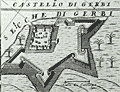 | Details | Coronelli, Vincenzo | 1691 |
| Isola e Castello di Gerbi |
|
Coronelli, Vincenzo |
|
| 1691 |
| LOC:8 |
| $325.00 | Coronelli--Vincenzo | Isola-e-Castello-di-Gerbi | A large antique sheet (13.5x19.5) from Coronelli's well known Isolario or Island Book with a map the island of Djerba off the north coast of Africa. With an inset of the Djerba Castle in upper right. <BR> </BR>
An interesting combination of styles, typefaces , and the broadsheet format makes this page by the famous Venetian cartographer a valuable addition to any collection at little cost. Copperplate engraving with Italian letterpress text below and on verso. Ornate capital letter "C". Page 301. |
| 97 | 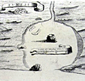 | Details | Coronelli, Vincenzo | 1691 |
| Penon di Velez Isola della Goleta |
|
Coronelli, Vincenzo |
|
| 1691 |
| LOC:8 |
| $250.00 | Coronelli--Vincenzo | Penon-di-Velez-Isola-della-Goleta | A large antique sheet (13.5x19.5) from Coronelli's well known 'Isolario' or Island Book . Contains two engravings on opposing pages not backing on to the other. The engravings are nautical maps of two stronghold islands off the Moroccan and Tunisian coasts: Penon di Velez and Isola della Goleta. Italian letterpress text. |
| 820 |  | Details | Coronelli, Vincenzo | 1692 |
| Antique map of Cape Verde Islands and West Africa |
|
Coronelli, Vincenzo |
|
| 1692 |
| LOC:54 |
| $650.00 | Coronelli--Vincenzo | Antique-map-of-Cape-Verde-Islands-and-West-Africa | Beautiful antique map of the Cape Verde Islands and West coast of Africa by cartographer and Franciscan monk Vicenzo Coronelli (1650 - 1718). The map was published from Venice in 1692 in Coronelli's atlas, the Atlante Veneto. Highly decorative title cartouche at bottom left with angels holding a large tapestry in front of a decorative garland. Inset of the African island of Goree at upper right corner. Goree was a trading post with some association to the Atlantic slave trade.
<br></br>
The Cape Verde islands were a stopping and revictualing location for numerous early explorers since their discovery by the Portugese around 1456. In 1522 the famished crew of Ferdinand Magellan's ship Victoria, numebering about two dozen, stopped at the island of Santiago on their return from their record-setting circumnavigation of the earth. A bit more that 60 years later in 1585, Sir Francis Drake attacked and burned the town of Cidade Velha on the island of Santiago.
<br></br>
Seller's attribution at bottom left reads "Si vende presso Domenico Padoani sul ponte di Rialto all'Insegna della Geografia." Contains some soundings and marked anchorages but the intended use of the map was not for navigation but for general information and decoration. |
| 792 |  | Details | de Fer, Nicolas | 1692 |
| Isle of Wight, Solent, and South England |
|
de Fer, Nicolas |
|
| 1692 |
| LOC:89 |
| $400.00 | de-Fer--Nicolas | Isle-of-Wight--Solent--and-South-England | Antique nautical chart of the Isle of Wight, the Solent, and part of the south coast of Great Britain by French cartographer Nicolas de Fer. Published in 1692. Noted features of this attractive, colorful sea-chart include: Parkhurst Forest ("Wachinu Park"), the Golfe de Southampton, Pointe de Rames-head, Harve de Hamble, Harve de Rey, Presqu' Isle de Freshwater, Presque Isle de Binbridge, Banc de Mackett, and Spithead. Habitations shown include: Tirchfeild, Newchurch, Portsmouth, Gosport, Worth, Yarmouth, Newport, Helene, Nordwood, Yaverland, and St. Laurens Park. Two insets at bottom depict Tor Baye, and the Scilly Islands ("Isles Solrlingues").
<br></br>
The title cartouche carries the attribution: " A Paris Chez N. de Fer dans l'ile du Palais sur le Quaye de 'lOrloge a la Sphere Royale, aver Priv du Roy, 1692". Published from Paris, France by French geographer and cartographer, Nicolas de Fer (1646 - 1720). De Fer was a prolific producer of maps and prints who among other honors, was appointed as official geographer to the Spanish King in 1702. |
| 790 |  | Details | Jaillot, Alexis-Hubert | 1693 |
| Antique chart of English Coast with Poole, Isle of Wight, Christchurch, Portsmouth |
|
Jaillot, Alexis-Hubert |
|
| 1693 |
| LOC:0 |
| $1,450.00 | Jaillot--Alexis-Hubert | Antique-chart-of-English-Coast-with-Poole--Isle-of-Wight--Christchurch--Portsmouth | Large, bold, antique nautical chart of the south coast of England including portions of the counties of Dorset ( Dorchester ), Hampshire ( Southampton ), and Sussex. Dark, graphically pleasing impression with numerous rhumb lines and three extremely decorative compass roses. Coverage includes Wareham, Brownsea Island, Poole Harbor, Swanage Bay ( Baye de Sandwich ) , Christchurch, Nash, Milford, Lymington, Southampton River, Portsea Island and Portsmouth, Hayling Island, and Thorney Island, and the Harbor of Chichester.
<br></br>
From the NEPTUNE FRANÇOIS, entitled: "Le Neptune François ou Atlas des Cartes Marines Levées et Gravées par Ordre Exprés du Roy. Pour L'usage de Ses Armées de Mer, dans Lequel on Voit la Description Exacte ee Toutes les Côtes de la Mer Oceane, & de la Mer Baltique, Depuis la Norwege Jusques au Detroit de Gibraltar." Published by French royal geographer Alexis-Hubert Jaillot from Paris in 1693. Published with the royal privilege granted by King Louis XIV. Drawn by C. Berey. |
| 4728 | 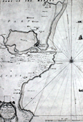 | Details | Adair, John | 1693 |
| Very Rare Antique Chart of Montrose, Angus, Scotland |
|
Adair, John |
|
| 1693 |
| LOC:88 |
| $1,950.00 | Adair--John | Very-Rare-Antique-Chart-of-Montrose--Angus--Scotland | Original antique navigation chart of Montrose (Montross), Scotland by civilian marine surveyor and cartographer John Adair (1655 - 1722). Maps by Adair seldom are found for sale.
<br></br>
Adair was the foremost surveyor of Scotland in the late 1600s, and was appointed to conduct a hydrographical survey of the Scottish coast by a special act of Scottish Parliament to be funded by a tax on vessels entering Scottish ports. The tax proved unpopular and Adair's survey was underfunded and slow in progress. Thus, this chart, engraved in 1693, was not printed until 10 years later in 1703.
<br></br>
Montrose lies along the eastern coast of Scotland about 50 miles north of Dundee. The chart includes small images of local fishing vessels.
<br></br>
This rare chart of the Scottish coast, although compiled and engraved in 1693, was published in 1703 along with 5 other charts in Adair's rare sea atlas "The Description of the Sea- Coast and Islands of Scotland With Large and Exact Maps, for the Use of Seamen" [1]. These other charts in Adair's atlas are titled as below:
<div class="indenttextblock">
1) General chart of Scotland made on a voyage by James the Fifth.</BR>
2) St. Abb's Head to Sunderland Point.</BR>
3) Firth of Forth.</BR>
4) Frith and River Tay.</BR>
5) Red Head to Aberdeen including Montrose.</BR>
</div>
</BR>
The AMPR shows no record of this chart sold individually and records only one copy of Adair's atlas sold (2010).
<br></br>
[1] Robinson, A.H.W. 'Marine Cartography in Britain'. Leicester University Press. 1962. pp. 162; . |
| 998 | 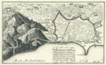 | Details | de Fer, Nicolas | 1693 |
| Old plan of Barcelona, Spain |
|
de Fer, Nicolas |
|
| 1693 |
| LOC:4 |
| $495.00 | de-Fer--Nicolas | Old-plan-of-Barcelona--Spain | Attractive, detailed antique birds-eye view or plan of Barcelona, Spain on the Mediterranean Sea, from 1693. Will frame and display nicely.
<br></br>
This antique copperplate-engraved map was produced toward the end of the 17th century by the well known French geographer and cartographer, Nicolas de Fer (1646 - 1720). De Fer was a prolific producer of maps and prints who among other honors, was appointed as official geographer to the Spansh King in 1702. From de Fer's "Forces de l'Europe ou Introduction a la Fortification". |
| 5241 |  | Details | Lea, Phillip | 1695 |
| One sheet from The Travelers Guide after Saxtons map of England and Wales |
|
Lea, Phillip |
|
| 1695 |
| LOC:0 |
| $350.00 | Lea--Phillip | One-sheet-from-The-Travelers-Guide-after-Saxtons-map-of-England-and-Wales | Two sheets from Phillip Lea's revised version of Christopher Saxton's large scale map of England and Wales first published in 1583. Shows a portion of Scotland at left; Northumberland (Northumbria), Cumbria (Cumberlandia) and Durham (Dunelmensis). Fifth state published by Philip Lea, Globemaker at ye Atlas and Hercules in Cheapside nere the corner of Fryday Street in London, [1687 - 1700].
<br></br>
Philip Lea re-published Saxton's the map on a smaller scale designed to be used as a travelling map. He reduced the map to ten full sheets and four half sheets. This artifact consists of Lea's top two sheets laid side by side on vellum.
<br></br>
Verso shows English MS text legal document with a date of 1732 visible. Philip Lea re-engraved the plates at least five times during his period of ownership. |
| 1375 | 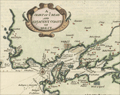 | Details | Moll, Herman | 1695 |
| Antique map of Belle Isle, Brest, in Brittany France |
|
Moll, Herman |
|
| 1695 |
| LOC:7 |
| $200.00 | Moll--Herman | Antique-map-of-Belle-Isle--Brest--in-Brittany-France |
Attractive antique copper-engraved map by Moll of the lower tip of Brittany (Bretagne), France from roughly the Pointe de Corsen, past Pointe de Kermorvan, le Conquet, Brest, and Crozon. This scarce map is titled "The Marquisate and Government of Bell-Isle Divided into its Four Parishes of the Palace, Bangor, Lomaria, and Sauzon."
<br></br>
One unusual feature of this map is the large number of mills the cartographer identifies, perhaps because their high elevation, like that of church steeples, would have provided coastal mariners with navigational reference points ashore. Together Moll's emphasis on features of great height and the rhumb lines with compass rose, suggest the original inspiration for this map is derived from a nautical chart. Verso with map of Belle Isle, France in the Sea of Bretagne. |
| 894 |  | Details | Coronelli, Vincenzo | 1696 |
| Coronelli's globe gore of the Arabian Sea, India and Maldive Islands |
|
Coronelli, Vincenzo |
|
| 1696 |
| LOC:9 |
| $480.00 | Coronelli--Vincenzo | Coronelli-s-globe-gore-of-the-Arabian-Sea--India-and-Maldive-Islands | Unusual antique hand-colored <b>globe gore</b> by cartographer and Franciscan monk Vincenzo Coronelli (1650 - 1718). Originally produced for <b>Coronelli's 1688 terrestrial globe</b>. This fine engraved gore was included inset with text in his famous island book or "Isolario" published from Venice in 1696 - 1697.
<br></br>
Ranging from Oman, Dubai, and Abu Dhabi, past the Strait of Hormuz and then trending southeast across Iran, Pakistan and the west coast of India this scarce cartographic curiosity includes the Maldive Islands ("Isole Maldive" ) and west coast of Sri Lanka. Among the many noted towns and villages in India are Mumbai ("Bombaim"), <b>Hyderabad ("Golconda")</b> , and Madurai ("Madura").
<br></br>
A globe gore is a 2 dimensional representation on flat paper of a curved segment of the earth's surface. The gores are characterized by their curved top, bottom, and sides. Each gore would have been carefully cut to size and then pasted on a blank globe to produce a finished globe which would have been colored. Typically 12 gores were required to complete the 360 degree circumference of the earth at the latitudes covered by the gore.
<br></br>
We estimate a globe created with this gore would have had a circumference of about 11 feet. (The gore covers roughtly 30 degrees of longitude or 1/12 of the earths circumference. At the equator, this gore is 11" wide giving us 11" x 12 = 132" circumference or 11 feet.)
<br></br>
Text on both the recto and verso is Italian. Page 113. |
| 752 | 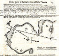 | Details | Coronelli, Vincenzo | 1697 |
| Antique chart of Cartagena Spain in Murcia by Coronelli |
|
Coronelli, Vincenzo |
|
| 1697 |
| LOC:8 |
| $325.00 | Coronelli--Vincenzo | Antique-chart-of-Cartagena-Spain-in-Murcia-by-Coronelli | Rare antique nautical chart of the harbor and anchorages near Cartagena, Spain in the region of Murcia. Simple, antique wood-cut print with profile view of the village of Cartagena, a compass rose, and soundings set in a much larger page of Italian text . Italian text also on verso largely consists of sailing directions ( distances and courses to steer between ports ).
<br></br>
Probably a copy by Coronelli derived from an atlas / pilot guide originally produced by the Genoan cartographer Francesco Maria Levanto in 1664 in "La Prima Parte dello Specchio del Mare…" . The Specchio del Mare was reissued later by Coronelli in 1697 and bears a strong similarity in paper, format, and typography to Coronelli's Isolario or Island Book. Charts from the Specchio del Mare are quite scarce and a small port plan such as this in text , even more scarce. Page 15. Chain laid paper. |
| 618 | 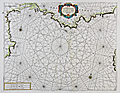 | Details | Coronelli, Vincenzo | 1697 |
| Chart of the Coast of Languedoc and Provence |
|
Coronelli, Vincenzo |
|
| 1697 |
| LOC:58 |
| $950.00 | Coronelli--Vincenzo | Chart-of-the-Coast-of-Languedoc-and-Provence | Antique nautical chart with original hand color covering the southern Mediterranean coast of France including the provinces of Languedoc and Provence. Coverage of this original antique chart includes numerous towns along southern France's Mediterranean coast, including the Cote d'Azure, Monaco, and the western coast of Corsica. Towns noted include Palamos, Roses, Agde, Marseilles, Toulon, Antibe, Freuil, and many more. From the scarce Isolario ( island book ) of Vincenzo Coronelli ca. 1697. <br></br>
Verso with Italian text on two pages and includes two inset views- the first of the town of Avignon, France along the Rhone river, titled "Avignone Già Seggio de Sommi Pontefici". The second inset view, titled "Isole di Ionquieres e Torre di Buc Nel Canale di Martegues" shows the area near the Canal de Martigues in the Bouches-du-Rhône department, nicknamed "The Venice of Provence" because of its canals and maritime features. |
| 315 | 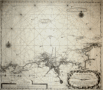 | Details | van Keulen, Gerard | 1698 |
| Nouvelle carte marine croissante en degres d'une partie des cotes maritime de Bretagne |
|
van Keulen, Gerard |
|
| 1698 |
| LOC:0 |
| $375.00 | van-Keulen--Gerard | Nouvelle-carte-marine-croissante-en-degres-d-une-partie-des-cotes-maritime-de-Bretagne | Antique nautical chart of Brittany (Bretagne) from 1698 by Gerard van Keulen, well known Dutch chart maker. Coverage is centered on the coastline, estuary and rivers near Morlaix, France. Goulven, St. Paul de Leon, and Lanion are among the largest towns depicted. Chart contains picturesque details that would have been useful to coastal navigators including villages, churches, windmills, offshore rocks and islands (Les Seit Isles; roche blanche) and navigational aids. Chart is set on a series of rhumb lines with two decorative compass roses. |
| 300 |  | Details | de Fer, Nicolas | 1700 |
| Anvers |
|
de Fer, Nicolas |
|
| 1700 |
| LOC:7 |
| $350.00 | de-Fer--Nicolas | Anvers | Small antique map /plan of the historic town of Antwerp (Anvers), Belgium ca. 1700. Shows the walled and moated city of Antwerp along the Scheldt (Escaut) river with an additional fortress ( Citadelle ) attached on the upstream end of the city. A general street plan is supported by a 20+ item legend identifying key points in the city and surrounding area.<BR> </BR>
This antique copperplate-engraved map was produced toward the end of the 17th century by the well known French geographer and cartographer, Nicolas de Fer (1646 - 1720). De Fer was a prolific producer of maps and prints who among other honors, was appointed as official geographer to the Spansh King in 1702. |
| 297 | 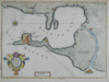 | Details | de Fer, Nicolas | 1700 |
| Isle Ville et Port de Cadis |
|
de Fer, Nicolas |
|
| 1700 |
| LOC:4 |
| $225.00 | de-Fer--Nicolas | Isle-Ville-et-Port-de-Cadis | Scarce antique map of the bay and island of Cadiz, Spain from ca. 1696 - 1708. This neat copperplate engraving is oriented to the north and shows some details of the city and port of Cadis including Pont. St Sebastien, Pte. Caterine, and Caleta. A single bridge is shown at the north end of the island : Pont de Suaco. Other habitations noted are Rota, (Rotta) Port Saint Marie, Port Real, Chiclana, Puntal, and Isle St. Pierre. Most of the island is shown covered by agricultural fields, apparently vineyards, labeled with rare praise (for a Frenchman) "ou croit le meilleur vin d'Espagne" translated very roughly as- 'thought to be the best Spanish wine'.<BR> </BR>
This antique map was produced toward the end of the 17th century by the well known French geographer and cartographer, Nicolas de Fer (1646 - 1720). De Fer was a prolific producer of maps and prints who among other honors, was appointed as official geographer to the Spanish King in 1702. |
| 1102 | 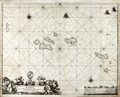 | Details | Loots, Johannes | 1700 |
| Pascaerte vande Vlaemsche Eylanden |
|
Loots, Johannes |
|
| 1700 |
| LOC:9 |
| $2,500.00 | Loots--Johannes | Pascaerte-vande-Vlaemsche-Eylanden | Singular rare nautical chart of the Azores Islands (Vlaemsche = Flemish) by Dutch cartographer Johannes Loots, ca 1700. Pascaerte vande Vlaemsche Eylanden is not recorded in Koeman's Atlantes Neerlandici. <B>No record of another copy of this chart is found online or in cartograhic reference sources.</b> Charts by Johannes Loots are very scarce; only eight charts by Loots are recorded in the Antique Map Price Record covering 210,000 map and chart sales in the last 35 years.
<br></br>
Scrollwork title cartouche with putto and horses led by robed young men and topped with an armillary sphere on a pedestal.
<br></br>
The topography of the Azores islands closely resembles that on an an earlier chart with the same title produced by Arnold Colom but differences in the rhumb lines, cartouches, lattitude marks, compass roses and decorations strongly suggest that this chart was printed from a new plate engraved for Loots.
<br></br>
From Koeman's biography of Johanne's Loots (1665[6] - 1726) we know Loots was born in Amsterdam and is not as is sometimes believed one of the two sons of Anthonie (Theunisz) Jacobsz who named themselves Lootsman to confuse cartographic researchers in future centuries. Loots served an apprenticeship under Hendrick Doncker as a maker of mathematical and nautical instruments including cross-staffs. Loots was accepted into the Guild of Booksellers in 1693 and settled into a shop in the Nieuebrugsteeg 'In de Jong Lootsman'. Two well-known competing catographers lived on the same street- Johannes van Keulen and Hendrick Doncker. |
| 1376 |  | Details | Wells, Edward | 1700 |
| Interesting antique map of Spain or Celtiberia |
|
Wells, Edward |
|
| 1700 |
| LOC:0 |
| $350.00 | Wells--Edward | Interesting-antique-map-of-Spain-or-Celtiberia | Highly interesting framed intaglio engraved map of Spain ca. 1700 with names of the provinces of that era. Old color and the engraver's use of bold strokes with large and decorative typefaces makes this antique map a joy to study. The Celtiberians were a group of Celts in the central-eastern Iberian Peninsula ca. 200 BC.
<br></br>
By Edward Wells (1667 - 1727) and dedicated to William, Duke of Glouchester, upon his death from encephalitis at age 11. Bears the Duke's coat-of-arms above the scrollwork title. Engraved by R. Spofforth.
<br></br>
With frame the engraving measures 22.5" x 17.5". Packaging and ground shipping within USA: $45. |
| 879 |  | Details | de Fer, Nicolas | 1701 |
| Antique Map of the Mediterranean island of Sicily, Italy |
|
de Fer, Nicolas |
|
| 1701 |
| LOC:4 |
| $240.00 | de-Fer--Nicolas | Antique-Map-of-the-Mediterranean-island-of-Sicily--Italy | Attractive antique map of the island of <b>Sicily</b> in Italy published from Paris in 1701 . Adjoining the mainland at the "toe" of the Italian peninsula, and separated by the Strait of Messina, the southermost tip of Calabria is shown with the key city of Reggio.
<br></br>
Much detail in the interior of this original old map includes mountains, rivers, major roads, and villages. Key cities in Sicily include Palermo, Messina, Noto, Mazara, and Siracusa. A few miles northwest of the coastal city of Catania, <b>Mount Etna</b> ( Aetna ) is shown erupting violently.
<br></br>
At the time this map was published Sicily, the largest of all Mediterranean islands, was ruled by Philip IV , King of Spain.
<br></br>
This antique map was produced by the well known French geographer and cartographer, Nicolas de Fer (1646 - 1720) and was published in de Fer's atlas: "L'atlas curieux, ou Le monde réprésenté dans des cartes générales et particulières du ciel et de la terre… et orné par des plans et descriptions des villes capitales et principales ..."
<br></br>
Publication details are found In the lower left corner : <div class="indenttextblock">" A Paris. Chez l'Autheur dans l'Isle du Palais a la Sphere Royale. Avec Privilege du Roy. 1701. " </div> |
| 3643 | 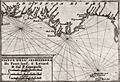 | Details | Coronelli, Vincenzo | 1702 |
| Coronelli's rare chart of England from Portland to the Lizard |
|
Coronelli, Vincenzo |
|
| 1702 |
| LOC:77 |
| $500.00 | Coronelli--Vincenzo | Coronelli-s-rare-chart-of-England-from-Portland-to-the-Lizard | Rare engraved chart from Coronelli's "Teatro della Guerra" shows the east coast of England (Provincia di West) from Portland Bill in Dorset to the Lizard in Cornwall. Features shown include Torbay, Dartmouth, the Isle of Wight and much more. A fine addition to any collection of coastal charts of England.
<br></br>
This small well-engraved antique chart is from the <b>Isole Britanniche</b> volume of the Teatro della Guerra. |
| 1278 | 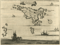 | Details | Dapper, Olfert (Olivier) | 1703 |
| De l'Ile de Scyros (Skyros) |
|
Dapper, Olfert (Olivier) |
|
| 1703 |
| LOC:0 |
| $115.00 | Dapper--Olfert-(Olivier) | De-l-Ile-de-Scyros-(Skyros) | Antique copper-plate engraved map of the <b>Greek Island of Skryos</b> (also Skiros or Scyros) by Olfert Dapper. Skyros is the southernmost island in the <b>Sporades Archipelago</b>. Dapper notes by name two smaller nearby islands, Schirodola (Skiropoula), and Skantzoura (Scanda) and off the east coast Dapper identifies 4 anchorages maked with "A" and notes: "Tutti Buoni Porti".
<br></br>
Decoratively presented with a ribbon title block and depictions of a square-rigged man-of-war and two galleys with lateen sails. North is oriented at the top left corner.
<br></br>
From "Description exacte des isles de l'archipel, et de quelques autres adjacentes…" by Olfert Dapper. This leaf with French text from 1703 was originally published in Dutch in 1688. |
| 6640 |  | Details | Gemelli Carreri, Giovanni Francesco | 1704 |
| Early map of Mexico City with Lakes and Causeways by Gemelli |
|
Gemelli Carreri, Giovanni Francesco |
|
| 1704 |
| LOC:3 |
| $525.00 | Gemelli-Carreri--Giovanni-Francesco | Early-map-of-Mexico-City-with-Lakes-and-Causeways-by-Gemelli | Original, copper-plate engraved and hand-colored map of the Valley of Mexico by Giovanni Francesco Gemelli Carreri (Gemelli) after Enrico Martinez and Adrian Boot (1). Scarce. North is oriented to the left.
<br><br>
Shows lakes, rivers, streams, and mountains in the Valley of Mexico along with numerous villages and towns. Nascent Mexico City or Tenochtitlán, is shown to lie in lower Lake Texcoco connected to the mainland by seven causeways. From an English-language publication of A Voyage Around the World (1699), probably A. and J. Churchill, 1704.
<br><br>
(1) Connolly, Patricia and Roberto Mayer. Vingboons, Trasmonte and Boot: European Cartography of Mexican Cities in Early Seventeenth Century. Imago Mundi. January, 2009. |
| 5264 |  | Details | Bodenher, Gabriel | 1704 |
| Antique bird's-eye view of Cote d'Azur Provence Nice Monaco |
|
Bodenher, Gabriel |
|
| 1704 |
| LOC:77 |
| $350.00 | Bodenher--Gabriel | Antique-bird-s-eye-view-of-Cote-d-Azur-Provence-Nice-Monaco | Fine antique engraved bird's-eye coastal view of a small portion of the Cote d'Azur in Provence, France from Nice to Monaco. Decorated beautifully with drawings of galleys and several square-rigged sailing vessels. During this time period up to forty French galleys, stationed in Marseilles, France, provided protection and projected France's power in the region.
<br></br>
Fine detail and careful engraving make this a very beautiful record of the Cote d'Azur from almost 320 years ago. Legend below in German keyed to 25 important locations including Nice (Niza), Villefranche-sur-Mer, Cap Ferrat, and Monaco.
<br></br>
Taken from G. Bodenher's "Europeans Macht und Pracht", a series of engravings depicting city views, plans, fortresses and castles in Europe. Gabriel Bodenher was a publisher of maps and prints in Augsburg, Germany. |
| 2575 | 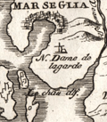 | Details | Coronelli, Vincenzo | 1706 |
| Scarce antique map and plan of Marseilles, France |
|
Coronelli, Vincenzo |
|
| 1706 |
| LOC:77 |
| $275.00 | Coronelli--Vincenzo | Scarce-antique-map-and-plan-of-Marseilles--France | Very scarce map of the Bay of Marseille and surrounding area with a birds-eye view of the city of Marseille, France (Marseglia). Marseilles was the home of France's 'Corps de Galleres' or rowing galleys with lateen-rigged sails. The main fleet of French Navy sailing vessels was headquarted in Toulon, France. The two services were combined in 1744.
<br></br>
Shows a very early view of Marseilles predating the construction and fortification of the town's southern side. In 1660, Louis XIV ensured Marseilles would become the premier commercial port of France in the Mediterranean. Louis commissioned significant new fortifications, and was reported to have said “We noticed that the inhabitants of Marseilles were extremely fond of nice fortresses. We wanted to have our own at the entrance to this great port.”
<br></br>
From "La Francia Divisa in XII Prefetture" , a section of Coronelli's multi-volume "Teatro delle citta e porti principali dell'Europa…" Plate 3 with previous plate number 212. Verso blank |
| 5210 | 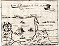 | Details | Coronelli, Vincenzo | 1706 |
| Coronelli's Forte di Brigancon ed Isole de yeres (Bregancon, Hyeres) |
|
Coronelli, Vincenzo |
|
| 1706 |
| LOC:77 |
| $245.00 | Coronelli--Vincenzo | Coronelli-s-Forte-di-Brigancon-ed-Isole-de-yeres-(Bregancon--Hyeres) | Rare birdseye view of the island of Bregancon, France and the Isles de Hyeres by Coronelli. Today the island of Bregancon, near the French Riviera, is attached to the mainland by a short causeway. Includes the offshore islands of Tilan, Port Cros, Porquerolles and the village of San Margarita. Decorated with drawings of galleys under sail and oars.
<br></br>
This small well-engraved antique chart is from Coronelli's Teatro della Guerra. TEATRO DELLA GUERRA, DIVISO IN XXXXVIII. PARTI, IN CUI SONO ESATTAMENTE DELINEATI, E COMPENDIOSAMENTE DESCRITTI SIN L'ANNO M.DCC. NAPLES, 1706. (See also our smaller-scale chart of the entire Toulon harbor by Coronelli). Page 8.
<br></br>
Vincenzo Maria Coronelli (1650-1718), is considered as one of Italy's most famous and greatest cartographers and cosmographers to the Republic of Venice. |
| 5216 | 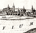 | Details | Coronelli, Vincenzo | 1706 |
| Fine elevation view of the town of Orleans, France. |
|
Coronelli, Vincenzo |
|
| 1706 |
| LOC:77 |
| $265.00 | Coronelli--Vincenzo | Fine-elevation-view-of-the-town-of-Orleans--France- | Antique elevation view of the town of Orleans, France along the Loire River. With a fine decorative cartouche dedicating the engraving to Carlo Bernardi.
<br></br>
This small well-engraved antique chart is from Coronelli's Teatro della Guerra. TEATRO DELLA GUERRA, DIVISO IN XXXXVIII. PARTI, IN CUI SONO ESATTAMENTE DELINEATI, E COMPENDIOSAMENTE DESCRITTI SIN L'ANNO M.DCC. NAPLES, 1706.
<br></br>
Vincenzo Maria Coronelli (1650-1718), is considered as one of Italy's most famous and greatest cartographers and cosmographers to the Republic of Venice. |
| 5211 |  | Details | Coronelli, Vincenzo | 1706 |
| Rare antique chart of French islands of Sainte-Marguerite and Saint-Honorat |
|
Coronelli, Vincenzo |
|
| 1706 |
| LOC:77 |
| $265.00 | Coronelli--Vincenzo | Rare-antique-chart-of-French-islands-of--Sainte-Marguerite-and-Saint-Honorat | Rare chart of the a portion of the Cote d'Azur and islands of Sainte-Marguerite and Saint-Honorat off the coast of Cannes, (Canet) France near the Cap de Antibes.
<br></br>
This small well-engraved antique chart is from Coronelli's Teatro della Guerra. TEATRO DELLA GUERRA, DIVISO IN XXXXVIII. PARTI, IN CUI SONO ESATTAMENTE DELINEATI, E COMPENDIOSAMENTE DESCRITTI SIN L'ANNO M.DCC. NAPLES, 1706. Page 25.
<br></br>
Vincenzo Maria Coronelli (1650-1718), is considered as one of Italy's most famous and greatest cartographers and cosmographers to the Republic of Venice. |
| 5214 | 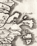 | Details | Coronelli, Vincenzo | 1706 |
| Scarce Italian Map of the French Riviera Cote d'Azur |
|
Coronelli, Vincenzo |
|
| 1706 |
| LOC:77 |
| $265.00 | Coronelli--Vincenzo | Scarce-Italian-Map-of-the-French-Riviera-Cote-d-Azur | Original early eighteenth-century engraved map of the coast of Provence, France at the Cote d'Azur, or French Riviera. Includes the villages of Antibes and Cannes. North is oriented to the upper left.
<br></br>
This small well-engraved antique chart is from Coronelli's Teatro della Guerra. TEATRO DELLA GUERRA, DIVISO IN XXXXVIII. PARTI, IN CUI SONO ESATTAMENTE DELINEATI, E COMPENDIOSAMENTE DESCRITTI SIN L'ANNO M.DCC. NAPLES, 1706. Page 13.
<br></br>
Vincenzo Maria Coronelli (1650-1718), is considered as one of Italy's most famous and greatest cartographers and cosmographers to the Republic of Venice. |
| 5215 | 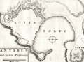 | Details | Coronelli, Vincenzo | 1706 |
| Plan of fortifications at Antibes, France |
|
Coronelli, Vincenzo |
|
| 1706 |
| LOC:77 |
| $265.00 | Coronelli--Vincenzo | Plan-of-fortifications-at-Antibes--France | V. Coronelli's rare antique engraved plan of the port and the Vauban-style fortifications surrounding the city of Antibes, France. Antibes is a town on the French Riviera: the Cote d'Azur. North oriented to the right.
<br></br>
This small well-engraved antique chart is from Coronelli's Teatro della Guerra. TEATRO DELLA GUERRA, DIVISO IN XXXXVIII. PARTI, IN CUI SONO ESATTAMENTE DELINEATI, E COMPENDIOSAMENTE DESCRITTI SIN L'ANNO M.DCC. NAPLES, 1706. Page 25.
<br></br>
Vincenzo Maria Coronelli (1650-1718), is considered as one of Italy's most famous and greatest cartographers and cosmographers to the Republic of Venice. |
| 5217 | 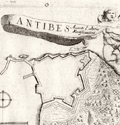 | Details | Coronelli, Vincenzo | 1706 |
| Antique birds-eye view of Antibes, France |
|
Coronelli, Vincenzo |
|
| 1706 |
| LOC:77 |
| $265.00 | Coronelli--Vincenzo | Antique-birds-eye-view-of-Antibes--France | Antique bird's-eye view of Antibes, France. In this scarce early eighteenth-century engraving an angel flies above a fortified port city with a banner that reads: "Antibes Avanti l' ultime Fortificazioni'. That banner flies for Antibes, a village' on the French Riviera or Cote d'Azur, shown with its fortress and harbor.
<br></br>
This small well-engraved antique chart is from Coronelli's Teatro della Guerra. TEATRO DELLA GUERRA, DIVISO IN XXXXVIII. PARTI, IN CUI SONO ESATTAMENTE DELINEATI, E COMPENDIOSAMENTE DESCRITTI SIN L'ANNO M.DCC. NAPLES, 1706.
<br></br>
Vincenzo Maria Coronelli (1650-1718), is considered as one of Italy's most famous and greatest cartographers and cosmographers to the Republic of Venice. |
| 4744 | 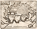 | Details | Coronelli, Vincenzo | 1706 |
| Coronelli's port plan of Toulon, France |
|
Coronelli, Vincenzo |
|
| 1706 |
| LOC:77 |
| $225.00 | Coronelli--Vincenzo | Coronelli-s-port-plan-of-Toulon--France | A fine and rare engraved chart from Coronelli's "Teatro della Guerra" with a plan of Toulon, France along the northern Mediteranean coast. This nice antique engraved chart shows two distinct anchorages for ships: "Porto per i Vascelli de Re" for the King's vessels and "Porto per i Vascelli di Mercanzia" for merchant vessels. The small town of Tolon (Toulon) is shown heavily fortified with then-modern Vauban style walls.
<br></br>
This small well-engraved antique chart is from Coronelli's Teatro della Guerra. TEATRO DELLA GUERRA, DIVISO IN XXXXVIII. PARTI, IN CUI SONO ESATTAMENTE DELINEATI, E COMPENDIOSAMENTE DESCRITTI SIN L'ANNO M.DCC. NAPLES, 1706. (See also our smaller-scale chart of the entire Toulon harbor by Coronelli). Page 8.
<br></br>
Vincenzo Maria Coronelli (1650-1718), is considered as one of Italy's most famous and greatest cartographers and cosmographers to the Republic of Venice. |
| 4745 | 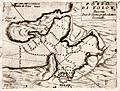 | Details | Coronelli, Vincenzo | 1706 |
| Coronelli's plan of the bay and harbor at Toulon, France |
|
Coronelli, Vincenzo |
|
| 1706 |
| LOC:77 |
| $270.00 | Coronelli--Vincenzo | Coronelli-s-plan-of-the-bay-and-harbor-at-Toulon--France | Attractive antique engraved chart from Coronelli's "Teatro della Guerra" with a harbor chart of Tolon (Toulon), France along the northern Mediteranean coast. Numerous depth soundings criss-cross the bay, reflecting several surveys. Little named detail.
<br></br>
This small well-engraved antique chart is from the "Teatro della Guerra." TEATRO DELLA GUERRA, DIVISO IN XXXXVIII. PARTI, IN CUI SONO ESATTAMENTE DELINEATI, E COMPENDIOSAMENTE DESCRITTI SIN L'ANNO M.DCC. NAPLES, 1706. (See also our larger-scale port plan of the town of Toulon by Coronelli). Page 7.
<br></br>
Vincenzo Maria Coronelli (1650-1718), is considered as one of Italy's most famous and greatest cartographers and cosmographers to the Republic of Venice. |
| 6337 | 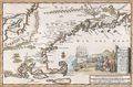 | Details | Aa, Pieter van der | 1707 |
| Nieuw Engeland in Twee Scheeptogten door Kapitein Johan Smith inde iaren 1614 en 1615 Bestevend |
|
Aa, Pieter van der |
|
| 1707 |
| LOC:78 |
| $1,000.00 | Aa--Pieter-van-der | Nieuw-Engeland-in-Twee-Scheeptogten-door-Kapitein-Johan-Smith-inde-iaren-1614-en-1615-Bestevend | Scarce map of New England, Cape Cod, Nantucket and more after John Smith. "Nieuw Engeland in Twee Scheeptogen door Kapitein Johan Smith inde iaren 1614 en 1615 bestevend". (New England as Described by Captain John Smith in two voyages in 1614 and 1615. By Pieter van der Aa, a Dutch mapmaker and publisher.
<br></br> |
| 1060 |  | Details | Loots, Johannes | 1708 |
| Unrecorded Late Golden Age Dutch Sea Chart of the World |
|
Loots, Johannes |
|
| 1708 |
| LOC:0 |
| $95,000.00 | Loots--Johannes | Unrecorded-Late-Golden-Age-Dutch-Sea-Chart-of-the-World | Previously unrecorded nautical chart of the entire world by Dutch cartographer Johannes Loots. Not recorded in Koeman's Atlantes Neerlandici. Not found online. Not in AMPR.
<br></br>
Likely the only Dutch late Golden-Age unrecorded world nautical chart to surface in the 21st century. Differs from other sea charts of the period in that Loots places van Diemen's Land much farther east (13 degrees) than the others (Robijn, Roggeveen, Goos, Morden, Keulen, Wit, Doncker, Moxon, Halley) all of whom tend to place van Diemen's Land at the longitude of the west coast of the Cape York Peninsula (de Fer an exception). One possible explanation for the mis-alignment is that Hendrik Doncker never included van Diemen's Land on his charts, and as Doncker's apprentice, Loots was never required to deal with that area.
<br></br>
Covers the entire world. Loot's newly-discovered chart with title cartouche in four languages (1) Is the only known example of any world chart by Loots. (2) Is of a unique design found in no other world chart. (3) Includes tracks of explorers in the southern passage up to 1708, include le Maire, Schouten, Halley and "Vaisseau St. Louis, 1708" the last, just one year after Loots disolved a partnership with Antoni de Winter and Claas de Vries. (4) Is on Mercator's projection. (5) Shows the “Terre Austral du St. Espirit”.
<br></br>
From Koeman's biography of Johanne's Loots (1665[6]-1726) we know Loots was born in Amsterdam and is not as is sometimes believed one of the two sons of Anthonie (Theunisz) Jacobsz who named themselves Lootsman to confuse cartographic researchers in future centuries. Loots served an apprenticeship under Hendrick Doncker .
<br></br>
Contact for price. |
| 2482 | 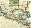 | Details | Moll, Herman | 1709 |
| Mexico, or New Spain With Guadalajara, Guatemala, and Florida |
|
Moll, Herman |
|
| 1709 |
| LOC:3 |
| $500.00 | Moll--Herman | Mexico--or-New-Spain-With-Guadalajara--Guatemala--and-Florida | A map dealer's map!! I love it!
<br></br>
Hermans Moll's classic map of the United States, Caribbean, and Central America. Moll has divided the area into the four provinces of Mexico, Guadalajara Guatemala, and Florida. Pacific Ocean is labeled "The Great South Seas"; the Gulf of Mexico is sub-titled "the Bay of Mexico". Beginning of Chapter VII. Page 214. English text on verso. |
| 1116 | 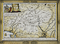 | Details | Aa, Pieter van der | 1713 |
| Antique map of North India or The Empire of the Grand Mogol |
|
Aa, Pieter van der |
|
| 1713 |
| LOC:6 |
| $250.00 | Aa--Pieter-van-der | Antique-map-of-North-India-or-The-Empire-of-the-Grand-Mogol | Attractive antique map by Peter van der Aa of India, the Empire of the Grand Mogol, with the frontiers of Persia and Tartary after the memoires of Nuno de Cunha . Nunho de Cunha, the son of famed Portugese explorer Tristão da Cunha, was the ninth governor of Portuguese possessions in India from 1528 to 1538.
<br></br>
Extends across northern India with parts of Pakistan and Afghanistan. Includes the Indian states of Gujarat ("Guzaratte"), Rajasthan, Madhya Pradesh, and Haryana as well as numerous tributaries to the Ganges and Indus rivers. Key cites noted on the map include Dehli ("Deli"), Ahmedabad ("Hamedebat"), Kabul ("Cabul"), Lahore, Attock, Parvan, Campion, Pitan and numerous others. The map is printed into a finely-engraved decorative frame and will make a handsome presentation when framed.
<br></br>
Pieter van der Aa (1659 - 1733) was a Dutch publisher working in Leiden during the early eighteenth century. He is best known for publishing maps and atlases, though he also printed pirated editions of foreign bestsellers and illustrated volumes. Van de AA's use of stock mock-frame borders is a characteristic for which he is well known. This map shows evidence of two plate marks, one for the mock-frame and the second interior platemark for the smaller map which was printed inside the mock-frame. From "Le nouveau theatre du monde. ou La geographie royale, composée de nouvelles cartes tres-exactes", published from Leiden in 1713. |
| 1381 | 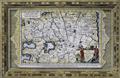 | Details | Aa, Pieter van der | 1713 |
| Fine antique framed map of Tartary or north central Asia |
|
Aa, Pieter van der |
|
| 1713 |
| LOC:0 |
| $240.00 | Aa--Pieter-van-der | Fine-antique-framed-map-of-Tartary-or-north-central-Asia | Matted and framed…
<br></br>
Attractive, framed copper-engraved antique map of Tartary by Pieter van der Aa. The name "Tartary" was used until the twentieth century to designate the great tract of northern and central Asia stretching from the Caspian Sea and the Ural Mountains to the Pacific Ocean. Tartary consisted of the high plateau of central Asia and its north-western slopes, which formed part of the Tartar empire in the Middle Ages.
<br></br>
Includes the Black Sea ("Pontus Euxinus"), Caspian Sea ("Mare Caspium") and western Mediterranean Sea ("Mare Mediterraneum"). Covers parts or all of modern-day Turkey, Iran, Georgia, Azerbaijan, Syria, Iraq, China, Nepal, and Afghanistan.
<br></br>
Matted and framed measures 17" x 13". Map itself, ca. 1713 within an elaborate and decorative printed border.
<br></br>
Pieter van der Aa (1659 - 1733) was a Dutch publisher working in Leiden during the early eighteenth century. He is best known for publishing maps and atlases, though he also printed pirated editions of foreign bestsellers and illustrated volumes. Van de AA's use of stock mock-frame borders is a characteristic for which he is well known. The map shows evidence of two plate marks, one for the mock-frame and the second interior platemark for the smaller map which was printed inside the mock-frame. From "Le nouveau theatre du monde. ou La geographie royale, composée de nouvelles cartes tres-exactes", published from Leiden in 1713. |
| 996 | 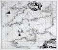 | Details | Renard, Louis | 1715 |
| Renard's decorative sea chart of the English Channel from 1715. |
|
Renard, Louis |
|
| 1715 |
| LOC:50 |
| $1,400.00 | Renard--Louis | Renard-s-decorative-sea-chart-of-the-English-Channel-from-1715- | Fine and scarce copper-engraved sea chart of the <strong>English Channel</strong> from the end of the Dutch Golden Age- a time when Dutch influence, military power, and commerce was at its peak. This very decorative chart "Canalis Angliae et Galliae Littora" was published by Dutch engraver and entrepreneur <strong>Louis Renard</strong>. Two beautiful cartouches, the upper with mythological figures and the lower representing scenes from the world of shipping and commerce with a very affluent, fashionably dressed overseer looking on as plainly-dressed workers go about their tasks.
<br></br>
Louis Renard (1678-1746) was from a Huguenot family. He moved from France to the Netherlands and became a book dealer and publisher in Amsterdam in 1703. This chart is based on an earlier work of Frederick de Wit, from whom Renard purchased the plates. Issued with corrections based on van Keulen, and published in Renard's "Atlas de la Navigation et du Commerce" in 1715. |
| 1012 | 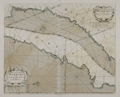 | Details | Mount and Page | 1715 |
| Antique chart of Africa from Agadir, Morocco to Nouadhibou, Mauritania |
|
Mount and Page |
|
| 1715 |
| LOC:0 |
| $285.00 | Mount-and-Page | Antique-chart-of-Africa-from-Agadir--Morocco-to-Nouadhibou--Mauritania | Two old charts on one sheet: West African coastline of Morocco, Western Sahara, and Mauritania from "Cape Geer" (north of Agadir near Tamri) south to "Cape Bajadore" (near Boujdour) and then south to the "Gulf of St. Ann" (Ras Nouadhibou). Nouadhibou has the unfortunate distiction of being the location of the world's largest ship graveyards, with over 300 rusting hulks abandoned by their owners .
<br></br>
Attribution on this old nautical chart has been partially erased but the lower cartouche one can see the faint remainder of the engraved names of John Seller and Charles Price. This edition of the antique chart is attributed to Mount and Page of London, 1715. |
| 6773 |  | Details | Moll, Herman | 1715 |
| Moll's world map of with monsoons and trade winds |
|
Moll, Herman |
|
| 1715 |
| LOC:89 |
| $400.00 | Moll--Herman | Moll-s-world-map-of-with-monsoons-and-trade-winds | Increasingly scarce map of the world by Herman Moll ca. 1715 covering a large area from 50 degrees north to 50 degrees south of the Equator. The map, on Mercator's projection is centered on "the Great South Sea", or Pacific Ocean, and Moll's incomplete outlines for New Zealand, Australia, and Tasmania reflect the uncertain state of geographical knowledge in the early eighteenth century.
<br><br>
Moll's maps touching on compass variation and wind patterns, especially the trade winds, stand out as significant contributions to cartography and navigation. Moll tried to visualize the concept of global atmospheric circulation, making use of the contemporary understanding of trade winds and monsoons. Monsoon winds are seasonal wind patterns that occur over various regions, most notably in South and Southeast Asia, where they cause the well-known monsoon rains. As Moll explains in his note at upper left:
<br><br>
<div class="indenttextblocksingle">
"Note that the Arrows among the Lines shew the Course of these General & Coasting Winds, and the Arrows in the void Spaces shew the Course of the Shifting TRADE-WINDS, and the abbreviations Sept. &c. Shew the Times of the Year when such Winds blow".
</div><br>
<div id="0" align="center">
<a title=""></a>
<img id="6773" src="/ZoomifyImages/SC_6773/SC_6773_detail_1.jpg" alt="Detail of the East Indies from Moll's Map of Monsoon and Trade Winds." width="340"/> <br><br> <font size="-2">Monsoon and Trade Winds in The East Indies. Moll, 1715.</font>
</div><br>
On this map, Moll represented the trade winds – the predictable east-west wind patterns in the tropical latitudes – using arrows. Knowing the direction of the trade winds at specific times of the year, was crucial to understanding how to plan routes for ships involved in trade and exploration. This information was invaluable to the burgeoning Atlantic economies, particularly in the context of the Atlantic triangular trade. |
| 992 |  | Details | de Fer, Nicolas | 1715 |
| Old plan of Palma, Majorca or Mallorca, Spain |
|
de Fer, Nicolas |
|
| 1715 |
| LOC:4 |
| $495.00 | de-Fer--Nicolas | Old-plan-of-Palma--Majorca-or-Mallorca--Spain | Attractive, detailed antique birds-eye view or plan of Palma the capital of Mallorca / Majorca, now part of Spain. Features the walls, gates, roads, and numerous Vauban-style defenses that surrounded Palma / Palme in the early 18th century. Majorca is the largest of Spain's Balearic Islands, located south of Barcelona in the Mediterranean Sea. Will frame and display nicely.
<br></br>
Numerous defensive bastions are numbered and the key roads leading into the city are named including:
Chemin de Plumayor, Chemin de Manacor, Chemin d'Inca, Chemin Banola, and Chemin de Soller. City gates are also named including: Puerta de Jesus, Puerta Santa Catarina, Puerta de Campo, Puerta St. Antoine, Puerta Pintada, and Porte au Mole, leading to a jetty in the harbor. Additional defensive works under construction are shown with dotted lines. At the northeast, a single stream leading into the city walls is shown connected to a short aqueduct.
<br></br>
This antique copperplate-engraved map was produced toward the end of the 17th century by the well known French geographer and cartographer, Nicolas de Fer (1646 - 1720). De Fer was a prolific producer of maps and prints who among other honors, was appointed as official geographer to the Spansh King in 1702.Dated within at 1715. From de Fer's "Forces de l'Europe ou Introduction a la Fortification".
<br></br>
Plate No. 69. |
| 52 | 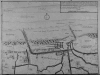 | Details | Anonymous | 1716 |
| Plan des environs de Dunkerque et Mardick |
|
Anonymous |
|
| 1716 |
| LOC:9 |
| $175.00 | Anonymous | Plan-des-environs-de-Dunkerque-et-Mardick | This antique French map on watermarked, chain-laid paper depicts the environs of Mardick and Dunkirk within 3 years after the demolition of the Dunkirk harbor in 1714. <BR> </BR>
At the end of the War of Spanish Succession England agreed to turn over Dunkirk, which it captured in 1708, to the French. In order to prevent the port's usage as a base for privateers and sea raiders the English demolished the harbor and city walls. This map depicts the French's quick response to the demolition- a new canal near Mardick that re-connected Dunkirk's harbor to the sea. |
| 1297 | 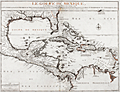 | Details | de Fer, Nicolas | 1717 |
| Scarce antique map of Gulf of Mexico and Caribbean |
|
de Fer, Nicolas |
|
| 1717 |
| LOC:51 |
| $1,950.00 | de-Fer--Nicolas | Scarce-antique-map-of-Gulf-of-Mexico-and-Caribbean | Very interesting and scarce Nicolas de Fer map (1717) of the Gulf Coast of the United States, the Caribbean, Central America, and northern South America. Pleasing appearance with original outline handcoloring. This 300 year-old copper-plate engraved map is full of local place names, historical notes and observations about native American tribes. For example:
<div class="indenttextblock">
<ul style="list-style-type: circle;">
<li>Near the Mississippi River mouth- "Embouchure du Mississippi decouverte in 1685 par M. de la Salle" and a location "Pointe de Mardi Gras".</li>
<li>About the fishing skills of American indians near the Georgia Sea Islands: "Isles de Mosquites Peuples plus adroit por peche de tout l' Amerique".</li>
<li>De Fer locates several native American tribes including "les Natchez", "Village de Apalaches" and "Village de la Mobile". </li>
<li>Locates La Salle's fort ('Fort de Francois') on Matagorda Bay, Texas ('Baye de St. Louis et de St. Bernard').</li>
</ul>
</div>
De Fer's seminal map of the Caribbean "Le Golfe de Mexique..." is a fine adaptation of Guillaume Delisle's 1701 "Carte des environs du Missisipi". The map shows a well-formed Mississippi Delta and Gulf Coast and locates La Salle's fort ('Fort de Francois') on Matagorda Bay, Texas ('Baye de St. Louis et de St. Bernard').
<br></br>
De Fer's "Le Golfe de Mexique" displays Florida correctly as a peninsula rather than as an archipelago, as first depicted by Thomas Nairne in 1711. The 300 year old map is based upon information obtained from the War of Spanish Succession and other contemporary sources. The map is considerably rarer than De L'Isle's contemporary map and more focused on the Caribbean and Gulf Coast regions. |
| 3672 | 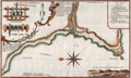 | Details | Frezier, Amedee | 1717 |
| Plan of the anchorage at Ilo, Peru |
|
Frezier, Amedee |
|
| 1717 |
| LOC:77 |
| $325.00 | Frezier--Amedee | Plan-of-the-anchorage-at-Ilo--Peru | Frezier's plan of the Peruvian port city of Ilo (Ylo), the capital of Ylo province. Frezier made a reconnaissance mission to the coast of South America from 1712-1714. Posing as a trader or merchant captain, Frezier sketched harbor defenses and gathered information on the military preparedness of each port visited.
<br></br>
Includes a coastal elevation view and several drawings of a mill probably for sugar cane. Key at top right relates to locations identified on the plan. North is oriented to the left.
<br></br>
Amédée Frézier (1682 – 1773) was an French explorer, military engineer, mathematician, and spy. This plan of Ylo, Peru is from Frezier's 1717 account of his travels published in French in 1717: "Relation du voyage de la mer du Sud, aux côtes du Chili, du Pérou et de Brésil, fait pendant les années 1712, 1713, et 1714". |
| 347 | 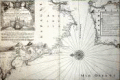 | Details | Michelot and Bremond | 1718 |
| Baye de Cadiz et Detroit de Gibraltar |
|
Michelot and Bremond |
|
| 1718 |
| LOC:57 |
| $900.00 | Michelot-and-Bremond | Baye-de-Cadiz-et-Detroit-de-Gibraltar | From the perspective of this writer this antique nautical chart of Cadiz and the Strait of Gibraltar is the most important chart of the 16 large Mediterranean sea charts by <a style="color:#9BAFCB" rel="nofollow" href= "/MichelotBremondBackground.aspx">Henry Michelot and Laurens Bremond</a> . The chart bears the earliest date of any of the 16 that were published - 1718. Also, the large decorative title cartouche at the upper left is reflective of Michelot's rank and symbols of high status. Michelot describes himself as “Hydrographe et Pilote Real des Galères du Roy” (hydrographer and pilot of the royal galley for the kings galley corps).
<BR> </BR>
The vessel depicted in the cartouche is clearly the "Reale" or Royal Galley (galère, Fr.) with three large stern lanterns. These distinctive lights served at night as a reference point for the fleet to follow. Above the galley, at the center top of the cartouche are the coat of arms of the French King surrounded on both sides by numerous banners and weapons including cannon and pikes. Perhaps the most unusual and significant decorative element is the two captive Muslim prisoners. Along with the opulent galley and other power icons the image of these near naked, chained ‘infidel’ captives would have been intended to demonstrate the map maker’s high status and authority to the map’s audience and as Petto points out, to reflect glory onto the map-makers patron to whom the charts were dedicated.<BR> </BR>
With an inset legend and a single large very decorative central compass rose and rhumb lines. Includes San Lucar de Barameda, Rota, Cape Trafalgar, Ceuta, Tangiers, Tarife (Tarifa) Gibraltar, Puerto Santa Maria and the hills of Medina Sidonia. Perhaps more than any other chart from the pair of Marseilles-based cartographers the numerous guard towers, soundings, and marked anchorages would have been important to the intended constituency for this chart- galley pilots and other coastal navigators of that period. |
| 334 | 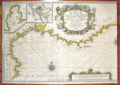 | Details | Michelot and Bremond | 1718 |
| Nouvelle Carte De Cotes De Catalogne, Roussillon, Languedoc, Provence |
|
Michelot and Bremond |
|
| 1718 |
| LOC:58 |
| $1,500.00 | Michelot-and-Bremond | Nouvelle-Carte-De-Cotes-De-Catalogne--Roussillon--Languedoc--Provence | Original antique engraved nautical chart from 1718. Left half of a double-width chart of the Northwestern Mediterranean sea titled: <br> <i>"Nouvelle Carte De Cotes De Catalogne, Roussillon, Languedoc, Provence, D'Italie et Partie De L'Isle De Corce dediee a Monseigneur le Chevalier d'Orleans General de Galeres de France par ses tres Humbles Serviteurs Michelot Hydrographe et Pilot de Galeres du Roy et Bremond Hydrographe du Roy et de la Ville" </i> Dated within an elaborate title cartouche at 1718.
<br></br> Inset port/ harbor plans include: <br>
"Plan du Port de Cette en Languedoc" <br>
"Plan du Port de Cadeques en Catalogne"
<br></br>
This antique nautical chart was produced ca. 1727 by French hydrographer and pilot of the French royal galley "La Reale" <a style="color:#9BAFCB" rel="nofollow" href= "/MichelotBremondBackground.aspx">Henry Michelot</a>. <BR> </BR>
Possibly a later impression as the chart has a small line near bottom left that appears to be the result of a cracked engraving plate. Published by Laurens Bremond from Marseilles, France. |
| 1177 | 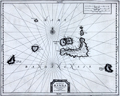 | Details | Aa, Pieter van der | 1719 |
| Antique map of the Banda Islands, Indonesia |
|
Aa, Pieter van der |
|
| 1719 |
| LOC:9 |
| $880.00 | Aa--Pieter-van-der | Antique-map-of-the-Banda-Islands--Indonesia | Rare Dutch map / chart of the Banda Islands, part of the Indonesian province of Maluku, comprising the important Spice Islands. The Banda Islands are part of the Moluccas archipelago to the west of New Guinea. Until the mid-19th century the Banda Islands were the world's only source of the spices nutmeg and mace, produced from the nutmeg tree.
<br></br>
Pieter van der Aa (1659 - 1733) was a Dutch publisher working in Leiden during the early eighteenth century. He is best known for publishing maps and atlases, though he also printed pirated editions of foreign bestsellers and illustrated volumes. From "Nouvel atlas...contenant les principales cartes géographiques dressées suivant les nouvelles observations de Mr. de l'Académie royale des sciences" published in 1714 from Leiden by Van der Aa. Plate number 27 (in manuscript).
<br></br>
Printed on a large sheet measuring 19" W x 15" H. |
| 1288 |  | Details | Chiquet, Jacques | 1719 |
| Old antique map of The Greek Archipelago |
|
Chiquet, Jacques |
|
| 1719 |
| LOC:2 |
| $210.00 | Chiquet--Jacques | Old-antique-map-of-The-Greek-Archipelago | Decorative map of Greece and Turkey displaying the wide extent of the Aegean Archipelago. Fine engraving and a title cartouche flanked by two winged female figures, topped by a fan shaped shell. Dated within at 1719. This attractive antique map, now nearly 300 years old, is characterized by its strong impression, evident platemark, and restrained hand coloring.
<br></br>
Named features include: Negroponte, Athens, the Peloponnese, Zante, Corfu, Macedonia, Constantinople,
Naxos, Santorini, Crete, and Rhodes.
<br></br>
From "Le Nouveau et Curieux Atlas Geographique et Historique..." by Jacques Chiquet. |
| 1186 |  | Details | Aa, Pieter van der | 1719 |
| Scarce Antique Map of Hokkaido, Japan |
|
Aa, Pieter van der |
|
| 1719 |
| LOC:9 |
| $600.00 | Aa--Pieter-van-der | Scarce-Antique-Map-of-Hokkaido--Japan | Antique Dutch map of the island of Eso, today called Hokkaido, the northernmost of Japan's main islands. Printed on a large sheet measuring 19" W x 15" H.
<br></br>
Pieter van der Aa (1659 - 1733) was a Dutch publisher working in Leiden during the early eighteenth century. He is best known for publishing maps and atlases, though he also printed pirated editions of foreign bestsellers and illustrated volumes. From "Nouvel atlas...contenant les principales cartes géographiques dressées suivant les nouvelles observations de Mr. de l'Académie royale des sciences" published in 1714 from Leiden by Van der Aa. Plate number 27 (in manuscript). |
| 1187 | 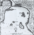 | Details | Aa, Pieter van der | 1719 |
| Scarce Antique Map of Banten in Java Indonesia |
|
Aa, Pieter van der |
|
| 1719 |
| LOC:9 |
| $300.00 | Aa--Pieter-van-der | Scarce-Antique-Map-of-Banten-in-Java-Indonesia | Antique Dutch map of the bay and village of "Bantam" or Banten, Java. Includes a plan of Bantam, and the smaller islands of Pulau Panjang, Groot P. Moby, Poele Don, Cleyn P. Moby, and Hollands kerk-hof. On a much larger sheet of watermarked (with fleur-de-lis), chain laid paper measuring 19" W x 15" H.
<br></br>
Pieter van der Aa (1659 - 1733) was a Dutch publisher working in Leiden during the early eighteenth century. He is best known for publishing maps and atlases, though he also printed pirated editions of foreign bestsellers and illustrated volumes. From "Nouvel atlas...contenant les principales cartes géographiques dressées suivant les nouvelles observations de Mr. de l'Académie royale des sciences" published in 1714 from Leiden by Van der Aa. Plate number 19 (in manuscript). |
| 1191 |  | Details | Aa, Pieter van der | 1719 |
| Antique City Plan of Batavia or Jakarta, Indonesia |
|
Aa, Pieter van der |
|
| 1719 |
| LOC:9 |
| $365.00 | Aa--Pieter-van-der | Antique-City-Plan-of-Batavia-or-Jakarta--Indonesia | Antique Dutch map of the village of "Batavia" or Jakarta, Indonesia. Jakarta was the de facto capital of the Dutch East Indies, formed from the nationalized colonies of the Dutch East India Company (VOC), which came under the administration of the Dutch government in 1800.
<br></br>
Forty-one notable locations are identified numerically on this fine copper-plate engraved plan and are explained in a large table at bottom right. These important locations include defensive positions, churches, and maritime related sites such as:
<div class="indenttextblock">
<ul style="list-style-type: circle;">
<li>le Fort</li>
<li>Redoute d' Amsterdam</li>
<li>Bastion le Saphir</li>
<li>Reduit de Nassau</li>
<li>le Werf Place aux Ancres</li>
<li>Grande Riviere</li>
<li>le Canal</li>
<li>l'Eglise des Portugais</li>
<li>Marche au poissons</li>
<li>le Hospital</li>
</ul>
</div>
On a much larger sheet of antique chain-laid paper measuring 19" W x 15" H.
<br></br>
Pieter van der Aa (1659 - 1733) was a Dutch publisher working in Leiden during the early eighteenth century. He is best known for publishing maps and atlases, though he also printed pirated editions of foreign bestsellers and illustrated volumes. From "Nouvel atlas...contenant les principales cartes géographiques dressées suivant les nouvelles observations de Mr. de l'Académie royale des sciences" published in 1714 from Leiden by Van der Aa. Plate number or notation in manuscript at bottom left. |
| 4854 | 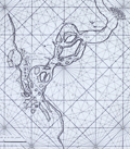 | Details | Valentijn, Francois | 1720 |
| Surat, India |
|
Valentijn, Francois |
|
| 1720 |
| LOC:9 |
| $900.00 | Valentijn--Francois | Surat--India | Scare Dutch chart of the Tapti River and Surat, India. This fine antique chart shows Surat then partially surrounded by a wall and the Casteel Suratta or Surat Castle (built 1546). The author provides numerous depth soundings and great detail on sandbanks in the Tapti River. Such rich detail suggests the source of information on the chart had a significant amount of experience in the area.
<br></br>
From contemporaneous accounts we know that Suratte was a key trading center.
<div class="indenttextblocksingle">
"At one end of the City of Suratte upon the very banks of the river called Tapty you see a very fair castle with four large towers of free-stone with a broad ditch always full of water…there are here three great factories, to wit: of the French, English and Dutch East India Companies, each of which are distinguished by their banners of their respective nations which are to be seen on the tops of their houses."
<br></br>
"But when any European ships arrive at this port, the Persians, Indians, Armenians, and Turks, plant their tents or booths in such numbers, as to give it the resemblance of a very handsome fair." (Rennefort, Crull, Dellon. A Voyage to the East Indies… 1698. Google Books. Online)
</div>
<br></br>
From François Valentyn's Oud en Nieuw Oost Indien (Old and New East India), part V : Beschryving van Coromandel, Pegu, Arrakan, Bengale, Mocha, Persien, Malakka, Sumatra, Ceylon. François Valentijn (1666-1727) was a missionary who worked at Amboina from during the late 17th and early 18th centuries. With numerous rhumb lines and two compass roses topped with fleur-de-lis. Plate 9. |
| 648 |  | Details | Valentijn, Francois | 1720 |
| Amboina, Seram, and Malaku Islands |
|
Valentijn, Francois |
|
| 1720 |
| LOC:0 |
| $880.00 | Valentijn--Francois | Amboina--Seram--and-Malaku-Islands | Scarce antique Dutch chart of part of the Maluku (Molucca) island chain in Indonesia (the Spice Islands). Includes Buru Island ( Boero ), Amboin, Seram (Ceram) , Banda, and many other smaller islands. The chart is comprised of two conjoined sheets making up the seldom available 29" wide chart of the region. On watermarked chain-laid paper.
<br></br>
From François Valentyn's Oud en Nieuw Oost Indien (Old and New East India), part V : Beschryving van Coromandel, Pegu, Arrakan, Bengale, Mocha, Persien, Malakka, Sumatra, Ceylon. François Valentijn (1666-1727) was a missionary who worked at Amboina from during the late 17th and early 18th centuries. With numerous rhumb lines and two compass roses topped with fleur-de-lis. Plate 1. |
| 3673 | 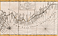 | Details | Moll, Herman | 1720 |
| Antique Chart of the west coat of Panama, Colombia, Ecuador, and Peru |
|
Moll, Herman |
|
| 1720 |
| LOC:77 |
| $250.00 | Moll--Herman | Antique-Chart-of-the-west-coat-of-Panama--Colombia--Ecuador--and-Peru | Compact antique chart of the west coast of Panama, Colombia, Equator, and Peru by Herman Moll |
| 4755 | 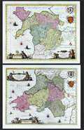 | Details | Jansson, Jan | 1720 |
| Fine pair (2) of antique maps of North Wales and South Wales. |
|
Jansson, Jan |
|
| 1720 |
| LOC:64 |
| $1,100.00 | Jansson--Jan | Fine-pair-(2)-of-antique-maps-of-North-Wales-and-South-Wales- | Pair of beautiful antique maps of North and South Wales in the United Kingdom ca. 1720. Fine condition. Both maps are filled with charming pictorial topography describing forests, cities, and mountains. Published in Amsterdam by Pieter Schenk and Gerard Valk after Joannes Janssonius (Jan Jansson).
<br></br>
Locations within Wales include Glamorgan, Carmarthen, Pembroke, Brecon, Cardingan, Radnor in South Wales and Snowdown Hill (Snowdon) in North Wales, the highest mountain in the country. Both maps are adorned with superb engraved aquatic cartouches adorned with putti, coats of arms and sailing ships. Blank verso. Attribution at bottom to Shenk and Valk, Amsterdam, publishers. |
| 51 | 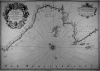 | Details | Michelot and Bremond | 1720 |
| Plan de la Baye et Rades de Marseille (small scale) |
|
Michelot and Bremond |
|
| 1720 |
| LOC:58 |
| $1,875.00 | Michelot-and-Bremond | Plan-de-la-Baye-et-Rades-de-Marseille-(small-scale) | Antique nautical chart of the Bay of Marseilles, France. Drawn by <a rel="nofollow" href= "/MichelotBremondBackground.aspx">Henri Michelot</a>, pilot of the royal galley for Louis XIV and XV. This large antique sea chart of the Bay of Marseilles would have been useful to coastal navigators such as those with the French Corps de Galeres. Extending from Cap Couronne past Cap Croisete to Morgiou the chart notes local water sources (galleys could only carry enough water for about two weeks), anchorages, and denotes a near-shore passage for the galleys near Cap Croisete: "Passage ordinaire des Galeres". The city of Marseille is shown surrounded by protective walls on three sides. <BR> </BR>
The authors' intimate knowledge of the area is confirmed by their location of several "madragues" around the bay (large anchored fish ponds or seines) that would have posed a threat to any fleet of coastal vessels operating in the area. <BR> </BR>
This chart is of special interest as Marseille the home bases for the galleys ( galère / galères ) of Louis XIV and XV as well as the home port for Michelot and Bremond. In the year this chart was published, 1720, the city of Marseille experienced an outbreak of "la peste", bubonic plague, that killed an estimated 40% of its population. The plague, spread from an arriving merchant ship, was one of the last great outbreaks in Western Europe. Perhaps it is coincidence but the location of both the Infirmerie Vieux and the Infirmerie Vielle in Marseille are indicated.<BR> </BR>
With a large beautifully engraved title cartouche by Starckman featuring Neptune with two overflowing horns-of-plenty. |
| 574 |  | Details | Homann, Johann | 1720 |
| Regni Norvegiae Accurata Tabula |
|
Homann, Johann |
|
| 1720 |
| LOC:57 |
| $500.00 | Homann--Johann | Regni-Norvegiae-Accurata-Tabula | Decorative copper-plate engraved antique map of Norway by Johann Baptist Homann (1664-1724) . Homann was a profilic German cartographer and publisher who was appointed cartographer to the Holy Roman Empire from 1715.
<br></br>
After Homann's death his maps were re-published by his heirs. Homann Heirs (also "Homannianis Heredibus" or "Homann Erben" or "Heritiers de Homann") was a company established after the death of Homann to carry on the publishing business of the firm he started in the early 1700's. The designation "Homann Heirs" appears on maps published by that successor firm from about 1730 to 1848. This antique map does not carry that designation but probably dates to to ca. 1742 - 1748.
<br></br>
At bottom left of the map is a highly decorative title cartouche containing the Norwegian state coat of arms, a lion bearing an axe. Beneath that emblem are depicted numerous nymphs cavorting in the sea. |
| 13 | 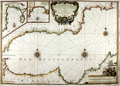 | Details | Michelot and Bremond | 1723 |
| Antique French nautical chart of the western Mediterranean |
|
Michelot and Bremond |
|
| 1723 |
| LOC: |
| $2,850.00 | Michelot-and-Bremond | Antique-French-nautical-chart-of-the-western-Mediterranean | This authentic, antique, early 18th-century <strong>portolan-style nautical chart</strong> showcases the western Mediterranean Sea, featuring the southern coasts of France and Spain. The rare nautical chart was created by <strong>Henri Michelot and Laurent Bremond</strong>, and covers the Mediterranean coastlines of Europe and Africa (Barbarie) from the Strait of Gibraltar and Ceuta in the west to Cap Palle in the east, passing through Marbella, Malaga, Almeria, and Cartagena. Numerous guard towers are marked along the shorelines, which would have been vital during that period of extensive raiding from the Barbary coast. It also includes two large insets: one of Gibraltar and the other of the Bay of Tangier (Tanger).
<br><br>
Some distinctive elements not found in other <a rel="nofollow" href= "/MichelotBremondBackground.aspx">Michelot and Bremond</a> antique nautical charts are a portrayal of a navigator (possibly Michelot?) seated on bales of goods adorned with the initials and symbols associated with the authors and engraver, surrounded by maritime items and navigational instruments such as chart, compass, and cross-staff. Additionally, an unexplained distance scale is included inside the neat line near the bottom left. This scale is typically only found on small-scale charts and was likely intended for navigators to place divider points without damaging the main distance scale through constant pricking.
<br><br>
Stopp |
| 2511 |  | Details | Michelot and Bremond | 1723 |
| Carte Particuliere des cotes D'Espagne et de Barbarie |
|
Michelot and Bremond |
|
| 1723 |
| LOC:0 |
| $1,850.00 | Michelot-and-Bremond | Carte-Particuliere-des-cotes-D-Espagne-et-de-Barbarie | Antique, attractive early 18th-century working portolan-style nautical chart of the western Mediterranean Sea with the southern coasts of France and Spain. This original rare nautical chart was produced by Henri Michelot and Laurent Bremond, who had close, first-hand experience with many of the areas they charted.
<BR> </BR>
Chart coverage includes the Mediterranean coasts of Europe and Africa (Barbarie) from the Strait of Gibraltar and Ceuta in the west through Marbella, Malaga, Almeria and Cartagena to Cap Palle in the east. Dozens of guard towers are noted along the coast; they would have been crucial during that era of intense raiding from the Barbary coast. Includes two large insets, one of Gibraltar and the other of the Bay of Tangier (Tanger). <BR> </BR> Some unique features not found in other <a rel="nofollow" href= "/MichelotBremondBackground.aspx">Michelot and Bremond</a> antique nautical charts include a depiction of a navigator (Michelot?) sitting atop bales of merchandise embellished with initials and symbols related to the authors and engraver, and surrounded by maritime objects and navigational instruments including chart, compass and cross-staff. A separate and unexplained distance scale is included inside the neatline near bottom left. As these additional scales are found only on small-scale charts, their probable intended usage is for navigators' placement of divider points so as not to damage the master distance scale by repeated pricking. |
| 572 |  | Details | van Keulen, Gerard | 1724 |
| Sicilia |
|
van Keulen, Gerard |
|
| 1724 |
| LOC:0 |
| $4,000.00 | van-Keulen--Gerard | Sicilia | Extra-large, rare, original antique nautical chart of the island of Sicily, Italy. <strong>Two views of an erupting Mount Aetna ( Etna ) in Catania.</strong> Includes nine smaller harbor charts on the same sheet: Palermo, Trapani, Messina, Milazzo, Augusta, Catania, Agrigento and Siracusa. Unusually colorful and attractive specimen. Unusual to find this combination of large-scale and small-scale charts on a single page.
<br></br>
Inset at right in the sea shows two scenes related to the Battle of Cape Passaro, between Spanish and British naval forces on August 11, 1718 off the coast of Sicily. During the Battle of Cape Passaro, off the southeast coast of Sicily, forces led by British Admiral Sir George Byng aboard the flagship 'Barfleur' defeated Spanish naval forces led by Rear-Admiral Don Fernando Chacon.
<br></br>
By Gerard van Keulen, with the royal privilege, possibly from the third part of 'De Nieuwe Groote Lichtende Zee-Fakkel' published 1724. Near van Keulen's name is found the Coat of Arms of the Kingdom of Sicily with two facing eagles flanking the red stripes of the arms of the House of Aragon. |
| 4730 |  | Details | Renneville, René Augustin Constantin de | 1725 |
| Cote Meridionale de la Terre del Fuego |
|
Renneville, René Augustin Constantin de |
|
| 1725 |
| LOC:77 |
| $165.00 | Renneville--René-Augustin-Constantin-de | Cote-Meridionale-de-la-Terre-del-Fuego | Small antique chart of the southern Argentine portion of Tierra de Fuego, <b>Le Maire Strait</b> (about 18 miles in width), and Staten Island (Spanish: Isla de los Estados ). Key features include Mauritius Landt, Valentyns Bay, Isle de Diego Ramirez, Barneveldo Eylanden, and Withonds Bay. Tierra de Fuego is separated from the Argentine mainland by the Strait of Magellan.
<br></br>
From the French reissue of the account of early Dutch voyages first published in 1608 by Commelin: "Recueil des Voiages qui ont servi à l'établissement et aux progès de la Compagnie des Indes Orientales.
<br></br>
The French translation was by René Augustin Constantin de Renneville a 17th-century French author known for his works on the Inquisition, French Revolution, geography and religion. Recueil des Voyages was a multi-volume work about world voyages featuring full-page and folding engravings of landmarks, people, cultures as well as views and maps.
<br></br>
Amsterdam. Tome 9. Page 40. Dutch placenames and a French title.
<br></br>
In Richard Henry Dana Jr.'s book "Two Years Before the Mast" Staten Island is the first land seen from the ship after leaving San Diego. Dana describes the land as
<div class="indenttextblock">
". . . bare, broken, and girt with rocks and ice, with here and there, between rocks and broken hillocks, a little stunted vegetation of shrubs. . ."
</div>
A breeding colony of the Magellanic penguin is found in the Le Maire Strait on Isla de los Estados. |
| 5162 | 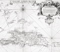 | Details | Frezier, Amedee | 1725 |
| Isle de S. Domingue |
|
Frezier, Amedee |
|
| 1725 |
| LOC:51 |
| $300.00 | Frezier--Amedee | Isle-de-S--Domingue | Map of the island of Hispaniola by Amedee Francois Frezier (1682-1773). Includes portions of the Bahamas, Cuba, Jamaica, and Puerto Rico. Decorative dedicatory cartouche.
<br><?br>
Includes an inset plan "Plan de la Ville Espagnole de S. Domingue". Condition issues at right margin but should mat and frame nicely. |
| 4843 | 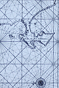 | Details | Valentijn, Francois | 1726 |
| Antique Dutch Chart of the Environs of Cape Town South Africa |
|
Valentijn, Francois |
|
| 1726 |
| LOC:9 |
| $825.00 | Valentijn--Francois | Antique-Dutch-Chart-of-the-Environs-of-Cape-Town-South-Africa | For collectors. Very old, scarce chart of the South African west coast from the Bay of Saldanha including Table Bay (Taefel Bay), False Bay, and Sout Bay all surrounding the Cabo de Boa Esperanca or Cape of Good Hope now the location of Cape Town, South Africa. By Dutch minister Francois Valentijn (Valentyn).
<br></br>
Only two sales recorded in the AMPR, none in the last 15 years. #43.
<br></br>
From Francois Valentijn's labor of seven years, the <b>Oud en Nieuw Oost-Indië</b>, considered the best source for reference material related to Asia for a period of almost two hundred years. |
| 250 | 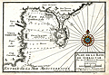 | Details | Michelot and Bremond | 1727 |
| Plan de la Baye de Gibraltar |
|
Michelot and Bremond |
|
| 1727 |
| LOC:4 |
| $300.00 | Michelot-and-Bremond | Plan-de-la-Baye-de-Gibraltar | An attractive and scarce antique copperplate large scale chart of the bay and peninsula of Gibraltar, a British Overseas Territory. Contains detail on the fortifications and numerous guard towers in the area. Numerous soundings, anchorages, and navigation hazards are noted. Hand colored compass rose. Algeciras is labeled "Vieux Gibraltar". Other noted locations include the old and new quay (mole), Cap Carnero, Plaine de St. Roch and the Ville et Mt. Gibraltar (Rock of Gibraltar).
<br></br>
This plan was produced in 1727 by French hydrographers and galley pilot <a style="color:#9BAFCB" rel="nofollow" href= "/MichelotBremondBackground.aspx">Henry Michelot</a> and Laurens Bremond . This old chart of Gibraltar is one of a handful of Michelot and Bremond charts that were copied by Thomas Kitchin and others for more than 30 years and it should be a part of any serious collection of maps from that region.
<BR> </BR>
Engraved by one of the finest engravers of the time, Peter Starckman. Carries the sellers information: " Ce Vend chez Laurens Bremond sur le Port a Marseilles a coin de Reboul." Published with the royal privilege. |
| 331 | 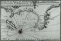 | Details | Michelot and Bremond | 1727 |
| Plan de la Rade du Gourjan et des Isles Ste. Marguerite |
|
Michelot and Bremond |
|
| 1727 |
| LOC:4 |
| $425.00 | Michelot-and-Bremond | Plan-de-la-Rade-du-Gourjan-et-des-Isles-Ste--Marguerite | Antique copperplate-engraved nautical chart / plan of the islands, bay, and beaches between Cane (Cannes) and Antibe, France in the Cote d'Azur region of the French Riviera. Islands noted offshore by Michelot include Isle St. Honora (Saint-Honorat ) and Île Sainte-Marguerite which is one of the locations where the "man in the Iron Mask" is known to have been jailed. Other features are Pointe de la Foucade (Fourcade) Cap de la Garoupe, tours de la Croisette on (Cap de la Croisette) and two beaches: plage du pilon, and plage qui conduit a Nice.<BR> </BR>
This antique chart / plan was produced ca. 1730 by French hydrographer and pilot of the French royal galley "La Reale" <a style="color:#9BAFCB" rel="nofollow" href= "/MichelotBremondBackground.aspx">Henry Michelot</a>. The port plan was one of 37 original plans published in Marseilles by Michelot and Laurens Bremond in a volume titled "Recueil de Plusieurs Plans de Ports et Rades de la Mer Mediterranée." Later in the 18th century the plans were copied and reprinted by Roux, Allezard, Kitchin and others. |
| 100 | 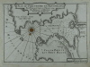 | Details | Michelot and Bremond | 1727 |
| Plan du Port du Portvendre en Roussillon |
|
Michelot and Bremond |
|
| 1727 |
| LOC:4 |
| $300.00 | Michelot-and-Bremond | Plan-du-Port-du-Portvendre-en-Roussillon | Interesting large-scale, black and white copperplate antique nautical chart / plan of Portvendre (Port-Vendres), France with a carefully colored compass rose. This antique chart is one of 37 port plans published by <a rel="nofollow" href= "/MichelotBremondBackground.aspx">Henry Michelot and Laurens Bremond</a> ca. 1730 in their atlas of small scale Mediterranean ports: "Recueil de Plusieurs Plans de Ports et Rades de la Mer Mediterranée" .
<BR> </BR>
Notations are made on both sides of the bay warning that the surrounding land is high. It must have been a welcome sight when a navigator finally spied the beach near the harbor where a galley (galère) could land. Along with two forts, the few noted points of interest include a water source, a chapel, and a few stores. |
| 4708 | 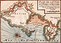 | Details | Michelot and Bremond | 1727 |
| Plan de la Ville et Port d'Antibe (Antibes) |
|
Michelot and Bremond |
|
| 1727 |
| LOC:13 |
| $350.00 | Michelot-and-Bremond | Plan-de-la-Ville-et-Port-d-Antibe-(Antibes) | Highly detailed, engraved port plan of Antibes, France on the French Riviera or Cote d'Azur, based on information that was current as of 1720. Highlighted by a colored compass rose oriented with north to bottom right, this old antique chart / plan shows Antibes surrounded by Vauban-style defensive walls. Key noted features include "le Chateau", land and sea entrances (ports), le mole or jetty, the Fort d'Antibes and a beach leading to Nice - "Plage qui conduit a Nice."
<BR> </BR>
Numerous soundings, underwater hazards, and anchorages are noted in and near Antibes harbor. This nautical chart was produced in 1727 by French hydrographers and galley (galère, Fr.) pilot Henry Michelot and Laurens Bremond.
<BR> </BR>
The distance scale is in toises which was about 1.95 meters before 1812. |
| 254 | 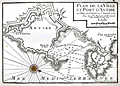 | Details | Michelot and Bremond | 1727 |
| Plan de la Ville et Port d'Antibe (Antibes) |
|
Michelot and Bremond |
|
| 1727 |
| LOC:4 |
| $300.00 | Michelot-and-Bremond | Plan-de-la-Ville-et-Port-d-Antibe-(Antibes) | Highly detailed, engraved port plan of Antibes, France on the French Riviera or Cote d'Azur. Highlighted by a colored compass rose, this old antique chart / plan shows the city and fort of Antibes both surrounded by defensive walls. Numerous soundings, underwater hazards, and anchorages are noted in and near Antibes harbor. This nautical chart was produced in 1727 by French hydrographers and galley (galère, Fr.) pilot <a style="color:#9BAFCB" rel="nofollow" href= "/MichelotBremondBackground.aspx">Henry Michelot</a> and Laurens Bremond.
<BR> </BR>
A note in the title cartouche states that the chart is based on information that was current as of 1720. The distance scale is in toises which was about 1.95 meters before 1812. |
| 2498 | 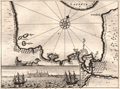 | Details | Olearius, Adam | 1727 |
| Map and elevation view of Arkhangelsk, Russia |
|
Olearius, Adam |
|
| 1727 |
| LOC:7 |
| $120.00 | Olearius--Adam | Map-and-elevation-view-of-Arkhangelsk--Russia | Antique map and view of Arkhangelsk, Russia (Archangel; Archangelsk), the administrative center of Arkhangelsk Oblast, in the north of European Russia. Arkhangelsk is today situated on both banks of the northern Dvina River near its exit into the White Sea.
<br></br>
From "Voyages très-curieux & très renommez faits en Moscovie, Tartarie, et Perse...." by Adam Olearius (1603-1671). |
| 332 | 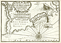 | Details | Michelot and Bremond | 1727 |
| Plan de la Ville et du Mole d'Agde in Languedoc |
|
Michelot and Bremond |
|
| 1727 |
| LOC:4 |
| $375.00 | Michelot-and-Bremond | Plan-de-la-Ville-et-du-Mole-d-Agde-in-Languedoc | Small antique nautical chart / plan depicts the small walled village of Agde, France along the lower portion of the Riviere de l'Eraux (Hérault River) with two bridges. At top left is the junction of that river with the Canal Royal (Canal du Midi) and l'Ecluse (locks), well known because of their unusual round shape. Other feature include Mont d'Adge, Fort de Brescon offshore of "le Mole" (a breakwater or jetty), la Conque, and Plage de Tau (Thau).<BR> </BR>
This antique nautical chart was produced ca. 1730 by French hydrographer and pilot of the French royal galley "La Reale" <a style="color:#9BAFCB" rel="nofollow" href= "/MichelotBremondBackground.aspx">Henry Michelot</a>. The port plan was one of 37 original plans published in Marseilles by Michelot and Laurens Bremond in a volume titled "Recueil de Plusieurs Plans de Ports et Rades de la Mer Mediterranée." Later in the 18th century the plans were copied and reprinted by Roux, Allezard, Kitchin and others. |
| 270 | 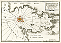 | Details | Michelot and Bremond | 1727 |
| Plan du Port de Cadequie en Catalogne |
|
Michelot and Bremond |
|
| 1727 |
| LOC:4 |
| $365.00 | Michelot-and-Bremond | Plan-du-Port-de-Cadequie-en-Catalogne | Old, rare antique nautical chart of Cadaqués, on the Costa Brava ("rough coast") of the Mediterranean Sea in Catalunya Spain. This antique 18th century antique sea chart covers the Bay of Cadeques and this northern Spanish port along with a few of the nearby mountains in the vicinity of Cape Creus. The chart shows but does not name Cadeques' only inhabited island: Isla S'Arenella.
<BR> </BR>
This among several large-scale charts of Spanish ports in Michelot's and Bremond's important 37-plate atlas of 1730: <a id="A3" href="http://www.rarecharts.com/ShowDetail/Creator/Michelot-and-Bremond/Title/Recueil-de-plusieurs-plans-des-ports-et-rades-de-la-mer-mediterranee---(Atlas-of-37-plates)/230" onclick="_gaq.push(['_trackEvent', 'Michelot and Bremond, 'View All', 'MichelotBremondBackground']);">
“Recueil de Plusiers Plans des Ports et Rades de la Mer Mediterranee". </a>
</br></br>
Single colored compass rose with rhumb lines. Numerous soundings.
<BR> </BR>
<p><a style="color:#9BAFCB" rel="nofollow" href= "/Creator/Michelot-and-Bremond">[All Items by Henry Michelot and Laurens Bremond]</a> </p> |
| 271 |  | Details | Michelot and Bremond | 1727 |
| Plan de la Baye et Rades du Sofa |
|
Michelot and Bremond |
|
| 1727 |
| LOC:4 |
| $350.00 | Michelot-and-Bremond | Plan-de-la-Baye-et-Rades-du-Sofa | Scarce large-scale antique copperplate Mediterranean / Balearic sea chart of the coast surrounding the Bay of Sofa from galley pilot Henri Michelot and Laurens Bremond. Coverage of the coast of Catalunya Spain from Les Cases de Alcanar to past the Tortosa (Tortose) river to approximately Riumar. Chart details include Serra del Montsià, Amposta (Emposta), Sant Carles de la Rapita, and the salinas.
<BR> </BR>
A monastery and numerous guard towers are identified as is a "source d'eau", of great importance to those traveling aboard the galleys which held only enough water for two weeks at best.
<BR> </BR>
Single colored compass rose with rhumb lines. Numerous soundings.
<BR> </BR>
<p><a style="color:#9BAFCB" rel="nofollow" href= "/Creator/Michelot-and-Bremond">[All Items by Henry Michelot and Laurens Bremond]</a> </p> |
| 333 | 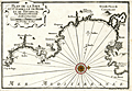 | Details | Michelot and Bremond | 1727 |
| Plan de la Baye et Citadelle de Rose et de Tourrille |
|
Michelot and Bremond |
|
| 1727 |
| LOC:4 |
| $375.00 | Michelot-and-Bremond | Plan-de-la-Baye-et-Citadelle-de-Rose-et-de-Tourrille | Interesting original antique nautical chart / plan of the vicinity of Roses, Spain from Cap de Begu (Cabo Begur) past the Riviere du Ter (el Ter river), Roses to Calla Figuire where it is noted that water could be obtained. Other features that Michelot and Bremond captured include l'Estardiez (L'Estarit), Tour de Mongon, Emporia, St Pierre le Pescador, Lescalle (L'Escala), Castillon, and the tiny Illes des Medes.
<BR> </BR>
This antique chart was produced ca. 1727 by French hydrographer and pilot of the French royal galley "La Reale" <a style="color:#9BAFCB" rel="nofollow" href= "/MichelotBremondBackground.aspx">Henry Michelot</a>. The port plan was one of 37 original plans published in Marseilles by Michelot and Laurens Bremond in a volume titled "Recueil de Plusieurs Plans de Ports et Rades de la Mer Mediterranée." Later in the 18th century the plans were copied and reprinted by Roux, Allezard, Kitchin and others. |
| 817 | 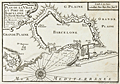 | Details | Michelot and Bremond | 1727 |
| Barcelona, Spain port and fortification plan |
|
Michelot and Bremond |
|
| 1727 |
| LOC:4 |
| $200.00 | Michelot-and-Bremond | Barcelona--Spain-port-and-fortification-plan | One of the first port plans of Barcelona, Spain (from 1727) created for navigational purposes in an atlas for the Mediterranean Sea: “Recueil de Plusiers Plans des Ports et Rades de la Mer Mediterranee". This chart was published by the team of Henri Michelot and Laurens Bremond, both associated with the French Royal Galley Corps. In their business relationship it appears that Bremond provided the retail space in the port of Marseille, France where this chart, as well as other atlases and nautical prints were sold. Michelot, the chief pilot or"Pilote Hauturière" for the galley service provided the name recognition and authority needed for the charts to sell widely.
<br></br>
The chart covers from Mont-Jouy ( Montjuïc ) in the West to the far Eastern walls at Barcelona's edge. The chart shows Barcelona's fortifcations with numerous bastions; redoubts, gun batteries, windmills, the arsenal, and 5 entrances into the city: the Porte de Mont-Jout; Porte St. Antoine; Porte de l'Ange; Porte Neuve; and Porte de la Marine, near the harbor. Depth soundings extend only in the interrior harbor, and are intersperced with anchor symbols reflecting locations where sea-going vessels could find shelter. In the title cartouche the authors note that the plan is based on the state they observed in 1697, likely during Michelot's service for the Louis XIV's Corps des Galeres. |
| 49 | 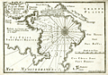 | Details | Michelot and Bremond | 1727 |
| Plan du Port de Cartagena |
|
Michelot and Bremond |
|
| 1727 |
| LOC:4 |
| $300.00 | Michelot-and-Bremond | Plan-du-Port-de-Cartagena | Large-scale original, antique chart / plan from galley pilot Henri Michelot and Laurens Bremond of the Mediterranean harbor and town of Cartagena, Spain. Very attractive pictorial profile view of Cartagena as it looked at that time surrounded by city walls at the beach and by hills to the east. The "Petit Fort" is shown guarding the entrance to the harbor. Other features that Michelot references by name include: "le Chateau", the "Masse de Moulin", a "Grotte ou Caverne", the "Grand Valong" and "l'Ermitage" to the east of Cartagena.
<BR> </BR>
Single compass rose with rhumb lines. Numerous soundings include several warnings about a dangerous area. See also the offered large-scale antique chart of the anchorage of Escombreras ("Rade d'Ascombrera") which provides detail of the environs along roughly a seven-mile stretch of coastline directly south of Cartagena. |
| 1325 |  | Details | Cutler and Halley | 1728 |
| Scarce Antique Chart with West Coasts of Europe and Africa |
|
Cutler and Halley |
|
| 1728 |
| LOC:57 |
| $550.00 | Cutler-and-Halley | Scarce-Antique-Chart-with-West-Coasts-of-Europe-and-Africa | Scarce antique chart by Nathaniel Cutler and Edmund Halley, the discoverer of Halley's comet. From "Atlas Maritimus & Commercialis, or a General View of the World, so Far as Relates to Trade and Navigation …". Shows the western coastline of Europe with a broad expanse of the eastern Atlantic Ocean. Includes the "Western Islands" or Azores, Britain, and the western coast of Ireland, Holland, Flanders, Normandy, Brittany, Portugal, Spain, the Strait of Gibraltar, and Morocco.
<br></br>
The sea atlas "Atlas Maritimus" was a collaborative effort of a number of the leading cartographic and scientific names of the era, including English astronomer Sir Edmund Halley, John Senex, Nathaniel Cutler, and Daniel Defoe. The atlas was developed by Senex and Harris to compete with Mount & Page’s English Pilot. Published from London: James and John Knapton et al. |
| 5460 |  | Details | Cutler and Halley | 1728 |
| A Chart of the East Indian Ocean from Cape Guardefoy to Cochin or the Coast of Malabar |
|
Cutler and Halley |
|
| 1728 |
| LOC:64 |
| $1,650.00 | Cutler-and-Halley | A-Chart-of-the-East-Indian-Ocean-from-Cape-Guardefoy-to-Cochin-or-the-Coast-of-Malabar | Rare antique chart from 1728 of the Persian Gulf and Gulf of Oman on a <b>globular projection</b> by scientists <b>Nathaniel Cutler and Edmund Halley</b> (the latter was the discoverer of Halley's comet). Shows Saudi Arabia, Yemen, West India, Iran, the Indian Ocean, and much more with detailed notations of habitations along the coast.
<br></br>
From "Atlas Maritimus & Commercialis, or a General View of the World, so Far as Relates to Trade and Navigation …". The sea atlas "Atlas Maritimus" was a collaborative effort of a number of the leading cartographic and scientific names of the era, including English astronomer Sir Edmund Halley, John Senex, Nathaniel Cutler, and Daniel Defoe. The atlas was developed by publishers Senex and Harris to compete with Mount & Page’s English Pilot. Published from London: James and John Knapton et al. |
| 4952 |  | Details | Cutler and Halley | 1728 |
| Halleys chart Atlantick Ocean on a Globular Projection |
|
Cutler and Halley |
|
| 1728 |
| LOC:65 |
| $1,350.00 | Cutler-and-Halley | Halleys-chart-Atlantick-Ocean-on-a-Globular-Projection | Rare antique chart on a <b>globular projection</b> by scientists <b>Nathaniel Cutler and Edmund Halley</b> (the latter the discoverer of Halley's comet). Shows the western coastline of Europe with a broad expanse of the eastern Atlantic Ocean. Includes North America, East Mexico, the Caribbean Islands (Cuba, Hispaniola, Martinique, Antigua and more), and the East Coast of Europe and of Africa. Greatly exaggerates the length of the Saint John's River in Florida.
<br></br>
From "Atlas Maritimus & Commercialis, or a General View of the World, so Far as Relates to Trade and Navigation …". The sea atlas "Atlas Maritimus" was a collaborative effort of a number of the leading cartographic and scientific names of the era, including English astronomer Sir Edmund Halley, John Senex, Nathaniel Cutler, and Daniel Defoe. The atlas was developed by publishers Senex and Harris to compete with Mount & Page’s English Pilot. Published from London: James and John Knapton et al. |
| 4848 | 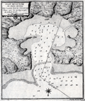 | Details | Laval, Antoine | 1728 |
| Scarce antique chart of Bahia Honda, Cuba |
|
Laval, Antoine |
|
| 1728 |
| LOC:13 |
| $250.00 | Laval--Antoine | Scarce-antique-chart-of-Bahia-Honda--Cuba | Antique copperplate engraved harbor chart shows Bahia Honda, Cuba as it existed in 1720. Bahia Honda, is located about 50 miles west of Havana in Artemisa province on the north-western coast of Cuba. Laval's chart predates Thomas Jeffery's "Plan of Bahia Honda" by more than 35 years and is the earliest known detailed harbor chart of Bahia Honda. It does not appear, however that Laval's map is based on any observations made by him as the ship he was on seems to have bypassed the Bay entirely on its way to Havana.
<br></br>
From the report of French astronomer and Jesuit Priest, Antoine Laval (1664-1728): "Voyage de la Louisiane", an account of the 1720 expedition to the Florida and Louisiana coasts led by French officer Valette de Laudun. Laval is recorded as mathematician or astronomer on that voyage. Laval was a professor of hydrography and mathematics based in the city of Toulon, France. Page 137.
<br></br>
Vallette de Laudun led the French expedition to Dauphin Island in the Gulf of Mexico between March and November, 1720. The 262-member crew embarked from Toulon, France, on the ship Toulouse , encountering Madeira, Martinique, Saint-Domingue, and Cuba before entering the Gulf of Mexico. Following a month at Dauphin Island, the expedition returned to France. |
| 328 | 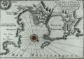 | Details | Michelot and Bremond | 1728 |
| Plan de la Ville et Port de Colioure |
|
Michelot and Bremond |
|
| 1728 |
| LOC:4 |
| $300.00 | Michelot-and-Bremond | Plan-de-la-Ville-et-Port-de-Colioure | Fine antique print with a depiction and plan of the harbor and village of Colioure (Collioure), in Southern France near the border of Spain. Features include Fort Saint-Elme, Convent de Jacobins, the Chateau Royal and l'Ermitage. Thick Vauban-designed defensive walls are shown surrounding the Chateau and village.<BR> </BR>
This nautical chart / plan was produced ca. 1730 by French hydrographer and pilot of the French royal galley "La Reale" <a style="color:#9BAFCB" rel="nofollow" href= "/MichelotBremondBackground.aspx">Henry Michelot</a>. The port plan was one of 37 original plans published in Marseilles by Michelot and Laurens Bremond in a volume titled "Recueil de Plusieurs Plans de Ports et Rades de la Mer Mediterranée." Later in the 18th century the plans were copied and reprinted by Roux, Allezard, Kitchin and others. |
| 4829 | 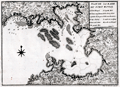 | Details | Laval, Antoine | 1728 |
| Rare early map of Fort Royal Bay, Martinique |
|
Laval, Antoine |
|
| 1728 |
| LOC:13 |
| $500.00 | Laval--Antoine | Rare-early-map-of-Fort-Royal-Bay--Martinique | Rare, earliest (1728) chart of the entirety of Fort de France Bay. By Father Antoine Laval. Laval's antique chart of Fort Royal, based on surveys of 1720, should be considered a foundational artifact for collectors of Caribbean Island cartography as it is the first detailed printed chart to cover the entire Baie de Fort de France on the island of Martinique. It was almost 35 years later when the next accurate harbors plans of the "Cul de Sac Royal" were printed by Bellin (1764) and by Caylus (1760).
<br></br>
This map was included in the report of French astronomer Father Antoine Laval: "Voyage de la Louisiane", an account of the 1720 expedition to the Florida and Louisiana coasts led by French officer Valette de Laudun. Laval is recorded as mathematician or astronomer on that voyage. Laval was a professor of hydrography and mathematics based in the city of Toulon, France. Page 48.
<br></br>
Vallette de Laudun led the French expedition to Dauphin Island in the Gulf of Mexico between March and November, 1720. The 262-member crew embarked from Toulon, France, on the ship Toulouse , encountering Madeira, Martinique, Saint-Domingue, and Cuba before entering the Gulf of Mexico. Following a month at Dauphin Island, the expedition returned to France. |
| 1357 | 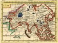 | Details | Duchesne, J.B.P. | 1729 |
| Fine antique hand colored map of Asia |
|
Duchesne, J.B.P. |
|
| 1729 |
| LOC:0 |
| $99.00 | Duchesne--J-B-P- | Fine-antique-hand-colored-map-of-Asia | Interesting small antique map of Asia by the Jesuit J.B.P. Duchesne published in "La Science de La Jeune Noblesse", a two volume manual written by Duchesne and published in Paris in 1729 with a set of world maps. The maps in that volume were part of a manual intended for young noblemen which also included heraldry and genealogical tables. |
| 4811 |  | Details | Seutter, Albrecht Carl | 1730 |
| Fine antique map of Martinique in the Caribbean Sea |
|
Seutter, Albrecht Carl |
|
| 1730 |
| LOC:51 |
| $1,050.00 | Seutter--Albrecht-Carl | Fine-antique-map-of-Martinique-in-the-Caribbean-Sea | Beautiful original antique engraved map of the <b>Caribbean island of Martinique</b> ca. 1730. This is a map that has much to offer when viewed up close: wonderful topography with trees, mountains, roads, and rivers. Many important locations and structures are identified directly on the map, for example in the area around Fort de France Bay (Baye et Cul de Sac Royal): l'Hopital le Capucins, Morne Rouge, le Fort Royal St. Louis, le Cul de Sac a Vache, Notre Dame de Grace, and Café des Navires.
<br></br>
Discovered by Columbus in 1493, he landed there in 1502 and named the island Martinica. Martinique was a French colony from 1635-1946 when it became the French Overseas Department of Martinique.
<br></br>
Fine decorative cartouche with Mercury, god of Commerce, hovering above and Poseidon below while half-clothed Native Americans are shown trading with Europeans. Title reads: "Representation la plus nouvelle et exacte de l'Ile Martinique, la premiere des Iles del' Amerique Antilles nommees Barlovento, aux depens de Matthieu Seutter , graveur de cartes geograph de S.M.I. a Augsbourg."
<br></br>
Top of the map with an interesting Avertissement in French and German "Pour rendre cette Carte a l'usage des Navigateurs…des Marques" or an explantion of symbols used on the map that would be useful to navigators including water mills ("moulins a eau"), anchorages for small boats ("mouillage pour les petits batimens"), and sugar mills ("sucrerie"). Some of the more heavily traveled bays show depth soundings and below-water navigational hazards. |
| 230 |  | Details | Michelot and Bremond | 1730 |
| Recueil de plusieurs plans des ports et rades de la mer mediterranee. (Atlas of 37 plates) |
|
Michelot and Bremond |
|
| 1730 |
| LOC:0 |
| $6,500.00 | Michelot-and-Bremond | Recueil-de-plusieurs-plans-des-ports-et-rades-de-la-mer-mediterranee---(Atlas-of-37-plates) | Scarce and complete atlas of 37 large-scale 10" x 7" antique engraved Mediterranean port and harbor plans by French hydrographers and galley (galère, Fr.) pilot Henry Michelot and Laurens Bremond. </br> </br>
<strong><a href= "/MBPlansViewer.aspx">[ Browse all 37 charts here ]</a></strong>
</br></br> This 12" x 8" atlas, published ca. 1730 was the culmination of Henry Michelot's career; the result of at least 40 years experience as pilot of the Reale, premier vessel in the galley service of Louis XIV and XV. These charts are influenced by and bear similarities to a set of manuscript charts published by Michelot from Marseille around 1689 but are updated to reflect his cumulative experience over the intervening 40 years. With an elaborately engraved title page. Some charts engraved by Peter Starck-man. <BR> </BR>
This 290-year old sea atlas contains port plans from France, Italy, and Spain including Barcelona, Antibe, Mayorca, Bay of Naples, Bay of Gibraltar, and Cadiz. Several of these charts (e.g. Cadiz, Gibraltar) were considered to be the most authoritative works of that era and were copied by others including Thomas Kitchin well into the mid 18th century.<BR> </BR>
For more information on the life and works of Henry Michelot and his business partner Bremond see our <a rel="nofollow" href= "/MichelotBremondBackground.aspx">brief illustrated biography.</a> |
| 1019 | 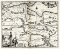 | Details | Aa, Pieter van der | 1730 |
| North Africa Barbarie, Biledulgerid and Libye |
|
Aa, Pieter van der |
|
| 1730 |
| LOC:50 |
| $300.00 | Aa--Pieter-van-der | North-Africa-Barbarie--Biledulgerid-and-Libye | Uncommon, beautifully engraved map of North Africa and the southern Mediterranean Sea by Peter van der Aa. A fine example.
<br></br>
Attractive cartouche with scene of galleys and wild animals, representative of Africa. Includes the southern Mediterranean Sea with Crete and the southern Aegean Archipelago.
<br></br>
Published from Leiden ca 1730 by Covens and Mortier. |
| 2485 |  | Details | Anville, Jean Baptiste Bourguignon d' | 1730 |
| Fine antique plan of the Bay of Cartagena, Colombia |
|
Anville, Jean Baptiste Bourguignon d' |
|
| 1730 |
| LOC:5 |
| $700.00 | Anville--Jean-Baptiste-Bourguignon-d- | Fine-antique-plan-of-the-Bay-of-Cartagena--Colombia | Early and very scarce map of the area surrounding Cartagena, Colombia in northern South America. Hilly or mountainous areas are shown in relief. With depth soundings of the channel from Boca Chica into the inner harbor at Cartagena.
<br></br>
From Charlevoix's history of the Caribbean.
Noted features on this copper-plate engraved plan of Cartagena include
<div class="indenttextblock">
<ul style="list-style-type: circle;">
<li>La Cienega de Tesca</li>
<li>Mancanillo</li>
<li>La Madre de Popa ou Nuestra Senora de la Candelaria (a hilltop religious complex dating to 1607).</li>
<li>Boca Chica (entrance to Cartagena Bay)</li>
<li>La Isla de Varu</li>
<li>Paso a Caballos</li>
<li>Isla de Brugas</li>
<li>el Fuerte de Santa Cruz</li>
</ul>
</div> |
| 48 |  | Details | Michelot and Bremond | 1730 |
| Plan de la Rade d'Ascombrera |
|
Michelot and Bremond |
|
| 1730 |
| LOC:4 |
| $300.00 | Michelot-and-Bremond | Plan-de-la-Rade-d-Ascombrera | Large-scale antique copperplate-engraved nautical chart / plan of waters offshore Cartagena, Spain from French galley pilot and hydrographer <a rel="nofollow" href= "/MichelotBremondBackground.aspx">Henri Michelot.</a> Coverage extends roughly from Cabo Tinoso (Cap-Tignoso) past Cartagena, Spain; Escombrera Island and Bay, and ends in the east near Cabo del Aqua. Single compass rose with rhumb lines radiating in all directions. Highlight detail includes the "Chapelle des Galères" not too far from a beach at the head of Escombrera bay. <BR> </BR>
See also the related large-scale <a rel="nofollow" href= "/ShowDetail/Creator/Michelot-and-Bremond/Title/Plan-du-Port-de-Cartagena/49">antique chart / plan of Cartagena, Spain</a> which provides detail of the city and the harbor directly south of Cartagena. When framed both charts together would make an attractive grouping. |
| 253 | 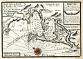 | Details | Michelot and Bremond | 1730 |
| Plan de la Baye et Rades de Cadis et des Environs (Cadiz) |
|
Michelot and Bremond |
|
| 1730 |
| LOC:4 |
| $300.00 | Michelot-and-Bremond | Plan-de-la-Baye-et-Rades-de-Cadis-et-des-Environs--(Cadiz) | Highly detailed antique chart of Cadiz, Spain from Rota to Chiclana showing guard towers, water sources, salt pans, and defenses with prominent topographical features drawn pictorially. Among the many noted habitations are: Medina (Medina-Sidonia), Rota (Rotta), St. Maria, Chiclana, and Puerto Real. Other features include Tour (tower) St. Sebastien, Tours d'Hercule, Canal de St. Pierre (with locations where galleons we built and careened), , Tour Vermea, Fort Matagord, Fort St. Laurent, and the Isle de Tour de St. Pierre.
<BR> </BR>
Of special note is the hilltop village of Medina (Medina-Sidonia) used as a range marker for the main channel into the Bay of Cadiz. That village has a history that dates back to Roman times and was the ancestral home to the Duke of Medina Sidonia who reluctantly led and lost the Spanish "Invincible" Armada on a planned invasion of England in 1588.
<br></br>
This old chart and port plan of Cadiz is one of a handful of Michelot and Bremond charts that were copied by Thomas Kitchin and others for more than 30 years and it should be a part of any serious collection of maps from that region. The charts were published from Marseilles in Michelot's and Bremond's important 37-plate atlas of 1730: <a id="A3" href="http://www.rarecharts.com/ShowDetail/Creator/Michelot-and-Bremond/Title/Recueil-de-plusieurs-plans-des-ports-et-rades-de-la-mer-mediterranee---(Atlas-of-37-plates)/230" onclick="_gaq.push(['_trackEvent', 'Michelot and Bremond, 'View All', 'MichelotBremondBackground']);">
“Recueil de Plusiers Plans des Ports et Rades de la Mer Mediterranee". </a>
<BR> </BR>
Numerous soundings, underwater hazards, and anchorages are noted. Colored compass rose. |
| 47 | 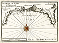 | Details | Michelot and Bremond | 1730 |
| Plan de la Rade d'Alicant |
|
Michelot and Bremond |
|
| 1730 |
| LOC:4 |
| $300.00 | Michelot-and-Bremond | Plan-de-la-Rade-d-Alicant | Antique copperplate portulan-style nautical chart / plan of Alicante, Spain and nearby waters.
<BR> </BR>
This chart is one of 37 port plans published by <a rel="nofollow" href= "/MichelotBremondBackground.aspx">Henry Michelot and Laurens Bremond</a> ca. 1730 in their atlas of small scale Mediterranean ports: "Recueil de Plusieurs Plans de Ports et Rades de la Mer Mediterranée" . Single compass rose with radiating rhumb lines and fleur de lis indicating north. Charming profile view of Alicante topped by "le Chateau". Chart coverage extends eastward from a guard tower past Cap de la Houerta and ends at the prominent villa "la Ste. Face ou la Veronique".<BR> </BR>
Obligatory '+' symbols for rock at every headland and few soundings suggest that the authors were not as familiar with these waters as with other areas they charted. Three suggested anchorages are designated. These anchorages are arranged as expected by the relative draft of each vessel. The "mouillage de vaisseaux" is farthest from shore, with the "mouillage des barques" and "mouillage des galeres" each in progressively shallower water. |
| 329 | 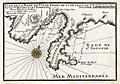 | Details | Michelot and Bremond | 1730 |
| Plan de la Baye de Villefranche et de Celle de St. Souspir |
|
Michelot and Bremond |
|
| 1730 |
| LOC:4 |
| $375.00 | Michelot-and-Bremond | Plan-de-la-Baye-de-Villefranche-et-de-Celle-de-St--Souspir | Interesting antique chart / plan of the bay, harbor and walled city of Villefranche-sur-Mer, France in the Cote d'Azur region of the French Riviera. Numerous soundings and anchorages are noted in the bay which is one of the deepest natural harbors in the Mediterranean. Other depicted features include the Ruines du Chateau de Nice, the old harbor "la Darce", Fort Mont Alban, Tour de Boze, Pointe de Mala Langue (now Cap Ferrat) , Ruines de Fort St. Souspir, and the villages of St. Michel and Heze (Èze). <BR> </BR>
This antique nautical plan was produced ca. 1730 by French hydrographer and pilot of the French royal galley "La Reale" <a style="color:#9BAFCB" rel="nofollow" href= "/MichelotBremondBackground.aspx">Henry Michelot</a>. The port plan was one of 37 original plans published in Marseilles by Michelot and Laurens Bremond in a volume titled "Recueil de Plusieurs Plans de Ports et Rades de la Mer Mediterranée." Later in the 18th century the plans were copied and reprinted by Roux, Allezard, Kitchin and others. |
| 330 | 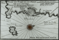 | Details | Michelot and Bremond | 1730 |
| Plan du Port et du Mole de la Ciotat |
|
Michelot and Bremond |
|
| 1730 |
| LOC:4 |
| $355.00 | Michelot-and-Bremond | Plan-du-Port-et-du-Mole-de-la-Ciotat | Antique copper-plate engraved nautical chart / plan of the area surrounding la Ciotat, France in the Cote d'Azur region of the French Riviera. Named features noted by Michelot in this antique chart include Cap Canaille, Cap de l'Aigle, the fountaine du prat; port, mole (jetty or breakwater), and fort of la Ciotat; les Capucins, and Pointe des Moulins.<BR> </BR>
This plan was produced ca. 1730 by French hydrographer and pilot of the French royal galley "La Reale" <a style="color:#9BAFCB" rel="nofollow" href= "/MichelotBremondBackground.aspx">Henry Michelot</a>. The port plan was one of 37 original plans published in Marseilles by Michelot and Laurens Bremond in a volume titled "Recueil de Plusieurs Plans de Ports et Rades de la Mer Mediterranée." Later in the 18th century the plans were copied and reprinted by Roux, Allezard, Kitchin and others. |
| 101 | 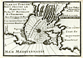 | Details | Michelot and Bremond | 1730 |
| Plan du Port de Bouc |
|
Michelot and Bremond |
|
| 1730 |
| LOC:4 |
| $300.00 | Michelot-and-Bremond | Plan-du-Port-de-Bouc | Antique copperplate nautical chart / port plan of the entrance to the harbor at Port-de-Bouc near Martigues, France produced by French hydrographer and galley pilot Henry Michelot and Laurens Bremond in 1730 . Along with many soundings and navigation hazards the features that Michelot deemed important and referenced by name include a "Pigeonnier", the beach "Plage de Fos", a tower "Tour de Bouc", and numerous "Bordigues" or fish weirs.
<BR> </BR>
Michelot describes Bouc harbor in the English translation of his book of sailing directions published in 1715 - "The Mediterranean Pilot". Michelot's self-confidence in his superior knowledge of the region is unmistakable: <br><div class="indenttextblock">"The mouth is very narrow being only 150 fathoms over; on the starboard point as you go in there is a fortress with a square tower in the middle, of white stone which is seen a great way off; it stands at a low point of an island, which is only separated from the main land by a small rivolet, The Dutch and some authors set down the entrance of this port in their sea-mapps to the eastward of this island where the tower of Bouc is; which shows they have never used this coast, no more than the author of the little Flambeau, printed at Harve de Grace."</div> |
| 1020 |  | Details | Michelot and Bremond | 1730 |
| 1730 Plan of Port-de-Bouc, near Martigues, France |
|
Michelot and Bremond |
|
| 1730 |
| LOC:50 |
| $320.00 | Michelot-and-Bremond | 1730-Plan-of-Port-de-Bouc--near-Martigues--France | Antique copperplate nautical port plan of the entrance to the harbor at Port-de-Bouc near Martigues, France produced by French hydrographer and galley pilot Henry Michelot and hydrographer Laurens Bremond in 1730 . Colored compass rose at center with rhumb lines and numerous soundings.
<br></br>
Along with soundings and navigation hazards the features that Michelot deemed important near Port-de-Bouc and referenced by name include a "Pigeonnier", the beach "Plage de Fos", a tower and fortress "Tour de Bouc", and numerous "Bordigues" or fish weirs. |
| 592 |  | Details | de Fer, Nicolas | 1730 |
| Le Roussillon |
|
de Fer, Nicolas |
|
| 1730 |
| LOC:0 |
| $1,100.00 | de-Fer--Nicolas | Le-Roussillon | Beautiful, old, antique map of the French historical county of Rousillion and the southern French Mediterranean coastline ca. 1730 . Today the area comprises the French department of Pyrenees-Orientales. With 7 inset plans of towns surrounded by walled Vauban-style fortifications: Perpignan; Ville-Franche; Mont-Louis; Belle-Garde; Collioure; Puicerda; Roses. Coverage includes northern Catalonia (Catalunya ). Interestingly an inset shows the town of Roses, Spain as part of Roussillon.
<br></br>
A compass rose and numerous galleys and square-rigged ships at battle fill the Mediterranean. Extremely colorful, decorative and interesting.
<br></br>
This scarce antique map of Roussillon was produced ca. 1727 by Nicholas de Fer, Geographer to Louis XIV. Published from Paris by G. Danet "sur le Pont N. Dame sur la Sphere Royale". Verso blank. |
| 218 | 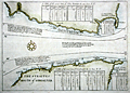 | Details | Bolland, Richard | 1730 |
| The Straites Mouth of Gibralter |
|
Bolland, Richard |
|
| 1730 |
| LOC:8 |
| $675.00 | Bolland--Richard | The-Straites-Mouth-of-Gibralter | Antique hydrographic chart of the Strait of Gibraltar including both Spanish and Moroccan coasts created by Captain Richard Bolland to illustrate his systematic hydrographic description of the currents and tidal flows in that area. Bolland's work, "A Draught of the Streights of Gibraltar with Some Observations upon the Currents thereunto Belonging", dated July 24, 1675 was based on Bolland's first-hand observations and measurements while living in Tangiers for nine years. The chart includes substantial tide tables and information on currents in the Strait.<BR> </BR>
This work of Bolland is clearly the source of Mortier's later similar engraving of the Strait published ca. 1705. Mortier pirated this work to publish in Amsterdam along with many other works in an age before international copyright law. <BR> </BR>
Published (and attributed to Bolland) by Awnsham and John Churchill ca. 1704 at the end of Volume 4 of their publication: "A Collection of Voyages and Travels". Page 777. English text. Verso blank. <BR> </BR>
Online copy of Bolland's text provides interesting background for the methodology that Bolland used to develop the chart (http://www.canadiana.org/view/33300/812 ). |
| 252 | 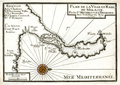 | Details | Michelot and Bremond | 1730 |
| Plan de la Ville et Rade de Melasse (Milazzo, Sicily) |
|
Michelot and Bremond |
|
| 1730 |
| LOC:4 |
| $300.00 | Michelot-and-Bremond | Plan-de-la-Ville-et-Rade-de-Melasse-(Milazzo--Sicily) | Antique copperplate chart of Cape Milazzo, Sicily from French galley pilot and hydrographer <a style="color:#9BAFCB" rel="nofollow" href= "/MichelotBremondBackground.aspx">Henri Michelot.</a> This is one of four old charts of Sicilian ports in Michelot's and Bremond's important 37-plate atlas of 1730: <a id="A3" href="http://www.rarecharts.com/ShowDetail/Creator/Michelot-and-Bremond/Title/Recueil-de-plusieurs-plans-des-ports-et-rades-de-la-mer-mediterranee---(Atlas-of-37-plates)/230" onclick="_gaq.push(['_trackEvent', 'Michelot and Bremond, 'View All', 'MichelotBremondBackground']);">
“Recueil de Plusiers Plans des Ports et Rades de la Mer Mediterranee". </a>
<BR> </BR>
The town of Milazzo (Melasse) , Sicily is clearly shown surrounded by Vauban-style defensive walls and the nearby sea area is marked with sparse soundings and a few anchorages. The charts contains a feature that is unusual for these smaller plans-- labeled, keyed references to five locations in Milazzo: Le Chateau; l'Ancienne Ville; La Nouvelle; Chemin Couvert; and St. Francois. These detailed labels suggest a high level of familiarity with the area. |
| 740 | 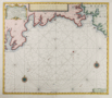 | Details | van Keulen, Gerard | 1730 |
| Antique Nautical Chart of South Cornwall Including Plymouth |
|
van Keulen, Gerard |
|
| 1730 |
| LOC:64 |
| $525.00 | van-Keulen--Gerard | Antique-Nautical-Chart-of-South-Cornwall-Including-Plymouth | Antique Dutch nautical chart of a portion of South Cornwall, England coastline extending from Falmouth in the southwest past Plymouth Sound as far east as Bigbury-on-the Sea. Noted features include Pendennis Castle, St. Mawes Castle, Fay Castle, Palmere, Fovey, Rame Head, Trematon Castle, Eddystone Light, and the Citadel at Plymouth. Published ca. 1730 from Amsterdam by Gerard van Keulen with a title cartouche written in English, and Dutch.
<br></br>
Gerard van Keulen (1678–1726) was the son of Johannes van Keulen (d. 1715), founder of the Dutch publishing house that produced "the largest and finest marine atlases in Holland". Gerard possessed mathematical, scientific, and engraving skills that enabled him to build the firm started by his father into a substantial and respected business venture. (C. Koeman. "The Sea on Paper: The Story of the Van Keulens and their 'Sea Torch'."Theatrum Orbis Terrarum Ltd. Amsterdam, 1972). |
| 735 | 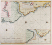 | Details | van Keulen, Gerard | 1730 |
| De Rivier Tyne Of New Castle |
|
van Keulen, Gerard |
|
| 1730 |
| LOC:64 |
| $575.00 | van-Keulen--Gerard | De-Rivier-Tyne-Of-New-Castle | Original detailed Dutch sea chart ca. 1730 of the north-east coast of England from Sunderland and the River Wear in the south to the River Blyth ( Blyt Haven ) in the north. Major geographic areas that Keulen identifies in this antique chart include: The Bishoprik of Durham, Nort ( Noord ) Humberland, and Schotland. With three detailed insets: of the Tyne river to Newcastle on Tyne; the mouth of the Tyne River; and the mouth of the Blyth River. Most place names are in Dutch and some also include their English equivalent. Numerous soundings, aids to navigation, rocks, sandbanks and other hazards along with 4 compass roses and numerous rhumb lines attest to the nautical nature of this working nautical chart.
<br></br>
By Gerard van Keulen (1678–1726), son of Johannes van Keulen (d 1715), founder of the Dutch publishing house that produced "the largest and finest marine atlases in Holland". Gerard possessed mathematical, scientific, and engraving skills that enabled him to build the firm started by his father into a substantial and respected business venture. (C. Koeman. "The Sea on Paper: The Story of the Van Keulens and their 'Sea Torch'."Theatrum Orbis Terrarum Ltd. Amsterdam, 1972). |
| 741 | 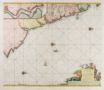 | Details | van Keulen, Gerard | 1730 |
| Antique Chart of northeast England near Newcastle and Tyne River |
|
van Keulen, Gerard |
|
| 1730 |
| LOC:64 |
| $550.00 | van-Keulen--Gerard | Antique-Chart-of-northeast-England-near-Newcastle-and-Tyne-River | Antique Dutch nautical chart depicting the Yorkshire coast of England and Scotland's east coast south of Edinburgh. Contains a detailed inset showing the river Tyne and Newcastle at top left. Coverage of coastal habitations and geographical features includes: Flamborough Head, Filey Bay, Stockton-on-Tees, Newcastle, Hartlepool, Sunderland, the Tyne River, Morpeth, North Berwick, and the entrance to the Firth of Forth ("de Rivier van Edenborg").
<br></br>
Very decorative title cartouche in Dutch depicts a mermaid and mermen with fishes. The blank area in the North Sea is decorated with a sea serpent, three colorful compass roses, and a square-rigged sailing vessel. North is oriented to the right. Plate 23.
<br></br>
Gerard van Keulen (1678–1726) was the son of Johannes van Keulen (d. 1715), founder of the Dutch publishing house that produced "the largest and finest marine atlases in Holland". Gerard possessed mathematical, scientific, and engraving skills that enabled him to build the firm started by his father into a substantial and respected business venture. (C. Koeman. "The Sea on Paper: The Story of the Van Keulens and their 'Sea Torch'."Theatrum Orbis Terrarum Ltd. Amsterdam, 1972). |
| 818 | 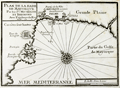 | Details | Michelot and Bremond | 1730 |
| Bay of Palma, on Mallorca, Spain (Balearics) |
|
Michelot and Bremond |
|
| 1730 |
| LOC:4 |
| $200.00 | Michelot-and-Bremond | Bay-of-Palma--on-Mallorca--Spain-(Balearics) | One of the first port plans of the Bay of Palma, Spain (1730) on the Bealeric Island of Mallorca (Majorca) created for navigational purposes in an atlas for the Mediterranean Sea: “Recueil de Plusiers Plans des Ports et Rades de la Mer Mediterranee". The chart covers from Fort de Porto pin in the West to the far plains east of Palma ( "Palme") . Shows the region around Palama including fortifications, bastions, redoubts, gun batteries, and numerous windmills both to the east and west of the city. The Bay of Palma is referred to as the "Golfe de Mayorque".
<br></br>
This chart was published by the team of Henri Michelot and Laurens Bremond, both associated with the French Royal Galley Corps. In their business relationship it appears that Bremond provided the retail space in the port of Marseille, France where this chart, as well as other atlases and nautical prints were sold. Michelot, the chief pilot or"Pilote Hauturière" for the galley service provided the name recognition and authority needed for the charts to sell widely. |
| 4707 | 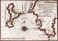 | Details | Michelot and Bremond | 1730 |
| Antique French nautical chart of Ibiza and Formentera, Balearic Islands, Spain |
|
Michelot and Bremond |
|
| 1730 |
| LOC:13 |
| $350.00 | Michelot-and-Bremond | Antique-French-nautical-chart-of-Ibiza-and-Formentera--Balearic-Islands--Spain | Attractive and authentic antique engraved nautical chart of the <b>Balearic islands of Ibiza and Formentera, Spain.</b> Includes the noted locations of St. Hilaire, Porto Magno, Cap Saline, Isle des Salines, and Isle Tagomago. The authors identify anchorages, navigation hazards, depth soundings, watering locations, and a shallow northern passage between the islands labeled "on peut passer ici par un beau tems." Shows the port and the town of Elvissa labeled "Yvice".
<BR> </BR>
This small antique chart is one of 37 port plans and harbor charts published by Henry Michelot and Laurens Bremond ca. 1730 in their small-scale atlas of Mediterranean ports: "Recueil de Plusieurs Plans de Ports et Rades de la Mer Mediterranée."
<BR> </BR>
Contains a carefully colored compass rose with north oriented to the right, |
| 819 | 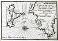 | Details | Michelot and Bremond | 1730 |
| Antique chart of the Balearic Islands of Ibiza and Formentera |
|
Michelot and Bremond |
|
| 1730 |
| LOC:4 |
| $200.00 | Michelot-and-Bremond | Antique-chart-of-the-Balearic-Islands-of-Ibiza-and-Formentera | Original engraved antique nautical chart of the Balearic islands of Ibiza and Formentera which now belong to an autonomous unit and province of Spain. The French chart, from 1730, shows the port and the town of Eivissa or Ibiza Town which is is labeled "Yvice". Other noted points of interest include: Cap Saline, Porto Magno or Galache Fraques, Ile de Tagomago, and Ile Espalmador. Numerous soundings , anchorages, and rocks are noted as well as a water source near the village of St. Hilaire.
<BR> </BR>
This chart is one of 37 port plans published by <a style="color:#9BAFCB" rel="nofollow" href= "/MichelotBremondBackground.aspx">Henry Michelot and Laurens Bremond</a> ca. 1730 in their atlas of small scale Mediterranean ports: "Recueil de Plusieurs Plans de Ports et Rades de la Mer Mediterranée" . Both Michelot and Bremond were associated with the French Royal Galley Corps. In their business relationship it appears that Bremond provided the retail space in the port of Marseille, France where this chart, as well as other atlases and nautical prints were sold. Michelot, the chief pilot or"Pilote Hauturière" for the Corps des Galeres provided the name recognition and authority needed for the charts to sell widely. |
| 1050 | 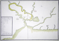 | Details | Real Escuela de Navegacion | 1735 |
| Early Manuscript plan of Cienfuegos Bay (Puerto de Jagua) |
|
Real Escuela de Navegacion |
|
| 1735 |
| LOC:0 |
| $3,100.00 | Real-Escuela-de-Navegacion | Early-Manuscript-plan-of-Cienfuegos-Bay-(Puerto-de-Jagua) | Pen and ink manuscript port plan of the Bahia de Cienfuegos, Cuba dating to the first half of the 18th century: "Puerto de Jagua". This is the earliest available manuscript plan of that important bay on the south coast of Cuba and is a near perfect copy of a map held in the Library of Congress (https://www.loc.gov/item/91680835/). The existence of multiple manuscript copies of the same chart is explained by the fact that the chart was produced by the Real Escuela de Navegación in Cadiz, whose role was to ensure the accuracy and consistency of maps produced for naval and commercial shipping and to house the growing record of maps and charts related to Spain's vast empire. Copyists at the school would have reproduced numerous identical copies by hand for distribution to military and commerical maritime users. During this time period few maps of Spain's New World possessions were reproduced by printing press, presumeably in order to limit their distribution. Spain's jealous secrecy over their colonial possessions is well documented.
<br></br>
The title and key are located within a frame at lower left; the chart shows coastline, coastal features, soundings, navigational hazards, an anchorage, a few buildings, roads, and streams.
<br></br>
Dating the map depends chiefly on its depiction of the location marked "B"- "lomas estrecho de la entrada" (Translated: Hilly narrow entrance). This site would later become the site of a fort or Castillo (Nuestra Señora de los Ángeles de Jagua) founded in 1745. On this chart, the fact that no mention is made of any structure suggests the map dates to before 1733 when construction on the fort began. On a later manuscript version for example that spot is defined as "es donde esta el Castillo, que es donde estaba la Bateria de ?[Fagina] (Translated: Where the castle is, which is where the Battery of ?? was.")
<br></br>
Note: "jagua" may be translated from Spanish as "Fruit of the custard-apple." |
| 892 | 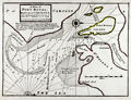 | Details | Moll, Herman | 1736 |
| Antique Chart of Port Royal Harbor, South Carolina |
|
Moll, Herman |
|
| 1736 |
| LOC:3 |
| $425.00 | Moll--Herman | Antique-Chart-of-Port-Royal-Harbor--South-Carolina | This antique chart of <b>Port Royal Sound</b>, drawn by Herman Moll before 1732, is the earliest obtainable large-scale chart focused on the Port Royal / Beaufort, South Carolina area and one of the earliest to name <b>Hilton Head</b>. With locations identified for two proposed forts guarding the main channel to "Bauford Town" (Beaufort), which was located by Moll on Parris Island ("Port Royal Island"). Other noted features include St. Helena Island, with Phillips Point and St. Michaels Head. Numerous soundings and sandbars are indicated.
<br></br>
Moll added this description of the area below the title block: <div class="indenttextblock">"Port Royal River lies 20 Leagues from Ashley River SW it has a bold entrance 19 or 20 foot at low-water. The Harbor is large, safe, and commodious and runs into ye best country in Carolina. Here ye air is always cleer and agreeable to Europian constitutions".</div>
</br>
This old map of Port Royal, Hilton Head, and Beaufort S.C. is from the 3rd edition of Moll's "Atlas Minor: or a New and Curious Set of Sixty-two Maps", published for Thomas and John Bowles in 1736. |
| 1353 | 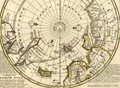 | Details | Moll, Herman | 1736 |
| Original Antique Polar Map of the North Pole |
|
Moll, Herman |
|
| 1736 |
| LOC:1 |
| $425.00 | Moll--Herman | Original-Antique-Polar-Map-of-the-North-Pole | Fine original antique 18th-century polar map of the <b>North Pole</b> annotated with observations and facts regarding early exploration of the north polar region. This striking polar projection shows Iceland, Greenland, Spitsbergen, Nova Zembla, portions of North America and Northern Europe. Text blocks at right and left detail the sun's movement at high latitudes and the explorations of the polar region by Frobisher, Davis and others
<br></br>
Printed for Tho: Bowles next ye Chapter House in St. Pauls Church Yard, & John Bowles at the Black Horse in Cornhill, London. |
| 5462 | 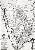 | Details | Anville, Jean Baptiste Bourguignon d' | 1737 |
| Original antique map of southern India and Coromandel Coast after Bouchet |
|
Anville, Jean Baptiste Bourguignon d' |
|
| 1737 |
| LOC: |
| $450.00 | Anville--Jean-Baptiste-Bourguignon-d- | Original-antique-map-of-southern-India-and-Coromandel-Coast-after-Bouchet | Early antique copper-plate engraved map from 1737 of <strong>southern India</strong> and a bit of Sri Lanka (Ceylan) including the <strong>Coromandel Coast</strong> of southeast India.
<br></br>
Created by J.B. d'Anville (1697-1782) after Jesuit cartographer Jean-Venant Bouchet who spent 30 years surveying southern India. Includes the Jesuit "logo" at bottom left, an acknowledgement of its Jesuit sources. Anville would have used the symbol to legitimize and to promote the value of this derivative work.
<br></br>
Engraved by Louis Corne. Apparently scarce. No copy found for sale online nor any sale record in AMPR.
<br></br>
This is one of the earliest maps to accurately detail the interior of Southern India. Legend at lower left identifies locations described in French as:
<div class="indenttextblocksingle">
<ul style="list-style-type: circle;">
<li>Place considerable</li>
<li>Demeure d'un Nabab ou Gouvereur.</li>
<li>Demure d'un Paleagaren ou petit Prince.</li>
<li>Eglise ou Christienti.</li>
<li>Pagode ou Temple de Gentile.</li>
</ul>
</div> |
| 3633 | 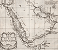 | Details | Bellin, Jacques Nicolas | 1740 |
| Nice French antique map of Saudi Arabia, Red Sea, Persian Gulf |
|
Bellin, Jacques Nicolas |
|
| 1740 |
| LOC:6 |
| $320.00 | Bellin--Jacques-Nicolas | Nice-French-antique-map-of-Saudi-Arabia--Red-Sea--Persian-Gulf | Striking and beautifully engraved map of Arabia, the Red Sea, and the Persian Gulf. Decorative compass rose and scroll-work title cartouche. The area shown on this fine original map is currently territory of these states: Saudi Arabia, Egypt, Israel, Jordan, Iraq, Iran, United Arab Emirates, Yemen, Oman and more.
<br></br>
Published by Jacques Bellin by order of the Count de Maurepas (Jean-Frédéric Phélypeaux 1701-1781) who served as France's Minister of Marine from 1723-1749. By his recommendations to Louis XVI delaying economic and administrative reforms, Maurepas was partially responsible for the governmental crises that led to the French Revolution.
<br></br>
French hydrographer Jacques Nicolas Bellin (1703-1772) was born in Paris and educated as an engineer. In 1741, Bellin became the first Ingénieur de la Marine of the Depot des cartes et plans de la Marine (the French Hydrographical Office) and was named Official Hydrographer of the French King. Bellin's largest and most comprehensive work is the Petit Atlas Maritime that covered the coasts and important port cities of the known world. |
| 570 |  | Details | Homann Heirs | 1742 |
| Italia |
|
Homann Heirs |
|
| 1742 |
| LOC:58 |
| $490.00 | Homann-Heirs | Italia | Attractive antique map of Italy divided into provinces with the islands of Corsica ( Corse ), Sardinia ( Sardegna or Sardigna ), Sicily ( Sicilia ), Malta, Gozo, and Lampedusa. This large 18th century, hand-colored engraving was published from Nuremberg, Germany in 1742 (dated at top of map). Decorative title cartouche in Latin at bottom left of the map.
<br></br>
By the heirs of J. B. Homann. Homann Heirs (also "Homannianis Heredibus" or "Homann Erben" or "Heritiers de Homann") was a company established after the death of the famous German cartographer Johann Baptist Homann to carry on the publishing business of the firm he started in the early 1700's. The designation "Homann Heirs" appears on maps published by that successor firm from about 1730 to 1848. |
| 1439 | 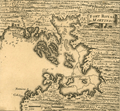 | Details | Popple, Henry | 1742 |
| Antique plan Fort-de-France Bay on Martinique, France Caribbean |
|
Popple, Henry |
|
| 1742 |
| LOC:0 |
| $85.00 | Popple--Henry | Antique-plan-Fort-de-France-Bay-on-Martinique--France-Caribbean | Antique chart fragment ca. 1742 of Baie de Fort-de-France or Fort-de-France Bay on the west side of the Island of Martinique, an overseas region of France. Includes Fort-de-France (Fort Royal). With soundings and sand banks delineated. Key locations named on the map include Flemish Bay, Grand and Petit Islets, Ramieres or Ramiers Ilet, and Cul de Sac au Hay.
<br></br>
This antique map was originally published by Covens and Mortier in 1742 in "Les Principales Forteresses Ports etc. de L'Amerique Septentrionale" a sheet containing harbor and island maps and plans of the Americas. This map is a fragment trimmed from the larger sheet.
<br></br>
That sheet of 18 maps and plans of islands and harbors was published by Covens and Mortier to replace Popple's original large map of 20 sheets with a more manageable six-sheet version. Popple's original map was titled: "A Map of the British Empire in America with the French, Spanish and the Dutch Settlements adjacent thereto". |
| 3692 |  | Details | Homann Heirs | 1743 |
| Scarce antique view of Portobelo, Panama |
|
Homann Heirs |
|
| 1743 |
| LOC:77 |
| $225.00 | Homann-Heirs | Scarce-antique-view-of-Portobelo--Panama | Very scarce birds-eye view of Portobelo, Panama in Colon Province during its capture and destruction in 1739-1742 during the War of Jenkins' Ear. The map depicts the town of Portobelo, Fort Gloria, and the immediate vicinity, including the harbor and Fort Hierro (iron), constructed across the harbor from Portobelo. Several sailing ships depict a naval battle scene and notes in the title block identify and explain sixteen important locations and actions on the view.
<br></br>
Portobelo was founded in March 1597 as "San Felipe de Portobelo". A military compound, Portobelo belonged to a Spain's colonial defensive system, including Veracruz (Mexico), Cartagena (Colombia), and Havana (Cuba), to protect the route of commercial trade between the Americas and Spain. Portobelo, where the annual late summer trade fairs were held, was one of the principal Caribbean ports and played a leading role controlling Spain's imperial trade in the Americas.
<br></br>
Published by the firm Homann Heirs. Homann Heirs (also "Homannianis Heredibus" or "Homann Erben" or "Heritiers de Homann") was a company established after the death of German cartographer J.B. Homann to carry on the map publishing business of the firm he started in the early 1700's. The designation "Homann Heirs" appears on maps published by that successor firm from about 1730 to 1848. |
| 582 |  | Details | Homann Heirs | 1743 |
| Guinea propia |
|
Homann Heirs |
|
| 1743 |
| LOC:54 |
| $350.00 | Homann-Heirs | Guinea-propia | Decorative antique map of the West Coast of Africa from 1743 with several regions denoted by outline/wash coloring: Sahara, Ethiopia, Guinea. Map is marked with names of sub-regions, tribal kingdoms, and numerous notations in Latin. Large decorative cartouche at left of map focuses on the daily life of indigenous tribesmen and elephant tusks.
<br></br>
Published by the firm Homann Heirs. Homann Heirs (also "Homannianis Heredibus" or "Homann Erben" or "Heritiers de Homann") was a company established after the death of German cartographer J.B. Homann to carry on the publishing business of the firm he started in the early 1700's. The designation "Homann Heirs" appears on maps published by that successor firm from about 1730 to 1848. |
| 584 |  | Details | Homann Heirs | 1743 |
| Americae Mappa Generalis |
|
Homann Heirs |
|
| 1743 |
| LOC:52 |
| $500.00 | Homann-Heirs | Americae-Mappa-Generalis | Extremely decorative mid 18th-century antique map of North and South America by Homann.
<br></br>
Geographic coverage on this fine old relic includes Western Europe, West Africa, and large portions of both the Atlantic and Pacific Oceans. The territory in the U.S. Pacific Northwest was largely unexplored when the map was created and the area is shown as blank. At the time this map was printed knowledge of U.S. west coast geography had improved past the point in time when California was thought to be an island.
<br></br>
A highly decorative title cartouche at bottom left of this antique map features four native Americans and two erupting volcanos along with a large vessel containing coins.
<br></br>
Published by the firm Homann Heirs. Homann Heirs (also "Homannianis Heredibus" or "Homann Erben" or "Heritiers de Homann") was a company established after the death of German cartographer J.B. Homann to carry on the publishing business of the firm he started in the early 1700's. The designation "Homann Heirs" appears on maps published by that successor firm from about 1730 to 1848. |
| 1040 |  | Details | Homann Heirs | 1743 |
| Carte d' Artois et des Environs |
|
Homann Heirs |
|
| 1743 |
| LOC:0 |
| $250.00 | Homann-Heirs | Carte-d--Artois-et-des-Environs | Decorative antique map of France covers the Duchy of Artois from Dunkerque to Abbeville and inland to Lille, Douai and Cambrai. Decorated with a very attractive uncolored title cartouche.
<br></br>
Published by the firm Homann Heirs. Homann Heirs (also "Homannianis Heredibus" or "Homann Erben" or "Heritiers de Homann") was a company established after the death of German cartographer J.B. Homann to carry on the publishing business of the firm he started in the early 1700's. The designation "Homann Heirs" appears on maps published by that successor firm from about 1730 to 1848. |
| 579 |  | Details | Homann Heirs | 1744 |
| Carte de l'Asie |
|
Homann Heirs |
|
| 1744 |
| LOC:59 |
| $355.00 | Homann-Heirs | Carte-de-l-Asie | Decorative antique map of Asia dated to 1744. Coverage include Egypt, Saudia Arabia, the Persian Gulf, India, China, Borneo, New Guinea, Siberia, and Japan, and the North Pole. Bottom left of this antique map contains a title cartouche with a large lizard, natives, and subtropical fauna.
<br></br>
Published by the firm Homann Heirs. Homann Heirs (also "Homannianis Heredibus" or "Homann Erben" or "Heritiers de Homann") was a company established after the death of German cartographer J.B. Homann to carry on the map publishing business of the firm he started in the early 1700's. The designation "Homann Heirs" appears on maps published by that successor firm from about 1730 to 1848.
<br></br> |
| 1057 |  | Details | Bellin, Jacques Nicolas | 1744 |
| Antique chart of the mouth of the Mississippi River |
|
Bellin, Jacques Nicolas |
|
| 1744 |
| LOC:3 |
| $460.00 | Bellin--Jacques-Nicolas | Antique-chart-of-the-mouth-of-the-Mississippi-River | One of the earliest available charts to focus solely on the passes at the mouth of the Mississippi River, then considered by the French to be their overseas possession. The location covered by this chart lies roughly 75 miles southeast of New Orleans, Louisiana which had only been founded in 1718 by the French Mississippi Company, under the leadership of Jean-Baptiste Le Moyne de Bienville.
<br></br>
This is the first and earliest of two small charts by the Depot de la Marine; the later chart appeared in Bellin's 1764 "Le Petit Atlas Maritime". This chart is characterized by numerous descriptions of the hydrography ("recif" or reef; "bancs de vase molle" or soft mudflats; and "le bare") but contains no depth soundings. The southwest pass is particularly interesting for it is labeled "Embouchure par ou les vaisseau entrant" or mouth where vessels enter. Just inside the mouth near two reefs a small ship is depicted aground ("V[aisse]au Echoué"). Further up the channel ("Chenal") is Fort de la Balise (Fr. seamark). At that spot the French constructed a 62 foot high pyramidal wooden tower (the Balise) in 1721.
<br></br>
This chart was undoubtedly based on observations prior to 1740 when the Balise was destroyed by a hurricance. Bellin's later 1764 chart shows no structure at that location, just a mass of debris. |
| 5209 | 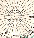 | Details | Moll, Herman | 1744 |
| Map of the North Pole by Herman Moll 1744 |
|
Moll, Herman |
|
| 1744 |
| LOC:13 |
| $325.00 | Moll--Herman | Map-of-the-North-Pole-by-Herman-Moll-1744 | Fine original antique 18th-century polar map of the North Pole by Herman Moll. This scarce map is annotated with observations and facts regarding early exploration of the north polar region. Perhaps this is an unrecorded fifth state of the map as the "Vol 1. p. 714" found at upper left in the fourth state has been largely effaced and only a faint hint of the graved lines remain visible. The number " 2 " at upper right is clearly visible.
<br></br>
This striking polar projection shows Iceland, Greenland, Spitsbergen, Nova Zembla, portions of North America and Northern Europe. Text blocks at right and left detail the sun's movement at high latitudes and the explorations of the polar region by Frobisher, Davis and others
<br></br>
Published in London in "Thomas Salmon's Modern History: or the Present State of All Nations." Printed for Tho: Bowles next the Chapter House in St. Pauls Church Yard, & John Bowles at the Black Horse in Cornhill, London. |
| 3593 | 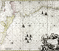 | Details | Ottens, Ranier and Joshua | 1745 |
| Spectacular antique chart of Mexico, Central America and South America |
|
Ottens, Ranier and Joshua |
|
| 1745 |
| LOC:51 |
| $1,150.00 | Ottens--Ranier-and-Joshua | Spectacular-antique-chart-of-Mexico--Central-America-and-South-America | Copper-engraved sea chart oriented with north to the left, showing the Pacific Ocean from Xalisco, Mexico, to Puerta Bairres in Chile (including Yucatan, Central America, the Western Caribbean and the Galapagos Islands). Columbia is shown in its entirety, along with a small piece of Venezuela. Includes well over 125 place names arranged in Portolan style. Finely engraved title cartouche with conquistadors, slaves, and putti set into an allegorical background.
<br></br>
Updated and corrected sea chart by Ottens, after Renard and de Wit from "Atlas van Zeevart en Koophandel door de Geheele Wereldt" (Amsterdam, 1745). The name of Louis Renard has been replaced by the names of Reinier and Joshua Ottens. Reinier and Joshua Ottens (1704-1765) were Dutch publishers, cartographers and map engravers. The family business was founded by their father Joachim, but the firm was most productive under the leadership of Reinier and Joshua. |
| 571 | 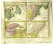 | Details | Homann Heirs | 1745 |
| Dominia Anglorum in America Septentrionali |
|
Homann Heirs |
|
| 1745 |
| LOC:53 |
| $495.00 | Homann-Heirs | Dominia-Anglorum-in-America-Septentrionali | Four early maps of the British colonies in North America on one page made 30+ years before the Revolutionary war, ca. 1745. These antique maps are based on the work of Herman Moll, a London-based cartographer and engraver.
<br></br>
Coverage on this antique copperplate engraving includes Newfoundland and Saint Lawrence Bay in Canada, New York, New England, New Jersey, Pennsylvania, the Carolina and Florida Territories, Virginia, and Maryland including Chesapeake Bay.
<br></br>
The four inset maps are titled as follows:<br>
A. Newfoundland od. Terra Nova S. Laurentii Bay die fisch-bank Acadia… New Schotland.<br>
B. New Engelland, New York, New Jersey, und Pensilvania.<br>
C. Virgina und Maryland<br>
D. Carolina ... Florida
<br></br>
Text below the maps elaborates on the maps, the Iroquis indians, and provides a brief dictionary of terms translated to German.
<br></br>
By the heirs of J. B. Homann. Homann Heirs (also "Homannianis Heredibus" or "Homann Erben" or "Heritiers de Homann") was a company established after the death of the famous German cartographer Johann Baptist Homann to carry on the map publishing business of the firm he started in the early 1700's. The designation "Homann Heirs" appears on maps published by that successor firm from about 1730 to 1848. |
| 869 | 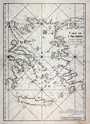 | Details | Depot de la Marine | 1745 |
| Antique Chart of the Aegean Sea, Turkey and Greek Archipelago |
|
Depot de la Marine |
|
| 1745 |
| LOC:58 |
| $1,400.00 | Depot-de-la-Marine | Antique-Chart-of-the-Aegean-Sea--Turkey-and-Greek-Archipelago | Scarce antique chart of the Greek Archipelago including parts of mainland Greece and Turkey. This large copperplate-engraved nautical chart of the Aegean Sea is based on surveys by French naval pilot Arnaud Grognard (1681-1751) and published by the Depot de la Marine.
<br></br>
Dedicated to Jean-Frédéric Phélypeaux comte de Maurepas (1701-1781). Interesting signed approval by Jacques Bellin, of the French Depot de la Marine" which translates roughly to: 'I examined the chart of the archipelago presented by Sieur Grognard, a pilote of the department from Toulon, under orders of the Count de Maurepas, and I find it is acceptable for navigation…". Bellin published many charts under his own name and it is unusual to find this type of signed attribution of a chart published by the Depot. |
| 583 |  | Details | Homann, Johann | 1745 |
| Totius Regni Neapolis |
|
Homann, Johann |
|
| 1745 |
| LOC:58 |
| $600.00 | Homann--Johann | Totius-Regni-Neapolis | Map of the southern boot of Italy divided into provinces. Coverage of this antique hand-colored map includes islands of both the Tyrhennian Sea and Adriatic Sea including Capri, Procida, Ischia, Naples ( Napoli ), Stromboli, Lipari, Basiluzzo, the Tremiti Islands and the northern tip of Sicily including Milazzo and the Strait of Messina. Two decorative cartouches give life to the map, one includes a sea serpent, flying horses and numerous putti fencing with epee.
<br></br>
Drawn by famous German cartographer Johann Homann ca. 1720, the map was published later by the firm Homann Heirs. Homann Heirs (also "Homannianis Heredibus" or "Homann Erben" or "Heritiers de Homann") was a company established after the death of Homann to carry on the publishing business of the firm he started in the early 1700's. The designation "Homann Heirs" appears on maps published by that successor firm from about 1730 to 1848. |
| 3586 | 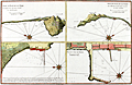 | Details | Ayrouard, Jacques | 1746 |
| Scarce Port Plan details near the Bay of Naples |
|
Ayrouard, Jacques |
|
| 1746 |
| LOC:88 |
| $475.00 | Ayrouard--Jacques | Scarce-Port-Plan-details-near-the-Bay-of-Naples | Beautifully colored antique detailed nautical plans of four areas near the Bay of Naples, Italy by Jacques Ayrouard (Marseilles ca. 1746). From Ayrouard's scarce nautical atlas: "Recueil de Plusiers Plans des Ports et Rades et de Quelque Cartes Particulieres de la Mer Mediterranee". Includes the breakwater/wharf in Naples; the port of Pozzuoli; and two views of the "Cote Romaine" or Roman Coast south of Terracina.
<BR> </BR>
Little information exists on Ayrouard's background but like <a style="color:#9BAFCB" rel="nofollow" href= "/MichelotBremondBackground.aspx">Henry Michelot</a>, Ayrouard was a pilot of the French royal galley, the Reale, based in Marseille. However, Ayrouard's port plans and charts are very different from Michelot's earlier works. The much larger size (17"x11") and the extensively shaded topography are distinctive characteristics of Ayrouard's plans.
<BR> </BR>
Plate 34. With the royal privilege. |
| 182 | 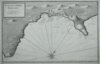 | Details | Ayrouard, Jacques | 1746 |
| Plan de la Baye d'Alicant |
|
Ayrouard, Jacques |
|
| 1746 |
| LOC:8 |
| $375.00 | Ayrouard--Jacques | Plan-de-la-Baye-d-Alicant | This antique, black and white harbor chart /port plan of Alicante Bay, Spain is by Jacques Ayrouard (Marseilles ca. 1732- 1746) from a scarce atlas titled: "Recueil de Plusiers Plans des Ports et Rades et de Quelque Cartes Particulieres de la Mer Méditerranée". Coverage extends eastward from Cap St. Paul to past Cap de la Houerta. Engraved by Louis Corne. Plate 67. <BR> </BR>
Little information exists on Ayrouard's background but like Henry Michelot before him, Ayrouard was a pilot of the French royal galley, the Reale, based in Marseille. However, Ayrouard's port plans are very different from Michelot's earlier works. The much larger size (18"x11") and extensively shaded topography in this plan are distinctive characteristics of Ayrouard's nautical plans. <BR> </BR> |
| 183 | 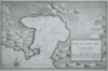 | Details | Ayrouard, Jacques | 1746 |
| Plan de la Port de Cartagene |
|
Ayrouard, Jacques |
|
| 1746 |
| LOC:8 |
| $450.00 | Ayrouard--Jacques | Plan-de-la-Port-de-Cartagene | This antique nautical chart or plan of the town and harbor of Cartagena, Spain by Jacques Ayrouard (Marseilles ca. 1732- 1746) is sourced from a scarce sea atlas titled: "Recueil de Plusiers Plans des Ports et Rades et de Quelque Cartes Particulieres de la Mer Méditerranée". Beautifully engraved by Louis Corne this copperplate engraving shows the town of Cartagena surrounded by defensive walls, and unusually for 18th century charts/plans shows the adjacent topography in great detail.
<br></br>
Like <a rel="nofollow" href= "/MichelotBremondBackground.aspx">Henry Michelot</a> before him, Ayrouard was a pilot of the French royal galley, the Reale, based in Marseille. However, Ayrouard's port plans are very different from Michelot's earlier works. The much larger size (18"x11") and extensively shaded topography in this plan are distinctive characteristics of Ayrouard's nautical plans. Plate 68. <BR> </BR> |
| 6774 | 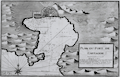 | Details | Ayrouard, Jacques | 1746 |
| Plan du Port de Cartagene |
|
Ayrouard, Jacques |
|
| 1746 |
| LOC:8 |
| $375.00 | Ayrouard--Jacques | Plan-du-Port-de-Cartagene | Fine nautical chart or plan of the town and harbor of Cartagena, Spain by Jacques Ayrouard (Marseilles ca. 1732- 1746). Original copperplate engraving shows the town of Cartagena surrounded by defensive walls, and unusually for 18th century charts/plans shows the adjacent topography in great detail. Noted features include l'Hermitage", "le Chateau", "pointe du fort", and "pointe galere" near a "chapelle".
<br></br>
<div id="0" align="center">
<a title=""></a>
<img id="6774" src="/ZoomifyImages/SC_6774/SC_6774_detail_1.jpg" alt="Plan du Port de Cartagene a nautical port plan for Cartagena, Spain by Jacques Ayrouard 1746." width="340"/> <br><br> <font size="-2">View of Cartagena, Spain by Ayrouard, 1746.</font>
</div><br>
Sourced from Ayrouard's scarce sea atlas: "Recueil de Plusiers Plans des Ports et Rades et de Quelque Cartes Particulieres de la Mer Méditerranée." Beautifully engraved by Louis Corne.
<br></br>
Ayrouard was a pilot of the French royal galley, the Reale, based in Marseille, France. The much larger size (18"x11") and extensively shaded topography in this plan are distinctive characteristics of Ayrouard's nautical port plans. Plate 68. <BR> </BR> |
| 1378 | 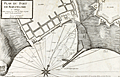 | Details | Ayrouard, Jacques | 1746 |
| Scarce antique port plan of Barcelona, Spain |
|
Ayrouard, Jacques |
|
| 1746 |
| LOC:8 |
| $700.00 | Ayrouard--Jacques | Scarce-antique-port-plan-of-Barcelona--Spain | Scarce antique French port plan / chart for the town of Barcelona, Spain on Spain's Mediterranean coast. This expertly designed and robustly executed antique chart is by Jacques Ayrouard (Marseilles ca. 1732- 1746) from a scarce atlas titled: "Recueil de Plusiers Plans des Ports et Rades et de Quelque Cartes Particulieres de la Mer Mediterranee". In a style that reflects Ayrouard's military and engineering background.
<br></br>
In the attribution Ayrouard is described as "Pilote Real" or pilot of la Reale, the flagship of the French galley corps with a total complement of about 550 including 360 oarsmen and 100 soldiers. In their <i>Dictionnaire de la Marine</i> from 1702 Covens and Mortier explain: <div class="indenttextblock">"(Réale) is the name of the main galley of an independent kingdom, not of a tributary kingdom annexed to a greater one. The Réale, in France, is reserved for the general of the galleys and flies the royal ensign which distinguishes it from the others. This ensign is square in shape and red in colour, with golden fleurs-de-lys." <a href="http://www.ulmo.net/bateaux/reale/dico02.jpg" target="_blank"> (Internet)</a> </div>
Ayrouard was likely one of the last such pilots as the French Corps des Galeres was disbanded in 1748 and incorporated into the regular French sailing navy. |
| 5166 |  | Details | Anville, Jean Baptiste Bourguignon d' | 1746 |
| Antique French map of North America Amerique Septentrionale |
|
Anville, Jean Baptiste Bourguignon d' |
|
| 1746 |
| LOC:53 |
| $460.00 | Anville--Jean-Baptiste-Bourguignon-d- | Antique-French-map-of-North-America-Amerique-Septentrionale | Two joined sheets of D'Anville's four-sheet map of North America and the West Indies from 1746 (dated within). Much blank space west of the Mississippi River reflects the scarcity of information about the geography of Tecas (Texas) and most of the west United States save for that of the Spanish territories around New Mexico. D'Anville names and locates many native American tribes including the Chicachas, Canoatinos, the Cherakis, Iroquois, and Chetimachas (around Bayou Lafourche, Louisiana).
<br></br>
At upper left is an inset of Hudson Bay, Baffin Bay, Labrador, Baffin Bay, and Greenland.
<br></br>
Designed by Gravelot; engraved by Major. |
| 1181 | 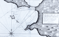 | Details | Ayrouard, Jacques | 1746 |
| Antique plan of the Bay of Taranto, Italy |
|
Ayrouard, Jacques |
|
| 1746 |
| LOC:8 |
| $375.00 | Ayrouard--Jacques | Antique-plan-of-the-Bay-of-Taranto--Italy | Distinctive antique engraved French port plan / chart ca. 1746 for the bay and walled village of Taranto, Italy a coastal city in Apulia. Today, Taranto is the capital of the Province of Taranto and is an important commercial port as well as the main Italian naval base and claims a population of over 200,000 persons.
<br></br>
The antique chart is by Jacques Ayrouard (Marseilles ca. 1732- 1746) from a scarce atlas titled: "Recueil de Plusiers Plans des Ports et Rades et de Quelque Cartes Particulieres de la Mer Mediterranee". Plate 37.
<br></br>
Ayrouard identifies a few key landmarks including several offshore: La Pizolle, Isle Pisco, Isle de St. George, and two channels into the bay. On land only a few landmarks are noted including guard towers, the port; the village of Taranto ("Tarante") connected to the mainland by two bridges; and the Pointe de Victo where today is found the area of San Vito.
<br></br>
In the attribution Ayrouard is described as "Pilot Real" or pilot of la Reale, the flagship of the French galley corps with a total complement of about 550 including 360 oarsmen and 100 soldiers. In their <i>Dictionnaire de la Marine</i> from 1702 Covens and Mortier explain: <div class="indenttextblock">"(Réale) is the name of the main galley of an independent kingdom, not of a tributary kingdom annexed to a greater one. The Réale, in France, is reserved for the general of the galleys and flies the royal ensign which distinguishes it from the others. This ensign is square in shape and red in colour, with golden fleurs-de-lys." <a href="http://www.ulmo.net/bateaux/reale/dico02.jpg" target="_blank"> (Internet)</a> </div>
Ayrouard was likely one of the last galley pilots as the French galley corps was disbanded in 1748 and incorporated into the regular French sailing navy. |
| 907 | 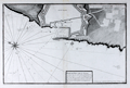 | Details | Ayrouard, Jacques | 1746 |
| Antique plan of the port of Livorno, Italy |
|
Ayrouard, Jacques |
|
| 1746 |
| LOC:8 |
| $525.00 | Ayrouard--Jacques | Antique-plan-of-the-port-of-Livorno--Italy | Antique French port plan / chart for the town of Livorno, Italy located on the western coast of the Tuscany region.
The antique chart is by Jacques Ayrouard (Marseilles ca. 1732- 1746) from a scarce atlas titled: "Recueil de Plusiers Plans des Ports et Rades et de Quelque Cartes Particulieres de la Mer Mediterranee".
<br></br>
Ayrouard identifies a few key landmarks including several offshore: a "fanal" or lighthouse and another the "Tour de la Marsoque". On land only a few landmarks are noted including "Les 4 gigantes" a reference to the Four Moors statue (the engraver includes a tiny icon-like representation of the statue) next to "la darce" or the old port for Livorno; a church- St. Francois; and of course the walled town of Livorno ("Livourne") itself.
<br></br>
In the attribution Ayrouard is described as "Pilot Real" or pilot of la Reale, the flagship of the French galley corps with a total complement of about 550 including 360 oarsmen and 100 soldiers. In their <i>Dictionnaire de la Marine</i> from 1702 Covens and Mortier explain: <div class="indenttextblock">"(Réale) is the name of the main galley of an independent kingdom, not of a tributary kingdom annexed to a greater one. The Réale, in France, is reserved for the general of the galleys and flies the royal ensign which distinguishes it from the others. This ensign is square in shape and red in colour, with golden fleurs-de-lys." <a href="http://www.ulmo.net/bateaux/reale/dico02.jpg" target="_blank"> (Internet)</a> </div>
Ayrouard was likely one of the last such pilots as the French Corps des Galeres was disbanded in 1748 and incorporated into the regular French sailing navy. |
| 908 | 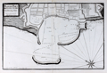 | Details | Ayrouard, Jacques | 1746 |
| Antique plan of the port of Civitavecchia, Italy |
|
Ayrouard, Jacques |
|
| 1746 |
| LOC:8 |
| $525.00 | Ayrouard--Jacques | Antique-plan-of-the-port-of-Civitavecchia--Italy | Plan of Civitavecchia, Italy also referred to as the "port of Rome", as it lies on the Tyrrhenian Sea, about 50 miles south of Rome. The antique chart is by Jacques Ayrouard (Marseilles ca. 1732- 1746) from a scarce atlas titled: "Recueil de Plusiers Plans des Ports et Rades et de Quelque Cartes Particulieres de la Mer Mediterranee". Identifies only a few features by name including "la Darce" or the old port, and significantly "les Chantiers des Galeres" or the boatyard where galleys were constructed and repaired.
<br></br>
In the attribution Ayrouard is described as "Pilot Real" or pilot of la Reale, the flagship of the French galley corps with a total complement of about 550 including 360 oarsmen and 100 soldiers. In their <i>Dictionnaire de la Marine</i> from 1702 Covens and Mortier explain: <div class="indenttextblock">"(Réale) is the name of the main galley of an independent kingdom, not of a tributary kingdom annexed to a greater one. The Réale, in France, is reserved for the general of the galleys and flies the royal ensign which distinguishes it from the others. This ensign is square in shape and red in colour, with golden fleurs-de-lys." <a href="http://www.ulmo.net/bateaux/reale/dico02.jpg" target="_blank"> (Internet)</a> </div>
Ayrouard was likely one of the last such pilots as the French Corps des Galeres was disbanded in 1748 and incorporated into the regular French sailing navy.
<br></br>
Little information exists on Ayrouard's background but like Henry Michelot, Ayrouard was a pilot of the French royal galley, the Reale, based in Marseille, France. However, Ayrouard's port plans and rare sea charts are very different from Michelot's earlier works. The much larger size (18"x11") and extensively shaded topography seen in this plan of Antibe are distinctive characteristics of Ayrouard's plans. Engraved by Louis Corne. Published with the royal privilege. |
| 1473 |  | Details | Ayrouard, Jacques | 1746 |
| Scarce antique port plan of Port-de-Bouc, France |
|
Ayrouard, Jacques |
|
| 1746 |
| LOC:8 |
| $300.00 | Ayrouard--Jacques | Scarce-antique-port-plan-of-Port-de-Bouc--France | Scarce antique French port chart for the town of Port-de-Bouc, France made by Jacques Ayrouard, at Marseilles, in 1746. No. 35.
<br></br>
In the attribution at bottom, Ayrouard is described as "Pilote Real", or pilot of la Reale, the flagship of the French galley corps with a total complement of about 550 including 360 oarsmen and 100 soldiers. In their <i>Dictionnaire de la Marine</i> from 1702 Covens and Mortier explain: <div class="indenttextblock">"(Réale) is the name of the main galley of an independent kingdom, not of a tributary kingdom annexed to a greater one. The Réale, in France, is reserved for the general of the galleys and flies the royal ensign which distinguishes it from the others. This ensign is square in shape and red in colour, with golden fleurs-de-lys." <a href="http://www.ulmo.net/bateaux/reale/dico02.jpg" target="_blank"> (Internet)</a> </div>
Ayrouard was likely one of the last such pilots as the French Corps des Galeres was disbanded in 1748 and incorporated into the regular French sailing navy. |
| 1328 | 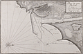 | Details | Ayrouard, Jacques | 1746 |
| Antique plan of the port of Cette, France (Sete) |
|
Ayrouard, Jacques |
|
| 1746 |
| LOC:8 |
| $600.00 | Ayrouard--Jacques | Antique-plan-of-the-port-of-Cette--France-(Sete) | Antique French Mediterranean port plan or chart for the town of <b>Sète, France</b> (Cette) in the southeast French region of Occitanie. This old port plan by Jacques Ayrouard (Marseilles ca. 1732- 1746) depicts the small port of Sète in 1733, likely on an earlier visit by Ayrouard. Of particular interest is that Sète is and was the Mediterranean terminus for the Canal Royal de Languedoc ( now the <b>Canal du Midi</b> ), opened in 1681. Shows the protective outer môle or jetty with a walkway and an inner jetty of rock. Wharves line docks where offshore sailing vessels would have had their cargos unloaded and trans-shipped through the canal in smaller shallow-draft barges. In the early 18th century French galleys may have traveled through the canal between their base in Marseilles and Bordeaux, St. Malo or Dunkirk. (Source: Chatelain, Henry. "Carte Generalle du Gouvernement Militaire de France")
<br></br>
The antique chart was published from Marseilles, France in a scarce atlas titled: "Recueil de Plusiers Plans des Ports et Rades et de Quelque Cartes Particulieres de la Mer Mediterranee".
<br></br>
In the attribution Ayrouard is described as "Pilot Real" or pilot of la Reale, the flagship of the French galley corps with a total complement of about 550 including 360 oarsmen and 100 soldiers. In their <i>Dictionnaire de la Marine</i> from 1702 Covens and Mortier explain: <div class="indenttextblock">"(Réale) is the name of the main galley of an independent kingdom, not of a tributary kingdom annexed to a greater one. The Réale, in France, is reserved for the general of the galleys and flies the royal ensign which distinguishes it from the others. This ensign is square in shape and red in colour, with golden fleurs-de-lys." <a href="http://www.ulmo.net/bateaux/reale/dico02.jpg" target="_blank"> (Internet)</a> </div> |
| 5191 |  | Details | Ayrouard, Jacques | 1746 |
| Plan du Port Hercule Porto Ercole Tuscany |
|
Ayrouard, Jacques |
|
| 1746 |
| LOC:9 |
| $450.00 | Ayrouard--Jacques | Plan-du-Port-Hercule-Porto-Ercole-Tuscany | Original antique nautical chart or plan of the town and harbor of Port Hercule (Porto Ercole), Italy by Jacques Ayrouard (Marseilles ca. 1732- 1746). The plan is from Ayrouard's scarce sea atlas titled: "Recueil de Plusiers Plans des Ports et Rades et de Quelque Cartes Particulieres de la Mer Méditerranée". This engraved plan is of the old port at Porto Ercole which is located on the eastern side of the Monte Argentario promontory in the province of Grosetto, in the Tuscany region.
<br></br>
Like Henry Michelot, Jacques Ayrouard was a pilot of the French royal galley, the Reale, based in Marseille. However, Ayrouard's port plans are very different from Michelot's earlier works. The much larger size (18"x11") and extensively shaded topography in this plan are distinctive characteristics of Ayrouard's nautical plans. Plate 29. <br> </br> |
| 4973 |  | Details | Ayrouard, Jacques | 1746 |
| Antique plan of Portoferraio Porto Ferraro Italy |
|
Ayrouard, Jacques |
|
| 1746 |
| LOC:0 |
| $425.00 | Ayrouard--Jacques | Antique-plan-of-Portoferraio-Porto-Ferraro-Italy | Fine copper-plate engraved 1746 antique port/harbor plan or chart of Porto Ferraro (Portoferraio), Italy by Jacques Ayrouard. Portoferraio is the largest city on the island of Elba, located in the Tyrrhenian Sea about 30 miles east of Corsica.
<br></br>
In the chart's attribution Ayrouard is described as "Pilot Real" or pilot of la Reale, the flagship of the French galley corps with a total complement of about 550 including 360 oarsmen and 100 soldiers. In their <i>Dictionnaire de la Marine</i> from 1702 Covens and Mortier explain: <div class="indenttextblock">"(Réale) is the name of the main galley of an independent kingdom, not of a tributary kingdom annexed to a greater one. The Réale, in France, is reserved for the general of the galleys and flies the royal ensign which distinguishes it from the others. This ensign is square in shape and red in colour, with golden fleurs-de-lys." <a href="http://www.ulmo.net/bateaux/reale/dico02.jpg" target="_blank"> (Internet)</a> </div>
Ayrouard was likely one of the last such pilots as the French Corps des Galeres was disbanded in 1748 and incorporated into the regular French sailing navy. Engraved by Louis Corne. |
| 543 | 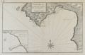 | Details | Ayrouard, Jacques | 1746 |
| Plan de la Baye et Port de Mayorque (Palma Majorca or Mallorca) |
|
Ayrouard, Jacques |
|
| 1746 |
| LOC:8 |
| $600.00 | Ayrouard--Jacques | Plan-de-la-Baye-et-Port-de-Mayorque-(Palma-Majorca-or-Mallorca) | Antique original engraved chart of the northwest portion of the island of Mallorca, Spain, the largest of the Balearic islands in the Mediterranean sea. Includes the capital city, Palma surrounded by a wall, and the Bay of Palma. Coverage extends from the "Cote de Solery" and Sa Dragonera (with two watchtowers shown) past the Bay of Palma to "Cap Blanc". A detailed inset includes the area at the harbor in Palma, "la mole", a jetty or breakwater where accoring to Ayrouard there was room to moor 5 galleys stern-first, as is still the custom in the Mediterranean: "en grande point, on peut y placer 5 galeres la poupe au mole en quatres amarres." <br><br/>
This rare chart by Jacques Ayrouard (Marseilles ca. 1730) comes from a scarce nautical atlas: "Recueil de Plusiers Plans des Ports et Rades et de Quelque Cartes Particulieres de la Mer Mediterranee". <br><br/>
Little information exists on Ayrouard's background but like <a style="color:#9BAFCB" rel="nofollow" href= "/MichelotBremondBackground.aspx">Henry Michelot </a> two decades earlier, Ayrouard was a pilot of the French royal galley, the Reale, based in Marseille. Ayrouard's port plans and charts are very different from Michelot's earlier works; the much larger size (17"x11") and the extensively shaded topography enable the viewer to easily recognize Ayrouard's plans. Large compass rose with fleur-de-lis. Plate 70 but manuscript notation at upper left reads "No. 69". |
| 6777 | 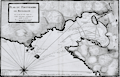 | Details | Ayrouard, Jacques | 1746 |
| Plan du Portvendre en Rousillon |
|
Ayrouard, Jacques |
|
| 1746 |
| LOC:8 |
| $375.00 | Ayrouard--Jacques | Plan-du-Portvendre-en-Rousillon | Fine original hydrographic port and harbor chart for Portvendre (Port-Vendres), France by Jacques Ayrouard (Marseilles ca. 1732- 1746). This antique copperplate engraving shows the town of Port-Vendres as it was in 1733 with the adjacent topography in great detail. Noted features include the Devil's Tower- "Tour de Diable", Fort de la Mauresque or "le Fort et le Fanal", "la Redoutte", the "Cote qui va a Cadequie" and "Cote qui va a Colioure., "le bourg", two other towers- "la masane" and "St. Elme", and the "maison du gouvernment". North is oriented to the bottom of the chart.
<br></br>
Ayrouard makes extensive use of depth soundings and variegated stippling for rough depth contour intervals and has laid down sight bearing lines from the above towers to other fixed objects to help mariners navigate the challenging entrance to Port-Vendres.
<br></br>
<div id="0" align="center">
<a title=""></a>
<img id="6777" src="/ZoomifyImages/SC_6777/SC_6777_detail_1.jpg" alt="Plan du Portvendre en Rousillon. A hydrographic port plan for Port-Vendres, Frances by Jacques Ayrouard. 1746." width="340"/> <br><br> <font size="-2">View of Port-Vendres, Frances by Ayrouard, 1746.</font>
</div><br>
Sourced from Ayrouard's scarce sea atlas: "Recueil de Plusiers Plans des Ports et Rades et de Quelque Cartes Particulieres de la Mer Méditerranée." Beautifully engraved by Louis Corne.
<br></br>
Ayrouard was a pilot of the French royal galley, the Reale, based in Marseille, France. The much larger size (18"x11") and extensively shaded topography in this plan are distinctive characteristics of Ayrouard's nautical port plans. Plate 68. <BR> </BR> |
| 62 |  | Details | Ayrouard, Jacques | 1746 |
| Plan de La Baye du Gourien et des Isles St. Marguerite |
|
Ayrouard, Jacques |
|
| 1746 |
| LOC:8 |
| $390.00 | Ayrouard--Jacques | Plan-de-La-Baye-du-Gourien-et-des-Isles-St--Marguerite | Scarce, antique nautical harbor plan / chart of the village of Cane' (Cannes) France on the French Riviera with the offshore Lerins Islands. On the largest of these islands, Ile Sainte-Marguerite, the Man in the Iron Mask was held prisoner during 1687-1698. This antique chart of the area around Cannes is by Jacques Ayrouard (Marseilles ca. 1732- 1746) from a scarce atlas titled: "Recueil de Plusiers Plans des Ports et Rades et de Quelque Cartes Particulieres de la Mer Méditerranée". <BR> </BR>
Interior areas shown with little structural detail, but do contain significant shading and hachuring to convey elevation details. Little information exists on Ayrouard's background but like Henry Michelot before him, Ayrouard was a pilot of the French royal galley, the Reale, based in Marseille. However, Ayrouard's port plans are very different from Michelot's earlier works. The much larger size (18"x11") and extensively shaded topography are distinctive characteristics of Ayrouard's charts. <BR> </BR>
On chain-laid paper. Large compass rose with fleur-de-lis. Plate 13. |
| 63 |  | Details | Ayrouard, Jacques | 1746 |
| Plan du Port d'Antibe |
|
Ayrouard, Jacques |
|
| 1746 |
| LOC:8 |
| $450.00 | Ayrouard--Jacques | Plan-du-Port-d-Antibe | Antique port / harbor plan of the northwest portion of the fortress at Antibe, France and the harbor including Fort Quare opposite to the north. Much detail about the Antibes breakwater and mole. Small inset in upper right containing a profile of the mole and fortifications as seen from the sea. This chart is by Jacques Ayrouard (Marseilles ca. 1732- 1746) from a scarce atlas titled: "Recueil de Plusiers Plans des Ports et Rades et de Quelque Cartes Particulieres de la Mer Méditerranée". <BR> </BR>
Little information exists on Ayrouard's background but like <a rel="nofollow" href= "/MichelotBremondBackground.aspx">Henry Michelot</a>, Ayrouard was a pilot of the French royal galley, the Reale, based in Marseille, France. However, Ayrouard's port plans and rare sea charts are very different from Michelot's earlier works. The much larger size (18"x11") and extensively shaded topography seen in this plan of Antibe are distinctive characteristics of Ayrouard's plans. Engraved by Louis Corne. Plate 15. <BR> </BR> |
| 3639 | 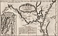 | Details | Bellin, Jacques Nicolas | 1747 |
| Scarce antique map of the Mississippi River |
|
Bellin, Jacques Nicolas |
|
| 1747 |
| LOC:10 |
| $800.00 | Bellin--Jacques-Nicolas | Scarce-antique-map-of-the-Mississippi-River | Bellin's fine map from 1747 focusing on the Red River and the Mississippi River. Full of interesting notes (in French) about the rivers, habitations, and native American tribes. Includes an inset of the area surrounding Fort St. Jean [Baptiste] a military post on the Red River in Natchitoches, Louisiana (founded by French Canadians in 1716). Shows the channel upstream of the fort was partially dammed by a tangle of uprooted trees.
<br></br>
Coverage extends southward along the Mississippi River almost as far as Baton Rouge.
<br></br>
French hydrographer Jacques Nicolas Bellin (1703-1772) was born in Paris and educated as an engineer. In 1741, Bellin became the first Ingénieur de la Marine of the Depot des cartes et plans de la Marine (the French Hydrographical Office) and was named Official Hydrographer of the French King. Bellin's largest and most comprehensive work is the Petit Atlas Maritime that covered the coasts and important port cities of the known world. |
| 569 | 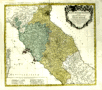 | Details | Homann Heirs | 1748 |
| Status Ecclesiastici Toscanae |
|
Homann Heirs |
|
| 1748 |
| LOC:66 |
| $290.00 | Homann-Heirs | Status-Ecclesiastici-Toscanae | Fine, large, hand-colored, copper-plate engraved antique map of Italy centered on Tuscany by the heirs of J. B. Homann. Includes Rome, Citavecchia, Ostia, Elba, Pisa, Ravenna, and the northern tip of Corsica. Leafy cartouche at top right decorated with the arms of Rome and Tuscany.
<br></br>
The map was published from Nuremberg, Germany in 1748 (dated at top).
<br></br>
Homann Heirs (also "Homannianis Heredibus" or "Homann Erben" or "Heritiers de Homann") was a company established after the death of the famous German cartographer Johann Baptist Homann to carry on the map publishing business of the firm he started in the early 1700's. The designation "Homann Heirs" appears on maps published by that successor firm from about 1730 to 1848. |
| 1323 | 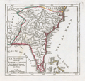 | Details | Vaugondy, Robert de | 1749 |
| Interesting antique map of Florida and the Carolinas |
|
Vaugondy, Robert de |
|
| 1749 |
| LOC:11 |
| $280.00 | Vaugondy--Robert-de | Interesting-antique-map-of-Florida-and-the-Carolinas | Attractive and fascinating map of south-eastern United States with "Virginie, Caroline, Louisiane, and Floride". Named features include Pensacola, the Bahama Islands, Cape Canaveral, St. Augustine, Saint Simons Island, Tybee Island, Savannah, Charleston, Cape Fear, and the "Montagnes de Apalaches". Florida is depicted as an archipelago of islands as some sources believed at the time. Published by the family of Robert Vaugondy in 1749.
<br></br>
This scarce map is an authentic French copper-plate engraving printed ca. 1749 on a larger 11" x 8.5 inch sheet of old chain-laid paper. |
| 402 |  | Details | Bellin, Jacques Nicolas | 1750 |
| Macao |
|
Bellin, Jacques Nicolas |
|
| 1750 |
| LOC:6 |
| $180.00 | Bellin--Jacques-Nicolas | Macao | Early chart of the port of Macao, China by Bellin ca. 1750. |
| 842 | 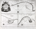 | Details | Collins, Greenvile | 1750 |
| Antique chart of coastal England with Bridlington, Scarborough and Hartlepoole |
|
Collins, Greenvile |
|
| 1750 |
| LOC:0 |
| $240.00 | Collins--Greenvile | Antique-chart-of-coastal-England-with-Bridlington--Scarborough-and-Hartlepoole | Three antique charts of ports on the Yorkshire and Durham coasts of England, including Bridlington ( Burlington ) , Scarborough and Hartlepoole. Coastal areas around these three English ports on the eastern coast of England were important to mid 18th century navigators. The approach to Bridlington in particular would have been particularly hazardous without an accurate chart because of an offshore sandbar ( "Smithick Sand" ) and the nearby promontory of Flamborough Head. The lighthouse shown at Flamborough Head was constructed in 1669 by Sir John Clayton. The current lighthouse dates to 1806.
<br></br>
Dedicated to Captain Ralph Sanderson. From one of the many editions of Greenville Collin's 'Great Britain's Coasting Pilot', published from 1693 to 1792. Number 37. |
| 528 |  | Details | Anonymous | 1750 |
| Smyrna |
|
Anonymous |
|
| 1750 |
| LOC:2 |
| $350.00 | Anonymous | Smyrna | Original etched view of Smyrna (Izmir) Turkey dating to about the mid 18th century. Foreground depicts European-style warships at anchor. Background shows several forts and a minaret. |
| 4701 | 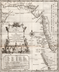 | Details | Bellin, Jacques Nicolas | 1750 |
| Antique map with Iran, India, and Yemen |
|
Bellin, Jacques Nicolas |
|
| 1750 |
| LOC:13 |
| $180.00 | Bellin--Jacques-Nicolas | Antique-map-with-Iran--India--and-Yemen | Attractive and highly decorative antique map of the Malabar coast of India, the Arabian Sea, and the coasts of Yemen, Iran, and Pakistan. Includes a good depiction of the Maldive Islands and the Laccadive Islands. Numerous noted locations include Surat, Bombay (Mumbai), Rajapor, Goa, Kalikoet (Calicut, now Kozhikode), Madura, and Cape Comorin.
<br></br>
Graphic title cartouche features a seahorse and a merman, with dragonfly-winged heads above. Legend at bottom left contains Dutch translations of many French geographical terms.
<br></br>
Re-engraved by von Schley after a French map by J.N. Bellin and published in Amsterdam in a Dutch edition of L'Histoire Generale des Voyages. Dutch title at bottom reads "Kaart van de Kusten van Persie, Guzaratte en Malabar…" |
| 4857 |  | Details | Bellin, Jacques Nicolas | 1750 |
| Antique engraved plan of Goa, India |
|
Bellin, Jacques Nicolas |
|
| 1750 |
| LOC:13 |
| $325.00 | Bellin--Jacques-Nicolas | Antique-engraved-plan-of-Goa--India | Fine mid eighteenth-century birds-eye view map (plan) of Goa and the Port of Goa, on the southwest coast of India, under Portuguese rule from 1510 to 1961. If you look carefully on the beach you can see two elephants, apparently used for heavy work at the docks and shipyard. A fine legend at right, in an elaborate title cartouche, names twenty-nine locations on the plan.
<br></br>
A fine view of Goa as it existed in 1607 by the prolific desk-cartographer J.N. Bellin. The plan is from the 1607 voyage of Admiral Paulus van Caerden, with the Dutch East India Company (VOC). From Prevost's 'Collection of Voyages'.
<br></br>
North is oriented to the bottom. Tome VIII No IX.
<br></br>
French hydrographer Jacques Nicolas Bellin (1703-1772) was born in Paris and educated as an engineer. In 1741, Bellin became the first Ingénieur de la Marine of the Depot des cartes et plans de la Marine (the French Hydrographical Office) and was named Official Hydrographer of the French King. Bellin's largest and most comprehensive work is the "Petit Atlas Maritime Recueil De Cartes et Plans Des Quatre Parties Du Monde Petit Atlas Maritime". |
| 3577 |  | Details | Anonymous | 1750 |
| MS 18th century hydrographic map of the Fayoum Region - Egypt - Arsinoe - Lake Moeris |
|
Anonymous |
|
| 1750 |
| LOC:0 |
| $17,000.00 | Anonymous | MS-18th-century-hydrographic-map-of-the-Fayoum-Region---Egypt---Arsinoe---Lake-Moeris | Rare detailed, unsigned French manuscript hydrographic map of the Fayoum region of Egypt “the Land of the Lake” with Lake Moeris (Qarun). With an elevation view and floor plan of a building considered to be the "Labyrinthe" mentioned by Herodotus. Ca. 1720 - 1750. Possibly the earliest map to focus on the Fayoum reqion.
<br></br>
This 18th century MS map locates archaeological sites and features the extensive network of rivers, streams, and canals that emptied into Lake Moeris from the Nile River via the Bahr Yusuf canal. Shows seven smaller canals from the Bahr Yusuf emptying into "Lake Moeris ou de Caron Nomne a presant Lac de la Corne". The hydrography and naming (ex. "Lac de la Corne", "Chateau de Caron") are similar to <a href="https://gallica.bnf.fr/ark:/12148/btv1b531002007/f1.item.zoom" target="_blank">Claude Sicard's map of Egypt</a> copied in MS by Guillaume Delisle in 1726.
<br></br>
The Fayoum (also Fayum, Faioum) region was once the center of the cult of Sobek, an Egyptian deity associated with the crocodile. Medinet el-Faiyum or Shedet was the ancient regional capital. The town was called "Crocodilopolis" by the Greeks (renamed Arsinoë by the Romans). Camels and crocodile are shown near the southwest shore of the lake with several pyramids, grottos, ruins, and Coptic Christian sites.
<br></br>
The map wrongly identifies the Ptolomaic temple at Qasr Qaroun as the Labyrinth described by Herodotus.
<br></br>
French explorers who first visted the Fayoum region include Paul Lucas (1714-17), Jomard (1800), P.D. Martin (1801), and Linant de Bellefonds (1821). By 1800 Edme-Francois Jomard in "Emplacement de l'ancien lac Moaris et du Labyrinthe dans le Fayoum d'après tous les Auteurs" had correctly determined that the site of the Labyrinth lay not at Qasr Qaroun, but rather at a mud-brick temple near Hawara. Our estimated date of this map to the 18th century rests on this timeline and on dates of other maps from the same purchase. |
| 943 | 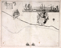 | Details | Collins, Greenvile | 1750 |
| Antique chart of the coast near Leith, Scotland |
|
Collins, Greenvile |
|
| 1750 |
| LOC:0 |
| $325.00 | Collins--Greenvile | Antique-chart-of-the-coast-near-Leith--Scotland | Antique chart of the city of <b>Leith, Scotland</b> (North and South Leith) and the surrounding coastline by <b>Greenville Collins</b>. With an attractive inset view "Prospect of Leith from the East" showing Leith Harbour, with square-rigged sailing ships anchored behind the pier. With one of the earliest available street plans of Leith, showing the bridge across the Water of Leith linking the two halves of the city. That bridge, originally built in the late 15th century, was demolished in 1780.
<br></br>
From one of the many editions of Greenville Collin's 'Great Britain's Coasting Pilot', published from 1693 to 1792. At top left angels hover holding a sheet on which is drawn a elevation view of a castle with three domed towers and three gates, each with a portcullis. Suggested by one writer to be a coat-of-arms, the actual meaning of the image is unkown. |
| 20 | 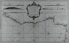 | Details | Bellin, Jacques Nicolas | 1750 |
| Carte Generale De La Coste De Guinee |
|
Bellin, Jacques Nicolas |
|
| 1750 |
| LOC:0 |
| $395.00 | Bellin--Jacques-Nicolas | Carte-Generale-De-La-Coste-De-Guinee | Large working antique nautical chart of African coast focusing on the Gulf of Guinea and Gulf of Benin. Six profile views of the coast of West Africa, just north of the equator. This chart was intended for service aboard French vessels as noted in the cartouche "Pour servir aux vaisseaux du Roy".<BR> </BR>
Large central cartouche framed by strapwork and floral flourishes. This nautical chart was published less than 40 years after the death of Louis XIV, the "sun king" by the Depot des Cartes et Plans de la Marine. |
| 653 | 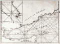 | Details | Anonymous | 1750 |
| Gulf of Aden and Yemen |
|
Anonymous |
|
| 1750 |
| LOC:0 |
| $375.00 | Anonymous | Gulf-of-Aden-and-Yemen | Uncommon anonymous mid-18th century British nautical chart labeled "Arabian Gulph". Includes the lower Red Sea, Gulf of Aden, Coast of Yemen, and the island of Socotra. Includes parts of the Somalian coast. Copperplate engraved working chart on chain laid paper with no watermark.
<br></br>
Lack of a title, authors name, or date makes the source of the chart hard to place but the style, English wording, and lack of a longitude scale is consistent with British charts published ca. 1740 - 1770. The missing title information or any form of attribution is in itself unusual, as during the period when this map was produced, publishers were only too happy to "borrow" other's works to be sold under their own name.
<br></br>
Noted geographical features include Mocha and Aden in Yemen, Zea Hill, Birim Island (I. Babel-Mandel ), The Eight Islands, Cabo St. Anthony, Black Point, The Asses Ear, Doffar, Bird Island, Berbera ( Barbara ), Cape Guardafui ( Guardafoy ) , Somalia and part of the Gulf of Tadjoura and Djibouti. We have been unable to locate another example of this chart.
<br></br>
Plate 2. |
| 1287 | 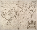 | Details | Collins, Greenvile | 1750 |
| Antique Chart of the Shetland Islands |
|
Collins, Greenvile |
|
| 1750 |
| LOC:0 |
| $240.00 | Collins--Greenvile | Antique-Chart-of-the-Shetland-Islands | Antique sea chart of the eastern portion of the <b>Shetland island of the "Mainland"</b>, a part of Scotland. Includes the islands of Bressay (Brassey) and Noss (Nos). Noted are the villages of Lerwick, Heoghan, Laxford and many more.
<br></br>
Decorative antique eighteenth century copperplate nautical sea chart, printed on thick paper ca. 1750. Attribution for engraving at bottom left to "H. Moll"- Herman Moll.
<br></br>
From Captain Greenville or Greenvile Collins "Great Britain's Coasting Pilot: being a new and exact survey of the sea-coast of England and Scotland from the river of Thames to the westward and northward ...".
<br></br>
Greenville Collins was an officer of the Royal Navy and prominent hydrographer who was commissioned by King Charles II in 1676 and appointed by Samuel Pepys to chart the coasts of Great Britain. The resulting atlas - Great Britain's Coasting Pilot - was the first original sea atlas to be produced by an Englishman. |
| 1316 | 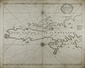 | Details | Collins, Greenvile | 1750 |
| Antique Chart of the South Shetland Islands |
|
Collins, Greenvile |
|
| 1750 |
| LOC:0 |
| $240.00 | Collins--Greenvile | Antique-Chart-of-the-South-Shetland-Islands | Old engraved antique sea chart of the southern portion of the <b>Shetland Islands</b>, a part of Scotland. Includes the islands of Tronzo, Nebra, West Buro, Bressay (Brassey) and Noss (Nos). Inset chart of Catford Roe with soundings and anchorages noted.
<br></br>
A decorative antique eighteenth century copperplate nautical sea chart, with an authentic sea-worn appearance, printed on thick paper ca. 1750.
<br></br>
From Captain Greenville or Greenvile Collins "Great Britain's Coasting Pilot: being a new and exact survey of the sea-coast of England and Scotland from the river of Thames to the westward and northward ...".
<br></br>
Greenville Collins was an officer of the Royal Navy and prominent hydrographer who was commissioned by King Charles II in 1676 and appointed by Samuel Pepys to chart the coasts of Great Britain. The resulting atlas - Great Britain's Coasting Pilot - was the first original sea atlas to be produced by an Englishman. |
| 1354 | 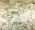 | Details | Collins, Greenvile | 1750 |
| Antique Chart of the Chief Ports of the British Isles |
|
Collins, Greenvile |
|
| 1750 |
| LOC:64 |
| $180.00 | Collins--Greenvile | Antique-Chart-of-the-Chief-Ports-of-the-British-Isles | Antique nautical chart by Collins of seven key ports and harbors in England. These important English locations were dominated by the <b>Thames River</b> with Greenwich, Deptford, and finally upriver- London. Other insets are included for:
<div class="indenttextblock">
<ul style="list-style-type: circle;">
<li>Isle of Wight and Portsmouth</li>
<li>Plimouth Sound [Plymouth]</li>
<li>Portland Bill</li>
<li>Road and Harbour of Dartmouth</li>
<li>Falmouth Harbour</li>
</ul>
</div>
An attractive eighteenth-century engraved nautical chart, with an authentic sea-worn appearance, printed ca. 1750.
<br></br>
From Captain Greenville or Greenvile Collins "Great Britain's Coasting Pilot: being a new and exact survey of the sea-coast of England and Scotland from the river of Thames to the westward and northward ...".
<br></br> |
| 825 |  | Details | Collins, Greenvile | 1750 |
| Antique nautical chart of the Orkney Islands |
|
Collins, Greenvile |
|
| 1750 |
| LOC:57 |
| $550.00 | Collins--Greenvile | Antique-nautical-chart-of-the-Orkney-Islands | Antique sea chart of the North Sea, the Orkney Islands, Wide Firth, Hoy Sound and Deer Sound. The islands shown on this scarce, old British chart include parts of the Mainland ("Pomona"), Shapinsay, Gairsay, Wyre, Egilsay, and Rousay. With 5 coastal elevation views including: Copinsha to Mulhead; Faire Isle; the Maiden Papps of of Carness; Dunkins Bay Head.
<br></br>
Title cartouche on this decorative chart of the Orkneys is held up by a pair of fierce sea eagles clutching a rag between their beaks. <div class="indenttextblock">Sea eagles have a long history in Orkney. The Bronze Age burial tomb at Isbister, South Ronaldsay (the ‘Tomb of the Eagles’) famously contains their bones, while a Pictish symbol stone found at the Knowe of Burrian, Harray, features a beautifully carved bird.
<br></br>
Sea eagles became extinct across the UK in the early 19th century due to combination of widespread habitat loss and human persecution, with the last bird shot in Shetland in 1918. (<b>Sea Eagles Nest in Orkney after 142-year Absence</b>". Royal Society for the Protection of Birds. <a href="http://www.rspb.org.uk/community/placestovisit/orkney/b/orkney-blog/archive/2015/04/16/sea-eagles-nest-in-orkney-after-142-year-absence.aspx">Internet.</a> June 19, 2015)</div>
</br>
Date in the title cartouche was largely erased from the copper engraving plate but remains faintly visible as 1688. This sheet is probably a later edition (estimated 1750), explaining the erasure. From one of the many editions of Greenville Collin's 'Great Britain's Coasting Pilot', published from 1693 to 1792. |
| 116 |  | Details | Collins, Greenvile | 1750 |
| How the Several Lands Show at Sea |
|
Collins, Greenvile |
|
| 1750 |
| LOC:0 |
| $135.00 | Collins--Greenvile | How-the-Several-Lands-Show-at-Sea | Antique nautical profile views of English coast including Beachy Head, Portland, Isle of Wight, Dartmouth, and Milford. This scarce nautical engraving accompanied other nautical charts from one of the many editions of Great Britain's Coasting Pilot by Greenville Collins. |
| 262 | 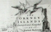 | Details | Mackenzie, Murdoch (Senior) | 1750 |
| Survey of the Orkney and Lewis Islands. (Atlas of 8 folio plates) |
|
Mackenzie, Murdoch (Senior) |
|
| 1750 |
| LOC:0 |
| $8,600.00 | Mackenzie--Murdoch-(Senior) | Survey-of-the-Orkney-and-Lewis-Islands--(Atlas-of-8-folio-plates) | This important, intact, and scarce folio-sized antique atlas of 8 plates is a landmark in cartography by Orkney native Murdoch Mackenzie Senior (1712 - 1797). This antique nautical atlas of the Orkney Islands, published in 1750 is Mackenzie's first published work and is considered to be the most accurate survey in Britain up to the mid 18th century. </br> </br>
<strong><a style="color:#9BAFCB" href= "/MackenzieAtlasViewer.aspx">[ Browse the entire atlas ]</a></strong> </br> </br>
In 1962 A.G.W. Robinson wrote about the unique characteristics of Mackenzie's first charts: "Some of the conventions he adopted, for example showing bottom deposits by a letter under the relevant sounding, are still in use on present day charts."
<br></br>
Contents include Title Page, Subscriber list, A 14 page History of the Orkneys, 8 charts of the Orkneys, Pomona, and the Lewis.
<br></br>
Reference: Robinson, A.H.W. 'Marine Cartography in Britain'. Leicester University Press. 1962. pp. 60-70. |
| 3631 |  | Details | Anville, Jean Baptiste Bourguignon d' | 1751 |
| Mid eighteenth-century French map of the Province of Quito |
|
Anville, Jean Baptiste Bourguignon d' |
|
| 1751 |
| LOC:88 |
| $350.00 | Anville--Jean-Baptiste-Bourguignon-d- | Mid-eighteenth-century-French-map-of-the-Province-of-Quito | Fine example of the single sheet version of Pedro Vicente Maldonado's map of the Province of Quito, one of the most important regional maps of South America published in the 18th Century. Includes the triangular network of survey lines la Condamine utilized in his survey.
<br></br>
The map is a reduced version of Maldonado's 4 sheet map published in Paris in 1750. This single sheet version was incorporated in La Condamine's authoritative account of the Spanish-French Geodesic Mission to the area, often referred to as the "la Condamine expedition".
<br></br>
This map was drawn by Jean-Baptiste Bourguinon d'Anville, one of the most celebrated French cartographers, and engraved by Guillaume Delahaye. This map was commissioned by Mr. de la Condamine to be included in his Journal du voyage fait par ordre du roi à l'équateur, servant d'introduction historique à la 'Mesure des trois premiers degrés du méridien', which was published in Paris by l'Imprimerie Royale in 1751.
<br></br>
Focused on what is today Ecuador, the map extends from Jaen on the Rio Maranon in what is now northern Peru, all the way northwards to Popayan (Colombia), and runs from the Pacific coast over the Andes to include the upper reaches of the Amazon Basin. Includes important cities such as Quito, Guayaquil, Cuenca, Popayan and Esmereldas. This vast area was one of the most challenging in the world to map, as it included thousands of square miles of coastal plains, volcanic peaks, and swamps. |
| 4694 |  | Details | Anville, Jean Baptiste Bourguignon d' | 1752 |
| Carte De La Louisiane |
|
Anville, Jean Baptiste Bourguignon d' |
|
| 1752 |
| LOC:53 |
| $1,250.00 | Anville--Jean-Baptiste-Bourguignon-d- | Carte-De-La-Louisiane | Large, scarce antique map by d'Anville of the lower Mississippi, the Arkansas, the Red, the Osage, and lower Missouri rivers as well as much of the coast bordering on the Gulf of Mexico. States included in this copperplate-engraved French antique map are Texas, Louisiana, Mississippi, Alabama and Florida.
<br></br>
Large inset map of the Mississippi River system including the Illinois and Missouri Rivers with several French forts. Identifies locations of numerous native American Indian settlements including the Metchigamias, Caskakias, Osage, Kansez, Tapouchas, Chacchoumas, and Petits Akansas. The town of St. Louis, Missouri, not founded until 1763, is not shown but two references to the Cahokia Indians including an "Ancien Village des Caho." are identified.
<br></br>
This two-sheet map is sometimes found in separate sheets but here both sheets are joined together resulting in a large 37" wide image.
<br></br>
Points of interest include New Orleans, Pascagoula, Mobile, and Pensacola Bay (Baye de Ste. Marie de Galbes), and St. Josephs Bay. |
| 1109 |  | Details | Anville, Jean Baptiste Bourguignon d' | 1752 |
| Partie Superieur de la Louisiane |
|
Anville, Jean Baptiste Bourguignon d' |
|
| 1752 |
| LOC:10 |
| $315.00 | Anville--Jean-Baptiste-Bourguignon-d- | Partie-Superieur-de-la-Louisiane | The east-most sheet of d'Anville's two-sheet map of the Texas, Louisiana, and Florida Gulf Coast. This sheet would have been joined to the western sheet to provide a complete map- "Carte de la Louisiane".
<br></br>
Coverage on this sheet extends from the Perdido River past Pensacola, Pensacola Bay ( Baye de St, Marie de Galbes ) Santa Rosa ( Sainte-Rose ) Island, St. Andrew Bay ( Baye de St. Andre ) and terminates just past Cape San Blas ( Cabo Escondido ) at the Appalachicola River. Includes part of the Alabama River ( Rio des Alibamons ) with Fort Toulouse (North of Montgomery, Alabama).
<br></br>
Large inset map of the Mississippi River system including the Illinois and Missouri Rivers with several french forts. Identifies locations of numerous native American Indian settlements including the Metchigamias, Caskakias, Osage, Kansez, Tapouchas, Chacchoumas, and Petits Akansas. The town of St. Louis, Missouri, not founded until 1763, is not shown but two references to the Cahokia Indians including an "Ancien Village des Caho." are identified. |
| 3634 |  | Details | Buache, Philippe | 1753 |
| Antique maps of the Seine River |
|
Buache, Philippe |
|
| 1753 |
| LOC:77 |
| $325.00 | Buache--Philippe | Antique-maps-of-the-Seine-River | Two informative mid eighteenth-century maps of the Seine River on one sheet. The smaller-scale main map covers the Seine's course from Paris, past numerous tributaries, past Pistres (modern Pîtres), to Pont de l'Arche. The bridge at Pont de l'Arche was erected in the 9th century by Charles the Bald who believed that a fortified bridge in that location would prevent Viking longships from sailing upriver.
<br></br>
A larger inset map at larger scale shows the river flowing from Pistres, with a "Palais Royal" to Rouen with greater detail given to the topography and to depictions of the many islands inhabiting the river. Of particular interest is L'île aux Boeufs (then Isle de Oissel).
<br></br>
Verso is blank. From Memoire de l'Academy Vol 20. Page 109. By Philippe Buache, Member of the Academy of Sciences and "Premier Geographe du Roi".<br> |
| 1065 |  | Details | van Keulen, Johannes | 1753 |
| Scarce Dutch Chart of Kayalpatnam, India |
|
van Keulen, Johannes |
|
| 1753 |
| LOC:6 |
| $350.00 | van-Keulen--Johannes | Scarce-Dutch-Chart-of-Kayalpatnam--India | Scarce antique "secret" coastal chart of "Cayl" ( Kayalpatnam ) on the Gulf of Mannar, near the southern end of the Coromandel Coast (Tamil Nadu) that had long been prosperous from maritime trade and pearl fishing. The area was conquered by the Portuguese in 1548, and taken over by the VOC in 1658. Prior to that time Kayal is referred to in Marco Polo's travel diaries dating to 1250 AD. Kayal was an important trading port dating to the 1st century A.D.
<br></br>
The chart identifies Dutch settlements / churches in the area of <b>Kayalpatnam</b>: Warande Patnam, Ould Cayl, Tolhuys, and Groote Kerk van Pt. Cayl, several topped by the Dutch flag. Insert elevation view facing west of the coast line. The seas feature detailed nautical information, including bathymetric soundings and the locations of sandbars and other navigation hazards.
<br></br>
From the sixth part of van Keuelen's "<b>de Nieuwe Groote Lichtende Zee-Fakkel</b>" based on secret charts of the <b>Dutch East India Company</b> (Vereenigde Oost-Indische Compagnie or <b>VOC</b>). Prior to the mid-18th century these charts were only disseminated in manuscript to safeguard what the VOC considerd to be proprietary trade secrets. The Dutch East India Company was the dominant trade force in Asia for nearly 200 years.
<br></br>
Bears the attribution at bottom: "In't ligt gebragt door Joannes van Keulen". |
| 1086 | 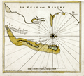 | Details | van Keulen, Johannes | 1753 |
| Scarce Dutch Chart of Tuticorin, India |
|
van Keulen, Johannes |
|
| 1753 |
| LOC:6 |
| $350.00 | van-Keulen--Johannes | Scarce-Dutch-Chart-of-Tuticorin--India | Scarce Dutch Chart of Tuticorin, India on the Gulf of Mannar, India by Johannes van Keulen from 1753. |
| 1085 | 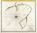 | Details | van Keulen, Johannes | 1753 |
| Scarce Dutch Chart of Phan Rang Bay, Vietnam |
|
van Keulen, Johannes |
|
| 1753 |
| LOC:6 |
| $350.00 | van-Keulen--Johannes | Scarce-Dutch-Chart-of-Phan-Rang-Bay--Vietnam | Scarce "secret" coastal chart of the Bay of Padaran ( vinh Phan Rang ) on the East Sea, north of Cape Padaran and just south of Cam Ranh Bay in Vietnam. Near the center of the chart a river, today's "Song Cai Phan Rang", empties into the bay. Located on the bay today is the city of Phan Rang–Tháp Chàm, also called Panduranga. Oriented with west at the top.
<br></br>
Keulen provides very little interior detail around this Vietnamese bay other than a few palm trees and some low mountains. The seas feature detailed hydrographic data, including depth soundings and the locations of sandbars and other navigation hazards. Two suggested anchorages are noted for VOC vessels, each for a specific wind direction: "Noorder Mouson" and "Zuyder Mouson".
<br></br>
From the sixth part of van Keulen's "<b>de Nieuwe Groote Lichtende Zee-Fakkel</b>" based on secret charts of the <b>Dutch East India Company</b> (Vereenigde Oost-Indische Compagnie or <b>VOC</b>). Prior to the mid-18th century these charts were only disseminated in manuscript to safeguard what the VOC considered to be proprietary trade secrets. The Dutch East India Company was the dominant trade force in Asia for nearly 200 years.
<br></br>
Bears the attribution at bottom: "By Joannes van Keulen". |
| 1415 |  | Details | Bellin, Jacques Nicolas | 1753 |
| Antique Colonial-era Plan of the French Quarter in New Orleans, Louisiana |
|
Bellin, Jacques Nicolas |
|
| 1753 |
| LOC:3 |
| $600.00 | Bellin--Jacques-Nicolas | Antique-Colonial-era-Plan-of-the-French-Quarter-in-New-Orleans--Louisiana | Antique French plan of the city of New Orleans, Louisiana ("la Nouvelle Orleans") from the period of French colonization ca. 1753. This antique city plan of New Orleans by Nicolas Bellin was based on a manuscript map created by Pauger approximately 15 years after the city was founded on the east bank of the Mississippi river.
<BR> </BR>
Bellin's plan shows the city laid out with French Quarter streets most residents would recognize today including Bienville, Bourbon, Chartres, Royale and at the center of the plan- Jackson Square. Note the spelling of the Mississippi River below the town with one "P" as "Fleuve Mississipi".
<BR> </BR>
On this old uncolored, copper-plate engraved map nineteen key points within the city are keyed to a legend on the map just below the title. These important locations within early New Orleans include:
<div class="indenttextblock">
<ul style="list-style-type: circle;">
<li>Prisons</li>
<li>Place d'Armes (today's Jackson Square)</li>
<li> l'Eglise Paroissiale (parish church)</li>
<li>Poudriere (powder magazine)</li>
<li>Magasins du Roi (Royal stores)</li>
<li>Nouvelle Maison du Urselines (or new home for the Ursuline nuns, an important force in early New Orleans)</li>
<li>Forges du Roi (the King's forge or metalworking shop)</li>
<li>Moulin a vent et a Cheval (a mill operated by the wind and horse )</li>
</ul>
</div>
The plan is based on a design initially created by military engineers Adrien de Pauger and Le Blond de la Tour in 1722. That plan envisoned a street grid extending six blocks northward from the Mississippi River, a plan that was likely scaled back in 1729 as a result of the Natchez Indian massacre of settlers at Fort Rosalie near Natchez Mississippi. At that point security became paramount, reflected in some of the other features found in Bellin's plan: guardhouses, a powder magazine, and a single bridge controlling access across the moat to the city. Plate number 19. |
| 1193 |  | Details | Bellin, Jacques Nicolas | 1753 |
| Plan de la Nouvelle Orleans (3) |
|
Bellin, Jacques Nicolas |
|
| 1753 |
| LOC:3 |
| $700.00 | Bellin--Jacques-Nicolas | Plan-de-la-Nouvelle-Orleans-(3) | Antique French plan of the city of New Orleans, Louisiana ("la Nouvelle Orleans") from the period of French colonization ca. 1753. This antique city plan of New Orleans was based on a manuscript map created approximately 25 years after the city was founded on the east bank of the Mississippi river. This neat hand-colored, copper-plate engraved map shows the city laid out with French Quarter streets most residents would recognize today including Bienville, Bourbon, Chartres, Royale and at the center of the plan- Jackson Square. Note the spelling of Mississippi below the town with one "P" as "Fleuve Mississipi".
<BR> </BR>
Nineteen key points within the city are keyed to a legend on the map just below the title. These key points within early New Orleans include:
<div class="indenttextblock">
<ul style="list-style-type: circle;">
<li>Prisons</li>
<li>Place d'Armes (today's Jackson Square)</li>
<li> l'Eglise Paroissiale (parish church)</li>
<li>Poudriere (powder magazine)</li>
<li>Magasins du Roi (Royal stores)</li>
<li>Nouvelle Maison du Urselines (or new home for the Ursuline nuns, an important force in early New Orleans)</li>
<li>Forges du Roi (the King's forge or metalworking shop)</li>
<li>Moulin a vent et a Cheval (a mill operated by the wind and horse )</li>
</ul>
</div>
Interestingly, what appears to be a defensive wall around the city is labeled "fosse' plein d'eau". Fosse' is French for "canal". Therefore, even at this relatively early point in its history New Orleans, Louisiana had a canal originating in the vicinity of today's Canal Street. An opening for a gate labeled "St. Jean" would have allowed access to a road leading to Bayou St. John, then an important route to points East. Plate number 19. |
| 864 | 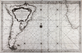 | Details | Bellin, Jacques Nicolas | 1753 |
| Carte Reduite de l'Ocean Meridional |
|
Bellin, Jacques Nicolas |
|
| 1753 |
| LOC:51 |
| $555.00 | Bellin--Jacques-Nicolas | Carte-Reduite-de-l-Ocean-Meridional | Antique French nautical chart of the southern Atlantic Ocean with most of the South American continent and southwest Africa. Features the full extent of the Amazon River, likely based on the exploration by French explorer Charles Marie de La Condamine. Condamine led the first scientific exploration of the Amazon River in 1743, publishing his results with a map of the Amazon in the memoirs of the French Académie des Sciences in 1745. Large decorative title cartouche dedicates the chart to M. Rouille, Minister and Sceretary of State to the French Department de Marine.
<br></br>
The Falkland Islands, off the east coast of Patagonia, are described as "Isle Nouvelles". In this chart East and West Falkland Islands are conjoined and the far west coastline is not defined. This reflects the fact that the island group was not discovered until 1690 and the town of Port Louis was not settled until Louis de Bougainville established it as the first French settlement on the island in 1764.
<br></br>
Published by Bellin with the title of "Ingeneur de la Marine" from Paris at "Rue de Doyenne pre la Rue St. Thomas du Louvre". At that time although Bellin had a relationship with the French Depot de la Marine he also published charts privately under his own name. |
| 1295 | 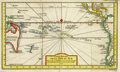 | Details | Bellin, Jacques Nicolas | 1753 |
| Antique South Pacific map with oddly-shaped Australia |
|
Bellin, Jacques Nicolas |
|
| 1753 |
| LOC:6 |
| $600.00 | Bellin--Jacques-Nicolas | Antique-South-Pacific-map-with-oddly-shaped-Australia | Fine 18th-century antique French map of the South Pacific showing recent discoveries as of mid century: Australia's posited eastern coastline is virtually featureless, running from New Guinea to Tasmania without a break. Only a small section of the western coast New Zealand is marked, the rest unknown. The Americas are shown from Baja California through Central America and the western coastline of South America including the Straits of Magellan and Cape Horn.
<br></br>
Published in a French edition of L'Abbe Prevost's "Histoire Générale des Voyages", less than twenty years before Captain Cook's famous voyage. |
| 2533 |  | Details | Bellin, Jacques Nicolas | 1753 |
| Antique Map of Sri Lanka |
|
Bellin, Jacques Nicolas |
|
| 1753 |
| LOC:6 |
| $350.00 | Bellin--Jacques-Nicolas | Antique-Map-of-Sri-Lanka | A fine antique map Sri Lanka (Ceylon or Ceylan), an island country in South Asia, located to the southwest of the Bay of Bengal and to the southeast of the Arabian Sea. Sri Lanka is separated from the Indian subcontinent by the Gulf of Mannar and the Palk Strait. Historically, Sri Lanka's geographic location and deep harbours made it of great strategic importance from the time of the ancient Silk Road through to the modern Maritime Silk Road.
<br></br>
Published in a French edition of L'Abbe Prevost's "Histoire Générale des Voyages", less than twenty years before Captain Cook's famous voyage. |
| 1173 | 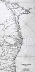 | Details | Anville, Jean Baptiste Bourguignon d' | 1753 |
| Antique Chart of The Coromandel Coast of India |
|
Anville, Jean Baptiste Bourguignon d' |
|
| 1753 |
| LOC:0 |
| $300.00 | Anville--Jean-Baptiste-Bourguignon-d- | Antique-Chart-of-The-Coromandel-Coast-of-India | Fine large antique French sea chart of India's Coromandel coast, the southeastern coastal region of the Indian Subcontinent, between the Eastern Ghats and the Bay of Bengal of the Indian Ocean. |
| 5135 |  | Details | Prevost, Antoine-Francois | 1753 |
| Histoire générale des voyages tome onzième v 11 |
|
Prevost, Antoine-Francois |
|
| 1753 |
| LOC:2001 |
| $1,750.00 | Prevost--Antoine-Francois | Histoire-générale-des-voyages-tome-onzième-v-11 | Volume 11 of Prevost's history of voyages to the south sea. Contains accounts of the explorations of Narborough, Wood, Anson, Dampier, Carieri and others. Plates of unusual animals and six plates of botannicals with copper-engraved maps as below. <b>Includes two very desirable, foundational maps of Australia</b> with the continent shown attached to Tasmania:
<div class="indenttextblocksingle">
<ul style="list-style-type: circle;">
<li>"Carte reduite des Terres Australes pour servir …" by Nicolas Bellin. 1753. (11" x 8"). Very good.</li>
<li>"Carte reduite de la Mer du Sud pour servir ..." by Nicolas Bellin. 1753. (14" x 8"). Good. </li>
</ul>
</div>
French text. Volume 11- tome onzième. Second Partie. "Histoire Generale des voyages, ou nouvelle collection de toutes les relations de voyages par mer et par Terre, qui ont ete publiees jusqu'a present dans les differentes langues de toutes les nations connue …". Published by Didot from Paris in 1753.
<br></br>
Contents include but are not limited to these plates:
<div class="indenttextblocksingle">
<ul style="list-style-type: circle;">
<li>Carte reduite de la partie la plus meridionale de l'Amerique No. 1</li>
<li>Carte reduite du Detroit de Magellan No. 2</li>
<li>Carte de l'Isle de Caienne No. 3</li>
<li>La Ville de Cayenne No. 4</li>
<li>Carte du Detroit de le Maire No. 5</li>
<li>Carte particuliere de l'Isle de Juan Fernandez No. 6</li>
<li>Coste du Nord Est de l'Isle de Juan Fernandez No. 7</li>
<li><b>Carte reduite des Terres Australes No. 8</b></li>
<li><b>Carte reduite de la Mer du Sud No. 9</b></li>
<li><b>Representation du cours ordinaires des vents … Mer du Sud</b> No. 10</li>
<li>Vue de la Place de Juan Fernandez No. 13</li>
<li>Batiment leger des Isles de Larrons No. 14</li>
</ul>
</div> |
| 1087 |  | Details | van Keulen, Johannes | 1753 |
| Scarce Dutch Chart of Cosmoledo Atoll, Seychelles |
|
van Keulen, Johannes |
|
| 1753 |
| LOC:6 |
| $275.00 | van-Keulen--Johannes | Scarce-Dutch-Chart-of--Cosmoledo-Atoll--Seychelles | Rare antique "secret" chart of the raised coral atoll of <b>Cosmoledo</b> of the Aldabra Group, belonging to the Outer Islands of the Seychelles. The name Cosmoledo is said to honor a Portuguese navigator, who was part of Juan de Nova's crew. De Nova was a Galician explorer of the Atlantic and Indian Oceans at the service of Portugal. He is credited as the discoverer of Ascension and Saint Helena islands.
<br></br>
The chart is very sparse showing only a thin circle of land ringing the atoll with five palm trees and a related few notes. No soundings .
<br></br>
From the sixth part of van Keuelen's "<b>de Nieuwe Groote Lichtende Zee-Fakkel</b>" based on secret charts of the <b>Dutch East India Company</b> (Vereenigde Oost-Indische Compagnie or <b>VOC</b>). Prior to the mid-18th century these charts were only disseminated in manuscript to safeguard what the VOC considered to be its proprietary trade secrets. The Dutch East India Company was the dominant trade force in Asia for nearly 200 years.
<br></br>
Bears the attribution at bottom: "In't ligt gebragt door Joannes van Keulen". |
| 1396 |  | Details | Bellin, Jacques Nicolas | 1754 |
| Caribbean Antique Map with Hispaniola (Hayti), Porto Rico, Jamaica |
|
Bellin, Jacques Nicolas |
|
| 1754 |
| LOC:0 |
| $285.00 | Bellin--Jacques-Nicolas | Caribbean-Antique-Map-with-Hispaniola-(Hayti)--Porto-Rico--Jamaica | Matted and framed.
<br></br>
Original mid 18th-century French map of Caribbean islands centered on the island of Hispaniola with Haiti and Santo Domingo by Nicolas Bellin. The island of Hayti ( Haiti ) is shown divided into the five pre-Columbian cacicazgos, or Taino kingdoms. Puerto Rico is named I. Boriquen or S. Jean Baptiste. Nearly all of Jamaica is shown, as well as the eastern half of Cuba, the Turks and Caicos islands, and the Bahamas as far north as Cat Island.
<br></br>
Size with frame 18" x 15".
<br></br>
Published in a French edition of L'Abbe Prevost's "Histoire Générale des Voyages". Tome 12, No. 1. |
| 1402 |  | Details | Bellin, Jacques Nicolas | 1754 |
| Antique Pre-Columbian Plan of Mexico City |
|
Bellin, Jacques Nicolas |
|
| 1754 |
| LOC: |
| $300.00 | Bellin--Jacques-Nicolas | Antique-Pre-Columbian-Plan-of-Mexico-City | Early French map of the Valley of Mexico and Mexico City. Shows Mexico City or Tenochtitlán, the island capital of the Aztec state, as it was when encountered by Spanish conquistador Hernán Cortés in 1521. In the copper-plate engraved image Tenochtitlán is located near the southwest end of the "Lac de Mexico" or Lake Texcoco. Tenochtitlán was connected to the Valley of Mexico via several causeways. Includes the larger cities of Pachuca, Tezcuco, Chalco. No mention of Teotihuacan. By French cartographer Nicolas Bellin.
<br></br>
Framed and matted meaures 12" W x 14" H.
<br></br>
Tenochtitlan was largely destroyed by Cortés after a siege in 1521, and modern-day Mexico City now lies over much of its remains.
<br></br>
Published in a French edition of L'Abbe Prevost's "Histoire Générale des Voyages". Tome 12, No. 10. |
| 5213 | 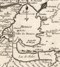 | Details | Bellin, Jacques Nicolas | 1754 |
| Antique plan of Mexico City with Lake Texcoco Cortez Moctezuma |
|
Bellin, Jacques Nicolas |
|
| 1754 |
| LOC:77 |
| $250.00 | Bellin--Jacques-Nicolas | Antique-plan-of-Mexico-City-with-Lake-Texcoco-Cortez-Moctezuma | Original engraved French map of the Valley of Mexico and Mexico City as it was when encountered by Spanish conquistador Hernán Cortés in 1521. Shows Mexico City or Tenochtitlán, the island capital of the Aztec state. In this copper-plate engraved image Tenochtitlán is located near the southwest end of the "Lac de Mexico" or Lake Texcoco. Tenochtitlán was connected to the Valley of Mexico via several causeways. Includes the larger cities of Pachuca, Tezcuco, Chalco. Tenochtitlan was largely destroyed by Cortés after a siege in 1521, and modern-day Mexico City now lies over much of its remains.
<br></br>
By Jacques Bellin. Published in a French edition of L'Abbe Prevost's "Histoire Générale des Voyages". Tome 2 No. 5. |
| 1401 | 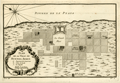 | Details | Bellin, Jacques Nicolas | 1754 |
| Antique plan of Buenos Aires, Argentina |
|
Bellin, Jacques Nicolas |
|
| 1754 |
| LOC:5 |
| $200.00 | Bellin--Jacques-Nicolas | Antique-plan-of-Buenos-Aires--Argentina | Early French map or plan of Buenos Aires, Argentina along the western shore of the estuary of the Plate River (Rio de la Plata) in South America. By important French cartographer Nicolas Bellin. North is oriented to the upper left. Named features on this early colonial-period map include:
<div class="indenttextblock">
<ul style="list-style-type: circle;">
<li>Maison de Ville</li>
<li>Le Fort containing the governor's lodgings, the chapel, and guard's quarters.</li>
<li>Convent de la Merci</li>
<li>l'Hopital</li>
<li>Convent de S. Domingue</li>
<li>Maison des Jesuites</li>
<li>Maison de l'Eveque</li>
<li>Eglise de St. Jean hors de la Ville</li>
</ul>
</div>
Published in a French edition of L'Abbe Prevost's "Histoire Générale des Voyages". Tome 14, No. 2. |
| 3659 | 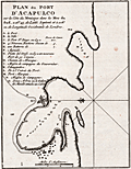 | Details | Bellin, Jacques Nicolas | 1754 |
| Antique port plan of Acapulco, Mexico |
|
Bellin, Jacques Nicolas |
|
| 1754 |
| LOC:77 |
| $185.00 | Bellin--Jacques-Nicolas | Antique-port-plan-of-Acapulco--Mexico | J.N. Bellin's neat antique plan of the walled fort, port and harbor at Acapulco, Mexico. Includes a French-language key to fourteen principal locations on the plan including Fort San Diego with 100 pieces of cannon, four new bastions lining the bay, and on the south side of the bay- two trees where the Manilla Galleon attaches a cable (rope) for mooring.
<br></br>
North is oriented to the left. Page 195. |
| 3596 | 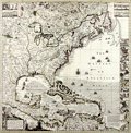 | Details | Popple, Henry | 1755 |
| A Map of the British Empire In America |
|
Popple, Henry |
|
| 1755 |
| LOC:53 |
| $4,200.00 | Popple--Henry | A-Map-of-the-British-Empire-In-America | Beautiful, original hand-colored example of the Covens and Mortier (Dutch) edition of Henry Popple's key map of North America. Made under the auspices of Britain's Lords Commisioners of Trade and Plantations.
<br></br>
The index sheet or key map for Henry Popple's great 20-sheet map, the most important of its time. According to R.V. Tooley "This was the best and most detailed map issued up to this date [1733]." (Tooley, R.V. Maps and Map Makers. p 114.) Published from Amsterdam in 1741 by Covens and Mortier. An important endorsement by Sir Edmund Halley (famous for the eponymous comet) in the bottom right reads in part: <div class="indenttextblock">" I have see the abovementioned map which as far as I am judge seems to have been laid down with great accuracy and to show the position of the different provinces and islands in that part of the globe more truly than any yet extant." </div>
<BR/>
In upper left and right hand corners of Popples key map are insets of Niagara Falls, Mexico City, Quebec and New York City. At right is a column of 18 plans of ports, harbors and islands including Boston, Cartagena, Charleston, Bermuda, New York, and Annapolis. The map is richly embellished with a title cartouche featuring Native Americans, monkeys, a crocodile and a scene of European traders. Numerous ships and sea battles are shown throughout the oceans that are hachured and arrows depict current directionality. Engraved by Johannes Condet.
<br></br>
Popple's personal history is poorly known. McCorkle states <div class="indenttextblock">"… he came from a family whose members had served the Board of Trade and Plantations for three generations, a connection that must have been a factor in his undertaking the map, his only known cartographic work. As Popple had no training or experience as a mapmaker he used available manuscript and printed maps as his sources ... ".</div> |
| 1128 | 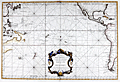 | Details | Depot de la Marine | 1756 |
| Antique French Sea Chart of the Pacific Ocean with Australia |
|
Depot de la Marine |
|
| 1756 |
| LOC:62 |
| $2,200.00 | Depot-de-la-Marine | Antique-French-Sea-Chart-of-the-Pacific-Ocean-with-Australia | Antique sea chart of the Pacific Ocean with a very decorative rococo cartouche. This old French nautical chart contains incomplete representations of Australia and New Zealand coastal regions, reflecting the lack of knowledge that still existed at that time. 2nd. Ed. By J.N. Bellin. A later edition of this chart includes the Depot de la Marine engraved stamp at bottom left.
<br></br>
Coverage spans the Pacific from east Asia to the east coast of the United States. The chart will display beautifully when framed. |
| 1073 |  | Details | Homann Heirs | 1756 |
| Plan of the town and port of Mahon on Minorca |
|
Homann Heirs |
|
| 1756 |
| LOC:58 |
| $1,050.00 | Homann-Heirs | Plan-of-the-town-and-port-of-Mahon-on-Minorca | Spectacular antique engraved port plan of the harbor, town, and defences of Mahon, the capital city of Menorca ( Minorca ) one of the Balearic Islands in the Mediterranean Sea, belonging to Spain. This attractive chart shows great detail of the interior of the island with delineation of hills, roads, streams and individual fields. Printed on 2 separate sheets each measuring approximately 18" x 18".
<br></br>
Britain captured and occupied Minorca beginning in 1708 until 1756 (year this chart was published) when France captured the island after the Siege of Fort St. Philip, led by the Duke de Richelieu, of France.
<br></br>
Two charts on separate sheets, not joined. Insets: Plan of Fort St. Philippe; cross-section of Fort St. Philippe.
<br></br>
Published in Nuremberg by Homann Heirs (also "Homannianis Heredibus" or "Homann Erben" or "Heritiers de Homann"), a company established after the death of German cartographer J.B. Homann to carry on the map publishing business of the firm he started in the early 1700's. The designation "Homann Heirs" appears on maps published by that successor firm from about 1730 to 1848. |
| 785 | 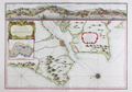 | Details | Bellin, Jacques Nicolas | 1756 |
| Antique chart of Lisbon and Setubal, Portugal with the Tagus River |
|
Bellin, Jacques Nicolas |
|
| 1756 |
| LOC:57 |
| $1,600.00 | Bellin--Jacques-Nicolas | Antique-chart-of-Lisbon-and-Setubal--Portugal-with-the-Tagus-River | Beautiful, antique plan and chart of the Tagus River, Lisbon, Portugal and surrounding area. At the top the entire width of this scarce nautical chart contains a detailed panoramic profile view of Lisbon ( Lisbonne ) westward past Belem as it existed in the mid-eighteenth century with the core city surrounded by walls. Would make a fine gift for anyone with an interest in boating or other maritime activities in the area of Lisbon, Portugal.
<br></br>
At that time the size of the city was much smaller than today- Belem ( Bourg de Belem ) and the Tower of Belém ( Tour de Belem ) are far outside the city walls. An inset plan below the decorative title cartouche shows detailed information about Lisbon and an explanatory legend. These important feature include : le Chateau; la Palais du Roy; the customs house- la Douane; and a major shipyard - Chantier pour la construction des Vaisseaux. Coverage includes several areas that are popular today with tourists including Sintra ( Cintra ), and Cascais, on the Atlantic coast near Cabo de la Roca.
<br></br>
Numerous geographical and topographical features including: Setubal, Colares, Fort St. Antoine, Fort de St. Julien, Village de Passe d'Arc', the convent of Notre Dame de Bon Voyages, Sacaven, Port Brandan, Fort de Bougie, Romeira, Cap Spichel, Sezimbre, and Fort St. Philippe.
<br></br>
With rhumb lines and an attractive compass rose with an adjustment for magnetic variation. As expected on a sea chart there are numerous soundings, anchorages, and hazards including several long reefs off the mouth of the Tagus River. Published by J.N. Bellin for France's Depot de La Marine. |
| 423 |  | Details | Le Rouge, George | 1757 |
| Title Page from Recueil des Cotes Maritimes de France |
|
Le Rouge, George |
|
| 1757 |
| LOC:0 |
| $150.00 | Le-Rouge--George | Title-Page-from-Recueil-des-Cotes-Maritimes-de-France | Title page from an atlas of the coasts of France, "Recueil des Cotes Maritimes de France", printed in 1757. The copperplate engraving shows a scene of ships navigating near a rocky coast inset into a decorative scroll-work cartouche decorated with implements of war. Dedicated to the Comte de Clermont.<BR> </BR>
<b>George Le Rouge<b> (1712-1790)was a German-born Paris-based engineer and surveyor who had a shop on the Rue des Grands Augustins. Le Rouge's tireless work for the King earned him the title <b>"Geographe du Roi". </b>
<BR> </BR>
Le Rouge's important works include his edition of the Franklin/ Timothy Folger chart of the Gulf Stream (after Franklin [1]) " and the Pilote américain septentrional (1778) which published Plan de Boston avec les Sondes et les Directions pour la Navigation : traduit de l'Anglais" and "Ocean Atlantique et Mers Adjacentes en quatre feuilles…"
[1] Mount and Page. London. 1768. |
| 81 | 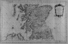 | Details | Bellin, Jacques Nicolas | 1757 |
| Isles Britanniques, Troisieme Feuille |
|
Bellin, Jacques Nicolas |
|
| 1757 |
| LOC:0 |
| $500.00 | Bellin--Jacques-Nicolas | Isles-Britanniques--Troisieme-Feuille | Impressive antique copperplate nautical chart of Scotland (Edinburgh), Firth of Forth, Aberdeen, Dundee, Glasgow, Firth of Clyde, the Irish Sea and Northern Ireland (Londonderry) on very thick wove paper. Published by J.N. Bellin of the Depot de la Marine in 1757. The antique chart contains a large, decorative, dated title cartouche in upper right. Single vertical fold as issued. |
| 83 | 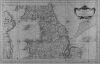 | Details | Bellin, Jacques Nicolas | 1757 |
| Isles Britanniques, Second Feuille |
|
Bellin, Jacques Nicolas |
|
| 1757 |
| LOC:0 |
| $510.00 | Bellin--Jacques-Nicolas | Isles-Britanniques--Second-Feuille | Impressive, large antique copperplate-engraved nautical chart of Wales (Isle of Anglesey), Northern Britain (Isle of Man, Yarmouth) , Scotland, and Eastern Ireland (Belfast, Dublin) on very thick wove paper. Published by J.N. Bellin of the Depot de la Marine in 1757. Single vertical fold as issued. Heavy impression. (Second sheet also available). |
| 2562 | 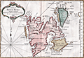 | Details | Bellin, Jacques Nicolas | 1758 |
| Antique French map of Spitsbergen, Norway |
|
Bellin, Jacques Nicolas |
|
| 1758 |
| LOC:88 |
| $270.00 | Bellin--Jacques-Nicolas | Antique-French-map-of-Spitsbergen--Norway | Fine 18th-century antique French map of Spits-berg (Spitsbergen), in today's Svalbard Islands - in northern Norway; the largest Norwegian island. One of the most northern regions to be discovered by Europeans, the place names seen here reflect the nationalities of those early travellers, English, Dutch, Scandinavian and French. Spitsbergen was first used as a whaling base in the 17th and 18th centuries.
<br></br>
The first known sighting of Spitsbergen by a European was by Willem Barentsz, who came across it in 1596 while searching for the Northern Sea Route.
<br></br>
Published in a French edition of L'Abbe Prevost's "Histoire Générale des Voyages", less than twenty years before Captain Cook's famous voyage. Page 192. Book 17. |
| 4875 | 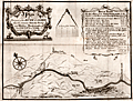 | Details | Eyes, John | 1758 |
| River Calder between Sowerby and Halifax |
|
Eyes, John |
|
| 1758 |
| LOC:88 |
| $250.00 | Eyes--John | River-Calder-between-Sowerby-and-Halifax | Map of the course of the Calder River between Sowerby Bridge and Halifax Brooks mouth by John Eyes. January, 1758. Includes towns and hamlets of Mermaid and Norland Town.
<br></br>
Now part of the Calder and Hebble Navigation suitable for vessels up to 14 feet in width.
<br></br>
John Eyes was a Liverpool surveyor, active 1740-1758, well known for his work surveying the Dee estuary. Eyes' four charts of the Lancashire coast from 1738 are said to be the first charts to show Greenwich as the Prime Meridian. (Skempton, Alec ed. Biographical Dictionary of Civil Engineers, Vol 1. p.220)
<br></br>
J. Evans sculpt. Liverpool. |
| 1391 | 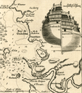 | Details | Gentlemans Magazine | 1758 |
| Antique Map of Basque Roads Anchorage near Rochefort, France |
|
Gentlemans Magazine |
|
| 1758 |
| LOC:7 |
| $125.00 | Gentlemans-Magazine | Antique-Map-of-Basque-Roads-Anchorage-near-Rochefort--France | Neat antique map of Basque Road anchorage related to the failed 1757 British surprise attack of the port of Rochefort, France, along the Charente River. Locations shown include the Isle of Aix, Isle Madame, "Chatalilon" (Chatelaillon) , Fort de la Point, and Fort Lupin.
<br></br>
With a profile view of Fort Fouras with its 17th century fortifications. Although the French were taken by surprise, a bombardment by the British on Fort Fouras was called off when the water off the Fort was discovered to be too shallow. Inset stern view of a Brtish triple-decked ship-of-the line was included to support the discussion in text about the water depth at Fort Fouras.
<br></br>
This fine original copper-engraved map was take from Gentleman's Magazine and Historical Chronicle, Vol 28. |
| 6630 | 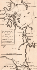 | Details | Gentlemans Magazine | 1758 |
| Coast of Britany Between St. Malos and Cancale Bay Where the English Army Landed June 1758 |
|
Gentlemans Magazine |
|
| 1758 |
| LOC:0 |
| $250.00 | Gentlemans-Magazine | Coast-of-Britany-Between-St--Malos-and-Cancale-Bay-Where-the-English-Army-Landed-June-1758 | Coastal chart of Britany (Brittany) between the ports of St. Malo France and Cancale, centered on St. Malo. The chart was published in Gentlemen's Magazine June, 1758. St. Malo is said to have been the birthplace of Henri Michelot, French Galley Pilot and cartographer.
<br><br>
Map with north at the right Verso is blank. |
| 165 |  | Details | Bellin, Jacques Nicolas | 1759 |
| Carte de la Coste Occidentale d'Afrique |
|
Bellin, Jacques Nicolas |
|
| 1759 |
| LOC:6 |
| $110.00 | Bellin--Jacques-Nicolas | Carte-de-la-Coste-Occidentale-d-Afrique | Small chart of the African coast near the bay of Arguim (Arguin) from the Dutch version of Prevost's widely published history originally engraved by Bellin. This copperplate, engraved by J.V. Schley., shows the African coast with both French and Dutch place names. Highlights the island of Arguim which was the site of an important Portuguese trading post / slave fort from which as many as 1000 slaves may have been sold each year. |
| 1024 | 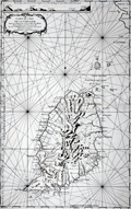 | Details | Bellin, Jacques Nicolas | 1760 |
| 1760 Nautical Chart of Grenada in the Caribbean Sea |
|
Bellin, Jacques Nicolas |
|
| 1760 |
| LOC:68 |
| $975.00 | Bellin--Jacques-Nicolas | 1760-Nautical-Chart-of-Grenada-in-the-Caribbean-Sea | Large antique French sea chart of the island of Grenada in the Carribbean Sea. Dated within the decorative title cartouche to 1760. Coverage includes several of the smaller islands and islets in the Grenadine's chain: Carriacou, Round Island (Isle Rond), l'Islet de la Tante, Islet de Levera, Islet de Mileu, Islet de Haut. By Jacques Bellin of the French Depot de la Marine.
<br></br>
This edition of Bellin's chart of Grenada lacks the circular logo of the Depot de la Marine at bottom right, the "No. 82" at top right, and the price. Contains an attractive inset elevation view of the approach to the north end of the island showing le Grison, l'Islet Rond, Islet de la Tante, la Pointe Percee, and Cape David.
<br></br>
Noted features of this large navigational chart include Cape David, Cape de la Grenade, Poine de la Grande Riviere, Pointe du Fort Jendy, Pointe des Salines, Piton (peak) de Levera, Sauteurs, the Bourg du Grand Marquis, Victoria, Gouyave, and the town of St. George ( Fort Royal ). Soundings and anchorages are shown for the vicinity of St. George's. |
| 672 |  | Details | Bellin, Jacques Nicolas | 1760 |
| Antique French Chart of the Caribbean Island of Grenada |
|
Bellin, Jacques Nicolas |
|
| 1760 |
| LOC:51 |
| $675.00 | Bellin--Jacques-Nicolas | Antique-French-Chart-of-the-Caribbean-Island-of-Grenada | Striking, original antique French sea chart of the Island of Grenada in the Carribbean Sea. Possibly the last official French chart of the island as Britain wrested Grenada from France in 1762 during the Seven Years' War. By J.N. Bellin of the French Depot de la Marine.
<br></br>
Coverage includes several of the smaller islands and islets in the Grenadine's chain: Carriacou, Round Island (Isle Rond), l'Islet de la Tante, Islet de Levera, Islet de Mileu, Islet de Haut. The chart is large and colorful and will display nicely.
<br></br>
Noted features of this large navigational chart include Cape David, Cape de la Grenade, Poine de la Grande Riviere, Pointe du Fort Jendy, Pointe des Salines, Piton (peak) de Levera, Sauteurs, the Bourg du Grand Marquis, Victoria, Gouyave, and the town of St. George ( Fort Royal ). Soundings and anchorages are shown for the vicinity of St. George's.
<br></br>
Inset profile view of the approach to the north end of the island showing le Grison, l'Islet Rond, Islet de la Tante, la Pointe Percee, and Cape David. With the circular logo of the French Depot de la Marine. Attributed to Bellin and dated to 1760 in a decorative title cartouche. Price: trente sols. No. 82. |
| 753 | 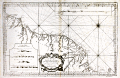 | Details | Depot de la Marine | 1760 |
| Antique French sea chart of South America south of the Orinoco River |
|
Depot de la Marine |
|
| 1760 |
| LOC:67 |
| $475.00 | Depot-de-la-Marine | Antique-French-sea-chart-of-South-America-south-of-the-Orinoco-River | Original, 254 year-old antique working nautical chart of the east coast of South America including parts of Venezuela, Guyana, Suriname, French Guiana and Brazil. Coverage on this large French sea-chart includes a large area between the Orinoco (Grande Embouchure de l'Orenoque) and Amazon rivers that was once collectively known as "Guyane", a term derived from an indigenous word meaning "land of many waters". Named geographical features include Nouvelle Middelbourg, Fort de Nouvelle Zeeland, Cap de Nassau, Essequibo River, a settlement along the Essequibo labeled simply "le Bourg", Demerary River, Berbiche River, Port Nassau, Corentin River, Suriname River, Paramaribo and Nouvelle Amsterdam, Maurany River, Devils' Islands (Isles au Diable), Oyapoque River, Counany River, Cayenne, St. Paul Mission, Cap d'Orange, and Cap de Nord.
<br></br>
Numerous depth soundings, anchorages, hazards, and offshore details are noted. Some interior detail including rudimetary roads, missions, and guardposts are shown in French Guiana.
<br></br>
As denoted on the chart coverage area extends southward from Venezuela (Guyane Espagnole), Guyana and Suriname (Guyane Hollandoise) to French Guiana (Guyane Francoise) and Brazil (Guyane Portugaise). Inset at top right contains a elevation plan of the coast in the vicinity of Cayenne, the capital of French Guiana. Inset at bottom left contains profiles of headlands seen when approaching Cayenne and Cap d'Orange from the sea.
<br></br>
By Nicolas Bellin in 1760, working for France's Depot des Cartes et Plans de la Marine. At this later stage of his career Bellin's extensive experience as a cartographer is evidenced by the attribution within the large decorative cartouche: "Par le S, Bellin Ingenieur de la Marine, Censeur Royal de l'Acedemie de Marine, et de la Societe Royal de Londres."
<br></br>
With the circular anchor logo of the Depot de la Marine. |
| 4758 | 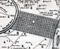 | Details | Gibson, John | 1761 |
| A Plan of the City of Philadelphia, with the Country Adjacent |
|
Gibson, John |
|
| 1761 |
| LOC:0 |
| $295.00 | Gibson--John | A-Plan-of-the-City-of-Philadelphia--with-the-Country-Adjacent | Early plan of Philadelphia laid out on a grid between the Delaware River and the Schuylkill River. John Gibson engraved this fine original after Scull & Heap's smaller-scale plan of June, 1752 - "Plan of the city and environs of Philadelphia". Numerous homes are identified by name: Maddox, Plumsted, Pemberton, Rouse, Campbell and more. Shows the locations of two ferry's including Daniel Cooper's Ferry
<br></br>
A fine gift for anyone with an interest in Philadelphia, Pennsylvania or early colonial history. Volume 5. Page 20.
<br></br>
Gibson's plan though small, focuses on the city and omits the environs. Gibson has engraved the earliest affordable plan of Philadelphia pre-dating Bellin's work of 1764 by three years. Gibson's engraving clearly predates Faden's later revised edition (1771) of the Scull and Heap plan of Philadelphia. Scull and Heap show the city clearly with the Battery not yet demolished and lacking the numerous additional lots that Faden shows creeping outward near the Delaware River (see red circles).
<img src="/PageImages/c_JCB_Philadelphia_Faden_1771.jpg" alt="Fadens Edition Of Sculls Map" align="top" width="200"> |
| 530 |  | Details | Jefferys, Thomas | 1761 |
| Plan of the Isle of Aix |
|
Jefferys, Thomas |
|
| 1761 |
| LOC:4 |
| $185.00 | Jefferys--Thomas | Plan-of-the-Isle-of-Aix | Plan of the island of Aix, France, off the mouth of the Charente river on the west coast of France. Depicts the village, vineyards, and fort, gun batteries, and a shipwreck at the northern end of the island. The plan shows the island as it existed after it was captured by the British in 1757 during the Seven Year's War.
<br><br/>
This plate is one of 80 maps included in Jeffery's "A Description of the Maritime Parts of France…" first published in 1761. |
| 412 |  | Details | Bellin, Jacques Nicolas | 1761 |
| Carte du Detroit de Gibraltar |
|
Bellin, Jacques Nicolas |
|
| 1761 |
| LOC:58 |
| $900.00 | Bellin--Jacques-Nicolas | Carte-du-Detroit-de-Gibraltar | Large, handsome 251 year-old working sea-chart of the Strait of Gibraltar and surrounding areas by J.N. Bellin of the French Depot de la Marine. This stunning chart from 1761 contains a large cartouche at right embellished with pikes, shields, drums, flags, and other implements of war. At left is a detailed inset plan of Gibraltar with a legend keyed to locations on the plan. Table at top contains tidal flow data. North oriented to the left .<BR> </BR>
Coverage in Spain includes Rota, Cadiz (Cadix), Cape Trafalgar, Tariffa, Algeciras, and Gibraltar. Coverage of the coast of Africa ("Barbarie") includes Arzille, Cape Spartel, Cape Malbare, Tangiers, Ceuta, and Tetouan. Numerous soundings, hazards and guard towers are noted. With stamp of Depot de la Marine "R.F." . Price: Trente sols. |
| 2484 |  | Details | Jefferys, Thomas | 1762 |
| Jefferys' scarce plan of the city of Cartagena, Colombia |
|
Jefferys, Thomas |
|
| 1762 |
| LOC:13 |
| $800.00 | Jefferys--Thomas | Jefferys--scarce-plan-of-the-city-of-Cartagena--Colombia | Scarce large-scale birds-eye plan of the city of Cartagena, Colombia (1762) by engraver Thomas Jefferys. Emphasis on the considerable defences of Cartagena with more than one dozen defensive bastions identified by name. Secondary fortified position is labeled "Xemani or the suburb." Shows Fort Saint Philip- St. Lazaro or Baraxas and the long road to Bosquilla. Plate 5 Page 13.
<br></br>
After an apprenticeship to Emmanuel Bowen, Thomas Jefferys was one of the more prominent commercial cartographers in London during the middle of the eighteenth century. Although he was responsible for a wide variety of prints and for maps of much of the world, he is particularly remembered for his publication of many maps of North America.
<br></br>
Upon George III's accession to the throne in 1760, Jefferys became "Geographer to the King", a title signifying the status of a favored tradesman, and a reputable publisher with a sufficiently large collection of maps to fill the King's personal needs. Later, bankruptcy forced Jefferys into a partnership with Robert Sayer, a successful publisher of a diverse range of materials. Sayer provided the capital to reprint many of Jefferys' existing plates and presumably took the larger share of the profits. <a href="http://www.oshermaps.org/special-map-exhibits/percy-map/jefferys-and-north-america" target="_blank">(Online. Osher Map Library.)</a> |
| 575 | 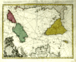 | Details | Homann Heirs | 1762 |
| Antique chart of the Mediterranean featuring Sicily Sardinia Corsica Malta Gozo |
|
Homann Heirs |
|
| 1762 |
| LOC:50 |
| $650.00 | Homann-Heirs | Antique-chart-of-the-Mediterranean-featuring-Sicily-Sardinia-Corsica-Malta-Gozo | Decorative antique chart of the southern boot of Italy with the islands of <strong>Corsica</strong> ( Corse ) , <strong>Sardinia</strong> ( Sardegna or Sardegna ), <strong>Sicily</strong> ( Sicilia ), <strong>Malta</strong>, <strong>Gozo</strong> and much more to the Gulf of Tunis and northern coast of Africa (Barbaria). Based on the work of Rizzi Zannoni. Dated in the top title to 1762. A highly decorative title cartouche at bottom left of this antique map contains angels carrying state coats of arms above symbols of war including a warship firing a salvo from its starboard side.
<br></br>
Published by the firm <strong>Homann Heirs</strong>. Homann Heirs (also "Homannianis Heredibus" or "Homann Erben" or "Heritiers de Homann") was a company established after the death of German cartographer J.B. Homann to carry on the map publishing business of the firm he started in the early 1700's. The designation "Homann Heirs" appears on maps published by that successor firm from about 1730 to 1848. |
| 1385 |  | Details | Jefferys, Thomas | 1762 |
| Antique British Plan of Puerto de Cavanas or Cabañas, Cuba |
|
Jefferys, Thomas |
|
| 1762 |
| LOC:5 |
| $325.00 | Jefferys--Thomas | Antique-British-Plan-of-Puerto-de-Cavanas-or-Cabañas--Cuba | Antique hand-colored copperplate engraved harbor chart shows Puerto de Cabañas (Cavanas), Cuba in the Artemisa province on the Northwestern coast of Cuba, about 50 km west of Havana, Cuba. In addition to depth soundings Jefferys identifies only three features in his plan of Cabañas Bay: An "aguada" or watering place, Ysla Larga, and Punta Longa.
<br></br>
The Bay of Cabañas was used as a haven for pirates to plunder Havana . In June, 1558 governor Diego de Mazariegos received news that pirate galleons had captured two Spanish caravels in a naval battle at the Bay of Cabañas. In 1586 the Spanish adopted measures for their defense against unfriendly nations and pirates. Those defensive measures stationed frigates and lookouts in the port of Cabañas in order to warn the town of Havana of impending attack.
<br></br>
This scarce nautical chart / plan was published in 1762 by the prolific British engraver and publisher Thomas Jefferys (ca.1710-1771) in "A Description of the Spanish Islands and Settlements on the Coast of the West Indies, compiled from Authentic Memoirs, Revised by Gentlemen who have Resided Many Years in the Spanish Settlements".
<br></br>
Scale in Miles. Plate 27. Page 90. |
| 5192 | 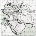 | Details | de Mornas, Buy | 1762 |
| Empire de Cyrus |
|
de Mornas, Buy |
|
| 1762 |
| LOC:66 |
| $325.00 | de-Mornas--Buy | Empire-de-Cyrus | Fine original antique engraved map of the empire of Cyrus the Great of Persia. "Empire de Cyrus", was taken from the <b>Atlas Historique et Géographique</b> by de Mornas. The map encompasses much of western Asia and the Middle East including Saudi Arabia and Iran. Very decorative border. |
| 3655 |  | Details | Jefferys, Thomas | 1762 |
| Antique plan of the Port de Baracoa, Cuba |
|
Jefferys, Thomas |
|
| 1762 |
| LOC:77 |
| $300.00 | Jefferys--Thomas | Antique-plan-of-the-Port-de-Baracoa--Cuba | A scarce antique copperplate-engraved chart of the Bay of Honey (Playa de Miel) and Port of Baracoa on Cuba's eastern tip. Baracoa is the oldest Spanish settlement in Cuba and was its first capital. The plan shows less than one dozen structures whereas in 2004, the municipality of Baracoa had a population of over eighty thousand.
<br></br>
This scarce English chart was published in 1762 by the prolific British engraver and publisher Thomas Jefferys (ca.1710-1771) in "A Description of the Spanish Islands and Settlements on the Coast of the West Indies, compiled from Authentic Memoirs, Revised by Gentlemen who have Resided Many Years in the Spanish Settlements".
<br></br>
Scale in sea leagues. At sea, a league is three nautical miles (3.45 miles). Plate 21. Page 84. |
| 5377 | 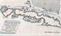 | Details | London Magazine | 1762 |
| Antique engraved Plan of the Straights of Bahama |
|
London Magazine |
|
| 1762 |
| LOC:13 |
| $325.00 | London-Magazine | Antique-engraved-Plan-of-the-Straights-of-Bahama | Original antique engraved map of the route taken by the British Fleet during their attack on the city of Havana, Cuba in 1762.
<br></br>
The map depicts the fleet's passage through the Old Bahamas Channel, a risky route just north of Cuba, through a channel only 10 miles wide at some points. The route taken by the British reduced the amount of warning time afforded to the Spanish Fleet.
<br></br>
Conducted during the Seven Years' War, the Siege of Havana was a successful British siege against Spanish-ruled Havana that lasted from March to August 1762.
<br></br>
"A Plan of the Straights of Bahama, through which the Expedition Fleet was Conducted in the Year 1762 against the Havana". Engraved for the London Magazine. Published from London by Baldwin in January 1763. |
| 3650 |  | Details | Depot de la Marine | 1762 |
| Antique French harbor chart of Havana, Cuba |
|
Depot de la Marine |
|
| 1762 |
| LOC:51 |
| $1,350.00 | Depot-de-la-Marine | Antique-French-harbor-chart-of-Havana--Cuba | Striking, original harbor chart and plan of the bay, town and forts of Havana, Cuba as they existed before 1762. Bellin identifies forty-five important locations in and around Havana and denotes their location on the plan alphabetically. Created by order of the Duc du Choiseul, French Minister of War.
<br></br>
With three inset plans "Le Fort du Maure" (Morro Castle, or more correctly- Castillo de los Tres Reyes del Morro), Fort de la Pointe (Castillo de San Salvador de la Punta), and Le Vieux Chateau (Castillo de la Real Fuerza) with 22 pieces of cannon. In 1762, after the Siege of Havana, the British captured all of Havana including the forts. All were returned to Spain a year later under terms of the Treaty of Paris.
<br></br>
This fine antique chart is from Nicolas Bellin, 1762, working for France's Depot des Cartes et Plans de la Marine.
<br></br>
With the circular anchor logo of the Depot de la Marine. Price when issued dix huit (18) Sols. No. 69. |
| 263 |  | Details | Jefferys, Thomas | 1762 |
| Plan of la Vera Cruz from Spanish Draughts. |
|
Jefferys, Thomas |
|
| 1762 |
| LOC:5 |
| $425.00 | Jefferys--Thomas | Plan-of-la-Vera-Cruz-from-Spanish-Draughts- | Antique copperplate engraved map / port plan of the fortified city of 'la Vera Cruz' and historically significant Fort San Juan de Ulúa in the Mexican state of Veracruz. Published in 1762 by the prolific British engraver and publisher Thomas Jefferys (ca.1710-1771) in "A Description of the Spanish Islands and Settlements on the Coast of the West Indies, compiled from Authentic Memoirs, Revised by Gentlemen who have Resided Many Years in the Spanish Settlements".<br></br>
It was on the island of San Juan de Ulúa that Spanish captain Juan de Grijalva first arrived in 1518, along with conquistador and author Bernal Díaz del Castillo ("The True History of the Conquest of New Spain"). That island was also the scene of a battle in 1569 between the Spanish Navy and a fleet led by John Hawkins that included Francis Drake. The treachery that the English perceived on the part of Spain at that battle helped to fuel antagonism between the two powers for many decades. <br></br>
In Vera Cruz several key points are identified including the powder magazine, a 'magazine of masts for the galleons', and numerous churches, chapels, and sites associated with religious orders of Jesuits, Dominicans, Augustines, and Franciscans.<br></br>
Plate 14. Page 64. Contains an 11 item legend. |
| 670 |  | Details | Bellin, Jacques Nicolas | 1762 |
| Carte de la Baye de Gibraltar |
|
Bellin, Jacques Nicolas |
|
| 1762 |
| LOC:0 |
| $550.00 | Bellin--Jacques-Nicolas | Carte-de-la-Baye-de-Gibraltar | Large, original, antique French sea chart of the Bay and Rock of Gibraltar from 1762. Noted features include the village and mountain of Gibraltar, Fort St. Philippe, Fort St. Roch, Pointe de Mala, Pointe de Roquadillo, the River Entrance Tower ( Tour d'Entre los Rios ), the Admiral's Tower ( Tour de le Amirante ) , Algeciras, Ance de Getare, and Cape Carnero. With numerous soundings, navigational hazards, and anchorages.
<br></br>
Decorative title cartouche attributes the chart to: " le S. Bellin Ingenieur de la Marine Ceuseur Royal & a." |
| 685 |  | Details | Janvier, Robert (Jean) | 1762 |
| l'Asie Divisee en Ses Principaux Etats |
|
Janvier, Robert (Jean) |
|
| 1762 |
| LOC:9 |
| $350.00 | Janvier--Robert-(Jean) | l-Asie-Divisee-en-Ses-Principaux-Etats | An attractive, hand-colored antique map depicting the Asian continent from the Red Sea in the West to Java and the Moluccas in the South as far East as the Bering Strait. This old map covers Saudi Arabia, India, Iraq, Iran, the Caspian Sea, Black Sea, Japan, Sumatra, Borneo, Java, Malaku Islands ( Isles Moluques ), Phillipine Islands, Korea ( Coree ), Japan and Kamchatka. In South East Asia, New Guinea ( Nouvelle Guinee ) is elongated with an indistinct outline of its coasts stretching off the map, hinting at a connection with Australia.
<br></br>
Janvier further identifies the mythical 'Detroit du Nord ou d'Anian' off the easternmost point of the Asian Continent. Anian is generally considered to be an undiscovered land or strait in the extreme northwestern part of America. The earliest known reference to Anian is in the narratives of Marco Polo, who describes it as 'East of India'. In many early maps Anian appears as an imaginary proto-Bering Strait, the Strait of Anian, separating Asia from America as part of the Northwest Passage, which was hoped would shorten the passage to the riches of the orient. The concept of the Strait of Anian lingered on maps after the Bering Strait was explored by Vitus Bering in 1728, until the northwest coast of North America had been well mapped.
<br></br>
Title cartouche at right suggests the rich and exotic destinations on the map through a depiction of rugs and other riches along with incense burning in a large censer topped with a crescent signifying Islamic origin.
<br></br>
Published by Lattre as plate 24 in "Atlas moderne ou collection de cartes sur toutes les parties du globe terrestre ar plusieurs auteurs." Paris, 1762 with Royal Privilege. |
| 3657 | 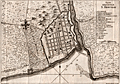 | Details | Masi, Tommaso Gio. | 1763 |
| Plan of the walled city of Santo Domingo. |
|
Masi, Tommaso Gio. |
|
| 1763 |
| LOC:77 |
| $350.00 | Masi--Tommaso-Gio- | Plan-of-the-walled-city-of-Santo-Domingo- | Scarce engraved antique nautical plan (after Thomas Jefferys) of the walled town of Santo Domingo on the island of Hispaniola. With a legend explaining numerous important locations on the plan including Fort San Girolamo, the Cathedral, and the Palace of Christopher Columbus (Cristoforo Colombo). Includes the bar across the entrance to the Ozama River as well as suggested anchorages within the river. Details on roads surpasses what is typical for nautical plans of this era. Italian text.
<br></br>
Originally published in the Gazzetiere Americano, from Livorno, Italy. Contains a few depth soundings and notations of the composition of the sea bottom, important to navigators who had to rely heavily on lead-line measurements for safe passage. Engraved by Giuseppe Pazzi and drawn by Viol. Vanni. |
| 5177 |  | Details | Masi, Tommaso Gio. | 1763 |
| Piano del Porto e degli Stabilimenti di Pensacola Uncolored |
|
Masi, Tommaso Gio. |
|
| 1763 |
| LOC:87 |
| $575.00 | Masi--Tommaso-Gio- | Piano-del-Porto-e-degli-Stabilimenti-di-Pensacola-Uncolored | Beautifully engraved antique plan of Pensacola, Florida and the surrounding bays and sounds created in 1763 when Pensacola was not much more than a tiny village. Coverage includes areas of present day Gulf Islands National Seashore, Gulf Breeze, Pensacola Beach, Navarre, Navarre Beach, Blackwater Bay, Escambia Bay, Santa Rosa Sound and Santa Rosa Island.
<br></br>
Two old forts are noted, Fort Santa Rosa, a long-destroyed log fort built by the Spanish on the western end of Santa Rosa Island near present day Fort Pickens, and Fort Santa Maria de Galres (Galves/Galve) , near present day Fort Barrancas. Other features noted that reflect Spanish/Italian place names are "Baia di Santa Maria de Galres" - Pensacola Bay; "Golfo dell Ostriche", now Escambia Bay; "Canale di Santa Rosa" or Santa Rosa Sound; "Fiume del Governatore" and "Fiume del Almirante" - the Yellow and Blackwater Rivers. Siguenca Point at the western tip of Santa Rosa Island is named after Dr. Carlos de Siguenza y Gongora, a member of a Spanish reconnaissance expedition in 1693 who was one of the first to map Pensacola Bay.
<br></br>
Originally published in the Gazzetiere Americano, from Livorno, Italy. Contains many soundings and notations of the composition of the sea bottom, important to navigators who had to rely heavily on lead-line measurements for safe passage. Engraved by Giuseppe Pazzi and drawn by Viol. Vanni. |
| 642 | 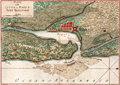 | Details | Masi, Tommaso Gio. | 1763 |
| Piano della Citta e Porto di Sant Agostino |
|
Masi, Tommaso Gio. |
|
| 1763 |
| LOC:200 |
| $625.00 | Masi--Tommaso-Gio- | Piano-della-Citta-e-Porto-di-Sant-Agostino | Handsome, pre-revolutionary war (1763) Italian antique copperplate engraved plan of the old town and port of St. Augustine, Florida. Areas and features named on the plan include the Matanzas River, San Marco River, San Sebastian River, Anastasia Island, Castillo de San Marcos ( oldest fort in the U.S.) , and Fort Picolata, built by the Spaniards to protect a ferry landing.
<br></br>
Nicely preserved specimen of one of the earliest available plans of Saint Augustine, the oldest continuously inhabited European settlement in the United States. St. Augustine is depicted with a neatly laid out network of perpendicular streets and surrounded by a high wall with several bastions. On the North and South ends and outside of the walled city are noted "Citta Indiana" or American Indian habitations. Numerous soundings and depictions of sandbanks and other hazards surround the entrance to the port.
<br></br>
The landing place of General James Oglethorpe is identified at the left end of the coastline (Sbarco del Gen. Oglethorpe). The General landed at that spot with an English force in 1740 during the War of Jenkin's Ear.
<br></br>
Orignally published in the Gazzetiere Americano, from Livorno, Italy. Engraved by Giusepe Pazzi and drawn by Viol. Vanni. |
| 1081 | 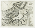 | Details | Coltellini, Marco | 1763 |
| Antique harbor chart and plan of Havana, Cuba |
|
Coltellini, Marco |
|
| 1763 |
| LOC:10 |
| $425.00 | Coltellini--Marco | Antique-harbor-chart-and-plan-of-Havana--Cuba | Antique chart from 1763 of the city and harbor of <b>Havana </b> on the island of Cuba. Two legends at far right in Italian are keyed to specific locations on the map including: the market; the Cathedral; churches; the powder magazine; defensive batteries and gun emplacements. Numerous soundings and shallow areas are identifed within the harbor. "Forte Moro" (<b>Morro Castle</b>) is clearly drawn opposite "Puntale" or San Salvador de la Punta Fortress, both guarding the entrance to the harbor.
<br></br>
Created by Marco Coltellini, drawn by Gieuseppe Pazzi, and published in volume 2 of the 1763 edition of the magazine "Il gazzettiere Americano" |
| 1088 | 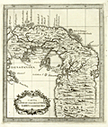 | Details | Coltellini, Marco | 1763 |
| Attractive antique map of the Isthmus of Panama |
|
Coltellini, Marco |
|
| 1763 |
| LOC:5 |
| $325.00 | Coltellini--Marco | Attractive-antique-map-of-the-Isthmus-of-Panama | Detailed and interesting antique (1763) engraved map of the Isthmus of Panama (Spanish: Istmo de Darien) showing interior detail and the Bay of Panama. Noted feautures include Portobelo ("Porto Bello"), Panama City, and Nuova Edinburg . New Edinburg was the site of the "Darien Scheme", a colony called "Caledonia" supported by the Kingdom of Scotland in the late 1690's. That unsuccessful colony was established by the Scottish Darien Company in an attempt to create a trading point between Europe and the Far East. The attempt was a disaster. When it failed the venture cost Scotland of an estimated quarter of its liquid assets and was an important factor in encouraging the country to the 1707 Act of Union which united the Kingdoms of Scotland and England.
<br></br>
The Gulf of Darién is the southernmost region of the Caribbean Sea, located north and east of the border between Panama and Colombia. Within the gulf is the Gulf of Urabá, a small lip of sea extending southward, between Caribana Point and Cape Tiburón, Colombia, on the southern shores of which is the port city of Turbo, Colombia.
<br></br>
Published from Livorno, Italy in 1763 in "Il Gazzettiere americano". |
| 1089 | 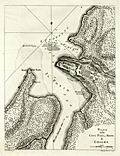 | Details | Coltellini, Marco | 1763 |
| Attractive antique plan of Chagres, Panama and Fort San Lorenzo |
|
Coltellini, Marco |
|
| 1763 |
| LOC:5 |
| $325.00 | Coltellini--Marco | Attractive-antique-plan-of-Chagres--Panama-and-Fort-San-Lorenzo | Finely engraved, antique (1763) port plan of Fort San Lorenzo and the town of Chagres, Panama on the north coast of Panama, now abandoned. Features include Chagres village, Castillo San Lorenzo, Forte della Punta, numerous depth soundings and a road labeled "Strado de Vento de Cruzes 56 miglia, e a Panama".
<br></br>
Spain's early trail to Panama City, the Las Cruces Trail, was reliant on the Chagres River for much of its route. Spain established Chagres at the mouth of the Chagres River, in the 16th century as a port for the purpose of loading its Peruvian plunder for trans-shipment to Nombre de Dios or Portobello where it would be consolidated and shipped onward to Spain. To protect the port, the Spanish established a fort, San Lorenzo, on a cliff overlooking the harbor.
<br></br>
Published from Livorno, Italy in 1763 in "Il Gazzettiere americano". |
| 3640 | 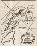 | Details | Bellin, Jacques Nicolas | 1763 |
| Scarce mid eighteenth-century antique map of the Mississippi River passes. |
|
Bellin, Jacques Nicolas |
|
| 1763 |
| LOC:77 |
| $400.00 | Bellin--Jacques-Nicolas | Scarce-mid-eighteenth-century-antique-map-of-the-Mississippi-River-passes- | Very attractive early French maritime map shows the mouth of the "Fleuve St. Louis" or Mississippi River in Louisiana. Noted locations include Passe a la Loutre and Isle de la Fort de Balise.
<br></br>
From J.N. Bellin's <b>Le Petit Atlas Maritime</b> . With soundings at the key passes into the Gulf of Mexico. Lacks latitude and longitude scales. North is oriented to the top left of map. Tome I, No. 38. |
| 4740 |  | Details | Bellin, Jacques Nicolas | 1763 |
| Chart Western Hemisphere Petit Altas Maritime |
|
Bellin, Jacques Nicolas |
|
| 1763 |
| LOC:88 |
| $675.00 | Bellin--Jacques-Nicolas | Chart-Western-Hemisphere-Petit-Altas-Maritime | Fine authentic antique chart of the Western Hemisphere by Jacques Nicolas Bellin: "Carte de l'Amerique et des Mers Voisines."
<br></br>
This scarce (12" x 18") copper-plate engraving is from Bellin's "Le Petit Atlas Maritime." Includes North America, South America, west Europe and Africa. Dated within to 1763. |
| 502 |  | Details | Depot de la Marine | 1763 |
| Plan de l'ile de Saint Pierre au Sud De Terre-Neuve |
|
Depot de la Marine |
|
| 1763 |
| LOC:65 |
| $550.00 | Depot-de-la-Marine | Plan-de-l-ile-de-Saint-Pierre-au-Sud-De-Terre-Neuve | Antique French sea chart of the island of Saint Pierre about 25 miles south of Newfoundland, in the northwestern Atlantic Ocean.. Lying just offshore of Saint Pierre are numerous smaller islands including Le Grand Colombier; Isle aux Chiens, Isle aux Pigeons, and the gruesomely named "Isle Massacre". The small village is referred to as "le Bourg".
<BR> </BR>
Several features on this chart suggest it was rushed into production. These features include numerous small rectangular areas where the engraving had been smoothed and then re-engraved with place names or descriptors, and at least one area where the chart was smoothed but then left blank. These new additions include "Teste de Galantry"; "Broussailles" ( Fr. Brush wood); and "Bois de Chaufage" (Fr. Heating wood).
<BR> </BR>
In the year this chart was published, 1763, under the terms of the Treaty of Paris, France ceded all its North American possessions, but Saint-Pierre and Miquelon were returned to France. Saint Pierre and Miquelon is today a self-governing overseas territory of France.
<BR> </BR>
Large decorative title cartouche at bottom left is adorned with garlands. Rhumb lines extend from a simple compass rose at right. At bottom right the anchor stamp of the Depot de la Marine and a later red hand-stamp of the "Military Depot" containing the royal coat of arms of the United Kingdom: a shield and crown flanked by a lion and unicorn. |
| 1055 | 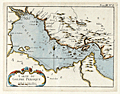 | Details | Bellin, Jacques Nicolas | 1764 |
| Antique French Chart of the Persian Gulf Region |
|
Bellin, Jacques Nicolas |
|
| 1764 |
| LOC:9 |
| $350.00 | Bellin--Jacques-Nicolas | Antique-French-Chart-of-the-Persian-Gulf-Region | Antique French maritime map of the <b>Persian Gulf</b> by the French cartographer Jacques-Nicolas Bellin (1703−72). <b>Qatar</b> is shown as Catura. Cities on both the Arabian and Persian sides of the gulf are indicated, and the map shows a river emptying into the gulf at the port of Julfar (present-day Ra's al-Khaymah, United Arab Emirates). Key features include the islands of "Baharem" (Bahrain), "Ormus" (Hormuz), and "Kimishe" (Qeshm); and the city of Banderabashi (Bandar Abbas, Iran),
<br></br>
From Bellin's "Le Petit Atlas Maritime: Recueil de Cartes et de Plans des Quatre Parties du Monde" (Small maritime atlas: collection of maps and charts of the four parts of the world), in five volumes containing 581 maps in total.
<br></br>
Plate 8, Tome 3. |
| 167 |  | Details | Roux, Joseph | 1764 |
| Rade de Marseille |
|
Roux, Joseph |
|
| 1764 |
| LOC:4 |
| $110.00 | Roux--Joseph | Rade-de-Marseille | Antique chart engraving of the Bay of Marseille from the atlas of Mediterranean ports produced by Joseph Roux.<BR> </BR>
There were at least four small atlases of port and coastal charts that originated from Marseille hydrographers in the 18th century. Beginning in approximately 1727 these atlases included works by cartographers
<a rel="nofollow" href= "/MichelotBremondBackground.aspx"> Michelot and Bremond</a>,
<a rel="nofollow" href= "/Creator/Ayrouard--Jacques"> Jacques Ayrouard</a>,
<a rel="nofollow" href= "/Creator/Roux--Joseph"> Joseph Roux</a>
, and Jean Allezard. Comparison between Roux's chart of Marseille Bay and that of Michelot and Bremond shows that although Roux's coastal outline is slightly different than Michelot, the hydrographic soundings were lifted directly from Michelot's charts that were produced 40 years earlier. Plate 20. |
| 2535 |  | Details | Bellin, Jacques Nicolas | 1764 |
| Interesting antique plan of Cartagena Colombia |
|
Bellin, Jacques Nicolas |
|
| 1764 |
| LOC:88 |
| $250.00 | Bellin--Jacques-Nicolas | Interesting-antique-plan-of-Cartagena-Colombia | A very interesting plan of the walled city of Cartagena, Colombia in South America with North oriented to the bottom left. Cartagena was an important hub of the Spanish empire in South America. The plan includes a key at top that identifies the important public buildings, numerous churches, powder magazine, prison and fortifications. Unlike other maps and plans of the period this map provides little detail of the hydrographic nature of the surrounding bay.
<br></br>
Cartagena, a major port, was founded in 1533, and named after Cartagena, Spain, which in turn was named after Carthage in Tunisia. Settlement in the region around Cartagena Bay by various indigenous peoples dates back to 4000 BC. During the Spanish colonial period Cartagena served a key role in administration and expansion of the Spanish empire.
<br></br>
From J.N. Bellin's "Le Petit Atlas Maritime: Recueil de Cartes et de Plans des Quatre Parties du Monde" (Small maritime atlas: collection of maps and charts of the four parts of the world), in five volumes containing 581 maps in total. |
| 1305 |  | Details | Bellin, Jacques Nicolas | 1764 |
| South American Continent |
|
Bellin, Jacques Nicolas |
|
| 1764 |
| LOC:5 |
| $215.00 | Bellin--Jacques-Nicolas | South-American-Continent | Fine copper-plate engraved map of South America ca. 1764. Noted features on this attractive, decorative map include the Amazon River, the Malvinas Islands (Falklands), Buenos Aires, Lake Titicaca, Lima, and the islands of Trinidad and Martinique. "Tierra Firme" is the name the Spanish used to denote their overseas possessions on the north coast of South America including present day Colombia.
<br></br>
Published by Nicolas Bellin in his "Petit Atlas Maritime." Volume 2, Number 3. With both latitude and longitude markings. |
| 1152 | 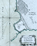 | Details | Bellin, Jacques Nicolas | 1764 |
| Plan du Fort et du Village du Bequier |
|
Bellin, Jacques Nicolas |
|
| 1764 |
| LOC:6 |
| $180.00 | Bellin--Jacques-Nicolas | Plan-du-Fort-et-du-Village-du-Bequier | Shows the village and fort at Aboukir ("Bequier"), Egypt north of Alexandria on the North African coast of the Mediterranean Sea. Aboukir Bay was the site where British Admiral Horatio Nelson fought the naval <b>Battle of the Nile</b> on August 1, 1798 also referred to as the "Battle of Aboukir Bay". From Bellin's <b>Le Petit Atlas Maritime</b> . |
| 1153 |  | Details | Bellin, Jacques Nicolas | 1764 |
| Plan des Ports et Ville d'Alexandrie |
|
Bellin, Jacques Nicolas |
|
| 1764 |
| LOC:6 |
| $250.00 | Bellin--Jacques-Nicolas | Plan-des-Ports-et-Ville-d-Alexandrie | This fine maritime chart / plan shows the ancient walled town of <b>Alexandria, Egypt</b> on the North African coast of the Mediterranean Sea. The plan includes both the old port and to the east, the new port.
<br></br>
Includes a representation of <b>Pompey's Pillar</b>. The "Colonne de Pompee" is a 30-meter tall monolithic Roman triumphal column in Alexandria, Egypt, and the largest of its type constructed outside the imperial capitals of Rome and Constantinople. Numerous soundings, hazards, and anchorages attest to the nautical nature of this plan. From Bellin's <b>Le Petit Atlas Maritime</b> .
<br></br>
Tome III No. 86. |
| 1154 |  | Details | Bellin, Jacques Nicolas | 1764 |
| Antique chart of the Nile Delta north of Alexandria, Egypt |
|
Bellin, Jacques Nicolas |
|
| 1764 |
| LOC:6 |
| $250.00 | Bellin--Jacques-Nicolas | Antique-chart-of-the-Nile-Delta-north-of-Alexandria--Egypt | Fine antique map of the waterways crisscrossing the Nile delta from Suez west past Alexandria, Egypt. Noted features include: "Lac Mareotis" (Lake Mariout or Maryut); the Isthmus of Suez and upper tip of the Gulf of Suez; "Rosette" (Rosetta, the location of the discovery of the archaeologically important rock stele known as the Rosetta Stone.)
<br></br>
From Bellin's <b>Le Petit Atlas Maritime</b> .Tome III, No. 89. |
| 1158 |  | Details | Bellin, Jacques Nicolas | 1764 |
| Antique engraved chart of the anchorage at Aboukir Bay |
|
Bellin, Jacques Nicolas |
|
| 1764 |
| LOC:6 |
| $265.00 | Bellin--Jacques-Nicolas | Antique-engraved-chart-of-the-anchorage-at-Aboukir-Bay | This colorful antique French chart shows the anchorage ("Mouillage des Vaisseaux") and waters near the "Fort du Bequier" and "Isle du Bequier" at Aboukir ("Bequier"), Egypt. Aboukir lies north of Alexandria on the Mediterranean Sea coast of North Africa.
<br></br>
Aboukir Bay was the site where British Admiral Horatio Nelson fought the naval <b>Battle of the Nile</b> on August 1, 1798 also referred to as the "Battle of Aboukir Bay". Ironically, the French were badly defeated by the British at the battle in part because the British had better information about water depth in the area.
<br></br>
From Bellin's <b>Le Petit Atlas Maritime</b> .
<br></br>Tome III, No 88. |
| 1358 | 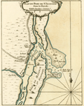 | Details | Bellin, Jacques Nicolas | 1764 |
| Antique mid-eighteenth century chart of the harbor of St. Augustine, Florida |
|
Bellin, Jacques Nicolas |
|
| 1764 |
| LOC:11 |
| $475.00 | Bellin--Jacques-Nicolas | Antique-mid-eighteenth-century-chart-of-the-harbor-of-St--Augustine--Florida | Fine small French navigation chart of the port and harbour of St. Augustine, Florida ca. 1764 from Bellin's "Petit Atlas Maritime". Anastasia Island, directly offshore the harbor is titled "Isle de Matance ou St. Anastasie". Shows the entrance to the harbor encircled by shallow sand-banks with a tower ("balise") serving as a navigational aid. Other features noted by Bellin include an "Eglise des Indiens" or church for native americans; the fort- Castillo de San Marcos; a monastery; the "Riviere Diego" now the Tolomato River; and "Riviere St. Sebastien"
<br></br>
Tome I No 39. |
| 3642 |  | Details | Bellin, Jacques Nicolas | 1764 |
| Neat French antique map of St. Augustine, Florida and harbor. |
|
Bellin, Jacques Nicolas |
|
| 1764 |
| LOC:87 |
| $400.00 | Bellin--Jacques-Nicolas | Neat-French-antique-map-of-St--Augustine--Florida-and-harbor- | Fine small French navigation chart of the port and harbour of St. Augustine, Florida ca. 1764 from Bellin's "Petit Atlas Maritime". Anastasia Island, directly offshore the harbor is titled "Isle de Matance ou St. Anastasie". Shows the entrance to the harbor encircled by shallow sand-banks with a tower ("balise") serving as a navigational aid. Other features noted by Bellin include an "Eglise des Indiens" or church for native americans; the fort- Castillo de San Marcos; a monastery; the "Riviere Diego" now the Tolomato River; and "Riviere St. Sebastien" .
<br></br>
From J.N. Bellin's master work <b>Le Petit Atlas Maritime</b> . North is oriented to the top. Uncolored. Tome I, No. 39. |
| 1462 |  | Details | Bellin, Jacques Nicolas | 1764 |
| Plan of the Fortress and Town of Le Havre France |
|
Bellin, Jacques Nicolas |
|
| 1764 |
| LOC:7 |
| $220.00 | Bellin--Jacques-Nicolas | Plan-of-the-Fortress-and-Town-of-Le-Havre-France | Fine engineer's grade "Plan of the Fortress and Town of Le Havre France". Le Havre lies in France's Normandy region. Shows a Vauban-style fortress, adapted to defend against sustained attack by artillery. By J.N. Bellin 1764 from his Petit Atlas Maritime. Tome 5 No 32. |
| 626 |  | Details | Roux, Joseph | 1764 |
| Ibiza and Formentera Spain |
|
Roux, Joseph |
|
| 1764 |
| LOC:4 |
| $190.00 | Roux--Joseph | Ibiza-and-Formentera-Spain | Antique engraved nautical chart of the harbor and town of Yvice ( Ibiza ) on the island of Ibiza, Spain. Coverage includes nearby Formentera ( Fromentiere ) Island.
<BR> </BR>
This small original chart is from the atlas of Mediterranean ports produced by Joseph Roux - "Recueil des Principaux Plans des Ports et Rades de la Mer Méditerranée".<BR> </BR>
There were at least four small atlases of port and coastal charts that originated from Marseille hydrographers in the 18th century. Beginning in approximately 1727 these atlases included works by cartographers
<a rel="nofollow" href= "/MichelotBremondBackground.aspx"> Michelot and Bremond</a>,
<a rel="nofollow" href= "/Creator/Ayrouard--Jacques"> Jacques Ayrouard</a>,
<a rel="nofollow" href= "/Creator/Roux--Joseph"> Joseph Roux</a>
, and Jean Allezard.
<br></br>
Comparison between Roux's chart and that of Michelot and Bremond shows that Roux copied Michelot's topography, anchorages, place names, and soundings directly from Michelot's chart that had been produced 40 years earlier. Plate 7. |
| 630 | 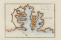 | Details | Roux, Joseph | 1764 |
| Plan of Valletta Malta by Joseph Roux |
|
Roux, Joseph |
|
| 1764 |
| LOC:4 |
| $385.00 | Roux--Joseph | Plan-of-Valletta-Malta-by-Joseph-Roux | Beautifully hand-colored mid 18th-century antique nautical chart and plan of Valetta, Malta ( Malthe ). Plate 75. <BR> </BR>
There were at least four small atlases of port and coastal charts that originated from Marseille hydrographers in the 18th century. Beginning in approximately 1727 these atlases included works by cartographers
<a rel="nofollow" href= "/MichelotBremondBackground.aspx"> Michelot and Bremond</a>,
<a rel="nofollow" href= "/Creator/Ayrouard--Jacques"> Jacques Ayrouard</a>,
<a rel="nofollow" href= "/Creator/Roux--Joseph"> Joseph Roux</a>
, and Jean Allezard. This small original chart is from the atlas of Mediterranean ports produced by Joseph Roux - "Recueil des Principaux Plans des Ports et Rades de la Mer Méditerranée". |
| 3641 | 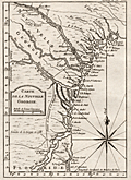 | Details | Bellin, Jacques Nicolas | 1764 |
| Fine mid eighteenth-century antique map of the Georgia coast. |
|
Bellin, Jacques Nicolas |
|
| 1764 |
| LOC:77 |
| $450.00 | Bellin--Jacques-Nicolas | Fine-mid-eighteenth-century-antique-map-of-the-Georgia-coast- | This early French maritime map shows the coast of Georgia in the United States. Coverage ranges from Saint Helena Island in the north to past St. Augustine in the south and includes the road "chemin" linking the two locations. Our copper-plate engraved map includes Augusta, Savannah, Jekyll Island, Talbot Island, Sapelo and Saint Simon's Island in Georgia; and St. Augustine, Florida. Prominently features those rivers which would have been important travel routes to the interior: St. John's River, Altahama River, Ogeechee River and the Savannah River along with many smaller waterways.
<br></br>
From J.N. Bellin's <b>Le Petit Atlas Maritime</b> . With latitude and longitude scales and a large decorative compass rose with rhumb lines. North is oriented to the top of map. Tome I, No. 38. |
| 729 | 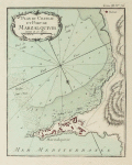 | Details | Bellin, Jacques Nicolas | 1764 |
| Plan du Chateau et Port de Marzalquivir |
|
Bellin, Jacques Nicolas |
|
| 1764 |
| LOC:4 |
| $150.00 | Bellin--Jacques-Nicolas | Plan-du-Chateau-et-Port-de-Marzalquivir | Antique port plan du Chateau et Port de Marzalquivir ( Algeria ) by J.N. Bellin in "Le Petit Atlas Maritime ". Tome 3 Number 76. |
| 628 | 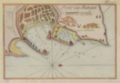 | Details | Roux, Joseph | 1764 |
| Antique chart of Rhodes, Greece |
|
Roux, Joseph |
|
| 1764 |
| LOC:2 |
| $185.00 | Roux--Joseph | Antique-chart-of-Rhodes--Greece | Antique nautical chart of the town and harbor of Rhodes on the island of Rhodes, Greece in the Aegean sea, close to the coast of Turkey.
<BR> </BR>
Original copperplate-engraved chart coverage by Joseph Roux includes the walled village of Rhodes, Casa Cornuta, and Rhodes harbor. The harbor and lighthouse, are shown as flanked by two jetties, each supporting a half-dozen windmills, and terminating offshore with a small fort or bastion. Numerous soundings and anchorages would have assisted 18th century mariners in navigating that area. <BR> </BR>
There were at least four small atlases of port and coastal charts that originated from Marseille hydrographers in the 18th century. Beginning in approximately 1727 these atlases included works by cartographers
<a rel="nofollow" href= "/MichelotBremondBackground.aspx"> Michelot and Bremond</a>,
<a rel="nofollow" href= "/Creator/Ayrouard--Jacques"> Jacques Ayrouard</a>,
<a rel="nofollow" href= "/Creator/Roux--Joseph"> Joseph Roux</a>
, and Jean Allezard. This small original chart is from the atlas of Mediterranean ports produced by Joseph Roux - "Recueil des Principaux Plans des Ports et Rades de la Mer Méditerranée". Plate 127. |
| 3675 | 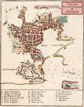 | Details | Bellin, Jacques Nicolas | 1764 |
| Antique chart of the harbor, town, and fort at Plymouth, England |
|
Bellin, Jacques Nicolas |
|
| 1764 |
| LOC:7 |
| $295.00 | Bellin--Jacques-Nicolas | Antique--chart-of-the-harbor--town--and-fort-at-Plymouth--England | Fine mid eighteenth-century French navigation port plan and map of Plymouth, England. By Jacques-Nicolas Bellin. A key with seventeen items provides information on the precise location of important governmental, ecclesiastical, and commercial sites as well a provides the location of major gates or access-control locations. This is a larger-scale plan covering a smaller area than Bellin's related smaller-scale "Carte de la Port de Plimouth" of Plymouth Sound.
<br></br>
From Bellin's <b>Petit Atlas Maritime.</b> Tome IV No 11. |
| 3676 | 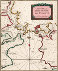 | Details | Bellin, Jacques Nicolas | 1764 |
| Antique chart of Plymouth Sound in England |
|
Bellin, Jacques Nicolas |
|
| 1764 |
| LOC:7 |
| $295.00 | Bellin--Jacques-Nicolas | Antique-chart-of-Plymouth-Sound-in-England | Attractive small French navigation port plan and map of Plymouth Sound and the town of Plymouth, England. By Jacques-Nicolas Bellin. Numerous depth soundings, anchorages, shallow areas, and navigational hazards are noted throughout this fine antique chart.
<br></br>
From Bellin's <b>Petit Atlas Maritime.</b> Tome IV, Number 10. |
| 627 | 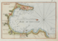 | Details | Roux, Joseph | 1764 |
| Bay of Gibraltar and Algeciras |
|
Roux, Joseph |
|
| 1764 |
| LOC:4 |
| $200.00 | Roux--Joseph | Bay-of-Gibraltar-and-Algeciras | Attractive antique nautical chart by Joseph Roux of the environs around the Bay of Gibraltar in the southwest Mediterranean Sea.
<BR> </BR>
This small original copperplate-engraved chart covers from the British Overseas Territory of Gibraltar in the east to the town of Algeciras in the west with plentiful soundings, sea hazards, and anchorages identified. Named features include numerous lookout towers, Rio Guadarranque ( Cuaranque ), Rio Palamones ( Riviere des Promones ), Fort St. Roch, Fort St. Philippe. Oriented with north to the left. <BR> </BR>
There were at least four small atlases of port and coastal charts that originated from Marseille hydrographers in the 18th century. Beginning in approximately 1727 these atlases included works by cartographers
<a rel="nofollow" href= "/MichelotBremondBackground.aspx"> Michelot and Bremond</a>,
<a rel="nofollow" href= "/Creator/Ayrouard--Jacques"> Jacques Ayrouard</a>,
<a rel="nofollow" href= "/Creator/Roux--Joseph"> Joseph Roux</a>
, and Jean Allezard. This small original chart is from the atlas of Mediterranean ports produced by Joseph Roux - "Recueil des Principaux Plans des Ports et Rades de la Mer Méditerranée". Plate 2. |
| 198 | 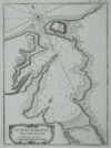 | Details | Bellin, Jacques Nicolas | 1764 |
| Le Port Marianne dans l'Isle de Cube. (Mariel, Cuba) |
|
Bellin, Jacques Nicolas |
|
| 1764 |
| LOC:5 |
| $185.00 | Bellin--Jacques-Nicolas | Le-Port-Marianne-dans-l-Isle-de-Cube--(Mariel--Cuba) | Antique black and white large-scale chart of Mariel harbor in the La Habana province of Cuba. This scarce engraved harbor chart is from Jacque Nicholas Bellin's "La Petit Atlas Maritime". Port of Mariel on the island of Cuba is labeled "Marianne". Mariel is the closest Cuban port to the U.S. Numerous soundings and sparse interior detail, in fact no habitation noted. Very good condition. Tome 1 No. 53. |
| 997 | 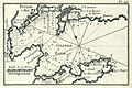 | Details | Roux, Joseph | 1764 |
| Toulon, France harbor |
|
Roux, Joseph |
|
| 1764 |
| LOC:4 |
| $95.00 | Roux--Joseph | Toulon--France-harbor | Antique engraving of the French port of Toulon, France from the atlas of Mediterranean ports produced by Joseph Roux. The old nautical chart concentrates on the harbor around Toulon and its surrounding area, including forts St. Louis, Balaguie, Leguillette, and the larger Fort de la Marque.
<BR> </BR>
Published in Roux's : "Recueil des principaux plans des Ports et Rades de la Mer Mediterranee …" including 121 harbor plans.
<BR> </BR>
There were at least four small atlases of port and coastal charts that originated from Marseille hydrographers in the 18th century. Between approximately 1720 and 1760 these atlases included works by cartographers
<a rel="nofollow" href= "/MichelotBremondBackground.aspx"> Michelot and Bremond</a>,
<a rel="nofollow" href= "/Creator/Ayrouard--Jacques"> Jacques Ayrouard</a>,
<a rel="nofollow" href= "/Creator/Roux--Joseph"> Joseph Roux</a>
, and Jean Allezard.
<BR> </BR>
Plate 23 |
| 2521 | 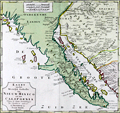 | Details | Tirion, Isaac | 1765 |
| Fine 18th century map of Lower California, Arizona and Mexico |
|
Tirion, Isaac |
|
| 1765 |
| LOC:10 |
| $750.00 | Tirion--Isaac | Fine-18th-century-map-of-Lower-California--Arizona-and-Mexico | Isaac Tirions's map of the American Southwest reflects the recent explorations of the Jesuit Fathers and others. Named locations include Casa Grande and San Xavier de Bac in the Southwest. Along the Pacific Ocean are noted San Diego, Ensenada and Cabo San Lucas. Numerous, oversized islands are shown along both coasts of the Baja California Peninsula.
<br></br>
Missions are pictorially identified throughout the map and there are two fortifications in Baja at San Jose del Cabo and Loretto.
<br></br>
Isaak Tirion, (1705 - 1765) was a Dutch publisher who produced several atlases and Dutch town plans from the Kalverstraat, in Amsterdam. Tirion produced a total of eight atlases in multiple editions |
| 1374 | 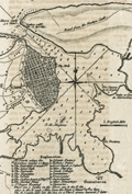 | Details | Smollett, Tobias G. | 1765 |
| Antique harbor plan or chart of Havana, Cuba |
|
Smollett, Tobias G. |
|
| 1765 |
| LOC:0 |
| $175.00 | Smollett--Tobias-G- | Antique-harbor-plan-or-chart-of-Havana--Cuba | Fine antique plan of the harbor and town of Havana ("Havanna"), Cuba in the Caribbean Sea from the middle of the 18th century. Rhumb lines, navigation hazards, sandbanks, and soundings suggest this small plan was based on a larger, probably military nautical chart of the location.
<br></br>
In writing about the port's defenses the author notes at bottom: "There are 2 castles on the shore one to the E. and the other to the W. each 5 miles from the town and mount 10 th. 12 guns."
<br></br>
20 key locations are identified, labeled alphabetically, and explained at bottom. For example:
<div class="indenttextblock">
<ul style="list-style-type: circle;">
<li>a. El Fuerte where the Governor resides, 22 guns.</li>
<li>b. The point gate and small fort</li>
<li>d. The barracks</li>
<li>g. The custom house and shipyard</li>
<li>k. Asiento factory</li>
<li>t. Nunneries</li>
</ul>
</div>
Other points of interest identified by the author include: Guanabacoa; Venta of Inn de Marmoleno; Estero de Cajunar; Morro Castle 52 guns; Battery called the 12 Apostles; Fort St. Maria de la Punta 30 guns; Nuestra Senora de la Regla [patron of the Bahía de la Habana].
<br></br>
The harbor plan of Havana comes from "History of England" by T. Smollett, published by Richard Baldwin, London. 1765. |
| 410 | 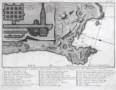 | Details | Morghen, Filippo | 1766 |
| Pianta del Cratere |
|
Morghen, Filippo |
|
| 1766 |
| LOC:8 |
| $190.00 | Morghen--Filippo | Pianta-del-Cratere | 18th century scarce copperplate engraved plan of the Phlegraean Fields (Campi Flegrei) near Pozzuoli west of Naples, Italy by Florentine artist Filippo Morghen in his "Views of Ruins in the Environs of Naples". <BR> </BR>
Noted geographic features include Capo di Posilipo, Miseno, Campana, Bacoli, Mare Morto, Lago Fusaro, Cuma, and Lago di Patria. This finely engraved plan contains inset plans of grottos in the vicinity including Grotta a Miseno, Grotta Lago Averno, and the Grotta a Cuma Superiore and Grotta a Cuma Inferiore. These geographical features and inset items and many more are among the 40 places of interest denoted by numbers on the plan and explained in a legend at the bottom of the engraving. Number 1. "Anno 1766". |
| 506 | 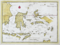 | Details | Le Rouge, George | 1767 |
| Isles Moluques |
|
Le Rouge, George |
|
| 1767 |
| LOC:6 |
| $185.00 | Le-Rouge--George | Isles-Moluques | Antique map of the Moluccas (Malaku Islands) in Asia, an archipelago within Indonesia. These islands were once referred to as the "Spice Islands". Plate 82. Coverage includes Bali, Borneo, Sulawesi (Celebes Isle) , East Java, Timor, Ambon, Ceram, and Western New Guinea. |
| 1069 | 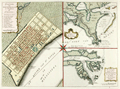 | Details | Tirion, Isaac | 1769 |
| Maps of French Colonial New Orleans and the Mississippi River |
|
Tirion, Isaac |
|
| 1769 |
| LOC:10 |
| $1,175.00 | Tirion--Isaac | Maps-of-French-Colonial-New-Orleans-and-the-Mississippi-River | Scarce early plan of New Orleans, Louisiana with insets of the mouth of the Mississippi River and also a long stretch of the Mississippi river from south of Donaldsonville to the passes. Published less than 50 years after the founding of New Orleans, Tirion's map of New Orlean's French Quarter is derived from an earlier map by Jacques Bellin / Brion de la Tour but contains additional details outside the French Quarter, which was largely marsh land at that time, including a road to Bayou St. John, a key trade route to the city from the east.
<br></br>
The sheet with three views is based on the layout of Thomas Jefferys earlier work (1759), who borrowed the earlier works of Jacques Bellin, of France's Depot de la Marine. Text is in German.
<br></br>
Isaak Tirion, (1705 - 1765) was a Dutch publisher who produced serveral atlases and Dutch town plans from the Kalverstraat, in Amsterdam. Tirion produced eight atlases in multiple editions |
| 6545 | 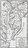 | Details | Mason, Charles and Jeremiah Dixon | 1769 |
| Scarce Chesapeake region map from the survey of Mason and Dixon |
|
Mason, Charles and Jeremiah Dixon |
|
| 1769 |
| LOC:78 |
| $400.00 | Mason--Charles-and-Jeremiah-Dixon | Scarce-Chesapeake-region-map-from-the-survey-of-Mason-and-Dixon | Scarce map of the Chesapeake Bay region with portions of Maryland, Virginia, Delaware, New Jersey and Pennsylvania. The map shows the results of Charles Mason and Jeremiah Dixon's survey of the boundary between the states of Pennsylvania and Maryland. Published in Gentleman's Magazine, 1769.
<br><br>
Surveyors Charles Mason and Jeremiah Dixon spent 58 months establishing the boundaries of Pennsylvania, Maryland, Delaware and West Virginia. The team attained widespread recognition as the creators of the Mason-Dixon Line, the de facto border between the northern and southern United States. Key features include: the Potowmack River, Cape May, Cape Charles, Baltimore, Philadelphia, and Annapolis. Shows several of the key roads in use during the mid 18th-century. |
| 659 |  | Details | Tirion, Isaac | 1769 |
| Plate River, Buenos Aires and Montevideo |
|
Tirion, Isaac |
|
| 1769 |
| LOC:5 |
| $125.00 | Tirion--Isaac | Plate-River--Buenos-Aires-and-Montevideo | Original antique chart by Isaac Tirion of the mouth of the Plate River ( Rivier de la Plata ) and points in present-day Argentina and Uruguay, South America.
<br></br>
Noted features include the city of Buenos Aires ( Ayres) Argentina , Quilmes ( Quelmes ), Bay of Montevideo ( Montvidio ) Uruguay, Kruid Magazyn, Wagthuis. Also includes the Juan River, St. Lucia River, Achuela River, Solis River, Baay van Maldonado, Kaap (Cape) St. Maria, Kaap der Steenrotsen, Kaap de Castilhos, and several islands: St. Michiel, St. Gabriel, Flora, and Zeehanden. Several large sand banks are shown. Inset map of the Bay of Maldonado.
<br></br>
Published in 1769 from Amsterdam by Isaac Tirion (1705 - 1765) in his "Hedendaagsche Historie of Tegenwoordige Staat van Amerika" or "Modern History". |
| 669 | 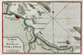 | Details | Tirion, Isaac | 1769 |
| Veracruz, Mexico |
|
Tirion, Isaac |
|
| 1769 |
| LOC:5 |
| $165.00 | Tirion--Isaac | Veracruz--Mexico | <br></br>Original antique chart of Veracruz, Mexico. Prominently features the walled city of Vera Cruz with the fortress (Kafteel) of San Juan de Ulua across a narrow channel. Includes Green Island ( Groen Eiland ) , White Island, Offerhanden Island, Blanquilla Island, Rivier Medello, Cape Gorda, Cape Hornos, Cape Mocamba, and Cape d'Anton Lizardo. Hydrographic features include numerous soundings and sandbanks.
<br></br>
It was on the island of San Juan de Ulúa that Spanish captain Juan de Grijalva first arrived in 1518, along with conquistador and author Bernal Díaz del Castillo ("The True History of the Conquest of New Spain"). That island was also the scene of a battle in 1569 between the Spanish Navy and a fleet led by John Hawkins that included Francis Drake. The treachery that the English perceived on the part of Spain at that battle helped to fuel antagonism between the two powers for many decades.
<br></br>
Published in 1769 from Amsterdam by Isaac Tirion (1705 - 1765) in his "Hedendaagsche Historie of Tegenwoordige Staat van Amerika" or "Modern History". |
| 1100 |  | Details | Le Roy, David | 1770 |
| Antique Chart of Piraeus and Phalere, Greece |
|
Le Roy, David |
|
| 1770 |
| LOC:8 |
| $275.00 | Le-Roy--David | Antique-Chart-of-Piraeus-and-Phalere--Greece | Attractive copper-engraved map of the environs of Piraeus, Greece by David le Roy (1724-1803). Coverage includes Munichia (today Mikrolimano) and Faliro. At the port of Pireaus le Roy identifies an anchorage, ruins of a market, several tombs, the "Maison du Consul", and a few depth soundings. Other key points on the map are the Church of Saint Nicolas and Cap Colias.
<br></br>
Le Roy was French architect and archaeologist, who published a well-researched description of the Acropolis of Athens and other Greek archaeological sites in his 1758 work: " Les Ruines des plus beaux monuments de la Grèce" (<i>Ruins of the Most Beautiful Monuments of Greece</i>). Second edition. |
| 4821 |  | Details | Jefferys, Thomas | 1770 |
| Rare Original Antique Chart of Amelia Island, Florida and Vicinity |
|
Jefferys, Thomas |
|
| 1770 |
| LOC:61 |
| $4,000.00 | Jefferys--Thomas | Rare-Original-Antique-Chart-of-Amelia-Island--Florida-and-Vicinity | Scarce engraved, hand-colored British navigation chart from 1770 containing three maps of Amelia Island, the Nassau River, Talbot Island and Cumberland Island, Georgia on the same sheet:
<div class="indenttextblocksingle">
<ul style="list-style-type: circle; ">
<li><b>Plan of Amelia Island in East Florida.</b> Based on an earlier survey by military engineer, surveyor, and cartographer John William Gerard de Brahm. De Brahm is known publishing “A Map of South Carolina and a Part of Georgia” in 1857.</b></li>
<li><b>A Chart of the Entrance to the St. Mary's River taken by Captn. W. Fuller.</b></li>
<li><b>A Chart of the Mouth of Nassau River and the Soundings on it taken at Low Water by Captn. W. Fuller.</b></li>
</ul>
</div>
Dedicated to John Earl of Egmont by William Fuller. Published by Thomas Jefferys, London, March 1770. |
| 719 |  | Details | Bellin, Jacques Nicolas | 1771 |
| Plan of Buccari ( Bakar ) and Porto-Re ( Kraljevica), Croatia |
|
Bellin, Jacques Nicolas |
|
| 1771 |
| LOC:7 |
| $200.00 | Bellin--Jacques-Nicolas | Plan-of-Buccari-(-Bakar-)-and-Porto-Re-(-Kraljevica)--Croatia | Beautifully colored 18th century French antique map / plan of the Bay of Bakar including Buccari, Croatia with Buccariza and Porto-Re, now Kraljevica. A few soundings and anchorages noted and two chateau, but much emphasis on the fortifications and batteries, containing in total 41 cannon. By J.N. Bellin, cartographer for the French Depot de la Marine.
<br></br>Published in Paris (1771) by Didot in "Description géographique du Golfe de Venise et de la Morée : avec des remarques pour la navigation et des cartes et plans des côtes, villes, ports et mouillages". Plate 14. |
| 1210 |  | Details | Dalrymple, Alexander | 1772 |
| Chart of the Northern Part of The Bay of Bengal |
|
Dalrymple, Alexander |
|
| 1772 |
| LOC:59 |
| $950.00 | Dalrymple--Alexander | Chart-of-the-Northern-Part-of-The-Bay-of-Bengal | Rare English sea chart, covering the mouth of the Ganges River and surrounding areas, by Alexander Dalrymple. Includes the population centers of Kolkata ("Calcutta") and Chittagong ("Islamabad") and the Chittagong Coast.
<br></br>
List of references at upper right of the chart contains a listing of islands, rivers, and creeks between Sagor and Chittagong.
<br></br>
Includes very extensive depth extensive soundings in fathoms. Arrows indicate the directions of strongest part of the flood-tide; Roman numbers show the high and low tides.
<br></br>
Published by Alexander Dalrymple on 15 September, 1772 "According to an Act of Parliament." In his doctoral thesis Cook wrote of Dalrymple that he was: <div class="indenttextblock"> "now generally regarded as the originator of official British hydrography… was cumulatively a private publisher of nautical charts and plans (from 1767), the 'examiner of ships' journals' and chart publisher for the East India Company (from 1779), and Hydrographer to the Admiralty (from 1795)". </div>
<br>
<div class="indenttextblock">Reference: Cook, Andrew S., <b>Alexander Dalrymple (1737 - 1808) Hydrographer to the East India Company and to the Admiralty; as publisher: A Catalogue of Books and Charts. </b> Vol. 3 .Doctoral Thesis, University of St. Andrews. 1992.</div> |
| 5171 |  | Details | de Vaugondy, Robert | 1772 |
| Carte de La Californie et des Pays Nord Ouest 1772 |
|
de Vaugondy, Robert |
|
| 1772 |
| LOC:10 |
| $325.00 | de-Vaugondy--Robert | Carte-de-La-Californie-et-des-Pays-Nord-Ouest-1772 | Two maps of the West Coast of North America, from the Strait of Anian to Cabo San Lucas and the southern tip of Baja California in Mexico. The work by Vaugondy consists of comparative geography from two maps derived from Mercator (1612) and Petrus Planicus (1641). The larger map (by Mercator) shows the Strait of Anian, Anian Regnum, Quivira Regnum, the Sierra Nevada mountains, and Nova Albion. Includes over 30 coastal place names, including Cabo Mendocino, San Miguel (San Diego), Cape Fortuna, and Laguna de los Apostolos. On both maps the lower end of the Baja Peninsula, Cabo San Lucas is referred to as "Cabo California" but only on the larger map is northwestern Mexico called "Nova Granada".
<br></br>
The smaller inset map (by Planicus) also shows the Strait of Anian, and depicts an open sea above, suggesting a Northwest Passage in the Arctic Circle. The northwest coastline on North America differs radically, and only Anian Regnum and Quivira Regnum are located, the latter considerably south of the location on the larger map. The smaller map includes a similar number of coastal place names including Cabo Blanco , Cabo de San Francisco and los Farilones (the Farallon islands). |
| 3647 |  | Details | Vaugondy, Robert de | 1772 |
| Antique map on travels of Captain Cluny |
|
Vaugondy, Robert de |
|
| 1772 |
| LOC:88 |
| $180.00 | Vaugondy--Robert-de | Antique-map-on-travels-of-Captain-Cluny | Map by Vaugondy to illustrate the mythical voyage of Captain Cluny. In 1769 Alexander Cluny published "The American Traveller: or, Observations on the Present State, Culture and Commerce of the British Colonies in America, in a Series of Letters... by an Old and Experienced Trader." The map, based on Cluny's supposed observations depicts North America from above the Arctic Circle, to the Gulf of Mexico, including an early exaggerated depiction of present day Alaska.
<br></br>
The most interesting feature is perhaps Cluny's supposed Northwest Passage extending from Repulse Bay to the mythical Arctic Cape Fowler. To the east is Greenland, Iceland, the western part of the European continent, and the northern portion of Africa.
<br></br>
This map is part of the 10 map series prepared by Vaugondy exploring the mapping of North American and specifically the Northwest Passage. The copper-plate engraved map was part of an early study in comparative cartography. |
| 4869 |  | Details | Jefferys, Thomas | 1774 |
| Three plans of Dunkirk France 960 1400 1658 |
|
Jefferys, Thomas |
|
| 1774 |
| LOC:13 |
| $150.00 | Jefferys--Thomas | Three-plans-of-Dunkirk-France-960-1400-1658 | Three plans of Dunkirk (Dunkerque), France on a single sheet of fine watermarked laid paper ca. 1760. Engraved by prolific British engraver and publisher Thomas Jefferys (1710-1771):
<div class="indenttextblock">
<ul style="list-style-type: circle;">
<li> A plan of Dunkirk as first walled round in 960 by Baldwin 3, Earl of Flanders.</li>
<li> A plan of Dunkirk as it was first fortifies in 1400 by Robert de Marle.</li>
<li> A plan of Dunkirk as it was fortified when taken by Marshal Turenne June 28, 1658.</li>
<br></br>
From Jefferys' "A description of the maritime parts of France, containing a particular account of all the fortified towns, forts, harbours, bays, and rivers …". Published by Faden and Jefferys, 1774. Plate III. |
| 1049 |  | Details | Depot de la Marine | 1774 |
| Large antique French sea chart of the Caribbean and Gulf of Mexico |
|
Depot de la Marine |
|
| 1774 |
| LOC:61 |
| $1,750.00 | Depot-de-la-Marine | Large-antique-French-sea-chart-of-the-Caribbean-and-Gulf-of-Mexico | Beautiful second edition (1774) of Bellin's important map of the Caribbean, Central America, and Gulf Coast, which is substantially revised and updated from the first edition issued by Bellin in 1749. Most notable feature on this stunning 18th century survivor is that south Florida is depicted as a mass of islands. The concept of the Florida archipelago derives from the work of Father Francois Le Maire, a missionary who arrived in Louisiana in June 1706.
<br></br>
In the title block the date has been partially erased from the original plate, causing some confusion that this chart might date to the 17th year of the French Revolution (1806). This is not the case. The attribution to the Duc du Paslin, the lack of R.F. in the circular Depot logo, and the depiction of Florida as an archipelago are all consistent with the Library of Congress' date for this map of 1774. (Library of Congress Map Diivision. "A List of Maps of America in the Library of Congress". 1901. p. 423. Retrieved online 3/2016) |
| 162 | 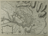 | Details | Jefferys, Thomas | 1774 |
| Plan of the City and Harbour of Toulon |
|
Jefferys, Thomas |
|
| 1774 |
| LOC:4 |
| $175.00 | Jefferys--Thomas | Plan-of-the-City-and-Harbour-of-Toulon | Nice antique copperplate-engraved plan from 1774 of the Vauban-style fortifications around Toulon, France includes the King's harbor, merchant's harbor, arsenal, and the two city gates, where the beginnings of development outside the walls is barely visible.
<BR> </BR>
Despite its massive bastions and the support of a combined British/Spanish naval force, the fortress fell to French Republican forces in 1793 forcing the fleet to withdraw. It was during the Siege of Toulon that 24 year old Napoleon Bonaparte won a promotion from Captain to Brigadier General for his leadership including strategic placement of artillery batteries.
<BR> </BR>
Printed for Faden and Jefferys in 1774; the two volumes in the series contained 87 charts of the sea coast and coastal fortifications. |
| 5306 |  | Details | Mannevillette, d'Apres | 1775 |
| Rare French charts of Vietnam Coast including Da Nang |
|
Mannevillette, d'Apres |
|
| 1775 |
| LOC:9 |
| $475.00 | Mannevillette--d-Apres | Rare-French-charts-of-Vietnam-Coast-including-Da-Nang | Two original antique engraved charts on a single sheet: the Con Son Island Archipelago and Da Nang Bay including the Vietnam coast between the towns of Hue and Da Nang: "Plan de l'Isle Condor"; "Carte d'une Partie de la Cote de Cochinchine".
<br></br>
Includes three fine inset coastal elevation views:
<div class="indenttextblocksingle">
<ul style="list-style-type: circle;">
<li>Vue de l'Isle Champello ou Cham Collao.</li>
<li>Vue de l'entrée de la Baye de Touranne (Da Nang was known as Tourane during the French colonial period)</li>
<li>Vue de l'Isle Condor lorsque la Havre...</li>
</ul>
</div>
From J. B. d'Apres de Mannevillette's sea atlas "Le Neptune Oriental ou routier general des Cotes des Indes orientales et de la Chine." Jean-Baptiste d'Après de Mannevillette (1707 - 1780) was a French sailor, navigator, and hydrographer active in the mid-18th century. Mannevillette studied mathematics and navigation in Paris before winning a commission as an officer on a merchant vessel headed for the West Indies. Mannevillette collected and revised a number of regional nautical charts during numerous voyages around Africa to India and China.
The Compagnie des Indes (French East India Company) appointed D'Apres de Mannevillette as director of maps and plans at Lorient in 1752. |
| 4807 |  | Details | Jefferys, Thomas | 1775 |
| Jefferys excellent 1775 antique chart of the Yucatan Peninsula to western Cuba |
|
Jefferys, Thomas |
|
| 1775 |
| LOC:0 |
| $1,050.00 | Jefferys--Thomas | Jefferys-excellent-1775-antique-chart-of-the-Yucatan-Peninsula-to-western-Cuba | Antique engraved sea chart from <b>Yucatan</b> Peninsula to western Cuba. Numerous large square-rigged ships are depicted enroute to either Campeche; Cartagena, Colombia; or Havana, Cuba.
<br></br>
Published under Thomas Jeffery's name by Sayer and Bennet. Includes <b>Merida, Valladolid, Loggerhead Key, Cozumel, Isla Mujeres</b>, etc.
<br></br>
This 1775 original British privately-published chart is a continuation of Jefferys' magnificent map of Cuba, which omits the western tip of the Pearl of the Antilles, Cuba.
<br></br>
A fleet of square-rigged galleons is shown sailing on a plotted track labeled: "Gallions Track from Cartagena", while two ships sail west along a plotted track labeled: "Track from Cape Catoche to Campeche." To round out the cast of characters a third ship, apparently a privateer, exits a shorter track between two rocky areas. That track is noted as the "Passage del Corsario." Note: a favorite tactic of pirates, corsairs, and cocaine smugglers has long been to use local knowledge of the water depth and hazards to frustrate pursuers.
<br></br>
From Sayer's and Bennett's atlas titled: The West-India Atlas: or, a compendious description of the West-Indies: illustrated with forty one correct charts and maps, taken from actual surveys."
<br></br>
Publishers attribution reads: "London. Printed for Rob.t Sayer, Map and Print seller. No 53 Fleet Street as the Act directs 20th Feb.y 1775. According to Rumsey <div class="indenttextblock">
"Sayer and Bennet acquired his [Jefferys'] materials in preparation for this atlas, and published the atlas posthumously under his name (as they did with the American Atlas) in 1775. The heart of this atlas and the most detailed part is the sixteen sheet large chart and index sheet of the whole of the West Indies. (
<a href="http://www.davidrumsey.com/luna/servlet/detail/RUMSEY~8~1~2795~310044:The-coast-of-Yucatan-from-Campeche-" target="_blank">Internet </a>)
</div> |
| 4958 |  | Details | Jefferys, Thomas | 1775 |
| Jefferys Antique Chart of the Yucatan Peninsula |
|
Jefferys, Thomas |
|
| 1775 |
| LOC:52 |
| $650.00 | Jefferys--Thomas | Jefferys-Antique-Chart-of-the-Yucatan-Peninsula | Well-worn, decorative antique sea chart covering from the Yucatan Peninsula of Mexico to western Cuba, including Merida, Valladolid, Loggerhead Key, Cozumel, Isla Mujeres, etc. By English cartographer Thomas Jefferys. A fleet of galleons is shown on a plotted track labeled: "Gallions Track from Cartagena", while two ships head west along a plotted track labeled: "Track from Cape Catoche to Campeche." To round out the cast of characters a third ship, apparently a privateer, exits a shorter track between two rocky areas. That track is noted as the "Passage del Corsario" (A corsair was a privateer, or pirate acting with the explicit backing of a foreign government).
<br></br>
From Sayer's and Bennett's atlas titled: The West-India Atlas: or, a compendious description of the West-Indies: illustrated with forty one correct charts and maps, taken from actual surveys."
<br></br>
Publishers attribution reads: "London. Printed for Rob.t Sayer, Map and Print seller. No 53 Fleet Street as the Act directs 20th Feb.y 1775. |
| 4828 | 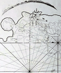 | Details | Mannevillette, d'Apres | 1775 |
| Antique chart of Jeddah Gedda Saudi Arabia |
|
Mannevillette, d'Apres |
|
| 1775 |
| LOC:88 |
| $900.00 | Mannevillette--d-Apres | Antique-chart-of-Jeddah-Gedda-Saudi-Arabia | Rare. Early French nautical chart of the anchorage of Jeddah, Saudi Arabia on the Red Sea. Shows the passage into the port of "Gedda" with a defensive wall. Curved elevation view of the coastline near Jeddah, Saudi Arabia.
<br></br>
From J. B. d'Apres de Mannevillette's sea atlas "Le Neptune Oriental ou routier general des Cotes des Indes orientales et de la Chine." Jean-Baptiste d'Après de Mannevillette (1707 - 1780) was a French sailor, navigator, and hydrographer active in the mid-18th century. Mannevillette studied mathematics and navigation in Paris before winning a commission as an officer on a merchant vessel headed for the West Indies. Mannevillette collected and revised a number of regional nautical charts during numerous voyages around Africa to India and China.
<br></br>
Antique copper-engraving, published in Paris, ca. 1775. No folds. (Jiddah) |
| 5336 |  | Details | Niebuhr, Carsten | 1775 |
| Antique plan of the port of Jeddah Saudi Arabia |
|
Niebuhr, Carsten |
|
| 1775 |
| LOC: |
| $375.00 | Niebuhr--Carsten | Antique-plan-of-the-port-of-Jeddah-Saudi-Arabia | Very scarce antique copper engraving of the port and city of <b>Jeddah (Dsjidda), Saudi Arabia.</b> The plan is after the travels to the Middle East and India of German explorer Carsten Niebuhr. Niebuhr himself conducted the survey of Jeddah of which this is a record. The plan of Jeddah has both topographic and hydrographic details with numerous soundings and sandbanks reflecting an extensive, time-consuming survey of the port and harbor of Jeddah. North oriented to bottom right.
<br></br>
With a population currently estimated at 4.2 million persons, Jeddah is the largest city in Makkah Province, the largest sea port on the Red Sea, and the second-largest city in Saudi Arabia.
<br></br>
<b>Carsten Niebuhr</b> (1733-1815), a military surveyor, was the only survivor of the six-member Royal Danish Expedition to Arabia that departed the city of Copenhagen in 1761 at the request of Danish King Frederick V. In addition to Jeddah the expedition visited Istanbul, Cairo, Bombay, Basra, Baghdad, Aleppo, Mokka, Alexandria and other middle eastern sites. Returning alone to Copenhagen in November 1767, Niebuhr spent the next few years writing an extensive account of the expedition's travels in four volumes including <i>Beschreibung von Arabien</i> in 1772.
Plate 18. |
| 1450 |  | Details | van Keulen, Gerard | 1775 |
| Jefferys Sayers Chart of Jamaica from West-India Atlas |
|
van Keulen, Gerard |
|
| 1775 |
| LOC:51 |
| $450.00 | van-Keulen--Gerard | Jefferys-Sayers-Chart-of-Jamaica-from-West-India-Atlas | Attractive, very desirable antique British chart of the Island of Jamaica in the Caribbean Sea by Thomas Jefferys. After surveys by Dutch cartographer Gerard Van Keulen.
<br></br>
This spectacular chart is from the scarce <b>first issue of The West-India Atlas, 1775 by Sayer</b>, the other issues being 1781, 1787, 1794, 1796, 1807, and 1818 published by Sayer and then Laurie and Whittle. <a href="https://www.davidrumsey.com/home" target="_blank">(Online).</a>
<br></br>
"The West-India Atlas: or, A Compendious Description of the West-Indies: illustrated with Forty Correct Charts and Maps, taken from Actual Surveys. Together with An Historical Account of the Several Countries and Islands which compose that part of the world. Their Discovery, Situation, Extent, Boundaries, Product, Trade, Inhabitants, Strength, Government, Religion, &c."
Authors: Gerard van Keulen, Thomas Jefferys.
Publishers: Robert Sayer.
Jefferys died in 1771; Sayer acquired Jefferys' materials in preparation for this atlas, and published the atlas posthumously under his name. |
| 1448 |  | Details | van Keulen, Gerard | 1775 |
| Curacao by Gerard van Keulen West-India Atlas Jefferys Sayer |
|
van Keulen, Gerard |
|
| 1775 |
| LOC:51 |
| $1,800.00 | van-Keulen--Gerard | Curacao-by-Gerard-van-Keulen-West-India-Atlas-Jefferys-Sayer | Fine, very desirable chart of Curaçao in the Lesser Antilles of the Caribbean Sea. Inset plan of Fort Amsterdam, in Willemstad, constructed in 1634 by the Dutch West India Company. A beautiful British published chart based on hydrographic surveys by Dutch cartographer Gerard van Keulen.
<br></br>
The chart is from the scarce <b>first issue of 1775 by Sayer</b>, the other issues being 1781, 1787, 1794, 1796, 1807, and 1818 published by Sayer and then Laurie and Whittle. <a href="https://www.davidrumsey.com/home" target="_blank">(Online).</a>
<br></br>
From: "The West-India Atlas: or, A Compendious Description of the West-Indies: illustrated with Forty Correct Charts and Maps, taken from Actual Surveys. Together with An Historical Account of the Several Countries and Islands which compose that part of the world. Their Discovery, Situation, Extent, Boundaries, Product, Trade, Inhabitants, Strength, Government, Religion, &c."
Authors: Gerard van Keulen, Thomas Jefferys.
Publishers: Robert Sayer.
Jefferys died in 1771; Sayer acquired Jefferys' materials in preparation for this atlas, and published the atlas posthumously under his name. |
| 3594 | 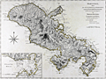 | Details | Jefferys, Thomas | 1775 |
| Antique nautical chart of Martinique West-India Atlas Jefferys Sayer |
|
Jefferys, Thomas |
|
| 1775 |
| LOC:0 |
| $900.00 | Jefferys--Thomas | Antique-nautical-chart-of-Martinique-West-India-Atlas-Jefferys-Sayer | Fine, very desirable chart of Martinique (Martinico) in the the Caribbean Sea. A beautiful British-published chart based on hydrographic surveys by English engineers before 1775. Inset port plan of Cul de Sac Royal or Fort de France Bay.
<br></br>
The chart is from the scarce <b>first issue of 1775 by Sayer</b>, the other issues being 1781, 1787, 1794, 1796, 1807, and 1818 published by Sayer and then Laurie and Whittle. <a href="https://www.davidrumsey.com/home" target="_blank">(Online).</a>
Publishers attribution reads: "London. Printed for Rob.t Sayer, Map and Printseller. No 53 in Fleet Street as the Act directs 20th Feb.y 1775.
<br></br>
From: "The West-India Atlas: or, A Compendious Description of the West-Indies: illustrated with Forty Correct Charts and Maps, taken from Actual Surveys. Together with An Historical Account of the Several Countries and Islands which compose that part of the world. Their Discovery, Situation, Extent, Boundaries, Product, Trade, Inhabitants, Strength, Government, Religion, &c."
Authors: Gerard van Keulen, Thomas Jefferys.
Publishers: Robert Sayer.
Jefferys died in 1771; Sayer acquired Jefferys' materials in preparation for this atlas, and published the atlas posthumously under his name. |
| 1460 | 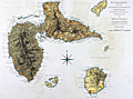 | Details | Jefferys, Thomas | 1775 |
| Antique Chart of Guadeloupe in the Caribbean Sea Jefferys Sayer |
|
Jefferys, Thomas |
|
| 1775 |
| LOC:51 |
| $800.00 | Jefferys--Thomas | Antique-Chart-of-Guadeloupe-in-the-Caribbean-Sea-Jefferys-Sayer | Fine antique British chart of the island of Guadeloupe ("Guadaloupe") in the Caribbean Sea. Includes the nearby islets of Marie-Galante, Isle des Saintes, Petit Terre, and la Desirade. Jefferys names three main sections of Guadeloupe: Basse Terre, Cares Terre, and Grand Terre. With depth soundings, sand banks, and anchorages identified. Fine central compass rose.
<br></br>
Attribution reads: London. Printed for Robert Sayer Map and Printseller. No. 53 Fleet Street as the act directs 20 February, 1775.
<br></br>
The chart is from the scarce <b>first issue of The West-India Atlas, 1775 by Sayer</b>, the other issues being 1781, 1787, 1794, 1796, 1807, and 1818 published by Sayer and then Laurie and Whittle. The volume combined both the elements of an atlas and a pilot, with geographic and hydrographic information. The maps include those for the larger individual islands of the West Indies. <a href="https://www.davidrumsey.com/home" target="_blank">(Online).</a> |
| 2489 |  | Details | Jefferys, Thomas | 1775 |
| Antique Chart of The Island of Jamaica and Cape Gracias a Dios |
|
Jefferys, Thomas |
|
| 1775 |
| LOC:51 |
| $1,675.00 | Jefferys--Thomas | Antique-Chart-of-The-Island-of-Jamaica-and-Cape-Gracias-a-Dios | Fine antique sea chart covering from the Mosquito Coast (labeled Moskito King's Party) of Honduras and Nicaragua to Jamaica, a distance over water of more than 400 miles. First state chart with numerous navigational details such as depth soundings, reefs, and the prevailing current.
<br></br>
Includes ships' tracks labeled 'Galleons Track from Cartagena to Havana' that skirt numerous reefs on the dangerous voyage from Colombia to Cuba. These details are worthy of study under magnification for the insight they provide on the key success factors for seafarers in the mid-eighteenth century.
<div class="indenttextblock">
<ul style="list-style-type: circle;">
<li>South Key- "Fresh water under a large wild grape tree."</li>
<li>"Main Cape Reef and Keys by the Spaniards los Tiburones"</li>
<li>"Serrana alias The English Bank called also Pearl Island"</li>
<li>"Quinta el Sueno called by the baymen Guana Reef"</li>
<li>Southwest of Jamaica- "La Bivora or Pedro Shoals according to the surveys of Spanish pilots in 1727 and 1750"</li>
</ul>
</div>
From Sayer's and Bennett's atlas titled: The West-India Atlas: or, a compendious description of the West-Indies: illustrated with forty one correct charts and maps, taken from actual surveys."
<br></br>
Publishers attribution reads: "London. Printed for Rob.t Sayer, Map and Printseller. No 53 Fleet Street as the Act directs 20th Feb.y 1775. According to Rumsey <div class="indenttextblock">
"Sayer and Bennet acquired his [Jefferys'] materials in preparation for this atlas, and published the atlas posthumously under his name (as they did with the American Atlas) in 1775. The heart of this atlas and the most detailed part is the sixteen sheet large chart and index sheet of the whole of the West Indies. (
<a href="http://www.davidrumsey.com/luna/servlet/detail/RUMSEY~8~1~2795~310044:The-coast-of-Yucatan-from-Campeche-" target="_blank">Internet </a>)
</div> |
| 895 |  | Details | Jefferys, Thomas | 1775 |
| Antique Chart of Southern Mexico from Veracruz to Ciudad del Carmen |
|
Jefferys, Thomas |
|
| 1775 |
| LOC:51 |
| $920.00 | Jefferys--Thomas | Antique-Chart-of-Southern-Mexico-from-Veracruz-to-Ciudad-del-Carmen | Beautiful antique British chart of southern Mexico and Guatemala centered on the Mexican state of Oaxaca. This first edition chart by Thomas Jefferies in 1775, includes coastal features of the <b>Bay of Campeche</b> to the north and the <b>Gulf of Tehuantepec</b> on the Pacific or southern coast. This chart contains significant interior details including volcanos (e.g. Vulcan de San Martin or "el Pan de Mizapa"), rivers, mountains, and numerous towns and villages.
<br></br>
First, more scarce edition with spelling error in the title: "NEUva Veracruz". In the second edition the title was corrected to "NUEva Vera Cruz".
<br></br>
On the northern Gulf Coast in Mexico's Veracruz and Tabasco states significant habitations include <b>Nueva Vera Cruz</b>, San Juan de Ulua, a fort, guardhouse, and dock near the Laguna de Alvarado ("Rio Alvarado"), smaller villages both near the mouth of the Rio Gijalva and Frontera, and in the vicinity of Ciudad del Carmen ("Y. Triste"). Fascinating note south of the Laguna de Terminos at far right corner reads "<b>Logwood Creeks</b> occupied formerly by the English". Logwood, a small tree used to produce dye for clothing, was one of the main exports from the region. Notably, in 1675, the explorer and sometime buccaneer William Dampier traveled to "Campeachy" and worked among the logwood-cutters.
<br></br>
On the Pacific Coast, in the states of Oaxaca and Chiapas noted villages include: Puerto Angel ("Puerto de Angeles"), Puerto Escondido, Galera ("Punta de la Galera"), Tangolunda ("Tangolo or Tangolotanga"), "Puerta de la Ventosa", Salina Cruz, and Puerto San Jose, Guatemala ("Port of Guatimala").
<br></br>
Publishers attribution reads: "London. Printed for Rob.t Sayer, Map and Printseller. No 53 Fleet Street as the Act directs 20th Feb.y 1775. Online sources indicate that the misspelling of Nueva as "Neuva" is a characteristic of Jeffery's first state of this chart. |
| 3624 | 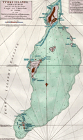 | Details | Jefferys, Thomas | 1775 |
| Antique Chart of the Turks Islands and Turks Islands Passage |
|
Jefferys, Thomas |
|
| 1775 |
| LOC:51 |
| $900.00 | Jefferys--Thomas | Antique-Chart-of-the-Turks-Islands-and-Turks-Islands-Passage | A fine original antique British chart of the <b>Turks Islands</b> in the Caribbean Sea engraved by Thomas Jefferys. Covers Grand Turk Island, Salt Key, Sand Key, Cotton Island, Pelicans Island, and others in the vicinity. A foundational map for collectors, it is the earliest obtainable sea chart to focus solely on the Turks Islands, today a British Overseas Territory. (Note: The Caicos Islands are not included on this chart.)
<br></br>
Shows rocks, banks, reefs, shoals, anchorages, "Salt Rakers Huts" on the 2 main islands, rhumb lines. Printing done from a hand-engraved copper plate by Jefferys.
<br></br>
At Sand Key at point "A", on the Southern Bluff, a note reveals <div class="indenttextblock"> " Upon this bluff (Sand Key) the French, after the late Peace, erected a Sea Mark which they were soon obliged to demolish."</div>
<BR/>
The chart is from the scarce <b>first edition of the West India Atlas" 1775 by Sayer</b>, the other issues being 1781, 1787, 1794, 1796, 1807, and 1818 published by Sayer and then Laurie and Whittle. <a href="https://www.davidrumsey.com/home" target="_blank">(Online).</a>
<br></br>
From: "The West-India Atlas: or, A Compendious Description of the West-Indies: illustrated with Forty Correct Charts and Maps, taken from Actual Surveys. Together with An Historical Account of the Several Countries and Islands which compose that part of the world. Their Discovery, Situation, Extent, Boundaries, Product, Trade, Inhabitants, Strength, Government, Religion, &c."
Author: Thomas Jefferys.
Publishers: Robert Sayer.
Jefferys died in 1771; Sayer acquired Jefferys' materials in preparation for this atlas, and published the atlas posthumously under his name. |
| 1220 |  | Details | Mannevillette, d'Apres | 1775 |
| Antique Chart of the Arabian Sea, Gulf of Aden, and Gulf of Oman |
|
Mannevillette, d'Apres |
|
| 1775 |
| LOC:59 |
| $925.00 | Mannevillette--d-Apres | Antique-Chart-of-the-Arabian-Sea--Gulf-of-Aden--and-Gulf-of-Oman | Large striking antique sea chart centered on the Arabian Sea. This copperplate navigational chart was printed in Paris ca. 1775 based on the explorations of d'Apres de Mannvillette. Includes the Laccadive Archipelago, Sri Lanka ( Ceylan ), the Maldive Archipelago, the Gulf of Aden and Gulf of Oman. Key cities noted include Aden, Oman, Muscat, Mumbai ( Bombay ), Surate, Goa, Pondicherry, and Colombo. Simple outline hand-coloring and the absence of interior details lends this fine example a striking graphical appearance. |
| 5207 | 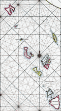 | Details | Mannevillette, d'Apres | 1775 |
| Nautical chart of the Nicobar Islands Indian Ocean |
|
Mannevillette, d'Apres |
|
| 1775 |
| LOC:9 |
| $300.00 | Mannevillette--d-Apres | Nautical-chart-of-the-Nicobar-Islands-Indian-Ocean | Original engraved sea chart of the Nicobar Island Archipelago in the Bay of Bengal. Islands in the Nicobar Archipelago include Car Nicobar, Battimalym, Chowra, Great Nicobar, Little Nicobar, Katchal, Nancowry, and more. In 2013 UNESCO declared 85% of Great Nicobar Island, the largest, as the Great Nicobar Biosphere Reserve.
<br></br>
Manvillette's chart Includes an inset plan of the channel between the islands of Camorta, Nancowry, and Trincut which would have provided a harbor from storms but where navigation without the chart would have been dangerous: "Plan Particulier du Port Compris entre les Isles Nancaueri, Souri, et Tricutte."
<br></br>
This fine hand-colored nautical chart is from J. B. d'Apres de Mannevillette's sea atlas "Le Neptune Oriental ou routier general des Cotes des Indes orientales et de la Chine." Jean-Baptiste d'Après de Mannevillette (1707 - 1780) was a French sailor, navigator, and hydrographer active in the mid-18th century. Mannevillette studied mathematics and navigation in Paris before winning a commission as an officer on a merchant vessel headed for the West Indies. Mannevillette collected and revised a number of regional nautical charts during numerous voyages around Africa to India and China. |
| 6491 | 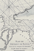 | Details | Mannevillette, d'Apres | 1775 |
| Antique nautical chart of the Bangka or Banca Strait |
|
Mannevillette, d'Apres |
|
| 1775 |
| LOC:90 |
| $250.00 | Mannevillette--d-Apres | Antique-nautical-chart-of-the-Bangka-or-Banca-Strait | Antique nautical chart of the Detroit du Banca or Bangka Strait from 1775 by Jean-Baptiste-Nicolas-Denis D’ Après de Mannevillette (1707 – 1780). Inset chart of a smaller strait between the Isle de Sel and part of Biliton Island or Belitung Island. That strait lies approximately 70 miles to the east of south Bangka Island.
<br><br>
The map is particularly interesting historically as it incorporates paste-over corrections to the eastern portion of the Isle de Banca with the previously charted coastline still faintly visible beneath the corrections. According to a pasted note at bottom left, the pasted corrections to the northeast of Bangka Island were based on the observations of M. Crozet. Julien Crozet was second in command during the French expedition of Marion De Fresne to Tasmania, New Zealand, and the South Pacific, sailing in 1771. Crozet assumed command of the expedition after the voyage's commander, Marion De Fresne, and 26 crew members were killed by the Maori Ngare Raumati tribe off the coast of New Zealand in June 1772.
<br><br>
Bangka Strait is the narrow body of water that separates the island of Sumatra from the Indonesian island of Bangka. Bangka is one of the world's most important tin-producing areas. |
| 7887 |  | Details | Mannevillette, d'Apres | 1775 |
| Malacca Strait Bay of Bengal, from the Isle of Ceylon Gulf of Siam |
|
Mannevillette, d'Apres |
|
| 1775 |
| LOC:141 |
| $495.00 | Mannevillette--d-Apres | Malacca-Strait-Bay-of-Bengal--from-the-Isle-of-Ceylon-Gulf-of-Siam | A fine 18th-century nautical chart of the Bay of Bengal ."Carte Reduite du Golfe de Bengale, depuis L'Isle De Ceylan jusqu'au Golfe De Siam, avec la partie Septentrionale du Detroit De Malac". Produced by Jean-Baptiste Nicolas Denis d'Après de Mannevillette (1707-1780).
<br><br>
It depicts the Bay of Bengal region, extending from Ceylon (present-day Sri Lanka) to the Gulf of Siam (now known as the Gulf of Thailand), and include the northern part of the Strait of Malacca.
<br><br>
<div style="text-align: center;font-size:105%;">
<i>Professional hand coloring for this chart is available at a very modest fee.</i>
</div> |
| 6704 |  | Details | Mannevillette, d'Apres | 1775 |
| Chart of the east coast of Madagascar |
|
Mannevillette, d'Apres |
|
| 1775 |
| LOC:68 |
| $475.00 | Mannevillette--d-Apres | Chart-of-the-east-coast-of-Madagascar | Original French nautical chart of a portion of the east coast of the island of Madagascar, off the east coast of Africa. From the second edition of Le Neptune Oriental published 1775 in Paris.
<br><br>
The most prominent feature of the chart is Antongil Bay, a large bay located on the northeast coast of Madagascar. The bay is known for its beautiful beaches, rich biodiversity, and important fishing industry. The surrounding area is also home to several protected areas, including the Masoala National Park and the Nosy Mangabe Special Reserve.
<br><br>
Antongil Bay has a rich history dating back to the early days of Madagascar's settlement by humans. The bay was a major center of trade and commerce for the island's indigenous populations, who used it to transport goods and communicate with other communities along the coast.
<br><br>
During the colonial period, Antongil Bay became an important center of trade for the French, who established several ports along its shores. The bay was used to transport goods such as vanilla, cloves, and other spices, which were grown on plantations throughout the region
<br><br>
The chart includes large-scale inset plans for the following bays and anchorages:
<div class="indenttextblocksingle">
<ul style="list-style-type: circle;"></li>
<li>Plan de l'Ance de Tamatave</li>
<li>Plan de l'Anse de Veninguebe</li>
<li>Plan du Port de Teintingue</li>
<li>Plan de la Rade de Fullpointe</li>
</ul>
</div> |
| 798 |  | Details | Mannevillette, d'Apres | 1775 |
| Antique chart of the Strait of Bali with Madura and Java |
|
Mannevillette, d'Apres |
|
| 1775 |
| LOC:9 |
| $550.00 | Mannevillette--d-Apres | Antique-chart-of-the-Strait-of-Bali-with-Madura-and-Java | Antique French nautical chart of the Bali Strait with Java to the left and Bali at right and the Island of Madura at top. This attractive 1775 sea chart contains an inset plan of Banyuwangi Bay ("Baye de Ballambouang") and three inset profile coastal views of the headlands surrounding the Bali Strait.
<br></br>
Key points of interest include Buleleng ("Bollilingh"), Bali; the Madura Strait; Sumenep, Madura; Palau Puteran; Palau Gili Iyang; Palau Sapudi ("Isle Galioen ou Respondi"); Palau Raas ("Isle de Entrepot").
<br></br>
The chart is based on exploration and observations aboard several vessels: France's "Elephant", and several British ships including the 29 gun East Indiaman "Winchelsea" commanded by Thomas Howe. Number 45.
<br></br>
By Jean-Baptiste d'Après de Mannevillette (1707 - 1780) a French sailor, navigator, and hydrographer active in the mid-18th century. Mannevillette studied mathematics and navigation in Paris before winning a commission as an officer on the merchant headed for the West Indies. Mannevillette collected and revised a number of regional nautical charts during numerous voyages around Africa to India and China. |
| 1449 |  | Details | Lempriere, Clement | 1775 |
| Bermuda or Summer's Island West-India Atlas Lempriere Jefferys Sayer |
|
Lempriere, Clement |
|
| 1775 |
| LOC:51 |
| $4,500.00 | Lempriere--Clement | -Bermuda-or-Summer-s-Island-West-India-Atlas-Lempriere-Jefferys-Sayer | <div class="indenttextblock">
"This coast is the boldest in Bermuda and in some places the Largest Ships may with safety come within half gun shot of shore."
</BR></BR>
"Here in the months of March, April, and May they Fish for Whales."
</div>
</BR>
Above are a few of the notes from this fine antique chart of Bermuda. An extremely desirable British chart titled: "The Bermuda's or Summer's Islands." After a survey by Clement Lempriere. This is from the scarce <b>first issue of The West-India Atlas, 1775 by Sayer</b>, the other issues being 1781, 1787, 1794, 1796, 1807, and 1818 published by Sayer and later Laurie and Whittle.<a href="https://www.davidrumsey.com/home" target="_blank">(Online).</a>
<br></br>
On age-appropriate laid watermarked paper with a fleur-de-lis surmounted by a crown
<br></br>
During Bermuda's colonial period ca. 1615 the island was divided into eight equally-sized administrative areas west of St. George's called <b>"tribes" (parishes)</b>. These "tribes" were areas of land partitioned off to the principal investors of the Somers Isles Company.
<br></br>
From: "The West-India Atlas: or, A Compendious Description of the West-Indies: illustrated with Forty Correct Charts and Maps, taken from Actual Surveys. …"
Authors: Clement Lempriere (original survey), Thomas Jefferys.
Publishers: Robert Sayer.
Jefferys died in 1771; Sayer acquired Jefferys' materials in preparation for this atlas, and published the atlas posthumously under his name. |
| 4706 |  | Details | Fortin, J. | 1775 |
| Antique star chart of the Southern Hemisphere after Lacaille |
|
Fortin, J. |
|
| 1775 |
| LOC:13 |
| $280.00 | Fortin--J- | Antique-star-chart-of-the-Southern-Hemisphere-after-Lacaille | Fine decorative antique hand-colored engraved celestial star chart for the Southern Hemisphere from the Atlas Céleste de Flamstéed, updated and reduced by J. Fortin in 1776. This map of the Southern skies is based on Nicolas Louis de Lacaille’s star chart from 1754 in which Lacaille included 14 new constellations.
<br></br>
Lacaille sailed to South Africa in 1750 where he set up a small observatory at the Cape of Good Hope under the famous Table Mountain, which impressed him so much that he later named a constellation after it, Mensa. At the Cape in 1751 - 52 Lacaille observed the positions of nearly 10,000 stars. On his return to France in 1754, Lacaille presented a map of the southern skies to the French Royal Academy of Sciences which included 14 new constellations of his own invention. An engraved version of his celestial map was published in the Academy’s Mémoires in 1756 and Lacaille’s new constellations were rapidly accepted by other astronomers.
<br></br>
Flamsteed was born into a prosperous family & was largely self taught as he did not attend University due to poor health. He was appointed the first Astronomer Royal by King Charles II, with the Royal Observatory at Greenwich being built for him to continue his astronomical observations. Flamsteed's Celestial Atlas was first published ten years posthumously by his wife in 1729. It set the standard in professional astronomy for almost a century, with the positions of over 3,000 stars given more accurately than ever before.
<br></br>
French text for names of stars and constellations. Page 29. Lettered by Beauble' ; engraved by C.E. Voisard. |
| 567 |  | Details | Sayer, Robert and Bennett, John | 1776 |
| A General Map of the Northern British Colonies in America |
|
Sayer, Robert and Bennett, John |
|
| 1776 |
| LOC:200 |
| $1,750.00 | Sayer--Robert-and-Bennett--John | A-General-Map-of-the-Northern-British-Colonies-in-America | Scarce antique map of the British colonies in North America during the Revolutionary War. Dated August 14, 1776. Coverage includes Maryland, Pennsylvania, New Jersey, New York, Massachusetts, Connecticut, New Hampshire, Maine, and the provinces of what is now Canada. Notes locations of American Indian tribes.
<br></br>
This map has been referred to as the "Beaver map" because of a prominent beaver in the title cartouche as well as some text related to a then unexplored portion of upstate New York: <div class="indenttextblock">"This vast tract of land which is the Antient Couchcachrage one of the four beaver hunting countries of the six nations is not yet surveyed."</div>
</br>
At very top is a second title: "The seat of war in the Northern Colonies containing the province of Quebec, Newfoundland, Nova-Scotia, New England, New York, New Jersey, Pennsylvan ia, etc".
<br></br>
This map was originally one of six maps published by Sayer and Bennet in "The American Military Pocket Atlas; Being An Approved Collection of Correct Maps, Both General and Particular, of The British Colonies". David Rumsey notes that this is one of three maps in the atlas that were important to the mapping of the American Revolution. As Rumsey explains:<div class="indenttextblock"> "Nicknamed the 'Holster Atlas' because it was made for the use of British army officers. All maps in outline color, folded and bound into book with paper covered boards and quarter leather with "American Pocket Atlas" stamped in gilt on the spine."</div>
</br>
Watermarked with a shield containing a fleur de lis surmounted with a crown: at the bottom is "GR". Bottom attribution reads: London, Printed for Robert Sayer and John Bennett, Map and Seachart sellers No 53 Fleet Street, as the act directs, 14th Aug. 1776., |
| 1233 | 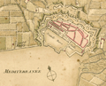 | Details | Bonne, Rigobert | 1778 |
| Scarce antique miniature plan of Toulon, France |
|
Bonne, Rigobert |
|
| 1778 |
| LOC:7 |
| $90.00 | Bonne--Rigobert | Scarce-antique-miniature-plan-of-Toulon--France | Scarce miniature plan of the fortified port city of Toulon, France, the chief base for France's large naval fleet the Vaisseaux de Guerre. Toulon lies along the Mediterranean coast in the Provence region of southern France. This small (4 1/2 " x 3 1/2 ") antique engraved plan of Toulon shows Vauban-style defensive walls around the city as well as the old harbor "vieille darce" (built 1604 - 1610) and the new harbor or "nouvelle darce". Maps the roads connecting to Toulon.
<br></br>
In a brief description of Toulon at the end of the atlas Bonne wrote:
<div class="indenttextblock">
Toulon, assez grande Ville et Port de Mer en Provence, est dans une situation admirable. Des Montagnes eleves jusquaux nues la couvrent au Septentrion et rendent son Port, qui est fort grand, une des plus sur de la Mediterranee. Ce Port, destine aux Vaisseaux de guerre, est une des plus connus de l'Europe; le entre est defendue par nombre de batteries et par plusieurs forts…"
</div>
<br />
From Rigobert Bonne's miniature nautical atlas "Atlas maritime ou Cartes réduites de toutes les Côtes de France avec des cartes particulières des isles voisines les plus considérables, suivies des plans des principales villes maritimes de ce royaume." Published by Lattre from Paris. With the royal privilege. No. 30.
<br></br>
Bonne attributes the source the of plans to three others: "… des belles Vues de nos Ports, que donnent M.M. Cochin et Les Bas, d'apres les excellens Tableaux de M. Vernet." |
| 1252 | 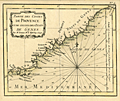 | Details | Bonne, Rigobert | 1778 |
| Antique miniature chart of the coast near Provence, France |
|
Bonne, Rigobert |
|
| 1778 |
| LOC:7 |
| $185.00 | Bonne--Rigobert | Antique-miniature-chart-of-the-coast-near-Provence--France | Fine antique miniature nautical chart of the <b>Provencal Coast</b> of France on the Mediterranean Sea. Coverage includes the villages of Toulon, St. Tropez, Cannes, Antibes, Ventimille, Oneille, Albinga, Genes, and the Principality of Monaco.
<br></br>
From Rigobert Bonne's miniature nautical atlas "Atlas maritime ou Cartes réduites de toutes les Côtes de France avec des cartes particulières des isles voisines les plus considérables, suivies des plans des principales villes maritimes de ce royaume." One of 12 charts published in the Atlas Maritime which are considered to among the very few miniature nautical charts published during the golden age of miniature maps . Published by Lattre from Paris. With the royal privilege. No. 9.
<br></br>
This scarce miniature copper-plate engraving contains much of the same information found on larger charts- rhumb lines; an adjustment for magnetic variation; depth soundings that are numerous; headlands, capes, navigation hazards and sand banks that are clearly identified.
<br></br>
Rigobert Bonne (1727-1794) was the successor to Jacques Nicolas Bellin as Royal Cartographer to France in the office of the Hydrographer at the Depôt de la Marine. Bonne first came to prominence when he published a number of charts in the Atlas Maritime in 1762. He is better known for later publications, including the Atlas Encyclopedique, which he collaborated on with Nicholas Desmarest, as well as the maps he produced for Raynal's Atlas de Toutes Les Parties Connues du Globe Terrestre, which was published in 1780. |
| 1167 |  | Details | Le Rouge, George | 1778 |
| Scarce early nautical chart of Tampa Bay, Florida |
|
Le Rouge, George |
|
| 1778 |
| LOC:200 |
| $1,500.00 | Le-Rouge--George | Scarce-early-nautical-chart-of-Tampa-Bay--Florida | Fine and very scarce copper-plate engraved harbor chart of the "Baye du Spiritu Santo" comprised of "Bay de Tampa" and the "Baye de Hillsborough", by George le Rouge, from Paris. Coverage on this fine historic French nautical artifact covers areas in Florida that are today's <b>St. Petersburg, Tampa, Brandon, Bradenton and Sarasota</b>. Only one sale recorded in AMPR, 28 years ago.
<br></br>
Le Rouge noted only a few key features including: two references to "Eau douce" (Trans. 'sweet water'); a location noted as "Black Rocks"; "Egmont Island"; and "Long Island" (today's Longboat Key).
<br></br>
From Pilote américain septentrional by <b>George le Rouge</b>, this is one of the <b>earliest available large-scale nautical charts of Tampa Bay</b> with the entrance to the Gulf of Mexico. Rouge's Pilote américain septentrional drew heavily upon the work of William Faden and Thomas Jefferys. The maps were modified with French nomenclature but their British origin explains why some place names are in English. Latitude is noted but no metrics exist for longitude. Distance scale is in English miles. Manuscript number "27" in upper right. |
| 1266 | 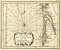 | Details | Bonne, Rigobert | 1778 |
| Antique miniature chart of the Biscayan coast near Bordeaux, France |
|
Bonne, Rigobert |
|
| 1778 |
| LOC:7 |
| $120.00 | Bonne--Rigobert | Antique-miniature-chart-of-the-Biscayan-coast-near-Bordeaux--France | Fine antique French miniature nautical chart of the <b>Bourdelois Coast</b> of France near Bourdeaux, France, Cape Ferret, Blaye and the Gironde River.
<br></br>
From Rigobert Bonne's miniature nautical atlas "Atlas maritime ou Cartes réduites de toutes les Côtes de France avec des cartes particulières des isles voisines les plus considérables, suivies des plans des principales villes maritimes de ce royaume." One of 12 charts published in the Atlas Maritime which are considered to among the very few miniature nautical charts published during the golden age of miniature maps . Published by Lattre from Paris. With the royal privilege. No. 6.
<br></br>
This scarce miniature copper-plate engraving contains much of the same information found on larger charts- rhumb lines; an adjustment for magnetic variation; numerous depth soundings; headlands, capes, navigation hazards and sand banks that are clearly identified.
<br></br>
Rigobert Bonne (1727-1794) was the successor to Jacques Nicolas Bellin as Royal Cartographer to France in the office of the Hydrographer at the Depôt de la Marine. Bonne first came to prominence when he published a number of charts in the Atlas Maritime in 1762. He is better known for later publications, including the Atlas Encyclopedique, which he collaborated on with Nicholas Desmarest, as well as the maps he produced for Raynal's Atlas de Toutes Les Parties Connues du Globe Terrestre, which was published in 1780. |
| 1379 | 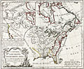 | Details | Vaugondy, Robert de | 1778 |
| Fine Antique Speculative Map of North America |
|
Vaugondy, Robert de |
|
| 1778 |
| LOC:10 |
| $350.00 | Vaugondy--Robert-de | Fine-Antique-Speculative-Map-of-North-America | A good example of Robert de Vaugondy's 1778 map of North America's English Possessions incorporating his speculative geography of the American northwest. The map covers from Hudson Bay to the Gulf of Mexico and from the Atlantic Ocean to Texas, then "Nouveau Mexique".
<br></br>
This map's most interesting features are in the large inset in the upper left quadrant illustrating Vaugondy's speculative geography of the American Northwest. The map features the Sea of the West (Mer de L'Ouest), the discoveries of Admiral de Fonte, the discoveries of Bernarda, the Strait of Anian, and the mythical kingdoms of Quivira and Teguaio.
<br></br>
There is no reliable evidence to authenticate either the existence of Admiral de Fonte himself or of the voyage. The account of de Fonte's voyage, first published in 1708, took the form of a letter by de Fonte in which he described himself as “then Admiral of New Spain and Peru, and now Prince of Chili.” The story is now attributed to the editor of the London Magazine.
<br></br>
Perhaps Vaugondy was attempting a bit of "fake news" and trying to muddy the waters over the English claims to North American territory by including these speculative geographic features into the map.
<br></br>
From Vaugondy's "Nouvel atlas portatif ". Engraved by Dussy. |
| 1241 | 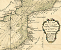 | Details | Bonne, Rigobert | 1778 |
| Miniature antique nautical chart of the Strait of Dover |
|
Bonne, Rigobert |
|
| 1778 |
| LOC:7 |
| $160.00 | Bonne--Rigobert | Miniature-antique-nautical-chart-of-the-Strait-of-Dover | Fine miniature antique nautical chart of the coasts near the <b>Strait of Dover</b> (Pas de Calais), the narrowest part of the English Channel. Coverage on this attractive miniature sea chart includes coastal France and England. Bonne shows a few towns on the English side of the channel including Hastings, Rye, Dover (Douvres) , Romney and Sandwich. On the French and Belgian side of the English channel Bonne locates numerous towns and villages including Ostend, Dunkirk, Calais, Boulogne, Etaples, Montreuil, Abbeville, Dieppe, and Fecamp.
<br></br>
Despite its small size this scarce miniature engraving contains most features found on larger sea charts- numerous headlands are noted; depth soundings are provided; anchorages, hazards and sand banks are clearly identified; and rhumb lines are provided with a 18 3/4 degree compass adjustment for magnetic variation. Unlike several other charts in the series, on this particular miniature chart Bonne provides very little detail about the interior topography of either England or France.
<br></br>
From Rigobert Bonne's miniature nautical atlas "Atlas maritime ou Cartes réduites de toutes les Côtes de France avec des cartes particulières des isles voisines les plus considérables, suivies des plans des principales villes maritimes de ce royaume." One of 12 charts published in the Atlas Maritime which are considered to among the very few miniature nautical charts published during the golden age of miniature maps . Published by Lattre from Paris. With the royal privilege. No. 2.
<br></br>
Rigobert Bonne (1727-1794) was the successor to Jacques Nicolas Bellin as Royal Cartographer to France in the office of the Hydrographer at the Depôt de la Marine. Bonne first came to prominence when he published a number of charts in the Atlas Maritime in 1762. |
| 748 | 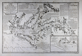 | Details | Depot de la Marine | 1778 |
| 1778 Chesapeake Bay Sea Chart after Anthony Smith |
|
Depot de la Marine |
|
| 1778 |
| LOC:53 |
| $4,900.00 | Depot-de-la-Marine | 1778-Chesapeake-Bay-Sea-Chart-after-Anthony-Smith | Large antique nautical chart from the Revolutionary War period of Chesapeake Bay and associated waterways in Maryland and Virginia. The first state of two in the French edition of Anthony Smith's influential and detailed chart of the Chesapeake Bay, Delmarva Peninsula, and surrounding waterways. Coverage includes the towns of Baltimore, Annapolis, Alexandria, Colcester, and James Town. Noted waterways include the Choptank River, Rappahanock River, Pokomoke ( "Pokomack" ) River, Potomac ( "Pawtomack" ) River, and Patapsco River.
<br></br>
Published by the French Depot de la Marine under the auspices of Antoine de Sartine during a period in which he served King Louis XVI as Secretary of the Navy. Text and notes are in French- for example below the town of Norfolk, Virginia is the note <b>"brule en 1776" </b>. That refers to the bombardment of Norfolk with red-hot shot by British naval forces, led by Lord Dunmore. Due to the shelling, British landing parties, and local Britsh patriot forces, Norfolk was totally destroyed between January 1 - 3, 1776.
<br></br>
This first state is differentiated from the second state by the lack of added scrollwork around many of the text blocks and much less stippling of the land masses than in the second state. These decorative flourishes could have easily been added at a later date.
<br></br>
This chart was likely offered for sale individually but was also available as one of 13 full sheets and 5 half sheets published by the Depot de la Marine in the atlas "Neptune Americo-Septentrional contenant les côtes, les et bancs, iles baies, ports, et mouillages, et les sondes des mers de cette-partie du monde, depuis le Groenland inclusivement, jusques et compris le golfe du Mexique." Contains an inset plan of Herring Bay Maryland. |
| 1242 | 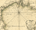 | Details | Bonne, Rigobert | 1778 |
| Miniature antique nautical chart of the Gulf of Lyon |
|
Bonne, Rigobert |
|
| 1778 |
| LOC:7 |
| $135.00 | Bonne--Rigobert | Miniature-antique-nautical-chart-of-the-Gulf-of-Lyon | Fine miniature antique nautical chart of the Gulf of Lyon and the French coast of the regions of <b>Provence and Languedoc-Roussillon</b>. Numerous towns and villages are identified by name, including Perpignan, Narbonne, Beziers, Agde, Sete (Cette), Montpellier, Arles, Aix, la Ciotat, Cassis, and Marseilles. The chart ends to the east near the resort town of Six Fours les Plages. Small coverage of Spain includes Roses.
<br></br>
Despite its small size this scarce miniature engraving contains most features that appear on larger sea charts- numerous depth soundings are provided; navigational hazards and sand banks are clearly identified; and rhumb lines are provided with a 18 degree compass adjustment for magnetic variation. Bonne provides very little detail about the interior topography.
<br></br>
From Rigobert Bonne's miniature nautical atlas "Atlas maritime ou Cartes réduites de toutes les Côtes de France avec des cartes particulières des isles voisines les plus considérables, suivies des plans des principales villes maritimes de ce royaume." One of 12 charts of France published in the Atlas Maritime which are considered to among the very few miniature nautical charts published during the golden age of miniature maps . Published by Lattre from Paris. With the royal privilege. No. 2.
<br></br>
Rigobert Bonne (1727-1794) was the successor to Jacques Nicolas Bellin as Royal Cartographer to France in the office of the Hydrographer at the Depôt de la Marine. Bonne first came to prominence when he published a number of charts in the Atlas Maritime in 1762. |
| 3666 |  | Details | Avery, Joseph | 1779 |
| Rare chart of the Channel Islands after Joseph Avery |
|
Avery, Joseph |
|
| 1779 |
| LOC:57 |
| $4,200.00 | Avery--Joseph | Rare-chart-of-the-Channel-Islands-after-Joseph-Avery | Unrecorded French chart of Îles de la Manche in the English Channel- the Normandy coast and Channel Islands after the survey of Joseph Avery. Islands include Alderney, Guernsey, Jersey, Herm, and Sark.
<br></br>
Though similar to Beaurain's chart of 1757, no copy of this very attractive work after Avery is found online nor in AMPR. No copy of Avery's own original survey is found anywhere but his work should be dated between 1721 and 1742.
<br></br>
Joseph Avery was born in Scotland and is known to have charted the southern coast of England ca. 1721 and to have published a "well approved" map of that work. Avery emigrated to Charleston, SC where he worked as a ship builder and was hired in 1742 as surveyor to the Georgia province. (Cadle, Farris W. Georgia Land Surveying History and Law. University of Georgia Press. 1991. Pages 4-26)
<br></br>
J.F.W. DeBarres chart of the Coast Rivers and Inlets of the Province of Georgia (1780) is credited to be after the work of Joseph Avery and others. |
| 71 |  | Details | Bonne, Rigobert | 1780 |
| Carte de l'Isle de la Jamaique |
|
Bonne, Rigobert |
|
| 1780 |
| LOC:5 |
| $150.00 | Bonne--Rigobert | Carte-de-l-Isle-de-la-Jamaique | Attractive hand-colored antique chart by Bonne ca. 1780. Horizontal format of the island of Jamaica showing extensive mountain ranges. Spanish Town, Fort "Ahgusta", and Port Royal Harbor clearly identified. |
| 1406 |  | Details | Bonne, Rigobert | 1780 |
| Nice antique map of Asia with Australia |
|
Bonne, Rigobert |
|
| 1780 |
| LOC:9 |
| $160.00 | Bonne--Rigobert | Nice-antique-map-of-Asia-with-Australia | Antique map of Asia by French hydrographer Rigobert Bonne. Coverage on this copper-plate engraved map includes Saudi Arabia, India, China, New Guinea, northern Australia ("Nouvelle Hollande"), New Zealand., Japan, Korea, and much more. Coverage extends far to the east to include Alaska with the Bering Strait and the Alaska Peninsula. No. 28.
<br></br>
Rigobert Bonne (1727-1794) was the successor to Jacques Nicolas Bellin as Royal Cartographer to France in the office of the Hydrographer at the Depôt de la Marine. Bonne first came to prominence when he published a number of charts in the Atlas Maritime in 1762. He is better known for later publications, including the Atlas Encyclopedique, which he collaborated on with Nicholas Desmarest, as well as the maps he produced for Raynal's Atlas de Toutes Les Parties Connues du Globe Terrestre, which was published in 1780. This map is from Raynal's atlas. |
| 1331 |  | Details | Bonne, Rigobert | 1780 |
| Fine antique map of the Moluccas and North Australia |
|
Bonne, Rigobert |
|
| 1780 |
| LOC:6 |
| $240.00 | Bonne--Rigobert | Fine-antique-map-of-the-Moluccas-and-North-Australia | Attractive antique uncolored copperplate-engraved map of the islands of Java, Sumatra, Celebes, Malaca, Borneo, New Guinea (shown only partially due to incomplete exploration in the late 18th century) as well as the tip of Australia's northern coast(s) with each side of the Cape York Peninsula or "Terre du Sud" named: Terre de Diemen (west) and Terre d'Arnheim (east).
<br></br>
Arrow notations depict the directions of the winds during the various months of the year. Includes an inset map of the Moluccan Islands - the Spice Islands.
<br></br>
From "Atlas de toutes les parties connues du Globe Terrestre, dressé pour l’histoire philosophique et politique des établissemens et du commerce des européens dans les deux Indes. "
<br></br>
Rigobert Bonne (1727-1794) was the successor to Jacques Nicolas Bellin as Royal Cartographer to France in the office of the Hydrographer at the Depôt de la Marine. Bonne first came to prominence when he published a number of charts in the Atlas Maritime in 1762. He is better known for later publications, including the Atlas Encyclopedique, which he collaborated on with Nicholas Desmarest, as well as the maps he produced for Raynal's Atlas de Toutes Les Parties Connues du Globe Terrestre, which was published in 1780. |
| 1438 | 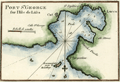 | Details | Roux, Joseph | 1780 |
| Roux antique plan of Vis (Lucca) harbor in Croatia |
|
Roux, Joseph |
|
| 1780 |
| LOC:2 |
| $125.00 | Roux--Joseph | Roux-antique-plan-of-Vis-(Lucca)-harbor-in-Croatia | Attractive, antique nautical chart / port plan of the town and harbor on the island of Vis, Croatia, ("Lissa") off the Dalmatian Coast, in the Adriatic Sea. Vis is furthest island in the Adriatic from the Croatian coast and lies southwest of the islands of Hvar, Brac and Solta.
<BR> </BR>
The port of Vis is identified by Roux as "Lucca". Other key features on this port plan include "Cut", "St. Spilice", "Calle St. George", "Calle Stance", and "Pointe Argentine". On the small and high offshore island of Otočić Host, Roux notes a "Reconnaissance pour le Mouillage" or a place to view the anchorage at Vis.
<BR> </BR>
For many years Vis was the military and naval headquarters of Tito’s partisan army and was closed to the public until 1989. This meant that it largely escaped commercial development and has been able to retain its natural beauty. Plate 85.
<BR> </BR>
Joseph Roux Sr. (1725-1793) was a French cartographer and hydrographer who lived in Marseille. The Roux family, with Roux's son Jospeh Jr. and grandson Antoine Roux, was involved in marine cartography and marine painting from Marseille into the mid-19th century. |
| 1094 | 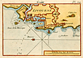 | Details | Roux, Joseph | 1780 |
| Roux antique port plan of Livorno, Italy |
|
Roux, Joseph |
|
| 1780 |
| LOC:4 |
| $165.00 | Roux--Joseph | Roux-antique-port-plan-of-Livorno--Italy | Attractive, antique nautical chart / port plan of the town and harbor of Livorno ("Livourne"), Italy on the Ligurisn Sea, southwest of Pisa. Variant edition Plate 24 published from Livorno by Meucci in the "Recueil Des Principaux Plans des Ports et Rades de la Mer Méditerranée, Estraits de ma carte en Douze Feüilles Dediée à Mons. Le Duc de Choiseul Ministre de la guerre et de la Marine …" .
<BR> </BR>
Original copperplate-engraved nautical port plan with depth soundings by Joseph Roux includes the town of Livorno surrounded by double Vauban-style defensive walls; the darce, or interior shipping basin; the Capucine; a lighthouse or signal tower ("fanal"); the "Tours de la Marsoque"; and "Maison de Sante".
<BR> </BR>
Joseph Roux Sr. (1725-1793) was a French cartographer and hydrographer who lived in Marseille. The Roux family, with Roux's son Jospeh Jr. and grandson Antoine Roux, was involved in marine cartography and marine painting from Marseille into the mid-19th century. |
| 1093 | 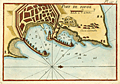 | Details | Roux, Joseph | 1780 |
| Roux antique plan of Rhodes, Greece |
|
Roux, Joseph |
|
| 1780 |
| LOC:2 |
| $225.00 | Roux--Joseph | Roux-antique-plan-of-Rhodes--Greece | Attractive, antique nautical chart / port plan of the town and harbor of Rhodes on the island of <b>Rhodes, Greece</b> in the Aegean sea, close to the coast of Turkey. Variant edition Plate 127A published in "Recueil Des Principaux Plans des Ports et Rades de la Mer Méditerranée, Estraits de ma carte en Douze Feüilles Dediée à Mons. Le Duc de Choiseul Ministre de la guerre et de la Marine …" from Livorno by Meucci.
<BR> </BR>
Original copperplate-engraved chart by Joseph Roux includes the walled village of Rhodes, Casa Cornuta, and Rhodes harbor. The harbor and lighthouse, are shown as flanked by two jetties, each supporting a half-dozen windmills, and terminating offshore with a small fort or bastion. Numerous soundings and anchorages would have assisted 18th century mariners in navigating that area.
<BR> </BR>
Joseph Roux Sr. (1725-1793) was a French cartographer and hydrographer who lived in Marseille. The Roux family, with Roux's son Jospeh Jr. and grandson Antoine Roux, was involved in marine cartography and marine painting from Marseille into the mid-19th century. |
| 696 | 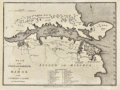 | Details | Cary, John | 1781 |
| Antique Plan of Mahon, Menorca, Spain |
|
Cary, John |
|
| 1781 |
| LOC:4 |
| $325.00 | Cary--John | Antique-Plan-of-Mahon--Menorca--Spain | Old antique engraved map and plan of the harbor and town of Mahon, the capital city of Menorca ( Minorca ) in the Balearic Islands, an archipelago and province of Spain in the Mediterranean Sea. Two areas of habitation are documented on the map, the largest consisting of the fortress and dwellings of St. Phillips town at the entrance to Mahon Harbor. In the vicinity of the fortress are a smaller structure- Charles Fort, St. Stephens Cove, Marlborough Redout, and just outside the walls, the Governor of the Castle's House.
<br></br>
Other noted points of interest around the harbor include Mast House, St. Anthony's Convent, Safron Island, Quarantine Island, Philipet Cove, Fort Philipet and a naval hospital on the aptly named "Bloody Island". A further 23 key points are noted and tied to a list of references at bottom with alphabetical indexes. These additional locations include: the Royal Counterguard, the Nunnery, and the Victualing Office for the Navy.
<br></br>
Admiral John Byng will forever be remembered for losing the island of Menorca to the French in 1756 near the beginning of what has come to be called "The Seven Years War". The island had been invaded and overrun by French forces with only Fort St. Philip remaining in British hands. Byng's failure to do his utmost to defeat the French fleet at the Battle of Minorca on May 20, 1756 and to recapture the fort and the island led to his court martial. Admiral Byng was found guilty and was later executed by firing squad on March 17, 1757 aboard the HMS Monarch while it lay at anchor in Portsmouth harbor.
<br></br>
Published from London by James Macgowan & William Davis. Dated within at Feb. 17, 1781. |
| 835 | 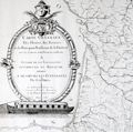 | Details | Dupain Triel, Jean-Louis | 1781 |
| Antique thematic map of French rivers and canals |
|
Dupain Triel, Jean-Louis |
|
| 1781 |
| LOC:0 |
| $3,000.00 | Dupain-Triel--Jean-Louis | Antique-thematic-map-of-French-rivers-and-canals | A large and rare antique thematic map of the rivers, streams, and canals of France with a very fine decorative cartouche. First and only edition. In two un-joined sheets. 36" W x 37" H when joined. Very decorative title cartouche with illustration of a late 18th century river barge with a large rudder; the size probably was necessitated by a small turning angle limited to the width of the barge cabin just aft of amidships. Possibly influenced by Sanson's 1641 "Carte des rivières de la France, curieusement recherchée" but Dupain-Triel's waterways map is much larger and contains greater detail.
<br></br>
Une grande et rare carte thématique antique des rivières, ruisseaux et canaux de France avec un très beau cartouche décoratif. Première et unique édition. Dans deux feuilles non jointes. 36 "L x 37" H une fois joint. Cartouche titre très décorative avec illustration d'une barge fluviale. Peut-être influencé par 1641 "Carte des rivières de la France de Sanson, curieusement recherchée" mais la carte des cours d'eau Dupain-Triel est beaucoup plus grande et contient plus de détails.
<br></br>
Both sheets of a 2 sheet map (not joined) of France by J.L. Dupain-Triel Sr. Rare, only one holding listed in OCLC/World Cat. Only two sales recorded in the AMPR.
<br></br>
In 1782 Dupain-Triel paid for the typesetting and engraving of a manuscript by Marcellin du Carla that proposed the use of contour lines as a means of adding elevation information to terrestrial maps and Dupain-Triel Sr. is distinguished as the maker of the first contour map of France in 1791, based on du Carla's method. This thematic map is noteworthy in that it does not contain any contour information although it is clear that when the map was published Dupain Triel Sr. had strong interest in the topic. (Konvitz, Joseph. "Cartography in France, 1660-1848: Science, Engineering, and Statecraft". University of Chicago Press. 1987. pp. 76-80.) |
| 4839 | 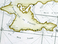 | Details | Tardieu, Pierre Antoine | 1783 |
| Antique Chart of the Sea of Azov Azof and Crimean Peninsula |
|
Tardieu, Pierre Antoine |
|
| 1783 |
| LOC:88 |
| $675.00 | Tardieu--Pierre-Antoine | Antique-Chart-of-the-Sea-of-Azov-Azof-and-Crimean-Peninsula | Fine original antique map of the Sea of Azov ( Azof ) and environs, based on Jan-Hendrik Van Kinsbergen's 1774 manuscript map of Crimea (formerly Ukraine; annexed by Russia in March 2014.) Detailed inset chart of the Kerch Strait (Detroit de Zabache) linking the Sea of Azov to the Black Sea. |
| 849 | 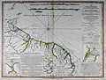 | Details | Rochette, Louis S. | 1783 |
| Chart of the Northern Atlantic Coast of South America |
|
Rochette, Louis S. |
|
| 1783 |
| LOC:51 |
| $250.00 | Rochette--Louis-S- | Chart-of-the-Northern-Atlantic-Coast-of-South-America | Antique nautical chart of the coast of South America including Venezuela, the island of Trinidad and Tobago, Guyana, Suriname, and Brazil. Four inset plans: "The Entrances of the Rivers Essequibo and Demerari", Entrance to the River Berbice", "Surinam River from the Dutch", and "Port of Cayenne from the French". From suveys conducted by Captain Edward Thompson, commander of the Hyaena
<br></br>
This chart was printed in 1783 by William Faden, English cartographer and map publisher, who after the death of Thomas Jefferys suceeded Jefferys to the title of "Geographer to the King". Carries the following endorsement at bottom: "Approved by the Chart Committee of the Admiralty" which would have been a seal of approval important to both the buyers and to Faden. Faden's charts were preferred by the Chart Committee of the Admiralty, appointed beginning in 1807 to select suitable charts for the fleet.
<div class=indenttextblock>"They selected two hundred of the least unsatisfactory, half of them Admiralty charts, either already published or in course of preparation, and the remainder from the commercial publishers. An impressive 50% of the one hundred privately published charts came from William Faden who published many surveys from naval officers so probably offered more charts of areas frequented by warships…" (Fisher, Susanna. The Makers of Blueback Charts: A History of Imray Laurie Norie and Wilson Ltd. Imray Laurie Norie and Wilson Ltd. 2001. p. 11)</div>
</br>
The chart is annotated with numerous fascinating notes and comments about the local geography and inhabitants. For example: <div class=indenttextblock> "Orinoco Islands Covered with palm trees and overflowed from the middle of January to the middle of July. They are inhabited by the Guaraunas and Tivitivas whose houses are built on piles driven in the mud or among branches of the trees".</div>
and,
<div class=indenttextblock> "Runaway negroes with whom peace was made in September 1761".</div> |
| 4830 | 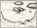 | Details | Ransonnette, Nicolas | 1783 |
| Scarce antique map of the Bay at Santorini, Italy |
|
Ransonnette, Nicolas |
|
| 1783 |
| LOC:13 |
| $175.00 | Ransonnette--Nicolas | Scarce-antique-map-of-the-Bay-at-Santorini--Italy | Interesting antique engraved map of the bay and islands of Santorini (Santorin), Italy. Shows the central portion of the volcanic caldera on "Isle Nouvelle" as emitting steam or smoke, an indication of recent and continuing volcanic activity on the island. Shows the Chateau de Searo. From "Illustrations de Lettres édifiantes et curieuses" by Nicolas Ransonnette (1745-1810). Tome 1, Page 78. |
| 196 | 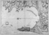 | Details | Faden, William | 1783 |
| Plan of the Bay Rock and Town of Gibraltar |
|
Faden, William |
|
| 1783 |
| LOC:66 |
| $750.00 | Faden--William | Plan-of-the-Bay-Rock-and-Town-of-Gibraltar | This beautifully engraved plan of the Bay and Rock of Gibraltar and Algeciras by William Faden details the disposition of military forces of France, Spain, and England during the great Siege of Gibraltar during 1779 - 1783, specifically in 1782. Details include the town, fortifications and the location and movement of the Spanish fleet's "forty-nine sail of the line", fire-ships, and battering ships <BR> </BR>
Hydrographic details in this antique map include current flow and numerous soundings. Remarkably extensive hachuring is used throughout the land areas to convey differences in elevation and topography. This chart/map must have required considerable effort by Faden to engrave. Faden promotes the accuracy of the map though his assurance in the title that it is based on a first-hand survey made between 1769 and 1775. Publication date in title of January 26, 1783 by William Faden. Number "24" printed on otherwise blank verso. |
| 568 |  | Details | Ponce, Nicolas. and Godefroy, Francois. | 1784 |
| Époques de l'établissement des Européens dans les États Unis |
|
Ponce, Nicolas. and Godefroy, Francois. |
|
| 1784 |
| LOC:3 |
| $375.00 | Ponce--Nicolas--and-Godefroy--Francois- | Époques-de-l-établissement-des-Européens-dans-les-États-Unis | One of the earliest available United States post-Revolutionary War population thematic maps, ca. 1784. Tabulates the population of the U.S. by state/territory. <br></br>
Shaded geographic areas on this original antique map show the Northeast United States and the extent of the original territories of Georgia, South Carolina, and North Carolina west to the Mississippi River. The shaded areas are tied back to a population table at left that shows the population for each territory. States and territories at the time of publication totaled a meager 3,119,676 persons, just 1% of the total population in 2013. This tabulation pre-dates the first official census that was conducted in 1790. In that earliest census the population was estimated at 3.92 million.<br></br>
At right the major ports for each state are identified and at bottom the authors provide a brief history for each state. All area west of the Mississippi River is labeled "Louisiane".<br></br>
French map published in Paris c. 1784. Source: "Collection d'estampes représentant les évenemens de la guerre, pour la liberté de l'Amérique Septentionale". |
| 5279 |  | Details | Bougard, Rene | 1785 |
| Rare woodcut chart Table Bay Saldanha Bay South Africa |
|
Bougard, Rene |
|
| 1785 |
| LOC: |
| $350.00 | Bougard--Rene | Rare-woodcut-chart-Table-Bay-Saldanha-Bay-South-Africa | Two scarce 18th-century woodcut harbor charts for South Africa on a single sheet. This fine antique harbor chart covers Table Bay, near Cape Town, South Africa and the Cape of Good Hope (Cap de Bonne Esperance). Verso contains another woodcut harbor chart of the Bay of Saldanha, on Africa's west coast about 70 statute miles northwest of Cape Town.
<br><br/>
From the atlas "Petit Flambeau de la Mer", published in more than 12 editions beginning in 1683 [1785] from le Havre, France by Rene Bougard. Printed area measures 4" x 6" on a larger sheet of laid paper. On the title page Bougard is listed as a Lieutenant of France's Vaisseau du Roi or the French sailing navy. The French navy was headquartered in Toulon while the French galley corps was at that time considered a separate entity and was based mainly at Marseille, France. French text.
<br><br/>
Copies of Bougard's harbor charts are rare and seldom found available for sale.
<br><br/>
Full title of Bougard's atlas is: "Le Petit Flambeau de la mer ou le veritable guide des pilotes cotiers ; Où il est clairement enseigné la maniere de naviguer le long de toutes les Cotes de France, d’Angleterre, d’Irlande, d’Espagne, de Portugal, d’Italie, de Sicile, de Malte, de Corse & de Sardaigne, & autres isles du Detroit; & des Cotes de Barbarie . . . " |
| 1459 |  | Details | Zatta, Antonio | 1785 |
| French, English and Spanish Islands in the Caribbean Sea |
|
Zatta, Antonio |
|
| 1785 |
| LOC:10 |
| $425.00 | Zatta--Antonio | French--English-and-Spanish-Islands-in-the-Caribbean-Sea | Fine antique decorative map of the Caribbean Islands "Arcipelago delle Antille" with a beautiful and colorful title cartouche published from Venice, Italy. Shows Florida as an archipelago of islands. Antonio Zatta issued this attractive antique engraving in his "Atlante Novissimo" in 1785. |
| 195 |  | Details | Anonymous | 1786 |
| Costa de Espana |
|
Anonymous |
|
| 1786 |
| LOC:0 |
| $340.00 | Anonymous | Costa-de-Espana | Set of antique profile coastal views of Spain's Costa del Sol and other coastal areas in the Mediterranean published as part of the first scientific sea atlas of Spain: 'Atlas Maritimo de España' (Maritime Atlas of Spain) by the Dirección de Hidrografía, Spain's equivalent to the U.S. Coast Survey in 1787. Included in this large dated sheet of land profiles from Tofino de San Miguel's atlas of antique nautical charts: Estepona; Punta de Velez, Malaga; Sierra d Marbella; Cabo de Gato; Cabo de Palos; Torre de Almazarron; Islands of Columbretes, Bedra and Benidorm; and many more coastal features. Sheet 1.
<br></br> The interested reader can find most of these profile locations described in an English-language translation of Tofino de San Miguel's sailing directions "Espana Maritima". This translation of San Miguel's work published in 1812 by Faden can be found online at: "http://books.google.com/books". |
| 1306 | 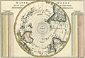 | Details | Bonne, Rigobert | 1787 |
| Antique Pre-Antarctica Southern Polar Projection |
|
Bonne, Rigobert |
|
| 1787 |
| LOC:9 |
| $325.00 | Bonne--Rigobert | Antique-Pre-Antarctica-Southern-Polar-Projection | Early antique South polar projection covering from the South Pole to the Equator. Produced by Bonne before the dimensions of continental Antarctica were known. This colorful antique map includes Australia (Nouvelle Hollande) and New Guinea.
<br></br>
Crisply and finely engraved to include mountain ranges and numerous place names with islands given extra coverage. Surrounded by two tables showing the distance corresponding to one degree at different latitudes. Published in Paris in 1787. Plate 23. |
| 1336 |  | Details | Bonne, Rigobert | 1787 |
| Eastern Hemisphere - Antique 45 Degree Northern Oblique Projection |
|
Bonne, Rigobert |
|
| 1787 |
| LOC:9 |
| $245.00 | Bonne--Rigobert | Eastern-Hemisphere---Antique-45-Degree-Northern-Oblique-Projection | Early antique projection covering the Eastern Hemisphere taken from 45 degrees north latitude. Includes the North Pole, northern North America with Alaska; Africa, Madagascar, Europe, Japan, western Australia (Nouvelle Hollande"), and New Zealand. A very fine copper-plate engraved map produced by Rigobert Bonne and crisply and finely engraved by Andre to include mountain ranges and numerous place names. Includes two related views on the plate including one colorful view of the "Sphere Oblique" and another obtuse drawing labeled "Effet de Pesanteur".
<br></br>
Rigobert Bonne (1727-1794) was the successor to Jacques Nicolas Bellin as Royal Cartographer to France in the office of the Hydrographer at the Depôt de la Marine. Bonne first came to prominence when he published a number of charts in the Atlas Maritime in 1762, but Bonne is better known for later publications, including the Atlas Encyclopedique, which he collaborated on with Nicholas Desmarest, as well as the maps he produced for Raynal's Atlas de Toutes Les Parties Connues du Globe Terrestre. Published in Paris in 1787. Plate 24. |
| 3632 |  | Details | Bonne, Rigobert | 1787 |
| Fine antique map of China, Korea and Japan |
|
Bonne, Rigobert |
|
| 1787 |
| LOC:9 |
| $265.00 | Bonne--Rigobert | Fine-antique-map-of-China--Korea-and-Japan | Map of China, Korea and Japan includes only northern China, extending south as far as Nanjing. Numerous cities are shown spread throughout China, however fewer are shown in Korea and Japan reflecting the lack of knowledge of these regions in the late 18th century. The Great Wall of China is also depicted.
<br></br>
Rigobert Bonne (1727-1794) was the successor to Jacques Nicolas Bellin as Royal Cartographer to France in the office of the Hydrographer at the Depôt de la Marine. Bonne first came to prominence when he published a number of charts in the Atlas Maritime in 1762. He is better known for later publications, including the Atlas Encyclopedique, which he collaborated on with Nicholas Desmarest, as well as the maps he produced for Raynal's Atlas de Toutes Les Parties Connues du Globe Terrestre, which was published in 1780. |
| 1413 | 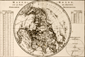 | Details | Bonne, Rigobert | 1787 |
| Antique Northern Polar Projection or Hemisphere Septentrional |
|
Bonne, Rigobert |
|
| 1787 |
| LOC:9 |
| $180.00 | Bonne--Rigobert | Antique-Northern-Polar-Projection-or-Hemisphere-Septentrional | Attractive North polar projection covering the Northern Hemisphere or "Hemisphere Septentrional" from the North Pole to the Equator. Early French copper-plate engraved map produced by Rigobert Bonne and crisply and finely engraved by Andre' to include mountain ranges and numerous place names. Surrounded by two tables of climatological data and a view of the "Sphere Parallele." Published in Paris in 1787. Plate 22.
<br></br>
Rigobert Bonne (1727-1794) was the successor to Jacques Nicolas Bellin as Royal Cartographer to France in the office of the Hydrographer at the Depôt de la Marine. Bonne first came to prominence when he published a number of charts in the Atlas Maritime in 1762, but Bonne is better known for later publications, including the Atlas Encyclopedique, which he collaborated on with Nicholas Desmarest, as well as the maps he produced for Raynal's Atlas de Toutes Les Parties Connues du Globe Terrestre. |
| 1428 | 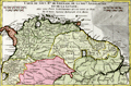 | Details | Bonne, Rigobert | 1787 |
| Antique map of northern South America |
|
Bonne, Rigobert |
|
| 1787 |
| LOC:50 |
| $99.00 | Bonne--Rigobert | Antique-map-of-northern-South-America | Fine hand-colored antique map of northern South America with portions of Colombia, Venezuela, Brazil and Chile and neighboring countries to the south. Includes the Amazon River basin. By R. Bonne a cartographer and hydrographer who produced maps of both land and sea, although his work leaned more toward the sea for reasons expressed below. Number 31.
<br></br>
Rigobert Bonne (1727-1794) was the successor to Jacques Nicolas Bellin as Royal Cartographer to France in the office of the Hydrographer at the Depôt de la Marine. Bonne first came to prominence when he published a number of charts in the Atlas Maritime in 1762, but Bonne is better known for later publications, including the Atlas Encyclopedique, which he collaborated on with Nicholas Desmarest, as well as the maps he produced for Raynal's Atlas de Toutes Les Parties Connues du Globe Terrestre. Published in Paris in 1787.
<br></br>
This site offers several charts from Bonne's miniature nautical atlas "Atlas maritime ou Cartes réduites de toutes les Côtes de France ..." The 12 small charts of coastal France in the Atlas Maritime are considered to be among the very few miniature nautical charts published during the golden age of miniature maps. |
| 193 |  | Details | Varelay Ulloa, Joseph | 1787 |
| Carta Esferica de la Costa de Africa |
|
Varelay Ulloa, Joseph |
|
| 1787 |
| LOC:54 |
| $600.00 | Varelay-Ulloa--Joseph | Carta-Esferica-de-la-Costa-de-Africa | This rare, engraved antique nautical chart of the Northwest coast of Africa was published as part of the first scientific Spanish sea atlas: 'Atlas Maritimo de España' (Maritime Atlas of Spain) by the Dirección de Hidrografía, Spain's equivalent to the U.S. Coast Survey. The antique chart was authored by Spanish naval Captain Don Joseph Varelay Ulloa (ca. 1743-1794) who made several hydrographic surveys of the coast of Africa. With manuscript pencil plots from 1808 centered on Madeira. <BR> </BR>
Coverage from Cape St. Vincent past the Strait of Gibraltar to Cape Bojador in the south including the Canary Islands. Inset with 20 detailed coastal profile views. |
| 187 |  | Details | Tofino de San Miguel | 1788 |
| Carta Esferica de una Parte del Oceano Atlantico |
|
Tofino de San Miguel |
|
| 1788 |
| LOC:54 |
| $850.00 | Tofino-de-San-Miguel | Carta-Esferica-de-una-Parte-del-Oceano-Atlantico | Scarce, 18th century antique nautical chart published as part of the first scientific Spanish sea atlas: 'Atlas Maritimo de España' (Maritime Atlas of Spain) by the Dirección de Hidrografía, Spain's equivalent to the U.S. Coast Survey. This antique small-scale copperplate engraved chart by the renowned Spanish hydrographer Don Vincente Tofino de San Miguel (1732-1795) covers the coast of Spain and of Africa as far south as Cape Verde. Includes Cape Verde islands, Canary islands, the Azores. Coverage of the Western Mediterranean includes the Balearic islands with Ibiza, Mallorca ( Majorca ), and Minorca ( Menorca ).
<BR> </BR>
Picturesque dedicatory cartouche to Frey Don Antonio Valdes engraved by D. Fernando Selma includes palm trees, an anthropomorphic lion and two rabbits overlooked by crumbling columns bearing the inscribed national motto "Plus Ultra". |
| 3601 | 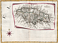 | Details | Zatta, Antonio | 1788 |
| Splendid antique map of Jamaica divided into parishes |
|
Zatta, Antonio |
|
| 1788 |
| LOC:10 |
| $400.00 | Zatta--Antonio | Splendid-antique-map-of-Jamaica-divided-into-parishes | Antique, hand-colored engraving, a decorative map of Jamaica drawn as though on a scroll, published in Antonio Zatta's 'Atlante Novissimo' as sheet IX in his twelve-sheet map of North America. With many engraved place names, rivers, mountains, etc. The island of Jamaica is divided into eighteen parishes including Portland, San Andrea, San Elisabet, and Westmoreland . Numerous place names, all in Italian.
<br></br>
Folio 9. Large compass rose. |
| 4963 | 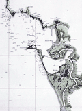 | Details | Tofino de San Miguel | 1789 |
| Antique Map of Cadiz Spain and Cape Trafalgar |
|
Tofino de San Miguel |
|
| 1789 |
| LOC:57 |
| $1,450.00 | Tofino-de-San-Miguel | Antique-Map-of-Cadiz-Spain-and-Cape-Trafalgar | Finely engraved and printed scarce original Spanish antique nautical chart of Cadiz, Spain and environs from Captain Vincente Tofiño de San Miguel y Van der Walle (1732-1795), Director of the Spanish Naval Academy in Cadiz. Manuscript pencil notations in English below the title cartouche suggest use aboard an English-speaking vessel.
<br></br>
This antique nautical chart of covering Cadiz, Spain to Cape Trafalgar was one of 47 charts published in 1789 as part of the first scientific Spanish sea atlas: 'Atlas Maritimo de España' (Maritime Atlas of Spain) by the Dirección de Hidrografía, Spain's equivalent to the U.S. Coast Survey. Prior to the late 18th century Spain jealously guarded nautical maps and charts of its possessions, especially so for its overseas colonies.
<br></br>
Drawn by Bauza. Grabado en Madrid por Joaquin Ballester. |
| 780 | 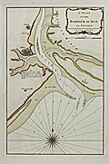 | Details | Sayer, Robert | 1789 |
| Antique nautical chart of the Harbor of Rye in Sussex, England |
|
Sayer, Robert |
|
| 1789 |
| LOC:89 |
| $425.00 | Sayer--Robert | Antique-nautical-chart-of-the-Harbor-of-Rye-in-Sussex--England | Beautiful antique nautical chart/plan depicts the coast of Kent and nearby towns of Rye and Playden ( Playdon ), England along with the Rye Camber and part of the Romney Marshes. This scarce harbor chart by Robert Sayer was published in 1789 and shows the navigational channel to Rye harbor marked by beacons as well as numerous soundings at high and low water. Noted features include Winchelsea Castle, Stoney Beach, the East Bar, Wenneway River, Camber Point, Guildford Gut, Black Shore, and a single windmill between Rye and Playden.
<br></br>
Sayer borrowed heavily from a chart published earlier by Greenville Collins. Two obvious differences are that the Romney Marsh in Collin's chart is here labeled 'Walland Marsh' and in this chart the town called Playdon is called 'Socket' on Collins'. Sayer's chart carries this additional note not found on Collin's chart: "A flag by day & a light by night are hoisted on the west pier-head of the new harbour of Rye, whenever there are nine feet water at the mouth of the harbour."
<br></br>
With a colorful compass rose. Published by Robert Sayer, Map and Chart-seller. 53 Fleet Street, London in "The Channel Pilot". Number 8 stamped in upper right corner. |
| 662 | 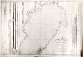 | Details | Nordenankar, Jan | 1790 |
| Chart of Northern Gulf of Bothnia ( Botten Wiken ) |
|
Nordenankar, Jan |
|
| 1790 |
| LOC:0 |
| $1,200.00 | Nordenankar--Jan | Chart-of-Northern-Gulf-of-Bothnia-(-Botten-Wiken-) | Scarce antique Swedish nautical sea chart by Nordenankar of the upper portion of the Gulf of Bothnia with portions of the coasts of Sweden and Finland. Includes these noted cities and features: Umea, Skelleftea, Pitea, Lulea, Tornio, (Tornea), Kemi, Oulu (Uleaborg), Brahestad, Jacobstad, and Kokkola ( Gamla Carleby ).
<br></br>
Produced by Swedish Admiral and cartographer Johan Corvin Nordenankar (1722-1804). Nordenankar, in order to gain major experience at sea early in his career, served in both the English and Maltese navies, participating in a battle between Maltese galleys and an Algerian ship on May 16, 1752. Returning home to Sweden, Nordenankar rose through the ranks of the Swedish navy first as Lieutenant-Commander and later in 1772 served as head of the galley fleet stationed in Stockholm.
<br></br>
Nordenankar is best known for his work as Director of the sjökarteverket, Sweden's nautical chart department, in the 1780's. During his tenure as Director he led the survey and charting of areas that previously were only poorly documented including the Baltic Sea with the Gulf of Bothnia and Gulf of Finland, the Sound, Kattegat and Skagerrak. These areas had become more important militarily to Sweden with Russia's advances into the region and improvements to the cartography of the area had stalled after intial work by Peter Gedda, Nils Power Crona, and Jonas Hahn. Nordenankar's work leading the renewed charting of the region resulted in the publication of at least 11 charts under his name. (Reference: sok.riksarkivet.se/SBL/Presentation.aspx?id=8198)
<br></br>
Much hydrographic detail, soundings, and hazards. Left and right portions of the chart contain numerous profile views of the coastline as seen from sea. Engraved by Arkrel. Number 3. |
| 1127 |  | Details | Roux, Joseph | 1790 |
| Antique harbor plan of Çesme , Turkey |
|
Roux, Joseph |
|
| 1790 |
| LOC:2 |
| $160.00 | Roux--Joseph | Antique-harbor-plan-of-Çesme---Turkey | Antique nautical chart or port plan of the environs around the Bay and village of Çeşme ( Chesme ) Turkey at the far west end of Anatolia near the Çeşme Peninsula. Interestingly, the character "N" in the title "Natolie" is engraved backwards. Çeşme Castle, a 500 year old Ottoman fort is depicted as a walled compound and dominates the east end of the bay. The castle, renovated after the Ottoman-Russian War in 1770, was not used for military purposes after the Crimean War. The castle is is now the Çeşme Archeology Museum.
<BR> </BR>
Çeşme lies in Izmir Province about 50 miles west of the city of Izmir and across a narrow strait from the Greek island of Chios. Çeşme is known as the windsurfing and kite-surfing capital of Turkey, and is considered among the best surfing areas in the world. A few small islands or sandbars, and depth soundings are shown on the map, along with a grove of trees on the north side of the bay.
<BR> </BR>
This small original chart is from a late 18th century edition of the atlas of Mediterranean ports produced by Joseph Roux - "Recueil des Principaux Plans des Ports et Rades de la Mer Méditerranée". Plate 144A.
<BR> </BR>
There were at least four small atlases of port and coastal charts that originated from Marseille hydrographers in the 18th century. Beginning in approximately 1727 these atlases included works by cartographers :
<a rel="nofollow" href= "/MichelotBremondBackground.aspx"> Michelot and Bremond</a>,
<a rel="nofollow" href= "/Creator/Ayrouard--Jacques"> Jacques Ayrouard</a>,
<a rel="nofollow" href= "/Creator/Roux--Joseph"> Joseph Roux</a>
, and Jean Allezard. |
| 5218 | 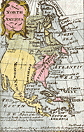 | Details | Anonymous | 1790 |
| Fine pair miniature maps North America South America |
|
Anonymous |
|
| 1790 |
| LOC:13 |
| $165.00 | Anonymous | Fine-pair-miniature-maps-North-America-South-America | Fine pair of miniature maps of North America and of South America. Each charming antique, hand-colored map measures 2" x 3.5" inside the neatline. With minuscule text in English describing each continent. Anonymous. Shows Nootka Sound. Date estimated ca. 1790 but certainly between 1778 and 1803.
<br></br>
Most of the western U.S.A. is labeled as Mexico or New Spain or as Louisiana. Page numbers 5 and 6. |
| 45 | 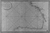 | Details | Depot de la Marine | 1790 |
| Carte Reduite de Golfe de Gascogne |
|
Depot de la Marine |
|
| 1790 |
| LOC:0 |
| $250.00 | Depot-de-la-Marine | Carte-Reduite-de-Golfe-de-Gascogne | Large, no-nonsense antique copperplate engraved navigational chart on wove paper. Coverage is of the Gulf of Gascogne from Isle d'Ouessant to Cape Finisterre.
<br></br>
Published by the French Depot de la Marine in 1790. |
| 1471 | 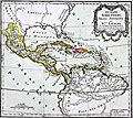 | Details | Brion, Louis, de la Tour | 1790 |
| Guyane, Terre Ferme. Isles Antilles et Nouvelle Espagne |
|
Brion, Louis, de la Tour |
|
| 1790 |
| LOC:10 |
| $130.00 | Brion--Louis--de-la-Tour | Guyane--Terre-Ferme--Isles-Antilles-et-Nouvelle-Espagne | Antique map of the Caribbean Archipelago, Mexico, and the southeast United States. Map is set within a page of French text related to the map. |
| 1011 |  | Details | Depot de la Marine | 1791 |
| French Chart of the Azores Island, Portugal |
|
Depot de la Marine |
|
| 1791 |
| LOC:54 |
| $750.00 | Depot-de-la-Marine | French-Chart-of-the-Azores-Island--Portugal | Antique chart from 1791 of the Azores Islands, off the coast of Portugal. This chart "Carte réduite des Isles Açores" is a 1791 French sea chart based on the earlier observations of Tofino de San Miguel, of the Spanish Admiralty. Contains numerous elevation profile views of the Azores coastline as seen from sea. Coverage inccludes the islands of Corvo, Flores, Graciosa ("Gracieuse"), Terceira, São Jorge, Pico, Faial, São Miguel, and Santa Maria. |
| 40 |  | Details | La Bretonniere | 1792 |
| Cotes de France- Departement du Pas de Calais |
|
La Bretonniere |
|
| 1792 |
| LOC:0 |
| $225.00 | La-Bretonniere | Cotes-de-France--Departement-du-Pas-de-Calais | Depot de la Marine antique copperplate engraved nautical chart by La Bretonniere of the Pas de Calais region focused on the town of Calais and its near offshore waters. Sand banks, soundings, and coastal features are shown with fine detail. Top right of chart annotated with manuscript "16" in large letters.<BR> </BR>
Of special historical note on this antique chart are two items that reflect the French revolution: Date of " l'An I " and the Depot de la Marine stamp with "E.F." replacing the Fleur de Lis. |
| 613 | 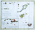 | Details | Fahlberg, Samuel | 1792 |
| Chart of Saint Barthelemy, St. Martin and Anguilla |
|
Fahlberg, Samuel |
|
| 1792 |
| LOC:51 |
| $22,500.00 | Fahlberg--Samuel | Chart-of-Saint-Barthelemy--St--Martin-and-Anguilla | Exceedingly rare original antique chart of the Caribbean islands of <b>Anguilla, St. Barts, St. Martin, Dog Island, and Prickly Pear Island</b> by Swedish cartographer and physician <b>Dr. Samuel Fahlberg</b> (1758-1834) . This beautifully engraved chart may well be the only available small-scale sea chart of these three Caribbean Islands by a Swedish cartographer.
<br></br>
No record of a sale of this chart in the Antique Map Price Record database (200K map sales since 1982). Faint pencil notations and a course plot into the harbor at Saint Martin indicate that this chart was used at sea. <br></br>
Fahlberg moved to St. Barthelemy (St. Barts / Barth) as a physician in 1784 after the island was ceded to Sweden by France. In 1803 Fahlberg was named Director of Survey of St. Barts; he thoroughly mapped the island for the Swedish West India Company ( Svenska Vastindiska Kompaniet ) <sup>1</sup>.
<br></br>
Contains a detailed inset of Gustavia on St. Barths titled "Speciale-Chart ofver Inloppet och Hammen Carenage samt Staden Gustavia. According to the John Carter Brown library: "The main town on Saint Barthélemy was called Le Carenage by the French, but renamed Gustavia by the Swedes when the island was given to the Swedes by Louis XVI in return for free port rights to Gothenburg, Sweden". A 'carenage' is an area typically along a shallow beach where wooden ships without access to a drydock could be beached at high tide, or careened, in order to clean, caulk, and repair their hulls.
<br></br>
On chain-laid paper with watermark: "C & I Honig". Engraved by the Swedish chart maker Erik Akerland (1754–1832). Stockholm: 1792. Text is in Swedish. <br></br>
<sup>1</sup> Reinhartz, Dennis. "The Caribbean Cartography of Samuel Fahlberg". History of Cartography Symposium. Springer. 2012. http://www.springer.com/978-3-642-19087-2. |
| 636 |  | Details | Depot de la Marine | 1793 |
| Cote Meridionale d'Espagne depuis Cadiz jusqu'au Cap de Palos |
|
Depot de la Marine |
|
| 1793 |
| LOC:0 |
| $900.00 | Depot-de-la-Marine | Cote-Meridionale-d-Espagne-depuis-Cadiz-jusqu-au-Cap-de-Palos | Exceptional antique French nautical chart of the Western Mediterranean Sea, including the southern coasts of Spain and France and the northern coast of Africa. Nearly perfect condition. Coverage on this handsome folding sea chart extends from Cadiz, Spain eastward past Cape Trafalgar, Gibraltar, Malaga, Cartagena, to Cape Palos. Hundreds of named towns, villages, and geographic features ring the coastline with depth soundings, but virtually no interior details. Latitude and longitude scales.
<br><br/>
With the circular stamp of the French Depot de la Marine. Price when issued: Three Francs. No. 93.
<br><br/>
Exterior of the original linen cover contains a decorative octagonal seller's label: "Ch. Piquet, Geographe ordinaire DU ROI et de S.A.R. Monseig(neur) le Duc d'Orleans. A Paris Quai de Conti No. 17, entre l'Hotel des Monnaies et le Pont des Arts." |
| 757 |  | Details | Beautemps-Beaupre, Charles-Francois | 1793 |
| Carte Generale de la Partie du Grand Archipel d'Asie |
|
Beautemps-Beaupre, Charles-Francois |
|
| 1793 |
| LOC:59 |
| $2,550.00 | Beautemps-Beaupre--Charles-Francois | Carte-Generale-de-la-Partie-du-Grand-Archipel-d-Asie | The Singapore Library web site sums up the significance of this scarce map of Asia: "Map of Indonesia showing tracks of Recherche and Esperance in 1792-1793. This map is part of the great archipelago of Asia, recognized by Rear Admiral Bruny-Dentrecasteaux, in 1792 and 1793" (1). This very scarce copper-plate engraved map is by Charles-François Beautemps-Beaupré (1766-1854). Charts by Beautemps-Beaupre are scarce. Only one other instance of this map is found in the AMPR.
<br></br>
On thick wove paper.
<br></br>
Chart of the waters and islands lying to the north of Australia including portions of the Ceram Sea, Arafura Sea, Banda Sea, and Molucca Sea, Key geographical features include a passage labeled "Dampier Strait", Waigeo ( Waigiou ), Batanta, Ceram, Ambon, Northern New Guinea, and Sulawesi ( Celebes ) and Timor. Much of the coastline of these islands is left blank because as of 1793 they were still uncharted and unexplored.
<br></br>
The map shows the track of two ships, the Recherche and Espérance , as they conducted an expedition (1791 - 1793) led by French Rear-Admiral Antoine Raymond Joseph de Bruni d'Entrecasteaux to find the missing ships of Jean-François de La Pérouse of whom nothing had been heard since March 1788.
<br></br>
C.F. Beautemps-Beaupre was one of the earliest hydrographers to use isobaths to represent water depth. Beautemp-Beaupres' many contributions to hydrography and his dedication to his profession is the reason he is sometimes referred to as the 'father of French hydrography'.
<br></br>
(1) Source online: http://eresources.nlb.gov.sg/printheritage/detail/61fb49ca-26e8-49cb-8e93-5f3558b123d2.aspx |
| 1383 |  | Details | Sayer, Robert | 1793 |
| Antique map of Provence, France related to the Siege of Toulon |
|
Sayer, Robert |
|
| 1793 |
| LOC:0 |
| $300.00 | Sayer--Robert | Antique-map-of-Provence--France-related-to-the-Siege-of-Toulon | Three fine antique maps on one sheet related to the French Revolutionary War, and in particular the Siege of Toulon (Aug. 1793 - Dec. 1793). It was at the important naval base of Toulon where young Napoleon Bonaparte won his first military victory. Coverage of coastal Provence, France includes the Côte d'Azure with Monaco, Nice, Antibes, and St. Tropez. Trending to the west it shows the Bay de Hyeres, Marseilles, Avignon, Agde, Narbonne, Perpignan, and Port Vendres.
<BR></BR>
The top map shows the coastline of Southern France from the border with Italy to the border with Spain. Fortified towns and post roads are delineated. Bottom left inset map of "The Roads of Toulon with the Adjacent Country" showing the position of Toulon at much greater scale, and extensive soundings, anchorages, and landmarks in the Little Road and Great Road of Toulon. (Note: A road is a sheltered location where vessels may lie at anchor). Bottom right inset is "Plan of the City and Harbour of Toulon", a detailed plan showing the city with references to the various bastions.
<BR></BR>
Published October 10, 1793 by Robert Sayer & co. Fleet Street, London. |
| 2563 |  | Details | Vaugondy, Robert de | 1795 |
| Canada. Louisiane. Etats-Unis. |
|
Vaugondy, Robert de |
|
| 1795 |
| LOC:10 |
| $360.00 | Vaugondy--Robert-de | Canada--Louisiane--Etats-Unis- | Uncommon third edition (Delamarche) of Vaugondy's map with changed title cartouche and "corrigés par le Cen.Lamarche son successeur" added to title.
<br></br>
Several changes are notable for this later edition as compared to Vaugondy's 1778 issue. For Florida,new locations are recorded at Saint Augustine and Cape Canaveral. Two maps on one sheet- east and west coasts.
<br></br>
The map of the western part of North America is most notable for it's depiction of Mer de L'Quest or Sea of the West. A great sea, easily the size of the Mediterranean, to flow from the then-known Strait of Juan de Fuca. Shows an opening to the ocean from this great sea at roughly in North California or Oregon and Quivira somewhere in Idaho.
<br></br>
Martha's Vineyard is named as "Martins Viniard". Many Indian Tribes and French Forts located in the Old Northwest and west of the Mississippi. Florida is depicted as an Archipelago.
<br></br>
Dated to 1795, the 3rd year of the French Republic. |
| 940 | 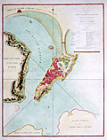 | Details | Barrow, John | 1796 |
| Large antique plan of Macau, China |
|
Barrow, John |
|
| 1796 |
| LOC:59 |
| $1,800.00 | Barrow--John | Large-antique-plan-of-Macau--China | Spectacular plan of <b>Macau or Macao</b>, the Macao Special Administrative Region of the People's Republic of China. Published in George Staunton's "An Authentic Account of an Embassy from the King of Great Britain to the Emperor of China", a work which documented <b>Britain's first official embassy to China</b>, lead by Lord Macartney, in 1792.
<br></br>
Published on April, 12, 1796 by George Nicol. |
| 721 | 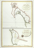 | Details | La Perouse, Jean François Galaup | 1797 |
| Antique 1782 Plan of San Diego, California |
|
La Perouse, Jean François Galaup |
|
| 1797 |
| LOC:63 |
| $800.00 | La-Perouse--Jean-François-Galaup | Antique-1782-Plan-of-San-Diego--California | Two very attractive engraved antique nautical charts on one page of the harbors of <b>San Diego</b>, California (upper half) and San Blas, Mexico in Nayarit State. Locations around San Diego, California that are noted on the chart include: the Presidio de St. Diego, the 'faux port', Pointe des Morts, Rancherie de las Choyas, Pointe St. Augustin, Rancherie ou Village d'Indiens nomme de la Pointe, Pointe St. Joseph, Pointe St. Michel, Petite Port de St Jean, Pointe Guizarros, and Pointe de la Colline. Numerous soundings are included with descriptions of the composition of the sea floor on the approaches to and bottom of the San Diego Bay.
<br></br>
These two charts by Jean-Francois de la Perouse are based on surveys by Juan Pantoja, a captain of the Manila trade for Spain. Derived from Pantoja's manuscript, the charts were published posthumously in the "Atlas du Voyage de la Perouse 1785-1788". Plate 35.
<br></br>
San Blas was used by Spain's Navy as a naval base beginning in 1768 and it served for several decades as a base of operations for Spanish expeditions to the Pacific Northwest. For about twenty years in the late 18th century, San Blas was one of the busiest ports on the Pacific coast of the Americas, rivaling Acapulco. L. Aubert, scripsit.
<br></br>
As a French explorer and naval officer la Perouse (1741-1788?) was tasked by King Louis XVI of France with completing the Pacific exploration begun by British Captain James Cook. Aboard the ships Astrolabe and Boussole, la Perouse and his crew mapped the west coast of North America and Alaska in 1786 and visited Easter Island and the Sandwich Islands ( Hawaii ). After reaching Australia's Botany Bay in 1788 his ships were lost at sea while searching for the Solomon Islands. |
| 280 |  | Details | Malham, John | 1797 |
| A Correct Chart of the Baltic Sea engraved for Malham's Naval Gazetteer |
|
Malham, John |
|
| 1797 |
| LOC:7 |
| $150.00 | Malham--John | A-Correct-Chart-of-the-Baltic-Sea-engraved-for-Malham-s-Naval-Gazetteer | Small antique nautical chart showing the Baltic Sea, Gulf of Finland and surrounding coastal areas including Poland, Estonia, and Sweden (then including Finland). From the rare first American edition of Malham's Naval Gazetteer, published by Spotswood and Nancrede in Boston in 1797. Vol 1.<BR> </BR>
This sea chart comes from an antique nautical gazetteer or geographical dictionary produced first in England and after 1796 in the United States. Key noted cities include Copenhagen, Stockholm, and St. Petersburg. <BR> </BR>
Rev. John Malham was a prolific Yorkshire-born author who produced other diverse works that include "Navigation Made Easy and Familiar", "Twenty-Two Sermons on Doctrinal and Practical Subjects" and "The Scarcity of Wheat considered". Malham died near London in 1807. (Gentleman's Magazine, Vol 102, 1807, p. 568).<BR> </BR>
Colophon at end of Volume 1 states that the work is "From the prefs of Samuel Etheridge, No. 9 Newbury Street, Boston, 1797"). |
| 3587 |  | Details | La Perouse, Jean François Galaup | 1797 |
| Beautiful Antique Chart of Monterey Bay and Carmel Bay, California |
|
La Perouse, Jean François Galaup |
|
| 1797 |
| LOC:10 |
| $950.00 | La-Perouse--Jean-François-Galaup | Beautiful-Antique-Chart-of-Monterey-Bay-and-Carmel-Bay--California | First French edition of this original antique early plan of Monterey Bay, Carmel, and Carmel Bay in California. This map is the earliest obtainable map of the Monterey and Carmel region.
<br></br>
Because this chart is the only one of Perouse's charts based on his own exploration some dealers consider this map to be a foundational map for all collectors of 18th century California cartography.
<br></br>
The fine hand-colored chart shows the very small town of Carmel with the Mission de St. Charles, and the Presidio at a distance. The map makes it possible to understand how the development of local transportation routes was impacted by the area's geography. Locates an anchorage (mouillage"), Pointe du Nouvel-an (New Year Point near Santa Cruz) and the Montagnes de St. Lucie. Rhumb lines in the bay with north oriented to the left. A scarce map of the area.
<br></br>
As a French explorer and naval officer la Perouse (1741-1788?) was tasked by King Louis XVI of France with completing the Pacific exploration begun by British Captain James Cook. Aboard the ships Astrolabe and Boussole, la Perouse and his crew mapped the west coast of North America and Alaska in 1786 and visited Easter Island and the Sandwich Islands ( Hawaii ). After reaching Australia's Botany Bay in 1788 his ships were lost at sea while searching for the Solomon Islands.
<br></br>
This map is from the French edition of the "Atlas du voyage de La Perouse". L. Aubert scripsit. Plate 34. |
| 3616 |  | Details | La Perouse, Jean François Galaup | 1797 |
| Earliest obtainable map of the Monterey and Carmel, California region. |
|
La Perouse, Jean François Galaup |
|
| 1797 |
| LOC:10 |
| $550.00 | La-Perouse--Jean-François-Galaup | Earliest-obtainable-map-of-the-Monterey-and-Carmel--California-region- | The first French edition of the antique early plan of Monterey Bay, Carmel, and Carmel Bay in California is an uncolored and historically significant chart. It is the only chart of La Pérouse's based on his own exploration, making it a foundational map for collectors of 18th-century California cartography. This chart represents the earliest obtainable map of the Monterey and Carmel region.
<br><br>
The hand-colored chart accurately portrays the small town of Carmel, featuring the Mission de St. Charles and the Presidio at a distance. The map provides insight into how the area's geography impacted the development of local transportation routes. It locates an anchorage (mouillage), Pointe du Nouvel-an (New Year Point near Santa Cruz), and the Montagnes de St. Lucie. The bay's rhumb lines are oriented with north to the left, adding to the rarity of the map.
<br><br>
This map is part of the French edition of the "Atlas du voyage de La Perouse," with L. Aubert as the engraver. It appears as Plate 34 within the atlas. Collectors and historians alike treasure this map as a crucial piece of 18th-century California cartography and a testament to La Pérouse's exploration of the Pacific. |
| 419 |  | Details | Malham, John | 1797 |
| A Correct Chart of the West India Islands engraved for Malham's Naval Gazetteer |
|
Malham, John |
|
| 1797 |
| LOC:3 |
| $375.00 | Malham--John | A-Correct-Chart-of-the-West-India-Islands-engraved-for-Malham-s-Naval-Gazetteer | Increasingly scarce on the market. Rev. John Malham's chart of the United States east coast lying south of Charlestown, South Carolina. Covers the Gulf of Mexico, Cuba, Bahamas, Hispaniola, the West Indies, Central America, Columbia, and Venezuela south to the mouth of the Orinoco River. This chart has examples of interesting usage of terms that are today known only from history books: 'Spanish Main' for the southern Caribbean Sea; 'Terra Firma' denotes northern Colombia and Venezuela. Key noted cities include Charleston, Savannah, St. Augustine, New Orleans, Havana, Port Royal, Cartagena, Caracas.
<br></br>
From the rare first American edition of Malham's Naval Gazetteer, published by Spotswood and Nancrede in Boston in 1797. Early U.S. colonial nautical chart engravings are scarce.
<BR> </BR>
This chart comes from an early nautical gazetteer or geographical dictionary produced first in England and after 1796 in the United States by John Malham a prolific Yorkshire-born author who produced other diverse works that include "Navigation Made Easy and Familiar". |
| 421 |  | Details | Malham, John | 1797 |
| A Correct Chart of the Indian Ocean engraved for Malham's Naval Gazetteer |
|
Malham, John |
|
| 1797 |
| LOC:200 |
| $175.00 | Malham--John | A-Correct-Chart-of-the-Indian-Ocean-engraved-for-Malham-s-Naval-Gazetteer | Scarce chart showing the Indian Ocean, Arabian Sea and Bay of Bengal. From the first American edition of Malham's Naval Gazetteer, published by Spotswood and Nancrede in Boston during September 1796. Vol 2.<BR> </BR>
This chart comes from an early nautical gazetteer produced first in England and after 1796 in Boston, Massachusetts. Coverage includes the Persian Gulf, Maldive Islands, Andaman Island, and Nicobar Islands. With three sets of rhumb lines. Rev. John Malham was a prolific Yorkshire-born author. Malham died near London in 1807. Archivally matted.<BR> </BR> |
| 510 |  | Details | Malham, John | 1797 |
| A Correct Chart of the Coast of Portugal engraved for Malham's Naval Gazetteer |
|
Malham, John |
|
| 1797 |
| LOC:7 |
| $185.00 | Malham--John | A-Correct-Chart-of-the-Coast-of-Portugal-engraved-for-Malham-s-Naval-Gazetteer | Early U.S. printed sea chart of Portugal's Atlantic coast from 37 to 42 degrees North Latitude. From the rare first American edition of Malham's Naval Gazetteer, published by Spotswood and Nancrede in Boston. Vol 2.<BR> </BR>
This chart comes from an early nautical gazetteer produced first in England and after 1796 in Boston, Massachusetts. Coverage includes Seville, Cape St. Vincent, Sagres, Setuval, Lisbon, Coimbra, and Oporto. Just below the fleur-de-lis pointing North is a notation: "About this spot is supposed to exist a submarine volcano that occasioned the earthquake Nov 1, 1755." This earthquake, referred to as the "Great Lisbon Earthquake", killed over 10,000 people in Lisbon alone.
Rev. John Malham was a prolific Yorkshire-born author. Malham died near London in 1807. (Gentleman's Magazine, Vol 102, 1807, p. 568).<BR> </BR> |
| 5243 |  | Details | Malham, John | 1797 |
| A Correct Chart of the West India Islands early Boston published |
|
Malham, John |
|
| 1797 |
| LOC:200 |
| $365.00 | Malham--John | A-Correct-Chart-of-the-West-India-Islands-early-Boston-published | Antique nautical chart showing the east coast of the United States south of Charlestown, South Carolina, the Gulf of Mexico, Cuba, Bahamas, Hispaniola, the West Indies, Central America, Columbia, and Venezuela south to the mouth of the Orinoco River. This chart has examples of interesting usage of terms that are today known only from history books: 'Spanish Main' for the southern Caribbean Sea; 'Terra Firma' denotes northern Colombia and Venezuela. Key noted cities include Charleston, Savannah, St. Augustine, New Orleans, Havana, Port Royal, Cartagena, Caracas.
<br></br>
From the rare first American edition of Malham's Naval Gazetteer, published by Spotswood and Nancrede in Boston in 1797. Early U.S. colonial nautical chart engravings are scarce.
<BR> </BR>
This chart comes from an early nautical gazetteer or geographical dictionary produced first in England and after 1796 in the United States by John Malham. Rev. John Malham was a prolific Yorkshire-born author who produced other diverse works that include "Navigation Made Easy and Familiar", "Twenty-Two Sermons on Doctrinal and Practical Subjects" and "The Scarcity of Wheat considered". Malham died near London in 1807. (Gentleman's Magazine, Vol 102, 1807, p. 568).<BR> </BR> |
| 961 | 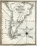 | Details | Malham, John | 1797 |
| A Correct Chart of the Coasts of South America |
|
Malham, John |
|
| 1797 |
| LOC:5 |
| $195.00 | Malham--John | A-Correct-Chart-of-the-Coasts-of-South-America | Antique engraved nautical chart of South America below the Equator from the rare first American edition of <b>Malham's Naval Gazetteer</b>, published by Spotswood and Nancrede in Boston in 1797. Early U.S. colonial nautical chart engravings are scarce. This small chart incorrectly shows Tierra del Fuego as a solid land mass rather than as an archipelago. The area we today know as Argentina is labeled '<b>Patagonia</b>', and the size of the Plate River "Rio de la Plata" is vastly overestimated with its westward extent shown reaching across half the width of the continent. Key cites noted include: Quito, Lima, Buenos Aires, and Sao Paulo.
<BR> </BR>
At extreme upper left of chart the Galapagos Islands are shown, where the largest of the archipelago, Isabella, is designated as 'Albemarle Island' as it was known to the British of that period.
<BR> </BR>
This chart comes from an early nautical gazetteer or geographical dictionary produced first in England and after 1796 in the United States by John Malham. Rev. John Malham was a prolific Yorkshire-born author who produced other diverse works that include "Navigation Made Easy and Familiar", "Twenty-Two Sermons on Doctrinal and Practical Subjects" and "The Scarcity of Wheat considered". Malham died near London in 1807. (Gentleman's Magazine, Vol 102, 1807, p. 568).
<BR> </BR>
Colophon at end of Volume 1 states that the work is "From the prefs of Samuel Etheridge, No. 9 Newbury Street, Boston, 1797"). |
| 6800 | 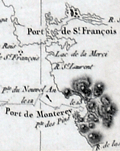 | Details | Dagelet, Joseph Lepaute | 1797 |
| Original antique French nautical chart of the west coast of North America |
|
Dagelet, Joseph Lepaute |
|
| 1797 |
| LOC: |
| $800.00 | Dagelet--Joseph-Lepaute | Original-antique-French-nautical-chart-of-the-west-coast-of-North-America | Original antique nautical chart of the west coast of North America from Mt. St. Elias (1) to Monterey Bay. Shows route of la Perouse. Includes the west coasts of California, Washington, and Oregon. From the atlas of the voyage by Lapérouse. Plate 16.
<br><br>
Jean-François de Galaup, Comte de Lapérouse was a French Naval officer and explorer whose journey started in 1785 under the commission of King Louis XVI. The expedition comprised two ships, the Astrolabe and the Boussole, and a crew of 225. The crew included scientists and artists who were tasked with documenting various aspects of the journey, including geography, wildlife, and indigenous cultures. This expedition aimed to complete the Pacific explorations undertaken by Captain Cook and others. The journey is noted for its tragic disappearance of Laperouse near the end.
<br><br>
The disappearance of Lapérouse's expedition sparked much interest and concern, leading to numerous rescue and search missions. The wreckage of the two ships was finally discovered in 1826 near Vanikoro, an island in the Solomon Islands, but the exact circumstances of the expedition's end remain a mystery.
<br><br>
(1) Mount St. Elias, located on the border between Alaska in the United States and Yukon in Canada, is one of the highest peaks in North America, at an elevation of 18,008 feet. It forms part of the St. Elias Mountain Range, which hosts some of the most extensive ice fields in the world. |
| 1263 | 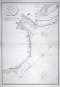 | Details | Depot de la Marine | 1798 |
| Antique French chart of the mouth of the Humber River in England |
|
Depot de la Marine |
|
| 1798 |
| LOC:0 |
| $465.00 | Depot-de-la-Marine | Antique-French-chart-of-the-mouth-of-the-Humber-River-in-England | Antique nautical chart includes some of the west coast of England with portions of Norfolk and Lincolnshire counties. Points charted on this old nautical artifact extend from Lowestoff in the south past Yarmouth, Lynn Regis, Wainfleet and Saltfleet; terminating in the north past Grimsby.
<br></br>
With the circular logo of France's Depot de la Marine with "R.F." used during the period immdiately after of the French Revolution . |
| 1382 | 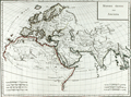 | Details | Mentelle and Chanlaire | 1798 |
| Fine antique 18th-century map with Europe and Asia |
|
Mentelle and Chanlaire |
|
| 1798 |
| LOC:9 |
| $220.00 | Mentelle-and-Chanlaire | Fine-antique-18th-century-map-with-Europe-and-Asia | Beautifully engraved and hand-colored map centered on the Arabian Peninsula with much of that area designated "Arabia Deserta". Includes Scandinavia, north Africa, India, China, Sri Lanka ("Taprobana"), and much more. The title indicates that the coverage includes those portions of the world's surface that were known to exist in antiquity. Engraved by Tardieu.
<br></br>
The curved map projection and the fine coloring work act synergistically to emphasize the curvature of the earth's surface.
<br></br>
Published from Paris by French cartographers E. Mentelle and Pierre-Giles Chanlaire. Edme Mentelle (1730 - 1816) was a French geographer and historian in Paris who studied under the historian Jean-Baptiste Louis Crevier at the College of Beauvais. After accepting a position as professor of Geology and History at the Ecole Militaire he tutored students including the young Napoleon Bonaparte. Mentelle published a number of important geographical works including the 1778 Geographie Comparee, the 1779 Atlas Universel, and the 1801 Cours Complet de Cosmographie, de Chronologie, de Geographie et d'Histoire. Plate 3. |
| 6806 | 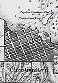 | Details | Oxholm, Peter Lotharius | 1799 |
| Rare antique map of the Caribbean island of St. Croix slavery |
|
Oxholm, Peter Lotharius |
|
| 1799 |
| LOC:2001 |
| $2,700.00 | Oxholm--Peter-Lotharius | Rare-antique-map-of-the-Caribbean-island-of-St--Croix-slavery | Rare, highly detailed and accurate map of the Caribbean island of St. Croix by Peter Oxholm. Dated 1799 per the Royal Danish Library. Only two recorded copies in WorldCat, one at Bibliothèque nationale de France.
<br><br>
This second edition of Oxholm's map is updated with details for Christiansted Harbor after a survey by Captain Rohde. Table at top left in Danish and English with population statistics for Whites, Coloreds, and Negros. Denotes locations of the numerous windmills and horse-powered mills as well as cotton plantations ("bomulds plantage") on St. Croix. In spite of his strong advocacy for slavery Oxholm was concerned about poor living conditions of the slaves.
<br><br>
Dissected and laid to linen when issued. Library hand stamp from 1815 at top right. |
| 533 | 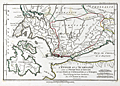 | Details | Bocage, J.D. Barbie du | 1799 |
| Greek Ionian islands of Lefkada, Ithaca and Cephalonia |
|
Bocage, J.D. Barbie du |
|
| 1799 |
| LOC:50 |
| $110.00 | Bocage--J-D--Barbie-du | Greek-Ionian-islands-of-Lefkada--Ithaca-and-Cephalonia | Map covers the Ionian Sea with the islands of Leucade (Lefkada), Ithaca and Cephalonia (Kefalonia) in Western Greece; the Gulf of Patras; and the Gulf of Corinth.
<br></br>
North of the three islands is depicted an area where two of the most well known sea battles of antiquity were conducted. Just off Preveza, Ottoman and Christian galley fleets engaged in one of the last major battles with large numbers of oared fighting vessels. Further inland, in the Ambracian Gulf, forces of Octavian clashed with those of Antony and Cleopatra at the Battle of Actium in 32 BC.
<br></br>
From Bocage's "Recueil de Cartes Geographiques Plans, Vues, et Medailles de l'Ancienne Grece, Relatifs au Voyage du Jeune Anacharsis." Dated to 1799 (Prairial An VI in the French revolutionary calendar). Number 26. |
| 855 | 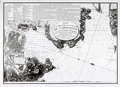 | Details | Depot de la Marine | 1799 |
| Old nautical chart of the harbor and town of Cartagena, Spain |
|
Depot de la Marine |
|
| 1799 |
| LOC:8 |
| $600.00 | Depot-de-la-Marine | Old-nautical-chart-of-the-harbor-and-town-of-Cartagena--Spain | Attractive antique harbor chart of Cartagena ( Carthagene ), Spain derived from the surveys of Admiral Don Vincente Tofiño de San Miguel. Noted geographical features of this plan of the port city of Cartagena on Spain's Mediterranean coast include Escombrera Bay ( Ensenada de Escombreras ) and Escombrera Island, Cartagena Harbor, "Montagne des Maures" ( Cerro de los Moros ) , "Petit Algameque" ( Algameca Chica ) , Plage des Chaloupes, and Cap Negrete.
<br></br>
Based on Tofino de San Miguel's chart which was originally published from Spain in the Atlas Maritimo de España in 1789. This later French edition was published by the French Depot General des Cartes et Plans in year 8 of the French revolution which dates it to roughly 1799 - 1800.
<br></br>
The chart contains much detail of both the terrain, local fortifications, and hydrographical features. A legend at top left contains several dozen entries keyed to military, religious, and secular locations of importance. Among these are "le Catedrale"- the cathederal; "Le Bagne"- the prison; "Depot de bois dans l'eau"- a series of connected pond-like pools near the shipyard where planking, spars and other lumber used in shipbuilding could be seasoned in water; "Pompe a Feu" - the fire pump; and numerous other entries. Sailing directions at top right. All text is in French. |
| 4725 | 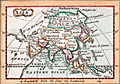 | Details | Turner, Richard (Rev.) | 1799 |
| Antique Miniature Map of Asia |
|
Turner, Richard (Rev.) |
|
| 1799 |
| LOC:0 |
| $95.00 | Turner--Richard-(Rev-) | Antique-Miniature-Map-of-Asia | Antique miniature map of Asia by Turner. Includes India, Tibet, China, Japan, Arabia, Persia, Siberia, New Britain, and the Philippine Islands. Hand colored on paper with watermark.
<br></br>
From one of the smallest geographical atlases issued in the 18th century: <b>A New and Easy Introduction to Universal Geography</b>. First issued in 1794. Reverend Richard Turner's most successful publication went through at least 11 editions. Verso blank.
<br></br>
Within Letter XXIII of Turner's Universal Geography the author introduces the reader to the geography, dress, climate, and culture of the region.
<div class="indenttextblock">
Asia … is superior to Europe and Africa in the extent of its territories, stretching into all climates; from the frozen wilds of Siberia, where the hardy inhabitants, clothed in furs, are drawn in sledges over the snow; to the sultry regions of India and Siam, where, seated upon lofty elephants, the people shelter themselves from the scorching sun by spreading umbrella.
</div>
In two paragraphs Turner lays out the riches available in the region and then describes those peoples in unflattering terms which some could argue formed the basis for exploiting those same resources.
<div class="indenttextblock">
Most of the islands lying |
| 1351 | 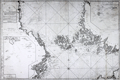 | Details | Nordenankar, Jan | 1800 |
| Scarce antique Swedish sea chart of the Baltic Sea with Stockholm |
|
Nordenankar, Jan |
|
| 1800 |
| LOC:0 |
| $1,600.00 | Nordenankar--Jan | Scarce-antique-Swedish-sea-chart-of-the-Baltic-Sea-with-Stockholm | Scarce antique Swedish nautical chart by Nordenankar of the Upper Baltic Sea and the lower portion of the Gulf of Bothnia. Sweden to the west, Finland to the east, the Aland Islands between the two, dominating the upper Baltic; Estonia in the lower right corner. Includes Stockholm and numerous other cities. Special charts inset include: "Sandhamns Inloop" and "Inloppet til Finska Uto".
<br></br>
Produced by Swedish Admiral and cartographer Johan Corvin Nordenankar (1722-1804). Nordenankar, in order to gain major experience at sea early in his career, served in both the English and Maltese navies, participating in a battle between Maltese galleys and an Algerian ship on May 16, 1752. Returning home to Sweden, Nordenankar rose through the ranks of the Swedish navy first as Lieutenant-Commander and later in 1772 served as head of the galley fleet stationed in Stockholm.
<br></br>
Nordenankar is best known for his work as Director of the sjökarteverket, Sweden's nautical chart department, in the 1780's. During his tenure as Director he led the survey and charting of areas that previously were only poorly documented including the Baltic Sea with the Gulf of Bothnia and Gulf of Finland, the Sound, Kattegat and Skagerrak. These areas had become more important militarily to Sweden with Russia's advances into the region and improvements to the cartography of the area had stalled after intial work by Peter Gedda, Nils Power Crona, and Jonas Hahn. Nordenankar's work leading the renewed charting of the region resulted in the publication of at least 11 charts under his name. (Reference: sok.riksarkivet.se/SBL/Presentation.aspx?id=8198)
<br></br>
Much hydrographic detail, soundings, and hazards. Left and right portions of the chart contain numerous profile views of the coastline as seen from sea. Engraved by Akerlund. Number 5. |
| 3689 | 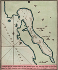 | Details | Luffman, John | 1800 |
| Antique map of Saldanha Bay, South Africa engraved for Luffman's Select Plans |
|
Luffman, John |
|
| 1800 |
| LOC:77 |
| $230.00 | Luffman--John | Antique-map-of--Saldanha-Bay--South-Africa-engraved-for-Luffman-s-Select-Plans | Fine copper-plate engraved plan of Saldanha Bay, South Africa, an important port north of Cape Town. As described by Luffman: <div class="indenttextblock">
"Saldanha Bay, An excellent harbour of Africa fourteen leagues north of Table Bay. In this Bay Lord Keith Captur'd a Dutch squadron under Admiral Lucas. Aug 17, 1796. Lat 33.30 S Longitude 18.20 E of London."
</div>
</BR>
Named after the early 16th-century Portuguese navigator António de Saldanha, the bay is both larger and safer than Table Bay, which is located 65 miles (105 km) farther south-southeast. Saldanha Bay’s former abundance of seals, fish, and guano deposits was long contested between French, English, and Dutch interests, with exploitation restricted only by a lack of fresh water in the area. (Encyclopaedia Britannica Online).
<br></br>
From "Luffman's Select Plans of the Principal Cities, Harbors, Forts etc. in the World". Engraved and published by John Luffman, No. 28 Little Bell Alley, Coleman Street. London. May 1, 1801. Volume II, Number 9.
<br></br>
Luffman also provided similar engravings to this at about the same time for J.T. Serres' "The Little Sea Torch: or, True Guide for Coasting Pilots." Serres translated the Little Sea Torch from an earlier illustrated coasting pilot guide, based on Bougard's "Le petit flambeau de la mer", first published in 1684.
<br></br>
John Luffman (1751-1821) began his career as an engraver, producing a very large and fine map of Antigua, where he had resided in 1787 and 1789. That map was published by Luffman to accompany his 'A Brief Account of the Island of Antigua', 1788." Luffman shared the same sad fate as many publishers and was declared bankrupt on 9th March, 1793. Moving forward Luffman was more cautious and produced small format atlases and handy-sized maps of the theatres of war, principal towns and cities and battle-plans relating to the Wars of the French directorate and the subsequent Napoleonic War. |
| 3600 | 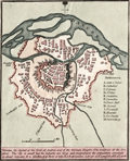 | Details | Luffman, John | 1800 |
| Fine Antique Plan of Vienna, Austria |
|
Luffman, John |
|
| 1800 |
| LOC:77 |
| $180.00 | Luffman--John | Fine-Antique-Plan-of-Vienna--Austria | Scarce and attractive antique copper-plate engraved map of Vienna, Austria by John Luffman. Luffman describes Vienna as: ". . . The capital of the Circle of Austria and of the German Empire: The residence of the Emperor. The city is small but the suburbs are large and magnificent, the population amounts to about 300,000. It is 565 miles E. of Paris and 680 E.S.E. of London…"
<br></br>
Key locations noted by Luffman include the Danube River, Nusdorf Gate, St. Mark's Gate, Lerchenfeld Gate, the Arsenal, the Hospital, the Carmelites, and the Cathedral.
<br></br>
From "Luffman's Select Plans of the Principal Cities, Harbors, Forts etc. in the World". Engraved and published by John Luffman, No. 28 Little Bell Alley, Coleman Street, October 1, 1800. Volume 1 . Number 63.
<br></br> |
| 3688 | 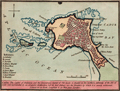 | Details | Luffman, John | 1800 |
| Antique map of Cadiz, Spain engraved for Luffman's Select Plans |
|
Luffman, John |
|
| 1800 |
| LOC:13 |
| $220.00 | Luffman--John | Antique-map-of-Cadiz--Spain-engraved-for-Luffman-s-Select-Plans | Fine copper-plate engraved plan of Cadiz, Spain not far from the Strait of Gibraltar. As described by Luffman: <div class="indenttextblock">
"Cadiz. The capital of Andalusia and the commercial capital of Old Spain is situated on the northern extremity of the Isle of Leon and Surrounded by an irregular fortification, but its best defence are the breakers by which it is nearly environed. Latitude 36 30 North. Longitude 6, 40 West from London"
</div>
</BR>
From "Luffman's Select Plans of the Principal Cities, Harbors, Forts etc. in the World". Engraved and published by John Luffman, No. 28 Little Bell Alley, Coleman Street, Cheapside, London. November 1, 1800. Volume I, Number 67.
<br></br>
Luffman also provided similar engravings to this at about the same time for J.T. Serres' "The Little Sea Torch: or, True Guide for Coasting Pilots." Serres translated the Little Sea Torch from an earlier illustrated coasting pilot guide, based on Bougard's "Le petit flambeau de la mer", first published in 1684.
<br></br>
John Luffman (1751-1821) began his career as an engraver, producing a very large and fine map of Antigua, where he had resided in 1787 and 1789. That map was published by Luffman to accompany his 'A Brief Account of the Island of Antigua', 1788." Luffman shared the same sad fate as many publishers and was declared bankrupt on 9th March, 1793. Moving forward Luffman was more cautious and produced small format atlases and handy-sized maps of the theatres of war, principal towns and cities and battle-plans relating to the Wars of the French directorate and the subsequent Napoleonic War. |
| 1119 | 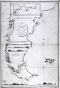 | Details | Depot de la Marine | 1800 |
| Antique French Sea Chart of Patagonia in South America |
|
Depot de la Marine |
|
| 1800 |
| LOC:51 |
| $1,450.00 | Depot-de-la-Marine | Antique-French-Sea-Chart-of-Patagonia-in-South-America | An attractive large antique French sea chart of Patagonia in lower South America published by France's Depot de la Marine in 1800. This spectacular chart encompasses the southern half of South America. With part or all of what is today Argentina, and Chile and includes the Falkland Islands. The map, as noted in the cartouche, is based on charts or surveys published in 1789, 1790, etc. by officers of the Spanish Navy.
<br></br>
In a few areas where information about the coast was scarce or completely lacking, the coastline is drawn using a very light line with no shading. For example, the "Canal de St. Sebastien" shown on the chart in the upper part of Tierra del Fuego (Fr. "Terre de Feu") near the Bay of St. Sebastien was completely without basis in fact and its questionable existence is communicated by the use of thin lines on both the north and south limits of that feature.
<br></br>
At top is an inset map of the north part of Golfe de St. George showing Isla Tova. This spectacular chart also contains seven very attractive coastal elevation views that would aid navigators as they approached shore:
<div class="indenttextblock">
<ul>
<span style= style="list-style-type: circle;">
<li>Vue de l'IIe de la Mocha</li>
<li>Vue du Cap Blanc</li>
<li>Vue de 'Entrée du Port Desire</li>
<li>Vue du Cap de 3 Pointes</li>
<li>Vue des Iles Salvages</li>
<li>Vue des Iles de Diego Ramirez</li>
<li>Vue du Cap de Horn</li>
</span>
</ul>
</div>
"Prix Trois Francs" at bottom right. Logo of the Depot de la Marine in the lower left of the map. |
| 6698 | 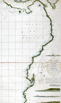 | Details | Direccion Hidrografia | 1800 |
| Rare Spanish chart of northwest South America exploration |
|
Direccion Hidrografia |
|
| 1800 |
| LOC:68 |
| $1,800.00 | Direccion-Hidrografia | Rare-Spanish-chart-of-northwest-South-America-exploration | A scarce, finely engraved original nautical chart of the northwest coast of South America from 1800. With the logo of the Deposito Hidrografico. Shows the tracks of Malaspina aboard the Atrevida and Corveta (1). In the area of Ecuador the map is overlaid with the lines of the triangulation survey of La Condamine (2). Engraved by Fernando Selma. Dedicated to Don Antonio Cornel.
<br><br>
Shows the erupting volcano "Sangay" in Ecuador's eastern cordillera near to La Condamine's survey location.
<br><br>
(1) Malaspina Expedition - a voyage of scientific exploration sponsored by the Spanish government in the late 18th century. Led by Alejandro Malaspina the expedition set sail in 1789 with the aim of exploring and mapping the coasts of South America, Alaska, and the Philippines. The expedition included scientists, cartographers, and artists, and was one of the most extensive scientific expeditions of its time.
<br><br>
(2) Charles Marie de La Condamine was a French geographer, mathematician, and explorer who lived from 1701 to 1774. La Condamine conducted a triangulation survey near Quito, Ecuador and other locations during his expedition to South America. His goal was to measure the length of a degree of arc at the equator, which helped to confirm the shape of the Earth as an oblate spheroid. La Condamine also made important contributions to the study of Amazonian geography and culture, and he was one of the first Europeans to provide a detailed account of rubber. |
| 5198 |  | Details | Anonymous | 1800 |
| Two French Manuscript Cadastral Plans near Dijon, France. |
|
Anonymous |
|
| 1800 |
| LOC:77 |
| $165.00 | Anonymous | Two-French-Manuscript-Cadastral-Plans-near-Dijon--France- | Two manuscript cadastral plans of lands in France belonging to Mr. Jacob, one with grape vines, ca. 1790. Today there are at least two wine producers operating in France with the name Jacob. Both wineries lie about 30 km southwest of Dijon, France near the main road : Domaine Jacob and Domaine Lucien Jacob.
<br></br>
<div class="indenttextblocksingle">
1) MS plan of an L-shaped lot belonging to Mr. Jacob and containing 49 ares and 49 centiares. Site plan was located at the intersection of the "Grande route de Dijon a Paris" and the "Chemin de Memont a Dijon." North oriented to the right with a fine arrow direction indicator. 8" x 6". </br>
2) MS plan of two lots belonging to Mr. Jacob. One lot planted with grapevines. 7" x 5".
</div>
</br>
A French "are" was a metric measurement equal to 100 square meters; a "centiare" was equal to one square meter. Usage of ares and centiares dates the map after the French Revolution, when France adopted the Metric System of measurement. |
| 5169 |  | Details | Anonymous | 1800 |
| Antique plan of the intended navigable canal from Leeds to Selby. |
|
Anonymous |
|
| 1800 |
| LOC:64 |
| $800.00 | Anonymous | Antique-plan-of-the-intended-navigable-canal-from-Leeds-to-Selby- | <br>Unrecorded map</b> ca. 1774 (but printed early 19th C.?) of a proposed canal in England from the town of Leeds to Selby. Probably after the survey of John Longbotham who is reported to have been employed to survey the route.
<br></br>
The Leeds and Selby Canal would connect with another waterway, the Leeds to Liverpool Canal, then under construction. The canal was proposed to reduce the time and costs to ship bulky items between the two towns which were currently served by boats over the winding course of the River Aire.
<br></br>
The canal proposal ultimately was defeated in Parliament and the shorter Selby Canal was built to Haddesley on the Aire in 1778.
<br></br>
Similar to but much larger (28" x 13") than an anonymous map of the same name published in the Gentleman's Magazine in 1774 (~ 8" x 13"). With two tables of distances, a table of references to the River Calder and a table of references to the River Aire.
<br></br>
Fine circular inset context map centered on York showing the towns, villages and waterways. Title on the inset reads:
<div class="indenttextblocksingle">
"A map of 40 miles round York shewing the advantageous situation of that city in a fertile country abounding with every convenience for the support of trade which would be greatly improved from the center to the utmost limits by making a canal navigation from Leeds to Selby."
</div>
</br>
On wove paper, with evident platemark. Unattributed. |
| 80 | 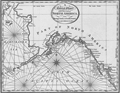 | Details | Malham, John | 1801 |
| A Correct Chart of the West Coast of North America |
|
Malham, John |
|
| 1801 |
| LOC:3 |
| $350.00 | Malham--John | A-Correct-Chart-of-the-West-Coast-of-North-America | Crisp antique copperplate map / chart of Alaska published from Boston in 1801 by Rev. John Malham in Malham's Naval Gazetteer. One of the earliest available maps of Alaska printed in the United States in the early 19th century. Named features include Bristol Bay, Prince William's Sound, Queen Charlotte's Isles, Mt. St. Elias, Cook's River, Bhering's Straits, Port Bukarelli (Bucareli Bay), and Kodiak Island.
<br></br>
The land mass that today we call Alaska is only noted as "Part of North America", and the designation "Alaska" is reserved for the Alaska Peninsula, a narrow body of land separating Bristol Bay from the Pacific Ocean.
<br></br>
This later edition of Malham's map is updated with detailed place names not found in his earlier map of 1796. Mt. St. Elias, today designated Boundary Peak 186, is much more prominently noted. Numerous decorative rhumb lines.
<br></br>
Rev. John Malham was a prolific Yorkshire-born author. Malham died near London in 1807. (Gentleman's Magazine, Vol 102, 1807, p. 568). |
| 4850 |  | Details | Luffman, John | 1801 |
| Antique map of Cadiz Harbour, Spain |
|
Luffman, John |
|
| 1801 |
| LOC:0 |
| $250.00 | Luffman--John | Antique-map-of-Cadiz-Harbour--Spain | Fine copper-plate engraved plan of Cadiz Harbor, Spain not far from the Strait of Gibraltar. Includes Rota, Porto St. Maria, Fort Saint Sebastien, Puntal Road, Carraca, and Chiclana. As described by Luffman: <div class="indenttextblock">
"Cadiz, by the Phoenecians called 'Gadir' and by the Romans 'Gades', is situated in the province of Andalusia & its harbour the best in Old Spain. It was originally built by the Tyrians and possessed successively by the Carthaginians, Romans, and Moors, the latter were dispossessed in 1260. It is 42 miles N.W. of Gibraltar. Lat. 36.30 N. Lon. 6.40 W."
</div>
</BR>
From "Luffman's Select Plans of the Principal Cities, Harbors, Forts etc. in the World". Engraved and published by John Luffman, No. 28 Little Bell Alley, Coleman Street, Cheapside, London. July 1, 1801. Volume I, Number 1.
<br></br>
Luffman also provided similar engravings to this at about the same time for J.T. Serres' "The Little Sea Torch: or, True Guide for Coasting Pilots." Serres translated the Little Sea Torch from an earlier illustrated coasting pilot guide, based on Bougard's "Le petit flambeau de la mer", first published in 1684.
<br></br>
John Luffman (1751-1821) began his career as an engraver, producing a very large and fine map of Antigua, where he had resided in 1787 and 1789. That map was published by Luffman to accompany his 'A Brief Account of the Island of Antigua', 1788." Luffman shared the same sad fate as many publishers and was declared bankrupt on 9th March, 1793. Moving forward Luffman was more cautious and produced small format atlases and handy-sized maps of the theatres of war, principal towns and cities and battle-plans relating to the Wars of the French directorate and the subsequent Napoleonic War. |
| 3602 | 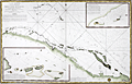 | Details | Depot de la Marine | 1801 |
| Antique French sea chart of northern Cuba and the Bahamas |
|
Depot de la Marine |
|
| 1801 |
| LOC:51 |
| $700.00 | Depot-de-la-Marine | Antique-French-sea-chart-of-northern-Cuba-and-the-Bahamas | Authentic, old French nautical chart, an attractive antique engraving with hand coloring ca. 1801.
Inset plans include:
<div class="indenttextblock">"Plan du Mouillage que forment les Cayesde Piedra, Mono, Monillo et autres ajacentes."</div>
<div class="indenttextblock">"Plan du Mouillage que forment les Cayes Verde et Confites."
<br></br>
French antique navigation chart of the "Vieux Canal" or old canal of the Bahamas. Other features (in French) include Canal de Santarem and Banc de Los Rocques. Inset chart of the anchorage near Cayo Blanco ("les Cayes de Piedras, Monillo, et autres ajacentes") and of the anchorage at Cayo Verde and Cayo Confites. Circular logo of the Depot de la Marine.
<br></br>
"Carte Reduite d'Une Partie du Vieux Canal de Bahama st des Bancs Adjacents". Dated "l'An X" (10th year of the Revolutionary calendar). Published in Paris. |
| 1470 | 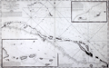 | Details | Depot de la Marine | 1801 |
| French antique chart of the Bahamas old channel and northern Cuba |
|
Depot de la Marine |
|
| 1801 |
| LOC:67 |
| $489.00 | Depot-de-la-Marine | French-antique-chart-of-the-Bahamas-old-channel-and-northern-Cuba | French antique navigation chart of the "Vieux Canal" or old canal of the Bahamas. Other features (in French) include Canal de Santarem and Banc de Los Rocques. Inset chart of the anchorage near Cayo Blanco ("les Cayes de Piedras, Monillo, et autres ajacentes") and of the anchorage at Cayo Verde and Cayo Confites. Circular logo of the Depot de la Marine. |
| 3690 | 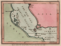 | Details | Luffman, John | 1801 |
| Antique map of the Red Sea and Bab al-Mandab Strait for Luffman's Select Plans |
|
Luffman, John |
|
| 1801 |
| LOC:77 |
| $230.00 | Luffman--John | Antique-map-of-the-Red-Sea-and-Bab-al-Mandab-Strait-for-Luffman-s-Select-Plans | Fine copper-plate engraved plan of the Bab al-Mandab Strait (Babel Mandel) at the mouth of the Red Sea. Includes the villages of Assab (Asab), Eritrea and Mocha (Moka), in Yemen. The Bab al-Mandab Strait connects the Red Sea to the Gulf of Aden. Other key features noted on the map include Purim (Mehta) Island, Cape Rasel, Pilot Island or Robands and the Lofty Islands.
<br></br>
From "Luffman's Select Plans of the Principal Cities, Harbors, Forts etc. in the World". Engraved and published by John Luffman, No. 28 Little Bell Alley, Coleman Street. London. November 1, 1801. Volume II, Number 53.
<br></br>
Luffman also provided similar engravings to this at about the same time for J.T. Serres' "The Little Sea Torch: or, True Guide for Coasting Pilots." Serres translated the Little Sea Torch from an earlier illustrated coasting pilot guide, based on Bougard's "Le petit flambeau de la mer", first published in 1684.
<br></br>
John Luffman (1751-1821) began his career as an engraver, producing a very large and fine map of Antigua, where he had resided in 1787 and 1789. That map was published by Luffman to accompany his 'A Brief Account of the Island of Antigua', 1788." Luffman shared the same sad fate as many publishers and was declared bankrupt on 9th March, 1793. Moving forward Luffman was more cautious and produced small format atlases and handy-sized maps of the theatres of war, principal towns and cities and battle-plans relating to the Wars of the French directorate and the subsequent Napoleonic War. |
| 4823 | 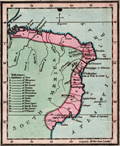 | Details | Luffman, John | 1801 |
| Antique map of Brazil engraved for Luffman's Select Plans |
|
Luffman, John |
|
| 1801 |
| LOC:77 |
| $230.00 | Luffman--John | Antique-map-of-Brazil-engraved-for-Luffman-s-Select-Plans | Fine original copper-plate engraved map of Brazil, on the South American continent, by John Luffman, 1801.
<br></br>
Antique map from Luffman's "<b>Select Plans of the Principal Cities, Harbors, Forts etc. in the World</b>". Engraved and published by John Luffman, No. 28 Little Bell Alley, Coleman Street. London. May 1, 1801. Volume II.
<br></br>
Luffman also provided engravings for J.T. Serres' "The Little Sea Torch: or, True Guide for Coasting Pilots." Serres translated the Little Sea Torch from an earlier illustrated coasting pilot guide, based on Bougard's "Le petit flambeau de la mer", first published in 1684.
<br></br>
<b>John Luffman (1751-1821)</b> began his career as an engraver, producing a very large and fine map of Antigua, where he had resided in 1787 and 1789. That map was published by Luffman to accompany his 'A Brief Account of the Island of Antigua', 1788." Luffman shared the same sad fate as many publishers and was declared bankrupt on 9th March, 1793. Moving forward Luffman was more cautious and produced small format atlases and handy-sized maps of the theatres of war, principal towns and cities and battle-plans relating to the Wars of the French directorate and the subsequent Napoleonic War. |
| 1216 | 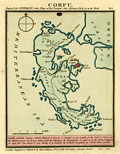 | Details | Luffman, John | 1801 |
| Plan of Corfu engraved for Luffman's Select Plans |
|
Luffman, John |
|
| 1801 |
| LOC:2 |
| $160.00 | Luffman--John | Plan-of-Corfu-engraved-for-Luffman-s-Select-Plans | Copper-plate engraved plan or map of the island of Corfu, Greece by John Luffman. Corfu is a Greek island in the Ionian Sea. The northeastern edge of Corfu lies off the coast of Sarandë, Albania, separated by straits varying in width from 2 to 14 miles.
<br></br>
The town of Corfu is depicted as surrounded by a Vauban-style fortified wall; it's harbor protected by a long 'mole' or breakwater. Coverage includes Castle St. Angelo, Porto Sideri, Porto Timoni, Porto Euripo, Porto Spilea, Formiche, Gudia Island, Condilonisi, and the Valley of St. Stefano.
<br></br>
Description at the bottom reads in part:
<div class="indenttextblock">
"<b>Corfu</b>, anciently Depane, Scheria, Phoeacia, and Corcyra is situated in the mouth of the Gulf of Venice, in the Mediterranean Sea. It was taken from the Venetians by Buonaparte in 1798 and by the Turks and Russians in 1799."
</div>
<br />
From "Luffman's Select Plans of the Principal Cities, Harbors, Forts etc. in the World". Engraved and published by John Luffman, No. 28 Little Bell Alley, Coleman Street, October 1, 1801. Number 15.
<br></br> |
| 5286 | 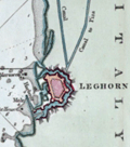 | Details | Luffman, John | 1801 |
| Chart of Leghorn, Italy (Livorno) engraved for Luffman's Select Plans |
|
Luffman, John |
|
| 1801 |
| LOC:7 |
| $225.00 | Luffman--John | Chart-of-Leghorn--Italy--(Livorno)-engraved-for-Luffman-s-Select-Plans | Copper-plate engraved chart or map of the port of Livorno (Leghorn), Italy. In the 16th-century Leghorn was under the control of the Medici family who greatly improved the harbor. Leghorn was free and neutral from 1691 until 1867 when it was incorporated into the nation of Italy.
<br></br>
The chart shows the Mellora Shoal and Mellora Tower west of Livorno; the Tower of Marzocco, the Colombrone River, and numerous hydrographic features including anchorages, navigation hazards, and depth soundings.
<br></br>
Description at the bottom reads in part:
<div class="indenttextblock">
"The Port of Leghorn is a free port in the Mediterranean Sea, in the Dominions of the Grand Duke of Tuscany in Italy. It is a place of considerable trade; 46 miles west of Florence & 145 miles North West of Rome."
</div>
<br />
From "Luffman's Select Plans of the Principal Cities, Harbors, Forts etc. in the World". Engraved and published by John Luffman, No. 28 Little Bell Alley, Coleman Street, January 1, 1801. Vol 1. Number 73.
<br></br> |
| 3691 | 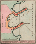 | Details | Luffman, John | 1801 |
| Antique plan of the harbor at Rhodes, Greece for Luffman's Select Plans |
|
Luffman, John |
|
| 1801 |
| LOC:77 |
| $230.00 | Luffman--John | Antique-plan-of-the-harbor-at-Rhodes--Greece-for-Luffman-s-Select-Plans | Fine copper-plate engraved plan of the harbor at Rhodes, Greece, the largest of Greece's Dodecanese islands. Shows the two jetties at the harbor entrance each protected by two fortified positions. Along with the city walls, depth soundings and anchorages are clearly marked. Luffman notes: <div class="indenttextblock">
"The harbour of Rhodes is situated in the island of the same name in the Mediterranean Sea. Here stood the famous colossal statue of Apollo. The city is Lat 36.24 N Long 28.12 E of London."
</div>
</BR>
<br></br>
From "Luffman's Select Plans of the Principal Cities, Harbors, Forts etc. in the World". Engraved and published by John Luffman, No. 28 Little Bell Alley, Coleman Street. London. March 1, 1801. Volume II, Number 1.
<br></br>
Luffman also provided similar engravings to this at about the same time for J.T. Serres' "The Little Sea Torch: or, True Guide for Coasting Pilots." Serres translated the Little Sea Torch from an earlier illustrated coasting pilot guide, based on Bougard's "Le petit flambeau de la mer", first published in 1684.
<br></br>
John Luffman (1751-1821) began his career as an engraver, producing a very large and fine map of Antigua, where he had resided in 1787 and 1789. That map was published by Luffman to accompany his 'A Brief Account of the Island of Antigua', 1788." Luffman shared the same sad fate as many publishers and was declared bankrupt on 9th March, 1793. Moving forward Luffman was more cautious and produced small format atlases and handy-sized maps of the theatres of war, principal towns and cities and battle-plans relating to the Wars of the French directorate and the subsequent Napoleonic War. |
| 1217 | 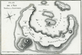 | Details | Benard, Robert | 1801 |
| Fine antique map of Santorini, Greece |
|
Benard, Robert |
|
| 1801 |
| LOC:0 |
| $170.00 | Benard--Robert | Fine-antique-map-of-Santorini--Greece | Very attractive map of the volcanic Greek island of <b>Santorini</b> ( Thera ) in the Aegean Sea. A very strong impression and meticulous attention to topographical detail make this an attractive candidate for framing.
<br></br>
Santorini lies within the Cyclades group of islands located in the southern part of the Aegean. The archipelago contains some 2,200 islands, islets and rocks but only 33 islands are inhabited.
<br?</br>
Includes the nearby islands of Thirasia, Palea Kameni and Nea Kameni. Numerous towns and villages within the island of Santorini are identified including:
<div class="indenttextblock">
<ul style="list-style-type: circle;">
<li>Apanomeria ( Oia )</li>
<li>Scauro</li>
<li>Phira ( Fira ) </li>
<li>Acrotiri or Akrotiri</li>
</ul>
</div>
From Guillaume Olivier: "Atlas Pour Servir au Voyage dans L 'Empire Othoman." Plate 7. |
| 4852 | 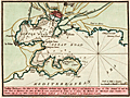 | Details | Luffman, John | 1801 |
| Antique British chart of Toulon Harbor, France |
|
Luffman, John |
|
| 1801 |
| LOC:13 |
| $250.00 | Luffman--John | Antique-British-chart-of-Toulon-Harbor--France | Antique large scale chart of Toulon Harbor, France by John Luffman from 1801.
<br><br>
A fine plan of the Little Road and the Great Road of Toulon. Depth soundings and marked anchorages fill the chart on the way south to the Mediterranean Sea. Shows numerous defensive features including Fort St. Louis, Malgue Fort, numerous towers, and two powder magazines (outside town walls).
<br></br>
As described by Luffman: <div class="indenttextblock">
"Toulon Harbour. The mole of this celebrated harbour was begun by Henry 4 and finished by Louis 13. The arsenal A. and the new port or harbor for Men of War B. were constructed by Louis 14. C. shews the harbour for merchant ships, coasters, etc. Toulon City is 217 miles south-east of Paris. Latitude 43.7 North. Longitude 5.37 East from London."
</div>
</BR>
From "Luffman's Select Plans of the Principal Cities, Harbors, Forts etc. in the World". Engraved and published by John Luffman, No. 28 Little Bell Alley, Coleman Street, Cheapside, London. September 1, 1801. Volume I, Number 9.
<br></br>
John Luffman (1751-1821) began his career as an engraver, producing a very large and fine map of Antigua, where he had resided in 1787 and 1789. That map was published by Luffman to accompany his 'A Brief Account of the Island of Antigua', 1788." Luffman shared the same sad fate as many publishers and was declared bankrupt on 9th March, 1793. Moving forward Luffman was more cautious and produced small format atlases and handy-sized maps of the theatres of war, principal towns and cities and battle-plans relating to the Wars of the French directorate and the subsequent Napoleonic War. |
| 5287 | 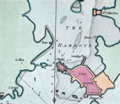 | Details | Luffman, John | 1801 |
| Port Louis, France harbor chart engraved for Luffman's Select Plans |
|
Luffman, John |
|
| 1801 |
| LOC:7 |
| $185.00 | Luffman--John | Port-Louis--France-harbor-chart-engraved-for-Luffman-s-Select-Plans | Copper-plate engraved chart or map of Port Louis, France. Louis XIV established the French East India Company or Compagnie française pour le commerce des Indes orientales, at Port-Louis in 1664. in 1769, unable to maintain itself financially, the Company was liquidated.
<br></br>
The chart shows the walled town of Port Louis and the Citadel, now home to the Musée de la Compagnie des Indes. Along the roadstead: St. Catherines, two un-named forts, the Island of St. Michael; Querco Point and Bangor Point.
<br></br>
Description at the bottom reads in part:
<div class="indenttextblock">
"Port Louis, a town & fort in the Dept. of Morbihan 2 miles S. of l'Orient and 282 W. by S. of Paris."
</div>
<br />
From "Luffman's Select Plans of the Principal Cities, Harbors, Forts etc. in the World". Engraved and published by John Luffman, No. 28 Little Bell Alley, Coleman Street, October 1, 1801. Vol II. Number 25.
<br></br> |
| 5288 | 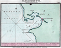 | Details | Luffman, John | 1801 |
| Chart of Iskenderun (Alexandretta) engraved for Luffman's Select Plans |
|
Luffman, John |
|
| 1801 |
| LOC:2 |
| $275.00 | Luffman--John | Chart-of-Iskenderun-(Alexandretta)-engraved-for-Luffman-s-Select-Plans | Harbor chart for Iskenderun (Alexandretta) on Turkey's east Mediterranean Coast. Noted features include: Mount Caillo, Baylassa, Cape Porco, and Cape Canzin.
<br></br>
Description at the bottom reads in part:
<div class="indenttextblock">
"Alexandretta or Scanderoon, a port of Syria at the North Eastern extremity of the Mediterranean Sea, it is the sea port of Aleppo from which city it is distant about seventy miles."
</div>
<br />
From "Luffman's Select Plans of the Principal Cities, Harbors, Forts etc. in the World". Engraved and published by John Luffman, No. 28 Little Bell Alley, Coleman Street, September 1, 1801. Vol II. Number 33.
[ Scanderoon ]. |
| 4873 | 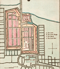 | Details | Luffman, John | 1802 |
| Antique map of Batavia |
|
Luffman, John |
|
| 1802 |
| LOC:77 |
| $280.00 | Luffman--John | Antique-map-of-Batavia | Antique map of Batavia (Jakarta, Indonesia) by John Luffman. |
| 1344 | 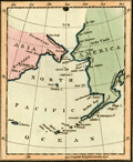 | Details | Luffman, John | 1802 |
| Behrings Strait and Alaska engraved for Luffman's Select Plans |
|
Luffman, John |
|
| 1802 |
| LOC:3 |
| $280.00 | Luffman--John | Behrings-Strait-and-Alaska-engraved-for-Luffman-s-Select-Plans | Scarce and attractive antique copper-plate engraved map of the Bering (Behring) Strait and Gulf of Alaska by John Luffman. This small but fine map extends past 70 degrees north latitude. The Bering Strait is a narrow body of water that links the Arctic Ocean with the Bering Sea and separates the continents of Asia and North America ( Alaska ) at their closest point. Some portions of the Alaska and Asia coasts not well explored at the time are shown with dotted lines, reflecting the uncertainty about their geography.
<br></br>
Key locations noted by Luffman include Bristol Bay, Cook River, Cape Prince of Wales, Cape Stephens, Cape Mulgrave, Cape Lisburn, Round Island, Norton Sound, and Trinity Island at the southern tip of the Kodiak Archipelago (not shown in its entirety).
<br></br>
Bering's strait averages 100 to 165 feet in depth and at its narrowest point is about 53 miles wide. About 20,000 years ago, during the Ice Age, the sea level fell by several hundred feet, making the strait into a land bridge between Asia and North America, over which the migration of plants and animals and humans occurred.
<br></br>
From "Luffman's Select Plans of the Principal Cities, Harbors, Forts etc. in the World". Engraved and published by John Luffman, No. 28 Little Bell Alley, Coleman Street, February, 1802. Volume II; Number 67.
<br></br> |
| 1315 | 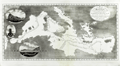 | Details | Willyams, Cooper | 1802 |
| Antique chart of the Mediterranean Sea related to the Battle of the Nile in 1798 |
|
Willyams, Cooper |
|
| 1802 |
| LOC:8 |
| $325.00 | Willyams--Cooper | Antique-chart-of-the-Mediterranean-Sea-related-to-the-Battle-of-the-Nile-in-1798 | Striking, detailed, and unusual aquatint chart of the Mediterranean Sea showing the track of the Royal Navy at the command of Horatio Nelson and the tracks of the Imperial French Navy at the Command of Napoleon I from Europe to Egypt, before and during the Battle of the Nile at Aboukir Bay, in Egypt.
<br></br>
The map includes three oval views:
<div class="indenttextblock">
<ul style="list-style-type: circle;">
<li>The Rock of Gibraltar from the Spanish Lines.</li>
<li>The Devil's Tower.</li>
<li>Ceuta Point bearing S by E 3/4 East.</li>
</ul>
</div>
From Willyam's "A Voyage Up the Mediterranean in His Majesty's Ship the Swiftsure" an eye-witness account of the Battle of the Nile in 1798, Admiral Nelson's greatest triumph. The Battle of the Nile is considered by historians to have been Nelson's most complete victory and Willyams' account to be the most authentic. The work contains 43 plate-engravings of sketches he produced of the battle. It was published in London in 1802, soon after the battle.
<br></br>
The Rev. Cooper Willyams (1762 – 1816) was a clergyman and a British artist. Willyams was chaplain on the Boyne in 1793, during England's war with France. In 1796, Willyams returned to London and published "An Account of the Campaign in the West Indies", which included six drawings by Willyams, all rendered in the difficult aquatint technique. Educated at Emmanuel College, Cambridge, Willyams took holy orders in 1784. The son of a navy commander and formerly chaplain to Admiral St. Vincent, Willyams was a veteran of several campaigns, having accompanied the expedition to the West Indies which ended in a British defeat of the French in 1794. |
| 1275 | 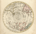 | Details | Walch, Johann | 1803 |
| Antique Southern Hemisphere polar view. |
|
Walch, Johann |
|
| 1803 |
| LOC:1 |
| $135.00 | Walch--Johann | Antique-Southern-Hemisphere-polar-view- | Attractive antique hand-colored <b>polar view</b> of the Southern Hemisphere. Perhaps most surprising about this copper-plate engraved polar map to modern eyes is the lack of an Antarctic Continent with its ice, which was not discovered by Europeans until much later. Published by Johann Walch, in his rare "Allgemeiner Atlas Nach den bewährsten Hülfsmitteln…", Augsburg, Germany, 1803.
<br></br>
Land details of this old map of the Southern Hemisphere include Van Dieman's Land (Tasmania), attached to Australia; Magellan's Land (Patagonia); Cook Strait in New Zealand; and Sandwich Land (not the Hawaiian Islands), discovered by Cook in 1775 and now the South Sandwich Islands. Notes the Amazon River, Congo, Madagascar, Paraguay, New Guinea, Java, and Borneo. |
| 1084 | 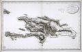 | Details | Depot de la Marine | 1803 |
| Antique French Chart of the Dominican Republic and Haiti |
|
Depot de la Marine |
|
| 1803 |
| LOC:51 |
| $750.00 | Depot-de-la-Marine | Antique-French-Chart-of-the-Dominican-Republic-and-Haiti | Old French map of Saint Dominque- the island of Hispaniola not yet divided into political entities of Haiti and the Dominican Republic. Topography is shown in relief with extensive shading and hachuring. There is extensive depiction of the roads, rivers, and towns that populate the interior of the island. While the map does provide the user with visual geographic details, the is no information either of elevation of the terrain, nor are there any depth soundings.
<br</br>
The map was published by the Depot de la Marine in "An XI" - the 11th year after the French Revolution of 1803. Two changes on the map from an earlier edition of the same map published before the revolution are that the Depot de la Marine logo incorporates the letters "R.F." (Republique francaise) and the town previously denoted as "Port au Prince" is called "Port Republicain" in the post-revolutionary edition. |
| 547 | 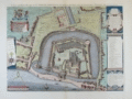 | Details | Society of Antiquaries of London | 1803 |
| Tower of London |
|
Society of Antiquaries of London |
|
| 1803 |
| LOC:64 |
| $500.00 | Society-of-Antiquaries-of-London | Tower-of-London | Splendid copperplate engraving of the Tower of London. An antique bird's-eye view of the Tower of London by the London Society of Antiquaries. A fine re-issue of a striking view created by Haiward and Gascoyne in 1597 and issued first in 1742. This edition on paper watermarked "1803".
<br><br/>
At top, below the royal coat of arms, is a scroll containing a compass rose and a dated attribution to the publishers in Latin :"Sumptibus Societatis Antiquaria Lond. MDCCXLII." At right are two scrollwork cartouches explaining the limits of the 'Tower Liberties' as they existed in 1597. Several dozen locations on the plan are keyed alphabetically to a legend at right. The tower is shown surrounded by a moat with a narrow fortified strip of land between the Tower and the Thames River. |
| 1061 |  | Details | House of Commons | 1803 |
| 1803 plans of the Thames River docks and proposed construction |
|
House of Commons |
|
| 1803 |
| LOC:89 |
| $425.00 | House-of-Commons | 1803-plans-of-the-Thames-River-docks-and-proposed-construction | Two plans from early 1800's of the docks along the River Thames, the upper plan showing the Thames between London Bridge and the Tower of London. Lower map showing from London Bridge downstream past the Isle of Dogs. Part of the area now comprises the London Docklands, a center for redevelopment and urban renewal. Includes the location of the recently constructed Canary Wharf business district in the bend of the Thames River called the Isle of Dogs (once referred to as Stepney Marsh).
<br></br>
Two hand-colored maps of one sheet: a) Extension of the legal quays &c. and b) Plan of the River Thames with the proposed docks at Rotherhithe and in the Isle of Dogs for 814 ships with room for shifting and lighters.
<br></br>
Sourced from Appendix 3 and 4 of volume XIV of the Report (1796) "On Providing Accommodation for the Trade and Shipping of the Port of London". The report, ordered by the House of Commons was printed in 1796 and reprinted in 1803 by Luke Hansard and Sons, printers. |
| 615 | 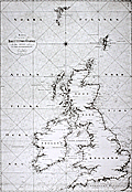 | Details | Klint, Gustaf | 1803 |
| Scarce Swedish chart of the British Isles by Admiral Gustaf Klint |
|
Klint, Gustaf |
|
| 1803 |
| LOC:0 |
| $1,500.00 | Klint--Gustaf | Scarce-Swedish-chart-of-the-British-Isles-by-Admiral-Gustaf-Klint | Original antique nautical chart of the British Isles from 1803 by Admiral Gustaf Klint (1771 - 1840) of the Swedish Royal Navy. This scarce antique "Karta ofver Brittiske Öarne" covers the Shetland, Faroe, and Orkney Islands, England, Scotland, Wales, and Ireland to Cornwall and the western coast of France below Calais. The engraving on this chart is quite exceptional and with added color could be a startling conversation piece. <br></br>
Charts of the British Isles by Admiral Klint are scarce as most of his hydrographic efforts were spent on his native land, Sweden- pricipally the Gulf of Bothnia. Klint is also known for his sailing directions of the Baltic Sea, Gulf of Finland, and Gulf of Bothnia, published posthumously. Number 19. <sup>1</sup>
Swedish text.<br></br>
<sup>1</sup> Dawson, L.S. ( Commander ). "Memoirs of Hydrography including brief biographies of the Principal Officers who have served in H.M. Naval Surveying Services between the years 1750 and 1885". Part II. 1885. [ http://books.google.com/books?id=3SwBAAAAQAAJ&dq=gustaf+klint+admiral&source=gbs_navlinks_s ] |
| 4794 | 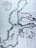 | Details | Faden, William | 1803 |
| Antique Chart of the Baltic Sea, Gulf of Bothnia and Gulf of Finland |
|
Faden, William |
|
| 1803 |
| LOC:57 |
| $350.00 | Faden--William | Antique-Chart-of-the-Baltic-Sea--Gulf-of-Bothnia-and-Gulf-of-Finland | Fine antique British nautical chart of the Baltic Sea by William Faden. Inset port and harbor chart of Cronstadt (Kronstadt) on Kotlin Island and Saint Petersburg, Russia. Separate inset harbor chart for Revel (Tallinn, Estonia) on the shore of the Gulf of Finland. Coverage on the chart extends from Copenhagen at bottom right, to Stockholm and far into the Gulf of Bothnia.
<br></br>
Published by W. Faden, Geographer to the King, and to H.R.H. the Prince of Wales, Charing Cross, June 4, 1803. Engraved by S.I. Neele, Strand. |
| 897 | 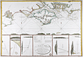 | Details | Depot de la Marine | 1803 |
| Attractive antique chart of the Isle of Wight and Portsmouth, England |
|
Depot de la Marine |
|
| 1803 |
| LOC:64 |
| $720.00 | Depot-de-la-Marine | Attractive-antique-chart-of-the-Isle-of-Wight-and-Portsmouth--England | Attractive French copperplate engraved sea chart of the <b>Isle of Wight</b> and Hampshire coast of England after a chart of 1800 by Captain William Price. This spectacular antique chart is packed with interesting observations that are now over 200 years old. On the main, upper chart numerous soundings, buoys, current indicators, and sandbanks are displayed along with seven inset coastal recognition elevation views to include the Needles, Ash Down Beacon, and Dunnose.
<br></br>
Towns, villages, and other noted features include: St. Aldan's Head, Poole, Christ-church, Lymington, Portsmouth, Portchester, Brackelsome Bay, Chelsea Bill, Brading, Blackgang Chin, Wacht House, Spithead, Sandown Bay, Chichester, and Cowes.
<br></br>
Central inset contains an oval title cartouche and a description of local buoys with the water depths at each. These named buoys include <b>Royal George</b> (a first-rate British ship-of-the-line lost off Portsmouth while at anchor in August 1782) , Edgar, Normansland, Bembridge Ledge, Knab Rock and the Horse and Dean Sands. Flanking the central inset are five attractive detailed elevation views with bearings <b>triangulating buoys to on-shore features</b>, usually prominent houses, beacons, or hills. These bearings are often accompanied with sailing directions in French such as this one indicating an anchorage with a 3-masted sailing ship at anchor. It triangulates a compass heading with a white marker on the Isle of Wight to a windmill on Portsea Island. <div class="indenttextblock"> "La Chapelle dans Portsmouth Common et le Moulin dans l'est du Chateau de South Sea l'un par l'autre N 14 NE".</div>
</br>
Published by order of Contre-Amiral (Rear Admiral) Decres in An XII (year 12) of the French Revolution which is equivalent to 1803. With the circular logo of an anchor surrounded by "R.F." (REPUBLIQUE FRANÇAISE) used by the Depot during the revolution. Price when published was two Francs. |
| 933 | 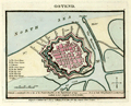 | Details | Luffman, John | 1803 |
| Antique plan of Ostend, Belgium |
|
Luffman, John |
|
| 1803 |
| LOC:7 |
| $145.00 | Luffman--John | Antique-plan-of-Ostend--Belgium | Small, neat, antique plan of the Belgian coastal town of <b>Ostend</b> shown surrounded by water on 3 sides and by Vauban-style defensive walls with numerous bastions. Published 1804 by <b>John Luffman</b> in "Select Plans of the Principal Cities, Harbours, Forts etc. in the World." Luffman (1776-1820) was a London goldsmith, engraver, and publisher.
<br></br>
Description of the town at bottom reads: <div class="indenttextblock">"Ostend, a considerable port and city of the French Republic in the department of Lys. It is 22 miles NE of Dunkirk and 10 W. of Bruges. Latitude 51.14 N. Longitude 5.0 E. of London." </div>
</br>
Luffman shows thick, double defensive walls around the town with a street plan. Includes the harbor at the east end and Key Creek to the south. A legend at left is keyed to several important locations including: the town house; the great church; St. Martins; the great square; the new market, the key gate; the west gate; the beast market; and coffers (piers). The plan is drawn at low tide with the coffers high above a large expanse of exposed beach.
<br></br>
Publisher's attribution at bottom margin reads: <div class="indenttextblock">Engraved and Published Nov 1, 1803 by J. Luffman, No. 28 Little Bell Alley, Coleman Street, London.</div> |
| 1058 | 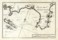 | Details | Allezard, Jean Joseph | 1804 |
| Early French Port Plan of Cannes and Antibes France |
|
Allezard, Jean Joseph |
|
| 1804 |
| LOC:4 |
| $150.00 | Allezard--Jean-Joseph | Early-French-Port-Plan-of-Cannes-and-Antibes-France | Small antique port plan of a portion of the Côte d'Azur on the Mediterranean coast of southeatern France. Coverage includes Cannes and Cap d'Antibes, the peninsula between the Bay of Cannes to the south-west and the Baie des Anges to the north east.
<br></br>
Plate 20 of Allezard's atlas "Recueil de 163 des principaux Plans des Ports et Rades de la Mediterranée, dont 40 ont été derniérement publiés par Jean Joseph Allezard ancien Capitaine de Marine." Essentially this plan is a later copy of a plan first laid down by Michelot and Bremond around 1727 and later published by Roux. |
| 593 |  | Details | Depot de la Marine | 1804 |
| Plan du Port de Plymouth |
|
Depot de la Marine |
|
| 1804 |
| LOC:64 |
| $860.00 | Depot-de-la-Marine | Plan-du-Port-de-Plymouth | Neat chart of the harbor and town of Plymouth, England published in the 12th year of the French Revolution (1804). With shaded topographical details, numerous soundings, defensive structures, and navigational aids. Single profile view of the entrance to Plymouth Sound at top right.
<br></br>
Named features include Ram Head, Redden Point, Point Penlee, Saltash, Tamer River, Line River, East Anthony, Stoke Damerel, Plymouth, Sutton Pool, Mount Batten, Catwater, Causand Bay, Shagstone, Mewstone, Yealme River, Mill Bay, Drakes Island, and many more.
<br></br> Black and white copperplate-engraved chart was published by France's Depot de la Marine. With the circular anchor stamp of the Depot. Original price was one and one-half francs. |
| 932 | 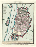 | Details | Luffman, John | 1804 |
| Antique plan of Antwerp, Belgium |
|
Luffman, John |
|
| 1804 |
| LOC:7 |
| $200.00 | Luffman--John | Antique-plan-of-Antwerp--Belgium | <div class="indenttextblock">"Antwerp, fine city of France in the department of the Scheldt; heretofore the capital of the Austrian Brabant, and once the mistress of the commerce of Europe. Latitude 51.13 North. Longitude 4.29 East from London." </div> So reads the description of this neat antique plan of the walled town of <b>Antwerp, Belgium</b>. Published 1804 by <b>John Luffman</b> in "Select Plans of the Principal Cities, Harbours, Forts etc. in the World." Luffman (1776-1820) was a London goldsmith, engraver, and publisher.
<br></br>
Luffman shows double defensive walls around the rather large town with a street plan. Includes the Citadel at the southern end of town and two forts across the Scheldt river along the "Dyke of Flanders".
A legend at left is keyed to several important locations including: The Cathedral; Town House; Fort Isabella; St. James; St. George; St. Walburg; St. Andren; St. Michael; the Exchange; and Meer Street. Two additional forts are identified as Terre de Flanders and Fort St. Laurent.
<br></br>
Publisher's attribution at bottom margin reads: <div class="indenttextblock">"Engraved and Published Feb 1, 1804 by J. Luffman, No. 28 Little Bell Alley, Coleman Street, London."</div> |
| 1165 |  | Details | Wilhelm, Gottlieb Tobias | 1804 |
| Group of antique engravings related to slavery. |
|
Wilhelm, Gottlieb Tobias |
|
| 1804 |
| LOC:0 |
| $250.00 | Wilhelm--Gottlieb-Tobias | Group-of-antique-engravings-related-to-slavery- | A group of three pages containing five hand-colored copper-plate engravings of scenes related to African slaving and slavery.
</br>
<div>
<ul style="margin:2em; list-style-type: circle; line-height: 1.2em;">
<li>Three general-arrangement plans define the three-dimensional distribution of slaves packed in the hold of a slave ship; and vignette of a woman slave in chains working on a coffee plantation with her small children, while behind her another slave is whipped while tied horizontally to a grating. </li>
<li>Two scenes illustrating that Africans were not only slaves but were often complicit in conducting slave raids against other tribes. Black men are shown carrying rifles and assisting in the restraint of naked captives.</li>
<li>Scene showing armed and uniformed Caucasian men rounding up a fugitive slave.</li>
</ul>
</div>
From G. T. Wilhelm's Encyclopedia of Natural History: Mankind. Augsburg, 1804. Gottlieb Tobias Wilhelm (1758-1811) was a Bavarian clergyman and naturalist known as the German Buffon. |
| 1457 |  | Details | Gold, Joyce | 1804 |
| Chart of the Supposed Course of the Florida Stream |
|
Gold, Joyce |
|
| 1804 |
| LOC:3 |
| $400.00 | Gold--Joyce | Chart-of-the-Supposed-Course-of-the-Florida-Stream | Graphically arresting thematic chart of the "Florida Stream" or Gulf Stream with its flow northwards up the east coast of the United States, well past Bermuda, and then into the North Atlantic Ocean. Direction of the Gulf Stream current is shown visually by arrows supplemented with written notations indicating the compass direction at several locations across the stream.
<br></br>
The map may be considered to be an example of persuasive cartography. The concept of the Gulf Stream was novel at that time (hence the "supposed"); many mariners had not fully adopted the notion when this map was published. The direction and flow of the Gulf Stream was proposed by Benjamin Franklin in 1770 based on measurements he took during voyages from the U.S. to England and France.
<br></br>
London Published May 31, 1804 by J. Gold, 103 Shoe Lane. |
| 524 |  | Details | Depot de la Marine | 1806 |
| Carte Generale des Isles Antilles |
|
Depot de la Marine |
|
| 1806 |
| LOC:51 |
| $775.00 | Depot-de-la-Marine | Carte-Generale-des-Isles-Antilles | Large, rolled, copperplate engraved antique 'brown-back' working sea chart of the Caribbean (Antilles) issued by the French Depot de la Marine in 1806. Coverage includes from eastern Puerto Rico and its islands of Culebra and Vieques, the British Virgin Islands, Anguilla, St. Kitts, Nevis, Montserrat, Antigua, Barbuda, Guadeloupe, Dominica, Martinique, St. Lucia, St. Vincent, Grenada, Barbados, Trinidad and Tobago to the Venezuelan coast. The lower portion of the map covers the northern coast of Venezuela including the cities of Cumana and Barcelona. Numerous French place names, soundings and navigation hazards are noted.
<BR> </BR>
Chart is covered with brown linen; probably contemporary to its issue based on the wear pattern. Blueback charts, covered in blue linen, or heavy paper are much more common, These brown back charts are not often found. The linen has done a good job of protecting the map and maintaining it's fine condition over the last 200+ years.
<BR> </BR>
With the circular stamp of the French Depot de la Marine. No 187. Price 3 Francs. |
| 5348 | 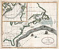 | Details | Anonymous | 1806 |
| Original antique Ben Franklins Chart of the Gulf Stream |
|
Anonymous |
|
| 1806 |
| LOC:11 |
| $275.00 | Anonymous | Original-antique-Ben-Franklins-Chart-of-the-Gulf-Stream | Decorative antique chart of the Gulf Stream with the Florida East and West Territories. After Benjamin Franklin's original chart, first engraved by James Poupard, published by the American Philosophical Society in 1786.
<br></br>
This chart lacks the written <b>sailing directions</b> in Poupard's engraving or "Remarks upon the navigation from Newfoundland to New York in order to avoid the Gulph Stream on the one hand, and on the other the Shoals that lie to the southward of Nantucket and of St. George's Banks." In those remarks, Franklin notes the time savings mariners can achieve through avoiding the Gulf Stream when westbound from England to the USA :
<div class="indenttextblocksingle">
"The Nantucket captains who are acquainted with this stream, make their voyages from England to Boston in as short a time generally as others take in going from Boston to England, viz. from 20 to 30 days."
</div>
</br>
Source: The Complete Works on Philosophy, Politics and Morals of the Late Dr. Benjamin Franklin, 2nd ed, London 1806. Plate VII. Vol 2. p. 197. Published by Longman, Hurst, Rees, and Orme. London, April 1, 1806. |
| 237 |  | Details | Direccion Hidrografia | 1809 |
| Puerto de Gibara |
|
Direccion Hidrografia |
|
| 1809 |
| LOC:5 |
| $400.00 | Direccion-Hidrografia | Puerto-de-Gibara | Beautiful, black and white engraved copperplate port plan of the port of Gibara on northeast coast of Cuba. Published in 1809, before the town of Gibara was founded, this antique plan / chart is one of 34 charts of Cuban ports published by the Spanish Admiralty, the Direccion Hidrografia, in the sea atlas "Portolano de la America Setentrional Construido en la Direccion Detrabajos Hidrograficos". <BR> </BR>
A fine example with careful, delicate engraving and a wide platemark on high-quality paper. Distance scale is in cables. Part 3. Plate #24.<BR> </BR>
Reference: Materiales para una Cartografia Mexicana. Manuel Orozco y Berra. 1871. p. 216.
<br></br>
<a href="/DireccionHidrografiaBackground.aspx" > See all items by Spain's Direccion de Hidrografia.</a> |
| 236 |  | Details | Direccion Hidrografia | 1809 |
| Plano del Puerto de Banes |
|
Direccion Hidrografia |
|
| 1809 |
| LOC:5 |
| $400.00 | Direccion-Hidrografia | Plano-del-Puerto-de-Banes | Beautiful, black and white engraved copperplate port plan of Banes, Cuba, birthplace of former dictator Fulgencio Batista, located on the northeast coast of that island nation. Published in 1809, this antique chart of Banes harbor is one of 34 charts of ports in Cuba published by the Spanish Admiralty, the Direccion Hidrografia, in the sea atlas "Portolano de la America Setentrional Construido en la Direccion Detrabajos Hidrograficos". <BR> </BR>
Highlights include elaborate calligraphic title and spare, careful engraving with a wide platemark on high-quality paper. Distance scale is in cables. Engraved by J.C. Part 3. Plate #18.<BR> </BR>
Reference: Materiales para una Cartografia Mexicana. Manuel Orozco y Berra. 1871. p. 216.
<br></br>
<a href="/DireccionHidrografiaBackground.aspx" > See all items by Spain's Direccion de Hidrografia.</a> |
| 3656 |  | Details | Direccion Hidrografia | 1809 |
| Puerto de Matanzas, Cuba |
|
Direccion Hidrografia |
|
| 1809 |
| LOC:77 |
| $400.00 | Direccion-Hidrografia | Puerto-de-Matanzas--Cuba | Scarce antique copperplate-engraved harbor chart of the Bay of Matanzas, Cuba on the northern coast of the island. Shows the then tiny Pueblo de San Carlos de Matanzas. Key features include Rio de Matanzas, Rio de Yumuris, Rio Canima, and the Castillo de San Severino, built in 1735. Bombed by the British in 1762, it was rebuilt in the 1770s. The Castillo became an offloading point for slaves and today is the site of the slavery-themed Museo de la Ruta de los Esclavos.
<BR> </BR>
Published in 1809, this rare chart was one of 34 charts of Cuban ports published by the Spanish Admiralty, the Direccion Hidrografia, in the sea atlas "Portolano de la America Setentrional Construido en la Direccion Detrabajos Hidrograficos". A fine example with careful, delicate engraving and a wide platemark on high-quality paper. Distance scale is in cables. Engraved by J.C. Part 3, Cuba. Plate #29.
<BR> </BR>
Reference: Materiales para una Cartografia Mexicana. Manuel Orozco y Berra. 1871. p. 216. |
| 239 | 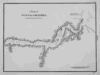 | Details | Direccion Hidrografia | 1809 |
| Puerto de Nuevas Grandes |
|
Direccion Hidrografia |
|
| 1809 |
| LOC:5 |
| $400.00 | Direccion-Hidrografia | Puerto-de-Nuevas-Grandes | Beautiful, black and white engraved copperplate chart of Puerto de Nuevas Grandes, in the province of Camaguey, on the northern coast of Cuba. Published in 1809, this chart was one of 34 charts of Cuban ports published by the Spanish Admiralty, the Direccion Hidrografia, in the sea atlas "Portolano de la America Setentrional Construido en la Direccion Detrabajos Hidrograficos". <BR> </BR>
A fine example with careful, delicate engraving and a wide platemark on high-quality paper. Distance scale is in cables. Engraved by J.C. Part 3. Plate #27.<BR> </BR>
Reference: Materiales para una Cartografia Mexicana. Manuel Orozco y Berra. 1871. p. 216.
<br></br>
<a href="/DireccionHidrografiaBackground.aspx" > See all items by Spain's Direccion de Hidrografia.</a> |
| 240 | 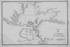 | Details | Direccion Hidrografia | 1809 |
| Puerto del Padre |
|
Direccion Hidrografia |
|
| 1809 |
| LOC:5 |
| $450.00 | Direccion-Hidrografia | Puerto-del-Padre | Beautiful, black and white engraved copperplate chart of Puerto del Padre, in the province of Las Tunas, on the northern coast of Cuba. Published in 1809, this chart was one of 34 charts of Cuban ports published by the Spanish Admiralty, the Direccion Hidrografia, in the sea atlas "Portolano de la America Setentrional Construido en la Direccion Detrabajos Hidrograficos". Puerto del Padre is one of several ports in Cuba that lay claim as the first spot in Cuba where Christopher Columbus landed on his well known 1492 exploration of the new world.<BR> </BR>
A fine example with careful, delicate engraving and a wide platemark on high-quality paper. Distance scale is in cables. Engraved by J.C. Part 3. Plate #25.<BR> </BR>
Reference: Materiales para una Cartografia Mexicana. Manuel Orozco y Berra. 1871. p. 216. |
| 241 |  | Details | Direccion Hidrografia | 1809 |
| Puerto de Taco |
|
Direccion Hidrografia |
|
| 1809 |
| LOC:5 |
| $400.00 | Direccion-Hidrografia | Puerto-de-Taco | Beautiful, black and white engraved copperplate harbor chart of the Bahia de Taco, in the province of Guantanamo, on the far northeastern coast of Cuba. The Bahia de Taco lies very near a UNESCO world heritage site, the Parque National Alejandro de Humboldt. The 275 square mile park is one of the most biologically diverse sites in the Caribbean basin and is home to a 3832 foot mountain peak named El Todo.<BR> </BR>
Published in 1809, this chart of Puerto de Taco was one of 34 charts of Cuban ports published by the Spanish Admiralty, the Direccion Hidrografia, in the sea atlas "Portolano de la America Setentrional Construido en la Direccion Detrabajos Hidrograficos". A fine example with careful, delicate engraving and a wide platemark on high-quality paper. Distance scale is in cables. Part 3. Plate #9.<BR> </BR>
Reference: Materiales para una Cartografia Mexicana. Manuel Orozco y Berra. 1871. p. 216. |
| 242 |  | Details | Direccion Hidrografia | 1809 |
| Puerto de Cananova |
|
Direccion Hidrografia |
|
| 1809 |
| LOC:5 |
| $400.00 | Direccion-Hidrografia | Puerto-de-Cananova | Beautiful, black and white engraved copperplate harbor chart of the shallow Bahia de Cananova, in the province of Holguin, on the northeastern coast of Cuba. It is generally accepted that Columbus landed in Holguin province on October 27, 1492 during his initial exploratory voyage, just two weeks after first landing in the New World at the Bahamas. <BR> </BR>
Published in 1809, this rare chart was one of 34 charts of Cuban ports published by the Spanish Admiralty, the Direccion Hidrografia, in the sea atlas "Portolano de la America Setentrional Construido en la Direccion Detrabajos Hidrograficos". A fine example with careful, delicate engraving and a wide platemark on high-quality paper. Distance scale is in cables. Engraved by J.C. Part 3. Plate #13.<BR> </BR>
Reference: Materiales para una Cartografia Mexicana. Manuel Orozco y Berra. 1871. p. 216. |
| 243 | 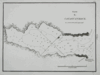 | Details | Direccion Hidrografia | 1809 |
| Puerto de Cayaguaneque (Cayoguaneque) |
|
Direccion Hidrografia |
|
| 1809 |
| LOC:5 |
| $400.00 | Direccion-Hidrografia | Puerto-de-Cayaguaneque-(Cayoguaneque) | Beautiful, black and white engraved copperplate harbor chart of Puerto de Cayaguaneque (or Cayoguaneque), Cuba a cove on the northeast coast of Cuba in Guantanamo province . <BR> </BR>
Published in 1809, this rare chart was one of 34 charts of Cuban ports published by the Spanish Admiralty, the Direccion Hidrografia, in the sea atlas "Portolano de la America Setentrional Construido en la Direccion Detrabajos Hidrograficos". A fine example with careful, delicate engraving and a wide platemark on high-quality paper. Distance scale is in cables. Engraved by J.C. Part 3. Plate #8.<BR> </BR>
Reference: Materiales para una Cartografia Mexicana. Manuel Orozco y Berra. 1871. p. 216. |
| 118 | 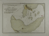 | Details | Direccion Hidrografia | 1809 |
| Plano del Puerto del Alacran |
|
Direccion Hidrografia |
|
| 1809 |
| LOC:5 |
| $400.00 | Direccion-Hidrografia | Plano-del-Puerto-del-Alacran | Small, extremely rare, antique copperplate island chart from the Direccion Hidrografia, Spain's equivalent of the Depot de la Marine in France. This chart is one of 66 charts from the second volume of the work published in 1809: "Portulano de la America Setentrional Construido en la Direccion Detrabajos Hidrograficos. Antique Spanish sea charts of their New World possessions from this time period are not often found.<BR> </BR>
About 65 miles from the Yucatan coast of Mexico the Alacranes (Scorpion) reef was declared a Marine Protection Area in 1994. The chart includes numerous soundings along with the composition of the sands near the reef. Shows 4 small islands: Isla de Perez, La Lavendera, Isla Chica, and Isla de Pajaras. North oriented at the right of the chart. |
| 371 | 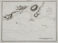 | Details | Direccion Hidrografia | 1809 |
| Plano del Fondeadero Bleufields |
|
Direccion Hidrografia |
|
| 1809 |
| LOC:5 |
| $500.00 | Direccion-Hidrografia | Plano-del-Fondeadero-Bleufields | Chart of southwest coast of Jamaica near Bluefields Bay (Bleufields), near the current town of Belmond. Noted feature include El Fuerte on a point jutting into the Caribbean and a small rocky island "Arrecife del Moro". North is oriented to the left.
<BR> </BR>
Published in 1809, this large-scale port/harbor chart is one of 22 charts of ports in Haiti, Dominican Republic and Jamaica (on 16 plates) published by the Spanish Admiralty, the Direccion Hidrografia, in Part IV of the atlas "Portolano de la America Setentrional Construido en la Direccion Detrabajos Hidrograficos". Because of Spain's secrecy about its New World territories these charts represent some of the earliest detailed charts of these areas. These small charts do not often appear on the market. Plate Number 6. Scale in cables.<BR> </BR>
Reference: Materiales para una Cartografia Mexicana. Manuel Orozco y Berra. 1871. p. 216. |
| 372 |  | Details | Direccion Hidrografia | 1809 |
| Puerto de Mosquito (Jamayca) |
|
Direccion Hidrografia |
|
| 1809 |
| LOC:5 |
| $500.00 | Direccion-Hidrografia | Puerto-de-Mosquito-(Jamayca) | Chart of Mosquito Cove on the north coast of Jamaica (Jamayca) near Barbican and between Lucea Harbor and Sandy Bay . North is oriented to the bottom. Numerous soundings and hazards are marked. Plate Number 4. Scale in cables.<BR> </BR>
Published in 1809, this large-scale port/harbor chart is one of 22 charts of ports in Haiti, Dominican Republic and Jamaica (on 16 plates) published by the Spanish Admiralty, the Direccion Hidrografia, in Part IV of the atlas "Portolano de la America Septentrional Construido en la Direccion Detrabajos Hidrograficos". Because of Spain's secrecy about its New World territories these charts represent some of the earliest detailed charts of these areas. <BR> </BR>
Reference: Materiales para una Cartografia Mexicana. Manuel Orozco y Berra. 1871. p. 216. |
| 373 | 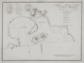 | Details | Direccion Hidrografia | 1809 |
| Puerto Antonio (Jamayca) |
|
Direccion Hidrografia |
|
| 1809 |
| LOC:5 |
| $500.00 | Direccion-Hidrografia | Puerto-Antonio-(Jamayca) | Chart of Puerto Antonio, the capital of the parish of Portland, on the northeast coast of Jamaica (Jamayca) Legend at right identifies 8 features including a church, fortress, and watering spot. North is oriented to the bottom. Numerous soundings, rocks, and hazards are marked. Plate Number 1. Scale in cables.<BR> </BR>
Published in 1809, this large-scale port/harbor chart is one of 22 charts of ports in Haiti, Dominican Republic and Jamaica (on 16 plates) published by the Spanish Admiralty, the Direccion Hidrografia, in Part IV of the atlas "Portolano de la America Septentrional Construido en la Direccion Detrabajos Hidrograficos". Because of Spain's secrecy about its New World territories these charts represent some of the earliest detailed charts of these areas. <BR> </BR> |
| 374 | 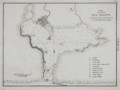 | Details | Direccion Hidrografia | 1809 |
| Plano de Puerto de Delfin (Santo Domingo) |
|
Direccion Hidrografia |
|
| 1809 |
| LOC:5 |
| $500.00 | Direccion-Hidrografia | Plano-de-Puerto-de-Delfin-(Santo-Domingo) | Interesting chart of what is today the Bay of Fort Liberte, Haiti. The city of Fort Liberte has changed hands several times and with each occupation the French, Spanish, and British renamed the city: from Bayaha, to Fort-Dauphin (Delfin in Spanish for dolphin), to Fort St. Joseph and finally in 1820 to Fort Liberte. The chart shows a sizeable settlement and a legend to the right explains several of the key features including two cannon batteries and four forts: Fuerte Ardubin, Fuerte Federico, Fuerte de la Boca, and Fuerte Delfin. Plate Number 3. Scale in cables.<BR> </BR>
Published in 1809, this large-scale port/harbor chart is one of 22 charts of ports in Haiti, Dominican Republic and Jamaica (on 16 plates) published by the Spanish Admiralty, the Direccion Hidrografia, in Part IV of the atlas "Portolano de la America Septentrional Construido en la Direccion Detrabajos Hidrograficos". Because of Spain's secrecy about its New World territories these charts represent some of the earliest detailed charts of these areas. <BR> </BR> |
| 375 | 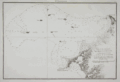 | Details | Direccion Hidrografia | 1809 |
| Plano de las Ensenadas de Monte-Cristi y Manzanillo |
|
Direccion Hidrografia |
|
| 1809 |
| LOC:200 |
| $450.00 | Direccion-Hidrografia | Plano-de-las-Ensenadas-de-Monte-Cristi-y-Manzanillo | Early chart by the Direccion Hidrografia of the northwest coast of the Dominican Republic including the Bay of Montecristi and the Bay of Manzanillo and the town of Montecristi. Much of this area now comprises the Parque Nacional Montecristi. The chart's coverage includes the offshore islands in that area, doubtless the source of the name "los siete hermanos" (the seven brothers) including Cayo de Arenas, Cayo Rataas, Cayo Tercero, Cayo de Muertos, and Cayo Totoru . Somewhat larger that the other charts from the Portolano. Plate Number 2. Scale in cables.<BR> </BR>
Published in 1809, this large-scale port/harbor chart is one of 22 charts of ports in Haiti, Dominican Republic and Jamaica (on 16 plates) published by the Spanish Admiralty, the Direccion Hidrografia, in Part IV of the atlas "Portolano de la America Septentrional Construido en la Direccion Detrabajos Hidrograficos". Because of Spain's secrecy about its New World territories these charts represent some of the earliest detailed charts of these areas. <BR> </BR> |
| 376 | 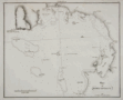 | Details | Direccion Hidrografia | 1809 |
| Plano de Bahia Antigua |
|
Direccion Hidrografia |
|
| 1809 |
| LOC:200 |
| $400.00 | Direccion-Hidrografia | Plano-de-Bahia-Antigua | Chart by the Direccion Hidrografia of the southern coast of Jamaica centered on what is today called Moore's Pen. When the chart was published a small settlement in that area is noted as "Bahia Antigua". Coverage includes Great Goat Island, Ridley's Bay, Coleman's Bay, Salt River Bay, Peake Bay, Mahoe Gardens, and Portland Point although places names on the chart from 1809 do not always correspond to today's. Somewhat larger that the other charts from the Portolano. Plate Number 7. Scale in cables.<BR> </BR>
Published in 1809, this large-scale port/harbor chart is one of 22 charts of ports in Haiti, Dominican Republic and Jamaica (on 16 plates) published by the Spanish Admiralty, the Direccion Hidrografia, in Part IV of the atlas "Portolano de la America Septentrional Construido en la Direccion Detrabajos Hidrograficos". Because of Spain's secrecy about its New World territories these charts represent some of the earliest detailed charts of these areas. <BR> </BR> |
| 359 | 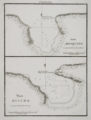 | Details | Direccion Hidrografia | 1809 |
| Bahia Mosquito, Puerto Escudo |
|
Direccion Hidrografia |
|
| 1809 |
| LOC:5 |
| $400.00 | Direccion-Hidrografia | Bahia-Mosquito--Puerto-Escudo | Rare nautical / harbor charts of Bahia Mosquito and Puerto Escudo, Santo Domingo (Dominican Republic).
<BR> </BR>
Published in 1809, these antique large-scale port/harbor charts are two of 22 charts of ports in Haiti, Dominican Republic and Jamaica (on 16 plates) published by the Spanish Admiralty, the Direccion Hidrografia, in Part IV of the atlas "Portolano de la America Setentrional Construido en la Direccion Detrabajos Hidrograficos". Because of Spain's secrecy about its New World territories these charts represent some of the earliest detailed charts of these areas. These antique nautical charts do not often appear on the market. Plate Number 7. Scale in cables.<BR> </BR>
Reference: Materiales para una Cartografia Mexicana. Manuel Orozco y Berra. 1871. p. 216. |
| 360 |  | Details | Direccion Hidrografia | 1809 |
| Fondeadero de Chouchou, Bahia de la Granja |
|
Direccion Hidrografia |
|
| 1809 |
| LOC:5 |
| $400.00 | Direccion-Hidrografia | Fondeadero-de-Chouchou--Bahia-de-la-Granja | Antique nautical / harbor charts of Fondeadero de Chouchou (N. coast of Haiti) and Bahia de la Granja, Haiti.<BR> </BR>
Published in 1809, these two large-scale port/harbor charts are two of 22 charts (on 16 plates) of ports in Haiti, Dominican Republic and Jamaica published by the Spanish Admiralty, the Direccion Hidrografia, in Part IV of the atlas "Portolano de la America Setentrional Construido en la Direccion Detrabajos Hidrograficos". Because of Spain's secrecy about its New World territories these antique harbor charts represent some of the earliest detailed charts of these areas. These small charts do not often appear on the market. Plate Number 5. Scale in cables.<BR> </BR>
Reference: Materiales para una Cartografia Mexicana. Manuel Orozco y Berra. 1871. p. 216. |
| 361 |  | Details | Direccion Hidrografia | 1809 |
| Plano de la Bahia del Pequeno Guave |
|
Direccion Hidrografia |
|
| 1809 |
| LOC:5 |
| $500.00 | Direccion-Hidrografia | Plano-de-la-Bahia-del-Pequeno-Guave | Rare antique nautical / harbor chart of Pequeno Guave (Petit-Goâve) Haiti, one of the oldest cities in the country. Coverage includes from punta Agujereada to punta de Piedras.<BR> </BR>
Published in 1809, this large-scale port/harbor chart is one of 22 charts (on 16 plates) of ports in Haiti, Dominican Republic and Jamaica published by the Spanish Admiralty, the Direccion Hidrografia, in Part IV of the atlas "Portolano de la America Setentrional Construido en la Direccion Detrabajos Hidrograficos". Because of Spain's secrecy about its New World territories these charts represent some of the earliest detailed charts of these areas. These antique charts do not often appear on the market. Plate Number 11. Scale in cables.<BR> </BR>
Reference: Materiales para una Cartografia Mexicana. Manuel Orozco y Berra. 1871. p. 216. |
| 362 |  | Details | Direccion Hidrografia | 1809 |
| Plano de la Bahia de S. Lorenzo |
|
Direccion Hidrografia |
|
| 1809 |
| LOC:5 |
| $400.00 | Direccion-Hidrografia | Plano-de-la-Bahia-de-S--Lorenzo | l scarce harbor chart of San Lorenzo Bay, near Sabana de La Mar, in Hato Mayor, Santo Domingo (now the Dominican Republic). Coverage includes several sandbanks and Rio San Lorenzo.<BR> </BR>
Published in 1809, this large-scale antique port/harbor chart is one of 22 charts (on 16 plates) of ports in Haiti, Dominican Republic and Jamaica published by the Spanish Admiralty, the Direccion Hidrografia, in Part IV of the atlas "Portolano de la America Setentrional Construido en la Direccion Detrabajos Hidrograficos". Because of Spain's secrecy about its New World territories these charts represent some of the earliest detailed charts of these areas. These antique nautical charts do not often appear on the market. Plate Number 16. Scale in nautical miles ("milla maritima").<BR> </BR>
Reference: Materiales para una Cartografia Mexicana. Manuel Orozco y Berra. 1871. p. 216. |
| 363 |  | Details | Direccion Hidrografia | 1809 |
| Punta de la Caldera |
|
Direccion Hidrografia |
|
| 1809 |
| LOC:5 |
| $400.00 | Direccion-Hidrografia | Punta-de-la-Caldera | Scare antique nautical harbor chart of Punta de la Caldera (Calderas), Santo Domingo (now the Dominican Republic), on the south coast of that island. Coverage includes from punta de Burros to punta de Salinas. At the location where the Base Naval de las Calderas is now located there is depicted a single small shack. Other features include: punta Intermedia, Punta de Mata-Sola, Caleton, punta Morrillos, casimba de agua dulce (Translated: 'bucket of sweet water'), punta de las Garzas, and punta Rancheros. Numerous soundings, anchorages, and rocks are noted.<BR> </BR>
Published in 1809, this large-scale port/harbor chart is one of 22 charts (on 16 plates) of ports in Haiti, Dominican Republic and Jamaica published by the Spanish Admiralty, the Direccion Hidrografia, in Part IV of the atlas "Portolano de la America Setentrional Construido en la Direccion Detrabajos Hidrograficos". Because of Spain's secrecy about its New World territories these charts represent some of the earliest detailed charts of these areas. These small antique charts do not often appear on the market. Plate Number 13. Scale in cables.<BR> </BR>
Reference: Materiales para una Cartografia Mexicana. Manuel Orozco y Berra. 1871. p. 216. |
| 364 | 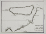 | Details | Direccion Hidrografia | 1809 |
| Puerto del Mole de San Nicolas |
|
Direccion Hidrografia |
|
| 1809 |
| LOC:5 |
| $400.00 | Direccion-Hidrografia | Puerto-del-Mole-de-San-Nicolas | On the northwest section of Haiti, Mole San Nicolas is located just 50 miles from Baracoa, Cuba. This rare chart of the bay and harbor chart of Mole San Nicolas shows the city firmly established at the time of the survey with these features: Almacen de Polvora (gunpowder magazine), quarteles, and la Ciudad protected by a defensive wall.<BR> </BR>
Published in 1809, this large-scale port/harbor chart is one of 22 charts (on 16 plates) of ports in Haiti, Dominican Republic and Jamaica published by the Spanish Admiralty, the Direccion Hidrografia, in Part IV of the atlas "Portolano de la America Setentrional Construido en la Direccion Detrabajos Hidrograficos". Because of Spain's secrecy about its New World territories these charts represent some of the earliest detailed charts of these areas. These small charts do not often appear on the market. Plate Number 9. Scale in cables.<BR> </BR>
Reference: Materiales para una Cartografia Mexicana. Manuel Orozco y Berra. 1871. p. 216. |
| 1324 | 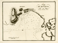 | Details | Direccion Hidrografia | 1809 |
| Antique chart of Montego Bay, Jamaica (Jamayca) |
|
Direccion Hidrografia |
|
| 1809 |
| LOC:5 |
| $600.00 | Direccion-Hidrografia | Antique-chart-of-Montego-Bay--Jamaica-(Jamayca) | Antique Spanish chart of the harbor at Montego Bay, Jamaica (Jamayca) by Spain's Direccion Hidrografia. Jamaica was a colony of Spain from 1511 until 1655, when England drove the Spanish from the island.
<BR> </BR>
Named features on this copper-plate engraved chart include:
<div class="indenttextblock">
<ul style="list-style-type: circle;">
<li>Poblacion de Barnat (Barnett Estate Plantation)</li>
<li>Rio Montego</li>
<li>Monte de Richmond</li>
<li>Punta de Fuerte Viejo (the old British fort)</li>
<li>Punta de Arenas</li>
</ul>
</div>
Published in 1809, this large-scale port/harbor chart is one of 22 charts of ports in Haiti, Dominican Republic and Jamaica (on 16 plates) published by the Spanish Admiralty, the Direccion Hidrografia, in Part IV of the atlas "Portolano de la America Septentrional Construido en la Direccion Detrabajos Hidrograficos". Because of Spain's secrecy about its New World territories these charts represent some of the earliest detailed charts of these areas.
<BR> </BR>
North is oriented to the left. Numerous soundings and hazards are marked. Plate Number 3. Scale in cables. Reference: (Materiales para una Cartografia Mexicana. Manuel Orozco y Berra. 1871. p. 216.) |
| 4940 | 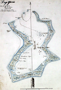 | Details | Anonymous | 1809 |
| Manuscript chart of the island of Diego Garcia |
|
Anonymous |
|
| 1809 |
| LOC:200 |
| $975.00 | Anonymous | Manuscript-chart-of-the-island-of-Diego-Garcia | French manuscript chart of the island of Diego Garcia. Diego Garcia, a coral atoll, is the largest and southernmost member of the Chagos Archipelago, in the central Indian Ocean.
<br/><br/>
Dated on or near May 2, 1809 when the French Governor of Mauritius Decaen granted rights over the island to Cayeux, the Didier brothers, and Lapotaire. Lapotaire was reported to have over 100 slaves working his copra plantation in 1809. The map clearly shows those three land holdings, with Didier at the southern end of the island. (Cawley, Charles. Colonies in Conflict: The History of the British Overseas Territories. Cambridge Scholars Publishing. 2015.)
<br/></br/>
"Portuguese explorers discovered Diego Garcia in the early 1500s. The islands remained uninhabited until the 18th century when the French established coconut and copra plantations with the help of slave labor. Diego Garcia became a possession of the United Kingdom after the Napoleonic wars, and from 1814 to 1965, it was a dependency of Mauritius."
(Source: https://www.cs.mcgill.ca) |
| 244 | 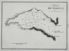 | Details | Direccion Hidrografia | 1809 |
| Puerto de Maravi (Bahia de Maravi) |
|
Direccion Hidrografia |
|
| 1809 |
| LOC:5 |
| $400.00 | Direccion-Hidrografia | Puerto-de-Maravi-(Bahia-de-Maravi) | Beautiful, black and white engraved copperplate chart of the Bay of Maravi, Cuba a cove on the northeast coast of Cuba in Guantanamo province. <BR> </BR>
Published in 1809, this rare chart of Maravi Bay was one of 34 charts of Cuban ports published by the Spanish Admiralty, the Direccion Hidrografia, in the sea atlas "Portolano de la America Setentrional Construido en la Direccion Detrabajos Hidrograficos". A fine example with careful, delicate engraving and a wide platemark on high-quality paper. Distance scale is in cables. Engraved by J.C. Part 3. Plate #6.<BR> </BR>
Reference: Materiales para una Cartografia Mexicana. Manuel Orozco y Berra. 1871. p. 216. |
| 245 | 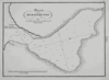 | Details | Direccion Hidrografia | 1809 |
| Puerto de Baitiqueri |
|
Direccion Hidrografia |
|
| 1809 |
| LOC:5 |
| $400.00 | Direccion-Hidrografia | Puerto-de-Baitiqueri | Beautiful, black and white engraved copperplate chart of the Bay of Baitiqueri, Cuba on the northeast coast of Cuba in Guantanamo province. <BR> </BR>
Published in 1809, this rare chart was one of 34 charts of Cuban ports published by the Spanish Admiralty, the Direccion Hidrografia, in the sea atlas "Portolano de la America Setentrional Construido en la Direccion Detrabajos Hidrograficos". A fine example with careful, delicate engraving and a wide platemark on high-quality paper. Distance scale is in cables. Part 3. Plate #3.<BR> </BR>
Reference: Materiales para una Cartografia Mexicana. Manuel Orozco y Berra. 1871. p. 216. |
| 246 | 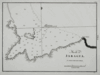 | Details | Direccion Hidrografia | 1809 |
| Puerto de Jaragua (Bahia de Jaragua) |
|
Direccion Hidrografia |
|
| 1809 |
| LOC:5 |
| $400.00 | Direccion-Hidrografia | Puerto-de-Jaragua-(Bahia-de-Jaragua) | Beautiful, black and white engraved copperplate chart of the Bay of Jaragua, Cuba on the northeast coast of Cuba in Guantanamo province. <BR> </BR>
Published in 1809, this rare chart of Jaragua bay was one of 34 charts of Cuban ports published by the Spanish Admiralty, the Direccion Hidrografia, in the sea atlas "Portolano de la America Setentrional Construido en la Direccion Detrabajos Hidrograficos". A fine example with careful, delicate engraving and a wide platemark on high-quality paper. Distance scale is in cables. Engraved by J.C. Part 3. Plate #10.<BR> </BR>
Reference: Materiales para una Cartografia Mexicana. Manuel Orozco y Berra. 1871. p. 216. |
| 247 |  | Details | Direccion Hidrografia | 1809 |
| Puerto de Navas (Bahia Navas) |
|
Direccion Hidrografia |
|
| 1809 |
| LOC:5 |
| $400.00 | Direccion-Hidrografia | Puerto-de-Navas-(Bahia-Navas) | Beautiful, black and white engraved copperplate chart of the Bay of Navas, Cuba on the northeast coast of Cuba in Guantanamo province. Navas is about 2.3 km northwest of Cayoguaneque.<BR> </BR>
Published in 1809, this rare chart of Navas Bay was one of 34 charts of Cuban ports published by the Spanish Admiralty, the Direccion Hidrografia, in the sea atlas "Portolano de la America Setentrional Construido en la Direccion Detrabajos Hidrograficos". A fine example with careful, delicate engraving and a wide platemark on high-quality paper. Distance scale is in cables. Part 3. Plate #7.<BR> </BR>
Reference: Materiales para una Cartografia Mexicana. Manuel Orozco y Berra. 1871. p. 216. |
| 248 |  | Details | Direccion Hidrografia | 1809 |
| Plano del Puerto de Cebollas (Bahia de Cebollas) |
|
Direccion Hidrografia |
|
| 1809 |
| LOC:5 |
| $600.00 | Direccion-Hidrografia | Plano-del-Puerto-de-Cebollas-(Bahia-de-Cebollas) | Beautiful, black and white engraved copperplate chart of the Bay of Cebollas, Cuba on the northeast coast of Cuba in Holguin province. Strong graphic composition; this engraving and the plate of Puerto de Vita would make a fine grouping. This chart is about 20% larger than other port plans in this series.<BR> </BR>
Published in 1809, this rare chart of Cebollas Bay was one of 34 charts of Cuban ports published by the Spanish Admiralty, the Direccion Hidrografia, in the sea atlas "Portolano de la America Setentrional Construido en la Direccion Detrabajos Hidrograficos". A fine example with careful, delicate engraving and a wide platemark on high-quality paper. Distance scale is in cables. Part 3. Plate 14.<BR> </BR>
Reference: Materiales para una Cartografia Mexicana. Manuel Orozco y Berra. 1871. p. 216. |
| 249 |  | Details | Direccion Hidrografia | 1809 |
| Plano del Puerto de Vita |
|
Direccion Hidrografia |
|
| 1809 |
| LOC:5 |
| $650.00 | Direccion-Hidrografia | Plano-del-Puerto-de-Vita | Beautiful, black and white copperplate engraved chart of the Port of Vita, Cuba on the northeast coast of Cuba in Holguin province. Commerce at the Puerto de Vita, Cuba includes the Marina Internacional Puerto de Vita with moorings for 38 boats. The port is reported to offer sufficient protection from hurricanes and also is one of the few Cuban ports where small cruising boats can clear customs. <BR> </BR>
Strong graphic composition; this engraving and the plate of Puerto de Cebollas would make a fine grouping. This chart is about 20% larger than other port plans in this series. Published in 1809, this rare chart of Puerto de Vita was one of 34 charts of Cuban ports published by the Spanish Admiralty, the Direccion Hidrografia, in the sea atlas "Portolano de la America Setentrional Construido en la Direccion Detrabajos Hidrograficos". A fine example with careful, delicate engraving and a wide platemark on high-quality paper. Distance scale is in cables. Part 3. Plate 21.<BR> </BR>
Reference: Materiales para una Cartografia Mexicana. Manuel Orozco y Berra. 1871. p. 216. |
| 5470 |  | Details | Prevost, Antoine-Francois | 1810 |
| Early map of Taiwan or Formosa after de Mailla 1721 1810 |
|
Prevost, Antoine-Francois |
|
| 1810 |
| LOC:6 |
| $600.00 | Prevost--Antoine-Francois | Early-map-of-Taiwan-or-Formosa-after-de-Mailla-1721-1810 | Early map of the island of Taiwan (Formosa / Formose) after a map from 1721 by Father de Mailla, a Jesuit priest. Father de Mailla's maps were published in volume 18 of <i>Lettres edifantes</i>, which dealt with the missions of the Jesuits on both hemispheres.
<br></br>
This copper-plate engraved antique map shows the extent of Chinese Imperial control over the western regions of Taiwan including the western coastlines of Taiwan and the adjacent Chinese mainland of Fujian province. Includes generalized, small-scale coverage of the Penghu Islands (the Pescadores) to the east of Taiwan in the Taiwan Strait. A more detailed look at the Penghu islands is available on another map after de Mailla in our inventory: <b>"Carte de Iles de Pong-hou …".</b>
<br></br>
Based on the volume and page collation numbers this antique map is believed to be from the Toulouse edition of <i>Lettres edifantes</i> printed in 1810. |
| 5471 |  | Details | Prevost, Antoine-Francois | 1810 |
| Early map Penghu Islands or Pescadores near Taiwan |
|
Prevost, Antoine-Francois |
|
| 1810 |
| LOC:6 |
| $250.00 | Prevost--Antoine-Francois | Early-map-Penghu-Islands-or-Pescadores-near-Taiwan | Scarce map of "Iles de Ponghou", the Penghu Islands (or Pescadores) in the Taiwan Strait off the east coast of Taiwan. After a map from 1721 by Father de Mailla, a Jesuit priest. Father de Mailla's maps were published in volume 18 of <i>Lettres edifantes</i>, which dealt with the missions of the Jesuits on both hemispheres.
<br></br>
Based on the volume and page collation numbers this antique map is believed to be from the Toulouse edition of <i>Lettres edifantes</i> printed in 1810.
<br></br>
Also, see de Mailla's early map of
<a href="https://www.rarecharts.com/ShowDetail/Creator/Prevost--Antoine-Francois/Title/Early-map-of-Taiwan-or-Formosa-after-de-Mailla-1721-1810/5470" target="_blank">the island of Taiwan</a> in our inventory. |
| 773 |  | Details | Laurie and Whittle | 1810 |
| Antique Chart of the Bay, Harbor, and Environs of Cadiz, Spain |
|
Laurie and Whittle |
|
| 1810 |
| LOC:4 |
| $275.00 | Laurie-and-Whittle | Antique-Chart-of-the-Bay--Harbor--and-Environs-of-Cadiz--Spain | Attractive nautical antique chart of the Bay of Cadiz, Spain published by British entrepreneurs Laurie and Whittle in 1810. Some of the key features noted in English include the settlements of Rota, Port Santa Maria, Port Royal ( Puerto Real ), Trocadero, St. Carlos Town and Cadiz, Spain. Other features include the Battery of la Gallina, Rio Salado, Castle of Santa Cataline, Convent of la Victoria, Bridge of Boats, Channel of Trocadero, and the Arsenal of the Carracas. On the Isle of Leon are located Torre Gorda or Hercules' Tower, Saint Carlos Town, Martyr's Hill, Castle of Puntales, Fort San Fernando, and the walled town of Cadiz itself with the Castle and Lighthouse of Saint Sebastian jutting westward into the Atlantic Ocean.
<br></br>
Notations of soundings, bottom composition, shoals and other navigational hazards would have made this chart useful to early 19th century sailors.
<br></br>
Publishers attribution at bottom reads: 'Published by Robert Laurie and James Whittle, Chartsellers to the Admiralty, &c &c. No. 53 Fleet Street, London. May 24, 1810.' This antique harbor plan / chart is an original copperplate engraving with later hand coloring based on the work of Spanish cartographer Tofino de San Miguel. Watermarked chain laid paper with the watermark date of 1805. |
| 5195 |  | Details | Heather, William | 1810 |
| Scarce Port Plan of The Harbor of St. Paul in Malta |
|
Heather, William |
|
| 1810 |
| LOC:77 |
| $325.00 | Heather--William | Scarce-Port-Plan-of-The-Harbor-of-St--Paul-in-Malta | Plan of the harbor of St. Paul, Malta in the Mediterranean Sea. Scarce. Published by William Heather in the New Mediterranean Pilot, 1810. Other sources attribute the port plan to Allezard or Roux but text is in English, thus not a French product; also the compass rose title cartouche is a distinctive diagnostic feature of William Heather.
<br></br>
Manuscript notation in an unknown script similar to Persian.
<br></br>
Heather's port plan of St. Paul shows Salt Bay, Point Chaura, Salmonetta, several watchtowers, a lighthouse, anchorages and a mosque. Below the "small harbor" a hilltop village is labeled "Redemption". |
| 589 |  | Details | Stratford, J. | 1810 |
| Sketch of the River Scheldt from Flushing to Antwerp |
|
Stratford, J. |
|
| 1810 |
| LOC:0 |
| $165.00 | Stratford--J- | Sketch-of-the-River-Scheldt-from-Flushing-to-Antwerp | Detailed. antique hydrographic map or chart of a portion of the Scheldt (Escaut) River. After the earlier work by French hydrographer Beautemps Beaupre. Named features include: Antwerp, Ft. Kruys Schans, Ft. St. Philip, Ft. Maria, Ft. Liefkenshoek, Ft. Rammekins, Fort Lillo, Ter Neuse, Santvliet, Biervliet, Middleburg, and Flushing. Numerous soundings (in feet), lighthouses, sand banks, forts and defensive structures are noted.
<br></br>
The antique chart is dated within as published March 24, 1810. Paper carries watermark of "1806". London. J. Stratford No. 112 Holborn Hill. |
| 1032 | 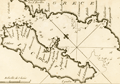 | Details | Allezard, Jean Joseph | 1811 |
| Chart of Corfu by Allezard |
|
Allezard, Jean Joseph |
|
| 1811 |
| LOC:2 |
| $165.00 | Allezard--Jean-Joseph | Chart-of-Corfu-by-Allezard | Antique chart / plan of the Ionian island of Corfu, Greece, the second largest of the Ionian islands. Includes a portion of the west coast of mainland Greece.
<br></br>
Very interesting note by Allezard at the far northwest of the mainland: "Cent quarante les 3 ecolles". Turns out that the area is Sarande, Albania and that the note is a reference to a Byzantine monastery "the Forty Saints" , honoring the "Forty Martyrs of Sebaste" leading to the Italian name "Santi Quaranta" which Allezard spelled phonetically "Cent Quarante".
<br></br>
One of 163 plates of ports on the Mediterranean, Adriatic and Black seas from Allezard's atlas "Recueil de 163 des principaux plans des ports et rades de la Mediterranée, dont 40 ont été derniérement publiés par Jean Joseph Allezard ancien capitaine de marine et plusieurs des autres corrigés" . This atlas was a re-issue of Joseph Roux's atlas published from Marseille in several editions beginning in 1764. Published by Joseph Gamba from Livorno, Italy. Plate 49. |
| 1304 | 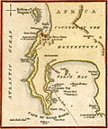 | Details | Naval Chronicle | 1812 |
| Cape of Good Hope with Table Bay and Cape Town. |
|
Naval Chronicle |
|
| 1812 |
| LOC:6 |
| $195.00 | Naval-Chronicle | Cape-of-Good-Hope-with-Table-Bay-and-Cape-Town- | Small attractive antique harbor chart near Cape Town, South Africa showing coastal mountains as well as False Bay and Table Bay. This neat copper-plated engraved antique nautical chart includes the following named features: Penguin Island, Sugar Loaf Hill or the Lion's Head, Lion's Rump, Chapman's or Hout Bay, Simon's Bay, Pringle Bay, Gordons Bay and Cape Hanglip.
<br></br>
Despite its small size the chart has an interesting history. The plate used to create this example was engraved and published by John Luffman in 1801 for Luffman's "Select Plans of the principal cities Ports, Harbours, Forts, etc. in the World". One can see the remnants of Luffman' original imprint mostly erased just below "Cape of Good Hope".
<br></br>
The hydrography includes anchorages, depth soundings, a "best track" into Simons Bay, numerous named rocks in False Bay including Romans Rock, Warren Hastings Rock, Francis Rock, Whittle Rock, and Anvil Rock.
<br></br>
Publisher's imprint at bottom reads: "Published December 31, 1812 by J. Gold. Naval Chronicle Office,103, Show Lane, London." |
| 4788 |  | Details | Direccion Hidrografia | 1813 |
| Rare Antique Plan of the Port and Anchorage at Barcelona, Spain |
|
Direccion Hidrografia |
|
| 1813 |
| LOC:88 |
| $600.00 | Direccion-Hidrografia | Rare-Antique-Plan-of-the-Port-and-Anchorage-at-Barcelona--Spain | Very interesting antique Spanish chart / port plan of Barcelona, Spain on the Mediterranean Sea. One of 16 charts and plans published by Spain's Direccion Hidrografia in the rare Spanish hydrographic atlas: "Portulano de las Costas de la Península de España, Islas adyacentes, y parte de la Costa de Africa. Construido y publicado en la Direccion Hidrografica, Cadiz ano 1813."
<br></br>
With (now faded) MS dedication and attached anchoring instructions, both in English. The dedication read "Presented by W??????? To his fd (friend?) Mr. Fleming Cadiz July 12, 1816." That date is 3 years after the atlas was first issued from Cadiz.
<br></br>
Scarce, no copy in AMPR
<br></br>
Included manuscript sailing directions reads
<div class="indenttextblock">
"In the outside Harbour of Barcelona to protect yourself of the E. and S.E. winds, anchor as follows= The light with the Tower of Merced and the coast of Garaf open on the south of Montjuif, anchoring in 18 - 25 f[athoms]mostly sand, from which … an east wind you can pass the Llobregat."
</div>
<BR/>
A circled spot on the map with light penciled isobaths (contour lines) at 10 and 20 fathoms seem to support the anchoring recommendation in the sailing directions.
<br></br>
Depth soundings are in "pies castellanos" ( 1 Castillian foot = .2786 m or .914 feet). |
| 5262 |  | Details | Direccion Hidrografia | 1816 |
| Rare harbor chart of Cartagena, Colombia |
|
Direccion Hidrografia |
|
| 1816 |
| LOC:88 |
| $1,400.00 | Direccion-Hidrografia | Rare-harbor-chart-of-Cartagena--Colombia | Rare harbor chart of Cartagena, Colombia. North is oriented to the right. Numerous soundings and hazards are marked. Plate Number 19.
<br></br>
Published in 1809, this large-scale port/harbor chart is one of 41 charts of ports in Part II of the atlas "Portolano de la America Septentrional Construido en la Direccion Detrabajos Hidrograficos" containing charts from the USA (Florida and Texas), Mexico, Nicaragua, Panama, and Colombia. Because of Spain's secrecy about its New World territories this chart represents the earliest easily available cartographic record of this area from Spanish sources. |
| 1408 | 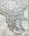 | Details | Lapie, Pierre | 1816 |
| Antique map of Greece and the Balkans |
|
Lapie, Pierre |
|
| 1816 |
| LOC:2 |
| $95.00 | Lapie--Pierre | Antique-map-of-Greece-and-the-Balkans | Antique map of Greece and the Balkans, including the regions of Romania, Bulgaria, Bosnia, Serbia and part of the Black Sea with the western part of Turkey including Constantinople. Much detail about the Greek archipelago. Coverage on this interesting engraved map extends as far south as the island of Crete ("Candie") and encompasses portions of the Ionian Sea, the Mediterranean Sea, the Black Sea, and the Adriatic Sea. Page 27.
<br></br>
Pierre M. Lapie (1779-1850) was a French cartographer and engraver. Lapie, a Colonel in the French army, worked in the corps of topographical engineers. |
| 1409 | 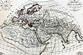 | Details | Lapie, Pierre | 1816 |
| Antique map of Asia |
|
Lapie, Pierre |
|
| 1816 |
| LOC:6 |
| $120.00 | Lapie--Pierre | Antique-map-of-Asia | Very nice antique map of the eastern hemisphere or the entire world as it was known to exist in ancient times. Notations on the map reference Pliny, Ptolemy, Eratosthenes and other very early Greek historians and geographers. Includes north Africa, Mediterranean Sea, India, Europe, Arabia,and western Asia. Upper left corner contains diagram with names of the winds.
<br></br>
Pierre M. Lapie (1779-1850), a Colonel in the French army, was a French cartographer and engraver. Lapie worked in the corps of topographical engineers. Pierre was the father of cartographer Alexandre Emile Lapie. In the first half of the 19th century, the work of the Lapie firm, with its precise engraving and informational density, strongly influenced their German competitors whose maps would eventually dominate the continental European market. |
| 972 | 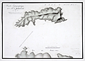 | Details | Pinot, Charles | 1816 |
| Antique manuscript map of Bagueau and Port-Cros in France's îles d'Hyères |
|
Pinot, Charles |
|
| 1816 |
| LOC:0 |
| $900.00 | Pinot--Charles | Antique-manuscript-map-of-Bagueau-and-Port-Cros-in-France-s-îles-d-Hyères | One of a kind, 200 year-old manuscript topographic map of the French Mediterranean island Île de Bagueau and the north coast of Port-Cros island. Signed and dated within by Ch[arles] Pinot, Director of Fortifications in 1816.
<br></br>
Topograhic detail shown through faint contour lines in pencil with benchmarks and elevation stated in several locations. Three cannon batteries noted in red on Bagueau. On Port-Cros, Pinot noted these features: Presqu'ile de Malalenge, Plage de Jeannet, Batterie Sud, and Chateau Ruine.
<br></br>
Both Île de Bagueau and Port-Cros belong to the îles d'Hyères, a group of four Mediterranean islands off the village of Hyères in the Var department of south-east France. Île de Bagueau at 45 hectares is the smallest of the four islands in the group. Port-Cros, at 650 hectares, is a French national Park.
<br></br>
Signed in French in faint ink: Toulon, 5th October, 1816 The Colonel and Director of Fortifcations Charles Pinot. A note in ink below the title begins: "La partie de terrain marquee…".
<br></br>
With a faint red oval overstamp of the "DEPOT de la Direction des Fortifications DE TOULON" |
| 866 | 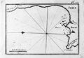 | Details | Allezard, Jean Joseph | 1817 |
| Antique nautical chart of Beirut, Lebanon and approaches |
|
Allezard, Jean Joseph |
|
| 1817 |
| LOC:4 |
| $135.00 | Allezard--Jean-Joseph | Antique-nautical-chart-of-Beirut--Lebanon-and-approaches | Antique maritime chart of the area around and including Beirut, Lebanon, then considered part of Syria ( "Syrie" ). This old copperplate-engraved map extends from Cape Danthon to the east past Beirut and then follows the coast northward until approximately the town of Juniyah. A few soundings and anchorages are defined. Sea charts of ports on the Levantine coast of the Eastern Mediterranean from this time period are somewhat scarce.
<br></br>
One of 163 plates of ports on the Mediterranean, Adriatic and Black seas from Allezard's atlas "Recueil de 163 des principaux plans des ports et rades de la Mediterranée, dont 40 ont été derniérement publiés par Jean Joseph Allezard ancien capitaine de marine et plusieurs des autres corrigés" . This atlas was a re-issue of Joseph Roux's atlas published from Marseille in several editions beginning in 1764. Published by Joseph Gamba from Livorno, Italy. Plate 119. |
| 1030 | 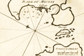 | Details | Allezard, Jean Joseph | 1817 |
| Antique chart of Mykonos, Greece |
|
Allezard, Jean Joseph |
|
| 1817 |
| LOC:2 |
| $145.00 | Allezard--Jean-Joseph | Antique-chart-of-Mykonos--Greece | Antique chart / plan of the Aegean island of Mikonos / Mykonos, Greece along with the northwestern portion of Delos, famous for its important archeological site and in mythology the birthplace of the twin gods Apollo and Artemis. Maps shows the village of Mykonos and a single building off in the distance labeled "Calori".
<br></br>
One of 163 plates of ports on the Mediterranean, Adriatic and Black seas from Allezard's atlas "Recueil de 163 des principaux plans des ports et rades de la Mediterranée, dont 40 ont été derniérement publiés par Jean Joseph Allezard ancien capitaine de marine et plusieurs des autres corrigés" . This atlas was a re-issue of Joseph Roux's atlas published from Marseille in several editions beginning in 1764. Published by Joseph Gamba from Livorno, Italy. Plate 141. |
| 865 | 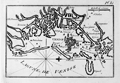 | Details | Allezard, Jean Joseph | 1817 |
| Antique nautical plan of Venice, Italy and lagoons |
|
Allezard, Jean Joseph |
|
| 1817 |
| LOC:4 |
| $175.00 | Allezard--Jean-Joseph | Antique-nautical-plan-of-Venice--Italy-and-lagoons | Antique harbor plan of Venice, Italy and its nearby islands, canals, and villages. The copperplate-engraved map extends from Chioggia ( "Chiozza" ) in the south past the islands of Lido and Malamocco. Venice is shown as an archipelago of about 30 inhabited islands in the center of the lagoon. Some of the noted towns and villages surrounding Venice include Ville Franche, Termine, Palestrina, Bolta, St. Ange, St. George, Muran ( Murano ), Vignole, Neuveau Lazaret, and St. Francis du Desert. Soundings and navigational aids are absent from this small nautical chart. The primary man-made feature of note is the hospital at the east of Venice.
<br></br>
One of 163 plates of ports on the Mediterranean, Adriatic and Black seas from Allezard's atlas "Recueil de 163 des principaux plans des ports et rades de la Mediterranée, dont 40 ont été derniérement publiés par Jean Joseph Allezard ancien capitaine de marine et plusieurs des autres corrigés" . This atlas was a re-issue of Joseph Roux's atlas published from Marseille in several editions beginning in 1764. Published by Joseph Gamba from Livorno, Italy. Plate 81. |
| 622 | 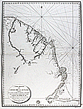 | Details | Depot de la Marine | 1817 |
| Mouth of the Amazon River with Coastal French Guiana and Suriname |
|
Depot de la Marine |
|
| 1817 |
| LOC:67 |
| $1,300.00 | Depot-de-la-Marine | Mouth-of-the-Amazon-River-with-Coastal-French-Guiana-and-Suriname | Exceptional antique French sea chart includes the mouth of the Amazon River in Brazil or "Bouche de la Riviere des Amazones" from Rio Araguari ( Araouari ) at the north as far inland as the town of Macapa'. Original small-scale copperplate engraving published by the Depot de la Marine in 1817 on thick chain-laid paper.
The full extent of this antique nautical chart includes numerous native villages, missionary posts, and points of interest on the coasts and rivers of Brazil, French Guyana, and Suriname (Oyapok ( Oiapoque ), Sinnamary, etc.) as far north as the Maroni River.
<br></br>
Key points of interest include Cayenne, Kourou, St. Paul, Cape Orange, Mt. Tripoupou (Tchoukouchipann ??) , and the far interior native village of Roukouyenes. These features are mentioned as the limits of exploration at the time by Alexander von Humboldt in his "Personal Narrative of Travels to the Equinoctal Regions of the New Continent During the Years 1799 - 1804." Near the Tumuk Humac mountains at the confluence of the Maroni and Oiapoque Rivers is noted: " 3 Villages d'Indiens Aramichaux et Caicouchiennes par 2 36' 30" de Latitude observee."<br></br>
Numeous soundings, isobaths, islands, and detail of the South American coast. No. 28. Price when issued was three francs. With the circular stamp of the French Depot de la Marine. |
| 1034 |  | Details | Leake, William Martin | 1818 |
| Map of Egypt, Nile River |
|
Leake, William Martin |
|
| 1818 |
| LOC:1403 |
| $1,295.00 | Leake--William-Martin | Map-of-Egypt--Nile-River | Very large and impressive <b>full-width example</b> of Leake's map of the Nile river from 1818 (29" x 50" at neatline). Rolled, and <b>NOT dissected.</b> Clean, bright, and strong. Scarce, as the map is not dissected and is in fine condition. Guaranteed original copper-plate engraved map by Sidney Hall for Aaron Arrowsmith. Dated at bottom to 1818. Two sheets well joined.
<br></br>
Published by Aaron Arrowsmith who in his early twenties worked for John Cary, the engraver and William Faden. Aaron Arrowsmith (1750-1823) founded a cartographic dynasty and was a close contemporary of Alexander Dalrymple (Hydrographic Office), Joseph Banks (Naturalist), Flinders and others of the period. Arrowsmith became Geographer to the Prince of Wales in 1810 and ultimately <b>Hydrographer to the King</b> in 1820.
<br></br>
This hand-colored, original map "Course of the Nile" was produced by Lieutenant Colonel W.M. Leake. William Martin Leake, a leading British authority on the region. In 1802, Leake and others were employed to make a general survey of Egypt. Leake's chart was published in 1818 after his retirement, incorporating additional material from Bryce and others. The map provides extensive information on the Nile, archaeological sites, the Sea of Suez, roads and railways. Numerous annotations are included about the areas extensive history and its inhabitants. Note: The Suez Canal is not included in this chart because that waterway was not completed until 1869, more than 50 years after this map was published. |
| 1145 | 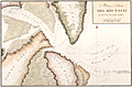 | Details | Direccion Hidrografia | 1818 |
| Boca y Barra Del Rio Nasau |
|
Direccion Hidrografia |
|
| 1818 |
| LOC:200 |
| $1,475.00 | Direccion-Hidrografia | Boca-y-Barra-Del-Rio-Nasau | Rare Spanish nautical chart of the mouth (boca) and bar (barra) in Nassau Sound, Florida in 1818. One of the earliest available large-scale charts of the entrance to the Nassau River and the coastal margins near that waterway which divides Amelia Island from Talbot Island.
<br></br>
From the second part of "Portolano de la America Septentrional Construido en la Direccion Detrabajos Hidrograficos" published in 1818 by Spain's Admiralty department, the
<a href="https://www.rarecharts.com/DireccionHidrografiaBackground.aspx " target="_blank">Dirección de Hidrografía. </a> Plate 326. |
| 5406 |  | Details | Direccion Hidrografia | 1818 |
| Plano del Puerto de Veracruz situado el Castillo de San Juan de Ulua Mexico |
|
Direccion Hidrografia |
|
| 1818 |
| LOC: |
| $375.00 | Direccion-Hidrografia | Plano-del-Puerto-de-Veracruz-situado-el-Castillo-de-San-Juan-de-Ulua-Mexico | Fine, original, engraved Spanish nautical chart of the harbor, islands, and waters surrounding Veracruz, Mexico by the Direccion Hidrografia [1]. The detailed chart is dotted with numerous depth soundings and notation of composition of the sea floor, e.g. arena (sand), piedra (rock), and lama (mud).
<br></br>
Place names and features on this old Spanish harbor chart include [2]:
<div class="indenttextblocksingle">
<ul style="list-style-type: circle;">
<li>Castillo de San Juan de Ulua</li>
<li>Arrecife e Isla de Pajaros</li>
<li>Arrecife de la Blanquilla</li>
<li>Punta de la Gallega</li>
<li>Punta de Hornos</li>
<li>Arrecife de Punta Gorda</li>
<li>Arrecife e Isla de Sacrificios</li>
<li>Anegada de adentro</li>
<li>Arrecife de Isla Verde</li>
</ul>
</div>
[1] From the second part of "Portolano de la America...", published in 1818 by Spain's Admiralty department, the Dirección de Hidrografía. In 1809 the Direccion first published this atlas of plans of bays, harbors, and ports from Spain’s New World possessions: "Portolano de la America Septentrional Construido en la Direccion de Trabajos Hidrograficos". Plate 52.<br/>
[2] Arrecife = reef; Isla = island; Anegada = flooded or underwater. |
| 1300 |  | Details | Direccion Hidrografia | 1818 |
| Antique Spanish chart the port of Veracruz, Mexico. |
|
Direccion Hidrografia |
|
| 1818 |
| LOC:10 |
| $850.00 | Direccion-Hidrografia | Antique-Spanish-chart-the-port-of-Veracruz--Mexico- | A scarce Spanish nautical chart of the harbor, islands, and waters surrounding Veracruz, Mexico. An original antique navigation chart by the Direccion Hidrografia; the detailed chart is dotted with numerous depth soundings and notation of composition of the sea floor, e.g. arena (sand), piedra (rock), and lama (mud).
<br></br>
Place names and features on this old Spanish harbor chart include Castillo de San Juan de Ulua, Arrecife e Isla de Pajaros, Arrecife de la Blanquilla, Punta de la Gallega, Punta de Hornos, and Arrecife de Punta Gorda and Arrecife e Isla de Sacrificios. Isla de Sacrificios has a bloody past. Bernal Diaz del Castillo reports that when the Spanish first landed on the Isla de Sacrificios:
<div class="indenttextblock">
"We found two stone buildings of good workmanship, each with a flight of steps leading up to a kind of altar, and on those altars were evil-looking idols, which were their gods. Here we found five Indians who had been sacrificed to them on that very night. Their chests had been struck open and their arms and thighs cut off, and the walls of these buildings were covered in blood. All this amazed us greatly, and we called this island the Isla de Sacrificios, as it is now named on the charts."
</div>
<BR/>
From the second part of "Portolano de la America...", published in 1818 by Spain's Admiralty department, the Dirección de Hidrografía. In 1809 the Direccion first published this atlas of plans of bays, harbors, and ports from Spain’s New World possessions: "Portolano de la America Septentrional Construido en la Direccion de Trabajos Hidrograficos". (Updated in 1818). Plate 52. |
| 144 |  | Details | Tardieu, Ambroise | 1818 |
| Plan du Combat Naval d'Algeciras |
|
Tardieu, Ambroise |
|
| 1818 |
| LOC:8 |
| $375.00 | Tardieu--Ambroise | Plan-du-Combat-Naval-d-Algeciras | A highly detailed, elegant, antique copperplate chart / map produced by Ambroise Tardieu (1788-1841) for Dumas' multi-volume "Precis Des Evenemens Militaires". The chart shows the positions of French, Spanish, and British ships during the battle of Algeciras set against a highly detailed hydrographic and topographic background. Careful and meticulous hachuring conveys elevation. Inset legend at bottom right explains labeled positions of ships including "le formidable vaisseaux General Francais" and "Chaloupes canonieres Espagnoles".
<BR> </BR>
Notation in upper right border: "Campagne de 1802. Tome 1.". |
| 4774 |  | Details | Direccion Hidrografia | 1818 |
| Scarce antique Spanish chart of Tampa Bay, Florida |
|
Direccion Hidrografia |
|
| 1818 |
| LOC:200 |
| $1,650.00 | Direccion-Hidrografia | Scarce-antique-Spanish-chart-of-Tampa-Bay--Florida | A scarce Spanish antique nautical chart of a large area now encompassing St. Petersburg and Tampa, Florida, and all of Tampa Bay. With anchorages identified, depth soundings, and several Spanish place-names. One unidentified location, "Cayo de Aguada" or Watering Key, remains unknown to me. That location likely would have been very attractive to pirates and privateers as it offered both close proximity to fresh water and to the nearby deeper entrance channels to Tampa Bay.
<br></br>
Contains numerous coastal locations with their second-Spanish period names: Longboat Key ("Id. Larga"), Passage Key ("Cayo del Passage"), Sweetwater Creek ("Rio de Aguadulce"), Little Manatee River ("Rio de Manaties"), Point Pinellas (Punta de Pinar [Sp. pine]). During the research for Spanish place-names our search turned up an exact match for "Punta de Piedras" or Rocky Point on the northeast shore of Old Tampa Bay. Unfortunately, that location for "Punta de Piedras" is on the wrong side of the bay. The search continues.
<br></br>
From the second part of "Portolano de la America...", published in 1818 by Spain's Admiralty department, the Dirección de Hidrografía. In 1809 the Direccion first published this atlas of plans of bays, harbors, and ports from Spain’s New World possessions: "Portolano de la America Septentrional Construido en la Direccion de Trabajos Hidrograficos". Plate 36. |
| 1290 | 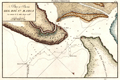 | Details | Direccion Hidrografia | 1818 |
| Scarce Spanish chart of north Amelia Island and St. Marys River bar. |
|
Direccion Hidrografia |
|
| 1818 |
| LOC:200 |
| $1,350.00 | Direccion-Hidrografia | Scarce-Spanish-chart-of-north-Amelia-Island-and-St--Marys-River-bar- | A scarce Spanish nautical chart of the mouth (boca) and bar (barra) of the Saint Mary's River, Florida. A scholarly summary of the map from the University of Miami notes the rarity of this small antique chart:
<div class="indenttextblock">
"This <b>rare map</b> shows the St. Marys River, which is the northern border of eastern Florida. It is from a Spanish portfolio showing harbor areas in its last colony in North America's eastern portion. <b>Very few maps are available that were made by them in the second Spanish Period</b>." <a href="http://scholar.library.miami.edu/floridamaps/view_image.php?image_name=dlp00020000860001001&group=cartographer" target="_blank">Internet. </a>
</div>
No record of the sale of the "Rio Santa Maria" map is reported in the Antique Map Price Record.
<br></br>
Includes portions of Fernandina Beach and north Amelia Island, Florida; Little Tiger Island, Florida; and south Cumberland Island Georgia.
<br></br>
Over 200 years ago, this chart of the bar with depth soundings, would have been very useful to mariner's entering or departing the St. Marys river. Shows "Fort Arruinado" ( Fort William ) on the southern tip of Cumberland Island.
<br></br>
The St. Marys River is a remote blackwater stream, located in southeastern Georgia and northeastern Florida, forming the easternmost border between the two states. The St. Marys serves as critical habitat for numerous rare, threatened or endangered species.
<br></br>
From the second part of "Portolano de la America...", published in 1818 by Spain's Admiralty department, the Dirección de Hidrografía. In 1809 the Direccion first published this atlas of plans of bays, harbors, and ports from Spain’s New World possessions: "Portolano de la America Septentrional Construido en la Direccion de Trabajos Hidrograficos". (Updated in 1818). Plate 40. |
| 1291 |  | Details | Direccion Hidrografia | 1818 |
| Antique Spanish chart of the mouth of St. Johns River, Florida |
|
Direccion Hidrografia |
|
| 1818 |
| LOC:200 |
| $1,325.00 | Direccion-Hidrografia | Antique-Spanish-chart-of-the-mouth-of-St--Johns-River--Florida | A scarce Spanish nautical chart by the Direccion Hidrografia of the mouth (boca) and bar (barra) of the Saint Johns River, Florida near Jacksonville. A scholarly summary by the the University of Miami of a similar map notes the rarity of these early antique Spanish charts:
<div class="indenttextblock">
"It is from a Spanish portfolio showing harbor areas in its last colony in North America's eastern portion. <b>Very few maps are available that were made by them in the second Spanish Period</b>." <a href="http://scholar.library.miami.edu/floridamaps/view_image.php?image_name=dlp00020000860001001&group=cartographer" target="_blank">Internet. </a>
</div>
<br></br>
North is oriented at the upper right.
<br></br>
The St. Johns is the longest river in Florida - 310 miles long. It is one of the few rivers in the United States that flows north. The source of the river is a large marshy area in Indian River County that flows north and turns eastward at Jacksonville, FL to its mouth in the Atlantic Ocean.
<br></br>
From the second part of "Portolano de la America...", published in 1818 by Spain's Admiralty department, the Dirección de Hidrografía. In 1809 the Direccion first published this atlas of plans of bays, harbors, and ports from Spain’s New World possessions: "Portolano de la America Septentrional Construido en la Direccion de Trabajos Hidrograficos". (Updated in 1818). Plate 40. |
| 30 |  | Details | Blondeau, Alexandre | 1820 |
| Carte de la partie de la Cote Nord-Ouest de L'Amerique |
|
Blondeau, Alexandre |
|
| 1820 |
| LOC:63 |
| $400.00 | Blondeau--Alexandre | Carte-de-la-partie-de-la-Cote-Nord-Ouest-de-L-Amerique | French copy of Vancouver's nautical chart of West North American coast from Alaska to Mexico. By Blondeau. Elsewhere attributed to Depot de la Marine but that is doubtful. Tracks of Vancouver's vessels, mountain ranges, missions, anchorages and a few soundings are clearly delineated.<BR> </BR>
Highly detailed (get a magnifier and enjoy) antique chart coverage extends down the coast from Kodiak Island, Alaska though Prince William sound, Port San Francisco and St. Diego California, into Mexico- Baie do Todos Santos, Baie de las Virgines, and ends near a marked anchorage near a mission 'St. Domingo'. California is described as "Nouvelle Albion".<BR> </BR> <BR> </BR>
Engraved and lettered by Blondeau: "Ecrit par M. Blondeau. Grave par Blondeau Rue et Porte St Jacques No 85." |
| 34 |  | Details | Beautemps-Beaupre, Charles-Francois | 1820 |
| Reconnoissance Hydrographique de la Cote Nord de France, Dunkerque |
|
Beautemps-Beaupre, Charles-Francois |
|
| 1820 |
| LOC:0 |
| $575.00 | Beautemps-Beaupre--Charles-Francois | Reconnoissance-Hydrographique-de-la-Cote-Nord-de-France--Dunkerque | This large-scale antique hydrographic chart of the town and environs of Gravelines is a fine example of the work of Charles-François Beautemps-Beaupré (1766-1854). Beautemps-Beaupre was one of the earliest hydrographers to use isobaths to represent water depth. In this chart he uses differently colored isobaths to represent three depth categories : less than 10 feet ; between 10 and 16 feet; and between 17 and 24 feet. This detail along with numerous soundings demonstrates Beautemp-Beaupre's dedication to his profession, and is the reason he is sometimes referred to as the 'father of French hydrography'.
<br><br/>
Date of 1802 is consistent with a dedication to vice-admiral F.E. de Rosily who served as Directeur of the Depot Generale de la Marine from 1795-1805. |
| 35 |  | Details | Beautemps-Beaupre, Charles-Francois | 1820 |
| Dunkerque |
|
Beautemps-Beaupre, Charles-Francois |
|
| 1820 |
| LOC:0 |
| $975.00 | Beautemps-Beaupre--Charles-Francois | Dunkerque | This scarce large-scale antique hydrographic chart of the town and environs of Dunkirk is a fine example of the work of Charles-François Beautemps-Beaupré, often referred to as the "Father of French Hydrography". Covering a stretch of coast from Mardick to Zuycoote the chart is focused almost entirely on the offshore areas.
<BR> </BR>
Beautemps-Beaupré (1766-1854), considered to be the father of modern French hydrography, was one of the earliest hydrographers to use colored isobaths to represent water depth. In this carefully colored chart he uses differently colored isobaths (light orange tones) to represent three depth categories : less than 10 feet ; between 10 and 16 feet; and between 17 and 24 feet. This detail along with hundreds of soundings demonstrates Beautemp-Beaupres' dedication to his profession.
<BR> </BR>
Not dated but another example from same series is dated to 1802. This fine example was likely published ca 1820 as part of "Le Pilote Francais", Beautemps-Beaupre's six folio-volume atlas comprised of 613 sheets of charts and plans. With the logo of the French Depot de la Marine. |
| 4956 |  | Details | Wood, John | 1821 |
| Rare Plan of the Town and Harbour of Stornaway Lewis Island |
|
Wood, John |
|
| 1821 |
| LOC:64 |
| $1,999.39 | Wood--John | Rare-Plan-of-the-Town-and-Harbour-of-Stornaway-Lewis-Island | Very scarce antique map of the Harbor at Stornaway on the Island of Lewis, part of the Outer Hebrides Islands of Scotland. An exceptional finely-engraved example of an early 19th century harbor map. By John Woods from his Town Atlas to accompany his "Descriptive Account of the Principal Towns of Scotland…"
<br></br>
With a decorative smaller-scale inset Plan of the Town and Harbor of Stornaway and Projected Improvements. Notable features of the inset plan include Seaforth Lodge, Gallow Hill, Anish, Sandwich Bay, Big Rock, and Sandwich Hill.
<br></br>
Wood described Stornaway as
<div class="indenttextblocksingle">"a considerable thriving town in the Island of Lewis, in the Parish of that name and shire of Ross. The old part of the Town is situated at the head of the Loch of Stornaway, on a point or ness of land jutting into it; the newer parts of the Town stretch to the north and south of this point, along the margins of the Loch." (ibid pp. 545-547).</div> |
| 4888 | 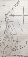 | Details | Melish, John | 1822 |
| Antique map of the Outlet of the Columbia River |
|
Melish, John |
|
| 1822 |
| LOC:13 |
| $325.00 | Melish--John | Antique-map-of-the-Outlet-of-the-Columbia-River | Scarce (1822) copperplate engraved map of the outlet of the Mouth of the Columbia River, near Astoria, Oregon by John Melish. Notes the Chinook and Clatsop Indians, native to the region, along with Cape Disappointment, and Gray's Bay .
<br></br>
From Melish's "A Geographical Description of the United States, with the Contiguous British and Spanish Possessions." Philadelphia, 1822. Engraved by J. Vallance. |
| 222 | 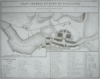 | Details | Tardieu, Ambroise | 1822 |
| Plan General du Port de Boulogne |
|
Tardieu, Ambroise |
|
| 1822 |
| LOC:89 |
| $175.00 | Tardieu--Ambroise | Plan-General-du-Port-de-Boulogne | Finely engraved map / plan of Boulogne harbor engraved by Ambroise Tardieu in 1822 (dated) with disposition of marine forces during the Campaign of 1803. Focus is on dozens of ships docked both in the river and in the hemispherical 'Bassin de la Flotille'. Bottom contains detailed French text keyed to locational numbers on the map; for example "Depot des Gardiens de la Chaine de Entrée". This antique copperplate engraving probably from one of a six-volume series published by General Count Mathieu Dumas: "Précis des evénemens militaires. Recueil de plans et de cartes pour servir à l'intelligence des opérations militaires décrites dans le texte."<BR> </BR>
Amboise Tardieu (1788 - 1841) was descended from a family of famous French engravers that included Pierre Alexandre Tardieu and Nicolas Tardieu, a 17th century coppersmith from Paris. Tardieu is sometimes confused with his famous son Auguste Ambroise Tardieu, France's top expert in forensic pathology. |
| 77 | 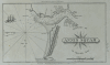 | Details | Blunt, Edmund | 1822 |
| Harbour of Annis Squam in Ipswitch Bay |
|
Blunt, Edmund |
|
| 1822 |
| LOC:3 |
| $125.00 | Blunt--Edmund | Harbour-of-Annis-Squam-in-Ipswitch-Bay | Small copperplate engraved antique nautical chart of Annissquam inlet and harbor by Edmund Blunt for an edition of his well-known port and pilot book. With a decorative three-masted sailing vessel depicted underway into the channel marked to the east by the Annissquam lighthouse, established only 20 years earlier. |
| 5358 | 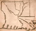 | Details | Anonymous | 1822 |
| Notable manuscript Louisiana map - early 19th |
|
Anonymous |
|
| 1822 |
| LOC:200 |
| $325.00 | Anonymous | Notable-manuscript-Louisiana-map---early-19th | A notable manuscript map of Louisiana by, according to the seller, "a schoolgirl" in Tallmadge, Ohio. Sold from a lot of other maps, one with the attribution: "Tallmadge [Ohio ?] Febr. 7, 1822". The map is notable for the inaccuracies, archaic place names, and a surprising included waterway.
<br></br>
First, the inaccuracy. The land west of the Sabine River, or Texas, was not a British Dominion. In 1822, after Mexico gained independence from Spain a year earlier, the land was Mexican Texas.
Second, in 1817 the State of Mississippi was admitted to the Union. The Mississippi Territory was divided into the State of Mississippi and State of Alabama (1819).
<br></br>
Finally, it is very surprising to see the Iberville River (Bayou Manchac) on this map. Today, Bayou Manchac is a shallow eighteen mile long Bayou but when the French arrived in Louisiana the waterway was the "rivière d'Iberville", an important channel in the area's transportation network. In 1814 Bayou Manchac was closed to the Mississippi and was no longer navigable. |
| 1178 | 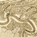 | Details | Melish, John | 1822 |
| 1822 Antique map of the New Orleans, Louisiana vicinity |
|
Melish, John |
|
| 1822 |
| LOC:3 |
| $325.00 | Melish--John | 1822-Antique-map-of-the-New-Orleans--Louisiana-vicinity | Scarce (1822) copperplate engraved map of New Orleans by John Melish. Map is uncommon. Coverage includes Bayou St. John, the lower shore of Lake Ponchartrain and a stretch of the Mississippi river below New Orleans. Legend at bottom graphically identifies two types of swamp surrounding New Orleans: "Cypress Swamp" and "Prairie Swamp".
<br></br>
Melish's named features include:
<div class="indenttextblock">
<ul style="list-style-type: circle;">
<li>Fort St. John</li>
<li>Borough of St. John</li>
<li>Suburb of Marigny</li>
<li>Bayou Sauvage and the Road to Chef Menteur</li>
<li>English Turn</li>
<li>Woodsville</li>
<li>Lake Lery</li>
<li>The Ouatchas River</li>
</ul>
</div>
Contains several notes related to the Battle of 1812 with the landing site and route of British forces identified.
<br></br>
From Melish's "A Geographical Description of the United States, with the Contiguous British and Spanish Possessions." Philadelphia, 1822. |
| 661 |  | Details | Depot de la Marine | 1822 |
| Plan of Saint George's Bay Newfoundland |
|
Depot de la Marine |
|
| 1822 |
| LOC:65 |
| $375.00 | Depot-de-la-Marine | Plan-of-Saint-George-s-Bay-Newfoundland | Beautiful copperplate-engraved chart of the interior of St. George's Bay near the present-day towns of Stephenville and Saint George's on the Southwest coast of Newfoundland. Early 19th century working sea chart of area near the Gulf of St. Lawrence produced by the French Depot de la Marine after the work of two French Naval officers: Saulnier de Vauhello and Begon de la Rouziere. Noted points of interest include Cap Sauvage, Flat Island ( Point de Sable ), and Riviere Saint George. Numerous soundings and hydrographical features.
<br></br>
With the circular logo of France's Depot General de la Marine. Price Two Francs. No. 148. |
| 1286 |  | Details | Tryer, James | 1822 |
| Antique map of the Caribbean Sea and the Spanish Main |
|
Tryer, James |
|
| 1822 |
| LOC:5 |
| $195.00 | Tryer--James | Antique-map-of-the-Caribbean-Sea-and-the-Spanish-Main | Antique map of the West Indies at the beginning of the 19th century by James Tryer. The area covered stretches from Florida in the north the Gulf of Darien in the south and from the Yucatan peninsula in the west to the Orinoco river in the east. Includes portions of the Atlantic Ocean, Gulf of Mexico, Caribbean Sea, Pacific Ocean, and Sea of Honduras. The northern coast of South America is labeled "The Spanish Main".
<br></br>
James Tyrer was a prolific engraver from Pentonville, London who flourished during the early part of the nineteenth century. This neat map was published by John Souter in Clark's A New General School Atlas in 1822. |
| 4787 |  | Details | Depot de la Marine | 1823 |
| Antique Nautical Chart of the Black Sea Azof Sea Crimea |
|
Depot de la Marine |
|
| 1823 |
| LOC:62 |
| $2,200.00 | Depot-de-la-Marine | Antique-Nautical-Chart-of-the-Black-Sea-Azof-Sea-Crimea | A foundational sea chart for collectors of the Black Sea and Azoff Sea with the track of the French survey vessel "Chevrette" during their survey cruise in 1820.
<br><br/>
A fine, scarce copper-plate engraved hydrographic chart of the Black Sea and Sea of Azov (Azof). This ~200 year-old artifact documents the hydrographic survey of Captain Pierre-Henry Gauttier with Benoist and others during their cruise aboard the gabare "Chevrette" in 1820 to the Sea of Marmara and the Black Sea.
<br></br>
Before the Black Sea survey, in 1818/1819 Gauttier conducted a survey to Greece with Jules Sébastien César Dumont d'Urville (1790-1842), where d'Urville played a role in bringing the statue of Venus from the island of Milos to the Louvre. Long story short, though d'Urville's importance in the affair appears to to have been secondary, skillful PR hyped d'Urville's importance and the "discovery" of the Venus de Milo launched his young career as a botanist and hydrographer.
<br></br>
Pierre-Henry Gauttier du Parc (1772 - 1850) was a French naval officer and hydrographer.
<br></br>
Engraved by Etienne Collin (1770, 1841). A brief biography explains that Etienne Collin was the nephew of the renowned Beautemps-Beaupre, considered to be the <b>father of French hydrography</b>. The biographer noted Beautemps-Beaupre practiced an "enlightened nepotism" and that during Beaupre's tenure as Hydrographer "that the functions (geographers, hydrographers, engravers, draughtsmen, ....) within the Depot were largely occupied by members of the Buache-Beautemps-Collin family." (Source: http://cartes-martinique.pagesperso-orange.fr/Graveurs_HydroFran.htm)
<br></br>
With the circular logo of the Depot General de la Marine. Price when issued 4 Francs. |
| 605 |  | Details | Depot de la Marine | 1823 |
| Plan du Golfe de Santa Manza |
|
Depot de la Marine |
|
| 1823 |
| LOC:66 |
| $500.00 | Depot-de-la-Marine | Plan-du-Golfe-de--Santa-Manza | Lovely antique chart of the Gulf of Santa Manza, on the southeast coast of Corsica ( Corse ), France near the town of Bonifacio with numerous soundings and coastal topographic details. Beautifully executed and finely detailed engraving in near-perfect condition. Noted features include: Port de Santa Manza, Iles de Porraja, Cap Capicciolo, Cap Blanc, Cap Rondinara, Port de la Rondinara, Calanque de Carlo Anto, Tour de Sponsaglia, Mt. Carpice, amd Porto Nuovo. At top, and extending the full width is a beautifully engraved view of the coastline that includes all the points above and many more.<br></br>
This large, original copperplate nautical chart was issued by the French Depot de la Marine in 1823 and bears the circular stamp of that agency. Engraved by Ambroise Tardieu. With the circular stamp of three fleur-de-lis surrounding an anchor, from the Depot General de la Marine. |
| 5466 | 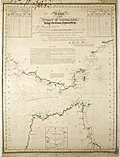 | Details | Reiner, Ignatius | 1824 |
| Rare chart of the Strait of Gibraltar by Reiner with tides and currents |
|
Reiner, Ignatius |
|
| 1824 |
| LOC: |
| $3,000.00 | Reiner--Ignatius | Rare-chart-of-the-Strait-of-Gibraltar-by-Reiner-with-tides-and-currents | A very rare chart by Ignatius Reiner, a chart of the Strait of Gibraltar published by Reiner and by John Purdy in 1824. Rare, the only recorded holding of the chart is at the British Library, London and no sales of any printed chart by Ignatius Reiner are recorded in the AMPR. With a small inset chart of the Bay of Tangier.
<br></br>
Reiner describes himself as "Pilot of the Schooner Pacifico, charged with the correspondence between Gibraltar and Barbary, in the years 1818, 19, 20, &c."
<br></br>
Upper left and right with tide tables for the European coast and the African coast respectively.
Engraved by Alex Findlay, Pentonville, London. Attribution at bottom reads:<div class="indenttextblocksingle"> "Published by the author Ignatius Reiner, at Gibraltar; and for him by John Purdy, Took's Court, London. 1st Dec. 1824."</div><br>
Well-executed mid 20th-century conservation with the chart laid to fresh linen and protected via a thin-film lamination process to both recto and verso. |
| 884 | 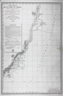 | Details | Depot de la Marine | 1824 |
| Antique chart of Brazilian east coast north of Cabo Frio |
|
Depot de la Marine |
|
| 1824 |
| LOC:67 |
| $500.00 | Depot-de-la-Marine | Antique-chart-of-Brazilian-east-coast-north-of-Cabo-Frio | Antique French sea chart issued in 1824 extends over approximately 800 miles of the east coast of Brazil and incudes portions of the State of Rio de Janeiro and the State of Espirito Santo. Coverage on this old chart starts about 80 miles to the east of Rio de Janeiro near Cabo Frio and trends generally north-northeast past Cabo de São Tomé, Vitoria, Rio Doce and Porto Seguro, ending north of Santo Andre. Little interior details are shown but the chart does identify several mountainous features that may have been visible from sea including the Pic ou Frade de Maccahe, Mt. de Campos, Mt. Mestre Alvaro, and Mont Pascoal.
<br></br>
Tracks are recorded for the two French vessels that conducted explorations and soundings of the area on this chart: the Corvette "la Bayadere" and the Brick "le Favori". Contains an avertissment below the title block with notes, warnings, and observations useful to mariners.
<br></br>
With the circular logo of the Depot Generale de la Marine. All text in French. No. 408. |
| 385 |  | Details | Parry, William Edward | 1824 |
| Chart of a part of the North Eastern Coast of America [North] |
|
Parry, William Edward |
|
| 1824 |
| LOC:53 |
| $450.00 | Parry--William-Edward | Chart-of-a-part-of-the-North-Eastern-Coast-of-America-[North] | A large chart of the Melville Peninsula and its adjacent islands, including Amherst, Liddon, and Ormond Islands. The chart documents the expedition of the vessels Fury and Hecla from 1822-1823 led by William Edward Parry to find a Northwest passage to the Pacific. Contains the route of the expedition's ships with Cape Englefield and Cape Hallowell off the Fury and Hecla strait as the western-most point. <BR> </BR>
Foldout steel engraving from: "Journal of a second voyage for the discovery of a north-west passage from the Atlantic to the Pacific; performed in the years 1821-22-23, in his Majesty's ships Fury and Hecla, under the orders of William Edward Parry, … ". Published by John Murray, Albemarle Street, London. January 6th, 1824. |
| 386 | 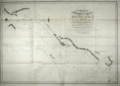 | Details | Parry, William Edward | 1824 |
| Chart of the Northern Shore of Hudson's Strait |
|
Parry, William Edward |
|
| 1824 |
| LOC:53 |
| $400.00 | Parry--William-Edward | Chart-of-the-Northern-Shore-of-Hudson-s-Strait | A large chart of upper Hudson's Strait from Nottingham Island to Resolution Island. The chart documents the expedition of the vessels Fury and Hecla from 1821-1823 led by William Edward Parry to find a Northwest passage to the Pacific. During that expedition Parry explored Repulse Bay and discovered what is now Fury and Hecla Strait. Contains the route of the expedition's ships. <BR> </BR>
Foldout steel engraving from: "Journal of a second voyage for the discovery of a north-west passage from the Atlantic to the Pacific; performed in the years 1821-22-23, in his Majesty's ships Fury and Hecla, under the orders of William Edward Parry, … ". Published by John Murray, Albemarle Street, London. January 6th, 1824. |
| 387 |  | Details | Parry, William Edward | 1824 |
| Chart of a part of the North Eastern Coast of America [South] |
|
Parry, William Edward |
|
| 1824 |
| LOC:53 |
| $450.00 | Parry--William-Edward | Chart-of-a-part-of-the-North-Eastern-Coast-of-America-[South] | A large chart of Northeastern America with Repulse Bay as the Western-most point.. The chart documents the expedition of the vessels Fury and Hecla from 1821-1822-1823 led by William Edward Parry to find a Northwest passage to the Pacific. During that expedition Parry explored Repulse Bay and discovered what is now Fury and Hecla Strait. Other geographical features on this chart include Cape Frigid, Duke of York Bay, Frozen Strait, Gore Bay, Ross Bay, and Lyon Inlet. <BR> </BR>
Foldout steel engraving from: "Journal of a second voyage for the discovery of a north-west passage from the Atlantic to the Pacific; performed in the years 1821-22-23, in his Majesty's ships Fury and Hecla, under the orders of William Edward Parry, … ". Published by John Murray, Albemarle Street, London. January 6th, 1824. |
| 733 |  | Details | Duperrey, Louis-Isidore | 1824 |
| Chart of French Polynesia with Tahiti and Bora Bora |
|
Duperrey, Louis-Isidore |
|
| 1824 |
| LOC:59 |
| $575.00 | Duperrey--Louis-Isidore | Chart-of-French-Polynesia-with-Tahiti-and-Bora-Bora | Antique French hydrographic chart with the islands of Pomotou (Tuamotu Islands or French Polynesia). Other names include Archipel Dangereux, Archipel des Pomotou, Archipel des Tuamotu, Tuamotu Archipelago, Tuamotu Islands, and Îles Tuamotu. Includes the Society Islands ( Archipel de la Société ) of Tahiti ( Taiti ), Emeo, Huaheine, Bora Bora and many others and the Toubouai Islands.
<br></br>
Produced by French explorer Louis-Isidore Duperrey (1786-1865). Duperrey served as marine hydrologist to de Freycinet aboard the Uranie and commanded the corvette la Coquille on its westward world circumnavigation during the period 1822–1825 with Jules Dumont d'Urville as second in command. WorldCat only records one copy of this chart- at the Paris Muséum National d'Histoire Naturelle.
<br></br>
Contains the tracks of many early voyages through the Pacific islands with dates of discovery for many islands. Discoverers include: Vancouver (1791), Carteret (1767), Bligh and Portlock (1792), Cook (1769), de Bougainville (1768), Lemaire and Schouten (1616) . Number 684. |
| 6737 |  | Details | Duperrey, Louis-Isidore | 1824 |
| Chart of the Harbor of Doreri West Papua New Guinea |
|
Duperrey, Louis-Isidore |
|
| 1824 |
| LOC:59 |
| $500.00 | Duperrey--Louis-Isidore | Chart-of-the-Harbor-of-Doreri-West-Papua-New-Guinea | Copperplate engraved French nautical chart of the bay and harbor of Doreri in the Province of West Papua on the island of New Guinea, Indonesia. Duperrey explored the region in 1793 while searching for the missing expedition of Jean-François de La Pérouse. Shows the route of the Corvette "la Coquille" during July, 1824.
<br><br>
From 'Voyage autour du monde' ('Voyage round the world') by Louis Isidore Duperrey (1826). Plate 34. Engraved by Tardieu.
<br><br>
The bay is on the east coast of West Papua near the city of Manokwari, which is the capital of the province. One notable fact about the Bay of Doreri is that today it is home to Doreri Nature Reserve, which is a protected area encompassing coastal and marine ecosystems.
<br><br>
The chart includes these other nearby locations:
<div class="indenttextblocksingle">
<ul style="list-style-type: circle;">
<li>Point Ambla</li>
<li>Isle Manas-Ouari (Mansinam)</li>
<li>Isle Masmapi</li>
<li>Baie Masinami</li>
<li>Baie Ouahouzi</li>
<li>Cap Ouacalo</li>
</ul>
</div> |
| 5329 |  | Details | Cruttwell, Eliza Ann | 1824 |
| Fine antique manuscript map of West Indies Caribbean Florida |
|
Cruttwell, Eliza Ann |
|
| 1824 |
| LOC:11 |
| $435.00 | Cruttwell--Eliza-Ann | Fine-antique-manuscript-map-of-West-Indies-Caribbean-Florida | A very fine antique pen and ink manuscript map of the West Indies or Caribbean Sea stretching from Florida to South America. This beautiful one-of-a-kind map reflects extreme precision in execution with careful attention to fine detail and lettering. The map is original and 196 years old; it looks beautiful and fresh.
<br></br>
Shows and labels the provinces of West Florida and East Florida, on a Florida peninsula that has a squared-off form unlike other modern maps of the period and more like Mark Catesby's map of 1743. Includes the islands of Cuba, Santo Domingo, Porto Rico, Trinidad, Barbados, and many of the other usual suspects you would expect to see on a map of the West Indies.
<br></br>
This manuscript antique map of the West Indies, dated within to November 1824, is by signed by E. A. Cruttwell (probably Eliza Ann Cruttwell) (nee Wilson) the wife of Clement Wilson Cruttwell (1780-1816). Eliza Ann Cruttwell (1783-1858) was born in London, England.
<br></br>
Eliza Cruttwell's father-in-law, Rev. Clement Cruttwell (1743-1808) was a well known English publisher of maps and atlases. Clement Cruttwell is best known for his work "The New Universal Gazetteer ; or Geographical Dictionary … with twenty-eight whole sheet maps". London. Pub. G. Kearsley. 1798. That large gazetteer, in 3 volumes, was published in 19 editions. Clement Cruttwell's maps were published by G. G. & J. Robinson from London in 1799 in a separate atlas.
<br></br>
This map was part of a larger lot of manuscript maps by E. A. Cruttwell from the same atlas. |
| 6354 |  | Details | Smyth, William Henry | 1825 |
| Chart of the Grecian Shores Parga to Kaiapha with adjacent islands Gulf of Patras |
|
Smyth, William Henry |
|
| 1825 |
| LOC: |
| $350.00 | Smyth--William-Henry | Chart-of-the-Grecian-Shores-Parga-to-Kaiapha-with-adjacent-islands-Gulf-of-Patras | Rare chart of coastal Greece, Parga to Kaiapha by Captain W. H. Smyth and his assistant officers. 1825. |
| 4780 | 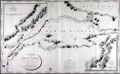 | Details | Depot de la Marine | 1826 |
| Antique Chart Marmara, Dardanelles, Istanbul |
|
Depot de la Marine |
|
| 1826 |
| LOC:66 |
| $2,500.00 | Depot-de-la-Marine | Antique-Chart-Marmara--Dardanelles--Istanbul | Very scarce and wonderfully-engraved French sea chart of the Sea of Marmara, the Dardenelles, Istanbul (Constantinople), the Bosphorous, and southern Black Sea from 1826. Depth soundings on this large antique navigational chart extend from the island of Tenedos in the Aegean Sea through the Dardenelles and the Sea of Marmara, up the Bosporus to Istanbul and then into the Black Sea (Mer Noire).
<br></br>
Dedicated to Christophe de Chabrol de Crouzol, Minister of the French Navy from 1824-1829. This supports our date of 1826 though the middle two characters in the date have been effaced leaving only (1--6).
<br></br>
With a large inset chart by Kauffer of the walled city of Constantinople, Turkey and the entire Bosphorous and a second inset chart with the Hellespont and Dardenelles by le Comte de Truguet.
<br></br>
<img src="/PageImages/Marmara_Bellin_1772.jpg" alt="Bellin 1772 chart of the Sea of Marmara." width="140" align="left" style="margin: 0px 10px"> No copy of this chart is found online, nor in the AMPR, while 11 sales are recorded of Bellin's earlier "Carte de la Mer de Marmara" at left.
<br></br>
A brief biography in French explains that Etienne Collin, engraver of this work, was the nephew of the renowned Beautemps-Beaupre, considered to be the father of French hydrography. Beautemps-Beaupre practiced an "enlightened nepotism". The biography notes during Beaupre's tenure as Hydrographer "that the functions (geographers, hydrographers, engravers, draughtsmen, ....) within the Depot were largely occupied by members of the Buache-Beautemps-Collin family."
<div class="indenttextblock">
"Etienne Collin (1770, 1841) né à la Neuville-au-Pont. Cousin de Beautemps-Beaupré, il est recruté par le célèbre hydrographe qui pratique un certain népotisme éclairé" ... (Source: http://cartes-martinique.pagesperso-orange.fr/Graveurs_HydroFran.htm)
</div> |
| 5467 |  | Details | Smyth, William Henry | 1827 |
| Complete 4-sheet set of Sardinia Capt W H Smyth |
|
Smyth, William Henry |
|
| 1827 |
| LOC: |
| $6,000.00 | Smyth--William-Henry | Complete-4-sheet-set-of-Sardinia-Capt-W-H-Smyth | Exceedingly rare and complete set of four nautical charts of the Mediterranean island of Sardinia by Captain William Henry Smyth based on his hydrographic survey of Sardinia for the Royal Navy during 1823 and 1824. Sardinia is the second largest island in the Mediterranean and one of 20 regions of Italy.
<br></br>
Whatman Turkey Mill watermark (date illegible) on one of four sheets. Complete set of four, ea. ~ 17" x 24".
Elson and Graves are co-authors for all four charts. Slater is credited on the chart of the entire Island.
<br></br>
In 1828 Smyth published a book on the political history of Sardinia- <b>"Sketch of the present state of the Island of Sardinia"</b> [1]. Smyth references a four chart set in the introduction to his "Sketch": <div class="indenttextblocksingle">… in conclusion it may not be unnecessary to state that my <strong>Nautical Survey of Sardinia</strong> has just been published, on four sheets, at the Hydrographical office of the Admiralty. As no pains have been spared in the construction, it is hoped that these charts will be found equal to every purpose of Navigation. [Smyth's chart titles are used here:] </br><div class="indenttextblocksingle">
<ul style="list-style-type: circle;">
<li>A general chart of the Island, "The Island of Sardinia"</li>
<li>"The South Coast of Sardinia"</li>
<li>"The North East Coast of Sardinia"</li>
<li>"The Gulf of Asinara on the N. W. Coast of Sardinia"</li></div>
</ul>
</div>
Small traces of manuscript pencil notations attesting to real-life use of this chart while at sea. Well-executed early to mid 20th-century conservation with the chart laid to linen and protected via a thin-film lamination process. After experience with the lamination process over time, lamination is not now considered to be a effective document conservation procedure.
<br></br>
[1] Captain William Henry Smyth. London. John-Murray. 351 pp.
<br></br>
[Sardegna] |
| 883 | 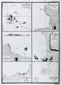 | Details | Duperrey, Louis-Isidore | 1827 |
| Old chart of the Galapagos Islands and anchorages |
|
Duperrey, Louis-Isidore |
|
| 1827 |
| LOC:0 |
| $550.00 | Duperrey--Louis-Isidore | Old-chart-of-the-Galapagos-Islands-and-anchorages | Antique French copper-plate engraved charts of the <b>Galapagos Islands</b> (Ecuador) and three ports in Colombia. Six charts and plans on a single sheet of heavy wove paper by Duperrey from the "Voyage autour du monde, exécuté par ordre du Roi, sur la corvette de Sa Majesté, La Coquille, pendant les années 1822, 1823, 1824 et 1825". Published by the Depot de la Marine - Hyd. Fr. N°. 725 N°. 42.
<br></br>
The charts include the following:
<div class="indenttextblock">
<ul>
<li>Carte des Iles Gallapagos d'aprés les observationes faites par Vancouver en 1791, par Davidson et le Capt. B. Hall en 1822. </li>
<li>Plan de la Baie Albany (Iles Gallapagos)</li>
<li>Plan de Mouillage de L'Ile Hood (Iles Gallapagos)</li>
<li>Plan de la Baye Salango (Colombie)</li>
<li>Plan du Mouillage de Tacames (Colombie)</li>
<li>Plan du Banc de la Perle (Ile de la Perle)</li>
</ul>
</div>
The <b>Banc de la Perle</b> is significant in that it was there that two British whalers grounded and were lost on April 24th, 1822. The combined crews salvaged parts and built a new vessel, the Deliverance, which some of the crew then sailed to Hawaii. The wreck site lay hidden until it was rediscovered by NOAA divers in 2004. <div class="indenttextblock"> (Pearl Site Survey 2006. National Oceanic and Atmospheric Administration.
<a href="http://sanctuaries.noaa.gov/maritime/expeditions/pearl.html" target="_blank">Internet</a>)
</div> |
| 599 | 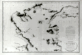 | Details | Depot de la Marine | 1827 |
| Northern Aegean Archipelago |
|
Depot de la Marine |
|
| 1827 |
| LOC:1403 |
| $1,750.00 | Depot-de-la-Marine | Northern-Aegean-Archipelago | Antique nautical chart of the coast and the islands of the northern Aegean Sea and the Sea of Marmara, including Constantinople, Turkey (modern Istanbul). Attractive old engraved chart documenting tracks of the exploration of that area. Extensive fine hachuring of coastal mountains, some soundings, and no interior details. At bottom of the inset 'avertissment' is found a legend dating each of the map's tracks to the year in which that exploration was conducted and identifying the abbreviations used by the authors for representing the composition of the sea bottom.
<br></br>
Geographical features covered by this antique chart include these locations in Greece and Turkey: Gulf of Corinth, Negroponte, Euboea ( the second largest Greek Insland after Crete ), Skyros, Skiatos, Gulf of Salonica, the Dardanelles, Istanbul, Tenedos ( Bozcada ), Lemnos, Gulf of Smryne, Smyrne ( Smyrna ), Samos and much more.
<br></br>
An avertisement at right states that the chart is the result of hydrographic and geodesic work on land and aboard the gabare 'la Chevrette' during the years 1818 and 1819. <a href="https://fr.wikipedia.org/wiki/Gabare" target="_blank">A 'gabare'</a> is a French term for a three masted vessel of between 100 and 450 tons, typically used as a cargo carrier. Their heavy construction and capacity made them especially suitable for exploration and survey work.
<br></br>
Dated to 1827 at bottom of the oval cartouche. With the circular stamp of the Depot General de la Marine. Attribution reads: "Publiée par Ordre du Roi sous le Ministère de Son Excellence M. le Comte Chabrol de Crousol. Dépôt Générale de la Marine" Price when issued: two Francs. |
| 304 | 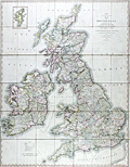 | Details | Cary, John | 1828 |
| Cary's Reduction of his Six Sheet Map of the British Isles |
|
Cary, John |
|
| 1828 |
| LOC:0 |
| $450.00 | Cary--John | Cary-s-Reduction-of-his-Six-Sheet-Map-of-the-British-Isles | Large, beautifully hand-colored antique folding map of the entire British Isles. John Cary's first map of the post roads, dated 1828. Good example of this map first published in 1796. Inset at upper right of the Shetland Isles. Maritime features include: the Atlantic Ocean, the German Ocean, the North Sea, the Irish Sea, St Georges Channel, and the English Channel.
<br></br>
Hand colored, dissected, and backed unto linen when issued. Folds into 42 parts. Marbled endpapers and complete with a green marbled slipcase to match that is labeled "Cary's two-sheet map of the United Kingdom." Published by G. and J. Cary, 86 St. James Street, London. |
| 1386 |  | Details | Pilie, Joseph | 1828 |
| Original Antique Plan of New Orleans Waterfront |
|
Pilie, Joseph |
|
| 1828 |
| LOC:0 |
| $250.00 | Pilie--Joseph | Original-Antique-Plan-of-New-Orleans-Waterfront | Scarce, early 19th-century engraved plan by city surveyor Gilbert Joseph Pilie depicting the Mississippi (with only one "P") River waterfront with levee and wharfs along New Orleans' French Quarter. Shows the levees, wharves, and a few buildings along the first block fronting the Mississippi River.
<BR> </BR>
Signed by Jh. Pilie, New Orleans, Nov. 15th, 1827. According to "Charting Louisiana" Gilbert Joseph Pilie had been an assistant to Barthelemy Lafon after emigrating to the U.S. from Santo Domingo before 1805. (Lemmon, Magill, and Wiese eds. "Charting Louisiana: Five Hundred Years of Maps". 2003. p. 321.)
<BR> </BR>
Notable features include the water works, Custom House and Market Hall (that site now is home to the famous <s>Morning Call</s> Café du Monde coffee house where tourists line up for beignets and café au lait). Several street names have changed since that time (Iberville Street was then called Custom House Street) and Jackson Square is simply named "Public Square".
<BR> </BR>
From the "Memorial of the Mayor, Aldermen and Inhabitants of New Orleans". 20th Congress, 1st Session. Washington: Gales & Seaton, 1828. |
| 335 |  | Details | Meyer, C. | 1828 |
| Gibraltar (Manuscript plan) |
|
Meyer, C. |
|
| 1828 |
| LOC:8 |
| $610.00 | Meyer--C- | Gibraltar--(Manuscript-plan) | Unique manuscript military/engineering architectural plan of the Landport (northern) defences of the fortress at Gibraltar from the Inundation, past the Devil's Tongue battery, and the old mole. Two cross sections, one through the north wall (with measurements) and one through the west wall. A high degree of detail shown about the bastions and cannon emplacements. <br></br>
Several dozen measurements in miniscule red script. Contains a small sketch of what appears to be a cave entrance. With watermark "Whatman 1828". Signed "Egina der 7 September 1828 C. Meyer". |
| 5465 |  | Details | Smyth, William Henry | 1830 |
| Rare unrecorded chart of Alexandria Egypt after Smyth |
|
Smyth, William Henry |
|
| 1830 |
| LOC: |
| $250.00 | Smyth--William-Henry | Rare-unrecorded-chart-of-Alexandria-Egypt-after-Smyth | Unrecorded French nautical chart of the town, anchorages and environs around Alexandria, Egypt after a chart by Captain William Henry Smyth. Published by Bellue Libraire, Toulon, France in 1830. Lithographed by Moquin & Co., Montpellier.
<br></br>
Based on the survey of William Henry Smith R.N. (1788 - 1865) in 1822 aboard the surveying sloop Adventure, 6 guns.
<br></br>
Manuscript pencil notation and course tracks.
<br></br>
Mid-20th century conservation effort with the chart laid to linen and protected via thin-film lamination process to both recto and verso. |
| 5176 |  | Details | Farmer, John | 1831 |
| Plat of the City of Detroit by John Farmer 1830 |
|
Farmer, John |
|
| 1831 |
| LOC:10 |
| $250.00 | Farmer--John | Plat-of-the-City-of-Detroit-by-John-Farmer-1830 | Plat of the City of Detroit, a fine steel-engraved cadastral plan of Detroit, Michigan drawn by John Farmer. The map of Detroit was issued by the US Government in their 'Report of Public Lands' for 1831.
<br></br>
Lacking the volume numbers and printer's attribution to Bowen and Co. that characterize the later edition of 1860, thus 1830. 21st Congress, 2nd Session, Washington, DC.
<br></br>
By cartographer John Farmer (1798-1859 ). In 1844 Farmer published his best known work- "The State of Michigan and the Surrounding Country". Extremely detailed, the map quickly became so popular with the public that prices for used copies of Farmer's map soon exceeded the list price. |
| 5212 |  | Details | Mullett, John | 1831 |
| Plan of Detroit |
|
Mullett, John |
|
| 1831 |
| LOC:10 |
| $325.00 | Mullett--John | Plan-of-Detroit | Original fine steel-engraved cadastral map of Detroit, Michigan and one of the earliest obtainable maps of Detroit. Excellent condition. One of three documents related to Detroit issued by the U/S. Government in their 'Report of Public Lands' for 1831.
<br></br>
In this Plan of Detroit there are wider avenues extending over longer distances and many small streets are eliminated. This smaller version of John Mullett's Plan of Detroit labels Michigan Avenue as Michigan Grand Avenue and shows a different layout for buildings proposed to be built at the waterfront. Perhaps the most significant difference between the two maps is the street layout below Michigan Avenue, where Fort Shelby remains in place, and Washington Avenue is projected all the way to the waterfront.
<br></br>
John Mullett (1786-1862) was a prominent Detroit surveyor. Mullett served as Deputy Surveyor General of the Northwest Territory from 1822 to 1849. Following Mullett's 1830 "Plan of Detroit" survey, he had two roads in Detroit named after him: Mullet Street (1835) and Catherine Street (1835).
<br></br>
Lacking the volume numbers and printer's attribution to Bowen and Co. that characterize the later edition of 1860, thus 1830. 21st Congress, 2nd Session, Washington, DC. |
| 5175 |  | Details | Mullett, John | 1831 |
| Plan of Detroit by John Mullett 1830 |
|
Mullett, John |
|
| 1831 |
| LOC:10 |
| $325.00 | Mullett--John | Plan-of-Detroit-by-John-Mullett-1830 | Original fine steel-engraved cadastral map of Detroit, Michigan and one of the earliest obtainable maps of Detroit. The map of Detroit was issued by the US Government in their 'Report of Public Lands' for 1831. Excellent condition. One very interesting feature of the map is the small drawings of local buildings that pepper Mullett's map including the Catholic Church, the Old Market, the Capitol, the Penitentiary, and the U.S. Arsenal.
<br></br>
John Mullett's survey of 1830 is the first map made of Detroit after the Great Fire of 1805. After the fire Territorial Judge Augustus Woodward created a street plan modeled after Washington, D.C with diagonal streets that radiated like the spokes of a wheel. The downtown shows Judge Woodward's plan of the "Grand Circus", the Campus Martius, and the waterfront with new proposed construction shaded at bottom.
<br></br>
John Mullett (1786-1862) was a prominent Detroit surveyor. Mullett served as Deputy Surveyor General of the Northwest Territory from 1822 to 1849. Following Mullett's 1830 "Plan of Detroit" survey, he had two roads in Detroit named after him: Mullet Street (1835) and Catherine Street (1835).
<br></br>
Lacking the volume numbers and printer's attribution to Bowen and Co. that characterize the later edition of 1860, thus 1830. 21st Congress, 2nd Session, Washington, DC. |
| 4759 | 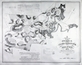 | Details | Baker, Edmund J. | 1831 |
| Very Rare Map of Dorchester and Milton Massachusetts |
|
Baker, Edmund J. |
|
| 1831 |
| LOC:53 |
| $4,500.00 | Baker--Edmund-J- | Very-Rare-Map-of-Dorchester-and-Milton-Massachusetts | Very rare map of Dorchester and Milton Massachusetts published by Edmund J. Baker of Milton, Mass. Very fine condition for such a scarce item.
<br></br>
This original antique map was compiled to comply with a resolution of the Massachusetts Commonwealth that every town and district in Boston should complete an accurate survey of 100 rods to an inch before July 1, 1831. The resolution specified the map record
<div class="indenttextblock">
"...the names, courses, and magnitude of Rivers and smaller Streams; Roads, public and private with their courses; the situation of Houses of Public Worship, Court Houses, and other public buildings, … bridges; ferries; falls; ponds; shores; harbors; islands; mountains; mills and manufactories… shall be inserted, specified, delineated, or described." (Source: https://archive.org/details/actsresolvespass182831mass/page/270)
</div>
</BR>
According to the Milton Historical Society
<div class="indenttextblock">
"Born in 1804, Baker was a postmaster and historian accorded great respect by his contemporaries. Grandson of both patriot Daniel Vose and chocolate pioneer Dr. James Baker, he had a direct connection to the town's most auspicious 18th century roots. His interest and conversations with that generation, such as Rachel Vose, make him an important source. (Source: http://www.miltonhistoricalsociety.org/Curator/Baker1826Map.html)
</div> |
| 6544 |  | Details | Thrall, Willis | 1831 |
| Map of the United States Compiled from the Most Authentic Sources |
|
Thrall, Willis |
|
| 1831 |
| LOC:1405 |
| $1,900.00 | Thrall--Willis | Map-of-the-United-States-Compiled-from-the-Most-Authentic-Sources | This scarce "Map of the United States Compiled from the Most Authentic Sources" is a historical map of the United States published in 1831 by Willis Thrall, a cartographer and publisher based in Hartford, Connecticut. Thrall's map includes detailed information about state and territorial boundaries at that time, major cities and towns, rivers, mountains, and other geographical features. The area now containing Texas, Arizona, New Mexico and California is labeled "Internal Provinces of Mexico."
<br><br>
One notable feature of the map is the inclusion of a combined distance table between major cities with population statistics for each in 1820 and 1830. Thrall's map of The United States contains inset maps for: <div class="indenttextblocksingle">
<ul style="list-style-type: circle;"></li>
<li>North America</li>
<li>City of New York and Vicinity</li>
<li>District of Columbia</li>
<li>Boston and its' Vicinity</li>
</ul>
</div>
Bottom of the map contains the statement "Copyright Secured." The United States passed its first copyright law on May 31, 1790, under the Copyright Act of 1790. This law established the legal framework in the United States for protecting the original works of authors, including books, maps, and charts, by granting them exclusive rights to their work for a period of 14 years.
<br><br>
As a native New Orleanian I found it interesting that the map locates a small town north of New Orleans- Madisonville, La. (today pop. < 900). I was unaware that in the 1830s, the area around Madisonville became a very important center for the timber industry. Large sawmills were built along the Tchefuncte River to take advantage of the abundant timber resources in the area, and the town became a hub for shipping timber and other goods to New Orleans. |
| 539 |  | Details | Donnet, Alejo | 1831 |
| Algarbe, Andalucia, Granada |
|
Donnet, Alejo |
|
| 1831 |
| LOC:0 |
| $575.00 | Donnet--Alejo | Algarbe--Andalucia--Granada | Map of the Algarve region in Portugal, southwest Spain, and the Strait of Gibraltar, with numerous city insets: Seville, Merida, Tarifa, Murviedro, Cadiz, Algeciras and Gibraltar. Large, attractive, well-kept, linen-backed folding map has been dissected into 18 sections of about 5.5 x 7.5 inches when issued. <BR> </BR>
The map's source is Donnet's six-sheet "Mapa Civil y Militar de España y Portugal, con la nueva división en distritos." Shows the Portuguese and Spanish coasts from Cape St. Vincent to well past Malaga along with the North African coast, Strait of Gibraltar, and Mediterranean Sea. Political regions and divisions are outlined in red. Published by Dauty and sold by Simonneau ca. 1831 from Paris. Hoja 4. <BR> </BR>
Contains two altitudinal cross sections. Detailed insets of key cities with prominent points identified and tied to a key for each city.<BR> </BR>
The map is unusual in that it presents 11 different measurement scales in alignment:<BR>
Leguas Geograficas de Espana<BR>
Leguas Legales de Espana<BR>
Leguas de Aragon<BR>
Leguas de Mallorquinas<BR>
Leguas Municipales Valencianas<BR>
Legoas communes de Portugal<BR>
Leguas Marimas o de 1 hora de Camino<BR>
Myriametres 10 por un grado decimal<BR>
Lieues de Poste de France 2000 toises<BR>
Lieues communes de France 2285 toises<BR>
British miles 1760 yards<BR> </BR>
Cover contains the seller's label in very fine condition that reads:<br>
"Magasin de Geographie de Charles Simonneau Graveur.
A Paris, Rue de la Paix, No. 6. Hotel Mirabeau vis-à-vis le Timbre. <br>
Cartes Geographiques et Topographiques Francaises et Etrangeres.<br>
Globes, Spheres, Atlas. Geographie, Ancienne et Moderne.<br>
(In manuscript): Espagne & Portugal Sud Ouest."<BR> </BR>
Not dated but Charles Simonneau was a French engraver, map publisher, and map seller in Paris, France from approximately 1803 to 1838. Grave par les Freres Malo, Rue du Ges No. 10. Pres la Sorbonne. |
| 540 |  | Details | Donnet, Alejo | 1831 |
| Cuenca, Valencia, Murcia, Baleares |
|
Donnet, Alejo |
|
| 1831 |
| LOC:0 |
| $550.00 | Donnet--Alejo | Cuenca--Valencia--Murcia--Baleares | Antique map of the Balearic Islands: Ibiza, Formentera, Mallorca ( Majorca ), Menorca ( Minorca ); the Mediterraneran Sea, and the East coast and interior of Spain. Published by Dauty and sold by Simonneau from Paris ca. 1831. Title printed on the map reads: "Cuenca, Valencia, Murcia, Baleares". The map's source is Donnet's six-sheet "Mapa Civil y Militar de España y Portugal, con la nueva división en distritos."
<BR> </BR>
Large, attractive, well-kept, linen-backed folding map dissected into 18 sections of about 5.5 x 7.5 inches as issued. Maps the Balearic Islands and the East coast of Spain from Mar Menor near Cartagena north to Barcelona. Political regions and divisions are outlined in red. <BR> </BR>
Cover contains the seller's label in very fine condition that reads:<br>
"Magasin de Geographie de Charles Simonneau Graveur.
A Paris, Rue de la Paix, No. 6. Hotel Mirabeau vis-à-vis le Timbre. <br>
Cartes Geographiques et Topographiques Francaises et Etrangeres.<br>
Globes, Spheres, Atlas. Geographie, Ancienne et Moderne.<br>
(In manuscript): "Espagne (illegible) centrales."<BR> </BR>
Not dated but Charles Simonneau was a French engraver, map publisher, and map seller in Paris, France from approximately 1803 to 1838. Engraving is attributed as: "Grave par les Freres Malo, Rue du Gres No. 10. Pres la Sorbonne." Contains index tab at top of the map: "No. 4". |
| 541 |  | Details | Donnet, Alejo | 1831 |
| Suplemento a los Planos de Ciudades |
|
Donnet, Alejo |
|
| 1831 |
| LOC:2001 |
| $500.00 | Donnet--Alejo | Suplemento-a-los-Planos-de-Ciudades | Scarce, detailed, antique folding map of plans for key cities in Spain and Portugal: Barcelona (still surrounded by a fortified wall), Ciudad Rodrigo, Tortosa, Oviedo, Denia, Cadiz, Granada, Lisbon (Lisboa), Madrid, Cartagena, and Valencia. The map was published as a supplement to Donnet's six-sheet "Mapa Civil y Militar de España y Portugal, con la nueva división en distritos."
<BR> </BR>
Large, attractive, well-kept, and linen-backed. Dissected into 18 sections of about 5.5 x 7.5 inches as issued. Published by Dauty and sold by Simonneau from Paris ca. 1831. The map is identified at top as the seventh and last part. <BR> </BR>
Cover contains the seller's label in very fine condition that reads:<br>
"Magasin de Geographie de Charles Simonneau Graveur.
A Paris, Rue de la Paix, No. 6. Hotel Mirabeau vis-à-vis le Timbre. <br>
Cartes Geographiques et Topographiques Francaises et Etrangeres.<br>
Globes, Spheres, Atlas. Geographie, Ancienne et Moderne.
With an index tab at top of the folded maps that reads: "Plans des Villes"<BR> </BR>
Not dated but Charles Simonneau was a French engraver, map publisher, and map seller in Paris, France from approximately 1803 to 1838. Attribution at bottom reads: " A Paris. Chez Dauty et Demaisons Palais Royal Galerie de Nemours, et Malo aine Graveur Rue St. Jacques No. 169." |
| 718 | 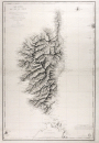 | Details | Blondeau, Alexandre | 1831 |
| Antique French Sea Chart of Corsica |
|
Blondeau, Alexandre |
|
| 1831 |
| LOC:66 |
| $850.00 | Blondeau--Alexandre | Antique-French-Sea-Chart-of-Corsica | Large antique copper-plate engraved nautical chart of the French island of Corsica ( Corse )and nearby islands: Isle of Asinara, Bonifacio Strait, Capraia Island, Elba ( Elbe ), and northern Sardinia ( Sardaigne ). Coverage includes the towns of Bonifacio, Ajaccio ( the birthplace of Napoleon Bonaparte ), Calvi, Ile Rousse, St Florent, Port Vecchio, and many more.
<br></br>
This splendid original French sea chart is a fine example of mid eighteenth-century nautical cartography. A heavy impression and admirable detailed engraving of the mountainous relief of the island are accompanied by a wealth of detail not only of the coastal regions but inland as well.
<br></br>
Issued by the French Depot Generale de la Marine in 1831 (dated within) after surveys by the Depot de la Guerre in 1824, and by Captain Hell in 1822, 1823, and 1824. Engraved by Alexandre Blondeau of France's Depot de la Guerre. At bottom right is the circular logo with anchor of the Depot General de la Marine. Number 232. Price when issued two Francs. |
| 1131 | 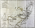 | Details | Arrrowsmith, John | 1832 |
| Antique map of southeast Australia with discoveries |
|
Arrrowsmith, John |
|
| 1832 |
| LOC:9 |
| $560.00 | Arrrowsmith--John | Antique-map-of-southeast-Australia-with-discoveries | SOLD
<br></br>
Scarce antique map by John Arrowsmith (1790-1873) is an early record of Australian history. The old map documented recent discoveries (as of 1832) in the interior of the southeastern portion of the continent of Australia. Coverage includes the Australian coastline from Brisbane to Adelaide (not named as it was not founded until 1836, 4 years after publication of this map).
<br></br>
Contains light outline color denoting tracks of exploration in the region between 1817 and 1829, and the miles explored by each. The explorers include: General Oxley, Lieutenant Currie, Mr. Hume, Mr. Allan Cunningham, and Captain Stuart.
<br></br>
Portions of the coast are denoted with dashed lines indicating that even by 1832 there were parts of the coast that were still poorly explored. Numerous notes about the character of the geography geology, and fauna of the region. For example Lake Alexandrina is described:
<div class="indenttextblock">
"The Lake is 50 miles long and 40 broad very shallow in some places, has several fine Bays, its water brackish it communications with Encounter Bay by a passage impracticable even for the smallest boats...The rise of the Tide does not exceed 8 inches."
</div>
<br />
Published in 1832 from London in Vol. 2 of the Journal of the Royal Geographical Society.
<br></br>
John Arrowsmith was a cartographer to both the Royal Geographical Society and the Parliamentary Reports. Those roles gave Arrowsmith access to information on the latest discoveries and he created numerous maps of Australia and other areas, revising the maps with results of later information. Published by John Murray, Albemarle Street. London. |
| 5351 |  | Details | City of Tarragona | 1833 |
| Very rare antique port pass for Tarragona, Spain wine related with map |
|
City of Tarragona |
|
| 1833 |
| LOC:57 |
| $900.00 | City-of-Tarragona | Very-rare-antique-port-pass-for-Tarragona--Spain-wine-related-with-map | Handsome, finely engraved, signed antique ship's port pass and anchorage plan for the U.S. Brigantine "Hancock" at the port of Tarragona, Spain along the Mediterranean Sea. The port pass, dated within at 1833, includes a large anchorage plan with numerous soundings for the port for Tarragona, with sailing directions in three languages [1] and a description of the ship's cargo of wine and aguardiente. Spanish text.
<br></br>
Rare. No holdings of this item are listed in WorldCat and only one record of a sale of a similar document, from 1820.
<br></br>
Bearing the armorial seal of Tarragona, Spain, the document is topped with a view of the walled city of Tarragona below a Latin scroll touting the safety and health of "Tarraco" [2]. At bottom the signers specify the pass applies specifically to the United States Bergantine (Brig) Hancok (Hancock ?), captained by Ebenezer L. Higgins [3], with a crew of eight sailors. Dated to February 12, 1833 the pass specifies the cargo exported from Tarragona to Brazil consisted of "vino tinto" (red wine), "aguardiente refinado" (brandy) and "aguardiente anisado" (an anise-flavored liqueur popular today in Colombia) [4].
<br></br>
SOURCES:
<br>
[1] "Cape Salou bears from the point of the mole to the So[luth] 5° O. 7 miles distant & Cape Gros or Pointe de la Mora to the east 12° 30' N. 6 1/2 miles distant. The soundings are denoted in Spanish feet of which 35 make 32 English feet." <br>
[2] "Salutem et Sanitatem en Capite insigni Despectans Tarraco Pontum." <br>
[3] Possibly Captain Ebenezer Higgins of Provincetown, Mass. (b. 1807) who died at the helm of the schooner Been Atkins on June 8, 1846 while bound for Norfolk, Virginia. (https://www.findagrave.com/memorial/120392629/ebenezer-higgins) <br>
[4] Colome-Ferrer, Josep and Ferrer, Loren. The importance of the liquor sector in Catalan viticulture in the 18th and 19th centuries. (From Spanish) Journal of Industrial History. No. 79. 2020. |
| 1213 | 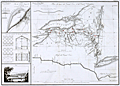 | Details | Poussin, Guillaume Tell | 1834 |
| Early plan of the Erie and Champlain Canals |
|
Poussin, Guillaume Tell |
|
| 1834 |
| LOC:53 |
| $350.00 | Poussin--Guillaume-Tell | Early-plan-of-the-Erie-and-Champlain-Canals | Very scarce original copperplate engraved of the Erie Canal (opened 1825) and the Champlain Canal by French engineer Guillaume Tell Poussin. Begun in 1817 and opened in its entirety in 1825, the Erie Canal is considered the engineering marvel of the 19th Century.
<br></br>
Engraved map. Relief shown by hachures. Includes profile of Erie Canal and Champlain Canal and view of covered bridge.
<br></br>
Plan du trace de Canal Erie et du Canal Champlain. Etat de New-York. // Plan du Port de Presqu'ile et du Barrage construit pour approfondir son entrée. // Détails de construction du pont de Mr. J. Town.
<br></br>
Published in: "Travaux d 'ameliorations interieures projetes ou executes par le Gouvernement General des Etats-Unis d 'Amerique, de 1824 a 1831"; par Guillaume-Tell Poussin … Atlas. Paris, Anselin, Libraire, pour l 'art militaire, les sciences et les arts, rue Dauphine, No. 36, dans le passage Dauphine. Carilian-Goeury, Libraire, des ponts et chaussees et des mines, Quai des Augustins, No. 41. 1834. Imprimerie de Lachevardiere, rue du Colombier, No. 30.<BR> </BR> |
| 1387 | 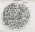 | Details | Michel fils | 1834 |
| Atlas Universal a small French pocket Atlas. |
|
Michel fils |
|
| 1834 |
| LOC:0 |
| $250.00 | Michel-fils | Atlas-Universal-a-small-French-pocket-Atlas- | Atlas Universel with 30 small steel-engraved maps. Followed by a 24-page section of definitions and explanations of geographic locations in French. With original paper covers.
<br></br>
Published by Michel fils aine [the elder brothers] , Paris, Rue de la Hachette, No. 24 |
| 319 | 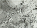 | Details | Depot de la Marine | 1836 |
| Plan du port de Barfleur et de ses environs |
|
Depot de la Marine |
|
| 1836 |
| LOC:0 |
| $355.00 | Depot-de-la-Marine | Plan-du-port-de-Barfleur-et-de-ses-environs | Highly detailed antique nautical chart of the harbor and town of Barfleur, France and the surrounding coastline extending about 1.5 French mille marine to the north and south. Roads, fields, and very rocky offshore topography near the coast are depicted with great detail and relief. This graphic treasure captures the state of that stretch of coastline as it was in 1832 from the Pointe de Barfleur with its lighthouse to the north, past Anse Crabet and dozens of small islets, beyond the Plateau de Antiqueires and Plateau de Moulard to Anse de Landemer south of Barfleur. Nearby villages depicted include Monfarville, Quenanville, and Gatteville.<BR> </BR>
Manuscript notation of a cannon battery at the far east end of Barfleur harbor includes four red lines extending into the sea presumably marking the prospective firing angle and range of those cannon protecting the navigational channel. Circular stamp of Depot General de la Marine. Number 848. Price 2 francs. |
| 5282 |  | Details | U.S. Congress | 1837 |
| Antique plat of lands Choctaw Point Lighthouse Mobile Bay Alabama |
|
U.S. Congress |
|
| 1837 |
| LOC:10 |
| $275.00 | U-S--Congress | Antique-plat-of-lands-Choctaw-Point-Lighthouse-Mobile-Bay-Alabama | Scarce plat map of land near Mobile, Alabama from 1837 to support the published opinion of Benjamin Franklin Butler, Attorney General of the United States (1833-1838) in a case dated August 5, 1837. The plat shows the Mobile River at right with Choctaw Point Lighthouse. Lot contains 2 page of legal opinion, supported by the plat, probably from a report to Congress.
<br></br>
Choctaw Point is located on the west bank of the Mobile River about one mile south of downtown Mobile and one mile SW of the U.S.S. Alabama memorial. A brick lighthouse (63' Fixed light), visible for 15 miles, existed at Choctaw Point from 1831 until the beginning of the Civil War. The American Lighthouse Guide of 1845 found the light of little use in navigating the Dog River.
<div class="indenttextblocksingle">
"To mail steamers and bay craft familiar with the shoals, and Choctaw Pass, this light is a valuable aid in dark nights, but of little benefit to strangers. This light is of little utility in consequence of forming too great an angle in its bearing from the courses required through the intricate and narrow channels of the river and passes." (Mills, Robert. The American Light-house Guide: with Sailing Directions, for the Use of the Mariner. 1845. p. 11)
</div>
Among the land holdings near Choctaw Point that are identified in the map are plots belonging to Antoine Espijo, John Forbes & Co., Regist Burnady, Simon Favre, and John Murrill. |
| 6771 |  | Details | Touanne, Edmund Bigot de la | 1837 |
| Bougainville elevation views Port Jackson Rio de Janiero Da Nang Hainan Macao |
|
Touanne, Edmund Bigot de la |
|
| 1837 |
| LOC:11111 |
| $800.00 | Touanne--Edmund-Bigot-de-la | Bougainville-elevation-views-Port-Jackson-Rio-de-Janiero-Da-Nang-Hainan-Macao | Sheet of coastal elevation views after drawings by Edmund Bigot de la Touanne (1796-1863) and engraved by Ambroise Tardieu (1) for "Journal de la navigation autour du globe de la Fregate la Thetis et de la corvette l 'Esperance." That journal documents the circumnavigation of Bougainville (2) during 1824 through 1826 aboard the Thetis and Esperance.
<br><br>
Plate 54. 1837.
<br><br>
The coasts depicted include the Philippine Island of Luzon; Guangzhou (Canton) China; Macao, China; Hainan, China; Da Nang, Vietnam; Lombok, Indonesia; Surabaya, Indonesia; Sydney, Australia; and Rio de Janeiro, Brazil. Descriptions of the views are translated here from the original text in French:
<div class="indenttextblocksingle">
<ul style="list-style-type: decimal;">
<li>Vue d'une partie de la cote Nord-Ouest de I'lle Lucon (Philippines) prise le 20 Decembre 1824</li>
<li>Vues de Piedra Branca a l'atterage du Golfe de Canton (Chine) prises le 24 December 1824</li>
<li>Vue du passage de Lantao a l'entree du Golfe de Canton (Chine) prises le 24 December 1824</li>
<li>Vue de la Ville de Macao (Chine) prises en Janvier 1825</li>
<li>Vue d'une partie de la cote est de I'lle d'Hainan (Chine) prises le 10 Janvier 1825</li>
<li>Vue de l'Entree de la Baie de Tourane (Cochinchine) prise le a Janvier 1825</li>
<li>Vue du Mouillage de Tourane (Cochinchine) prise en Fevrier 1825</li>
<li>Vue de I'lle Lombock (Archipel de al Sonde) prise le 10 Mai 1825</li>
<li>Vue de la Rade de Sourabaya a l'est de Java (Archipel de la Sonde) prise en Avril 1825</li>
<li>Vu de la Ville de Sidney au Port Jackson (Nouvelle Galles Meridionale) prise en Aout 1825</li>
<li>Vue de l'Entrée de la Baie de Rio Janeiro(Bresil) prise le Avril 1828.</li>
</ul>
</div> |
| 4953 |  | Details | U.S. Coast and Geodetic Survey | 1838 |
| First chart issued Coast Survey New Haven Harbour |
|
U.S. Coast and Geodetic Survey |
|
| 1838 |
| LOC:0 |
| $425.00 | U-S--Coast-and-Geodetic-Survey | First-chart-issued-Coast-Survey-New-Haven-Harbour | This "Extract from the U.S. Coast Survey New Haven Harbour" Connecticut is one of the three earliest charts published by the United States Coast Survey. No sale of this chart is recorded in the AMPR.
<br></br>
Taken from a Letter from the Secretary of Treasury transmitting a map of New Haven and its harbor in the state of Connecticut. Doc 25th Congress. 1839. |
| 4773 | 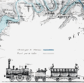 | Details | Compagnie du chemin de fer de Paris a la Mer | 1838 |
| Earliest map of the Paris au Havre railway in France |
|
Compagnie du chemin de fer de Paris a la Mer |
|
| 1838 |
| LOC:88 |
| $800.00 | Compagnie-du-chemin-de-fer-de-Paris-a-la-Mer | Earliest-map-of-the-Paris-au-Havre-railway-in-France | Rare antique lithographed map of the Paris to Havre Railway (Paris a la mer) made before construction and during the first French Railway boom. About the earliest available advertisement for French railroads (chemin de fer) and one of 10 competing railway proposals submitted to the French Parliament between 1835 and 1847.
<br></br>
With a fine detailed drawing of a 1838 coal-powered steam engine chugging along with wagons carrying passengers, horses and cattle, and agricultural goods. Gentleman passengers in top hats casually observe the countryside from seats atop the passenger car. Workers in the coal car appear appropriately fatigued.
<br></br>
The first locomotive-powered railway in France, the Paris to St. Germain opened in 1837 followed immediately by a lack of interest in financing railway projects by the large French banks. This map advertised the potential of the Paris to Havre railway, probably an attempt to reach capital sources outside the French banking industry. Shows two train routes. The first route, in blue, represented the "Chemin par les Plateaux" while the uncolored set of parallel lines denoted the "Project par la Valee."
<br></br>
Lithograph on laid paper with Blauw watermark. Lithographed by Delarue, Rue Notre Dame Victoires 16.
<br></br>
Grace's Guide to British Industrial History notes the leadership of the rail project was attributable to William Mackenzie and Thomas Brassey. In 1840 Mackenzie and Brassey
<div class="indenttextblock">
"began railway works in France, and elsewhere. These included the greater part of the Paris and Rouen Railway; the whole of the Rouen and Havre Railway, including the stations and the maintenance of way of both lines; the line from Rouen to Dieppe, all under Joseph Locke, and George Neumann. " (Source: https://www.gracesguide.co.uk/Brassey_and_Mackenzie)
</div> |
| 316 |  | Details | Depot de la Marine | 1839 |
| Plan de l'embouchure de la Seine (environs du Harve) |
|
Depot de la Marine |
|
| 1839 |
| LOC:0 |
| $225.00 | Depot-de-la-Marine | Plan-de-l-embouchure-de-la-Seine--(environs-du-Harve) | Large antique chart covering the mouth of the Seine river with Villerville on the South bank and Le Havre and St. Adresse on the North bank. Le Havre fortress shown completely encircled with Vauban-type defensive walls. Locations of cannon batteries added in manuscript. This antique nautical chart has been profusely annotated in manuscript apparently by a member of the military or a military engineer. Numerous pencil notations in left and right margins with bearings. Red pen used to draw lines radiating from cannon batteries to delineate the expected range and line of fire. Numerous soundings. Circular stamp of Depot General de la Marine. No. 892. Price 2 francs. |
| 317 |  | Details | Depot de la Marine | 1839 |
| Carte Particuliere des Cotes de France (Cherbourg) |
|
Depot de la Marine |
|
| 1839 |
| LOC:0 |
| $210.00 | Depot-de-la-Marine | Carte-Particuliere-des-Cotes-de-France-(Cherbourg) | Attractive antique nautical chart (1839 ) of the environs around Cherbourg, France including Cape Hague and Cape Levi. Includes villages of Biville, Vauville, Auderville, Tonneville, Omonville, Greeville, Flottemanville, Querqueville, Henneville, Equerdeville, Toulaville, and Bretteville, and Cherbourg. The locations of several forts are noted and the cannon batteries and forts are named via script annotations in black ink. <BR> </BR>
This antique chart has been profusely annotated in manuscript apparently by a member of the military or a military engineer. Numerous pencil notations in left margin and top with bearings. Red pen used to draw lines radiating from cannon batteries to delineate the expected range and line of fire. Numerous soundings. Circular stamp of Depot General de la Marine. Price 2 francs. |
| 1223 |  | Details | Anonymous | 1840 |
| Uncommon antique Map of Lake Pontchartrain |
|
Anonymous |
|
| 1840 |
| LOC:3 |
| $200.00 | Anonymous | Uncommon-antique-Map-of-Lake-Pontchartrain | Uncommon and unrecorded version of a lithographed map ca. 1840 of <b>Lake Pontchartrain</b> in Louisiana with three steamboat routes shown: to Madisonville, La., to Mandeville, La. and a mail steamboat route to Mobile, Alabama. Possibly by L. Hirt.
<br></br>
In 1834 it was reported that mail service was provided through three weekly round-trips between New Orleans and Mobile at a total annual cost of <a href="https://books.google.com/books?id=VfcaAAAAYAAJ&pg=PR1&dq=mail+steam+boat+mobile+new+orleans&source=gbs_selected_pages&cad=3#v=onepage&q=mail%20steam%20boat%20mobile%20new%20orleans&f=false" target="_blank">$40,000.</a></a>
<br></br>
This map appears as a vignette in L. Hirt's 1841 " Plan of New Orleans with Perspective and Geometrical Views of the Principal Buildings of the City" from <a href="http://louisdl.louislibraries.org/cdm/ref/collection/p15140coll28/id/76" target="_blank"> The Historic New Orleans Collection.</a> The present map shows signs of being disbound from a smaller volume. Scale: 3 inches to the mile. Louisiana History.
<br></br>
The map features Lake Borgne, Bayou Sauvage, and Bayou Bienvenue. Three steamboat routes terminate at Milneburg, at the north end of the Ponchartrain Rail Road on the south shore of Lake Pontchartrain. The Pontchartrain Rail-Road, the first railway in New Orleans, Louisiana began service in 1831. The route of the railway ran down the center of Elysian Fields Avenue from the Faubourg Marigny to the port of Milneburg, later the Lake Pontchartrain Amusement Park.
<br></br>
This scarce small map shows the city of New Orleans with Bayou St. John, the New Orleans canal, and the Carrolton Railroad. |
| 1224 |  | Details | Anonymous | 1840 |
| Scarce antique map of New Orleans Tenth Ward or the City of Lafayette |
|
Anonymous |
|
| 1840 |
| LOC:3 |
| $250.00 | Anonymous | Scarce-antique-map-of-New-Orleans-Tenth-Ward-or-the-City-of-Lafayette | Unrecorded version of an early wood-cut map of <b>New Orlean's Tenth Ward</b> circa 1840 when it was known as <b>Lafayette City</b>. Earlier, during the French period New Orlean's Tenth Ward was known as the Faubourg Lafayette. Boundaries of Lafayette City include the Mississippi River, Felicity Street, Nayades Street (later known as St. Charles Avenue), and a large tract owned by R. A. Delachaise. Shows the New Orleans and Carrollton Railroad connecting the city of New Orleans to then then distant resort village of Carrollton.
<br></br>
Possibly by L. Hirt, and derived or re-purposed from his larger work. This map appears as a vignette in L. Hirt's 1841 " Plan of New Orleans with Perspective and Geometrical Views of the Principal Buildings of the City" from <a href="http://louisdl.louislibraries.org/cdm/ref/collection/p15140coll28/id/76" target="_blank"> The Historic New Orleans Collection.</a> The present map shows signs of being disbound from a smaller volume. Scale: 3 inches to the mile. Louisiana History.
<br></br>
Faubourg Lafayette was founded with small settlements around steamboat landings in New Orleans. The faubourg became the City of Lafayette, then part of Jefferson Parish and its first parish seat. Lafayette was a separate municipality until it was incorporated into New Orleans, Orleans Parish, in 1852. The present boundaries of the Tenth Ward include St. Charles Avenue, Jackson Avenue, the Pontchartrain Expressway, and Simon Bolivar Avenue. <a href="https://en.wikipedia.org/wiki/Faubourg_Lafayette" target="_blank"> (Source.)</a> |
| 2566 | 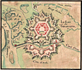 | Details | Anonymous | 1840 |
| The Mystery of le Fort de Tarlevinne |
|
Anonymous |
|
| 1840 |
| LOC:77 |
| $750.00 | Anonymous | The-Mystery-of-le-Fort-de-Tarlevinne | A pen and ink, manuscript plan of the Fort of Tarlevinne. French text. Location unknown. Original, attractive hand-coloring.
<br></br>
I am stumped on this one! A Google search on 'Tarlevinne' returns no results that tell us where the fort is located, if indeed it existed at all. Regardless of location, the creator put much effort and time into this small manuscript fortress plan.
<br></br>
A Vauban-style fort near "la Riviere de Tirenard" (a native French speaker suggests the interpretation of Tirenard is "little Fox River.") From the river a canal funnels the river's flow through a "port" with a set of locks ("Ecluse") into the "Canal d'Arne".
<br></br>
One location somewhat fits the plan of Tarlevinne, but is not completely convincing. Near Livorno, Italy where the Canale Imperiale connects the Arno River to the port. "Riviere de Tirenard" could refer to a river emptying into the Tyrrhenian Sea. |
| 5480 |  | Details | King, Peter Parker | 1840 |
| Rare charts of Smyth and Fury Harbor Magellan Strait Chile |
|
King, Peter Parker |
|
| 1840 |
| LOC:89 |
| $475.00 | King--Peter-Parker | Rare-charts-of-Smyth-and-Fury-Harbor-Magellan-Strait-Chile | Very rare engraved chart of Smyth Harbor, Fury Harbor and three other harbors of refuge, all along the Barbara Channel, one of three channels that connects the <strong>Strait of Magellan</strong> to the Pacific Ocean [1]. By Captain Phillip Parker King R.N. and printed just ten years after King surveyed the area aboard the Adventure, a stout ship of 330 tons.
Chart # 1306. London. 1840.
<br></br>
King named Smyth Harbor after Captain (later Admiral) William Henry Smyth who had commanded the Adventure before King and who was an early member of a number of learned societies, well known for his hydrographic charts, for his astronomical work, and for a wide range of publications in varied fields.
<div class="indenttextblocksingle">
"On the south side of Mount Maxwell is Smyth Inlet, which contains anchorage on the north shore, particularly one in Earle Cove; but in the centre the water is deep, and on that account, it is not an inviting place for a ship. [2]"</div>
<br>
Scale below graduated in "Nautic Miles". Rhumb lines subtly visible only near margins. Admiralty, December 24, 1840. R.B. Bate Agent for Admiralty Charts 21 Poultry.
<br></br>
[1] The other two channels connecting Magellan Strait to the Pacific are Abra Channel and Magdalena Channel. </br>
[2] King, P. P. Narrative of the surveying voyages of His Majesty's Ships Adventure and Beagle between the years 1826 and 1836, describing their examination of the southern shores of South America, and the Beagle's circumnavigation of the globe. Proceedings of the first expedition, 1826-30, under the command of Captain P. Parker King, R.N., F.R.S. London: Henry Colburn. 1839. [Online]. |
| 318 |  | Details | Depot de la Marine | 1841 |
| Carte Particuliere des Cotes de France (Cours de la Seine) |
|
Depot de la Marine |
|
| 1841 |
| LOC:0 |
| $375.00 | Depot-de-la-Marine | Carte-Particuliere-des-Cotes-de-France-(Cours-de-la-Seine) | Antique nautical chart of the Seine River with numerous soundings for the navigational channel. Villages include Guerbaville, Bliquetuit, Caudebec, Villequier, Aizier, Vieux Port, St. Aubin, Berville sur-mer, St. Opportune, Bouquelon, Conteville, St. Nicolas de-la-Taille, La Cerlangue, St. Vigor, Fiquetfleur, Tancarville, Rogerville, Gonfreville, St. Sauveire, Fatouville, and Honfleur. <BR> </BR>
Lower quarter of the nautical chart is dedicated to extensive remarks and a tide table. Numerous soundings and windmills are noted (moulin). Circular stamp of Depot General de la Marine. Number 949. Price 2 francs. |
| 326 |  | Details | Depot de la Marine | 1842 |
| Plan du port de Boulogne |
|
Depot de la Marine |
|
| 1842 |
| LOC:0 |
| $225.00 | Depot-de-la-Marine | Plan-du-port-de-Boulogne | Antique nautical chart published in 1842 covering the French port of Boulogne and nearby coastline. Circular stamp of Depot General de la Marine. |
| 885 |  | Details | Depot de la Marine | 1842 |
| Antique chart of Brazilian coast and mouth of the Amazon River |
|
Depot de la Marine |
|
| 1842 |
| LOC:67 |
| $575.00 | Depot-de-la-Marine | Antique-chart-of-Brazilian-coast-and-mouth-of-the-Amazon-River | Antique French sea chart from 1842 covers the mouth of the <b>Amazon River</b> in Brazil. This fine large copper-plate engraved nautical chart begins north of the Amazon River near Isla Maraca and trends south then east to include Rio Araguari ( Araouari ) , Rio Amazonas, Ilha de Marajo, Para River, and the Ile de Maranham. Includes the towns of <b>Belem</b> (Para) , Sao Luis (San Luiz) , Macapa, Chaves, and numerous smaller villages. Includes an inset chart/plan of the Para River with Belem.
<br></br>
Dozens of smaller rivers and tributaries of the Amazon are identified by name along with hundreds of depth soundings in meters. After a lapse of 25 years France had recently re-adopted the metric system in 1837. At bottom left the authors provided a useful depth conversion table from meters to feet (pieds), and to the old measure of depth- brasses (about five feet).
<br></br>
With the circular logo of the <b>Depot Generale de la Marine</b>. All text in French. No. 408. |
| 1198 |  | Details | Mitchell, Samuel Augustus | 1843 |
| Mitchell's National Map of the American Republic first ed. |
|
Mitchell, Samuel Augustus |
|
| 1843 |
| LOC:0 |
| $1,400.00 | Mitchell--Samuel-Augustus | Mitchell-s-National-Map-of-the-American-Republic-first-ed- | Large 1st edition linen-backed hanging map of the eastern United States surrounded with insets of the vicinity of major towns, ports, and harbors. This scarce map features 32 colored insets of United States cites including New Orleans, St. Louis, Nashville, Natchez, Mobile, Savannah, Charleston, Raleigh and many more. Population tables for each county in the different states and territories in 1840. Eastern Kansas and Oklahoma are shown combined and is labeled "Indian Territory" with tribes identified including Omaha's, Kickapoos, Cherokee, and Shawnee. Large Iowa Territory. Minnesota is not yet named foreshadowing the Westward population expansion to follow in later decades.
<br></br>
With an inset map of the Treaty of 1842, also called Webster-Ashburton Treaty settling a border dispute between Maine and New Brunswick.
<br></br>
Samuel Augustus Mitchell Sr. (1792-1868) is one of the pioneers in American cartography of the 19th century and led the conversion of engraved map plates to more affordable lithographic plates. Drawn by James Henry Young (1817-1866) and engraved by J.H. Brightly, both collaborated with Mitchell on this series of maps. Published from 8 1/2 South Seventh Street, Philadelphia. Wall map on linen with wooden scrolls. |
| 4959 |  | Details | Becher, Alexander Bridport | 1843 |
| Rare Drift Bottle Chart of the Atlantic Ocean |
|
Becher, Alexander Bridport |
|
| 1843 |
| LOC: |
| $600.00 | Becher--Alexander-Bridport | Rare-Drift-Bottle-Chart-of-the-Atlantic-Ocean | Rare. Little-known, engraved "bottle chart" of the Atlantic Ocean by A.B. Becher (1796-1876), a Commander in England's Royal Navy. After graduation from the Royal Naval College, Becher began a long career that included several assignments related to hydrographic surveying including Canada, the Azores, Africa, and the Cape Verde Islands.
<br></br>
No sales of the "bottle chart" recorded in AMPR. No other similar chart is found for sale online. Only two institutional holdings are confirmed.
<br></br>
In 1843 Becher published this chart in the Nautical Magazine, showing the courses followed by floating bottles where there was information available about the location the bottle was thrown into the sea and where it was found. With his bottle chart Becher included a table with data about the bottle such as the name of the ship, latitude and longitude, the dates the bottle was cast away and found, etc. The data were derived from published records of bottle discoveries that Becher had systematically recorded and published in the Nautical Magazine over the course of 40 years. Those data and associated letters to the editor and comments became known as the "Bottle Papers."
<br></br>
Published by the Proprietors of the Nautical Magazine Feb 1, 1843. Engraved by J and C Walker. Becher was founder and editor of the Nautical Magazine from 1832 - 1871.
<br></br>
Becher also authored "The Storm Compass or Seaman's Hurricane Companion", a booklet for the mariner explaining hurricanes with an emphasis on best practices to predict and avoid hurricanes. |
| 1098 |  | Details | Depot de la Marine | 1843 |
| Scarce early French sea chart of San Francisco Bay |
|
Depot de la Marine |
|
| 1843 |
| LOC:63 |
| $1,450.00 | Depot-de-la-Marine | Scarce-early-French-sea-chart-of-San-Francisco-Bay | Scarce French sea chart of <b>San Francisco Bay</b> made during a voyage to the Pacific from 1836-39 by Captain Abel Aubert Du Petit-Thouars in command of the French Frigate <b>Venus</b>. The bay is well delineated with soundings and profile views. Shows the route taken in October 1837 by the Hawaiian ship "Kamamalou" (Captain William Sturgis Hinckley) as it ferried a crew from Petit-Thoaurs' Venus, who remained aboard the Venus in Monterrey Bay, to gather water and vegetables. The crew used that trip to reconnoiter the port of San Francisco.
<br ></br>
With several small and one large elevation profile view of the entrance to San Francisco Bay as seen from sea. The largest elevation view, at bottom, shows the coastline as seen from 25 miles offshore. That beautifully engraved profile extends from the <b>Farralon Islands</b> to well past "Cap Blanc" (Point San Pedro). The key feature of Alcatraz Island is labeled "I. aux Oiseaux" (Bird Island).
<br ></br>
A circled "+" between Alcatraz Island and Yerba Buena Island labeled "Basse du Seringapatnam" suggests that this is the site of a wreck of a vessel by that name. Going through the records we find a 398 ton whaling ship "Seragapatam" that sailed from Sydney and arrived in San Francisco on March 18, 1850.
<br ></br>
The motivation behind Petit-Thouars' exploration was France's interest in obtaining territory from the Mexican government in exchange for the millions of dollars worth of loans that the French government had given to Mexico, and which the Mexican government had defaulted on. France sent Captain Du Petit-Thouars to survey the region and see what it offered, as well as to project a French presence to bolster any claims they had in the Pacific.
<br></br>
Circular logo with an anchor from the Depot de la Marine. Plate 6. Number. 1002. |
| 5352 |  | Details | South Cove Corporation | 1845 |
| South Cove Boston Massachusetts Auction Plat Rare Antique Map |
|
South Cove Corporation |
|
| 1845 |
| LOC:90 |
| $550.00 | South-Cove-Corporation | South-Cove-Boston-Massachusetts-Auction-Plat-Rare-Antique-Map | Scarce lithographed cadastral map of land filled by the South Cove Corporation in Boston, Massachusetts to be sold at auction on February 18, 1845 by Francis Jackson, agent for the Corporation. Folded into a small 6" x 9" booklet [1] detailing the condition of the dividend (auction) and the dimensions of each lot to be sold.
<br></br>
The land to be sold by the South Cove Corporation was bounded by Albany Street, Harrison Avenue, Erie Street, and Troy Street and Cobb Wharf.
<br></br>
[1] "Catalogue of 132 lots of land in the South Cove with the numbers, dimensions, and contents affixed to each lot. To be divided among the stockholders, by order of the Directors of the South Cove Corporation." Press of Foster and Brewster. Boston. 1845. 8 pages. [Mass., landfill, made land] |
| 1139 |  | Details | U.S. Coast and Geodetic Survey | 1846 |
| Antique Rolled Chart of Little Egg Harbor, New Jersey |
|
U.S. Coast and Geodetic Survey |
|
| 1846 |
| LOC:53 |
| $480.00 | U-S--Coast-and-Geodetic-Survey | Antique-Rolled-Chart-of-Little-Egg-Harbor--New-Jersey | Scarce separately issued antique chart (no folds) of <b>Little Egg Harbor, New Jersey</b> published on heavy paper in 1846 by the U.S. Coast Survey. Contains sailing directions, and two long elevation views of the entrance to Little Egg Harbor as seen from sea. Key features include: the New Inlet, Round Shoal, Tucker's Island (with <b>Reuben Tucker's boarding house</b> shown as a triangulation point), Brigantine Channel, Brigantine Beach, Great Thoroughfare, Hunt's Shoals, Anchoring Island, and Hatfield's store.
<br></br>
With numerous depth soundings , anchorages, shoals, and notes on the composition of the sea floor. Electrotype copy no. 2 by Mathiot. Under magnification fine detail is visible assuring the buyer of it's origin as an copperplate (electrotype) engraving. Price when issued was 15 cents.
<br></br>
Little Egg Harbor township is a township in Ocean County, New Jersey. Originally part of Burlington County, Little Egg Harbor took its name from the portion of a bay called Egg Harbor by Dutch sailors for the eggs found in nearby gull nests. The first known account of the town was made by Captain Cornelius Jacobsen May in 1614.
<br></br>
This is a scarce, separately issued, rolled nautical chart of Little Egg Harbor, NJ on heavy paper, not the more common folded version on thin, issued with other charts in an annual report to Congress .
<br></br>
This chart was printed in 1846 from an electrotype copy of the original hand-engraved copper plate, a process the U.S. Coast Survey newly adopted in mid century. As a soft medium, copper plates could only withstand print runs of perhaps 200 copies before the plates wore down. To enable larger print runs, a mold of the original plate was created in wax or another soft medium. Then, using an electro-chemical process ( electrotyping ), the mold was coated with a metal layer, typically copper. Printers were then able to produce output from the new electrotype copper copy, while preserving the original. |
| 1235 |  | Details | U.S. Coast and Geodetic Survey | 1847 |
| Antique chart of New Haven, Connecticut and New Haven Harbor |
|
U.S. Coast and Geodetic Survey |
|
| 1847 |
| LOC:53 |
| $550.00 | U-S--Coast-and-Geodetic-Survey | Antique-chart-of-New-Haven--Connecticut-and-New-Haven-Harbor | Rare, rolled, separately issued antique nautical chart of <b>New Haven, Connecticut</b> and harbor on the northern shore of Long Island Sound. Includes West Haven, and Fair Haven. Numerous depth soundings, aids to navigation and navigational hazards are noted such as Savin Rocks, New Haven Light, Quixes Ledge, Round Rock, and Sandy Point. Key features include Fort Wooster, Fort Hale, Farm River, Morris Cove, Mill River, and the Quinnipiac River.
<br></br>
Extensive sailing directions are included at right beginning:
<div class="indenttextblock">
"Bring the Light House to bear E.N.E. and run for it until Fort Hale is in range with the larger of two Church Spires next each other in the village of Fair Haven. You will then be about 1/2 of a mile from the light in 3 fathoms water and a short distance from the buoy upon Adams Fall Ledge. S. 1/2 E. you will see the buoy on the S.W. ledge and still further to the Eastward the beacon on Quixes Ledge. Run into the harbor upon the above mentioned range (Fort Hale and the Spire) until the Light House bears S. by E. when you will be in 2 fathoms soft bottom. Then steer …"
</div>
<br />
Price when issued 15 cents. Triangulation by James Ferguson and Edmund Blunt in 1833.
<br></br>
This chart was printed ca. 1847 from an electrotype copy of the original hand-engraved copper plate, a process the U.S. Coast Survey adopted around that time. As a soft medium, copper plates could only withstand print runs of perhaps 200 copies before the plates wore down. To enable larger print runs, a mold of the original plate was created in wax or another soft medium. Then, using an electro-chemical processs ( electrotyping ), the mold was coated with a metal layer, typically copper. Printers were then able to produce output from the new electrotype copper copy, preserving the original. Electrotype copy no. 3. |
| 979 |  | Details | Hartley, Jesse | 1848 |
| Plan of the Liverpool docks in Lancashire County, England |
|
Hartley, Jesse |
|
| 1848 |
| LOC:0 |
| $250.00 | Hartley--Jesse | Plan-of-the-Liverpool-docks-in-Lancashire-County--England | A long mid 19th-century hand-colored folding plan of the Liverpool Docks along the Mersey River in England. After a manuscript plan by Jesse Hartley (1780-1860). Shows the relative positions of the docks with their related canals and locks and through color coding shows the stage of development from proposal, though construction, to imnplementation.
<br></br>
By Jesse Hartley who was the world's first professional dock engineer, and is credited with creating a fireproof cast iron framed warehouse design used in building the Albert Dock at Liverpool. The Albert Dock, a complex of warehouses and dock buildings was the first structure in Britain to be built entirely of cast iron, brick, and stone, and was considered innovative at the time because it allowed ships to load and unload directly to the warehouses. (Merseyside Maritime Museum. "Creator of the dock, Jesse Hartley". <a href="http://www.liverpoolmuseums.org.uk/maritime/about/jesse-hartley.aspx" target="_blank">Internet</a>.)
<br></br>
C.B. Graham, Lithographer. Washington D.C. |
| 3651 |  | Details | Imray, James | 1849 |
| Fine gold-rush era blueback chart of California |
|
Imray, James |
|
| 1849 |
| LOC:1409 |
| $3,900.00 | Imray--James | Fine-gold-rush-era-blueback-chart-of-California | California gold-rush era blueback chart of the West Coast from the harbor of San Blas in Mexico heading north past San Francisco Bay. Coverage includes the Gulf of California and the Baja Peninsula. A wide nautical chart in landscape orientation.
<br></br>
Includes six insets and eight stunning coastal views. The insets include: "Entrance of San Francisco Harbour"; "Harbour of San Francisco By Capn. F.W. Beechey R.N. F.R.S."; and "Bay of Monterey By M. de Tessan of the French Navy." Also, Magdalen Bay, Mazatlan, and Guaymas.
<br></br>
Published by James Imray, Chart and Nautical Book Publisher 102, Minories. 1849.
<br></br>
During the 1800's there was a trend toward publication of very large small-scale charts with large-scale insets of key passages and harbors. The practice was driven as much by economics as any other reason. One chart could replace a dozen smaller charts. James Imray and Son was one of a handful of British publishers who specialized in these charts which were often backed with canvas or linen cloth or heavy blue paper in order to help them withstand the frequent use and abuse aboard ship, hence the term "blueback chart". |
| 3618 | 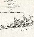 | Details | U.S. Coast and Geodetic Survey | 1849 |
| Reconnaissance of Pensacola and Perdido Bays |
|
U.S. Coast and Geodetic Survey |
|
| 1849 |
| LOC:11 |
| $120.00 | U-S--Coast-and-Geodetic-Survey | Reconnaissance-of-Pensacola-and-Perdido-Bays | Small coastal survey chart of Florida from Bonsecour Bay to the east end of Santa Rosa Island. Includes Pensacola Bay, Escambia Bay, Garcon Point, Blackwater River, Perdido Beach, Mast Bay, Forster's Island, and Fort Pickens. <strong>Price includes hand coloring.</strong>
<br><br>
Chart shows the triangulation network employed in an early survey conducted by the U.S. Coast [and Geodetic] Survey in 1849. Changes in topography inland are indicated by hachuring.
<br></br>
In surveying, triangulation is the process of determining the location of a point by measuring only angles to it from known points at either end of a fixed baseline. The point can then be fixed as the third point of a triangle with one known side and two known angles. Surveying error is minimized if first a mesh of triangles is created at the largest appropriate scale. Then points inside the triangles can all then be accurately located with reference to the triangulation network. |
| 4969 | 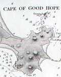 | Details | British Admiralty Hydrographical Office | 1849 |
| Antique Admiralty Chart Eastern China Chelang To Chauan |
|
British Admiralty Hydrographical Office |
|
| 1849 |
| LOC:59 |
| $575.00 | British-Admiralty-Hydrographical-Office | Antique-Admiralty-Chart-Eastern-China-Chelang-To-Chauan | Antique nautical chart of China coast. First edition of a scarce Admiralty nautical chart of the East coast of China. <b>"Sheet III - Eastern Coast from Chelang Pt. To Chauan Bay"</b> .
<br></br>
Includes an area north of Hong Kong from Jieshi Bay ( "Hie-Che-Chin Bay" ) trending northeast past Nan'ao ( "Namoa" ) Island to Zhao'an Bay ( "Chauan Bay" ). In 2007, off the coast of Nan'ao island local fishermen discovered a shipwreck, Nan'ao One, considered to be the first late Ming dynasty ship ever found; likely the only one from the reign of Emperor Wanli (1573–1620) that China has discovered.
<br></br>
Manuscript pencil and ink course plot lines and position plots. Published September 12, 1849 by the Hydrographic Agency of the British Admiralty. Number 1963. Four detailed inset port/harbor plans:
<div class="indenttextblocksingle">
<ul style="list-style-type: circle;">
<li>Chino Bay</li>
<li>Cupchi Point</li>
<li>Cape of Good Hope</li>
<li>Hai Mun</li>
</ul>
</div>
Based on a survey conducted by Royal Navy Captain R. Collinson in 1845. Published by the Admiralty September 12, 1849. Engraved by J & C Walker. Chart #1963. |
| 841 |  | Details | British Admiralty Hydrographical Office | 1849 |
| Nautical chart of China Between Taizhou and Wenzhou |
|
British Admiralty Hydrographical Office |
|
| 1849 |
| LOC:0 |
| $475.00 | British-Admiralty-Hydrographical-Office | Nautical-chart-of-China-Between-Taizhou-and-Wenzhou | British sea chart of the East coast of China, in Zhejiang province, from Taizhou ( "Taichow" ) to Wenzhou ( "Wan-Chew Foo" ), China. Coverage on this old nautical chart includes the Dachen Islands, consisting of 29 islands, rocks, and islets to the east of Taizhou. Also shown East of Wenzhou in the East China Sea is Dongtou, an island district in China composed of 168 islands.
<br></br>
Published from London by the British Admiralty, originally in 1843. This edition was produced in August 1849. Sold by J.D. Potter 31 Poultry and 11 King Street, Tower Hill. |
| 965 | 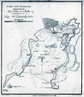 | Details | Blunt, E and G.W. | 1850 |
| Antique chart and plan of Cape Ann Harbor and Gloucester, Massachusetts |
|
Blunt, E and G.W. |
|
| 1850 |
| LOC:3 |
| $140.00 | Blunt--E-and-G-W- | Antique-chart-and-plan-of-Cape-Ann-Harbor-and-Gloucester--Massachusetts | Antebellum nautical chart of Gloucester ("Glocester"), MA. and Cape Ann Harbor from well known American publisher's of nautical charts and sailing directions, Edmund and George Blunt, and dated within to 1850. Noted features on this antique chart include <b>Ten Pound Island</b>, Ten Pound Island Ledge, Five Pound Island, Fort Point, Black Bess, Flat Point, and Norman's Woe Point with the nearby Norman's Woe Island. Includes numerous depth soundings, hazards, and aids to navigation as expected on a navigational chart. Shows a square fort at Fort Point near the Gloucester inner harbor but shows no structure in the location of Stage Point Fort.
<br></br>
The lighthouse on Ten Pound Island is shown near the mouth of the Gloucester inner harbor. The Ten Pound Island Light Station, originally a stone tower, was constructed on the island in 1821. That tower was replaced by the present cast-iron tower in 1881.
<br></br>
Topographic detail surrounding the harbor is shown through the use of light hachuring; numerous structures are shown scattered throughout that area.
<br></br>
The American Coast Pilot with other harbor charts, was published by Edmund and George W. Blunt from New York. The Blunts were the most prolific private publisher of navigational charts in the United States in the mid 19th century. |
| 957 | 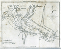 | Details | Blunt, E and G.W. | 1850 |
| Doboy Sound and Sapello Island, Georgia |
|
Blunt, E and G.W. |
|
| 1850 |
| LOC:3 |
| $75.00 | Blunt--E-and-G-W- | Doboy-Sound-and-Sapello-Island--Georgia | Antique nautical chart of the entrance to Doboy Sound, Georgia from the Blunts, renowned American publisher's of nautical charts and sailing directions. Noted features include Sapello Island, Marsh Island, Cabarita Island, and Pelican Shoals with nearby north and south breakers at the far right. Numerous depth soundings and descriptions of the sea floor composition.
<br></br>
On the south end of Sapelo Island, structures are identified as those of Thomas Spalding, Esq. Spalding, of St. Simons Island, purchased the land from his father-in-law, Richard Leake, in 1802.
<br></br>
Blunt placed a "Ruin at Wolf Island" across from a "Ruin of Little Wolf Island". The history of these ruins are unknown but perhaps they are among the 1000 archaeological sites of native Americans that dot the area.
<br></br>
The American Coast Pilot with other harbor charts, was published by Edmund and George W. Blunt from New York. The Blunts were the most prolific private publisher of navigational charts in the United States in the mid 19th century. |
| 5205 |  | Details | Morris | 1850 |
| Manuscript Map of North America |
|
Morris |
|
| 1850 |
| LOC:3 |
| $300.00 | Morris | Manuscript-Map-of-North-America | Fascinating antique manuscript map of North America, ca. 1850 by "Morris". Carefully drawn and lettered, this map clearly reflects the work of a dedicated draughtsman with fine penmanship at a very small size. It is difficult to imagine that anyone would be able to work in finer detail than on this small map.
<br></br>
Among the named features, a few help narrow the date when the map was drawn:
<div class="indenttextblocksingle">
<ul style="list-style-type: circle;">
<li>Shows the old West Florida Territory extending westward into Louisiana suggesting a date for the map between 1822 and 1845.</li>
<li>Shows Alaska as "Russian America" a term applied between 1733 and 1867 when Russia sold the Russian colony to the United States of America.</li>
<li>Shows Milledgeville, Georgia, the capital of that state from 1804 to 1868.</li>
<li>The map shows the boundaries of the New Mexico Territory, established in 1850</li>
</ul>
</div> |
| 5319 |  | Details | Dufour, Adolphe Hippolyte | 1850 |
| Antique Map of the Caribbean or Antilles |
|
Dufour, Adolphe Hippolyte |
|
| 1850 |
| LOC:11 |
| $255.00 | Dufour--Adolphe-Hippolyte | Antique-Map-of-the-Caribbean-or-Antilles | Fine engraved antique map of the Caribbean Islands from Florida to Venezuela. Map created by French cartographer A. H. Dufour ca. 1850.
<br></br>
Islands are colored according to the country who's possession each island was ceded to- England, Spain, France, Holland, Denmark, or Sweden. Legend or table at top center assigning colors to each occupying nation.
<br></br>
Engraved by Leclercq. Published by Mangeon. |
| 2518 | 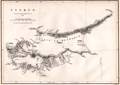 | Details | Graves, Thomas | 1850 |
| Antique map of Cyprus from Thomas Graves |
|
Graves, Thomas |
|
| 1850 |
| LOC:4 |
| $280.00 | Graves--Thomas | Antique-map-of-Cyprus-from-Thomas-Graves | Steel engraved map of Cyprus based on a large chart produced after the survey by Admiral Thomas Graves in 1849.
<br></br>
From Longbeare and Howson. The Life and Epistles of St. Paul. London: Published by Longman & Co. |
| 960 | 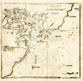 | Details | Blunt, E and G.W. | 1850 |
| Portsmouth Harbor, New Hampshire |
|
Blunt, E and G.W. |
|
| 1850 |
| LOC:3 |
| $75.00 | Blunt--E-and-G-W- | Portsmouth-Harbor--New-Hampshire | Antique nautical chart of Portsmouth Harbor, New Hampshire from the Blunts in their 16th edition of the American Coast Pilot, published in 1850.
<br></br>
The American Coast Pilot with other harbor charts and sailing directions, was published by Edmund and George W. Blunt from New York. The Blunts were the most prolific private publisher of navigational charts in the United States at that time. 179 Water Street New York. |
| 3623 |  | Details | Ringgold, Cadwalader | 1850 |
| Antique Chart of the Entrance to San Francisco Bay |
|
Ringgold, Cadwalader |
|
| 1850 |
| LOC:63 |
| $1,100.00 | Ringgold--Cadwalader | Antique-Chart-of-the-Entrance-to-San-Francisco-Bay | Cadwalader Ringgold's detailed, chart of the approach and entrance at San Francisco Bay, California from 1850. Includes Yerba Buena island, Alcatraces (Alcatraz Island), Sausalito Bay, Aspinwall Bay, and much more. Attractive elevation profile view of a square rigged sailing vessel set against a backdrop of the coastline at San Francisco. Constructed, projected and drawn by Fred D. Stuart.
<br ></br>
Ringgold (1802-1867) was a officer in the U.S. Navy who had served aboard the brig Porpoise with the U.S. Exploring Expedition during Wilkes' surveys of the area in 1841 . Ringgold was promoted to Commander in July, 1849 and began his groundbreaking survey of the San Francisco Bay region, suddenly important because of the discovery of gold in the area. The survey began in August 1849, with Ringgold commanding the chartered brig Col. Fremont. Peter Guthorn notes Ringgold's use of Beechy's earlier survey in his charts:
<div class="indenttextblock">"Ringgold's charts and sailing directions employed material extracted from the account by Fredrick William Beechy, the British explorer and naval officer whose narrative of the voyage to the Pacific and Behring Sea was published in 1831." (Guthorn, Peter. "U.S. Coastal Charts 1783-1861." Schiffer Publishing. 1984. p. 195)</div> |
| 763 | 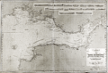 | Details | Robiquet, Aime | 1850 |
| Antique Chart of the Bristol Channel in England |
|
Robiquet, Aime |
|
| 1850 |
| LOC:0 |
| $350.00 | Robiquet--Aime | Antique-Chart-of-the-Bristol-Channel-in-England | Antique French hydrographic chart of southwest Wales and England surrounding the Bristol Channel. Coverage extends from Stackpole clockwise past Swansea, Barry, Cardiff, to Bristol, and moving south-westward to Portishead, Burnham, Bridgewater, Watchet, Minehead, Ilfracomb, Barnstaple, terminating at Kilkhampton. This is a privately published chart by Aime Robiquet, a French Hydrographer, but based on work by Denham and Robinson for an earlier British Admiralty chart. Inset at upper right contains numerous profile coastal views. Interesting small oval blindstamp by Robiquet at bottom right margin.
<br></br>
Numerous soundings, aids to navigation, compass course notations, current flows, and navigational hazards are noted.
<br></br>
This large nautical chart was published by Robiquet in the 'Atlas Hydrographique, one of 75 charts published in that atlas from in 1856. Rue Pavée Saint-André des Artes No. 2, Paris, France. Printed by Mangean, rue St Jacques. Price when issued was four francs. Number 9. |
| 732 | 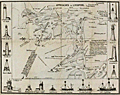 | Details | Holden, George | 1850 |
| Approaches to Liverpool 1850 |
|
Holden, George |
|
| 1850 |
| LOC:0 |
| $225.00 | Holden--George | Approaches-to-Liverpool-1850 | Scarce, well illustrated, and very 'nautical' chart of Liverpool Bay and the Mersey estuary with the entrance to the Mersey River. An unusual, information-dense navigational chart from 1850 of the Mersey Estuary packed with details on buoys, lights, channels, range markers, soundings and sailing directions. The chart is surrounded by enlarged profile views of lights, lightships, and range marks to aid in their identification. Working clockwise from top right these objects include: Bootle Marks, Rock Light, Leasowe Light, N.W. Formby, N.W. Lightship, Formby Lightship, Crosby Lightship, Bell Beacon, Hoylake lower and upper light, Bidston Light, New C. Mark, Crosby Light, Point of Ayre Light, and S.E. Mark.
<br></br>
Verso with a view attributed to B.C. Watts showing the arrangement of general communications signals about the lighthouses, made by hoisting flags, pendants, or balls to poles each with a specific purpose.
<br></br>
The above chart was issued with and folds into "Holden's Original Pocket Almanac and Tide Table, 1851" (3" x 5") included in the price. Along with tide tables, the Almanack includes information on distances to places on the river, life-boat stations, pilot-boats, widths of dock entrances and several dozen more types of information that would be useful to mariners or ship-owners.
<br></br>
In worn, blue paper covers, with intact and tight pages. The chart is loose but in good condition. Engraved and printed by J.B. Leatherbarrow, South John Street, Liverpool. Sold by Thomas Kaye, Castle-street. |
| 959 | 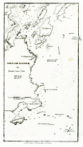 | Details | Blunt, E and G.W. | 1850 |
| Portland Harbor, Maine |
|
Blunt, E and G.W. |
|
| 1850 |
| LOC:3 |
| $75.00 | Blunt--E-and-G-W- | Portland-Harbor--Maine | Antique nautical chart of Portland Harbor, Maine from the Blunts in their 16th edition of the American Coast Pilot, published in 1850. Includes: the docks and wharves of Portland along the Fore River; Halfway River; Great Hog Island; Peaks Island; Bangs Island; Ram Island; Fort Preble; Portland Point Lighthouse; Richmond's Island; the Observatory; and Cape Elizabeth (with fixed revolving lights). Contains numerous depth soundings and fixes several offshore rocks and reefs including Bell Rock, Old Anthony, Alden's Rock, Taylor's Reef, Broad Cove Rock, and a set of rocks known as "Hue and Cry".
<br></br>
The American Coast Pilot with other harbor charts and sailing directions, was published by Edmund and George W. Blunt from New York. The Blunts were the most prolific private publisher of navigational charts in the United States at that time. 179 Water Street New York. |
| 1097 | 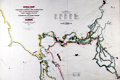 | Details | Ringgold, Cadwalader | 1851 |
| Antique U.S. Navy Chart of the Entrance to San Francisco Bay |
|
Ringgold, Cadwalader |
|
| 1851 |
| LOC:63 |
| $1,250.00 | Ringgold--Cadwalader | Antique-U-S--Navy-Chart-of-the-Entrance-to-San-Francisco-Bay | Cadwalader Ringgold's detailed, hand-colored chart of San Francisco Bay from 1851, extending up the Sacramento river at top right to Sacramento, Suttersville, and Boston, CA and to Stockton, Stanislaus City and San Joaquin at bottom right. Along Napa Creek Ringgold drew the plan of the small town of Vallejo which he refers to as "Capitol of the State". Other town plans include Suisun City, Martinez, New York, and Benicia. The map carries a dedication to William H. Aspinwall, Esq. of New York City, a merchant and ship owner.
<br ></br>
Published two years after the beginning of the 49'er gold rush, this most interesting lithographed chart is notable for the fine detail shown along California's rivers, which include names for a number of islands and regions which had never before appeared on commercial maps. The Webster or Russian Embarcadero is shown, as is Presidio, Washington, Indian Villages, Doaks Ferry, Martins, Table Hill, Petaluma Creek, Mount Diablo and many smaller islands, creeks, points and other features. Alcatraz island is labeled simply "Alcatraces".
<br ></br>
Ringgold (1802-1867) was a officer in the U.S. Navy who had served aboard the brig Porpoise with the U.S. Exploring Expedition during Wilkes' surveys of the area in 1841 . Ringgold was promoted to Commander in July, 1849 and began his groundbreaking survey of the San Francisco Bay region, suddenly important because of the discovery of gold in the area. The survey began in August 1849, with Ringgold commanding the chartered brig Col. Fremont. Of the sources used to compile the map Guthorn notes:
<div class="indenttextblock">"Ringgold's charts and sailing directions employed material extracted from the account by Fredrick William Beechy, the British explorer and naval officer whose narrative of the voyage to the Pacific and Behring Sea was published in 1831." (Guthorn, Peter. "U.S. Coastal Charts 1783-1861." Schiffer Publishing. 1984. p. 195)</div> |
| 6531 |  | Details | U.S. Coast and Geodetic Survey | 1851 |
| Rare engraved chart of Hell Gate and its approaches New York City |
|
U.S. Coast and Geodetic Survey |
|
| 1851 |
| LOC:68 |
| $1,550.00 | U-S--Coast-and-Geodetic-Survey | Rare-engraved-chart-of-Hell-Gate-and-its-approaches-New-York-City | Rolled, antique navigational and hydrographic chart of Hell Gate at the East River of New York City, 1851. Original and scarce. With sailing directions and numerous depth soundings. Copper-plate engraving with very fine detail. Not an electrotype copy. Triangulation by Edmund Blunt.
<br><br>
This chart encompasses what was previously a dangerous area to navigate. According to the NOAA website, during the 18th and early 19th century, strong currents and submerged rocks made Hell Gate <a target="_blank" style="color:#9BAFCB" href=" http://celebrating200years.noaa.gov/new_york_charts/hell_gate.html"> "a graveyard for ships"</a>. This chart shows Hell Gate in 1851, the year when the U.S. Army began blasting underwater rocks and obstructions to make the channel safe for marine traffic.
<br></br>
Visible plate mark with ink smudges outside the neatline confirm usage of the intaglio printing method from an engraved copper plate. A separately issued chart, not a marked as a 'survey' or 'preliminary' chart on thin paper issued in the annual reports to Congress. Contains the circular stamp of the U.S. Coast Survey Office. |
| 3619 |  | Details | U.S. Coast and Geodetic Survey | 1851 |
| Early U.S. Coast Survey Chart of Mare Island Vallejo California |
|
U.S. Coast and Geodetic Survey |
|
| 1851 |
| LOC:3 |
| $85.00 | U-S--Coast-and-Geodetic-Survey | Early-U-S--Coast-Survey-Chart-of-Mare-Island-Vallejo-California | Antique U.S. Coast Survey chart of the Mare Island Strait. Includes Mare Island and Vallejo, California. Topographic detail is rendered through elegant and informative hachuring. Scale 1 / 30,000. |
| 1007 |  | Details | U.S. Coast and Geodetic Survey | 1851 |
| Coast Survey Atlas (Sketches for the 1851 Annual Report) |
|
U.S. Coast and Geodetic Survey |
|
| 1851 |
| LOC:0 |
| $400.00 | U-S--Coast-and-Geodetic-Survey | Coast-Survey-Atlas-(Sketches-for-the-1851-Annual-Report) | About 57 nautical charts (many folded) in a single volume showing the hydrographic sketches and preliminary surveys of the U.S. East and West Coast. Bookplate: "With the compliments of A.D. Bache", Alexander Dallas Bache (1806-1867), then the superintendent of the United States Coast Survey.
<br></br>
Inserted, loose list of "Coast Survey Charts Published" dated within at March 15, 1853. Lists charts, sketches and preliminary charts, free sketches, and the names and residences for agents selling Coast Survey charts. Size: 9" x 22". On better paper. |
| 4921 |  | Details | Owen, David Dale | 1852 |
| Map Bad Lands Mauvaises Terres Nebraska |
|
Owen, David Dale |
|
| 1852 |
| LOC:13 |
| $350.00 | Owen--David-Dale | Map-Bad-Lands-Mauvaises-Terres--Nebraska | Map Showing the Position of the Bad Lands ( Badlands) or Mauvaises Terres of Nebraska.
<br></br>
After David Dale Owen's "Geological Map of Wisconsin, Iowa and Minnesota ... Constructed from observations by the United States Geological Corps ... 1851. Published by Lippincott, Grambo & Co., Philadelphia. |
| 382 |  | Details | Anonymous | 1853 |
| Lake Pontchartrain Harbour and Breakwater |
|
Anonymous |
|
| 1853 |
| LOC:10 |
| $225.00 | Anonymous | Lake-Pontchartrain-Harbour-and-Breakwater | Fascinating plan of the southern shore of Lake Ponchartrain in New Orleans, Louisiana from 1853. During that era both Bayou St. John and the New Canal (the present <a rel="nofollow" target="_blank" href="http://en.wikipedia.org/wiki/17th_Street_Canal">17th Street Canal</a>) were navigable to small vessels; a lighthouse is shown at the mouth of each canal. The plan shows projected construction of wooden breakwaters in the lake that were designed "to furnish safe anchorage in front of the termini of the Pontchartrain Railroad, Bayou St John, and New Canal…".<BR> </BR>
Other depicted features include Milneburg, then a suburb of New Orleans connected to it by the Pontchartrain Railroad, two lighthouses, and the Jefferson and Lake Pontchartrain Railroad in what is now Jefferson Parish. Construction details of the wooden breakwater are shown in profile and elevation. <BR> </BR>
Today neither of the two railroad lines linking New Orleans to the Lakefront exist. Neither Bayou St. John nor the 17th Street Canal (a large drainage ditch) are navigable. In fact a section of the 17th Street Canal failed after Hurricane Katrina and was responsible for flooding a large part of New Orleans and at least 31 deaths. The deadly breach in the canal can be located on the plan near the bottom of the shaded high land directly adjacent to the New Canal. <BR> </BR>
Dated October 30th, 1853. Printed by Wagner and Mc Guigan Lithographers, Philadelphia. For reference see: |
| 1447 |  | Details | Pittman, Philip | 1853 |
| Uncommon lithographed map of New Orleans |
|
Pittman, Philip |
|
| 1853 |
| LOC:3 |
| $285.00 | Pittman--Philip | Uncommon-lithographed-map-of-New-Orleans | Uncommon lithographed map ca. 1853 of New Orleans, Louisiana as it appeared in 1770, based upon the reconnaissance of Captain Philip Pittman, a British army engineer. This lithographed mid 19th-century map is the earliest easily obtainable copy of Pittman's 1770 engraved map.
<br></br>
Lithographed by Sarony & Major. Sarony and Major were well known New York lithographers 1846-1853.
<br></br>
Pittman's book was the first English book on the topography, settlements, and inhabitants of the region. In 1764, he traveled the Mississippi River to New Orleans with Major Arthur Loftus.
<br></br>
The map was first printed as an engraved plate in Pittman's "The Present State Of The European Settlements On The Mississippi; with A Geographical Description of that River Illustrated by Plans and Draughts" (J. Nourse, London 1770).
<br></br>
About the site of New Orleans Pittman wrote:
<div class="indenttextblock">
NEW ORLEANS stands on the east side of the river, it has a very easy communication with the northern parts of Louisiana (now West Florida) by means of the Bayou of St. John, a little creek, which is navigable for small vessels drawing less than six feet water, six miles up from the lake Ponchartain, where there is a landing-place, at which the vessels load and un load ; and this is about two miles from the city.
</div>
Pittman described the area around Jackson Square, and St. Louis Cathedral, perhaps New Orleans best-known locations (café du Monde, street artists, carriage rides):
<div class="indenttextblock">
The parade is a large square, in the middle of that part of the town which fronts the river ; in the back part of the square is the church dedicated to St. Louis, a very poor building, framed with wood ; it is in so ruinous a condition that divine service has not been performed in it since the year 1766, one of the king's store houses being at present used for that purpose.
</div> |
| 664 |  | Details | U.S. Coast and Geodetic Survey | 1853 |
| City of San Francisco, California |
|
U.S. Coast and Geodetic Survey |
|
| 1853 |
| LOC:63 |
| $1,400.00 | U-S--Coast-and-Geodetic-Survey | City-of-San-Francisco--California | Antique electrotype engraved plan of the booming town of San Francisco, California made in 1853 during the California gold rush. On a 25" x 33" sheet of heavy paper, never folded. Key named features include: Tonquin Shoal, Wreck of the Tonquin, Blossom Rock, Mission Rock, Point San Quentin, Mission de Dolores, Rincon Point, Mission Bay, Steamboat Point, Cunningham's Wharf, Law's Wharf, Broadway Wharf, Pacific Wharf, and Portsmouth Square.
<br></br>
The town is shown laid out into blocks with individual buildings. Numerous steets are identified including Market Street, Pine Street, Lombard Street and Broad Way. Includes numerous soundings and countour lines.
<br><br/>
This antique chart should not be confused with those similar copies that were issued with dozens of others as part of a Report to Congress, most on thin paper with folds that often show condition issues. This original mid 19th century survivor is a large, separately issued example on thick wove paper that has been stored either rolled of flat with no folds. Price 50 Cents. Verified I.I. Stevens . Outlines and Topography engraved by Max. F.O. Strobel; Lettering by E.F. Woodward. With the circular logo of the Coast Survey Depot. Number 627. |
| 797 |  | Details | Robiquet, Aime | 1854 |
| Antique chart of Table Bay, False Bay and Cape Town, South Africa |
|
Robiquet, Aime |
|
| 1854 |
| LOC:0 |
| $1,250.00 | Robiquet--Aime | Antique-chart-of-Table-Bay--False-Bay-and-Cape-Town--South-Africa | Very special antique nautical chart of the southern-most portion of the African continent and southern Madagascar below 23 degrees south latitude. Carries Robiquet's blindstamp at bottom and also a blue over-stamp of the seller: Antoine Roux Fils of Marseilles, France. The Roux family had a long history as chart-makers, chart-sellers and nautical artists in Marseilles extending well over 100 years.
<br></br>
This large, French, steel-plate navigational chart of South Africa includes Angra Pequena, Saint Helena Bay, Cape Town ("Captown"), the Cape of Good Hope ("Cap du Bonne Esperance") , Cape Infanta, Cape St. Francis, Cape St. Lucia, and Cape Correntes, Mozambique and a large portion of the southern Indian Ocean.
<br></br>
Includes inset plans of False Bay and Table Bay; Port Natal; Delagoa Bay; Cape Agulhas ("Cap de Aguilles"); and Dyer Island and Point Danger.
<br></br>
This large nautical chart was published privately by hydrographer Aime Robiquet in the 'Atlas Hydrographique', one of 75 charts published in that atlas in 1856. Rue Pavée Saint-André des Artes No. 2, Paris, France. Printed by Louis Antoine, Rue de Noyers, 70. Price when issued was four francs. Number 44.
<br></br> |
| 5448 |  | Details | U.S. Coast and Geodetic Survey | 1854 |
| Antique chart of Pass Fourchon Lafourche Parish Louisiana |
|
U.S. Coast and Geodetic Survey |
|
| 1854 |
| LOC:78 |
| $200.00 | U-S--Coast-and-Geodetic-Survey | Antique-chart-of-Pass-Fourchon-Lafourche-Parish-Louisiana | Antique lithographed chart of Pass Fourchon, Louisiana, at the mouth of Bayou Lafourche [1] where it entered the Gulf of Mexico in 1854. Shows Bird Island at bottom left and Lake Champagne to the right, today after erosion, no longer inland- called Bay Champagne. The pass shown on the chart no longer exists, it is closed and maritime traffic utilizes Belle Pass which lies to the west of the Pass Fourchon. The old Pass Fourchon channel is used to access Port Fourchon.
<br></br>
Port Fourchon is located about 60 miles SSW of New Orleans, Louisiana. The port is the marine support base for more than 90% of the Gulf of Mexico's deep-water oil production.
<br></br>
Drawn by F.W. Gerdes. Engineered by Bartle and Bradley. Lithographed by Bien and Sterner, New York.
<br></br>
[1] In 1854 Bayou Lafourche was an active distributary of the Mississippi River. Bayou Lafourche has not been navigable from the Mississippi River since 1905 when a dam was built at Donaldsonville, La. but prior to that time the portion of the Bayou north of the ICWW served as an important commercial artery to New Orleans and other points on the Mississippi River.
<br></br>
<div>
<img src="/ZoomifyImages/SC_993/SC_993_400x300.jpg" alt="" width="300" align="bottom" style="margin: 0px 10px 10px 0"/>
<span style="vertical-align: middle;">
<br>
<a href="https://www.rarecharts.com/ShowDetail/Creator/Anonymous/Title/Steamboat-Bill-of-Lading-for-Valence-Plantation/993" target="_blank">Steamboat Bill of Lading for Valence Plantation on Bayou Lafourche</a>
</span>
</div> |
| 2565 |  | Details | U.S. Coast and Geodetic Survey | 1855 |
| Preliminary Chart of Florida Reefs from Key Biscayne |
|
U.S. Coast and Geodetic Survey |
|
| 1855 |
| LOC:200 |
| $475.00 | U-S--Coast-and-Geodetic-Survey | Preliminary-Chart-of-Florida-Reefs-from-Key-Biscayne | Fine antique hydrographic survey chart of <b>Biscayne Bay</b>, Florida and surrounding area. Hundreds, perhaps thousands of depth soundings.
<br></br>
Miami, Florida is distinctly noted at the very top while a lighthouse is noted at the southern tip of Cape Florida. Other named features include: Old Rhodes Bank, Caesars Creek Bank, Elliott's Key, Triumph Reef, and Virginia Key.
<br></br>
Recommended reference for <b>treasure hunters</b>. Shows some locations of wrecks, dangerous reefs and banks.
<br></br>
Includes a list of abbreviations used to denote the sea floor composition (ex: S for Sand , C for clay).
<br></br>
A preliminary reduced-format hydrographic survey chart from a U.S. Coast Survey atlas with the U.S.C.G.S. circular winged logo. On thin paper with folds as issued. |
| 1090 | 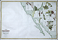 | Details | Robiquet, Aime | 1856 |
| Antique French chart of the California coast and Baja Peninsula |
|
Robiquet, Aime |
|
| 1856 |
| LOC:63 |
| $1,900.00 | Robiquet--Aime | Antique-French-chart-of-the-California-coast-and-Baja-Peninsula | Large engraved chart of the California coast south to Mazatlan, Mexico: "Carte des Côtes de Californie de Mazatlan à San Francisco d'après les derniers Travaux Amércains Par Robiquet, Hydrographe Rue Pavée Saint Andre No.2. Paris 1856". This large chart is particularly interesting for its collection of numerous inset plans of North American West Coast ports and bays during the late <b>Gold Rush era</b>.
<br></br>
Coverage includes the <b>Baja Peninsula</b> or "Vieille Californie" with Cabo San Lucas ("Cap St. Lucas") at the end. Contains inset plans of the bays and ports at Guaymas, Ballena, St. Bartholomé, Pulpito, San Quentin, San Diego, San Pedro, Monterey, San Francisco, and Bodega Bay.
<br></br>
Scarce and detailed map of California's coastline, with much detail for navigation and a few inland landmarks. Printed in Paris by French hydrograper and publisher Louis Antoine Robiquet. Presumably from Robiquet's "Atlas Hydrographique" of 1856, but this printing with separate price (4 francs) and publisher's blindstamp in bottom right margin.
<br></br>
Inset plans include: (1): Baie Bodega Levé en 1839 par Ed. Belcher. (2): Plan de la Baie de Monterey Levé en 1837 par Mr. De Tessan, Ingr. Geographe. (3): Entrée du Port de San Francisco par Cadwalader Ringgold. (4): San Pedro par James Alden 1852. (5): Entrée de San Diego par R.D. Cutts et G. Davidson. (6): Port San Quentin Levé in 1839 par Ed. Belcher. (7): Port St. Bartholomé Levé par le Cape. H. Kellet en 1847. (8): Mouillage Pulpito par le Cape. H. Kellet. (9): Port Balleno par le Cape. H. Kellet. (10): Guaymas Levé par Mr. Fisquet en 1840.
<br></br>
No. 61. Paris - Imp. Louis |
| 784 | 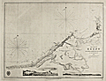 | Details | Smyth, William Henry | 1857 |
| The Coast of Egypt from Alamaid to the Rosetta Branch of the Nile |
|
Smyth, William Henry |
|
| 1857 |
| LOC:0 |
| $550.00 | Smyth--William-Henry | The-Coast-of-Egypt-from-Alamaid-to-the-Rosetta-Branch-of-the-Nile | Fascinating antique nautical chart of the Egyptian coast including Alexandria (Iskanderiah), Egypt, with its old port, and Aboukir Bay, the site of Admiral Horatio Nelson's decisive victory over the French fleet of Napoleon Bonaparte at the Battle of the Nile (Fr. Bataille d'Aboukir). At extreme right of the chart is one of the tributaries of the Nile River with the town of Rosetta ( Raschid ) and to the Northeast Fort Raschid now renamed Fort Julien. Fort Raschid is perhaps best known as the location where the stele known as the "Rosetta Stone" was discovered during a reconstruction in 1799.
<br></br>
This chart is a 1857 copperplate engraved edition of a nautical chart originally published in 1822 by W.H. Smyth of the British Royal Navy. This fine chart was made based on work conducted aboard the ship Adventure in 1821 as part of Smyth's survey of the North coast of Africa from the Strait of Gibraltar to the mouth of the Nile River.
<br></br>
With two inset coastal profiles: "Abukeer Castle from the Eastward", a pretty view of a felucca under full sail passing offshore Aboukir Castle (Taposiris Parva) and "Arab's Tower S.E. 10 miles".
<br></br>
With the oval logo of the British Hydrographical Office. Price when issued was 2 shillings. Number 242.
<br></br> |
| 949 | 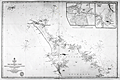 | Details | British Admiralty Hydrographical Office | 1857 |
| Antique Chart of the Northern Coast of New Zealand from Hokianga to Tutukaka |
|
British Admiralty Hydrographical Office |
|
| 1857 |
| LOC:59 |
| $1,500.00 | British-Admiralty-Hydrographical-Office | Antique-Chart-of-the-Northern-Coast-of-New-Zealand-from-Hokianga-to-Tutukaka | Scarce antique hydrographic chart of the northern coastline of <b>New Zealand</b> from the Hokianga Harbour to Tutukaka, in the province of Auckland. Among the earliest available artifacts from the first full hydrographic survey of New Zealand during 1849-1855. At upper left corner are the uninhabited Three-Kings Islands about 35 miles northwest of Cape Reinga, the northernmost point of New Zealand's North Island. With large insets of Parenga Renga Harbour and Ohora River and Bay.
<br></br>
Based on surveys of <b>Captain J. L. Stokes</b> and Commander R. Drury of the HMS Acheron and the Pandora respectively. Among his many accomplishments, Stokes served as assistant surveyor aboard the <b>HMS Beagle</b> during its well-known voyage around the world with Charles Darwin in 1833-36. Hooker's brief biography of Stokes includes a portrait and this entry:
<div class="indenttextblock"> "Stokes, John Lort (1812-86) - Royal Navy officer and hydrographer, was chosen by Beaufort, the British Hydrographer for the 'Great New Zealand Survey.' Stokes had joined the navy as a ‘volunteer first class’ in 1824 and by 1843, he was an experienced surveyor with the rank of commander. In 1846, he was promoted to captain and in the following year was given command of HMS Acheron. Between 1848 and 1855, Stokes surveyed extensively in New Zealand waters. With Drury’s surveys they were the most complete investigations carried out to that time. Over forty-five New Zealand charts were published in the years following Stokes’ and Drury’s surveys. Some of Stokes' data were also incorporated in maps published by Arrowsmith." (Hooker, Brian. Dictionary of New Zealand Map-Makers.<a href="http://zeehaen.tripod.com/dictionary_map_m/dictionary_part_c_bh.htm " target="_blank">Internet</a>)</div>
</br>
Contains a seller's circular black ink overstamp from "Reading and Wellbank, Chart and Nautical Booksellers, 366 George Street." Number 2525. |
| 346 | 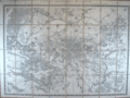 | Details | Depot General de la Guerre | 1857 |
| Environs de Paris. |
|
Depot General de la Guerre |
|
| 1857 |
| LOC:0 |
| $220.00 | Depot-General-de-la-Guerre | Environs-de-Paris- | Antique folding map of Paris, France and its environs by the French war department originally published in 1839. This revised edition from 1857 has an emphasis on the Seine river and includes Versailles. Backed with coarse brown linen, the map is divided into eight horizontal sections and 4 vertical sections and folds to a compact 6" x 8 3/4".<BR> </BR>
The antique map is annotated at bottom with a circular, blue seller's stamp from "E. Andriveau-Goujon - Geographe" and an oval blind-stamp by the "Depot de la Guerre". Scale 1:40,000. When folded the front cover contains a decorative black and white sticker from E. Andriveau-Goujon Geographe, editeur, Rue du Bac 21, Paris . The sticker details the many specialties of his shop including: globes, spheres, Atlas de Choix, and cartes de parties du monde. |
| 4934 |  | Details | Britton and Rey | 1858 |
| Map of the City of San Francisco |
|
Britton and Rey |
|
| 1858 |
| LOC:0 |
| $2,200.00 | Britton-and-Rey | Map-of-the-City-of-San-Francisco | Fine lithographed map of San Francisco, California with red overprinted circles at 1/4 mile intervals bound into the annual report described below. Stated by another dealer as "rare" and "one of the earliest maps of San Francisco published in the city."
<br/><br/>
Only 2 sales of these rare antebellum Britton & Rey lithographed maps are recorded in AMPR, only one previous sale of the red-overprinted edition. 2nd. ed. Originally issued in 1846, but not dated within; comparison to the first edition shows no differences except for red over-printing. Neither sale included the bound report. Britton & Rey were located on Montgomery Street at the corner with Commercial Street between 1854 and 1858 (Peters, California on Stone, p. 162).
<br/><br/>
Frontispiece shows a plan, "Diagram of the Chamber of the Board of Supervisors, 1863. H.P. Coon, President
<br/><br/>
The gilt-edged report into which the map is bound: " San Francisco Municipal Reports for the Fiscal Year 1862-'63" published at the orders of the Board of Supervisors. San Francisco: Printed at Charles F. Robbins & Company. No 417 Clay Street, between Sansome and Battery. 1863. Contains reports from City Auditors, City Surveyor and other department heads and city officials. 6" W x 9" H. Binding tight. Original covers with binders identification inside the front cover at top left: Bartling & Kimball, Binders, 505 Clay Street, San Francisco.
<br/><br/>
Spine (poor with 1" missing) reads: Municipal Reports, San Francisco 1862-663. Cover (good) reads: "Presented by the City of San Francisco." |
| 803 | 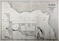 | Details | Robiquet, Aime | 1858 |
| Coast of West Africa |
|
Robiquet, Aime |
|
| 1858 |
| LOC:0 |
| $400.00 | Robiquet--Aime | Coast-of-West-Africa | Large antique steel plate engraved nautical chart of the West coast of Africa from Cape Verga south and west to Cape Ledo. Includes the small offshore islands of Fernando Po, São Tomé , and Principe or "Isle du Prince". Streches of coastline are named after the primary resource exported from the area and include the Gold Coast or "Côte d'Or"; the Ivory Coast or "Côte d'Ivoire"; and the "Côte de Calebar".
<br></br>
At bottom right seven detailed inset harbor plans include: Edina et Grand Bassa, Monrovia et Cape Mesurado, Plan de la Entrée de Sierra Leone, Baie de l'Ouest, Entrée de Vieux Calebar, Cap des Palmes, and Plan du Bassin Exterieur du Gabon. Contains numerous soundings and arrows indicating the primary direction of the current. Relative current strength is indicated by the number of feathers drawn on each arrow.
<br></br>
This antique chart was separately published by French hydrographer and publisher Aime Robiquet. Robiquet is best known as publisher of the "Atlas Hydrographique", a nautical atlas comprised of 75 large charts published from Paris between 1856 and 1861. This chart carries the imprint of Robiquet's oval-shaped blindstamp at the bottom right margin. Number 36. |
| 4847 |  | Details | Vigouroux and Caillat | 1858 |
| Algiers, Algeria City Renewal Proposal 1858 |
|
Vigouroux and Caillat |
|
| 1858 |
| LOC:62 |
| $1,150.00 | Vigouroux-and-Caillat | Algiers--Algeria-City-Renewal-Proposal-1858 | Rock the Casbah!
<br></br>
Rare lithographed map of a proposed renovation and expansion project for Algiers in 1858. By Vigououx, surveyor and Caillat of France's Ponts and Chaussees (Bridges and Roads). At bottom left, the map is dedicated in manuscript ink, signed by the author (Caillat) to Colonel Marengo, then the Mayor of the commune of Douéra. Just a few years previously Marengo had been Commander of the Citadel of Algiers or the Casbah, and apparently still retained some influence. The citadelle or Casbah is shown marked near bottom right, but in a broader sense the Casbah was
<div class="indenttextblock">
"the ancient core of Algiers, the triangular-shaped town carved into the hills facing the Mediterranean … the sea forms the base of the triangle; a citadel is at the triangle's summit. (Celik, Zeeynep. Algiers under French Rule in "Urban Forms and Colonial Confrontations. University of California Press. 1997.) </div>
<br></br>
Shows the "rivage actuel" or the existing shoreline with the new construction that would occur to complete the project in those areas.
<br></br>
Background: the French invaded Algeria in 1830. In 1834, Algeria became a French military colony and was subsequently declared by the constitution of 1848 to be an integral part of France and divided into three departments: Alger, Oran and Constantine. |
| 2564 |  | Details | Anonymous | 1858 |
| Map of the Florida Peninsula |
|
Anonymous |
|
| 1858 |
| LOC:87 |
| $180.00 | Anonymous | Map-of-the-Florida-Peninsula | Very attractive antique map of the Florida Peninsula from 1858. Shows status of surveys below the 2nd basis parallel conducted to that date. |
| 57 |  | Details | Vincedon-Dumoulin | 1858 |
| Carte de la Cote Orientale de la Nouvelle Hollande |
|
Vincedon-Dumoulin |
|
| 1858 |
| LOC:59 |
| $1,100.00 | Vincedon-Dumoulin | Carte-de-la-Cote-Orientale-de-la-Nouvelle-Hollande | Fine engraved lines define geographic boundaries in this copperplate engraved antique French navigational chart of Eastern Australia, the Great Barrier Reef, the Coral Sea, New Caledonia, and North New Zealand. Based on the voyages of French explorer Dumont D'urville in the 1820's and 1830's . <BR> </BR>
Contains the circular anchor stamp of the Depot General de la Marine. With a black over-stamp for Cartes de la Marine Impériale. Debrie Libraire au Harve, Seul Depositaire. Price: two Francs. Plate 1. Edition of 1858. |
| 6738 |  | Details | Soule, George | 1859 |
| Very Rare Antebellum New Orleans advertisement Soule Commercial College |
|
Soule, George |
|
| 1859 |
| LOC:150 |
| $6,500.00 | Soule--George | Very-Rare-Antebellum-New-Orleans-advertisement-Soule-Commercial-College | Very rare New Orleans imprint antebellum broadsheet advertisement or "Balance Sheet Circular" produced by George Soule to advertise Soule's Commercial College, established 1856 at the corner of Camp Street and Common Street, in New Orleans, Louisiana. A finely detailed lithograph featuring exquisite calligraphy, numerous inset views of commercial activities, and four example financial statements, including at bottom right, "Statement of Steamer Eclipse Trip No. 8 T.R. Winn Master."
<br><br>
An online search found only one copy of Soule's "Balance Sheet Circular", at the Historic New Orleans Collection.
<br><br>
<div id="6738" align="center">
<a title=""></a>
<img id="6738" src="/ZoomifyImages/SC_6738/SC_6738_400x300.jpg" alt=" Antebellum advertisement for Soule's Commercial College, established 1856 in New Orleans, LA." width="340"/> <br><br> <font size="-2">Soule's Commercial College Balance Sheet Circular</font>
</div><br>
Lithographed by J. Manouvrier. (2) This fine lithograph with beautiful calligraphy was printed in New Orleans in 1859, just after Soule opened the College at Camp and Common Streets. Between 1856 and 1860 Soule's Commercial College graduated a total of more than 275 students. By 1905 the school could boast 1000 students enrolled, 20 teachers, and over 19,000 former students. The school operated in New Orleans continuously, except for a few years during the Civil War, until 1983 when it finally closed.
<br><br>
<div id="6738_2" align="center">
<a title=""></a>
<img id="6738_2" src="/ZoomifyImages/SC_6738/SC_6738_Detail_2.jpg" alt=" Antebellum advertisement for Soule's Commercial College, a view of Jackson Square." width="340"/> <br><br> <font size="-2">Early View of Jackson Square, New Orleans</font>
</div> |
| 4909 |  | Details | Anonymous | 1859 |
| Antique manuscript plat Queens, New York deBevoise |
|
Anonymous |
|
| 1859 |
| LOC:200 |
| $500.00 | Anonymous | Antique-manuscript-plat-Queens--New-York-deBevoise | One of a kind manuscript map ca. 1859 of a plat of land in the city of Newtown, borough of Queens, New York. Newtown was founded as Middenburgh by the Dutch in 1652. In the 17th century Dutch colony of New Netherland, Newtown was a suburb of New Amsterdam, and was renamed "Elmhurst" in 1897.
<br></br>
Shows a tract of woodlands, owned by farmer Abraham de Bevoise. Contains surveyors' field notes including the metes and bounds [1] of the plat relating it to land owned by Theodorus Kolyer (d. 1854). A fine, piece with a simple, pastoral view of the woodlands owned by de Bevoise, totaling two acres and 4 perches. A perch is a unit of area equal to 1/160 of an acre.
<br /> <br />
Abraham de Bevoise (1819 - 1887) was a farmer originally of French Huguenot ancestors.
<br /> <br />
<div class="indenttextblocksingle">
[1] The term "metes" refers to a boundary defined by the measurement of each straight run, specified by a distance between the terminal points, and an orientation or direction. A direction may be a simple compass bearing, or a precise orientation determined by accurate survey methods. The term "bounds" refers to a more general boundary description, such as along a certain watercourse, a stone wall, an adjoining public road way, or an existing building. (Online Source: https://definitions.uslegal.com/m/metes-and-bounds/)
</div> |
| 1099 | 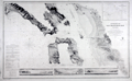 | Details | U.S. Coast and Geodetic Survey | 1859 |
| Entrance to San Francisco Bay California 1859 |
|
U.S. Coast and Geodetic Survey |
|
| 1859 |
| LOC:0 |
| $2,500.00 | U-S--Coast-and-Geodetic-Survey | Entrance-to-San-Francisco-Bay-California-1859 | Superb, large, antique U.S. Coast Survey chart of <b>San Francisco Bay</b>, the city of San Francisco, California, and lower Marin County, California on heavy paper with no folds. Laid down nicely to board. Produced just 10 years after the beginning of the California Gold Rush it shows numerous soundings and aids to navigation including Fort Point Light, Point Bonita Light, Yerba Buena Light, and Alcatraz Light.
<BR> </BR>
Coverage includes San Francisco and Sausalito and the surrounding areas and is the original 1859 electrotype edition not a later corrected version. Like later editions, the bottom of the chart contains two views of the bay- both inbound and outbound the port showing both steam and sail-powered vessels underway and at anchor. This 1859 edition contains a third engraved view not found in later editions- <b>"View of the Entrance to San Pablo Bay from near Angel Island"</b>. In later editions that view was removed to make room for notes and tables.
<BR> </BR>
Named points of interest include the Presidio, Oakland, Cliff House, Ocean House, Sausalito, Alcatraz Island, Mission Bay, San Leandro, Yerba Buena Island, Mission de Delores, Table Mountain, Brooklyn, Alameda, and of course the Golden Gate (with no bridge).
<BR> </BR>
This chart was printed in 1859 from an electrotype copy of the original hand-engraved copper plate, a process the U.S. Coast Survey adopted around 1850. As a soft medium, copper plates could only withstand print runs of perhaps 200 copies before the plates wore down. To enable larger print runs, a mold of the original plate was created in wax or another soft medium. Then, using an electro-chemical processs ( electrotyping ), the mold was coated with a metal layer, typically copper. Printers were then able to produce output from the new electrotype copper copy, while preserving the original. Electrotype copy no. 2. With the circular stamp of the U.S. Coast Survey. |
| 3668 | 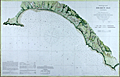 | Details | U.S. Coast and Geodetic Survey | 1860 |
| Fine antique chart of Drake's Bay, California |
|
U.S. Coast and Geodetic Survey |
|
| 1860 |
| LOC:63 |
| $650.00 | U-S--Coast-and-Geodetic-Survey | Fine-antique-chart-of-Drake-s--Bay--California | Very attractive scarce antique engraved chart of Drake's Bay, California on the Pacific Ocean just northwest of San Francisco. Coverage extends southward as far as Duxbury Reef. Includes sailing directions, notes on dangers, soundings and abbreviations, and tide table.
<br><br/>
A surviving survey file copy from the U.S. Geological Survey Library. With an oval faded ink stamp from that agency. Map number in MS at bottom corners as typical for surveyor's file copies.
<br><br/>
Now a part of Point Reyes National Seashore, the area covered by this old chart includes detailed topographical information and is generally devoid of named features. "Breakers" are noted in numerous areas all along the beaches. Numerous depth soundings.
<br><br/>
This antique chart should not be confused with those similar copies that were issued with dozens of others as part of a Report to Congress, most on thin paper with folds that often show condition issues. This original mid 19th century survivor is a large, separately issued example on crisp, strong paper that has been stored rolled with a NO FOLDS. Price 20 cents. NO logo of the Coast Survey Office. Number 629. |
| 4890 | 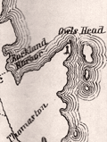 | Details | Prince, George | 1860 |
| Antique Map Georges River Adjacent Islands Explored Waymouth 1860 |
|
Prince, George |
|
| 1860 |
| LOC:0 |
| $500.00 | Prince--George | Antique-Map-Georges-River-Adjacent-Islands-Explored-Waymouth-1860 | A scarce lithographed map and booklet of Maine documenting a carto-analytic discovery by George Prince. Based on the exploration by English explorer George Waymouth (1585-1612) in 1605. Published from Bath, Maine.
<br></br>
Map by George Prince based on Rosier, locally available printed maps and one manuscript map he saw. Prince knew the area well: "Having been since my earliest childhood been acquainted with the Georges River, its entrance and all the islands." Upsetting common beliefs of the time, Rosier was able to determine that Waymouth had explored the Georges River, not the Kennebec or Penobscot rivers as many believed.
<br></br>
Rosier's narrative reminds us that our near ancestors were to say the least, "not PC". Rosier describes the capture of 3 Native Americans for transport back to England with their canoas (canoes) as a "matter of great importance."
<div class="indenttextblocksingle">
It was as much as five or sixe of us could do to get them into the light horseman [their boat]. For they were strong and so naked as our best hold was by their long haire on their heads; and <b>we would have beene very loath to do them any hurt, which of necessity we had beene constrained to have done if we had attempted them in a multitude, which we must and would, rather than to have wanted them, being a matter of great importance for the full accomplement of our voyage.</b>"
</div>
<br></br>
Booklet: With remarks by George Prince and "Rosier's Narrative of Waymouth's Voyage to the Coast of Maine in 1605" by James Rosier, chronicler of Waymouth's .
<br></br>
Scarce. Title page. Bookplate for William H. Hahn (Friendship, Maine) and MS signature (not Hahn) inside title page. 45 pages text. 1 folding map. Bath, Maine: Eastern Times Press. 1860. Reprinted from Collections of the Massachusetts Historical Society, 1843, 3d series, v. 8. |
| 4918 | 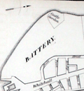 | Details | Corporation of the City of New-York | 1860 |
| Antebellum Plans for all New York City-owned Real Estate |
|
Corporation of the City of New-York |
|
| 1860 |
| LOC:2001 |
| $2,000.00 | Corporation-of-the-City-of-New-York | Antebellum-Plans-for-all-New-York-City-owned-Real-Estate | Quarto volume with 12 tabular lists and 12 engraved maps of all 281 parcels of real estate owned by the Corporation of the City of New York. Part of a report issued by New York City Comptroller Robert T. Haws in 1860. No holdings in World Cat; no sales recorded in AMPR.
<br></br>
Nearly one hundred years ago, in 1920, Anderson Galleries of Park Avenue, New York noted the scarcity of this volume:
</ br>
<div class="indenttextblock">
"No records of this exceedingly important volume. The lists are of every piece of land and every building owned by the city, to a total of 281. The maps are 12 very large and fine folding engraved plates showing the location, size, and frontage of every Park, Police property, Market, Fire Department building, School, Court building, Hospital;, Prison, Correctional institution, Island, Common land and Leased Property, and every other piece of real estate belonging to the corporation. Probably no other similar historical and topographical record is in existence. No doubt the volume was issued in a very small number of copies for a very few officials, and has thus never come to the attention of those interested in the past records of the city."</div>
<br />
Plates are all dated within to January 1, 1860. Maps by George F. Nesbitt and Company. Stationers & Printers. 165, 167, 169 171, Pearl Street cor. of Pine.
<div class="indenttextblocksingle">
<ul style="list-style-type: circle;">
<li>No. 1 LOTS subject to leases 18"Wx15"H</li>
<li>No. 2 COMMON LANDS</li>
<li>No. 3 COMMON LANDS</li>
<li>No. 4 SUNDRY LOTS</li>
<li>No. 5 IN USE BY ALMS HOUSE DEPARTMENT</li>
<li> No. 6 In use by BOARD OF EDUCATION</li>
<li>No. 7 In use by BOARD OF EDUCATION</li>
<li>No 8. In use by FIRE DEPARTMENT</li>
<li>No 9. In use by FIRE DEPARTMENT</li>
<li>No 10. In use for MARKETS</li>
<li>No 11 In use by POLICE DEPARTMENT</li>
<li>No 12. In use as SQUARES AND PARKS</li>
</ul>
</div> |
| 682 |  | Details | U.S. Coast and Geodetic Survey | 1860 |
| Albemarle Sound North Carolina |
|
U.S. Coast and Geodetic Survey |
|
| 1860 |
| LOC:52 |
| $675.00 | U-S--Coast-and-Geodetic-Survey | Albemarle-Sound-North-Carolina | Original, antique rolled U.S. Coast Survey chart of the Western portion of Albemarle Sound published in 1860. Produced under the supervision of A.D. Bache, Superintendent of the Survey of the Coast of the United States. Within a mile or so of the riverine margins each building, field, and plot of land are drawn in fine detail. With sailing directions and an explanation of navigation using the ranges. Based on triangulation and hydrography executed between 1847 - 1849.
<br></br>
Coverage of this fine antique chart include the towns of Plymouth, Edenton, Columbia, Hertford, Nixonton, and Elizabeth City, North Carolina; the Cashai (Cashie) River; Pocosson Swamp; Roanoke River; Chowan River; Bull Bay; Scuppernong River; Perquamons (Perquimans) River; Bear Garden Point; Little River; Redbank Land; and Truebloods Point.
<br></br>
This antique navigation chart should not be confused with those similar copies issued as part of a Report to Congress, most on thin paper with folds that often show condition issues. This original mid 19th century survivor is a large, separately issued example on thick paper that has been stored either rolled of flat with no folds.
<br></br>
Numerous soundings, lighthouses, and other aids to navigation are noted. With the logo of the Coast Survey Office. Price $1.50 when issued. |
| 4948 |  | Details | City of Elizabeth, New Jersey | 1860 |
| Broadside for Rising Sun Property Elizabethport, NJ. |
|
City of Elizabeth, New Jersey |
|
| 1860 |
| LOC:53 |
| $800.00 | City-of-Elizabeth--New-Jersey | Broadside-for-Rising-Sun-Property-Elizabethport--NJ- | Rare lithographed broadside for a Sheriff's sale of the Rising Sun Property, consisting of 1000 lots in Elizabethport, New Jersey along the Elizabeth River (13 miles SW of Lower Manhattan). The land for sale is apparently the Rising Sun Farm, one of Thomas Gibbon's extensive land holdings in New Jersey. Gibbon's was an early employer and partner with Cornelius Vanderbilt.
<br></br>
Quite a bit of land to the north of the Rising Sun tract is associated with Captain J.S. Spencer. Captain John Smythe Spencer (1745-1826), son of Colonel Thomas Spencer, was a British Army officer who lived in Elizabeth, New Jersey at an estate aptly named "Edgemoor". Spencer married Julia Radcliffe who produced two children: John Cotton Smith Spencer and Maria Spencer.
<br></br>
Two sailing vessels are shown plying the waters of Elizabethtown Creek; significant in that neither ship shows any evidence of steam power.
<br></br>
Streets named include: Atlantic, Baltic, Caspian, Delaware, Erie , Florida, Geneva ,Second, Butler, Smith, First, and Water Street. Avenues named include: Fourth, Third , Second, First, and Elizabeth Avenue.
<br></br>
Noted points of interest include: Old Point Road, Elizabethtown Creek, J. C. Fairbank & Company Rope Walk, Staten Island Sound, Whitmore & Jones Wheel Factory, Eagle Hotel, Price's Creek, Elizabethport & New York Ferry Dock, Voorhees and Bacon's Coal Yard, and the C. H. Waterbury Oil Manufactory.
<br></br>
Lithographed by William Faust, 59 Fulton Street, New York. An 1860 entry for Faust in Trow's New York City Directory lists his address as 59 Fulton Street. Stamped by James S. Vosseller. Purchased from a lot of similar Voseller surveys and sales broadsides dated 1857 - 1874.
<br></br>
The City of Elizabeth, N.J. was created in March, 1855 combining and replacing both Elizabeth Township and Elizabeth Borough. With the creation of the City of Elizabeth, Elizabeth Township was dissolved. |
| 6435 |  | Details | Weiss, Jacob | 1861 |
| Map of Charleston Harbor |
|
Weiss, Jacob |
|
| 1861 |
| LOC:10 |
| $2,150.00 | Weiss--Jacob | Map-of-Charleston-Harbor | Unrecorded edition of "Map of Charleston Harbor [South Carolina] showing the location of forts ..." printed by Jacob Weiss at 600 Chestnut Street, Philadelphia in 1861. Inset elevation or perspective view of Charleston at top.
<br><br>
My interpretation of the map suggests Weiss printed the map between December 27, 1860, when the Union surrendered Shutes Folly/Castle Pinckney to the S.C. militia but before April 12, 1861 when the Confederacy began bombardment of Union forces at Fort Sumter. During this period the public had an intense interest in the building conflict.
<br><br>
Shows the main channel from the Atlantic Ocean to Charleston docks. Circles represent the range of cannon fire from forts and batteries in vicinity of Charleston Harbor, Charleston, South Carolina. Key features include:
<div class="indenttextblocksingle">
<ul style="list-style-type: circle;"></li>
<li>Shutes Folly Island with Castle Pinckney</li>
<li>Rebellion Road [2]</li>
<li>US Arsenal</li>
<li>Customs House</li>
<li>Mount Pleasant</li>
<li>Sullivan's Island</li>
<li>Drunken Dick Breakers</li>
<li>Fort Johnson and Fort Sumter</li>
</ul>
</div>
WorldCat shows only two similar institutional holdings - Hagley Museum & Library, and University of Michigan Clements Library. This edition is similar to the edition at the U. Michigan Clements Library but lacks the price, and the Clements copy lacks both the decorative border, and the "Perspective View of the Harbor and City of Charleston" at top.
<br><br> |
| 836 |  | Details | Purdy, Isaac | 1861 |
| Blueback sea chart of the Azores |
|
Purdy, Isaac |
|
| 1861 |
| LOC:0 |
| $2,700.00 | Purdy--Isaac | Blueback-sea-chart-of-the-Azores | Blueback sea chart by Isaac Purdy of the Azores Islands off the West coast of Portugal. 10 coastal elevation views include: Teirceira and the Peak of Pico; Corvo and Flores. Inset port plans include: Channel between Fayal and Pico; the Road of Angra; and S. Miguel or St. Michael.
<br></br>
Published by R.H. Laurie. 53 Fleet Street, London in January 1861.
<br></br>
During the 1800's there was a trend toward publication of very large small-scale charts with large-scale insets of key passages and harbors. This made it possible for mariners to replace perhaps a half-dozen or more charts with just one. The practice was adopted as much for economics as any other reason.R.H. Laurie was one of a handful of British publishers who specialized in these charts which were often backed with canvas or linen cloth or heavy blue paper in order to help them withstand the frequent use and abuse aboard ship, hence the term "blueback chart". |
| 4729 |  | Details | Prang, Louis | 1862 |
| War Telegram Marking Map |
|
Prang, Louis |
|
| 1862 |
| LOC:53 |
| $1,000.00 | Prang--Louis | War-Telegram-Marking-Map | Original 1862 <b>Civil War</b> Telegram Marking Map by Louis Prang showing the Civil War territories of Virginia Pennsylvania, and Washington. The "War Telegram Marking Map", a large antique lithograph, was published by L. Prang, Boston, Massachusetts in 1862 during the second year of the great rebellion.
<br></br>
Louis Prang & Co. of Boston, Mass took advantage of both lithography and the immediacy of news provided by the telegraph to create this large <b>War Telegram Marking Map</b>. Prang produced these for the Northern public to see where the troops were and to follow along and mark the map up with optional colored pencils as the action was reported. As the map explains, one was to
<div class="indenttextblock">
“mark the change of positions of the UNION FORCES in RED PENCIL and the REBEL FORCES in BLUE, on the receipt of EVERY TELEGRAM from the seat of war.”
</div>
</BR>
Dated within to 1862. Lithographed with attractive brown ink. As advertised in the Burlington (Vermont) Sentinel on Friday August 29, 1862:
<div class="indenttextblock">
"A new war map and just the thing for present use has been published by L Prang & Co. No. 109 Washington Street, Boston called "War Telegram Marking Map" of the seat of War in Virginia. It gives a large and distinct view of the country and places where our armies and those of the rebels are now maneuvering, and is furnished with pencils, red and blue, with which to mark the positions and progress of the respective forces. It is handsomely printed in light brown colors and will be sent by mail on receipt of price: 25 cents for the map and 12 cents for the pencils".
</div>
</BR>
Source: “War Telegram Marking Map,” The News Media and the Making of America, 1730-1865, accessed January 2, 2019. |
| 4957 | 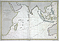 | Details | Depot de la Marine | 1862 |
| Fine French chart of the East Indies |
|
Depot de la Marine |
|
| 1862 |
| LOC:59 |
| $1,075.00 | Depot-de-la-Marine | Fine-French-chart-of-the-East-Indies | 1862 edition of a French nautical chart of the Indian Ocean and East Indies first published by the French Depot General de la Marine in 1837. French nautical charts of the Indian Ocean are scarce. No record of a sale of this chart is found in the AMPR.
<br></br>
This chart of the Indian Ocean to western Australia is based on exploration led by Daussy (Chief Hydrographer) and Wissocq. Engraved by Chassant. With contemporary manuscript ink annotations of a ship's daily course plotted east bound past the Cape of Good Hope and again west bound on the home trip. The positions extend far to the east, past the Philippine islands, another 4 days cruise past the neatline, and terminate at "Pelew" or the island of Palau.
<br></br>
Coverage includes a wide swath of ocean extending from Africa and Madagascar to Australia, Borneo, and Eastern China.
<br></br>
Published by order of the King. Seller's paste-on label at bottom right: "SAUVAT Libraire Rue Saint-Remy 3, a Bordeaux." |
| 4923 |  | Details | Anonymous | 1863 |
| Grand Gas-light Combination of the Metropolis of America |
|
Anonymous |
|
| 1863 |
| LOC:13 |
| $550.00 | Anonymous | Grand-Gas-light-Combination-of-the-Metropolis-of-America | Map representing five gas-light companies that served New-York City in 1863:
<div class="indenttextblocksingle">
<ul style="list-style-type: circle;">
<li>Harlem Gas Light Company</li>
<li>Metropolitan Gas Light Company</li>
<li>Manhattan Gas Light Company</li>
<li>New York Gas Light Company</li>
<li>Citizens' Gas-light Company</li>
</ul>
</div>
Published in the American Gas Light Journal, March 2, 1863. p. 265 |
| 5308 | 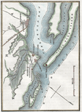 | Details | Anonymous | 1863 |
| Civil War era map Santa Rosa Island and Pensacola Florida |
|
Anonymous |
|
| 1863 |
| LOC:11 |
| $175.00 | Anonymous | Civil-War-era-map-Santa-Rosa-Island-and-Pensacola-Florida | Small hand-colored map of Santa Rosa Island and Pensacola Bay, Florida. Published before the end of the U. S. Civil War.
<br></br>
This fine map illustrates the fall of Pensacola to Rebel forces in "The History of the Civil War in America …" by John S. C. Abbott. Published in 1863 from Springfield, Massachusetts. Volume 1. Page 359.
<br></br>
<b>Includes the noted locations of these key features:</b>
<div class="indenttextblocksingle">
<ul style="list-style-type: circle;">
<li>Pensacola, Florida</li>
<li>Gulf of Mexico</li>
<li>Fort Barrancas </li>
<li>Fort McRae</li>
<li>Fort Pickens</li>
<li>Fort St. Miguel</li>
<li>Navy Cove</li>
<li>Warrington, Florida</li>
<li>Woolsey, Florida</li>
<li>Deer Point</li>
<li>Fair Point</li>
<li>Foster's Island</li>
<li>Pensacola Bay</li>
<li>Santa Rosa Island</li>
<li>Santa Rosa Sound</li>
<li>Bayou Chico</li>
<li>Bayou Grande</li>
<li>Grand Lagoon</li>
</ul>
</div>
Fort Pickens, located on the western tip of Santa Rosa Island in the Florida Panhandle, played a significant role in the United States' coastal defense system during the period from 1850 to 1870. The fort's strategic location allowed it to control the entrance to Pensacola Bay .
<br><br>
During the Civil War (1861-1865), Fort Pickens remained under Union control, despite Florida's secession from the United States in 1861. On January 12, 1861, just days before Florida officially seceded from the Union, a group of Florida state troops and local militia demanded the surrender of the Pensacola Navy Yard. The Union commander, Commodore James Armstrong, surrendered the yard to the Confederates without a fight. The Union forces, however, maintained control over Fort Pickens, located on Santa Rosa Island, which guarded the entrance to Pensacola Bay. Fort Pickens served as a base for Union operations along the Gulf Coast, and its presence helped to disrupt Confederate shipping and supply lines. |
| 607 |  | Details | U.S. Coast and Geodetic Survey | 1864 |
| Western Coast of U.S. from Umpqua River to the Boundary Uncolored |
|
U.S. Coast and Geodetic Survey |
|
| 1864 |
| LOC:63 |
| $475.00 | U-S--Coast-and-Geodetic-Survey | Western-Coast-of-U-S--from-Umpqua-River-to-the-Boundary-Uncolored | Rare, rolled, separately issued antique nautical chart ( 1864 ed. ) of the western coast of California focused on the Pacific coastline between the Umpquah River, Oregon north to the Canadian border. Noted with several habitations including Seattle, Astoria, and Olympia, Washington; Victoria, British Columbia; and Fort Langley. Many of the San Juan Islands are identified by name including Vancouver Island, San Juan, Lopez, Fidalgo, and <b> Guemes Island</b>.
<br></br>
This antique sea chart is enlivened with eight attractive engraved inset coastal profile views including: the Entrance to Columbia River / Cape Disappointment, Tatoosh Island, Flattery Rocks, Destruction Island, Tillamook Head, Cape Perpetua, and Cape Lookout.
<br></br>
The chart was first produced by the U.S. Coast Survey in 1855, a point in time when A.D. Bache was Superintendent.
<br></br>
This is a scarce, separately issued, rolled nautical chart of the area, not the more common folded version on thin paper that was issued with other charts in an annual report to Congress from the Coast Survey.
<br></br>
This chart was printed in 1864 from an electrotype copy of the original hand-engraved copper plate, a process the U.S. Coast Survey adopted around 1850. As a soft medium, copper plates could only withstand print runs of perhaps 200 copies before the plates wore down. To enable larger print runs, a mold of the original plate was created in wax or another soft medium. Then, using an electro-chemical process ( electrotyping ), the mold was coated with a metal layer, typically copper. Printers were then able to produce output from the new electrotype copper copy, while preserving the original. Electrotype copy no. 6, corrected to 1864." Scale 1 / 1,200,000. |
| 5158 |  | Details | British Admiralty Hydrographical Office | 1864 |
| Antique Chart of the Bay and Harbor at Trincomalee Trincomalie Ceylon Sri Lanka |
|
British Admiralty Hydrographical Office |
|
| 1864 |
| LOC:59 |
| $400.00 | British-Admiralty-Hydrographical-Office | Antique-Chart-of-the-Bay-and-Harbor-at-Trincomalee-Trincomalie-Ceylon-Sri-Lanka | Chart of the Bay and Harbor of Trincomalee, an important port in Sri Lanka, which has been called the finest in the Indian Ocean. Published by the Hydrographical Office of the British Admiralty on July 3rd, 1834. Last corrected 1864.
<br></br>
The numerous key features on the map include Flagstaff Point, Fort Frederick, Lake Tamblegam, Great Bay, Norway Point, Elephant Ridge, Round Island, and Great Saber Island. Numerous soundings and marked anchorages.
<br></br>
In 1834 the Nautical Magazine described the chart:
<div class="indenttextblocksingle">
"Double-elephant. Includes the whole of Back Bay on the north and Great Bay on the south with Foul Point. It gives a complete view of the whole of the indented coast by which the harbour of Trincomalee is surrounded."
</div>
(Vol. 3, p. 690)
<br></br>
The same issue noted a similar sized but larger scale chart only of the "Harbour of Trincomalee" by Owen, Cannon, and Loring. |
| 800 |  | Details | British Admiralty Hydrographical Office | 1864 |
| Chart of South Sulawesi and Lesser Sunda Islands from Bali to Timor |
|
British Admiralty Hydrographical Office |
|
| 1864 |
| LOC:59 |
| $1,075.00 | British-Admiralty-Hydrographical-Office | Chart-of-South-Sulawesi-and-Lesser-Sunda-Islands-from-Bali-to-Timor | Antique British Admiralty navigational chart of a major portion of the Lesser Sunda Islands. Coverage includes the Strait of Macassar, Gulf of Boni, Banda Sea, Arafura Sea, the lower portion of Sulawesi, Indonesia ( Celebes ) , and the islands of Bali ( Baly ), Lombok, Sombawa, Comodo, Flores, and Timor. <br></br>
This fine large chart Includes 9 inset detailed charts at bottom left: Anapanam Bay, Laboaen Tring Bay, Pampang Bay, Pidioe Bay, Taliwang Bay, Bima Bay, Sapie Bay, Nangamessie Bay, Koepang Bay.
<br></br>
Published at the Hydrographic Office of the Admiralty August 4, 1851 with last corrections in 1864. Originally sold by J.D. Potter, London. Bottom margin includes a small pasted seller's label from Australia: "Blundell & Ford, Admiralty Chart Agents. Melbourne". Number 2073. |
| 59 |  | Details | Depot de la Marine | 1864 |
| Detroit du Bass (Australie) |
|
Depot de la Marine |
|
| 1864 |
| LOC:59 |
| $1,400.00 | Depot-de-la-Marine | Detroit-du-Bass-(Australie) | Interesting antique nautical chart of South Australia, the Bass Straight and upper coast of Tasmania published by the Depot des Cartes et Plans de la Marine ( France ). Numerous lighthouses marked as red dots with yellow highlights and red circles indicating scope of lighthouse visibility. Includes Port Phillip and the city of Melbourne. Right center includes inset profile views. <BR> </BR>
With a black over-stamp for Cartes de la Marine Impériale. Debrie Libraire au Harve, Seul Depositaire. Price: Deux Francs. |
| 4947 |  | Details | U.S. War Department | 1865 |
| Military Map Marches of General Sherman Forces |
|
U.S. War Department |
|
| 1865 |
| LOC:53 |
| $850.00 | U-S--War-Department | Military-Map-Marches-of-General-Sherman-Forces | Fine original lithographed map showing the marches of the United States Forces under command of Major General W.T. Sherman U.S.A. during the years 1863, 1864, 1865.
<br></br>
Drawn by Captain William Kossak in St. Louis MO and printed by the American Photo Lithographic Company of New York using "Osborne's process." [1] The map was compiled by order of General Sherman under the direction of Brevet. Major W.L.B. Jenney. It covers the region bounded by Mobile in the south, Washington and St. Louis in the north, Chesapeake Bay to the east and to the west by Little Rock, Arkansas.
<br></br>
[1] Osborne's process was a photo-lithographic process based on a large copy camera and photo-sensitized transfer paper made from photo negatives. By 1866 the American Photolithographic Company operated a massive copy camera with a 14 foot platform at its Brooklyn plant. The huge apparatus was capable of reproducing drawings up to forty-eight by sixty inches. (Reps, John William. Views and View makers of Urban America: Lithographs of Towns and Cities in the United States … University of Missouri Press. 1984. pp 36, 37.) |
| 5126 |  | Details | Pomeroy, S.T. | 1865 |
| Manuscript early map of Pennsylvania Oil Fields |
|
Pomeroy, S.T. |
|
| 1865 |
| LOC:200 |
| $3,750.00 | Pomeroy--S-T- | Manuscript-early-map-of-Pennsylvania-Oil-Fields | A hand-drawn antique map, a historical cartographic artifact related to the early days of oil production along the Allegheny River in the U.S.A. An unrecorded foundational map for U.S. oil production created by S.T. Pomeroy six years after oil was first commercially produced in Pennsylvania. The main focus of the oil-field map seems to be a series of leases (in yellow) along Pine Run Creek.
<br></br>
This one-of-a-kind pen and ink manuscript map of oil fields in Pennsylvania was created during a time of great speculative excitement just six years after Edwin L. Drake struck "rock oil" at Titusville, Pennsylvania in Oil Creek Valley in 1859. Drawn by hand by Pomeroy in 1865, near the end of the Civil War, coverage includes lands, leases, wells, and waterways beginning about 8 miles south of Titusville.
<br></br>
Shows the Allegheny River and Clarion Rivers and the significant tributaries of Oil Creek, Pit Hole Creek, East Sandy Creek, Pine Hill Run, Big Sandy, and Hemlock Creek. With newly developed Oil City, Franklin, and President, Pennsylvania as well as a clear route for the turnpike linking Oil City, Sandy, and Franklin. One well near the confluence of the Allegheny River and East Sandy Creek is shown as producing 250 barrels daily, quite a prolific output in those days.
<br></br>
The Pomeroy name was somewhat common in Pennsylvania during that time period, but details on the map of islands in the Allegheny River and the wells along the rivers and creek suggest a nautical connection. Pomeroy's Oil Creek Boat Express operated a river-barge, the "Pomeroy Express" along Oil Creek.
<br></br>
(Sketches in Crude Oil: Some Accidents and Incidents of the Petroleum …) https://books.google.com/books |
| 4901 |  | Details | U.S. Coast and Geodetic Survey | 1865 |
| Antique Mississippi River Charts of Shoals and Sand Bars |
|
U.S. Coast and Geodetic Survey |
|
| 1865 |
| LOC:2001 |
| $500.00 | U-S--Coast-and-Geodetic-Survey | Antique-Mississippi-River-Charts-of-Shoals-and-Sand-Bars | Rare, separately published charts (23) of critical navigational areas on the Mississippi River and the Ohio River. A supplement of charts to accompany the <b>"Letter of the Secretary of the Navy communicating the report of the commission appointed under the joint resolution of Congress, approved June 30, 1864," </b> (Source: Online) <div class="indenttextblock"> "to select the most approved site for a navy yard or naval station on the Mississippi River or upon one of its tributaries and recommending a appropriation to cover the expenses of said commission." </div> The maps were not of proposed locations for the new Navy yard but of shoal or shallow areas of the Mississippi River. These shallow sand bars and narrow channels could impede the movement of vessels of vessels to the new yard:
<div class="indenttextblock">
"A series of topographical sketches of some of the difficult places of navigation on the Mississippi between Carondolet and Memphis and in the Ohio between Cairo and Cincinnati. They will have a value in furnishing means of comparison in future studies of the beds of these rivers."
</div>
<br>
Twenty-one charts (sketches) for the Mississippi River and two charts for the Ohio River including:
<div class="indenttextblocksingle">
<ul style="list-style-type: circle;">
<li>Sketch No. 1 Jefferson Barracks Bar</li>
<li>Sketch No. 3 Widow Beard's Island</li>
<li>Sketch No. 5 Penitentiary Shoal</li>
</ul>
</div>
The surveys were conducted by a Coast Survey party attached to the command of Admiral Lee, headed by F.H. Gerdes Chief of the Mississippi squadron topographical engineers.
<br></br>
The expenses of the commission included a whopping $870 to G.W. Blunt, $10 per diem from November 10, 1864 to February 4, 1865. From this expense we know that Blunt also was actively involved in the survey's that produced these maps. |
| 542 |  | Details | U.S. Coast and Geodetic Survey | 1866 |
| New York Bay and Harbor. Chart 20. |
|
U.S. Coast and Geodetic Survey |
|
| 1866 |
| LOC:0 |
| $325.00 | U-S--Coast-and-Geodetic-Survey | New-York-Bay-and-Harbor---Chart-20- | Detailed, antique, original folding harbor chart on linen of Manhattan, New York Bay, and surrounding areas published immediately after the U.S. Civil War. Coverage includes Staten Island, the Hudson River, Newark Bay, and the Rockaway Peninsula. Produced under the direction of A.D. Bache, a great-grandson of Benjamin Franklin (Guthorn, 1984). The chart is based on triangulation of J. Ferguson and E. Blunt.
<br></br>
This chart is even more scarce and unusual because of its provenance and because it is a folding chart. The chart was dissected into 8 sections and mounted to linen at the time it was issued. Folded the chart measures 8" x 14". Separately issued by the U.S. Coast Survey in 1866 for use at sea, this chart is NOT the commonly found Coast Survey sketch/chart on thin paper.
<br><br/>
This chart has an interesting provenance as it carries the manuscript signature of Charles DW Brownell, Bristol, Rhode Island on the inside front cover. Charles deWolf Brownell (1822 - 1909) was born in Providence Rhode Island, educated in the law, and later settled on a career as an artist for health reasons. Brownell travelled widely to Cuba, the Carribean and Europe. He is best known for his landscapes but produced several paintings of maritime subjects including "The Burning of the Gaspee". Brownell lived in New York City from 1860 - 1865. <br><br/>
With well-worn embossed black boards and manuscript notation on verso- "New York Harbor". |
| 6383 |  | Details | Anonymous | 1866 |
| Manuscript cadastral map of the Commune de Lovagny |
|
Anonymous |
|
| 1866 |
| LOC: |
| $100.00 | Anonymous | Manuscript-cadastral-map-of-the-Commune-de-Lovagny | manuscript map of the commune of Lovagny in the Haute-Savoie department in the Auvergne-Rhône-Alpes region in south-eastern France. |
| 1477 |  | Details | Wilson, Charles | 1866 |
| Blueback Chart of the East Coast of England Dungeness to Newcastle |
|
Wilson, Charles |
|
| 1866 |
| LOC:0 |
| $900.00 | Wilson--Charles | Blueback-Chart-of-the-East-Coast-of-England-Dungeness-to-Newcastle | Eight feet long. Ninety-three inches of blueback sea chart covering the English east coast. Four sheets joined. Highlights of this huge blueback chart include dozens of yellow dots highlighting the lighthouses and the inset drawings of lighthouses and other navigational aids. More than one dozen inset port plans and river entrances, large scale. You need this in your man cave!
<BR> </BR>
With blue paper backing as issued. During the 1800's there was a trend toward publication of very large small-scale charts with large-scale insets of key passages and harbors. This made it possible for mariners to replace perhaps a half-dozen or more charts with just one. The practice was adopted as much for economics as any other reason. Charles Wilson (as the successor to Norie and Company) was one of a handful of British publishers who specialized in these charts which were often backed with canvas or linen cloth or heavy blue paper in order to help them withstand the frequent use and abuse aboard ship, hence the term "blueback chart".
<BR> </BR>
Published by: "Charles Wilson (Late J.W. Norrie and Wilson) at the Navigation Warehouse and Naval Academy, 157 Leadenhall Street." London.
<BR> </BR> |
| 3578 |  | Details | U.S. Coast and Geodetic Survey | 1867 |
| Point Sal, California |
|
U.S. Coast and Geodetic Survey |
|
| 1867 |
| LOC:63 |
| $375.00 | U-S--Coast-and-Geodetic-Survey | Point-Sal--California | Rare U.S. Coast Survey chart of Point Sal, California. For the collector of California cartography, a special chart of Point Sal which lies on California's Pacific Coast somewhat midway between Santa Barbara and San Luis Obispo. Original copper-plate engraved chart 14" x 17" on a huge sheet of crisp surveyor's paper in total 20" x 26". Assumed to be the first edition.
<br></br>
Not an electrotype copy. This engraving was printed from the original hand-engraved copper plate. Evidence of a wide platemark. Price 15 cents when issued.
<br></br>
This chart of Point Sal is unlike most Coast Survey charts we have handled. It is on quality oversize paper and has not been folded into a Coast Survey atlas (nor was it printed for that purpose). The chart does not carrry the caveat at upper right "Electrotype Copy No. X". Based on that as well as by the markings on other items purchased in the same sales lot we feel there is a high probability that the chart was a surplus proof and or reference file copy of the U.S.G.S. The date appears at bottom left along with the map number "660", both to facilitate searching a the files. Chart no. 660. |
| 3583 |  | Details | U.S. Coast and Geodetic Survey | 1867 |
| Humboldt Bay, California |
|
U.S. Coast and Geodetic Survey |
|
| 1867 |
| LOC:63 |
| $475.00 | U-S--Coast-and-Geodetic-Survey | Humboldt-Bay--California | Rare and extremely attractive U.S. Coast Survey separately-published chart of Humboldt Bay, California. For the collector of California cartography, a very special chart of Humboldt Bay which lies on the Pacific Coast of California just below the town of Eureka, CA. With a elevation profile view of Red Bluff Entrance to Humboldt Bay as it then appeared from 2 1/2 miles offshore and a small-scale chart of the entire Humboldt Bay environs. Second edition. Dated 1852 but probably printed around 1867. MS chart number in margin "632".
<br></br>
Towns shown include Humboldt, Eureka and Bucksport. Other features include the site of a proposed lighthouse and a beacon, Elk River, Indian Island, and Howard House in Humboldt.
<br></br>
This plate is not from the common 1867 Report of the Superintendent of the United States Coast Survey. The chart is an original copper-plate engraved chart 14" x 17" on a huge sheet of crisp surveyor's paper 20" x 26". Not an electrotype copy. This engraving was printed from the original hand-engraved copper plate. Evidence of a wide platemark. Price when issued 15 cents.
<br></br>
This chart of Humboldt Bay is unlike most Coast Survey charts we have handled. It is on crisp oversize paper and has not been folded into a Coast Survey atlas (nor was it printed for that purpose). The chart does not carrry the caveat at upper right "Electrotype Copy No. X". Based on that as well as by the markings on this chart and other items purchased in the same sales lot we feel there is a high probability that the chart was a surplus proof and or reference file copy of the U.S.G.S. |
| 942 | 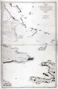 | Details | Direccion Hidrografia | 1867 |
| Antique Spanish Chart of Eastern Cuba and the Bahama Bank |
|
Direccion Hidrografia |
|
| 1867 |
| LOC:0 |
| $900.00 | Direccion-Hidrografia | Antique-Spanish-Chart-of-Eastern-Cuba-and-the-Bahama-Bank | Striking antique Spanish sea-chart of the southeastern Bahamas. This attractive 150 year old nautical artifact would make a fine gift for yachtsmen, fishermen, and sailors with an interest in the waters near the Windward Passage, the 50 mile-wide strait between Cuba and Hispaniola connecting the Atlantic Ocean and the Caribbean Sea.
<br></br>
This venerable nautical survivor includes western Haiti, eastern Cuba, east Jamaica, and the Inagua Islands. Covers the southern portion of the Great Bahama Bank, Grand Inagua Island, Little Inagua Island, Crooked Island, Acklins Island, Rum Cay, Conception Island, Mayaguana, Great Exuma; Providenciales, Turks and Caicos; Cat Island, San Salvador Islands ("Isla Watlings") , and the southern part of Eleuthera ("Isla Hetera"). Key cities noted include Kingston, Jamaica; Port-au-Prince ("Puerto Principe"), Haiti; Baracoa and Santiago de Cuba, Cuba.
<br></br>
Certainly a fine example of a mid-nineteenth century working navigational chart with numerous soundings, particularly in the area of the Great Bahama Bank. Nine lighthouses are identified with red and yellow highlights. Originally issued in 1856, this edition was printed with additions and corrections in 1867 by Spain's official maritime agency, the Direccion Hidrografia. |
| 3667 |  | Details | U.S. Coast and Geodetic Survey | 1867 |
| Fine antique chart of Suisun Bay, California |
|
U.S. Coast and Geodetic Survey |
|
| 1867 |
| LOC:63 |
| $800.00 | U-S--Coast-and-Geodetic-Survey | Fine-antique-chart-of-Suisun-Bay--California | Very attractive scarce antique engraved chart of Suisun Bay, California northwest of San Francisco Bay. Key features include Grizzly Island, Van Sickle's Island, Chipp's Island, Sherman Island, the Carquines Straits, and the towns of Antioch, Benicia and Martinez.
<br></br>
Rare U.S. Coast Survey separately published chart of Suisun Bay, California. For the collector of California cartography, a very special chart of Suisun Bay which lies at the confluence of the Sacramento and San Joaquin Rivers, forming the entrance to the Sacramento–San Joaquin River Delta. Dated within to 1867. With fine detail of interior topography. Assumed to be the first edition.
<br></br>
The map covers from Benicia and the Karquines Strait in the west as far as Sherman Island in the east and from Grizzly Island south to the San Joaquin River. Includes countless depth soundings in feet, detailed notes on tides. Several towns and cities are identified, including Martinez, Benicia, and Collinsville.
<br></br>
This plate is not from the common 1867 Report of the Superintendent of the United States Coast Survey. The chart is an original copper-plate engraved chart 32" x 17" on a huge sheet of crisp surveyor's paper 30" x 40". Not an electrotype copy. This engraving was printed from the original hand-engraved copper plate. Evidence of a wide platemark. Price 75 cents when issued.
<br></br>
This chart of Suisun Bay is unlike most Coast Survey charts we have handled. It is on crisp oversize paper and has not been folded into a Coast Survey atlas (nor was it printed for that purpose). The chart does not carry the caveat at upper right "Electrotype Copy No. X". Based on that as well as by the markings on this chart and other items purchased in the same sales lot we feel there is a high probability that the chart was a surplus proof and or reference file copy of the U.S.G.S. |
| 982 |  | Details | Depot de la Marine | 1867 |
| Plan of the Entrance to Valdivia Bay |
|
Depot de la Marine |
|
| 1867 |
| LOC:51 |
| $550.00 | Depot-de-la-Marine | Plan-of-the-Entrance-to-Valdivia-Bay | Antique French sea chart of the entrance to <b>Corral Bay</b> and the Valdivia estuary, situated to the southwest of the city of <b>Valdivia, Chile</b>. Clearly shows Mancera Island ("Ile Mansera") , Fort Niebla, Fort St. Carlos, Fort d"Amargos, and St Jean Bay. Two attractive elevation views of the coastline at the entrance to Valdivia River.
<br></br>
This edition of the old nautical chart was published in 1867 and contains changes made by French Naval officers Lartigue and Flury to an earlier survey by Ange René Armand, Baron de Mackau, Captain of the French 58-gun Frigate, the Clorinde (1822). The <b>Baron de Mackau</b> had been given command of the Clorinde which he sailed to the Pacific in order to conduct negotiations with the nascent states of Chile and Peru, in South America.
<br></br>
Inset plan of Corral Bay at bottom right: "Plan Particulier de l'Anse du Corral" with a small walled encampment, the "Chateau du Corral".
<br></br>
With an oval-shaped black ink overstamp from the seller in Harve, France. |
| 840 |  | Details | British Admiralty Hydrographical Office | 1868 |
| Antique Admiralty Nautical Chart of San Diego Bay to Cape Mendocino California |
|
British Admiralty Hydrographical Office |
|
| 1868 |
| LOC:63 |
| $3,000.00 | British-Admiralty-Hydrographical-Office | Antique-Admiralty-Nautical-Chart-of-San-Diego-Bay-to-Cape-Mendocino-California | Large antique British Admiralty sea chart of the California coast extending from Humboldt Bay and Cape Mendocino in the North, trending southeast past San Francisco Bay and Monterey Bay to San Diego, California. Lighthouses are picked out with red dots highlighted in yellow.
<br></br>
Contains fifteen coastal elevation views with some of the most stunning coastal scenery in the world including the Big Sur area. These carefully engraved coastal elevations include: Cape Mendocino, Point Arena, Pt. Reyes, Entrance to San Francisco Bay, Point Piedras, Point Ano Nuevo, South Farallon Lighthouse, Point Sur, Moro Rock, Point Arguilla, Pt. Conception, Point Loma, Catalina Harbor, and the Point of Boundary between the United States and Mexico.
<br></br>
First published by the Admiralty from London in April 1858 under the superintendence of Royal Navy Hydrographer Captain Washington. This edition of the scarce nautical chart was printed with corrections to July 1868.
<br></br>
Sold by J.D. Potter Agent for The Admiralty, 31 Poultry and 11 King Street Tower Hill. |
| 833 | 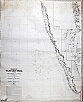 | Details | James Imray and Son | 1868 |
| West Coast of India from Kanyakumari (Cape Comorin) to Mumbai (Bombay) |
|
James Imray and Son |
|
| 1868 |
| LOC:0 |
| $600.00 | James-Imray-and-Son | West-Coast-of-India-from--Kanyakumari-(Cape-Comorin)-to-Mumbai-(Bombay) | Scarce antique blueback nautical chart of the West coast of India, including Mumbai ( Bombay ) and Goa, trending southward to Kanyakumari ( Cape Comorin ). Cape Comorin is the southern-most point of the Indian subcontinent, surrounded by the Laccadive Sea. This scarce nineteeth-century blueback nautical chart contains detailed inset port plans of Cochin Harbor, Calicut Roads, Bombay Harbor, and the Approach to Bombay.
<br></br>
During the 1800's there was a trend toward publication of very large small-scale charts with large-scale insets of key passages and harbors. The practice was adopted as much for economics as any other reason. James Imray and Son was one of a handful of British publishers who specialized in these charts which were often backed with canvas or linen cloth or heavy blue paper in order to help them withstand the frequent use and abuse aboard ship, hence the term "blueback chart".
<br></br>Due to changing conditions charts could become outdated quickly and it was important for mariners to understand the accuracy of their navigational charts. The British Admiralty and later the U.S. Coast Survey responded by recording the dates of each update on the map, in some cases maintaining a historical record of updates spanning many decades. Private publishers of sea charts like Imray or Laurie fulfilled the same need by providing the date of the last update with an inked overstamp. On this chart we find an example of that practice, an oval-shaped blue ink over-stamp that reads: "Imray and Son 1869".
<br></br>
Published by James Imray and Son, 89 and 102 Minories. Laid to blue paper for protection with cloth selvage. Original cloth map ties. Yellow label from the Imray firm attached on verso that reads "James Imray and Son, Hydrographers.". James Imray and Son is one of the three firms that over the last two centuries combined to form Imray Laurie Norie & Wilson Ltd. |
| 23 |  | Details | James Imray and Son | 1868 |
| The Coasts of France, Spain and Portugal (Blueback) |
|
James Imray and Son |
|
| 1868 |
| LOC:0 |
| $750.00 | James-Imray-and-Son | The-Coasts-of-France--Spain-and-Portugal-(Blueback) | Very attractive, imposing, and desirable 140+ year old blueback nautical chart of the Atlantic coast of Europe. Contains the blue stamp from the firm of "Imray 1869". Coverage includes the Strait of Gibraltar and western Mediterranean. This wide antique nautical chart of the West coat of Europe would have been useful to any navigator sailing eastward as it covers all the approaches to the Mediterranean, Bay of Biscay, English Channel and the Bristol and Irish Channels.<BR> </BR>
A six- foot working blueback nautical chart by Imray that has seen its time at sea and exudes history. You can almost smell the salt air! Several manuscript navigator's tracks plotted in pencil include notation: "8th day July 1877 from (illegible) to Falmouth 133 days out". 9 insets including rivers Tagus, Douro and Gironde. Lighthouses indicated in red.<BR> </BR>
On verso is original yellow publishers label from James Imray and Son with price of 10s 6d. Also on verso is a sellers label from "D. Eggert and Sons, manufacturers and importers of chronometers, fine watches, nautical instruments, charts, books, &c. 127 Pearl Street, New York between Wall Street and Old Slip."
<BR> </BR>
For more information on the evolution of blueback charts we recommend this book by Susanna Fisher:
<a target="_blank" style="color:#9BAFCB" href="http://www.regattapress.com/The_Makers_of_the_Blueback_Chart.html">The Makers of Blueback Charts.</a>
<BR> </BR> |
| 834 | 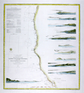 | Details | U.S. Coast and Geodetic Survey | 1869 |
| Western Coast of U.S. from San Francisco to Umpquah (Umpqua) River |
|
U.S. Coast and Geodetic Survey |
|
| 1869 |
| LOC:63 |
| $675.00 | U-S--Coast-and-Geodetic-Survey | Western-Coast-of-U-S--from-San-Francisco-to-Umpquah-(Umpqua)-River | Very attractive antique nautical chart of the <b>western coast of California</b> focused on the Pacific coastline between <b>San Francisco, California</b> and the Umpqua River, Oregon. This scarce, rolled, separately issued chart, corrected to 1869, was first published in 1854 by the U.S. Coast Survey. Noted habitations and geographical features include Empire City, Koos Bay, and Port Orford or Ewing Harbor, Oregon; Crescent City, Reddings Rock, Eureka, Mendocino City, Haven's Anchorage, Bodega Bay, Pt. Reyes, Alcatraz Island, Oakland, Alameda, Union City and San Francisco Bay, California. Numerous soundings, navigational hazards, and aids to navigation are identified.
<br></br>
This antique sea chart is enlivened with twelve attractive hand-colored <b>inset coastal elevation views</b> including: the Entrance to San Francisco Bay, Point Arena, Mendocino City Cove, Trinidad Head and City, Cape Mendocino, Red Bluff Entrance to Humboldt Bay, Point St. George, Mack's Arch and Reef, Rogues River, Cape Blanco, and Cape Gregory.
<br></br>
This is a scarce, separately issued, rolled nautical chart of the U.S. West Coast, not the more common folded version on thin paper that was issued with other charts in an annual report to Congress from the Coast Survey.
<br></br>
This chart was printed in 1869 from an electrotype-printed copy of the original hand-engraved copper plate. Electrotype printing is a process the U.S. Coast Survey adopted around 1850. As a soft medium, copper plates could only withstand print runs of perhaps 200 copies before the plates wore down. To enable larger print runs, a mold of the original plate was created in wax or another soft medium. Then, using an electro-chemical processs ( electrotyping ), the mold was coated with a metal layer, typically copper. Printers were then able to produce output from the new electrotype copper copy, while preserving the original. Electrotype copy no. 6 by Mathiot. |
| 6693 |  | Details | U.S. Coast and Geodetic Survey | 1869 |
| Western Coast of U.S. San Francisco to Umpquah Umpqua River |
|
U.S. Coast and Geodetic Survey |
|
| 1869 |
| LOC:68 |
| $350.00 | U-S--Coast-and-Geodetic-Survey | Western-Coast-of-U-S--San-Francisco-to-Umpquah-Umpqua-River | This is an finely detailed antique coastal nautical chart of the <b>western coast of California</b>, which focuses on the Pacific coastline between <b>San Francisco, California</b> and the Umpqua River, Oregon. It is a scarce, rolled, separately issued chart, corrected to 1869, and was first published by the U.S. Coast Survey in 1854. Notable habitations and geographical features on the chart include Empire City, Koos Bay, and Port Orford or Ewing Harbor, Oregon, as well as Crescent City, Reddings Rock, Eureka, Mendocino City, Haven's Anchorage, Bodega Bay, Pt. Reyes, Alcatraz Island, Oakland, Alameda, Union City, and San Francisco Bay, California. The chart identifies numerous soundings, navigational hazards, and aids to navigation.
<br></br>
This antique sea chart features twelve detailed <b>inset coastal elevation views</b>, including the Entrance to San Francisco Bay, Point Arena, Mendocino City Cove, Trinidad Head and City, Cape Mendocino, Red Bluff Entrance to Humboldt Bay, Point St. George, Mack's Arch and Reef, Rogues River, Cape Blanco, Cape Gregory, and Point Reyes. It is a scarce, separately issued, rolled nautical chart of the U.S. West Coast, not the more common folded version on thin paper that was issued with other charts in an annual report to Congress from the Coast Survey.
<br></br>
The chart was printed in 1869 from an electrotype-printed copy of the original hand-engraved copper plate. The U.S. Coast Survey adopted electrotype printing around 1850 because copper plates, being a soft medium, could only withstand print runs of about 200 copies before the plates wore down. To allow for larger print runs, a mold of the original plate was created in wax or another soft medium. Then, using an electro-chemical process (electrotyping), the mold was coated with a metal layer, usually copper. Printers were then able to produce output from the new electrotype copper copy while preserving the original. Electrotype copy no. 6 was done by Mathiot. |
| 3597 |  | Details | Multiple Authors | 1870 |
| Lot 1. MULTIPLE 19th C. survey lot and street plans CAMBRIDGE, Massachusetts |
|
Multiple Authors |
|
| 1870 |
| LOC:0 |
| $13,650.00 | Multiple-Authors | Lot-1---MULTIPLE-19th-C--survey-lot-and-street-plans-CAMBRIDGE--Massachusetts | A lot consisting of twenty-five lot and street plans from Cambridge, Massachusetts and nearby areas. An opportunity for a serious collector to expand his collection with items he cannot find elsewhere. <a href="https://www.rarecharts.com/Content/Lot_1_Cambridge_Survey_Artifacts_Locked.pdf" target="_blank">See full detailed lot description.</a>
<br></br>
These plans represent surveys performed in the 1840’s through the 1900’s by local Cambridge area surveyors and engineers William A. Mason, Joseph Whitney, J.G. Chase, E.F. Bowker, W.S. Barbour, and Alex Wadsworth. Artifacts include manuscript surveys, manuscript survey traces, and rare 19th century cyanotype (blueprints). Many of the items in this lot are unrecorded and for the others the few known holdings are in institutions. Condition and size vary by item.
<br></br>
The lot highlight is:
SC_Cam_1. Osgood Carleton [after]. PLAN OF THE CAUSEWAY OVER THE MARSH IN CAMBRIDGE EXHIBITING THE NAMES OF THE OWNERS AND THE QUANTITY OF LAND THROUGH WHICH IT PASSES INCLUDING MR JARVIS’S UPLAND SURVEYED AND PLATTED (by a scale of one chain to an inch) NOV 12TH 1792 BY OSGOOD CARLETON. COPIED FROM THE ORIGINAL BY W.A. MASON & CO. DEC. 20, 1855. MS ink surveyor’s collation number “1637”.
Unrecorded antebellum manuscript cadastral plan of great historical value after an earlier plan in 1793 by well-known Boston surveyor Osgood Carleton. This is the best and only available detailed plan of the West Boston Bridge causeway from the Charles River to Pelham island. This is Mason’s true signed MS surveyor’s copy from a survey made by Osgood Carleton contemporaneously with the Causeway construction. Numerous and detailed pencil notations of ownership record based on Carleton's original survey. Measurements recorded in chains and links.
<br></br>
A very rare plan of the old Causeway stretching 3344 feet over wet marshland largely owned by Leonard Jarvis. |
| 4833 |  | Details | Erie Railway Company | 1870 |
| Rare manuscript Erie Railway trace map Jersey City |
|
Erie Railway Company |
|
| 1870 |
| LOC:53 |
| $500.00 | Erie-Railway-Company | Rare-manuscript-Erie-Railway-trace-map-Jersey-City | One-of-a-kind post civil-war inked manuscript map of the Erie Railway Company and Long Dock Co. property [1] in Jersey City, New Jersey from 1870. On surveyor's tracing cloth, this artifact was likely used as the master copy for producing other cyanotype (blueprint) maps [2].
<br></br>
The map extends from the Hackensack River to the Hudson River south of 11th Street, including land now occupied by the Holland Tunnel approaches. To the south, the map ends roughly at Newark Avenue.
<br></br>
Shows the Long Dock Company Tunnel (Bergen Tunnel) built in 1861. The new tunnel was used by the Erie Railway to reach the Pavonia Depot on the Hudson River. Copious explanation of the lands, railroads, docks and piers; and improvements. Scale 400 feet to one inch. Title states "Made in compliance of an Act of the Legislature of the State of New Jersey. Approved March 17, 1870.
<br></br>
Made during a period of great change and great fortunes made by railroad speculators such as Jay Gould who attempted to take control of the Erie Railway in 1873. In fact it was just one year before this map was made that Gould and partner James Fisk caused financial devastation with a scheme to control the gold market.
<br></br>
[1] The property of the Long Dock Company was operated by Erie Railway Company and its receivers Jan. 1, 1861 to May 31, 1878. The Long Dock Company was incorporated by special act of the State of New Jersey in 1856,for the purpose of constructing a railroad within the limits of Hoboken and Jersey City, N. J. with docks, piers, and bulkheads and establish a ferry at or near Pavonia Avenue, Jersey City, N. J.<br/>
[2]A blueprint was created by overlaying the traced map (as we have here) onto a piece of paper treated with a photo-sensitive compound. After exposure to sunlight the paper was washed and dried with the end product a blue negative copy of the trace. |
| 6413 |  | Details | Fullarton, Archibald | 1870 |
| British Settlements Malay Peninsula Singapore Malacca Penang Labouan |
|
Fullarton, Archibald |
|
| 1870 |
| LOC:6 |
| $650.00 | Fullarton--Archibald | British-Settlements-Malay-Peninsula-Singapore-Malacca-Penang-Labouan | Scarce small map of British settlements, including Singapore, on the Malay Peninsula and on the coast of Borneo ca. 1870. By Archibald Fullarton. Engraved by J. Bartholomew, Edinburgh. Hand colored.
<br><br>
Five inset maps include:
<div class="indenttextblocksingle">
<ul style="list-style-type: circle;">
<li>Malacca and Nanning. Taken by the British 1795, restored to the Dutch 1801, again taken 1817, restored 1818, and resumed a third time by the British in 1825.</li>
<li>Sketch showing the positions of the British Settlements in the Malay Peninsula.</li>
<li>Island of Singapore. Occupied by the British since 1818.</li>
<li>Penang or Prince of Wales Island and Province Wellesley. Occupied by the British since 1786. Province Wellesley since 1802. Includes an inset of the city of George Town.</li>
<li>Island of Labouan [ Labuan ] Off the Coast of Borneo. Ceded to the British 1846.</li>
<li>Town and harbor of Singapore.</li>
</ul>
</div>
Depth soundings. Mountains shown by hachuring. |
| 2559 |  | Details | Laurie, Richard H. | 1870 |
| Huge fine antique blueback General Chart of the Coasts of Brazil |
|
Laurie, Richard H. |
|
| 1870 |
| LOC:1409 |
| $6,800.00 | Laurie--Richard-H- | Huge-fine-antique-blueback-General-Chart-of-the-Coasts-of-Brazil | Huge privately-published blueback chart of Brazil in fine condition. 3' 4" X 6' 4" in total size. Coverage extends from the estuary of the Amazon River in Brazil to the Plate River and Buenos Aires, Argentina. Numerous insets of harbors (eg. Rio de Janeiro, Pernambuco, San Salvador, ...) and elevation coastal views. By Richard H. Laurie. Dated within to 1870 and no later correction or issue dates mean this chart is truly from 1870. Rare, especially in this good condition.
<br></br>
Publishers' attribution at bottom reads: "London, Published by Richd. H. Laurie, No. 53 Fleet Street. January 1st 1870." Engraved by Alex Findlay.
<br></br>
Verso carries labels for both publisher (R.H. Laurie) and seller. Seller is Barber and Bustin, Successors to J.R. Cameron Chronometer, Watch, and Nautical Instrument Maker, 54 South Castle Street, Liverpool.
<br></br>
Note that the image is stitched together from 2 images. Any fuzziness you see near the title center is an artifact of the photo-stitching process. |
| 5161 | 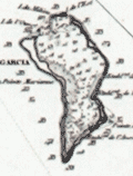 | Details | Depot de la Marine | 1870 |
| Antique French Chart of the Chagos Islands with Diego Garcia |
|
Depot de la Marine |
|
| 1870 |
| LOC:59 |
| $1,300.00 | Depot-de-la-Marine | Antique-French-Chart-of-the-Chagos-Islands-with-Diego-Garcia | Engraved antique nautical chart of the Chagos Island Archipelago, in the Indian Ocean, based on surveys of Moresby and Powell of the British East India Company. Published by the French Admiralty (Depot de la Marine) in 1841 with essential corrections in 1870.
<br></br>
The Chagos Island lie in the Indian Ocean about 300 miles south of the Maldive Islands. Diego Garcia, a United States military base, is located in the southeastern portion of the Chagos Archipelago.
<br></br>
Contains the circular anchor stamp of the Depot General de la Marine. With a black over-stamp, partially illegible but believed for "Cartes de la Marine Impériale. Debrie Libraire au Harve, Seul Depositaire."
<br></br>
Price: two Francs. Engraved by Chassant. Chart number 943. |
| 281 | 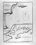 | Details | British Admiralty Hydrographical Office | 1871 |
| Bays of Pampatar and Port Moreno, and Port of Laguna Grande del Obispo |
|
British Admiralty Hydrographical Office |
|
| 1871 |
| LOC:5 |
| $95.00 | British-Admiralty-Hydrographical-Office | Bays-of-Pampatar-and-Port-Moreno--and-Port-of-Laguna-Grande-del-Obispo | Lithographed antique nautical chart shows Port Moreno and the castle and city of Pampatar, Venezuela near the easternmost point on the island of Margarita- Punta Ballena. Also, Laguna Madre del Obispo, a bay on the northern coast of the Golfo de Cariaco in the state of Sucre, Venezuela. Originally published in 1826 with corrections in 1871, these two nautical charts on a single page are copied from earlier copperplate engraved works prepared by the Spanish Direccion Hidrografia ca 1809.<BR> </BR>
<a style="color:#9BAFCB" rel="nofollow" href="/Creator/direccion-hidrografia">See all inventory by the Direccion Hidrografia: </a>
<BR> </BR>Stamp of "Hydrographical Office". Price: sixpence. Notation at bottom: "Sold by J.D. Potter, Agent for the sale of Admiralty Charts, 31 Poultry & 11 King Street, Tower Hill". |
| 282 | 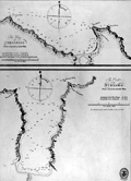 | Details | British Admiralty Hydrographical Office | 1871 |
| The Bay of Corsarios and the Port of Turiamo from Spanish printed plans. |
|
British Admiralty Hydrographical Office |
|
| 1871 |
| LOC:5 |
| $85.00 | British-Admiralty-Hydrographical-Office | The-Bay-of-Corsarios-and-the-Port-of-Turiamo-from-Spanish-printed-plans- | 19th century lithographed antique nautical chart shows two coastal areas in Venezuela: The Bay of Corsarios and The Port of Turiamo. Originally published in 1827 with corrections in 1871, these two charts on a single page are copied from earlier copperplate engraved works prepared by the Spanish Direccion Hidrografia.<BR> </BR>
<a style="color:#9BAFCB" rel="nofollow" href="/Creator/direccion-hidrografia">See all antique nautical charts by the Direccion Hidrografia: </a>
<BR> </BR>Stamp of "Hydrographical Office". Price: sixpence. Notation at bottom: "Sold by J.D. Potter, Agent for the sale of Admiralty Charts, 31 Poultry & 11 King Street, Tower Hill". |
| 581 | 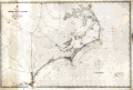 | Details | British Admiralty Hydrographical Office | 1871 |
| Albemarle Sound to Cape Fear |
|
British Admiralty Hydrographical Office |
|
| 1871 |
| LOC:0 |
| $720.00 | British-Admiralty-Hydrographical-Office | Albemarle-Sound-to-Cape-Fear | Antique, rolled, British Admiralty sea chart of the coast of North Carolina ( NC ). This lithographed chart, although issued by the Admiralty Hydrographic Office in London, is based on work by the U.S. Coast Survey ca. 1847 and is dated to the edition of 1871. Numerous soundings, aids to navigation, inlets, rivers, and hazards are noted.
<br></br>
Coverage extends from Currick Sound / Elizabeth City, N.C. south to Little River Inlet at the border with South Carolina. A sampling of the many noted points of interest include: Cape Fear, Cape Lookout, Cape Hatteras, Albemarle Sound, Pamplico Sound, Core Sound, Holden Beach, Neuse River, Ocracoke Inlet and Ocracoke Island, Beaufort, Wilmington, Elizabeth City, and at the very bottom, Frying Pan Shoals.
<br></br>
This antique sea chart was first published at the Admiralty in London on November 30, 1861 under the superintendence of Captain Washington, R.N.: F.R.S. Hydrographer. Sold by J.D. Potter, agent for the Admiralty Charts. 31 Poultry and 11 King Street Tower Hill (London). Number 2826. Price when issued was half a crown. |
| 1041 | 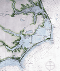 | Details | British Admiralty Hydrographical Office | 1871 |
| 1871 Chart of the Outer Banks, Albemarle Sound to Cape Fear |
|
British Admiralty Hydrographical Office |
|
| 1871 |
| LOC:53 |
| $1,600.00 | British-Admiralty-Hydrographical-Office | 1871-Chart-of-the-Outer-Banks--Albemarle-Sound-to-Cape-Fear | Antique, British Admiralty sea chart of the North Carolina Outer Banks in outstanding condition. Although issued by the Admiralty Hydrographic Office in London, this chart is based on work by the U.S. Coast Survey ca. 1847 and is dated with corrections to May, 1871. Numerous soundings, aids to navigation, inlets, rivers, and hazards are noted, particularly in Onslow Bay, Raleigh Bay, and the coastal inlets.
<br></br>
Coverage extends from Currick Sound / Elizabeth City, N.C. south to Little River Inlet at the border with South Carolina. A sampling of the many noted points of interest include: Cape Fear, Cape Lookout, Cape Hatteras, Albemarle Sound, Pamplico Sound, Core Sound, Holden Beach, Neuse River, Ocracoke Inlet and Ocracoke Island, Beaufort, Wilmington, Elizabeth City, and at the very bottom, Frying Pan Shoals.
<br></br>
This antique sea chart was first published at the Admiralty in London on November 30, 1861 under the superintendence of Captain Washington, R.N.: F.R.S. Hydrographer. Sold by J.D. Potter, agent for the Admiralty Charts. 31 Poultry and 11 King Street Tower Hill (London). Number 267. |
| 5093 |  | Details | Meyer, Ernest L. | 1871 |
| Unrecorded map of Elizabeth, New Jersey 19th Century |
|
Meyer, Ernest L. |
|
| 1871 |
| LOC:1409 |
| $4,650.00 | Meyer--Ernest-L- | Unrecorded-map-of-Elizabeth--New-Jersey-19th-Century | Unrecorded map of Elizabeth, New Jersey by Ernest L. Meyer and W.F. Wonneberg from 1871. Single sheet, apparently the bottom half of a two-sheet map. Published two years before an earthquake, in September 1873, caused a panic that led to a recession. Ernest L. Meyer C.E. was City Surveyor for Elizabeth, N.J.
<br></br>
Not in LOC, WorldCat, or AMPR. Not found online, nor mentioned anywhere.
<br></br>
Engraved by J. Schedler. No. 60 Fulton Street, N.Y. Entered according to Act of Congress in the year 1871 by Ernest L. Meyer and W.F. Wonneberg in the Office of the Librarian of Congress at Washington D.C.
<br></br>
Meyer also published a "Map of Elizabethtown, N.J. at the time of the Revolutionary War"; a smaller "Map of the City of Elizabeth, N.J.", 1856; and with P. Witzel in 1862, the "Topographical Map of Union County, New Jersey".
<br></br>
Includes two ink stamps: John G. Saurwein, Attorney at Law, Elizabeth, N.J.; and James Vosseller. |
| 910 | 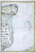 | Details | Depot de la Marine | 1871 |
| Antique nautical chart of coastal Kent, England from Dover to Margate |
|
Depot de la Marine |
|
| 1871 |
| LOC:64 |
| $875.00 | Depot-de-la-Marine | Antique-nautical-chart-of-coastal-Kent--England-from-Dover-to-Margate | Very attractive 1871 edition of an antique nautical chart of the coast of <b>Kent, England</b> including the towns of Dover, Deal, Sandwich, Ramsgate, Broadstairs, and Margate; originally issued in 1866.
Carefully hand-colored, this fine French Sea chart is a fabulous example of the value and appeal that coloring can add to a chart. This chart would make a fine gift for any sailor or fisherman who travels those waters.
<br></br>
Numerous attractive inset elevation views of the coast and drawings of navigational aids. These inset views include the Balise du Godwin Safety (a balise was an elevated signal fire); three lighthouses: "Feu de North Foreland", "Feu de Ramsgate", "Feu Superieur de South Foreland"; and seven extremely decorative profile views of the coast with homes, mills, churches and towers as they existed in 1866. These fine coastal elevation views include: Pugin's Tower; Broadstairs North Cliff with the Ramsgate jetty below; the Deal wharf with Old Parker's Cap in the background; a single view with Kingsdown Church in alignment with Ripple Mill and Walmer Castle aligned to the Upper Deal Mill; Old Stairs Bay; the Admiral's wharf with Shakespeare Cliff; and finally at the upper right, a long profile that includes Saint Lawrence Church, Ramsgate Church, the North Down monument and Redding Street balise.
<br></br>
Includes the dangerous North Goodwin Sands offshore the coast protected by these lightships: "Feu FixeSouth Sand Head", "Feu Floyttant de la Pt. N. du Goodwin" and "Gulf Stream Feu tournant de 20 s and 20 s"
<br></br>
Published by France's Depot des Cartes et Plans de la Marine with corrections in 1871 based on an earlier work from 1866 by the British Admiralty. Number 2410. Contains a blue ink over-stamp from the seller "Au Semaphore" in Havre. |
| 911 | 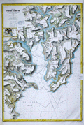 | Details | Depot de la Marine | 1871 |
| Antique nautical chart of the Bay and Port of Falmouth, England |
|
Depot de la Marine |
|
| 1871 |
| LOC:64 |
| $825.00 | Depot-de-la-Marine | Antique-nautical-chart-of-the-Bay-and-Port-of-Falmouth--England | Very attractive 1870 antique nautical chart of the <b>Port of Falmouth, England</b> on the south coast of Cornwall. The chart includes the towns of Penryn, Flushing, and Falmouth with an 3" x 4" inset map of Truro at left. Carefully hand-colored after issue, this fine French Sea chart is a fabulous example of the value and appeal that coloring can add to a chart. The blue wash coloring along the coastal margins and light brown highlights of the carefully hachured topographic detail heighten the allure of this decorative navigational lithograph. This chart would make a fine gift for any sailor or boat-man who travels the waters near Falmouth Bay.
<br></br>
Filled with the expected hundreds of depth soundings, isobaths (countour lines of equal depth below the surface), navigational hazards and aids to navigation. Also includes copious detail of the creeks, roads, villages, and topography in the surrounding area. A sample of those details include: <b>Pendennis Castle</b>; St. Mawes Harbor; Swan Pool; St. Gluvias Church; Beacon Hill; Conreeth Moor; the Truro branch of the West Cornwall Railway; St. Michael Penkevit Church; Saint Anthony Church; and Lamorran Church
<br></br>
Contains a blue ink over-stamp from the seller "Au Semaphore" in Havre, France.
<br></br>
Originally issued by France's Depot des Cartes et Plans de la Marine in 1867, this edition contains corrections up to 1870. Chart is based on an earlier work from 1853 by the British Admiralty. Number 2445. |
| 1283 | 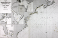 | Details | Robiquet, Aime | 1871 |
| Carte de la Cote des Etats-Unis Comprise Entre la Nouvelle-Ecosse et la Floride |
|
Robiquet, Aime |
|
| 1871 |
| LOC:0 |
| $1,350.00 | Robiquet--Aime | Carte-de-la-Cote-des-Etats-Unis-Comprise-Entre-la-Nouvelle-Ecosse-et-la-Floride | Fine chart of the east coast of North America. A scarce privately-published chart by Robiquet from Paris in 1871. Chart coverage includes Prince Edward Island and the Bay of Fundy, coastal Nova Scotia, Maine, New Hampshire, Massachusetts, Connecticut, Rhode Island, New Jersey, New York, Delaware, Virginia, North Carolina, Bermuda, South Carolina, Georgia and Florida. Numerous depth soundings and lighthouses higlighted in yellow.
<br></br>
At the bottom a paste-on stamp from the seller, the very cool "Librairie des Navigateurs" in Bordeaux, France. Four detailed inset charts include:
<div class="indenttextblock">
<ul style="list-style-type: circle;">
<li>Baie de New York</li>
<li>Charleston, S.C.</li>
<li>Carte de la Baie Delaware</li>
<li>The Florida Peninsula or "Complement de la Partie Meridionale des Etats-Unis"</li>
</ul>
</div>
This large nautical chart was published privately by hydrographer Aime Robiquet in 1871. Rue Pavée Saint-André des Artes No. 2, Paris, France. Printed by Louis Antoine. Number 44 |
| 4866 |  | Details | Rose, Edwin | 1872 |
| Manuscript cadastral map of Snow Shipyard Portland, Maine. |
|
Rose, Edwin |
|
| 1872 |
| LOC:0 |
| $1,675.00 | Rose--Edwin | Manuscript-cadastral-map-of-Snow-Shipyard-Portland--Maine- | Large manuscript map by Edwin Rose of the Snow Farwell and Company property in Rockland, Maine dated within to July 5th, 1872. A rare and informative map of the waterfront at south Rockland, Maine with a detailed record of shoreline and structures as they existed 150 years ago.
<br></br>
A few of the key features Rose noted include Mechanic Street, two marine railways and a marine railway wharf, apparently part of Snow Farwell & Co. The two octagonal building above the railways are almost certainly sheds for horse-powered winches. At bottom left a wharf surrounds
<br></br>
Snow Shipbuilding was founded in 1862 by Captain Israel Snow. It was located at the end of Mechanic Street, adjacent to the Cobb, Butler yard. The Snow family sold it to General Seafoods after WWII. The western half is now the Sail, Power and Steam Museum, while the eastern half is still active as Rockland Marine.
<br></br>
Location fronts on Owl's Head Bay; West Penobscot Bay. Surveyed by Edwin Rose Esq. Drawn by L.L. Buckland. Scale 50 feet to 1 inch. |
| 944 |  | Details | British Admiralty Hydrographical Office | 1872 |
| Antique British sea chart of Mobile Bay and Dauphin Island |
|
British Admiralty Hydrographical Office |
|
| 1872 |
| LOC:53 |
| $1,350.00 | British-Admiralty-Hydrographical-Office | Antique-British-sea-chart-of-Mobile-Bay-and-Dauphin-Island | Attractive, scarce antique British nautical chart of Mobile Bay, Alabama and Dauphin ("Dauphine") Island. With Isle aux Herbes and Bayou la Batre. On <b>Dauphin Island</b> the noted features include Fort Gaines, Heron Bayou, Second Bayou, Gravline Bay, Bayou Aloe, Chitgae Point, Drury Pass, Little (and Big) Margaret Pass, and Bayou Matagua. Opposite Dauphin Island, Bonsecours Bay, Mobile Point, Pilot Town and Fort Morgan are noted with a separate quarters building and three large umbrella pines, e.g. "West Umbrella tree" that are referenced as range markers in the sailing directions of Blunt's contemporary "American Coast Pilot" (Blunt, Edmund M. 21st ed. 1867. pp. 399-400.)
<br></br>
This is a large rolled nautical chart on heavy paper. Not the folded preliminary survey on weak paper that is often found in Reports to Congress.
<br></br>
North end of Mobile Bay includes a street plan of Mobile, Alabama with nearby features including Pole Cat Bay, Chicasaw Bayou, Chacaloochee Bay, Apalachee River, and Minetta Bay. Good detail of the east bay including Weeks Bay, Blakely River, Point Clear, <b>D'Olives Bay, D'Olives Creek</b>, (<i>near present-day Daphne, Al.</i> ), Alabama City, and Newport.
<br></br>
Inset sailing directions carry this warning:
<div class="indenttextblock"> "Caution: Sand and Pelican Is. are increasing in length and Pelican Channel is getting narrower every year… Pelican Bay is available only for vessels drawing less than 12 feet water. The entrance from outside should not be attempted without a pilot, nor can the state on the main channel be considered as permanent."</div>
</br>
Scale 1/80,000. Number 2344.
<br></br>
Publisher's attribution reads :<div class="indenttextblock"> "London, Published at the Admiralty 12th March 1862 under the Superintendence of Captn. Washington R.N.F.R.S. Hydrographer. Corrections Feb 72. Sold by J.D. Potter Agent for the Admiralty Charts 31 Poultry and 11 King Street Tower Hill."</div> |
| 3605 |  | Details | Eldridge, George | 1872 |
| Early Eldridge Harbor Chart of Salem, Beverly, Marblehead, Manchester, Gloucester, Rockport |
|
Eldridge, George |
|
| 1872 |
| LOC:53 |
| $650.00 | Eldridge--George | Early-Eldridge-Harbor-Chart-of-Salem--Beverly--Marblehead--Manchester--Gloucester--Rockport | Scarce and early Eldridge coastal chart of Massachusetts from LYNN to HALIBUT POINT. Shows George Eldridge's (the founder) bold and distinctive style that mariners came to appreciate for its utility.
<br></br>
Includes the towns of Lynn, Swampscott, Salem, Beverly, Marblehead, Manchester, Gloucester, Cape Ann, Rockport, and Annisquam. Includes extensive sailing directions.
<br></br>
Dated within to 1872. Published by S. Thaxter & Son, 125 State Street, Boston.
<br></br>
George Eldridge (1821-1900) was a fisherman, coastal pilot, and cartographer who published charts and coast pilots, some with his son George W., from the mid 1800's until his death . The Eldridges published their own charts in competition with the U.S. Coast Survey. |
| 4926 |  | Details | U.S. Coast and Geodetic Survey | 1872 |
| Antique chart of the Yucatan Channel Mexico Cuba |
|
U.S. Coast and Geodetic Survey |
|
| 1872 |
| LOC:13 |
| $240.00 | U-S--Coast-and-Geodetic-Survey | Antique-chart-of-the-Yucatan-Channel-Mexico-Cuba | Scarce U.S. Coast and Geodetic Survey hydrographic chart of the Yucatan Channel with soundings from 1872 taken by R. Platt then an Acting Master in the U.S.N.
<br /><br />
Old survey chart of the channel between the east Yucatan area of Mexico and the Cape San Antonio Light in Cuba. Inset drawing of the profile of the channel with a horizontal scale of 1 / 100,000. With a tabular display of the type of bottom composition (sand, mud …) encountered by depth of the soundings. |
| 345 |  | Details | Depot de la Marine | 1872 |
| Carte Particuliere de la Cote Sud-Ouest d'Amerique |
|
Depot de la Marine |
|
| 1872 |
| LOC:67 |
| $355.00 | Depot-de-la-Marine | Carte-Particuliere-de-la-Cote-Sud-Ouest-d-Amerique | Large mid-nineteenth century antique nautical chart from the French Depot de la Marine. This antique chart is made more interesting by the display of extensive topographical relief details of the coastal margins. Detailed coverage of the Southwest coast of Patagonia (Chile) from the Western approach to the Strait of Magellan (near the Evangelistas group of islands) north to the Gulf of Penas. An inside route is shown that would have permitted 19th century navigators to bypass at least some of the lower Pacific. Features include Mont Burney, insets of Hevre de l"isle and Anse Colombine; numerous islands, archipelagos, and straits. <BR> </BR>
Corrected version from 1872 of a chart first published in 1851. No. 1307. With circular stamp of Depot General de la Marine. |
| 5303 |  | Details | Colvin, Verplanck | 1873 |
| First map Hudson River headwater Lake Tear of The Clouds |
|
Colvin, Verplanck |
|
| 1873 |
| LOC:53 |
| $350.00 | Colvin--Verplanck | First-map-Hudson-River-headwater-Lake-Tear-of-The-Clouds | This gem is the first published map of the ultimate headwater for the Hudson River- <b>Lake Tear of the Clouds</b> (near Keene, NY) by Verplanck Colvin. A fine topographic map with 100 foot contour intervals from Colvin's 1873 Adirondacks Survey Report. Plate 6. Lithographed by Weed, Parsons and Company, Albany, N. Y. Scarce.
<br></br>
One thousand feet below the summit of Mt. Marcy on the southwest slope, Lake Tear of the Clouds is the highest pond in the state of New York. Verplanck Colvin and William Nye were the first white men to discover Lake Tear of the Clouds and to take the time to explore and document its flow to the south to the Hudson River.
<br></br>
Verplanck Colvin (1847–1920) was a lawyer and topographical engineer whose understanding and appreciation for the environment of the Adirondack Mountains was born exploring the Adirondack wilderness as a teenager. Colvin saw first hand how over-logging of the Adirondack wilderness reduced the water supply for downstream rivers, streams, and canals. He realized that the effects of this ecological mismanagement threatened the water supply of the Erie Canal, important to the economy of New York State.
<br></br>
Colvin's observations and relentless enthusiasm led the legislature to name him Superintendent of the New York state land survey and later to the establishment of Adirondack Forest Preserve in 1885.
Contour interval 100 feet. |
| 4925 |  | Details | U.S. Geological Survey | 1873 |
| Pair of mining maps for Slate Creek Basin, California |
|
U.S. Geological Survey |
|
| 1873 |
| LOC:13 |
| $270.00 | U-S--Geological-Survey | Pair-of-mining-maps-for-Slate-Creek-Basin--California | Two rare original antique mining maps of the northern and southern part of Slate Creek Basin in Sierra County California. Both maps show placer mine (stream-bed mining) locations with company names, Chinese mining camps, tunnel locations, hydraulic mines, dwelling houses, waterways and proposed tunnels.
<br /><br />
Shows many ditches and labeled wagon roads including the "wagon road from La Port to Queen City."
<br /><br />
Mining companies include Yankee Hill Placer Mines, Maria Hartman Company, Alturas Gold Mining Company, Indian Queen Company, and Poverty Point Placer Mines. |
| 896 | 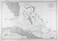 | Details | Depot de la Marine | 1873 |
| Antique French Chart of the Straits of Florida and Bahamas |
|
Depot de la Marine |
|
| 1873 |
| LOC:1111 |
| $900.00 | Depot-de-la-Marine | Antique-French-Chart-of-the-Straits-of-Florida-and-Bahamas | Attractive antique French navigation chart covers the <b>Strait of Florida</b>, Grand Bahama Bank, Little Bahama Bank, and much of Cuba. Originally released in 1865 this edition was printed with updates in 1873 by France's Depot de la Marine. Includes the Florida Keys, the Tortugas, Great Abaco Island, Grand Bahama Island, Andros Island, and the Bahamian island chain as far south as Great Inagua Island. Named habitations include Tampa, Florida, and Havana, Cuba.
<br></br>
Perhaps the most signifcant feature of the map is the lack of settlements along Florida's east coast. Hydrographic features on the lower east coast include the Indian River, Jupiter Inlet, Biscayne Bay, and Hillsboro Inlet ("Entre de Hillsboro") but the sole settlement is <b>Fort Dallas</b>, established on Key Biscayne by the U.S. Navy in 1836 to prevent trade between the indigenous Seminole Indians and traders from Cuba and the West Indies.
<br></br> Chart is a lithograph, based on U.S. and Spanish precursor charts, produced in 1873 by France's Depot de Cartes et Plans de la Marine, their official hydrographic agency. |
| 862 |  | Details | British Admiralty Hydrographical Office | 1873 |
| Antique Chart of the Bill of Portland to St Albans Head, England |
|
British Admiralty Hydrographical Office |
|
| 1873 |
| LOC:0 |
| $265.00 | British-Admiralty-Hydrographical-Office | Antique-Chart-of-the-Bill-of-Portland-to-St-Albans-Head--England | Old antique linen-backed sea chart of the Portland Bill, a promontory on the Isle of Portland, in southern Dorset, England extending eastward to the rocky headland of St. Albans Head. Two lighthouses are shown highlighted in yellow, an upper and a lower lighthouse. Key features identified by name on the chart include Portland Ledge, the Shambles, Weymouth, Melcombe Regis, White Nore, East and West Lulworth, Kimeridge, St. Alban's Head, and Endcombe House.
<br></br>
The surrounding coast of Portland, namely Portland Bill and Chesil Beach, have been notorious for the many vessels that became shipwrecked in the area over the centuries. The dangerous coastline, which features a stony shingle beach, shallow reefs and the Shambles sandbank, was proven more hazardous due to the strong tidal rapid known as the Portland Race. The Portland race, with short choppy waves and eddies, is caused by the constriction of the tidal flow between the Bill and the Shambles.
<br></br>
Published by the Admiralty March 5, 1873 under the Superintendence of Rear Admiral G.H. Richards, Hydrographer. Contains a pasted label for the seller, James Wyld, Geographer to the Queen.
<br></br>
See also a
<a href="http://www.rarecharts.com/ShowDetail/Creator/British-Admiralty-Hydrographical-Office/Title/Antique-Chart-of-the-Dorset-Coast-with-Weymouth-and-Portland--England/863 " target="_blank">similar large-scale chart of Weymouth and Portland.</a> |
| 863 |  | Details | British Admiralty Hydrographical Office | 1873 |
| Antique Chart of the Dorset Coast with Weymouth and Portland, England |
|
British Admiralty Hydrographical Office |
|
| 1873 |
| LOC:0 |
| $285.00 | British-Admiralty-Hydrographical-Office | Antique-Chart-of-the-Dorset-Coast-with-Weymouth-and-Portland--England | Large-scale detailed antique linen-backed sea chart of Weymouth, the West Bay, the Shambles, Portland Harbour, and Portland Bill, a promontory on the Isle of Portland, in southern Dorset, England. Two lighthouses are shown highlighted in yellow, an high light and a lower lighthouse. Three attractive inset elevation views at bottom include: Anvil Point, Wyke Regis Church, and the Small Chalk Pit.
<br></br>
Portland Bill and the nearby area have been notorious for the many vessels that became shipwrecked in the area over the centuries. The dangerous coastline, which features a stony shingle beach, shallow reefs and the Shambles sandbank, was proven more hazardous due to the strong tidal rapid known as the Portland Race. The Portland race, with short choppy waves and eddies, is caused by the constriction of the tidal flow between the Bill and the Shambles.
<br></br>
Key features identified by name on the chart include Portland Ledge, Chesilton, a merchant ships anchorage, the man of war anchorage, the Shambles, Weymouth, Melcombe Regis, Jordan Hill, Ringsted Ledge, and Holworth Cliff.
<br></br>
Published by the Admiralty May 9, 1855 with corrections to 1873. Contains a pasted label for the seller, J. Wyld, Geographer to the Queen. Scale 1/18,200.
<br></br>
See also a similar small-scale chart covering a
<a href="http://www.rarecharts.com/ShowDetail/Creator/British-Admiralty-Hydrographical-Office/Title/Antique-Chart-of-the-Bill-of-Portland-to-St-Albans-Head--England/862 " target="_blank">wider area of the Dorset coast to St. Alban's Head.</a> |
| 4757 |  | Details | British Admiralty Hydrographical Office | 1873 |
| Antique Chart of New Zealand from Otago to the Mataura River and Ruapuke Island |
|
British Admiralty Hydrographical Office |
|
| 1873 |
| LOC:59 |
| $1,100.00 | British-Admiralty-Hydrographical-Office | Antique-Chart-of-New-Zealand-from-Otago-to-the-Mataura-River-and-Ruapuke-Island | Two scarce antique charts of New Zealand on one sheet: 1) Middle Island, Otago to Mataura River (with large scale insets of Waikawa Harbor and of Catlin River), and 2) Foveaux Strait, Ruapuke Island.
<br></br>
Based on surveys of <b>Captain J. L. Stokes</b> and officers of the HMS Acheron during 1849-1851. Among his many accomplishments, Stokes served as assistant surveyor aboard the <b>HMS Beagle</b> during its well-known voyage around the world with Charles Darwin in 1833-36. Hooker's brief biography of Stokes includes a portrait and this entry:
<div class="indenttextblock"> "Stokes, John Lort (1812-86) - Royal Navy officer and hydrographer, was chosen by Beaufort, the British Hydrographer for the 'Great New Zealand Survey.' Stokes had joined the navy as a ‘volunteer first class’ in 1824 and by 1843, he was an experienced surveyor with the rank of commander. In 1846, he was promoted to captain and in the following year was given command of HMS Acheron. Between 1848 and 1855, Stokes surveyed extensively in New Zealand waters. With Drury’s surveys they were the most complete investigations carried out to that time. Over forty-five New Zealand charts were published in the years following Stokes’ and Drury’s surveys. Some of Stokes' data were also incorporated in maps published by Arrowsmith." (Hooker, Brian. Dictionary of New Zealand Map-Makers.<a href="http://zeehaen.tripod.com/dictionary_map_m/dictionary_part_c_bh.htm " target="_blank">Internet</a>)</div> |
| 3627 |  | Details | U.S. Coast and Geodetic Survey | 1873 |
| Antique Chart of Trinidad Harbor, California Humboldt County |
|
U.S. Coast and Geodetic Survey |
|
| 1873 |
| LOC:10 |
| $200.00 | U-S--Coast-and-Geodetic-Survey | Antique-Chart-of-Trinidad-Harbor--California-Humboldt-County | Rare harbor chart of Trinidad Harbor, in Humboldt County, California. With an attractive coastal elevation view of Trinidad Head, Prisoner's Rock and the entrance to the harbor as seen from offshore. Contains sailing directions, tide tables, notes and more. We are unable to find this item online or on AMPR!
<br></br>
Manuscript notations and ink stamp by the U.S. Geological Survey are unusual and point to the authenticity and age of this chart. |
| 5402 |  | Details | Wadsworth, George | 1873 |
| Unrecorded First Map of the Town Of Everett Massachusetts |
|
Wadsworth, George |
|
| 1873 |
| LOC:53 |
| $4,500.00 | Wadsworth--George | Unrecorded-First-Map-of-the-Town-Of-Everett-Massachusetts | Unrecorded original lithographed map of Everett, in Middlesex County, Massachusetts published in October 1873, three years after the town of Everett separated from the city of Malden, Mass. on March 9, 1870. Originally part of Charlestown and later Malden, this is <strong>the first printed map solely of the town of Everett (1873)</strong> after the separation.
<br></br>
The cost of potable water was one of the key factors motivating the separation of Everett (South Malden) from Malden. In 1870 Everett was an agricultural community with a population of 2,152 inhabitants. The needs of what was then South Malden diverged from the northern part of Malden, particularly with respect to the need for a water source. Despite a near unanimous vote of South Malden, which could draw water from the Mystic River, Malden voted to source water from Spot Pond. Everett's charter in 1870 contained a clause that exempted the new town from the onerous debt Malden incurred in sourcing their water supply.
<br></br>
No holdings of this rare map are recorded anywhere online including the LOC and Leventhal Library.
<br></br>
Created by and based on the surveys of George Wadsworth, civil engineer and surveyor in Everett, and others.
Published and lithographed by J. Mayer and Co. 4 State Street, Boston. |
| 2527 | 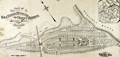 | Details | Whitman and Breck | 1874 |
| Plan of land in Orient Heights - Beachmont in Revere, Mass. |
|
Whitman and Breck |
|
| 1874 |
| LOC:53 |
| $2,400.00 | Whitman-and-Breck | Plan-of-land-in-Orient-Heights---Beachmont-in-Revere---Mass- | Unrecorded heliotype plan or plat of land for sale in 1874 by the Boston Land Company in Orient Heights, Revere, Massachusetts- today's Beachmont neighborhood. Orient Heights is Boston's northernmost and northeastern most neighborhood.
<br></br>
This early antique lot plan of Beachmont, is an unrecorded plan found nowhere else online. Bordered at the east by the Atlantic Ocean, the platted land lies with an area bounded by Endicott Avenue and Winthrop Avenue. Includes Bradstreet Avenue, Dudley Street, Sales Street, Cross Street, Crest Avenue, Bellingham Avenue and Leverett Avenue.
<br></br>
Other notable features include a proposed Boston Revere Beach and Lynn Railroad track and depot; the Orient Café surrounded by a small park; Sales Creek and a sand ridge. For each lot square footage and lot number are shown.
<br></br>
In upper right an inset small-scale map of other holdings of the Boston Land Company in Revere, Mass. with major roads, waterways and rail lines.
<br></br>
Surveyed by Whitman and Breck, 16 Water Street, Boston. Heliotype printed. A heliotype is a print produced by a “photomechanically produced plate for pictures or type made by exposing a gelatin film under a negative, hardening it with chrome alum, and printing directly from it.” (Source: https://www.thefreedictionary.com/heliotype) |
| 860 | 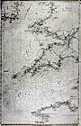 | Details | British Admiralty Hydrographical Office | 1874 |
| Antique linen-backed chart of the English Channel and Bristol Channel |
|
British Admiralty Hydrographical Office |
|
| 1874 |
| LOC:0 |
| $350.00 | British-Admiralty-Hydrographical-Office | Antique-linen-backed-chart-of-the-English-Channel-and-Bristol-Channel | Old antique nautical chart of the English Channel first published by the British Admiralty on July 1, 1859. This edition bears cummulative corrections to 1874. Coverage extends from Finisterre, France and Ushant ( "Ile de Ouessant" ) past the English county of Cornwall, past Wales, to the southeast coast of Ireland including Wexford and Waterford. Key features include Brest, France, the island of Guernsey, Cornwall, The Scilly Isles, the Bristol Channel, Saint George's Channel, and Cardigan Bay.
<br></br>
Original seller's attribution to J.D. Potter is pasted over with an addendum: "Sold by J. Wyld, Geographer to Her Majesty. 457 Strand." With the oval logo of the Hydrographical Service. Chart # 2675b. |
| 1464 | 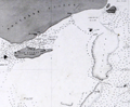 | Details | Depot de la Marine | 1874 |
| Detroit de Torres. Second sheet. |
|
Depot de la Marine |
|
| 1874 |
| LOC:59 |
| $200.00 | Depot-de-la-Marine | Detroit-de-Torres---Second-sheet- | Fine antique small-scale nautical chart (Sheet 2 of 3) of northern Torres Strait, the body of water separating the continent of Australia (Nouvelle Hollande) from New Guinea. Last corrections in 1874. One of 4 charts of the Torres Strait area produced by the Depot de la Marine, this being the second detail sheet encompassing the north end of the strait near New Guinea. |
| 1465 | 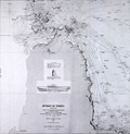 | Details | Depot de la Marine | 1875 |
| Detroit de Torres. Third sheet with Raine Island |
|
Depot de la Marine |
|
| 1875 |
| LOC:59 |
| $600.00 | Depot-de-la-Marine | Detroit-de-Torres---Third-sheet-with-Raine-Island | Fine antique small-scale nautical chart (Sheet 3 of 3) of southern Torres Strait, the body of water separating the continent of Australia (Nouvelle Hollande) from New Guinea. Last corrections in 1874. One of 4 charts of the Torres Strait area produced by the Depot de la Marine, this being the third detail sheet encompassing the south end of the strait and the tip of the Cape York Peninsula in north Australia.
<br></br>
<b>Inset drawings of Raine Island and the tower on Raine Island</b>, on the outer edges of the Great Barrier Reef, about 120 km east-northeast of Cape Grenville, Cape York Peninsula. Raine Island, a small vegetated coral cay, is the site of the oldest European structure in tropical Australia, a stone beacon built in 1844. An important environmental icon, Raine island got its name from Captain Thomas Raine (1793-1860), the English mariner who discovered it. |
| 1466 |  | Details | Depot de la Marine | 1875 |
| Detroit de Torres First sheet with York Island |
|
Depot de la Marine |
|
| 1875 |
| LOC:59 |
| $600.00 | Depot-de-la-Marine | Detroit-de-Torres-First-sheet-with-York-Island | Fine antique small-scale nautical chart (Sheet 1 of 3) of southern Torres Strait, the body of water separating the continent of Australia (Nouvelle Hollande) from New Guinea. First published in 1860 with last corrections made in 1875.
<br></br>
One of 4 charts of the Torres Strait area produced by the Depot de la Marine, this being the first detail sheet encompassing the Cape York Peninsula, York Island "Ile du Prince de Galles", Eborac Island, and numerous other cays and islands in the Torres Strait Archipelago. |
| 1330 |  | Details | Depot de la Marine | 1875 |
| Antique Chart of Cape York Peninsula, Australia and Torres Strait |
|
Depot de la Marine |
|
| 1875 |
| LOC:59 |
| $800.00 | Depot-de-la-Marine | Antique-Chart-of-Cape-York-Peninsula--Australia-and-Torres-Strait | Fine antique small-scale nautical chart of the Torres Strait, the body of water and passage separating the continent of Australia (Nouvelle Hollande) from New Guinea. Last corrections in 1875. Prominently shows the Cape York Peninsula, the northern-most portion of the Australian state of Queensland, surrounded by the Sea of Carpenteria to the west and the Coral Sea to the east. New Guinea lies to the north. (One of 4 charts of the Torres Strait area, this being the general chart of the entire area).
<br></br>
Published by the French Depot des Cartes and Plans de la Marine in 1860, this edition with corrections to 1875. Number 1861. |
| 4976 |  | Details | British Admiralty Hydrographical Office | 1875 |
| Admiralty chart of Australia Magnetic Island to Double Point Barrier Reefs |
|
British Admiralty Hydrographical Office |
|
| 1875 |
| LOC:59 |
| $1,300.00 | British-Admiralty-Hydrographical-Office | Admiralty-chart-of-Australia-Magnetic-Island-to-Double-Point-Barrier-Reefs | Antique British Admiralty navigation chart of the East Coast of Australia, sheet 15 in a series. Coverage includes Moresby River, Mourliyan Harbor, the King Reefs, Bay Hill, Dunk Island, Kennedy Bay, Rockingham Bay, Goold Island, Port Hinchinbrook, Bishops Peak, Halifax Bay.
<br></br>
Map clearly features several sources of fresh water, low mangrove swamps, sugar plantations, and much of the inner Australian Barrier Reef. Includes a large poorly mapped region of the east Australian coast noted as: "Low wooded coast and apparently much occupied by lagoons".
<br></br>
Colophon: Published according to an Act of Parliament at the Hydrographic Office of the Admiralty March 20th, 1855. Sold by J.D. Potter. |
| 5153 |  | Details | British Admiralty Hydrographical Office | 1875 |
| Antique Admiralty Chart of South Ceylon (Sri Lanka) |
|
British Admiralty Hydrographical Office |
|
| 1875 |
| LOC:59 |
| $1,150.00 | British-Admiralty-Hydrographical-Office | Antique-Admiralty-Chart-of-South-Ceylon-(Sri-Lanka) | Large nautical chart of south Sri Lanka (Ceylon) published in 1858 with last corrections in 1875. This scarce antique navigation chart was based on surveys by T.H. Twynam in 1833. The chart includes three finely engraved coastal elevation views- Colombo from the Outer Anchorage, Galle Light House, and Lion Peak.
side of Gan Island.
<br></br>
Five inset large-scale harbor charts include:
<div class="indenttextblocksingle">
<ul style="list-style-type: circle;">
<li>Colombo</li>
<li>Dodandowe Bay</li>
<li>Kirinde Road</li>
<li>Belligam Bay</li>
<li>Point de Galle Harbour</li>
</ul>
</div>
The sailing directions on this old chart make for interesting reading. For Belligam Bay the Admiralty recommended: "Keep the Cocoanut Trees on the point inside Woody Island well open until you bring Ruane Rock on with the east side of Gan Island."
<br></br>
The chart is titled: "Indian Ocean. Ceylon, South Coast. Surveyed by Mr. T.H. Twynam, Master Attendant at Point de Galle, 1833, with additions by Mr. James Steuart, Master, R.N., and E.I. Company's Officers."
<br></br>
Published by the Hydrographic Office of the Admiralty January 1858 by Captain Washington. Engraved by J and C. Walker. Sold by J.D. Potter, London. |
| 4738 | 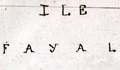 | Details | Favereau, Charles-Eugene | 1875 |
| Manuscript Notebook of Vice Admiral Charles Favereau with Charts |
|
Favereau, Charles-Eugene |
|
| 1875 |
| LOC:2001 |
| $1,500.00 | Favereau--Charles-Eugene | Manuscript-Notebook-of-Vice-Admiral-Charles-Favereau-with-Charts | <img src="\PageImages\Charles_Eugene_Favereau_Vice_Amiral.jpg" alt="French Vice-Admiral Charles Eugene Farereau" width="150" Align="left" style="margin:1em">Rare and desirable notebook including much tight French script and eight MS charts and port plans from the early training cruises of Vice-Admiral Charles Eugene Favereau (1856-1936), then an aspirant (Midshipman) in the French Navy.
<br></br>
Favereau entered Naval School in October, 1872 and after three years was an aspirant in October, 1875. Favereau first served on the training ship ALEXANDER and then on the GAULOISE in the Mediterranean and in 1877 on the MAGICIENNE in the Pacific. (Source: http://ecole.nav.traditions.free.fr/officiers_favereau_charles.htm)
<br></br>
During a long career in the French Navy Favereau served as Lieutenant Commander, Commander, and Captain aboard the cruiser NAIADE, the battleships FORMIDABLE, REPUBLIC, ST.LOUIS and BAYARD. On June 30, 1910 Favereau was promoted to contre-Admiral, and on January 28, 1914 to Vice Admiral . He left the Navy in 1918.
<br></br>
Favereau's eight ink manuscript harbor plans and charts include ports on the Mediterranean north coast of Africa, the Azores, Spain, and the islands of Madeira.
<div class="indenttextblock">
a) Port d'Alger (Algiers) </BR>
b) Plan du Mouillage de Mers al Kebir</BR>
c) Partie est de Madere (East portion of the Madeira archipelago)</BR>
d) Plan de Funchal et de la Baie</BR>
e) Western Azores (Sao Jorge, Faial, and Pico)</BR>
f) Plan of Fayal (Faial) and Baie de Horta</BR>
g) Faial-Pico channel</BR>
h) Vigo estuary and Cies Islands</BR>
</div>
</BR>
Text of about 80 pages in French. Small drawings of devices and machinery related to weapons and artillery. With small notations in red at several points believed to be grades or acknowledgement of completion by an instructor. |
| 953 | 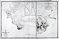 | Details | British Admiralty Hydrographical Office | 1875 |
| Antique Chart of Bluff Harbor and Invercargill, New Zealand |
|
British Admiralty Hydrographical Office |
|
| 1875 |
| LOC:59 |
| $1,375.00 | British-Admiralty-Hydrographical-Office | Antique-Chart-of-Bluff-Harbor-and-Invercargill---New-Zealand | Large British Hydrographic charts of <b>Bluff Harbor</b> on the southern coast of South Island, <b>New Zealand</b>. Located across the Foveaux Strait from Bluff is Stewart Island (not shown). Bluff is one of the oldest areas on New Zealand where Europeans established a presence. The first European settlers arrived around 1823. A second, enlarged scale chart is at right of "Entrance of Awarua or Bluff Harbour."
<br></br>
With an inset chart "Continuation of New River to <b>Invercargill</b> / surveyed by Mr J.T. Thomson, 1856." Invercargill is the southernmost and westernmost sizeable city in New Zealand, and among cities with a population of over 50,000 is the 5th southernmost city in the world. (<a href="https://en.wikipedia.org/wiki/Southernmost_settlements " target="_blank">Internet</a>)
<br></br>
The chart denotes the location of Maori settlements including: "Old village of Te Whero"; "Owi Village"; "Omawi Village"; and a "Freshwater Spot".
<b></b>
At upper right, sailing directions for Bluff Harbor from Mr. Thomson, Harbor Master in 1865 includes instructions for boarding a pilot:
<div class="indenttextblock"> "Vessels from the Eastward, taking the passage between Dog Island and the sands, should give the island a half mile berth and steer about West for Look-out Point till Starling Pt. bears North, then steer in to pass about 1 1/2 cables length [ a cable length is about 100 fathoms or 600 feet] off Starling Pt. leaving the red buoys on the starboard hand and when abreast of it the pilot boat will be seen.
</div>
</br>
Manuscript marginal notations (sailing directions) in French and two manuscript additions of bouys to the chart suggest that this chart was actually used for navigation in that area.
<br></br>
Based on surveys of <b>Captain J. L. Stokes</b> of the HMS Acheron. Stokes served as assistant surveyor aboard the <b>HMS Beagle</b> during its well-known voyage around the world with Charles Darwin in 1833-36. |
| 3653 | 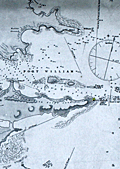 | Details | British Admiralty Hydrographical Office | 1875 |
| Scarce British chart of East Falkland Island and Stanley Harbor |
|
British Admiralty Hydrographical Office |
|
| 1875 |
| LOC:51 |
| $3,200.00 | British-Admiralty-Hydrographical-Office | Scarce-British-chart-of-East-Falkland-Island-and-Stanley-Harbor | Scarce, perhaps very rare, British hydrographic chart of the Stanley Harbor, Port William, and Port Harriett in the Falkland Islands. The chart is based on observations taken during the surveys of Captain Robert Fitzroy (1805 -1865) during the second voyage of the HMS Beagle. Includes an elevation view of the Cape Pembroke lighthouse.
<br></br>
A search of OCLC/WorldCat revealed that no libraries were found to hold the chart and no examples are online for sale. One instance of a sale of this chart is recorded in the Antique Map Price Record, in 2006.
<br></br>
Originally published by an act of Parliament in 1847. This chart was printed with corrections and additions in 1875 from London. With the seller's oval blue ink stamp of Phillip, Son & Nephew, Agents for the Admiralty Charts, 49 South Castle Street, Liverpool. Last correction 1875.
<br></br>
Robert Fitzroy studied at the Royal Naval College. His first command was the famed sloop HMS Beagle. During the Beagle's second voyage (Dec. 1831 - Oct. 1836) Fitzroy surveyed the coasts of Patagonia, Tierra del Fuego and the Straits of Magellan, accompanied by the naturalist Charles Darwin, whose later publications were largely based on discoveries and observations made during this voyage. Darwin and Fitzroy shared quarters aboard the Beagle and their discussions aboard ship are believed to have greatly influenced Darwin.
<br></br>
The main purpose of the expedition was to conduct a hydrographic survey of the coasts of the southern part of South America. The voyages of the Beagle established FitzRoy as an excellent navigator, a sound surveyor and a man of science. Suffering from depression, Fitzroy took his own life with a straight razor in 1865. Today a settlement on East Falkland is named in honor of Robert Fitzroy.
<br></br>
Chart no. 1774. |
| 578 | 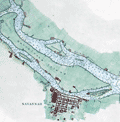 | Details | British Admiralty Hydrographical Office | 1875 |
| Savannah River and Calibogue Sound |
|
British Admiralty Hydrographical Office |
|
| 1875 |
| LOC:53 |
| $1,250.00 | British-Admiralty-Hydrographical-Office | Savannah-River-and-Calibogue-Sound | A large antique British Admiralty nautical chart of the Savannah River area, Georgia first issued in 1855 and corrected in 1862. This lithographed chart, although issued by the Admiralty Hydrographic Office in London, is based on work by the U.S. Coast Survey and is dated at bottom left to the edition of 1875. Numerous soundings, aids to navigation, and hazards are noted.
<br></br>
Named features on this antique nautical chart include Hilton Head Island, Daufuskie ( Daufuski ) Island, Tybee Island, Wilmington Island, McQueens Island, Cockspur Island, Argyle Island, Onslow Island, Hutchnison and Fig Islands; the towns/settlements of Savannah, Wassaw, Bonaventure; fortresses of Fort Jackson, Fort Pulaski, and Fort Thunderbolt; and the locations of Opossum Point, Stoddards House, Mongens House, and Spanish Wells.
<br></br>
The chart was first published at the Admiralty in London on July 1, 1861 under the superintendence of Captain Washington, R.N.: F.R.S. Hydrographer. Sold by J.D. Potter, agent for the Admiralty Charts. 31 Poultry and 11 King Street Tower Hill (London). Number 2826. Price when issued was half a crown. |
| 1468 | 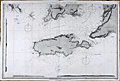 | Details | British Admiralty Hydrographical Office | 1875 |
| Gulfs of St. Vincent and Spencer Southern Sheet 2 |
|
British Admiralty Hydrographical Office |
|
| 1875 |
| LOC:59 |
| $1,300.00 | British-Admiralty-Hydrographical-Office | Gulfs-of-St--Vincent-and-Spencer-Southern-Sheet-2 | A special chart in excellent condition for the collector of Australian maps. This antique British Admiralty sea chart contains both the town of Adelaide, Australia AND also bears the blue sellers over-stamp of A.E. Sawtell a chart-seller from Port Adelaide, Australia from at least 1874 to 1901 or later (See <a href="https://www.rarecharts.com/ShowDetail/Creator/Sawtell--Alfred-E-/Title/Sawtells-Nautical-Almanac/209" target="_blank">Sawtell's 1874 nautical almanac</a> from our archives.).
<br></br>
The southern sheet of a large 2-sheet sea chart, unjoined. Last correction in 1875. Covers the southern portion of St. Vincent Gulf and Spencer Gulf with Investigator Strait, the MacDonnell Peninsula, Kangaroo island, Wedge Island, Thistle Island, Encounter Bay, Aldinga Bay, and Holdfast Bay . Shows the nascent town of Adelaide, Australia with several neighboring villages including: Plympton, Kensington, Beaumont, Norwood, and Glenelg.
<br></br>
Three inset coastal profile views taken from various directions including one view that is labeled: "Outline of the Land on the East side of St. Vincent Gulf as seen from a vessel's deck when running up Troubridge Lighthouse bearing N.W. by W 1/2 W. 9 1/2 miles."
<br></br>
Publisher's attribution reads: "Published at the Admiralty 17 Aug. 1874 under the Superintendance of Captain F.J. Evans R.N., C.B, F.R.S. Hydrographer ." Number 2389b.
<br></br>
Alfred E. Sawtell, was a seller of nautical charts and instruments from Port Adelaide Australia. Sawtell published a Nautical Almanac in 1874 containing an ephemeris, tide tables, sailing directions for Australian ports, pilotage dues, a 7 page list of Australian vessels and their tonnage; and ships regulations for bathing, sanitation and gunpowder. In that almanac the back cover advertisement describes A.E. Sawtell as: "Chronometer, Watchmaker, Nautical Optician, Chart and Nautical Bookseller". |
| 1469 |  | Details | British Admiralty Hydrographical Office | 1875 |
| Gulfs of St. Vincent and Spencer Northern Sheet 1 |
|
British Admiralty Hydrographical Office |
|
| 1875 |
| LOC:59 |
| $1,350.00 | British-Admiralty-Hydrographical-Office | Gulfs-of-St--Vincent-and-Spencer-Northern-Sheet-1 | A very special chart in excellent condition for the collector of Australian maps. The northern sheet of a large 2-sheet sea chart, covering Port Adelaide and sold by a nautical chart-seller from Port Adelaide.
<br></br>
This antique British Admiralty sea chart contains both the town of Port Adelaide, Australia AND also bears the blue sellers over-stamp of A.E. Sawtell a chart-seller from Port Adelaide, Australia from at least 1874 to 1901 or later. (See <a href="https://www.rarecharts.com/ShowDetail/Creator/Sawtell--Alfred-E-/Title/Sawtells-Nautical-Almanac/209" target="_blank">Sawtell's 1874 nautical almanac</a> from our archives.) Chart is In fine condition. North sheet of a large 2-sheet sea chart, unjoined but with a wing-sheet, an extension to the chart as issued covering northern-most Spencer Gulf miles past Port Augusta, Australia.
<br></br>
Covers the northern portion of St. Vincent Gulf and Spencer Gulf.
<br></br>Bottom sheet (2) publisher's attribution reads: "Published at the Admiralty 17 Aug. 1874 under the Superintendance of Captain F.J. Evans R.N., C.B, F.R.S. Hydrographer ." Number 2389a.
<br></br>
Bottom sheet (2) seller's information: "Sold by J.D. Potter Agent for sale of the Admiralty, 31 Poultry and 11 King Street, Tower Hill."
<br></br>
Alfred E. Sawtell, was a seller of nautical charts and instruments from Port Adelaide Australia. Sawtell published a Nautical Almanac in 1874 containing an ephemeris, tide tables, sailing directions for Australian ports, pilotage dues, a 7 page list of Australian vessels and their tonnage; and ships regulations for bathing, sanitation and gunpowder. In that almanac the back cover advertisement describes A.E. Sawtell as: "Chronometer, Watchmaker, Nautical Optician, Chart and Nautical Bookseller". An enclosed stock list included nautical books, charts, chronometers and "transparent dipping needle and plain compass cards all sizes". |
| 5322 |  | Details | S. B. Cushing and Company | 1875 |
| Antique manuscript map Seekonk or Pawtucket River Rhode Island |
|
S. B. Cushing and Company |
|
| 1875 |
| LOC:300 |
| $350.00 | S--B--Cushing-and-Company | Antique-manuscript-map-Seekonk-or-Pawtucket-River-Rhode-Island | Scarce historic manuscript pen and ink surveyor's plat map of several tracts of land owned by Phanuel E. Bishop at what is now called "Bishop Point" in Pawtucket, Rhode Island. North is oriented to the bottom. The land, about one mile north of the Phillipsdale Historic District, is bordered to the south and west by the Seekonk (Pawtucket) River, by Bishop Street to the north, and bordered by Charlton Street to the east. The plat, comprised of tracts totaling about 20 acres, shows the line of the high water mark at the boundary of the Pawtucket River.
<br></br>
<img src="https://digitalcollections.uhv.edu/digital/api/singleitem/image/p16791coll2/3342/default.jpg" alt="Phanuel E. Bishop in uniform ca. 1862" width="120" align="left" style="margin: 0px 20px">
Captain Phanuel Euclid Bishop (1844 - 1890) served during the War of the Rebellion in Company H. Ninth Rhode Island Infantry from May 1862 to September 1862. Bishop entered the 1867 class at Brown University where he studied for one year. Bishop then served in Company B, First Battalion Fourteenth Regiment of the Rhode Island Heavy Artillery during 1864 and left the army in October 1865 with the rank of Captain.
<br></br>
The map is a manuscript trace on surveyor's tracing cloth paper by S. B. Cushing and Company Rhode Island. A true copy dated October 9, 1878 signed by Lewis Pearce, Town Clerk.
<br></br>
See online: Chenery, William H. The Fourteenth Regiment Rhode Island Heavy Artillery (Colored,) in the war to preserve the Union 1861 - 1865. Providence. Snow & Farnham. 1898. p. 301. |
| 5321 |  | Details | Price, R. M. | 1876 |
| Antique Map Of The South Mountain And Boston Rail Road and Connections |
|
Price, R. M. |
|
| 1876 |
| LOC:53 |
| $350.00 | Price--R--M- | Antique-Map-Of-The-South-Mountain-And-Boston-Rail-Road-and-Connections | Hand-colored, antique lithographed thematic map showing the route of the South Mountain and Boston Rail Road across the states of New York, New Jersey, Pennsylvania, and Massachusetts. Colored regions of the map are labeled with names of the metals, fossil fuels or other natural resources in the vicinity of the SM&BRR route. These resources include:
<div class="indenttextblocksingle">
<ul style="list-style-type: circle;">
<li>Coal</li>
<li>Bituminous Coal</li>
<li>Anthracite</li>
<li>Iron</li>
<li>Zinc</li>
<li>Petroleum</li>
<li>Lumber</li>
</ul>
</div>
Incorporated in 1854, the company suffered during the Panic of 1873 and began to auction off its property between 1877 and 1880. Includes a fine large decorative title vignette showing a puffing SM&BRR locomotive pulling passenger cars out of a dark tunnel.
<br></br>
The map was produced by R.M. Price Jr, Chief Engineer for the railroad. Published by Reading Publishing House in 1876.
<br></br>
Title: "Map Of The South Mountain And Boston Rail Road & Connections showing territory passed through rail-roads and canals crossed or connected with together with mineral and geographical features of country passed through."
<br></br>
Inset map of the SM&BRR bridge over the Hudson River: "Bridge by which the South Mountain & Boston R.R. is to cross the Hudson River at Poughkeepsie, N.Y. A short, direct railroad route from New England to the coal, oil, and slate regions of Pennsylvania and to the west and south."
<br></br>
Verso includes two Pennsylvanian township maps- Washington and Heidelburg townships. Neat pencil notation on verso: John Strauss, Mrs. Strauss |
| 3680 | 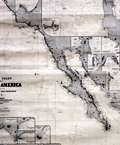 | Details | James Imray and Son | 1876 |
| West Coast of North America from San Blas to San Francisco |
|
James Imray and Son |
|
| 1876 |
| LOC:0 |
| $2,400.00 | James-Imray-and-Son | West-Coast-of-North-America-from-San-Blas-to-San-Francisco | Spectacular and large blueback nautical chart from <b>California's post Gold-Rush era</b> . Published five years before the establishment of the San Francisco Stock Exchange at 312 California Street, this antique sea-faring chart documents all the ports, harbors, and towns along the west coast of North America from Mendocino City, CA. to past Cabo Corrientes, Mexico and includes the Baja Peninsula with full coverage of all the areas surrounding <b>Cabo San Lucas</b> and <b>Mazatlan</b>, MX.
<br></br>
This blueback chart contains numerous inset charts including: San Francisco Bay; Santa Barbara; Bodega Bay; San Diego Bay; Ballena Bay; Mangles Road; San Jose del Cabo Bay; Tamales Bay; Magdalena Bay; San Lucas Bay; Mazatlan.
<br></br>
Verso consists of the original blue-paper backing as issued to strengthen the chart for its expected hard life at sea. Also on the verso is the original yellow publisher's label from the Imray firm that reads "COAST OF CALIFORNIA. James Imray and Son. London. Chart 135."
<br></br>
Due to changing conditions charts could become outdated quickly and it was important for mariners to understand the accuracy of their navigational charts. The British Admiralty and later the U.S. Coast Survey responded by recording the dates of each update on the map, in some cases maintaining a historical record of updates spanning many decades. Private publishers of sea charts fulfilled the same need by providing the date of the last update with an inked over stamp. |
| 5173 | 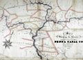 | Details | Wierman Jr., T. T. | 1876 |
| Map Showing the Canals Belonging to the Pennsylvania Canal Company. |
|
Wierman Jr., T. T. |
|
| 1876 |
| LOC:200 |
| $1,150.00 | Wierman-Jr---T--T- | Map-Showing-the-Canals-Belonging-to-the-Pennsylvania-Canal-Company- | Manuscript thematic surveyor's map from 1876 detailing the visible hydrographic features of east central Pennsylvania with numerous rivers, creeks and canals. The map's theme is the canals belonging to the Pennsylvania Canal Company.
<br></br>
The map was probably used to generate blueprint copies and dates to the beginning of the decline of the Pennsylvania Canal System. In 1867, the Pennsylvania Railroad formed the Pennsylvania Canal Company using their canals to haul freight. By 1900 most Pennsylvania canal were unused, a victim of the significant financial advantage provided by the railroads
<br></br>
With a finely drawn compass rose with a fleur de lis skewered by a gaily festooned pointer. Also contains much detail about railroads, bridges and towns, a reflection of the company's ownership by a railroad company.
<br></br>
Portions of the waterways are labeled as :
<div class="indenttextblocksingle">
West Branch Division
Juniata Division Penna Canal
Wyoming Division Pennsylvania Canal
Pennsylvania Canal
Union Canal
</div>
The map contains all or part of the following Pennsylvania counties: Blair, Center, Clynton, Huntingdon, Mifflin, Snyder, Juniata, Perry, Cumberland, York, Lancaster, Dauphin, Northumberland, Montou, Columbia, Luzerne, Lycom, Centre.
<br></br>
Drawn by T. T. Wierman Jr. Assistant Engineer. |
| 950 |  | Details | Depot de la Marine | 1876 |
| Antique Nautical Chart of Tasmania, Australia |
|
Depot de la Marine |
|
| 1876 |
| LOC:59 |
| $3,275.00 | Depot-de-la-Marine | Antique-Nautical-Chart-of-Tasmania--Australia | A bold, large, antique French hydrographic chart of the island of <b>Tasmania</b>, a part of the Commonwealth of Australia, after an English chart by F.J. Evans, master of the British Royal Navy (1860). Beautifully engraved, this old nautical chart on laid paper was first published by France's Depot de la Marine in 1867 and last updated with corrections in 1876. Coverage to the north includes portions of the Bass Strait and Banks Strait; Cape Barren Island and Clarke Island; and the Hunter Islands. Key features noted in Tasmania are largely within a few hundred miles of the coast; the interior is devoid of detail. Includes <b>Port Dalrymple</b>, George Town, Port Maquarie, Port Davey, Hobart ("Hobarttown"), the Derwent River and Fleurieu Bay.
<br></br>
Near bottom of the chart is found a elevation view of the southern approaches to the island extending from Maatsuyker Island to Cape Tasman. Elevation detail is shown by meticulous hachuring and shading and includes numeous peaks on that mountainous island. Mount Wellington, Cradle Mountain, Frenchman's Cap, Mount Victoria, and Eldon Peak are a few of the numerous peaks noted even though many of the highest peaks on the island had yet to be discovered as late as the mid 19th century.
<br></br>
Tasmania was first discovered in 1642 by an expedition led by Dutch explorer Abel Tasman aboard ships of the Dutch East India Company. During the first part of the 19th century the island served as the main penal colony for Australia and as many as 75,000 convicts were transported there. The island was originally known as <b>Van Diemen's Land</b>, a practice that continued until 1856 when it was renamed Tasmania . Number 2536.
<br></br> |
| 828 |  | Details | James Imray and Son | 1876 |
| Rice Ports of India |
|
James Imray and Son |
|
| 1876 |
| LOC:0 |
| $1,800.00 | James-Imray-and-Son | Rice-Ports-of-India | Privately published blueback chart of the Myanmar ( Burma ) coast including the entire Irawaddy River delta and the Gulf of Martaban. In the 1860's and 1870's as a result of Britain's investment in flood control projects in the Irawaddy River Basin, Burma was transformed into the world's largest rice exporter. This large antique chart would have provided ship owners and sailing masters in the rice trade with a single sheet that offered both small-scale and large-scale navigational information for many of the destinations they sailed from. Inset charts of: Kyouk Phyou, Aracan River, Bassein River, Rangoon River, Bentick Sound and Amherst Road.
<br></br>
Blueback charts are recognizable from the blue paper backing that was attached to a nautical chart to provide the needed strength to withstand hard usage at sea. Published by James Imray and Son, 89 Minories and Tower Hill, London, 1876. James Imray and Sons is one of the firms that over the last two centuries combined to form Imray Laurie Norie & Wilson Ltd.
<br></br>
The following description of the chart was published by Rosser and Imray in the Catalog section of their 1867 "Seaman's Guide" : <div class="indenttextblock">A chart on two large sheets of the the coasts of the Bay of Bengal between latitudes 13° and 21° N, longitudes 92° and 98° E. With plans of Akyab, Kyou, Phiouk, Bassein River, Rangoon River, Maulmain, and Kalegouk Island anchorage. A very useful chart for Shipmasters bound to Akyab, Rangoon, or Maulmain as it exhibits the navigation on a larger scale than any hitherto published. (Rosser, William H. and Imray, James F. <b>"The Seaman's Guide to the Navigation of the Indian Ocean and China Sea."</b> <a href="https://books.google.com/books?id=_8BBAAAAIAAJ">Internet</a>. 6/11/2015)
</div>
</br>
Laid to blue paper for protection with cloth selvage. Original cloth map ties. Yellow label from the Imray firm attached on verso. |
| 931 |  | Details | James Imray and Son | 1876 |
| Gulf of Mexico New Orleans to Tampico Mexico |
|
James Imray and Son |
|
| 1876 |
| LOC:1409 |
| $4,800.00 | James-Imray-and-Son | Gulf-of-Mexico-New-Orleans-to-Tampico-Mexico | A spectacular, huge (6' foot) antique British privately-published blueback nautical chart of the western Gulf of Mexico in very fine condition. Scarce to find this chart, especially an example kept in such great shape as this one. Chart coverage includes United States coastal areas from New Orleans, Louisiana trending west and then south to Tampico, Mexico. Contains the oval blue inked over-stamp that reads "James Imray and Son, 1876, London."
<br></br>
<b>Note:</b> Because of its large size the photo is stitched together from 2 halves. Some abberations in the image may appear.
<br></br>
This old chart is dotted with numeous inset large-scale charts of key ports and important bays, rivers and harbors including: Galveston, Texas; Atchafalya Bay, Louisiaana, Sabine Pass, Matagorga Bay, Rio Grande, and Tampico, Mexico.
<br></br>
During the 1800's there was a trend toward publication of very large small-scale charts with large-scale insets of key passages and harbors. The practice was adopted as much for economics as any other reason. James Imray and Son was one of a handful of British publishers who specialized in these charts which were often backed with canvas or linen cloth or heavy blue paper in order to help them withstand the frequent use and abuse aboard ship, hence the term "blueback chart".
<br></br>
Outer blue paper contains yellow a large seller's label with the logo of James Imray amd Son.
Price when sold 10 s. |
| 522 | 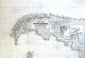 | Details | Wilson, Charles | 1877 |
| Blueback Chart of the East and West Coasts of South America |
|
Wilson, Charles |
|
| 1877 |
| LOC:1409 |
| $3,500.00 | Wilson--Charles | Blueback-Chart-of-the-East-and-West-Coasts-of-South-America | Very impressive, enormous, antique blueback sea chart of South America and west coast of the Antarctic Peninsula. We are unaware of any other copy of this chart. Strikingly large (6 ' +) and in excellent condition for 140+ years age. Oriented with North to the right. Drawn by J.S. Hobbs, F.R.G.S. Hydrographer. Insets of 'Magalhaen' Strait, Berkeley Sound and Stanley Harbor, Port of Valdivia, Rio Negro, Cumberland Bay, Port San Carlos, and Concepcion Bay. Numerous inset coastal profile views.
<BR> </BR>
Notable points of interest include Buenos Aires, Argentina, the Falkland Islands (Span. Islas Malvinas), Tierra del Fuego, Patagonia, Port Belgrano, Port Vallego, South Shetland Islands, and Graham Land (the western side of the Antarctic Peninsula named after Sir James R. G. Graham, First Lord of the Admiralty at the time of John Biscoe's exploration in 1832).
<BR> </BR>
With blue paper backing as issued. During the 1800's there was a trend toward publication of very large small-scale charts with large-scale insets of key passages and harbors. This made it possible for mariners to replace perhaps a half-dozen or more charts with just one. The practice was adopted as much for economics as any other reason. Charles Wilson (as the successor to Norie and Company) was one of a handful of British publishers who specialized in these charts which were often backed with canvas or linen cloth or heavy blue paper in order to help them withstand the frequent use and abuse aboard ship, hence the term "blueback chart".
<BR> </BR>
Published by: "Charles Wilson (Late J.W. Norrie and Wilson) at the Navigation Warehouse and Naval Academy, 157 Leadenhall Street." London.
<BR> </BR>
Seller's original red label reads: "River Plate to Valparaiso, including South Shetland Islands. C. Wilson (late Norie and Wilson), 157 Leadenhall St. London, E.C. Price 12 S, 0d." |
| 4896 |  | Details | Woodruff, James G. | 1877 |
| The Woodruff Scientific Expedition that Never Was |
|
Woodruff, James G. |
|
| 1877 |
| LOC:2001 |
| $200.00 | Woodruff--James-G- | The-Woodruff-Scientific-Expedition-that-Never-Was | First edition prospectus, the "Final Announcement" of the failed Woodruff Scientific Expedition Around the World (with map of the intended route), originally planned for 1877-1879. Two hundred paying students at $2,500 each were needed to fund the study-abroad adventure but subscriptions fell far short of the expedition's needs and the project failed. Woodruff abandoned the expedition project in May 1878 and died shortly thereafter. Despite efforts to revive the expedition for 1880-1882, it again failed to move forward.
<br><br />
The statement below from the brochure thoroughly document it's content:
<div class="indenttextblocksingle">
Final Announcement of the Woodruff Scientific Expedition Around the World starting October 1877 and Returning October 1879 giving plan of organization, management, faculty, financials, details, route and approximate dates and stoppages, description of vessel, equipment, and character of command, map of route, letters of approval, cadet class and other information necessary for a full understanding of this enterprise.
</div>
<br />
Includes two separate insert sheets:
<div class="indenttextblocksingle">
<ul style="list-style-type: circle;">
<li>A note (5"x7") from the Secretary of the Navy R.W. Thompson three months before the planned departure. Thompson gave faint, hedged support for the expedition: <b>" … if it shall prove successful ..." and "… there is at this time a fair prospect of this result."</b></li>
<li>A 2 page sheet (9"x12") issued from the St. Nicolas Hotel in New York City with a composite-woodblock engraving of the Woodruff Expedition Steamship "Ontario." Verso with a title and an expedition summary.</li>
</ul>
</div>
Printed at Riverside Press. Cambridge, Massachusetts. 1877. |
| 5239 |  | Details | U.S. Army Engineers | 1878 |
| Early U.S. Flow Map Tonnage Chart of Coastwise Commerce |
|
U.S. Army Engineers |
|
| 1878 |
| LOC:3 |
| $320.00 | U-S--Army-Engineers | Early-U-S--Flow-Map-Tonnage-Chart-of-Coastwise-Commerce | Scarce thematic <b>flow map</b> of the United States west coast: California, Oregon, and Washington. An early institutional example of a "flow map" used for the U. S. Government. The flow map was first used less than 40 years earlier by Charles-Joseph Minard after his earlier formative use line width to display the attrition of French troops during Napoleon's Russian campaign of 1812.
<br></br>
<div class="indenttextblocksingle">
The chart shows the volume (tonnage) of maritime trade from all points south of San Francisco to ports along the U.S. West Coast. The use for the chart was to support the decision-making process for selecting a new harbor of refuge and breakwater on the Pacific Ocean between the Strait of Juan de Fuca and San Francisco.
<br></br>
Tonnage Chart of Coastwise Commerce North of San Francisco -California
<br></br>
From "Harbor of Refuge on the Pacific Coast Appendix PP of the Annual report to the Chief of Engineers for 1881. Washington: Government Printing Office. 1881. |
| 764 |  | Details | Depot de la Marine | 1878 |
| Antique Nautical Chart of the North Sea and British Isles |
|
Depot de la Marine |
|
| 1878 |
| LOC:0 |
| $250.00 | Depot-de-la-Marine | Antique-Nautical-Chart-of-the-North-Sea-and-British-Isles | Large French antique nautical chart of the North Sea and the British Isles published in 1867 and updated with corrections to 1878. Detailed coverage includes the coasts of France, Belgium, Holland, Denmark, and Norway from Bordeaux, France at the south all the way to Averoy, Norway at the north. Includes the Faroe, Orkney, and Shetland islands, the Skaggerak, English Channel ( la Manche ) , Irish Sea, and North Sea.
<br></br>
Several hundred coastal lighthouses and lighted navigational aids are highlighted with a red dot and a yellow highlight. Three pasted on paper corrections at bottom when issued by the Depot de la Marine. Number 2367. |
| 647 |  | Details | British Admiralty Hydrographical Office | 1879 |
| Coquimbo Bay and Port Herradura, Chile |
|
British Admiralty Hydrographical Office |
|
| 1879 |
| LOC:67 |
| $175.00 | British-Admiralty-Hydrographical-Office | Coquimbo-Bay-and-Port-Herradura--Chile | British Admiralty chart of the Coquimbo Peninsula in north-central Chile, just south of the tourist destination of La Serena. Detailed topography and hydrography with numerous soundings about the town and bay of Coquimbo, Chile and the adjacent Port Herradura. Based on the survey by Captain Richard C. Mayne, R.N. and the officers of H.M.S. Nassau, 1868.
<br></br>
Feaures include Whale Rock, the town of Herradura (in ruins), Cuyacan, the English cemetery, a Clilean cemetery, Signal Hill, Tortuga Point with lighthouse, and four smeltting works. Railroad lines are located both to Serena and to Panucillo.
<br></br>
Orginally published at the Admiralty, London on May 1, 1869 and corrected in August 1873. Sold by J.D. Potter. 31 Poultry and 11 King Street, Tower Hill. |
| 2504 | 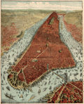 | Details | Rogers, Peet and Company | 1879 |
| Birdseye view of New York City |
|
Rogers, Peet and Company |
|
| 1879 |
| LOC:3 |
| $280.00 | Rogers--Peet-and-Company | Birdseye-view-of-New-York-City | Antique 19th century oblique-angle bird’s-eye view of New York City centered prominently on Manhattan. This original small folding map depicts the Brooklyn Bridge, the Peet company’s building on Broadway, hundreds of boats and ships (sail and steam) in the Hudson and East Rivers. Contains a key to 24 different points of interest including Castle Garden, Washington Square, Cooper Union, Central Park, and Long Island Sound.
<br></br>
The map was a promotional vehicle for the clothing company of Rogers, Peet & Co. Verso contains a "Strangers’ Guide to New York." Top margin and right margin with alpha-numeric symbols keyed to the map legend.
<br></br>
Drawn by J.W. Williams and copyrighted 1879 by Root & Tinker. Printed with Mather's inks. Folded brochure measures 3.0 x 5.5". |
| 5300 |  | Details | Liverpool, J. | 1880 |
| Quackery trade card Charlestown map Dr. J. Liverpool, Great Indian Herb Doctor |
|
Liverpool, J. |
|
| 1880 |
| LOC:300 |
| $2,500.00 | Liverpool--J- | Quackery-trade-card-Charlestown-map-Dr--J--Liverpool--Great-Indian-Herb-Doctor | Exceedingly rare and desirable trade card, in the form of a fan, ca. 1880 for Dr. J. Liverpool "The Great Indian Herb Doctor" with a map of Charlestown, Mass. - "Official Plan Battle of Bunker Hill" on verso. An advertisement for quack cures and treatments.
<br></br>
No other example found anywhere on this planet.
<br></br>
Advertising trade card in the form of a octagonal fan, mounted to a handle. <br></br>
Recto: <br></br>
<div class="indenttextblocksingle" style="text-align: center;">
"The Wonder of the World Dr. J. Liverpool Office and Laboratory 81 Green Street Boston, Mass. <br></br>
Where he may be consulted daily free of charge.<br></br>
Office hours 9 a.m. to 9 p.m. <br></br>
Sunday 10 a.m. to 3 p.m. For the benefit of the laboring class. <br></br>
All chronic diseases treated with nature's own remedies, ROOTS, HERBS, BARKS <br>Use no more poisonous drugs.<br></br>
GO AT ONCE AND SEE HIM!<br></br>
Delays are Dangerous.<br></br>
Your disease may be curable to-day - not tomorrow - therefore do not delay. He has cured thousands where others have failed."
<br></br>
</div>
Verso:<br></br>
<div class="indenttextblocksingle" style="text-align: center;">
"Official Plan Battle of Bunker Hill<br></br>
June 17, 1775<br></br>
Manufactured and Printed by L.F. Lawrence & Co.<br></br>
161 & 171 Devonshire and 30 & 32 Arch Streets, BOSTON."
</div>
<br></br>
Note: Dr. Liverpool's address at 81 Green Street, Charlestown, Mass, was one block from Bunker Hill Street and four blocks from the Bunker Hill Monument. Newspaper advertisements in 1882 for Dr. J. Liverpool recorded his address as 833 Tremont Street. |
| 5369 |  | Details | Whitman and Breck | 1880 |
| Plan of Section A in Orient Heights - Boston, Mass. |
|
Whitman and Breck |
|
| 1880 |
| LOC:53 |
| $2,400.00 | Whitman-and-Breck | Plan-of-Section-A-in-Orient-Heights---Boston---Mass- | Unrecorded plat of lands, ca. 1880, belonging to the Boston Land Company under the name Orient Heights, Section A. Shows the shoreline along the west side of Chelsea Creek.
<br></br>
Includes Summit Avenue, Orient Avenue, Terrace Avenue, Elm Street, Ashley Avenue, Chelsea Avenue, Saratoga Street, Breed Street, and Butler Avenue. Shows the proposed railroad tracks and depot for the Boston, Revere Beach and Lynn Railroad and the <b>Winthrop Horse Railroad</b>.
<br></br>
Verso with a statement by A.P. Blake, General Manager:
<div class="indenttextblocksingle">
"The within 'Section A' of the Boston Land Company's Property under the general name of ORIENT HEIGHTS, comprises about one-eights of its landed Estate all located in the City of Boston and is one of the most delightful tracts of Land east of the channel of Boston Harbor, and a very large percentage within the limits of this section is available for immediate building, and a great majority of the sites have either a southeastern, southwestern, or southern aspect, from which a charming view of Massachusetts Bay, and looks directly upon the whole Harbor of Boston, and the sites and towns with which it is surrounded, opening up for the first time to the forty-thousand people of East Boston the opportunity for rapid Expansion and assuring to them the building up of suburban surroundings equal, if not surpassing anything that has been done during the last twenty years of vigorous growth in the southerly and westerly direction, from the deep water of Boston Harbor."
</div> </br>
Surveyors index collation numbers: "11045 (4261)".
<br></br>
Surveyed by Whitman and Breck Civil Engineers and Surveyors, 16 Water Street, Boston, Massachusetts. Heliotype. A heliotype is a print produced by a “photomechanically produced plate for pictures or type made by exposing a gelatin film under a negative, hardening it with chrome alum, and printing directly from it.” (Source: https://www.thefreedictionary.com/heliotype) |
| 5199 |  | Details | Anonymous | 1880 |
| Manuscript plan of Chalon-sur-Saône, France |
|
Anonymous |
|
| 1880 |
| LOC:77 |
| $175.00 | Anonymous | Manuscript-plan-of-Chalon-sur-Saône--France | Fine manuscript pen and ink plan ca. 1880 titled: "Plan de deux enceintes primitives de Chalon sur Saone." Show the ancient city with the two ancient walls or "enceintes" at the village of Chalon-sur-Saône, France. Notes the location of many interesting sites including the "gibet" (gibbet) or post used as a gallows or place of execution.
<br></br>
With a unperforated red stamp bearing three circles ( the coat of arms of Chalon sur Saone) above the French medal Legion d'Honneur surmounted by a crown. Napoleon I awarded the Legion d'Honneur to the town of Chalon sur Saone in 1815 in recompense for their support during his Austrian campaign.
<br></br>
Top is oriented to the northeast. Shows the Saone river with bridges at right. |
| 4927 |  | Details | U.S. Coast and Geodetic Survey | 1880 |
| Scarce antique Chart of Monterey Harbor California |
|
U.S. Coast and Geodetic Survey |
|
| 1880 |
| LOC:63 |
| $750.00 | U-S--Coast-and-Geodetic-Survey | Scarce-antique-Chart-of-Monterey-Harbor-California | Electrotype copy of the chart of Monterey Harbor with a fine engraved coastal elevation view of Point Pinos from 5 miles seaward. Includes sailing directions. Chart number 5491. First issued 1852 but ca. 1880.
<br></br>
This is a scarce, separately issued, rolled hydrographic chart of the California coast, first published in 1852, not one of the common folded versions on thin paper that were issued with other charts in an annual report to Congress from the Coast Survey.
<br></br>
This antique chart was printed from an electrotype copy of the original hand-engraved copper plate, a process the U.S. Coast Survey adopted around 1850. As a soft medium, copper plates could only withstand print runs of perhaps 200 copies before the plates wore down. To enable larger print runs, a mold of the original plate was created in wax or another soft medium. Then, using an electro-chemical process ( electrotyping ), the mold was coated with a metal layer, typically copper. Printers were then able to produce output from the new electrotype copper copy, while preserving the original.
<br></br>
Electrotype copy no. 3. Sheet size 27"x24". Logo of the Coast Survey Office. Price when issued 15 cents. |
| 3652 |  | Details | British Admiralty Hydrographical Office | 1880 |
| Scarce British chart of the Falklands from Fitzroy, Robinson, and Sullivan |
|
British Admiralty Hydrographical Office |
|
| 1880 |
| LOC:51 |
| $4,000.00 | British-Admiralty-Hydrographical-Office | Scarce-British-chart-of-the-Falklands-from-Fitzroy--Robinson--and-Sullivan | Scarce, perhaps very rare, British hydrographic chart of the Falkland Islands based on observations taken during the surveys of Captain Robert Fitzroy (1805 -1865) and others. Includes ten coastal elevation views of the Falklands as seen from sea. Published by an act of Parliament in 1841 this chart was printed with corrections and additions in 1880. With the seller's oval blue ink stamp of Phillip, Son & Nephew, Agents for the Admiralty Charts, 49 South Castle Street, Liverpool.
<br></br>
No holdings of this chart are found in OCLC, no examples are online for sale. No records in AMPR.
<br></br>
Robert Fitzroy studied at the Royal Naval College. His first command was the famed sloop HMS Beagle. During the Beagle's second voyage (Dec. 1831 - Oct. 1836) Fitzroy surveyed the coasts of Patagonia, Tierra del Fuego and the Straits of Magellan, accompanied by the naturalist Charles Darwin, whose later publications were largely based on discoveries and observations made during this voyage. Darwin and Fitzroy shared quarters aboard the Beagle and their discussions aboard ship are believed to have greatly influenced Darwin.
<br></br>
The main purpose of the expedition was to conduct a hydrographic survey of the coasts of the southern part of South America. The voyages of the Beagle established FitzRoy as an excellent navigator, a sound surveyor and a man of science. Suffering from depression, Fitzroy took his own life with a straight razor in 1865. Today a settlement on East Falkland is named in honor of Robert Fitzroy.
<br></br>
Chart no. 1354. |
| 5360 |  | Details | Elliot, Charles D. | 1880 |
| Rare 1635 [1880] Historical Map of Cambridge, Massachusetts |
|
Elliot, Charles D. |
|
| 1880 |
| LOC: |
| $1,500.00 | Elliot--Charles-D- | Rare-1635-[1880]-Historical-Map-of-Cambridge--Massachusetts | Very rare original historical map of Cambridge, Massachusetts as it existed in 1635, reconstructed from earlier maps and surveys by Somerville civil engineer and surveyor Charles Darwin Elliot in 1880.
<br></br>
This artifact is the only known original <strong>full-size example</strong> of Elliot's map of Cambridge. In 1901 Elliot's map was reprinted in a reduced format as the frontispiece of the earliest Cambridge town records [1]. All extant copies of the map appear in the reduced size.
<br></br>
Charles D. Elliot (1837-1908) was born in Foxboro, Massachusetts, and studied civil engineering in the offices of W.B. Stearns and Daniel A. Sanborn (mapmaker). During the Civil War Charles D. Elliot served as a topographical engineer in the Army Engineers. Among other assignments during the war, Elliot served in Florida with responsibility for reconnaissance and construction of field fortifications. Elliot's other projects included the Cape Cod Canal and the "Mystic Valley Parkway."
<br></br>
In 1872 Charles D. Elliot became Somerville’s first city engineer. Elliot was also a member of the Somerville Historical Society. He published numerous articles related to the history of Somerville in the <strong>Historic Leaves of the Somerville Historical Society</strong> and in 1896 published "Somerville's History" [2].
<br></br>
[1] The Records of the Town of Cambridge (Formerly Newtowne) Massachusetts 1630-1703. Cambridge. 1901. Frontispiece. Accessed Online.<br>
[2] Elliot, Charles D. "Somerville's History" in "Illustrated Souvenir of the City of Somerville". Edward Samuels and Henry Kimball. 1896. |
| 1277 |  | Details | Depot de la Marine | 1880 |
| Antique chart of East Java and the Madura Strait |
|
Depot de la Marine |
|
| 1880 |
| LOC:0 |
| $450.00 | Depot-de-la-Marine | Antique-chart-of-East-Java-and-the-Madura-Strait | Antique French sea chart of east Java, Indonesia with the Strait of Madura, Lombok, <b>Bali</b> (Baly), and the <b>Kangean Archipelago</B>. A very attractive, large and clean antique nautical chart with finely-engraved detailed togography.
<br></br>
This chart was first issued by France's Depot de la Marine in 1862 and re-issued here with corrections in 1880. After an earler chart by Lt. Swann of the Royal Maraine Hollandaise. |
| 877 |  | Details | Depot de la Marine | 1881 |
| Antique Port Plan of Marseille, France in Provence |
|
Depot de la Marine |
|
| 1881 |
| LOC:58 |
| $875.00 | Depot-de-la-Marine | Antique-Port-Plan-of-Marseille--France-in-Provence | Old French large-scale chart of the port and harbor of Marseilles, France in the Provence region. The geographical extent of this antique chart extends from Cap Janet trending southward past the Iles d'Endoume ending at the beach area of Plage de Mont-Redon. Coverage includes the small island of Chateau d'If and eastern portions of Ile Ratonneau and Iles du Frioul .
<br></br>
Key features that are noted by name include: Chateau Talabot, tour St. Michel, the Nouvelle Cathedrale, Anse des Catalans, les Accoules, Hotel des Villes, and the Bassin de Carenage. Shows two lighthouses marking the entrance to the old harbor which is protected by Fort St. Jean and Fort St. Nicolas.
<br></br>
Published by France's Official Hydrographical Agency the <b> Depot des Cartes et Plans de la Marine</b>. Date of last correction: 1881. |
| 5151 |  | Details | British Admiralty Hydrographical Office | 1882 |
| Chart of South America West Coast Callao Lima Pisco Bay |
|
British Admiralty Hydrographical Office |
|
| 1882 |
| LOC:0 |
| $350.00 | British-Admiralty-Hydrographical-Office | Chart-of-South-America-West-Coast-Callao-Lima-Pisco-Bay | Antique engraved sea chart of the west coast of Peru based on explorations by the ship Beagle. Coverage includes a wide stretch of coast that includes Callao (the port for Lima, Peru), and Pisco Bay with the Ballestas Islands (Ballista). Last corrections 1882. These charts are increasingly scarce.
<br></br>
This fine chart contains seven engraved inset coastal elevation views with features that include Huacho Head, Hormigas Rocks, Salinas Point, Calavera Head, and Mount Lechuza. Two inset harbors charts: Ancon Bay and Chincha Hills.
<br></br>
Published by the Admiralty September, 15th 1840. Sold by J. D. Potter. Engraved by J. & C. Walker. Chart number 1323.
<br></br>
Faint blue stamped sellers label for Phillip, Son & Nephew, Liverpool. |
| 577 |  | Details | British Admiralty Hydrographical Office | 1882 |
| China Eastern Coast Hieshan Isles to the Yang-Tse-Kiang |
|
British Admiralty Hydrographical Office |
|
| 1882 |
| LOC:0 |
| $1,100.00 | British-Admiralty-Hydrographical-Office | China-Eastern-Coast-Hieshan-Isles-to-the-Yang-Tse-Kiang | Rolled British Admiralty sea chart of China's Eastern coast first published October 3, 1849. Coverage includes Shanghai, China, the mouth of the Yangtze River and part of the Poo-Tung (Putuo) Peninsula south to the Chusan (Zhoushan) islands. This edition of the antique nautical chart reflects the latest corrections made in 1882. With an attached extension at left. The chart is comprised of one large lithographed sheet conjoined with two smaller sheets when published.
<br></br>
Sold by J.D. Potter agent for the Admiralty Charts. 31 Poultry and 11 King Street Tower Hill (London). Number 1199. Price when issued was three shillings. |
| 6827 |  | Details | Fuller and Whitney | 1882 |
| Rare manuscript surveyors cadastral plan of Commonwealth Avenue in Boston Mass |
|
Fuller and Whitney |
|
| 1882 |
| LOC: |
| $850.00 | Fuller-and-Whitney | Rare-manuscript-surveyors-cadastral-plan-of-Commonwealth-Avenue-in-Boston-Mass | If you collect antique Boston paper or you are looking for an original, unique, one-of-a-kind gift for someone then consider this rare piece of Boston history:
<br><br>
This is a manuscript or hand drawn plan, a cadastral map of Commonwealth Avenue in Back Bay, Boston, Mass. from January, 1882. The map was the source map, a master map, a base map, for blueprint copies made around 1882 by the Civil Engineering firm of Fuller and Whitney who styled themselves "Back Bay Engineers". Fuller and Whitney tracked the owners name, lot width and lot number on Commonwealth during the fill and development of Boston's Back Bay in the latter half of the 19th century. Covers five blocks on Commonwealth Ave. between Dartmouth Street and West Chester Park, now called Massachusetts Ave.
<br><br>
Fuller and Whitey regularly used this master copy to publish beautiful blueprints tracking the progress of the Boston Back Bay project in the 1880's. To produce a blueprint they would lay a sheet of tracing paper across this master page and have a draftsman neatly trace and letter the plan in water-soluble ink. When that trace was complete they laid the trace across a sheet of unexposed blueprint paper and placed both sheets under the bright sun for several minutes to expose it, just like an old style contact photograph. The exposed print was then washed to develop it.
<br><br>
Although multiple blueprints may have been produced (I don't know of any) this is the only master manuscript source plan. They aren't making any more of these.
<br><br>
What a conversation piece! Includes notes from the engineers about the how the owner's names were put on the map and about lot widths.
<br><br>
Fuller and Whitey's document index file numbers 741 and 858.
<br><br>
<b>Other Boston manuscript maps are available. Contact us for more information.</b> |
| 2517 |  | Details | Boston Photo Electro. Co. | 1883 |
| An Exact Draught of Bostone harbour |
|
Boston Photo Electro. Co. |
|
| 1883 |
| LOC:3 |
| $380.00 | Boston-Photo-Electro--Co- | An-Exact-Draught-of-Bostone-harbour | Late 19th century facsimile of a very rare map of Boston attributed to Cyprian Southack. This facsimile is itself a scarce item and represents the best available copy of Southack's survey. Names many of the islands in Boston Harbour.
<br></br>
Depicts trees, buildings, the encampment on Noddle Island and ships in Boston Harbour pictorially. Boston Neck depicted as a very thin strip of land connecting the Shawmut peninsula to the mainland.
<br></br>
Note at bottom left reads: "Entered according to an Act of Congress in the year 1883 by A.O. Crane in the office of Librarian of Congress at Washington." |
| 559 |  | Details | U.S. Coast and Geodetic Survey | 1883 |
| Pacific Coast Pilot Alaska Part I |
|
U.S. Coast and Geodetic Survey |
|
| 1883 |
| LOC:0 |
| $495.00 | U-S--Coast-and-Geodetic-Survey | Pacific-Coast-Pilot-Alaska-Part-I | U.S. Coast Pilot of a portion of the Alaskan coast c 1883. An increasingly scarce late 19th century volume. With 16 folding lithographed charts and 13 folding sheets of views on thin onion-skin type paper all in excellent nearly pristine condition. Total of 331 pages includes over 200 pages of detailed sailing directions, several indexes, notes on name pronunciation, meteorological tables and sailing distances. <br><br/>
Manuscript fly page inscription dated July 22, 1887 by Edwin H. Abbot, Milwaukee, Wis. Original half leather with marbled boards and gold embossed spine. Boards cleanly detached but still present. U.S. Coast and Geodetic Survey. J.E. Hilgard, Superintendent. Washington 1883. |
| 4790 | 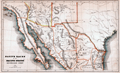 | Details | Bancroft, Hubert Howe | 1883 |
| Native races of the Pacific states New Mexican group |
|
Bancroft, Hubert Howe |
|
| 1883 |
| LOC:77 |
| $70.00 | Bancroft--Hubert-Howe | Native-races-of-the-Pacific-states-New-Mexican-group | Shows the names and lands of the Native American Indians. Covers the full extent of the Baja California peninsula, the Sea of Cortez, parts of Texas, Mexico, Arizona and New Mexico. Places Cape (Cabo) San Lucas at the tip of the Baja peninsula. Native tribes placed in their geographical context include the Guanicuris, Cochimis, Yuma, Papago, Comanche, Zuni, Navajo and many more.
<br></br>
From Bancroft's "The Native Races of the Pacific States of North America." Includes land formations, political boundaries, and rivers. |
| 596 | 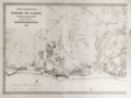 | Details | Direccao Geral dos Trabalhos Geodesicos | 1884 |
| Carta Topographica da Cidade de Lisboa |
|
Direccao Geral dos Trabalhos Geodesicos |
|
| 1884 |
| LOC:0 |
| $900.00 | Direccao-Geral-dos-Trabalhos-Geodesicos | Carta-Topographica-da-Cidade-de-Lisboa | Scarce extra-large (42" wide) antique, rolled map of Lisbon (Lisboa), Portugal. Lithograph. This large sheet is the left half of a two sheet map of Lisbon published in 1884. Finely engraved with minute topograhical details visble.
<br></br>
Produced by Portugal's Direccao Geral dos Trabalhos Geodesicos. One vertical fold as issued. |
| 5137 | 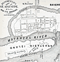 | Details | Bloomfield, Max | 1884 |
| Bloomfield's Map of St. Augustine Fla. and its Environs |
|
Bloomfield, Max |
|
| 1884 |
| LOC:11 |
| $250.00 | Bloomfield--Max | Bloomfield-s-Map-of-St--Augustine-Fla--and-its-Environs | Antique map of St. Augustine, Florida from "Bloomfield's Illustrated Historical Guide Embracing an Account of the Antiquities of St. Augustine, Florida." Fine detail shows the coquina quarries, Fort Marion, the Matanzas River, Anastasia Island and both the new lighthouse and the location of the old lighthouse. A shell road is shown entering the city past the city gates.
<br></br>
Published in 1884 by Max Bloomfield, Bookseller, News dealer and Stationer of St. Augustine, Florida. Copyrighted. At right a list of references in the City of St. Augustine including the old Spanish graveyard, the Huguenot Cemetery, the old slave market, and a monument to the Confederate dead.
<br></br>
North oriented to right. |
| 5458 | 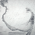 | Details | U.S. Coast and Geodetic Survey | 1885 |
| Original antique nautical chart Cape Cod Bay and Provincetown Massachusetts |
|
U.S. Coast and Geodetic Survey |
|
| 1885 |
| LOC:1403 |
| $850.00 | U-S--Coast-and-Geodetic-Survey | Original-antique-nautical-chart-Cape-Cod-Bay-and-Provincetown-Massachusetts | Original rolled, antique U.S. Coast Survey Chart no. 10 of Cape Cod Bay with the Cape Cod Peninsula first published in 1872. Numerous locations from Duxbury to Pochet Island and aids to navigation are highlighted and/or annotated in manuscript pen and ink (e.g. Nauset Beach Beacons, Wood End Light) Includes Provincetown and Provincetown Harbor. Three inset coastal recognition views as seen from offshore.
<br></br>
This is a scarce, separately issued, rolled hydrographic chart of the Massachusetts Coast from 1872, not one of the common folded versions on thin paper from annual report of the U.S. Coast Survey to Congress. This edition issued 1880 by C.P. Patterson. Updates to aids-to-navigation date the print to 1885. The price of this chart when first issued was 40 cents. Electrotype copy #2 [1].
<br></br>
[1] Artifact of the electrotype reprographic technique to create a intaglio copy of the original hand-engraved copper plate, a process the U.S. Coast Survey adopted around 1850. As a soft medium, copper plates could only withstand print runs of perhaps 200 copies before the plates wore down. To enable larger print runs, a mold of the original plate was created in wax or another soft medium. Then, using an electro-chemical process ( electrotyping ), the mold was coated with a metal layer, typically copper. Printers were then able to produce intaglio output from the new electrotype copper copy, while preserving the original hand-engraved plate.
<br></br>
Logo. |
| 6519 | 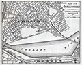 | Details | Fuller and Whitney | 1885 |
| Charles River Basin and Harvard Bridge Economic Studies |
|
Fuller and Whitney |
|
| 1885 |
| LOC:300 |
| $1,900.00 | Fuller-and-Whitney | Charles-River-Basin-and-Harvard-Bridge-Economic-Studies | Manuscript surveyors-trace economic option studies for road approaches and the proposed West Chester Park Bridge (now, Harvard Bridge, MIT Bridge, or Massachusetts Avenue Bridge). Eight surveyors' trace documents to support civil engineering and economic options for the placement of the Harvard Bridge, spanning the Charles River between Boston and Cambridge, Massachusetts. General plans for the new bridge were approved in July 1887; the bridge opened in September 1891.
<br><br>
The lot consists of eight MS pen and ink traces (for blueprint production) consisting of two base maps of Boston and Cambridge as well as six MS trace sheets with street and bridge options. The two base maps show the Charles River Basin with the existing West Boston Bridge (Longfellow Bridge) and road network. One map has much greater detail on street names and improved larger lettering.
<br><br>
Six map overlays:<br>
<div class="indenttextblocksingle">
<ul style="list-style-type: circle;">
<li>No 1. Shows the proposed new route as well as text and tabular information for the gain or loss of time over the proposed new route.</li>
<li>No. 2 Shaded area shows lands of the Charles River Embankment Company (proposed Esplanade),
proposed approaches to the Charles River Esplanade and proposed West Chester Park Bridge (aka Harvard Bridge)</li>
<li>No. 3 Approaches for the proposed West Chester Park Bridge (east of the final location)</li>
<li>No. 4 Second option. Bridge located at West Chester (aka Massachusetts Avenue) but terminated slightly more to the east.</li>
<li>No. 5 Third option. Bridge at West Chester, and a proposed wide avenue extending to the end of Commonwealth in Cambridge.</li>
<li>No. 6 Fourth option. No Esplanade </li>
</ul>
</div>
Scale 1650 feet to one inch. |
| 3613 |  | Details | Multiple Authors | 1885 |
| Lot 2. MULTIPLE antique surveyors plans BACK BAY, BOSTON , Massachusetts |
|
Multiple Authors |
|
| 1885 |
| LOC:0 |
| $6,200.00 | Multiple-Authors | Lot-2---MULTIPLE-antique-surveyors-plans-BACK-BAY--BOSTON---Massachusetts | A lot consisting of twenty lot and street plans from Boston, Massachusetts generally from the decade of the 1880's. Most items by surveyors and engineers William H. Whitney or the firm of Fuller and Whitney, Back Bay Engineers. An opportunity for a serious collector of Boston cartography to expand his collection with items he cannot find except in institutions. <a href="https://www.rarecharts.com/Content/Lot_2_Boston_Survey_Artifacts_Locked.pdf" target="_blank">See full detailed lot description.</a>
<br></br>
From the mid 1850’s through 1890 Boston conducted the most ambitious land-making of the era in the U.S. by transporting and placing gravel, ashes, and sand in an area that was previously a tidal marsh of the Charles River. The landfill of Boston’s Back Bay was fueled by a shortage of suitable land for new construction and the desire to remediate water pollution resulting from earlier bad decisions that placed profit ahead of citizen’s health and welfare.
<br></br>
Over a period of 35 years more than 450 acres of new land was added to Boston by filling the Back Bay with an average of 20 feet of fill. Much of this land was purchased by well-to-do Bostonians and today the Back Bay remains one of the most prestigious locations within that city.
<br></br>
We have been able to obtain 20 rare late 19th century artifacts that document the last decade of the 35 year land-making project in Boston’s Back Bay, for an area from Charlesgate Park to past Kenmore Square.
<br></br>
These maps and plans shed light on some of the decision-making factors and design options for Boston real-estate developers. These artifacts in this lot are of three types: hand-drawn or manuscript survey maps, manuscript traces of those surveys, and blueprints. The artifacts represent a very early application and adaptation of a cutting-edge technology: blueprinting. |
| 2543 |  | Details | Fuller and Whitney | 1885 |
| Antique manuscript engineers traced plan of Boston's Charlesgate East area |
|
Fuller and Whitney |
|
| 1885 |
| LOC:86 |
| $500.00 | Fuller-and-Whitney | Antique-manuscript-engineers-traced-plan-of-Boston-s-Charlesgate-East-area | William H. Whitney was a very early adopter of the "blue process" or blueprinting . Both this trace and the <a href="https://www.rarecharts.com/ShowDetail/Creator/Fuller-and-Whitney/Title/Antique-blueprint-engineer-s-plan-of-Boston-s-Charlesgate-East-area/2540" target="_blank">blueprint produced from this trace</a> were created by Whitney just 4 years after the earliest recorded use of blueprints for his Boston-based civil engineering firm.
<br><br>
This rare artifact is the original manuscript cadastral ink trace on tracing cloth from September 22, 1885 providing plan detail for a portion of the Boston Back Bay on Beacon and Marlborough Streets and Commonwealth Avenue west of West Chester Park (Massachusetts Avenue) and east of Ipswich Street (Charlesgate East). This trace would have been used as the reproducible master source to create one or more blueprints, then a new reprographic technology.
<br><br>
With Fuller & Whitney's ink oval over stamp. MS number in pencil at bottom right: "1277".
<br></br>
</div> |
| 2540 |  | Details | Fuller and Whitney | 1885 |
| Antique blueprint engineer's plan of Boston's Charlesgate East area |
|
Fuller and Whitney |
|
| 1885 |
| LOC:86 |
| $375.00 | Fuller-and-Whitney | Antique-blueprint-engineer-s-plan-of-Boston-s-Charlesgate-East-area | Original rare cadastral blueprint plan from September 22, 1885 providing detail for a portion of Boston's Back Bay on Beacon Street, Marlborough Street, and Commonwealth Avenue west of West Chester Park (Massachusetts Avenue) and east of Ipswich Street (Charlesgate East). At center left the reader will find the Beacon Entrance to Back Bay Park.
<br></br>
This blueprint, and perhaps other like it, were the end product created from <a href="https://www.rarecharts.com/ShowDetail/Creator/Fuller-and-Whitney/Title/Antique-manuscript-engineers-traced-plan-of-Boston-s-Charlesgate-East-area/2543" target="_blank">a manuscript trace document</a> by William H. Whitney.
</div>
Verso is blank.
<br></br>
During the period 1872 to 1888 Fuller & Whitney Civil Engineers, was conducted as a partnership between J. Franklin Fuller and William H. Whitney with offices at 39 Court Street, Boston, Mass. Whitney assumed sole control of the firm in 1888 and changed the name to William H. Whitney.
<br></br>
In his autobiography Whitney refers to his work with the latest cutting-edge reprographic technology- blueprinting: <div class="indenttextblock">“In September 1881 I received a bronze medal at the Massachusetts Charitable Mechanic Association Exhibit for sun or blue prints. I developed a process from the French and used it in illustrating the growth of Back Bay lands. I issued to subscribers monthly schedules and maps showing the changes of ownership, increase in value, improvement by filling and public works.” (The New England Historical and Genealogical Register. Vol 64, January 1910. Number 253. p. lix).</div> |
| 1377 |  | Details | Pennsylvania Railroad | 1885 |
| Early Pictorial Map of New Jersey Ocean Resorts and Railroads |
|
Pennsylvania Railroad |
|
| 1885 |
| LOC:0 |
| $190.00 | Pennsylvania-Railroad | Early-Pictorial-Map-of-New-Jersey-Ocean-Resorts-and-Railroads | Interesting map evoking seaside dreams of an earlier age at the Jersey shore.
<br></br>
Matted and framed pictorial map from 1885 to accompany the Pennsylvania Railroad Summer Excursion routes publication. Size with frame 17" x 21". This old survivor shows numerous resorts, beaches, parks, coast and bays covered with decorative ship traffic heading in every direction, most of the vessels under sail or sail with steam assist. Lithograph. Includes New York City at top, Coney Island, Asbury Park, Manasquan, Barnegat, Atlantic City, Cape May, Philadelphia, Delaware Bay and River and Rehoboth Beach at bottom. Very decorative. $45 packing and shipping.
<br></br>
Railroad lines shown include: the Camden and Atlantic Railroad, West Jersey Railroad, Pennsylvania Railroad, New York and Long Branch R.R., the Cumberland and Maurice Railroad and many more. Shows little trains of four or five commuter cars with a steam engine puffing along ahead. The age of steam! Great for the man cave. |
| 6417 |  | Details | Marine Board of South Australia | 1885 |
| Lighthouse Map of the Province of South Australia Rare Chart |
|
Marine Board of South Australia |
|
| 1885 |
| LOC: |
| $2,195.00 | Marine-Board-of-South-Australia | Lighthouse-Map-of-the-Province-of-South-Australia-Rare-Chart | A fine, unrecorded edition of the Lighthouse Map of the Province of South Australia January 1, 1885 published by the Marine Board of South Australia, Thomas N. Stevens, Secretary. Inset maps showing light beacons for Port Adelaide River and Port Pirie River. "The Marine Board was responsible for shipping safety, buoys, lighthouses and explosives amongst other functions." [1]
<br><br>
Large format charts of lighthouses displaying graphically the light color, period, and distance visible are very rare. See [2], [3]. For Australia this is the only copy recorded of this map for the 1885 edition. Only three other editions with one copy each (1881, 1883, and 1885) are held in Australian institutions. No copy of the 1885 edition is found anywhere online nor are any sales recorded in AMPR for any copy of this Australian Lighthouse Map.
<br><br>
P.P. No. 43. Lithographed by E. Spiller, Government Printer, Adelaide.
<br><br>
Inset index tables: (1) Reference to Lights with the lighthouse name, color, distance visible, period and other key data for each lighthouse. (2) List of Government Wharves and Jetties Showing Length and Depth of Water at Low Water.
<br><br>
Coverage of this Australian lighthouse chart stretches from Waterloo Bay at the west to Cape Northumberland at the south east. Includes the waters of Spencer Gulf, Separator Strait, Kangaroo Island, and the Gulf of St. Vincent with Port Adelaide.
<br><br>
[1] Encyclopedia of Australian Science. Online: https://www.eoas.info/biogs/P006561b.htm. <br>
[2] BRITISH LIGHTHOUSE CHART OF GENERAL COAST LIGHTS. Compiled from authentic sources by Woolfield H. F. Hardinge. London: J. D. Potter Admiralty Chart Agent, 1874.[3] <br>
[3] A Chart exhibiting the Light Houses and Light Vessels of the Coasts of Great Britain and Ireland and also those on the N.W. coasts of Europe between Ushant and Bergen. Alexander G. Findlay. London. Corporation of Trinity House. Published by R. H. Laurie. 1863. |
| 4874 |  | Details | Whitman and Breck | 1885 |
| Plan Sea Shore Lots Revere Beach Land Company Revere Massachusetts |
|
Whitman and Breck |
|
| 1885 |
| LOC:53 |
| $2,400.00 | Whitman-and-Breck | Plan-Sea-Shore-Lots-Revere-Beach-Land-Company-Revere-Massachusetts | Unrecorded heliotype plan or plat of lots for sale in today's Beachmont neighborhood with Crescent Beach and Revere Beach. Published in 1885 by the Revere Beach Land Company in Revere, Massachusetts. Large inset with a large-scale map of Winthrop Highlands, Revere, Beachmont and Crescent Beach
<br></br>
Surveyed by Whitman and Breck, 35 Devonshire St. Street, Boston.
<br></br>
Heliotype printed. A heliotype is a print produced by a “photomechanically produced plate for pictures or type made by exposing a gelatin film under a negative, hardening it with chrome alum, and printing directly from it.” (Source: https://www.thefreedictionary.com/heliotype) |
| 5335 |  | Details | British Admiralty Hydrographical Office | 1886 |
| Antique British Chart Port of Bombay India |
|
British Admiralty Hydrographical Office |
|
| 1886 |
| LOC:9 |
| $1,650.00 | British-Admiralty-Hydrographical-Office | Antique-British-Chart-Port-of-Bombay-India | Rare antique British harbor chart of the port of Bombay (Mumbai), India by the British Admiralty Hydrographical Office. This fine engraved chart covers the Port of Bombay on the east side of the southern peninsula from Prince's Dock (built in 1885) at the north down just past Sassoon Dock in the south.
<br></br>
At left of the chart is a table of data about the wet docks and graving docks including the width of the entrance and the depth over the sill. Six informative profile views of local aids-to-navigation include :
<div class="indenttextblocksingle">
<ul style="list-style-type: circle;">
<li>The Malet Shelf Beacon</li>
<li>North Channel Beacon</li>
<li>South Channel Beacon</li>
<li>North Kolaba (Colaba) Beacon</li>
<li>South Kolaba (Colaba) Beacon</li>
<li>Sunk Rock Lighthouse</li>
</ul>
</div>
Some of the key features and locations noted at the Port of Bombay are:
<div class="indenttextblocksingle">
<ul style="list-style-type: circle;">
<li>Great Indian Peninsula Railway lines and yard</li>
<li>Bombay, Baroda & Central India rail lines and Kolaba RY station</li>
<li>The dockyard</li>
<li>Sailor's home</li>
<li>Church Gate RY station</li>
<li>Fort district</li>
<li>Castle [Castle da Orta]</li>
<li>Ice house</li>
<li>Carnac, Nicol, and Musjid basins</li>
<li>The Pilot Pier</li>
</ul>
</div>
Published at the Admiralty 14th January 1885 under the Superintendence of Captain W. J. L. Wharton, R.N. Hydrographer. Number 655. Sold by J. D. Potter, London. Last corrections in 1886. Engraved by Davies and Company. |
| 2541 | 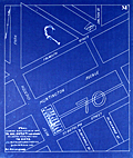 | Details | Fuller and Whitney | 1886 |
| Antique blueprint plan of Boston near Huntington and Massachusetts Avenues |
|
Fuller and Whitney |
|
| 1886 |
| LOC: |
| $300.00 | Fuller-and-Whitney | Antique-blueprint-plan-of-Boston-near-Huntington-and-Massachusetts-Avenues | Original cadastral blueprint plan from Jan. 1, 1886 of a portion of the Boston' Back Bay east of Massachusetts Avenue. The area includes the current location of the Boston Philharmonic Orchestra at 236 Huntington Ave. In the upper portion of the plan an artifact of the blueprint process reveals where a piece of lint or vegetation landed between the surveyor's trace and blueprint paper during exposure of the paper to sunlight.
<br></br>
The area for this blueprint in Boston, Massachusetts is bounded on three sides by Falmouth Street, West Chester Park (now Massachusetts Avenue) and St. Botolph Street. Verso is blank. Sheet is labeled "M". |
| 5375 |  | Details | Louisville and Nashville Railroad | 1886 |
| Birds Eye View of Gulf Coast Louisville and Nashville Railroad |
|
Louisville and Nashville Railroad |
|
| 1886 |
| LOC: |
| $725.00 | Louisville-and-Nashville-Railroad | Birds-Eye-View-of-Gulf-Coast-Louisville-and-Nashville-Railroad | </br>"The Great Through Car Line Between the North and South."</br>
"Unrivaled in Speed, Construction and Equipment."
<br></br>
Fine bird's eye view of the central Gulf Coast highlighting the route of the Louisville and Nashville Railroad from Mobile, Alabama, through Mississippi, to New Orleans, Louisiana. The route includes Bay St. Louis, Ocean Springs, Pass Christian, Mississippi City, Biloxi, Pascagoula. Numerous steam-powered and wind-powered vessels are shown plying the waters of the Gulf of Mexico, Lake Ponchartrain and the Mississippi River.
<br></br>
Six-panel folding map, neatly folded inside a 64-page pamphlet (4.5 " x 7.25") titled "The Gulf Coast". With the ink stamp of Sam. B. Jones, General Agent, New York. Published by the passenger department of the Louisville and Nashville R.R.
<br></br>
Printed in Louisville, KY by the Press of the Courier-Journal Job Printing Company. |
| 1361 |  | Details | Depot de la Marine | 1886 |
| Antique chart of the United States West Coast |
|
Depot de la Marine |
|
| 1886 |
| LOC:2001 |
| $550.00 | Depot-de-la-Marine | Antique-chart-of-the-United-States-West-Coast | Large folding nautical chart of the West Coast of the United States from past San Diego, California in the South to Queen Charlotte Sound and Moresby Island in British Columbia, Canada. Published by France's Depot de la Marine in 1862 but this edition with essential corrections dates to 1886.
<br></br>
With owners overstamps from the Library of Canadian Energy, Mines, and Resources Department in 1969 and 1976. Chart Number 1979. |
| 4907 |  | Details | Henry Reed Steamboat Company | 1887 |
| Rare Missionary Donation Card for Congo River Steamboat |
|
Henry Reed Steamboat Company |
|
| 1887 |
| LOC:0 |
| $350.00 | Henry-Reed-Steamboat-Company | Rare-Missionary-Donation-Card-for-Congo-River-Steamboat | <br />
<div style="text-align: center;font-size:100%;">
"This certifies that <b><i>Mrs. Sara E. Buxton</i></b> <br />by the payment of ten cents <br />is a shareholder in <br /> THE HENRY REED STEAMBOAT COMPANY<br /> for the year 1887"
</div><br />
Recto with scene of a small steam-powered stern-wheel riverboat, a la the African Queen, and two native Africans watching from shore. Map on verso of the Congo Free State, the Congo River, and in the upper Congo River a dotted line shows the route of the Henry Reed. Scarce.
<br /><br />
Very rare "stock certificate" given for a donation of ten cents to support a mission steamer on the upper Congo River in Africa. The vessel "Henry Reed' worked the upper river and after 1887 another steamer joined on the lower Congo River. By 1890 the name of the mission was changed to "The Congo Steamboat Company" and funds collected paid for both vessels as well as for operating expenses. Lifetime membership could be purchased for $1.00. (Baptist Missionary Magazine. American Baptist Missionary Union. Volume 70. Boston. 1890.) |
| 980 | 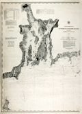 | Details | U.S. Coast and Geodetic Survey | 1887 |
| Antique chart of Cuttyhunk to Block Island with Narragansett Bay |
|
U.S. Coast and Geodetic Survey |
|
| 1887 |
| LOC:53 |
| $1,250.00 | U-S--Coast-and-Geodetic-Survey | Antique-chart-of-Cuttyhunk-to-Block-Island-with-Narragansett-Bay | Large, original, antique nautical chart of the New England coast (1887) including Narragansett Bay. Superb condition. Coverage includes the northern tip of Block Island and extends from Perrysville/Point Judith/Wakefield westward to past the <b>Hen and Chickens light vessel</b> and <b>Cuttyhunk Lighthouse</b>. This original navigation chart includes the surrounding bays, rivers, and islands of Connecticut, Massachusetts, and <b>Rhode Island</b>. Manuscript notations in ink on the verso indicate this chart was one of two purchased in 1887 for the ship "Asia". The old maritime chart shows fine detail and will display beautifully.
<BR> </BR>
Key geographic features include Fall River, Sakonnet River, Conanicut Island, East Tern Passage, and Mt. Hope Bay. Noted points of interest include Providence, Bristol, Warren, Newport, Wickford, East Greenwich, Apponaug, the Old Colony and Newport RR, and Brenton's Reef Light Vessel. Contains a table of lighthouses and a tide table as well as notations about lightships, soundings, and bottom abbreviations.
<BR> </BR>
First produced by the U.S. Coast and Geodetic Survey in 1876, this chart was reprinted in 1887 with corrections to the aids to navigation. Contains great detail of topographic and hydrographic features with hundreds of soundings and numerous aids to navigation.
<BR> </BR>
With the circular logo of the United States Coast and Geodetic Survey. Chart number 113. Electrotype copy No. 9. Price 40 cents when issued. |
| 3630 |  | Details | U.S. Coast and Geodetic Survey | 1888 |
| Early chart of St. John Harbor, Zarembo Island, Alaska |
|
U.S. Coast and Geodetic Survey |
|
| 1888 |
| LOC:10 |
| $300.00 | U-S--Coast-and-Geodetic-Survey | Early-chart-of-St--John-Harbor--Zarembo-Island--Alaska | Early chart of St. John Harbor on Zarembo Island in S.E. Alaska. Printed by the U.S. Coast and Geodetic Survey as a separately issued harbor chart for a price of 15 cents at the time.
<br></br>
Zarembo Island is an island in the Alexander Archipelago of southeastern Alaska, United States. It lies directly south of Mitkof Island and northwest of Etolin Island.
<br></br>
Rare to find old Coast Survey charts of this remote an area on such heavy paper. With red stamp of the U.S. Geological Survey library. Chart is believed to have been an institutional file copy. |
| 3590 |  | Details | U.S. Coast and Geodetic Survey | 1888 |
| Chart of Columbia River with Washington Oregon Kalama |
|
U.S. Coast and Geodetic Survey |
|
| 1888 |
| LOC:63 |
| $350.00 | U-S--Coast-and-Geodetic-Survey | Chart-of-Columbia-River-with-Washington-Oregon-Kalama | Rolled chart of the Columbia River from Kalama to Fales Landing. Includes portions of both Oregon and Washington states; St. Helen, Columbia City. With tables of authorities, buoys, river lights, abbreviations. Sheet number 5 of the series. Individually published and priced. Heavy paper consistent with the expected use for navigation onboard river vessels.
<br></br>
No mention of the use of the electrotype process. Presumed printed with original plate.
<br></br>
With the circular logo of the United States Coast and Geodetic Survey. Scale 1/40,000. Chart number 641. Issued May 1888. Price when issued: 25 cents. |
| 108 |  | Details | Anonymous | 1889 |
| Goat Island Ledge |
|
Anonymous |
|
| 1889 |
| LOC:0 |
| $45.00 | Anonymous | Goat-Island-Ledge | Corps of Engineers survey map shows Goat Island, Great Island, and Seavy's Island and a marked 'sailing course' through the nearby waters. Land areas identified through neat orange hachuring. |
| 3589 |  | Details | U.S. Coast and Geodetic Survey | 1889 |
| Huge antique chart of New York Bay and Harbor |
|
U.S. Coast and Geodetic Survey |
|
| 1889 |
| LOC:1401 |
| $3,250.00 | U-S--Coast-and-Geodetic-Survey | Huge-antique-chart-of-New-York-Bay-and-Harbor | A spectacular, large (48" high) antique nautical chart of New York Bay and Harbor from 1889. Beautiful hand coloring enhances the attractiveness of this scarce and fine engraving. Two sheets professionally joined.
<br></br>
This chart was printed in 1889 from an electrotype copy of the original hand-engraved copper plate, a process the U.S. Coast Survey adopted around 1850. As a soft medium, copper plates could only withstand print runs of perhaps 200 copies before the plates wore down. To enable larger print runs, a mold of the original plate was created in wax or another soft medium. Then, using an electro-chemical processs ( electrotyping ), the mold was coated with a metal layer, typically copper. Printers were then able to produce output from the new electrotype copper copy, while preserving the original. Electrotype copy number 3.
<br></br>
With the circular logo of the United States Coast and Geodetic Survey. Tables of lighthouses and lightships. Two inset coastal elevation views. Scale 1/40,000. Chart number 369. Published August, 1889. Plate number 1987. Price when issued: 75 cents. |
| 6687 |  | Details | Olmsted, F. L. and Company | 1889 |
| F.L. Olmsted heliotype landscape plan Linwood Lynn Massachusetts |
|
Olmsted, F. L. and Company |
|
| 1889 |
| LOC:50 |
| $875.00 | Olmsted--F--L--and-Company | F-L--Olmsted-heliotype-landscape-plan-Linwood-Lynn-Massachusetts | Rare finely-detailed heliotype (1) plat and landscape plan by Frederick Law Olmsted for the Linwood development, in Lynn, Massachusetts, 1889. WorldCat lists only one copy, at Harvard. Heliotype Printing Co., Boston. R.R. Jones, del.
<br><br>
<div class="indenttextblocksingle">
"John Charles and Frederick Law Olmsted developed the Linwood subdivision on the estate of Philip Tapley, a hilltop property with views of striking features like Breed’s Pond and Lynn Harbor. With the site's steep topography, the pair faced challenges and had to make strategic design choices to maximize space on the hilltop plateaus. Plans show that roughly 218 lots were mapped to house large single-family homes. Unfortunately, Linwood was never developed (1).
<br>
</div>
<br>
In 1889, F. L. Olmsted designed Linwood, a neighborhood in Lynn, Massachusetts. The Linwood neighborhood was a unique project at the time, as it was one of the earliest examples of a planned suburban community. Olmsted was hired by the developers of the Linwood project, the Lynn Land Company, to design the landscape and street plan for the neighborhood. Olmsted's plan for Linwood included winding streets, spacious lots, and plenty of green space. He also designed a park in the center of the neighborhood, which he called "The Park at Linwood."
<br><br>
September, 1889. F. L. Olmstead & Co. Landscape Architects. Brookline, Mass. 1889. and Isaac K. Harris, Engineer. Lynn, Mass.
<br><br> |
| 5365 |  | Details | Anonymous | 1890 |
| Surveyors manuscript trace plat of Little Nahant Island, Massachusetts |
|
Anonymous |
|
| 1890 |
| LOC:13 |
| $750.00 | Anonymous | Surveyors-manuscript-trace-plat-of-Little-Nahant-Island--Massachusetts | Very rare unrecorded, manuscript surveyors' trace plat map of lots on Little Nahant Island, Massachusetts which lies north-east of Boston in Nahant Bay. The pen and ink trace, on supple surveyor's "tracing cloth" would have been used as a master to create blueprint copies.
<br></br>
Carries pencil surveyor's collation number 2013. Includes a fine late 19th century compass rose at bottom right. Estimated date ca. 1885.
<br></br>
Anonymous trace map but stylistically similar to those of W. H. Whitney from the 1890's. |
| 6559 |  | Details | de Witt, Simeon | 1890 |
| Unusual manuscript trace map of New York state after Simeon de Witt 1802 |
|
de Witt, Simeon |
|
| 1890 |
| LOC:141 |
| $350.00 | de-Witt--Simeon | Unusual-manuscript-trace-map-of-New-York-state-after-Simeon-de-Witt-1802 | One of a kind finely detailed manuscript blue ink trace of sheet 6 from "A Map of State of New York" after Simeon de Witt, 1802. On tracing cloth. This map represents an exceptional effort that likely took days for the anonymous creator to lay down. With a few manuscript notes at bottom right that suggest the trace was created from the copy of de Witt's map held at the New York Public Library (1). Estimated date of creation ca. 1890.
<br><br>
A fine gift for collectors of New York cartography or of rare cartographic oddities.
<br><br>
From an estate with three similar manuscript traced maps of foundational New York State maps by David H. Burr, and <a href="https://www.rarecharts.com/ShowDetail/Creator/Hawkes--W--and-Barber--J-/Title/Manuscript-isodistance-map-of-the-New-York-City-area-after-Hawkes-and-Barber/6560" target="_blank">Hawkes and Barber. </a> Some hydrographic and marshy features in green ink, red ink for roads and highways, brown for political boundaries. Simeon de Witt's original map did not use color to identify these features. At bottom right, in manuscript, a copy of the original title cartouche that was not originally placed on sheet 6, demonstrating the tracer's access to multiple sheets of de Wits map.
<br><br>
(1) Lionel Pincus and Princess Firyal Map Division, The New York Public Library. "Map of the state of New York" The New York Public Library Digital Collections. 1802. https://digitalcollections.nypl.org/items/510d47df-f4d8-a3d9-e040-e00a18064a99 |
| 6560 |  | Details | Hawkes, W. and Barber, J. | 1890 |
| Manuscript isodistance map of the New York City area after Hawkes and Barber |
|
Hawkes, W. and Barber, J. |
|
| 1890 |
| LOC:141 |
| $700.00 | Hawkes--W--and-Barber--J- | Manuscript-isodistance-map-of-the-New-York-City-area-after-Hawkes-and-Barber | Very unusual and one-of-a-kind manuscript traced map ca. 1890 (on tracing cloth) of the area around New York City- after Hawkes and Barber's "The Country twenty five miles round New York" (1777). Text below the map contains a list of important events during the U.S. Revolution in 1776. A key feature of the map is the early use of <b>isodistances</b>, concentric circles at increasing five-mile intervals centered on the city of New York.
<br><br>
This map represents an exceptional effort that likely took days for the anonymous creator to trace. Fine attention to detail and careful execution suggest that the copy was created for research purposes, or possibly for the purpose of producing blueprints from this master trace document. With a few manuscript notes at bottom right that suggest the trace was created from the copy of Hawkes and Barber's map held at the New York Public Library (1).
<br><br>
A fine gift for collectors of New York cartography or of rare cartographic oddities.
<br><br>
From an estate with three similar manuscript trace maps of foundational New York State maps by <a href="https://www.rarecharts.com/ShowDetail/Creator/de-Witt--Simeon/Title/Unusual-manuscript-trace-map-of-New-York-state-after-Simeon-de-Witt-1802/6559"" target="_blank"> Simeon de Witt </a> and David H. Burr. Riverine features in green ink, red ink for highways and roads, brown for political boundaries and for isodistances.
<br><br>
(1) Lionel Pincus and Princess Firyal Map Division, The New York Public Library. "The Country twenty five miles round New York" The New York Public Library Digital Collections. 1777-01-01. https://digitalcollections.nypl.org/items/510d47da-ee36-a3d9-e040-e00a18064a99 |
| 6476 |  | Details | Rosen, Ludwig | 1890 |
| Engineers manuscript contour drainage plan of the Gärdet in Stockholm Sweden |
|
Rosen, Ludwig |
|
| 1890 |
| LOC:1402 |
| $900.00 | Rosen--Ludwig | Engineers-manuscript-contour-drainage-plan-of-the-Gärdet-in-Stockholm-Sweden | Early and rare engineer's pen and ink manuscript contour drainage plan of Stockholm's Ladugårdsgärdet [1] by States Engineer Ludwig Rosen in 1890. A hand-drawn and hand colored detailed plan on supple surveyors tracing cloth covering land that was at the time largely undeveloped. Today the outer portions of the Gärdet are well developed leaving a central open space that is part of Stockholm’s National City Park.
<br><br>
An important manuscript engineering plan related to urban growth, development, and the environmental preservation of Stockholm, Sweden.
<br><br>
<div id="0" align="center">
<a title="Täckdikningsplan for Ladugårdsgärde vid Stockholm"></a>
<img id="3" src="/ZoomifyImages/SC_6476/SCV_6476_Title.jpg" alt="Täckdikningsplan for Ladugårdsgärde vid Stockholm" width="300"/> <br><small>Title to Rosen's plan of the Ladugårdsgärde (1890)</small>
</div><br>
Plan shows land contour and numerous profile cross-section inset drawings. From a translation of the title "Täckdikningsplan" we can derive that the purpose of the plan was for the development of "cover ditches" or sub-surface drainage systems. North oriented to upper left. Detailed explanatory legend fills the left side of the plan.
<br><br>
[1] Ladugårdsgärdet or Gärdet is a suburb in Stockholm County east and northeast of Östermalm with a current population of roughly 21,500 residents. Until the mid 1800’s, the eastern areas of Stockholm were known as Ladugårdslandet, or “The Barn Land.” Throughout the 1900’s, large areas of Gärdet were developed. |
| 4856 |  | Details | Danforth, Frederic | 1890 |
| Manuscript Belfast, Maine Water Company Plan for Robert Elwell |
|
Danforth, Frederic |
|
| 1890 |
| LOC:0 |
| $1,150.00 | Danforth--Frederic | Manuscript-Belfast--Maine-Water-Company-Plan-for-Robert-Elwell | Original four-foot wide manuscript survey of Water Reservoir Number 1 at Belfast, Maine. "Plan of Land of the Belfast Water Company Made for Robert Elwell." By Frederic Danforth C.S. Dated within at October, 1890. Laid to linen.
<br></br>
The Belfast Water Company was founded in 1887 after two major fires (1865, 1871) demonstrated the existing water supply was insufficient. Construction began on the reservoir with a 175 foot long dam near the mouth of Little River. Scale 1 inch = 80 feet.
<br></br>
The water district discontinued using the Little River reservoir in 1980. Today the brick pump house on the north side of the dam serves as the offices of the Belfast Water District.
<br></br>
<div class="indenttextblocksingle">
Frederick Danforth, son of Judge Charles Danforth, was born in 1848. He graduated from Dartmouth College, specializing in civil engineering. After graduation Danforth settled upon the career of railroad engineering. In 1876, after an engagement with the European and North American railway Danforth established an office in Gardiner, and in 1891 he was elected a member of the American Society of Civil Engineers. (Online: http://files.usgwarchives.net/me/kennebec/gardiner/history/
kingsbury/gardiner/kengard.txt.)
</div> |
| 2578 |  | Details | Mobile Chamber of Commerce | 1890 |
| Antique Map Demostrating Mobile's Suitability as a Gateway for Trade |
|
Mobile Chamber of Commerce |
|
| 1890 |
| LOC:88 |
| $165.00 | Mobile-Chamber-of-Commerce | Antique-Map-Demostrating-Mobile-s-Suitability-as-a-Gateway-for-Trade | Small booklet ca. 1890 with a map of the Gulf Coast and Caribbean Sea showing distances for water-borne commerce. Addressed to "The Honorable Senators and Representatives of the Congress of the United States, Washington, D.C.".
<br></br>
The booklet contains an eight page section of text explaining the argument in favor of Mobile, as a shipping hub to the Caribbean, Mexico, and South America. According to the text a circle 600 miles in diameter with St. Louis at its center at that time contained a population of over 15,000,000 million persons and the richest area for production of agricultural products and livestock. Further, the authors argued that
<div class="indenttextblock">"Mobile, Alabama, by existing lines of raiway, is 244 miles nearer the center of the circle (St. Louis) than any port upon the Atlantic Ocean and 50 miles nearer that any other port upon the Gulf of Mexico."</div> Printed by T. Fitzwilliam and Company,New Orleans. |
| 759 |  | Details | Anonymous | 1890 |
| Manuscript page with flags and a chart of British Channel |
|
Anonymous |
|
| 1890 |
| LOC:7 |
| $450.00 | Anonymous | Manuscript-page-with-flags-and-a-chart-of-British-Channel | A small manuscript chart of the English Channel. Decorated at top with the crossed flags of England and France this hand-drawn and hand-colored chart of the British Channel could have been created in the latter half of the 19th century to early 20th century by a British naval student or maritime officer candidate or quite possibly a member of the Sea Cadets Corps or its predecessor, the Naval Lads' Brigade. A legend in English describes features that would be found on a nautical chart of the period such as buoys, rocks, and bearings, but oddly the manuscript map does not contain any of those components with one exception, the Eddystone lighthouse southwest of Plymouth sound.
<br></br>
The most interesting aspect of the chart is the dotted line suggesting the route of a voyage between ports in England and France including Plymouth, Dartmouth, Torquay, Weymouth, Southampton, Sheerness, Cherbourg, and Guernsey
<br></br>
At bottom are drawn three signal flags including the Blue Peter, which was often used when preparing to leave port, or as the caption suggests, when requesting a pilot. Of the other two flags, the center flag is confirmed as a French registration flag that indicates that the vessel was registered to the Cherbourg arondissement sector between Dunkirk and Honfleur. According to Sache:
<div class="indenttextblock">
"French merchant ships had to hoist at foremast a specific flag indicating in which arrondissement they were registered. The French coasts were divided in five metropolitan maritime arrondissements, each of them being divided in two sectors, and in two colonial sectors. The arrondissement flags were established by Royal Regulation of 3 December 1817, signed by Louis XVIII. They were confirmed in the 1852 Imperial Regulations on naval flags signed by Napoléon III and by Decree on 20 March 1868. " </div>
Source: Sache, Ivan. France: Registration flags for merchant ships (1817-1929). Link: flagspot.net/flags/fr~arro.html#che |
| 1423 |  | Details | Anonymous | 1890 |
| 19th-Century Map of North America |
|
Anonymous |
|
| 1890 |
| LOC:0 |
| $55.00 | Anonymous | 19th-Century-Map-of-North-America | Two 19th-century maps on a single sheet. On recto is a bold, colorful map of North America. On the verso a map of the eastern Hemisphere. |
| 5094 |  | Details | U.S. Congress | 1891 |
| Map supplement showing boundaries of congressional districts in 1891 |
|
U.S. Congress |
|
| 1891 |
| LOC:2001 |
| $300.00 | U-S--Congress | Map-supplement-showing-boundaries-of-congressional-districts-in-1891 | Scarce volume of maps and population statistics for 1880 and 1890 published as a supplement to the congressional directory. Maps show counties/parishes and boundaries of congressional districts.
<br></br>
With exceptions noted below, 43 maps show all the states admitted to the Union as of 1890. The following states are not mapped as they had not been admitted to the Union: Arizona, New Mexico, Utah, Oklahoma, District of Columbia, Alaska, Hawaii.
<br></br>
By W.H. Michael, Clerk of Printing Records. Washington. Government Printing Office. 1891. 123 pages. |
| 5007 |  | Details | Pujals, Jose | 1891 |
| Antique manuscript map plan of the Bay of Havana, Cuba with Regla |
|
Pujals, Jose |
|
| 1891 |
| LOC:200 |
| $700.00 | Pujals--Jose | Antique-manuscript-map-plan-of-the-Bay-of-Havana--Cuba-with-Regla | MS plan and hydrographic chart of the bay of Havana, Cuba. Very early surveyor's master document on tracing cloth of Havana, Cuba with blue color from the verso, as was the practice of the era for creating shading on blueprints. This manuscript map was intended for use in generating multiple cyanotype (blueprint) copies.
<br></br>
Names several important locations including Regla, Cabana, Ensenada de Mari Melena, and Casa Blanca. The plan includes isobaths showing depth of water in Havana Bay.
<br></br>
MS notation in Spanish reads: "Corresponde a la Real Orden de consesion des dichas obras fecha de 17 de ?? Habana de 13 Febrero de 1891 J. Pujals"
<br></br>
Creator is presumed to be Jose Pujals, an engineer with the Port of Havana Cuba. In 1899 Jose Pujals was the directing engineer in charge of works at the Port of Havana. On February 1, Captain A.H. Weber of the Second United States Volunteer Engineers was appointed as directing engineer and Pujals was moved to a position as Weber's assistant.
<br></br>
Scale 1:2500. |
| 4791 |  | Details | Ferbrache and Welton | 1891 |
| Unrecorded antique real estate map for Chicago Heights addition |
|
Ferbrache and Welton |
|
| 1891 |
| LOC:88 |
| $350.00 | Ferbrache-and-Welton | Unrecorded-antique-real-estate-map-for-Chicago-Heights-addition | Unrecorded map and advertisement from 1891 for Ferbrache and Welton's new addition near the nascent Chicago Heights development, then under construction, located to the south of Chicago, Illinois. No other copy of this map and sales advertisement is located anywhere.
<br></br>
A group of Chicago developers led by Charles Wacker established the Chicago Heights development in the 1890's as an industrial suburb. Wacker bought up much of the land around the two railroads. Developers convinced residents to change the name to “Chicago” to associate it with its booming neighbor to the north and “Heights”because the location is one of the highest in the county.
<br></br>
Key features on the map include Elgin, Joliet and Eastern Railway (or Outer Belt RR), , Michigan Central Railroad, Rolleston, the New Stock Yards, Joliet, Evanston, Waukegan, Lake Michigan.
<br></br>
Recto with a map of the Chicago area and the location of the new addition highlighted in red ink; Chicago Heights in black ink. Verso with a comparison of the Chicago Heights development vs. Ferbrache and Welton's new development that highlights the large profits investors could expect by buying in the addition where land was less expensive than in Chicago Heights. A list of reasons investors could make money by purchasing in 1891 include:
<div class="indenttextblock">
<ul style="list-style-type: circle;">
<li>The highest ground in Cook County.
<li>Railroads running over 100 trains per day.
<li>Abundant water supply…
</ul>
</div>
The ad concludes with a financial incentive that sounds too good to be true:
<div class="indenttextblock">
"You will attend the World's Fair of course [Opened May 1, 1893]. Then provide for all your expenses by buying a lot in this Subdivision and <b>we will guarantee to sell it for you by that time at a profit of over One Hundred Dollars ($100).</b>"
</div>
George H. Welton, Manager, 1008 Chamber of Commerce. |
| 3663 |  | Details | Anonymous | 1891 |
| Antique lot plan of Coronado Heights in San Diego County |
|
Anonymous |
|
| 1891 |
| LOC:88 |
| $210.00 | Anonymous | Antique-lot-plan-of-Coronado-Heights-in-San-Diego-County | Plat map of Coronado Heights Subdivision in San Diego County, California produced a year after Coronado residents voted to incorporate. Shows the grounds for the Hotel de Coronado, completed in 1888, at that time the largest resort hotel in the world.
<br></br>
Includes a boulevard to Coronado Beach as well as the tracks for the Coronado Railway, a street railway system to carry a 50-seat excursion car and steam locomotive. With notes indicating the size of blocks and street width. |
| 857 | 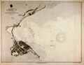 | Details | U.S. Navy Hydrographic Office | 1891 |
| Antique Nautical Chart of Yokohama Bay, Japan |
|
U.S. Navy Hydrographic Office |
|
| 1891 |
| LOC:59 |
| $225.00 | U-S--Navy-Hydrographic-Office | Antique-Nautical-Chart-of-Yokohama-Bay---Japan | Antique nautical chart of Yokohama Bay, Japan produced by the U.S. Navy Hydrographic Office in 1891. Yokohama, a Japanese city south of Tokyo, in 1859 was one of the first Japanese ports opened to foreign trade.
<br></br>
Selected aids-to-navigation are highlighted in yellow including Hommoku Light Ship and two lights at the end of the harbor breakwater. Details ashore include a railroad line running along the shore, a public garden, a fort, the Grand Hotel, an area designated "foreign settlement", the French Hatoba (wharf or quay) , the English Hatoba, and the English Naval Store-house.
<br></br>
Detailed U.S. harbor charts of Japan, like this example are scarce during this time period less than 50 years after Commodore Matthew Perry's expedition to Japan in the mid 1850's. Contains the circular logo of the U.S. Navy Hydrographic Office. |
| 339 |  | Details | U.S. Geological Survey | 1892 |
| Entrance to San Francisco Bay |
|
U.S. Geological Survey |
|
| 1892 |
| LOC:3 |
| $140.00 | U-S--Geological-Survey | Entrance-to-San-Francisco-Bay | Small antique lithographed chart of the Entrance to San Francisco Bay. The chart, from the U.S. Geological Survey, is derived from a U.S. Coast Survey chart and overlaid with hachured topographic details. Lighthouses, soundings, life saving stations and navigational aids are shown. Water shown in blue. Some of the features include the Golden Gate (entrance to the bay), Ballenas Bay, Alcatraz Island, San Bruno, Point Lobos, and Pt. San Pedro. <BR> </BR>
Produced for the U.S. Geological Survey Thirteenth Annual Report. Produced by George S. Harris Lithographers, Philadelphia. Plate 45. |
| 4913 |  | Details | New York, Providence and Boston Railroad | 1892 |
| Antique Chart New York, Providence and Boston Railroad |
|
New York, Providence and Boston Railroad |
|
| 1892 |
| LOC:62 |
| $550.00 | New-York--Providence-and-Boston-Railroad | Antique-Chart-New-York--Providence-and-Boston-Railroad | A foundational organizational diagram / map for collectors of ephemera related to the New York, Providence and Boston Railroad.
<br /><br/>
Very rare and very unusual cyanotype (blueprint) document showing the railroad and steamship lines, as of 1892, that comprised the New York, Providence and Boston Railroad (N.Y.P. & B.R.R.). Includes unusually-presented notes about dates of construction and leasing of the various component lines of the railroad within circular icons.
<br /><br />
A fine example of the use of the cyanotype process to create a map not intended for navigation but rather to inform the reader about the history of the railroad and its affiliated Providence and Stonington Steamship Company.
<br /><br />
Produced from Providence, Rhode Island by the Chief Engineer's Office in March, 1892. |
| 341 |  | Details | U.S. Geological Survey | 1892 |
| Turtle Harbor Florida |
|
U.S. Geological Survey |
|
| 1892 |
| LOC:3 |
| $75.00 | U-S--Geological-Survey | Turtle-Harbor-Florida | Small lithographed antique chart of Key Largo and Turtle Harbor Florida. The chart, from the U.S. Geological Survey, is derived from a U.S. Coast Survey chart and overlaid with hachured topographic details. Lighthouses, soundings, and navigational aids are shown. Water shown in blue. Some of the features shown include Pumpkin Key, Carysfort Reef, Angelfish Key, and Palo Alto Key. <BR> </BR>
Produced for the U.S. Geological Survey Thirteenth Annual Report. Produced by George S. Harris Lithographers, Philadelphia. Plate 36. |
| 343 |  | Details | U.S. Geological Survey | 1892 |
| Delta at Caesars Creek (Florida) |
|
U.S. Geological Survey |
|
| 1892 |
| LOC:3 |
| $75.00 | U-S--Geological-Survey | Delta-at-Caesars-Creek-(Florida) | Small lithographed antique chart of the area around Caesars Creek, on the southeast coast of Florida. The chart, from the U.S. Geological Survey, is derived from a U.S. Coast Survey chart (no. 66) and overlaid with hachured topographic details. Soundings, and navigational aids are shown. Water shown in blue. Some of the features shown include Elliott Key, Rubicon Key, Tottens Key, and Reids Key, Adams Key. <BR> </BR>
Produced for the U.S. Geological Survey Thirteenth Annual Report. Produced by George S. Harris Lithographers, Philadelphia. Plate 42. |
| 5317 |  | Details | Campbell, H. J. | 1892 |
| Antique manuscript cadastral map Fernandez Grant Reddick Florida |
|
Campbell, H. J. |
|
| 1892 |
| LOC:1402 |
| $750.00 | Campbell--H--J- | Antique-manuscript-cadastral-map-Fernandez-Grant-Reddick-Florida | Manuscript ink cadastral plat map ca. 1892 of a portion of the Fernandez Grant near Reddick, Florida in Marion County. Made by engineer H. J. Campbell during a period of intensive agricultural growth, facilitated by numerous railroads in the area. The plat is dotted with numerous small unnamed lakes and sinkholes, a product of Florida's' limestone Karst topography. Hand drawn plat on tracing cloth- the map would have been used to generate blueprints on cyanotype paper. Scale 1 inch = 400 feet.
<br></br>
Top of map shows Reddick (established 1882) as a small settlement with a portion of the right of way for the Florida Southern Railroad. The Florida Southern Railway stopped in Reddick as early as 1881. The line went into receivership on March 19, 1890 and when it emerged in 1892 it was acquired by Henry B. Plant as part of his Plant System and reorganized as the Florida Southern Railroad, which stretched from Gainesville through Reddick to Ocala and then to Punta Gorda.
<br></br>
Starting in 1790, Spain offered land grants to encourage settlement to the sparsely populated and vulnerable Florida colony. When the United States assumed control of Florida, it agreed to honor any valid land grants. Portions of the map include lands near Reddick, Florida granted to Stephen Fernandez in 1817 or 1818.
Engineer H.J. Campbell drew a number of town plats in the Marion County area including Stanton and South Lake Weir. The earliest record of Campbell places him in Gainesville, Florida and in 1884 Campbell moved his office to Palatka, Florida. |
| 5370 |  | Details | Stevens, Walter C. | 1892 |
| Manuscript presentation plan for Melrose Common in Melrose Massachusetts |
|
Stevens, Walter C. |
|
| 1892 |
| LOC: |
| $2,500.00 | Stevens--Walter-C- | Manuscript-presentation-plan-for-Melrose-Common-in-Melrose-Massachusetts | Unrecorded hand-colored manuscript presentation plan for the Melrose Common in Melrose, Massachusetts by Walter C. Stevens. 1892. Pen and ink plan of the Common surrounded by Second Street, Sixth Street, Third Street, and Larrabee Street. Scale 20 ft = 1 inch.
<br></br>
According to the History of Melrose, the Melrose Common was developed on land purchased and set aside by D.W. Gooch and Walter Littlefield in 1856 as part of a tract known as "The Home Association Lands." The land lay undeveloped for many years. As late as 1902 the Melrose Common was described:
<div class="indenttextblocksingle">
"... remains in a somewhat primeval state. Year by year, it is being utilized more and more as the place for the City's Fourth of July celebrations, display of fireworks, etc. It is hoped that some day the City will appropriate sufficient money to make of this a beautiful and healthful breathing spot and play ground." </div>
</br>
Two small lakes are shown on the plan. At left a lake contains a circular land area labeled "Maple Island". At right a large, bridged lake features a fountain.
<br></br>
By Walter C. Stevens, Civil Engineer and Surveyor from Melrose, Massachusetts. In 1894 Stevens was listed as "civil engineer for the town of Melrose."
<br></br>
Dated within to 1892. Red crayon surveyor's index collation number "2949". |
| 260 |  | Details | Monnier, Paul | 1893 |
| Carte Generale de la Martinique |
|
Monnier, Paul |
|
| 1893 |
| LOC:51 |
| $375.00 | Monnier--Paul | Carte-Generale-de-la-Martinique | Striking, antique sea chart / map of the island of Martinique, an overseas region of France, in the eastern Caribbean. This large chart is an 1877 edition of a chart first produced in 1831 by Monnier for France's Depot de la Marine, printed with corrections in 1893. . The chart is a fine example of the extensive use of hachuring to convey interior details of the island. <br></br>
Lighthouses dotted in yellow. Contains the circular seal for the Depot General de la Marine . |
| 5014 | 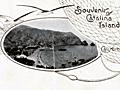 | Details | Healey, Charles T. | 1893 |
| Scarce map of Catalina Island after Coast Survey |
|
Healey, Charles T. |
|
| 1893 |
| LOC:77 |
| $375.00 | Healey--Charles-T- | Scarce-map-of-Catalina-Island-after-Coast-Survey | Scarce topographical Map of the Island of Santa Catalina in part from the U.S. Coast and Geodetic Survey 1893. Map is glued down to cover.
<br></br>
Folded on thin paper. Part of a scarce photo brochure "Souvenir of Catalina Island, California ca. 1895. Binding secured by ribbon through two punched holes at left.
<br></br>
With the route for Wilmington Transportation Company's Steamship Line. |
| 704 | 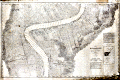 | Details | Mississippi River Commission | 1894 |
| The Mississppi River near St. James, Louisiana |
|
Mississippi River Commission |
|
| 1894 |
| LOC:0 |
| $450.00 | Mississippi-River-Commission | The-Mississppi-River-near-St--James--Louisiana | Large, very scarce, rolled survey chart or map of the Brilliant Point and College Point portions of the Mississippi River from 1894. Coverage on this antique map stretches across St. James Parish and documents numerous plantations, cultivated fields, and individual land holdings, including many with French surnames: Bonnecaze, Dernier, Bourgeois, Braud, Fabre, and Plaisance.
<br></br>
An inset index chart identifies the area as belonging to the Brilliant Point and College Point stretches of the Mississippi River, but may be more familiar as that portion of the river between Baton Rouge and New Orleans that includes the area near St. James, Louisiana and Oak Alley Plantation. No copy of this chart or any from the series are currently known to be available for sale.
<br></br>
On the North bank of the Mississippi are 3 towns: College, Donnelson, Wilton, and Hester; a race track, Jefferson College, and Sacred Heart Convent, Numerous plantations are mapped including St. Belmont Plantation, Homestead Plantation, Oneida Plantation, Uncle Sam Plantation, Wilton Plantation, Helvetia Plantation, St. Rose Plantation, St. Michael Plantation.
<br></br>
On the river's South bank lies St. Emma and a settlement referred to as "Free Town". Identifed plantations on the South bank include Oak Alley Plantation, St. James Estate, Felicite Plantation, St Joseph Plantation, Home Place Plantation, Jefferson Plantation, Pikes Peak Plantation, Cabanocey Plantation, Rich Bend Plantation, Bonsecour Plantation, M.B.C. Plantation, St. Cecile Plantation, Sydney Plantation, La Pice Plantation, and St. Claire Plantation.
<br></br>
Photo lithograph produced by Julius Bien and Company. From a two volume set of 78 sheets produced by the Mississippi River Commission ca. 1896 . Detailed soundings from bank to bank at approximately 400 - 500 foot intervals. Railroads and numerous benchmarks are identified. Number 71. |
| 1478 |  | Details | U.S. Army Engineers | 1894 |
| Barataria and Lake Borgne Levee Districts 1894 |
|
U.S. Army Engineers |
|
| 1894 |
| LOC:0 |
| $90.00 | U-S--Army-Engineers | Barataria-and-Lake-Borgne-Levee-Districts-1894 | Draftsman-style map of the lower Mississippi River from New Orleans to the Mississippi River passes. Depicts the levees constructed along the Mississippi River from June 1894. The map names levee improvements circa 1894 in Orleans, St. Bernard, Jefferson and Plaquemines parishes with Mississippi river mileage from Cairo, Illinois shown at 5 mile intervals. New Orleans is shown as it existed in 1894 with the northern half of the city to Lake Ponchartrain yet to be developed.
<BR> </BR>
Key points along the river that are identified include Southwest Pass, the Jump, Tropical Bend, Devils Plate, Fort Jackson and English Turn. Lines of latitude and longitude. Plate VII. Dated June, 1894. <BR> </BR> |
| 288 |  | Details | Depot de la Marine | 1895 |
| Cote est D'Irlande de la Baie de Dublin de la Baie de Belfast |
|
Depot de la Marine |
|
| 1895 |
| LOC:0 |
| $275.00 | Depot-de-la-Marine | Cote-est-D-Irlande-de-la-Baie-de-Dublin-de-la-Baie-de-Belfast | Interesting and uncommon folding 1895 edition (bottom of chart) of an antique nautical chart first printed in 1875. This intact linen-backed large folding chart of the Irish sea was published by the French Admiralty (Depot des Cartes et Plans de la Marine). Covers a wide area of Ireland and western portions of Britain including Belfast and Dublin , Isle of Man, and Holyhead Island. Lighthouses highlighted in yellow.<BR> </BR>
The antique chart folds to 5" x 9 1/2". Folds into 3 sections horizontally and 8 sections vertically. With a printed seller's sticker on front: " Maison Andriveau Goujon. Henry Barrere, Editeur-Geographe. 21 Rue du Bac, Paris". On the sticker below the seller's attribution is a script annotation of the chart title and a date of 1906.<BR> </BR>
Insets of the Port of Killough, Port of Ardglass, and a small view of the entrance to the Bay of Dundalk. Platemark is apparent but the chart is probably lithographic due to late 19th century provenance. Number 3460. Price: two francs. |
| 4920 |  | Details | Ruger, General Thomas H. | 1895 |
| Manuscript plans of Harbor Defenses, U.S. Department of the East |
|
Ruger, General Thomas H. |
|
| 1895 |
| LOC:0 |
| $6,000.00 | Ruger--General-Thomas-H- | Manuscript-plans-of-Harbor-Defenses--U-S--Department-of-the-East | One lot with 19 pen and ink manuscript plans (7" x 11.5") of U.S. harbor defenses with artillery at various ports from Portland, Maine to the Mississippi River including Pensacola, Key West, and Charleston. Data on the artillery includes the location and type of armament including the 16″ BLR (breech loading rifle), 12″, 10″, 8″ BLR, Dynamite Guns, 12″ Mortars, and quick loading guns. From a collection of the papers of General Thomas Ruger, late in his career.
<br></br>
In 1886 the Board of Fortifications, led by Secretary of War William C. Endicott, issued a report (Endicott Report) on the need for changes to the armament along the coastal forts of America. The use of mortared brick walls and smoothbore cannon were outdated.
<br></br>
Endicott era forts were constructed with concrete walls that concealed large, breech-loading rifled artillery guns mounted on "disappearing carriages". These carriages allowed the new, rifled cannons to be raised above the walls, aimed, and fired, and then quickly retrieved back into position. (Source: https://www.nps.gov/gate/learn/historyculture/endicotteradefenses.htm)
<br></br>
Along with the 19 charts are six spreadsheets containing tabular compilations of the count and size of artillery at each location. Includes a personal letter to Ruger from his papers.
<br></br>
Thomas H. Ruger (1833-1907) was born in New York and grew up in Wisconsin. Ruger graduated the U.S. Military Academy in 1854. He was commissioned in the Wisconsin Volunteers during the Civil War; wounded at the Battle of Antietam and participated in eastern battles such as Chancellorsville and Gettysburg, before being transferred to Sherman’s Army and the famous march to the sea. Following the Civil War, Ruger was military governor of Georgia, Superintendent at West Point, and commanding general of the Department of the East from 1895-1897.
<br></br>
See Endicott Report online : https://babel.hathitrust.org/cgi/pt?id=njp.32101059089340&view=1up&seq=7 |
| 5183 | 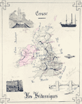 | Details | Herbinet, B. | 1895 |
| Manuscript map Iles Britanniques with submarine |
|
Herbinet, B. |
|
| 1895 |
| LOC:200 |
| $250.00 | Herbinet--B- | Manuscript-map-Iles-Britanniques-with-submarine | Interesting manuscript French map "Iles Britanniques" with vignettes illustrating the prowess of those isles at a time when Britain ruled the waves. Shows major roads or railways.
<br></br>
Inset vignettes include:
<div class="indenttextblocksingle">
<ul style="list-style-type: circle;">
<li>A suspension bridge</li>
<li>A coal mine</li>
<li><b>An early submarine: "la Gombe. Bateau sous marine"</b></li>
<li>A transitional three-masted warship with supplemental steam power </li>
<li>A geyser</li>
</ul>
</div>
Beautifully signed in manuscript "B. Herbinet Avril 1895" |
| 6353 |  | Details | Coyle, J. E. F. | 1895 |
| Blueprint Sydney Northbridge Suspension Long Gully Bridge |
|
Coyle, J. E. F. |
|
| 1895 |
| LOC:300 |
| $1,500.00 | Coyle--J--E--F- | Blueprint-Sydney-Northbridge-Suspension-Long-Gully-Bridge | Beautiful, original late 19th century cyanotype (blueprint) profile view of the "North Sydney Bridge" NSW, then a suspension bridge, (also known as Northbridge or Long Gully Bridge). Original 48" rolled old blueprint paper with slight signs of wear consistent with date of late 19th century but fresh and bright from a protected environment. The rigid symmetry of the suspension bridge contrasts with the sketch-like character of the title and gully profile. Scale 20' = 1".
<br></br>
The Suspension Bridge in Northbridge, NSW was built as a steel suspension bridge with sandstone turreted towers by a private syndicate to promote residential development. The bridge opened to traffic in in January, 1892. With a suspension span of about 500 feet, it was considered one of the engineering wonders of Sydney and became a great tourist attraction. In 1939 the bridge was rebuilt as a reinforced concrete two rib arch bridge, with the original towers intact. (1)
<br></br>
Manuscript address on the verso "F. L. Keir Esq. Chief Engineer's. Railway Department. Brisbane. Queensland." Keir was an engineer with the railways department (2).<br /><br />
Sources:<br /> |
| 4979 |  | Details | Washington Map and Blueprint Company | 1895 |
| Cyanotype map of San Juan County, Washington state |
|
Washington Map and Blueprint Company |
|
| 1895 |
| LOC:88 |
| $475.00 | Washington-Map-and-Blueprint-Company | Cyanotype-map-of-San-Juan-County--Washington-state | Early blueprint (cyanotype) map of the San Juan Islands including Stuart Island, Waldron Island, Orcas Island, Shaw Island, Blakely Island, Lopez Island, San Juan Island and many more. Numerous water features include the Canal de Haro, San Juan Channel, President Channel, Rosario Strait, Strait of Juan de Fuca, and Thatcher Passage. Manuscript notations in red for several parcels of land on Orcas Island and Lopez Island.
<br></br>
Scarce. With detached fragmentary front cover of map. Price when issued 50 cents.
<br></br>
By the Washington Map and Blueprint Company, 607-11 Pacific Block, Seattle, Washington. That company was the successor to the O.P. Anderson Map and Blueprint Company, Engineers and Draughtsmen. Established 1885.
<br></br>
Printed by Lowman and Hanford Stationery and Printing Company. |
| 5082 |  | Details | Atlas Steamship Company | 1896 |
| Track of the Atlas Line showing the Special Cruises Season 1897 - 98. |
|
Atlas Steamship Company |
|
| 1896 |
| LOC:0 |
| $90.00 | Atlas-Steamship-Company | Track-of-the-Atlas-Line-showing-the-Special-Cruises-Season-1897---98- | Map of the Caribbean Sea for the <b>Atlas Steamship Company</b> showing their special passenger cruises in a six-panel folding brochure "Special Cruises of the Atlas Steamship Company's Mail Steamers to the West Indies & the Spanish Main."
<br></br>
Ports visited on the Special Cruises included New York; Port Royal, Jamaica; Cartagena, Colombia; Barranquilla (Sabanilla), Colombia; and Port Limon, Costa Rica. The twenty-five day cruise cost on $125.
<br></br>
With an ink stamp on the cover for an unknown reading room. Brochure folds to 4" x 8". |
| 5345 |  | Details | Snyder, Antes | 1896 |
| Antique blueprint map of Lancaster, Pennsylvania with railroads |
|
Snyder, Antes |
|
| 1896 |
| LOC:300 |
| $1,220.00 | Snyder--Antes | Antique-blueprint-map-of-Lancaster--Pennsylvania-with-railroads | Fine unrecorded 19th century cyanotype or blueprint map of Lancaster, Pennsylvania by the Pennsylvania Railroad Company . This original, large (34" x 24") blueprint from 1896 shows Lancaster, PA streets along with the route of the Philadelphia and Columbia Railroad passenger line and the Lancaster cut off freight line, both owned by the Pennsylvania Railroad Company. Additional key features include the Lancaster PRR station, the city limits, Big Conestoga Creek (Conestoga River), Dillersville, and two reservoirs.
<br></br>
The Pennsylvania Railroad (PRR) was established in 1846, with headquarters in Philadelphia, Pennsylvania. By 1882, the Pennsylvania Railroad had become the largest railroad by traffic and revenue, and the largest corporation in the world. Its budget was second only to the U.S. government.
<br></br>
Drawn under the direction of Antes Snyder, Right of Way Engineer, P.R.R. Blairsville, Indiana County, Pennsylvania. J. V. Kilgore, draftsman. 1896. Scale 400 feet = one inch. North is oriented to top. [Penn., railway] |
| 6602 | 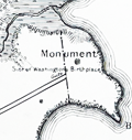 | Details | Lindenkohl, A. | 1897 |
| Map of Washington's Birthplace by Coast and Geodetic Survey |
|
Lindenkohl, A. |
|
| 1897 |
| LOC:1404 |
| $300.00 | Lindenkohl--A- | Map-of-Washington-s-Birthplace-by-Coast-and-Geodetic-Survey | Fine map of Washington's birthplace published by the U.S. Coast and Geodetic Survey based on a survey by Adolph Lindenkohl in 1879, but 1897. Photo-lithograph by Andrew B. Graham. Scarce, <b>only one copy of the survey map was located in WorldCat and no copies in the AMPR.</b>
<br><br>
George Washington was born in 1732 on Pope's Creek Plantation in Westmoreland County, Virginia.
<br><br>
Price when issued was 20 cents (upper left) but that price is crossed out and replaced in manuscript with "30". Note at bottom right: "Location of Monument and other data added in 1897."
<br><br>
Map # 3081. Scale 1/10,000 |
| 4749 |  | Details | Consolidated Gold Fields of South Africa | 1897 |
| Scarce map of Witwatersrand gold fields south of Johannesburg, South Africa |
|
Consolidated Gold Fields of South Africa |
|
| 1897 |
| LOC:54 |
| $2,200.00 | Consolidated-Gold-Fields-of-South-Africa | Scarce-map-of-Witwatersrand-gold-fields-south-of-Johannesburg--South-Africa | Very rare sales broadside of the <b>Witwatersrand gold fields of Johannesburg</b> held by Gold Fields of South Africa, <b>South Africa's first mining house</b>, now <b>Gold Fields</b>. After the Witwatersrand gold rush in 1886 Consolidated Gold Fields was rated in 1897 as the most valuable company in the world, no doubt due in large part to the valuable assets detailed in this sales advertisement (1).
<br></br>
That company was formed in 1887, during the Witwatersrand gold rush, by Cecil Rhodes and Charles Rudd to hold properties they had acquired on the Transvaal's Witwatersrand gold fields. Reorganized as Consolidated Gold Fields of South Africa (Consgold) in 1892, this map from 1897 details the company's holdings near Johannesburg, SA.
<br></br>
Cecil John Rhodes was a British mining magnate from southern Africa who served as Prime Minister of the Cape Colony from 1890 to 1896 and was the founder of <b>De Beers</b> diamond company.
<br></br>
Rare. No copy of this map is found online or in the AMPR. Printed by Waterlow and Sons Limited, London. Map of the "Central Section" implies that this example would have been flanked by similar maps forming the west and east sections
<br></br>
The Witwatersrand is a 34 mi, north-facing ridge in South Africa. It consists of a hard rock, over which flow several waterfalls. In Afrikaans Witwatersrand, means "ridge of white waters".
<br></br>
(1) Bottom of the map contains a Schedule of Values of unworked reef claims at market prices on September 30, 1897. |
| 5469 |  | Details | Hance Brothers and White | 1897 |
| Unrecorded anthropomorphic map human circulatory system quack cure |
|
Hance Brothers and White |
|
| 1897 |
| LOC:300 |
| $495.00 | Hance-Brothers-and-White | Unrecorded-anthropomorphic-map-human-circulatory-system-quack-cure | Unrecorded persuasive advertisement for quack cure-alls using a map of the human circulatory system. It superimposes the image of a human with red veins and capillaries over a map of the United States. This cover image crosses several collecting categories- medicine, cartography, advertising, and quackery.
<br></br>
The ad, from 1897, comprises the cover of vol. 2 no. 3 of "The Frog", a pamphlet targeted at druggists and proprietors of soda fountains. The "Red Blood Frog" edition of "The Frog", printed entirely in red ink, was published in 1897 by Hance Brothers & White, pharmaceutical chemists, a manufacturer of other cure-all remedies including "Frog in your Throat" lozenges. Philadelphia. Dated within at 1897.
<br></br>
The cover and content of the Red Blood Frog issue was part of a advertising campaign by Hance Brothers & White to promote their line of "blood making goods". These product included sarsaparilla, beef wine and iron, <strong>coca wine</strong>, and elixir celery compound. Wholesale purchasers could even re-brand the product by purchasing custom printed product labels (all in red ink) bearing their own trade information.
<br></br>
By 1906 Congress moved to restrict quack cures like those promoted in this Red Blood Frog edition by passing the Pure Food and Drug Act, which prohibited transportation of impure or contaminated food and drugs in interstate commerce and required truthful product labeling. |
| 2499 |  | Details | Cram, George F. | 1898 |
| Antique Sacramento, California steet map |
|
Cram, George F. |
|
| 1898 |
| LOC:3 |
| $60.00 | Cram--George-F- | Antique-Sacramento--California-steet-map | An interesting and detailed late 19th-century map of Sacramento, California. This map of Sacramento shows the major streets, rivers, parks, cemeteries, railroads and more. Named points of interest include Lake Sutter, the Old Channel, Agriculture Park, Capitol Park, East Park, City Cemetery, Catholic Cemetery, Helvetia Cemetery, and Snowflake Park. Most of the city east of 32nd street and north of Y Avenue was undeveloped at that time.
<br></br>
From Cram's 1898 Universal Atlas - Geographical, Astronomical and Historical. |
| 765 |  | Details | British Admiralty Hydrographical Office | 1898 |
| Antique Chart for the Coast of Tunisia Africa |
|
British Admiralty Hydrographical Office |
|
| 1898 |
| LOC:0 |
| $175.00 | British-Admiralty-Hydrographical-Office | Antique-Chart-for-the-Coast-of-Tunisia-Africa | Antique British Admiralty working navigation chart for the Coast of Tunisia, Africa from the Fratelli Rocks west of Bizert ( Benzert ) extending southeastward past Tunis, Cape Carthage, Cap Bon, the Gulf of Hammamet, Monastir, and terminating near Mahedia. Detailed soundings and countour lines. Unlike many nautical charts this example provides good topographical detail extending well into the interior especially in the area of the Cape Bon peninsula.
<br></br>
With a purple inked stamp from the charts's owner with the vessel's name and home port: 'Vapor Jose Gallart, Barcelona' . The steamship Ramon Alonso R. was originally launched in 1898 by British shipbuilder Elder and Dempsey. She was sold in 1901 to Catalan shipping firm A. Folch y Cia who renamed her the 'Jose Gallart'. (Source: Vida Maritima.) |
| 2525 | 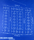 | Details | Bowker, E.F. | 1899 |
| Antique blueprint plan of the Coffin Estate, Watertown, Mass |
|
Bowker, E.F. |
|
| 1899 |
| LOC:0 |
| $475.00 | Bowker--E-F- | Antique-blueprint-plan-of-the-Coffin-Estate--Watertown--Mass | Rare late 19th-century blueprint of house lots for sale just northwest of Mt. Auburn Cemetery. A fine antique plat of the Coffin Estate in Watertown Massachusetts. Previously unrecorded plat with no copies found anywhere. The area covered in this blueprint is bounded by Arlington Street and Prentiss Street at cross streets of Dewey St., Sampson Street, and Keenan St., now E-W rather than N-S as shown. Data included for each lot includes lot dimensions, total square feet, and lot number.
<br></br>
19th century blueprints are generally scarce as blueprinting had only been invented in the 1870's and by 1899 was beginning to become widely adopted as a quick method of reproducing maps, plans, and architectural diagrams.
<br></br>
By E.F. Bowker, Engineer and Surveyor, 671 Massachusetts Ave. Cambridgeport, Mass. MS surveyor's number "1809" in corners. Dated within at January 9, 1899. |
| 4792 |  | Details | British Admiralty Hydrographical Office | 1899 |
| Antique British Chart of Gran Canaria island |
|
British Admiralty Hydrographical Office |
|
| 1899 |
| LOC:54 |
| $275.00 | British-Admiralty-Hydrographical-Office | Antique-British-Chart-of-Gran-Canaria-island | Antique, used 1899 British Admiralty nautical chart of the island of Gran Canaria one of the Canary Islands of Spain, lying off the coast of northwest Africa. In 1900 the population of the entire group of Canary Islands was estimated at almost 360,000 individuals with the main exports consisting of wine, spirits, potatoes, tobacco, bananas, and cochineal.
<br></br>
Based on a survey by Lieutenant William Arlett (d. 1839) of the Royal Navy aboard the ship Aetna. With several manuscript notations and course plots in pencil, attesting to a well-used life aboard ship. Arlett's notes on his survey of the Canary Islands describes his impression of the island and the survey method of triangulation, employed across the entire island :<div class="indenttextblock">
"On the 14th December we arrived at Port la Luz in the island of La Gran Canaria, the Great Canary. This island is nearly circular and about twenty-four miles in diameter, or seventy-five in circumference. Its is mountainous, and the coast, gereally speaking, precipitous. "
…<br></br>
"A base having been measured, a triangulation was carried completely round the island, whence the soundings as well as the coast line were laid down trigonometrically.
" (Arlett, W. The Journal of the Royal Geographic Society of London. Volume 6. 1836.)</div>
<BR/>
Highly detailed topography in the interior of the island. Includes these key features: Las Palmas, the capital city; la Luz Harbor; Ayrenaga Bay; Tenefe Point; Romeral Castle (Castillo); and Morro Colchas point with its lighthouse. With an inset plan of Maspalomas Anchorage and two inset coastal elevation views. Lighthouses are highlighted in yellow.
<br></br>
The chart was first published at the Admiralty in London on June 26th, 1848. Sold by J.D. Potter, agent for sale of Admiralty Charts, 14-5 Minories. Verso with MS chart collation number "5b". Number 1869. Numerous large and small corrections, the last correction in 1899. |
| 5340 |  | Details | U.S. Army Engineers | 1899 |
| Chart of the Mouth of the Columbia River |
|
U.S. Army Engineers |
|
| 1899 |
| LOC:88 |
| $275.00 | U-S--Army-Engineers | Chart-of-the-Mouth-of-the-Columbia-River | Antique hand-colored chart of the mouth of the Columbia River. From a survey made June 1899 by the U.S. Army Corps of Engineers. Includes Astoria, Oregon; Youngs Bay, Clatsop Spit, Sand Island, Chinook River, Cape Disappointment, and Fort Stevens. Emphasis of the chart is on the south jetty (built 1884) near Clatsop Spit with hundreds of depth soundings at the Columbia River bar and just beyond there offshore.
<br></br>
The Columbia River comprises most of the border between the U.S. states of Washington and Oregon. At 1,243 miles long the Columbia is the largest river in the Pacific Northwest. The Columbia River bar is very dangerous with over 2,000 wrecks recorded since 1792. The U.S. Coast Guard operates a National Motor Lifeboat School at Cape Disappointment to the north of the Columbia River mouth. |
| 5070 | 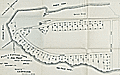 | Details | Spaulding, Leonard. H. | 1899 |
| Antique Plan of Cottage Lots on Ash Point West Harpswell Maine |
|
Spaulding, Leonard. H. |
|
| 1899 |
| LOC:200 |
| $500.00 | Spaulding--Leonard--H- | Antique-Plan-of-Cottage-Lots-on-Ash-Point-West-Harpswell-Maine | Antique surveyor's plat on thin folding paper of Cottage Lots on Ash Point in West Harpswell, Maine. Ash Point is a peninsula jutting into Casco Bay with Basin Cove to the West and Ash Point Cove to the East. Dated within to September 1899.
<br></br>
Shows a proposed steamboat pier at the end of Ash Point, and the existing boat house and cottage of
L. H. Spaulding. Streets shown include Aucocisco Avenue and Ocean Avenue.
<br></br>
Map folded in a brochure 5" x 7" with photographs and text advertising the benefits of living in Harpswell and in particular the joy of owning property on Ash Point.
<br></br>
Drawn by John T. Desmond, Civil Engineer and Surveyor. |
| 5247 |  | Details | Webster Canning Company | 1900 |
| Bird's eye view of the Chesapeake Bay |
|
Webster Canning Company |
|
| 1900 |
| LOC:77 |
| $250.00 | Webster-Canning-Company | Bird-s-eye-view-of-the-Chesapeake-Bay | Folding advertising broadside. A scarce decorative pictorial bird's eye view of the Delmarva Peninsula and Chesapeake Bay. Shows produce produced on the Virginia portion of the peninsula. Published by G.L. Webster Canning Company, Cheriton, Virginia. Verso with a view of the Cheriton, VA cannery. Printed by Everett Wadley Co. Richmond, Virginia. |
| 4887 |  | Details | Stewart, John Frew | 1900 |
| Four manuscript survey plats of Kentucky land. |
|
Stewart, John Frew |
|
| 1900 |
| LOC:13 |
| $250.00 | Stewart--John-Frew | Four-manuscript-survey-plats-of-Kentucky-land- | One lot of four manuscript plats of Kentucky real estate on surveyors' tracing cloth from ca. 1900. Attributed to John Frew Stewart of Paintsville, Kentucky. Includes a MS list of other maps sent out by Stewart in 1900.
<br></br>
John Frew Stewart (1833-1906) studied law at the office of Moore and Gallup at Louisa, and obtained a license to practice law in 1860. He was elected county attorney for Lawrence County, Kentucky in August, 1862. The next month Frew joined the Union army as a private and swiftly obtained the rank of Second Lieutenant in the Thirty-ninth Kentucky volunteers and again as major of his regiments in November, 1864.
Stewart held several government positions including Deputy Collector for the Internal Revenue, county school commissioner, and county judge.
<br></br>
Proceeding clockwise from upper left the maps include:
<div class="indenttextblocksingle">
<ul style="list-style-type: circle;">
<li>Adam Harmon Farm, 600 acres situated on a branch of the Stillwater River in Wolfe County, 5 miles from Campton. Size: 9" X 8"</li>
<li>Plat of 131 3/4 acres tract on a branch of Gladys Creek. Rowan County, KY.</li>
<li>Signed list of maps and plots</li>
<li>Plat of land of 139 acres on the Tire Branch of White Oak Creek in Mugoffin, Co. Kentucky</li>
<li>Plat of 250 acres on the left fork of Craney Creek, Morgan County, KY.</li> |
| 652 |  | Details | George W. Walker Lithograph and Publishing Co | 1900 |
| New Bedford And Vicinity |
|
George W. Walker Lithograph and Publishing Co |
|
| 1900 |
| LOC:0 |
| $265.00 | George-W--Walker-Lithograph-and-Publishing-Co | New-Bedford-And-Vicinity | Early folding antique lithographed map of New Bedford, Massachusetts on thin paper. With cardboard cover, graced by views of whaling ships, attached to map as issued. Locations coverd by the map include Buzzards Bay, the Elizabeth Islands, NW Martha's Vineyard, Westport, Dartmouth, Mattapoisett, Fall River, Acushnet, Naskatuckett Bay, Sippican Harbor, and West Falmouth, Massachusetts.
<br></br>
Published by H.S. Hutchinson and Company. Copyright 1892 by George W. Walker, lithographers. Precise publication date is unknown but must have been after 1899 as the map shows the New Bedford - Fairhaven Bridge that was completed in 1899. |
| 5277 |  | Details | Stanford, Edward | 1900 |
| Superb late 19th-century nautical chart of the English Channel |
|
Stanford, Edward |
|
| 1900 |
| LOC:1409 |
| $2,575.00 | Stanford--Edward | Superb-late-19th-century-nautical-chart-of-the-English-Channel | A visually captivating and informative original antique 19th-century nautical reference chart of the English Channel with visible extent of lighthouses shown graphically. Uncommon. The few similar items that come to mind are Hardinge's 1874 "British Lighthouse Chart of General Coast Lights", and "A Chart Exhibiting the Light Houses and Light Vessels of the Coasts of Great Britain and Ireland" issued by the Corporation of the Trinity House, 1863.
<br><br>
This antique original, rolled, linen-backed chart, based on data from Lieutenant H.C. Lockyer in 1899, was published by Edward Stanford from Stanford's Geographical Establishment in London on March 1, 1900. Stanford's, established in 1853, remains in business today, now at 7 Mercer Walk in Covent Garden.
<br></br>
Coverage includes relevant portions of the coast of Ireland, Wales, England, and France, with Cornwall near chart center.
<br><br>
Scarce, especially in fine condition as this example. Only one institutional holding in WorldCat.
<br></br>
Contains drawings of the uniform system of buoyage: starboard-hand buoys, port-hand buoys, middle ground buoys; pillar, spar, and gas buoys; and wreck-marking vessels. Of great visual interest are the dozens of lighthouses identified on the chart with the range, frequency, duration, and color of each light provided for navigators. The chart is filled with tide tables, general information, soundings and distances and sailing directions for numerous ports. Topographical detail useful to navigators is shown for coastal locations and for those inland locations where the height of a feature warranted inclusion, e.g. Brecknock Mountain, Wales at 2862 ft. elevation.
<br></br> |
| 5416 |  | Details | Merrill, Phinehas | 1900 |
| Rare restrike plan of Exeter New Hampshire engraved by Peasley |
|
Merrill, Phinehas |
|
| 1900 |
| LOC:90 |
| $850.00 | Merrill--Phinehas | Rare-restrike-plan-of-Exeter-New-Hampshire-engraved-by-Peasley | Very scarce plan of Exeter, New Hampshire by Phinehas Merrill engraved and first printed in 1802. This artifact is likely a later re-strike from the original plate ca. 1900. The engraving is in excellent condition with a strong impression, evident platemark, ample margins, and matches the 1802 edition in size and all other features.
<br></br>
The plan is printed to fine laid paper with a watermark "Little Chart England", a characteristic of paper made at the Ford Paper Mill in the village of Little Chart. Beginning in 1876 Joseph Batchelor (ex. Whatman) rented the mill and began producing fine handmade paper at the Ford Mill.
<br></br>
A plan of the compact part of the town of Exeter, at the head of the southerly branch of Piscataqua River |
| 715 |  | Details | Stanford, Edward | 1901 |
| Oarsmans and Anglers Map of the River Thames from its Source to London Bridge |
|
Stanford, Edward |
|
| 1901 |
| LOC:0 |
| $425.00 | Stanford--Edward | Oarsmans-and-Anglers-Map-of-the-River-Thames-from-its-Source-to-London-Bridge | <BR></br><div class="indenttextblock">"The Editors… have endeavoured to lay down the course over which a punt should be shoved. <i>They wish it to be distinctly understood that they do not claim to have found the best shoving in all cases</i>, but they have tried to describe the bottom of the river as they know it, perhaps not as intelligibly as they would have wished, owing to the exigencies of space and the subsequent condensation of language. "</div>
<br>Thus begins the introduction to this very interesting and quirky map of the Thames River, published in 1901 and oriented to the fishermen and boaters of the area. Filled with information about the Thames, not only locks, water depth, bridges and other navigational information, but also, inns, hotels, and boatyards.
<br></br>
A reader does not have to go too far perusing the notes on this chart to need a good nautical reference book, as some of the practices of that era are now outdated or not applicable in other countries. For example this note on Hart's or Eaton's Weir: <div class="indenttextblock">"The only weir on the Thames which has to be 'shot'. There is usually someone at the neighboring inn who will lend a hand in drawing the paddles and rymers." </div> Hmmm. Turns out that the term "paddles and rymers" refers to a method of lock contruction for "flash locks" based on a single gate. The method of constuction dates back to the medieval period. Paddle and rymer weirs are operated by placing large wooden posts – the rymers – into the bottom of the river. To control the water flow, paddles of different heights were placed against the rymers. When the paddles were removed water would pour through the opening and boaters would "shoot" the opening. This method of construction is now considered dangerous and most paddle and rymer weirs have been updated.
<br></br> Published by Edward Stanton, 12, 13, & 14, Long Acre, W.C. |
| 5371 |  | Details | Daily Picayune | 1901 |
| The Picayune's Map of New Orleans |
|
Daily Picayune |
|
| 1901 |
| LOC:90 |
| $400.00 | Daily-Picayune | The-Picayune-s-Map-of-New-Orleans | Scarce lithographed map of New Orleans, Louisiana published by The Picayune [1] newspaper in 1901. Shows both the West End Railroad and the Ponchartrain Railroad, both now long gone.
<br></br>
The Mississippi River is shown devoid of bridges but with <b>nine ferry crossings</b>. The first bridge across the Mississippi in Louisiana was not built until 1935. Several paddlewheel steamboats are shown underway in the river
<br></br>
The Picayune newspaper was started in 1837 in New Orleans, Louisiana. In 1914 The Picayune merged with the Times-Democrat to form the Times-Picayune.
<br></br>
[1] The Picayune was named after a Spanish coin used in Florida and Louisiana worth about six and one-half cents in the 1850s. |
| 5138 |  | Details | Boston and Maine Railroad | 1901 |
| Map of railway lines for the Boston and Maine Railroad |
|
Boston and Maine Railroad |
|
| 1901 |
| LOC:10 |
| $150.00 | Boston-and-Maine-Railroad | Map-of-railway-lines-for-the-Boston-and-Maine-Railroad | Official corporate map of railway and steamship lines for the Boston and Maine Railroad. Lithograph on thin paper.
<br></br>
Printed and included in the "Sixty-eighth Annual Report of the Directors of the Boston and Maine Railway to the Stockholders for the Year Ended June 30, 1901." Printed at Boston, Massachusetts in 1901 by Rand Avery Supply Company.
<br></br>
Red lines designate Boston & Maine lines and leased lines operated by the railroad. Purple lines show lines controlled by the Boston and Maine R.R. Includes steamship routes owned and operated by the company shown offshore with black or purple dotted lines. Margins about 1/4" on all sides. |
| 4946 |  | Details | Lighthouse Board of the United States | 1901 |
| Report of the United States Light-house Board. 1901. |
|
Lighthouse Board of the United States |
|
| 1901 |
| LOC:2001 |
| $475.00 | Lighthouse-Board-of-the-United-States | Report-of-the-United-States-Light-house-Board--1901- | Scarce annual report of the United States Light-house Board for the fiscal year ending June 30, 1901. Folds to 6" x 9".
<br></br>
Contents include:
<div class="indenttextblocksingle">
<ul style="list-style-type: circle;">
<li>Index chart of all lighthouse districts approximately 15" x 18" inside the neatline.</li>
<li>Seventeen colored folding charts of individual lighthouse districts. Unfolded, each chart measures approximately 15" x 18" inside the neatline.</li>
<li>Eleven black and white plates.</li>
</ul>
</div>
</div>
Washington. Government Printing Office. Treasury Department. Document No. 2228. Office of Lighthouse Board. |
| 1476 |  | Details | Eldridge, George W. | 1901 |
| Massachusetts Bay and Coast from Chatham to Gloucester 2 |
|
Eldridge, George W. |
|
| 1901 |
| LOC:0 |
| $300.00 | Eldridge--George-W- | Massachusetts-Bay-and-Coast-from-Chatham-to-Gloucester-2 | Chart D Massachusetts Bay and the Coast from Chatham to Gloucester, published by George W. Eldridge in 1901, is a navigational chart that accurately depicts the coastline, harbors, and navigational hazards along Massachusetts Bay, from Chatham in the south to Gloucester in the north.
<br><br>
The chart is highly detailed and includes information on soundings (water depth measurements), tides, currents, and other navigational data. It shows the location of lighthouses, buoys, beacons, and other aids to navigation, as well as the location of rocks, shoals, and other navigational hazards.
<br><br>
In addition to navigational aids, the chart also shows the names and locations of towns, cities, and other landmarks along the coast, providing a useful reference for sailors navigating the area. Coverage includes the coastal margins near the towns of Provincetown, Truro, Wellfleet, Brewster, Yarmouth, Plymouth, Scituate, Cohasset, Marblehead, Salem, Gloucester, and the town and harbor of Boston, Massachusetts. The chart was designed to be used by sailors and navigators, and its accuracy and level of detail made it an essential tool for safe navigation along the Massachusetts Bay.
<br><br>
Date printed in blue stamp "1901". Note: Price is discounted for condition. |
| 5224 | 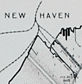 | Details | Eldridge, George W. | 1901 |
| Eldridges Antique Harbor Chart of New Haven, Connecticut |
|
Eldridge, George W. |
|
| 1901 |
| LOC:10 |
| $250.00 | Eldridge--George-W- | Eldridges-Antique-Harbor-Chart-of-New-Haven--Connecticut | Early 1901 harbor chart of the port of New Haven, Connecticut by George W. Eldridge. Key features noted include the Southwest Ledge Light, several breakwaters, Five Mile Point, Fort Hale, Sandy Point, Morris Cove, West Haven, and Fair Haven. Numerous aids to navigation, anchorages, and depth soundings.
<br></br>
Much useful information including soundings, anchorages, ranges, buoys, and bottom composition are presented by Eldridge in a clear graphic style that would have been helpful to mariners. The chart is printed with bold black coastal outlines that would have been much easier to read under poor lighting conditions. Lighthouses, buoys, and other aids to navigation are highlighted in red. Bottom composition is presented according to an attached table of abbreviations.
<br></br>
Attribution reads: 'AUTHORIZED and PUBLISHED By Geo. W. Eldridge, Vineyard Haven, Mass. and 152 State Street, Boston. Copyright by Geo. W. Eldridge 1901.' Number 17 in Eldridge's book of harbor charts. |
| 1362 | 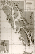 | Details | Depot de la Marine | 1902 |
| Antique nautical chart of southern Alaska, Prince of Wales Island, Juneau |
|
Depot de la Marine |
|
| 1902 |
| LOC:2001 |
| $1,200.00 | Depot-de-la-Marine | Antique-nautical-chart-of-southern-Alaska--Prince-of-Wales-Island--Juneau | Fine nineteeth-century folding Gold-Rush era nautical chart of southwest Alaska from Graham Island/Dixon Entrance past Prince of Wales Island, and terminating with Glacier Bay. Large, separately issued French chart of the Alaska Panhandle and the inside passage. Includes part of the route used by modern cruise ships visiting Juneau or Haines or Skagway, Alaska. Inset of "Extremite nord du Canal Lynn".
<br></br>
Published first in 1893, this edition contains corrections to 1902. Early charts of Alaska are scarce. No copies of this antique chart are listed in OCLC/WorldCat or in the Antique Map Price Record.
<br></br>
Some of the many named features on this fine chart include Admiralty Island, Cross Sound, Baranoff Island, Dall Island, and Wrangell Island, Chatham Canal, Port Protection (of TV fame), Haines, and the Skagway River. Numerous mountains with elevation details as well as many glaciers are identified and named.
<br></br>
With owners overstamps from the Library of Canadian Energy, Mines, and Resources Department in 1969 and 1976. Number 4553. |
| 694 | 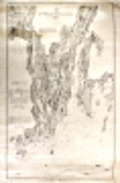 | Details | U.S. Coast and Geodetic Survey | 1902 |
| Kennebec and Sheepscot Rivers, Maine |
|
U.S. Coast and Geodetic Survey |
|
| 1902 |
| LOC:0 |
| $165.00 | U-S--Coast-and-Geodetic-Survey | Kennebec-and-Sheepscot-Rivers--Maine | Large, rolled, antique nautical chart of the southern reaches of the Kennebec and Sheepscot Rivers in Maine first issued in 1868 with corrections to 1902. This old chart covers the numerous bays, coves, and idyllic islands that dot the coast to the south and to the east of Bath, Maine.
<br></br>
Two interesting features add value to the chart. The first is a location defined as "Ancient Augusta 1717 - 1721" but near the mouth of Cape Small Harbor well south of present-day Augusta, Maine. The second interesting feature, identified as "Ancient Fort George", lies directly to the west of Fort Popham, in the area of Sabino Head. That reference to Fort George is apparently Fort St. George, part of a very early English colonial settlement of Popham recently 'rediscovered' in 1994. The colony (also called the Sagadahoc Colony) was founded in 1607, 13 years before the Plymouth Colony and it has been called "the cornerstone in the foundation of English America". ( Reference: www.smithsonianmag.com/history/maines-lost-colony-106323660/?no-ist=&page=1 )
<br></br>
Geographical features include: Merry Meeting Bay, Georgetown Island, Linekins Bay, Montseag Bay, Southport Island, Seguin Island, Hockomock Bay, Mount Pisgah, and Robin Hood Cove. Noted population centers include: Bath, Woolwich, Winnegance, Drummore Mills, Phillipsburg Center, Parker's Head Village, Wicasset, and Boothbay Harbor, Maine. Bottom of chart contains 3 inset profile coastal views of various approaches to the Kennebec River.
<br></br>
On heavy paper, this chart (Electroype copy No. 3) was printed on or after 1902 from an electrotype plate of the original hand-engraved copper plate, a process the U.S. Coast Survey adopted around 1850. Numerous soundings, aids to navigation and hazards are noted. Rubber stamp imprint at bottom reads: "Aids to navigation correct from information received to Aug 4 1902." Number 314. |
| 706 | 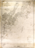 | Details | U.S. Coast and Geodetic Survey | 1902 |
| St. George River and Muscle Ridge Channel, Maine |
|
U.S. Coast and Geodetic Survey |
|
| 1902 |
| LOC:0 |
| $225.00 | U-S--Coast-and-Geodetic-Survey | St--George-River-and-Muscle-Ridge-Channel--Maine | Antique nautical chart issued in 1902 covers from Thomaston, Maine southwestward along the St. George River past St. George, Maine and Tennant Harbor, the Marshall Point Lighthouse to Burnt Island and from a line drawn through those areas to the east, covering the island-strewn Maine Atlantic coast. Coastal areas covered by this old sea chart encompass Two Bush Channel and these islands: Rackliff's, Andrew's, Hewell's, Hooper's, Metlinik, Ash, Sheep, Grafton, Pleasant, Sprucehead, Whitehead, Munroe, and Alleni Islands.
</br>
Other points of interest noted on this old chart include South Thomaston, Friendship and Port Clyde, Maine; Fort St. George, Maple Juice Cove, Hart's Neck, Mosquito Head, Cutter's Nubble, Old Woman Ledge, Owl's Head Light, and Fog's Hill.
<br></br>
Date of first publication was 1873. This antique chart bears a stamp at the bottom in purple ink that identifies this edition as later: "Aids to navigation corrected with information received Jul 13, 1902."
<br></br>
This chart was printed from an electrotype copy of the original hand-engraved copper plate, a process the U.S. Coast Survey adopted around 1850. As a soft medium, copper plates could only withstand print runs of perhaps 200 copies before the plates wore down. To enable larger print runs, a mold of the original plate was created in wax or another soft medium. Then, using an electro-chemical processs ( electrotyping ), the mold was coated with a metal layer, typically copper. Printers were then able to produce output from the new electrotype copper copy, while preserving the original. This print run is electroype copy number 2. Chart number 312. Price when issued 25 cents. |
| 5180 | 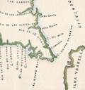 | Details | Fiske, John | 1902 |
| Sketch of the earliest map of Florida coast by Fiske after Cantino |
|
Fiske, John |
|
| 1902 |
| LOC:11 |
| $135.00 | Fiske--John | Sketch-of-the-earliest-map-of-Florida-coast-by-Fiske-after-Cantino | Sketch of the Florida coast, a sketch of the earliest image of Florida known from an anonymous Portuguese manuscript portolan map of the world: The Cantino Planisphere. Martin Waldseemuller's 1507 map is derived from the Cantino Planisphere.
<br></br>
In 1501 Alberto Cantino commissioned a Portuguese official to make a map with all the latest discoveries known to the Portuguese. That large map incorporated discoveries made by several explorers in the first decade of the 16th century and revealed unpublished details of Portuguese trade routes.
<br></br>
This bookplate sketch of a portion of Cantino's map is from "The Discovery of America" by John Fiske, 1892. |
| 1188 |  | Details | US Post Office Department | 1903 |
| Rare Post Route Map of the State of Washington |
|
US Post Office Department |
|
| 1903 |
| LOC:0 |
| $1,500.00 | US-Post-Office-Department | Rare-Post-Route-Map-of-the-State-of-Washington | Rare official U.S. Postal Service map of Washington State, complete with an oval vignette of a Pony Express rider and a steam locomotive with the motto of the US Post Office--"with Celerity, Certainty and Security". A rolled map with no folds. Should frame brilliantly.
<br></br>
Legend at bottoms shows "Explanation of Mail Service." keyed to colored lines on the map showing frequency of delivery. Also noted are railroads, beginning and end of delivery routes, mail messenger routes, Post Offices, discontinued Post Offices, and rural free delivery (RFD) routes.
<br></br>
Published September 1903 by order of Postmaster General Henry C. Payne, under the direction of A. von Haake, Topographer P.O. Department. |
| 4941 |  | Details | Boston and Maine Railroad | 1903 |
| Boston and Maine Railroad Summer Excursions with five maps |
|
Boston and Maine Railroad |
|
| 1903 |
| LOC:2001 |
| $350.00 | Boston-and-Maine-Railroad | Boston-and-Maine-Railroad-Summer-Excursions-with-five-maps | Rare booklet from the Boston and Maine Railroad (1903) with Summer Excursions, rates, stage and steamer connections. Includes five maps and birds-eye views on thin paper. 88 pages. Thin card covers. 4" x 8" overall.<br></br>
"Boston and Maine Railroad Summer Excursions to the White Mountains, Mount Desert, Adirondacks, Catskills, Montreal and Quebec, Winnipesaukee, Memphremagog, Champlain, Rangeley and Moosehead lakes and the New England Beaches."
<div class="indenttextblocksingle">
<ul style="list-style-type: circle;">
<li>1) "Bird's Eye Map of the White Mountains reached by Boston and Maine." Birds-eye view map of the White Mountains in New Hampshire. </li>
<li>2) Map of Lake Winnipesaukee and Vicinity Reached by Boston and Maine and Steamer Mt. Washington. Printed by Rand, Avery Supply Co,. Engineers and Printers, Boston.<.li>
<li>3) Lake Memphremagog and About There. Boston and Maine Railroad. Printed by Rand Avery Supply Company, Boston, Mass.</li>
<li>4) Fishing and Hunting Resorts reached by Boston and Maine Railroad Connections.</li>
<li>5) Map of Lake Sunapee and Vicinity Reached by Boston and Maine Railroad. Rand, Avery Supply Co,. Engineers, Boston, Mass.</li>
</ul>
</div>
Issued by the Passenger Department, Boston and Maine Railroad. 1903. Boston City Ticket Office: 322 Washington Street Cor. Of Milk Street |
| 5185 |  | Details | British Admiralty Hydrographical Office | 1903 |
| Island of St. Lucia Port Castries |
|
British Admiralty Hydrographical Office |
|
| 1903 |
| LOC:51 |
| $575.00 | British-Admiralty-Hydrographical-Office | Island-of-St--Lucia-Port-Castries | Antique chart of Port Castries in the French West Indies. Castries is the capital and a major port on the island of St. Lucia in the Caribbean.
<br></br>
Published at the Admiralty on November 13, 1865. Chart number 499. |
| 5307 |  | Details | Gobiet, Arthur | 1904 |
| Plan of the Industrial Exhibition in Cape Town during 1904 |
|
Gobiet, Arthur |
|
| 1904 |
| LOC:9 |
| $325.00 | Gobiet--Arthur | Plan-of-the-Industrial-Exhibition-in-Cape-Town-during-1904 | Plan of part of the place for the International Industrial and Commercial Exhibition held in Cape Town, South Africa in 1904 and 1905. Shows the layout for hundreds of exhibitors between the Sea Point Eisenbahn and Green Point Strasse.
<br></br>
German text. Lithograph on thin paper by Howard and Jones, London. Very rare.
<br></br>
An announcement in the Monthly Consular and Trade Reports describes the activities:
<div class="indenttextblocksingle">
"International industrial exhibition at Cape Town - An international industrial and trade exhibition is to be held at Cape Town, South Africa from November 1, 1904 to January 31, 1905. This exhibition will be of <b>special importance for the textile industry</b> and those trades which are closely identified therewith."
</div> |
| 6649 |  | Details | Perkins, T.C. | 1905 |
| 1905 Connecticut Valley Electric Transit Route Pictorial |
|
Perkins, T.C. |
|
| 1905 |
| LOC: |
| $250.00 | Perkins--T-C- | 1905-Connecticut-Valley-Electric-Transit-Route-Pictorial | Birds'-eye view pictorial map of the Connecticut Valley, following the Connecticut River. Shows the Electric Transit Trolley Route from Hartford, Connecticut To Greenfield, Massachusetts. The route includes the towns of Hartford, Chicopee, Springfield, Holyoke, Greenfield, and Turner Falls with population centers shown pictorially in profile.
<br><br>
The Connecticut Valley Electric Transit Route was a trolley line that operated in the early 20th century, specifically from 1905 to 1926, in the Connecticut River Valley region of Massachusetts. The line was a part of the Springfield Street Railway Company, which was one of the largest electric streetcar systems in the United States at the time.
<br><br>
The Connecticut Valley Electric Transit Route ran from Springfield to Holyoke, Northampton, and Amherst, and it was an important transportation link for people living in those areas. The trolley line connected these towns and allowed for easy travel between them, which was especially important for college students attending schools in the region, such as Amherst College and Smith College.
<br><br>
Mount Tom is a mountain located in Holyoke, Massachusetts, in the Connecticut River Valley region. The mountain has an elevation of 1,202 feet (366 meters) and offers sweeping views of the surrounding area.
In the early 20th century, Mount Tom was a popular tourist destination, and it was a common stop on the Connecticut Valley Electric Transit Route. The trolley line had a station at the base of the mountain, and visitors could take a funicular railway up Mount Tom. Once at the top of Mount Tom, visitors could enjoy a range of activities, including hiking, picnicking, and even a zoo. The mountain was also home to a popular amusement park, which featured a roller coaster, a Ferris wheel, and other rides and attractions.
<br><br>Published by T.C. Perkins Hartford, Connecticut 1905. E.A. Sherman del. |
| 6814 |  | Details | Whitney, William H. | 1905 |
| Manuscript engineers trace map of Cambridgeport Massachusetts |
|
Whitney, William H. |
|
| 1905 |
| LOC: |
| $500.00 | Whitney--William-H- | Manuscript-engineers-trace-map-of-Cambridgeport-Massachusetts | Original manuscript trace map by the civil engineering firm of William H. Whitey, Boston. A traced pen and ink map on tracing cloth of an area in Cambridgeport, Massachusetts bounded by the Charles River to the south and Erie Street to the North and from Magazine Street at the west to roughly where Briggs Field now stands. This manuscript trace would have been used to create numerous blueprint copies for Whitney's clients. Whitney was a very early adopter of blueprinting to support his map-making and design business.
<br><br>
The map shows the location of the Boston University Bridge across the Charles River then under construction as well as the proposed location for an additional bridge downstream.
<br><br>
Includes Washington Square, a soap works of J. Reardon and Sons, Hastings Square, Morse School, Captain's Island Playground, Baptist home, and Lammson Memorial Building. By William H. Whitney, Boston Civil Engineer. |
| 5039 |  | Details | Southern Pacific Company | 1906 |
| San Francisco The Imperishable map 1906 earthquake fire |
|
Southern Pacific Company |
|
| 1906 |
| LOC:63 |
| $450.00 | Southern-Pacific-Company | San-Francisco-The-Imperishable-map-1906-earthquake-fire | Single page folding booklet about the Great San Francisco Fire and Earthquake of 1906. Scarce. With a map of the burned area by Allan Dunn and two panoramic photographs on the verso. Map size is 10" x 15". Published by Southern Pacific Company, Passenger Department.
<br></br>
One source states that the booklet was an instance of disinformation.
<div class="indenttextblock">
"Southern Pacific Railroad Co. was aggressive in its attempt to rewrite the history of the San Francisco earthquake and fire. As part of that campaign, the publicity department of the railroad churned out hundreds of articles like this to highlight the damage from fire, and minimize the effects of the earthquake; to "set the record straight," as one piece of SP literature put it."
<br></br>
"Note how his article casually dismisses the earthquake in San Francisco and surrounding communities, and stresses that the worst results from the tremor were outside the city. " (Source: Virtual Museum of the City of San Francisco. http://www.sfmuseum.org/conflag/imperish.html)
</div> |
| 5314 |  | Details | Ranson, Robert | 1906 |
| Antique map of Cracker Swamp drainage Hastings, Florida FEC |
|
Ranson, Robert |
|
| 1906 |
| LOC:87 |
| $800.00 | Ranson--Robert | Antique-map-of-Cracker-Swamp-drainage-Hastings--Florida-FEC | Cyanotype (blueprint) cadastral plat map of the vicinity around Hastings, Florida, the "Potato Capital of Florida", featuring a proposed drainage canal from the St. Johns River to Hawhead at the northernmost point of what is today referred to as "Cracker Swamp" . This early plat of the area in Volusia County, is from an auction lot of maps related to Wetumpka Fruit Company. The map was published in 1906 just 16 years after Hastings was founded by Thomas Hastings [1] at the urging of his cousin <b>Henry Morrison Flagler</b>. Hastings, northeast of East Palatka, Florida, in St. Johns County, had a population of about 1,200 in 1910.
<br></br>
With a graphed depth profile (at left) of the proposed canal running from the vicinity of May Road (Mays Cove Road) on the St. Johns River to Hawhead. Depth measurements are provided every 400 feet.
<br></br>
Shows the tracks of the Florida East Coast Railroad curving through Hastings, a portion of the <b>Huertas Grant</b> [2], East Palatka, and across Deep Creek. Other noted features include: Leonard Tract, White Towers, Buncombe Island (inside the "Cracker Swamp"), orange mills, Florida Vegetable Company Boulevard; and two short branches off Deep Creek- Wilkinson Branch and Cracker Branch.
<br></br>
[1] In 1889 Henry Flagler convinced his cousin Thomas H. Hastings to develop a farm nearby Flagler's railroad in order to supply vegetables to Flagler's St. Augustine resort hotels.<br>
[2] Spanish Governor Sebastien Kindelan granted St. Augustine, Florida resident Antonio Huertas 10,000 acres west of St. Augustine in 1813. |
| 4902 | 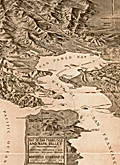 | Details | Monticello Steamship Company | 1907 |
| Antique Birdseye View of San Francisco and Napa Valley Monticello Steamship Company |
|
Monticello Steamship Company |
|
| 1907 |
| LOC:0 |
| $350.00 | Monticello-Steamship-Company | Antique-Birdseye-View-of-San-Francisco-and-Napa-Valley-Monticello-Steamship-Company | Antique birds-eye view of the Bay of San Francisco and Napa Valley. "On the Bay of San Francisco from the Monticello Steamship Company". Scarce with this view.
<br></br>
Copyright 1907 by Monticello Steamship Company.
<br></br>
With steamship routes and electric railroad routes to and through:
Vallejo
The U.S. Navy Yard
Mare Island
Napa Valley Route
<br></br>
Card cover and four inner pages. With Information on fares, steamship and electric Railroad Routes
Size closed: 4" x 9 1/2". By Sierra Art and Engineering Co. S.E. |
| 716 |  | Details | George W. Walker Lithograph and Publishing Co | 1907 |
| Boston Harbor and the North Shore |
|
George W. Walker Lithograph and Publishing Co |
|
| 1907 |
| LOC:0 |
| $260.00 | George-W--Walker-Lithograph-and-Publishing-Co | Boston-Harbor-and-the-North-Shore | Orginal antique birdseye view folding map of Boston Harbor by George Walker shows ferry routes, steamer routes and railroad lines between Boston and points both within Boston Harbor and to outlying towns. This fascinating old lithographed map differs from other birdseye-view maps we are aware of from this era because it includes Marblehead, Lynn, Salem and extends north-eastwards to Gloucester, Massachusetts. We can date the map with confidence because it clearly shows the Wonderland Amusement Park at Revere Beach which failed after five years, operating exclusively between 1906 and 1911. Wonderland, served by the Revere Beach and Lynn Railroad, was modeled along the lines of the World's Fairs of that era and included roller coasters, technological exhibits, theaters and a boardwalk.
<br></br>
Noted points of interest include Charlestown, Point of Pines, Magnolia, Baker's Island, Thompson's Island, "the Pumping Station", Dorchester Bay, Squantum, Norfolk Downs, Quincy Bay, Hough's Neck, Hingham Harbor, Winthrop, Beachmont, Great Head, Peddock's Island, Nantasket Beach, Port Allerton, the town of Hull with Fort Revere, George's Island with Fort Warren, Deer Island, Lovell's Island, Lynn, Swampscott, Thatcher's Island, Strawberry Hill, and many more. Captures several local lighthouses and aids to navigation including Boston Light, Long Island Light, Fawn Bar Beacon, Graves Light, and far out the bay - a whisting buoy.
<br></br>
Original lithograph by George W. Walker, lithographer of Boston in landscape format is in very good condition for a 105+ year old map. Was originally folded into a card cover but the front half has disappeared leaving the map attached to the back cover, as issued.
<br></br> |
| 756 |  | Details | Depot de la Marine | 1907 |
| Antique nautical chart of Brittany Coast near the Vilaine River |
|
Depot de la Marine |
|
| 1907 |
| LOC:0 |
| $425.00 | Depot-de-la-Marine | Antique-nautical-chart-of-Brittany-Coast-near-the-Vilaine-River | Antique chart of the west coast of France from the Anse de Cornaud and Pointe du Grand Mont southward to le Croisic. First published in 1826, this chart of Brittany includes part of the Department of Morbihan, and the mouths of the Penerf and Vilaine rivers. The chart is updated as of 1907. Settlements and habitations covered include Cornaud, Saint-Gildas-de-Rhuys, Chateau de Suscino (en ruins), Damgan, Port de Billiers, Penestin (Pennetin), Mesquer, Piriac-sur-Mer, la Turballe, Guerande, Clie, and Saille. The chart extends westward to include the Ile d'Hoedic and many surrounding smaller islets of the greater and lesser Cardinaux Islands.
<br></br>
Very extensive and minute detail of the shoreline and near shore areas with elevation denoted by fine hachuring. Hundreds of individual structures are placed accurately. Thousands of soundings with isobath contour lines and navigational hazards would have aided the coastal navigator in the area.
<br></br>
This is a early 20th century linen-mounted folding chart, an updated edition of a chart first published by France's Depot de la Marine in 1826. This sea chart is based on the original surveys conducted in 1820 and 1821 under the supervision of Charles-François Beautemps-Beaupré (1766-1854), considered to be the father of modern French hydrography. Linen verso is printed via letterpress with "De La Pointe du Grand-Mont AU CROISIC. Entrée de la Vilaine." |
| 758 |  | Details | Depot de la Marine | 1908 |
| Antique nautical chart of Quiberon Bay with islands of Belle-Ile, Hoedic, and Houat |
|
Depot de la Marine |
|
| 1908 |
| LOC:66 |
| $425.00 | Depot-de-la-Marine | Antique-nautical-chart-of-Quiberon-Bay-with-islands-of-Belle-Ile--Hoedic--and-Houat | Antique lithographed chart of waters offshore of the west coast of France from southwest of the village of Saint Gildas and the Pointe du Grand-Mont. First published in 1826, this chart near the Brittany coast in western France includes the peninsula of Presqu'ile Quiberon and is the edition of January 1903 published with the latest updates in 1908.
<br></br>
Very extensive and minute detail of the shorelines and near shore areas with elevation denoted by fine hachuring. Thousands of soundings with isobath contour lines and navigational hazards would have aided the coastal navigator in the area. At the far right a particularly dangerous area for navigators, the "Plateau de la Recherche" is highlighted in brown
<br></br>
This is a early 20th century linen-mounted folding chart, an updated edition of a chart first published by France's Depot de la Marine in 1827. This lithographed nautical chart is based on the original surveys conducted during 1820 and 1821 under supervision of Charles-François Beautemps-Beaupré (1766-1854), considered to be the father of modern French hydrography. Beautemps-Beaupre was one of the earliest hydrographers to use isobaths to represent water depth.
<br></br>
Linen verso is printed via letterpress with "BELLE-ILE Entrée de la Baie de Quiberon. Iles Houat et Haedik". Number 135. |
| 5440 |  | Details | Lone Star Immigration Company | 1908 |
| Original antique advertisement map for Texas immigrants MKT |
|
Lone Star Immigration Company |
|
| 1908 |
| LOC:53 |
| $350.00 | Lone-Star-Immigration-Company | Original-antique-advertisement-map-for-Texas-immigrants-MKT | Scarce thematic map of the state of Texas ca. 1908, an advertisement aimed at immigrants. No copy of this edition of the MK &T map of Texas is found online.
<br></br>
The map shows the lines of the Missouri, Kansas and Texas Railway as well as regional crops typically produced in each part of the state and yearly rainfall amounts. The purpose of the map was to encourage settlement in Texas, in this case to lands in the Lower Rio Grande Valley near Brownsville that were owned by the Lone Star Irrigation Company of Kansas City, Missouri.
<br></br>
The Missouri, Kansas and Texas Railway (MKT) was established in 1865. Commonly referred to as the K-T railway, the name evolved into "Katy". Following the route of an old cattle trail, the Katy became the first railroad to cross Indian Territory, now the state of Oklahoma, and enter Texas from the north. By 1904, the MKT system had over 1,110 miles of track in Texas. The railroad carried passengers and transported cattle, cotton, and other crops to market. |
| 2553 |  | Details | Eldridge, George W. | 1908 |
| Antique Chart of Portsmouth, New Hampshire |
|
Eldridge, George W. |
|
| 1908 |
| LOC:10 |
| $145.00 | Eldridge--George-W- | Antique-Chart-of-Portsmouth--New-Hampshire | Elegant, simple and useful early 20th-century antique nautical chart of Portsmouth, New Hampshire harbor and entrance. Nearby points of interest include Kittery, Seaveys Island, Gerrishes Island, Cutts Island, Newcastle Island, Little Harbor, Sagamore Creek and much more. By George W. Eldridge.
<br></br>
Much useful information including soundings, anchorages, ranges, buoys, and bottom composition are presented by Eldridge in a clear graphic style that would have been appreciated by and helpful to mariners. For instance, these charts are printed with bold black coastal outlines that would have been much easier to read under poor lighting conditions.
<br></br>
Attribution reads: 'AUTHORIZED and PUBLISHED By Geo. W. Eldridge, Vineyard Haven, Mass and 132 State St. Boston.' Number 56 from Eldridges book of harbor charts. Price 30 cents. |
| 3608 |  | Details | British Admiralty Hydrographical Office | 1908 |
| Large Chart of Mississippi River from the Passes to New Orleans |
|
British Admiralty Hydrographical Office |
|
| 1908 |
| LOC:53 |
| $1,050.00 | British-Admiralty-Hydrographical-Office | Large-Chart-of-Mississippi-River-from-the-Passes-to-New-Orleans | Fine British Admiralty chart of the Mississippi River from Nine Mile Point above New Orleans, south to the Mississippi River passes. Bold dark lithographed print retains the cartographic look and style of late 19th century Admiralty charts.
<br></br>
New Orleans shown with the mid-city area only partially built out. Virtually no development on the West Bank. Well before the bridges were built.
<br></br>
Later edition of a British Admiralty chart first engraved and published from London in 1903, and updated with corrections after that. From the copper plate engraved by Davies & Co. Sold by J.D. Potter. Dated to 1908 by the note regarding magnetic variation.
<br></br>
Logo of the British Hydrographical Office at top of the title block. Published from London on Nov 6, 1903 . Number 3382. |
| 5285 |  | Details | Oregon Railroad and Navigation Company | 1908 |
| Route map T. J. Potter Steamer between Portland and North Long Beach |
|
Oregon Railroad and Navigation Company |
|
| 1908 |
| LOC:10 |
| $575.00 | Oregon-Railroad-and-Navigation-Company | Route-map-T--J--Potter-Steamer-between-Portland-and-North-Long-Beach | Two rare, unrecorded advertising maps on a single sheet:<br>
1) Route of the Oregon Railroad and Navigation Company's Excursion Steamer "T. J. Potter" between Portland and North (Long) Beach. Contains an inset drawing of the Steamer T. J. Potter with a domed wheelhouse and flagpole.<br>
2) Map of the Oregon Railroad and Navigation Company Along the Columbia River, Portland to Celilo Falls. One half-page on verso.
<br></br>
Undated but ca. 1908 based on a advertisement for the excursion steamer T.J. Potter on the six-hour summer run (every day except Sunday) on the Columbia River between Portland, Oregon and North Beach, Washington promoted as "One of the Most Attractive Beach Resorts on the North Pacific Coast."
<br></br>
The T. J. Potter was a wooden side-wheel paddle steamer owned by the Oregon Railway and Navigation Company. The Potter operated on the Columbia River and Puget Sound between 1888 and 1916, and was considered for a time to be the fastest side-wheel steamer in the Northwest U. S. A. Rebuilt in 1901, the Potter then sported a dome with a flagpole instead of a flat roof. By the 1920's the Potter had been withdrawn from passenger service and was used as a quarter boat for construction crews before she was abandoned near Astoria, Washington. |
| 5065 |  | Details | Plumb, Arthur W. | 1908 |
| Scarce Maplewood Hotel Pittsfield, Massachusetts Advertisement |
|
Plumb, Arthur W. |
|
| 1908 |
| LOC:400 |
| $325.00 | Plumb--Arthur-W- | Scarce-Maplewood-Hotel-Pittsfield--Massachusetts-Advertisement | Rare point-of-sale advertising placard for the Maplewood Hotel in the Berkshire Mountains, ca. 1908.
<br></br>
Edges of the placard contain manuscript advertising copy:
<div class="indenttextblocksingle">
"One of the automobile road maps will be mailed free to anyone sending their names to A.W. Plumb, Pittsfield, Mass.
<br></br>
The most picturesque auto. trip in America is up through the Berkshire Hills via Lenox, Pittsfield and Manchester, Vt."
</div>
</br>
The Maplewood Hotel opened in 1887, converted from the Pittsfield Young Ladies Institute. The girl's school had operated on the site since 1841. Later, the school was known as the Maplewood Institute which has historical connections to the world of intercollegiate athletics.
<div class="indenttextblocksingle">
"… the school hosted the country’s <b>first intercollegiate baseball game</b>, with rival schools Amherst College and Williams College playing here on July 1, 1859. The game drew large numbers of Maplewood girls, who watched Amherst win 73-32 in 26 innings, in a game that bore little resemblance to today’s game." (Source: http://lostnewengland.com/2017/02/maplewood-pittsfield-mass-1/)
</div> |
| 777 |  | Details | Eldridge, George W. | 1908 |
| Antique Chart of Gloucester Harbor and of Sandy Bay, Massachusetts |
|
Eldridge, George W. |
|
| 1908 |
| LOC:0 |
| $125.00 | Eldridge--George-W- | Antique-Chart-of-Gloucester-Harbor-and-of-Sandy-Bay--Massachusetts | Separately issued nautical charts of Gloucester Harbor and of Sandy Bay on the Cape Ann peninsula in Massachusetts. Includes the Massachusetts towns of Rockport and Gloucester. Other key features include Fresh Water Cove, Tenpound Island, Southeast Harbor, Eastern Point, Thatcher's Island, Milk Island, Loblolly Cove, Whale Cove, Straitsmouth Island, The Rockport Granite Company, and Andrews Point. Much useful information including soundings, ranges, buoys, and bottom composition are presented in a clear graphic style that would have been appreciated by and helpful to mariners. For instance, these charts are printed with bold black coastal outlines that would have been easier to read under poor lighting conditions.
<br></br>
Attribution reads: 'AUTHORIZED and PUBLISHED By Geo. W. Eldridge, Vineyard Haven, Mass and 132 State St. Boston.' Price when issued was 30 cents. |
| 4980 |  | Details | Barrow, John | 1909 |
| Official map of Covington, La. St Tammany by K.H. Barrow, City Engineer |
|
Barrow, John |
|
| 1909 |
| LOC:13 |
| $795.00 | Barrow--John | Official-map-of-Covington--La--St-Tammany-by-K-H--Barrow--City-Engineer | Rare, unrecorded official map of Covington, Louisiana in St. Tammany Parish. The map taken from surveys by K.H. Barrow, City Engineer. No copies found in the AMPR or WorldCat. A very attractive, fresh map from 1909 with delicate hand coloring. Attractive. Copyrighted 1909 by J.I. Sanford.
<br></br>
This historical duo includes an 1886 copy of the charter for the town of Covington, Louisiana: "Charter of the Town of Covington as passed by the Legislature of the State of Louisiana and approved April 2d 1832 and March 16th 1870." Printed at Covington by St. Tammany Farmer Printers, 1886.. Both items inside newer simple card stock cover.
<br></br>
Features on this rare map of Covington, La. Include railroads, several churches, the Tchefuncta (Tchefuncte) River, Abita Bayou, Bogufalaya River, Courthouse, convent, City Park, Mandeville Road, Dixon Academy, Ozone Rest Cure, and the cemetery. Colored sections of the map delineate the area for several subdivisions, specifically: New Covington, Donnolley Addition, Sulphur Springs Addition, Oak Ridge Addition (has very strange street alignment), Division of St. John, Division of Spring, Weaver Addition, Wayside Addition, and the Sommer Addition.
<br></br>
Online sources list the following contact details for Barrow: K. H. BARROW. Surveying, Engineering and Mapping. Member Louisiana Engineering Society. Office-526 Whitney Bldg. Phone Main 1481. |
| 3693 |  | Details | Hunter, T.B. | 1909 |
| Large antique blueprinted map of Pebble Beach, California |
|
Hunter, T.B. |
|
| 1909 |
| LOC:1408 |
| $1,800.00 | Hunter--T-B- | Large-antique-blueprinted-map-of-Pebble-Beach--California | Fine large rolled 5' original antique cyanotype (blueprint) map (20 sq. ft.) of Pebble Beach, CA made in 1909, almost ten years before the opening of the famed Pebble Beach golf course. The earliest reasonably obtainable and the largest cyanotype cadastral map of Pebble Beach, CA.
<br></br>
Ironically, on this map the area now partly occupied by the golf course is marked "Reserved for Public Use". Pebble Beach Lodge is shown centered within Lot 123, a parcel of 9.487 acres. Locations that are shown but not named include Arrowhead Point, Pescadero Canyon, and Stillwater Cove.
<br></br>
Data for each lot include the lot number, metes and bounds (bearing and length of all lines bisecting each physical property marker stake), and acreage.
<br></br>
Includes Seventeen-Mile Drive and Carmel Bay. Monterey County. Shows topography with contour intervals of 10 feet.
<br></br>
Surveyed by T.B. Hunter, C.E. and drawn by T.F. Rogers.
<br></br>
North is oriented to upper right.
<br></br>
(Note: Yellow straight-edge rules shown are 48" long.) |
| 4737 |  | Details | British War Office | 1909 |
| Rare Map of Peking and Environs |
|
British War Office |
|
| 1909 |
| LOC:62 |
| $6,000.00 | British-War-Office | Rare-Map-of-Peking-and-Environs | Extremely rare British map of Beijing or Peking, China drawn prepared by the British Ordnance Survey Office, Southampton for the War Office. Dated within to 1909. Blue ink stamp to recto "For Official Use Only". Black oval stamp on verso: "North China Command, 7 Jul 1910, General Staff."
<br></br>
Not found in the Antique Map Price Record (AMPR).
<br></br>
Cartographically the map is based upon a 1907 German map published in Berlin entitled Peking und Umgebung. This map was created during the period of occupation following the suppression of the 1900 Boxer Rebellion, an era that produced detailed survey work, such as the present map, in anticipation of urban management needs and infrastructure development.
<br></br>
In the present example, stamped Chinese characters have been added for each English location name.
Chart no. 2417. |
| 5364 |  | Details | Anonymous | 1909 |
| Pair of manuscript allegorical Maps of the Heart, anatomically correct. |
|
Anonymous |
|
| 1909 |
| LOC:13 |
| $1,100.00 | Anonymous | Pair-of-manuscript-allegorical-Maps-of-the-Heart--anatomically-correct- | Two rare <b>manuscript pen and ink</b> anatomically-correct heart-shaped geographical guides or allegorical maps: "Map of Man's Heart" and "Map of Woman's Heart". Both maps are attributed within circular cartouches reading "Surveyed and Drawn by HUB. Scale 2 miles = 1". 1909." This style of anatomical heart-shaped maps and some of the traits are not found anywhere online.
<br></br>
After similar Victorian-era maps by D.W. Kellogg & Co. of Connecticut ca. 1840. Unlike this manuscript pair of maps, the Kellogg lithographs were based on a stylized and exaggerated bi-lobed conception of the heart- the "Valentine" heart that we know today. Despite the differences in wording of traits, the theme of negative stereotypes for women is the same.
<br></br>
Map of Man's Heart includes large areas devoted to patience, modesty, fidelity (twice), benevolence, humanity, knowledge and love. On the other hand, the Map of Woman's Heart largely features conceit, jealousy, scandal, duplicity, deceit, fickleness and avarice among other traits. The woman's heart is pierced by the "River Tongue" and surrounded on one side by the "kleptomaniac ocean" and on the other side, the "cantankerous ocean".
<br></br>
Seller attributes the provenance to India "it came from a nurses friendship book, she being based in Bangalore India - her name was probably MacDonald." |
| 5431 |  | Details | Osborn, Frank | 1909 |
| Plat sales map of Sea Girt New Jersey Atlantic Ocean |
|
Osborn, Frank |
|
| 1909 |
| LOC:90 |
| $125.00 | Osborn--Frank | Plat-sales-map-of-Sea-Girt-New-Jersey-Atlantic-Ocean | Original lithographed plat map of Sea Girt, New Jersey in Monmouth County by Frank Osborn. The maps reflects sales of residential lots as early as 1909 but the Borough of Sea Girt was formed by an act of the New Jersey Legislature later, in March, 1917.
<br></br>
The features depicted on the map include the state military encampment including a "Governor's Cottage"; Crescent Park, Edgemere Park, Sea Girt Inlet and the Sea Girt Station- apparently used by several railroads including the New York and Long Branch Railroad. Also shows the route for a trolley line snaking through the settlement to other N.J. communities including Spring Lake, Belmar, Ocean Grove, and Asbury Park.
<br></br>
Title includes the name of the real estate agent selling the property: E.V. Patterson Jr. on Washington Boulevard in Sea Girt NJ. Interestingly, the map does not show the Sea Girt Lighthouse which has occupied a corner at Ocean Avenue and Beacon Boulevard since 1896.
<br></br>
North is oriented to the upper right. |
| 6841 |  | Details | Northwest Publishing Company | 1909 |
| Plat Book of St. Louis County Missouri |
|
Northwest Publishing Company |
|
| 1909 |
| LOC: |
| $1,400.00 | Northwest-Publishing-Company | Plat-Book-of-St--Louis-County-Missouri | A complete cadastral plat book or atlas of St. Louis County, Missouri. This large atlas contains 105 pages of plats, 5 pages of photographs, misc. other maps and pages of local business-card size advertisements, a patron's directory, and an outline map of St. Louis County. Published in 1909 by Northwest Publishing Company, J. R. Dunham compiler and draftsman.
<br><br>
Cities and towns include:
<div class="indenttextblocksingle">
<ul style="list-style-type: circle;">
<li>Brentwood</li>
<li>Black Jack</li>
<li>Clayton</li>
<li>Creve Couer</li>
<li>Ferguson</li>
<li>Gumbo</li>
<li>Kirkwood</li>
<li>Manchester</li>
<li>Spanish Lake</li>
<li>University City</li>
<li>Valley Park</li>
<li>Webster Groves</li>
</ul>
</div> |
| 5284 | ![Manuscript trace of the earliest map of Erving's Grant, 1788 [1910].](../../ZoomifyImages/SC_5284/TN.GIF) | Details | Avery, F. Deane | 1910 |
| Manuscript trace Erving's Grant Massachusetts Map by Metcalf |
|
Avery, F. Deane |
|
| 1910 |
| LOC:10 |
| $1,100.00 | Avery--F--Deane | Manuscript-trace-Erving-s-Grant-Massachusetts-Map-by-Metcalf | Rare decorative ink manuscript trace map ca. 1910 made by F. Deane Avery (1876 - 1940) of an earlier 1788 [1] map of Erving's Grant, Massachusetts by surveyor Joseph Metcalf in Orange, MA. April 21, 1788 (copied by John ? Pope, Boston, August 11, 1788). The text describing Metcalf's map is in a decorative calligraphic style as might have been used in the late 18th century. The only available true copy of Metcalf's survey of Erving's Grant. [2]
<br></br>
In 1920 Avery, self-described as an "Engineer and Architect", published a short article describing his method of indexing survey artifacts [3]. By 1924 F. Deane Avery was employed as County Engineer in Greenfield, Massachusetts. With Avery's index number "5B-20" at lower right corner.
<br></br>
[1] On February 6, 1788 Massachusetts became the sixth state to ratify the U.S. Constitution and was admitted to the Union.<br>
[2] On the map the land is described as lying in Hampshire County, but today the land lies in Franklin County, Massachusetts.<br>
[3] Avery, F. Deane. "A simple system of indexing notes and plans: Filing by location preferred to other methods- key has numbered areas- loose leaf ledger used". Engineering News-Record. Vol. 85 p. 155. |
| 5482 |  | Details | Anonymous | 1910 |
| Copper Belt of Alaska Manuscript Copper Mining |
|
Anonymous |
|
| 1910 |
| LOC:90 |
| $700.00 | Anonymous | Copper-Belt-of-Alaska-Manuscript-Copper-Mining | Intriguing pen and ink manuscript map related to early copper mining in Alaska ca. 1910 in the area of the Wrangell Mountains, east of Anchorage. Shows an area spanning about 100 miles E-W with the Hanagita Trail, Tonsina Station (est. 1903), and the properties of the New York-Alaska Copper Co, Copper River Mining Co., and White River Mining Co. Does not show the lines for the Copper River and Northwestern Railway (est. 1911) and most important the Kennecott Mines or townsite (ca. 1911).The map would have been used to produce multiple blue-printed copies (cyanotypes).
<br></br>
Shows the McClellan trail taken by parties led by R.F. McClellan (Chittyna Exploration Company) in 1898 and 1899 to the Copper River and then on eastward along the Chitina River where large copper lode discoveries were made exploited by the Bonanza Mine and the Nicolai Mine. Some of the parties disputed the ownership of the finds, formed a separate entity (Copper River Mining Company) and brought suit against Chittyna Exploration in 1902. The suit was decided in favor of McClellan and his partners of the Chittyna Exploration Company. In 1903 Stephen Birch consolidated 21 claims as "Alaska Copper and Coal Company", enlisted the help of J.P. Morgan and Daniel Guggenheim, and founded the Kennecott Copper Company.
<br></br>
Includes key features: Bonanza Mine, Nickolai Mine, Skolai Pass, Wrangell Glacier, Long Glacier, and Mount Wrangell.
<br></br>
Manuscript trace map on surveyor's tracing cloth (paper). N |
| 2514 |  | Details | George W. Walker Lithograph and Publishing Co | 1910 |
| Birds-eye view of Provincetown, Massachusetts. |
|
George W. Walker Lithograph and Publishing Co |
|
| 1910 |
| LOC:200 |
| $450.00 | George-W--Walker-Lithograph-and-Publishing-Co | Birds-eye-view-of-Provincetown--Massachusetts- | A fine panoramic birds-eye view of Provincetown, Mass. With Cape Cod Bay and the Atlantic Ocean in the background. Throughout Provincetown Harbor large ships and smaller sailing craft sail about; Long Point at bottom left corner. At the far horizon, barely visible at a distance are: Plymouth, Sunset Light, Standish Monument, Wireless Station - Duxbury, Blue-Hills, Boston, Boston Light, Minot's Light, and the Boston Light Ship. Folds to 3" x 5". Cover is still attached to the back of the lithograph, as issued.
<br></br>
Very fine condition for an antique folding lithographed map. Copyright 1910 by Walker Lithograph, Newbury Street, Boston, Massachusetts. |
| 4798 |  | Details | Companie Maritime Bordeaux Ocean | 1910 |
| Companie Maritime Bordeaux Ocean 1910 Route Map |
|
Companie Maritime Bordeaux Ocean |
|
| 1910 |
| LOC:88 |
| $280.00 | Companie-Maritime-Bordeaux-Ocean | Companie-Maritime-Bordeaux-Ocean-1910-Route-Map | Antique map by the French firm <b>Companie Maritime Bordeaux Ocean</b> of the Garonne River from the town of Bordeaux following the river to its mouth near Royan. A source of commercial and geographical information about the Garonne River, Gironde Department and specifically the Bordeaux wine region of France during the first decade of the 20th century. A scarce folding booklet with cover depicting a sidewheel steamboat bearing the company flag with "B.C."
<br></br>
Shows these vineyards: Chateau Margaux, Chateau Larose Trintaudon, Chateau Pichon Longueville, Chateau Latour, Chateau Moulin d'Armailhac, Château Loudenne, and Chateau Sainte Barbe. Many other landmarks are shown pictorially including the Tour de Cordouan, Port de Mortagne, Port Maubert, and Place des Quinconces. Verso incudes timetable, and many advertisements for local maritime-related firms.
<br></br>
From La Bastide and Bordeaux north to the river's confluence with the Atlantic Ocean. |
| 4881 |  | Details | Seattle Municipal Plans Commission | 1911 |
| Seattle Harbor Island Waterfront District Antique Plan |
|
Seattle Municipal Plans Commission |
|
| 1911 |
| LOC:88 |
| $60.00 | Seattle-Municipal-Plans-Commission | Seattle-Harbor-Island-Waterfront-District-Antique-Plan | Antique plan of the Harbor Island Waterfront District in Seattle, Washington. Coverage extends from the proposed Outer Harbor Line to west Spokane Street and then south of Whatcom Avenue. Harbor Island is an artificial island in the mouth of the Duwamish River. When Harbor Island was completed in 1909 it was the largest (350 acres) artificial island in the world.
<br></br>
Includes two 750 foot wide slips and numerous tracks for the railways. At least 4 slips for ferry boats are shown just inside the inner harbor line.
<br></br>
The map fronts on Elliott Bay and includes features of the Duwamish East Waterway, Duwamish West Waterway, Harbor island, and the northern portion of the West Industrial District.
<br></br>
By Virgil G. Bogue, engineer. Date within to September, 1911. Map number 6. |
| 1120 |  | Details | Bull, W.H. | 1911 |
| Antique Birdseye View Map of San Francisco |
|
Bull, W.H. |
|
| 1911 |
| LOC:205 |
| $675.00 | Bull--W-H- | Antique-Birdseye-View-Map-of-San-Francisco | Scarce large antique map or bird's-eye view of San Francisco, California showing the street layout as it existed in 1911. A search of the Internet finds no map with by Bulland title. Suggest you verify.
<br></br>
Key at bottom lists 31 points of interest including the Union Ferry Depot, the Southern Pacific Depot, St. Francis Hotel, Mission Dolores and locations of nine churches. Other labeled features include the Presidio, Fort Miley Park, Golden Gate Park, Buena Vista Park, Twin Peaks, Cliff House, and Telegraph Hill. Ferry routes are shown from the Union Ferry Depot to numerous points including Sacramento, Alameda, Oakland, and Berkeley, California.
<br></br>
Published after the great earthquake and subsequent fire of 1906 the map was issued by the California General Committee of the 13th International Sunday School Convention (June 20-27, 1911) to registrants at the convention. Verso contains photos and descriptions of regional points of interest.
<br></br>
San Francisco commercial artist William Howell Bull (1861-1940) was a Bull’s colorful illustrations graced the pages of books and magazines of the early 1900s. His work can also be found in the pages of the University of California yearbook, the Blue and Gold via Anthony Bruce and Facebook.
<br></br>
Bull moved to California from New York in the late 1800s. In 1893, Bull organized a trip with three other men to explore and sketch the south fork of Kings River. In 1901, Bull became a resident of San Mateo where he lived for the rest of his life and a year later co-founded the California Society of Artists as an alternative to the earlier established San Francisco Art Association. Around 1915, he worked as a commercial artist for the Southern Pacific Railroad, and also provided illustrations to Pacific Electric, Sunset magazine, and Stanford University. Bull’s rare landscape paintings typically feature scenic areas in Northern California. |
| 5261 |  | Details | Marden, Edwin R. | 1911 |
| Unrecorded sales plat map Villa Park Washington D.C. |
|
Marden, Edwin R. |
|
| 1911 |
| LOC:10 |
| $1,650.00 | Marden--Edwin-R- | Unrecorded-sales-plat-map-Villa-Park-Washington-D-C- | A rare, unrecorded sales plat map of Villa Park, Villa Park Heights, and Sherwood subdivisions in Washington, District of Columbia by Edwin R. Marden (d. 1914). Marden owned the National Co-operative Realty Company. Dated within to July 2, 1911.
<br></br>
Recto with a map of the entire District showing Villa Park in its geographical context and with the prices per sq. foot for other developments in the District of Columbia. The Villa Park subdivision lay just across the border from Mount Rainier, Maryland.
<br></br>
Verso with a detailed plat map and a price list for hundreds of lots with price per square foot ( $.15 to $.60 ) and the total price. The Villa Park development was generally bounded by 20th Street, Rhode Island Avenue, and Eastern avenue.
<br></br>
The detailed plat map shows <b>McKinley Circle</b> in the location of Barnard Hill Park. Apparently the feature was never developed. Land for Barnard Hill Park was acquired by the National Capital Park Commission around 1930. The park was named after Brigadier General John G. Barnard who supervised the construction of the forts protecting Washington, D.C. during the Civil War.
<br></br>
Includes four half-tone photographs of new housing at these intersections:
<div class="indenttextblocksingle">
<ul style="list-style-type: circle;">
<li>Corner Rhode Island Avenue and 22nd Street (Verso)</li>
<li>Jackson Street looking west from 20th Street (Recto)</li>
<li>Kearny Street between 20th and 22nd Streets (Recto)</li>
<li>22nd Street looking north from Kearny Street (Recto)</li>
</ul>
</div> |
| 5437 |  | Details | Durham Iron and Coal Company | 1911 |
| Unrecorded blueprint railroad freight map southeast United States |
|
Durham Iron and Coal Company |
|
| 1911 |
| LOC:1401 |
| $315.00 | Durham-Iron-and-Coal-Company | Unrecorded-blueprint-railroad-freight-map-southeast-United-States | Very large unrecorded cyanotype (blueprint) map, a decision maker's document, showing the railroad network and rates for freight on bituminous coal shipments across the southeastern USA. The map from 1911, by the Durham Iron and Coal Company, has been marked up in manuscript to show the rail lines for several railroad companies in six groups:
<div class="indenttextblocksingle"><ul style="list-style-type: circle;">
<li>Seaboard Airline Railway</li>
<li>Atlantic Coastline Railroad</li>
<li>Southern and M. O. </li>
<li>Louisville and Nashville; Nashville, Chattanooga and St. Louis Railroad; W and A </li>
<li>Queen and Crescent; A.G.S. N.O. N. E. </li>
<li>Illinois Central, Central of Georgia</li>
</ul>
</div> |
| 4968 |  | Details | Canada Department of the Interior | 1911 |
| Railway Map of the Dominion of Canada |
|
Canada Department of the Interior |
|
| 1911 |
| LOC:0 |
| $700.00 | Canada-Department-of-the-Interior | Railway-Map-of-the-Dominion-of-Canada | Scarce antique railway map of the entire Dominion of Canada, from coast to coast, a work of eight sheets roughly totaling about 104 inches in length inside the neatline, over 9 feet wide including the margins. Call for complete photo set and condition report. No sale of this map is recorded in AMPR. No holdings of the 1911 edition of the Railway Map were found in WorldCat (1 holding of the 1910 edition).
<br></br>
Ottawa. R.E. Young, D.L.S. Chief Geographer. Scale 35 miles to one inch.
<br></br> |
| 4966 |  | Details | Canada Department of the Interior | 1911 |
| Antique Map of the Dominion of Canada |
|
Canada Department of the Interior |
|
| 1911 |
| LOC:1112 |
| $400.00 | Canada-Department-of-the-Interior | Antique-Map-of-the-Dominion-of-Canada | Antique map of the Dominion of Canada, with an emphasis on the Canadian Railroads, published by Canada's Department of the Interior . A reduced edition of the "Railway Map of the Dominion of Canada" aa much larger work of eight sheets totaling 100 inches in length.
<br></br>
Ottawa. R.E. Young, D.L.S. Chief Geographer.
<br></br>
Table at right shows a total of 1869 of track miles constructed in the Dominion of Canada during 1910 broken down into railway systems including:
<div class="indenttextblocksingle">
<ul style="list-style-type: circle;">
<li>Canadian Northern</li>
<li>Canadian Pacific</li>
<li>Grand Trunk Pacific</li>
<li>National Transcontinental</li>
<li>Algoma Central and Hudson Bay</li>
<li>Atlantic Quebec and Western</li>
<li>Sundry Railways</li>
</ul>
</div> |
| 5190 |  | Details | Anonymous | 1912 |
| Saloon Map of New Haven Connecticut |
|
Anonymous |
|
| 1912 |
| LOC:200 |
| $400.00 | Anonymous | Saloon-Map-of-New-Haven-Connecticut | Very scarce thematic map related to the temperance movement: "Saloon Map of New Haven, Connecticut" where red dots indicate the location of saloons within the city. Left side with statistics unfavorable to the consumption of alcohol which link alcohol to many of the ills besetting New Haven at the beginning of the twentieth century. For example:
<div class="indenttextblocksingle">
<ul style="list-style-type: circle;">
<li>One saloon to every 349 inhabitants.</li>
<li>42 percent of New Haven's arrests are for drunkenness.</li>
<li>44 percent of New Haven inmates of jail are there for drunkenness</li>
<li>60 percent of New Haven children in local public institutions in 1911 due to drunkenness of parents.</li>
</ul>
</div>
[ alcohol, temperance, prohibition, bar, pub, drinking, intoxication ] |
| 4822 |  | Details | British Admiralty Hydrographical Office | 1912 |
| Antique nautical chart of Arabia from Muscat to Ras Sukra, Oman |
|
British Admiralty Hydrographical Office |
|
| 1912 |
| LOC:54 |
| $3,750.00 | British-Admiralty-Hydrographical-Office | Antique-nautical-chart-of-Arabia-from-Muscat-to-Ras-Sukra--Oman | Chart of Oman on the eastern Arabian coast by Commander J.P. Sanders and Lieutenant Albany Grieve of the <b>Indian Navy</b> aboard the ship <b>Palinurus</b>. The survey was significant in that it resulted in connecting the surveys of the Persian Gulf to the surveys of the Red Sea.
<div class="indenttextblocksingle">
"… and thus the coastline, from Cape Comorin to Ras Gulwainee on the African continent, had been minutely examined and laid down by the officers of the Indian Navy." [1]
</div>
</br>
Includes 6 inset port and harbor charts from other British surveys as well as surveys of the French Government:
<div class="indenttextblocksingle">
<ul style="list-style-type: circle;">
<li>Bandar Jissa</li>
<li>Sur Anchorage</li>
<li>Bandar Khairan</li>
<li>Madraka Anchorage</li>
<li>Khor Jarama</li>
<li>Dar Sait Anchorage</li>
</ul>
</div>
</div>
[1] Low, Charles Rathbone. History of the Indian Navy (1613-1863). V2. London, 1877. p. 215.
</div> |
| 4751 | 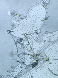 | Details | British Admiralty Hydrographical Office | 1912 |
| Antique chart of Galveston Bay to the San Bernard River, Texas |
|
British Admiralty Hydrographical Office |
|
| 1912 |
| LOC:63 |
| $525.00 | British-Admiralty-Hydrographical-Office | Antique-chart-of-Galveston-Bay-to-the-San-Bernard-River--Texas | A fine early 20th-century British Admiralty chart of <B>Galveston Bay, Bolivar Peninsula, San Bernard River, and Galveston Island, Texas</b> made long before the massive development we see today. This chart, published by the Hydrographic Office is based on existing U.S. Coast Survey charts of the area from 1855 - 1858.
<br></br>
Coverage includes all of Galveston Bay extending as far north as San Jacinto Bay and Turtle Bay. Numerous named features include Quintana, Bastrop Bayou, San Luis Pass, Texas City, Clear Lake, the Trinity River, Fort Anahuac, and Bolivar Point. Shows existing and proposed dredged navigation channels. Inset large-scale charts for Clopper's Bar and Redfish Bar.
<br></br>
Published at the Admiralty under the Superintendence of Captn. Washington R.N. F.R.S. Hydrographer. Sold by J.D. Potter Agent for the Admiralty. Numerous small and large corrections; the last correction being in 1912.
MS notations on verso identifying the chart collation number "68" in large red letters. Number 2831. |
| 4834 | 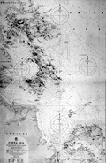 | Details | British Admiralty Hydrographical Office | 1912 |
| China Sea Banka Strait to Singapore |
|
British Admiralty Hydrographical Office |
|
| 1912 |
| LOC:59 |
| $1,500.00 | British-Admiralty-Hydrographical-Office | China-Sea-Banka-Strait-to-Singapore | Fine original British Admiralty Chart of the South China Sea with Singapore featured prominently at top left. Singapore, at the south end of the Malay peninsula, was made a British colony in 1946 and in 1965 became an independent republic. Singapore is separated from the Malay Peninsula to the north by the Johor Strait. At the time of last correction (1912) the chart showed only two navigational lights on the island of Singapore.
<br></br>
South of Singapore, across the Singapore Strait, lie the Riau Archipelago (Kepulauan Riau) including the islands of Batam, Bintan, Rempang, Galang, and numerous smaller islands.
<br></br>
A scarce and desirable chart.
<br></br>
Moving south down the East Coast of Sumatra past the islands of Batam, Bintan, Ligga, and Singkep, the chart ends at the Banka Strait and Banka Island.
<br></br>
Verso with manuscript index labeling in several locations. |
| 4904 | 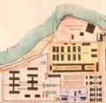 | Details | Anonymous | 1912 |
| Plan General de St. Laurent de Maroni French Guyana Papillon |
|
Anonymous |
|
| 1912 |
| LOC:88 |
| $600.00 | Anonymous | Plan-General-de-St--Laurent-de-Maroni-French-Guyana-Papillon | Unrecorded plan for the <b>French Penal Colony at St. Laurent</b> along the Maroni River in French Guyana. Established by Napoleon III in 1850, for almost 100 years St. Laurent de Maroni was the main penal establishment of French Guiana. Rare.
<br></br>
Henri Charriere, the famous prisoner <b>Papillon</b> of the eponymously named film starring Steve McQueen and Dustin Hoffman, was a prisoner at St. Laurent de Maroni. The prison can be found on the map at top center surrounded by a wall . The prison complex included a old hospital and a new hospital, a transportation camp, the "Quartier Disciplinaire. The hospital was among the inmates favorites. Many prisoners faked illnesses just to be sent to the hospital so that they could plan their escape more easily.
<br></br>
The town of Saint-Laurent-du-Maroni proper was founded on 16 March 1880. St. Laurent was a penal town whose inhabitants were nearly all guards or liberated prisoners. The hospital was built in 1912, and the prison itself closed in 1946, the same year the whole colonial penal system was abolished. |
| 6425 |  | Details | Hope Mining, Milling, and Leasing Company | 1912 |
| Aspen Colorado Hope Mining Lease Map Brochure |
|
Hope Mining, Milling, and Leasing Company |
|
| 1912 |
| LOC: |
| $625.00 | Hope-Mining--Milling--and-Leasing-Company | Aspen-Colorado-Hope-Mining-Lease-Map-Brochure | Map of the property of the Hope Mining, Milling, and Leasing Company of Aspen, Colorado ca. 1912. An optimistic four-panel folding promotional brochure designed for potential investors. The Hope mine lies about four miles due south of the town of Aspen, Colorado at an altitude of 10,259 feet. The map is found on the verso flanked by two striking full-panel images of local mountainous mining scenes in a style somewhat similar to a wood-block print. The verso will make a very-attractive presentation when framed.
<br><br>
The recto contains three photographic images of the Aspen, Colorado area and of the Hope mine:
<div class="indenttextblocksingle">
<ul style="list-style-type: circle;"></li>
<li><i>"Aspen, The Crystal City of the Rockies"</i></li>
<li><i>"Portal of the Tunnel"</i></li>
<li>A larger two-panel image with the caption: <i>"You are looking at the power plant in the foreground. The boarding house is on the hillside in the rear. The winding road leads down to Castle Creek which will be the source of our hydro-electric power when we "strike" it."</i></li>
</ul>
</div>
Folded 4" x 9". Unfolded 14" x 8 within the neatlines.
<br><br>
In October 1911 the Crystal City (Aspen, Colorado) Boosters Association organized a local mining company the "Hope Mining, Milling, and Leasing Company" with initial capitalization of $50,000. The Association secured ten-year leases on the Little Annie Group of Mines, the Little Annie Tunnel, and the Famous Tunnel. [1]
<br><br>
[1] "Hope Mining, Milling, and Leasing Company: Read and 'Get Wise' to what the Crystal City Boosters are doing for Aspen and the 'Get In' the bandwagon and boost." The Aspen Democrat-Times. Aspen, CO. March 6, 1912. |
| 4817 |  | Details | deHora, Manuel Herrera | 1913 |
| Antique Manuscript Gold-mining Map Antioquia Region in Colombia |
|
deHora, Manuel Herrera |
|
| 1913 |
| LOC:62 |
| $2,100.00 | deHora--Manuel-Herrera | Antique-Manuscript-Gold-mining-Map-Antioquia-Region-in-Colombia | Early <b>gold-mining map</b> in manuscript pen and ink on surveyor's tracing "cloth" by New York based mining engineer <b>Manuel Herrera de Hora</b> (1849-1934). Rare manuscript trace document of the gold field leases, including Oroville Dredging Company, near the Nechi River in Colombia, S.A. ca. 1913. For use in reproducing multiple blueprint (cyanotype) copies of the map.
<br></br>
<div class="indenttextblock">
"In my opinion, there is <b>no part of the world so favorable for investment</b> and so <b>attractive from the gold miner’s point of view</b> as the Department of Antioquia. [Colombia]"
<br></br>
"Dredgeman's paradise".
<br></br>
</div>
In his <a href="/ZoomifyImages/SC_4817/de Hora 2.pdf" target="_blank">presentation</a> to the American Institute of Mining Engineers in August 1913 de Hora made the business case for the profits that could be made using barge-mounted dredges to mine the thick gravel placer gold deposits along the Nechi, Cauca, and Porce Rivers near Zaragoza in Colombia's Antioquia department.
<br></br>
In his analysis de Hora reviews the history of gold-mining in the Antioquia region, describes topography and the physical properties of the region's gold, estimates risks and resource availability, and provides useful information on Colombia's liberal mining laws and climate. (de Hora, M.H. The Gold Placers of Antioquia, Republic of Colombia, South America. Bulletin American Institute of Mining Engineers. July 1913. p. 1197.)
<br></br>
The New York Times <a href="/ZoomifyImages/SC_4817/Manuel deHora.pdf" target="_blank">obituary</a> of de Hora in 1934 reads like chapters in an adventure novel:
<div class="indenttextblock">
<li>COLONEL DE HORA ADVENTURER, DIES</li>
<li>As Soldier of Fortune and a Mining Engineer Had a Thrilling Career.</li>
<li>Shanghied in his Youth</li>
<li>Reported to have Seized a Warship and Steamer--A Police Chief in South Africa</li>
</div> |
| 7903 |  | Details | Green, Lewis Henry | 1913 |
| Early Plat of Royal Park Palm Beach Florida |
|
Green, Lewis Henry |
|
| 1913 |
| LOC:500 |
| $450.00 | Green--Lewis-Henry | Early-Plat-of-Royal-Park-Palm-Beach-Florida | Brochure (9" x 8") with a detailed plat of the Royal Park addition in Palm Beach, Florida. The Royal Park addition was one of the earliest planned developments in Palm Beach, Florida, developed starting around 1908, three years before Palm Beach was incorporated, in 1911. Royal Park was developed by Elisha Newton "Cap" Dimick, Palm Beach's first mayor, and early developers who had previously worked on the development of the Palm Beach Inn (later known as The Breakers hotel).
<br><br>
Dimick and his business partners marketed Royal Park as an exclusive residential community, featuring large lots, ocean to lake access, and Mediterranean Revival style architecture. In 1913, Lewis Henry Green, a wealthy Mexican-born real estate agent and investor from California, started working for the Royal Park subdivision in Palm Beach, Florida. He employed a game plan of splashy advertising, auctions, and prize giveaways for buyers. Green's dubbing of Royal Park as "the Millionaire's Playground" sparked significant interest in the development.
<br><br>
Tours of the "playground" were handled by W.E. Watson, a businessman who helped promote the project with two 24-seat vehicles that made the rounds. Green offered prizes daily at afternoon auctions held three days a week on Royal Palm Way, opposite the new bridge. At the first auction, 600 to 800 people attended, buying lots at around $375 each.
<br><br>
Royal Park sold out by 1917. Completed and settled a year later with eclectic bungalows, gabled Victorians, and front-porch cottages, the subdivision's burgeoning prominence would shift the town's center southward, paving the way for the 1920s dawn of Worth Avenue. |
| 6732 |  | Details | Goldthwait, James Walter | 1913 |
| Topographical map region five miles Dartmouth campus |
|
Goldthwait, James Walter |
|
| 1913 |
| LOC:68 |
| $700.00 | Goldthwait--James-Walter | Topographical-map-region-five-miles-Dartmouth-campus | Unrecorded diazotype blueline map of the area within a five-mile radius of the campus of Dartmouth University, in Hanover, New Hampshire. The Connecticut River bisects the map. This 1913 Second Edition map is annotated in manuscript with colors reflecting local geological features including granite, sand, gneiss, trap and hornblende schist, described below the map in a manuscript hand-colored index. Contour interval is 20 feet. Scale 2.5 inches = one mile. The base map, described below, is credited to James Walter Goldthwait (1) and was drawn by R. E. Pritchard.
<br><br>
Similar to a copy from January 1913 in the library at Dartmouth. This November, 1913 edition is updated with a significant amount of new topographic detail that was lacking in the edition of January, 1913 found at the Dartmouth Library (2).
<br><br>
<div class="indenttextblocksingle">
"The map is based upon the Hanover and Strafford Quadrangles of the U.S. Geological Survey. Incorporated into it are detailed stadia-survey maps of the districts near Hanover Village and the Reservoir by members of Thayer School of Civil Engineering. The topography of the eastern part of the region was done by J.W. Goldthwait and R.W. Tobey in 1911 - 1912." Title description.
</div>
<br><br>
(1) James Walter Goldthwait (1880-1947) was Dartmouth College, Geology Professor and Curator of the Dartmouth College Museum from 1912 to 1928. Hanover, New Hampshire. Goldthwait authored the well regarded "The Geology of New Hampshire", published by Rumford Press, Concord, N.H. in 1925.
<br><br>
(2) Another edition, lithographed, at the Dartmouth Library from 1915, show concentric circles at one mile intervals around the center. Walker Lith & Pub Co., Boston. (Online: https://hoodmuseum.dartmouth.edu)
<br><br>
(3) https://collections.dartmouth.edu/archive/... |
| 6669 |  | Details | Empire Tours Accociation | 1913 |
| 1915 Empire Tours map Native American Adirondack Iroquois and Onondaga Trails |
|
Empire Tours Accociation |
|
| 1913 |
| LOC:86 |
| $100.00 | Empire-Tours-Accociation | 1915-Empire-Tours-map-Native-American-Adirondack-Iroquois-and-Onondaga-Trails | Empire Tours thematic tours map issued by the Empire Tours Association in 1913. Map shows three colored auto-tourism routes in New York State: the Adirondack Trail, Iroquois Trail, and Onondaga Trail all routes associated with Native American tribes and. Numbers opposite the tour routes referred to corresponding route numbers in Volume 1 of the Automobile Blue Book.
<br><br>
Copyright Empire Tours Association. Compiled by Official Automobile Blue Book Publishing Company. Comprises eight panels of a 12-panel brochure.
<br><br>
Overall, the Empire Tours map issued by the Empire Tours Association in 1913 provides a fascinating glimpse into the early days of auto tourism in New York and the United States, and highlights the important role that organizations like the Empire Tours Association played in promoting travel and tourism in the region.
<br><br>
During the early 20th century, the advent of the automobile brought about a new era of travel and exploration, as more and more people began to hit the road in search of adventure and new experiences. To help these travelers navigate the often-unfamiliar territory they encountered on their journeys, publishers began producing auto tour road maps, which provided detailed information about road conditions, landmarks, and other useful information.
<br><br>
Circa 1910-1920, these road maps were an essential tool for any auto tourist, as they helped drivers plan their routes, find accommodations, and locate important sites and attractions along the way. Many of these maps were produced by established publishers, such as the Official Automobile Blue Book Publishing Company and Rand McNally, and featured colorful illustrations, detailed descriptions, and helpful tips for travelers.
<br><br> |
| 5273 |  | Details | Beck, George W. | 1914 |
| Scarce map of the route of the Overland Westerners. |
|
Beck, George W. |
|
| 1914 |
| LOC:14 |
| $95.00 | Beck--George-W- | Scarce-map-of-the-route-of-the-Overland-Westerners- | Map ca. 1914 documenting a 20,352 mile horse-back ride across the United States (1912-1915) that visited the state capitols in each of the 48 contiguous states. Map on one panel of a an unused folding postcard with photographs of the four riders who made the journey: C. C. Beck, J. B. Ransom, G. W. Beck, and R. G. Rayne.
<br></br>
The four riders set out from Shelton. Washington on May 1, 1912 and sold promotional calendars and postcard along the way to pay for their expenses. On May 24, 1915 the four reached their final state capitol at Sacramento, California and they ended the trip at the Panama-Pacific International Exposition in San Francisco on June 1, 1915. Unfolded the card measures 7" x 5.5". |
| 557 |  | Details | U.S. Coast and Geodetic Survey | 1914 |
| 1914 Inside Route Pilot Key West to New Orleans |
|
U.S. Coast and Geodetic Survey |
|
| 1914 |
| LOC:2001 |
| $400.00 | U-S--Coast-and-Geodetic-Survey | 1914-Inside-Route-Pilot-Key-West-to-New-Orleans | Very scarce, intact 1914 Coast Pilot with six strip charts and sailing directions for what is now the Gulf Intracoastal Waterway, from Key West, Florida heading north and then west to New Orleans, Louisiana. Published by the U.S. Coast and Geodetic Survey. Contains 93 pages of text plus an index.
<br><br/>
In its early history some portions of the 'inside route' were owned and dredged by private entities who charged a toll to vessels for passage, sometimes by stringing a chain across narrow passages to restrict traffic flow. After 1919 Congress mandated that the entire passage should be turned over to the Federal government and the tolls were eliminated.
<br><br/>
The sailing directions for Bayou St. John describe a moment in time that New Orleans residents can only imagine today: <dir class="indenttextblock">The channel at the entrance is protected by training walls on each side. Spanish Fort is a pleasure resort at the mouth of Bayou St. John and is connected with New Orleans by an electric car line... Small craft of all kinds use the bayou as far as Esplanade Street, about 2 3/4 miles above the entrance, but pleasure boats rarely go above that point." </dir>
Size of each chart when folded is approximately 8" x 5". The pilot's lithographed working navigational charts capture the full extent of the southern U.S. Inside Route in detail. Chart sections include roughly these areas and chart sizes: (fully opened, height is 10" and width is listed below). <br>
1. Key West to Matanzas Pass - 24"<br>
2. Matanzas Pass to Clearwater - 23"<br>
3. Clearwater to Tampa - 27"<br>
4. Tampa to St. Andrews Sound - 24"<br>
5. St. Andrews Sound to Bay St. Louis - 36"<br>
6. Bay St. Louis to New Orleans. - 23"<br>
<br><br/>
If they were placed end to end, the charts would extend over 13 feet long. Original price 20 cents. Published by the Government Printing Office in Washington DC in 1915. |
| 3588 | 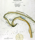 | Details | Eldridge, George W. | 1914 |
| Iconic Antique Chart of Provincetown, Mass. |
|
Eldridge, George W. |
|
| 1914 |
| LOC:10 |
| $450.00 | Eldridge--George-W- | Iconic-Antique-Chart-of-Provincetown--Mass- | Elegant, simple and useful early 20th-century antique nautical chart of Provincetown, Massachusetts on the island of Cape Cod, Mass. Very attractive hand coloring. Features include Race Point, Wood End Bar, North Truro, Clapp's Pond, Herring Cove, Shank Painter Pond; and the Highland, Crow Hill, and Peaked Hill Life Saving Stations.
<br></br>
Much useful information including soundings, anchorages, ranges, buoys, and bottom composition are presented by Eldridge in a clear graphic style that would have been appreciated by and helpful to mariners. For instance, this chart of Provincetown, MA. is printed with bold black coastal outlines that would have been much easier to read under poor lighting conditions. Lighthouses, bouys, and other aids to navigation are highlighted in red. Bottom composition is presented according to an attached table of abbreviations.
<br></br>
Published by Wilfrid O. White of Boston, Massachusetts. White was G. W. Eldridge's son-in-law who contnued to sell Eldridge's charts after his death until 1932.
<br></br>
Attribution reads: 'AUTHORIZED and PUBLISHED By Geo. W. Eldridge, Kelvin & Wilfrid O. White Co. 112 State Street, Boston. 38 Water Street, New York ' Number 49 in Eldridge's book of harbor charts. |
| 2558 |  | Details | Eldridge, George W. | 1914 |
| Antique Harbor Chart of Stamford Connecticut |
|
Eldridge, George W. |
|
| 1914 |
| LOC:10 |
| $350.00 | Eldridge--George-W- | Antique-Harbor-Chart-of-Stamford-Connecticut | Early 20th-century antique nautical chart of Stamford, Connecticut harbor and channels ca. 1914. Noted features and locations include Stamford Yacht Club House, Shippan Point, Peck's Point, Davenport Point, Pine Island, and Stamford Light. Printed on strong, watermarked paper "Resolute Ledger".
<br></br>
Much useful information including numerous rocks, soundings, anchorages, ranges, buoys, and bottom composition near Stamford are presented by Eldridge in a clear graphic style that would have been appreciated by mariners. For instance, this chart of Stamford Ct. is printed with bold black coastal outlines that would have been much easier to read under poor lighting conditions. Lighthouses, buoys, and other aids to navigation are highlighted in red or green.
<br></br>
Published by Wilfrid O. White of Boston, Massachusetts. White was Eldridge's son-in-law who continued to sell Eldridge's charts after his death until 1932.
<br></br>
Attribution reads: 'AUTHORIZED and PUBLISHED By Geo. W. Eldridge, Kelvin & Wilfrid O. White Co. 112 State Street, Boston. 38 Water Street, New York '. Number 10 in Eldridge's book of harbor charts. |
| 5443 |  | Details | U.S. Coast and Geodetic Survey | 1914 |
| Scarce antique chart of Key West Harbor and Approaches |
|
U.S. Coast and Geodetic Survey |
|
| 1914 |
| LOC: |
| $1,440.00 | U-S--Coast-and-Geodetic-Survey | Scarce-antique-chart-of-Key-West-Harbor-and-Approaches | A scarce 107 year-old chart of Key West Harbor and its approaches in Florida. A nice example, scarce to find with process color from this era.
<br></br>
Published by the US Coast and Geodetic Survey in 1914, the chart shows Whitehead spit, east and west Martello Tower, Raccoon Key, and Stock Island. Coverage extends to the west as far as Boca Grande Key. Chart # 584. Price when issued was 50 cents. |
| 6361 |  | Details | U.S. Coast and Geodetic Survey | 1914 |
| Key West Harbor 1914 |
|
U.S. Coast and Geodetic Survey |
|
| 1914 |
| LOC: |
| $1,000.00 | U-S--Coast-and-Geodetic-Survey | Key-West-Harbor-1914 | Large 42" x 34" U.S. Coast Survey chart of Key West Harbor, Florida . Issued September 1914 by the U.S. Department of Commerce / U.S. Coast Survey. Number 584. A scarce original nautical chart of Key West at 107 years old. Last date is 1914. |
| 4967 |  | Details | Barker, Charles R. | 1915 |
| Three antique manuscript maps of Ardmore Pennsylvania |
|
Barker, Charles R. |
|
| 1915 |
| LOC:200 |
| $600.00 | Barker--Charles-R- | Three-antique-manuscript-maps-of-Ardmore-Pennsylvania | Lot of three original hand-drawn (manuscript) maps of Ardmore, Pennsylvania. Ardmore, a close suburb on the west side of Philadelphia, lies within Montgomery County and Delaware County.
<br></br>
The largest map, at 8" x 16", is a large-scale MS plat map, a copy of an 1822 tract map for land owned by Simon Litzenberg. The copy was made by Charles R. Barker on August 1, 1915.
<br></br>
The other two manuscript maps each roughly 8" x 12" are smaller scale maps of Ardmore Pennsylvania with detail. One map with hand color and showing the campus for Haverford College and the Merion Cricket Grounds. Not signed; presumed by Barker. |
| 4736 |  | Details | Murphy, John F. | 1915 |
| Birds Eye View of Boston Harbor and South Shore to Provincetown |
|
Murphy, John F. |
|
| 1915 |
| LOC:88 |
| $275.00 | Murphy--John-F- | Birds-Eye-View-of-Boston-Harbor-and-South-Shore-to-Provincetown | A fine, original, early 20th-century folding harbor excursion map of Boston Harbor ready for framing. This fine antique birds-eye view is bright, in great condition with no holes or tears as is common.
<BR> </BR>
Coverage includes South Boston, Nantasket Beach, Hough's Neck, South Bay, Pleasure Bay, Boston Harbor, Dorchester Bay, Quincy Bay, Hingham, Squantum, and Cape Cod Bay to Provincetown. Verso is blank. Index on inside cover with 35 points of interest keyed on the map.
<BR> </BR>
Published by Union News Company , South Station, Boston, Massachusetts. Price is noted on the front cover as "10 cents". Manuscript owner's name on cover, detached but present. |
| 5256 |  | Details | Jonni, G. | 1915 |
| Pianta di Pisa |
|
Jonni, G. |
|
| 1915 |
| LOC:14 |
| $75.00 | Jonni--G- | Pianta-di-Pisa | Map of Pisa, Italy for Jonni's Grand Hotel Minerva ca 1915. Located on verso of a folding trade card for the hotel. No phone number, but electric lights … estimated ca. 1915 when adoption rates for the telephone in Italy were about 5% of the rate in the U.S.A. |
| 5035 |  | Details | Georgia Southern and Florida Railway | 1916 |
| Track Chart Valdosta GA to Palatka FL for Georgia Southern and Florida Railway |
|
Georgia Southern and Florida Railway |
|
| 1916 |
| LOC:300 |
| $350.00 | Georgia-Southern-and-Florida-Railway | Track-Chart-Valdosta-GA-to-Palatka-FL-for-Georgia-Southern-and-Florida-Railway | Rare unrecorded cyanotype accordion-folded track chart or track profile (1916) for the <b>Georgia Southern and Florida Railway</b> over their Valdosta, Georgia to Palatka, Florida line. Measures more than 16 feet long. Railroad track charts are very rare and comprise an often-overlooked source for detailed geographic data that is unavailable elsewhere. Published January, 1916 with a MS note on the title page that the ballast is corrected to December 31, 1917.
<br></br>
The blueprint track chart was produced for internal use in the railway Engineering and Maintenance Office and thus may be the only copy remaining. Provides an unique source of detailed data for the railroad line which could be combined with existing cartographic data to enable father analysis.
<br></br>
Data includes railroad milepost numbers, track elevation, track grade, ballast composition (earth or cinders), track weight per linear yard, and geographical features. Notes features along the route including passenger stations, freight depots, water stations, coal stations, trestles, drains, culverts, and stock pens.
<br></br>
Please enquire for complete photographs of this 16' track chart. |
| 5186 |  | Details | Oakland Waterfront Company | 1916 |
| Map of a Portion of Oakland Harbor and Alameda Encinal Basin |
|
Oakland Waterfront Company |
|
| 1916 |
| LOC:63 |
| $1,850.00 | Oakland-Waterfront-Company | Map-of-a-Portion-of-Oakland-Harbor-and-Alameda-Encinal-Basin | Large original map and engineering drawing of the area surrounding Alameda's present-day Star Harbor re-development project. The map, with <b>numerous manuscript notations</b>, shows a portion of Oakland Harbor related to the contract for dredging in the area of what is now the Marina Village Yacht Harbor in Alameda, California. Toward the bottom the map clearly shows a <b>"line segregating high-and-dry land from marsh land."</b>
<br></br>
<img src="/ZoomifyImages/SC_5186/SC_5186_Context.jpg" alt="Context map for the Oakland Harbor map of 1916" width="320" align="center" style="margin: 0px 20px">
<br></br>
</br>
This map was made in 1916 in the first decade after the City of Oakland took ownership of the waterfront (1907) after almost 50 years of private ownership by the Oakland Waterfront Company. The map shows Oakland Harbor from Webster Street with the Webster Street Bridge (1871-1928) and the Harrison Street Bridge (1898-1924) for the Southern Pacific Railroad; the western portion of Coast Guard Island, and those portions of Oakland and Alameda lying to the east just past Fortman Basin.
<br></br>
Oakland, California has a long history as an important transportation hub. Oakland was the western terminus for the Southern Pacific Railroad. Just east of the dredged area are the lands of the Alaska Packer's Association where, by 1925, the Encinal Basin was dredged for the use of cargo ships by what was to later become the Del Monte company.
<br></br>
Blueline base map with manuscript notations in red and green with hand-applied wash coloring. Dated within to 1916. Compiled by R.E. Demeritt, C.E.
<br></br>
Manuscript notations include engineering calculations and this statement: "
<b>"Duplicate of this map delivered to Harrison S. Robinson January 28, 1919. Geo Sessions."</b>
Harrison S. Robinson was an attorney in Oakland, California; George L. Sessions from Sessions Waterfront Company. |
| 4862 |  | Details | Foreman, D. H. | 1916 |
| Antique Plans Hidden Treasure Mine Lake City, Colorado |
|
Foreman, D. H. |
|
| 1916 |
| LOC:0 |
| $3,250.00 | Foreman--D--H- | Antique-Plans-Hidden-Treasure-Mine-Lake-City--Colorado | The most interesting set of gold mining plans I have seen!
<br><br>
A very absorbing pair of fine antique presentation plans for the Hidden Treasure Mine at Lake City, in Hinsdale County, Colorado between Crystal Creek and Ute Creek. The Hidden Treasure Mine (1897-1922) was a gold, silver, lead, and copper mine located at an elevation of 10,200 feet.
<br><br>
Both plans are hand-colored blue-line artifacts on architectural vellum.
<b>Plan 1 includes:</b>
<div class="indenttextblocksingle">
<ul style="list-style-type: circle;">
<li>Fig 1. Plan Map of the Hidden Treasure Property</li>
<li>Fig 2. Longitudinal Section of Slope of Vein Looking West.</li>
<li>Fig 3. Plan of Underground Workings.</li>
</ul>
</div>
<b>Plan 2 includes:</b>
<div class="indenttextblocksingle">
<ul style="list-style-type: circle;">
<li>Fig 4. Longitudinal Section Underground Workings. Looking West.</li>
<li>Fig 5. Cross-section Through "X-Y" (Plate 1) Looking S.W.</li>
<li>Sampling data and ore valuation table.</li>
</ul>
</div>
Dated within to 12/20/16. Drawn by D.H. Foreman, Denver, Colorado.
<br></br>
The old Hidden Treasure Dam on Henson Creek, built in the 1890's, made the news in late May, 2019. It was announced that the dam was to be demolished because of the concern for flash floods associated with the potential for sudden heavy snowmelt. (Source: https://www.cpr.org/news/story/historic-hidden-treasure-dam-is-coming-down-to-ease-the-flood-threat-to-lake-city)
<br></br>
On Fig 1. Plan Map of the Hidden Treasure Property two tunnels are shown leading to the Lower Terminal Mill. More than 100 years old, the Hard Tack Mine tunnel was built as an underground transport tunnel for the Hidden Treasure Mining Company's ore production one quarter mile up the mountain (shown here as "proposed"). The Hardtack Mine now (2024) houses a museum designed to preserve area mining history and offers tours June to September. |
| 4771 |  | Details | U.S. Coast and Geodetic Survey | 1916 |
| Nantucket Sound Massachusetts |
|
U.S. Coast and Geodetic Survey |
|
| 1916 |
| LOC:53 |
| $1,200.00 | U-S--Coast-and-Geodetic-Survey | Nantucket-Sound-Massachusetts | Fine antique engraved nautical chart first issued in 1915 covers the southeast portion of Cape Cod trending south and includes Hyannis Harbor, Tuckernuck Island and the islands of Nantucket, Monomoy, Chatham and eastern Nantucket Sound.
<br></br>
This bright antique chart bears a stamp at the bottom right in black ink that identifies this edition as corrected to May 29, 1916. Plate number 3446 for this 1915 ed. replaced the previous edition of 1909 which used plate number 2999. With the circular logo of the Department of Commerce and Labor. Chart number 111. |
| 6553 |  | Details | U.S. Coast and Geodetic Survey | 1916 |
| 8 Charts Inside Route New York to Key West or ICWW 1916 |
|
U.S. Coast and Geodetic Survey |
|
| 1916 |
| LOC:300 |
| $585.00 | U-S--Coast-and-Geodetic-Survey | 8-Charts-Inside-Route-New-York-to-Key-West-or-ICWW-1916 | Very scarce and complete set of eight U.S. Coast and Geodetic Survey folding navigational charts for the inside route for maritime traffic on the eastern coast of the United States from New York South. Third edition. These historical charts from 1916 predate the U.S. Government's ownership of the route which later became part of the Intracoastal Waterway (ICWW) . Placed end to end, the charts would extend over 18 feet long.
<br><br>
Includes the 94 page Coast Survey Sailing Directions that once housed the 8 charts in an attached interior envelope. Card cover. Binding intact. Price when issued was 20 cents.
<BR> </BR>
A bit of research shows that in its early history some portions of the inside route were owned and dredged by private entities who charged a toll to vessels for passage, sometimes by stringing a chain across narrow passages to restrict traffic flow. In fact, chart 7 contains manuscript pencil annotations, obviously made during a voyage, of "Toll" and "Toll chain" that reflects that little-known fact. Interestingly, the toll chains are not noted as part of the official chart. After 1919 Congress mandated that the entire passage should be turned over to the Federal government and the tolls were eliminated.<BR> </BR>
Size of each chart when folded is approximately 8" x 5". These 8 lithographed working navigational charts capture the full extent of the eastern U.S. inside route in detail with some manuscript pencil annotations, especially in Florida. Chart sections include roughly these areas and chart sizes: (one dimension is typically 10" and the other dimension is below). <BR>
1. Jersey City to Philadelphia - 10" <BR>
2. Philadelphia to Norfolk - 33" <BR>
3. Norfolk to Cape Lookout - 28" <BR>
4. Cape Lookout to Murphy Island - 31" <BR>
5. Murphy Island to Fernandina - 35" <BR>
6. Fernandina to Cape Canaveral -28" <BR>
7. Cape Canaveral to Miami -32" <BR>
8. Miami to Key West - 24" <BR> |
| 1352 |  | Details | Bullard Company, The | 1916 |
| Huge road map of New England with early advertisements |
|
Bullard Company, The |
|
| 1916 |
| LOC:0 |
| $65.00 | Bullard-Company--The | Huge-road-map-of-New-England-with-early-advertisements | Large antique advertising-related 4' x 3' road map of south New England from the beginning of the age of automobile travel. Coverage extends from New York and Albany in the west to Cape Ann and Nantucket in the east. Includes Boston, Cape Cod, Martha's Vineyard, Block Island Sound, Rhode Island and Long Island Sound. Copyrighted 1916 by the Bullard Company, 44 Cornhill, Boston. A fine piece for the man-cave. (Yard-stick shown for size estimation, not included).
<br></br>
Inset advertising and related photographs and numerous closeup circular maps of key areas including: Fall River, Marblehead, New London, Concord, Plymouth, and Cape Cod. Overstamp reads: "Compliments of the Hotel Raymond. Fitchburg, Mass.".
<br></br>
Verso with advertisements and numerous tables of related information including distances and census data. Orginal envelope included. |
| 6807 |  | Details | Innes, Frederick A. | 1917 |
| Map of Oklahoma producing oil and gas fields blueline |
|
Innes, Frederick A. |
|
| 1917 |
| LOC:400 |
| $700.00 | Innes--Frederick-A- | Map-of-Oklahoma-producing-oil-and-gas-fields-blueline | Rare, large comprehensive one-sheet cloth map of producing oil and gas fields in Oklahoma from 1917. Copyright 1917 by F. A. Innes, Tulsa Oklahoma. Published by the Kelley Map Company, Tulsa, Oklahoma.
<br><br>
Manuscript pencil notation at bottom about recorded deeds in 1947. Manuscript red marks below Oklahoma City in Cleveland County possibly reflect sites for the deeds.
<br><br>
The era in which this map was produced was one of rapid growth in Oklahoma oil and gas exploration, driven in part by the demands of WWI. In 1917 Phillips Petroleum Company was incorporated in Bartlesville, Oklahoma. During 1918 the Southwestern Association of Petroleum Geologists, established just one year earlier, became the American Association of Petroleum Geologists (AAPG).
<br><br>
Type of well is denoted on the map using symbols explained in a legend for: <br><br>
<div class="indenttextblocksingle">
<ul style="list-style-type: circle;">
<li>Oil wells</li>
<li>Gas wells</li>
<li>Abandoned wells</li>
<li>Dry holes</li>
<li>Drilling wells</li>
</ul>
</div>
<br>
Photographed in two sections to accommodate size. |
| 6648 |  | Details | Seaboard Air Line Railway | 1917 |
| Military Camps Winter Resorts Map Florida |
|
Seaboard Air Line Railway |
|
| 1917 |
| LOC:150 |
| $800.00 | Seaboard-Air-Line-Railway | Military-Camps-Winter-Resorts-Map-Florida | Rare patriotic WWI map titled "Military Camps and Nearby Resorts. Winter Near Your Soldier Boy." This fine 31 inch long antique map was published by Seaboard Airline Railway in 1917. Outstanding and emotionally evocative graphics on the cover with a fine thematic promotional map on the recto.
<br><br>
<div id="0" align="center">
<a title=""></a>
<img id="6648" src="/ZoomifyImages/SC_6648/SC_6648_cover_detail.jpg" alt="WWI map titled "Military Camps and Nearby Resorts. Winter Near Your Soldier Boy" published by Seaboard Airline Railway Florida." width="100"/> <br><br> <font size="-2">Military Resorts Cover Art</font>
</div><br>
Only one holding is found in WorldCat, at Rutgers. WorldCat's mildly cynical one-line summary of the map reads <b>"War as a tourist industry for elegant ladies & gentlemen."</b> (1)
<br><br>
This full-size folding map shows twenty-eight locations (Army, Navy, and Aero training camps) served by the Seaboard Air Line Railway where a spouse (wife) could travel to spend the winter holidays with her soldier (husband) during 1917, the fourth year of WWI. The camps and stations of the U.S. Army were indicated with red square symbols, those of the Navy with circles, and Aero Stations by triangles. The U.S. Army Air Service, as it was then called, was established after April, 1917 making this map one of the earliest available maps to show Pensacola as an Naval Air Training Station.
<br></br>
These Army, Navy, and Aero training locations, described in the key at bottom right, include Pensacola, Tampa, and Key West, Florida; New Orleans, Louisiana; Charleston, South Carolina; and Port Royal, SC.
<br></br>
Brochure folds to 4" x 9". Printed by Poole Brothers, Chicago and dated within at 8/16/1917.
<br><br>
(1) WorldCat. Online. Accessed: January, 2023 |
| 5327 | 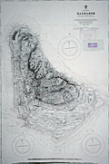 | Details | British Admiralty Hydrographical Office | 1917 |
| Admiralty sea chart of Barbados Bajan |
|
British Admiralty Hydrographical Office |
|
| 1917 |
| LOC:51 |
| $1,250.00 | British-Admiralty-Hydrographical-Office | Admiralty-sea-chart-of-Barbados-Bajan | Fine engraved antique nautical chart of the Island of Barbados first published by the British Admiralty in 1869 from a survey by Staff Commander J. Parsons, R.N. assisted by Navigating Lieut. H. R. Harris & G. Stanley R. N. This edition of the Barbados chart was published at the Admiralty on Feb. 26, 1873. This issue contains the latest corrections from 1917.
<br></br>
Two inset profile views of Barbados at bottom. Chart number 2485.
<br></br>
With two ink stamps for chart sellers from South America: Thomas Bruzzone e Hijos, Buenos Aires and Rodolfo Bosenberg, Libros y Mapas Maritimos [Buenos Aires]. |
| 5124 |  | Details | Straub, W.L. | 1917 |
| Antique airplane views of St. Petersburg Florida |
|
Straub, W.L. |
|
| 1917 |
| LOC:11 |
| $400.00 | Straub--W-L- | Antique-airplane-views-of-St--Petersburg-Florida | Brochure with maps and scarce airplane views of St. Petersburg, Florida including a fine oblique elevated view of the harbor: "St. Petersburg, the Place 'of Proved Desire and Known Delight' " by artist W.L. Straub (15" x 6"). Found at the center of a six-panel folding brochure- "St. Petersburg Florida, The Sunshine City Issued by the St. Petersburg Board of Trade."
<br></br>
Along with numerous smaller illustrations and photographs the brochure includes additionally two fine views and two maps:
<div class="indenttextblocksingle">
<ul style="list-style-type: circle;">
<li>View of the "mole", the "spa", the municipal pier and bathing beaches</li>
<li>Panoramic view of St. Petersburg, Fla. from the Plaza Theater (by Van Deventer & Sons 1913.</li>
<li>Map showing location of St. Petersburg Florida with Railroad and Steamship Connections.</li>
<li>Map of Pinellas County, Florida showing location of St. Petersburg "The Sunshine City".</li>
Brochure folds to 9" x 4". |
| 1005 |  | Details | Finn, W.J. | 1917 |
| Birdseye View of Boston Harbor by Union News Co. |
|
Finn, W.J. |
|
| 1917 |
| LOC:200 |
| $240.00 | Finn--W-J- | Birdseye-View-of-Boston-Harbor-by-Union-News-Co- | Folding antique colored harbor excursion map from ca. 1917 of South Boston, Boston Harbor, Dorchester Bay, Quincy Bay, and Cape Cod Bay to Provincetown. This colorful survivor shows steamship routes to coastal towns and identifies many nearby islands.
<br></br>
This map could have been purchased by passengers aboard any steamboat plying the routes shown on the map including:
<div class="indenttextblock">
<ul style="list-style-type: circle;">
<li>To Europe</li>
<li>To Provincetown</li>
<li>To Plymouth</li>
<li>To Nantasket</li>
<li>To New York</li>
</ul>
</div>
Legend at bottom identifies numerous islands and other features as a sample below illustrates:
<div class="indenttextblock">
<ul style="list-style-type: circle;">
<li>Nixes Mate</li>
<li>Snake Island</li>
<li>Commonwealth Pier</li>
<li>Minots Light</li>
<li>Rowes Wharf</li>
</ul>
</div>
Without the advertisements sometimes found on the cover. Price is noted on the front as "10 cents". |
| 847 |  | Details | Eldridge, George W. | 1917 |
| Antique chart of Block Island Sound between Montauk and Martha's Vineyard |
|
Eldridge, George W. |
|
| 1917 |
| LOC:1409 |
| $600.00 | Eldridge--George-W- | Antique-chart-of-Block-Island-Sound-between-Montauk-and-Martha-s-Vineyard | Antique nautical chart by Eldridge of Block Island Sound with portions of coastal New York, Connecticut, Maine, Massachusetts, and Rhode Island. Coverage on this maritime chart of New England includes Montauk Point on Long Island, Gardiners Island, Fishers Island, Block Island, Point Judith, Cuttyhunk Island, and Nashawena Island. Towns include: New London, Connecticut; Stonington, Maine; Newport, Rhode Island; and Westport Point, Massachusetts. Inset plan of Block Island Harbor at upper center. Near Newport, Rhode Island chart detail includes the Brenton Reef Light Ship, Fort Adams, Beavertail Point, Coasters Harbor Island, and Rose Island.
<br></br>
Newport, Rhode Island has a long association with sea trade, piracy, and naval history. During the colonial era the major financial activity in Rhode Island was the slave trade and Newport was at the the center of that commerce. One of the first outward American acts of defiance against the British government took place on the north end of Goat Island in Newport harbor. In May, 1769 a mob of Rhode Islanders sank and burned the British revenue sloop HMS Liberty in retaliation for British seizures of American vessels.
<br></br>
This antique chart was produced under the name of George Washington Eldridge (1845-1914) who carried on the business of chart publishing after the death of his father George Eldridge in 1900. It was published by Wilfrid O. White of Boston, Massachusetts. White was Eldridge's son-in-law who contnued to sell Eldridge's charts after his death until 1932.
<br></br>
Guthorn explains the atraction and value that Eldridge's charts held through the years for seafarers who depended on them: <div class="indenttextblock"> "They survived because of good design, simplicity, omission of extraneous shore topography, legible soundings, notes and the use of compass courses only ( Guthorn, Peter. United State Coastal Charts: 1783 - 1861. Exton, Pennsylvania. 1984. p. 12. )." </div> |
| 5494 |  | Details | Rice, Charles A. | 1917 |
| Map Showing Lines of March and Border Patrols Mexican Border Service 1916 1917 |
|
Rice, Charles A. |
|
| 1917 |
| LOC:1402 |
| $8,500.00 | Rice--Charles-A- | Map-Showing-Lines-of-March-and-Border-Patrols-Mexican-Border-Service-1916--1917 | Extremely rare, self-published map by C.A. Rice: "Lines of March and Border Patrols, In My Mexican Border Service. 1916 - 1917." Rice's map records the first deployment of the U.S. National Guard in time of emergency or war. A very desirable map for collectors of Texas cartography. Only 2 examples in WorldCat.
<br></br>
Rare map of the Texas border during the 1916-1917 Mexican Expedition or Mexican Punitive expedition, a military action taken by the United States Army during 1916 - 1917 in the second decade of the 20th century. Covers a 20 mile-wide swath of the U.S. along the border with Mexico from Rio Grande City, Texas south to the Gulf of Mexico.
<br></br>
A detail-filled map with military and march roads, camps and outposts, railroads, trails, rifle ranges, and telephone lines.
<br></br>
The action was taken in response to the attack of Pancho Villa across the U.S. border on the town of Columbus, New Mexico. Villa's attack, which killed 19, added to his previous depredation in which he kidnapped and slaughtered 18 U.S. citizens.
<br></br>
As a response to Villa's attacks, the President authorized General Pershing to pursue Villa and his band of rebels hundreds of miles into Mexico. As authorized by the National Defense Act of 1916, the National Guard was mobilized for the first time to man the U.S. border with Mexico. Quickly, National Guard Units deployed from 21 states and by August 1916, an estimated 117,000 guardsman were stationed along the U.S. side of the border, although they were unable to cross over into Mexico.
<br></br>
By Act of U.S. Congress in 1918 the Mexican Border Service Medal was a established as a military award for service between May 9, 1916 and March 24, 1917, or with the Mexican Border Patrol between January 1, 1916 to April 6, 1917. The medal recognizes those military service members who were assigned to the U.S.-Mexico border at the period of time when the United States was on the verge of all-out war with Mexico. |
| 5152 | 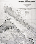 | Details | British Admiralty Hydrographical Office | 1918 |
| Chart of eastern Bermuda Islands St. Georges |
|
British Admiralty Hydrographical Office |
|
| 1918 |
| LOC:54 |
| $450.00 | British-Admiralty-Hydrographical-Office | Chart-of-eastern-Bermuda-Islands-St--Georges | Antique engraved British Admiralty chart of the eastern Bermuda Islands-- St. George's Island, Paget Island, Smith's Island, and St. David's Island. Shows roads and buildings then existing in St. George's Town and the channel dredged into St, George's Harbor in 1916 and 1917. Edition of February, 1918.
<br></br>
This navigational chart of Bermuda was published in July 1897, but 1918, under the superintendence of Rear Admiral W. J. L. Wharton. Engraved by Davies and Company. Sold by J.D. Potter, London.
<br></br>
Chart number 1315. |
| 5053 |  | Details | Anonymous | 1918 |
| Two manuscript maps of St. Augustine, Florida and of the area. |
|
Anonymous |
|
| 1918 |
| LOC:11 |
| $400.00 | Anonymous | Two-manuscript-maps-of-St--Augustine--Florida-and-of-the-area- | Two manuscript maps on a single sheet inserted into a tourism brochure of St. Augustine, Florida after printing. Unusual. Maps show St. Augustine at street-level detail and on verso a smaller-scale map of the area surrounding St. Augustine. Type-written text on one map sheet indicates re-use of a telephone service remittance document for creation of the map. The small scale map of the area around St. Augustine appears only to consider railway lines (F.E.C., A.C.C.) of importance as railways are highlighted in color and stops along each route are identified.
<br></br>
Booklet (folds to 4" x 9") presented with the compliments of the St. Augustine Hotel Association. Fine cover graphics of period clothing. Booklet art work, engraving and printing by the Record Company, St. Augustine. Dated between 1916 and 1919 based on information provided about the Flagler Hospital, under construction at printing, after a fire in 1916 destroyed much of the original structure. |
| 3607 | 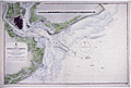 | Details | British Admiralty Hydrographical Office | 1918 |
| Large Chart of Charleston Harbor, South Carolina |
|
British Admiralty Hydrographical Office |
|
| 1918 |
| LOC:53 |
| $1,250.00 | British-Admiralty-Hydrographical-Office | Large-Chart-of-Charleston-Harbor--South-Carolina | Fine British Admiralty chart of Charleston Harbor, South Carolina based on U.S.C.G.S. charts to 1914. This edition with corrections to 1918. Named features Include Folly Island, Morris Island, James Island, Sullivan Island, and the Isle of Palms. From the copper plate engraved by J & C Walker.
<br></br>
Later edition of a British Admiralty chart first engraved and published from London in 1869, and updated with correctiosn after that.
<br></br>
Bold dark lithographed print retains the cartographic look and style of the late 19th century. Logo of the British Hydrographical Office at top of the title block. Published from London on April 1, 1869 . Number 2324 |
| 4894 | 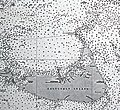 | Details | British Admiralty Hydrographical Office | 1918 |
| Antique Chart of Nantucket Sound and Eastern Approaches |
|
British Admiralty Hydrographical Office |
|
| 1918 |
| LOC:53 |
| $1,350.00 | British-Admiralty-Hydrographical-Office | Antique-Chart-of-Nantucket-Sound-and-Eastern-Approaches | Fine engraved British Admiralty navigation chart (1918) of Nantucket Island, Nantucket Sound and portions of "America" (what Nantucket locals seem to call the mainland U.S.A.). On Nantucket Island the chart shows some of the primary landmarks that guide visitors today: the Sankaty Head Light, Brant Point Lighthouse, Siasconset, Maddaket Harbor and more.
<br></br>
The chart, engraved by Edward Weller, is titled "United States East Coast. Nantucket Sound and Eastern Approaches. From United States Government Charts to 1914."
<br></br>
Notable locations shown on the mainland include Hyannis, Lewis Bay, Monomoy Island, Dennis Port, Harwich Port, and Chatham. Edition of February, 1916 with last corrections in 1918.
<br></br>
London. Published at the Admiralty, January 28, 1896 under the superintendence of Rear Admiral W.J.L. Wharton. C.B., F.R.S. Hydrographer. Sold by J.D. Potter. Chart number 2489. |
| 5080 |  | Details | British Admiralty Hydrographical Office | 1918 |
| Oman Maskat and Al Matrah surveyed by Lieut A.W. Stiffe |
|
British Admiralty Hydrographical Office |
|
| 1918 |
| LOC:66 |
| $2,500.00 | British-Admiralty-Hydrographical-Office | Oman-Maskat-and-Al-Matrah-surveyed-by-Lieut-A-W--Stiffe | Scarce and truly fascinating British Admiralty chart of the coast of Oman showing Matrah (Mutrah) Bay and Maskat Cove with a plan of the town of Maskat, now Muscat the port capital of Oman. Includes two fine inset elevation views: View of Maskat from the Cove and a view of the larger area from Ras Maskat to Doha. Only one sale of the chart is recorded in the Antique Map Price Record- by the esteemed dealer Jonathan Potter in 1985 (those were the days).
<br></br>
Published first by the Admiralty May 27, 1862 under the superintendence of Rear Admiral Washington, Hydrographer. This is the edition of 1917 with last correction in 1918. Engraved by J. & C. Walker.
<br></br>
Just a few of the interesting features captured by this chart include:
<div class="indenttextblocksingle">
<ul style="list-style-type: circle;">
<li>The Sultan's Palace.</li>
<li>"Mass of rugged hills culminating in the Saddle 3 miles to the Southward."</li>
<li>A pass through the rugged terrain "for foot passengers and unloaded animals."</li>
<li>The city gate with an auction bazaar just outside the walls.</li>
<li>Telegraph office.</li>
<li>British Consulate.</li>
</ul>
</div>
Chart number 2869. |
| 713 | 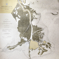 | Details | U.S. Coast and Geodetic Survey | 1918 |
| Mississippi River from the Passes to Grand Prairie Louisiana |
|
U.S. Coast and Geodetic Survey |
|
| 1918 |
| LOC:0 |
| $135.00 | U-S--Coast-and-Geodetic-Survey | Mississippi-River-from-the-Passes-to-Grand-Prairie--Louisiana | Large colorful early 20th century navigation chart of the Mississippi River Delta with the passes into the Gulf of Mexico. Coverage includes the area south of Point Pleasant and Metcalf, Louisiana and Tropical Bend with Breton Island, the Bird Islands, Main Pass, Octave Pass, Baptiste Collett's Bayou, Raphael Pass, and Southwest Pass. Includes Fort Jackson and on the opposite bank- Fort St. Philip. The most southerly habitation shown is Buras, Louisiana and it appears in those days the road ended there.
<br></br>
It is striking in comparing this old map to modern charts to see how much marsh land has been replaced with open water in less that 100 years.
<br</br>
Based on surveys from 1859 to 1918.Bears a blue ink stamp in the bottom margin that states the chart was issued based on corrections made in December 1918. Plate 3614. Number 94. |
| 6538 |  | Details | Weston, T.W. | 1919 |
| Map of Pinellas County Florida with Fishing Grounds |
|
Weston, T.W. |
|
| 1919 |
| LOC:300 |
| $250.00 | Weston--T-W- | Map-of-Pinellas-County-Florida-with-Fishing-Grounds | Colorful lithographed map (8" x 16") of Pinellas County, Florida in 1919 by T.W. Weston issued in a folding 4" x 9" brochure by the Pinellas County Board of Trade. In addition to the Pinellas County map, the brochure includes a fine small oblique birds-eye view - "Dunedin - a typical coast town" (Fig 1.), a small regional distance chart extending for 1500 miles from Pinellas County (Fig 2.), descriptive text, and numerous photographs. <br><br>
<div id="1" align="center">
<a title="Dunedin, Florida Birds-eye View"></a>
<img id="1" src="/ZoomifyImages/SC_6538/SC_6538_Detail1.jpg" alt="Dunedin, Florida 1919 Birds-eye View" width="320"/> <br><small>Fig. 1 - 1919 Birds-eye View of Dunedin, Florida.</small>
</div><br>
The Pinellas County map shows soil type (coastal beach, Parkwood loam, tidal marsh …) indicated by color overlaid with routes of steam railroads, electric railways, three types of roads, canals, and drainage districts.
<br><br>
<div id="2" align="center">
<a title="Pinellas County Distance Chart"></a>
<img id="2" src="/ZoomifyImages/SC_6538/SC_6538_Detail2.jpg" alt="Distance chart related to Pinellas County Florida." width="250"/> <br><small>Fig. 2 - Statute mile distances from Pinellas County.</small>
</div><br>
Red font denotes species of fish found around Pinellas County (Fig. 3) These fish include tarpon, trout, channel bass (redfish), mackerel, and kingfish.<br><br>
<div id="3" align="center">
<a title="Pinellas County Fish Species"></a>
<img id="3" src="/ZoomifyImages/SC_6538/SC_6538_Detail3.jpg" alt="Detail from Pinellas County Map." width="250"/> <br><small>Fig. 3 - Detail of Pinellas County fish species.</small>
</div> |
| 4803 |  | Details | Osceola Oil Company | 1919 |
| Osceola Oil Company Gushers in the Great Texas Oil Field |
|
Osceola Oil Company |
|
| 1919 |
| LOC:63 |
| $2,500.00 | Osceola-Oil-Company | Osceola-Oil-Company-Gushers-in-the-Great-Texas-Oil-Field | Gushers! More gushers! No gushing prose here but dozens of <b>gushing oil wells</b>. Extraordinary! No other copy found anywhere online.
<br></br>
The Great Texas Oil Field: Electra, Clara, Burkburnett, Iowa Park, Holliday, Wichita Falls, Huff, and Dundee, Texas.
<br></br>
Our artifact is a very rare cyanotype (blueprint) pictorial map documenting the Texas Oil Boom in north Texas during the period 1919-1921. This persuasive map exuberantly promotes drilling the 200 acre lease held by Osceola Oil Company (now extinct) near Dundee, Texas in Russell A. Richardson's subdivision "Located right on the Dundee Dome and Anticline."
<br></br>
Drawn by Wichita Falls Blueprint and Supply Co.
<br></br>
Names numerous famous oil fields and wells including: the Sunshine Hill Pool, the Ramming Pool, the Burkburnett southwest extension, the Kemp-Munger-Allen field.
<br></br>
<b>Boom Town</b>, a 1940 film starring Clark Gable and Spencer Tracy, was inspired by events around Burkburnett, Texas during the early 20's oil boom. <img src="/PageImages/BoomTown.jpg" alt="Gushers!" width="140" align="left" style="margin: 10px 10px">
<br></br>
The first oil in Burkburnett was discovered in 1912, when a gusher of 2000 barrels a day was brought in on the S.L. Fowler farm. The Burkburnett Townsite Field in Wichita County was discovered in 1918. In 1919 oil was discovered in the Kemp-Munger-Allen field.
<br></br>
Osceola Oil Company was organized in 1919 with corporate officers Russell A. Richardson, President and C.C. Drake, Secretary. With authorized capital of $500,000 and a single leased property of 200 acres "...one mile east of the Waggoner Ranch in Wichita County Texas" the company began seeking investors. By 1922 it was all over but for the crying… Osceola filed a lawsuit against the driller, Stewart Drilling Company, who failed to discover oil with a 2000 foot deep well on the property. (Source: https://books.google.com/books?id=55tDAQAAMAAJ. Page 698.) |
| 4949 |  | Details | British Admiralty Hydrographical Office | 1919 |
| St. Petersburg Russia Petrograd Bay (Neva Bay) |
|
British Admiralty Hydrographical Office |
|
| 1919 |
| LOC:62 |
| $675.00 | British-Admiralty-Hydrographical-Office | St--Petersburg-Russia-Petrograd-Bay-(Neva-Bay) | Antique nautical chart of PETROGRAD BAY (Neva Bay) and St. Petersburg, Russia copied from Russian Surveys made between 1831-1894. Manuscript corrections in red ink dated to 1919. Lighthouses and other navigational aids are marked in orange.
<br></br>
First published at the Admiralty March 19, 1855 under the superintendence of Captain Washington. Sold by J.D. Potter. This issue with final minor corrections up to 1919. Chart number 2279.
<br></br>
Four inset sketches of important local aids to navigation including:
<br></br>
<div class="indenttextblocksingle">
<ul style="list-style-type: circle;">
<li>Krasnaya Gorka Signal Station</li>
<li>Pitka Point Tower</li>
<li>Stirs Point Lighthouse</li>
<li>Tolbenkin Lighthouse</li>
</ul>
</div> |
| 4858 |  | Details | Garcia, G. | 1919 |
| Guide to San Sebastian, Spain |
|
Garcia, G. |
|
| 1919 |
| LOC:88 |
| $150.00 | Garcia--G- | Guide-to-San-Sebastian--Spain | Small folding brochure for San Sebastian, Spain aimed at travelers. Edited by Miguel Ramos . July, 1919.
<br></br>
Contains one folding lithographed map (by G. Garcia) and about 12 dual sided pages of advertisements. Legends for key streets and locations. One of the brochure pages is a fine steel engraving of an eagle perched upon a wreath. Within the wreath the printers acknowledgement:
<div class="indenttextblocksingle">
"Esta guia esta impresa en los talleres tipo-litograficos de la Editorial Guipuzcoana. Muguerza Hos. Y Yarza: Tolosa."
</div> |
| 5132 |  | Details | J. Walker Pope and Son | 1919 |
| Official Road Map of Polk County Florida, 1919 |
|
J. Walker Pope and Son |
|
| 1919 |
| LOC:87 |
| $265.00 | J--Walker-Pope-and-Son | Official-Road-Map-of-Polk-County-Florida--1919 | Scarce map of Polk County, Florida highways: "Official Road Map of Polk County Florida, 1919 showing the famous 300 mile system of asphalt paved highways. Approved by J. Walker Pope. President Polk County Good Roads Association, Winter Haven." District roads are shown in dark red. According to advertising copy on the map:
<div class="indenttextblocksingle">
Polk County ships over a million boxes of citrus fruits and two thousand car loads of winter vegetable annually -- and furnishes over 40 per cent of the world's output of phosphate."
</div>
<br></br>
The map is printed on the verso of a single-sheet folding advertisement for J. Walker Pope and Son of Winter Haven, Florida. Recto with six half-tone photographs including local orange groves, Mountain Lake Golf Course, Lake Wales, and the offices of J. Walker Pope and Richard D. Pope of Winter Haven, Florida.
<br></br>
J.W. Polk was President of the Polk County Good Roads Association, President of the Winter Haven Motor Club, and Vice-President of the United States Highway Association. |
| 4951 | 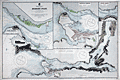 | Details | British Admiralty Hydrographical Office | 1919 |
| Antique Admiralty chart of Vancouver, B.C. and Burrard Inlet |
|
British Admiralty Hydrographical Office |
|
| 1919 |
| LOC:65 |
| $1,450.00 | British-Admiralty-Hydrographical-Office | Antique-Admiralty-chart-of-Vancouver--B-C--and-Burrard-Inlet | Original antique British Admiralty nautical chart of Burrard Inlet and Vancouver in British Columbia, Canada. The large chart sheet includes detailed larger-scale inset charts of Vancouver Harbor, the First Narrows, and the Second Narrows. This nautical chart was first published by the British Admiralty in 1893. This is the edition of 1917 with last corrections to 1919. Canada.
<br></br>
In June 1890, while outbound for the Orient from Burrard Inlet, BC the Canadian Pacific Railway steamer Parthia touched a shoal, incurring minor damage. The incident caused the Dominion government to recommend that the inlet be resurveyed and in April 1891 William J. Stewart arrived in Vancouver, British Columbia to lead the effort which lasted until September of that year. Traveling an estimated 75 miles of shoreline on foot and sounding over 450 miles by whaleboat, Stewart accomplished the survey of Burrard Inlet for less that $2,600. (https://www.cnrs-scrn.org/northern_mariner/vol14/tnm_14_1_7-42.pdf) |
| 5445 |  | Details | British Admiralty Hydrographical Office | 1919 |
| Chart of the Chesapeake River 1872 1919 |
|
British Admiralty Hydrographical Office |
|
| 1919 |
| LOC:56 |
| $700.00 | British-Admiralty-Hydrographical-Office | Chart-of-the-Chesapeake-River-1872-1919 | Nautical chart of the Potomac River by the British Admiralty after earlier charts by the U.S. Coast Survey. Displayed as 3 charts on a single sheet. Upper left chart contains Washington, DC and Alexandria, Virginia. Aids to navigation are highlighted in orange.
<br></br>
Published July 1, 1872 under the Superintendence of Rear Admiral Richards. London. Numerous large and small corrections are recorded with the last corrections in 1919. Chart number 2857. |
| 7907 |  | Details | Sebring Board of Trade | 1920 |
| Maps and Views of Sebring Florida |
|
Sebring Board of Trade |
|
| 1920 |
| LOC:500 |
| $350.00 | Sebring-Board-of-Trade | Maps-and-Views-of-Sebring-Florida | In 1920, just nine years after George E. Sebring acquired over 9,000 acres in the Florida Highlands to establish a new town, the Sebring Board of Trade published this substantial promotional pamphlet titled "Sebring, Florida. The City of Health and Happiness." By the time this brochure was circulated, Sebring's population had grown to around 3,000 residents. The historic downtown area of Sebring, which still reflects its 1920s origins, has been recognized as a Historic District on the National Register of Historic Places, acknowledging its significance and the enduring legacy of George E. Sebring's vision for the city.
<br><br>
The pamphlet is packed with text and photographs showcasing nearly every beneficial aspect of life in Sebring. The back cover features a bird's-eye view of the town encircling Lake Jackson, with "Twelve miles of velvet asphalt boulevard surrounding the Twilight Trail." Inside the front cover, another bird's-eye view depicts a fountain nestled among lush trees and meticulously landscaped formal gardens, described as "Sebring's beautiful little park around which the town revolves."
<br><br>
Within the pages, readers will find a map of peninsular Florida highlighting the area around Sebring, accompanied by a table displaying distances to various locations within the state. The pamphlet culminates with a pictorial map of the region immediately surrounding Sebring, illustrating the town's layout with the central park as its focal point, encircled by vast orange groves that stretch out into the surrounding countryside.
<br><br> |
| 5103 |  | Details | Burgert Brothers | 1920 |
| Lakemont Florida Early Bird's-eye View |
|
Burgert Brothers |
|
| 1920 |
| LOC:11 |
| $125.00 | Burgert-Brothers | Lakemont-Florida-Early-Bird-s-eye-View | Scarce drawn bird's-eye view of Lakemont, Florida ca. 1920 as it was being platted and developed for sale. Below the scene of lots, lakes, and orange groves, a brief description explains the view (shown looking south):
<div class="indenttextblocksingle">
"Lakemont, located between Avon Park and Sebring, Fla., at the crossing of scenic highway and S.A.L.R.R. [Seaboard Air Line Railway]"
</div></br>
Description on the verso reads:
<div class="indenttextblocksingle">
"LAKEMONT, FLA. A new townsite now being developed and destined to become a city within the next few years, located in the Ridge Section at the crossing of scenic highway and new S.A.L. Railroad. Four miles north of Sebring and five miles south of Avon Park, Florida."
</div></br>
Major topographic features include the city of Sebring with Dinner Lake, Lake Jackson, Basket Lake, Bonnet Lake, and Little Red Water Lake.
<br></br>
Folding postal card in two panels. White border (1915-1930). No. 103139. Fl. Fla. Postally unused. Dated with reference to the founding of Sebring, Florida in 1912. Published by Burgert Brothers of Tampa, Florida. |
| 4770 | 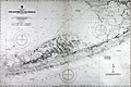 | Details | British Admiralty Hydrographical Office | 1920 |
| Large Antique Chart of The Florida Keys |
|
British Admiralty Hydrographical Office |
|
| 1920 |
| LOC:61 |
| $1,375.00 | British-Admiralty-Hydrographical-Office | Large-Antique-Chart-of-The-Florida-Keys | Fine antique British Admiralty sea chart with cartographic coverage of the islands of the <b>Florida Keys</b>. Hydrographic data on this early 1866 British navigational chart extend past Key West. Though updated to 1920, this scarce survivor retains the appearance of a 19th-century British copperplate-engraved nautical chart, a visual charm more recent charts do not generally possess.
<br></br>
An inset diagram shows an example <b>navigational beacon</b>, made of iron, 36 feet in height and carrying an identifying letter within a moveable vane. These beacons, or day marks, delineated the southern boundary of the Florida Keys. The accompanying note states:
<br></br>
<div class="indenttextblock">
<img src="/PageImages/Beacon for 4770.jpg" alt="Florida keys navigational beacons (day marks)" width="120" align="left" style="margin: 0px 20px">
"The Beacons marking the outer Florida Reefs are distinguished by Letter or Numbers in the vane which each carries, commencing off Key West and proceeding in alphabetical or numerical order toward Cape Florida. With the exceptions of that American Shoal which is brown and that on Fowey Rock which is black, the Beacons are all painted white. These beacons are likely to be washed away."
</div>
<br></br>Manuscript notations in pencil from a previous owner record eight of the beacons as "damaged."
<br></br>
This chart of Lower Matacumbe Cay to Boca Grande Cay should be treasured by anyone with interests in fishing, sailing, or boating in the Florida Keys.
<br></br>
After U.S. Coast Survey charts from the last half of the 19th century. First published by the British Admiralty on July 18, 1866, with several editions and later corrections after, the last correction in 1920. Originally sold by J.D. Potter, agents, London. Chart no. 1098. |
| 4944 |  | Details | Adams Engineering Company | 1920 |
| Wildcatters oil-field prospect map for San Juan County, New Mexico |
|
Adams Engineering Company |
|
| 1920 |
| LOC:62 |
| $300.00 | Adams-Engineering-Company | Wildcatters-oil-field-prospect-map-for-San-Juan-County--New-Mexico | Wildcatter's blueprint (cyanotype) oil-field prospect map ca. 1920 for San Juan County, New Mexico. Four corners region near Aztec, Farmington, Shiprock and the Navajo Indian Reservation. The blueprint shows existing and proposed oil wells and oil field leases owned by an anonymous individual or company, annotated with typewritten notes:
<br></br>
"Midwest Oil Co. pool on the Hog Back they just … the 7th well at 690 feet they found sand … this is the most wonderful oil field in the world."
<br></br>
"U.S. Geological Survey of 1916 Professional paper 98-P of the San Juan … I looked this country over carefully for 5 months at the same time trying to get rid of my Rheumatism and [in my] my opinion it will only take development to have an oil field where I have my leases marked in red on this map."
<br></br>
My interpretation of the maps and notes are that the purpose of the map was to persuade investors to invest in the leases marked in red squares (at furthest right center) by reference to other known, producing oil wells (marked with small red dots).
Published by Adams Engineering Company, Oklahoma City, Oklahoma. Drawn by H. Marsh. |
| 5444 |  | Details | U.S. Coast and Geodetic Survey | 1920 |
| Chart of the St. Johns River in Florida From Hibernia to Racy Point 1900 1920 |
|
U.S. Coast and Geodetic Survey |
|
| 1920 |
| LOC:56 |
| $750.00 | U-S--Coast-and-Geodetic-Survey | Chart-of-the-St--Johns-River-in-Florida-From-Hibernia-to-Racy-Point-1900-1920 | Nautical chart of a section of the St. Johns River Florida from Hibernia southward to Racy Point. Hibernia, Florida lies about 22 miles southwest of downtown Jacksonville, on the western side of the St. Johns River, off US 17. Racy Point lies on the east bank of the St. John's River about four miles northwest of Hastings, Florida and 12 miles from Palatka.
<br></br>
Published by the U.S. Coast and Geodetic Survey October, 1900. Reissued December, 1916. Last corrections April, 1920. Chart # 455c. Price when issued was 40 cents. |
| 995 | 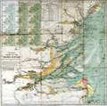 | Details | Stanford, Edward | 1920 |
| Stanford's Colored Chart of the Thames Estuary |
|
Stanford, Edward |
|
| 1920 |
| LOC:0 |
| $145.00 | Stanford--Edward | Stanford-s-Colored-Chart-of-the-Thames-Estuary | 2 coloured lithographic charts mounted on linen and folding into the same original cloth covers with paper label. With a tide table and 12 small inset maps showing tidal flows in knots over a 12 hour period based on high-water at Dover.
<br></br>
Two folding charts, the largest mounted on linen and both folding into the same original cloth covers with paper label.
<br/>
--Estuary Chart "Stanford's Chart of the Thames Estuary Prepared Under the Supervision of Captain O.M. Watts, A.I.N.A.". 28" x 27".
<br/>
--River Thames. "The River Thames from London to Gravesend". 20" x 6"
<br></br>
Original blue cloth boards with mounted printed publisher's plate to front cover. Published by Edward Stanton, 12, 13, & 14, Long Acre, W.C.2 London and Whitehall S.W.1 |
| 5291 |  | Details | Parsons, A.F. | 1921 |
| Unrecorded cyanotype plat Beasley Ranch San Luis Obispo, California |
|
Parsons, A.F. |
|
| 1921 |
| LOC:3 |
| $475.00 | Parsons--A-F- | Unrecorded-cyanotype-plat-Beasley-Ranch-San-Luis-Obispo--California | Unrecorded cyanotype (blueprint) cadastral map of the Beasley Ranch in San Luis Obispo County, California. In 1921 the Beasley Ranch was owned by R.K. Smith. Manuscript outline coloring to differentiate the Beasley Ranch in yellow, from property owned by Eckstine in red.
<br></br>
The Beasley Ranch, at the junction of the Nacimiento River and Burnett Creek, was named for William F. Beasley, a native Californian from Mariposa County, CA. Neighboring property is recorded for Joshua Wood, Alice Lynch, Luther Hester, Sands, Harris, Wheeler, Knox, Eckstine, and others.
<br></br>
Survey of the Beasley Ranch was conducted by Austin F. Parsons in October, 1921. Parsons (b. 1853), was San Luis Obispo County Surveyor from 1902 to 1930. Parsons was the Civil Engineer for numerous area bridges including the California Canyon Bridge and San Juan Bridge.
<br></br>
Scale 1" = 40 chains ( 1/2 mile). T.25S R.8E. |
| 5296 |  | Details | Dunwody, William E. | 1922 |
| Earliest map of Charlotte, Glades, Hardee, Highlands counties Florida after DeSoto redivision |
|
Dunwody, William E. |
|
| 1922 |
| LOC:87 |
| $225.00 | Dunwody--William-E- | Earliest-map-of-Charlotte--Glades--Hardee--Highlands-counties-Florida-after-DeSoto-redivision | Map of DeSoto, Charlotte, Glades, Hardee, and Highlands counties in Florida ca. 1922. In 1921 the Florida legislature created the latter four counties out of what had previously been DeSoto County. Possibly the earliest map containing the names of those four new counties. Map is a Fotoprint printed by Foote & Davies Co, Atlanta.
<br></br>
Published by William Elliott Dunwody (1882-1956) a businessman in Arcadia, Florida, the seat of DeSoto County. Dunwody had interests in real estate, ranching, and citrus farming, and was Chairman of the local Selective Service Board from 1941 to 1954.
<br></br>
Interesting in that before this Fotoprint was produced a base plat map was edited in manuscript (by Dunwody ?) to show the new county boundaries and features: roads, railroads, towns, lakes; and type of terrain: swamp and muck, pine, or prairie. This item is a product of that enhancement made just after the new counties were created.
<br></br>
It is ironic that at center left, in one of the marked swampy areas, a manuscript notation is made: <b>"Red dot within green circle represents location your 10 acres."</b> Lucky guy! Key features include the Kissimmee River, Lake Istokpoga, Lake Okeechobee, Charlotte Harbor, and two airbases built in 1917 during early WWI: Carlstrom Field, and Dorr Field. |
| 4908 |  | Details | Higgins Tours | 1922 |
| Pre-depression map and brochure for Higgins Tours in New Orleans |
|
Higgins Tours |
|
| 1922 |
| LOC:0 |
| $140.00 | Higgins-Tours | Pre-depression-map-and-brochure-for-Higgins-Tours-in-New-Orleans | Scarce brochure, with a map (9"x16") of Orleans Parish, for tours of New Orleans, Louisiana by Higgins Tours. In 1922 Higgins Tours' office and garage was at 630 Julia Street, part of what later was to become New Orleans's skid row in the 1970's, and today is part of the revitalized warehouse district.
<br></br>
On the back cover an offer for Higgin's Plantation Tour for $2.00 round trip: "30 Miles on LOUISIANA Shell Roads". Oooh, pinch me! Special points of interest on the Plantation Tour included St. Roch's Shrine, famous old Villere Plantation, slave huts and orange groves. Cars left daily from the corner of Canal and St. Charles Street at 10:00 a.m. and 1:30 p.m. daily. "Look for the green cars."
<br></br>
Light card cover and four interior sheets front and back. Fare $1.00. Printed ca. 1922. |
| 5492 |  | Details | State and City Bank and Trust Richmond VA | 1922 |
| Map NC and SC with principal 1922 crop acreages |
|
State and City Bank and Trust Richmond VA |
|
| 1922 |
| LOC:10 |
| $295.00 | State-and-City-Bank-and-Trust-Richmond-VA | Map-NC-and-SC-with-principal-1922-crop-acreages | Thematic advertising map of North Carolina and of South Carolina with 1922 acreage statistics related to crops, livestock and other agricultural resources. Contains several inset tables of summary statistics:
<div class="indenttextblocksingle">
<ul style="list-style-type: circle;">
<li>Principal SC 1922 crop acreages (Cotton was #1 at nearly 2.2 million acres)</li>
<li>SC 1921 crop and sales value (Cotton #1 at $61M made up nearly half of SC crop output)</li>
<li>NC 1922 Crop acreages.</li>
<li>A marketing schedule for major agricultural crops and livestock: "When Carolina Crops are Marketed"</li>
</ul>
</div>
Lithographed. The maps are based on data provided by the U.S. Bureau of Markets and U.S. Bureau of Crop Estimates. A discreet call to action in inset text at far right: "You need some kind of banking service every day … Banking by Mail is one of our specialties … Our resources exceed $21,500,00." |
| 5244 |  | Details | Nashville Chattanooga and St. Louis Railway | 1922 |
| Early twenties map of the Dixie Route from Chicago to Florida |
|
Nashville Chattanooga and St. Louis Railway |
|
| 1922 |
| LOC:200 |
| $375.00 | Nashville-Chattanooga-and-St--Louis-Railway | Early-twenties-map-of-the-Dixie-Route-from-Chicago-to-Florida | Fine and attractive early map (1922) of the Dixie Route in the center of a twenty-page brochure mostly devoted to Florida sights and cities. Inset map of Cuba. Published by the Poole Brothers on October 2, 1922.
<br></br>
The Dixie Route was a train service that in 1939 operated three passenger trains across several affiliated railroads and their stops to provide passenger service from the Midwest (St. Louis and Chicago) to Florida. |
| 586 |  | Details | Belcher Abstract and Title Company | 1922 |
| Belcher's Pocket Map of Humboldt County, California |
|
Belcher Abstract and Title Company |
|
| 1922 |
| LOC:0 |
| $275.00 | Belcher-Abstract-and-Title-Company | Belcher-s-Pocket-Map-of-Humboldt-County--California | Compact folding topographic map of <strong>Humboldt County, California</strong> from 1922. Self-described as "The only accurate map of the County ever made". Contains a detailed record of drainage, railroads, settlements, roads, trails, section and township lines. Copyright 1922. (Note top of map image is in shadow.)
<br></br>
With an attached intact folding greenish-brown card-stock cover. Size when folded is approx. 4 1/2" W x 5 1/2" H. Price when sold $1.00. Compiled by the Belcher Abstract and Title Company of Eureka California. |
| 5208 |  | Details | Astor, William Waldorf | 1922 |
| Maps and auction brochure for Bronx property of William Waldorf Astor |
|
Astor, William Waldorf |
|
| 1922 |
| LOC:88 |
| $1,250.00 | Astor--William-Waldorf | Maps-and-auction-brochure-for-Bronx-property-of-William-Waldorf-Astor | Very rare sales brochure for an auction of a tract of 1669 lots owned by <b>William Waldorf Astor</b> located in the Morris Park area of the Bronx in New York City. Rare- only one other holding located anywhere, an inferior example held by the New York Public Library. Astor died of heart failure in October, 1919 and the auction documented in these artifacts was held to settle Astor's estate less than three years later, in June, 1922.
<br></br>
Brochure (11" x15") includes a fine bird's eye view on the front cover; a map of a portion of New York City with the Bronx showing the tract location in context to subways and roads on the back cover; and a folding plat map enclosed within with lots platted shown on both sides of a large sheet measuring 21" x 30". All in good to very good condition. (Images of the folding plat map are available on request.)
<br></br>
William Waldorf Astor (1848-1919), was the only child of John Jacob Astor III, an attorney, politician, philanthropist, and newspaper publisher. W.W. Astor's great-grandfather father, John Jacob Astor, made a fortune in the fur trade and was the wealthiest man in the U.S. in 1848. |
| 5392 |  | Details | Miami Chamber of Commerce | 1923 |
| Advertising Brochure for Miami, Florida Winter Tourist Season |
|
Miami Chamber of Commerce |
|
| 1923 |
| LOC:11 |
| $235.00 | Miami-Chamber-of-Commerce | Advertising-Brochure-for-Miami--Florida-Winter-Tourist-Season | Folding brochure from the Miami Chamber of Commerce, published in 1923, for the Miami, Florida winter tourist season, November to May. <br></br>
With two maps, each 8" x 9":
<div class="indenttextblocksingle">
<ul style="list-style-type: circle;">
<li>"Miami in the Tropical Zone of Florida. Where Winter is Turned to Summer."</li>
<li>"Greater Miami and Vicinity</li>
</div>
The brochure Includes a 30" long foldout page covered with photographs of Miami Hotels and Miami area attractions and numerous pages with test and photographs surrounded by colorful scenes of Miami, Florida leisure activities.
<br></br>
An inset text block on the second page summarizes Miami's winter attractions:<br>
<strong>MIAMI in the Tropical Zone of Florida where winter is turned to summer.</strong>
<div class="indenttextblocksingle">
<ul style="list-style-type: circle;">
<li>The Tourist's Delight</li>
<li>The Motorist's Mecca</li>
<li>The Fisherman's Paradise</li>
<li>The Golfer's Wonderland</li>
<li>The Polo-player's Pride</li>
<li>The Surf-bather's Joy</li>
<li>The Aviator's Dreamland</li>
<li>The Yachtsman's Rendezvous</li>
</ul>
</div>
Copyright 1923, Miami Chamber of Commerce. Designed, engraved and printed by the Record Company. St. Augustine, Florida. Folds to 4" x 9". |
| 5087 |  | Details | Tampa Board of Trade | 1923 |
| Tampa the Strong Box in the Treasure House of Florida |
|
Tampa Board of Trade |
|
| 1923 |
| LOC:11 |
| $250.00 | Tampa-Board-of-Trade | Tampa-the-Strong-Box-in-the-Treasure-House-of-Florida | Pre-depression advertising map promoting Tampa and Hillsborough County as: "The Strong Box in the Treasure House of Florida". Beneath the map an explanation describes the benefits to be found in Hillsborough County:
<div class="indenttextblock">
"Containing lands, rich and of infinite variety, adapted for fruit raising, agriculture in all its phases, trucking, poultry farming, stock raising, and all those novelty lines for which Florida is famous. The marketplace of practically all of South and West Coast Peninsular Florida, with over fifty miles of salt water shoreline. Look us over."
</div>
Unusual and scarce. 1923.
<br></br>
Map image with strong graphics is inside the front cover of 44-page brochure ( 9" x 6") about Tampa, Florida. Brochure wraps covered with images of local leisure activities for Tampa (front) and Hillsboro County (rear). On both covers images of bi-planes cruising aloft attest to the importance of Tampa, Florida as an early aviation center. |
| 5337 |  | Details | Sanford, W. D. | 1923 |
| Manuscript Map Norfolk and Western Railway and Connections |
|
Sanford, W. D. |
|
| 1923 |
| LOC:53 |
| $225.00 | Sanford--W--D- | Manuscript-Map-Norfolk-and-Western-Railway-and-Connections | Attractive original pen and ink manuscript map of the lines of the Norfolk and Western Railway signed by W. D. Sanford (bottom right corner) and dated within at January 25, 1923. Shows lines of the Chesapeake and Ohio, Hocking Valley, Richmond, Fredericksburg & Potomac (Washington-Southern) and two other lines now faded but the Virginian Railway; and the Carolina, Clinch River … Some lines and text (especially red ink) faded from cleaning. With the Norfolk and Western logo.
<br></br>
At the end of 1925,the Norfolk and Western Railway had conducted freight traffic of 13,684 million net ton-miles across 2,241 miles of route on 4,429 miles of track. Over time the N&W merged with several of the connecting lines including the Virginian Railway (VGN) in 1959. |
| 6658 |  | Details | Mount Tamalpais and Muir Woods Railroad | 1923 |
| Birds eye view Map of the Pacific Coast in the vicinity of San Francisco |
|
Mount Tamalpais and Muir Woods Railroad |
|
| 1923 |
| LOC:3 |
| $295.00 | Mount-Tamalpais-and-Muir-Woods-Railroad | Birds-eye-view-Map-of-the-Pacific-Coast-in-the-vicinity-of-San-Francisco | An attractive original antique four-panel bird's eye view / map of the California Pacific coast in the vicinity of San Francisco Bay and San Pablo Bay from 1923.
<br><br>
Elevation is shown in relief. The view stretches from Mount Shasta at top left to the Farallon Islands at the bottom right and extends from Lake Lagunitas at bottom left to Mount Hamilton. Includes towns ranging around San Pablo Bay and San Francisco Bay: San Jose, San Francisco, Palo Alto, Oakland, Sausalito, Napa, Sonoma, and Walnut Creek. At bottom left is a table of air line distances from the summit of Mt. Tamalpais. Sacramento is 73 miles distant and Mt. Shasta a long 237 mile crow-flight from Mt. Tamalpais.
<br><br>
The map comprises four of eight panels of a brochure issued by the Mount Tamalpais and Muir Woods Railroad. Printed by Leighton Press, San Francisco, California. Dated in the plate at 1923. Verso includes photos and text. |
| 5091 |  | Details | Board of Commissioners of the Port of New Orleans | 1923 |
| Early Map of New Orleans Inner Harbor Navigation Canal |
|
Board of Commissioners of the Port of New Orleans |
|
| 1923 |
| LOC:3 |
| $250.00 | Board-of-Commissioners-of-the-Port-of-New-Orleans | Early-Map-of-New-Orleans-Inner-Harbor-Navigation-Canal | Scarce early promotional map in an advertisement for the New Orleans Inner Harbor Navigation Canal (the Industrial Canal), a 5 1/2 mile waterway linking Lake Ponchartrain to the Mississippi River. Published from New Orleans, Louisiana by the Board of Commissioners of the Port of New Orleans in 1923, the year the canal opened.
<br></br>
At center right is shown a "possible location of deep-sea connection", a concept that was later, in 1965, to become the Mississippi River Gulf Outlet (MRGO) providing a shorter link for shipping traffic from New Orleans to the Gulf of Mexico.
<br></br>
Published in the May 12, 1923 edition of The Traffic World Magazine by the Traffic Service Corporation. Volume XXXI No. 19. P. 1090. |
| 5257 |  | Details | Johnson, W.L. | 1923 |
| Map Pinehurst Golf Country Club North Carolina |
|
Johnson, W.L. |
|
| 1923 |
| LOC:200 |
| $650.00 | Johnson--W-L- | Map-Pinehurst-Golf-Country-Club-North-Carolina | Rare. Original, 1923 map of Pinehurst Country Club in Pinehurst, North Carolina. Includes the Club House, putting greens, tennis courts, polo fields 1 and 2 as well as courses 1,2,3, and 4, each 18 hole golf courses. Courses designed by important golf-course architect Donald J. Ross. Excellent condition for a map near 100 years old.
<br></br>
Insets with tables of distance between holes in yards for each course and hole. Lithograph on thin paper. Engraved by W.L. Johnson. |
| 5386 |  | Details | Holly Hill Grove and Fruit Company | 1923 |
| Fine brochure for Holly Hill Groves Davenport Florida with maps and views |
|
Holly Hill Grove and Fruit Company |
|
| 1923 |
| LOC:11 |
| $240.00 | Holly-Hill-Grove-and-Fruit-Company | Fine-brochure-for-Holly-Hill-Groves-Davenport-Florida-with-maps-and-views | Fine brochure for Holly Hill Groves in Davenport, Polk County, Florida with a map, views, and numerous 2-color photographs.
<br>
<div class="indenttextblocksingle">1) A colorful view titled "<b>Diagram of Holly Hills Groves</b>" . With an inset view "A Five Acre Grove". 18" W x 6.5" H.<br>
2) An index or context map shows the location of Davenport, Florida in the center of the state. "<b>Map of Florida Showing Location of Davenport and Polk County."</b> 6.5" W x 9" H.</div>
Photos are of the orange groves in various states of completion as well as of the Holly Grove Inn, located along the Dixie Highway. Published during the early 1920's during Florida's real estate boom.
<br></br>
The Holly Hill Grove and Fruit Company, with over 5,000 acres, was a subsidiary of Wilson and Toomer Fertilizer Company, owned by Lorenzo A. Wilson. The brochure was published as a marketing tool to promote sales of five-acre plots of the grove. <br></br>
32 pages. Soft covers. Folds to 5" W x 7" H. Printed by The Record Company, St. Augustine, Florida.
<br></br> |
| 5305 |  | Details | Searsce, F. W. | 1924 |
| Flagler Tribune Map Flagler County, Florida |
|
Searsce, F. W. |
|
| 1924 |
| LOC:87 |
| $400.00 | Searsce--F--W- | Flagler-Tribune-Map-Flagler-County--Florida | Map of Flagler County, Florida with overlay in red for drainage canals and drainage district boundaries. By F. W. Searsce. Includes the towns of Volusia, Harwood, Flagler Beach and parts of St. John's, Fulham, and Volusia counties. Shows about a 20 mile long stretch of the Old Kings Road north of Ormond. Land is shown surveyed using the Township and Range system.
<br></br>
TITLE: "The Flagler Tribune Map. Flagler County, Florida showing County Commissioners Districts and general information. Compiled in Office of F. W. Searsce. Bunnell, Florida."
<br></br>
Dated within at January, 1924. Scale about 1 inch - 2 miles.
<br></br>
In 1917 Flagler County was formed out of St. Johns and Volusia Counties. The Flagler Tribune was published weekly from 1917 to 1981 from Bunnell, Florida. On January 1, 1924 the paper was sold to Alexander Martin (Duke) McDaniel and Melvin Blanchard Fuller. Ownership remained unchanged until March 1939, when McDaniel sold his interest to Fuller. Sold in 1981, the paper is now known as the Flagler/Palm Coast News-Tribune. |
| 5415 |  | Details | Standard Blueprint Map and Engineering Company | 1924 |
| Oilfield cadastral map of Borden County, Texas |
|
Standard Blueprint Map and Engineering Company |
|
| 1924 |
| LOC:300 |
| $235.00 | Standard-Blueprint-Map-and-Engineering-Company | Oilfield-cadastral-map-of-Borden-County--Texas | Scarce, unrecorded 1920's blue-line oilfield map of Borden County, Texas from the early Texas oil boom that started with the Spindletop discovery near Beaumont, Texas in 1901. This antique thematic map shows land owners and locations for petroleum exploration in Borden County. Manuscript outlining of tracts and pencil notations of lessee names.
<br></br>
Scale 4.5" = 5 miles.
<br></br>
A legend at upper right explains the types of oil exploration sites as:
<div class="indenttextblocksingle">
<ul style="list-style-type: circle;">
<li>Location</li>
<li>Rig Up</li>
<li>Drilling</li>
<li>Producing</li>
<li>Gas</li>
<li>Abandoned</li>
<li>Dry Hole</li>
</ul>
</div>
Map was printed on heavy paper by the Standard Blueprint Map and Engineering Company 515 Main Street, Fort Worth Texas. Does not show the Shreveport office address, as on other maps therefore presumed a bit earlier than 1925. |
| 5016 |  | Details | Silver Springs Transportation Company | 1924 |
| Map of Silver Springs Daylight Route Cruise Ocklawaha River |
|
Silver Springs Transportation Company |
|
| 1924 |
| LOC:11 |
| $295.00 | Silver-Springs-Transportation-Company | Map-of-Silver-Springs-Daylight-Route-Cruise-Ocklawaha-River | Florida 1920's land-boom era map of Silver Springs Daylight Route cruise over the Silver River, Ocklawaha River, and St. John's River Florida, a distance of 135 miles. Map is one page in a folded brochure "Daylight Route Ocklawaha River" produced by the Silver Springs Transportation Company for the 1923-24 season. For more than a century tourism and transportation have both greatly contributed to Florida's growth. The map, supported by the rest of the brochure, details the route, landings, and sights for one of three boats operated by the Silver Springs Transportation Company the "City of Ocala", "Silver Springs", and "Wekiwa".
<br></br>
During the season two trips were offered daily, six days a week with one boat traveling from Silver Springs to Palatka and the other from Palatka to Silver Springs. Map identifies important points along the trip including Gore's Landing, Hell's Half Acre, Forty Feet Cliff, Fort Brooks, McBride's landing and many more. |
| 1397 |  | Details | Norfolk City Planning Commission | 1924 |
| Large 1921 Planning Commission Map of Norfolk, Virginia and Vicinity |
|
Norfolk City Planning Commission |
|
| 1924 |
| LOC:2001 |
| $1,000.00 | Norfolk-City-Planning-Commission | Large-1921-Planning-Commission-Map-of-Norfolk--Virginia-and-Vicinity | Impressive huge lithographed folding map of Norfolk in the Commonwealth of Virginia. Boundary lines mark the city's boundary with Norfolk County and to its east Norfolk County's boundary with Princess Anne County. This 1924 edition is the first revision of the original 1921 Norfolk City Planning Commission map (other revisions were in 1928 and 1939). Compiled by Paul F. Mueller C.E., who worked for Sanborn Map Co. until 1906. (Norfolk Virginia: Evolution of a City in Maps. Berent, Irwin M. Norfolk History Publihers. 2013. pp. 23-25. <a href="https://books.google.com/books?id=sQsvAQAAQBAJ&pg=PA25&lpg=PA25&dq=Norfolk+and+Vicinity,+City+Planning+Commission+map+1921&source=bl&ots=BHr35I7PFg&sig=qOBa1pA-rTOpTKgYZ26zxMS-_3w&hl=en&sa=X&ved=0ahUKEwjE_L-p5oTYAhVR1IMKHSIWCXEQ6AEIRzAJ#v=onepage&q=Norfolk%20and%20Vicinity%2C%20City%20Planning%20Commission%20map%201921&f=false" target="_blank">Online.</a>)
<br></br>
Numerous printed notes of historical interest, for example: "Near this spot was the "Mother Church" of Elizabeth River Parish. See Book 4, Page 175, 3 January 1684." Key features on this map include Willoughby Bay, Boush Creek, Mason Creek, Little Creek, Elizabeth River, Lafayette River, Craney Island, and Port Norfolk.
<br></br>
Pencil annotation for Ward's Corner.
<br></br>
Norfolk is located at the heart of the Hampton Roads metro area. Named for the large natural harbor of the same name located at the mouth of Chesapeake Bay, Norfolk It is one of nine cities and seven counties that constitute the Hampton Roads metro area. The city has a long history as a military and transportation hub. The largest Navy base in the world, Naval Station Norfolk, is located in Norfolk, Va.
<br></br>
With label for C.S. Wertsner & Sons, Maps and Mounting, 50 North 13th Street, Philadelphia, Pa. Lithographed by A. Hoen and Co., Baltimore. |
| 5181 |  | Details | Krenn and Dato | 1924 |
| Krenn and Datos Dempster Street Evanston Chicago |
|
Krenn and Dato |
|
| 1924 |
| LOC:62 |
| $200.00 | Krenn-and-Dato | Krenn-and-Datos-Dempster-Street-Evanston-Chicago | Rare cyanotype, or blueprint, maps related to the lots for sale in the Dempster Street 'L' terminal addition, in northern Chicago, Illinois. Produced by Krenn and Dato, Subdividers. Interesting depictions of local commuter trains including the Elevated Extension or "L" and the Chicago and Northwestern Railroad.
<br></br>
Krenn and Dato are here self-described as "subdividers" operating from 600 N. Michigan Avenue, Chicago, Illinois. In a contemporaneous print for Edward A. Dato, the firm is listed as Krenn & Dato, Engineering, Consulting, and Service Company, Exclusive Agent for Mrs. Rockefeller's McCormick Properties.
<br></br>
Cyanotype engineering drawing is by G. I. Silander, Land Surveyor, Chicago. Dated within to 5-1924. Sheer 255. Evanston interest. |
| 6586 |  | Details | Anonymous | 1924 |
| Map of City of Palo Alto Santa Clara County California |
|
Anonymous |
|
| 1924 |
| LOC:59 |
| $150.00 | Anonymous | Map-of-City-of-Palo-Alto-Santa-Clara-County-California | Map of Palo Alto, California in Santa Clara County dated within to November, 1924. At map bottom, below Alma Street, is Stanford Park, the Palo Alto Stock Farm, Palo Alto Union High School, and Stanford University and stadium.
<br><br>
The map of Palo Alto shows tract numbers, and the location of numerous tracts, subdivisions and developments including Clara Vista, Alba Park Addition, the Alcorn tract, and Ravenswood.
<br><br>
Palo Alto city limits in 1924 are shown with a dotted line. |
| 6421 |  | Details | Edwards, Robert | 1924 |
| Scarce pictorial 1st ed map of Greenwich Village New York |
|
Edwards, Robert |
|
| 1924 |
| LOC:300 |
| $365.00 | Edwards--Robert | Scarce-pictorial-1st-ed-map-of-Greenwich-Village-New-York | Scarce presumed 1st edition map of Greenwich Village, New York copyrighted by Robert Edwards in 1924. More that 50 locations in Greenwich Village are identified numerically and correspond to an included advertising section "Mr. Quill's Guide" where advertisers could feature their establishments for one dollar per line per month. According to the guide <b>"Places marked with a double asterisk ** sell booze to anybody."</b>
<br><br>
Locations identified on the map include:
<div class="indenttextblocksingle">
<ul style="list-style-type: circle;"></li>
<li>The Green Goat -- 97 West 3rd Street "Booze, gambling, and murders committed to order."</li>
<li>The Jolly Friars </li>
<li>Joseph Kling -- 3 Christopher Street. "International book shop. Rarest prints and originals."</li>
<li>The Four Trees -- 4 Christopher Street. "Soft music that inspires synthetic moonlight, glamour, charm and romance fortified by delicious food. Here the editor dines and dances."</li>
<li>The Blue Horse.</li>
<li>Cherry Lane Theater.</li>
<li>De Pamphilis Press -- 51 Greenwich Avenue. "The cheesy printer who makes this nifty book."</li>
<li>MacDougal Alley.</li>
</ul>
</div>
Robert "Bobby" Edwards (1879-1948) attended Chase Art School and later moved to Greenwich Village New York where he had a career as an artist, writer, performer, and maker of Ukuleles. Edwards advertised himself as <br>
<div class="indenttextblocksingle">
“Maker of the Ukalyptos, Second Cousin of the Ukulele. Painting, Poetry, Movie Acting, Music, Singing, Illustrating and General Art Work Neatly Done. Also Contracts Taken to Make Restaurants Famous. Terms for Singing at Parties on Application. Also Portrait Photography.”
</div>
Bobby Edwards edited the Greenwich Village magazine, The Quill and contributed songs, gossip, verse and this early pictorial map. Price includes complete "The Quill". Vol 15. July 1924. No. 1. Light card cover. 31 pages.
<br><br> |
| 6755 |  | Details | Oppenlander, J. H. and H. F. | 1924 |
| Fine and rare map of the Columbia River Portland to the Dalles |
|
Oppenlander, J. H. and H. F. |
|
| 1924 |
| LOC:400 |
| $2,500.00 | Oppenlander--J--H--and-H--F- | Fine-and-rare-map-of-the-Columbia-River-Portland-to-the-Dalles | A very fine and very long (67") folding map of the Columbia River from Portland to the Dalles, Oregon- a straight-line distance of approximately 71 miles as the Google flies. North oriented to the left. Legend at far left end.
<br><br>
<div id="0" align="center">
<a title=""></a>
<img id="6755_1" src="/ZoomifyImages/SC_6755/SC_6755_Detail_1.jpg" alt="Detail of Portland, Oregon region from the Oppenlanders' 1924 map of the Columbia River." width="340"/> <br><br> <font size="-2">Portland, Oregon detail.</font>
</div><br>
As a collector, beyond all the hachured topography and meticulous colored detail, the map highlights are the numerous Lewis and Clark native-American place names, camps locations, and notes overlaid on the Oppenlanders' 1924 plan of the area.
<br><br>
<div id="0" align="center">
<a title=""></a>
<img id="6755_3" src="/ZoomifyImages/SC_6755/SC_6755_Detail_3.jpg" alt="Detail of Dalles region from Oppenlander's map of the Columbia River, 1924." width="340"/> <br><br> <font size="-2">The Dalles region detail, 1924.</font>
</div><br>
The map is carefully folded into a thirty-nine page booklet with text and photographs. From the Penland Guide Series' "The Columbia River Guide and Panorama- from Portland to the Dalles. Myths Legends - History- Geology - Lewis and Clark Notations - Vancouver Expedition Notes". Copyright 1924 by J. H. and H. F. Oppenlander, Portland, Oregon.
<br><br>
<div id="0" align="center">
<a title=""></a>
<img id="6755_2" src="/ZoomifyImages/SC_6755/SC_6755_Detail_2.jpg" alt="Panoramic photo looking east from Crown Point. Taken from Oppenlander's map of the Columbia River, 1924." width="340"/> <br><br> <font size="-2">Looking East from Crown Point.</font>
</div>
<br><br>
Six institutional holdings are noted in WorldCat (Washington and Oregon) but apparently quite rare on the market. |
| 4808 |  | Details | George W. Walker Lithograph and Publishing Co | 1925 |
| Attractive lithographed map of Boston, Mass |
|
George W. Walker Lithograph and Publishing Co |
|
| 1925 |
| LOC:53 |
| $180.00 | George-W--Walker-Lithograph-and-Publishing-Co | Attractive-lithographed-map-of-Boston--Mass | Fine lithographed map of Boston, Massachusetts by Walker Lithographers and Publishers, 400 Newbury Street, Boston. In a style easily recognizable as Walker's. Attractive appearance with variously-shaped red and green lines identifying surface lines, subway lines, elevated lines, and tunnels , all explained in a key at the bottom right corner. Parks and common lands are identified with solid green.
<br></br>
Shows the beginnings of a municipal airport ("airplane landing field") on the East Boston Flats where Logan's Field now stands. Map contains two helpful lists: "places of amusement" and "places of historical and general interest." Includes numerous piers and docks along with significant portions of South Bay, the Charles River, the Mystic River and Chelsea River.
<br></br>
Folding pocket map folds to a simple brown card-stock cover 3" x 5". Cover states this as "Walker's Vest Pocket Map of Boston" with an address as 390 Newbury Street, different from the address on the map at 400 Newbury Street.
<br></br>
Undated but based on known dates for the airport construction and some of the subway stations, the estimated publishing date for this piece is ca. 1925. |
| 4996 |  | Details | Young, George F. | 1925 |
| St Petersburg Florida map issued by the CoC |
|
Young, George F. |
|
| 1925 |
| LOC:87 |
| $325.00 | Young--George-F- | St-Petersburg-Florida-map-issued-by-the-CoC | Map of St Petersburg, Florida drawn by engineer George F. Young and issued by the St. Petersburg Chamber of Commerce in 1925. Verso with an oblique birds-eye photo view of St. Petersburg, Florida looking toward land from offshore. Scarce.
<br></br>
George F. Young, Inc. is one of the oldest Florida engineering and surveying companies, established in 1919. Today G.F. Young, Inc. has professional offices located in St. Petersburg, Tampa, Lakewood Ranch, Gainesville, and DeBary, Florida
<br></br>
Shows the Coffee Pot Golf Club. In 1920, St. Petersburg developer, C. Perry Snell opened a 9-hole golf course along Coffee Pot Bayou called the <b>“Coffee Pot Golf Club.”</b> In 1926, Snell hired golf architects, Wayne Stiles and John van Kleek to build a modern 18-hole golf course. It was renamed the Snell Island Golf Course. In 1948, , known as Sunset Golf and Country Club, the operation was purchased by the Alsonett Hotel Corporation, and re-named the <b>Vinoy Golf Club.</b>
<br></br>
During February, 2019 Vinoy Golf Club was featured as Florida Historic Golf Trail Course of the Month by the Florida Department of State.
<br></br>
Publisher's colophon reads : "Map prepared in office of G.F. Young Civil and Landscape Engineer Drafting and Blueprints 633 Central Ave. St. Petersburg Fla." [FL. Fla.] |
| 4735 |  | Details | Lake Shore Realty Co. | 1925 |
| Cyanotype Sales Map of Howard Avenue Subdivison No. 2 Chicago |
|
Lake Shore Realty Co. |
|
| 1925 |
| LOC:88 |
| $350.00 | Lake-Shore-Realty-Co- | Cyanotype-Sales-Map-of-Howard-Avenue-Subdivison-No--2-Chicago | Authentic cyanotype (blueprint) Chicago-area map from 1925 with interesting illustrations of local transportation including an electrified trolley and coal-fired steam locomotive. A fine, unique early 20th century artifact that should appeal to advertising collectors or others with interests in Evanston or Chicago, Illinois and the expansion into the suburbs. Dated within to 5/28/25. Drawn by J.R.W.A.
<br></br>
Right-hand side of this neat piece shows a large scale map with major streets centered on the Howard Ave Subdivison No 2. Concentric circles drawn at one mile intervals for 3 miles total radius. Left hand large-scale map of the Subdivision with side streets Jonquil Terrace, Lehigh Ave., Dobson Street, and North Meade Ave. Lots already sold are highlighted with dark red pencil.
<br></br>
The new subdivision was located at the intersection of Gross-Point Road and Howard Ave (now Street). Also crossing that intersection is a proposed trolley car line on Howard Ave. and the Chicago, Milwaukee and St. Paul R.R. with a locomotive drawn heading northbound pulling a freight car and four passenger cars.
<br></br>
Text describes restrictions, title guarantor, and contact details for the Lake Shore Realty Co. at Consumer's Building Room 1716. 220 State Street. Phone Wabash9180.
<br></br>
Restrictions were: " Howard Ave is restricted to business buildings of stone or brick construction, two or more stories high. Balance is restricted to residence or apartment buildings of stone or brick construction." Titles guaranteed by Chicago Title & Trust Co.
<br></br>
In the 19th century blueprints (cyanotype prints) were generally scarce as blueprinting had only been invented in the 1870's and by 1899 the process was beginning to become widely adopted as a quick method of reproducing maps, plans, and architectural diagrams. Blueprinting was a well-accepted business tool in 1925 but no other copy of this map is found online. |
| 4747 |  | Details | Edward E. Manning Company | 1925 |
| Cyanotype map of north Chicago and Evanston, IL |
|
Edward E. Manning Company |
|
| 1925 |
| LOC:62 |
| $320.00 | Edward-E--Manning-Company | Cyanotype-map-of-north-Chicago-and-Evanston--IL | Authentic hand-colored cyanotype (blueprint) Chicago-area map from ca. 1925. A fine, unique early 20th-century artifact that should appeal to collectors or others with interests in Evanston or Chicago, Illinois and its expansion into the suburbs. Cyanotype maps are generally scarce.
<br></br>
Coverage begins at W. Lawrence Avenue and extends north to Lake Avenue in Evanston, Illinois. Our map is bounded to the east by Lake Michigan and to the west a few blocks past Harlem Avenue. Shows the location of Northwestern University along Lake Michigan. Includes by name Morton Center, Edison Park, Rogers Park, and the town of "Niles Center", now Skokie, Il.
<br></br>
In the 19th century blueprints (cyanotype prints) were generally scarce as blueprinting had only been invented in the 1870's. By 1899 the cyanotype process was beginning to become widely adopted as a quick method of reproducing maps, plans, and architectural diagrams. Blueprinting was a well-accepted business tool in 1925.
<br></br>
Produced by the Edward E. Manning Company, 55 W. Wacker, Drive, Chicago. |
| 5050 |  | Details | Lovett Company | 1925 |
| Rare, early map of Nela Isle Subdivision Orlando Florida. |
|
Lovett Company |
|
| 1925 |
| LOC:11 |
| $350.00 | Lovett-Company | Rare--early-map-of-Nela-Isle-Subdivision-Orlando-Florida- | Early, pre-construction map of the Nela Isle Subdivision on Lake Conway at Orlando, Florida in Orange County. Rare. Map on verso of a four-panel folding brochure. Dated within at August, 1925.
<br></br>
By The Lovett Company 118 S. Orange Avenue, Orlando, Florida. Map drawn by M. Klein, Cleveland, Ohio. With an inset large-scale context map showing Nela Isle in the larger Orlando, Lake Conway, Pine Castle area.
<br></br>
Verso with title and a fine two-panel Artist's Conception of the New Bridge to Nela Isle. According to the brochure:
<div class="indenttextblocksingle">
"Plans are being developed by the Florida Associated Engineers--- The Bridge will soon be a Reality. Watch Nela Grow." </div>
MS signature of Geo[rge] W. Ireland 1897 (likely the phone number). Scale 1" = 200'. |
| 5227 |  | Details | McDowell, L. N. | 1925 |
| Rare Cyanotype Cadastral Map Beverly Hills Wilshire Boulevard California |
|
McDowell, L. N. |
|
| 1925 |
| LOC:300 |
| $375.00 | McDowell--L--N- | Rare-Cyanotype-Cadastral-Map-Beverly-Hills-Wilshire-Boulevard-California | Rare, previously unknown and fascinating cyanotype strip map of Wilshire Boulevard in Beverly Hills, California ca. 1925 by L. N. McDowell. This 10.5 foot-long blueprint map stretches eastward from South Lasky Drive, past Rodeo Drive and Beverly Drive, and terminates to the west at San Vincente Blvd, a total linear distance of 2.25 miles. With numerous blue over-colored 'erasures', stamped bungalow pictograms, and MS notations (1940's and 1950's) documenting usage of the map well after 1926. (Note: Contact us for complete photographs.)
<br></br>
The map reflects the early history of Beverly Hills. It shows Preuss Road before renaming to Robertson Boulevard in 1926 (1) and Realtor Road before renaming to Arnaz Drive (2). El Camino Drive is recorded as "Speedway Drive" with "El Camino" in MS pencil. Between 1919 and 1924 the Beverly Hills Speedway occupied a tract of land at Wilshire and Beverly that now includes the Beverly Wilshire Hotel which was built in 1928.
<br></br>
Date is based on an LA Times article which fixes the date that Preuss Road was renamed as 'Robertson Road':
<div class="indenttextblocksingle">
"In 1926, the city of Los Angeles agreed to rename its section of Preuss Road as Robertson Boulevard to honor developer George Robertson. Beverly Hills also voted to rename its stretch of road after Robertson." (1)
</div></br>
Title: "Business and Residential Income Properties Fronting on Wilshire Boulivard [sic] in the City of Beverly Hills. Compiled by L.N. McDowell - 559087 -"
<br></br>
Scale 1" = 100'.
<br></br>
(1) https://www.latimes.com/archives/la-xpm-2006-dec-10-me-then10-story.html</br>
(2) ibid. Named not in honor of Desi Arnaz, but for Don Jose de Arnaz, a landholder in 19th century Los Angeles. |
| 4886 |  | Details | Nirenstein, Nathan | 1925 |
| Nathan Nirensteins 100 Percent Locations Atlantic City New Jersey |
|
Nirenstein, Nathan |
|
| 1925 |
| LOC:53 |
| $400.00 | Nirenstein--Nathan | Nathan-Nirensteins-100-Percent-Locations-Atlantic-City-New-Jersey | Map of business locations in Atlantic City, New Jersey. From the first edition of Nathan Nirenstein's "One Hundred Percent Preferred Real Estate Locations" 1925. Shows hundreds of business locations along the boardwalk and almost 2 miles of Atlantic beachfront.
<br></br>
A native of Russia, Nathan Nirenstein (1890-1973) emigrated to the United States as a boy. Nirenstein entered the real estate business and in 1925 established the Nirenstein National Realty Map Company (1925-1958). Nirenstein's map company published high-quality real estate maps of locations throughout the United States, mostly of southern states and states east of the Mississippi River. He was also involved in several other companies, including the Kellogg Buildings Realty Trust Company and the Harrison Realty Corporation.
<br></br>
Copyrighted by Nathan Nirenstein Springfield, Massachusetts, 1925. Scale 1 inch = 80 feet. |
| 4885 |  | Details | Nirenstein, Nathan | 1925 |
| Nathan Nirensteins 100 Percent Locations Hartford Connecticut |
|
Nirenstein, Nathan |
|
| 1925 |
| LOC:0 |
| $400.00 | Nirenstein--Nathan | Nathan-Nirensteins-100-Percent-Locations-Hartford-Connecticut | Map of business locations in Hartford Connecticut. From the first edition of Nathan Nirenstein's "One Hundred Percent Preferred Real Estate Locations" 1925.
<br></br>
A native of Russia, Nathan Nirenstein (1890-1973) emigrated to the United States as a boy. Nirenstein entered the real estate business and in 1925 established the Nirenstein National Realty Map Company (1925-1958). Nirenstein's map company published high-quality real estate maps of locations throughout the United States, mostly of southern states and states east of the Mississippi River. He was also involved in several other companies, including the Kellogg Buildings Realty Trust Company and the Harrison Realty Corporation.
<br></br>
Copyrighted by Nathan Nirenstein Springfield, Massachusetts, January, 1925. Cobb, Beesley Mills, Engineers. Scale 1 inch = 80 feet. |
| 6647 |  | Details | Douglas County Abstract Company | 1925 |
| Cadastral map Township No. 28 near Roseburg, Oregon |
|
Douglas County Abstract Company |
|
| 1925 |
| LOC:89 |
| $100.00 | Douglas-County-Abstract-Company | Cadastral-map-Township-No--28-near-Roseburg--Oregon | Blueprint cadastral map of lands southeast of Roseburg, Oregon. Date c. 1920's. |
| 6580 |  | Details | Scheuerle, Joseph G. | 1925 |
| Pictorial Map of Glacier National Park |
|
Scheuerle, Joseph G. |
|
| 1925 |
| LOC:68 |
| $675.00 | Scheuerle--Joseph-G- | Pictorial-Map-of-Glacier-National-Park | Striking pictorial map of Glacier National Park from 1925 by Joseph G. Scheuerle (1873-1948). Published by the Great Northern Railway. This pictorial map documents Blackfoot Glacier, Harrison Glacier, Pumpelly Glacier, Sperry Glacier, Red Eagle Glacier, Carter Glacier, Dixon Glacier, Sexton Glacier Grinnell Glacier, Ahern Glacier, and Iceberg Lake (1).
<br><br>
Glacier National Park in 1925 was a popular destination for tourists who were seeking adventure, breathtaking scenery, and a chance to experience the great outdoors- hiking, by pack train, or by car. The Going-to-the-Sun Road was completed in 1932, but construction began in 1919. In 1925, visitors could drive part of the road, which offered stunning views of the park's glaciers, mountains, and valleys.
<br><br>
The Many Glacier Hotel was completed in 1915, but it underwent extensive renovations in the early 1920s. By 1925 the hotel had been transformed into a luxurious mountain retreat with modern amenities such as electricity, running water, and telephones.
<br><br>
Around 1873 Joe Scheuerle, moved to Ohio, where he eventually studied at the Cincinnati Art Academy. Best known for his portraits of Native Americans, beginning in 1909, Scheuerle made many visits to Indian reservations in Montana and across the West. He produced "more than 200 exceptional portraits of native American's" (2). One need only look at the title cartouche to understand that Scheurle's portraits greatly influenced this map.
<br><br> |
| 5414 |  | Details | Rowlett, C. | 1925 |
| Oilfield map of Colbert Ranch Shackelford Texas |
|
Rowlett, C. |
|
| 1925 |
| LOC:300 |
| $215.00 | Rowlett--C- | Oilfield-map-of-Colbert-Ranch-Shackelford-Texas | Colorful, blue-line geological oil-field map of Colbert Ranch in Shackelford County, Texas. Lessee's denoted by color. Heavy paper.
<br></br>
Field work by R. Rowlett. Elevations taken from massive limestone beds in the Permian. Scale: 1" = 1000'.
<br></br>
Lessee's noted on the map include
<div class="indenttextblocksingle">
<ul style="list-style-type: circle;">
<li>Phillips Petroleum Company</li>
<li>Marland Oil Company</li>
<li>C. Rowlett</li>
<li>Cosden & Company</li>
<li>Midwest</li>
<li>Humble Oil Co. and Refining (became ExxonMobil)</li>
</ul>
</div> |
| 5412 | 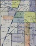 | Details | Irvin, R. B. | 1925 |
| Oilfield map Menard County, Texas to J. C. Barnett |
|
Irvin, R. B. |
|
| 1925 |
| LOC:300 |
| $165.00 | Irvin--R--B- | Oilfield-map-Menard-County--Texas-to-J--C--Barnett | Colorful blue-line cadastral oil-field map of an area in Menard County, Texas that was leased during the 1920's to J. C. Barnett. Created by R. B. Irvin, Civil Engineer from Brownsville, Texas during the mid-1920's Texas oil boom.
<br></br>
Includes a key at upper left presumably relating lessee's to leased sections by color. Scale: 2.4 in. = 1 mile. |
| 4937 |  | Details | British Admiralty Hydrographical Office | 1925 |
| Awesome Chart of Vancouver Island Washington Territory |
|
British Admiralty Hydrographical Office |
|
| 1925 |
| LOC:65 |
| $875.00 | British-Admiralty-Hydrographical-Office | Awesome-Chart-of-Vancouver-Island-Washington-Territory | Very fine British Admiralty chart of Vancouver Island, the Strait of Juan de Fuca, San Juan Islands, the Washington Territory, Bellingham. An early 20th century copper-engraved chart with very fine detail. The topography and presentation are based on an earlier edition from the mid-19th century, with corrections as noted. With six fine inset elevation views of the coast.
<br/><br/>
"North America … West Coast … VANCOUVER ISLAND and Adjacent Shores of British Columbia Surveyed by Captain G.H. Richards, R.N." … First published by the Admiralty on Sept 25, 1865. Large corrections in 1890 and 1900 with last correction in 1925. Chart # 1917.
<br/><br/>
'Sir George Henry Richards (1820 –1896) was hydrographer to the British Admiralty from 1864 to 1874.
After joining the Royal Navy in 1832, Richards was a hydrographer on the coast of British Columbia in 1857–1862 and was the second British commissioner to the San Juan Islands Boundary Commission. Richards is responsible for the selection and designation of dozens of placenames along the British Columbia coast.
<br/><br/>
Richards conducted surveys in the Pacific Northwest aboard the survey ships Plumper, and later the Hecate. As second commissioner for the maritime boundary, he was tasked with a detailed survey of the waters between Vancouver Island and the American mainland, to help determine the location of the international boundary through the San Juan Islands. The survey was completed in June 1858.' (Dictionary of Canadian Biography. http://www.biographi.ca/en/bio.php?id_nbr=6394). |
| 5450 | 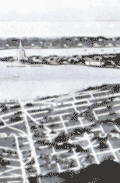 | Details | F.A. Bennett | 1925 |
| Rare view Fairyland Point Fleetwood Hotel Ormond-on-the-Bay and Muriel Estates |
|
F.A. Bennett |
|
| 1925 |
| LOC: |
| $350.00 | F-A--Bennett | Rare-view-Fairyland-Point-Fleetwood-Hotel-Ormond-on-the-Bay-and-Muriel-Estates | Rare, unrecorded antique 1920's panoramic birds-eye view of Ormond-on-the-Bay and Muriel Estates, Florida with the Fleetwood Hotel. Photograph of a painting showing Ormond-on-the-Bay and Muriel Estates both promoted by F.A. Bennett Developments. Inset of the Fleetwood Hotel. Probably a postal card. Framed.
<br></br>
The Fleetwood Hotel was a planned 300-room 15-story resort hotel with a casino, tennis courts, pool, ballroom on what is now part of Tomoka State Park. The Fleetwood Hotel, promoted by a developer called "Commodore" J. Perry Stoltz, was to embody the luxury and decadence synonymous with the Roaring Twenties.
<br></br>
[1] Jarmusz, T.S. Did Ormond Beach pillars mark a fantasy hotel that never materialized?. Daytona Beach News-Journal. January 7, 2009. Accessed Online. |
| 5333 |  | Details | Howell and Graves | 1925 |
| Early blueprint plat map for Muscle Shoals, Alabama |
|
Howell and Graves |
|
| 1925 |
| LOC:53 |
| $275.00 | Howell-and-Graves | Early-blueprint-plat-map-for-Muscle-Shoals--Alabama | Rare blueprint map of Muscle Shoals Center Number Twelve Colbert County, Alabama. The map was part of a large development planned for the area.
<br><br>
Produced ca. 1925 by A. L. Howell and C. T. Graves Owners and Developers. Detroit, Michigan. Executive Office 350 Madison Avenue, New York, N. Y.
<br><br> |
| 7868 |  | Details | Howell and Graves | 1925 |
| Muscle Shoals, Alabama City of Unlimited Opportunity |
|
Howell and Graves |
|
| 1925 |
| LOC:141 |
| $450.00 | Howell-and-Graves | Muscle-Shoals--Alabama-City-of-Unlimited-Opportunity | Muscle Shoals, Alabama, a small city nestled along the Tennessee River, is perhaps best known today for its outsized influence on American music. The iconic "Muscle Shoals Sound," born in the city's legendary recording studios, has left an indelible mark on genres ranging from soul and R&B to rock and country.
<br><br>
But a century ago, Muscle Shoals was the epicenter of a different kind of boom - one fueled by grand industrial ambitions and the promise of a brighter future.
<br><br>
In the 1920s, automotive pioneer Henry Ford set his sights on transforming the sleepy Alabama town into a bustling metropolis to rival Detroit (1). The centerpiece of this vision was the Wilson Dam, a hydroelectric marvel that would provide cheap, abundant power to fuel the growth of industry.
<br><br>
Sensing an opportunity, New York City developers Howell and Graves began heavily promoting Muscle Shoals as the "City of Unlimited Opportunity." This advertising brochure, circa 1925, with a rare birds-eye view map showcases their grand plans. The map, which stretches from Seven Mile Island to the Wilson Dam, depicts a thriving industrial landscape, with the Tennessee River winding majestically in the background.
<br><br>
At the time, nitrate plants were the region's biggest employers, and the promise of readily available electricity was expected to lure even more manufacturers to the area. Howell and Graves themselves invested heavily in the city's future, constructing the first City Hall, homes, and the Howell and Graves Jr. High School, which still stands today as a Board of Education building.
<br><br>
However, the grand vision for Muscle Shoals was not to be. Much of the infrastructure built by Howell and Graves went unused as the Great Depression stifled the city's growth. The promised industrial boom never materialized, and Muscle Shoals settled into a quieter existence.
<br><br> |
| 5387 |  | Details | Simpson and Pope | 1925 |
| Map and marketing brochure for Ortona, Florida |
|
Simpson and Pope |
|
| 1925 |
| LOC:11 |
| $150.00 | Simpson-and-Pope | Map-and-marketing-brochure-for-Ortona--Florida | Scarce sales brochure ca. 1925 for the Ortona, Florida development located on Florida's east coast in Volusia County just south of Ormond, Florida. Cover of the brochure shows several cottages and bungalows built in the Ortona neighborhood in the early 1920's. Note: this location is NOT the town of Ortona, Florida in Glades County.
<br></br>
The map shows Ortona bounded at the west by the Halifax River and at the east by the [Daytona] Auto Race Course on the beach. To the south, in 1925 Ortona was bounded by the "Clarendon Golf Links" and Seabreeze. The towns of Seabreeze, Daytona Beach, and Daytona are shown as platted and developed.
<br></br>
TITLE: "Ortona, On the Finest Ocean Beach in America, For Your Winter Home". Single sheet, folded. |
| 6769 |  | Details | Milner, P. S. | 1925 |
| Blueprint map Industrial Plant Gate Addition Muscle Shoals Nitrate Plant 2 |
|
Milner, P. S. |
|
| 1925 |
| LOC:11111 |
| $250.00 | Milner--P--S- | Blueprint-map-Industrial-Plant-Gate-Addition-Muscle-Shoals-Nitrate-Plant-2 | Scarce blueprint plat map for the Industrial Plant Gate Addition located near the main gate to the U.S. Government's Nitrate Plant #2 at Muscle Shoals, Alabama. Dated withing to April 27, 1925. The nitrate was used for producing gunpowder. An ugly reminder of the racism that was endemic one-hundred years ago is that one of the three building restrictions listed was "Caucasian Race Only."
<br><br>
Inset smaller-scale map of the greater Muscle Shoals district drawn by W. A. Dealy. The map shows the location of Nitrate Plants #1 and #2 in relationship to Sheffield, Florence, and Tuscumbia, AL.
<br><br>
Please see our other blueprint cadastral plat maps for the 1920's Muscle Shoals land boom from Keane Development Corp., Howell and Graves, and others. These proposed additions include Huston Heights, Lakeside Highlands, and Muscle Shoals Center. |
| 6689 |  | Details | Colonial Land Company | 1925 |
| Pinewood Florida |
|
Colonial Land Company |
|
| 1925 |
| LOC:86 |
| $285.00 | Colonial-Land-Company | Pinewood-Florida | Plat for a development- "Pinewood" in Fort Pierce, Florida, 1925. Shows usage in the real-estate trade by the presence of manuscript color probably to track sales of each lot. Streets include the New Dixie Highway / South Fourth Street, Indian River Drive, Georgia Avenue, Park Way, Coconut Drive, Sunrise Boulevard and many more.
<br><br>
At bottom sample elevation profiles of trendy 1920's Florida bungalows (1).
<br><br>
The neighborhood was owned and developed by Colonial Land Company of Trenton, N. J. with offices in Fort Pierce and West Palm Beach, Florida. Robb & Buchanan, Engineers. Fort Pierce, Florida. Dated within at June 8, 1925 and signed by N. C. Buchanan.
<br><br>
<div id="0" align="center">
<a title=""></a>
<img id="6689" src="/ZoomifyImages/SC_6689/SC_6689_detail_2.jpg" alt="Bungalows on a 60' street cross section for a development- "Pinewood" in Fort Pierce, Florida, by Colonial Land Company in 1925." published by Seaboard Airline Railway Florida." width="320"/> <br><br> <font size="-2">Bungalows at Pinewood. A 60' street cross section.</font>
</div><br>
(1) The bungalow is a type of housing unit that emerged in the late 19th century. It is a one-story or one-and-a-half-story house that is typically small in size and has a low-pitched roof with wide eaves that often extend to form a porch.
<br><br>
In the United States, the bungalow style became popular in the early 20th century, particularly in the western states where it was seen as a way to adapt to the climate and terrain of the region. Bungalows were often built in neighborhoods where land was relatively cheap and could be subdivided into small lots. The bungalow style continued to evolve throughout the 20th century, with many variations and adaptations, including the California bungalow, the Chicago bungalow, and the Craftsman bungalow. |
| 1076 |  | Details | British Admiralty Hydrographical Office | 1926 |
| Antique British Chart of the Caribbean Sea and West Indies |
|
British Admiralty Hydrographical Office |
|
| 1926 |
| LOC:61 |
| $750.00 | British-Admiralty-Hydrographical-Office | Antique-British-Chart-of-the-Caribbean-Sea-and-West-Indies | Spectacular large and original early twentieth-century nautical chart of south Florida and the Caribbean. Points in the USA include towns south of Orlando: Tampa, Cape Canaveral, Key West , Lake O-kee-cho-bee, and much more. Includes the islands of Jamaica, Cuba, Hispaniola, the Bahamas, Turks and Caicos. Hundreds of soundings and navigational hazards are identified.
<br></br>
Later edition of a British Admiralty chart first engraved and published from London in 1876. This bold, dark print retains the cartographic look and style of the late 19th century with updated hand-coloring by a professional map colorist. More recent charts do not display the character of this beauty.
<br></br>
Oval logo of the British Hydrographical office at upper right. Price when sold was three shillings. Chart number 761. Sold by J.D. Potter. |
| 6860 |  | Details | Anonymous | 1926 |
| Unrecorded Pictorial Map of Nevada and Calendar |
|
Anonymous |
|
| 1926 |
| LOC:89 |
| $350.00 | Anonymous | Unrecorded-Pictorial-Map-of-Nevada-and-Calendar | A very fine pictorial advertising map of Nevada from the Virginia City Bank of Virginia City, Nevada. With a complete calendar for 1926 at bottom. Includes unused metal hanger at top. A rare survivor in excellent condition. Map size 9.5" x 12.5". Overall, about 12" x 23".
<br><br>
<div id="0" align="center">
<a title=""></a>
<img id="6860" src="/ZoomifyImages/SC_6860/SC_6860_detail1.jpg" alt="Unrecorded Pictorial Map of Nevada with Calendar from 1926" width="240"/> <br><br> <font size="-2">1926 Virginia City Bank Advertising Map</font>
</div><br>
Virginia City, Nevada, was a historic mining town that experienced a significant boom in the mid-19th century due to the discovery of the Comstock Lode, a large deposit of silver ore. By 1926, however, the city had long passed its heyday and was in a state of decline. In 1926, the population was estimated to be around 1,500 people, a far cry from the 25,000 residents during the height of the mining boom.
<br><br>
In the early 20th century Virginia City began to shift its focus towards tourism. Efforts were made to embrace, preserve and promote the town's rich mining history and Wild West character to attract visitors. This map reflects that sentiment. |
| 4733 |  | Details | Asahi Shimbun | 1926 |
| Fine Japanese inter war sugoroku biplane flight game board |
|
Asahi Shimbun |
|
| 1926 |
| LOC:0 |
| $165.00 | Asahi-Shimbun | Fine-Japanese-inter-war-sugoroku-biplane-flight-game-board | Very attractive and decorative Japanese Taisho period inter-war sugoroku board game with pictures of biplanes. This large sugoroku commemorates a record long flight to Europe in July 1925 via the route of Tokyo-Paris-London. The flight, with two Breguet 19 A2 biplanes, was sponsored by the Asahi Shimbun newspaper and piloted by H. Abe and K. Kawachi, covering 13,800 km (8,575 mi).
<div class="indenttextblock">
The Bréguet XIX was two-seater light bomber and as a reconnaissance aircraft, first rolled out in 1923. A very successful metal biplane, it stayed in operational service for fifteeen years.
(Source Online: http://acepilots.com/pioneer/breguet19.html)
</div>
</BR>
Set across a background of Asia, locations on the board correspond to cities in Asia and Europe to include Rome, London, Paris, Istanbul and many more. Text in Japanese. Verso is blank.
<br></br>
E-sugoroku, with rules similar to the game of chutes and ladders, appeared in Japan as late 13th century and became popular due to the cheap and elaborate wooden block printing technology of the Edo period. Sugoroku boards were made with pictures and themes from religion, political, actors, heros, and popular culture. |
| 6676 |  | Details | Coolidge, P.T. | 1926 |
| Manuscript forest stand map south Allen's Island St George Maine Wyeth |
|
Coolidge, P.T. |
|
| 1926 |
| LOC:86 |
| $350.00 | Coolidge--P-T- | Manuscript-forest-stand-map-south-Allen-s-Island-St-George-Maine-Wyeth | Rare pen and ink manuscript forestry stand map of the south part of Allen's (Allen) Island, Maine. The map was created to represent the vegetation type, stand density and species distribution for South Allen Island in 1924. A century ago spruce predominated at the south end with pasture and scrub growth surrounding an old farm near island center.
<br><br>
Allen Island is a 450-acre private island located in St. George, Knox County, Maine. Situated near the southeastern end of Muscongus Bay, it is the largest island of a small cluster, with Benner Island to the northwest and Burnt Island to the east.
<br><br>
According to historical records, the island was first granted to William Allen, a prominent businessman and politician in Massachusetts, in the mid-18th century. Allen used the island primarily for fishing and hunting, and it remained in his family for several generations. In 1979, the island was purchased by Betsy Wyeth, wife of painter Andrew Wyeth. Prior to their ownership, the island had become a seasonal home for two fishing families living in decaying houses on the fringe of a fast-encroaching spruce forest.
<br><br>
<div id="0" align="center">
<a title=""></a> <img id="3" src="/zoomifyimages/SC_6676/SC_6676_Island.jpg" alt="Allen Island, Maine." width="300"/> <br><small>Allen Island, Maine courtesy Colby College.</small>
</div><br>
Wyeth was drawn to the island's stark natural beauty and solitude, which he found to be a perfect place for inspiration and artistic creation. He spent much of his time on the island, painting the landscape as well as the old decaying houses and structures that dotted the island's coastline. Many of his paintings featuring the island's landscape are considered to be among his most iconic works. |
| 6808 | 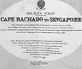 | Details | British Admiralty Hydrographical Office | 1926 |
| Scarce Antique Chart Malacca Strait Cape Rachado to Singapore |
|
British Admiralty Hydrographical Office |
|
| 1926 |
| LOC: |
| $1,400.00 | British-Admiralty-Hydrographical-Office | Scarce-Antique-Chart-Malacca-Strait-Cape-Rachado-to-Singapore | Original British Admiralty chart of the Strait of Malacca from Cape Rachado to Singapore, first published in 1896 under the superintendence of Admiral Wharton, Hydrographer. The coast of the Malay Peninsula and soundings taken from British Surveys in 1852-5; H.M. surveying ship Egeria (1893); and H.M. surveying ship Waterwitch 1909. Last corrected in 1926. Includes Singapore with numerous soundings.
<br><br>
Inset chart of "Approaches to Malacca" at upper right.
<br><br>
Sold by J.D. Potter agent for the Admiralty. Price when issued was four shillings. Admiralty chart number 795. Engraved by Davies and Company.
<br><br>
The first European chart of the Strait of Malacca was likely produced by Portuguese explorers in the early 16th century. After capturing Malacca in 1511, the Portuguese established a strong presence in the region and began extensive maritime exploration and cartography. |
| 4820 |  | Details | Anonymous | 1926 |
| Rare Plan of the Carissa Gold Mine, South Pass, Wyoming |
|
Anonymous |
|
| 1926 |
| LOC:200 |
| $400.00 | Anonymous | Rare-Plan-of-the-Carissa-Gold-Mine--South-Pass--Wyoming | Rare cyanotype (blueprint) gold mine plan and section of the <b>Carissa Mine</b>, South Pass City, Wyoming.
<br></br>
During the late 1860s, miners discovered gold near South Pass City and the Carissa mine quickly became the most productive of all mines in the Sweetwater Mining District. After nearly 100 years, the Carissa Mine finally ended operations permanently in 1954.
<br></br>
Dated with reference to a similar, more detailed map of 1926 made during a detailed assay of the entire mine. (Hausel, W. Dan .The Carissa Gold Mine, South Pass Wyoming-A Sleeper. ICMJ. Prospecting and Mining Journal. July, 1999)
<br></br>
Three drawings are included: Longitudinal Section; Plan of the Third Fourth and Fifth Levels; and Claims Comprised in the Carissa Group.
</div>
Claims included the "Lucky Strike Placer", "Hermit Placer", "Chas. Dickens" and "Jeanette 183."
<br></br>
<a href="https://www.southpasscity.com/carissa-tours" target="_blank">South Pass City</a>
today is operated as a Wyoming state historic site with 40 historic buildings, one of the best-preserved gold mining towns in the American West:
<div class="indenttextblock">
"The State of Wyoming bought the 200-acre Carissa Mine site and began a ten-year restoration and reconstruction project. The interior was restored to the post–World War II period, when the mine and mill were most productive and milled approximately sixty tons of ore per day in three round-the-clock shifts. The reinstalled equipment is now fully functional. The State of Wyoming runs the Carissa Mine as part of the South Pass City State Historic Site, with tours of the mill that include demonstrations of the mid-twentieth-century milling equipment in operation."
<b>Samantha Ford, “Carissa Mine” [Lander, Wyoming], SAH Archipedia, eds. Gabrielle Esperdy and Karen Kingsley, Charlottesville: UVaP, 2012—, http://sah-archipedia.org/buildings/WY-01-013-0097.</b>
</div> |
| 1338 | 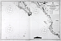 | Details | British Admiralty Hydrographical Office | 1926 |
| Chart of Lower Baja California, Cabo San Lucas, to Manzanilla Bay |
|
British Admiralty Hydrographical Office |
|
| 1926 |
| LOC:0 |
| $525.00 | British-Admiralty-Hydrographical-Office | Chart-of-Lower-Baja-California--Cabo-San-Lucas--to-Manzanilla-Bay | Amazing, clean, authentic British nautical chart of lower Baja Peninsula and west coastal Mexico with Sinaloa, Jalisco and the Sea of Cortez. Heading southward this popular and highly attractive chart covers from San Ignaciao Bay to Manzanillo Bay. This large chart will make a very attractive, unusual, and affordable gift for anyone with an interest in fishing or boating in the vicinity of Baja California. Thousands of depth soundings and numerous well-known fishing spots are noted including: San Jaime Bank, Golden Gate Bank, Outer Gorda Bank, Finger Bank, and Morgan Bank. Two inset profile views at top of the Baja Californa coast as seen from offshore near Las Animas.
<br></br>
Later edition of a British Admiralty chart first engraved and published from London in 1879; this edition to 1916 and the last corrections made in 1926. Coverage includes the lower Baja California Peninsula and Gulf of California (Sea of Cortez) from Las Animas to Cabo San Lucas, Mexico, Mazatlan, Cape Corrientes, and on to Manzanillo Bay. Contains detailed names of the numerous rivers, lights, capes, and bays surrounding the Baja Peninsula. Includes the Revillagigedo Archipelago.
<br></br>
Bold dark lithographed print retains the cartographic look and style of the late 19th century. More recent charts do not display the character of this beauty. Logo of the British Hydrographical Office at top of the title block. Originally published from London on April 9, 1879 but the edition of 1916 with corrections to 1926. Number 2323. |
| 6653 | 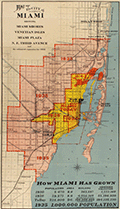 | Details | A.C. Douglass Printing Company | 1926 |
| 1926 Map of the City of Miami and Environs with Estimated Expansion |
|
A.C. Douglass Printing Company |
|
| 1926 |
| LOC:89 |
| $600.00 | A-C--Douglass-Printing-Company | 1926-Map-of-the-City-of-Miami-and-Environs-with-Estimated-Expansion | Interesting and prescient original lithographed map of the City of Miami and the nearby surrounding area made during the Miami land boom. The map shows forecasted expansive development between the period 1925 - 1935. Scarce.
<br><br>
Show Miami's historic growth from 1910 - 1925 and forecasts development to 1935 with projected future boundaries shown. Miami's boundary shows rapid population growth from 5,470 people in 1910, to 29,571 in 1920, and 225,000 in 1926, with the population projected to reach 1,000,000 by 1935.
<br><br>
Compiled and drawn by Sauer and Seghy. Printed by A.C. Douglass Printing Co., (2907 N.W. 12th Ave., Miami) in 1926.
<br><br>
Along with the usual suspects the map captures several lesser known historical features:
<div class="indenttextblocksingle">
<ul style="list-style-type: circle;">
<li>Irons Manor subdivision: The Irons Manor development was platted by developer V. Earl Irons in 1926 following the principles of the City Beautiful movement. </li>
<li>Miami Jockey Club: established in 1924 by James Bright, Glenn Curtis, and Joseph Smoot. </li>
<li>Hanson's avocado grove established by Edgar F. Hanson in 1922 was the largest in the world with over 30,000 avocado trees.</li>
<li>King Cole Hotel, with 60 rooms was completed in 1925.</li>
<li>Future site of the University of Miami, opened in fall 1926.</li>
</ul>
</div> |
| 6657 | 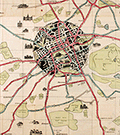 | Details | Pilcher, R. Stuart | 1926 |
| Pictorial map of Edinburgh roads and tramways Scotland |
|
Pilcher, R. Stuart |
|
| 1926 |
| LOC: |
| $275.00 | Pilcher--R--Stuart | Pictorial-map-of-Edinburgh-roads-and-tramways-Scotland | A scarce and graphically interesting pictorial map of Edinburgh and Leith, Scotland, the "Edinburgh Corporation Tramways & Motors" map published 1926 with tramway routes in red and motor bus routes shown in blue. R. Stuart Pilcher, Tramways Manager. Printed by Robert Mitchell and Sons Lithographers, Edinburgh. Verso with cover of Edinburgh skyline and numerous advertisements.
<br><br>
A graphically commanding map of Edinburgh, the core of the city displayed in a circle with black overtones and colorful motorways radiating outwards past Edinburgh's green spaces- cemeteries, parks, public gardens, and golf courses which include:
<div class="indenttextblocksingle">
<ul style="list-style-type: circle;">
<li>Craigentinny Golf Course</li>
<li>Leith Links</li>
<li>Craigmiller Park Golf Course</li>
<li>Bruntsfield Golf Course</li>
<li>Murrayfield Golf Course</li>
<li>Prestonfield Golf Course</li>
<li>Liberton Golf Course</li>
</ul>
</div>
This pictorial map of Edinburg contains numerous inset sketches of important local buildings including:
<div class="indenttextblocksingle">
<ul style="list-style-type: circle;">
<li>City Poorhouse</li>
<li>Redford Barracks</li>
<li>Merchiston Castle </li>
<li>Dan Steworth College</li>
<li>Royal Observatory</li>
<li>Fettes College</li>
<li>Leith Public Health Hospital</li>
<li>Holyrood Castle</li>
</ul>
</div> |
| 6835 | 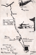 | Details | Yenching University Geology Department | 1927 |
| Rare Advertising Brochure Map of Peking for Sanitary Fur Company |
|
Yenching University Geology Department |
|
| 1927 |
| LOC: |
| $320.00 | Yenching-University-Geology-Department | Rare-Advertising-Brochure-Map-of-Peking-for-Sanitary-Fur-Company | Rare, unrecorded pictorial advertising map of Peking or Beijing, China prepared ca. 1927 for the Sanitary Fur Company by the Department of Geology and Geography at Yenching University. The maps are signed by George Barbour (1). Format: small tourist-oriented folding brochure.
<br><br>
The interior of the brochure shows a two-panel "Simplified Map of Peking". Back panel with a smaller-scale "Plan of the Northern Environs of Peking."
<br><br>
According to an inserted sheet found within:
<div class="indenttextblocksingle">
"The tanning of furs in China was started by Dr. H. S. Vincent, head of the Leather Department of Yenching University. This much needed step has popularized Chinese furs as the tanning makes them perfectly sanitary, all germs being killed in the process which also destroys the disagreeable smell so noticeable with Chinese furs imperfectly tanned."
</div><br>
<div id="SC_6835" align="center">
<a title=""></a>
<img id="6835" src="/ZoomifyImages/SC_6835/SC_6835_detail.jpg" alt="Advertisement for the Sanitary Fur Company. Peking China. 1927." width="300"/> <br><font size="-2">Advertisement for the Sanitary Fur Company. 1927.</font>
</div><br> |
| 2510 |  | Details | Puget Sound Navigation Company | 1927 |
| Puget Sound Birdseye View |
|
Puget Sound Navigation Company |
|
| 1927 |
| LOC:0 |
| $300.00 | Puget-Sound-Navigation-Company | Puget-Sound-Birdseye-View | Original 1927 birds-eye view of Puget Sound. This very fine view includes Vancouver, Port Townsend, Bellingham, Seattle, Everett, Puyallup, Tacoma, Olympia, Anacortes, and Guemes Island. North is oriented to the right.
<br></br>
Includes inset map showing major regional highways, and another inset with brief written descriptions of five "Short, enjoyable outings": the Hood Canal country; the Olympic Peninsula country; Vancouver Island; the San Juan Islands; and Whidby Island.
<br></br>
Verso contains information of interest to commuters or vacationers and photos, descriptions, and timetables for numerous local ferries and steamships. Entire brochure unfolds to 29" W x 16" H. |
| 4945 |  | Details | New York Central Railroad | 1927 |
| MS Rate Map for Quebec Central Railway Company Pulpwood |
|
New York Central Railroad |
|
| 1927 |
| LOC:200 |
| $250.00 | New-York-Central-Railroad- | MS-Rate-Map-for-Quebec-Central-Railway-Company-Pulpwood | Very cool manuscript U.S.A. railroad route rate map for a Canadian railroad: "Map of the Quebec Central Railway Company showing rates on Pulpwood, Carloads from Quebec Central Railway Stations to Watertown- Boonville - Fulton and Lockport, N.Y. U.S.A. 1927."
<br></br>
Compiled by H.W. Schatt, General Freight Office, N.Y.C.R.R. January, 1927. Very neat, tidy lettering.
<br></br>
The Quebec Central Railway served the area of Quebec called the Eastern Townships, south of the St. Lawrence River. Its headquarters was in Sherbrooke. It was originally incorporated in 1869 as the Sherbrooke, Eastern Townships and Kennebec Railway, and changed its name to the Quebec Central Railway in 1875.
<br></br>
Interesting in that the map was produced by the New York Central Railroad probably for their own internal use. |
| 5026 |  | Details | Carr and McFadden, Inc. | 1927 |
| Map and Brochure for Palm Beach Regatta 1927 |
|
Carr and McFadden, Inc. |
|
| 1927 |
| LOC:87 |
| $365.00 | Carr-and-McFadden--Inc- | Map-and-Brochure-for-Palm-Beach-Regatta-1927 | Map (9" x 12") and booklet for the Washington's Birthday Regatta on Lake Worth. Palm Beach Yacht Club, 1927. Florida. Map shows the course of the Regatta races. Very scarce.
<br></br>
33 pages with advertisements, race rules, race history, and members of the Palm Beach Regatta Association.
<br></br>
Map drawn by Carr & McFadden, Inc. Civil Engineers in West Palm Beach Florida. |
| 6472 | 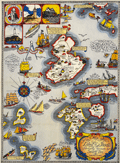 | Details | Shurtleff, Elizabeth | 1927 |
| Rare pictorial map of the Isle of Shoals |
|
Shurtleff, Elizabeth |
|
| 1927 |
| LOC:53 |
| $2,100.00 | Shurtleff--Elizabeth | Rare-pictorial-map-of-the-Isle-of-Shoals | Very rare original full-color lithographed pictorial map of the Isle of Shoals from 1927 designed and drawn by Elizabeth Shurtleff. Copyright by Jessie E. Donahue (1927). Beautiful, saturated colors. With verse by Celia Thaxter and Frederick T McGill.
<br><br>
Only two copies of Elizabeth Shurtleff's 1927 map of the Isle of Shoals were found in WorldCat. No record of a sale of the map was found online. A later much-revised edition of the Shurtleff's map was copyrighted and published in 1960 by Edward Rowe Snow.
<br><br>
Captain John Smith discovered the Isle of Shoals in 1664 lying about seven miles offshore on the border of what are today the states of New Hampshire and Maine. |
| 5005 |  | Details | Seaboard Air Line Railway | 1927 |
| Map of Seaboard Airline Railway and Connections |
|
Seaboard Air Line Railway |
|
| 1927 |
| LOC:61 |
| $425.00 | Seaboard-Air-Line-Railway | Map-of-Seaboard-Airline-Railway-and-Connections | Map of Seaboard Airline Railway and Connections. Covers the route along the United States East Coast from Virginia, through the Carolinas to Florida. Verso blank.
<br></br>
Folds into card stock folder with a List of Stations and Index to locations on map. Issued by the Freight Traffic Department, Norfolk, Virginia. June, 1927.
<br></br>
Printed by the Whitney Graham Co. Inc. Buffalo and New York City. |
| 5297 |  | Details | Armstrong, Edward Robert | 1927 |
| Armstrong Seadrome map Floating airstrips Atlantic repeater station |
|
Armstrong, Edward Robert |
|
| 1927 |
| LOC:1405 |
| $750.00 | Armstrong--Edward-Robert | Armstrong-Seadrome-map-Floating-airstrips-Atlantic-repeater-station | Very rare cyanotype (blueprint) engineering diagrams from 1927 and a Seadrome route map related to Edward Robert Armstrong's Seadrome System, a proposed system of floating airports. Armstrong's Seadrome was the first major concept for a stable floating structure at sea. Its design influenced the later development of the semi-submersible drilling rig. [1]. Armstrong's Seadrome Map (center of sheet) shows locations of repeater structures and airports planned to be anchored in the Atlantic Ocean. Only available original map of the Seadrome concept signed by Armstrong.
<br></br>
In the late 1920's aircraft did not have the capacity to carry passengers non-stop across the Atlantic. Armstrong's Seadrome System was designed to anchor huge landing fields in the Atlantic Ocean at 375 mile intervals, enabling short-range aircraft to hop across the Atlantic.
<br></br>
Signed at bottom right corner "E.R. Armstrong 5/16/27."
<br></br>
This diagram shows Armstrong's Seadrome semi-submersible concept, modified and adapted for use as a repeater station for trans-Atlantic cable traffic. The repeater stations were conceived in order to increase the bandwidth of cables across the Atlantic, which in the late 1920's was limited to a single telephone conversation. Through the use of Armstrong's semi-submersible repeater stations and two cables Bell Telephone engineers calculated that eight circuits across the Atlantic Ocean might be achievable. In the end, the floating repeater station idea was scrapped as it was believed impractical. [2]
<br></br>
[1] Pease, F. T. The Armstrong Seadrome: World's First Semi-Submersible Design ??? The Society of Naval Architects and Marine Engineers. 13th Offshore Symposium, 24 February, Houston, Texas. January 21, 2004.
[2] Jacobs, O.B. Bell Laboratories Record. Vol XXXV. Number 6. June 1957. p. 207.
[3] https://sites.google.com/site/richardarthurnorton/edwardr.armstrong |
| 5077 |  | Details | British Admiralty Hydrographical Office | 1927 |
| Chart of Harbours and Anchorages in the Hawaiian or Sandwich Islands 1927 |
|
British Admiralty Hydrographical Office |
|
| 1927 |
| LOC:59 |
| $1,350.00 | British-Admiralty-Hydrographical-Office | Chart-of-Harbours-and-Anchorages-in-the-Hawaiian-or-Sandwich-Islands-1927 | Bold, engraved chart with harbor plans in the Hawaiian Islands first published by the British Admiralty in 1891 but 1927. Retains the distinctive appearance of antique British nautical charts. "Harbours and Anchorages in the Hawaiian or Sandwich Islands from Surveys of the Hawaiian Government". Engraved by Edward Weller. Excellent topographic detail for mountains and hills.
<br></br>
Apparently, quite scarce. No record of a sale in AMPR and only one copy in WorldCat.
<br></br>
Published at the Admiralty, London, February 5, 1891 under the superintendence of Captain W. J. L. Wharton, Hydrographer. This edition: 1912. Last correction in 1927. Sold by J.D. Potter.
<br></br>
Includes large-scale harbor and anchorage plans for 12 locations in Hawaii:
<div class="indenttextblocksingle">
<ul style="list-style-type: circle;">
<li>Waimea Bay, Kauai</li>
<li>Hanamaula Bay, Kauai</li>
<li>Kapueokahi Bay, Maui</li>
<li>Kaanapali Anchorage, Maui</li>
<li>Lahaina Roads, Maui</li>
<li>Pukoo Harbor, Molokai</li>
<li>Kaunakakai Harbor, Molokai</li>
<li>Kamalo Harbor, Molokai</li>
<li>Waimea Bay, Oahu</li>
<li>Waianae, Oahu</li>
<li>Waialua Bay, Oahu</li>
<li>Kawaihae Bay, Hawaii</li>
<li>Mahukona Harbor, Hawaii</li>
</ul>
</div> |
| 5108 |  | Details | Lake Worth Herald Press | 1928 |
| 1927 Florida State Road Map |
|
Lake Worth Herald Press |
|
| 1928 |
| LOC:87 |
| $125.00 | Lake-Worth-Herald-Press | 1927-Florida-State-Road-Map | Road map for the entire state of Florida in a ten-panel folding brochure published during the 1920's Florida land boom, prior to the Great Depression. The brochure is titled: "Greeting Nobles, Oases of Lake Worth welcomes you. This road guide will assist you in your tour of Florida while attending the Shrine Convention at Miami, May 1, 2, 3, 1928."
<br></br>
Cover with logo for the Shriner organization. Verso captioned "Lake Worth Greets You" and filled with text descriptions and half-tone photographs of Lake Worth's attractions including the Municipal Recreational Center, the Gulf Stream Hotel, and its fine schools.
<br></br>
Published by the Lake Worth Herald Press. |
| 4872 |  | Details | Smith, Eugene R. | 1928 |
| Cadastral Map Fair Harbor Development Fire Island New York |
|
Smith, Eugene R. |
|
| 1928 |
| LOC:13 |
| $200.00 | Smith--Eugene-R- | Cadastral-Map-Fair-Harbor-Development-Fire-Island-New-York | Seldom seen cadastral map of one section (2) of a new development platted in 1928 for sale on Fire Island in New York. Map of Fair Harbor Property of Fair Harbor Development Co., Inc. Fire Island Beach, Suffolk Co. N.Y. Section 2.
<br></br>
Coverage includes Fifth Avenue, Holly Walk, Oak Walk, and Pine Walk streets and their alleys between the Atlantic Ocean and Great South Bay on Fire Island. The section lies between the Fair Harbor Ferry Dock and the Dunewood Ferry Dock. Rare.
<br></br> |
| 5062 |  | Details | St. Augustine Green Cove Springs Bridge Company | 1928 |
| Map of Shands Bridge over the St. Johns River |
|
St. Augustine Green Cove Springs Bridge Company |
|
| 1928 |
| LOC:11 |
| $180.00 | St--Augustine-Green-Cove-Springs-Bridge-Company | Map-of-Shands-Bridge-over-the-St--Johns-River | Map of the first Shand's Bridge over the St. Johns River in Florida from 1928. Map in folding brochure 18" x 6" with information on the Shand's Toll Bridge in the year of its opening. The bridge was conceived, financed and built privately by the St. Augustine Green-Cove Springs Bridge Company.
<br></br>
Title: "Shands Bridge over the St. Johns River connecting scenic highways St. Augustine and Green Cove Springs: Florida's longest single span bridge Open April 10, 1928."
<br></br>
In 1928 the bridge was a toll bridge of wooden construction, except for the draw span. The current bridge, located just south of the old bridge, opened in 1963. |
| 5265 |  | Details | Whitfield Colliery | 1928 |
| Three MS plans mining accidents Whitfield Colliery, Staffordshire, England |
|
Whitfield Colliery |
|
| 1928 |
| LOC:7 |
| $265.00 | Whitfield-Colliery | Three-MS-plans-mining-accidents-Whitfield-Colliery--Staffordshire--England | Lot containing three manuscript plans related to mining accidents at the Chatterley Whitfield colliery (coal mine) in Stoke-on-Trent, Staffordshire, England. The three accidents took place over a period of eight years, attesting to the danger of coal mining.
<div class="indenttextblocksingle">
<ul style="list-style-type: circle;">
<li>Plan shewing scene of accident to Charles Stubbs on Newtons No. 3 north conveyor face institute pit 29th Oct. 1935. [MS plan on paper at a scale of 1/4" = 1 foot]</li>
<li>Plan showing scene of accident to Joseph Howell on No. 5 Bowling Alley Level, Holly Lane dip in the middle pit. 8/1/37 [MS plan of tracing cloth. Scale 1/4" = one foot]</li>
<li>Plan shewing scene of accident to Richard Harper in the No. 3 south ten feet, hard mine dip, middle pit on 27-3-29. [MS plan of tracing cloth. Scale 1/4" = one foot] </li>
</ul>
</div>
The Chatterley Whitfield colliery was the largest mine working the North Staffordshire coalfield and was the first colliery in the UK to produce 1,000,000 tons of saleable coal in a year (1938). In 2019, the colliery was named on the Victorian Society's list of the top ten most endangered buildings in England and Wales. |
| 6869 |  | Details | Title Insurance and Trust Company Los Angeles | 1929 |
| Rare Map Old Spanish and Mexican Ranchos of Los Angeles County |
|
Title Insurance and Trust Company Los Angeles |
|
| 1929 |
| LOC:78 |
| $1,350.00 | Title-Insurance-and-Trust-Company-Los-Angeles | Rare-Map-Old-Spanish-and-Mexican-Ranchos-of-Los-Angeles-County | "The Old Spanish and Mexican Ranchos of Los Angeles County" is apparently the first advertising map of that title published by the Title Insurance and Trust Company of Los Angeles, just one year after the firm was incorporated in 1928. Compared to later editions this earliest 1929 edition appears as though it was produced more quickly, fitting for a company that was just beginning to take advertising seriously. The 1929 edition is smaller, more colorful, and much less elaborately executed than two later maps by the same name that the firm published in 1930 and 1937.
<br><br>
Rare. Not found in Rumsey or WorldCat.
<br><br>
Compared to the 1930 edition the 1929 edition lacks the elaborate compass rose and distance scale, the Spanish missions are drawn more simply and they lack the founding dates found in the 1930 edition. In the 1930 edition the artist has labeled public lands as such, and has filled the Pacific Ocean with a sailing ship, flying fish, and sea monsters, familiar scenes that cartographers have used for hundreds of years.
<br><br>
Title Insurance Building. 433 So. Spring Street. Los Angeles. Copyright 1929.
<br><br> |
| 6506 |  | Details | Dummer, H. Boylston | 1929 |
| Rare unrecorded pictorial historical map Boston South Shore |
|
Dummer, H. Boylston |
|
| 1929 |
| LOC: |
| $450.00 | Dummer--H--Boylston | Rare-unrecorded-pictorial-historical-map-Boston-South-Shore | Unrecorded and very scarce <strong>pictorial map of Boston's South Shore</strong> including the towns of Hingham and Cohasset. The map includes the locations of Bumkin Island, Weir River, World's End, Planters Hill, Sandy Beach, and Hominy Point. Inset illustrations of historical structures including the Garrison House, "Old Ship Church" and "The Old Ordinary" as well as named homes of local families including Ulman, Beal, Reilly, Donovan, Bolles, Foss and the entrance to the estate of Mrs. Thomas J. Plant and Mrs. E.R. Thayer's Weir River Farm.
<br><br>
No examples of the map in WorldCat, OWA, or AMPR. No other copies found online. An online search turned up another map by Dummer in a very similar style and format: "Points of Interest in Quaint Marblehead, published by the Marblehead Craft Shop.
<br></br>
Signed, and dated within to August 4, 1929, |
| 5129 |  | Details | U.S. Army Engineers | 1929 |
| Port of Pensacola, Florida scarce photomosaic and two maps |
|
U.S. Army Engineers |
|
| 1929 |
| LOC:0 |
| $300.00 | U-S--Army-Engineers | Port-of-Pensacola--Florida-scarce-photomosaic-and-two-maps | Small booklet of 66 pages that includes 3 cartographic artifacts related to Pensacola, Florida.
<div class="indenttextblocksingle">
<ul style="list-style-type: circle;">
<li>Mosaic Composed of Aerial Photographs Pensacola Florida. Made by Air Service, U.S. Army 4th Photo Section. Dec. 22, 1922.</li>
<li>Origin of Imports and Destination of Exports Pensacola, Fla. 1928. Quantities expressed in cargo tons of 2240 lbs. and shown thus. 1929.</li>
<li>Port Facilities at Pensacola, Fla. 1929.</li>
</ul>
</div>
Along with many data tables and additional photographs the contents of the entire booklet include:
<div class="indenttextblocksingle">
<ul style="list-style-type: circle;">
<li>Port and Harbor Conditions</li>
<li>Port Customs and Regulations</li>
<li>Port Services and Charges</li>
<li>Fuel and Supplies</li>
<li>Port and Harbor Facilities</li>
<li>Communications</li>
<li>The freight rate situation</li>
<li>Commerce of the port</li>
<li>The territory tributary to the port</li>
<li>General</li>
</ul>
</div>
War Department Corps of Engineers and United States Shipping Board Port Series No. 3 Part 2 THE PORT OF PENSACOLA, FLORIDA.
Printed by the U.S. Government Printing Office, Washington, D.C. 1929. Price when issued 30 cents. |
| 5078 |  | Details | British Admiralty Hydrographical Office | 1929 |
| Fine harbor chart of Port Townsend, Washington and Kilisut Harbor |
|
British Admiralty Hydrographical Office |
|
| 1929 |
| LOC:63 |
| $790.00 | British-Admiralty-Hydrographical-Office | Fine-harbor-chart-of-Port-Townsend--Washington-and-Kilisut-Harbor | Bold original harbor chart of Port Townsend / Kilisut Harbor, Washington drawn and published from London in June, 1893 by the British Admiralty under the superintendence of Captain W. J. L. Wharton, Hydrographer. Chart data are after the U.S. Coast Survey chart of 1892 (1929). Scarce.
<br></br>
Fine topographic contour lines and details on this old nautical chart. Points of interest include Port Hadlock, Irondale, Chimikim Creek, Mystery Bay, Oak Bay, Marrowstone Island, and Fort Townsend.
<br></br>
Sold by J.D. Potter. Chart number 1792. Engraved by Edward Weller. Scale: 1 / 24,361. Last correction 1929. |
| 4861 |  | Details | Edwards, Ham | 1929 |
| Antique Map Catalina Island, California Depression-era |
|
Edwards, Ham |
|
| 1929 |
| LOC:13 |
| $150.00 | Edwards--Ham | Antique-Map-Catalina-Island--California-Depression-era | Fine pre-depression-era brochure with a bright pictorial map of Catalina Island in the Pacific Ocean, off the coast of Long Beach, California. Published by Wilmington Transportation Company who offered steamer services from the Catalina Steamer Terminal to Catalina Island from Los Angeles, Long Beach, and Pasadena.
<br></br>
Included in a six-page brochure with things to do, rates for trips and ferry service, photographs, and advertisements for local hotels including the "Largest one floor hotel in the world with 1250 rooms." Map predates the Great Crash of October 1929 by three months.
<br></br>
Drawn by "Ham" Edwards - Art Services. |
| 1345 |  | Details | British Admiralty Hydrographical Office | 1929 |
| Antique Nautical Chart of Costa Rica, Panama, Colombia and Equador |
|
British Admiralty Hydrographical Office |
|
| 1929 |
| LOC:0 |
| $225.00 | British-Admiralty-Hydrographical-Office | Antique-Nautical-Chart-of-Costa-Rica--Panama--Colombia-and-Equador | Large, graphically striking, antique engraved British Admiralty sea chart of the Pacific coast extending from the Gulf of Dulce, Costa Rica, through all of Panama, and down the west coast of Colombia and Equador. The beauty of this chart lies in the extensive and bold engraving of mountain ranges and other topographical details.
<br></br>
Numerous lighthouses are picked out with red or yellow highlights. Last corrections made in manuscript with red ink.
<br></br>
First published by the Admiralty from London in August 1903 under the superintendence of Royal Navy Hydorgrapher Rear Admiral Wharton. This very attractive edition of the scarce Admiralty chart was printed with last corrections to 1929.
<br></br>
Sold by J.D. Potter Agent for The Admiralty. |
| 5427 |  | Details | Anonymous | 1929 |
| Map of the University Pool oilfield in Pecos County, Texas |
|
Anonymous |
|
| 1929 |
| LOC:300 |
| $250.00 | Anonymous | Map-of-the-University-Pool-oilfield-in-Pecos-County--Texas | Large anonymous oilfield cadastral map of the University Pool oilfield in Pecos County, Texas ca. 1929. An unintentional found work of abstract art- a 38" x 30" blueline map with hand color of leased tracts by pencil with similar ownership designated by coloring.
<br></br>
Across the center of entire map are simply the words: <strong>"State University Land."</strong>
<br></br>
Numerous lessees are noted on the map with many large and small oil companies including:
<div class="indenttextblocksingle">
<ul style="list-style-type: circle;">
<li>Tower & McKanna</li>
<li>Dixie</li>
<li>Shell</li>
<li>Humble</li>
<li>Tidal</li>
<li>Transcontinental</li>
<li>Tay-Link</li>
<li>California</li>
<li>W.R. Jones</li>
</ul>
</div>Large manuscript crayon filing notation on the verso reads "Rowan-Tong Area, Pecos County." |
| 5184 |  | Details | U.S. Coast and Geodetic Survey | 1929 |
| Florida Inside Route St. Augustine to Titusville |
|
U.S. Coast and Geodetic Survey |
|
| 1929 |
| LOC:61 |
| $180.00 | U-S--Coast-and-Geodetic-Survey | Florida-Inside-Route-St--Augustine-to-Titusville | Chart of a portion of what is today known generally as the Intracoastal Waterway: "Florida Inside Route St. Augustine to Titusville." South of the Matanzas Inlet, a portion of the inside route opposite Flagler Beach is labelled "Florida East Coast Canal." In the 1920's portions of the Inside Route were maintained by private entities who paid for canal maintenance by charging a toll for use of the waterway. As many as six toll stations existed in those days from Jacksonville to Hallandale, Florida.
<br></br>
First published by the U. S. Coast and Geodetic Survey, Washington D. C. in September 1928. Chart # 3258. Stamped October 17, 1929. |
| 6455 |  | Details | White, Ruth Taylor | 1929 |
| Six early pictorial airline route maps by Ruth Taylor White |
|
White, Ruth Taylor |
|
| 1929 |
| LOC:14 |
| $1,200.00 | White--Ruth-Taylor | Six-early-pictorial-airline-route-maps-by-Ruth-Taylor-White | Rare and fine eleven-page brochure for Western Air Express published in 1929, just three and one-half years after the airline was founded. Includes six pictorial airline route maps or cartographs by famed illustrator Ruth Taylor White. </b> Maps with inset half-tone images of aircraft and flight operations.
<br><br>
The Western Air Express Corporation, later Western Airlines, began its first passenger service in 1926 touting speed, comfort, and dependability. By 1928, employing Fokker Super Tri-motor passenger aircraft capable of transporting twelve passengers at a blistering 125 MPH, the airline "carried about eighteen percent of all inter-city passengers in the United States." In 1928 the company initiated a seaplane route from Catalina Island, California to Los Angeles, California. Maps include:
<div class="indenttextblocksingle">
<ul style="list-style-type: circle;"></li>
<li><b>San Francisco - Los Angeles.</b> 365 miles, 3 hours. "The Worlds Model Air Line." Two facing sheets, each 7.5" x 8"</li>
<li><b>Los Angeles - Kansas City.</b> 1,417 miles - 12 hours. First and fastest all Daylight Passenger Airway." Two facing sheets each 7.5" x 8".</li>
<li><b>Los Angeles to Catalina.</b> 45 miles - 30 minutes. "Over land and sea. The first air passenger service in the United States. Single center-fold sheet 15" x 8".<br>
<b> Los Angeles to Tia Juana or Agua Caliente".</b> 116 miles - 1 hour. With above. </li>
<li><b>Los Angeles - Salt Lake City.</b> 600 miles - 6 hours. "Over the Old Mormon Trail". Two facing sheets each 7.5" x 8".</li>
<li>Map of the USA showing expected travel-time zones, indicated by color legend. No title. One half sheet.</li>
<li>B&W inset map showing location of the Western Air Express Terminal south of San Gabriel. No title.</li>
<li>Cover 8" x 9" showing all included passenger routes for Western Air Express.</li>
</ul>
</div>
Publication date noted within as October, 1929. Folds down to 4" x 9". |
| 6540 |  | Details | White, Ruth Taylor | 1929 |
| Pictorial Western Air Express route map by Ruth Taylor White |
|
White, Ruth Taylor |
|
| 1929 |
| LOC:78 |
| $135.00 | White--Ruth-Taylor | Pictorial-Western-Air-Express-route-map-by-Ruth-Taylor-White | Pictorial airline route map or cartograph by famed illustrator Ruth Taylor White for Western Air Express published in 1929, just three and one-half years after the airline was founded. Inset half-tone images of an early seaplane and of Avalon Harbor on Catalina. <br><br>
<div id="1" align="center">
<a title="Western Air Express 1929 Seaplane"></a>
<img id="1" src="/ZoomifyImages/SC_6540/SC_6540_Seaplane.jpg" alt="Western Air Express 1929 Seaplane" width="300"/> <br><small>Western Air Express 1929 Seaplane, LA to Catalina</small>
</div><br>
This map include two routes flown from Los Angeles by Western Air Express:
<div class="indenttextblocksingle">
<ul style="list-style-type: circle;"></li>
<li><b>Los Angeles to Catalina.</b> 45 miles - 30 minutes. "Over land and sea. The first air passenger service in the United States.<br>
<b> Los Angeles to Tia Juana or Agua Caliente".</b> 116 miles - 1 hour.</li>
</div>
<div id="2" align="center">
<a title="Ruth Taylor White LA to Catalina route map details"></a>
<img id="2" src="/ZoomifyImages/SC_6540/SC_6540_Detail.jpg" alt="Ruth White map details" width="300"/> <br><small>Ruth Taylor White LA to Catalina route map detail</small>
</div><br>
The Western Air Express Corporation, later Western Airlines, began its first passenger service in 1926 touting speed, comfort, and dependability. By 1928, employing Fokker Super Tri-motor passenger aircraft capable of transporting twelve passengers at a blistering 125 MPH, the airline "carried about eighteen percent of all inter-city passengers in the United States." In 1928 the company initiated a seaplane route from Catalina Island, California to Los Angeles, California. Publication date: October, 1929. |
| 4841 |  | Details | Belanske, William E. | 1930 |
| Charts related to Vanderbilts circumnavigation in 1930 Belanske |
|
Belanske, William E. |
|
| 1930 |
| LOC:300 |
| $750.00 | Belanske--William-E- | Charts-related-to-Vanderbilts-circumnavigation-in-1930-Belanske | One lot of six (6) charts, each well-marked recto and verso with blue ink stamps of William E. Belanske, two with MS annotations. Belanske was an artist and former curator of William K. Vanderbilt's Marine Museum on his estate near Centerport, Long Island. These charts are related to the 1931 - 1932 circumnavigation of the world by William K. Vanderbilt II aboard the Motor Ship Alva with Belanske aboard recording flora and fauna.
<br></br>
Two charts (Tuamotu and Marquesas) heavily annotated presumably in the hand of Belanske and based on research before the cruise. Topics include tattooing, sex morality, cannibalism, food, hunting, local personalities and notable historic events.
<div class="indenttextblocksingle">
Near Takaroa: "Where Woronick the Parisian jewel expert bought the wonderful pearl that he made a fortune with. Mostly monsoons in these islands."
<br></br>
At Makatea: "Makatea is famous as the rendezvous of the infamous Marquesan half-caste Boraki the most picturesque pirate that ever sailed the South Pacific"
</div>
</br>
Recto with Navy Department ink stamp for the corrections date. On the verso each chart bears the blue ink hand-stamp "Property of William E. Belanske" and numerous manuscript identifiers. The six charts include:
<div class="indenttextblocksingle">
<ul style="list-style-type: circle;">
<li><b>Tuamotu Archipelago from a Survey of the U.S. Ex Ex in 1839.</b> 1872 / 1930. U.S. Navy. No. 77. 35"x24" MS Annotations. </li>
<li><b>The Marquesas Islands. From French Surveys in 1881 and 1882.</b> 1899 / 1930. U.S. Navy. No 1797. 21"x28". MS Annotations.</li>
<li>Port Phaeton and Approaches. 1902 / 1930 U.S. Navy. No. 1992. 27"x20".</li>
<li>East Coast of Viti Levu. 1914 / 1930. U.S. Navy. No. 2859. 38" x25"</li>
<li> Whitsunday Island to Percy Isles. 1924 / 1930. U.S. Navy. No 3455. 39"x25"</li>
<li>Borabora Island. 1902 / 1930 U.S. Navy. No. 2005. 22"x26".</li>
</ul>
</div> |
| 5258 |  | Details | Goodrich, James J. | 1930 |
| Unrecorded Panoramic Pictorial Map of Panama |
|
Goodrich, James J. |
|
| 1930 |
| LOC:77 |
| $275.00 | Goodrich--James-J- | Unrecorded-Panoramic-Pictorial-Map-of-Panama | Unrecorded pictorial map of Panama by Corporal James J. Goodrich, 11th Engineers ca. 1930. Adorned with numerous idiosyncratic illustrations including at upper right a drawing of a panther labeled "Black Cats." Many illustrations of military aircraft and naval vessels. Dotted line north of the Panama Canal shows a "proposed highway across the isthmus" beginning at the Madden Dam, completed in 1935, and terminating at Colon on the Pacific Ocean.
<br></br>
The 11th Engineer battalion was activated on the 20th of November, 1920 in the Panama Canal Zone. The 11th engineers conducted numerous engineer missions over rugged terrain and through dense jungle. It was in Panama that the 11th adopted for its crest the Panama Black Panther and assumed the nickname "Jungle Cats." The 11th Engineers were relieved of their assignment to the Panama Canal Division in April, 1932. |
| 6374 |  | Details | British Israel World Federation | 1930 |
| Unusual map depicting British Empire derived from the Lost Tribes of Israel. |
|
British Israel World Federation |
|
| 1930 |
| LOC:4 |
| $250.00 | British-Israel-World-Federation | Unusual-map-depicting-British-Empire-derived-from-the-Lost-Tribes-of-Israel- | Scarce map of the British Empire by the British-Israel-World Federation a United Kingdom-based organization which promotes British Israelism, the belief that the people of the British Isles are descendants of the Ten Lost Tribes of ancient Israel.
<br></br>
Map after "The World on Mercator's Projection Showing the British Empire 1924." With a small card-stock folder and a card containing an image of the Coronation Chair, Westminster Abbey. Folder is titled: "Set of Pamphlets bearing on British-Israel-World Federation. With the compliments of the Salisbury Branch of the British-Israel-World Federation Publishers of The National Message, 2d." |
| 6724 |  | Details | Perry, Heather "Herry" | 1930 |
| Rare Art Deco Imperial and International Communications Ltd Map Puzzle |
|
Perry, Heather "Herry" |
|
| 1930 |
| LOC:500 |
| $3,500.00 | Perry--Heather-"Herry" | Rare-Art-Deco-Imperial-and-International-Communications-Ltd-Map-Puzzle | <br></br>Bring a piece of British telecommunications history to your collection. This exquisite, complete, and rare Art Deco style puzzle map of the Imperial and International Communications (IICL) network ca. 1930 precedes McDonald Gill's Cable and Wireless Great Circle map by 15 years and features elegant characters representing the Anemoi, mythological Roman wind gods, and the Greek wind gods or Venti: Boreas, Zephyrus, Notus, Eurus, Aquilo, Favonius, Auster, and Vulturnus. Green lines indicate the undersea cables of the IICL, while dotted green lines signify IICL wireless transmissions.
<br><br>
<div id="0" align="center">
<a title="Perry's Telecom Map Puzzle"></a> <img id="3" src="/zoomifyimages/SC_6724/SC_6724_Detail.jpg" alt="Art Deco details from Herry Perry map puzzle for Imperial and International Communications Ltd, 1930, London." width="350"/> <br><small>Detail from Herry Perry's Art Deco IICL map puzzle, 1930.</small>
</div><br>
The map was designed by Herry Perry and manufactured as a promotional item for the IICL, by the Chad Valley Company, an eminent English toy manufacturer . The Chad Valley Company was active from 1860 to 1978. Its products ranged from high-quality soft toys, educational puzzles, board games, to construction sets.
<br></br>
In 1929, the Imperial Telegraphs Act paved the way for the formation of two new companies that would merge the various telegraph and wireless services within the British Empire and create a coordinated global communications network. Initially, IICL focused on expanding its services within the British Empire, but it eventually expanded its coverage to other regions like the Middle East, Africa, and Asia. IICL merged with Cable & Wireless Limited in 1934. Includes the intact original puzzle box.
<br><br>
Don't miss out on the opportunity to own a rare and remarkable piece of British telecommunications history - purchase this Art Deco map puzzle of the IICL network today. |
| 1453 |  | Details | Baltimore Bureau of Harbors | 1930 |
| Bureau of Harbors Huge Map of Baltimore Harbor |
|
Baltimore Bureau of Harbors |
|
| 1930 |
| LOC:2001 |
| $350.00 | Baltimore-Bureau-of-Harbors | Bureau-of-Harbors-Huge-Map-of-Baltimore-Harbor | 5 foot wide chart of Baltimore Harbor, Marylandwith insets of numerous shipping terminals. Second Edition.
<br></br>
Key features include: Sparrows Point Terminal, Fort Howard, Western Maryland Railway Port, Covington Terminals, Logan Field, Patapsco River.
Insets include Canton Company and Canton Railroad Terminal; Upper Basin; and New Coal Pier and Old Coal Pier, |
| 5058 |  | Details | Anonymous | 1930 |
| Lane Park Cottages Lake Harris Tavares, Florida |
|
Anonymous |
|
| 1930 |
| LOC:11 |
| $50.00 | Anonymous | Lane-Park-Cottages-Lake-Harris-Tavares--Florida | Small map of Lane Park Cottages on Lake Harris, three miles southwest of downtown Tavares, Florida ca. 1930's. Lane Park is named for Captain A.J. Lane who as early as 1883 had plans for developing a peninsula that extended into Lake Harris. Map is on a postcard with two photographs of the cottages.
<br></br>
These cottages were likely the same as those attributed to Robert Kleiser:
<div class="indenttextblock">
"Kleiser's Fish Camp was established in 1918 on an island located in the middle of Lake Harris. Robert Forest Kleiser acquired the island and built six cottages, several boat sheds, and a pier. Several years later, Kleiser disassembled the cottages and moved the camp to Lane Park." (Grenier, Bob. Images of America: Tavares. Arcadia Publishing. 2011)
</div>
</br>
Printed by the County Seat Printers, Tavares, Florida. |
| 5182 |  | Details | Goodson and Wilson | 1930 |
| Cyanotype blueprint map Evanston Illinois Niles Center Rogers Park |
|
Goodson and Wilson |
|
| 1930 |
| LOC:62 |
| $175.00 | Goodson-and-Wilson | Cyanotype-blueprint-map-Evanston-Illinois-Niles-Center-Rogers-Park | Original cyanotype or blueprint map including Evanston, Illinois with Niles Center, Rogers Park, and Edgewater neighborhoods ca. 1930. Includes a significant portion of Lake Michigan shoreline. Key noted features include West Moreland Golf Course, Northwestern University, Calvary Cemetery, Bryn Mar Golf Club, Edgewater Golf Club, and the Tam O'Shanter Country Club.
<br></br>
Blueprint shows usage to the master trace employed to create the print.
<br><br>
By Goodson and Wilson 35 W. Wacker Drive (the Jeweler's Building) , Chicago. Documentation online from 1931 shows a Goodson and Wilson Mortgage Company at 55 E. Wacker.
<br></br>
Thirty-five East Wacker Drive was originally designed and built in the 1920's as a high tech office tower for jewelers. The lower 23 floors were serviced by automobile elevators that transported the tenant, their jewels, and their car directly up to the office floor. |
| 4877 |  | Details | Parker, Charles | 1930 |
| Parker's Scenic Motor Boat Trip on the Juanita. Bar Harbor. |
|
Parker, Charles |
|
| 1930 |
| LOC:77 |
| $250.00 | Parker--Charles | Parker-s-Scenic-Motor-Boat-Trip-on-the-Juanita---Bar-Harbor- | Fine wood-block print map of Mount Desert Island, Maine showing the course of a scenic motor boat cruise aboard the "Juanita" a 21 passenger motor boat, leaving from Bar Harbor, Maine. Rare, no other copy found online.
<br></br>
Map covers the verso of a small rare brochure for Parker's Scenic Motor Boat Trip on the Juanita with additional details for a deep sea fishing trip. The scenic trip left Parker's Pier at the foot of Main Street in Bar Harbor, Maine three times daily at 10:30, 2:30 and 4:30. Cost was $1.00 per person.
<br></br>
As the brochure explained the route:
<div class="indenttextblocksingle">
"The 'JUANITA' passes close to the principle [sic] water-front estates and continues to follow the shore to the 'ovens' (a peculiar rock formation) then makes its return trip back across the bay, giving a wonderful panoramic view of the mountains of ACADIA NATIONAL PARK and goes as far along the ocean side of the PARK as weather and time permits."
</div>
<br />
Captain Parker served as head mechanic for the Fabbri Brothers, builders of a radio station formerly located on Ocean Drive. Parker entered into the boating business about 1925 as a Yacht Agent and was responsible for bringing the first speed boat to Bar Harbor. (Source: Online: Bar Harbor Times. September 11, 1941). In 1938 for $1.00 Parker offered a four-hour "Naturalist's Sea Cruise" with Captain Parker and a U.S. Park Ranger sharing the guide role aboard the "Narmada". (Sullivan Maurice. Naturalist Cruises of Acadia. National Park Service Review. Vol 1. No 5. November, 1938.) |
| 4824 |  | Details | Martin, Edward W. | 1930 |
| Map of Washington D.C. advertising the Lee House Hotel. |
|
Martin, Edward W. |
|
| 1930 |
| LOC:88 |
| $125.00 | Martin--Edward-W- | Map-of-Washington-D-C--advertising-the-Lee-House-Hotel- | Interesting advertising map of Washington D.C. with numerous points of interest identified by number in two inset legends. Published for the Lee House Hotel, then at 15th and L Streets. Not dated but based on photographs of the automobiles on verso date is estimated as circa 1930. Mentions the American Automobile Association National Headquarters but no advertisement for the A.A.A. unlike a similar edition of the map.
<br></br>
Even at this early date traffic in Washington D.C. was an issue; the black lines on the map represent the proposed best automobile routes into the city, terminating at the Lee House Hotel. Verso with photographs and text describing the Lee House's Reduced Summer Rates (Room for two persons with bath for $3.00 - $3.50 and dinner staring at $ .75.)
<br></br>
Copyright by E.W. Martin. |
| 6466 |  | Details | Ambler, Edward Vassar | 1930 |
| Pictorial map of the Cape Ann Trail |
|
Ambler, Edward Vassar |
|
| 1930 |
| LOC:150 |
| $150.00 | Ambler--Edward-Vassar | Pictorial-map-of-the-Cape-Ann-Trail | Original 1930 pictorial map of the Cape Ann Trail, Massachusetts in a folding brochure (now flattened) published by the Gloucester, Massachusetts Chamber of Commerce. Attributed to Edward Vassar Ambler but the map is signed within the plate by "Mons". Copyright by Cottage Services, Inc. Text and cover on verso.
<br><br>
The map includes numerous pictograms highlighting key locations along the Cape Ann Trail. The border is filled with vignettes and text that provides detail about each feature. These features include:
<div class="indenttextblocksingle">
<ul style="list-style-type: circle;"></li>
<li>Norman's Woe</li>
<li>Five and Ten Pound Islands</li>
<li>Bass Rocks</li>
<li>Thatcher's Island</li>
<li>The Carillon Church</li>
<li>Ravenswood Park</li>
<li>Mother Ann</li>
<li>Rocky Neck</li>
</ul>
</div> |
| 6561 |  | Details | Howell and Graves | 1930 |
| Florence Alabama Lakeside Highlands Blueprint Plat Map Muscle Shoals |
|
Howell and Graves |
|
| 1930 |
| LOC:53 |
| $300.00 | Howell-and-Graves | Florence-Alabama-Lakeside-Highlands-Blueprint-Plat-Map-Muscle-Shoals | Rare original blueprint plat map of the Lakeside Highlands subdivision on the east side of Lake Wilson in the Muscle Shoals District at Florence in Lauderdale County, Alabama. With a small scale inset context map (1 inch = 1 mile): "Muscle Shoals District Showing Location of Lakeside Highlands." G.P. Nicolopoolos Owner and Developer. Date ca. 1930.
<br><br>
Drawn by W.A. Dealy, the map includes insets of a suggested tree-lined street section and a suggested business section designed by landscape architect Frank M. Button ("The highest type of Architecture is our aim.") Streets shown include the existing Lee Highway and Wilson Dam Highway (South Wilson Dam Road), and the proposed Center Drive, Shoals Boulevard, and Lakeside Drive, East Lakeside Drive and two bridle paths.
<br><br> |
| 5274 |  | Details | Pepin, A. L. | 1931 |
| Map Plum Island Annie H. Brown Wild Life Sanctuary |
|
Pepin, A. L. |
|
| 1931 |
| LOC:10 |
| $550.00 | Pepin--A--L- | Map-Plum-Island-Annie-H--Brown-Wild-Life-Sanctuary | An unrecorded cyanotype (blueprint) map of Plum Island from 1931 related to early conservation efforts on the Massachusetts coast. The map shows the location of land purchased for the Annie H. Brown Wildlife Sanctuary and several adjacent properties proposed for purchase.
<br></br>
Plum Island is a New England barrier island that lies on the coast of Massachusetts about two miles from Newburyport, Mass. Plum Island, 11 miles in length, is named for the beach plum shrubs that grow in the dunes. The North Point of the island is located at the mouth of Newburyport Harbor, where the Atlantic Ocean meets the Merrimack River.
<br></br>
Legend at bottom describes seven numbered tracts of land on the map:
<div class="indenttextblocksingle">
<ul style="list-style-type: circle;">
<li>300 acres - Annie H. Brown Wildlife Sanctuary.</li>
<li>110 acres - Land of Knobbs Beach Associates.</li>
<li>225 acres - Land of Woodworth.</li>
<li>90 acres - Land of Stafford.</li>
<li>75 acres Land of Clement.</li>
<li>400 acres - Land of Bar Island realty Company.</li>
<li>3 acres - Land of Small.</li>
</ul>
</div>
Annie Hamilton Brown, a resident of Stoneham, willed a sum of between $15,000 and $25,000 to the Federation of the Bird Clubs of New England in 1929. Working with the Massachusetts Audubon Society, the federation was able to purchase most of the southern end of Plum Island for a wildlife sanctuary. In 1943, the Audubon Society sold the 1,600 acre sanctuary to the Federal Government who merged the land into the Parker River National Wildlife Refuge. This item includes the original fund-raising transmittal letter and return envelope from the Federation of the Bird Clubs of New England, Inc. Laurance B. Fletcher, Secretary; Boston, Massachusetts.
<br></br> |
| 6714 |  | Details | Northwestern Pacific Railroad | 1931 |
| Hiking Map Marin County California |
|
Northwestern Pacific Railroad |
|
| 1931 |
| LOC:68 |
| $375.00 | Northwestern-Pacific-Railroad | Hiking-Map-Marin-County-California | Original Hiking Map of Marin County California copyrighted and first issued by the Northwestern Pacific Railroad Company (NWPRR) in 1925 [1931]. Shows both hiking trails and fire trails with the greatest concentration around the area of Mt. Tamalpais, Muir Woods, Lagunitas Lake, and Alpine Lake. Scarce on the market. Only 5 institutional holdings of the map are listed in WorldCat.
<br><br>
Includes an inset detail map of Mill Valley with an approx. 1/2 mile walking route from the NWPRR station to the trailhead of the Pipeline Trail. No contour lines but the map does show the elevation at many points. The map shows many identified hiking trails including:
<br>
<div class="indenttextblocksingle">
<ul style="list-style-type: circle;"></li>
<li>Boot Jack Trail</li>
<li>Rock Spring Trail</li>
<li>Hidden Lake Fire Trail</li>
<li>Cataract Trail</li>
<li>Bolinas Ridge Trail</li>
<li>Woodacre Fire Trail</li>
<li>Lagunitas Fire Trail</li>
<li>Indian Fire Trail</li>
</ul>
</div>
This a revised edition from 1931. Edward Denny & Co. Publishers, San Francisco. Manuscript marginal note: "1939."
<br><br> |
| 1421 |  | Details | Johst, Paul Spener | 1931 |
| South Carolina Pictorial Map |
|
Johst, Paul Spener |
|
| 1931 |
| LOC:20 |
| $85.00 | Johst--Paul-Spener | South-Carolina-Pictorial-Map | Pictorial map of the State of South Carolina in a cartoon-like style. Depicts transportation (mules), agriculture (tobacco, rice, watermelon, cotton, corn) for the State of South Carolina in an exaggerated, stereotyped manner. A decorative legend at bottom left identifies four locations within South Carolina: Charleston, Columbia, Greenville, and Spartanburg. Page 57.
<br></br>
Verso with text extolling the virtues of South Carolina geography and natural wonders.
<br></br>
From "Picture Map Geography of the United States" by Vernon Quinn. With Picture Maps by Paul Spener Johst. Publisher: Frederick A. Stokes Company. New York. 1931. Some picture maps in the book contain depictions that today might be considered politically incorrect or even racist. |
| 1418 |  | Details | Johst, Paul Spener | 1931 |
| California Pictorial Map |
|
Johst, Paul Spener |
|
| 1931 |
| LOC:20 |
| $85.00 | Johst--Paul-Spener | California-Pictorial-Map | Pictorial map of the State of California in a cartoon-like style. Depicts transportation, chief industries (film-making, asparagus farming), nature, and recreations for the state in an exaggerated, stereotyped manner. Legend identifies 5 locations within California: Yosemite National Park, San Francissco, Oakland, Los Angeles, and San Diego. Catalina Island is identified by name. Page 181.
<br></br>
Verso with text extolling the virtues of California's natural wonders and its agriculture.
<br></br>
From "Picture Map Geography of the United States" by Vernon Quinn. With Picture Maps by Paul Spener Johst. Publisher: Frederick A. Stokes Company. New York. 1931. Some picture maps in the book contain depictions that today might be considered politically incorrect or even racist. |
| 6478 |  | Details | Boyle, Stuart | 1931 |
| Elegant lithographed pictorial map of the Cape Peninsula South Africa |
|
Boyle, Stuart |
|
| 1931 |
| LOC:14 |
| $550.00 | Boyle--Stuart | Elegant-lithographed-pictorial-map-of-the-Cape-Peninsula-South-Africa | Lovely, original pictorial map of the Cape Peninsula in South Africa by illustrator Stuart Boyle. Stuart Boyle illustrated several books including Evelyn Waugh’s The Loved One.
<br><br>
This fine map of the Cape Peninsula is characterized by elegant, colorful design and superb execution, with locations, notes, and literary quotes identified in scrollwork captions. These include:
<div class="indenttextblocksingle">
<ul style="list-style-type: circle;"></li>
<li>For the seas call and the stars call, and oh! the call of the sky- G. Gould.</li>
<li>White as sand of Muizenberg spun before the gale - Kipling.</li>
<li>Under hot Constantia broad the vineyards lie - Kipling</li>
<li>Good bathing to be had here.</li>
<li>Some say this drive in unequalled anywhere.</li>
<li>Fish simply ask to be caught here.</li>
<li>These are the twelve apostles</li>
</ul>
</div>
Only three holdings of this 1931 pictorial map are identified in WorldCat. No copies currently for sale were located.
<br><br>
Verso with text and numerous photogravure images of locations around the Cape Peninsula.
<br><br>
Issued by the Cape Peninsula Publicity Association and the South African Railways and Harbours Administration in 1931. Printed by the Cape Times. |
| 6584 |  | Details | Held, John Jr. | 1931 |
| Pictorial Map of Lower Manhattan or Broadway Butterfly's Map |
|
Held, John Jr. |
|
| 1931 |
| LOC:89 |
| $200.00 | Held--John-Jr- | Pictorial-Map-of-Lower-Manhattan-or-Broadway-Butterfly-s-Map | John Held, Jr., (1889-1958) was a cartoonist, illustrator, printmaker and author. Held's cartoons satirized and epitomized the United States' “Jazz Age” of the 1920s. Here, Held's cartoon for "Broadway Butterflys" satirizes the fast life of the New York elite with its focus on Wall Street, Broadway, Fifth Avenue, and Park Avenue. Shows the Jefferson Market Night Court, now the Jefferson Market Branch of the New York Public Library and the morgue, "end of the Primrose Path." Presumably Held included the image to illustrate his story, “Broadway Butterfly,” in Held's second published collection of short stories, Dog Tales (1930).
<br><br>
Verso with an engraving by Held: "When the Theatre was Fraught with Romance."
<br><br>
Held was apparently a VERY popular cartoonist before the Depression. According to New York's Center Gallery: <div class="indenttextblocksingle">"He lived in the era of cartoonists as national heroes. In 1927, Vanity Fair named Held to its “Hall of Fame” alongside international luminaries of the decade. The Hearst newspapers paid him $250,000 a year (nearly $4,000,000 today, adjusted for inflation) for his cartoon strip, Oh! Margy, and his drawings sold for up to $5,000 each, roughly the price of a house." (1)
</div><br>
(1) Online. Retrieved December, 2022. https://www.centergallerynyc.org/exhibitions/johnheldjr |
| 5052 | 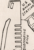 | Details | Rice, George T. | 1931 |
| Map of Key West Florida |
|
Rice, George T. |
|
| 1931 |
| LOC:11 |
| $250.00 | Rice--George-T- | Map-of-Key-West-Florida | Scarce map of Key West Florida in booklet "Fifth Annual Tourists Sight Seeing Guide of Key West Florida 1933 Courtesy of Key West Business People". Locations identified numerically on the map appear not to correspond to numbered locations in the booklet. It is informative to compare this map with a very similar sightseeing map (1945-1948) in the Touchton Map Library. Numerous changes to Key West related to WWII are apparent, especially the construction of Meacham Field.
<br></br>
Booklet 3.5" x 7" with advertisements for local Key West businesses including: The Artman Press, The Key West Citizen, Gardner's Pharmacy, Columbia Laundry, The Key West Colonial Hotel and more. With a list of facts about Key West and a description of a tour of local sights including the "turtle crawls":
<div class="indenttextblocksingle">
"3. Visit the turtle crawls where turtles weighing over two hundred pounds may be seen swimming by dozens in pens while waiting to be slaughtered. Turtles have been caught near Key West weighing over one thousand pounds. This is a sight to remember. Located: Dock at North end of Margaret street."
</div></br>
The map was compiled under the direction of George T. Rice, Captain 13th C.A. (Coast Artillery). Drawn by A.D. Shirk, Staff Sergeant, 13th C.A. July 10, 1931. |
| 1419 |  | Details | Johst, Paul Spener | 1931 |
| Alaska Pictorial Map |
|
Johst, Paul Spener |
|
| 1931 |
| LOC:20 |
| $85.00 | Johst--Paul-Spener | Alaska-Pictorial-Map | Pictorial map of the State of Alaska in a cartoon-like style. Depicts transportation (dog sledding) , nature (bears and igloos) and recreations for Alaska in an exaggerated, stereotyped manner. Legend identifies four locations within Alaska: Juneau, Ketchikan, Anchorage, and Wrangell. Kodiak Island, British Columbia and the Yukon are identified by name. Page 193.
<br></br>
Verso with text extolling the virtues of Alaska's natural wonders and its mountains; and bears.
<br></br>
From "Picture Map Geography of the United States" by Vernon Quinn. With Picture Maps by Paul Spener Johst. Publisher: Frederick A. Stokes Company. New York. 1931. Some picture maps in the book contain depictions that today might be considered politically incorrect or even racist. |
| 6551 |  | Details | Johst, Paul Spener | 1931 |
| Johst pictorial maps of Alabama and Georgia |
|
Johst, Paul Spener |
|
| 1931 |
| LOC: |
| $135.00 | Johst--Paul-Spener | Johst-pictorial-maps-of-Alabama-and-Georgia | SOLD
<br><br>
Two pictorial maps of the states of Alabama and of Georgia in a pictorial cartoon-like style.
<br><br>
From "Picture Map Geography of the United States" by Vernon Quinn. With Picture Maps by Paul Spener Johst. Publisher: Frederick A. Stokes Company. New York. 1931. Some picture maps in the book contain depictions that today might be considered politically incorrect or even racist. |
| 6643 |  | Details | White, Ruth Taylor | 1931 |
| Pictorial map of the Island of Oahu in Hawaii |
|
White, Ruth Taylor |
|
| 1931 |
| LOC:89 |
| $200.00 | White--Ruth-Taylor | Pictorial-map-of-the-Island-of-Oahu-in-Hawaii | Fine lithographed cartograph or pictorial map of the island of Oahu, Hawaii by Ruth Taylor White. In 1931 White produced four maps of individual islands for the Hawaii Tourist Bureau: Kauai, Maui, Hawaii, Oahu, and one map of the entire Hawaiian Island chain. Printed by the Honolulu Star-Bulletin.
<br><br>
Locations and features that White captured on her map of Oahu include:"
<div class="indenttextblocksingle">
<ul style="list-style-type: circle;"></li>
<li>Waimea Falls</li>
<li>Kaneohe Bay</li>
<li>Kailua Bay</li>
<li>Diamond Head</li>
<li>Waikiki Beach</li>
<li>Honolulu</li>
<li>Pearl Harbor</li>
<li>Koko Head</li>
</ul>
</div> |
| 6644 |  | Details | White, Ruth Taylor | 1931 |
| Pictorial map of the island of Maui in Hawaii |
|
White, Ruth Taylor |
|
| 1931 |
| LOC:89 |
| $250.00 | White--Ruth-Taylor | Pictorial-map-of-the-island-of-Maui-in-Hawaii | Fine lithographed cartograph or pictorial map of the island of Maui, Hawaii by Ruth Taylor White. In 1931 White produced four maps of individual islands for the Hawaii Tourist Bureau: Kauai, Maui, Hawaii, Oahu, and one map of the entire Hawaiian Island chain. Printed by the Honolulu Star-Bulletin.
<br><br>
Locations and activities that White featured on her map of Maui include:"
<div class="indenttextblocksingle">
<ul style="list-style-type: circle;"></li>
<li>Lahaina</li>
<li>Kaanapali</li>
<li>Kahului Harbor</li>
<li>Hana</li>
<li>Kipahuhu</li>
<li>Molokini</li>
<li>Makena</li>
<li>Wailuku</li>
</ul>
</div> |
| 6645 |  | Details | White, Ruth Taylor | 1931 |
| Pictorial map of the island of Kauai in Hawaii Polynesia |
|
White, Ruth Taylor |
|
| 1931 |
| LOC:89 |
| $250.00 | White--Ruth-Taylor | Pictorial-map-of-the-island-of-Kauai-in-Hawaii-Polynesia | Fine lithographed cartograph or pictorial map of the Polynesian island of Kauai, Hawaii by Ruth Taylor White. In 1931 White produced four maps of individual islands for the Hawaii Tourist Bureau: Kauai, Maui, Hawaii, Oahu, and one map of the entire Hawaiian Island chain. Printed by the Honolulu Star-Bulletin.
<br><br>
Locations and activities that White featured in her map of the Island of Kauai include:"
<div class="indenttextblocksingle">
<ul style="list-style-type: circle;"></li>
<li>Barking Sands</li>
<li>Napali Coast</li>
<li>Hanalei Beach</li>
<li>Moloaa</li>
<li>Nawiliwili Harbor</li>
<li>Port Allen</li>
<li>Ruins of Russian Port</li>
<li>Waimea</li>
</ul>
</div> |
| 6646 |  | Details | White, Ruth Taylor | 1931 |
| Pictorial map of the Island of Hawaii |
|
White, Ruth Taylor |
|
| 1931 |
| LOC:89 |
| $200.00 | White--Ruth-Taylor | Pictorial-map-of-the-Island-of-Hawaii | Fine lithographed cartograph or pictorial map of the island of Hawaii by Ruth Taylor White. In 1931 White produced four maps of individual islands for the Hawaii Tourist Bureau: Kauai, Maui, Hawaii, Oahu, and one map of the entire Hawaiian Island chain. Printed by the Honolulu Star-Bulletin.
<br><br>
Locations and features that White featured in her map of Hawaii include:"
<div class="indenttextblocksingle">
<ul style="list-style-type: circle;"></li>
<li>Mauna Kea</li>
<li>Mauna Loa</li>
<li>Kilauea</li>
<li>Hilo</li>
<li>Kealakekua Bay</li>
<li>Kailua</li>
<li>Upolu Point</li>
<li>Hookena</li>
<li>Hoopuloa</li>
</ul>
</div> |
| 6471 |  | Details | White, Ruth Taylor | 1932 |
| Ruth Taylor 1932 pictorial map cartograph Monterey Bay Region |
|
White, Ruth Taylor |
|
| 1932 |
| LOC:78 |
| $250.00 | White--Ruth-Taylor | Ruth-Taylor-1932-pictorial-map-cartograph-Monterey-Bay-Region | Fine original pictorial map or cartograph of the Monterey Bay Region by Ruth Taylor (1932). Later Ruth would sign her many maps with her married name, Ruth Taylor White. The map represents some of Ruth's earliest work, just three years after she drew four beautiful route-map cartographs for Western Air Express' newly inaugurated passenger service (1929). First edition, lacking the black redaction of the 2nd edition.
<br><br>
<div id="0" align="center">
<a title="Ruth Taylor White 1929 cartograph for Western Air Express"></a>
<img id="3" src="/ZoomifyImages/SC_6455/SC_6455_CaliRoutes.jpg" alt="Ruth Taylor White 1929 cartograph for Western Air Express" width="330"/> <br><small>Ruth Taylor White 1929 cartograph for Western Air Express.</small>
</div><br>
The cartograph was probably published by the Chamber of Commerce of the Pajaro Valley as the verso text promoting Watsonville, California refers to the map on the recto as "the marvelously scenic Monterrey Bay Region (pictured on the reverse side.)" |
| 6728 |  | Details | Anonymous | 1932 |
| Child's pencil box pictorial map United States |
|
Anonymous |
|
| 1932 |
| LOC:13 |
| $125.00 | Anonymous | Child-s-pencil-box-pictorial-map-United-States | Lithographed uncommon pictorial map ca. 1932 of the United States by the Joseph Dixon Crucible Company (DCC). Inset maps for the Philippine Islands, Alaska, Hawaiian Islands, Panama, and Porto Rico. Map interior is the standard cotton, cattle, and cactus and the seas are filled with the scene of a whaleboat capsized by its quarry, a fierce WWI-era battleship, a passenger liner, and a single-deck ship-of-the-line, possibly the Constitution. Following restoration that began in 1925, the Constitution sailed on a 90-port tour along United States' coasts by late 1931.
<br><br>
The DCC is also credited with the publication of Dixon's Mickey Mouse Map of the United States ca. 1936. That 10"x14" map was designed for inclusion in a set of child's pencils.
<br><br>
The Dixon Crucible Company was established by Joseph Dixon in Jersey City, NJ in 1847. Dixon (1799-1869) invented the Dixon Ticonderoga pencil, which was made by mixing graphite with clay and water and pressing it into grooved cedarwood. The company was taken over by Dixon's son-in-law, Orestes Cleveland, who established it as a highly regarded brand for mass production. The company suffered financial setbacks due to Cleveland's malfeasance, but it was saved by Edward F.C. Young and eventually came under the control of his son-in-law George T. Smith. The manufacturing complex was later converted into the Dixon Mills, a mixed-use apartment complex. In 2005, Dixon-Ticonderoga was acquired by the Italian-based FILA Group, a manufacturer in Mexico and China. |
| 6730 | 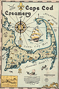 | Details | Gaffney, Walter M. | 1933 |
| Pictorial advertising map for the Cape Cod Creamery |
|
Gaffney, Walter M. |
|
| 1933 |
| LOC:13 |
| $550.00 | Gaffney--Walter-M- | Pictorial-advertising-map-for-the-Cape-Cod-Creamery | Historical pictorial map for Cape Cod Creamery ca. 1933 by Walter M. Gaffney. An unrecorded advertising piece for Cape Cod Creamery, associated with Noble's milk. On heavy card stock. Maps numerous historical and geographic locations including Pilgrim Monument, the Highland Light, Pleasant Bay, the Sandy Neck Light, the Cape Cod Canal. Scattered in each corner is a logo for Noble's milk, the map shows several delivery trucks labeled "Noble's that's good milk", and the large compass rose with a bottle of milk arranged at the center. Small piece of contiguous card stock apparently fashioned into a print hanger suggests the piece may have been trimmed into this shape by a previous owner.
<br><br>
Includes Buzzards Bay, Duxbury Bay, Provincetown Harbor, Wellfleet Harbor, Barnstable Harbor, Pleasant Bay, and a portion of Nantucket Sound.
<br><br>
<div class="indenttextblocksingle">
"Wellfleet or Whalefleet as it was originally called undoubtedly surpassed other towns. In 1843 a whale was captured near the end of the Cape and estimated to contain 200 barrels of oil and 2000 pounds of bone. Only 125 barrels of oil and 300 lbs. of bone were saved but with this waste it netted $10,000."
</div>
<br><br>
Gaffney is also credited with a larger pictorial map of Cap Cod 1932, in a different style, less historically oriented. |
| 5188 |  | Details | Los Angeles and Salt Lake RR | 1933 |
| Map of the Los Angeles and Salt Lake Railroad |
|
Los Angeles and Salt Lake RR |
|
| 1933 |
| LOC:62 |
| $200.00 | Los-Angeles-and-Salt-Lake-RR | Map-of-the-Los-Angeles-and-Salt-Lake-Railroad | Rare, large blue-line route map for the <b>Los Angeles and Salt Lake Railroad</b> (LA&SL). With an inset map of Los Angeles stops and the Central Office. A decorative historic item dating from 1933 before those rail lines were incorporated into the Union Pacific System in 1936 as the Caliente, the Sharp, and the Lynndyl divisions.
<br></br>
Shows the route extending west from Salt Lake City, through Las Vegas, Nevada and Utah to Los Angeles, California and the stops in between the two end points. The LA&SL was known for its depot buildings, many of which were in the Mission Revival architectural style, inspired by early Spanish missions in California.
<br></br>
Produced during the Great Depression by the Chief Engineer's Office. Omaha, Nebraska. February 1, 1933. |
| 4974 |  | Details | Camm, Frederick James | 1933 |
| The Fury Four Circuit Map |
|
Camm, Frederick James |
|
| 1933 |
| LOC:10 |
| $125.00 | Camm--Frederick-James | The-Fury-Four-Circuit-Map | Circuit map of the Fury Four radio introduced in 1933. The circuit was characterized by two high-frequency stages. Not to be confused with the 1954 revised circuit for the Fury Four. Printed in blue in the style of a cyanotype, or blueprint diagram. Dated within as February 11, 1933. Drawn by F.J. Camm and published by George Newnes Ltd. as a free supplement to the magazine "Practical Wireless.
<br></br>
Frederick James Camm (1895 – 1959) was an English technical author and magazine editor. He founded several radio and electronics titles, including Practical Wireless devoted to radio and electronics. In 2017 Practical Wireless was sold to Warners Group Publications, a Lincolnshire-based publishing company. |
| 5057 | 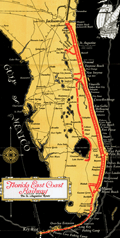 | Details | Florida East Coast Railway | 1933 |
| Map of Florida East Coast Railway the St. Augustine Route |
|
Florida East Coast Railway |
|
| 1933 |
| LOC:200 |
| $250.00 | Florida-East-Coast-Railway | Map-of-Florida-East-Coast-Railway-the-St--Augustine-Route | Colorful folding map of Henry Flagler's Florida East Coast Railway, the St. Augustine Route. Includes the Key West extension and the route from Key West to Havana, Cuba of the Peninsular and Occidental Steamship Company.
<br></br>
Interesting and seemingly out-of-place notations for two fishing camps on the Keys: Pirates Cove fishing camp and Long Key fishing camp. Printed by the Record Company, St. Augustine, Florida. Map is in the center of a folding brochure of 15 pages. |
| 5266 | 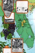 | Details | Anonymous | 1933 |
| Advertisement with map for Lake County, Florida |
|
Anonymous |
|
| 1933 |
| LOC: |
| $175.00 | Anonymous | Advertisement-with-map-for-Lake-County--Florida | Map of Lake County, Florida on an advertising brochure from the Lake County Chamber of Commerce. Fine graphics focused on the agricultural bounty available in a fertile and water-rich Florida. Shows numerous cities in central Florida including Altoona, Eustis, Howey, Clermont, Tavares, Sanford, and Orlando. Inset half-tone black and white illustrations of scenes typical to the area.
<br></br>
Brochure was issued by the Lake County Chamber of Commerce in Tavares, Florida to registrants at the Florida Exhibit during the Century of Progress Exhibition in Chicago (the 1933-34 Chicago World's Fair). |
| 4826 |  | Details | Union Pacific Railroad | 1933 |
| Map Oregon Washington Railroad and Navigation Company |
|
Union Pacific Railroad |
|
| 1933 |
| LOC:62 |
| $550.00 | Union-Pacific-Railroad | Map-Oregon-Washington-Railroad-and-Navigation-Company | Original cyanotype map (blueprint) of Oregon, Washington, and Idaho with the rail lines and stops of the Oregon-Washington Railroad and Navigation Company ca. 1933. Shows large and small railways some of which are now abandoned.
<br></br>
This map could be of interest for anyone with an interest in the Rails to Trails Conservancy or the Great American Rail-Trail initiative (a coast-to-coast multi-use trail of over 3,700 miles). Portions of this map includes abandoned tracks that are incorporated into that coast-to-coast trail including the Chicago, Milwaukee, St. Paul & Pacific Railroad (C. M. St. P and P.), now a part of the <b>Palouse to Cascades State Park Trail</b>.
<br></br>
Great detail and names of mountains in the Cascades Range including Mount Rainier, Mount St. Helens, Mount Adams, and Mount Hood. Coverage extends past Seattle to Everett, Washington.
<br></br>
The Oregon Railroad and Navigation Company operated from 1896 after a consolidation of several smaller railroads. Union Pacific (UP) purchased a majority stake of the line in 1898. In 1910 the line became a subsidiary of UP titled the <b>Oregon–Washington Railroad and Navigation Company.</b> Union Pacific formally absorbed the smaller railway into its system in 1936.
<br></br>
Dated 1933 based on 2 other similar items purchased in the same lot, each from the Chief Engineer's Office.
<br></br>
In the 1930's, minor abandonments of the company's Oregon lines included the partial abandonment of the line to Homestead, as well as joint operation with the Spokane, Portland & Seattle of the Oregon Trunk railroad line from the Columbia River south to Bend.
<br></br>
Drawn by REB. Published by the office of the Chief Engineer, Portland, Oregon. |
| 6326 |  | Details | Keane Development Corporation | 1933 |
| Blueprint plat map for Huston Heights Muscle Shoals, Alabama |
|
Keane Development Corporation |
|
| 1933 |
| LOC:53 |
| $250.00 | Keane-Development-Corporation | Blueprint-plat-map-for-Huston-Heights-Muscle-Shoals--Alabama | Rare unrecorded cyanotype (blueprint) plat map of the Huston Heights development near <b>Muscle Shoals</b>, Alabama which was incorporated in 1923.</b> Inset at upper left is a fine context map of the Tri-cities area of Florence, Sheffield, and Muscle Shoals compiled by T.J. Evans showing the locations of the Huston Heights development. Features the Wilson Dam on the Tennessee River and two nitrate plants. Dated within at February, 1933.
<br></br>
The plat encompasses an area in Muscles Shoals bounded by and including Ford Highway, Washington Drive, Henry Street and Sheridan Drive. |
| 6402 |  | Details | Broms, Allan | 1934 |
| Broms Star Guide Planisphere |
|
Broms, Allan |
|
| 1934 |
| LOC:300 |
| $995.00 | Broms--Allan | Broms-Star-Guide-Planisphere | Broms Star Guide (1934), a very rare planisphere created during the depth of the Great Depression. This planisphere is the only example of Broms Star Guide known to exist (per Internet search). It contains much peripheral information about astronomy that are not found on other planispheres, e.g. moon phases, meteor calendar, the Greek alphabet, and a moon map.
<br><br>
Model AN, for the Northern Hemisphere. Published by the Graphex Company, New York.
<br><br>
This planisphere was created by Allan (Allen) Strong-Broms (1886-1965), draft resister, Leavenworth prisoner, author, inventor, lecturer, businessman and "not a professional astronomer". As a result of his pacifism and resistance Broms told his son that he “had seen the inside of twenty-two jails.” [2]
<br><br>
No copies located online and no holdings recorded in WorldCat. The only mention of Broms Star Guide is the LOC copyright catalog. Allan Broms was granted a patent for the Star Guide on November 20, 1934.
<br><br> |
| 5242 |  | Details | Zulch, Herman C. | 1934 |
| Maps of the Mossback Gold Mine near Oatman Arizona |
|
Zulch, Herman C. |
|
| 1934 |
| LOC:62 |
| $550.00 | Zulch--Herman-C- | Maps-of-the-Mossback-Gold-Mine-near-Oatman-Arizona | Scarce lot of six hand-colored blue-line mine maps of the Mossback Mine near the town of Oatman in Mohave County, Arizona. Five of the six maps show a distinctive tunnel, or level, of the mine (levels 100-400 (12" x 17") and level 700 (17" x 46")). The sixth and most interesting map is the "Cross Section Through Mossback Shaft" (18" x 26") which shows the Ritter Vein and the Mossback Vein, reported to be a rich source of gold ore. From a geological perspective the map projects the potential position of the Mossback Vein as it was shifted by the Mossback Fault.
<br></br>
According to the Arthur Lakes Library at the Colorado School of Mines the tunnel maps and cross-section map are scarce:
<div class="indenttextblocksingle">
"Most mining maps show a mining district or region. . . Most of mine maps in our collection show only the location of the claims, not the tunnels. Very few maps show cross-sections of a mine." [1]
</div></br>
The Mossback Mine, at an altitude of 2,400 feet, was first discovered in 1863 by Garry Mining Company. Past operations took place as late as 1933 to 1935, but the mine is now closed. The Mossback vein extended nearly half a mile in length and was 23 feet in width at the surface, widening to 40 feet at the bottom. The ore contained up to $2,000 in gold per ton (100 ounces per ton). [2]
<br></br>
Traced by mining engineer Herman Zulch at Oatman, Arizona. Herman Charles Zulch graduated from the Colorado School of Mines in May 1908.
<br></br>
Sources include:
</br>
[1] https://libguides.mines.edu/maps/mining</br>
[2] https://thediggings.com/mines/6530 |
| 6598 |  | Details | Dietemann, C.A. | 1934 |
| Scarce Pictorial Map Denver and Rio Grande Western Railroad |
|
Dietemann, C.A. |
|
| 1934 |
| LOC:400 |
| $250.00 | Dietemann--C-A- | Scarce-Pictorial-Map-Denver-and-Rio-Grande-Western-Railroad | C. A. Dietemann's scare pictorial map: Denver and Rio Grande Western (D&RGW) Railroad Scenic Line of the World spans four panels of a six-panel promotional brochure for the railroad featuring the Royal Gorge Route and the James Peak Route with the Moffat Tunnel, cutting through the Continental Divide. The map, dating from the mid 1930's features a wide expanse of the west including portions of New Mexico, Colorado, Utah and Arizona. From Salt Lake City to Denver, this fine map of routes for the Denver and Rio Grande Railroad entices the viewer to visit some of the West's greatest attractions including Mesa Verde National Park, Pikes Peak, Santa Fe, and Rocky Mountain National Park.
<br><br>
Dietemann's pictograms on this lithographed pictorial map feature numerous outdoor activities such as hiking, tennis, skiing, hunting, tobogganing, and fishing.
<br><br>
The D&RGW entered bankruptcy in 1935 and was not able to emerge from that status until 1947.
<br><br>
Only five holdings od Dietmann's pictorial map are found in WorldCat. No copies appear for sale on the market at this moment (01/23). |
| 1333 |  | Details | U.S. War Department | 1934 |
| Old War Department Map of New Orleans Area 1934 |
|
U.S. War Department |
|
| 1934 |
| LOC:1401 |
| $450.00 | U-S--War-Department | Old-War-Department-Map-of-New-Orleans-Area-1934 | Large, original War Department / U.S. Corps of Engineers blueprint index map from 1934 for south-eastern Louisiana including New Orleans, Donaldsonville, Baton Rouge, Mandeville, Slidell and Bay St. Louis. Names railways, numerous waterways and bodies of water, but does not show roads or highways. Includes the Bonnet Carre Floodway (completed 1931), the Harvey Locks, portions of the Intracoastal Canal (later called the Gulf Intracoastal Waterway or ICWW), Lake Borgne, Lake Ponchartrain, Barataria Bay, Atchafalaya Bay, and the Mississippi River as far south as Venice, Louisiana. Perfect for the man cave.
<br></br>
On this map the route shown for the Intracoastal Canal passes through Lockport, Louisiana and Bayou Terrebonne. The segment of the canal from Larose to Bourg, Louisiana to was not completed until 1949.
<br></br>
Dated within at bottom right to 1934. Drawn by L. Lecaze. |
| 6451 |  | Details | U.S. Geological Survey | 1935 |
| Fine large Geologic Map of Colorado |
|
U.S. Geological Survey |
|
| 1935 |
| LOC: |
| $500.00 | U-S--Geological-Survey | Fine-large-Geologic-Map-of-Colorado | Original large folding Geologic Survey Map of Colorado [1] from 1935, dissected and laid to linen. With an inset index map of Colorado. Includes an impressive table of the principal sources of geologic data that were used to compile the map of Colorado, USA. Published by the Department of the Interior, U.S. Geological Survey.
<br><br>
Scarce in this format. Type of rock (igneous, metamorphic, sedimentary) is indicated by color keyed to an extensive index scattered across the right side of the map.<br><br>
[1] Geologic Map of Colorado by the United States Geological Survey W. C. Mendenhall Director in cooperation with the Colorado State Geological Survey Board and Colorado Metal Mining Fund 1935. |
| 5499 |  | Details | New Hampshire State Planning and Development Comm | 1935 |
| Scarce Map or Poster of New Hampshire Ski Trails |
|
New Hampshire State Planning and Development Comm |
|
| 1935 |
| LOC:150 |
| $365.00 | New-Hampshire-State-Planning-and-Development-Comm | Scarce-Map-or-Poster-of-New-Hampshire-Ski-Trails | Very scarce original lithographed skiing map / poster for the State of New Hampshire from 1935 when the state was the heart of skiing in the United States.
<div class="indenttextblocksingle">
"New Hampshire was the first place in America to have many things you see now at every ski resort. New Hampshire was the first to have trails cut just for downhill skiing. The Granite State was the first to have overhead wire-rope ski tows and an aerial tramway. Many famous races and styles of racing took place in New Hampshire. Professional ski patrols and ski schools began in New Hampshire. These new ideas, plus ski villages, started a whole new tourism industry." [1]
</div>
<br>
Inset tables of distances between cities, status (active/inactive) of airports during the winter season, and a list of approximately seventy member clubs of the U.S. Eastern Amateur Ski Association that included:
<div class="indenttextblocksingle">
<ul style="list-style-type: circle;">
<li>Appalachian Mountain Club. Boston, Mass.</li>
<li>Dartmouth Outing Club</li>
<li>Winnipesaukee Ski Club</li>
<li>Woodstock Ski Club</li>
<li>Nansen Ski Club</li>
<li>Lake Placid Ski Club</li>
</ul>
</div>
A rare record of club and commercial skiing in New Hampshire published by the New Hampshire State Planning and Development Commission in Concord, New Hampshire. Unlike another example of this ski map that we have in stock from a decade later in 1945, this map only lists individual ski trails, organized by region and very few of these trails have mechanical assistance to bring the skier up the mountain, such as tow ropes, chair lifts or trams (the first chairlift was built in New Hampshire. in 1937).
<br></br>
Verso contains text and statistics describing ski trails across the state. Copyright General Drafting Company, New York, N.Y.
<br></br>
[1] New Hampshire Ski History. Online. 2016. http://newenglandskimuseum.org/new-hampshire-ski-history-for-4th-graders/ |
| 6797 |  | Details | Appleton, LeRoy H. | 1935 |
| New Deal allegorical pictorial map Federal Water Shed |
|
Appleton, LeRoy H. |
|
| 1935 |
| LOC:89 |
| $225.00 | Appleton--LeRoy-H- | New-Deal-allegorical-pictorial-map-Federal-Water-Shed | A stunningly-executed allegorical persuasive map on the subject of the New Deal by LeRoy Appleton. The intent of the map was to argue against FDR's New Deal policies.
<br><br>
The New Deal was a series of economic programs and reforms implemented by President Franklin D. Roosevelt in the United States during the 1930s in response to the Great Depression. It aimed to provide relief, recovery, and reform to address the severe economic crisis and high unemployment rates of that time. It was implemented between 1933 and 1939.
<br><br>
Appleton uses water as a symbol to represent money, with rivers and wells as sources of that money later stored behind a dam, a symbol for the "reservoir of revenue."
<br><br>
Other allegorical imagery was used during that era to explain specific New Deal programs. For example, the symbol of the "Three Little Pigs" was employed to illustrate the different types of economic recovery measures. The first pig represented the ineffective, weak measures of the past, while the second pig symbolized temporary relief efforts. The third pig, who built his house with sturdy bricks, represented the New Deal programs that aimed to provide long-term economic stability and reform. By employing such storytelling devices, FDR and his administration aimed to create a sense of unity, hope, and support for the New Deal programs among the American people. Found in an issue of Fortune Magazine in 1935.<br> |
| 2502 |  | Details | Chase, Francis J. | 1935 |
| The Last Frontier |
|
Chase, Francis J. |
|
| 1935 |
| LOC:10 |
| $350.00 | Chase--Francis-J- | The-Last-Frontier | Colorful and fun pictorial map of Alaska with pictures of flora, fauna, and native peoples. Prominently features the Japanese Current. Key named locations include Seattle, Bristol Bay, Aleutian Islands, Point Hope, and Point Barrow. Oceans colored black, with whales, local ships, a compass rose, iceberg, and rising sun. Rope-bordered cartouche decorated with nautical subjects, fishermen, float plane, and a totem pole.
<br></br>
Designed by J. Francis Chase. Copyright 1935 by Abbott Laboratories, North Chicago, Ilinois, producers of Abbott's Haliver Oil, a nutritional supplement derived from the liver of the halibut. |
| 5114 |  | Details | Poole Brothers, Inc. | 1935 |
| Map Dixie Route rail service to Florida |
|
Poole Brothers, Inc. |
|
| 1935 |
| LOC:11 |
| $200.00 | Poole-Brothers--Inc- | Map-Dixie-Route-rail-service-to-Florida | Map (8" x 15") within a twenty-two page folding brochure for <b>The Dixie Route</b>, a train service that in 1939 operated three passenger trains across several affiliated railroads and their stops to provide passenger service from the Midwest (St. Louis and Chicago) to Florida. The railway companies contributing to the brochure included:
<div class="indenttextblocksingle">
<ul style="list-style-type: circle;">
<li>Chicago and Eastern Illinois Railway</li>
<li>Louisville and Nashville Railroad</li>
<li>Nashville, Chattanooga, and St. Louis R.Y</li>
</ul></div>
Daily Dixie Route trains to Florida were The Dixieland (with overnight service to Florida) , The Dixie Flyer, and The Dixie Limited.
<br></br>
Copyright 1935 by publishers Poole Brothers, Inc. Published October 1939 (dated within).
<div class="indenttextblocksingle">
Poole Brothers was a publishing company founded in 1870 by George Amos and William H. Poole. The company was the largest printing house in the country that catered to transportation companies. According to The Inland Printer, "practically every railroad in the country used Poole Brothers materials." [1] </div>
</br>
[1] Source: https://en.wikipedia.org/wiki/Poole_Brothers |
| 5047 |  | Details | Dornbush, Adrian | 1935 |
| Depression era pictorial brochure 1st Edition map The Coral Isle of Key West |
|
Dornbush, Adrian |
|
| 1935 |
| LOC:300 |
| $300.00 | Dornbush--Adrian | Depression-era-pictorial-brochure-1st-Edition-map-The-Coral-Isle-of-Key-West | Two scarce maps of Key West, Florida in a visitor's guide booklet simply titled "Key West" published by the Key West Administration in 1935. The booklet is a product of the Public Works of Art Project (PWAP) during the New Deal that was succeeded by the Federal Art Project of the Works Progress Administration (WPA).
<div class="indenttextblocksingle">
"Public Works of Art Project artists from other parts of the country were brought in and put to work creating paintings, murals or public places, and other projects, such as tourist brochures and postcards." [1]
</div>
</br>
The brochure includes a fine 1st edition pictorial map (9" x 6") of Key West, Florida: "The Coral Isle of Key West" by artist Adrian Dornbush, 1935. The map (first edition) was engraved on a "miraculous" scale and shows key landmarks such as Duval Street, the lighthouse, the Martello Towers, and the yacht basin. Other FERA artists who contributed works to the brochure include Edward Bruce, Richard Sargeant, Avery Johnson, Klir Beck, and Richard Jansen.
<br></br>
At center of the brochure is an anonymous two-sheet "Map of the Lower Florida Keys or the Key West Archipelago" (18" x 6") containing a smaller inset map of the Caribbean region.
<br></br>
Printed by Orange Publishing Co. St. Cloud, Florida.
<br></br>
[1] https://keysarts.com/public_art/wpa.html <br>
[2] <a href="https://www.rarecharts.com/ShowDetail/Creator/Dornbush--Adrian/Title/Depression-era-pictorial-brochure-with-variant-2nd-Edition-map-Coral-Isle-of-Key-West/5493" target="_blank">See the second edition here.</a> |
| 5493 |  | Details | Dornbush, Adrian | 1935 |
| Public Works of Art Project brochure variant 2nd Edition map Coral Isle of Key West |
|
Dornbush, Adrian |
|
| 1935 |
| LOC:11 |
| $325.00 | Dornbush--Adrian | Public-Works-of-Art-Project-brochure-variant-2nd-Edition-map-Coral-Isle-of-Key-West | Two scarce maps including a rare presumed 2nd. "The Coral Isle of Key West" Florida in a visitor's guide booklet simply titled "Key West" published by the Key West Administration after 1935. The booklet is a product of the Public Works of Art Project (PWAP) during the New Deal that was succeeded by the Federal Art Project of the Works Progress Administration (WPA).
<div class="indenttextblocksingle">
"Public Works of Art Project artists from other parts of the country were brought in and put to work creating paintings, murals or public places, and other projects, such as tourist brochures and postcards." [1]
</div><br>
<div id="3" align="center">
<a title="Key West Booklet"></a>
<img id="3" src="/ZoomifyImages/SC_5493/SC_5493_Cover_400x300.jpg" alt="Dornbush pictorial map The Coral Isle of Key West." width="240"/>
</div>
<br />
Other FERA artists who contributed works to the brochure include Edward Bruce, Richard Sargeant, Avery Johnson, Klir Beck, and Richard Jansen.<br>
</br>
The brochure includes a fine 9" x 6" pictorial map of Key West, Florida: "The Coral Isle of Key West" by artist Adrian Dornbush, 1935. Second edition. This map is most interesting in that it is an <b>unrecorded substantial revision of Dornbush's original map of Key West.</b> This edition contains numerous changes from the first edition including:
<div class="indenttextblocksingle">
<ul>
<li>For the first time, an airport is noted in the location of Meacham Field, now Key West International Airport (EYW)</li>
<li>Seaplane ramps at Trumbull Point (labeled "Key West Airways") are replaced with ship docks. </li>
<li>Radio towers are now shown located at the island's west side near Duval Street.</li>
</ul>
</div>
The map was engraved on a "miraculous" scale and shows key landmarks such as Duval Street, the lighthouse, the Martello Towers, and the yacht basin.
<br></br> |
| 6780 | 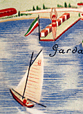 | Details | Ministero della Cultura Popolare | 1935 |
| Pictorial map of the province of Verona, Italy |
|
Ministero della Cultura Popolare |
|
| 1935 |
| LOC:400 |
| $395.00 | Ministero-della-Cultura-Popolare | Pictorial-map-of-the-province-of-Verona--Italy | An attractive lithographed touristic pictorial map of the Verona region of Italy on the verso of an 8-panel folding brochure for that region. Includes Lake Garda and Monte Baldo. Designed by F. Poggi and published ca. 1935 by Italy's Ministero della Cultura Popolare. Rare, no copy is found online.
<br><br>
The map shows images of duck hunters, skiers, swimmers, hikers, soldiers, and winemakers set on a background with local road and rail networks connecting Verona to the rest of Italy and Europe, especially to many nearby old cities. <br><br>
<div id="6780a" align="center">
<a title=""></a>
<img id="6780" src="/ZoomifyImages/SC_6780/SC_6780_detail_1.jpg" alt="Lake Garda detail from a pictorial map of the province of Verona, Italy" width="340"/> <br><br> <font size="-2">Lake Garda coastal boating detail.</font>
</div><br>
Recto with photographs of local attractions. Printed by Pizzi & Pizio - Milano-Roma. French text description at right.><br><br>
<div id="6780b" align="center">
<a title=""></a>
<img id="6780b" src="/ZoomifyImages/SC_6780/SC_6780_detail_2.jpg" alt="Lake Garda coastal and Monte Baldo detail from a pictorial map of the province of Verona, Italy." width="340"/> <br><br> <font size="-2">Lake Garda and Monte Baldo detail .</font>
</div><br> |
| 6500 | 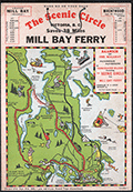 | Details | Page, Peter Hugh | 1936 |
| Rare pictorial map of Victoria, British Columbia with Ferry Routes |
|
Page, Peter Hugh |
|
| 1936 |
| LOC:78 |
| $350.00 | Page--Peter-Hugh | Rare-pictorial-map-of-Victoria--British-Columbia-with-Ferry-Routes | Rare pictorial auto map of Victoria, Vancouver Island, British Columbia, Canada featuring the Mill Bay Ferry route as an element of the Scenic Circle auto route. The map features numerous small cartoonish drawings of local activities including golfing, hunting, fishing, gardening, and horse racing. No holdings of this rare pictorial auto route map are found anywhere else online, nor any record of sales. Dated within to 1936.
<br><br>
Locations noted on the map include Telegraph Beach, Victoria Golf Club, James Island, Sidney, Sidney Island, Esquimalt Harbor, and Cordova Bay.
<br><br>
On card stock, this unusual piece of cartographic ephemera includes the original string hanger still attached through two punched holes.
<br><br>
Recto with departure times for the Mill Bay Ferry from both Malahat and from Brentwood. Verso with a photo of the ferry - M.S. Cascade, an inset smaller-scale sketch map of the Victoria surrounding area, a mileage table, and text on points of interest and suggestions for the Scenic Circle drive.
<div class="indenttextblocksingle">
"Ferry Trip across the placid waters of Saanich Arm, Sport Fishing preserve, where salmon up to 53-lbs. are taken and over fifty species of fish are found. From the Ferry can be seen Senanus Island, an ancient Indian burial ground, Bamberton Cement Works, Brentwood Cottage".
<br>and<br>
"A glance at the Map on the other side will convince you of the ease and simplicity of this Route. You can save MONEY, TIME and reduce your mileage from 83 to 45 by using this convenient connecting link [ferry] between Mr. BUTCHARTS GARNENS and the Famous MALAHAT DRIVE…"
</div> |
| 6677 |  | Details | Anonymous | 1936 |
| About and Roundabout Tucson pictorial map Arizona botanical interest |
|
Anonymous |
|
| 1936 |
| LOC:86 |
| $250.00 | Anonymous | About-and-Roundabout-Tucson-pictorial-map-Arizona-botanical-interest | Neat pictorial map of Tucson, Arizona, filled with historical facts and illustrated with simple sketches related to the city's long and colorful history. Bernice Walkley Porter, a Vassar graduate, is credited with creating a map "About and Roundabout Tucson" in 1936 (1). Though untitled, the map here is apparently Porter's and was issued as an folded untitled insert in a guide book by the same name that was published by the Junior League of Tucson in 1936. Verso with a road map of the state of Arionna.
<br><br>
During the 1930s, Bernice Walkley and Rutger Porter operated Desert Gardens Nursery on the same property as their small adobe house in Tucson. Rutger's love for desert plants earned him the nickname "Kactus Kid". Together Bernice and Rutger expanded their home and created the garden surrounding it. Over the years, their garden evolved into a beautiful oasis of winding walks, adobe walls, fountains, and greenery that reflected the sturdier choices for the Tucson climate.
<br><br>
The Porters closed their Desert Gardens Nursery in 1958. However, Bernice had a dream of turning their beloved property into a public garden, and donated it to the City of Tucson in 1968. By the early 1970s, the Tucson Botanical Gardens and the Porter property became a reality, with the City passing a resolution to develop the property into a horticultural center, sanctuary for wild birds, and a center for education. The Porter's adobe house now serves as the Gift Shop for the Tucson Botanical Garden
<br><br>
Many of the original plants from the Porter estate, including citrus, roses, privet, and jasmine, are still preserved in the Historical Garden, which represents the oasis style typical of large Tucson gardens dating from the 1920s to the mid-1960s.
<br><br>
(1) Griffin, Dori. Mapping Wonderlands: Illustrated Cartography of Arizona, 1912–1962. United States, University of Arizona Press, 2013. p. 192. |
| 4994 |  | Details | Brockway, George S. | 1936 |
| Lot of 3 maps Palm Beach Atlas Florida MS notes |
|
Brockway, George S. |
|
| 1936 |
| LOC:11 |
| $525.00 | Brockway--George-S- | Lot-of-3-maps-Palm-Beach-Atlas-Florida-MS-notes | Lot of three (3) scarce cadastral maps from the Palm Beach, Florida Atlas ca. 1936 by Civil Engineer George S. Brockway. Data printed on each sheet include tract/development name, deed reference location, lot dimensions, street names and lot number.
<br></br>
Sheets may contain manuscript pencil notations (ca. 1947 / 1948) with additional property owner names, property prices and indications of whether there was a structure on the property. Verso of each sheet contains Brockway's ink-stamped disclaimer of legal responsibility.<br></br>
<b>Details for the three atlas plates include</b>
<div class="indenttextblocksingle">
<ul style="list-style-type: circle;">
<li>Sheet 5: Covers an area bounded by Merrain Road (N), La Puerta Way (S), Lake Worth (W), Atlantic Ocean (E). Developments include the Bello Lido, Alto Lido and Mockingbird Trail tracts. </li>
<li>Sheet 6: Covers and area bounded by La Puerta Way (N), Orange Grove Road (S) - Lake Worth (W) Atlantic Ocean (E). Includes developments of Palm Beach Shores, Gregory Addition and the New Siears tracts. Shows the former <b>Kennedy Estate with two lots owned by Joseph P. Kennedy</b> totaling 440 feet of ocean frontage.</li>
<li>Sheet 15-A: Bounded by Seminole Ave (N), Royal Poinciana Way (S), Lake Worth (W), North County Road (E) Includes the Flagler Memorial Bridge, old <b>Biltmore Hotel and the Beach Club</b>. Developments include Ocean Park, Floral Park, and Bungalow Park.</li>
</ul>
</div> |
| 6589 |  | Details | W. A. Fisher Company | 1936 |
| Pictorial map of Kabetogama Lake Minnesota |
|
W. A. Fisher Company |
|
| 1936 |
| LOC:59 |
| $325.00 | W--A--Fisher-Company | Pictorial-map-of-Kabetogama-Lake-Minnesota | Scarce original pictorial map of Kabetogama Lake, Minnesota. Kabetogama means "rough waters" in Chippewa. Created by Frank M. Antoncich. Published by the W. A. Fisher Company, Virginia, Minnesota. Date of 1936 from the example in the Rumsey Collection. Price when issued was 25 cents.
<br><br>
Along with and cute cartographs including bears and Native Americans the map is filled with useful navigational information and historical facts. Portages, trails and roads are laid out. Many canoes.
<br><br>
Notes and observations about the area include:<br>
<div class="indenttextblocksingle">
<ul style="list-style-type: circle;"></li>
<li>an "Indian Village",</li>
<li>"Funeral Island Burial Ground"</li>
<li>the "Yates Resort",</li>
<li>"Mrs. McCaw- first white woman and homestead here",</li>
<li>"Good duck hunting", and</li>
<li>"Impassable in low water".</li>
</ul>
</div> |
| 5390 |  | Details | English, Robert B. | 1936 |
| Unrecorded maps on development of Florida counties 1831 to 1935 WPA |
|
English, Robert B. |
|
| 1936 |
| LOC:11 |
| $240.00 | English--Robert-B- | Unrecorded-maps-on-development-of-Florida-counties-1831-to-1935-WPA | Original photostat copy of a document with a time-series of ten maps on the development, boundaries, and naming of counties in the State of Florida from 1831 to 1935. White print on black background. Contains detailed textual data on Dade County including population and historical notes. With documentation of the sources for information about Dade County.
<br></br>
Unrecorded. No copy of this document is found online. Assembled by the Historical Records Survey and the State Archives survey- local office, District 3, 3041 Grand Avenue, Coconut Grove, Florida. Dr. Robert B. English, Compiler. Natalie Newell, del. October 1, 1936. WPA.
<br></br>
A substantially different version of this work from 1936, covering the years 1820 - 1936 is attributed to the Works Progress Administration, Florida. That version, from a single online source appears at https://www.floridamemory.com/items/show/322986. |
| 5154 |  | Details | Edwards, Parker | 1937 |
| Dole Pictorial Map of the Hawaiian Islands 1937 |
|
Edwards, Parker |
|
| 1937 |
| LOC:63 |
| $1,100.00 | Edwards--Parker | Dole-Pictorial-Map-of-the-Hawaiian-Islands-1937 | Iconic pictorial map of the Hawaiian Islands drawn by Parker Edwards and published by the Hawaiian Pineapple Co., Ltd. In 1937. Includes the original, franked (4 cent) cardboard mailing tube. This extremely decorative 3-foot wide map is very desirable and somewhat scarce in this excellent A+ condition.
<br></br>
Top of the sheet contains a decorative border featuring a colorful assortment of local plant life. Lower border displays many of the bright, exotic fish that inhabit the waters around the islands of Hawaii.
<br></br>
Title:
<div class="indenttextblocksingle">
<ul style="list-style-type: circle;">
The Dole Map of the Hawaiian Islands U.S.A. being a Descriptive Portrayal of the History, Transportation, Industries and Geography of the Territory of Hawaii, U.S.A.
</ul>
</div> |
| 5040 |  | Details | H. R. Elliot and Co. Inc. | 1937 |
| Map of Bermuda Merrily we go around |
|
H. R. Elliot and Co. Inc. |
|
| 1937 |
| LOC:10 |
| $175.00 | H--R--Elliot-and-Co--Inc- | Map-of-Bermuda-Merrily-we-go-around | Cute pictorial map of Bermuda: "Merrily we go around. " Four panel brochure with an Illustration of a train and a pirate are featured next to the title cartouche. Verso with advertisements. Not dated but ca. 1937.
<br></br>
Published and printed by H. R. Elliot and Co. Inc., New York, N. Y. Provided courtesy of Bermuda. Size within the neatline 17" W x 7 H. |
| 7866 |  | Details | Borden Milk Company | 1937 |
| Bordenland Rare Pictorial Map New York |
|
Borden Milk Company |
|
| 1937 |
| LOC:89 |
| $1,200.00 | Borden-Milk-Company | Bordenland-Rare-Pictorial-Map-New-York | Bordenland is a very rare pictorial map of New York City and the surrounding area produced by the Borden Milk Company in 1937 near the end of the Great Depression. The map shows cities and towns where Borden's branches were located throughout the New York area identified on banners within a pictorial map of the New York City area.
<br><br>
This rare example of an advertising map is not found in WorldCat. Only one example is known to have been sold in the last 12 years.
<br><br>
Compiled by Borden's Farm Products Division of the Borden Company.
<br><br>
Verso with phone numbers of all Borden's branches and subsidiaries. Includes an extensive list of places where Borden's milk was delivered. |
| 4756 |  | Details | Bell Telephone | 1938 |
| Early Radiobell Persuasive Sales Advertisement |
|
Bell Telephone |
|
| 1938 |
| LOC:57 |
| $200.00 | Bell-Telephone | Early-Radiobell-Persuasive-Sales-Advertisement | Map of Europe ca. 1938 centered on Antwerp. Purpose of the map is to promote the sales of the "Radiobell" brand of radio receivers manufactured by the Bell Telephone Mfg. Co. With television not yet widely available, at time of publication radio was still growing rapidly as a means of mass entertainment and news.
<br></br>
Contains a list of early European radio broadcasting stations, their location, frequency and power (kilowatts). Radio stations built by Radiobell are designated with a bell-shaped icon.
<br></br>
"Radiobell" a division of the Bell Telephone Mfg. Co. built radios in Belgium in the 1930' - 1940's.
<br></br>
Concentric circles at 100km intervals show the distance from Antwerp. Phrase at bottom "Radiobell klaar als een bel" translates to "Radiobell ready as a bell."
<br></br>
Date is based on the inclusion of Austrian territory within Germany (Duitchland). In 1938 Adolf Hitler annexed his native Austria and the Sudetenland. |
| 5373 |  | Details | Board of Park Commissioners San Francisco | 1938 |
| Blueprint plan of the San Francisco Aquatic Park |
|
Board of Park Commissioners San Francisco |
|
| 1938 |
| LOC:53 |
| $1,200.00 | Board-of-Park-Commissioners-San-Francisco | Blueprint-plan-of-the-San-Francisco-Aquatic-Park | Very rare design blueprint for the San Francisco Aquatic Park. The Park lies on the north west shore of San Francisco due south of the island of Alcatraz.
<br></br>
Original blueprint (cyanotype) plan of the San Francisco Aquatic Park ca. 1938 issued by the Board of Park Commissioners for San Francisco, California. The plan features the Bath Pavilion addition, built in 1939 by the Works Projects Administration (WPA).
<br></br>
Today the Aquatic Park Historic District is a National Historic Landmark- the San Francisco Maritime National Historic Park. The Bath Pavilion is home to the San Francisco Maritime Museum.
<br></br>
WPA project no. 2175. Sheet A-0. |
| 6705 |  | Details | John Player and Sons | 1938 |
| Unrecorded thematic pictorial tobacco advertising map |
|
John Player and Sons |
|
| 1938 |
| LOC:40 |
| $1,000.00 | John-Player-and-Sons | Unrecorded-thematic-pictorial-tobacco-advertising-map | Fine unrecorded advertising world map "Tobacco" published by John Player and Sons (1) circa 1938 (2). The map shows graphically the sources where tobacco was grown as well as shipping routes for tobacco cargos to England. Inset tables for: the four methods of curing tobacco; and the United Kingdom's principal sources of supply of different types of tobacco. Sketches at top and bottom of the map show the various steps in the growth, shipment, and preparation of Player's various tobacco products including cigarettes.
<br><br>
Not found in WorldCat. No example or record of a sale of the Tobacco map is found online.
<br><br> |
| 5430 |  | Details | Anonymous | 1938 |
| Detailed map Railroads Interchanges, and Terminals New Orleans Louisiana |
|
Anonymous |
|
| 1938 |
| LOC:1401 |
| $900.00 | Anonymous | Detailed-map-Railroads-Interchanges--and-Terminals-New-Orleans-Louisiana | Original unrecorded blueprint (cyanotype) map of the railroad network in New Orleans in 1938. At a high level, the map shows the ownership and location of railroad tracks, interconnections (Interchanges) between railroad lines, and input/output points to the rail system (Terminals). Includes parts of the West Bank communities of Avondale, Westwego, Marrero, Harvey, Gretna, and Algiers. Also clearly shows the Industrial Canal (opened 1923) [1] and the New Orleans Lakefront Airport, then the Shushan Airport (opened 1934).
<br></br>
Shows the West End (remember Brunings? Fitzgerald's?) and the <strong> New Basin Canal</strong>, now long filled.
<br></br>
For many years New Orleans was a key seaport. Its location allowed access to large ships (cutting edge technology at that time) from across the world and provided a water route into the heart of the United States that favored movement of bulk goods and people.
<br></br>
At extreme upper left is a numerical index to key streets and locations in New Orleans (e.g. Julia Street, N.O. Cooperative Butchers Abattoir, and the Cotton Warehouse and Elevator). Below that is an index to the location of railroad interchanges and to support locations for railroad logistics operations: Engine Houses, Train Yards, Freight Depots, and Passenger Depots.
<br></br>
[1] More correctly known as the Inner Harbor Navigation Canal (IHNC). The IHNC connects the Mississippi River with Lake Ponchartrain. |
| 772 |  | Details | Direccion Hidrografia | 1939 |
| Spanish sea chart of West Africa |
|
Direccion Hidrografia |
|
| 1939 |
| LOC:0 |
| $325.00 | Direccion-Hidrografia | Spanish-sea-chart-of-West-Africa | Large hydrographic chart of western Africa by Spain's Hydrographic Office, the Direccion de Hidrografia. This chart was originally engraved in 1855 by Serra and updated several times after that; the latest corrections date from 1939. Coverage extends from the islands of São Tomé and Príncipe in the south up as far north as the Strait of Gibraltar and includes the Canary Islands ( Islas Canaria ) and Cape Verde Islands ( Islas de Cabo Verde ).
<br></br>
A later edition of one of four sheets published in Madrid in 1855, that could be joined to cover the entire mid Atlantic Ocean from the Americas to Europe and Africa. Number 212. |
| 6595 |  | Details | Hayden, Walter Emmet | 1939 |
| Olancha to Sierraville tourists driving map Bullocks advertisement |
|
Hayden, Walter Emmet |
|
| 1939 |
| LOC:89 |
| $275.00 | Hayden--Walter-Emmet | Olancha-to-Sierraville-tourists-driving-map-Bullocks-advertisement | 1939 Two-sided black and white edition of the Hayden Map Company's Olancha to Sierraville tourist's auto map sponsored in part by Bullock's Sporting Goods. Interesting inset large-scale detailed maps of the Reno, Nevada Business District, Bridgeport Business District, Leevining Business District, and a very unusual inset circular 360 degree mileage chart of points south and east of Tahoe City. Includes Lake Tahoe, Truckee, Reno.
<br><br>
Map # 825419. Copyright 1939. No price.
<br><br>
Inset small-scale context map of California.
<br><br> |
| 6499 |  | Details | Anonymous | 1939 |
| Fine colorful map of Bermuda ca. 1939. |
|
Anonymous |
|
| 1939 |
| LOC:90 |
| $125.00 | Anonymous | Fine-colorful-map-of-Bermuda-ca--1939- | An original and very attractive 7"x21" pictorial map of the Bermuda Islands on the recto of a folding promotional brochure for Bermuda in four panels. Numerous simple realistic sketches depict locations that include:
<div class="indenttextblocksingle">
<ul style="list-style-type: circle;">
<li>Ireland Island</li>
<li>Gibbs Hill Lighthouse</li>
<li>St. Paul's Church</li>
<li>Military Barrack Prospect</li>
<li>Harrington Sound</li>
<li>Tucker's Town</li>
<li>Shelly Bay Race Track</li>
<li>St. George</li>
<li>St. Catherines Point</li>
</ul>
</div>Inset street plans for St. George and for Hamilton. North oriented at upper right with a fine colorful compass rose. Text below the map includes latitude and longitude coordinates for Bermuda and a scale of miles.
<br><br>
The verso contains photos and text related to steamship service to Bermuda from several maritime firms including:
<ul style="list-style-type: circle;">
<div class="indenttextblocksingle">
<ul style="list-style-type: circle;"></li>
<li>The Furness Bermuda Line</li>
<li>The Pacific Steam Navigation Company</li>
<li>The Munson Steamship Lines</li>
<li>The Canadian National Steamships</li>
<li>Elders & Fyffes, Ltd.</li>
<li>New York Bermuda Lines</li>
</ul>
</div> |
| 6637 |  | Details | Larter, H.C. Jr. | 1939 |
| Pictorial Map of the Lake Champlain Region by Larter |
|
Larter, H.C. Jr. |
|
| 1939 |
| LOC:89 |
| $80.00 | Larter--H-C--Jr- | Pictorial-Map-of-the-Lake-Champlain-Region-by-Larter | An historical pictorial map of the Lake Champlain area surrounded on three sides by vignettes of historical events in the region. Four panels of an 8-panel brochure on Lake Champlain Bridges, specifically the Rouse's Point Bridge and the Lake Champlain Bridge. Published in 1939 by the States of New York and Vermont, Lake Champlain Bridge Commission, Crown Point, N.Y. The New York World's Fair was held in 1939 as well.
<br><br>
Verso with an eight-panel traditional driver's road map of the wider area extending from Boston at lower right to Ottawa at upper left. Printed by The National Survey, Chester, Vermont. National Survey published maps from 1912 until 2000 when they were acquired by Universal Map. |
| 1443 |  | Details | Raggio, Antonio | 1939 |
| Manuscript map of the Caribbean island of Guadeloupe |
|
Raggio, Antonio |
|
| 1939 |
| LOC:5 |
| $300.00 | Raggio--Antonio | Manuscript-map-of-the-Caribbean-island-of-Guadeloupe | Beautiful manuscript map of Guadeloupe (Isla Guadalupe), part of the Lesser Antilles in the Caribbean Sea. Includes the Isles des Saintes and Maria Galante Island. Fine detail with rivers, mountains, and cities identified. Includes a separate matching fact sheet on the island in Spanish. Both on light card stock.
<br></br>
By Antonio F. Raggio as one in a series of ink and watercolor maps on cards prepared for the Exposicion Filatelica Internacional 11th Congreso de la Union Postal Universal (World Postal Congress), held in Buenos Aires, Argentina in 1939. It is likely that the manuscript cards were proof drawings or models for the engraving of stamps. |
| 6436 |  | Details | Monterey California Planning Commission | 1939 |
| 1939 Master Plan with 4 maps City of Monterey California |
|
Monterey California Planning Commission |
|
| 1939 |
| LOC:300 |
| $2,400.00 | Monterey-California-Planning-Commission | 1939-Master-Plan-with-4-maps-City-of-Monterey-California | A landmark in planning for the city of Monterey, California, an early master plan to conserve local historic buildings and landscape features. A significant feature of those conservation efforts was Emerson Knight's establishment of a Ring Route (Map D.) that “links together most of the historic houses and makes broad suggestions for street tree and vacant lot planting." [1]
<br><br>
Rare <b>Master Plan for the City of Monterey, California</b> published May 24, 1939 by the Monterey California Planning Commission. 31 pages and acknowledgements, five maps, (4 detached), more. 8 1/2" x 11". Leather-like embossed card cover, string binding.
<br><br>
Contents include text, 15 photographic images (high quality; one color), small format master plan for the City of Monterey regional sketch map. 8" x 5".
<br><br>
Back section with sleeve containing four separate detached folding maps by Emerson Knight, City Planning Advisor, in top unused condition on fine thin paper. Maps printed by Modern Printing Company, Monterey, CA:
<div class="indenttextblocksingle">
<ul style="list-style-type: circle;"></li>
<li>Map A. Conservation including protection of bay and beach frontage with proposed promenade. Emerson Knight. March 1939. 21" x 13". </li>
<li>Map B. Parks parkways and recreation showing publicly owned lands, all lands to be publicly acquired for parks, parkways, public buildings & streets also proposed promenade, bath house, and pedestrian ways. Emerson Knight. March 1939. 8" x 21". </li>
<li>Map C. Streets and highways existing traffic volumes proposed increase in traffic facilities. Emerson Knight. March 1939. 21" x 13". </li>
<li>Map D. Preservation of historic values including historic buildings and sites also showing historic ring route and proposed planting along course. Emerson Knight. March 1939. 21" x 13". </li>
</ul>
</div> |
| 6823 |  | Details | Harris, Charles E. | 1939 |
| Rare Pictorial Map of Hyannis, Massachusetts Homes of Sea Captains in 1854 |
|
Harris, Charles E. |
|
| 1939 |
| LOC:87 |
| $395.00 | Harris--Charles-E- | Rare-Pictorial-Map-of-Hyannis--Massachusetts-Homes-of-Sea-Captains-in-1854 | A very rare unrecorded historical map of the village of Hyannis, Massachusetts in 1854 showing the locations of sea captains' homes. Copyrighted in 1939 by Dr. Charles E. Harris.
<br><br>
No copies are recorded in WorldCat, nor were any copies found online as of August, 2023.
<br><br>
Includes a alphabetical indexed table of names of sea captains tied numerically to locations Harris has identified on the map. A brief glance at the captains' names makes it apparent that command of Hyannis-based vessels during that time period was largely a familial occupation. Families with the most numerous seafarers included the surnames: Baker (10), Baxter (9) Bearse (23), Crowell (17), Hallett (22), and Lothrop (8). A legend above the table identifies each name with the type of maritime trade each captain was associated with: coastal, deep water, lighthouse service, canal boat, pilot, steamer, and living.
<br><br>
Dated January 1, 1939. Data collected and assembled by Dr. Charles E. Harris. Map courtesy of James F. McLaughlin C.E. Drawn by Walter M. Gaffney. |
| 5012 |  | Details | Atlantic Coastline Railroad Company | 1939 |
| Lot of 2 very rare Atlantic Coastline Railroad Florida Track Charts |
|
Atlantic Coastline Railroad Company |
|
| 1939 |
| LOC:0 |
| $950.00 | Atlantic-Coastline-Railroad-Company | Lot-of-2-very-rare-Atlantic-Coastline-Railroad-Florida-Track-Charts | Lot of two rare condensed books of profile maps, or track charts providing unique, detailed data for a cross-section of Florida traversed by the Atlantic Coastline Railway. The two books were intended for use only within the railway system and include:
<div class="indenttextblocksingle">
<ul style="list-style-type: circle;">
<li>Northbound and southbound mainline of the Atlantic Coast Line Railroad Company between Richmond, Virginia and Jacksonville, Florida.</li>
<li>Track charts of A. C. L. R. R. feeder lines including Dunnellon to Wilcox, Trilby to St. Petersburg, Uceta to Tampa, and other routes.</li>
</ul>
</div>
By the Office of the Chief Engineer for the Atlantic Coast Line Railroad Company ca. 1938. Profiles are printed via the cyanotype process (blueprint). Numerous manuscript edits in red to maintain track profiles and routes current over time.
<br></br>
Provides a mile by mile detailed record of the path of the A.C.L.R.R. as it made its way south along the Atlantic Coast region and within Florida, for the routes noted above. Most of the data provided in these profiles are unavailable elsewhere and include:
<div class="indenttextblocksingle">
<ul style="list-style-type: circle;">
<li>Track weight per linear foot and year track was laid</li>
<li>Milepost number</li>
<li>Direction of the line via compass heading for sub-segments of the line</li>
<li>Slope of the grade for each sub-segment</li>
<li>Details about every opening beneath the railway including drainage pipes, bridges, arches, and boxes</li>
<li>County boundaries</li>
<li>Town and village names</li>
<li>Locations of railway infrastructure (freight depots, passenger stations, and signals) </li>
</ul>
</div>
Charts are paginated in booklet format. Charts are blank on verso. |
| 5419 |  | Details | McLaughlin, James F. | 1939 |
| Tercentary Map of Barnstable Massachusetts |
|
McLaughlin, James F. |
|
| 1939 |
| LOC:53 |
| $295.00 | McLaughlin--James-F- | Tercentary-Map-of-Barnstable-Massachusetts | Scarce copy of the Tercentary Map of Barnstable, Massachusetts a pictorial map designed and drawn by James F. Mc Laughlin, Hyannis. Published in 1939. Tables at top left show members of the tercentenary committee (McLaughlin was Chairman) and a list of some of the first Non-Native American settlers in the region.
<br></br>
Contains native American place names such as Skonkonet, Wequaquet, Santuit, and Moskeehtickgut.
Includes the seal of the town of Barnstable, Mass and below, two small circular inset maps: "Old England" and "New England."
<br></br>
WorldCat list only two institutional holdings of this Tercentary Map of Barnstable, Massachusetts.
<br></br> |
| 6405 |  | Details | Atherton, Jack Bonney | 1940 |
| Rare Original Historical Map of Haverhill Massachusetts LeBaron-Bonney |
|
Atherton, Jack Bonney |
|
| 1940 |
| LOC:77 |
| $750.00 | Atherton--Jack-Bonney | Rare-Original-Historical-Map-of-Haverhill-Massachusetts-LeBaron-Bonney | Fine original antique pictorial map of Haverhill, Massachusetts dated within to 1940. Map was compiled by the Haverhill Historical Society, copyrighted and published by the LeBaron-Bonney Company of Bradford, Mass.
<br><br>
Apparently quite scarce. WorldCat shows only one institutional holding, at the Peabody Essex Museum.
<br><br>
Inset key to 38 historical locations identified numerically on the map. Some of those 39 locations with historical significance are depicted in inset graphic sketches including Buttonwoods, the old covered bridge, Kimball Tavern, the old Haverhill Academy, John Ward house, and the first post office.
<br><br>
This pictorial or picture map of Haverhill was designed by Jack Atherton and printed on paper with a light brown tint. Lee (LeBaron) Atherton and Jack (Bonney) Atherton opened the LeBaron-Bonney Co. as a bicycle rental business on Cape Cod in 1938, and expanded into a direct mail business offering pictorial and historic maps. |
| 6412 |  | Details | Uren, Edward Clement | 1940 |
| Mining claim map Grover Murphy Nevada City California |
|
Uren, Edward Clement |
|
| 1940 |
| LOC:10 |
| $250.00 | Uren--Edward-Clement | Mining-claim-map-Grover-Murphy-Nevada-City-California | Plat map of the Grover Murphy Claims Nevada City, California from 1940 by Edward Clement Uren M.E. (1873 - 1861). The gold claim was near Indian Flat Road about 1.8 km WNW of Nevada City.
<br><br>
At upper left the circular professional stamp of Edw. C. Uren, Registered Civil Engineer.
<br><br>
Little is known about the life of E. C. Uren. In 1912 Uren quit his job as superintendent of the Champion mine in Nevada City, CA to start a practice as a civil and mining engineer. |
| 6858 |  | Details | Graham County Arizona Chamber Commerce | 1940 |
| Pictorial Map of Gila Valley, Arizona |
|
Graham County Arizona Chamber Commerce |
|
| 1940 |
| LOC:89 |
| $315.00 | Graham-County-Arizona-Chamber-Commerce | Pictorial-Map-of-Gila-Valley--Arizona | Rare, humorous pictorial map of Gila Valley, Graham County, Arizona- The Valley of Smiles, circa 1940, drawn by artist Hal Empie. The map, on the verso of a folding brochure, shows pictograms reflecting Western culture all designed to attract visitors to the Gila Valley. At upper right the Gila Cliff Dwellings. Contains an interesting compass rose composed of Native American Indian Artifacts.
<br><br>
Towns included along Hwy. 70 as it follows the Gila River include: Bylas, Geronimo, Fort Thomas, Ashurst, Glenbar, Pima, Thatcher, and Safford, the seat for Graham County.
<br><br>
There were apparently two editions of this brochure, only one copy of the other (earlier ?) brochure with map was found online. No copy of this map or brochure found in WorldCat. |
| 5144 |  | Details | Zorsky, Joseph | 1940 |
| Map from Cactus Terrace Cottages First Motel in Key West |
|
Zorsky, Joseph |
|
| 1940 |
| LOC:11 |
| $95.00 | Zorsky--Joseph | Map-from-Cactus-Terrace-Cottages-First-Motel-in-Key-West | Map of the Florida Keys ca. 1940 from Cactus Terrace Cottages and Motel which was the first motel built in Key West, in the 1930's. The Cactus Terrace was located on Highway 1 across from the Catholic Church. With a larger scale inset map showing roads and location of the motel on the island of Key West.
<br></br>
In the 1930's Joseph Zorsky (1894 - 1971) founded the Cactus Terrace Motor Court on land that formerly contained Key West Mayor Walter Maloney's fruit orchard, as well as the historic Maloney House, built in 1854.. In 1971 Zorsky was killed during a robbery attempt and eventually the property was renamed Key Lime Village (now Key Lime Inn).
<br></br>
Verso with faint half-tone images of the hotel and properties which include an early bird's-eye photograph of the Cactus Terrace Motel and of "the largest collection of cactus east of the Mississippi." |
| 6513 |  | Details | Page, Peter Hugh | 1940 |
| Fine pictorial map of Stanley Park, Vancouver, British Columbia, Canada |
|
Page, Peter Hugh |
|
| 1940 |
| LOC:78 |
| $350.00 | Page--Peter-Hugh | Fine-pictorial-map-of-Stanley-Park--Vancouver--British-Columbia--Canada | Beautiful lithographed pictorial map of Stanley Park, Vancouver, Canada by Peter Hugh Page, ca. 1940. Excellent condition. Second Edition. Shows Prospect Point, Brockton Point, Deadman's Island, Lost Lagoon, Second Beach, Beaver Lake and many other locations and attractions in Stanley Park.
<br><br>
<div align="center">
<a title="Stanley Park Cover"></a>
<img id="3" src="/ZoomifyImages/SC_6513/SC_6513_detail.jpg" alt="Cover from a brochure on Stanley Park, Vancouver, Canada by Peter Hugh Page in 1940." width="175"/> <br><small>Cover from Page's map of Stanley Park</small>
</div><br>
The second edition of Page's map of Stanley Park differs from the first edition in that it includes a depiction of the Lion's Gate Bridge, built in 1939. Verso with text about Stanley Park. |
| 5293 |  | Details | Brockway, George S. | 1940 |
| Promotional street map of Palm Beach Florida |
|
Brockway, George S. |
|
| 1940 |
| LOC:87 |
| $325.00 | Brockway--George-S- | Promotional-street-map-of-Palm-Beach-Florida | Promotional street map of Palm Beach, Florida from the Chamber of Commerce ca. 1940. A simplified map for visitors; limited in scope, this edition lacks detailed coverage of West Palm Beach and does not include either a key to street names or names of the inhabitants found in other similar maps by Brockway. Dated with reference to "Island no. 17" which is labeled "Pinner's Island" in Brockway's 1942 edition.
<br></br>
Verso is blank but with a blue ink stamp: "Courtesy of the Palm Beach Chamber of Commerce."
<br></br>
The map spans an area of southern Palm Beach from the Southern Boulevard Bridge (now Bingham Island Bridge) at north, past the Lake Worth Bridge, and terminating past the Lantana Bridge near the north corporate limits of Manalapan. By George S. Brockway, Engineer.
<br></br>
Features on the map include:
<div class="indenttextblocksingle">
<ul style="list-style-type: circle;">
<li>Lake Worth Municipal Golf Course</li>
<li>Phipps Ocean Park</li>
<li>Ibis Isle</br>
<li>Lake Worth Municipal Casino and Pool</li>
<li>South Ocean Club</li>
<li>WWPG radio broadcasting station</li>
<li>Island 17 and Island 18</li>
<li>Ambassador Hotel Villas</li>
<li>Hypoluxo Island</br>
</ul>
</div>
<br>
Two manuscript notations in pencil apparently for additions of Clifton and Corley Streets.
<br></br>
North oriented to right. Scale 1 inch = 1 mile. |
| 6868 |  | Details | Anonymous | 1940 |
| Pictorial Map Metropolitan Oakland California Pre-war |
|
Anonymous |
|
| 1940 |
| LOC:89 |
| $300.00 | Anonymous | Pictorial-Map-Metropolitan-Oakland-California-Pre-war | Scarce unattributed pictorial map of the metropolitan Oakland, California. Likely dates to circa 1940 based on the aircraft style in one of the photographic vignettes and the fact that the Oakland Bay Bridge, built 1936, appears on the map. Unsigned and undated. |
| 6614 |  | Details | San Francisco Harbor Commission Board | 1940 |
| Detailed Map of San Francisco Waterfront 1940 |
|
San Francisco Harbor Commission Board |
|
| 1940 |
| LOC:1403 |
| $650.00 | San-Francisco-Harbor-Commission-Board | Detailed-Map-of-San-Francisco-Waterfront-1940 | A 55 inch long detailed planning map of the Harbor of San Francisco, California dated 1940. Produced by the Board of State Harbor Commissioners for San Francisco Harbor, Frank White, Chief Engineer. Rare.
<div><img src="/ZoomifyImages/SC_6614/SC_6614_title_detail.jpg" alt="Close-up detail from the title of the Map of the Waterfront of San Francisco 1940 by SF Harbor Commissioners" width="300" align="center" style="margin: 20px 0px 20px 20px"/>
</div>
Documents harbor development in 1940 in minute detail. Coverage sweeps along San Francisco Bay from the South Basin westward and then northward past the Aquatic Park and Fort Mason. Delineates the extent of both the pier head line and the waterfront line. Details each wharf and shows measurements of every space along the waterfront with pier lengths and pier slip widths as well as the very extensive railroad yards and rail lines connected to each dock. Most of these railroad tracks do not exist today.<div><img src="/ZoomifyImages/SC_6614/SC_6614_wharf_detail.jpg" alt="Close-up detail of the waterfront piers near Fisherman's Wharf in San Francisco, California in 1940." width="300" align="center" style="margin: 20px 0px 20px 20px"/>
</div>
Photo-lithograph on a 55" long rolled sheet of thin translucent paper. |
| 7876 |  | Details | Paterson, Alan Stuart | 1940 |
| Pictorial Historical Map of New Zealand |
|
Paterson, Alan Stuart |
|
| 1940 |
| LOC:141 |
| $335.00 | Paterson--Alan-Stuart | Pictorial-Historical-Map-of-New-Zealand | Scarce cartoonish pictorial map of New Zealand ca. 1940 primarily focused on historical events related to white settlers, but with a lighthearted, comical touch. Apparently scarce; only three examples found in WorldCat, all in New Zealand institutions.
<br><br>
Drawn by Alan Stuart Patterson. Published by A.H. Reed and A.W. Reed. Dunedin, NZ. by permission of the Lands and Survey Department.
<br><br>
Paterson's clever map shows numerous historical events in New Zealand including:
<div class="indenttextblocksingle">
<ul style="list-style-type: circle;"></li>
<li>The Great Migration of the Maoris from Hawaiki to Aotearoa</li>
<li>Route of explorer Abel Tasman.</li>
<li>Treaty of Waitangi in 1840.</li>
<li>First arrival of tourists at Rotorua</li>
<li>Arrival of the 'Tory' at Port Nicholson in 1839.</li>
<li>Discovery of the succulence of Bluff Oysters</li>
</ul>
</div>
In the late 18th and early 19th centuries, European explorers, primarily from Britain, began to visit and settle in New Zealand. The first known European to sight New Zealand was Dutch navigator Abel Tasman in 1642, but it was not until the voyages of British explorer James Cook in the late 1760s and 1770s that the islands were mapped and more extensively explored. Following Cook's journeys, whalers, sealers, and traders started to visit New Zealand, establishing contact with the indigenous Māori people.
<br><br>
The early interactions between European settlers and Māori were characterized by a mix of cooperation, trade, and conflict. Many Māori initially welcomed the newcomers, as they brought new technologies, such as muskets and metal tools, which the Māori quickly adapted for their own purposes. However, the increasing European presence also led to disputes over land, resources, and cultural misunderstandings. The introduction of European diseases, to which the Māori had no immunity, also had a devastating impact on the indigenous population.
<br><br> |
| 6522 |  | Details | Cockrell, Monroe F. | 1941 |
| Cyanotype 1st ed Military Campaigns of Nathan Bedford Forrest |
|
Cockrell, Monroe F. |
|
| 1941 |
| LOC:11111 |
| $375.00 | Cockrell--Monroe-F- | Cyanotype-1st-ed-Military-Campaigns-of-Nathan-Bedford-Forrest | Cyanotype or blueprint map - "The Military Campaigns of Nathan Bedford Forrest" based on Forrest's calvary campaigns in Tennessee, Alabama and Mississippi during the Civil War. The map was copyrighted in 1907 and published by Monroe F. Cockrell in 1941. Cockrell developed the map originally in 1907 when he was at V.M.I. based on information on N.B. Forrest from John Allen Wyeth's Life of Forrest (1900). Drawn by Emery L. Ring. September 18, 1941.
<br><br>
Rare. Only one copy of this map found online and this, the earliest known edition. A later 1944 printed edition is found online with citation at lower right to R.S. Henry's 1944 work "First with the Most - Forrest". The citation is lacking in this 1941 edition.[1]
<br><br>
Nathan Bedford Forrest (1821- 1877) was a <strong>Confederate calvary commander</strong>during the U.S. Civil War. "His command was responsible for the massacre of African American Union troops stationed at Fort Pillow, Tennessee, in April 1864, and he served as the first grand wizard of the Ku Klux Klan in the early years of Reconstruction." [2]
<br><br>
A similar cyanotype map by Cockrell on Stonewall Jackson is also found online- " The Military Campaigns of Stonewall Jackson based on Henderson's Life of Jackson. June 1, 1940. [1]
<br><br>
[1] Tennessee Virtual Archive. Online: https://teva.contentdm.oclc.org <br>
[2] Glaze, Robert L.. Nathan Bedford Forrest Confederate general. Britannica. Online: https://www.britannica.com/biography/Nathan-Bedford-Forrest |
| 6591 |  | Details | Hayden, Walter Emmet | 1941 |
| Mono County Hayden Fishermans Paradise Map 1941 |
|
Hayden, Walter Emmet |
|
| 1941 |
| LOC:89 |
| $400.00 | Hayden--Walter-Emmet | Mono-County-Hayden-Fishermans-Paradise-Map-1941 | Early, scarce, 1941 edition of the Hayden Map Company's Fisherman's Paradise map for Mono County, California. Map # 818415. South oriented at upper left. Copyright 1941. Verso blank.
<br><br>
Shows numerous and substantial advertiser differences from the 1952/1955 edition at the Rumsey Map Collection and several topographic and road changes including but not limited to:
<div class="indenttextblocksingle">
<ul style="list-style-type: circle;">
<li>Lake Crowley covers a greater area in the 1941 edition, with the eastern portion of the lake extending past Chalk Bluff. Global warming? </li>
<li>In the 1955 edition Hayden extended map coverage to the northwest by approximately 4 miles and included Saddlebag Lake, perhaps to make room for additional advertisements.</li>
<li>The 1955 edition shows a new road linking U.S. 395 in the vicinity of Birchim Canyon to a feeder road and following the Owens River Road.</li>
<li>The 1955 edition no longer shows the road from rock creek Lake as extending along the Little Lakes Valley all the way to Lang Lake</li>
<li>In the 1955 edition upper right contains a price for the map of 25 cents, the price not included in the earlier edition.</li>
</ul>
</div> |
| 4993 | 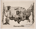 | Details | Perone, Frank T. | 1941 |
| WWII FDR Patriotic Pictorial Map Photo with Perrone MS signature |
|
Perone, Frank T. |
|
| 1941 |
| LOC:0 |
| $125.00 | Perone--Frank-T- | WWII-FDR-Patriotic-Pictorial-Map-Photo-with-Perrone-MS-signature | One-of-a-kind WWII FDR patriotic pictorial map of the United States with creator's manuscript dedication and MS signature of Frank T. Perone. A photographic copy from the original. No other copy of this map was found.
<br></br>
Similar to, but different from, a 10" x 14" colored version of Perone's map published by Allied Printing of Atlantic City titled "Remember Pearl Harbor" (of which no known examples were found in institutional collections). Probably an earlier concept design by Perone.
<br></br>
Includes several scenes and features found in the (presumed later) colored version including the association of freedom, defense, and recovery with the initials FDR.
<br></br>
Differs from the colored version as follows:
<div class="indenttextblocksingle">
<ul style="list-style-type: circle;">
<li>Our map is not set upon a flag background, rather the flags appear at the image sides.</li>
<li>Our map shows FDR as a much older man, not the youthful FDR found in the colored version.</li>
<li>Our map shows engines and a top gunners-turret on the airplane.</li>
<li>Perhaps most interesting is our map includes an image of a four-finned rocket in flight that is missing from the colored version.</li>
</ul>
</div>
Copyright May 1, 1941; K 4907, 47908. |
| 6638 |  | Details | G.M. Hopkins Co. | 1941 |
| Pictorial Map of the Southwest United States |
|
G.M. Hopkins Co. |
|
| 1941 |
| LOC:89 |
| $75.00 | G-M--Hopkins-Co- | Pictorial-Map-of-the-Southwest-United-States | A fine decorative pictorial map of the United States Southwest that plays to many of the stereotypes of the era for that region. One interesting feature near the center of Texas is a depiction of an airplane taking off from "West Point of The Air". West Point of The Air was the name of a 1935 American movie about pilot training at Randolph Field, about 15 miles northeast of San Antonio, Texas. Between October 1931 and March 1935, more than 2,000 candidates reported for pilot training at Randolph Field.
<br><br>
At upper right an inset "Transportation Map of the Picturesque Southwest. With legend showing routes used by aircraft, railroads, and automobile.
<br><br>
Anonymous author, but signed illegibly in the plate at bottom right.
<br><br>
Published in Picturesque Southwest by Picturesque Publications, November, 1941. |
| 6579 |  | Details | Deering, Roger L. | 1941 |
| Unrecorded pictorial map Portland Maine by Maine artist Roger Deering |
|
Deering, Roger L. |
|
| 1941 |
| LOC:3 |
| $575.00 | Deering--Roger-L- | Unrecorded-pictorial-map-Portland-Maine-by-Maine-artist-Roger-Deering | Unrecorded pictorial map of Portland, Maine copyrighted in 1941 by Maine artist Roger Deering.
<br><br>
Roger L. Deering (1904-1980) is best known for his paintings of Maine and is credited with creation of a series of small black and white prints for the Maine Bonding and Casualty Company of Portland, Maine.
<br><br>
Tri-fold brochure. Recto with text and black and white images explaining why the reader should "Make your headquarters in Portland". No reference found anywhere to "Playground Metropolis." |
| 5019 |  | Details | Canadian Pacific Railroad | 1941 |
| Map of Banff Lake Louise Columbia Icefield Highway Glaciers |
|
Canadian Pacific Railroad |
|
| 1941 |
| LOC:10 |
| $350.00 | Canadian-Pacific-Railroad | Map-of-Banff-Lake-Louise-Columbia-Icefield-Highway-Glaciers | Attractive and very scarce lithographed map of Banff, Lake Louise and the Columbia Icefield Highway with the Yoho Valley Emerald Lake Field, and Golden, Canada. Shows highways, glaciers, mountain ranges, trails, and the route of the Canadian Pacific Railway.
<br></br>
Map is on the recto of a folding six-part brochure with an inset elevation view of the "Altitudes of principal peaks from Golden to Banff in the Canadian Rockies." In that view the peaks with names underlined are on the South Side of the Canadian Pacific Railway main line from Banff to Golden.
<br></br>
Verso contains photographs, text and a map of the Columbia Icefield Highway (Sunwapta Pass to Lake Louise) and a cross section (elevation view) of the Canadian Rockies from the same Columbia Icefield Highway. Dated by reference to the Rumsey Collection. |
| 4853 |  | Details | Hampton Yacht Club | 1941 |
| Hampton Yacht Club Regatta Cyanotype Map |
|
Hampton Yacht Club |
|
| 1941 |
| LOC:13 |
| $250.00 | Hampton-Yacht-Club | Hampton-Yacht-Club-Regatta-Cyanotype-Map | Unusual self-published cyanotype (blueprint) course map of the Hampton Yacht Club 14th Annual Regatta July 5 and 6 at Hampton, Virginia, complete with a sketch of an undulating sea serpent (rarely found on a cyanotype) and another small cartoon at the Hampton Bar. The course chart shows the coast outline with the offshore one-fathom line and the beacons and buoys marking the course.
<br></br>
This pre-war cartographic artifact is sold with two included documents:
<div class="indenttextblocksingle">
<ul style="list-style-type: circle;">
<li>A printed summary of the Regatta's sailing event with notes on prizes, courses, starting signals, rules for resolving protests, and a schedule of sailing events. For a map of the course the summary states: "See chart no. 400 and blueprint copies of part of the same which will be available at the clubhouse."</li>
<li> A one-page type-written set of Racing Rules for Warwick One Design Dinghies.</li>
</ul>
</div>Top left corner "H.K.S. 7/3/41" |
| 5067 |  | Details | British Admiralty Hydrographical Office | 1941 |
| Large chart of eastern Singapore Strait |
|
British Admiralty Hydrographical Office |
|
| 1941 |
| LOC:59 |
| $950.00 | British-Admiralty-Hydrographical-Office | Large-chart-of-eastern-Singapore-Strait | Large, used nautical chart for the eastern portion of Singapore Strait with eastern Singapore Island. Last corrections in 1941 were made shortly before the invasion of Singapore by Japan in February 1942.
Manuscript ink lines with notation: "Keep south of this line."
<br></br>
Published at the Admiralty October 1, 1927 under the superintendence of Rear Admiral H.P. Douglas, Hydrographer. Chart number 3834. Engraved 1927. Verso is blank with file drawer label. |
| 6423 |  | Details | Suchy, Arthur Bartholomew | 1941 |
| Cayo Hueso or Key West Florida Second Edition |
|
Suchy, Arthur Bartholomew |
|
| 1941 |
| LOC:87 |
| $375.00 | Suchy--Arthur-Bartholomew | Cayo-Hueso--or-Key-West-Florida-Second-Edition | Stunning original second-edition pictorial birds-eye map of Cayo Hueso or Key West, Florida. Printed as designed in red ink. Designed, executed, produced and copyrighted by Arthur Suchy ca. 1941. Excellent detail on over 70 key locations that Suchy identifies alphabetically and numerically on a key that surrounds the view including:
<div class="indenttextblocksingle">
<ul style="list-style-type: circle;"></li>
<li>Cigar factories</li>
<li>P.A.A. Airport</li>
<li>Turtle crawls</li>
<li>Fish market</li>
<li>Warbler (helpful tug)</li>
<li>Pepe's coffee shop</li>
<li>Delmonico's</li>
<li>Key West radio station</li>
</ul>
</div>
Arthur Bartholomew Suchy (1901 - 1995) produced two editions of his famous map of Cayo Hueso- the first edition, larger and with full hand color was produced in a limited edition of 100 copies dated to 1940 and the second and smaller edition printed in red ink to 1941. [1] Includes numerous historical notes about Key West.
<br><br>
Suchy was issued a copyright for the collectors edition on Dec. 14, 1938. He filed a renewal application on Nov. 17, 1966.
<br><br>
[1] David Rumsey Map Collection at Stanford University Libraries |
| 1190 |  | Details | Davenport, Joseph B. | 1941 |
| Southern Districts of Vancouver Islands and Adjacent Gulf Islands |
|
Davenport, Joseph B. |
|
| 1941 |
| LOC:0 |
| $850.00 | Davenport--Joseph-B- | Southern-Districts-of-Vancouver-Islands-and-Adjacent-Gulf-Islands | Very large whiteprint or blue-line map of Southern Vancouver Island, British Columbia. First printed in 1932, this revised edition dates from 1941. Inset map of Saturna Island. Contains cadastral and road detail with a road index at center left. Laid to linen and on rollers; no folds.
<br></br>
Coverage includes Ladysmith, Duncan, Victoria, Sidney, portions of Juan de Fuca Strait, Strait of Georgia, Galiano Island, Mayne Island, North and South Pender Island, and numerous other islands and passages in that area.
<br></br>
Contains a red-stamped notation: "Pocket copies of this map may be obtained at the office--". Manuscript pencil course line and distances drawn from top of map near Kulleet Bay, through Stuart Channel and Haro Strait to Victoria Harbor.
<br></br>
Copyrighted in Canada 1932 by Joseph Davenport. Printed by the Island Blue Print and Map Company, Victoria, B.C. |
| 6597 |  | Details | McClelland S.W. Kincaid R.L. et al | 1941 |
| Cyanotype (blueprint) map of the Route of Jefferson Davis in Spring 1865 |
|
McClelland S.W. Kincaid R.L. et al |
|
| 1941 |
| LOC:3 |
| $200.00 | McClelland-S-W--Kincaid-R-L--et-al | Cyanotype-(blueprint)-map-of-the-Route-of-Jefferson-Davis-in-Spring-1865 | Unrecorded and interesting cyanotype map of the route of Confederate General Jefferson Davis as he fled south after the Civil War from Charlotte, North Carolina to the city of Irwinville, Georgia where he hoped to escape to a foreign country. The map shows key rivers crossed and locations where Jefferson Davis stopped along the route.
<br><br>
Creators were Dr. S.W. McClelland, Dr. R.L. Kincaid, Dr. J.M. Nicholson, and C.P. Williams in August. 1941. This blueprint map is yet another scarce example of how an early photographic reproduction technology allowed individuals to disseminate their own unique works, bypassing traditional publishing technologies and institutions. |
| 6742 |  | Details | Asahi Shimbun | 1942 |
| Japanese map of Singapore printed the day Britain capitulated |
|
Asahi Shimbun |
|
| 1942 |
| LOC:6 |
| $400.00 | Asahi-Shimbun | Japanese-map-of-Singapore-printed-the-day-Britain-capitulated | Interesting Japanese maps of the Malaysian Peninsula and Singapore, Malaysia printed on February 15, 1942 (Showa 17).
<br><br>
<div id="0" align="center">
<a title=""></a>
<img id="6742" src="/ZoomifyImages/SC_6742/SC_6742_detail.jpg" alt="Japanese map of Singapore published the day Britain capitulated to Japan in February, 1942." width="340"/> <br><br> <font size="-2">Japanese Map of Singapore. 1942. (6.5" x 4.5")</font>
</div><br>
Maps and text related to Malaysian history, terrain and climate, natural resources, population, and administration. Smaller map of Singapore contains information related to fortifications, broadcast towers, airfields, and oil storage facilities.
<br><br>
<div class="indenttextblocksingle">
Translation (partial): "In 1824 Singapore reached the southern coast of the island of Singapore, which the Englishman Raffles purchased from the King of Johor for $600,000. With a population of 600,000, it is the base of the British East Asian Fleet, along with Malacca in the Strait of Malacca and Jiyoji Town on Penang Island, and is the <b>cornerstone of world shipping that connects the Pacific Ocean and the Indian Ocean.</b>"
</div>
<br>
February 15, 1942, was a significant day during World War II as it marked the fall of Singapore to the Japanese forces. Singapore, then a British colony, was considered a crucial strategic stronghold in Southeast Asia. On that day, Japanese troops launched a major assault on Singapore, breaching the defensive lines and rapidly advancing. The British and Commonwealth forces, vastly outnumbered and lacking in supplies and reinforcements, were unable to hold back the Japanese onslaught.
<br><br>
Printed by Seiko Printing Co., Ltd. For Asahi Shimbun, Japan Publishing Culture Association Member Number 101503B. (1) |
| 6613 |  | Details | British Information Services | 1942 |
| Pictorial WWII era propaganda map Great Britain Natural and Industrial Resources |
|
British Information Services |
|
| 1942 |
| LOC:400 |
| $2,500.00 | British-Information-Services | Pictorial-WWII-era-propaganda-map-Great-Britain-Natural-and-Industrial-Resources | Large, lithographed poster-sized map: "Great Britain Her Natural & Industrial Resources" published circa 1942, during WWII, by British Information Services. On the verso a printed statement: "Printed in Great Britain." Scarce on the market and quite nicely executed.
<br><br>
At bottom right the attribution reads: "Distributed by British Information Services, an agency of the British Government, 30 Rockefeller Plaza, New York City." British Information Services was formed in 1941 as an office of the British Government with the goal to promote Britain's interests in the United States. Prior to December 1941 the United States had not formally entered into the war in Europe and this map poster was part of the propaganda Britain employed to sway U.S. opinion to its side. |
| 5385 |  | Details | British Information Services | 1942 |
| Fine pictorial WWII-era map of the British Commonwealth of Nations |
|
British Information Services |
|
| 1942 |
| LOC: |
| $300.00 | British-Information-Services | Fine-pictorial-WWII-era-map-of-the-British-Commonwealth-of-Nations | Fine pictorial world map showing the British Commonwealth of Nations. Issued during WWII by the British Information Services, an agency of the British Government. Mercator projection.
<br></br>
Includes two inset tables:<br>
1) "Forms of Government". This key uses color to signify the form of government administration and management of internal and external affairs. <br>
2) "Principal Products". A tabular representation by geographical area uses pictograms to represent the most valuable products produced in the Commonwealth.
<br></br>
Distributed by the British Information Services, an agency of the British Government, 30 Rockefeller Plaza, New York. Printed in England. |
| 6375 |  | Details | Owen, G. Frederick | 1942 |
| Foundational topographic birds eye view of Palestine |
|
Owen, G. Frederick |
|
| 1942 |
| LOC: |
| $1,200.00 | Owen--G--Frederick | Foundational-topographic-birds-eye-view-of-Palestine | Original, scarce <b>first-edition</b> foundational birds-eye view of Palestine from 1942 by author and Middle-East expert G. Frederick Owen (1897-1987). In 1942 a group of Zionists in the United States adopted a set of resolutions titled the <b>Biltmore Program</b>, calling for <b>open immigration to Palestine</b> and the establishment of <b>Palestine as a Jewish Commonwealth</b>. Owen's 1942 small-scale view of Palestine pre-dates by six years the independence of the Jewish state of Israel in 1948.
<br></br>
Owen's 1942 lithographed map of Palestine in Third Dimension was cited by UCLA's Gerry Hale as among 18 of the best Middle-East reference and wall maps available in the West (1972), and was the only map to focus on Palestine in Hale's list [1]. Owen's map was published in six editions (1942, 1942*, 1955, 1955, 1967 and 1981). In 1947 Owen designed and edited a similar but larger-scale bird-eye view "Jerusalem in Third Dimension." Relief is shown pictorially and by shading.
<br></br>
A deep dive into WorldCat confirms only <b>four institutional holdings</b> of the 1942 first edition: LOC, BYU, Amherst, Harvard.
<br></br>
Copyright 1942 by G. Frederic Owen. Published by Beacon Hill Press, Kansas City, Missouri.
<br></br>
Palestine in Third Dimension Designed and Edited by G. Frederick Owen Member of the Palestine Oriental Society and the American School of Oriental Research
<br></br>
Sources:
<br></br>
[1] Hale, Gerry A. International Journal of Middle East Studies, vol. 3, no. 4, Cambridge University Press, 1972, pp. 505–08, http://www.jstor.org/stable/162501. |
| 6516 |  | Details | Barnes, Myra Zimmerman | 1942 |
| Pictorial plan of New Orleans French Quarter of Vieux Carre |
|
Barnes, Myra Zimmerman |
|
| 1942 |
| LOC: |
| $375.00 | Barnes--Myra-Zimmerman | Pictorial-plan-of-New-Orleans-French-Quarter-of-Vieux-Carre | Very attractive lithographed pictorial map of the Vieux Carre (French Quarter) in New Orleans, Louisiana. Rolled with no folds. Barnes based the overall scope of her map and details on the walls surrounding the Vieux Carre on plans produced by surveyors Carlos Trudeau and Joseph Pilie from 1794 through 1808. Over this early framework Barnes has illustrated local architecture and history with elements of contemporary culture from the early 1940s .
<br><br>
The border is surrounded by vignettes of New Orleans and Louisiana history and culture as it existed in 1942 when Barnes created the map, as well as important key events such as two fires in 1788 and 1794 that destroyed many of the early wooden French structures in the city.
<div class="indenttextblocksingle">
<ul>
<li>The Southern Yacht Club</li>
<li>The Fairgrounds</li>
<li>The Bonnet Carre Spillway</li>
<li>Cutting sugar cane</li>
<li>Suicide Oak</li>
</ul>
</div> |
| 6547 |  | Details | Gist, Gilman Jr. | 1943 |
| A Soldier's Guide to Palo Alto Pictorial WWII Era Map |
|
Gist, Gilman Jr. |
|
| 1943 |
| LOC:300 |
| $1,250.00 | Gist--Gilman-Jr- | A-Soldier-s-Guide-to-Palo-Alto-Pictorial-WWII-Era-Map | <br><br>
<div class="indenttextblocksingle">
"This cartoon guide makes it as easy as "Squads Right" to find that <b>place</b> you're looking for and right here within reach of all. If you want to splurge or just "gold-brick" away an evening this will show you just what you want and how to get there."
</div>
<br><br>
Rare pictorial map of Palo Alto, California by Gilman A. Gist Jr. (d. 1960) published in a 1943 issue of the Stanford Chaparral. The Stanford Chaparral or <i>Chappie</i> is a humor magazine published by students of Stanford University since 1899, the third oldest continually published humor magazine in the world.
<br><br>
Inset maps of Menlo Park, El Camino Real, and a stretch of Bayshore Highway. Includes light-hearted images of area restaurants, clubs, theaters and other businesses that a WWII G.I. might want to visit while on leave, as well as transportation. These fine establishments include:
<div class="indenttextblocksingle">
<ul style="list-style-type: circle;"></li>
<li>Bill and Walt Collins Club</li>
<li>Fat Boy Barbecue</li>
<li>O'Neil's Stanford Bowl</li>
<li>Dinah's Shack - real suthen chicken!</li>
<li>Varsity Theater</li>
<li>Stanford Theater</li>
<li>Clarence's Smoke Shop</li>
<li>Grab-a-bite</li>
</ul>
</div> |
| 5027 |  | Details | Wholesale Radio Laboratories | 1943 |
| Radio Reference Map of the United States |
|
Wholesale Radio Laboratories |
|
| 1943 |
| LOC:11111 |
| $400.00 | Wholesale-Radio-Laboratories | Radio-Reference-Map-of-the-United-States | Interesting, large WWII-era (1943) map of monitoring stations and the territory of the nine radio call-sign zones that existed in the United States during that time. At bottom, the map is filled with four inset maps of the USA showing locations of broadcast stations for the chief networks of the period: The Blue Network, Mutual Broadcasting System, Columbia Broadcasting System (CBS), and National Broadcasting Company (NBC). Includes tables of radio-related data: List of Standard (AM) Broadcast Stations, World Leading Shortwave Stations, and Experimental Frequency Modulation (FM) Stations.
<br><br>
Published for Wholesale Radio Laboratories, by Omaha native Leo Meyerson (d. 2011) during WWII. Meyerson founded Wholesale Radio Laboratories in Council Bluffs, Iowa in 1935, later renamed 'World Radio Labs' after WWII, 'WRL Manufacturing' in 1953 and to 'Globe Electronics' in 1958 The company became one of the world's largest manufacturers and distributors of amateur radio equipment.
<br><br>
During WWII all amateur radio stations were forbidden to transmit, although shortwave listening was still permitted. After the war amateur radio broadcasts were permitted by the government. This probably explains why a slightly older post-war edition of this map from 1947, in the Rumsey Map Collection prominently features a photograph of Myerson in his very impressive radio 'shack' where the earlier edition does not.
<br><br>
Another interesting difference between the two editions is that here Meyerson's amateur call sign, or unique identifier, is W9GFQ, where in Rumsey's 1947 edition his call sign is W0GFQ. The system of amateur radio call districts in the United States originally started with nine districts. This changed to ten districts in 1947. The 10th call district, '0', was added to accommodate the increasing number of amateur radio operators in the Midwest, especially in the Chicago area. |
| 5368 |  | Details | Money, Anton | 1943 |
| Rare cyanotype pictorial map Whitehorse, Yukon Territory, Canada |
|
Money, Anton |
|
| 1943 |
| LOC:55 |
| $1,250.00 | Money--Anton | Rare-cyanotype-pictorial-map-Whitehorse--Yukon-Territory--Canada | Very rare satirical, cyanotype pictorial view of the town of Whitehorse in the Yukon Territory of Canada dated within to October, 1943. A folk-art style humorous blueprint, bird's eye view of the city of Whitehorse by engineer Anton Money.
<br></br>
The view includes numerous annotated humorous scenes of daily life in Whitehorse including a Mountie dog-sled team, gold panning, gambling, drinking, whoring, the White Pass and Yukon Route narrow gauge railway and the Whitehorse railway station.
<br></br>
By explorer Anton Money with acknowledgements to Louis McCormick and Don Reikard.
<br></br>
No recorded sales or holdings of this view except for one copy at the library of the University of Calgary in Canada. |
| 5357 |  | Details | Grimes, George | 1944 |
| Pictorial map of Lowry Field Denver Colorado |
|
Grimes, George |
|
| 1944 |
| LOC:77 |
| $275.00 | Grimes--George | Pictorial-map-of-Lowry-Field-Denver-Colorado | A very scarce pictorial map of Lowry Field, at the eastern edge of Denver, Colorado, from the first issue of the Lowry Field Information Handbook [1] in November, 1944. Lowry field was activated in February, 1938 as the site of the Army Air Forces Training Command [2]. From the 1980’s, Lowry Air Force Base was one of Colorado’s largest employers. Lowry AFB employed nearly 10,000 military and civilian men and women, providing an economic impact annually approaching $1 billion [3].
<br></br>
<div class="indenttextblocksingle">
[1] Earliest publication was November, 1944 with a later edition of February, 1945. On the later map a telephone icon is added and locations of the telephone shelter house and telephone lounges are colored orange.<br>
[2] Information Handbook Lowry Field (AAF Training Command). Mountain States Telephone and Telegraph Company. Denver. 1944. Online.<br>
[3] https://wingsmuseum.org/about/history/. Online
</div> |
| 6793 |  | Details | Nelson, Catherine and E. Theodore | 1944 |
| Pictorial, historical, advertising map of the Village of Flatlands in 1870 |
|
Nelson, Catherine and E. Theodore |
|
| 1944 |
| LOC:89 |
| $275.00 | Nelson--Catherine-and-E--Theodore | Pictorial--historical--advertising-map-of-the-Village-of-Flatlands-in-1870 | Fine historical pictorial promotional map of The Village of Flatlands, as it was in 1870 - compiled from "old and musty maps, records and surveys" by Catherine & Theodore Nelson. The map was commissioned, copyrighted, and published in 1944 by George L. Clark, Inc., "A complete real estate institution", 142 Avenue "U" Brooklyn, N.Y.
<br><br>
Rare. Only two copies recorded in WorldCat.
<br><br>
This historical map of Flatlands encompasses the area of Canarsie, extending eastward from Ocean Avenue to Fresh Creek and northward from Jamaica Bay to Hunters Fly Road. The map provides a detailed representation of the region, showcasing the names of various property owners, as well as the locations of important landmarks such as dams, hotels, schools, shops, public buildings, cemeteries, and churches. Additionally, the map also features the route of the Brooklyn and Rockaway Branch Railroad, which played a significant role in the development and connectivity of the area.
<br><br>
George L. Clark, Inc., formerly Clark Realty Co., is a family real estate firm founded in 1870 that spans five generations of Clarks. John J. Clark began the family business on Long Island in 1870. His son, Patrick L. Clark, relocated the business to Brooklyn in 1907. George L. Clark Sr. joined the family business in 1919 and served the Brooklyn community as a Realtor for 67 years. Clark was active on many New York real estate organizations and was President of the Brooklyn Board of Realtors, the Bay Ridge Real Estate Board and the Flatbush Real Estate Board.
<br><br> |
| 6795 |  | Details | Delkin, James Ladd | 1944 |
| WWII-era Map of San Francisco, California |
|
Delkin, James Ladd |
|
| 1944 |
| LOC:89 |
| $195.00 | Delkin--James-Ladd | WWII-era-Map-of-San-Francisco--California | Original WWII-era street map of San Francisco, California with sketches of local life including a cable car, a machine-gun emplacement near the Golden Gate Bridge, and a sailor carrying a duffel bag. War housing projects scattered across the city are outlined in red. The map was originally attached within a small brochure published ca. 1944 by James Ladd Delkin: "All About San Francisco, Illustrated Map and Guide."
<br><br>
Verso with a map of Golden Gate Park and Panhandle by the San Francisco Board of Park Commissioners Division of Engineering and Landscape Design.
<br><br>
During World War II, San Francisco experienced significant changes in its housing landscape to accommodate the needs of the military. The city experienced a surge in population due to the influx of military personnel and defense workers, leading to a severe housing shortage. To address the housing shortage, the federal government, in collaboration with local authorities, initiated several public war housing projects. Projects highlighted in red on this map include:
<div class="indenttextblocksingle">
<ul style="list-style-type: circle;">
<li>Hunters Point Annex: The Hunters Point Annex, located in the southeastern part of San Francisco near the Hunters Point Naval Shipyard, was a housing development constructed for defense workers. It provided temporary housing during the war years.</li>
<li>Sunnydale Housing Development: Situated in the Visitacion Valley neighborhood of San Francisco.</li>
<li>Potrero Terrace and Annex: Built in the Potrero Hill neighborhood of San Francisco. </li>
<li>Oakdale</li>
<li>Candlestick Cove</li>
</ul>
</div> |
| 6622 |  | Details | Sundberg, Edwin L. | 1944 |
| Thematic Map of the World's population WWII era |
|
Sundberg, Edwin L. |
|
| 1944 |
| LOC:300 |
| $125.00 | Sundberg--Edwin-L- | Thematic-Map-of-the-World-s-population-WWII-era | WWII-era thematic Coloroto (1) or color rotogravure map by Edwin Sundberg presenting statistics on the relative population density of the world's nations in 1944.
<br><br>
(1) Coloroto is a trade name for a rotogravure used to print multiple colors. According to Google a rotogravure printing system uses a rotary press with <b>intaglio cylinders</b>, typically running at high speed and used for long print runs of magazines and stamps. (Google Oxford languages dictionary. Online).
<br><br> |
| 4870 |  | Details | U.S. Navy Office of Naval Research | 1944 |
| WWII three-dimensional weather map training simulator. |
|
U.S. Navy Office of Naval Research |
|
| 1944 |
| LOC:0 |
| $300.00 | U-S--Navy-Office-of-Naval-Research | WWII-three-dimensional-weather-map-training-simulator- | From the U.S. Navy Office of Naval Research Special Devices Center, a set of three, three-dimensional pilot training weather simulators (Device 12-K-2a) produced during WWII. This device is noteworthy for its connection to Rear Admiral Luis de Florez (1889-1962) who established the Special Devices Desk at the U.S. Navy during WWII.
<br></br>
De Florez, an MIT graduate, was inducted into the Hall of Fame by the National Center for Simulation in 2014.
<div class="indenttextblocksingle">
"As both an active duty and a retired U.S. Navy Admiral, de Florez was influential in the development of early flight simulators, and was a pioneer in the use of virtual reality to simulate flight and combat situations in World War II."
<br></br>
"In 1941 ... Commander de Florez became head of the new Special Devices Desk in the Engineering Division of the Navy’s Bureau of Aeronautics. De Florez championed the use of synthetic training devices and urged the Navy to undertake development of such devices to increase readiness."
<br></br>
During World War II, he was subsequently promoted to captain and then to Flag rank, becoming a rear admiral in 1944.In 1944, de Florez was awarded the Robert J. Collier Trophy for 1943 for his work in training combat pilots and flight crews through the development of inexpensive synthetic devices. (https://www.simulationinformation.com/hall-of-fame/members/luis-de-florez)
</div>
<BR />
Set of 3 folding weather map models on heavy card stock that present a three-dimensional view of typical cyclonic storms:
<div class="indenttextblocksingle">
<ul style="list-style-type: circle;">
<li>Map 1. Early Stage of Development</li>
<li>Map 2. Cold-Front type occlusion</li>
<li>Map 3. Warm front type occlusion</li>
</ul></div>
Each model depicts a single storm through a series of eight slices or sections representing storm development across a front of 800 miles and a depth of 1000 miles at a single point in time. |
| 6765 |  | Details | St. Johns County Florida Chamber of Commerce | 1945 |
| St. Johns County blueprint style pictorial map |
|
St. Johns County Florida Chamber of Commerce |
|
| 1945 |
| LOC:89 |
| $220.00 | St--Johns-County-Florida-Chamber-of-Commerce | St--Johns-County-blueprint-style-pictorial-map | Scarce ephemera. Interesting blueprint style pictorial map of St. John's County on the east coast of Florida. Drawn by Sam Hubbard. Issued by the St. John's County Chamber of Commerce ca. 1945. A broadside, on a larger sheet with printing on both sides 23" x 14". Contains a cute compass rose incorporating a fishing rod into the graphic.
<br><br>
<div id="6765" align="center">
<a title=""></a>
<img id="6765" src="/ZoomifyImages/SC_6765/SC_6765_400x300.jpg" alt=blueprint style pictorial map of St. John's County, Florida ca, 1965." width="300"/> <br><br> <font size="-2">Broadside with map of St. John's County, Florida.</font>
</div><br> |
| 6661 | 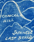 | Details | Henshell, J. | 1945 |
| Cyanotype pictorial map of Okinawa, Japan post WWII |
|
Henshell, J. |
|
| 1945 |
| LOC:86 |
| $350.00 | Henshell--J- | Cyanotype-pictorial-map-of-Okinawa--Japan-post-WWII | This is an original, rare cyanotype blueprint map, self published by J. Henshell, likely a soldier stationed on Okinawa, Japan. It depicts a birds-eye view of the Island of Okinawa, Japan and is dated November 1945, just three months after the surrender of Japan, or V-J Day (1). Henshell's design showcases his appreciation for local Okinawan art and culture, depicting shrines, temples, and tombs in a local artistic style. Local airfields and airbases are shown in rectangular boxes (e.g. Kadena, Futema, Yontan). After a Japanese Imperial Land Survey conducted in 1931.
<br><br>
The design also highlights the hills that played a significant role in the Battle of Okinawa. The island's rugged terrain made them difficult to attack. American forces faced fierce resistance from entrenched Japanese defenders during the battle. Henshell labels three of these key locations: Sugar Loaf Hill, the Conical Hill (Mount Yaedake), and the Japanese Last Stand.
<br><br>
Sugar Loaf Hill was a heavily fortified Japanese defensive position that played a significant role in the Battle of Okinawa. Today, it is a peaceful park and memorial site called the Okinawa Peace Memorial Park. The transformation of Sugar Loaf Hill from battlefield to symbol of peace is a testament to the strength of the people of Okinawa.
<br><br>
Mount Yaedake, also known as Conical Hill, was a key location in the Battle of Okinawa during World War II, as it was heavily fortified by Japanese defenders and provided a natural defensive position. Today, Mount Yaedake is a popular tourist destination, known for its stunning views of the surrounding area.
<br><br>
<div class="indenttextblock">
(1) Nakagusuku Bay, located on the eastern coast of Okinawa, was renamed Buckner Bay in honor of Lieutenant General Simon Bolivar Buckner Jr., who served as commanding General US Army's 10th Army Division during the Battle of Okinawa. Buckner was the highest-ranking US officer to be killed during the battle.
</div> |
| 5498 | 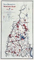 | Details | New Hampshire State Planning and Development Comm | 1945 |
| Ski Map or Poster for New Hampshire State |
|
New Hampshire State Planning and Development Comm |
|
| 1945 |
| LOC:150 |
| $275.00 | New-Hampshire-State-Planning-and-Development-Comm | Ski-Map-or-Poster-for-New-Hampshire-State | Decorative lithographed skiing map / poster of the State of New Hampshire published by the New Hampshire State Planning and Development Commission in 1945.
<br></br>
This medium-sized thematic pictorial poster of New Hampshire uses an unusual two-part icon design to signify locations in New Hampshire for skiing, snowmobiling (skimobile) and ice skating for these regions:
<div class="indenttextblocksingle">
<ul style="list-style-type: circle;">
<li>Monadnock Region</li>
<li>White Mountains Region</li>
<li>Dartmouth, Lake Sunapee Region</li>
<li>Lakes Region</li>
<li>Merrimack Region</li>
<li>Seacoast Region</li>
</ul>
</div>
The poster shows numerous, mostly small ski-areas, many no longer in operation including:<a href="http://www.nelsap.org/nh/epping.html" target="_blank">Epping Tow</a>, <a href="http://www.allroutes.to/berlin/skijump/" target="_blank">Nansen Ski Jump (Berlin, N.H.)</a>, and <a href="http://www.nelsap.org/nh/drummer.html" target="_blank">Drumalock Hill / Drummer Hill Tow (Keene, N.H.</a> and many more [1].
</br>
Recto contains text and statistics describing ski locations across the State of New Hampshire, organized alphabetically by town within region.
<br></br>
[1] New Hampshire's lost ski areas. Online. http://www.nelsap.org/nh/nh.html
<br></br>
[ NH ] |
| 5200 | 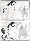 | Details | Army Bureau of Current Affairs | 1945 |
| Wartime pictorial maps one week after A-bombs on Japan |
|
Army Bureau of Current Affairs |
|
| 1945 |
| LOC:62 |
| $475.00 | Army-Bureau-of-Current-Affairs | Wartime-pictorial-maps-one-week-after-A-bombs-on-Japan | Large wartime pictorial poster issued less than one week after the United States used nuclear weapons on Hiroshima and Nagasaki, Japan. This issue, with a heavy emphasis on use of maps to communicate the progress of the war, was the first such to be issued by the [British] Army Bureau of Current Affairs (ABCA) after the United States dropped atomic bombs on Hiroshima and Nagasaki on August 6 and 9 respectively. The issue was published 3 days before Emperor Hirohito announced the total Japanese surrender on national radio.
<br></br>
The maps reflect the importance of the A-bomb to Allied war efforts and the hastiness with which this publication was revised before publication. No photographs or illustrations are present that show the mushroom cloud or the aftermath of the attacks. The verso contains text that does not reflect the news about the bomb: " … the counter invasion of this island empire [East Indies] has begun."
<br></br>
Printed on both sides:
<div class="indenttextblocksingle">
<ul style="list-style-type: circle;">
<li><b>Recto:</b> Headings include "The close of 14 years of Jap aggression" with six inset pictorial maps charting Japanese aggression from 1933 to 1945. Japan's early successes and later defeat are reflected in the image of a sword-bearing Japanese soldier who grows fat with success and then thin with defeat. Also, photographs of the British Cabinet and news from the Potsdam conference.</li>
<li><b>Verso:</b> "Riches of the Southern Seas". Large black and white pictorial map focused on the strategic value of key commodities in the Netherlands East Indies. Map contains pictograms for oil, rubber, rice, tin, and vegetable oils. </li>
</ul>
</div>
ABCA MAP Review No. 72 From July 30th to August 12th, 1945. Drawn and issued by the Army Bureau of Current Affairs. Printed for H.M. Stationery Office by Fosh & Cross Ltd., [1945]
<br></br>
No copies of this issue found online. Scarce. |
| 4814 |  | Details | Bell, Euphemia Young | 1945 |
| Map of The Bermuda Islands alias Somers Islands |
|
Bell, Euphemia Young |
|
| 1945 |
| LOC:0 |
| $120.00 | Bell--Euphemia-Young | Map-of-The-Bermuda-Islands-alias-Somers-Islands | Colorful and very attractive map of Bermuda: "Map of The Bermuda Islands alias Somers Islands". The map was created by Euphemia Young Bell and published by 'Beautiful Bermuda' Publishing Co. as the front of a single-sheet brochure with numerous local Bermuda advertisements populating the verso. Publication of the book coincides with the end of World War II which marked the beginning of steady, sustained economic prosperity for Bermuda.
<br></br>
Folding map (8" x 6" folded) was copyrighted by Frank R. Bell in 1945 and sold with a cover as "The Standard Road and Railroad Map of the Beautiful Bermuda Islands." Inset maps of the City of Hamilton, and the Town of St. George. Large index of Places and Points of Interest including these categories:
<div class="indenttextblock">
<ul style="list-style-type: circle;">
<li>Airports</li>
<li>American Consulate General</li>
<li>Banks</li>
<li>Bicycle Garages</li>
<li>Churches</li>
<li>Ferry Landings</li>
<li>Golf Links</li>
<li>Government Offices</li>
<li>Guest Houses</li>
<li>Hospital</li>
<li>Hotels</li>
<li>Lodges and Clubs</li>
<li>Motor Fuel</li>
<li>Newspaper Offices</li>
<li>Public Utilities</li>
<li>Restaurants, etc.</li>
<li>Sightseeing</li>
<li>Theaters</li>
<li>Transportation Offices</li>
<li>Visitor's Information</li>
<li>Railway Stations</li>
</ul>
</div></div>
Lithographed by Hagstrom Company, Inc. N.Y. Map Makers. Seller's ink stamp on the cover. |
| 6565 | 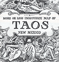 | Details | Lockwood, Ward | 1945 |
| Scarce pictorial map of Taos New Mexico by Ward Lockwood |
|
Lockwood, Ward |
|
| 1945 |
| LOC:89 |
| $325.00 | Lockwood--Ward | Scarce-pictorial-map-of-Taos-New-Mexico-by-Ward-Lockwood | Scarce mid-century pictorial map of Taos New Mexico by Ward Lockwood. This fine, humorous map of Taos comprises three panels in a folding brochure issued by the Taos Chamber of Commerce circa 1945.
<br></br>
<div class="indenttextblock">
<img src="/ZoomifyImages/SC_6565/SC_6565_Title.jpg" alt="Pictorial map of Taos New Mexico by Ward Lockwood, 1945" width="300" align="left" style="margin: 0px 20px">
</div>
<br></br>
Taos artist Ward Lockwood (1894-1963) attended the University of Kansas. Based in Taos (NM), Lockwood taught at the University of Texas (1938-49) and UC Berkeley (1949-61). |
| 6520 |  | Details | MIT | 1946 |
| Campus map and handbook Massachusetts Institute of Technology |
|
MIT |
|
| 1946 |
| LOC:300 |
| $150.00 | MIT | Campus-map-and-handbook-Massachusetts-Institute-of-Technology | MIT campus map and handbook Massachusetts Institute of Technology. June, 1946. |
| 5201 |  | Details | Barnes, Carroll | 1946 |
| Mt. Rainier National Park Willy Nilly Map |
|
Barnes, Carroll |
|
| 1946 |
| LOC:88 |
| $175.00 | Barnes--Carroll | Mt--Rainier-National-Park-Willy-Nilly-Map | Pictorial mailer map of Mt. Rainier National Park from 1946, a Willy Nilly Map by C. Barnes, Cartographer. Locations on the map include Paradise Valley, Narada Falls, Longmire Springs, Yakima Park, Ohanapecosh and many more. Barnes also produced Willy Nilly mailer maps for Sequoia, Yosemite, and Yellowstone National Parks.
<br></br>
Sixty locations are listed in an index on the verso with numbers that correspond to locations on the map. Verso also with room for a mailing address and a stamp, which along with a closeable tab, turn the map into a large mailer.
<br></br>
Originally from North Carolina, Carroll Barnes (1906-1997) made his home in Three Rivers, California.
Barnes studied at Washington DC's Corcoran School of Art, and with Carl Milles in the Cranbrook Academy of Art in Bloomfield Hills, Michigan 'Barnes embarked on a 16 ½-foot-tall version of Paul Bunyan, a project which, interrupted by service in the Army, preoccupied him for seven years. Carved from a 2,000-year-old Sequoia tree, (over the actual time of 18 months) the mammoth statue gained distinction as the world’s largest wood carving and earned Barnes a legendary status among sculptors.' (Source Online: https://cranbrookartmuseum.org/artwork/carroll-barnes/) |
| 6620 |  | Details | Sundberg, Edwin L. | 1946 |
| Colorful Scarce Coloroto Map Arab League Nations Middle East |
|
Sundberg, Edwin L. |
|
| 1946 |
| LOC:300 |
| $250.00 | Sundberg--Edwin-L- | Colorful-Scarce-Coloroto-Map-Arab-League-Nations-Middle-East | Colorful "Coloroto" rotogravure (1) map of the Middle East post WWII highlighting the Arab League member nations and prospective nations. Shows the seven nations that comprised the Arab League in July, 1946: Saudi Arabia, Egypt, Syria, Palestine, Iraq, Yemen, and Lebanon.
<br><br>
Formed March, 1945, the Arab League's purpose was "… draw closer the relations between member states and co-ordinate collaboration between them, to safeguard their independence and sovereignty, and to consider in a general way the affairs and interests of the Arab countries". (1)
<br><br>
(1) Coloroto is a trade name for a rotogravure used to print multiple colors. According to Google a rotogravure printing system uses a rotary press with <b>intaglio cylinders</b>, typically running at high speed and used for long print runs of magazines and stamps. (Google Oxford languages dictionary. Online).
<br>
<br>
(2) Pact of the League of Arab States, 22 March 1945. The Avalon Project. Yale Law School. 1998.
<br><br> |
| 6621 |  | Details | Sundberg, Edwin L. | 1946 |
| India Britains Problem Child Pictorial Coloroto map |
|
Sundberg, Edwin L. |
|
| 1946 |
| LOC:300 |
| $250.00 | Sundberg--Edwin-L- | India-Britains-Problem-Child-Pictorial-Coloroto-map | Post-WWII pictorial Coloroto (1) or color rotogravure map with India referred to a "Britain's Problem Child", reflecting Britain's colonial presence in India in July, 1946. A legend lists numerous exported products with icons for each including jute, coconut, manganese, copper, linseed, and rubber. Inset map at left shows trade routes from Britain to India via the Suez Canal with British colonies colored in red. Inset pictorial bar chart at right shows the comparative population for each religion in India.
<br><br>
(1) Coloroto is a trade name for a rotogravure used to print multiple colors. According to Google a rotogravure printing system uses a rotary press with <b>intaglio cylinders</b>, typically running at high speed and used for long print runs of magazines and stamps. (Google Oxford languages dictionary. Online).
<br><br> |
| 6497 |  | Details | Skacel, Bill | 1946 |
| Pictorial Cartoon map of Wyoming |
|
Skacel, Bill |
|
| 1946 |
| LOC:90 |
| $250.00 | Skacel--Bill | Pictorial-Cartoon-map-of-Wyoming | Original, uncommon pictorial map of the State of Wyoming by artist Bill Skacel. The humorous, historical "Cartoon Map of Wyoming" was produced ca. 1946 as a folded nine-panel tourist-oriented mailer with the verso containing space for an address as well as facts and photos of the state of Wyoming.
<br><br>
Geographic coverage includes the towns of Jackson Hole, Cheyenne, Laramie, Kemmerer, Casper, and Cody as well as Yellowstone National Park.
<br><br>
Skacel's illustrations include moose, a horned dinosaur, Buffalo Bill, two devils, and a native-American maiden with teepee.
<br><br>
Copyright by E.C. Kropp Co. Milwaukee, Wis. C.M. 27. |
| 6507 |  | Details | Skacel, Bill | 1946 |
| Pictorial Cartoon map of Vieux Carre New Orleans by Bill Skacel |
|
Skacel, Bill |
|
| 1946 |
| LOC:90 |
| $400.00 | Skacel--Bill | Pictorial-Cartoon-map-of-Vieux-Carre-New-Orleans-by-Bill-Skacel | Original, scarce pictorial map of the Vieux Carre or French Quarter in New Orleans, Louisiana by artist Bill Skacel ca. 1946. The humorous, historical "Cartoon Map of Vieux Carre in New Orleans" was produced ca. 1946 as a folded nine-panel tourist-oriented mailer with the verso containing space for an address as well as facts and photos of the New Orleans Vieux Carre.
<br><br>
Skacel takes a humorous angle at depicting Vieux Carre locations and culture in the post-WWII era. Two cartoon are puzzling- 1) four images of a young girl with pigtails wearing a sweatshirt bearing the letter "K" , that could possibly, represent a Catholic girl's school student or someone close to Skacel, and 2) at bottom right a matron crocheting a rug? with steel wire.
These cartoons include locations of:
<div class="indenttextblocksingle">
<ul style="list-style-type: circle;"></li>
<li>The Absinthe House, now the Old Absinthe House</li>
<li>Pirates Alley</li>
<li>Tabarry (Tabary) Theater</li>
<li>Napoleon House</li>
<li>A pelican</li>
<li>Blacksmith shop of Jean Lafitte</li>
<li>Cabildo prison</li>
</ul>
</div> |
| 6526 |  | Details | Skacel, Bill | 1946 |
| Pictorial Cartoon map of Florida Bill Skacel |
|
Skacel, Bill |
|
| 1946 |
| LOC:300 |
| $200.00 | Skacel--Bill | Pictorial-Cartoon-map-of-Florida-Bill-Skacel | Original, scarce pictorial map of the State of Florida by artist Bill Skacel ca. 1946. The humorous, historical cartoon map of Florida was produced ca. 1946 as a folded nine-panel tourist-oriented mailer with the verso containing space for an address as well as facts and photos of Florida
<br><br> |
| 5324 |  | Details | Anonymous | 1947 |
| Birdseye view of Johnston Island Atoll Pacific Ocean |
|
Anonymous |
|
| 1947 |
| LOC:300 |
| $295.00 | Anonymous | Birdseye-view-of-Johnston-Island-Atoll-Pacific-Ocean | One of a kind humorous birdseye view of the U. S. base at Johnston Island (also Johnston Atoll) in the Pacific Ocean. The author was clearly a member of the U. S. Armed Forces, probably Navy ("X.O.","yeomen", "chief"), who created this view as a memento or souvenir for others. Focus is one the off-hour entertainment and leisure activities on the island: Johnston Island Little Theater, Officer's Club, Ear Banger's Bar and Grill, J.I. Distillery, fishing, hobby shop, etc.
<br></br>
The date of this item is unclear but probably from the years immediately after WWII. Shows the troops engaged in construction activities. Quonset huts, four-engine propeller driven aircraft, and an airstrip apparently not paved and requiring watering to reduce the dust. No trace of heavy armament, or mention of the enemy, which would surely have been a major concern in the middle of the Pacific Ocean. The Navy operated Johnston Island from 1934 to 1948 when the Air Force took over. The site was used for high-altitude nuclear tests in the 1950s and 1960s.
<br></br>
Reproduced with a diazo process. |
| 6702 |  | Details | Mathis, George | 1947 |
| Scarce pictorial map of the Feather River Basin |
|
Mathis, George |
|
| 1947 |
| LOC:87 |
| $325.00 | Mathis--George | Scarce-pictorial-map-of-the-Feather-River-Basin | A boomer-era 'cartogravure' of the Feather River Basin by George Mathis on the verso of a folding brochure for Gray Eagle Lodge in Blairsden, Plumas County, California. Dated within at 1955 in a hand-stamp on the recto. Coverage includes the Feather River, Long Lake, Gold Lake, Mud Lake, Smith Lake, Mt. Elwell, Frazier Falls, Mohawk Creek, Mills Peak and more.
<br><br>
The Feather River is a major river in Northern California, USA, with a length of about 71 miles. It is a tributary of the Sacramento River and is known for its scenic beauty, recreational opportunities, and historic significance.
<br><br>
During the California Gold Rush of the mid-19th century, the Feather River became an important source of gold. Miners used hydraulic mining techniques to extract gold from the riverbed, which caused significant environmental damage and siltation of the river. The discovery of gold in the Feather River contributed to the growth of several nearby towns, including Oroville and Marysville.
<br><br>
In the early 20th century, the Feather River became a focal point of water development projects aimed at supplying water to the growing population and agricultural needs of California. The Oroville Dam, completed in 1968, is the tallest dam in the United States and forms Lake Oroville, a major reservoir that stores water from the Feather River. |
| 4971 |  | Details | Withers, James Harlan | 1947 |
| Humorous map of Texas from a Texan perspective |
|
Withers, James Harlan |
|
| 1947 |
| LOC:63 |
| $700.00 | Withers--James-Harlan | Humorous-map-of-Texas-from-a-Texan-perspective | Scarce original blue-line, politically incorrect, map of the state of Texas from the 'humorously' distorted perspective of a Texan looking outward at the rest of the country. Believed to be the earliest recorded version of later similar 'humorous' maps of Texas inspired by Wither's design. Only one holding is found online, at the University of Texas, Arlington, where it is described:
<div class="indenttextblocksingle">
Map shows distortion of boundaries of the state of Texas in comparison to its U.S. neighbors with humorous bragging and derogatory relabeling. Relief shown by hachures. (Source: https://texashistory.unt.edu/ark:/67531/metapth252139/)
</div>
<br></br>
The Catalog of Copyright Entries for 1947 records a copyright for "A Texan's Map of U.S.A.", held by James Harlan Withers of San Angelo , Texas. Predates by two years the derivative but substantially different "A Texan's Map of the United States" by Frank Oliver published in 1949 for TexOak flooring.
<br></br>
The blue-line, or diazo process is a chemical method of document reproduction that fell out of use in the early 2000's. |
| 6863 | 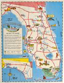 | Details | Requa | 1947 |
| Very Rare Attractions Map of Florida |
|
Requa |
|
| 1947 |
| LOC: |
| $200.00 | Requa | Very-Rare-Attractions-Map-of-Florida | Fine lithographed pictorial map of Florida highlighting its numerous attractions and State Parks. Seems to be very scarce and generally unavailable.
<br><br>
Several of the attractions on the map have either been sold to developers, renamed, or closed. These include:
<div class="indenttextblocksingle">
<ul style="list-style-type: circle;">
<li>McKee's Jungle Gardens</li>
<li>Turner's Sunken Gardens</li>
<li>Ringling Art Museum</li>
<li>Marineland</li>
<li>Ravine Gardens</li>
<li>Oriental Gardens (closed in 1954)</li>
<li>Dupree Gardens</li>
<li>Everglades Reptile Gardens (now Everglades Wonder Gardens)</li>
</ul>
</div>
Lithographed and published by Macdonald Publishers of Tampa, Florida in 1947 two years before the establishment of the Florida Attractions Association (1949). |
| 6735 | 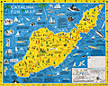 | Details | Ramsey, George | 1947 |
| Scarce pictorial fun map of Santa Catalina Island |
|
Ramsey, George |
|
| 1947 |
| LOC:89 |
| $295.00 | Ramsey--George | Scarce-pictorial-fun-map-of-Santa-Catalina-Island | <br><div class="indenttextblocksingle"><b>For a lasting remembrance of a grand vacation!</b> Keep this souvenir fun-map and mark the points you visit and the dates. Trace the routes of your travels on Catalina. Send copies to friends</div>
<br><br>
Where to go - What to see Santa Catalina Island fun map. A post-WWII pictorial map of Catalina Island, California. Copyright by George Ramsey. Published 1947 by Recreation Publishing Company, Los Angeles, CA. Price when issued 25 cents. Features include: Location of Ling-Ho Chinese junk movie set; Seal Rocks; submarine gardens; Chicago Cubs Ball Park and training grounds; the Catalina Visitors Country Club and much more.
<br><br>
Verso with map for Avalon Town |
| 5399 |  | Details | Michaels, Lawrence | 1947 |
| Map of the Halifax River Port Orange Florida Dave's Dock |
|
Michaels, Lawrence |
|
| 1947 |
| LOC:11 |
| $195.00 | Michaels--Lawrence | Map-of-the-Halifax-River-Port-Orange-Florida-Dave-s-Dock | Rare map of the Halifax River area near Port Orange, Florida ca. 1947. The map is on the verso of a folding postal card featuring Dave's Dock (currently Aunt Catfish's since ca. 1979), about five miles south of Daytona, Florida. Unfolds to 3.5" x 11".
<br></br>
In addition to channels and fishing areas, noted features on the chart include:
<div class="indenttextblocksingle">
<ul style="list-style-type: circle;">
<li>Location of the old Port Orange Bridge.</li>
<li>Pelican Island</li>
<li>Freeman Oyster bar</li>
<li>Rose Bay</li>
<li>Wilbur Bay</li>
<li>Daggett's Island</li>
<li>Peter Johnson's Point</li>
<li>Fozzard, Sutton, Sharpe's and Mill's Creeks</li>
<li>Half Dollar Island</li>
</ul>
</div>
Dave’s Dock was built before 1938. Lawrence “Mike” Michaels, bought Dave’s Dock in the mid 1940's and retained ownership until 1959. Front of the card shows fishing and pleasure boats tied up at Dave's 600' long dock and a Coca Cola sign on the front of the office.
<br></br>
Name the owner was modified to read " L. Michaels" on the camera-ready copy by a quick 'copy and paste' before printing. That must mean that this is a second edition of Dave's Dock card. The scene shown may reflect a much earlier date, perhaps as early as 1938 when the dock was first built. |
| 6543 |  | Details | Turner, Stanley | 1948 |
| Pictorial map Laurentides region Montreal, Canada Stanley Turner 1948 |
|
Turner, Stanley |
|
| 1948 |
| LOC:300 |
| $500.00 | Turner--Stanley | Pictorial-map-Laurentides-region-Montreal--Canada-Stanley-Turner-1948 | Historical-pictorial map of the Laurentides region of Canada with Montreal by Stanley Francis Turner, 1948. A tourist-oriented map published by Brading Brewery designed to encourage vacationers to visit Montreal and the Laurentides region of Canada.
<br><br>
<div id="1" align="center">
<a title="Montreal, Canada"></a>
<img id="1" src="/ZoomifyImages/SC_6543/SC_6543_detail.jpg" alt="Stanley Turner pictorial view of Montreal, Canada from 1948 Brading Brewery map." width="340"/> <br><small>Stanley Turner pictorial view of Montreal, Canada.</small>
</div>
<br>
Copyright 1948 Bradings Capital Brewery Ltd. Ottawa, Canada. French language.
<br><br> |
| 6465 | 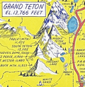 | Details | Lindgren, Jolly | 1948 |
| Pictorial map of the Jackson Hole country and Grand Teton National Park |
|
Lindgren, Jolly |
|
| 1948 |
| LOC:90 |
| $600.00 | Lindgren--Jolly | Pictorial-map-of-the-Jackson-Hole-country-and-Grand-Teton-National-Park | "A hysterical map of the Jackson Hole country and Grand Teton National Park slightly cockeyed" a fine pictorial map of the area around Jackson Hole, Wyoming. "Made on purpose" by artist Jolly Lindgren, Spokane, Washington.
<br><br>
In addition to numerous mountains identified by name and height Lindgren's many features include Jackson Lake, Jenny Lake, Jackson Hamburgers, Resor Ranch, Church of the Transfiguration, the Federal Elk Refuge, and numerous dude ranches identified by large western-style hats. |
| 6542 |  | Details | Turner, Stanley | 1948 |
| Pictorial map Saguenay region Quebec, Canada Stanley Turner 1948 |
|
Turner, Stanley |
|
| 1948 |
| LOC:300 |
| $400.00 | Turner--Stanley | Pictorial-map-Saguenay-region-Quebec--Canada-Stanley-Turner-1948 | Historical-pictorial map of the Saguenay region of Canada with Quebec by Stanley Turner, 1948. A tourist-oriented map published by Brading Brewery designed to encourage vacationers to visit the Saguenay area.
<br><br>
<div id="1" align="center">
<a title="TITLE HERE"></a>
<img id="1" src="/ZoomifyImages/SC_6542/SC_6542_detail.jpg" alt="Stanley Turner pictorial view of Quebec from Brading Brewery map 1948" width="340"/> <br><small>Stanley Turner pictorial view of Quebec.</small>
</div><br>
<div class="indenttextblocksingle">
"This map represents Bas-Saint-Laurent and Saguenay. A lot of information is offered on the map, such as main arteries, railroads, golf clubs, airports, crossings, battlefields, hydroelectric installations and hunting and fishing spots. Some historical information is also added such as dates of battles and discovery of territories. Drawings of inhabitants, animals or historical figures decorate the document."
</div><br>
Copyright 1948 Bradings Capital Brewery Ltd. Ottawa, Canada. French language.
<br><br>
[1] Online. https://archivesdemontreal.ica-atom.org/carte-de-vacances-brading-du-bas-st-laurent-et-de-la-region-de-saguenay-1949 |
| 5251 |  | Details | Hutson, H.H. | 1948 |
| Humorous map of the world from a Texans perspective |
|
Hutson, H.H. |
|
| 1948 |
| LOC:200 |
| $125.00 | Hutson--H-H- | Humorous-map-of-the-world-from-a-Texans-perspective | A humorous map of the world explained by pictorial illustrations related to Texas features and exaggerations. Distributed as a paper placemat for Long Champ restaurant in Amarillo, Texas - Homer Rice, Owner. Copyright 1948 by H.H. Hutson. Only one recent sale recorded, scarce. |
| 5422 |  | Details | Douglas, Jack | 1948 |
| Rare blueprint prospectors map of California gold lodes |
|
Douglas, Jack |
|
| 1948 |
| LOC:90 |
| $550.00 | Douglas--Jack | Rare-blueprint-prospectors-map-of-California-gold-lodes | Very rare cyanotype (blueprint) self-published gold mining map of California by Jack Douglas (d. 1956)- "The Old Prospector's Lode Map of California." At a scale of one inch = 32 miles the map shows areas in California known to have produced gold, shown as shaded areas.
<br></br>
The map includes crude decorative images of gold panning equipment and of an old prospector at work. At bottom left a list of other gold lode district maps for sale at $1.00 each includes Alaska, Arizona, British Columbia, Idaho, Montana, Nevada, New Mexico, Oregon, Utah, Washington, and Wyoming. These could be purchased along with blueprint assembly instructions for mining equipment by Jack Douglas at Box 21, Dutch Flat, California.
<br></br>
No holdings found in WorldCat and no mention of the map is found online.
<br></br>
Text at right discusses gold mining in several California mining districts. Verso is blank. Map no. 153.
<br></br>
Jack Douglas was the founder of the United Prospectors Organization (1947), originally targeted at professionals who made their livelihood by prospecting and mining. Douglas published a journal- Panning Gold- the first issue of which was issued in 1947. United Prospector's was incorporated on November 29, 1949 with Jack Douglas as President. Other officers at the time of incorporation included Walter Robertson, Stockton, CA; Tylar Jack, Reedy, CA; Speed Freeman, Olympia Field, IL; Louis Borde, Eugene, OR; Harold Mitchell, Umatilla, OR; and Glen Houston, Lodi, CA. Today UPI is "the oldest gold, gems, and minerals prospecting group of its kind."
<br></br>
<div>
<img src="/ZoomifyImages/SC_5422/Doodle_Bug.jpg" alt="" width="200" align="left" style="margin: 0px 10px"/>
<span style="vertical-align: middle;">
Note: Price includes an additional rare blueprint (shown here) for Jack Douglas' "Doodle Bug" wet concentrator. Copyright 1944.
</span>
</div>
<br></br> |
| 6525 | 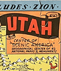 | Details | Lindgren, Jolly | 1948 |
| Pictorial hysterical puzzle map of Utah and parks |
|
Lindgren, Jolly |
|
| 1948 |
| LOC:300 |
| $175.00 | Lindgren--Jolly | Pictorial-hysterical-puzzle-map-of-Utah-and-parks | Unused pictorial puzzle map of the State of Utah- "A hysterical map of Utah which includes Zion, Bryce Canyon, Cedar Breaks & Stinking Springs". "Made in broken English" by artist Jolly Lindgren, Spokane, Washington. Includes the original puzzle mailer with a transparent front. Lindgren-Turner Company.
<br><br>
A humorous tourist-oriented puzzle featuring the State of Utah and many of its numerous natural attractions including:
<div class="indenttextblocksingle">
<ul style="list-style-type: circle;"></li>
<li>Dinosaur National Monument</li>
<li>Zion National Park</li>
<li>Bryce Canyon</li>
<li>Escalante Desert</li>
<li>Natural Bridge</li>
<li>Arches National Monument</li>
<li>Skull Valley</li>
<li>Canyon de Chelly, Arizona</li>
</ul>
</div> |
| 6695 |  | Details | Sink, John | 1949 |
| Pictorial Map Eastern North Carolina Vacationist's Guide Sink |
|
Sink, John |
|
| 1949 |
| LOC: |
| $550.00 | Sink--John | Pictorial-Map-Eastern-North-Carolina-Vacationist-s-Guide-Sink | Rare and nicely lithographed folding pictorial map "Eastern North Carolina Vacationist's Guide" by John Sink ca. 1949, WorldCat records only two holdings of this map. Also, Sink is credited with a similar map: "Western North Carolina a vacationists map and guide."
<br><br>
Very interesting pictorial map. On the verso the description of some of the coast's less well-travelled areas is priceless. Before overall completion of Highway 12 (1) here is a description of a car trip down the path now filled by Hwy. 12:
<br>
<div class="indenttextblocksingle">
"Down the Outer Banks of North Carolina, from junction of road with US 158 to Hatteras. 60 miles. This tour is recommended for the adventurous and only the <b>good sand driver</b> should attempt it in his own car. Much of the route is without benefits of highways, and often the inexpert driver is <b>stalled in the sand.</b> Generally, best driving is on the beach at low tide (it should not be attempted on an incoming tide). All the villages are on the Sound side, however, and to reach them, motorists must drive across the top of the beach, usually through soft sand. Take a can of extra water... There are coast guard stations along the way where help may be obtained. There are no facilities or dwellings between villages."
<br><br>
" is junction of a paved road (L) with US 158 at the so-called Whalebone site. Turn left on this road which is paved for only a mile, and down either the "inside" set of sand ruts or the beach. The route runs along an undeveloped beach section, with here and there the remains of old wrecks.
At 05.0 on R is Bodie Island (pronounced body) lighthouse. It first was erected in 1848, rebuilt in 1859 and destroyed during the Civil War. While the present tower was under construction five sailing vessels were wrecked on the beach. Rebuilt in 1872, the structure is 162 feet high, has a 160,000 candlepower beam visible 19 m. "
</div>
<br>
(1) I-12 was completed in the 1990s. |
| 6367 |  | Details | Leisen, Theodore | 1949 |
| Theodore Leisen Pictorial Map of Key West Florida |
|
Leisen, Theodore |
|
| 1949 |
| LOC: |
| $225.00 | Leisen--Theodore | Theodore-Leisen-Pictorial-Map-of-Key-West-Florida | Scarce medium-format pictorial map of Key West, Florida by Theodore Leisen Jr. The map of Key West map is undated but ca. 1949 based on Leisen's population estimate of 20,000 at publication. The population of Key West in 1950 is recorded as 21,792 persons excluding military personnel [1].
<br></br>
The map / brochure published by the Key West Chamber of Commerce contains a legend with numerous points of interest in Key West. Recto with map of the "World Famous Overseas Highway" from Key Largo to Key West. Key West translates to Cayo Hueso in Spanish.
<br></br>
[1] Wilkinson, Jerry. History of Key West. Online: http://www.keyshistory.org/keywest.html |
| 5272 |  | Details | Bennett, Philip A. | 1949 |
| Earliest U.S. Government map television stations and networks |
|
Bennett, Philip A. |
|
| 1949 |
| LOC: |
| $1,250.00 | Bennett--Philip-A- | Earliest-U-S--Government-map-television-stations-and-networks | The earliest official large-format map of U.S. television stations and networks from the infancy of TV advertising. By U.S. Department of Commerce Industrial Economist Philip A. Bennet and printed by the U.S. Coast and Geodetic Survey in July, 1949. At the time of publication in 1949 the map clearly shows that numerous states were without a single operating TV station including: Nevada, Idaho, Montana, Colorado, Kansas, North Dakota, South Dakota, Nebraska, South Carolina, Vermont, New Hampshire, and Maine.
<br></br>
This map is scarce outside of institutional holdings. No copy of the map or record of the sale of this television map is found online. Price when issued 35 cents.
<br></br>
In January 1948, less than 200,000 TV sets existed in the U.S. This map documents the early distribution of broadcast TV stations, pre-dating the phenomenal growth of the industry. The map was and is important because the geographical distribution of TV stations impacted the size of the television market while TV networks served to lower the cost of content production.
<br></br>
Shows the 75 existing and 42 prospective analog broadcast television stations and <b>network routes</b> in the United States. Compiled and printed by the U.S. Coast and Geodetic Survey (Department of Commerce) to the specifications of Philip A. Bennet, General Products Division of the Office of Domestic Commerce.
<br></br>
See also Gould in NYT: https://timesmachine.nytimes.com/timesmachine/1949/04/24/93542916.html?pageNumber=299 |
| 6567 |  | Details | Anonymous | 1949 |
| Castles Inc. map of Hollywood and Los Angeles |
|
Anonymous |
|
| 1949 |
| LOC:3 |
| $750.00 | Anonymous | Castles-Inc--map-of-Hollywood-and-Los-Angeles | Clean, single-sided pictorial advertising map of Hollywood and the surrounding area circa 1948 published by Castle's Camera Store, 1529 Vine Street, Hollywood 28, California. Scarce. Price when issued 5 cents.
<br></br>
Castle's Camera Store operated from a small storefront across from the streamline-moderne style NBC Radio City office and studios at the corner of Sunset and Vine streets. <br></br>
<div>
<img src="/ZoomifyImages/SC_6567/Castles Camera Shop.jpg" alt="Castle's Camera Store Hollywood Storefront" width="300" align="left" style="margin: 0px 20px"/>
Karl Breneman was brother to radio personality Tom Breneman who operated Tom Breneman's restaurant from a location at 1525 North Vine Street, a few doors from brother Karl's Castle's Camera Shop.
<br></br>
Key landmarks on the map include:
<div class="indenttextblocksingle">
<ul style="list-style-type: circle;">
<li>Don Lee Mutual Broadcasting Studios (1313 North Vine Street opened August 1948)</li>
<li>Beverly Hills</li>
<li>Republic Studios</li>
<li>Grauman's Egyptian Theater</li>
<li>Hollywood Ball Park</li>
<li>a television studio</li>
<li>Earl Carrol's</li>
<li>Santa Monica, Ocean Park, and Venice piers</li>
<li>American Legion Stadium</li>
</ul>
</div> |
| 6763 | 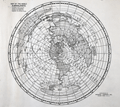 | Details | National Company | 1949 |
| Map of the World in Azimuthal Projection Centered on Malden Mass USA |
|
National Company |
|
| 1949 |
| LOC:89 |
| $250.00 | National-Company | Map-of-the-World-in-Azimuthal-Projection-Centered-on-Malden-Mass-USA | Scarce "Map of the World in Azimuthal Projection Centered on Malden, Mass USA". Presumed first edition lacking the more elaborate title cartouche found on the 2nd. No copies located in WorldCat.
<br><br>
Malden was home to the National Company, a heavyweight in the manufacturing of radio equipment. The legacy of this enterprise and the town's distinctive place in radio history were immortalized in a unique piece of advertising - this world map centered on this otherwise little-known Massachusetts town.
<br><br>
This ingeniously designed cartographic promotional map was part of a strategy tailored to captivate the attention of amateur radio enthusiasts. It underscored the awe-inspiring power of radio communication, visualizing the potential of the most potent transmitters of the time. One glance at this map made it crystal clear: with the right equipment, you could quite literally tap into the global conversation.
<br><br>
A feature that makes the azimuthal projection stand out among other cartographic methods is its fidelity to directions. Any line drawn from the center point to another location on the map accurately represents the real-world direction. This attribute, where all points appear radially symmetrical around the center, makes it an invaluable tool in aeronautical charts.
<br><br> |
| 5268 | 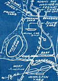 | Details | Anonymous | 1950 |
| Small Mid-20th Century blueprint map Memphis Railroad Terminal |
|
Anonymous |
|
| 1950 |
| LOC:13 |
| $135.00 | Anonymous | Small-Mid-20th-Century-blueprint-map-Memphis-Railroad-Terminal | Small unrecorded cyanotype (blueprint) map of Memphis, Tennessee related to the railway lines, rail yards, and railroad depots in the Memphis area. Would have provided a high-level condensed overview of the railways in the Memphis area.
<br></br>
Key features on the map include:
<div class="indenttextblocksingle">
<ul style="list-style-type: circle;">
<li>Union Station</li>
<li>Central Station</li>
<li>Paine Yard</li>
<li>Frisco Yale Yard</li>
<li>Forrest Yard</li>
<li>North Yard</li>
<li>South Yard</li>
<li>Johnston Yard</li>
<li>Motor Car shop</li>
<li>Mississippi River</li>
<li>President's Island</li>
</ul>
</div>
Dated within at May 1950. MS annotation on verso: "V. W. White." [Tenn. , TN] |
| 6794 |  | Details | Poisson, O. | 1950 |
| Fine mid-century lithographed pictorial map of Nice, France |
|
Poisson, O. |
|
| 1950 |
| LOC:89 |
| $165.00 | Poisson--O- | Fine-mid-century-lithographed-pictorial-map-of-Nice--France | Original, attractive, lithographed pictorial map of Nice, France by O. Poisson ca. 1950. Printed by Impremerie Bonfant & Rampelberg, Nice. Shows the Velodrome, Parc Chambrun, Conservatoire de Musique, Eglise Russe, Casino Municipal, and much more. Recto with German text about the city.
<br><br>
Located on the beautiful French Riviera, Nice is a captivating city that offers a unique blend of natural beauty, rich history, and vibrant culture. With its stunning coastline, palm-lined promenades, and crystal-clear waters, Nice is a paradise for beach lovers and outdoor enthusiasts. The iconic Promenade des Anglais, stretching along the azure waters of the Mediterranean, is a bustling hub where visitors can soak up the sun, enjoy leisurely walks, or indulge in delicious cuisine at the numerous beachside cafes and restaurants. Beyond the beaches, Nice boasts a charming Old Town with its narrow streets, colorful buildings, and lively markets, providing a glimpse into the city's rich heritage and offering a delightful blend of local shops, boutiques, and authentic French cuisine. |
| 1068 |  | Details | Down-East Sportcraft | 1950 |
| Birds-eye View of Casco Bay, Portland, Maine and Surroundings |
|
Down-East Sportcraft |
|
| 1950 |
| LOC:0 |
| $99.00 | Down-East-Sportcraft | Birds-eye-View-of-Casco-Bay--Portland--Maine-and-Surroundings | Large, detailed, panoramic view of coastal Maine north of Portland, including Casco Bay. Neat, 1950's re-print of a view first published by Walker Lithograph at the end of the 19th century, and reproduced in the mid-1950's. This folding birds-eye view highlights dozens of islands, coves, lighthouses, railroad, ferry routes, and other points of nautical interest. Shows the locations of Fort Williams, Portland Head, Fort Preble, Fort Leavitt, Ft. McKinley, Casco Castle, Freeport Landing, and the Portland Yacht Club. Folds to 3 1/2" x 6 1/2".
<br></br>
Named features include Cape Elizabeth, Portland Head light, Cushing Island, Great Diamond Island, Long Island, Great Chebeague Island, Presumpscot River, Mt. Washington, Sebago Lake, Falmouth, Underwood, Harraseeket River, Cousins Island, Bailey's Island, Harpswell Harbor, Merriconeag Sound, Maquoit Bay, Freeport Landing, Brunswick and Lewiston. Routes of the Casco Bay Lines shown in solid black.
<br></br>
Simple, green cardboard cover with blue title printing. |
| 5433 |  | Details | Anonymous | 1950 |
| Map of Rothesay Sound with watercolor side-wheel steamer. |
|
Anonymous |
|
| 1950 |
| LOC:78 |
| $160.00 | Anonymous | Map-of-Rothesay-Sound-with-watercolor-side-wheel-steamer- | Attractive, offset lithographed chart of Rothesay Sound and the Firth of Clyde, Scotland decorated with a small manuscript watercolor of a side-wheel steamboat. The chart is undated but probably 20th century after an earlier chart. Aids to navigation are highlighted in red and yellow.
<br></br>
The steamboat is unnamed but probably the <strong>Duchess of Fife</strong>, built and launched by Fairfield Shipbuilding and Engineering Company in May 1903. The Duchess of Fife was owned by the Caledonian Steam Packet Company and except for use during WWI and WWII, spent her career serving passenger routes in the Firth of Clyde.
<br></br>
Anonymous but initials "E.S." at bottom right corner. |
| 6437 |  | Details | Flachmann, Chuck | 1950 |
| Pictorial or cartoon map of St. Louis Missouri |
|
Flachmann, Chuck |
|
| 1950 |
| LOC:90 |
| $350.00 | Flachmann--Chuck | Pictorial-or-cartoon-map-of-St--Louis-Missouri | Pictorial map of St. Louis, Missouri. Specifically, the Anheuser-Busch variant edition of Chuck Flachman's Cartoon Map of St. Louis, 1950. Two prominent identifying features distinguish the Anheuser-Busch variant edition from Flachman's pictorial "Mound City Pride of the Mississippi Valley" edition: 1) The Busch Budweiser logo appears at bottom left rather than the compass rose and 2) the lettering surrounding the map reflects its Mound City moniker. Additionally, the Busch brewery and Clydesdale horses are featured on the map in the Busch edition. Both editions are dated 1950.
<br><br>
Scarce, the Busch-Budweiser variant is much less common on the market in our experience. |
| 6660 |  | Details | Mundorff, Ted | 1950 |
| Scarce pictorial map of Oahu, Hawaii |
|
Mundorff, Ted |
|
| 1950 |
| LOC:86 |
| $195.00 | Mundorff--Ted | Scarce-pictorial-map-of-Oahu--Hawaii | Scarce original pictorial map of Oahu, Hawaii by Ted Mundorff on light-ish weight paper. An insert road map from a book "Around Oahu with Moki: A trip around the Island of Oahu as seen through the versatile camera of Fred Maxwell." The map is annotated with location numbers keyed to Maxwell's book. Published by Maxwell from Honolulu in 1950.
<br><br>
Verso is blank.
<br><br>
Interesting cartoon-like drawings featuring cab driver Moki at bottom left lend a relaxed air to the prospective journey around Oahu including:
<div class="indenttextblocksingle">
<ul style="list-style-type: circle;">
<li>A hula-dancing rabbit on Rabbit Island.</li>
<li>Waialae Golf Club</li>
<li>A barber giving a shave at Barber's Point.</li>
<li>Healing stones</li>
<li>Manoa Valley</li>
<li>King Kamehameha</li>
<li>Schofield Barracks</li>
<li>Haleiwa and Kahuku</li>
</ul>
</div> |
| 5339 | 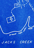 | Details | Somberg, Seymour I. | 1950 |
| Blueprint plat map of Cedar Grove Plantation St. Paul South Carolina |
|
Somberg, Seymour I. |
|
| 1950 |
| LOC:1401 |
| $900.00 | Somberg--Seymour-I- | Blueprint-plat-map-of-Cedar-Grove-Plantation-St--Paul-South-Carolina | Unrecorded blueprint or cyanotype plat map of <b>Cedar Grove Plantation</b> or Smythe Plantation, <b>St. Paul / Summerton, South Carolina</b> in Clarendon County with Robert Adger Smythe (1871-1962) , Manager. The blueprint was created ca. 1950 and signed by Seymour. I. Samberg L.S. (Land Surveyor) with property lines taken from an earlier plat by Bushner and Rutledge dated May 30, 1914. North oriented to lower left.
<br></br>
Robert Adger Smythe was born in Charleston, S.C. in 1871 and graduated from the Citadel in 1890. He founded the Lambda Chapter fraternity at the Citadel. Smythe spent most of his business years in cotton brokerage in Atlanta. Robert Smythe did not live at Cedar Grove, but visited often, conducting his business through manager Joe. H. King.
<br></br>
The earliest record of Cedar Grove Plantation dates to 1796 when Jack Lawson laid out a plantation of 2,160 acres between Jack's Creek and Taw-Caw. In the mid-1800's the plantation had grown to over 5,000 acres.
Nearby features on this plat map include Jack's Creek, Highway 15, Manning Turnpike, Lake Marion, Nelson's Ferry Road, and St. Paul.
<br></br>
Legend at bottom right includes the signature of Seymour Somberg. In 1953 Seymour I. Somberg was listed as President of Forestry Aids (forestry - surveying) in Manning, South Carolina. [1]
<br></br>
[1] Eller, Robert C. ed. Surveying and Mapping. Volume XIII, No. 1 January - March, 1953. p. 252. (Online) |
| 4983 |  | Details | Feher, Joseph | 1950 |
| The Dole Map of the Hawaiian Islands |
|
Feher, Joseph |
|
| 1950 |
| LOC:63 |
| $400.00 | Feher--Joseph | The-Dole-Map-of-the-Hawaiian-Islands | Original lithographed pictorial map of the Hawaiian Islands copyrighted by the Hawaiian Pineapple Company Ltd. 1950. Artist Joseph Feher depicted the Hawaiian islands and adjacent waters with boats, fish, and typical objects and pursuits associated with the islands: flying fish, surfing, spear fishing, sailing, poi-making, hula dancers, etc. Islands of the State of Hawaii mentioned in the legend include: Kauai, Niihau, Oahu, Molokai, Lanai, Maui, Kahoolawe, and the big island- Hawaii.
<br></br>
The map is completely original minus the attached text legend at right that is, as in this case, often detached from the print. This is the second of two "Dole Pineapple Maps", the first was published in 1937.
<br></br>
Lithography by Schwabacher-Frey.
<br></br>
Once known as the Sandwich Islands, the Hawaiian Islands first documented discovery by a westerner occurred in 1778 with the arrival of British explorer Captain James Cook.
<br></br> |
| 4743 | 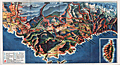 | Details | Societe Nationale des Chemins de Fer Francais | 1950 |
| Attractive map of France's Cote d'Azur |
|
Societe Nationale des Chemins de Fer Francais |
|
| 1950 |
| LOC:77 |
| $80.00 | Societe-Nationale-des-Chemins-de-Fer-Francais | Attractive-map-of-France-s-Cote-d-Azur | Attractive birds-eye view of the coast of the <b>Cote D'Azur</B> in Provence, France stretching from Lyons, France past Monaco. With an inset of the Island of Corsica. Published as a fine folding brochure in 1950 by the Societe Nationale des Chemins de Fer Francais (S.N.C.F.). Red lines represent the railways owned by the French National Railways (SNCF) in in the mid 20th century. |
| 6529 |  | Details | Green, Walter O. | 1951 |
| Western style pictorial map of the Colorado Rocky Mountains |
|
Green, Walter O. |
|
| 1951 |
| LOC: |
| $375.00 | Green--Walter-O- | Western-style-pictorial-map-of-the-Colorado-Rocky-Mountains | Interesting and scarce pictorial folding motor-tour map of a portion of Colorado near the Rocky Mountain National Park from 1951. Includes Boulder, Estes Park and much more in a western style complete with horse-riding cowboys, bucking broncos, and wizened prospectors. A serious map, not a hint of humor. Issued by the Rocky Mountain Motor Company, Denver, Colorado in 1951. Map by Walter O. Green.
<br><br>
Towns and cities on the map include:
<div class="indenttextblocksingle">
<ul style="list-style-type: circle;"></li>
<li>Denver</li>
<li>Evergreen</li>
<li>Golden</li>
<li>Boulder</li>
<li>Granby</li>
<li>Grand Lake</li>
<li>Estes Park</li>
<li>Fort Collins</li>
<li>Greely</li>
<li>Longmont</li>
<li>Lyons</li>
</ul>
</div>
Verso with color photographs, text, and motor tour schedules.
<br><br>
Green also identifies numerous geographical features
<div class="indenttextblocksingle">
<ul style="list-style-type: circle;"></li>
<li>Big Thompson Canyon</li>
<li>Iceberg Lake</li>
<li>Grand Lake</li>
<li>Arapaho Peak Elev. 13506 Ft.</li>
<li>Longs Peak Elev. 14255 Ft.</li>
<li>Red Rocks</li>
<li>Mount Evans Elev. 14360 Ft.</li>
<li>Berthoud Pass</li>
</ul>
</div> |
| 5253 | 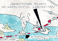 | Details | James River Ceramics Club | 1951 |
| Jamestown James River Ceramics Club Field Trip |
|
James River Ceramics Club |
|
| 1951 |
| LOC: |
| $350.00 | James-River-Ceramics-Club | Jamestown-James-River-Ceramics-Club-Field-Trip | Unrecorded and hand-colored pictorial route map for the James River Ceramics Club. Mid 20th-century birds-eye perspective map of the area surrounding the James River near Jamestown, Virginia, location of the first permanent English settlement in North America.
<br></br>
Made for the occasion of the first annual field trip of the James River Ceramics Club to the Jamestown Island Archaeological Laboratory and to James O'Donnell Pottery on Sunday, August 12, 1951. Shows the towns of Williamsburg, Hilton Village, Benn's Church, Bacon's Castle, Surry, Burrowsville and more. With the logo for the James River Ceramics Club. |
| 5109 |  | Details | Winter Park Board of Realtors | 1951 |
| Mid-century map of Winter Park Florida |
|
Winter Park Board of Realtors |
|
| 1951 |
| LOC:87 |
| $115.00 | Winter-Park-Board-of-Realtors | Mid-century-map-of-Winter-Park-Florida | Map of the city of Winter Park, Florida and vicinity published by the Winter Park Board of Realtors (1952) in a 12-panel folding format. Lakes shown boldly in green. Key at bottom left with road reference locations in Orlando, Eatonville, Maitland, and Winter Park. One section of road highlighted in red. Small manuscript notation in pencil.
<br></br>
Verso titled "Maps and facts about Winter Park Florida <b>City of Homes</b>." Full of text and photographs related to Winter Park, particularly to Rollins College and to the history behind Winter Park's appellation as the "City of Homes." With logo for the National Association of Real Estate Boards at bottom right. Border with alpha-numeric location index indicators.
<br></br>
Shows more than a dozen lakes of all sizes including Lake Fairview, Lake Killarney, Lake Maitland, Lake Osceola, Lake Corrine, and Lake Rowena.
<br></br>
Copyright 1952 by James T. Ellis. Interesting compass rose style unknown logo by Ellis' name. |
| 5221 |  | Details | Peninsular and Oriental Shipping Co. | 1951 |
| Map of Singapore for P and O cruise passengers |
|
Peninsular and Oriental Shipping Co. |
|
| 1951 |
| LOC:13 |
| $150.00 | Peninsular-and-Oriental-Shipping-Co- | Map-of-Singapore-for-P-and-O-cruise-passengers | Small folding map of Singapore issued in 1951 by The Peninsular and Oriental Shipping Company ( P&O). Verso with text about Singapore history and key local notes. Tourist notes include several drives available to Johore, Changi, the Botanic Gardens, and the Gap.
<br></br>
An index at left identifies key sites on the map including the Raffles Hotel, Fort Canning, Mount Palmer, the P&O office, and the Chinese Club. |
| 5054 |  | Details | Green, John B. | 1951 |
| Map brochure for Brightwaters Snell Isle Harbour St. Petersburg Florida |
|
Green, John B. |
|
| 1951 |
| LOC:87 |
| $400.00 | Green--John-B- | Map-brochure-for-Brightwaters-Snell-Isle-Harbour-St--Petersburg-Florida | Scarce original plat map of <b>Snell Isle Harbor</b> in St. Petersburg, Florida ca. 1951, by John B. Green, a local realtor. Includes red manuscript notes about lots previously sold. With an inset photograph of the area surrounding Brightwaters Snell Isle. Shows the outline of property for Clark's Sunset Golf Course and a block reserved as a business center. North is oriented to left bottom. Plat includes Snell Isle Boulevard, Cordova Boulevard, Toledo Way, Miramar Blvd., and Brightwaters Boulevard. Verso with information and a fine bird's eye view of the planned development.
<br></br>
Now one of St. Petersburg’s most upscale and desirable neighborhoods, Snell Isle was once nothing more than a low-lying mangrove swamp. When C. Perry Snell, a Kentucky pharmacist, came to visit the area in 1899, he envisioned a residential waterfront enclave and invested in the property of what is now Coffee Pot Bayou and Snell Island. In 1911, he began developing Snell Island.
<br></br>
In 1926, Snell opened the Coffee Pot Bayou Golf Club, now the 18-hole Vinoy Renaissance Resort Golf Club on Snell Isle. A few years later in 1928, he gifted land to the St. Petersburg Woman’s Club which still stands today on Coffee Pot Bayou and is on the U.S. Register of National Historic Places.
<br></br>
Snell Isle is completely residential, with several apartment communities, two schools, and two churches. Many original homes from the 1920s still exist today, with charming European and Spanish architecture. More than 80 percent of homes on Snell Isle enjoy waterfront views, some of the Bay and others on interconnected waterways. |
| 5066 |  | Details | Anonymous | 1951 |
| Route Map of the Municipal Transit System St. Petersburg, Florida |
|
Anonymous |
|
| 1951 |
| LOC:87 |
| $150.00 | Anonymous | Route-Map-of-the-Municipal-Transit-System-St--Petersburg--Florida | Scarce route map of the Municipal Transit System in St. Petersburg, Florida (not to scale). On thinnish yellow paper a fourteen-panel folding sheet folds to 3" x 8". Includes an inset plan for downtown St. Petersburg revised October, 1951. The Yellow Issue published Dec 3, 1951. |
| 5099 |  | Details | U.S. Coast and Geodetic Survey | 1951 |
| Tampa Bay Tidal Current Chart Book |
|
U.S. Coast and Geodetic Survey |
|
| 1951 |
| LOC:0 |
| $200.00 | U-S--Coast-and-Geodetic-Survey | Tampa-Bay-Tidal-Current-Chart-Book | Scarce 1951 tidal chart book on card stock with 12 (front and back) charts of Tampa Bay, Florida showing the direction and velocity of tidal flow across Tampa bay for each hour of its semi-daily tidal cycle.
<br></br>
Price when issued 35 cents; when sold 50 cents. U.S. Government Printing Office. Serial no.743. |
| 6492 |  | Details | Dubuque City Planning Commision | 1951 |
| Master Plan for the City of Dubuque Iowa |
|
Dubuque City Planning Commision |
|
| 1951 |
| LOC:400 |
| $400.00 | Dubuque-City-Planning-Commision | Master-Plan-for-the-City-of-Dubuque-Iowa | Very large, scarce 1951 master plan map of the City of Dubuque, Iowa by the Dubuque City Planning and Zoning Commission, J.M. Wolfe, Chairman. Justin R. Hartzog, City Planner. A fine record of the city and its ambitions in the mid 20th-century.
<br><br>
Two matching legends at bottom right and left show symbols and coloration used for mapped features under existing conditions and for the Commission's planning proposals respectively. These details include streets, railroads, intersections, city boundaries, parks, playgrounds, schools and other land uses. North oriented to top. |
| 6556 |  | Details | Anonymous | 1952 |
| Pictorial map New Orleans area near Bayou Gardens Lacombe Louisiana |
|
Anonymous |
|
| 1952 |
| LOC:3 |
| $150.00 | Anonymous | Pictorial-map-New-Orleans-area-near-Bayou-Gardens-Lacombe-Louisiana | Pictorial map (1952) of the New Orleans area to promote the Bayou Gardens attraction in Lacombe, Louisiana. The map spans the back two panels of a promotional brochure titled: "Bayou Gardens Lacombe, La. Beauty Spot of the Bayou Country."
<br><br>
Bayou Gardens was a 25-acre gardening attraction located north of New Orleans between Mandeville and Slidell. Bayou Gardens was founded in the late 1940's by convicted felon and former Louisiana Governor Richard W. Leche (1898-1965). In addition to a commercial nursery, swimming pool and a museum, according to the brochure "The Gardens contain one of the nation's outstanding Camelia collections, numbering hundreds of varieties."
<br><br>
Two-panel folding brochure with text on the recto. |
| 6711 |  | Details | Newton, Art | 1952 |
| Outer Banks Pictorial Map Carteret County North Carolina |
|
Newton, Art |
|
| 1952 |
| LOC:86 |
| $250.00 | Newton--Art | Outer-Banks-Pictorial-Map-Carteret-County-North-Carolina | Rare pictorial post-war map of Carteret County, North Carolina and the Outer Banks. Inset large-scale map of Bogue Sound and the coast near Morehead City and Beaufort, NC. Found on the verso of a two-sided 12-panel folding brochure. Designed by Art Newton and published by Celeste Gold in 1952. Printed by Wilmington Printing Company.
<br>
A few of the key features that Newton included are:
<div class="indenttextblocksingle">
<ul style="list-style-type: circle;"></li>
<li>Copeland's salt water fishing pond</li>
<li>Edgewater Lodge</li>
<li>Fort Macon State Park</li>
<li>Hummock House</li>
<li>Ocracoke Lighthouse</li>
<li>Mailboat Atlantic to Ocracoke</li>
<li>Cedar Island pier fishing</li>
<li>Cape Lookout Lighthouse</li>
</ul>
</div> |
| 6679 |  | Details | Glaubke, Bob | 1952 |
| Wild Bill Hickok Treasure Map pictorial thematic map |
|
Glaubke, Bob |
|
| 1952 |
| LOC:40 |
| $125.00 | Glaubke--Bob | Wild-Bill-Hickok-Treasure-Map-pictorial-thematic-map | 1950's pictorial thematic map, the "Wild Bill Hickok Treasure Map, of the United States, created by Bob Glaubke and published by Rand McNally in 1952. This map was a promotional item created by Rand McNally to advertise their line of maps and atlases.
<br><br>
The Wild Bill Hickok Treasure Map was a colorful and fanciful depiction of the American West, with illustrations of cowboys, Indians, and other Wild West icons. The map purported to show the locations of hidden treasures that were supposedly buried by the legendary gunslinger Wild Bill Hickok.
<br><br>
The Hickok map identifies numerous locations with some connection to mythical lost treasure including
<div class="indenttextblocksingle">
<ul style="list-style-type: circle;">
<li>Pensacola: Five large Spanish Treasure ships were wrecked...</li>
<li>Apalachicola: The pirate Billy Bowlegs ran his ship aground here...</li>
<li>Savannah: Th pirate John Hint is thought to have buried his treasure...</li>
<li>Murrell's Inlet: ...the pirate Murrell took shelter and buried treasure in the marshes here. </li>
</ul>
</div>
Wild Bill Hickok was a famous figure in the Old West, known for his prowess as a gunfighter and gambler. There are several legends surrounding him, including a supposed treasure map that he left behind. According to the legend, Hickok buried a treasure he won in a poker game, gold and other valuables, in the Black Hills of South Dakota before his death in 1876. He allegedly entrusted a treasure map to a friend, but the exact location of the treasure and the authenticity of the map are both widely disputed. |
| 6592 |  | Details | Hayden, Walter Emmet | 1952 |
| West Walker River Topaz Lake Directory Fishing Hunting Map 1952 |
|
Hayden, Walter Emmet |
|
| 1952 |
| LOC:89 |
| $350.00 | Hayden--Walter-Emmet | West-Walker-River-Topaz-Lake-Directory-Fishing-Hunting-Map-1952 | 1959 revised edition of the Hayden Map Company's Hunter's and Fisherman's map for the Topaz Lake / West Walker River area of Mono County, California. Map # 598141. Copyright 1952. Verso blank.
<br><br>
Very fine detail, printed in blue, ink based on surveys from 1923 to 1952.
<br><br>
Scarce today. Price was 50 cents when issued.
<br></br> |
| 6384 |  | Details | Lepper, Ruth Rhoads | 1952 |
| Pictorial map of Western, Central, and Eastern Maine |
|
Lepper, Ruth Rhoads |
|
| 1952 |
| LOC:87 |
| $650.00 | Lepper--Ruth-Rhoads | Pictorial-map-of-Western--Central--and-Eastern-Maine | A Map of Western, Central, and Eastern Maine made and published in 1952 by Ruth Rhoads Lepper, West Southport, Maine. The prominent and colorful compass rose topped by a fleur-de-lis is a signature feature of Ruth Lepper pictorial maps. Coverage includes the entire coast of the state of Maine extending from New Hampshire to Canada.
<br><br>
Two sides of the map include historical facts about Maine as well as drawings of some of the more famous old Maine buildings including:
<div class="indenttextblocksingle">
<ul style="list-style-type: circle;"></li>
<li>Blaine House, the Executive Mansion of Augusta</li>
<li>Portland Observatory</li>
<li>Old Lincoln County Jail, Wiscasset</li>
<li>Marie Antoinette House, North Edgecomb</li>
<li>Symphony House, Bangor</li>
<li>Farnsworth Homestead and Art Museum, Rockland</li>
</ul>
</div>
<strong>"Maine built ships have sailed the seven seas in peace and war since 1607"</strong>
<br><br>
Maine has a long history of seafaring and ship-building. The bottom of the map and the area of the Atlantic Ocean includes depictions of some of the more famous Maine-built ships. These ships span four centuries and include:
<div class="indenttextblocksingle">
<ul style="list-style-type: circle;"></li>
<li>The U.S.S. Mitscher, launched at Bath in 1952.</li>
<li>An early 17th century English merchant ship.</li>
<li>Ship Commodore, bult at Yarmouth in 1879.</li>
<li>The Red Jacket, built at Rockland in 1853.</li>
<li>The pinnace Virginia, the first boat built by the English in America.</li>
<li>U.S.S. Kearsarge, built at Kittery in 1861.</li>
<li>Privateer brig Grand Turk, built at Wiscasset.</li>
</ul>
</div> |
| 5063 |  | Details | Oil and Gas Journal | 1952 |
| Journal-Guide to Oil Basins of the United States |
|
Oil and Gas Journal |
|
| 1952 |
| LOC:65 |
| $680.00 | Oil-and-Gas-Journal | Journal-Guide-to-Oil-Basins-of-the-United-States | A large special data and cartography supplement in the Oil and Gas Journal 1952 titled: "Journal-Guide to Oil Basins of the United States." The insert includes a map of United States Oil basins and a Formation Correlator (tabular data relating geographical region to era, period, rock system and group. At right cross sections of the major oil basins including the Permian Basin. Cross sections through each basin are shown schematically on the map.
<br></br>
Supplement to The Oil and Gas Journal. Volume 50 No. 46. Compiled and drawn by the editorial staff. The Oil and Gas Journal Copyright 1952. The Petroleum Publishing Company. Tulsa, Oklahoma. |
| 1371 |  | Details | Butler, Lowell | 1952 |
| Fine Baby-Boom Era Pictorial Map of California |
|
Butler, Lowell |
|
| 1952 |
| LOC:0 |
| $155.00 | Butler--Lowell | Fine-Baby-Boom-Era-Pictorial-Map-of-California | Large, attractive poster-size map of California's historical sites created during the post-war baby-boom era of the early 1950s. Numerous sites are numbered on the map. Includes extensive notations on the verso related to a whopping 496 sites in California. Cartography By Lowell Butler.
<br></br>
Verso contains textual descriptions related to the precise location and a brief history of each of the 496 sites.
A few examples of the sites include: <br><br/>
<hr>
<ul>
<li><strong>1-- Customs House. Alvarado, Main and Scott Streets, Monterrey.</strong><i> The port of entry for vessels and cargo reaching California during the days of Spanish and Mexican occupation...</i></li>
<li><strong>411-- Campo Store. Campo, San Diego County</strong><i> A frontier trading post and border fort built by Luman H. and Silas E. Gaskill who settled here in 1868.</i></li>
<li><strong>190-- Painted Rock. 7 miles southeast of Corona on State Highway No 71, Riverside County. </strong><i>A boulder with Indian pictographs applied (probably of Louiseno origin), registered and marked in 1927. What the pictographs mean has not been determined.
<hr></i></li>
</ul>
According to David Rumsey "The sites are identified by whether they are from the Spanish-Mexican Period, Years of the Gold Rush, Agricultural Era or Commercial and Industrial Expansion era. . With insets: San Francisco Bay; Monterey sites; Los Angeles and vicinity sites; San Diego sites; Mother lode sites. On verso: 'A note of explanation by Phil Townsend Hanna'; descriptive list of historical sites with color drawings, numbered to correspond with sites on map."
<br></br>
Compiled from the official registrations of the California State Department of Natural Resources. By Phil Townsend Hanna and William Webb. Copyright 1952 by the Automobile Club of Southern California. Published by Westways, Vol. 44, No. 12. |
| 3678 |  | Details | British Admiralty Hydrographical Office | 1953 |
| Chart of Channel Islands and Coast of France |
|
British Admiralty Hydrographical Office |
|
| 1953 |
| LOC:0 |
| $180.00 | British-Admiralty-Hydrographical-Office | Chart-of-Channel-Islands-and-Coast-of-France | An authentic 20th-century British nautical chart of the Channel Islands and the nearby Normandy coast of France . This large chart includes the islands of Jersey, Guernsey, Alderney, Sark and some smaller islands. Last corrections are dated to 1953.
<br></br>
Logo of the British Hydrographical Office at top of the title block. Number 2669. |
| 5024 |  | Details | Borrego Springs Land and Development Company | 1953 |
| Scarce Borrego Springs California Sales Map |
|
Borrego Springs Land and Development Company |
|
| 1953 |
| LOC:400 |
| $550.00 | Borrego-Springs-Land-and-Development-Company | Scarce-Borrego-Springs-California-Sales-Map | Scarce tract map of lots for sale in Borrego Springs, California ca. 1953 before construction was completed on the Catholic Church. With an inset smaller-scale humorous pictorial map of the region around Borrego Springs, in San Diego County.
<br></br>
Today Borrego Springs is designated as a Dark Sky Community, the only community in California with that designation and one of only 22 locations in the world to have the designation. Not dated, not attributed. |
| 6483 |  | Details | Sandefur, John Courtney | 1954 |
| Scarce pictorial cartograph or map Monterey Bay Hotel Jeffery |
|
Sandefur, John Courtney |
|
| 1954 |
| LOC:87 |
| $150.00 | Sandefur--John-Courtney | Scarce-pictorial-cartograph-or-map-Monterey-Bay-Hotel-Jeffery | Rare folding pictorial map of the Monterey Bay Region in California by John Courtney Sandefur. Sandefur's pictograms show the obvious influence of an earlier cartograph of the Monterey Region by Ruth Taylor White.
<br><br>
The map was published by Hotel Jeffery ca. early 1950s, then conducting business in Salinas, California for over 90 years. Colorful compass rose bearing a dog's image and the motto of the Hotel Jeffery- "Friendly."
<br><br>
Verso with text about the recreational activities and resources available in the Monterey Bay Area and the Salinas Valley including Pacific Grove, Carmel, Fort Ord, Santa Cruz, and Watsonville.
<br><br>
The Jeffery Hotel in Salinas, California was opened in 1888 at the corner of Alisal and Main Streets by William "Bill" Jeffery. In the 1970’s the original three-story Jeffery Hotel was demolished.<br><br>
<div id="0" align="center">
<a title="Hotel Jeffery, Salinas, California."></a>
<img id="3" src="/ZoomifyImages/SC_6483/SC_6483_HotelJeffery.jpg" alt="Photo of Hotel Jeffery, Salinas, California circa 1960" width="300"/> <br><small>Hotel Jeffery. <i>Courtesy U. California: https://calisphere.org/</i></small>
</div><br> |
| 4851 |  | Details | Anonymous | 1954 |
| Birds-eye view of the French Riviera |
|
Anonymous |
|
| 1954 |
| LOC:88 |
| $195.00 | Anonymous | Birds-eye-view-of-the-French-Riviera | The recto features a highly detailed birds-eye view and map of the French coast, extending from St. Tropez and St. Raphael to Menton. It highlights various towns, such as <b>Grasse, Cannes, Juan-les-Pins, Antibes, Nice, and Monaco</b>. Additionally, it offers a helpful route map that indicates the names and distances of cities along two travel segments for a journey from St. Raphael to Menton:
<br><br>
<div class="indenttextblocksingle">
<ol>
<li>From Nice to St. Raphael via the Corniche de l'Esterel</li>
<li>From Nice to Menton along the Corniches</li>
</ol>
</div>
<div id="0" align="center">
<a title="French Riviera"></a>
<img id="3" src="/ZoomifyImages/SC_4851/SC_4851_detail.jpg" alt="Old birds-eye view and road map of the French Riviera." width="340"/> <br><small>Nice-Cannes-Menton et les routes du littoral.</small>
</div><br>
Although labeled "Ed 54" on the cover, suggesting a publication date of 1954, the included photographs appear to be from the early 1940s. The map's top section displays the names of mountain peaks in the background, and all text is in French.
<br><br>
On the verso, you'll find extra routes, photographs, and descriptions of various sights and attractions. After reviewing the brochure, it's clear that this area is an excellent candidate for a future vacation destination.
<br><br>
Published by France's Direction générale du Tourisme under the Ministry of Public Works, Transport, and Tourism, this edition is identified as "Ed. 54." |
| 4984 |  | Details | West Coast Airlines | 1954 |
| Pictorial Map of Washington State by West Coast Airlines |
|
West Coast Airlines |
|
| 1954 |
| LOC:88 |
| $300.00 | West-Coast-Airlines | Pictorial-Map-of-Washington-State-by-West-Coast-Airlines | Scarce, colorful, pictorial map of airline routes across Washington, Oregon, and Idaho flown by West Coast Airlines. Statement at bottom of the map reads: "Paul Bunyan's Empire Cut to Travel Size".
<br></br>
West Coast Airlines (WCA), founded in 1941, was based at Boeing Field in Seattle. WCA began scheduled passenger service in 1946 with a fleet of Douglas DC-3s. Table at upper right contains a list of Key Points of Interest across the three-state area. Dated within at 1954. Verso with text and photo images from across the region.
<br></br>
Apparently the map was updated and re-issued again in 1962. |
| 5474 |  | Details | Fuller, R. Buckminster | 1954 |
| Dymaxion Airocean World Map Raleigh edition signed in manuscript by Fuller. |
|
Fuller, R. Buckminster |
|
| 1954 |
| LOC:150 |
| $6,250.00 | Fuller--R--Buckminster | Dymaxion-Airocean-World-Map-Raleigh-edition-signed-in-manuscript-by-Fuller- | <br></br>Scarce original offset-lithographed <strong>Dymaxion Airocean World map by R. Buckminster Fuller </strong> and Shoji Sadao [1]. From the "Raleigh Edition", (1954) of 3,000 copies. Red stamped sheet number "0138". Published by the Student Publications of the School of Design, North Carolina State University, Raleigh, N.C. Verso blank.
<br></br>
R. Buckminster Fuller's Dymaxion map projection is a method of projecting the spherical Earth onto a folded twenty-sided polyhedron known as an icosahedron. Fuller intended the map to be unfolded in different ways to emphasize different aspects of the world. This Dymaxion map displays mean annual low temperature.
<br></br>
An earlier version of Fuller's projection based on a cuboctahedron was featured in the March 1, 1943 edition of Life magazine. Titled “Life Presents R. Buckminster Fuller’s Dymaxion World”, the article included a pull-out section that could be assembled as a three-dimensional model.
<br></br>
Manuscript dedication to Carroll Williams signed "Buckminster Fuller" dated to June 1, 1956. From 1951-1954 Carroll Williams taught graphic arts at Black Mountain College, then in Black Mountain, NC Carroll collaborated with Buckminster Fuller on Geodesics, Inc. in Raleigh, NC during 1956-1957.
<br></br>
At bottom right is a pasted label with the return address for A.H. Fuller at 3013 Hillsboro Street. Here, A.H. Fuller is Fuller's wife Anne Hewlett Fuller d. 1983.
<br></br>
Includes a second large sheet with explanatory diagrams and text explaining the Dymaxion Airocean World Fuller Projective-transformation. U.S. Patent 2,393,676.
<br></br>
[1] Shoji Sadao (1927- 2019) Cartographer for the United States Army during WWII. Met Buckminster Fuller in the early 1950's while studying architecture at Cornell. Collaborated with Fuller in Raleigh, NC to draw the Dymaxion Airocean World map in 1954. |
| 6594 | 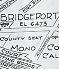 | Details | Hayden, Walter Emmet | 1954 |
| Northern Mono County Bridgeport Fishing Hunting Map |
|
Hayden, Walter Emmet |
|
| 1954 |
| LOC:89 |
| $350.00 | Hayden--Walter-Emmet | Northern-Mono-County-Bridgeport-Fishing-Hunting-Map | 1954 edition of the Hayden Map Company's Hunter's and Fisherman's Map and Resort Directory of Northern Mono County with Bridgeport, California. Map # 1162954. Copyright 1954. Verso blank. No price.
<br><br>
Inset small-scale context map of California. North oriented to bottom. |
| 6564 |  | Details | McCarty, Lea | 1955 |
| Scarce pictorial map of Sonoma County |
|
McCarty, Lea |
|
| 1955 |
| LOC:89 |
| $350.00 | McCarty--Lea | Scarce-pictorial-map-of-Sonoma-County | Fun, activity-oriented cartograph or pictorial map of Sonoma County, California by artist Lea McCarty. From a folding brochure "Fascinating Sonoma County in California's Redwood Empire Wonderland" issued in 1955 by the Sonoma County Board of Supervisors and Associated Chambers of Commerce of Sonoma Valley Inset context map withing a colorful compass rose shows Sonoma County in relationship to San Francisco and other nearby counties in California.
<br></br>
Coverage on this amusing map of Sonoma County includes portions of the surrounding counties: Napa County, Mendocino County and Marin County as well as numerous Sonoma County highlights to include:
<div class="indenttextblocksingle">
<ul style="list-style-type: circle;"></li>
<li>Bodega Bay</li>
<li>Bohemian Grove</li>
<li>Stewarts Point</li>
<li>Healdsburg</li>
<li>Digger Indian Reservation</li>
<li>Petrified Forest</li>
<li>Burbank Gardens, and</li>
<li>Petaluma</li>
</ul>
</div> |
| 6387 | 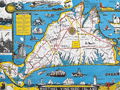 | Details | Parker, Larry | 1955 |
| Pictorial Map of Martha's Vineyard Island, Massachusetts |
|
Parker, Larry |
|
| 1955 |
| LOC:87 |
| $750.00 | Parker--Larry | Pictorial-Map-of-Martha-s-Vineyard-Island--Massachusetts | Original, scarce, 1950's Martha's Vineyard Island, Massachusetts pictorial map by Larry Parker. This lithographed tourist map features bright, bold colors, inset pictorial images of island life, and text blocks of historical facts, all hallmarks of a tourist souvenir map. Slight gloss to the paper finish as typical.
<br></br>
Remarkable condition.
<br></br>
This 1950's era edition is based on Parker's earlier 1935 black and white map of Martha's Vineyard Island. Not only does the new edition feature vivid lithographed color, several changes were made to the content including below the rope-wrapped bollard where the text "Edgartown Harbor" does not appear directly below the bollard. On this colored edition of Parker's map the area is blank. |
| 5025 | 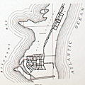 | Details | Florida State Road Department | 1955 |
| Lot of 14 Florida County General Highway and Transportation Maps |
|
Florida State Road Department |
|
| 1955 |
| LOC:0 |
| $900.00 | Florida-State-Road-Department | Lot-of-14-Florida-County-General-Highway-and-Transportation-Maps | Lot of fourteen (14) transportation maps of Florida, published by the Florida State Road Department, Traffic Planning Division in coordination with the U.S. Department of Commerce Bureau of Public Roads. Mid 20th-century.
<br></br>
<b>General Highway and Transportation Maps:</b>
<div class="indenttextblocksingle">
<ul style="list-style-type: circle;">
<li>Lafayette County. 1936 Revised 1956. </li>
<li>Madison County. 1936 Revised 1955.</li>
<li>Suwannee County. 1936 Revised 1956.</li>
</ul>
</div>
<b>General Highway Maps:</b>
<div class="indenttextblocksingle">
<ul style="list-style-type: circle;">
<li>Baker County. 1955.</li>
<li>Palm Beach County. 1949. 3 of 4 sheets. </li>
<li>Bay County. 1956. 2 of 2 sheets. </li>
<li>Calhoun County. 1949.</li>
<li>Bradford County. 1951 / 1956. </li>
<li>Dade County. 1952 / 1956. Supplemental sheet.</li>
<li>Flagler County. 1948. </li>
<li>Union County . 1951 / 1956. </li>
<li>Liberty County. 1953. </li>
<li>Escambia County. 1956. Supplemental sheet. </li>
<li>Washington County. 1951 / 1956. </li>
</ul>
</div> |
| 4705 | 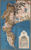 | Details | Cape Peninsula Publicity Association | 1955 |
| The Cape Peninsula, South Africa |
|
Cape Peninsula Publicity Association |
|
| 1955 |
| LOC:88 |
| $200.00 | Cape-Peninsula-Publicity-Association | The-Cape-Peninsula--South-Africa | Colorful 4-color lithographed map of Cape Town, South Africa with numerous fishing sites identified in False Bay, Table Bay, Hout Bay, Chapmans Bay and the coastal margins of the Cape Peninsula as far south as the Cape of Good Hope. Very interesting and colorful map with topographic detail of the nearby Table Mountain, Twelve Apostles, Steenberg and Constantia Mountains. Includes Seal Island, Roman Rock.
<br></br>
Original highly graphic map of 1955 with photos and text on the verso of a folding brochure "The Cape Peninsula- A Map for Visitors."
<br></br>
Drawn by PLIK. Cape Peninsula Publicity Association. Cape Town. 4-colour litho plates by Photo Process (Pty.) Ltd. Cape Town. Printed by Galvin and Sales (Pty.) Ltd. Cape Town. Copyright 1955 |
| 6834 | 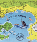 | Details | Melendez, Gilberto | 1955 |
| Fine mid-century pictorial map of Acapulco Mexico |
|
Melendez, Gilberto |
|
| 1955 |
| LOC:86 |
| $395.00 | Melendez--Gilberto | Fine-mid-century-pictorial-map-of-Acapulco-Mexico | Quite attractive touristic pictorial map of Acapulco Bay and surrounding areas. Inset map at top in a larger scale showing the road network between Acapulco and Mexico City. Additional inset map at right of Centro Downtown. Scarce.
<br><br>
Map contains an inset of the main advertiser, Hotel Caleta. Noted features include Isla la Roqueta, Puerto Marquez, el Patal Beach, Playa Suave, and many more. Inset tables identify local nightclubs and beaches. Produced by Gilberto Melendez. |
| 3629 |  | Details | Nickerson, K.F. | 1955 |
| Manuscript chart of Cape Cod, Massachusetts Bay, Provincetown |
|
Nickerson, K.F. |
|
| 1955 |
| LOC:200 |
| $450.00 | Nickerson--K-F- | Manuscript-chart-of-Cape-Cod--Massachusetts-Bay--Provincetown | An interesting manuscript chart of Cape Cod and Cape Cod Bay in black and red ink. Not only does the chart have a different look than a printed chart but the item raises questions as to why so much care was placed on its creation. Signed by K.F. Nickerson and dated to February 1955.
<br></br>
Detailed mid 20th-century manuscript chart of Cape Cod, Massachusetts Bay and Cape Cod Bay. The MS chart is drawn on the verso of an earlier chart from 1935. Nickerson apparently cannibalized an old chart simply to create his chart on the back. We don't know why Nickerson spent so much time on the chart but it is evident he spent hours meticulously copying from an unknown source. Perhaps the map was constructed for sale as a tourist keepsake. More likely it had some utility to Nickerson in his occupation, because the chart detail is at a granular level that could be used for navigation.
<br></br>
Contains info on radio beacons, depth soundings, maritime hazards, aids to navigation and much more. Scale 1/2 inch = 1 mile. |
| 6340 |  | Details | Johnson, W.R. | 1955 |
| Plan of the Atomic Tunnel 1950's attraction near Daytona Beach |
|
Johnson, W.R. |
|
| 1955 |
| LOC:11 |
| $199.00 | Johnson--W-R- | Plan-of-the-Atomic-Tunnel-1950-s-attraction-near-Daytona-Beach | Lithographed plan / view of the <i>"World's Most Unusual</i> Atomic Tunnel". A four-panel <strong>Florida roadside-attraction</strong> brochure from the early 1950s. An atomic age wonder! The illustrator is unknown but his interpretation of Happy the Walking Fish is a high point in mid-century illustration with Happy dressed to the nines in bow tie, top hat, and tuxedo and carrying a cane.
<div class="indenttextblocksingle">
" … it was a long, white concrete building in the shape of a meandering tube, studded with 824 "port holes" (variously shaped small windows) that was designed primarily as a showcase and shop for exotic orchids. It also featured tropical birds, a monkey, and "Happy, the walking fish," a typical Southeast Asian "walking" catfish that could be prodded into flipping its way across a short dry connection from one tank to another." (1)
</div>
<BR />
<div id="1" align="center">
<a title="Atomic Tunnel">
<img id="TunnelPlan" src="/ZoomifyImages/SC_6340/SC_6340_Happy_400x300.jpg" alt="Atomic Tunnel" width="240"
/>
</a>
</div>
<div id="2" align="center">
<a title="Atomic Tunnel">
<img id="TunnelPlan" src="/ZoomifyImages/SC_6340/SC_6340_400x300.jpg" alt="Atomic Tunnel" width="300"
/>
</a>
</div>
<br />
<u>Verso</u> contains two reverse-profile portraits of "Happy, the Walking Fish" and also two fold-in panels showing a map and plan of the Atomic Tunnel with happy visitors strolling along walkways. The illustrator cleverly uses two different levels of scale on this work, at top a linear representation with mile boards of HWY 1 stretching from Daytona Beach, Florida through Port Orange to the Atomic Tunnel and below on the same page a plan view of the Atomic Tunnel's tunnels, rooms and walkways at a large scale. The <u>recto</u> shows detailed photographs of the rooms including the Fish room, Bird room and Cactus room. |
| 6750 |  | Details | Nicholson, George F. | 1956 |
| Unrecorded Marina del Rey Economic Study |
|
Nicholson, George F. |
|
| 1956 |
| LOC:2001 |
| $950.00 | Nicholson--George-F- | Unrecorded-Marina-del-Rey-Economic-Study | Unrecorded, detailed analytical economic report "Marina del Rey Economic Study" produced March 5, 1956 by George F. Nicholson, C.E. Consulting Engineer.
<br><br>
A detailed report by Nicholson bound with transmittal letter and six-page summary from Nicholson to J.A. Lambie, Los Angeles County Engineer. Hard cover. 79 pages text. Table of Contents. Three maps. One site photograph. Four tables. Manuscript signature inside cover for Walt Petty.
<br><br>
Rare. No copy of this report is found anywhere online. |
| 5283 |  | Details | Torrey, Bill Sr. | 1956 |
| Rare privately published map of Ossabaw Island, Georgia |
|
Torrey, Bill Sr. |
|
| 1956 |
| LOC:10 |
| $750.00 | Torrey--Bill-Sr- | Rare-privately-published-map-of-Ossabaw-Island--Georgia | Rare, a privately-published first edition map of Ossabaw Island, Georgia from 1956 with roads, woods, ponds, marsh, and artesian wells as the chief focus. Contains an inset map showing the generalized coastline from Savannah to Brunswick, Georgia. Just behind the Egg Islands, at the north end of Ossabaw Island, Torrey's Landing is simply labeled "Boat House". Two additional maps on the verso.
<br></br>
The map was created and privately published by William F. "Bill" Torrey Sr., the son of Henry Torrey and Nell Ford Torrey who purchased the island in 1924. Bill Torrey Sr. ran a timber operation and a cattle business, Circle T. Ranch, on Ossabaw Island in the 1950's. The cattle business Torrey operated was no doubt the reason that the location of artesian wells on the island was considered as a key data point.
<br></br>
Together the three maps were designed for use by visitors to the island, providing route details from the DeSoto hotel in Savannah, GA to the Torrey Dock at Vernon View (verso); then from the dock to St. Catherine's Sound and Ossabaw Sound (verso). Once visitors had docked at Torrey Landing boat house the map (recto) served as a guide to the entire island. This map, by Torrey who knew the island well, is the reference source for place names and island locations on more recent maps. Source (DuBose, Elizabeth. Executive Director, Ossabaw Island Foundation. June, 2020. Personal communication.)
<br></br>
Ossabaw Island is Georgia's third largest barrier island, with 26,000 acres total - 9,000 acres of high ground. Ossabaw is bounded by the Atlantic Ocean to the east; the Bear River/ Florida Passage of the Intracoastal Waterway to the west; the Ogeechee River to the north; and, St. Catherine’s Sound to the south. |
| 5229 |  | Details | Hoff, P. J. | 1956 |
| Early Television Weather Map P. J. Hoff Chicago WBBM Channel 2 |
|
Hoff, P. J. |
|
| 1956 |
| LOC:53 |
| $770.00 | Hoff--P--J- | Early-Television-Weather-Map-P--J--Hoff-Chicago-WBBM-Channel-2 | Rare manuscript cartoon television weather map for the Chicago, Illinois area from Friday, September 14, 1956. With a very unusual mechanical enhancement (string) for animating the map that foreshadows later computer-generated animation of TV weather maps.
<br></br>
This manuscript map was drawn during the early days of television by P. J. Hoff, one of Chicago's best known TV's personalities, at WBBM Channel 2. Hoff was known for his large weather maps drawn with a black wide-tipped marker and populated with two-dimensional cut-outs representing weather features: clouds, raindrops, umbrellas, suns, and an assortment of cartoon characters including Nanook North Wind, Susanna South Wind, and "The Vice President in Charge of Looking Out the Window."
<br></br>
Here the "V.P." is fashioned with two strings to permit the character to be pulled though a wringer with a bucket at the bottom labeled "H 2 0". All in fun to illustrate the forecast for rain. At right, a Chinese character promises more of the same weather in the eastern part of the weather area: "Allee Samee Okley You Sneeze." Today that stereotype would be considered politically incorrect.
<br></br>
With an ink MS dedication by Hoff to David Rowley.
<br></br>
Hoff (1896-1981) was born Piercy J. Hoffstrom in Mounds, Oklahoma. In 1963 Hoff was so well known locally that he patented and sold a "P.J. Hoff Weather Kit" with a printed blank map, cut-out characters, and other weather-related items based on his on-air maps as his prototype. In 1968, after a career as a columnist, cartoonist, and radio/TV personality Hoff retired to Saint Simons Island, Georgia.
<br></br>
WBBM-TV began as WXBK in 1940, but in 1953 was sold to CBS in a complex swap whereby CBS took over WBBM-TV.
<br></br>
Source </br>
https://www.robertfeder.com/2014/09/10/remembering-p-j-hoff-chicagos-original-weatherman-with-character/ |
| 6811 |  | Details | Maury, Matthew Fontaine | 1956 |
| Matthew Maury's Whale Chart Third Ed |
|
Maury, Matthew Fontaine |
|
| 1956 |
| LOC:0 |
| $2,500.00 | Maury--Matthew-Fontaine | Matthew-Maury-s-Whale-Chart-Third-Ed | Rare world-wide thematic chart of reported whale sightings by Matthew Fontaine Maury. Provides data on whale sightings by season, geographic area, whale species, and relative frequency. First published in 1851 but this 3rd edition printed in 1956.
<br><br>
Maury's Whale Chart provided valuable information about the migratory patterns of various whale species based on data collected from whalers and merchant ships and depicted the seasonal movements of different whale species in the Atlantic and Pacific Oceans. It included information about the regions where whales were most commonly found during specific times of the year, helping whalers optimize their efforts and increase their chances of successful hunts.
<br><br>
The last three editions of Maury's Whale Chart may be identified thus:
<div class="indenttextblocksingle">
<ul style="list-style-type: circle;">
<li><b>Third Edition (1956)</b></br>
Upper top left position with logo of eagle clutching items in claws surrounded by text: "Hydrographic Office U.S. Navy". Top right position is blank. Bottom right position reads "Price 20 cents / H.O. Miscel. No. 8514".</li>
<li><b>Fourth edition (1960)</b></br>
Upper top left position with logo of eagle over an anchor surrounded by text: "United States Hydrographical Office". Top right position reads "Catalog: Introduction. Part 1.". Bottom right position reads "Price 50 cents / H.O. Miscel. No. 8514" .
</li>
<li><b>Fifth edition (after 1972)</b></br>
Upper top left with logo containing an eagle perched on a globe with text "Defense Mapping Agency". Top right position reads "Catalog P2V10". Bottom right reads "Lith of Wm. Endicott & Co. N. York | 5018 | DMA Stock Number | W0XZC5018.</li>
</ul>
</div> |
| 6508 |  | Details | Moss, Ira | 1957 |
| Pictorial Sportsmen's Fishing Map United States and Neighboring Waters |
|
Moss, Ira |
|
| 1957 |
| LOC:141 |
| $275.00 | Moss--Ira | Pictorial-Sportsmen-s-Fishing-Map-United-States-and-Neighboring-Waters | Scarce original 1957 fisherman's map of the United States and Neighboring Waters designed by Ira Moss and produced by Barry, Moss, and Shore. Border is decorated with numerous images of fishing flies and saltwater fishing lures.
<br><br>
Saltwater fish, freshwater fish. Swordfish, bonefish, weakfish, flounder. Whitefish, bluefish, jewfish, croaker. No redfish but "channel bass" with a spot. Wahoo !
<br><br>
Includes small inset maps of the USA showing where a few specific species are most prevalent. Several inset tables: lists of saltwater fish, and freshwater fish; list of states and locations keyed to fish species,
<br><br>
Copyright 1957. Published by Shorewood Press, Fine Arts Publishers, New York. |
| 4868 |  | Details | British Admiralty Hydrographical Office | 1957 |
| Chart Malacca Strait Pandang One Fathom Bank to Singapore. |
|
British Admiralty Hydrographical Office |
|
| 1957 |
| LOC:59 |
| $500.00 | British-Admiralty-Hydrographical-Office | Chart-Malacca-Strait-Pandang-One-Fathom-Bank-to-Singapore- | British Admiralty (United Kingdom Hydrographic Office) chart of the Strait of Malacca with portions of coastal Sumatra and Malaysia. Published May 21, 1954 but this sheet with corrections to 1957. Verso with a green ink stamp and the 1957 correction date by the seller: Iver C. Weilbach and Co. Copenhagen.
<br></br>
Singapore at bottom right. This presumed second state of the 1954 edition of 'Pandang and One Fathom Bank to Singapore' is distinguished by an expertly executed 2" x 3" pasted correction to coastal details at 103 degrees longitude in the vicinity of Senggarang. Includes the Johore Strait.
<br></br>
Scale 1/885,000. Chart number 1358. |
| 5491 |  | Details | Eldredge, Everett R. | 1957 |
| Pickwick Ale Massachusetts Salt Water Guide Fishing Map |
|
Eldredge, Everett R. |
|
| 1957 |
| LOC:150 |
| $1,450.00 | Eldredge--Everett-R- | Pickwick-Ale-Massachusetts-Salt-Water-Guide-Fishing-Map | Very rare large original fishing map / advertising poster published and copyrighted by Haffenreffer Brewery, Boston, Massachusetts in 1957. No copies of this map are recorded anywhere online.
<br></br>
At bottom left, the map contains a photo and facsimile signature of Capt. Everett "Gunny" Eldredge holding a can of Pickwick Ale. Below the photo Eldredge is described as "Skipper of the Gannett II, Salt Water Sports Fishing Expert, Chatham, Mass."
<br></br>
Haffenreffer Brewery, established in 1870, was a former brewer in Jamaica Plain, Massachusetts. The Haffenreffer Brewery closed in 1965 and their brands, including Pickwick Ale, were sold to Narragansett Brewing Company.
<br</br>
Everett R. ‘Gunny’ Eldredge (1909 - 1999) was born in Boston and raised in Chatham, Mass. During World War II he served in the Merchant Marine. Eldredge was a licensed charter boat captain, a taxidermist, artist, and a respected naturalist and teacher. He was the builder, owner and director of a nature day camp for boys, and later of Camp Malabar Sea Camp for boys from 1936 to 1951. He built and owned Eldredge Marine Basin at Oyster River, now the Chatham Yacht Basin. Eldredge was the author of the Pickwick Ale Massachusetts's Sportsman's Guide. |
| 6411 |  | Details | Overly, Charles H. | 1957 |
| 1st ed. Block Island Town of New Shoreham Rhode Island |
|
Overly, Charles H. |
|
| 1957 |
| LOC:89 |
| $450.00 | Overly--Charles-H- | 1st-ed--Block-Island-Town-of-New-Shoreham-Rhode-Island | Very nice original pictorial map of Block Island, Rhode Island lying in Block Island Sound by Charles H. Overly. First edition map printed in 1957. The map is printed on laid paper with a light brown tint throughout to simulate age.
<br><br>
Esta Gray operated a gift shop in Old Harbor, Block Island- Esta's Gifts of Distinction. In 1957 Esta commissioned Charles H. Overly to draw the map of Block Island to sell to tourists visiting her shop. This edition contains Esta' Grays 1957 copyright notice and a double decorative rope-work border.
<br><br>
Charles H. Overly (1908-1970) was a University of Vermont graduate and artist. Returning home after a long tour of Europe, Overly began the Charles H. Overly Studio in 1938. He is best known for sketches and paintings of New England historical landmarks. |
| 5255 |  | Details | Anonymous | 1958 |
| Pictorial Map of Sanlando Springs attraction near Longwood, Florida |
|
Anonymous |
|
| 1958 |
| LOC: |
| $125.00 | Anonymous | Pictorial-Map-of-Sanlando-Springs-attraction-near-Longwood--Florida | Colorful pictorial map of the Sanlando Springs tourist attraction in Central Florida. Map is surrounded with drawings of family-oriented activities available at Sanlando: Jungle Cruise, outdoor cooking, dancing on the patio. Based on the postal rate of 3 cents this item probably dates to the late 1950's. Folding map, verso with space for a stamp and address as well as a pre-written letter in script touting the many things to do at Sanlando.
<br></br>
Sanlando Springs, along with nearby Rock Springs, Wekiwa Springs and Palm Springs, form the headwaters of the Wekiva River.
<br></br>
The spring, originally Hoosier Springs, was used for recreation as far back as the 1880's. The location was renamed as Sanlando by Altamonte Mayor J.F. Haithcox who developed the location as an amusement park in the 1920's. (Source: https://studiohourglass.blogspot.com/2013/06/giving-new-life-to-sanlando-springs.html). |
| 7893 |  | Details | Oberbacher, Hans | 1958 |
| Lido di Jesolo beach near Venice Italy |
|
Oberbacher, Hans |
|
| 1958 |
| LOC: |
| $255.00 | Oberbacher--Hans | Lido-di-Jesolo-beach-near-Venice-Italy | Fine birds-eye view, "Lido di Jesolo", with Venice, Italy at the left. By Hans Oberbacher. 1958.
<br><br>
Lido di Jesolo, a popular seaside resort town, is situated within the metropolitan city of Venice, Italy. It is well known for its long sandy beach and vibrant nightlife, and it serves as a popular tourist destination, especially during the summer months. Lido di Jesolo is situated on the Adriatic coast close to Venice, making it a convenient location for visitors looking to enjoy both the beach and the historic city of Venice.
<br><br>
The region surrounding Jesolo has been featured in cartographic works dating back to the 14th century or earlier, crafted by renowned cartographers such as Pietro Vesconte, Fra Mauro, Benedetto Bordone, and Vincenzo Maria Coronelli, among others. These prior charts provide insight into the development of the Venetian Lagoon over time.
<br><br>
Jesolo has a history that dates back to ancient Roman times when it was known as Equilium, meaning "city of horses." The area was largely abandoned during the Middle Ages due to the decline of the Roman Empire and encroachment of the surrounding marshlands.
<br><br>
During the era of the Republic of Venice, which lasted from the 8th to the 18th century, the Venetians began to drain and reclaim the land for agriculture and fishing. The first settlements were established in the 19th century, and the town was renamed Cavazuccherina.
<br><br>
The opening of the first beach resort in 1911 marked the beginning of tourism in Lido di Jesolo. However, it was not until the post-World War II period that the town experienced a significant boom in tourism. During the 1950s and 1960s, rapid development and urbanization transformed Lido di Jesolo into one of the most popular seaside resorts in Italy. |
| 6651 |  | Details | Macdonald, John Ross | 1958 |
| Birds Eye View of Cape Cod Nantucket Marthas Vineyard |
|
Macdonald, John Ross |
|
| 1958 |
| LOC:89 |
| $400.00 | Macdonald--John-Ross | Birds-Eye-View-of-Cape-Cod-Nantucket-Marthas-Vineyard | Original Map of Cape Cod and the Islands including Nantucket and Martha's Vineyard by John Ross McDonald, 1958. Apparently Macdonald, a local artist, published this map of Cape Cod himself after a painting he created. The map is notable for its photo-realistic appearance. Includes Nantucket Sound, The Atlantic Ocean, Vineyard Sound, Buzzard's Bay, and Cape Cod Bay. |
| 5097 |  | Details | Withers, James Harlan | 1958 |
| A Texan's Map of U.S.A. |
|
Withers, James Harlan |
|
| 1958 |
| LOC:0 |
| $500.00 | Withers--James-Harlan | A-Texan-s-Map-of-U-S-A- | A Texan's Map of U.S.A. A derivative edition of a classic pictorial "humorous" map with more than a whiff of the intolerance that some believe permeates the state of Texas today. Tablecloth-sized map of the United States on Indian Head cloth [1] based on a design copyrighted by J.H. Withers in 1947 and branded with the imprint of Lackland Air Force Base in San Antonio, Texas.
<br></br>
Wither's distinctive design elements include a revised shape for Texas which extends to the west coast to provide Texas with a space for a "future seaport" and the appellation "damm' Yankee territory" for most of the northeast U.S.A.
<br></br>
The Catalog of Copyright Entries for 1947 records a copyright for "A Texan's Map of U.S.A.", held by James Harlan Withers of San Angelo, Texas. Wither's 1947 pictorial map is the earliest documented example of a genre of pictorial map with many derivative versions that begin with the fact that Texas was, at the time, the largest state in the U.S. and extend that simple premise to exaggerate the importance and quality of the state of Texas over the every other state in the U.S.A.
<br></br>
Early 50's date is supported by the fact that neither Alaska nor Hawaii, which both attained statehood in 1959, are mentioned on the map.
<br></br>
[1] Indian Head cloth was not manufactured after 1962. Indian Head Cloth Permanent Finish Sanforized stamping on a single line is associated with cloth produced from the late 1940s to early 1950s. (Source: http://info.fabrics.net/indian-head-remembered-revisiting-an-american-institution/) |
| 5118 |  | Details | Coker, Broward | 1958 |
| Sebring Endurance Race Official Safety and Communications Card |
|
Coker, Broward |
|
| 1958 |
| LOC:11 |
| $125.00 | Coker--Broward | Sebring-Endurance-Race-Official-Safety-and-Communications-Card | Official safety and communications card for the 12-Hour Florida International Grand Prix of Endurance. This 12-hour endurance race for the Amoco Trophy was held at the Sebring Air Terminal on March 22, 1958, the seventh year the race was run. A Ferrari 250 TR 58, driven by Phil Hill and Peter Collins won the race.
<br></br>
Map shows the course layout among the runways and taxiways of the air terminal. The card documents radio communications procedures and protocols for ambulances and fire trucks during the race.
<br></br>
Sebring International Raceway, America’s oldest road racing track, evolved from Hendricks Field, a World War II airbase used to train B-17 combat crews. Sebring is well known for celebrity participation. Steve McQueen, James Brolin, Paul Newman, Gene Hackman and even journalist Walter Cronkite have competed in the race. (Source: https://www.sebringraceway.com/track-info/about-sir) |
| 5245 |  | Details | Brindle, Melbourne | 1958 |
| Authentic Treasure Map of the Eastern Seaboard |
|
Brindle, Melbourne |
|
| 1958 |
| LOC:88 |
| $200.00 | Brindle--Melbourne | Authentic-Treasure-Map-of-the-Eastern-Seaboard | Scarce mid 20th-century decorative <b>treasure map</b> by artist Melbourne Brindle of Bridgewater Connecticut. A chart of shipwrecks along the East Coast of the United States from Sandy Hook, NJ past Long Island and Block Island Sound as far as Horseneck Beach, Massachusetts. With an inset map of Delaware Bay and another inset map of the waters off Cape Cod, Nantucket and Martha's Vineyard. No holdings of this map recorded in WorldCat. Lacks attached sheet of wreck locations.
<br></br>
Map copyrighted 1958 by United States Treasure Maps, Litchfield, Connecticut.
<br></br>
Ewart Melbourne Brindle (1904 – 1995) was an Australian-American illustrator and painter who in mid-career became for his automobile illustrations. In 1958 Brindle published another similar map: "An authentic map of Florida, the Gulf of Mexico, and the Caribbean Sea, showing locations of sunken treasure." |
| 6716 |  | Details | Greater Wilmington Chamber of Commerce | 1958 |
| New Hanover County Pictorial Fishing Map Mid century |
|
Greater Wilmington Chamber of Commerce |
|
| 1958 |
| LOC:86 |
| $175.00 | Greater-Wilmington-Chamber-of-Commerce | New-Hanover-County-Pictorial-Fishing-Map-Mid-century | Pictorial fishing map from 1958 of New Hanover County, NC. Drawn by Art Newton. Shows pictorially many locations for public fishing piers, surf fishing spots, wrecks, charter boats, boat launches and more. Soundings are provided near the beach and numerous inlets are identified including Carolina Beach Inlet, Masonboro Inlet, Moore Inlet, and Rich Inlet. Decorated with local fish: Flounder, Dolphin, Amberjack, Barracuda, Sailfish, and Bonito.
<br><br>
Copyrighted and published by the Greater Wilmington Chamber of Commerce, 1958. Printed by the Wilmington Printing Company, Wilmington, North Carolina.
<br><br> |
| 7884 |  | Details | Chase, Francis J. | 1959 |
| Pictorial Map of Alaska, the 49th State |
|
Chase, Francis J. |
|
| 1959 |
| LOC: |
| $295.00 | Chase--Francis-J- | Pictorial-Map-of-Alaska--the-49th-State | Ernest Dudley Chase's "A Pictorial Map of Alaska, the 49th State" is a fascinating visual representation of Alaska's history and its journey to statehood. The map, created in 1959, celebrates Alaska's admission to the Union as the 49th state on January 3 of the same year. Chase's signature style, combining attractive illustrations with geographical information, provides a unique perspective on this momentous event in American history.
<br><br>
The Chase's map incorporates an alphanumeric grid system to help users easily locate specific points of interest. Surprisingly, the map retains its original advertising sticker, prominently displayed in the upper left corner, bearing a price of 50 cents. The presence of the sticker serves as a testament to its authenticity, further enhancing its overall value and desirability.
<br><br>
The map showcases various aspects of Alaskan life, including its natural resources, industries, and cultural heritage. Chase depicts the state's diverse landscapes, from the rugged coastlines to the majestic mountain ranges, highlighting the beauty and vastness of America's last frontier.
<br><br>
Chase's map also chronicles the historical events leading up to Alaska's statehood, such as the purchase of Alaska from Russia in 1867, known as "Seward's Folly," and the discovery of gold in the late 19th century, which led to the Klondike Gold Rush. The map portrays the development of Alaska's major cities, including Anchorage, Fairbanks, and Juneau, as well as the growth of its industries, such as fishing, mining, and logging.
<br><br> |
| 6410 |  | Details | Santos, George | 1959 |
| Rare pictorial map of Australia with local fauna produced for Shell Oil Company |
|
Santos, George |
|
| 1959 |
| LOC:89 |
| $1,200.00 | Santos--George | Rare-pictorial-map-of-Australia-with-local-fauna-produced-for-Shell-Oil-Company | A very beautiful original 1959 lithographed pictorial map of Australia decorated profusely with drawings of Australian animals. Guaranteed original. Scarce on today's market.
<br><br>
Artwork by George Santos for the Shell Oil Company of Australia. Shell Oil Company logo at upper left.
<br><br>
Overall dimensions: 17.5 in. x 22.25 or 45 cm. x 57 cm.
<br><br>
Legend contains an inset key map and a list that denotes the names of the animals related numerically to positions on the key map.
<br><br>
Very rare. Only two institutional holdings are cataloged in WorldCat, both within Australia. |
| 4962 |  | Details | Hayden, T.A. | 1959 |
| Huge Unrecorded Map of the Salt River Project Phoenix Arizona |
|
Hayden, T.A. |
|
| 1959 |
| LOC:1409 |
| $2,500.00 | Hayden--T-A- | Huge-Unrecorded-Map-of-the-Salt-River-Project-Phoenix-Arizona | Large, very rare map of the first Federal hydroelectric energy project, updated to show hydrological improvements and issued revised 8-7-1959. An untitled birds-eye view map of the Salt River Project by T.A. Hayden, centered near Phoenix, Arizona. Similar to, but covering a larger area, than a small format map of the region by Hayden from 1934, now housed at Arizona State University.
<br><br>
Blue-line print hand-colored and enhanced with small red paste-on stickers and larger, manuscript lettering for cities. Shows the rivers, dams, reservoirs, lakes, and canals . Particular interest is indicated for reservoirs and canals as they have been hand colored in white and bright blue respectively.
<br></br>
The beginning of federal production of electric power occurred on the Salt River Project when Congress, in 1906, authorized the Reclamation Service to develop and sell hydroelectric power from the project. The map is significant because it was updated in 1959 when the original name "Salt River Dam #1" was changed to the name in use today: Roosevelt Dam.
<br></br>
Coverage is bound to the west by Gila Bend and to the east by Superior, AZ. Northern coverage ends above Prescott, Arizona, and to the south the map extends as far as Casa Grande.
<br></br>
The map has an interesting orientation with North oriented about 35 degrees to the left and that with the birdseye perspective, the large size, and the township and range grid of the Public Lands Survey System all give the map a commanding appearance.
<br></br>
In the 1930's T.A. Hayden was the Chief Assistant Engineer with the Salt River Valley Water User's Association, Phoenix. Copyrighted 1932 and Revised 1934 by T.A. Hayden. Final revision 1959. Phoenix, Arizona. |
| 6426 |  | Details | Pictorial Publications Limited | 1959 |
| Pictorial map of Wellington, New Zealand |
|
Pictorial Publications Limited |
|
| 1959 |
| LOC:90 |
| $550.00 | Pictorial-Publications-Limited | Pictorial-map-of-Wellington--New-Zealand | Apparently quite scarce original pictorial birds-eye view map of Wellington, New Zealand. The artist is unknown but the map was copyrighted and published ca. 1959 by Pictorial Publications Limited, Hastings, New Zealand. A fun, comical map of Wellington featuring local activities such as water-skiing, fishing, boating, swimming, and sailing. Small manuscript notation "Evening Post" on recto pointing to a building on Willis Street, downtown.
<br><br>
The map is surrounded with color photographic images of local Wellington, NZ attractions including:
<div class="indenttextblocksingle">
<ul style="list-style-type: circle;"></li>
<li>Oriental Bay</li>
<li>Massey Memorial</li>
<li>Wellington from Tinakori Heights</li>
<li>Riddiford baths</li>
<li>Carillon</li>
<li>Parliament buildings</li>
</ul></div>
Text on verso with historical and tourist-related details. Manuscript dedication on verso. |
| 6708 |  | Details | Allyn, Rube | 1960 |
| Allyns Fishing Map Lemon Bay 2G |
|
Allyn, Rube |
|
| 1960 |
| LOC:0 |
| $175.00 | Allyn--Rube | Allyns-Fishing-Map-Lemon-Bay-2G | DESCRIPTION: Original Rube Allyn's Authentic Fishing Map for Lemon Bay, Florida (ca. 1960). Drawn by Charlie Allyn and Barbara Hagerman. Points of interest include Gasparilla Sound, Coral Creek, Little Gasparillo Pass, Stump Pass, Stanford's Fishing Resort, Manasota Key, Englewood, and Alligator Creek.
<br></br>
Map # 2G. ca. 1960. Copyright Rube Allyn, St Petersburg, Florida. Great Outdoors Association. Pier 63, Central Basin, St. Petersburg, Florida. |
| 6709 |  | Details | Allyn, Rube | 1960 |
| Rube Allyn's Fishing Map Little Sarasota Bay Venice Florida 2F |
|
Allyn, Rube |
|
| 1960 |
| LOC:0 |
| $175.00 | Allyn--Rube | Rube-Allyn-s-Fishing-Map-Little-Sarasota-Bay-Venice-Florida-2F | DESCRIPTION: Original Rube Allyn's Authentic Fishing Map for the Little Sarasota Bay / Venice, Florida area. Key locations and features Allyn has noted include: Casey Key, Vamo, Osprey, Sarasota Beach, Midnight Pass, Tamiami Trail, Lyons Bay, and Roberts Bay. Perhaps the most interesting feature is a rock shelf (avg. depth 28 feet) that sinuously snakes its way just offshore the beach. Chart #2F.
<br></br>
Copyright Rube Allyn, St. Petersburg, Florida |
| 6329 |  | Details | Allyn, Rube | 1960 |
| Allyn's Fishing Map 2E Sarasota Bay |
|
Allyn, Rube |
|
| 1960 |
| LOC:61 |
| $135.00 | Allyn--Rube | Allyn-s-Fishing-Map-2E-Sarasota-Bay | Original Rube Allyn's Authentic Fishing Map (ca. 1960), for Sarasota Bay, Florida. Key features include Sister Key, Sleepy Lagoon, Dream Island, Buttonwood Harbor, Longboat Key, Sarasota, Ringling Isles and Big Sarasota Pass.
<br></br>
Map # 2E. Ca. 1960. Copyright Rube Allyn, St. Petersburg, Florida. Lithographed by MacDonald, Tampa. |
| 5049 |  | Details | Jungle Queen Tours | 1960 |
| Route Map Jungle Queen Sightseeing Cruises Fort Lauderdale |
|
Jungle Queen Tours |
|
| 1960 |
| LOC:11 |
| $80.00 | Jungle-Queen-Tours | Route-Map-Jungle-Queen-Sightseeing-Cruises-Fort-Lauderdale | Map of the routes followed by the "World Famous Original" Jungle Queen Sightseeing Cruises ca. 1960. Two cruises were offered on the New River by the operator departing from the Jungle Queen Docks in Bahia Mar, Fort Lauderdale, Florida. One option, the 3-hour Circular Jungle and Everglades Tour, was highlighted by a stop at the Seminole Indian Village (including alligator wrestling). For passengers desiring a later start, at 7:00 p.m. the Jungle Queen II departed with as many as 250 passengers for their Bar-B-Q and Shrimp Dinner cruise followed by a vaudeville review and dancing under the stars.
<br></br>
Three-panel folding brochure closes to a compact 4" x 9".
<br></br>
Tourism has been an important part on the Florida economy for more than 100 years. For many decades operators have offered boat tours as a way of showing off the many attractions of Florida to large numbers of customers. From glass-bottomed boats to mail boats to today's high-speed thrill rides the enthusiasm of tourists for excitement and entertainment on the water has not diminished. |
| 6707 |  | Details | Allyn, Rube | 1960 |
| Allyns Fishing Map Hillsboro Bay 2B Tarpon |
|
Allyn, Rube |
|
| 1960 |
| LOC:0 |
| $165.00 | Allyn--Rube | Allyns-Fishing-Map-Hillsboro-Bay-2B-Tarpon | DESCRIPTION: Original Rube Allyn's Authentic Fishing Map (ca. 1960), for lower Hillsboro Bay south of St. Petersburg, Florida. Features include McKay Bay, Black Point, Gadsden Point, Coon Hammock Creek, the Kitchen, East Tampa, Alafia River, and Delaney Creek. Shows an astounding number of locations to catch Tarpon!
<br></br>
Map # 2B. ca. 1960. Copyright Rube Allyn, St. Petersburg, Florida. Research by Doc Howe. Drawn by Jack Meyer. |
| 5056 |  | Details | Anonymous | 1960 |
| Map Seven Seas Sightseeing Miami and Miami Beach Cruise |
|
Anonymous |
|
| 1960 |
| LOC:11 |
| $85.00 | Anonymous | Map-Seven-Seas-Sightseeing-Miami-and-Miami-Beach-Cruise | Brochure for a 2.5 hour lectured cruise of North Biscayne Bay, Miami Beach, Florida aboard the double-decked motorboat Seven Seas. With a map of the cruise route (in red) around North Biscayne Bay.
<br></br>
Unlike other cruises on south Biscayne Bay (e.g. Uncle Sam cruise) the Seven Seas cruise was operated in<b> North Biscayne Bay</b>, departing from Pier 8 at the Miami City Yacht Basin twice daily. The cruise passed the Venetian Causeway, passed the Charles Deering estate, and sailed past the 79th street causeway, retiring past Mt. Sinai Hospital and making a circle in Sunset Lake before docking 2 1/2 hours later. Other points of interest included the Goodyear Blimp Base, Flagler Memorial Monument, Little River, and Indian Creek Village.
<br></br>
Printed on both sides and folds to 4" x 9". |
| 5029 |  | Details | Anonymous | 1960 |
| Map and Brochure New Uncle Sam Cruise Tour Biscayne Bay Florida |
|
Anonymous |
|
| 1960 |
| LOC:11 |
| $80.00 | Anonymous | Map-and-Brochure-New-Uncle-Sam-Cruise-Tour-Biscayne-Bay-Florida | Brochure for a 2.5 hour touristic cruise of Biscayne Bay, Miami Beach, Florida aboard the glass-enclosed motorboat Uncle Sam. With a map of the path of the cruise (in red) around Biscayne Bay.
<br></br>
The diesel-powered 84-passenger Uncle Sam departed Pier 10 at the Miami Yacht Basin in Bayfront Park and passed the Venetian Islands, the Flagler Memorial, Fisher's Island then crossed the Rickenbacher Causeway. On the return to the yacht basin the Uncle Sam passed the bayfront estates of James Deering (Villa Viscaya), Charles Coryell, Damon Runyon, and more.
<br></br>
Detailed inset map of access roads and parking for the Uncle Sam cruise. Multi-lingual brochure ca. 1960's with key details translated and targeted to appeal to a Spanish-speaking audience: "Mostrando especialmente las mansiones de Cubanos y Portorriquenos en la zona residential…"
<br></br>
Printed on both sides and folds to 4" x 9". |
| 6593 |  | Details | Hayden, Walter Emmet | 1960 |
| June Lake Lee Vining Directory Map Fishing Hunting Map |
|
Hayden, Walter Emmet |
|
| 1960 |
| LOC:89 |
| $160.00 | Hayden--Walter-Emmet | June-Lake-Lee-Vining-Directory-Map-Fishing-Hunting-Map | 1960 revised edition of the Hayden Map Company's Hunter's and Fisherman's map for the June Lake / Lee Vining area of Mono and Inyo Counties, California. Map # 61912. Copyright 1952. Verso blank.
<br><br>
Price was 50 cents when issued. Printed in bright blue ink.
<br><br>
Inset small-scale context map of California. |
| 5346 |  | Details | Kellogg, Charles W. | 1960 |
| Pictorial Map of Seats on Talbot County Waterways |
|
Kellogg, Charles W. |
|
| 1960 |
| LOC:53 |
| $480.00 | Kellogg--Charles-W- | Pictorial-Map-of-Seats-on-Talbot-County-Waterways | Scarce pictorial thematic map with more than 80 historic estates (seats) near Chesapeake Bay in Talbot County, Maryland. Each estate is numbered and keyed to a list with the names of their owners. Small elevation drawings of each estate provide a rough idea of how the estate looked in 1960. The map includes some old historic points of interest in Talbot County such as the old Wye Church and Friends Meeting House.
<br></br>
The large waterways shown on this estate map include the Wye River, Miles River, Harris Creek, Broad Creek, Tred Avon River, and Choptank River. Smaller waterways include among others, Goldsborough Creek, Leeds Creek, Island Creek, and Trappe's Creek. Towns in Talbot County include St. Michaels, Easton, Oxford, Queen Anne, and Trappe.
<br></br>
Map Title: "Seats on Talbot County Waterways Chesapeake Bay." By Charles W. Kellogg. Updated edition from 1960 of a map that Kellogg first published in 1949. Charles Kellogg's own estate on Skipton Creek, numbered as #1 was "Langshaws".
<br></br>
Several of the seats listed in Talbot County in 1960 are found today in the National Register of Historic Places.
<div class="indenttextblocksingle">
<ul style="list-style-type: circle;">
<li>The Anchorage: Easton. Robert L. Kemp</li>
<li>Compton: Trappe. Charles F.C. Arensberg</li>
<li>Otwell: Oxford. J. E. Jackson</li>
<li>Troth's Fortune: Easton. Frederick S. Thomas</li>
<li>Wye House. Easton. Morgan B. Schiller</li>
</ul>
</div> |
| 6736 |  | Details | Information Bureau Royal Afghan Embassy London | 1960 |
| Rare Pictorial tourist map of Afghanistan |
|
Information Bureau Royal Afghan Embassy London |
|
| 1960 |
| LOC:54 |
| $475.00 | Information-Bureau-Royal-Afghan-Embassy-London | Rare-Pictorial-tourist-map-of-Afghanistan | A serious (not comical) pictorial map of Afghanistan published in the early 1960's by the Information Bureau of the Royal Afghan Embassy in London.
<br><br>
Rare, only one copy in WorldCat, at the University of Nebraska, Omaha.
<br><br>
Map focuses on mosques, livestock, and natural resources of Afghanistan. Boundaries of provinces delineated with dotted lines, and mountain passes shown by reversed brackets. Small inset map of Wakhan and Pamir. Scale 1:2,000,000. Roads with distances between major cities. |
| 6710 | 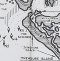 | Details | Allyn, Rube | 1960 |
| Rube Allyn's Fishing Map Boca Ciega Bay Clearwater 1B |
|
Allyn, Rube |
|
| 1960 |
| LOC:0 |
| $175.00 | Allyn--Rube | Rube-Allyn-s-Fishing-Map-Boca-Ciega-Bay-Clearwater-1B | DESCRIPTION: Original Rube Allyn's Authentic Fishing Map ca. 1960. for upper Boca Ciega Bay and Gulf Beaches. Locations and features that Allyn chose to include are: Clearwater Harbor, Reddington Beach, Upper Boca Ciega Bay, Madeira Beach, Long Bayou, Jungle Estates, Sunset Beach, Devil's Elbow, Blind Pass, and St. John's Pass.
<br></br>
Copyright Rube Allyn, St. Petersburg, Florida. Chart #1B. Drawn by Jack Meyer. |
| 5380 |  | Details | Royal Palm Harbor, Inc. | 1960 |
| Naples, Florida sales plat for Royal Harbor subdivision |
|
Royal Palm Harbor, Inc. |
|
| 1960 |
| LOC:90 |
| $250.00 | Royal-Palm-Harbor--Inc- | Naples--Florida-sales-plat-for-Royal-Harbor-subdivision | Scarce lithographed plat of lots for sale during 1960 in the Royal Harbor subdivision of Naples, Florida. The shaded areas consist of lots sold before October 1, 1960.
<br></br>
Originally developed in the 1960’s-1970’s, Royal Harbor is a waterfront community consisting of over 600 plus single family homes and condominiums located on the Eastern shore of Naples Bay. Royal Harbor is located near the heart of Naples, across the bay from Port Royal.
<br></br>
Published by Royal Palm Harbor, Inc. 1650 Curlew Avenue Naples Florida. |
| 5061 |  | Details | U.S. Army Engineers | 1960 |
| Two maps of recreation facilities on the Okeechobee Waterway. |
|
U.S. Army Engineers |
|
| 1960 |
| LOC:87 |
| $150.00 | U-S--Army-Engineers | Two-maps-of-recreation-facilities-on-the-Okeechobee-Waterway- | Two charts of recreation facilities on the Okeechobee Waterway stretching across the state from East Florida to West Florida. Recto with a map of recreation facilities including locks and dams along the Caloosahatchee River from Pine Island Sound to Moore Haven on Lake Okeechobee. Includes the Ortona Lock and Dam and the Franklin Lock and Dam.
<br></br>
Verso with a map of Lake Okeechobee and the Okeechobee waterway outlet to the Atlantic Ocean at Stuart, Florida. Published by the U.S. Army Corps of Engineers, Jacksonville District. |
| 5381 |  | Details | Smith Kline and French | 1962 |
| Thematic map of the USA allergy season by state |
|
Smith Kline and French |
|
| 1962 |
| LOC:88 |
| $220.00 | Smith-Kline-and-French | Thematic-map-of-the-USA-allergy-season-by-state | Decorative thematic advertising map of the continental United States showing the months during which three types of pollen are prevalent. The map, by Smith, Kline, and French Laboratories (SKF) was created to support sales of Teldrin Spansules, SKF's brand name for chlorpheniramine maleate, an antihistamine. This mid 20th-century map shows the pollen season for grass pollen, tree pollen, and ragweed pollen.
<br></br>
Philadelphia. October 1962. |
| 6391 |  | Details | Varvatis Brothers | 1962 |
| Very scarce pictorial map of Greece |
|
Varvatis Brothers |
|
| 1962 |
| LOC:150 |
| $500.00 | Varvatis-Brothers | Very-scarce-pictorial-map-of-Greece | Pictorial map of Greece. Scarce.
<br></br>
Produced by Hellenic Pictorial Cartography of Varvatis Brothers established 1930 Patent 10221 Copyright Varvatis Brothers.
<br></br>
Only one copy found in WorldCat, at BnF. |
| 5055 |  | Details | Anonymous | 1962 |
| Lot of six (6) scarce Fin Fishing Charts Lemon Bay to Tarpon Springs Florida |
|
Anonymous |
|
| 1962 |
| LOC:40 |
| $180.00 | Anonymous | Lot-of-six-(6)-scarce-Fin-Fishing-Charts-Lemon-Bay-to-Tarpon-Springs-Florida | Lot of six scarce "Fin Fishing Charts" for Florida coastal areas in the vicinity of Tampa Bay, Florida. Charts folded as issued.
<br></br>
All charts fit inside a point-of-sale envelope/folder printed with an index map of southern Florida showing all available Fin Fishing charts and highlighting these specific charts from Lemon Bay to Tarpon Springs: W7, W8, W9, W10, W11, W12.
<br></br>
Hot fishing spots are highlighted with red dots and tide table adjustments are included for several locations. Several marinas and other business establishments are noted in red on the charts, probably locations that sold these charts or that paid for the advertisement. Ink stamp on the folder carries a date of March 6, 1962. Creator of the charts is unattributed and very few, if any, of these charts are available on the market. |
| 5028 | 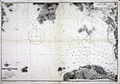 | Details | British Admiralty Hydrographical Office | 1963 |
| Chart of Hong Kong Waters West China South Coast |
|
British Admiralty Hydrographical Office |
|
| 1963 |
| LOC:59 |
| $1,000.00 | British-Admiralty-Hydrographical-Office | Chart-of-Hong-Kong-Waters-West-China-South-Coast | Twentieth-century British Admiralty nautical chart of western Hong Kong Harbor, Hong Kong Island, Victoria Harbor, and Belcher Harbor. Extends as far west as Lantau Island in the vicinity of Hong Kong Disneyland.
<br></br>
Engraved and first published by the Admiralty in 1903, this edition contains minor corrections to 1963. Chart number 3280. Numerous updates to aids to navigation shown in red ink. |
| 5089 |  | Details | WBOP Radio | 1963 |
| WBOP All-Negro AM Radio Pensacola Florida Coverage Map |
|
WBOP Radio |
|
| 1963 |
| LOC:11 |
| $225.00 | WBOP-Radio | WBOP-All-Negro-AM-Radio-Pensacola-Florida-Coverage-Map | Coverage contour map for AM radio station WBOP in Pensacola, Florida from September 1963. Map compiled by Bill Lee of WLAK Electronics Service, Lakeland, Florida. With consumer marketing data for the black population in the WBOP market area. African-American interest. Station coverage extends as far north as South Flomaton and as far east as Foley, Florida. |
| 5309 |  | Details | Dade County Planning Department | 1963 |
| Land Use Master Plan Miami Dade County Florida with maps |
|
Dade County Planning Department |
|
| 1963 |
| LOC:400 |
| $475.00 | Dade-County-Planning-Department | Land-Use-Master-Plan-Miami-Dade-County-Florida-with-maps | Proposed long-term master land use plan for Dade County, Florida published in October, 1963. The plan was prepared for the Board of County Commissioners of Dade County by the Metropolitan Dade County Planning Advisory Board and the Metropolitan Dade County Planning Department.
<br><br>
Very scarce on the market.
<br><br> 8 institutional holdings in WorldCat.
<br><br>
Folding document with 16 panels printed on both sides of a single sheet.
<br><br>
<b>Includes three large multicolored maps of Dade County, FL.</b>
<div class="indenttextblocksingle">
<ul style="list-style-type: circle;">
<li>Generalized existing land use for 1,080,000 population - 1963 estimate<br>
Metropolitan Dade County, Florida.</li>
<li>Proposed general land use master plan for 2,500,000 population - 1985 estimate<br>
Metropolitan Dade County, Florida. </li>
<li>Elements of the general plan.<br>
Population, Distribution, Major Traffic Generators and Transportation System</li>
</ul>
</div>
<b>Additional smaller inset maps include:</b>
<div class="indenttextblocksingle">
<ul style="list-style-type: circle;">
<li>Future urban form</li>
<li>Residential Development</li>
<li>Major Industry and Tourism</li>
<li>Major Parks and Recreation Areas</li>
<li>Major Commercial and Service Centers</li>
<li>Major Transportation Facilities</li>
</ul>
</div> |
| 6388 |  | Details | Phillips, Luther Savage | 1963 |
| Pictorial Map of Penobscot Bay Rare 2nd Edition |
|
Phillips, Luther Savage |
|
| 1963 |
| LOC:87 |
| $550.00 | Phillips--Luther-Savage | Pictorial-Map-of-Penobscot-Bay-Rare-2nd-Edition | Rare second edition of L. S. Phillips's (Luther Savage Phillips) 1940 first edition pictorial map of Penobscot Bay: "A Decorative Map of Penobscot Bay Region Showing the tidal coast of Maine from Camden to Blue Hill and Islesboro to Bangor."
<br><br>
This fine map is credited to Augustus D. Phillips, Luther's son, in 1963. Author attribution and dates are within, below left of the compass rose. Printed on quality laid paper.
<br><br>
No copies of A.D. Phillip's second edition are found online including WorldCat and AMPR. |
| 6596 |  | Details | Brunswick Golden Isles Chamber of Commerce | 1963 |
| Treasure Map Brunswick and Golden Isles Georgia |
|
Brunswick Golden Isles Chamber of Commerce |
|
| 1963 |
| LOC:89 |
| $120.00 | Brunswick-Golden-Isles-Chamber-of-Commerce | Treasure-Map-Brunswick-and-Golden-Isles-Georgia | Ye Olde Treasure Map Brunswick and the Golden Isles of Georgia is a fact-filled pirate-themed pictorial map of Brunswick and the Golden Isles of Georgia. Includes Jekyll Island, Saint Simons Island, and Sea Island. At right, an inset large-scale context map of the United States East Coast.
<br><br>
Blackbeard says hoist your wallet and heave your doubloons on this one before she sails away. Arrgh! |
| 6464 |  | Details | Suyeoka, George | 1964 |
| VI-Daylin Natural History Map and National Heritage Map |
|
Suyeoka, George |
|
| 1964 |
| LOC:90 |
| $250.00 | Suyeoka--George | VI-Daylin-Natural-History-Map-and-National-Heritage-Map | Scarce pictorial map advertisement for Vi-daylin vitamins as a Natural History Map of the United States (recto). Verso with similar pictorial map but a National Heritage Map.
<br><br>
Not found online. Not in WorldCat.
<br><br>
Cartographs created by textbook illustrator, inventor, and commercial artist George Suyeoka (1926- 2015). Copyrighted and published in 1964 by Abbot Laboratories, North Chicago, Illinois. |
| 6685 |  | Details | Clarke, Dorothy Linscott | 1964 |
| Pictorial Map New Hampshire Coast |
|
Clarke, Dorothy Linscott |
|
| 1964 |
| LOC:68 |
| $950.00 | Clarke--Dorothy-Linscott | Pictorial-Map-New-Hampshire-Coast | Dorothy Linscott Clarke's desirable lithographed 1964 pictorial map of "New Hampshire's Famous Seacoast Region". Only 1 copy in WorldCat. Rare.
<br><br>
Unlike some artists' pictorial maps, Clarke doesn't attempt cheap humor or resort to demeaning stereotypes in her pictograms. The visual theme throughout could be described as old-fashioned Yankee Nautical as Clarke combines selected history and geography with nautical imagery to produce a map that reflects the nautical past and present of New Hampshire's Coast. Nautical symbols Clarke used include:
<div class="indenttextblocksingle">
<ul style="list-style-type: circle;">
<li>Anchor: The anchor is a symbol of stability, security, and hope. It represents the idea of being grounded and rooted, and being able to weather storms and challenges.</li>
<li>Ships wheel: The ship's wheel, also known as the helm, is a symbol of leadership, guidance, and control. It represents the idea of being able to steer a course through difficult waters.
<li>Whale: The whale is a symbol of strength, power, and the natural world. In maritime culture, whales were often seen as formidable creatures that commanded respect and awe.
<li>Sailor: The sailor is a symbol of adventure, courage, and freedom. Sailors were often seen as brave and resourceful individuals who were willing to venture out and face danger and uncertainty.</li>
<li>Rope: A rope can be seen as a symbol of connection, safety, or security, as it is often used to tie ships to docks or to other vessels.</li>
</ul>
</div>
Other pictorial maps by Dorothy Clarke include:
<div class="indenttextblocksingle">
<ul style="list-style-type: circle;">
<li>A map of Mother-Goose Land. 1933.</li>
<li>A map showing the locations of some of the houses at Strawberry Banke restoration at Portsmouth, N.H. 1965.</li>
<li>Historical picture map of Vermont, "The Green Mountain State." 1939.</li>
<li>A picture map of Noah's Ark for children. Circa 1930.</li>
</ul>
</div> |
| 6696 |  | Details | U. S. Navy Oceanographic Office | 1964 |
| United States Navy Chart of Baja California. |
|
U. S. Navy Oceanographic Office |
|
| 1964 |
| LOC:68 |
| $225.00 | U--S--Navy-Oceanographic-Office | United-States-Navy-Chart-of-Baja-California- | Very large original U. S. Navy chart of the Baja Peninsula and the Gulf of California. U.S. and British Admiralty charts of Baja California are among the most requested items on RareCharts.
<br><br>
Dark shading on land areas enhances the contrast between land and sea. Manuscript traces of faded writing.
<br><br>
<div id="0" align="center">
<a title=""></a>
<img id="6648" src="/ZoomifyImages/SC_6696/SC_6696_detail.jpg" alt="Very large original U. S. Navy chart of the Baja Peninsula and the Gulf of California, 1964" width="340"/> <br><br> <font size="-2">Baja- La Paz Bay and Isla Espiritu Santo</font>
</div><br>
"Mexico - West Coast Cabo San Lazaro to Cabo San Lucas and Southern Part of Golfo de California. From U. S. Navy Surveys between 1873 and 1901 with additions in 1962". 1st edition was in 1876 but this 68th edition last revised in June, 1964. Mercator projection. Catalog region 2. Chart # 621. |
| 5379 |  | Details | General Electric | 1964 |
| Map of General Electric support locations for Apollo Space Program |
|
General Electric |
|
| 1964 |
| LOC:55 |
| $275.00 | General-Electric | Map-of-General-Electric-support-locations-for-Apollo-Space-Program | Rare unrecorded map of locations in the United States for teams created by General Electric Corporation to provide engineering services to the Apollo Spaceflight Program- the "Apollo Support Department" (ASD) in the mid 1960s.
<br></br>
Two of the Apollo Support Department's seven locations are located in Florida; the headquarters in Daytona Beach, and another in Cocoa Beach, Florida. Other ASD locations included Houston, Texas; Huntsville, Alabama; Syracuse, New York; and Washington, D.C. The ASD was part of the Command Systems Division of G.E.
<br></br>
No copies of this map are found online.
<br></br>
Verso with signature: "M. Williams". |
| 6385 | 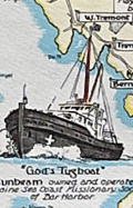 | Details | Lepper, Ruth Rhoads | 1965 |
| Pictorial Map of the Maine Coast from Rockland Schoodic Corea |
|
Lepper, Ruth Rhoads |
|
| 1965 |
| LOC:87 |
| $600.00 | Lepper--Ruth-Rhoads | Pictorial-Map-of-the-Maine-Coast-from-Rockland-Schoodic-Corea | Fine, bright, pictorial map of the Maine Coast from Rockland, through Schoodic to Corea by Ruth Rhoads Lepper, West Southport, Maine. Second Edition ca. 1965. Printed by the Spaulding-Moss Company, Boston, Massachusetts. Inset map of the Schoodic Peninsula. Filled with numerous historical facts and notes.
<br><br>
David Rumsey estimates the date of a later, third edition at 1970.
<br><br> |
| 6452 |  | Details | Utz, Thornton | 1965 |
| 60s Pictorial map of Sarasota Florida |
|
Utz, Thornton |
|
| 1965 |
| LOC:87 |
| $300.00 | Utz--Thornton | 60s-Pictorial-map-of-Sarasota-Florida | Pictorial map of Sarasota, Florida and surrounding areas ca. 1965. Designated the Official Chamber of Commerce map, it shows a single span of the old Sunshine Skyway bridge. Copyrighted and published by Thornton Utz as the Limited Gift Edition, this printing of Utz's Map of Sarasota was presented as a service by the Sarasota bank and Trust Company.
<br><br>
<div id="1" align="center">
<a title="Sarasota Florida Pictorial Map"></a>
<img id="3" src="/ZoomifyImages/SC_6452/SC_6452_Detail.jpg" alt="1960s Pictorial Map of Sarasota, Florida by Utz" width="340"/> <br><small>Detail from Utz's Map of Sarasota, Florida</small>
</div><br>
Utz included sketches of numerous commercial and recreational activities in his map including:
<div class="indenttextblocksingle">
<ul style="list-style-type: circle;"></li>
<li>Siesta Key and Longboat Key</li>
<li>Sarasota Jungle Gardens</li>
<li>Chicago White Sox training camp</li>
<li>Bradenton Art Center</li>
<li>Camp Flying Eagle Boy Scout camp</li>
<li>Crescent Beach and Lido Beach</li>
<li>Forest Lakes County Club</li>
<li>Ringling Museum</li>
</ul>
</div>
Based on the $3.00 price stated for an mail-order autographed copy of the map, it appears to predate the version of the map held at the Touchton Map Library which carries a $5.00 price and lacks the reference in the title cartouche to Sarasota Bank and Trust. |
| 5122 | 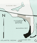 | Details | Ramrod Investments, Inc. | 1965 |
| Scarce map and sales brochure for Cutthroat Harbor Estates Cudjoe Key Florida |
|
Ramrod Investments, Inc. |
|
| 1965 |
| LOC:87 |
| $120.00 | Ramrod-Investments--Inc- | Scarce-map-and-sales-brochure-for-Cutthroat-Harbor-Estates-Cudjoe-Key-Florida | Plat of the first addition to Cutthroat Harbor Estates on the ocean side of Cudjoe Key, Florida. Plat is in a folding ten-panel sales brochure offering lots for sale in Cutthroat Harbor from $1,990 bordering Sacarma Bay, eighteen miles from Key West on U.S. Highway 1. Dated within to 1965, the brochure includes a small-scale map of the development in relationship to the southern portion of Cudjoe Key, and an aerial photograph of the same area.
<br></br>
The brochure includes a table of annual average weather conditions, photographs of construction work at the area, local fishing and boating activities, and the Key West International Airport. |
| 6618 | 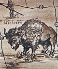 | Details | Holm, Bill | 1965 |
| Old West style pictorial map of the Permian Basin Texas New Mexico |
|
Holm, Bill |
|
| 1965 |
| LOC:89 |
| $350.00 | Holm--Bill | Old-West-style-pictorial-map-of-the-Permian-Basin-Texas-New-Mexico | Very scarce old-west style pictorial map of the Permian Basin region complete with Native Americans, buffalo, forts, cowboys, and scenic mesas. Created by Bill Holm.
<br><br>
The map is centered on Odessa, Texas. Covers the Permian Basin area in Texas and New Mexico, showing cities, towns, highways, Indians, roads, and trails. Legend at right includes the California Trail, overland stage trails, and the Comanche war trail.
<br><br>
Towns and features include:
<div class="indenttextblocksingle">
<ul style="list-style-type: circle;"></li>
<li>Big Spring, buffalo hunters camp</li>
<li>Fort Lancaster</li>
<li>Midland</li>
<li>Fort Stockton</li>
<li>the McDonald Observatory</li>
<li>Guadalupe Peak</li>
<li>Carlsberg Caverns State Park</li>
<li>The Llano Estacado</li>
<li>Castle Gap</li>
</ul>
</div>
Compiled by the Tourist Committee of the Permian Basic Chamber of Commerce and created by Bill Holm. Copyrighted by Holm and West Texas Office Supply circa 1965 (Interstate 20, or I20, is not shown).
<br><br>
The pictorial map is found on the verso of an eight-panel folding brochure titled "Ride the Permian Basin, The Official Guided of the History Lands of the Southwest. Price when issued 25 cents. |
| 5376 | 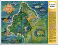 | Details | Runyan and Whitman | 1966 |
| Mid-century map of the Seventeen Mile Drive Carmel, Monterey golf |
|
Runyan and Whitman |
|
| 1966 |
| LOC:13 |
| $135.00 | Runyan-and-Whitman | Mid-century-map-of-the-Seventeen-Mile-Drive-Carmel--Monterey-golf | A perfect gift for the golfer! Fine pictorial map of the Seventeen Mile Drive snaking along Monterey Peninsula in California. Features found on this colorful map include Carmel, the Navy school in Monterey, Del Monte Shopping Center, Coast Highway No. 1, and the Pebble Beach Gun Club.
<br></br>
Verso contains descriptions of twenty-two numbered locations identified on the map including The Monterey Peninsula Country Club, Spanish Bay, Cypress Point, Crocker Grove, and the Pebble Beach Golf Links.
<br></br>
Date of the artifact is based on the fact that the brochure refers to the Spyglass Hill Golf Course as "A new 18 hole course". The Spyglass Hill course, designed by Robert Trent Jones Sr., opened in Pebble Beach during March 1966. |
| 5334 |  | Details | National Aeronautics and Space Administration | 1966 |
| NASA glossy publicity photo of J . F. K. Space Center map |
|
National Aeronautics and Space Administration |
|
| 1966 |
| LOC:11 |
| $100.00 | National-Aeronautics-and-Space-Administration | NASA-glossy-publicity-photo-of-J---F--K---Space-Center-map | An original NASA unclassified glossy black and white publicity photograph of a NASA birdseye view map of the John F. Kennedy Space Center and the surrounding area in eastern and central Florida. Dated on verso to 8/8/66.
<br></br>
The photograph shows a map, apparently tacked to a bulletin board, ranging in coverage as far as Orlando, Oak Hills, and Eau Galle, Florida. Key points of interest shown include: McCoy Air Force Base, Patrick Air Force Base, Cocoa Beach, the St. Johns River, Indian River, Banana River, and Mosquito Inlet. At the lower left corner is a key or context map showing the location of the map relative to the entire state of Florida.
<br></br>
When the photo was published in August, 1966 NASA was winding down the last two of 19 Gemini program missions to place a capsule with two astronauts into Earth orbit. The final two launches in the Gemini program were:
<br></br>
<div class="indenttextblocksingle">
<ul style="list-style-type: circle;">
<li>Pete Conrad and Richard Gordon. Launched September 12, 1966</li>
<li>Jim Lovell and Buzz Aldrin. Launched November 11, 1966</li>
</ul>
</div> |
| 6345 |  | Details | Roberts, Mike | 1966 |
| South Vietnam pictorial map mid-war era |
|
Roberts, Mike |
|
| 1966 |
| LOC:300 |
| $300.00 | Roberts--Mike | South-Vietnam-pictorial-map-mid-war-era | Fine pictorial poster-size map of South Vietnam. Created and published during the middle of the Vietnam War (1966) by Mike Roberts Color Productions. Map contains pictorial scenes of everyday life and of Vietnam War era aircraft and ships. Numerous inset photographs with scenes from simple Vietnamese everyday life, all in a format that suggests probable prior use as tourist-oriented postcards. (1)
<br></br>
Mike Roberts (1905-1989) was known as America's Postcard King. Roberts had a long career in color photography and printing that spanned more than 50 years. He became an important pioneer of Kodachrome postcards in the United States. (2)
<br></br>
Sources:<br />
(1) http://archiveswest.orbiscascade.org/ark:/80444/xv643950<br />
(2) https://www.huffpost.com/entry/wish-you-were-heremike-ro_b_7875752
<br></br>
[Fine pictorial map of Vietnam.] |
| 6493 |  | Details | Ohio Department of Highways | 1966 |
| Large pictorial map of the State of Ohio |
|
Ohio Department of Highways |
|
| 1966 |
| LOC:400 |
| $185.00 | Ohio-Department-of-Highways | Large-pictorial-map-of-the-State-of-Ohio | Large pictorial map of the State of Ohio. Copyrighted and published in 1966 by the Ohio Department of Highways.
<br><br>
<div id="3" align="center">
<a title="Detail from See the Wonderful World of Ohio map."></a>
<img id="3" src="/ZoomifyImages/SC_6493/SC_6493_Detail.jpg" alt="The Ohio River, 455 miles of water wonderland." width="360"/> <br><small>The Ohio River, 455 miles of water wonderland.</small>
</div><br>
Verso with additional road map, text, and photographs. |
| 6612 |  | Details | Fenner, Marie | 1967 |
| Rare 1960's Pictorial Map of Charleston South Carolina Queen City |
|
Fenner, Marie |
|
| 1967 |
| LOC:500 |
| $695.00 | Fenner--Marie | Rare-1960-s-Pictorial-Map-of-Charleston-South-Carolina-Queen-City | Rare, overlooked 1967 original historic-pictorial map of Charleston, S.C. by artist Marie Fenner, Olde South Galleries, Charleston, South Carolina. Of the six historic-pictorial maps of South Carolina towns that are attributed to Fenner, this item (1967) is the earliest.
<br><br>
A tourist-oriented map of Charleston, the Queen City, full of sketches of local architecture and interesting details of the city. The map's border is surrounded with drawings of local and regional historical scenes including:
<div class="indenttextblocksingle">
<ul style="list-style-type: circle;">
<li>Willtown Bluff- Edisto Island c. 1807</li>
<li>Seed from Madagascar, Carolina Rice Paddies - 1680</li>
<li>Charles Town - The Port City - c. 1800</li>
<li>The Old Citadel- Charleston's Arsenal</li>
<li>Arming the Hunley Submarine February 17, 1864</li>
<li>Volunteer Firefighters Organized 1736</li>
<li>Charleston Museum Organized 1773</li>
<li>Lining House - First Weather Observatory 1738</li>
</ul>
</div>
Only one copy is found online, in WorldCat, at the University of South Carolina, Columbia SC.
<br><br>
Copyright 1967 by Old South Galleries. 2nd printing. This second printing ca. 1967 adds the Gallery's Charleston address next to the copyright date at bottom left: 64 Society Street, Charleston, S.C. 29401. The address is absent in the 1st printing copy held by the University of South Carolina.
<br><br>
Created by offset lithography in 1967 using the halftone process (1). Bottom right corner: Charleston Lithographing Co. On 20th century laid paper with an illegible watermark. Verso is blank
<br><br> |
| 6393 |  | Details | Anonymous | 1967 |
| San Francisco Protest March map, route instructions and monitors armband. |
|
Anonymous |
|
| 1967 |
| LOC:78 |
| $275.00 | Anonymous | San-Francisco-Protest-March-map--route-instructions-and-monitors-armband- | April 15, 1967 San Francisco, California protest march map, monitor instructions, and a crude cloth armband for a march monitor. Rare.
<br><br>
On April 15, 1967 amidst growing opposition to the U.S. war in Vietnam, large-scale anti-war protests were held in New York, San Francisco, and many other cities.
<br><br>
Numerous "monitor's notes" including:
<br><br>
"So far we have had good relations with the police and we would like to keep it that way".
"Above all -keep cool; <b>the armband as a symbol of authority will handle most situations by itself</b>". |
| 6632 |  | Details | Fenner, Marie | 1968 |
| Rare 1968 Savannah, Georgia Sovereign City Pictorial Map by Marie Fenner |
|
Fenner, Marie |
|
| 1968 |
| LOC:500 |
| $695.00 | Fenner--Marie | Rare-1968-Savannah--Georgia-Sovereign-City-Pictorial-Map-by-Marie-Fenner | An attractive, tourist-oriented historic-pictorial map of Savannah, Georgia full of sketches of local architecture and interesting details of the city. At top center Fenner has drawn an image of James Edward Oglethorpe, the first Governor of Georgia.
<br><br>
As with other maps Fenner created in the late 1960's the map's border is surrounded with drawings of local and regional historical scenes including:
<div class="indenttextblocksingle">
<ul style="list-style-type: circle;">
<li>Fort Pulaski</li>
<li>Tybee Light- 18th Century</li>
<li>Cathedral of St. John the Baptist</li>
<li>Forsyth Park</li>
<li>The City Hall- Griffin Park</li>
<li>Davenport House</li>
<li>Monterey Square- General Pulaski Monument</li>
<li>Fort Jackson, and Fort Wayne</li>
</ul>
</div>
Only one copy is found online, in WorldCat, at the University of South Carolina, Columbia SC.
<br><br>
Copyright 1968 by Old South Galleries.
<br><br>
Printed in 1968 using the halftone process (1). Bottom right corner: Charleston Lithographing Co. On 20th century laid paper with an illegible watermark. Verso is blank |
| 5441 |  | Details | Morse, Russell A. | 1969 |
| Rusty's historical map of Clear Creek and Gilpin Counties Colorado pictorial |
|
Morse, Russell A. |
|
| 1969 |
| LOC:10 |
| $325.00 | Morse--Russell-A- | Rusty-s-historical-map-of-Clear-Creek-and-Gilpin-Counties-Colorado-pictorial | An original 1969 example of the first historical pictorial map produced by Rusty's Maps: Clear Creek and Gilpin Counties, Colorado. Small icons are used to represent key locations related to mining, railroads, and cultural history of those two counties. Important locations included the Argentine Pass, Silver Plume, Georgetown, Idaho Springs, East Portal, and Idaho Springs, Colorado and many more.
<br><br>
Measures 17 3/8" x 22 3/8" as called for as the 1969 first edition of 1000 on white offset stock. [1]. Published January 24, 1969.
<br><br>
Russell A. Morse (Rusty's Maps) began in 1969 with the publication of five historical maps that reflected Rusty's interest in old Ghost Towns: (1) Clear Creek and Gilpin Counties; (2) Western San Juan's; (3) Boulder-Estes Region; (4) Teller and West El Paso Counties, Colorado; (5) Summit and East Eagle Counties, Colorado. Though most prolific in the 1970's and 1980's, Rusty continued publishing maps and posters into the 1990s with a series for the National Western Stock Show and several posters of Colorado Gold Mining Regions.
<br></br>
[1] Online. 1669-1999. Listing of Rusty's Maps and related publications. https://rustysmaps.com/ |
| 5436 |  | Details | Crabb, Earl and Shubb, Rick | 1969 |
| Humbead's Revised Map of the World with List of Population |
|
Crabb, Earl and Shubb, Rick |
|
| 1969 |
| LOC:87 |
| $285.00 | Crabb--Earl-and-Shubb--Rick | Humbead-s-Revised-Map-of-the-World-with-List-of-Population | Original 1969 second-edition offset-lithograph counter-culture map of the "world". The first edition of Humbead's Revised Map of the World was created in 1968 based on a concept by Earl Crabb and drawn by artist Rick Shubb. Two subsequent editions were released in 1969 and 1970. |
| 5389 |  | Details | National Automobile Club | 1969 |
| About Baja California booklet with maps Mexico |
|
National Automobile Club |
|
| 1969 |
| LOC:3 |
| $90.00 | National-Automobile-Club | About-Baja-California-booklet-with-maps-Mexico | Fine original booklet for Baja California by the National Automobile Club, circa 1969, with two road maps of the automobile route from San Diego down Mexico's Baja Peninsula.
<br></br>
12 pages, with an dark green faux-leather, embossed, stapled card cover.
<br></br>
Text describes local accommodations and details each segment of the journey southward with the warning:<br>
<b>Travel South of Rosario By Passenger Automobile Not Recommended Under Any Circumstances."</b> |
| 6631 |  | Details | Fenner, Marie | 1969 |
| Original Pictorial Map of Columbia SC Beautiful Capital City by Fenner |
|
Fenner, Marie |
|
| 1969 |
| LOC:500 |
| $595.00 | Fenner--Marie | Original-Pictorial-Map-of-Columbia-SC-Beautiful-Capital-City-by-Fenner | Now virtually unobtainable historic-pictorial map of Columbia, South Carolina "surveyed and delineated by Marie Fenner in 1968-69 A.D.". Olde South Galleries. The map's border is surrounded with drawings of local Columbia and regional South Carolina historical scenes including:
<div class="indenttextblocksingle">
<ul style="list-style-type: circle;">
<li>Confederate printing plant 1864</li>
<li>Palmetto Armory and Iron Works - 1850</li>
<li>Ainsley Hall Mansion</li>
<li>The Fisher-Bachman House</li>
<li>The Horry-Guinard House 1818</li>
<li>The Governor's House</li>
</ul>
</div>
Only one copy of Fenner's Historic Savannah found online, in WorldCat, at the University of South Carolina, Columbia SC. No sales recorded in AMPR.
<br><br>
Copyright 1969 by Old South Galleries. 1st Printing.
<br><br>
Created by offset lithography in 1969 using the halftone process (1). On 20th century laid paper. Verso is blank |
| 5438 |  | Details | FAO United Nations | 1970 |
| Map of the world distribution of sperm and baleen whale catches |
|
FAO United Nations |
|
| 1970 |
| LOC:78 |
| $200.00 | FAO-United-Nations | Map-of-the-world-distribution-of-sperm-and-baleen-whale-catches | Scarce map of the number of catches of sperm whales and of baleen whales worldwide. From the "Atlas of the living resources of the seas" a publication of the Department of Fisheries for the <strong>Food and Agricultural Organization of the United Nations [1]</strong>.
<br><br>
Updating Maury one hundred years earlier, the color of whale pictographs are used to represent whale species. Location, and catch quantity also are represented on this chart of the world. Maury's chart reported whale sightings for sperm, baleen, and right whales, while this chart displays data on actual catches only of sperm and baleen whales.
<br></br>
[1] Online. Atlas of the living resources of the ses. United Nations FAO. http://www.fao.org/geonetwork/srv/en/metadata.show?id=9505&currTab=simple
<br></br>
(Atlas des resources biologiques des mers; Atlas de los recursos vivos del mar) |
| 5434 |  | Details | Crabb, Earl and Shubb, Rick | 1970 |
| Counterculture Cartography Humbead's Revised Map of the World |
|
Crabb, Earl and Shubb, Rick |
|
| 1970 |
| LOC:87 |
| $285.00 | Crabb--Earl-and-Shubb--Rick | Counterculture-Cartography-Humbead-s-Revised-Map-of-the-World | Original 1970 third-edition offset-lithograph counter-culture map of the "world". The first edition of Humbead's Revised Map of the World was created in 1968 based on a concept by Earl Crabb and drawn by artist Rick Shubb. Two subsequent editions were released.
<br></br>
Copyright 1970 by The Great Humbead. |
| 4769 |  | Details | Societa Partenopea di Navigazione | 1970 |
| Pictorial map of Amalfi Coast and Bay of Naples. |
|
Societa Partenopea di Navigazione |
|
| 1970 |
| LOC:0 |
| $35.00 | Societa-Partenopea-di-Navigazione | Pictorial-map-of-Amalfi-Coast-and-Bay-of-Naples- | Decorative pictorial map of the Bay of Naples and Amalfi Coast area in Italy ca. 1970. Includes the islands of Capri, Ischia, and Procida linked with mainland towns of Pozzuoli, Napoli, Sorrento, Positano, and Amalfi.
<br></br>
This colorful small map was published by the Italian transportation service SPAN, the Societa Partenopea di Navigazione. Art by Cassese. With the SPAN flag and the phrase "con la SPAN verso mete felici" or Google-translated from Italian as "with SPAN towards happy destinations."
<br></br>
Verso with a complete SPAN timetable in English. |
| 6862 |  | Details | Anonymous | 1970 |
| California Surf Map |
|
Anonymous |
|
| 1970 |
| LOC: |
| $2,000.00 | Anonymous | California-Surf-Map | <br><br>
<div class="indenttextblock" style="text-align: center; font-size: 1.2em;"><b>
Let's go surfin' now<br>
Everybody's learnin' how<br>
Come on and safari with me<br></b>
</div>
<br>
Very rare California Surf Map circa late 1960's to early 1970's. Apparently produced to support a sales promotion. The map at center is surrounded by photo illustrations of popular California surfing locations. Each location contains a brief description of when to expect the best surfing conditions. For example: <div class="indenttextblock">"MISSION BEACH Typical beach surf winter and summer. Less crowded than Pacific Beach. Takes all swells with south and west swells preferred. 2 - 6 feet ht."</div>
<br>
Surfing locations identified on the map include, from bottom right moving clockwise:
<div class="indenttextblocksingle">
<ul style="list-style-type: circle;">
<li>Mission Beach</li>
<li>Pacific Beach</li>
<li>Leucadia</li>
<li>Oceanside</li>
<li>San Clemente</li>
. . .
<li>Manhattan Beach</li>
<li>Malibu</li>
<li>Ventura</li>
<li>Staley's</li>
<li>Rincon</li>
</ul>
</div>
Only one copy was found online, at the archive for surfingheritage.org (1).
<br><br>
(1) http://archive.surfingheritage.org/2015/02/vintage-map-of-california-surf-spots.html |
| 5165 |  | Details | Keeth, Shirley Marshall | 1970 |
| Map Rancho Santa Fe San Diego County California |
|
Keeth, Shirley Marshall |
|
| 1970 |
| LOC:10 |
| $150.00 | Keeth--Shirley-Marshall | Map-Rancho-Santa-Fe-San-Diego-County-California | Map of the Rancho Santa Fe development in San Diego County , California ca. 1970. With an inset index map of the California coast showing the location of Ranch Santa Fe. By Shirley Keeth Real Estate, P.O. Box 865, Rancho Santa Fe. Inset map at top right shows the area surrounding the Shirley Keeth Office at the intersection of Paseo Delicias and La Granada. Data on the map include tract number, lot number, and number of acres on each lot.
<br></br>
Printed by Swadell Litho, Escondido, California. |
| 5085 |  | Details | Anonymous | 1970 |
| Manuscript copy of the map City of Bath after Joseph Gilmore |
|
Anonymous |
|
| 1970 |
| LOC:200 |
| $450.00 | Anonymous | Manuscript-copy-of-the-map-City-of-Bath-after-Joseph-Gilmore | Manuscript pen and ink (hand drawn) map of the City of Bath, England after an earlier map by Joseph Gilmore in 1731. On heavy paper. Likely mid-20th century. Differs from Gilmore's original map of Bath in that fewer buildings are shown on the border of the map.
<br></br>
Gilmore's original elaborate map of the city of Bath shows Bath still largely contained within its medieval walls. The map indicates the growing popularity of Bath as a destination for visitors in the early 18th century. Around the border of Gilmore's map are views of 36 lodging houses or other public buildings. The map was reissued 6 times between 1694 and 1731. |
| 5096 | 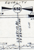 | Details | Louisville and Nashville Railroad | 1971 |
| Lot of 2 scarce Louisville and Nashville Railroad Florida Track Profile Charts |
|
Louisville and Nashville Railroad |
|
| 1971 |
| LOC:0 |
| $600.00 | Louisville-and-Nashville-Railroad | Lot-of-2-scarce-Louisville-and-Nashville-Railroad-Florida-Track-Profile-Charts | Lot of 2 scarce original Louisville and Nashville Railroad Florida track profile charts for their Pensacola & Atlantic Sub-division and Yellow River Branch lines. First printed in 1930 and revised and redrawn in Mobile, Alabama by R.W.P. in October 1971.
<br></br>
Condensed track profile charts are engineering documents giving mile-by-mile documentation of every aspect of a railroad’s right-of-way and trackwork: track layout, grades, curvature, bridgework, etc. Track profile charts may contain:
<div class="indenttextblocksingle">
<ul style="list-style-type: circle;">
<li>Milepost numbers</li>
<li>Direction of the line via compass heading for sub-segments of the line</li>
<li>Slope of the grade for each sub-segment</li>
<li>Details about culverts, bridges, arches, and boxes</li>
<li>Town names</li>
<li>Locations of railway infrastructure (freight depots, passenger stations, and signals) </li>
</ul>
</div>
First printed in 1930, these two volumes were updated in 1971 by "R.W.P."
<div class="indenttextblocksingle">
<ul style="list-style-type: circle;">
<li>The smaller of the two books (Vol. 1) contains track map profiles for 43 miles of track of the Pensacola Division of the L & N R.R. extending south from Flomaton, Alabama to Pensacola, Florida. Includes two pages of railway symbol conventions and common abbreviations; a list of stations on the route; and layouts for the Pensacola, Goulding, and Flomaton rail yards.</li>
<li>The larger volume (Vol. 2) includes track profiles for the Yellow River Branch of the L & N R.R. from Florala to Crestview, Florida and for the Pensacola and Atlantic Branch of the L & N R.R. extending from Pensacola (Red Bluff), Florida eastward to River Junction, Florida. Includes two pages of railway symbol conventions and common abbreviations; a list of stations on the route; and layouts for the Muskogee Wharf, Pensacola, Pace, and River Junction rail yards and facilities.</li>
</ul>
</div> |
| 6690 |  | Details | Weinstock, Howard | 1971 |
| Exuberant Pictorial Map of Florida |
|
Weinstock, Howard |
|
| 1971 |
| LOC:68 |
| $550.00 | Weinstock--Howard | Exuberant-Pictorial-Map-of-Florida | Exuberant Pictorial Map of Florida dated within at 1971. Designed and illustrated by Howard Weinstock. Copyright 1971 United States Map Company. Los Angeles, California.
<br><br>
<div id="0" align="center">
<a title=""></a>
<img id="6690" src="/ZoomifyImages/SC_6690/SC_6690_detail.jpg" alt="Details of the Florida Keys from the exuberant Pictorial Map of Florida by Weinstock dated within at 1971 " width="330"/> <br><br> <font size="-2">The Florida Keys</font>
</div><br>
<div id="0" align="center">
<a title=""></a>
<img id="6690" src="/ZoomifyImages/SC_6690/SC_6690_detail_1.jpg" alt="Gulf coast details from the exuberant Pictorial Map of Florida by Weinstock dated within at 1971 " width="330"/> <br><br> <font size="-2">Florida Gulf Coast</font>
</div><br>
<div id="0" align="center">
<a title=""></a>
<img id="6690" src="/ZoomifyImages/SC_6690/SC_6690_detail_2.jpg" alt="The Sun from the exuberant Pictorial Map of Florida by Weinstock dated within at 1971 " width="330"/> <br><br> <font size="-2">A happy Florida Sun</font>
</div><br> |
| 5420 |  | Details | Maury, Matthew Fontaine | 1972 |
| Maurys Whale Chart 5th Edition |
|
Maury, Matthew Fontaine |
|
| 1972 |
| LOC:0 |
| $1,500.00 | Maury--Matthew-Fontaine | Maurys-Whale-Chart-5th-Edition | Scarce official U.S. thematic chart of reported whale sightings by geographic area, whale species, and relative number of sightings (5th ed. ca. 1972). An early example of the graphical display of quantitative information for decision making. The chart shows the best whaling areas and migration patterns for sperm whales and right whales, as well as the most densely populated areas of "Straggling" Sperm Whales and Right Whales." Chart # 5018.
<br></br>
Matthew Maury's Whale Chart, was first issued by the United States Bureau of Ordnance & Hydrography in 1851. This is the official U.S. fifth (5th.) edition, from the United States Defense Mapping Agency Hydrographic/Topographic Center in the 1970s. The DMA existed from 1972 through 1996. The first edition of Maury's Whale Chart is extremely rare on the market. Only one sale of Maury's chart is recorded in the Antique Map Price Record.
<br/></br/>
The last three editions of Maury's Whale Chart may be identified thus:
<div class="indenttextblocksingle">
<ul style="list-style-type: circle;">
<li><b>Third Edition (1956)</b></br>
Upper top left position with logo of eagle clutching items in claws surrounded by text: "Hydrographic Office U.S. Navy". Top right position is blank. Bottom right position reads "Price 20 cents / H.O. Miscel. No. 8514".</li>
<li><b>Fourth edition (1960)</b></br>
Upper top left position with logo of eagle over an anchor surrounded by text: "United States Hydrographical Office". Top right position reads "Catalog: Introduction. Part 1.". Bottom right position reads "Price 50 cents / H.O. Miscel. No. 8514" .
</li>
<li><b>Fifth edition (after 1972)</b></br>
Upper top left with logo containing an eagle perched on a globe with text "Defense Mapping Agency". Top right position reads "Catalog P2V10". Bottom right reads "Lith of Wm. Endicott & Co. N. York | 5018 | DMA Stock Number | W0XZC5018.</li>
</ul>
</div> |
| 697 |  | Details | British Admiralty Hydrographical Office | 1972 |
| Acapulco Harbor |
|
British Admiralty Hydrographical Office |
|
| 1972 |
| LOC:0 |
| $125.00 | British-Admiralty-Hydrographical-Office | Acapulco-Harbor | Neat, attractive, authentic 20th century nautical chart of Acapulco, Mexico by the British Admiralty after an 1881 U.S. chart. This chart has character. Though published by the Admiralty in 1972, this chart retains much of the style and appearance of earlier copper-plate engraved charts but on modern paper in fine condition. Features shown on the map include Fort San Diego, Isla Roqueta or Isla Grifo, Puerto Marques, Punta Rodrigo, Punta Diamante (Diamond Point), Punta Bruja, Bahia St. Lucia, Punta Lorenz, Farallon de Obispo, the Fiscal Wharf and las Dos Piedras. The town of Acapulco is shown as it must have looked when the chart was first published… very small in extent.
<br></br>
This chart was originally published in August 1849 but updated and corrected numerous times, as documented at bottom left of the chart,- including 1882 (re-engraved) and 1945, and this copy dates to 1972. Numerous soundings and aids to navigation are noted.
<br></br>
With two profile view insets: 1) "Acapulco from the Westward, Isla Roqueta, 093° distant 9 or 10 miles" Boca Chica and Puerto Marques and 2) "Acapulco from the S.W., I Roqueta 042° distant 9 or 10 miles" with Punta Diamante. Modern compass rose with half fleur-de-lis indicating North.
Verso is stamped "Printed [19]72 1944 Acapulco Harbor. Folio 25. Consecutive number 11." Chart no. 1944. |
| 4928 |  | Details | Digital Equipment Corporation | 1972 |
| Early Persuasive Map Advertising ARPA Network pre-Internet |
|
Digital Equipment Corporation |
|
| 1972 |
| LOC:88 |
| $275.00 | Digital-Equipment-Corporation | Early-Persuasive-Map-Advertising-ARPA-Network-pre-Internet | I'll see your Timothy Edward Downs and raise you 20.
<br /><br />
Very early pictorial map advertisement for Digital Equipment Corporation or DEC, for their DEC10 Supercomputer as a key part of the ARPA network. With the introduction of the TCP-IP protocols, ARPANET grew rapidly in size and within less than 20 years evolved into the Internet.
<br /><br />
ARPA stands for Advanced Research Projects Agency, a U.S. Defense Department agency responsible for leading-edge technical research. Beginning in 1967, by 1969 the ARPANET network interconnected four supercomputers, in 1970 - 9 supercomputers and by 1972 - 24 supercomputers .
<br /><br />
The ad shows the location of ARPANET supercomputers, generally large universities and research institutions; the interconnections between those supercomputers; and the data exchanged between the computers.
<br /><br />
In the early 1970's networking concepts were poorly understood and the artist uses common pictograms as metaphors as an aid to understanding. Without exception each university/research Supercomputing center is represented by old white men in suits, most with ties (NASA Ames the exception). Names of each institution appears on the outstretched arms of the old white men as they extend into the cube of another institution with an old white man. By Digital Equipment Corporation, Maynard, Massachusetts, run by old white men in the 1970's. |
| 5079 |  | Details | British Admiralty Hydrographical Office | 1973 |
| Plans in the Islas Baleares from Spanish Government Charts |
|
British Admiralty Hydrographical Office |
|
| 1973 |
| LOC:58 |
| $175.00 | British-Admiralty-Hydrographical-Office | Plans-in-the-Islas-Baleares-from-Spanish-Government-Charts | Plans of the islands Ibiza and Formentera in Spain's Mediterranean Balearic Islands. Engraved in 1902 and published from London in July 8, 1902 by the British Admiralty under the superintendence of Captain W. J. L. Wharton, Hydrographer. Charts are after the Spanish Government Charts, 1898 - 1900. This sheet with corrections to 1973.
<br></br>
Includes the Balearic Islands of Ibiza and Formentera at a scale of 1 / 195,000 and the channel between Ibiza and Espalmador at a scale of 1 / 36,420
<br></br>
Chart number 3276. Crown Copyright Reserved. |
| 5432 |  | Details | Gamble, D.J. | 1973 |
| Map of Action on Koheroa Ridges Maori War New Zealand |
|
Gamble, D.J. |
|
| 1973 |
| LOC:78 |
| $65.00 | Gamble--D-J- | Map-of-Action-on-Koheroa-Ridges-Maori-War-New-Zealand | Map related to the New Zealand Wars. In response to Maori attacks on local settlers on the 12th of July 1863, Lieutenant-General Cameron and 400 soldiers occupied the high ground on the Koheroa Range in order to control navigation along the Waikato River. The map shows the location of Maori entrenchments, British field works, the track along the narrow ridge tops, and the site of battle on July 17, 1863.
<br></br>
An illustration from <strong>Bush Fighting: Illustrated by Remarkable Actions and Incidents of the Maori War in New Zealand</strong> by Major-General Sir James Edward Alexander.
<br></br>
Published by SAMPSON LOW, MARSTON, LOW AND SEARLE.: London. 1873. Lithographed by Edward Weller, Red Lion Square. Verso is blank. |
| 6404 |  | Details | Overly, Charles H. | 1973 |
| Block Island Town of New Shoreham Rhode Island |
|
Overly, Charles H. |
|
| 1973 |
| LOC:87 |
| $185.00 | Overly--Charles-H- | Block-Island-Town-of-New-Shoreham-Rhode-Island | Very nice pictorial map of Block Island, Rhode Island lying in Block Island Sound. A better quality edition after Charles H. Overly's original map first printed in 1957. The map is printed on laid paper with a light brown tint throughout to simulate age. Scarce.
<br><br>
Esta Gray operated a gift shop in Old Harbor, Block Island- Esta's Gifts of Distinction. In 1957 Esta commissioned Charles H. Overly draw the map of Block Island to sell to tourists visiting her shop. This edition of the map is estimated circa 1973 after Charles Overly's map which contained a double decorative border and a 1957 copyright notice among other differences.
<br><br>
Charles H. Overly (1908-1970) was a University of Vermont graduate and artist. Returning home after a long tour of Europe, Overly began the Charles H. Overly Studio in 1938. He is best known for sketches and paintings of New England historical landmarks. |
| 6609 |  | Details | Nillson, Bob | 1974 |
| Map of East New Hampshire Seacoast with Pictorial Scenes of Activities |
|
Nillson, Bob |
|
| 1974 |
| LOC:62 |
| $375.00 | Nillson--Bob | Map-of-East-New-Hampshire-Seacoast-with-Pictorial-Scenes-of-Activities | Window on the Seacoast the Publick Occurrences Guide to Activities in the New Hampshire Seacoast.
An attractive sketched map of the New Hampshire Seacoast region surrounded by smaller sketches of local New Hampshire Seacoast attractions and activities. These include Prescott Park, New Castle, Fuller Gardens, Isle of Shoals, apple orchards, Kingston, Adams Point, UNH, and Route 125.
<br><br>
Copyrighted, conceived, and created by well-known New Hampshire artist, cartoonist, and teacher- Bob Nilson in 1974. Nilson is best known for his two-handed ambidextrous drawing method and, since the 1990's, for his caricature sketches of local Seacoast bands and performers. Here we have one of Nilson's earlier works, probably based on architectural and landscape sketches he submitted to the Portsmouth Herald for a section: Seacoast Sketchbook. (1)
<br><br>
(1) Online. Accessed 1/23. https://www.portsmouthnh.com/where-the-music-is-seacoast-music-scene-through-eyes-of-bob-nilson/ |
| 6803 |  | Details | British Admiralty Hydrographical Office | 1974 |
| Original Admiralty Nautical Chart of Providence Island, Bahamas |
|
British Admiralty Hydrographical Office |
|
| 1974 |
| LOC: |
| $255.00 | British-Admiralty-Hydrographical-Office | Original-Admiralty-Nautical-Chart-of-Providence-Island--Bahamas | A fine British Admiralty nautical chart of the Bahamas Island of New Providence, first published in August, 1843. Retains the look of a mid-19th century copper-engraved sea chart. Admiralty chart # 1489.
<br><br>
At top of chart is a coastal elevation view of the Town of Nassau, on the Island of New Providence, from a distance offshore.
<br><br>
This item is the sixth edition of 1914 with corrections to 1974. |
| 6382 |  | Details | VX9A | 1975 |
| Scarce map of Sable Island, Nova Scotia in the form of a QSL card. |
|
VX9A |
|
| 1975 |
| LOC:78 |
| $150.00 | VX9A | Scarce-map-of-Sable-Island--Nova-Scotia-in-the-form-of-a-QSL-card- | Scarce pictorial map of Sable Island, Nova Scotia, Canada as a QSL card. A QSL card is a written confirmation of two-way radiocommunication between two amateur radio stations, in this case between VX9A on Sable Island and W4UW on the 40 mhz (shortwave band) on November 2, 1975.
<br></br>
On card stock with one vertical and two horizontal folds, as issued. Verso with text and halftone images. |
| 5088 |  | Details | Rockford Map Publishers | 1975 |
| Atlas and Plat Book Suwannee County Florida 1975 |
|
Rockford Map Publishers |
|
| 1975 |
| LOC:2001 |
| $200.00 | Rockford-Map-Publishers | Atlas-and-Plat-Book-Suwannee-County-Florida-1975 | Atlas and Plat Book Suwannee County Florida 1975, published by Rockford Map Publishers, Inc. Rockford, Illinois. Sponsored by Daniel Crapps, Realtor, Live Oak, Florida.
<br></br>
Contents contain an index map for Suwannee County; an alphabetized business directory; important facts about land descriptions; detailed maps for each of 23 townships in the index map; a map of the capital city of Suwannee County- Live Oak; a map of the city of Branford; and a reduced general highway map of Suwannee County, Florida. |
| 6533 | 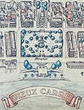 | Details | Fell, April P. | 1976 |
| Plan New Orleans Vieux Carre by April Fell |
|
Fell, April P. |
|
| 1976 |
| LOC:68 |
| $375.00 | Fell--April-P- | Plan-New-Orleans-Vieux-Carre-by-April-Fell | Scarce plan of the Vieux Carre or French Quarter in New Orleans, Louisiana by April P. Fell in 1976. Shows the buildings and street layout of the French Quarter as they existed in 1976. The limits of the Vieux Carre are the Mississippi River, Canal Street, Rampart Street, and Esplanade Avenue.
<br><br>
Todd and April Fell lived in New Orleans beginning in the 70s. They created a travel book called 'The Vignette' that was published until 1987.
<br><br>
Published by The Vignette 240 Rue Chartres. Copyright 1976. |
| 6697 |  | Details | Lepper, Ruth Rhoads | 1977 |
| Pictorial Map Maine Coast Between Casco Bay Penobscot Bay Lepper |
|
Lepper, Ruth Rhoads |
|
| 1977 |
| LOC:87 |
| $450.00 | Lepper--Ruth-Rhoads | Pictorial-Map-Maine-Coast-Between-Casco-Bay-Penobscot-Bay-Lepper | A Map of the Maine Coast Between Casco and Penobscot Bays made and published circa 1977 by Ruth Rhoads Lepper, West Southport, Maine. The prominent compass rose topped by a fleur-de-lis is a signature feature of Ruth Lepper pictorial maps and in this case is uncolored. Geographic coverage includes only those areas of the Maine Coast between Casco Bay and Penobscot Bay.
<br><br>
Map is dated with reference to a very similar larger-scale map held at the Osher Library: The Maine Coast from Kittery to Cape Elizabeth."
<br><br>
Lepper included brief facts on her coastal maps related to local maritime history:
<div class="indenttextblocksingle">
<ul style="list-style-type: circle;">
<li>On September 5, 1813, the U.S. brig. 'ENTERPRISE' captured the British brig. 'BOXER' The battle was fought in these waters. Both captains were killed.</li>
<li>Dixie Bull, the pirate. sailed into Pemaquid- In 1632. He sacked the trading post & dwellings, carrying away booty amounting to 2500.</li>
<li>The Virginia, first ship built by Englishmen on this Continent, was launched at Popham in 1608.</li>
<li>Allen's Island - Aug. 9,1607 Colonists from "Gift of God" & "Mary & John" listen to a sermon of Thanksgiving -the first English service on New England soil.</li>
</ul>
</div> |
| 702 | 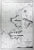 | Details | British Admiralty Hydrographical Office | 1977 |
| Yukon River to Point Barrow Alaska |
|
British Admiralty Hydrographical Office |
|
| 1977 |
| LOC:65 |
| $175.00 | British-Admiralty-Hydrographical-Office | Yukon-River-to-Point-Barrow-Alaska | Very decorative 20th century British nautical chart of the Alaskan West Coast that expresses much of the fine character of the older copper-plate engraved navigation charts. Detailed soundings in the Bering Sea from Alaska westward 51 miles to Asia with Cape Dezhnev ( Dezhneva ) in Russia. This large attractive specimen is graced with four splendid inset profile views that show the rugged, snow-capped terrain of the Alaskan coast: At top- a broad view stretching from Cape Thompson to Cape Seppings and Mulgrave Hills fills the width of the chart; lower are profile views of Cape Prince of Wales and Cape York; the Diomede Islands; and Cape Lisburne.
<br></br>
Key features include Kotzebue and Nome, Alaska, the Chuckchi Sea, Bering Sea, Diomede Islands, St. Lawrence Island, mouths of the Yukon River, Norton Bay, Cape Nome, and Cape Prince of Wales. Numerous soundings, navigation hazards, and aids to navigation are noted. Originally published from London in 1907, the chart underwent numerous updates and corrections over the following 70 years as noted in several locations on the chart.
<br></br>
The chart is based on the exploration of the Pacific Coast and Alaska led by Frederick William Beechy aboard the refitted survey ship "Blossom" which had recently been converted from an 24 gun sloop-of-war. During the course of their three-year voyage Beechy's orders were to explore the Bering Strait and to attempt to rendevous with Parry and Franklin aboard HMS Fury and Hecla, who were searching for a Northwest Passage from the East coast. Beechy is credited with the discovery of Port Clarence, one of the featured insets in this chart.<br></br>
With inset detailed plans: <ul>
<li>"Plan of the Anchorage of Chamisso in Kotzebue Sound"</li>
<li> "Plan of Port Clarence and Grantley Harbor" </li>
<li> the cut between Port Clarence and Grantley Harbor. </li>
</ul>
Number 563. Title cartouche contains the oval logo of the British Hydrographic Office. |
| 5383 |  | Details | Jacksonville Area Planning Board | 1977 |
| St. Johns River Corridor Plan with St. Johns River Study |
|
Jacksonville Area Planning Board |
|
| 1977 |
| LOC: |
| $500.00 | Jacksonville-Area-Planning-Board | St--Johns-River-Corridor-Plan-with-St--Johns-River-Study | Scarce <b>three-panel map</b> of the St. Johns River Corridor Plan in Duval County, Florida (accompanies the Study). The map contains summary recommendations and observations made by the Jacksonville Area Planning Board in their 1977 Study of the St. Johns River. Map 30" W x 10" H. Verso blank.
<br></br>
The planning study by the Jacksonville Area Planning Board (JAPD), is a 174-page environmental and urban study of the 39-mile extent of the St. Johns River found in Duval County, Florida: the <b>St. Johns River Corridor</b>. The study contains over 40 detailed large-scale, sectional geographic maps and thematic maps for land use along the St. Johns River Corridor (e.g. Military, Recreational). Light card cover.
<br></br>
Based on an analysis of five environmental factors the JAPD recommended land usage-intensity levels. They proposed design guidelines, development and improvement proposals, and program recommendations for 21 sections of shoreline along the corridor. Maps incorporate their findings.
<br></br>
Copy of Lynwood Roberts, then President of the Jacksonville City Council. With separate typed transmittal letter from the JAPD to Roberts. |
| 6552 |  | Details | British Admiralty Hydrographical Office | 1978 |
| Admiralty Chart Baja California Sea of Cortez with Cabo San Lucas |
|
British Admiralty Hydrographical Office |
|
| 1978 |
| LOC:0 |
| $500.00 | British-Admiralty-Hydrographical-Office | Admiralty-Chart-Baja-California-Sea-of-Cortez-with-Cabo-San-Lucas | Original later issue of a British Admiralty nautical chart first engraved and published in London at the Admiralty on April 9, 1879, under the superintendence of Royal Navy Hydrographer Captain F.J. Evans and updated with corrections. Last corrected in 1978.
<br></br>
Coverage on this fine Admiralty nautical chart includes the entire Baja Peninsula and Gulf of California (Sea of Cortez) from San Diego, California to Cabo San Lucas, Mexico.
<br></br>
Numerous well-known fishing spots are noted including: San Jaime Bank, Golden Gate Bank, Outer Gorda Bank, Finger Bank, and Morgan Bank. Two inset profiles of Cabo San Lucas.
<br></br>
Bold, dark, lithographed print retains the cartographic look and style of the late 19th century. Original engraving was executed by Davies and Company. Logo of the British Hydrographical Office at top of the title block. Chart Number 2324. Crown copyright reserved. |
| 5428 |  | Details | Anonymous | 1978 |
| Map of the 1978 Marijuana Trail |
|
Anonymous |
|
| 1978 |
| LOC:87 |
| $375.00 | Anonymous | Map-of-the-1978-Marijuana-Trail | Scarce Hippie / Yippie cannabis-related map or a 70's Hippie poster with cartographic interest. An uncommon original pictorial map from 1976 showing gatherings "The Marijuana Trail" planned across the continental United States during the Spring and Summer of 1978.
<br></br>
Interesting iconography used that adapts existing regional stereotypes to a counter-culture cannabis-infused outlook:
<div class="indenttextblocksingle">
<ul style="list-style-type: circle;">
<li>San Francisco- A drunk, be-wigged barrister and a bell-bottom mod smoker.</li>
<li>Ashland, Oregon- Bigfoot getting high</li>
<li>Grand Junction, Colo. Naked hippies with smokie the bear.</li>
<li>Atlanta- Southern gentleman and a banjo-playing hillbilly.</li>
<li>Montreal - a frog, cow, and lumberjack- all smoking</li>
</ul>
</div>
Near Kent, Ohio three citizens are shown holding large signs: REMEMBER | KENT | STATE
<br></br>
For many of the gatherings the provided activity and schedule information could have made this map a fine planning calendar. From A Yipster Times publication. |
| 1136 |  | Details | Wilson, John F. | 1979 |
| Decorative pictorial map of Manteo, North Carolina |
|
Wilson, John F. |
|
| 1979 |
| LOC:52 |
| $225.00 | Wilson--John-F- | Decorative-pictorial-map-of-Manteo--North-Carolina | Interesting pictorial map of downtown Manteo, North Carolina on Roanoke Island along Shallowbag Bay. This very decorative map is packed with features of daily life on Roanoke and provides a street map and birds-eye view of Manteo downtown ringed by pictures reflecting its maritime heritage including boats, sea chests, seagulls, oars, antique furniture, anchors, and foodstuffs.
<br></br>
A number of local historical homes are featured including the George Howard Creef House; the Forbes Nixon House; the Meekins House; the James Bonner House; and "The Old House" or George Washington Creef House, said to be one of the oldest structures then standing in downtown Manteo. Other key features pictured on the map are the Pioneer Theater; the Roanoke Island Volunteer Fire Department; Water Oak at Mother Vineyard; and the Dare County Courthouse.
<br></br>
About the courthouse Wilson notes:
<div class="indenttextblock"> "Erected 1904, replacing a wooden 1873 structure. The land for the building was donated by John Wescott in 1870 when the county of Dare was formed from the counties of Hyde, Tyrrell and Currituck. It was named in honor of Virginia Dare, the first child of English parents born in the New World."
</div>
<br />
Manteo is located on Roanoke Island, part of North Carolina's Outer Banks. Named the seat of government for Dare County in 1870, Manteo incorporated in 1899 and in 2010 had a population of just 1434 persons.
<br></br>
Published by John F. Wilson IV in 1979. |
| 6403 |  | Details | Rich, Howard L. | 1979 |
| Pictorial Historical Map of Chatham Massachusetts |
|
Rich, Howard L. |
|
| 1979 |
| LOC:87 |
| $225.00 | Rich--Howard-L- | Pictorial-Historical-Map-of-Chatham-Massachusetts | A fine original, first edition, pictorial historical map of Chatham, Massachusetts. Why buy a cheap copy when you can have the original version for a few dollars more?
<br></br>
The map shows numerous historical points of interest, those features no longer existing are shown in green font color. Includes an inset map of Monomoy Island and a smaller inset graphic representing the attack on Fort Fortune during October, 1606. Verso is blank.
<br></br>
Key geographical features on this historical map include Lookout Hill, Stage Harbor, Old Harbor, Great Beach, Strong Island, Great Hill, Morris Island, and Hardings Beach. Among the many historical events and locations that Rich chose to represent are the Mass. Humane Society hut for shipwrecked sailors, Old Harbor Life Saving Station, a ship's block factory, an Indian meeting house and burial ground, and the numerous salt works near Ryder's Cove.
<br></br>
Drawn by Howard L. Rich in 1979. Published by the Chatham Historical Society. |
| 5260 |  | Details | Stanton, Jeffrey | 1979 |
| Large pictorial map of Venice, California |
|
Stanton, Jeffrey |
|
| 1979 |
| LOC:53 |
| $375.00 | Stanton--Jeffrey | Large-pictorial-map-of-Venice--California | Large and amusing pictorial map of Venice, California by Jeffrey Stanton, businessman and artist. First edition.
<br></br>
Copyright 1979. Artwork by C. June Barton and R. Greenway Frager. |
| 6837 |  | Details | Prewitt, Jim | 1980 |
| Jim Prewitts Pictorial map 6th Street Austin Texas |
|
Prewitt, Jim |
|
| 1980 |
| LOC:53 |
| $275.00 | Prewitt--Jim | Jim-Prewitts-Pictorial-map-6th-Street-Austin-Texas | Scarce, humorous, pictorial advertising map of <b>6th Street in Austin Texas</b> by Texas graphic artist and illustrator Jim Prewitt. The cheerful map shows Austin's 6th Street as it was more than 40 years ago. Alongside dozens of advertisements for local businesses like Maggie Mae's, Santiago's, and Ravens Garage the detailed map is dotted with interesting cartoons typical to Austin daily life including snakes, armadillos, longhorn cattle, UFO's, and a police chase with dynamite along Interstate 35.
<br><br>
<div id="0" align="center">
<a title="TITLE HERE"></a>
<img id="3" src="/ZoomifyImages/SC_6837/SC_6837_330w.jpg" alt="Pictorial fun map of Austin's 6th Street in 1980." width="300"/> <br><small>6th Street, Austin, Texas. 1980. Jim Prewitt.</small>
</div><br>
With an advertisement for the first Pecan Street Festival held on Saturday and Sunday, May 3rd and 4th, 1980 (left center). Austin's Pecan Street Festival was inaugurated in 1980 by the non-profit Pecan Street Association with the goal of highlighting and beautifying the historical heritage of the district. In 1997 President of the Pecan Street Association Lynn Raridon explained "We like to think that our event was helping to <b>Make Austin Weird</b>, long before it was a trendy catch phrase/bumper sticker!" [1]
<br><br>
Copyright Jim Prewitt Design, 1023 West San Antonio Street, San Marcos, Texas. Printed by Futura Press, Austin Texas. Verso blank.
<br><br>
A local boy, Jim graduated Texas A&M-Kingsville. Other Jim Prewitt pictorial advertising maps of Texas towns include Wimberly, San Marcos, New Braunfels, Kingsville and Corpus Christi. [2]
<br><br>
Sources
<br><br>
[1] Salizar, Marisa. 37th Annual Pecan Street Festival. September 24, 2017. Jim Bowie High School Dispatch. Online.<br>
[2] Walraven, Bill. Cartoonist turns fun maps into profitable venture. January 17, 1985. Online: http://archives.tamuk.edu/uploads/A2019-016.0125E.pdf |
| 4964 | 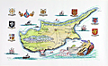 | Details | Sabry, John | 1980 |
| Manuscript map of Cyprus by Cypriot artist John Sabry |
|
Sabry, John |
|
| 1980 |
| LOC:200 |
| $1,800.00 | Sabry--John | Manuscript-map-of-Cyprus-by-Cypriot-artist-John-Sabry | Manuscript (hand-drawn) illustration of Cyprus by Cypriot artist John Sabry (1914-2006). ( Τζων Σάμπρι ). Date not stated but assumed 1980's. Fine condition.
<br></br>
Sabry is the author of pictorial maps of Cyprus in the "Romantic Cyprus" guide book (1947): Famagusta & Varosha, and Nicosia. John Sabry was born and raised in Kyrenia, Cyprus; a painter from an early age, he also worked as a professional photographer and managed the Kodak shop in Nicosia during the 1950’s.
In 1965 three of Sabry's paintings were selected for the Royal Academy Summer show in London. |
| 6470 |  | Details | Pargeter, Richard Arnold | 1980 |
| Pictorial oblique topographic birds-eye view of the San Juan Islands |
|
Pargeter, Richard Arnold |
|
| 1980 |
| LOC:150 |
| $450.00 | Pargeter--Richard-Arnold | Pictorial-oblique-topographic-birds-eye-view-of-the-San-Juan-Islands | An original fine panoramic relief map of the San Juan Islands in Washington State on an oblique perspective. Copyright 1980 by Richard Pargeter. Printed by University Printing Company, Seattle. Pencil stock number in bottom right margin.
<br><br>
A self-taught cartographic illustrator, Pargeter's output includes similar panoramic relief maps of The Olympic Peaks, the Puget Sound Country, and Washington's Northwest Passages. In 1980, when this map was copyrighted, copies were available by mail-order from the Pargeter Company in Kent, Washington. Pargeter's maps were once available online but all available copies are reported as sold-out.
<br><br>
<div class="indenttextblocksingle">
"Tens of thousands of these maps have been sold over the years. All Pargeter's maps are true oblique projections. No planimetrics. All, but the pre-color-separated Olympic map have been full-color halftone shaded relief illustrations rendered in acrylics and a very fine brush, The renderings are based on U.S.G.S. topo quads with mountain "facial features" derived from aerial oblique angle photos taken by Pargeter". [1]
</div><br>
Source
<br><br>
[1] Online: Panorama maps. Pargeter. Online: http://www.panorama-map.com/pargeter/pargeter.html |
| 6703 |  | Details | Prevoteau, Gerard | 1980 |
| Pictorial Map Aruba Pearl in the Caribbean |
|
Prevoteau, Gerard |
|
| 1980 |
| LOC:51 |
| $350.00 | Prevoteau--Gerard | Pictorial-Map-Aruba-Pearl-in-the-Caribbean | Very scarce out-of-print advertising-oriented pictorial map, circa 1980, of the island of Aruba in the Caribbean Sea. Illustrated by Gerard Prevoteau and published by Imprimerie Berger-Bellepage, Fort de France, Martinique (1). Prevoteau is known to have created more than thirty illustrations of towns and islands including Reims, the isle of Oleron, and a pair of maps or plans of the French town of St. Malo, France. Not in WorldCat.
<br><br>
Captions for many illustrations in either Dutch, English, or Spanish.
<br><br>
Aruba is a small Caribbean island located just off the coast of Venezuela. The island has a rich history, having been inhabited by indigenous tribes before being colonized by the Spanish in the 16th century. Today, Aruba is an autonomous territory of the Netherlands, and its culture is a unique blend of Dutch, Caribbean, and Latin American influences. Aruba is known for its beautiful beaches and also boasts a variety of outdoor activities, including snorkeling, scuba diving, hiking, and horseback riding. The island is also home to a number of historic landmarks and cultural attractions, including the California Lighthouse, the Arikok National Park, and the vibrant capital city of Oranjestad.
<br><br>
(1) Berger Bellepage company was created on August 1st, 1964, and it is one of the oldest printing companies in Martinique. The current printing facility has been located in Fort-de-France since 1969. |
| 6760 |  | Details | Hillam, Corbin | 1981 |
| First Silicon Valley Advertising Pictorial Map |
|
Hillam, Corbin |
|
| 1981 |
| LOC:150 |
| $5,600.00 | Hillam--Corbin | First-Silicon-Valley-Advertising-Pictorial-Map | Original first pictorial advertising map locating "Silicon Valley". In 1981, artist Corbin Hillam unveiled a remarkable pictorial advertising map of Silicon Valley California, an artistic and commercial illustration that inspired a series of more than eighteen similar pictorial advertising maps created by various artists and publishers. Together the maps (1) provide an informative graphical time series of the firms active in Silicon Valley and the Santa Clara Valley Region in the late 20th century.
<br><br>
Analysis: The map is important as it is among the few remaining copies of Hillam's 1981 Silicon Valley map, created in the year IBM introduced its inaugural personal computer or PC, a groundbreaking event that sent ripples of innovation across the business landscape. IBM's PC served as a resounding testament, affirming the tangible reality of personal computing and establishing its enduring presence. 1981 was the year that personal computing won the corporate seal of approval.
<br><br>
Copyright Eclectibles, 1981.
<br><br>
<div id="6760" align="center">
<a title=""></a>
<img id="6760" src="/ZoomifyImages/SC_6760/SC_6760_detail_1.jpg" alt="First Silicon Valley Advertising Pictorial Map. Corbin Hillam. 1981. " width="340"/> <br><br> <font size="-2">Palo Alto detail from "Silicon Valley".</font>
</div><br><br> |
| 6856 |  | Details | Blissberger, Linda | 1982 |
| Coconut Grove Poster Advertising Map |
|
Blissberger, Linda |
|
| 1982 |
| LOC:61 |
| $525.00 | Blissberger--Linda | Coconut-Grove-Poster-Advertising-Map | Scarce advertising poster map of Coconut Grove, Florida by artist Linda Blissberger. 1982.
<br><br>
"Designed by the Blissberger with the able assistance of the Bliss Bear while dodging bulldozers on Florida Ave. Jan. - Feb. '82. Blissberger Art & Airbrush Creations & Gallery of Surprises. 3425c Main Hwy. 445-3146." |
| 5417 |  | Details | Youth International Party Information Service | 1983 |
| Fine 1983 World Cannabis March on the U.N. Poster |
|
Youth International Party Information Service |
|
| 1983 |
| LOC:87 |
| $265.00 | Youth-International-Party-Information-Service | Fine-1983-World-Cannabis-March-on-the-U-N--Poster | Original, scarce, World Cannabis March on the U.N. poster on good-quality newsprint from a Yipster underground newspaper. The "World Cannabis March", sponsored by the 5th Avenue Pot Parade Coalition, featured speakers, a holistic massage workshop, and reggae music.
<br></br>
Purpose was to advertise a protest parade in New York City against the Reagan Administration's policies on cannabis. Reagan's policies diverted funds from the enforcement of hard drug laws to enforcement of the marijuana statutes, considered by many at the time to be a less harmful "soft" drug.
<br></br>
The march was scheduled to start at 11 A.M. May 7, 1983 at Washington Square Park in New York City. |
| 5429 |  | Details | Price, Matthew | 1983 |
| Historical Map of Duck and Beyond |
|
Price, Matthew |
|
| 1983 |
| LOC:200 |
| $155.00 | Price--Matthew | Historical-Map-of-Duck-and-Beyond | Pictorial map of Currituck Sound, the Atlantic Ocean and the Outer Banks in the vicinity of Duck, Dare County, North Carolina. Created by Matthew Price in 1983.
<br></br>
This "Historical Map of Duck and Beyond" is decorated with scenes typical to the area near Duck, North Carolina (past and present): crabs, whales, wild flowers, shipwrecks, and ducks.
<br></br>
Price shows the street network and notes many points of interest on that narrow strip of land in the Outer Banks including:
<div class="indenttextblocksingle">
<ul style="list-style-type: circle;">
<li>Old Navy bombing range (no bombing allowed during hunting season).</li>
<li>Powder Ridge Gun Club</li>
<li>Caffey's inlet station</li>
<li>Maurice and Bea's Decoy Shops</li>
<li>Home and duck shop of "Pop" Scarborough</li>
<li>Ocean Beach campground</li>
<li>Duck Woods Golf Course</li>
<li>Old site of Martin's Point Club</li>
<li>Carolina Dunes</li>
</ul>
</div> |
| 6397 |  | Details | Franzen, Dana | 1984 |
| World Cannabis March on the U.N. Poster 1984 |
|
Franzen, Dana |
|
| 1984 |
| LOC:300 |
| $285.00 | Franzen--Dana | World-Cannabis-March-on-the-U-N--Poster-1984 | Original, scarce and very colorful poster "World Cannabis March on the U.N." from 1984 on heavier and higher-quality newsprint by the 5th Avenue Pot Parade Coalition. Designed by Dana Franzen for A Yipster Times Publication. The poster was a center-fold insert advertising a protest parade in New York City against the Reagan Administration's policies on cannabis. The march was to start at 11 A.M. May 5, 1984 at Washington Square Park.
<br></br>
Verso with a black and white poster for "Rock Against Racism."
<br></br>
Ships folded as issued. |
| 5408 |  | Details | Franzen, Dana | 1985 |
| Fine 1985 World Cannabis March on the U.N. Poster |
|
Franzen, Dana |
|
| 1985 |
| LOC:87 |
| $275.00 | Franzen--Dana | Fine-1985-World-Cannabis-March-on-the-U-N--Poster | Stunning, scarce, original World Cannabis March on the U.N. poster (1985) on heavier, better-quality newsprint. Designed by Dana Franzen for A Yipster Times Publication. The poster was a center-fold insert.
<br></br>
The intent of the poster was to advertise a protest parade in New York City against the Reagan Administration's strict policies on cannabis. The march was to start "before high noon" on May 4, 1985 at Washington Square Park.
<br></br>
Contains text likely to appeal to members of the counter-culture who understood the double entendre meaning of some of the poster's copy:</br>
"Appeal to a <b>higher power</b>"</br>
"Meet at Washington Sq. Park before <b>high noon</b>" |
| 4799 |  | Details | Glantz, Dale A. | 1985 |
| Bathymetry and landmarks La Jolla, San Diego, California |
|
Glantz, Dale A. |
|
| 1985 |
| LOC:63 |
| $375.00 | Glantz--Dale-A- | Bathymetry-and-landmarks-La-Jolla--San-Diego--California | Original privately-published chart of the La Jolla coast. The most easily attainable chart of La Jolla, California from 1985 to combine bathymetry data from the U.S. Coast and Geodetic Survey with pictorial images of the landmarks and data regarding coverage of the kelp beds offshore. Designed, printed, and copyrighted 1985 by Dale A. Glanz d.b.a. Daleʾs Ink. Detailed countour intervals of one fathom (six feet). No copies in AMPR or online; limited institutional holding.
<br></br>
From 1978 to 2005 Dale Glanz is reported to have been employed by Kelco (now ISP Alginates) as Operations Manager/Senior Marine Biologist. Kelco began near San Diego in the late 1920s, harvesting brown seaweed, or kelp, and extracting the algin that is used in countless pharmaceutical, household and food products.
<br></br>
Shows notable landmarks that could be used to relate one's position to the bathymetry on the chart. Landmarks include a "copper roof mansion", the La Jolla Shores Lifeguard Station, the Summer House Inn, Seville Condominium, Sea World Tower, and Islandia House. Beaches shown include Ocean Beach, Mission Beach, Pacific Beach, Casa Beach, Windandsea Beach. Other noted features include Seal Rock, The Cove, Kellogg Park, Whale View Point, La Jolla Hermosa Park, and the Crystal Pier.
<br></br>
Shows the La Jolla Canyon and the Scripps Canyon that terminate just offshore of the Scripps Institute of Oceanography. Shading denotes areas with an overlaying canopy of kelp. |
| 5472 |  | Details | High Times | 1985 |
| Late 20th C map of International Drug Production |
|
High Times |
|
| 1985 |
| LOC:87 |
| $225.00 | High-Times | Late-20th-C-map-of-International-Drug-Production | Thematic, pictorial, world map focused on the agricultural and manufacturing/refining sites that produced illegal drugs in the mid 1980's. A two-page "Bonus Centerfold" to a 1985 issue of <i>High Times</i> a monthly drug-oriented, counterculture magazine published by Trans-High Corporation of Farmingdale, N.Y. Robert Aronson, publisher. Perfect for collectors, dispensary decoration, or nostalgic old hippies.
<br></br>
This fine, increasingly scarce, original map <strong>"The World According to Dope: A Guide to International Drug Production"</strong> shows locations for growing coca, pot, poppies, and khat as well as of laboratories for production of cocaine, heroin amphetamine, and more all explained in a legend near bottom center using simple easily-understood pictographs to represent each drug. Notations on the map supplement the location information with a few interesting tidbits, (e.g., "Ukrainian ditchweed", "Bahamas and Turks and Caicos Islands: one big money laundry".)
<br></br>
Verso with a single-page map <strong> "Guide to International Trade Routes" </strong>for heroin, marijuana, Quaaludes, Cocaine, and khat. Most destinations are located on the map in the United States or in Europe. Polar projection. |
| 6486 |  | Details | Maslin, John A. | 1985 |
| America's Cup pictorial bird-eye view of Freemantle, Western Australia |
|
Maslin, John A. |
|
| 1985 |
| LOC:1404 |
| $350.00 | Maslin--John-A- | America-s-Cup-pictorial-bird-eye-view-of-Freemantle--Western-Australia | Attractive oblique pictorial birds-eye view map of the town and harbor of Freemantle, Western Australia. July 1985 edition. Copyrighted and produced by Ausimap, Perth. Cartography by John A. Maslin.
<br><br>
In addition to Cockburn Sound and Freemantle Harbor the expansive birds-eye view shows Success Harbor, the fishing boat harbor, and the America's Cup harbour at Freemantle.
<br><br>
Two years before this map was published, and for the first time in 132 years, the America’s Cup was won by a team from other than the USA. That year, in Rhode Island, Australia II, skippered by John Bertrand defeated Dennis O'Conner on the Liberty. In 1987 the America's Cup race was held in Freemantle, Australia where the Stars & Stripes 87 won the series in a four-race sweep. |
| 3679 |  | Details | British Admiralty Hydrographical Office | 1986 |
| Chart of Eastern North America and Caribbean |
|
British Admiralty Hydrographical Office |
|
| 1986 |
| LOC:65 |
| $180.00 | British-Admiralty-Hydrographical-Office | Chart-of-Eastern-North-America-and-Caribbean | An authentic 20th-century British nautical chart of the east coasts of the U.S. and Canada. Includes Mexico, Central America, the Caribbean Islands, and northern South America.
<br></br>
Bold dark print retains the cartographic look and style of the late 19th century. Logo of the British Hydrographical Office at top of the title block. Published from London on April 9, 1870 (later edition). Last corrections from 1986. Number 2060b. |
| 5076 |  | Details | Smiley, Russ | 1987 |
| Russ Smiley's Fishing-Boating Map Cape Sable to Crystal River |
|
Smiley, Russ |
|
| 1987 |
| LOC: |
| $175.00 | Smiley--Russ | Russ-Smiley-s-Fishing-Boating-Map-Cape-Sable-to-Crystal-River | Late 1980's chart of the Everglades, South Florida, and the Florida Keys surrounded by Smiley's illustrations of colorful fishes. Chart is overprinted with dots representing hot fishing spots and with the names of the fishes that might be caught in an area.
<br></br>
Created and published by Miami, Florida artist Russ Smiley. Last copyright is from 1979 by Russ Smiley. Purchased as new old stock. Published by Windward Publishing, Miami.
<br></br>
Verso with illustrations of south Florida fishes, fishing techniques, and baits. |
| 6517 |  | Details | Smiley, Russ | 1987 |
| Russ Smiley's Fishing Map South Florida Miami Fort Lauderdale Key West |
|
Smiley, Russ |
|
| 1987 |
| LOC:87 |
| $175.00 | Smiley--Russ | Russ-Smiley-s-Fishing-Map-South-Florida-Miami-Fort-Lauderdale-Key-West | Late 1980's decorative fishing chart of the Everglades, Miami, South Florida, and the Florida Keys surrounded by Smiley's illustrations of colorful fishes. This map is becoming increasingly scare on the market. The chart is overprinted with red dots representing hot fishing spots from Ft. Lauderdale to Key West and with the names of the fishes that might be caught in an area.
<br></br>
Created and published by Miami, Florida artist Russ Smiley, El Portal Florida. Last copyright is from 1987 by Windward Publishing.
<br></br>
Verso with illustrations of South Florida fishes, fishing techniques, and baits. |
| 5461 |  | Details | Grant, John A. Jr. | 1988 |
| Official City Map of Lighthouse Point, Florida |
|
Grant, John A. Jr. |
|
| 1988 |
| LOC: |
| $650.00 | Grant--John-A--Jr- | Official-City-Map-of-Lighthouse-Point--Florida | Official City Map of <strong>Lighthouse Point, Florida</strong> prepared by John A. Grant Jr. Registered Land Surveyor 1141 State of Florida. The map was prepared in 1960 and later adopted in 1964. This edition is dated to 1988. No copy is found online.
<br></br>
The seaside community of Lighthouse Point is a suburb of Fort Lauderdale located in northeastern Broward County, Florida, United States. Lighthouse Point was named for the Hillsboro Inlet Lighthouse (map bottom right), located in Hillsboro Beach. In 2010 the population of Lighthouse Point was 10,344.
<br></br>
This map is hand colored to highlight neighborhood names and is colored by hand to represent the local zoning district. Pasted typed and hand-colored paper <strong>zoning legend</strong> at left provides an index to the zoning district designation by color. These districts in 1988 were:
<div class="indenttextblocksingle">
<ul style="list-style-type: circle;">
<li>RM-25 Apartment Districts</li>
<li>RM-16 4-Family Residence</li>
<li>RD-10 2-Family Residence</li>
<li>RS-3 Single Family Residence</li>
<li>B-3 Single Family Residence</li>
<li>B-3A Special Business Districts</li>
<li>B-3 General Business Districts</li>
<li>B-2A Planned Business Districts</li>
<li>B-2 Community Business Districts</li>
<li>B-1 Neighborhood Special Business Districts</li>
</ul>
</div>
<br></br>
Map, matted and framed with plexiglass glazing. Total overall size is 26" W x 37" H.
<br></br>
Price includes packing and shipping, insurance, within the Continental USA. Not shipped internationally due to size. |
| 7900 |  | Details | Emerald Technologies | 1989 |
| Unix Takes Manhattan Advertising Map Poster |
|
Emerald Technologies |
|
| 1989 |
| LOC:86 |
| $300.00 | Emerald-Technologies | Unix-Takes-Manhattan-Advertising-Map-Poster | Interesting 1989 ca. pictorial map handout poster promoting the Unix operating system for a Manhattan trade fair. Published by Emerald Technologies. Similar in conception to the numerous Silicon Valley advertising poster calendars but here with a focus on the applications of Unix by Manhattan area firms: Dow Jones & Co, Saloman Brothers, Shearson Lehman, Morgan Stanley, the New York Times, etc.
<br><br>
Single-sheet handout produced by Emerald Technologies for the System 3XExpos in New York and Toronto ca. 1989. Text and image advertising for Emerald Technologies on the verso. |
| 7877 |  | Details | Island Funnies | 1990 |
| Cute Pictorial Map Poster of Maui, Hawaii |
|
Island Funnies |
|
| 1990 |
| LOC:141 |
| $195.00 | Island-Funnies | Cute-Pictorial-Map-Poster-of-Maui--Hawaii | <br><br>
Cute pictorial map poster of Maui, Hawaii by Island Funnies (1990) - licensee of Fiesta Cartoon Maps. The map highlights local parks and recreational activities including scuba diving, golf, fishing, sailing, and surfing.
<br><br>
Maui, the second-largest island in Hawaii, has a rich history dating back to ancient Polynesian settlers. The island was first settled by Polynesians who navigated the Pacific Ocean using the stars, arriving in Hawaii around 400-800 AD. These early settlers developed a complex society with a strict social hierarchy and a subsistence economy based on fishing and agriculture.
<br><br>
In the late 18th century, European explorers arrived in Hawaii, with Captain James Cook being the first recorded European to visit Maui in 1778. The island later became a center for the whaling industry and a popular port for ships traveling between North America and Asia.
<br><br>
Lahaina, located on the west coast of Maui, was once the capital of the Hawaiian Kingdom in the early 19th century. It was also a major whaling port and a center of commerce. Today, Lahaina is a popular tourist destination known for its historic buildings, art galleries, and restaurants.
<br><br>
Kapalua, situated on the northwest coast of Maui, was once a plantation growing pineapples and coffee. In the 1970s, the area was transformed into a resort destination featuring world-class golf courses, luxurious accommodations, and pristine beaches.
<br><br>
Haleakala, a massive shield volcano that forms the eastern portion of Maui, is a significant feature of the island. The volcano's crater is a popular destination for hiking, stargazing, and watching the sunrise. In 1916, Haleakala National Park was established to protect the unique volcanic landscape and the endemic species that inhabit the area.
<br><br> |
| 7897 |  | Details | Rheault, Jean-Louis | 1990 |
| Pictorial advertising map of Singapore |
|
Rheault, Jean-Louis |
|
| 1990 |
| LOC:86 |
| $350.00 | Rheault--Jean-Louis | Pictorial-advertising-map-of-Singapore | Small pictorial advertising map of Singapore, emphasizing its muti-ethnic composition. Drawn by Jean-Louis Rheault. Copyright 1990. Singapore City Character Print produced by Descartes (Singapore), Tampines Street 93.
<br><br>
The map is filled with advertisements for local business, notable Singapore locations and facts about the city and its history including:
<div class="indenttextblocksingle">
<ul style="list-style-type: circle;">
<li>Singapore is the world's third largest oil refining center after Amsterdam and Houston.</li>
<li>October is the time of the pilgrimage to Kusu (turtle) island.</li>
<li>In the old days, Singapore River was home to Bugis traders and pirates from the Celebes who lived their entire lives on boats.</li>
<li>According to legend Sang Nila Utama, Prince of Palembang named Singa Pura, Sanskrit for Lion City.</li>
<li>Mandarin, Malay, Tamil, and English are Singapore's four official languages.</li>
<li>Just prior to the Japanese invasion Singapore was known as the "Gibraltar of the East."</li>
<li>General Yamashita invaded Singapore on Feb 2, 1952. The city was renamed Syonan.</li>
</ul>
</div> |
| 2481 |  | Details | Strickland, R. | 1990 |
| Very decorative map of Penobscot Bay, Maine |
|
Strickland, R. |
|
| 1990 |
| LOC:3 |
| $140.00 | Strickland--R- | Very-decorative-map-of-Penobscot-Bay--Maine | Very attractive etched map of west and east Penobscot Bay, Maine. On this very fine late 20th-century intaglio engraved print by R. Strickland geographic coverage includes Deer Island, Vinalhaven Island, and North Haven Island, with Camden, Rockport, and Rockland, Maine. Would make a fine inexpensive gift.
<br></br>
The artist features lighthouses, breaching humpback whales, a fine compass rose, and in the upper right a puffing wind head. The Owls Head Light Station a 30-foot tall granite lighthouse built in 1826, marks the southern entrance of Rockland Harbor.
<br></br>
Beautifully conceived, engraved, and printed on heavy art paper resulting in a print of the finest quality. It is difficult to overstate the fine quality of this engraving, a truly beautiful item executed to the highest standards. Numbered in a limited edition of 100. |
| 5145 |  | Details | Kiplinger Washington Editors, Inc. | 1991 |
| Florida Population map for 1991 |
|
Kiplinger Washington Editors, Inc. |
|
| 1991 |
| LOC:87 |
| $100.00 | Kiplinger-Washington-Editors--Inc- | Florida-Population-map-for-1991 | Colorful, poster sized, Florida Population Map for 1991 produced for The Kiplinger Florida Letter. The map shows county forecasts for population growth in 1996 and 2001 in the State of Florida. Kiplinger forecast that the population of Florida would grow from 13.2 million to 16 million in 2001, a 21% increase. Kiplinger is a Washington, D.C.-based publisher of business forecasts and personal finance advice.
<br></br>
Includes four population tables and text. Price when issued was $5.00.
<br></br>
Clearly marked as "Not to be used for navigation." |
| 6775 |  | Details | Mikkelsen and Associates | 1991 |
| Silicon Valley Pictorial Advertising Map Spirit of Innovation |
|
Mikkelsen and Associates |
|
| 1991 |
| LOC:150 |
| $4,400.00 | Mikkelsen-and-Associates | Silicon-Valley-Pictorial-Advertising-Map-Spirit-of-Innovation | Pictorial map poster for Silicon Valley, California by Mikkelsen and Associates, 1991. The creator identifies San Jose as the "Capital of Silicon Valley." Very scarce in this version, lacking a calendar.
<br><br>
<div id="0" align="center">
<a title=""></a>
<img id="6775" src="/ZoomifyImages/SC_6775/SC_6775_detail_1.jpg" alt="Pictorial map poster for Silicon Valley, California by Mikkelsen and Associates, 1991" width="340"/> <br><br> <font size="-2"> Capital of Silicon Valley, San Jose, CA.</font>
</div><br>
The poster was commissioned and copyrighted by Access Global Inc. 1992 (1). With the San Francisco skyline visible at upper left, the poster map shows elevation views of local tech firm buildings and other businesses, each identified with the firm's name and logo. These include:
<br><br>
<div class="indenttextblocksingle">
<ul style="list-style-type: circle;">
<li>Mylex</li>
<li>Phase Two Industries</li>
<li>Synoptics</li>
<li>Hitachi Data Systems</li>
<li>Zilog</li>
<li>Sierra Semiconductor</li>
<li>Jabil Circuit</li>
<li>Photronics</li>
</ul>
</div>
(1) Access Global, Inc. Milpitas, California. Access Global, Inc. was incorporated in 1991. That firm's trademark was "Spirit of Innovation. |
| 6782 |  | Details | City Design | 1991 |
| Pictorial Advertising Map of San Jose, California |
|
City Design |
|
| 1991 |
| LOC:111111 |
| $1,600.00 | City-Design | Pictorial-Advertising-Map-of-San-Jose--California | Scarce pictorial advertising map of San Jose, California at the heart of Silicon Valley. A late 20th-century map produced and copyrighted by City Design of Pleasanton, California, in 1991. Names and phone numbers of sponsoring businesses appear in banners in the general vicinity of the business' address.
<br><br>
<div id="6782" align="center">
<a title=""></a>
<img id="6782" src="/ZoomifyImages/SC_6782/SC_6782_detail_1.jpg" alt="Detail from City Design map of San Jose, California. 1991." width="340"/> <br><br> <font size="-2">Detail from 1991 City Design map of San Jose, CA.</font>
</div><br> |
| 6627 |  | Details | Banana, Joe | 1992 |
| Official Souvenir Map of Treasure Island Florida Pictorial |
|
Banana, Joe |
|
| 1992 |
| LOC:150 |
| $350.00 | Banana--Joe | Official-Souvenir-Map-of-Treasure-Island-Florida-Pictorial | Tourist-oriented pictorial map of coastal Treasure Island, Florida titled "Official Souvenir Map of Treasure Island Florida". Published 1992. Copyright 1993 by Joe Banana Enterprises.
<br><br>
An advertising-supported map designed and illustrated entirely by Joe Banana. Margins include text describing the Treasure Island area with statistics, information about the beaches and the educational institution Admiral Farragut Academy (AFA), a preparatory and boarding school. Among the facts in the margins is a statement that the map took Banana over 300 hours to draw and color. |
| 6821 |  | Details | Fitzgerald, Paul | 1996 |
| Thematic world map Rich World Poor World |
|
Fitzgerald, Paul |
|
| 1996 |
| LOC:400 |
| $375.00 | Fitzgerald--Paul | Thematic-world-map-Rich-World-Poor-World | An early, if not the earliest, large format pictorial map of the two-world model, used to attempt to explain the origins of economic inequities between the Global North (Rich World) and the Global South (Poor World). Map concept, text and artwork by Polyp ca. 1996. The map combines infographics with much textual explanation to explain the economic imbalances between the two conceptual worlds.
<br><br>
The term "Global South" refers to developing countries primarily located in Africa, Asia, and Latin America. These countries tend to be poorer, experience higher income inequality, and have harsh living conditions compared to the wealthier nations of the "Global North," mainly situated in North America, Europe, and Australia. The term "Global South" gained popularity after the collapse of the Soviet Union in 1991, replacing the previous term "Third World," (in a three-world model) which referred to developing nations during the time of colonialism.
<br><br>
Scarce. Six holdings in WorldCat. |
| 5095 |  | Details | Gulf Coast Impressions | 1996 |
| 50th anniversary poster map Pensacola Blue Angels |
|
Gulf Coast Impressions |
|
| 1996 |
| LOC:87 |
| $145.00 | Gulf-Coast-Impressions | 50th-anniversary-poster-map-Pensacola-Blue-Angels | Pictorial poster map of Pensacola, Florida printed for the 50th Anniversary of The Navy Blue Angels Precision Flying Squadron. With advertising for local businesses. Glossy paper.
<br></br>
The Blue Angels were formed in 1946 under the leadership of Admiral Chester Nimitz to increase public interest in naval aviation. Since 1955 the Blue Angels have made Forrest Sherman Field, Naval Air Station Pensacola, Florida their home base during the air show season. |
| 5270 |  | Details | Griffin, J. Eve | 1997 |
| Manuscript map of tribes Massachusetts, Rhode Island |
|
Griffin, J. Eve |
|
| 1997 |
| LOC:10 |
| $280.00 | Griffin--J--Eve | Manuscript-map-of-tribes-Massachusetts--Rhode-Island | Manuscript map, artwork for the book "Two Paths in the Wilderness" by Ellen Eaton Wilson, published in 1997. The book, about King Philip's War, included the Wampanoag Indians of Rhode Island and the first organized resistance of American Indians to English intrusion on their homelands. This map is the first of two similar MS maps in our inventory by Griffin.
<br></br>
The map, drawn by J. Eve Griffin, is reproduced in the book. Map includes the states of Connecticut, Massachusetts, and Rhode Island with the locations shown for native American Indian tribes: Nipmucks, Narragansett, and Wampanoags. |
| 5271 |  | Details | Griffin, J. Eve | 1997 |
| Manuscript map of Connecticut Massachusetts Rhode Island |
|
Griffin, J. Eve |
|
| 1997 |
| LOC:10 |
| $280.00 | Griffin--J--Eve | Manuscript-map-of-Connecticut-Massachusetts-Rhode-Island | Manuscript map, artwork for the book "Two Paths in the Wilderness" by Ellen Eaton Wilson, published in 1997. The book, about King Philip's War, included the Wampanoag Indians of Rhode Island and the first organized resistance of American Indians to English intrusion on their homelands. This map is the second of two similar MS maps in our inventory by Griffin.
<br></br>
The map, drawn by J. Eve Griffin, is reproduced in the book. Map includes the states of Connecticut, Massachusetts, and Rhode Island with several of the small towns identified including Deerfield, Hadley, Marlboro, Mt. Hope, and Simsbury. |
| 6626 |  | Details | Casey-toons | 1997 |
| Pictorial View of Jacksonville Florida Skyline and Jaguars Stadium |
|
Casey-toons |
|
| 1997 |
| LOC:150 |
| $500.00 | Casey-toons | Pictorial-View-of-Jacksonville-Florida-Skyline-and-Jaguars-Stadium | 1997 glossy advertising-oriented poster- a view of the Jacksonville, Florida skyline with a focus on the Jacksonville Jaguars NFL-team stadium, surrounded by Jaguars. Copyright Jacksonville, Jaguars LTD 1997. Produced and distributed by Casey-Toons , II, Inc. An official team illustration.
<br><br>
Above the stadium float blimp-like footballs containing blank scoreboards with the names and date of upcoming Jaguars football games.
<br><br>
Dedicated to Dave and signed in ink by Casey 4-29-97.
<BR><BR>
Includes numerous Jaguars. Here a Jaguar, there a Jaguar. Everywhere ... |
| 6348 |  | Details | s. w. artz inc. | 1998 |
| Key West Map Poster with street legend |
|
s. w. artz inc. |
|
| 1998 |
| LOC:61 |
| $200.00 | s--w--artz-inc- | Key-West-Map-Poster-with-street-legend | Late 20th Century Poster of Key West, Florida by s. w. artz, inc. Copyright 1998 by s. w. artz, inc. as "The Complete Map and Legend of Key West." Map with an inset legend of street names.
<br></br>
Key locations include:<br />
<div class="indenttextblocksingle">
<ul style="list-style-type: circle;">
<li>Wisteria Island</li>
<li>Christmas Tree Island</li>
<li>Fleming Key</li>
<li>Thompson Island</li>
<li>Fort Zachary Taylor State Park</li>
<li>Mallory Square</li>
<li>Simonton Beach</li>
</ul>
</div> |
| 6787 |  | Details | The Original Silicon Valley Map and Calendar | 1998 |
| Silicon Valley Historical Perspective Calendar Labeled Map |
|
The Original Silicon Valley Map and Calendar |
|
| 1998 |
| LOC: |
| $295.00 | The-Original-Silicon-Valley-Map-and-Calendar | Silicon-Valley-Historical-Perspective-Calendar-Labeled-Map | A sponsored calendar listing notable events for the 100 sponsoring firms in the Santa Clara Valley, Silicon Valley, California. Events range over a period from 1891 when Leland Stanford Jr. University opened near Palo Alto, through 1998 when Hexcel Corporation celebrated its 50th anniversary. Satellite photomap of Silicon Valley labeled with a numerical index sourced from the event table at right.
<br><br>
With large advertisement for the map's primary sponsor, Computer Literacy, that offered "computer and electronics books and related services to its customers through its retail stores and online."
<br><br>
Copyright 1997 by The Original Silicon Valley Map and Calendar a division of Amen International, San Jose California. Designed by OnTarget and printed by Benjamin Litho.
<br><br>
Other key events include:
<div class="indenttextblocksingle">
<ul style="list-style-type: circle;">
<li>1970 | Xerox Palo Alto Research Center is founded.</li>
<li>1976 | Wozniak and Jobs found Apple Computer.</li>
<li>1981 | IBM introduces the first IBM PC.</li>
<li>1987 | Microsoft PowerPoint introduced.</li>
<li>1995 | Sun Microsystems introduces Java.</li>
<li>1997 | Apple acquires Next with Steve Jobs.</li>
</ul>
</div> |
| 6682 |  | Details | Waldmire, Robert | 1999 |
| Old Route 66 Pictorial Map Poster Chicago to L.A. 4th Final edition |
|
Waldmire, Robert |
|
| 1999 |
| LOC:300 |
| $140.00 | Waldmire--Robert | Old-Route-66-Pictorial-Map-Poster-Chicago-to-L-A--4th-Final-edition | The "Old Route 66 Main Street U.S.A. Chicago to L.A." poster created by Robert Wildmire is a highly detailed and intricate compilation of maps, historical facts, and drawings related to the famous Route 66 highway that stretches across the U.S. from Chicago to Los Angeles. Includes numerous inset illustrations and larger scale detailed road map fragments. A few of the more unusual locations on the poster, along Route 66 are:<br><br>
<div class="indenttextblocksingle">
<ul style="list-style-type: circle;"></li>
<li>The U-Drop Inn in Shamrock, Texas.</li>
<li>The Blue Swallow Motel in Tucumcari, New Mexico</li>
<li>The Cadillac Ranch, "just West of Amarillo".</li>
</ul>
</div>
First printing 5000 copies, of what Wildmire considered to be the "fourth and final incarnation" of the Route 66 map. According to a note on the poster,
<br><br>
<div class="indenttextblocksingle">"this color map originally appeared in National Parks Magazine (Mar. - Apr. '91). It was subsequently reprinted (in 2 editions, both out-of-print collectibles by now) by Dan Harlow of Rt. 66 Clothing & Goods, by arrangement with the artist."
</div>
<br>
Wildmire explains how this map differs from the three previous editions:<br><br>
<div class="indenttextblocksingle">
"I have added new color drawings & included my set of 8 "66 state postcard strip maps," showing each state's alignment in detail. I have added color to indicate the drivable through stretches (shown in blue) and those stretches on unavoidable Interstate (shown in red). "
</div>
<br>
<div id="0" align="center">
<a title="Baxter Springs"></a>
<img id="3" src="/ZoomifyImages/SC_6682/SC_6682_detail.jpg" alt="Baxter Springs, Kansas. Home of Ruth-anne and Lynn's Biker Bar." width="320"/> <br><small>Drill down view near Baxter Springs, Kansas.</small>
</div><br>
Printed by Frye-Williamson Press Springfield, Illinois Copyright 1999 |
| 6501 |  | Details | Anonymous | 2000 |
| Poster and map for Dean Markley Guitar Strings and Jaros Custom Guitars |
|
Anonymous |
|
| 2000 |
| LOC:78 |
| $150.00 | Anonymous | Poster-and-map-for-Dean-Markley-Guitar-Strings-and-Jaros-Custom-Guitars | Unrecorded poster related to a coast-to-coast tour by Jon Butcher and Bruce Gatewood promoting Dean Markley guitar strings and Jaros Custom Guitars ca. 2000. With an inset map of the tour across the United States including photos of Jon and Bruce.
<br><br>
Jaros Guitars was started by the father and son team of Harry and Jim Jaros of Mary Street, Rochester, Pennsylvania in 1996. Dean Markley has produced guitar strings since 1972.
<br><br>
An archived web page about Jaros Custom Guitars from 1999 tells the Jaros story:
<div class="indenttextblocksingle">
"The Jaros Guitar "factory" is a home-based, part-time operation located in the beautiful Pennsylvania countryside. Jim, his wife Patty, and their sons Jason (14), and Taylor (8), live only 100 yards from Jim's folks, Harry and Mary (and coincidentally, Harry's large well-equipped woodshop).The shop is a 30' x 40' pole-barn with 12' ceilings and three work bays." <br> (Dynamic Duo: This father-son team's a good combination. TradeSecrets. Vol. 25. Wayback Machine)
</div> |
| 6590 |  | Details | Roma, Cheryl L. | 2004 |
| Maps and notes for an unpublished fantasy novel The Fires of Truth |
|
Roma, Cheryl L. |
|
| 2004 |
| LOC:2001 |
| $450.00 | Roma--Cheryl-L- | Maps-and-notes-for-an-unpublished-fantasy-novel-The-Fires-of-Truth | Like a map we sold a few years ago, <a href="https://www.rarecharts.com/ShowDetail/Creator/Zingg--Andrew/Title/Map-of-the-Future-by-Andrew-Zingg/4846" target="_blank">A New Map of the World</a> by Andrew Zingg , some map creators are driven to lay down their vision of a world that existed only in their imagination. Such are the manuscript maps in the notebooks of author Cheryl L. Roma who labored for three years to write "The Fires of Truth."
<br><br>
While the fate of the unpublished manuscript for Roma's novel "The Fires of Truth" is unknown we are pleased to offer two small bound notebooks that contain manuscript maps for the imaginary world she conceived. Apparently written ca. 2001-2004, the maps are part of two notebooks (Book of the Ancient World and Book of the New Kingdom) that contain research notes on real-world topics such as military formations and terminology, folk healing and folk food, and the structure and organization of royal courts.
<br><br>
The bulk of the notebooks contain historical timelines and numerous details Roma would have used to structure the plot of the book which seems to have had religious overtones. These include a sketch of the Palace of Seven Hills, a table of distances between locations, larger scale maps of Heden's Meadow, Woodburn, Erland's Point, and Amber Hill. |
| 6784 |  | Details | Silicon Maps Inc. and Trestria Inc. | 2008 |
| 2008 Pictorial Calendar Map of Silicon Valley California |
|
Silicon Maps Inc. and Trestria Inc. |
|
| 2008 |
| LOC:11111 |
| $600.00 | Silicon-Maps-Inc--and-Trestria-Inc- | 2008-Pictorial-Calendar-Map-of-Silicon-Valley-California | Scarce "Classic Edition" Silicon Valley map and calendar copyrighted 2008 by Silicon Maps Inc. and Testria, Inc. Sponsored by Citrix, 4988 Great America Parkway, Santa Clara, California. Glossy finish as issued. |