DESCRIPTION: Striking, original antique French sea chart of the Island of Grenada in the Carribbean Sea. Possibly the last official French chart of the island as Britain wrested Grenada from France in 1762 during the Seven Years' War. By J.N. Bellin of the French Depot de la Marine.
Coverage includes several of the smaller islands and islets in the Grenadine's chain: Carriacou, Round Island (Isle Rond), l'Islet de la Tante, Islet de Levera, Islet de Mileu, Islet de Haut. The chart is large and colorful and will display nicely.
Noted features of this large navigational chart include Cape David, Cape de la Grenade, Poine de la Grande Riviere, Pointe du Fort Jendy, Pointe des Salines, Piton (peak) de Levera, Sauteurs, the Bourg du Grand Marquis, Victoria, Gouyave, and the town of St. George ( Fort Royal ). Soundings and anchorages are shown for the vicinity of St. George's.
Inset profile view of the approach to the north end of the island showing le Grison, l'Islet Rond, Islet de la Tante, la Pointe Percee, and Cape David. With the circular logo of the French Depot de la Marine. Attributed to Bellin and dated to 1760 in a decorative title cartouche. Price: trente sols. No. 82.
Jacques-Nicolas Bellin (1703-1772)
Jacques-Nicolas Bellin was a prominent French hydrographer and geographer, recognized for his significant contributions to the development of cartography. For over half a century, Bellin served as the first Ingénieur de la Marine of the Depot des cartes et plans de la Marine (the French Hydrographic Office) and was appointed Official Hydrographer to the French King. His expertise and precision led to the production of thousands of significant nautical charts and maps, enhancing maritime navigation.
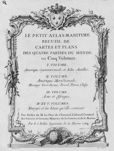
 Petit Atlas Maritime Title Page, 1764 Petit Atlas Maritime Title Page, 1764
One of Bellin's most notable works, "Le Petit Atlas Maritime," was published in 1764, encompassing five volumes of detailed charts and maps covering every part of the world. Bellin's cartographic legacy extends beyond France; his comprehensive maps and atlases were highly influential in shaping European understanding of global geography during the 18th century. His passion for accuracy and vast output have ensured his place in the annals of cartographic history.
PUBLICATION DATE: 1760
GEOGRAPHIC AREA: Grenada
BODY OF WATER: Caribbean
CONDITION: Good.
Slightly tanned, but overall in good condition witout serious condition issues. 1/2" margins tend to be browned and chipped at the edges but should be more than adequate for matting. Small inconspicuous stain/mark at top. One vertical and one horizontal fold.
COLORING: Later outline and wash handcolor.
ENGRAVER:
SIZE: 22
" x
35 "
ITEM PHYSICAL LOCATION: 51
PRICE: $675
ADD TO CART

|