DESCRIPTION: SOLD
Bellin's attractive map of New England and eastern Canada. With insets of the fortified town of Quebec, Fort Dauphin, the city and Port of Louisbourg, and the eastern United States and Canada from Cape Fear northward. The map includes New England as far south as Boston, the St. Lawrence River just beyond Quebec, and north to Cape Round. Very attractive title cartouche with ships and land batteries firing cannon.
Prince Edward Island, one of Canada's three maritime provinces, is labeled "St. Johns" after the original French name "Île Saint-Jean". The island is named for Prince Edward, Duke of Kent, the fourth son of King George III.
Coastal detail features soundings and the fishing banks. This attractive map of Canada was published by N. Bellin in 1744.
Jacques-Nicolas Bellin (1703-1772)
Jacques-Nicolas Bellin was a prominent French hydrographer and geographer, recognized for his significant contributions to the development of cartography. For over half a century, Bellin served as the first Ingénieur de la Marine of the Depot des cartes et plans de la Marine (the French Hydrographic Office) and was appointed Official Hydrographer to the French King. His expertise and precision led to the production of thousands of significant nautical charts and maps, enhancing maritime navigation.
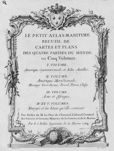
 Petit Atlas Maritime Title Page, 1764 Petit Atlas Maritime Title Page, 1764
One of Bellin's most notable works, "Le Petit Atlas Maritime," was published in 1764, encompassing five volumes of detailed charts and maps covering every part of the world. Bellin's cartographic legacy extends beyond France; his comprehensive maps and atlases were highly influential in shaping European understanding of global geography during the 18th century. His passion for accuracy and vast output have ensured his place in the annals of cartographic history.
PUBLICATION DATE: 1744
GEOGRAPHIC AREA: Canada
BODY OF WATER: Gulf of Saint Lawrence
CONDITION: Good.
Short margins. Laid to linen.
COLORING: Attractive hand coloring.
ENGRAVER:
SIZE: 18
" x
13 "
ITEM PHYSICAL LOCATION: 0
PRICE: $
ADD TO CART

|