DESCRIPTION: SOLD
Attractive antique French sea chart of the Indian Ocean with Australia, the southern half of Africa, Madagascar, Reunion Island ( "Île Bourbon" ), the Red Sea, Saudi Arabia and the Persian Gulf, India, Malaysia, Indonesia, the Philipines, and Taiwan. Key cities on this 1757 nautical chart include Macao, Manilla, Jakarta ( "Batavia" ), Mumbai ( "Bombay" ), Mecca ( "la Meque" ), and Cape Town.
Bellin's depiction of the west coast of of Australia ("Terres Australes" or "Nouvelle Hollande") is worth a few words. At the time the chart was produced in the mid-eighteenth century much the Australian coastline was poorly charted. The coast of Australia was first sighted and charted by by Willem Janszoon aboard the Dutch vessel Duyfken in 1606. Later Dutch, French and English explorers including William Dampier added to the outline of west Australia, but there was still significant uncertainty about coastal detail and location. Bellin conveys this ambiguity by the use of a very light and often broken outline for most of the south and west coastline. Where Bellin felt more certainty, as on the north coast he used a bold engraved outline with hachured coastal relief to convey a sense of certitude. Bellin provides three notes referring to his sources. Translated from French they are roughly:
- Terre de Concorde discovered in 1628.,
- Bay of Sea-Dogs ( "Chiens Marines" ) [or Shark Bay], viewed by Dampier in 1699. , and
- Coast viewed by Mr. Duquesne in 1687.
Attractive title cartouche with palm trees and African animals including a crocodile, elephant, and lion. As stated in the title the chart was produced for use by the French Navy. Unlike many other French charts there is no price noted, substantiating the premise that this copy was not intended for public consumption.
Jacques-Nicolas Bellin (1703-1772)
Jacques-Nicolas Bellin was a prominent French hydrographer and geographer, recognized for his significant contributions to the development of cartography. For over half a century, Bellin served as the first Ingénieur de la Marine of the Depot des cartes et plans de la Marine (the French Hydrographic Office) and was appointed Official Hydrographer to the French King. His expertise and precision led to the production of thousands of significant nautical charts and maps, enhancing maritime navigation.
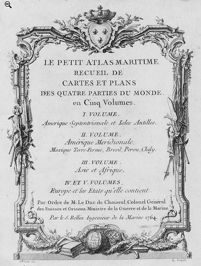
 Petit Atlas Maritime Title Page, 1764 Petit Atlas Maritime Title Page, 1764
One of Bellin's most notable works, "Le Petit Atlas Maritime," was published in 1764, encompassing five volumes of detailed charts and maps covering every part of the world. Bellin's cartographic legacy extends beyond France; his comprehensive maps and atlases were highly influential in shaping European understanding of global geography during the 18th century. His passion for accuracy and vast output have ensured his place in the annals of cartographic history.
PUBLICATION DATE: 1757
GEOGRAPHIC AREA: Australia
BODY OF WATER: Indian Ocean
CONDITION: Good.
Clean with a strong impression and clear platemark on heavy paper. Central vertical fold.
COLORING: None
ENGRAVER:
SIZE: 34
" x
22 "
ITEM PHYSICAL LOCATION: 0
PRICE: $
ADD TO CART

|