DESCRIPTION: Very large original U. S. Navy chart of the Baja Peninsula and the Gulf of California. U.S. and British Admiralty charts of Baja California are among the most requested items on RareCharts.
Dark shading on land areas enhances the contrast between land and sea. Manuscript traces of faded writing.
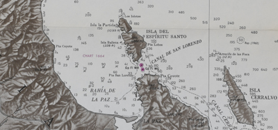 Baja- La Paz Bay and Isla Espiritu Santo Baja- La Paz Bay and Isla Espiritu Santo
"Mexico - West Coast Cabo San Lazaro to Cabo San Lucas and Southern Part of Golfo de California. From U. S. Navy Surveys between 1873 and 1901 with additions in 1962". 1st edition was in 1876 but this 68th edition last revised in June, 1964. Mercator projection. Catalog region 2. Chart # 621.
PUBLICATION DATE: 1964
GEOGRAPHIC AREA: Mexico
BODY OF WATER: Gulf of California
CONDITION: Very good.
A bit grubby from handling just at the vertical folds. Strong. Solid. No splits, tears or issues.
COLORING: dark brown shading over land.
ENGRAVER:
SIZE: 50
" x
33 "
ITEM PHYSICAL LOCATION: 68
PRICE: $225
ADD TO CART

|