DESCRIPTION: Matted and framed.
Original mid 18th-century French map of Caribbean islands centered on the island of Hispaniola with Haiti and Santo Domingo by Nicolas Bellin. The island of Hayti ( Haiti ) is shown divided into the five pre-Columbian cacicazgos, or Taino kingdoms. Puerto Rico is named I. Boriquen or S. Jean Baptiste. Nearly all of Jamaica is shown, as well as the eastern half of Cuba, the Turks and Caicos islands, and the Bahamas as far north as Cat Island.
Size with frame 18" x 15".
Published in a French edition of L'Abbe Prevost's "Histoire Générale des Voyages". Tome 12, No. 1.
Jacques-Nicolas Bellin (1703-1772)
Jacques-Nicolas Bellin was a prominent French hydrographer and geographer, recognized for his significant contributions to the development of cartography. For over half a century, Bellin served as the first Ingénieur de la Marine of the Depot des cartes et plans de la Marine (the French Hydrographic Office) and was appointed Official Hydrographer to the French King. His expertise and precision led to the production of thousands of significant nautical charts and maps, enhancing maritime navigation.
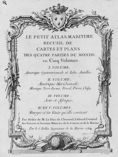
 Petit Atlas Maritime Title Page, 1764 Petit Atlas Maritime Title Page, 1764
One of Bellin's most notable works, "Le Petit Atlas Maritime," was published in 1764, encompassing five volumes of detailed charts and maps covering every part of the world. Bellin's cartographic legacy extends beyond France; his comprehensive maps and atlases were highly influential in shaping European understanding of global geography during the 18th century. His passion for accuracy and vast output have ensured his place in the annals of cartographic history.
PUBLICATION DATE: 1754
GEOGRAPHIC AREA: Dominican Republic
BODY OF WATER: Caribbean Sea
CONDITION: Good.
Matted and framed. Light browning. One vertical fold as issued. Wood frame with a few nicks and scratches as as shown. Engraving not examined out of frame but on visual inspection is clean without condition issues.
COLORING: None
ENGRAVER:
SIZE: 15
" x
11 "
ITEM PHYSICAL LOCATION: 0
PRICE: $285
ADD TO CART

|