DESCRIPTION: NOT AVAILABLE
Spectacularly decorative antique nautical map of the World from the 'Hydrographie francoise' by Jacques Bellin. Displays compass variation and prevailing wind direction across the globe. Australia is shown with only a partial coastline as "Terres Australis" or "Nouvelle Hollande" and the U.S. Pacific Northwest with no coastal detail.
Winds are represented as small cherubs with puffed cheeks. Huge rococo cartouche at right is decorated with cornucopia and numerous floral elements; capped with a crowned globe bearing the three fleur-de-lis that have been an emblem on the French coat of arms from the 14th century. This antique map of the world was produced by J.N. Bellin, the first French "Ingenieur de la Marine" towards the end of his career in 1765. The dedicatory cartouche to the Minister of War, the Duke de Choiseul, is as much a tribute to Bellin as to the minister as it lists his several accomplishments: "Ingenieur de la Marine", "Censeur Royal de l'Academie de Marine et de la Societe Royale de Londres".
Jacques-Nicolas Bellin (1703-1772)
Jacques-Nicolas Bellin was a prominent French hydrographer and geographer, recognized for his significant contributions to the development of cartography. For over half a century, Bellin served as the first Ingénieur de la Marine of the Depot des cartes et plans de la Marine (the French Hydrographic Office) and was appointed Official Hydrographer to the French King. His expertise and precision led to the production of thousands of significant nautical charts and maps, enhancing maritime navigation.
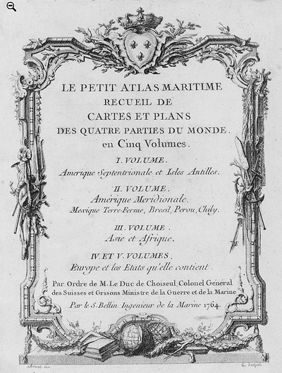
 Petit Atlas Maritime Title Page, 1764 Petit Atlas Maritime Title Page, 1764
One of Bellin's most notable works, "Le Petit Atlas Maritime," was published in 1764, encompassing five volumes of detailed charts and maps covering every part of the world. Bellin's cartographic legacy extends beyond France; his comprehensive maps and atlases were highly influential in shaping European understanding of global geography during the 18th century. His passion for accuracy and vast output have ensured his place in the annals of cartographic history.
PUBLICATION DATE: 1765
GEOGRAPHIC AREA: World
BODY OF WATER:
CONDITION: Very Good
Strong and very dark impression on thick wove paper with visible platemark all around. At least 1 inch margin on all sides. Several repaired tears in margin. Only one tear intrudes past the neat line and would not be noticed when matted.
COLORING: Modern outline and wash hand coloring.
ENGRAVER:
SIZE: 34
" x
22 "
ITEM PHYSICAL LOCATION: 0
PRICE: $
ADD TO CART

|