DESCRIPTION: Pictorial airline route map or cartograph by famed illustrator Ruth Taylor White for Western Air Express published in 1929, just three and one-half years after the airline was founded. Inset half-tone images of an early seaplane and of Avalon Harbor on Catalina.
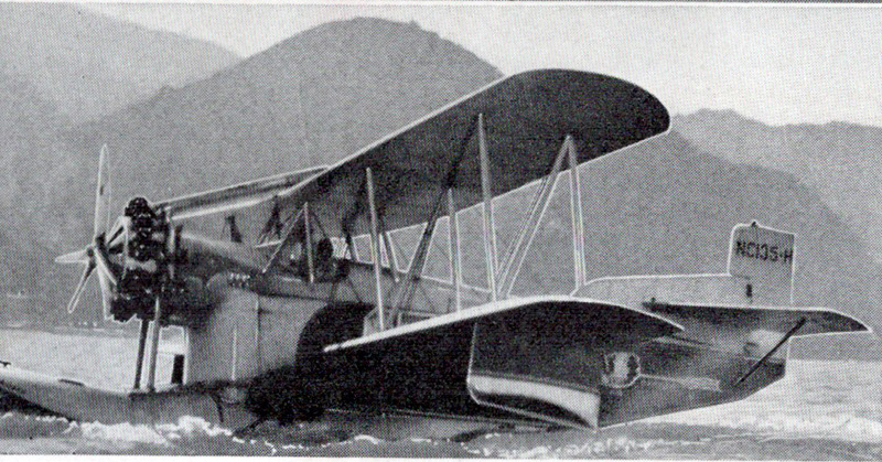 Western Air Express 1929 Seaplane, LA to Catalina Western Air Express 1929 Seaplane, LA to Catalina
This map include two routes flown from Los Angeles by Western Air Express:
- Los Angeles to Catalina. 45 miles - 30 minutes. "Over land and sea. The first air passenger service in the United States.
Los Angeles to Tia Juana or Agua Caliente". 116 miles - 1 hour.
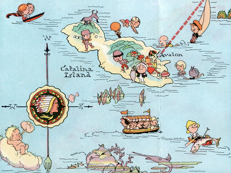 Ruth Taylor White LA to Catalina route map detail Ruth Taylor White LA to Catalina route map detail
The Western Air Express Corporation, later Western Airlines, began its first passenger service in 1926 touting speed, comfort, and dependability. By 1928, employing Fokker Super Tri-motor passenger aircraft capable of transporting twelve passengers at a blistering 125 MPH, the airline "carried about eighteen percent of all inter-city passengers in the United States." In 1928 the company initiated a seaplane route from Catalina Island, California to Los Angeles, California. Publication date: October, 1929.
Ruth Taylor White (1896 - 1985)
Ruth Taylor White was among the most prolific makers of pictographic maps or cartographs during the classic period of pictorial map making in the United States, the 1920's, 1930's, and 1940's. Taylor White’s ‘cartographs’ (as she called them) were characterized by bobble-headed cartoon characters across colorful, attractive landscapes. Despite their visual richness and vigor, White's cartographs resort to stereotyping with regard to culture, ethnicity, gender and class and their points of contrast to 21st century culture is a reminder. That said, White's pictorial maps combine graphic style, color and comical observation and are drawn in the same style of Jo Mora's works of the same period
PUBLICATION DATE: 1929
GEOGRAPHIC AREA: United States
BODY OF WATER: Pacific Ocean
CONDITION: Very good.
Verso with portions of other Taylor route maps. Slight bleeding/offsetting of red ink. Small rust spots from staples (removed).
COLORING: Litho color.
ENGRAVER:
SIZE: 8
" x
15 "
ITEM PHYSICAL LOCATION: 78
PRICE: $135
ADD TO CART

|