| | Thumbnail | | Creator | Date | Title / Author / Date / Location | Price | | | Description |
| 279 |  | Details | Malham, John | 1797 |
| A Correct Chart of the Southern Coasts of Africa |
|
Malham, John |
|
| 1797 |
| LOC:0 |
| $0.00 | Malham--John | A-Correct-Chart-of-the-Southern-Coasts-of-Africa | <BR> </BR>
SOLD - <BR> </BR>
Small antique nautical chart showing the continent of Africa south of the Equator and the island of Madagascar. From the rare first American edition of Malham's Naval Gazetteer, published by Spotswood and Nancrede in Boston in 1797. Vol 1.<BR> </BR>
This sea chart comes from an early nautical gazetteer or geographical dictionary produced first in England and after 1796 in the United States. Key noted features from this antique copperplate engraving include Madagascar, Cape of Good Hope, Isle France, Isle Bourbon, . Regional African native tribal associations or kingdoms identified include: Bake-bake, Hotentots, Bororos, Zambas, Nimeamai, Bembei, and Biri.<BR> </BR>
Rev. John Malham was a prolific Yorkshire-born author who produced other diverse works that include "Navigation Made Easy and Familiar", "Twenty-Two Sermons on Doctrinal and Practical Subjects" and "The Scarcity of Wheat considered". Malham died near London in 1807. (Gentleman's Magazine, Vol 102, 1807, p. 568).<BR> </BR>
Colophon at end of Volume 1 states that the work is "From the prefs of Samuel Etheridge, No. 9 Newbury Street, Boston, 1797"). |
| 1111 | 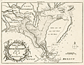 | Details | London Magazine | 1761 |
| A New Map of Louisiana and the River Mississipi from the Sea to Bayagoulas |
|
London Magazine |
|
| 1761 |
| LOC:0 |
| $0.00 | London-Magazine | A-New-Map-of-Louisiana-and-the-River-Mississipi--from-the-Sea-to-Bayagoulas | SOLD<br></br>Detailed antique map of the Mississippi River Delta taken from Thomas Jefferys' larger three-part map of the vicinity of New Orleans. Captures a point in time before subsidence and the rising sea level caused the loss of many hundred thousand acres of Louisiana land to the sea.
<br></br>
Bayou Lafourche is named "Cheimachas River" ; in contemporaneous French documents the waterway, once a distributary stream of the Mississippi River, was called "Bayou Lafourche des Chitimachas" after the Chitimacha Indians who inhabited land near present day Donaldsonville. The map shows the course of the Mississippi from Bayagoulas near the present-day town of Bayou Goula in Iberville Parish, Louisiana to Fort la Balise, which defended the entrance and channel of the river.
<br></br>
Contains very intersting notations including "Forest of Holms Fit for Ship Building" ("holm" refers to evergreen oak trees- probably the southern live oak ) and "Tchaouachas where Marshall de Bellisle had his grant". The latter notation near upper Plaquemine Parish refers to François Simars de Bellisle, first an officer of the French West Indies Company who wandered south-east Texas and Louisiana as a indian captive and slave from 1719 - 1721. In 1753 de Bellisle became a member of the Superior Council of Louisiana and served as town commander of New Orleans.
<br></br>
An important feature of this map is the depiction of the ruins of Fort La Boulaye the First Settlement made in 1700. This fort, located on the eastern bank of the Mississippi River about fifty miles from the Gulf of Mexico, was established by Pierre Le Moyne d'Iberville in 1700 and was abandoned about seven years later. In 1933 the remains of Fort La Boulaye were discovered near present-day Phoenix, Louisiana, in Plaquemines Parish. |
| 378 | 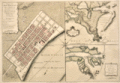 | Details | Jefferys, Thomas | 1759 |
| Plan of New Orleans and the Mississippi River |
|
Jefferys, Thomas |
|
| 1759 |
| LOC:0 |
| $0.00 | Jefferys--Thomas | Plan-of-New-Orleans-and-the-Mississippi-River | SOLD
<BR></BR>
Large, early foundational map for the collector of New Orleans cartography. By English cartographer Thomas Jefferys. Stunning and quite scarce plan of New Orleans, Louisiana with insets of the mouth of the Mississippi River and also a long stretch of the river from south of Donaldsonville to the passes. The map of New Orleans's French Quarter is similar to the earlier chart by <a rel="nofollow" href = "http://www.rarecharts.com/creator/Bellin--Jacques-Nicolas/" > Jacques Bellin</a> but contains additional details outside the French Quarter, which was largely marsh land at that time, including a road to Bayou St. John.<BR> </BR>
See <a rel="nofollow" href= "https://www.rarecharts.com/displaybycategory/city/new%20orleans"> other New Orleans items.</a> <BR> </BR>
Attribution and date at bottom: "Nov 1759. Published According to Act of Parliament by T. Jefferys at Charing Cross Price 2d.<BR> </BR> |
| 3591 | 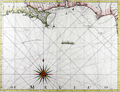 | Details | Jefferys, Thomas | 1775 |
| Antique Chart of Coast of West Florida and Louisiana |
|
Jefferys, Thomas |
|
| 1775 |
| LOC:51 |
| $0.00 | Jefferys--Thomas | Antique-Chart-of-Coast-of-West-Florida-and-Louisiana | SOLD<br><br>
Fine antique nautical chart and an important chart for the collector of Gulf Coast history. Geographic coverage on this antique chart extends from Sabine Pass, Texas (Cabo del Norte ) to Appalachicola Bay in the Florida Territory.
<br></br>
This first-edition British copper-engraved navigational chart documents the lack of of knowledge about Chandeleur Sound (1775) where a note about the waters inside those barrier islands states "Shallow water with many small islands but very little known". In the later second state (not shown) the depiction of the sound is updated with greater detail (Breton Island, Grandgosier Island) and the placename "Bay of Spiritu Santu" fills in what we now call Chandeleur Sound. Bayou Lafourche is labeled "Chetimachas River" after the Chitimacha Indians who were known to inhabit the area near Donaldsonville, La. Barataria Bay is labeled "Lake Ouachas".
<br></br>
A decorative flotilla graces the middle of our chart, highlighting a dashed lne from west to southeast. That dotted line, Jeffery noted was, "The Flota's Track from la Vera Cruz [Mexico] to Havanna to avoid the Trade Winds".
<br></br>
Very attractive decorative compass rose.
<br></br>
From Sayer's and Bennett's atlas titled: "The West-India Atlas: or, a compendious description of the West-Indies: illustrated with forty one correct charts and maps, taken from actual surveys."
<br></br>
Publishers attribution reads: "London. Printed for Rob.t Sayer, Map and Printseller. No 53 Fleet Street as the Act directs 20th Feb.y 1775. According to Rumsey <div class="indenttextblock">
"Sayer and Bennet acquired his [Jefferys'] materials in preparation for this atlas, and published the atlas posthumously under his name (as they did with the American Atlas) in 1775. (
<a href="http://www.davidrumsey.com/luna/servlet/detail/RUMSEY~8~1~2795~310044:The-coast-of-Yucatan-from-Campeche-" target="_blank">Internet </a>)
</div> |
| 449 | 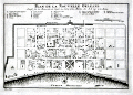 | Details | Bellin, Jacques Nicolas | 1774 |
| Plan de la Nouvelle Orleans (2) |
|
Bellin, Jacques Nicolas |
|
| 1774 |
| LOC:0 |
| $0.00 | Bellin--Jacques-Nicolas | Plan-de-la-Nouvelle-Orleans-(2) | <BR></BR>
This plate has been SOLD but please see another <a style="color:#0000EE" rel="nofollow" href="https://www.rarecharts.com/ShowDetail/Creator/Bellin--Jacques-Nicolas/Title/Plan-de-la-Nouvelle-Orleans-(3)/1193">hand-colored engraving of Bellin's plan.</a>
<br><br/>
A very desirable map and one of the few maps available from the colonial period, Nicolas Bellin's famous plan of the city of New Orleans, Louisiana is based on a manuscript map created approximately 15 years after the city was founded along high ground on the east bank of the Mississippi river. The plan depicts the city neatly laid out with streets most residents would recognize today including Bourbon, Chartres, Royale and at the center of the plan- Jackson Square.
<BR> </BR>
Copies of this map are increasingly difficult to find and prices have increased substantially since Hurricane Katrina. From "Histoire Generale des Voyages ou Nouvelle Collection de Toutes Relations de Voyages par Mer et par Terre". Published by van Harrevelt and Changuion; Amsterdam. Volume 21.
<BR> </BR>
The plan is based on a design initially created by military engineers Adrien de Pauger and Le Blond de la Tour in 1722. That plan envisioned a street grid extending six blocks northward from the Mississippi River, a plan that was likely scaled back in 1729 as a result of the Natchez Indian massacre of settlers at Fort Rosalie near Natchez Mississippi. At that point security became paramount. This plan by Bellin is more similar to an unsigned manuscript plan of New Orleans from 1732, which showed the city extending only 4 blocks north from the river, and partially surrounded by a defensive moat. The new emphasis on security, when the population totaled less than 2000 persons, is reflected in some of the other features found in Bellin's plan: guardhouses, a powder magazine, and a single bridge controlling access across the moat to the city. Those features were absent in Pauger's plan. |
| 591 | 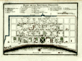 | Details | Bellin, Jacques Nicolas | 1753 |
| Plan de la Nouvelle Orleans |
|
Bellin, Jacques Nicolas |
|
| 1753 |
| LOC:0 |
| $0.00 | Bellin--Jacques-Nicolas | Plan-de-la-Nouvelle-Orleans | <BR></BR>
This plate has been SOLD but please see another <a style="color:#0000EE" rel="nofollow" href="https://www.rarecharts.com/ShowDetail/Creator/Bellin--Jacques-Nicolas/Title/Plan-de-la-Nouvelle-Orleans-(3)/1193">hand-colored engraving of Bellin's plan.</a>
<br><br/>
J.N. Bellin's early plan of the city of New Orleans, Louisiana. |
| 99 | 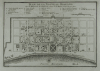 | Details | Bellin, Jacques Nicolas | 1753 |
| Plan de la Nouvelle Orleans - SOLD |
|
Bellin, Jacques Nicolas |
|
| 1753 |
| LOC:0 |
| $0.00 | Bellin--Jacques-Nicolas | Plan-de-la-Nouvelle-Orleans---SOLD | <BR></BR>
This plate has been SOLD but please see another <a style="color:#0000EE" rel="nofollow" href="https://www.rarecharts.com/ShowDetail/Creator/Bellin--Jacques-Nicolas/Title/Plan-de-la-Nouvelle-Orleans-(3)/1193">hand-colored engraving of Bellin's plan.</a>
<br><br/>
Bellin's famous plan of the city of New Orleans, based on a manuscript map created approximately 25 years after the city was founded along high ground on the east bank of the Mississippi river. Shows the city neatly laid out with streets most residents would recognize today including Bourbon, Chartres, Royale and at the center of the plan- Jackson Square. Number 19.<BR> </BR>
Interestingly, what appears to be a defensive wall around the city is labeled "fosse' plein d'eau". Fosse' is French for "canal". Therefore, even at this relatively early point in its history New Orleans had a canal originating in the vicinity of today's Canal Street. |
| 760 | 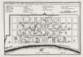 | Details | Bellin, Jacques Nicolas | 1744 |
| Plan of New Orleans French Quarter German ed. |
|
Bellin, Jacques Nicolas |
|
| 1744 |
| LOC:3 |
| $0.00 | Bellin--Jacques-Nicolas | Plan-of-New-Orleans-French-Quarter-German-ed- | SOLD<BR> </BR>
German edition of J.N. Bellin's well-known plan of the city of New Orleans, based on a manuscript document created approximately 15 years after the city was founded along high ground on the east bank of the Mississippi river. This plan from New Orlean's French colonial period, shows the city neatly laid out with streets most residents would recognize today as the French Quarter.
<BR> </BR>
The plan is based on a design initially created by military engineers Adrien de Pauger and Le Blond de la Tour in 1722. That plan envisoned a street grid extending six blocks northward from the Mississippi River, a plan that was likely scaled back in 1729 as a result of the Natchez Indian massacre of settlers at Fort Rosalie near Natchez Mississippi. At that point security became paramount. This plan by Bellin is more similar to an unsigned manuscript plan of New Orleans from 1732, which showed the city extending only 4 blocks north from the river, and partially surrounded by a defensive moat. The new emphasis on security, when the population totaled less than 2000 persons, is reflected in some of the other features found in Bellin's plan: guardhouses, a powder magazine, and a single bridge controlling access across the moat to the city. Those features were absent in Pauger's plan.
<br></br>
This plan was probably published in a German edition of Charlevoix's 'History and General Description of New France' which was originally published in French from Paris during 1744. (Source: Lemmon, Alfred E., John T Magill, and Jason R. Wiese. Charting Louisiana. The Historic New Orleans Collection. 2003).
<br></br><hr>
<a style="color:#0000EE" rel="nofollow" href= "https://www.rarecharts.com/ShowDetail/Creator/Tirion--Isaac/Title/Maps-of-French-Colonial-New-Orleans-and-the-Mississippi-River/1069">View this similar, larger map by Isaac Tirion from 1769.<br><br/>
<img src="http://www.rarecharts.com/ZoomifyImages/SC_1069/TN.gif"/> </a><BR> </BR><hr> |
| 1272 | 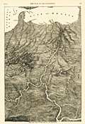 | Details | Anonymous | 1866 |
| Antique Birds Eye View of the Mississippi Basin |
|
Anonymous |
|
| 1866 |
| LOC:0 |
| $0.00 | Anonymous | Antique-Birds-Eye-View-of-the-Mississippi-Basin | SOLD
<br></br>
Unusual post-war antique wood engraving of a birds eye view of the <b>Mississippi basin</b> with numerous rivers, roads and cities identified by name. With this image the viewer looks at the landscape from a new perspective with South at the top of page. Attractive.
<br></br>
<div class="indenttextblock"> "Wood engraving is a printmaking and letterpress printing technique, in which an artist works an image or matrix of images into a block of wood. Functionally a variety of woodcut, it uses relief printing, where the artist applies ink to the face of the block and prints using relatively low pressure. By contrast, ordinary engraving, like etching, uses a metal plate for the matrix, and is printed by the intaglio method, where the ink fills the valleys, the removed areas. As a result, wood engravings deteriorate less quickly than copper-plate engravings, and have a distinctive white-on-black character." (Source: <a href="https://en.wikipedia.org/wiki/Wood_engraving" target="_blank">INTERNET</a> )
</div>
<BR/>
Coverage extends from St. Louis to the Gulf of Mexico and beyond with dozens of cities and town noted including Austin, Texas; Key West, Florida; New Orleans, Louisiana; Brownsville, Galveston, Montgomery, Jackson, Knoxville, Charleston, Savannah, Vicksburg, Natchez and many more.
<br></br>
Includes the Mississippi River, Missouri River, Ohio River, Arkansas River, Savannah River, Chattahoochee River, Escambia River, and the upper Gulf of Mexico. Published in 1866 by Harpers for the "Pictorial History of the Civil War" part 1. |
| 964 |  | Details | Anonymous | 1800 |
| Antique map of the Gulf of Mexico and Caribbean Sea |
|
Anonymous |
|
| 1800 |
| LOC:0 |
| $0.00 | Anonymous | Antique-map-of-the-Gulf-of-Mexico-and-Caribbean-Sea | SOLD <br></br>
Antique copper-plate engraved map of the Caribbean, <b>Gulf of Mexico</b>, Central America and portions of Colombia and Venezuela. This original old map ca. 1800 shows Florida as an archipelago of islands as well as the key cities of Havana, Cuba; Saint Augustine and Pensacola, Florida; Mobile, Alabama; <b>New Orleans, Louisiana</b>; and Port-Royal, Jamaica. Because the wide area encompassing the Louisiana Purchase is labeled as "Louisiana" we can date the map to prior to 1803, the date of that transaction.
<br></br>
After a map produced by J.B. Nolin for his "<i>Atlas Général a l'usage des colleges et maisons d'education</i>". Plate 25, |
| 158 |  | Details | Mugnier, George Francois | 1884 |
| Lower Levee, Shipping |
|
Mugnier, George Francois |
|
| 1884 |
| LOC:0 |
| $0.00 | Mugnier--George-Francois | Lower-Levee--Shipping | SOLD <BR> </BR>
Handsome, detailed, antique albumen cabinet card by New Orleans photographer George Francois Mugnier, taken early in his career circa 1884. Subjects are several 3-masted sailing vessels docked at a New Orleans wharf. Vessel closest to the wharf has sails partially unfurled, possibly to allow them to dry. Also, in the far background a sailor is seen climbing the rigging of another ship. <BR> </BR>
The ship farthest from the wharf can be identified under magnification as the "Glen Grant". On the Canadian Heritage on-line reference library we find 5 voyages by a vessel named "Glen Grant" (official # 69115) to the U.S. Gulf Coast including a round-trip voyage from England to a single Gulf port, unnamed, departing September 1882, returning March 1883. It is possible that this photo was taken during that voyage by Mugnier. <BR> </BR>
Bottom of photo reads: "Mugnier, Photographer Exchange Place N.O. La." Mugnier (1855-1936) achieved fame as a photographer with his 1885 photographs of the World's Industrial and Cotton Centennial Exposition in New Orleans. Number 538. Blank, pinkish verso. |
| 1010 |  | Details | U.S. Coast and Geodetic Survey | 1946 |
| Lakes Pontchartrain and Maurepas, Louisiana |
|
U.S. Coast and Geodetic Survey |
|
| 1946 |
| LOC:0 |
| $0.00 | U-S--Coast-and-Geodetic-Survey | Lakes-Pontchartrain-and-Maurepas--Louisiana | SOLD
<br></br>
Modern 70 year-old chart of South Louisiana focused on Lake Pontchartain and New Orleans. Key features are the chart's fine unblemished condition and the absence of the Lake Ponchartrain Causeway Bridge. A series of lighted bouys extends from the south shore in Metairie to the north shore near Mandeville. Little development shown in Metairie as expected.
<BR></BR>
Published in 1943 but this edition was published with corrections in 1946. |
| 340 |  | Details | U.S. Geological Survey | 1892 |
| Mouth of the Mississippi River |
|
U.S. Geological Survey |
|
| 1892 |
| LOC:0 |
| $0.00 | U-S--Geological-Survey | Mouth-of-the-Mississippi-River | SOLD
<BR> </BR>
Small antique lithographed chart of the Mouth of the Mississippi River. The chart, from the U.S. Geological Survey, is derived from a U.S. Coast Survey chart and overlaid with hachured topographic details. Lighthouses, soundings, life saving stations and navigational aids are shown. Water shown in blue. Some of the features shown include Lake Ponchartrain, Timbalier Pass, Bayou Lafourche, Pass Fourchon, Chandeleur Islands, Biloxi, and Pass Christian. <BR> </BR>
Produced for the U.S. Geological Survey Thirteenth Annual Report. Produced by George S. Harris Lithographers, Philadelphia. Plate 22. |
| 384 |  | Details | Pilie, Joseph | 1828 |
| Plan of the Front Part of the City of New Orleans in 1818. |
|
Pilie, Joseph |
|
| 1828 |
| LOC:0 |
| $0.00 | Pilie--Joseph | Plan-of-the-Front-Part-of-the-City-of-New-Orleans-in-1818- | SOLD … but see <a href="https://www.rarecharts.com/ShowDetail/Creator/Pilie--Joseph/Title/Original-Antique-Plan-of-New-Orleans-Waterfront/1386" target="_blank">another example of Pilie's plan here. </a>
<BR> </BR>
Scarce steel-engraved plan depicting the Mississippi River along New Orleans' French Quarter in 1818. |
| 383 | 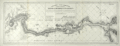 | Details | U.S. Army Engineers | 1893 |
| Barataria and Lake Borgne Levee Districts 1893 |
|
U.S. Army Engineers |
|
| 1893 |
| LOC:0 |
| $0.00 | U-S--Army-Engineers | Barataria-and-Lake-Borgne-Levee-Districts-1893 | SOLD
<BR> </BR>
Draftsman-style map of the lower Mississippi River from New Orleans to the Mississippi River passes. Depicts the levees constructed along the Mississippi River in the 1892-1893 season. The map names levee improvements circa 1893 in Orleans, St. Bernard, Jefferson and Plaquemines parishes with Mississippi river mileage from Cairo, Illinois shown at 5 mile intervals. New Orleans is shown as it existed in 1893 with the northern half of the city to Lake Ponchartrain yet to be developed. <BR> </BR>
Key points along the river that are identified include Southwest Pass, the Jump, Tropical Bend, Devils Plate, Fort Jackson and English Turn. Lines of latitude and longitude. Plate VII. Dated June 1, 1893. <BR> </BR> |
| 1228 | 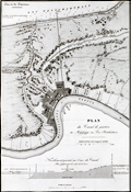 | Details | Poussin, Guillaume Tell | 1834 |
| Antique plan of New Orleans Louisiana ca. 1834 |
|
Poussin, Guillaume Tell |
|
| 1834 |
| LOC:0 |
| $0.00 | Poussin--Guillaume-Tell | Antique-plan-of-New-Orleans-Louisiana-ca--1834 | SOLD
<br></br>
Uncommon antique map or plan of New Orleans, Louisiana comprises the left half of the sheet. By William Tell Poussin (1796 - 1876), French architect, author, engineer, and diplomat.
<BR> </BR>
Detailed antique map of the New Orleans area shows the existing Carondolet Canal, Bienvenue Canal, and Treme Canal. The work also shows the proposed route of a canal to be constructed from the Mississippi River to Lake Ponchartrain running through the Faubourg Marigny along what is today Elysian Fields avenue. The canal was never constructed but in the 1830s the Ponchartrain Railway was built over the same route. The dream of a canal linking the lake with the river was not realized until 1923 with the opening of the Inner Harbor Navigation Canal (INHC), or "Industrial Canal".
<BR> </BR>
Includes a telling longitudinal elevation profile of the proposed canal from the Mississippi river to Lake Pontchartrain. Beginning at its highest point at the Mississippi River levee, the ground elevation along Elysian Fields Avenue declines gradually becoming "Forets inondees" until it crosses the Gentilly Ridge (an old natural levee) and the elevation increases.
<BR> </BR>
Right portion of the sheet contains a map of the Cheasapeake and Delaware Canal with a both a profile of the canal width and the canal length. Title on this half reads: "Plan de trace, situation des Ecluses, Nivellement general et Profile du Canal."
<BR> </BR>
Published in: "Travaux d'ameliorations interieures projetes ou executes par le Gouvernement General des Etats-Unis d'Amerique, de 1824 a 1831"; par Guillaume-Tell Poussin … Atlas. Paris, Anselin, Libraire, pour l'art militaire, les sciences et les arts, rue Dauphine, No. 36, dans le passage Dauphine. Carilian-Goeury, Libraire, des ponts et chaussees et des mines, Quai des Augustins, No. 41. 1834. Imprimerie de Lachevardiere, rue du Colombier, No. 30. |
| 1426 | 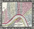 | Details | Mitchell, Samuel Augustus | 1860 |
| Antebellum Map of New Orleans, Louisiana |
|
Mitchell, Samuel Augustus |
|
| 1860 |
| LOC:0 |
| $0.00 | Mitchell--Samuel-Augustus | Antebellum-Map-of-New-Orleans--Louisiana | NOT AVAILABLE
<br></br>
Attractive antique map from 1860 of New Orleans, Louisiana with 11 of its 17 wards. On the West Bank of the Mississippi River three early neighborhoods are identified by their old (current) name: Algiers (Algiers Point); MacDonough (McDonogh), and Belle Ville (Whitney). Most of the boundaries of Wards 1 through 11 were drawn in 1852 when the city was reorganized into one centralized political entity. <a href="https://en.wikipedia.org/wiki/Wards_of_New_Orleans" target="_blank">Online. </a>
<br></br>
This neat, colorful old map clearly shows several early canals which evolved for both drainage and transport over a long period. For example the Carondelet Canal or Old Basin Canal, was a canal in New Orleans, operating for almost 135 years- from 1794 into the 1920s. The canal started at Bayou St. John, which connected with Lake Pontchartrain, and went inland to what was then the back edge of New Orleans, in the Tremé neighborhood. The two-acre turning basin at the head of the Canal inspired the naming of Basin Street in New Orleans.
<br></br>
Attribution at bottom reads: Entered according to Act of Congress, in the year 1860 by S. Augustus Mitchell Jr. in the clerks office of the District Court of the U.S. for the eartern District of Pennsylvania. Number 33.
<br></br>
Samuel Augustus Mitchell Sr. (1792-1868) is one of the pioneers in American cartography of the 19th century and led the conversion of engraved map plates to more affordable lithographic plates. |
| 1390 | 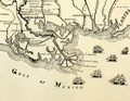 | Details | Lane, Walter A. | 1884 |
| Antique Civil War era map of the Gulf Coast |
|
Lane, Walter A. |
|
| 1884 |
| LOC:0 |
| $0.00 | Lane--Walter-A- | Antique-Civil-War-era-map-of-the-Gulf-Coast | SOLD
<br></br>
Neat decorative original antique map of the southeast Gulf Coast during the U.S. Civil War. Includes locations and features in Texas, Louisiana, Mississippi, Alabama, Florida and the surrounding states. Shows key forts including Fort Pike, Fort Pickens, Fort Jackson, Fort St. Philip and Fort McComb. Includes numerous railroad lines, the key to rapid re-supply. Lane shows and names all the Mississippi River passes (ex. "Pass a Loutre") and fills the empty space in the Gulf of Mexico with depictions of six sailing vessels, some with obvious smoke stacks signifying the use of steam power to assist the sails.
<br></br>
From "The Soldier in Our Civil War" by Frank Leslie. Text and wood-cut images on verso. Dotted line shows the path of Grierson's raid, an attack by 1700 Union cavalry on Baton Rouge, Lousiana in 1863 over routes no Union soldier had traveled prior to the raid. |
| 2539 | 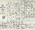 | Details | Miller and Jones | 1944 |
| Map of New Orleans Storyville Jazz and Red-Light District |
|
Miller and Jones |
|
| 1944 |
| LOC:0 |
| $0.00 | Miller-and-Jones | Map-of-New-Orleans-Storyville-Jazz-and-Red-Light-District | SOLD<br></br>
Map of Storyville jazz and red-light district in the Faubourg Treme neighborhood of New Orleans, Louisiana. Redrawn from an earlier map. Storyville was a 38-block area of New Orleans in which prostitution was tolerated between 1897 and 1917. The streets bounding the Storyville district were Iberville, Basin, St. Louis, and North Robertson streets.
<br></br>
Redrawn by Paul Edward Miller and Richard M. Jones from an earlier edition. |
| 2576 | 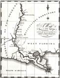 | Details | Schultz, Christian | 1810 |
| Early Original Map of the Mississippi River from Ohio R. to Gulf of Mexico |
|
Schultz, Christian |
|
| 1810 |
| LOC:10 |
| $0.00 | Schultz--Christian | Early-Original-Map-of-the-Mississippi-River-from-Ohio-R--to-Gulf-of-Mexico | SOLD
<br></br>
Finely executed original antique map of the <b>Mississippi River</b> from <b>Fort Jefferson, Kentucky</b>, near the junction with the Ohio River, to the Gulf of Mexico. Fort Jefferson was established in 1780 by George Rogers Clark at the express instruction of the then Governor of Virginia, Thomas Jefferson. The fort was abandoned in June 1781.
<br></br>
The area bounded by Bayou Manchac, Lake Ponchartrain and the Mississippi River is labeled "Island of New Orleans". In 1803 Alexander Hamilton wrote <div class="indenttextblock">"The Island of New-Orleans is in length about 150 miles; its breadth varies from 10 to 30 miles. Most of it is a marshy swamp, periodically inundated by the river. The town of New-Orleans, situated about 105 miles from the mouth of the river, contains near 1300 houses, and about 8000 inhabitants, chiefly Spanish and French. It is defended from the overflowings of the river, by an embankment, or leveé, which extends near 50 miles."(Purchase of Louisiana, [5 July 1803],” Founders Online, National Archives, last modified June 13, 2018, http://founders.archives.gov/documents/Hamilton/01-26-02-0001-0101.) </div>
<br></br>
This fine antique copper-plate engraved map is is one of the earliest maps of the Mississippi River published in America. Drawn by Christian Schultz. Two maps on one sheet.
<br></br>
Published in 1810 for Christian Schultz's "Travels on an Inland Voyage Through the States of New York, Pennsylvania, Virginia, Ohio, Kentucky and Tennessee, and through the territories of Indiana, Louisiana, Mississippi, and New-Orleans; performed in the years 1807 and 1808…"
<br></br>
Schultz's work is one of the earliest works to give a detailed account of travel and the actual risks and dangers encountered in the western country. Schultz's book is a compilation of his letters, and was published in direct response to the negative reports in an earlier travel guide written by Englishman Thomas Ashe in 1806. |
| 269 | 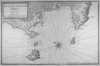 | Details | Ayrouard, Jacques | 1746 |
| Plan du Golfe de Naples |
|
Ayrouard, Jacques |
|
| 1746 |
| LOC:0 |
| $0.00 | Ayrouard--Jacques | Plan-du-Golfe-de-Naples | SOLD<br></br> Please search our site for "Ayrouard" for a similar engraving with beautiful hand-color..
<br></br>
Lovely antique nautical chart by Jacques Ayrouard (Marseilles ca. 1746) from a scarce nautical atlas: "Recueil de Plusiers Plans des Ports et Rades et de Quelque Cartes Particulieres de la Mer Mediterranee". |
| 3585 | 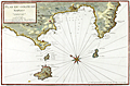 | Details | Ayrouard, Jacques | 1746 |
| Antique chart of the Gulf of Naples by Ayrouard |
|
Ayrouard, Jacques |
|
| 1746 |
| LOC:88 |
| $0.00 | Ayrouard--Jacques | Antique-chart-of-the-Gulf-of-Naples-by-Ayrouard | SOLD<br><br>
Beautifully colored antique nautical chart of the Bay of Naples, Italy by Jacques Ayrouard (Marseilles ca. 1746). From Ayrouard's scarce nautical atlas: "Recueil de Plusiers Plans des Ports et Rades et de Quelque Cartes Particulieres de la Mer Mediterranee".
<BR> </BR>
This fine small-scale copperplate-engraved chart covers the entire Bay of Naples, including Mount Vesuvius, Vigo, Sorrento, and the islands of Ischia (Iscle), Procida (Procita), and Capri (Cabrita). Numerous windmills, guard towers, and other structures are noted. Shows much of Italy's justly famous Amalfi Coast as far to the north as the vicinity of Positano and Praiano.
<BR> </BR>
Mount Vesuvius is shown erupting. According to one source, relatively severe eruptions of Vesuvius occurred in 1660, 1682, 1694, 1698, 1707, 1737. The 1737 event brought disaster to the town of Torre del Greco.
<BR> </BR>
Little information exists on Ayrouard's background but like <a style="color:#9BAFCB" rel="nofollow" href= "/MichelotBremondBackground.aspx">Henry Michelot</a>, Ayrouard was a pilot of the French royal galley, the Reale, based in Marseille. However, Ayrouard's port plans and charts are very different from Michelot's earlier works. The much larger size (17"x11") and the extensively shaded topography are distinctive characteristics of Ayrouard's plans.
<BR> </BR>
Large compass rose with fleur-de-lis. Plate 35. With the royal privilege. |
| 348 |  | Details | Anonymous | 1808 |
| Manuscript Map of Cadiz |
|
Anonymous |
|
| 1808 |
| LOC:0 |
| $0.00 | Anonymous | Manuscript-Map-of-Cadiz | Sold<BR> </BR>
Antique French pen and ink manuscript map of Cadiz, Spain ca. 1808. Scale: "Une mille." Interestingly, for a map associated with a naval officer, there is little hydrographic detail or soundings as there might be in a nautical chart , but instead a great deal of topographic detail about the surrounding area. Fourteen key locations are noted by lettering and described by a legend at the left of the map. Decorative compass rose denotes north to the upper left. |
| 186 | 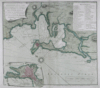 | Details | Rocque, John | 1762 |
| A Plan of the City of Cadis - - - SOLD |
|
Rocque, John |
|
| 1762 |
| LOC:0 |
| $0.00 | Rocque--John | A-Plan-of-the-City-of-Cadis-------SOLD | THIS ITEM HAS BEEN SOLD <BR> </BR> Scarce and desirable antique plan of Cadiz, Spain published by Mary Anne Rocque, wife of engraver John Rocque, after her husband's death in 1762. The colorful engraved plan covers from Rota in the North to Chiclana in the South with an scroll inset of the town of Cadiz. Inset legend with descriptions of map locations. Numerous soundings and navigational hazards are identified.<BR> </BR>
John Rocque, born in France, had a long career during which he engraved and published maps and plans based on surveys he personally conducted of many English estates, cities and counties. Two of Rocque's best known achievements are a 24 sheet map of London published by John Pine and John Tinney in 1746 and a posthumously published "A Set of Plans and Forts in America Reduced from Actual Surveys". |
| 286 |  | Details | Baugean, Jean-Jerome | 1814 |
| Navire Danois embarquant de Blocs de Marbre |
|
Baugean, Jean-Jerome |
|
| 1814 |
| LOC:0 |
| $0.00 | Baugean--Jean-Jerome | Navire-Danois-embarquant-de-Blocs-de-Marbre | Sold<BR></br>
A gem! This small, highly-detailed antique copperplate engraving by the French artist Jean-Jerome Baugean published circa 1814 depicts a Danish sailing vessel at anchor loading large blocks of marble from a lighter. The mizzen sail is set, presumably to help maintain the ship's position while loading.<BR> </BR>
This engraving is from a series of 72 fine antique engravings of merchant and naval vessels created and engraved by Baugean (1764-1830)- "Collection de Toutes les Especes de Batimens de Guerre et de Batimens Marchard." Baugean's engravings are notable for their accuracy and detail. |
| 307 |  | Details | Henri Sbonski de Passebon | 1690 |
| Flute vaisseau de charge a la voile |
|
Henri Sbonski de Passebon |
|
| 1690 |
| LOC:0 |
| $0.00 | Henri-Sbonski-de-Passebon | Flute-vaisseau-de-charge-a-la-voile | SOLD
<br></br>
"Flute vaisseau de charge a la voile" is one of a series of 17 antique folio-sized copperplate engravings created ca. 1690 by French galley Captain Henry Sbonski de Passebon. Engraved by Claude Randon, the collection of nautical architecture plates was first published from Marseille where, in the late 17th century the arsenal was home port to the galley service of Louis XIV.<BR> </BR>
A flute ( fluyt ; pronounced 'flight') was typically a cargo-carrying vessel of about 80 feet in length and displaced between 200 - 300 tons.<br></br>
<a style="color:#9BAFCB" rel="nofollow" href= "http://en.wikipedia.org/wiki/Fluyt"> According to Wikipedia the fluyt </a> was one of the keys to Dutch commercial competitiveness in the 17th century as it: <i>"... was designed to facilitate transoceanic delivery with the maximum of space and crew efficiency. Unlike rivals, it was not built for conversion in wartime to a warship, so it was cheaper to build and carried twice the cargo, and could be handled by a smaller crew. Construction by specialized shipyards using new tools made it half the cost of rival ships. The factors combined to sharply lower the cost of transportation for Dutch merchants, giving them a major competitive advantage."</i>
<br></br>
<a style="color:#9BAFCB" rel="nofollow" href= "/SbonskiPassebonBackground.aspx">View all Sbonski de Passebon engravings</a>
<BR> </BR>
De Passebon was stationed at Marseilles as a Lieutenant in the Corps des Galeres during the period that he produced the drawings from which these plates were engraved. <BR> </BR>
<br>Attribution at bottom left: "Randon delineauit et sculpsit cura D'ni de Passebon Equitis"
<br>Royal privilege at bottom right: "Marsiliae cum privilegio Regis"
<br>Seller's attribution: "Se vendent a Marseilles chez Laurent Bremond sur le port au Coin de reboul" |
| 322 | 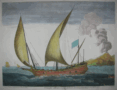 | Details | Henri Sbonski de Passebon | 1690 |
| Barque allant vent arriere |
|
Henri Sbonski de Passebon |
|
| 1690 |
| LOC:0 |
| $0.00 | Henri-Sbonski-de-Passebon | Barque-allant-vent-arriere | * SOLD * <BR> </BR>
This dynamic and striking antique engraving depicts a small sailing vessel towing the ship's boat in a stiff following breeze with an ominous fuming volcano in the background. The volcano depicted may well be Vesuvius as it was active almost continuously after 1631 with major eruptions noted in 1660, 1682, 1694, and 1698. Of all the prints in this series, this example of a bark best captures the feeling of movement and excitement as waves splash the port side of the vessel.<BR> </BR>
"Barque allant vent arriere" (Bark going downwind) is one of a series of copperplate engravings created ca. 1690 by French galley Captain Henry Sbonski de Passebon. Engraved by Claude Randon, "Plan de Plusieurs Batiments de Mer et ses proportions", a collection of 17 folio-sized nautical architecture plates, was first published from Marseille where, in the late 17th century the arsenal was home port to the galley service of Louis XIV.<BR> </BR>
<a style="color:#9BAFCB" rel="nofollow" href= "/SbonskiPassebonBackground.aspx">View other Sbonski de Passebon engravings</a>
<BR> </BR>
De Passebon was stationed at Marseilles as a Lieutenant in the Corps des Galeres during the period that he produced the drawings from which these plates were engraved. <BR> </BR>
Attribution at bottom left: "Randon delineauit et sculpsit cura D'ni de Passebon Equitis"
<BR> </BR> Royal privilege at bottom right: "Marsiliae cum privilegio Regis"
<BR> </BR> Seller's attribution: "Se vendent a Marseilles chez Laurent Bremond sur le port au Coin de reboul" |
| 46 |  | Details | Michelot and Bremond | 1727 |
| Plan de la Baye et Rades de Marseille LS |
|
Michelot and Bremond |
|
| 1727 |
| LOC:4 |
| $0.00 | Michelot-and-Bremond | Plan-de-la-Baye-et-Rades-de-Marseille-LS | SOLD<br></br>
Antique, original copperplate portulan-style coastal chart / plan of the Bay of Marseille and nearby islands. Coverage includes coastal France from Cap Couronne to Port Estat. Marseille shown with fortifications as they existed in the early 18th century.<BR> </BR>
Numerous soundings and marked anchorages on this antique nautical chart would have been useful to galley pilots and other mariners calling at Marseille. Single compass rose with radiating rhumb lines and fleur de lis indicating north. <a rel="nofollow" href= "/MichelotBremondBackground.aspx">Henry Michelot's</a> chart of Marseille was often copied by others such as Kitchin well into the late 1700's.<BR> </BR>
This chart is of special interest as Marseille was the chief base for the galleys (galères) of Louis XIV and XV as well as the home port for Michelot and Bremond. Also note that just seven year earlier, in 1720, the city of Marseilles had been subject to an outbreak of "la peste", bubonic plague that killed an estimated 40% of its population. The plague, spread from an arriving merchant ship was one of the last great outbreaks in Europe. |
| 1282 | 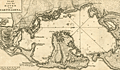 | Details | Tirion, Isaac | 1765 |
| Scarce antique plan or chart of Cartagena, Colombia |
|
Tirion, Isaac |
|
| 1765 |
| LOC:0 |
| $0.00 | Tirion--Isaac | Scarce-antique-plan-or-chart-of-Cartagena--Colombia | SOLD
<br></br>
Detailed antique harbor plan or chart of the bay and surrounding area near <b>Cartagena</b> (Carthagena) Columbia. At left of this fine map is shown the the small walled village of Carthagena. Most place names and features are in Spanish, including <b>Tierra Bomba</b>, Fort de Manzanillo, Castillo Grande, Fort de San Yago, Castillo de San Luiz, and near the village, Fort de San Felipe de Baraxas. The pass into the bay near the village of Cartagena was impassable even at that time as it is marked "Boca Cerrada".
<br></br>
The city, a major port, was founded in 1533, and named after Cartagena, Spain, which in turn was named after Carthage in Tunisia. Settlement in the region around Cartagena Bay by various indigenous people dates back to 4000 BC. During the Spanish colonial period Cartagena served a key role in administration and expansion of the Spanish empire.
<br></br>
Isaac Tirion (d. 1769) was an Amsterdam publisher. This plan of Cartagena, Colombia was published I Tirion's ' Nieuwe en beknopte handatlas' ca. 1765. |
| 1441 | 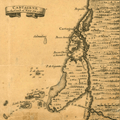 | Details | Popple, Henry | 1742 |
| Antique coastal chart including Cartagena, Colombia |
|
Popple, Henry |
|
| 1742 |
| LOC:0 |
| $0.00 | Popple--Henry | Antique-coastal-chart-including-Cartagena--Colombia | SOLD <BR> </BR>
Interesting and uncommon chart fragment of the coast of Colombia, South America in the vicinity of Cartagena (Cartagene). Other noted locations on this small antique chart include Boquilla, Boca Serada, Grand Bara (Isla Grande), Boca Chica, I. de Stesoro, Punta de Gigantes, Bay de Mattanilla. Pasacaballos is located with the notation in Spanish "Estere de Paso Cavallas". Without more knowledge of Colombian history my guess is that the location was known as place near the river's mouth to ford the river with horses.
<br></br>
This antique map was originally published by Covens and Mortier in 1742 in "Les Principales Forteresses Ports etc. de L'Amerique Septentrionale" a sheet containing harbor and island maps and plans of the Americas. This map is a fragment trimmed from the larger sheet.
<br></br>
That sheet of 18 maps and plans of islands and harbors was published by Covens and Mortier to replace Popple's original large map of 20 sheets with a more manageable six-sheet version. Popple's original map was titled: "A Map of the British Empire in America with the French, Spanish and the Dutch Settlements adjacent thereto". |
| 1243 |  | Details | Wells and Harris | 1798 |
| Scarce 18th century map of the River Thames with roads, rivers, and canals |
|
Wells and Harris |
|
| 1798 |
| LOC:0 |
| $0.00 | Wells-and-Harris | Scarce-18th-century-map-of-the-River-Thames-with-roads--rivers--and-canals | SOLD<BR></BR>
Scarce and attractive 3 foot long antique map of the <b>River Thames</b> from its mouth to its source at the Severn River. This marvelously detailed beauty records the transportation routes near the Thames River and London at the end of the 18th century. Mail coach roads, common stage roads, rivers and canals are meticulouly recorded and may be identifed by referring to a visual index at top left. All market towns are notated with the number of miles they lie from the Royal Exchange (Ex: Salisbury 84; Chippenham 96; Colchester 51). Major canals are named and annotated with their year of construction (Ex: Basingstoke Canal 1772; Braunston Grand Junction Canal 1793).
<br></br>
<b>No record of a sale of this map is found in the Antique Map Price Record (AMPR)</b> nor are any examples of the map for sale or catalogued online except for ONE COPY recorded at the British Library.
<br></br>
Scenic cartouche at right showns a tranquil, shady scene with water gushing out of a tunnel, overflowing a spillway
<br></br>
Published March 10, 1798 by L.B. Wells, No 26 Leadenhall Street J. Harris Sweetings Alley Royal Exchange and at No. 54 Tottenham Court Road. |
| 1166 | 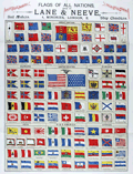 | Details | Lane and Neeve | 1895 |
| Flags of All Nations |
|
Lane and Neeve |
|
| 1895 |
| LOC:0 |
| $0.00 | Lane-and-Neeve | Flags-of-All-Nations | SOLD
<br></br>
Scarce and very colorful 19th century lithographed brochure/print of world flags. This scarce Victorian survivor presents numerous national flags, national merchant flags, naval ensigns and pendants. Prominently features the Royal Standard of Great Britain, the American Ensign and the American Jack. 44 stars on the American flags indicates the a date for the print between 1891 and 1896 when the U.S. added a star for the admission of Utah to the Union. When opened this attractive antique measures 15" x 22".
<br></br>
This seldom found brochure, "Flags of All Nations", is from the firm of Lane and Neeve at 4 Minories, London, East. That firm describes its commercial activities succinctly as Yacht Sail Makers, Yacht Flag Makers, Sail Makers, and Ship Chandlers. Lane and Neeve was located at 4 Minories, near the Tower of London and the Thames river, in an area with numerous other maritime-related business. The flag maker advertised their offerings on the back cover" "Flags Made to Order; House Flags, Name Burgees, Banners and Silk Flags". Also advertised is the sail loft at Britannia Works, East Ferry Road, London.
<br></br>
Folds to a compact 5" x 9". Printed by McLagan and Cumming. Lithographers, Edinburgh. |
| 5362 |  | Details | Corporation of Trinity House | 1863 |
| Rare Chart Lighthouses of Great Britain and Ireland |
|
Corporation of Trinity House |
|
| 1863 |
| LOC: |
| $0.00 | Corporation-of-Trinity-House | Rare-Chart-Lighthouses-of-Great-Britain-and-Ireland | SOLD
<br></br>
A fine, very large chart of Great Britain, Ireland, and the west coast of Europe showing lighthouses and lightships active in 1863. Inset charts. Constructed by Alexander G. Findlay. Published Jan 1, 1863 by R.H. Laurie, no. 53 Fleet Street, London. Other editions of this work were published from 1833 to 1888.
<br></br>
No sales of any edition of this work recorded in AMPR. No copies are found for sale online as of October, 2020. About six institutional copies of the 1863 edition are recorded in WorldCat.
<br></br>
Dissected and mounted on linen. Folded into covers with brass decorative gothic clasps. Boards are covered in cloth with a blind stamped decoration and the title, motto "Trinitas in Unitate", and the coat of arms of Trinity House in gilt.
<br></br>
The Trinity House was originally a guild of shipmen and mariners established by Henry VIII in 1517 to support and expand shipping in England. Later the Trinity House was tasked with maintaining buoys, lighthouses, and aids to navigation on the English coast as well as licensing ship's pilots. (Oxford Companion to Ships and The Sea, Peter Kemp, ed. Oxford University Press. London, 1976, p. 889.)
<br></br>
Note: Due to the large size of the chart, the image is a composite of two photographs and may display some small artifacts of the join at left. |
| 1259 | 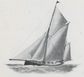 | Details | Norie and Wilson | 1890 |
| Sailing Vessels How to Distinguish Their Different Rigs |
|
Norie and Wilson |
|
| 1890 |
| LOC:0 |
| $0.00 | Norie-and-Wilson | Sailing-Vessels-How-to-Distinguish-Their-Different-Rigs | SOLD<br></br>
Small antique illustrated nautical booklet that defines and visually presents several types of 19th-century sailing vessels including: ship, barque, barquantine, brig, brigantine, schooners (top-sail, main-top-sail, fore and aft and three-masted), cutter, sloop, barge, lugger and others. At the end of the 19th century Norie and Wilson operated a nautical training adademy from 156 Minories with a focus toward training aspiring yachtsmen. This book would have likely been used by students of the academy.
<br></br>
With detailed plans of the standing rigging, running rigging, and square sails and driver for a merchant ship that name and relate each item to a drawing of the vessel. With additional illustrations showing the ropes, spars, and sails of both a yawl and a schooner.
<br></br>
Examples include:
<div class="indenttextblock">
<ul style="list-style-type: circle;">
<li>Sloop- A <b>SLOOP</b> has one mast and fore-and-aft sails like the Cutter but has a fixed standing bowsprit and jibboom, inclining upwards: her jib set upon a standing stay with hanks and carries a top-sail, sometimes a flying top-gallant sail and gaff-top-sail. </li>
<li>Barque- A <b>BARQUE</b> , or Bark is a vessel with three masts square rigged at the fore and main masts like a ship, but differs from a ship in having no top at her mizzen mast and carrying only fore-and-aft sails (A spanker and gaff-top-sail) on that mast.</li>
<li>Lugger- A <b>LUGGER</b> has either two or three masts with square-cut sails set fore and aft, called lug sails- some carry top-sails. These boats are called by the French Chasse-marees.</li>
</ul>
</div>
Published from London, England by Norie and Wilson at the Navigation Warehouse and Naval Academy, 156 Minories E. The firm of Norie and Wilson operated from 156 Minories after 1878 when they moved from their previous site they and precursor firms had occupied since 1763 at 157 Leadenhall. |
| 638 |  | Details | Merchant Navy Comforts Service | 1939 |
| On the Atlantic Front |
|
Merchant Navy Comforts Service |
|
| 1939 |
| LOC:0 |
| $0.00 | Merchant-Navy-Comforts-Service | On-the-Atlantic-Front | SOLD
<br><br/>
Early original WWII lithographed poster from 1939 depicting a merchant vessel running in heavy seas by artist Ellis Silas. <br><br/>
This old poster was produced by the Merchant Navy Comforts Service ( M.N.C.S. ) to garner donations for its activities in support of U.K. merchant seamen during the long battle with German submarines for the Atlantic Ocean. Message within the poster reads: <dir class="indenttextblock">" Send your thanks to the men who are winning the battle of the Atlantic by a donation to Merchant Navy Comforts Service, Appeal Headquarters: 62, Heath St. London, N.W.3."</dir>
<br><br/>
The Merchant Navy Comforts Service provided warm clothing, books, and other supplies to seamen. Of special interest were the emergency rescue kits that the M.N.C.S. provided to destroyers and other vessels that often rescued sailors from the icy Atlantic. Each kit contained 10 items of hand-knitted and store-bought clothing and it is reported that over a 2 year period 85,000 kits were distributed.
<br><br/>
Published by McCorquodale & Co. Ltd. London. |
| 1013 |  | Details | Taylor, Janet | 1850 |
| Trade Card for Janet Taylor, early author and teacher of navigation |
|
Taylor, Janet |
|
| 1850 |
| LOC:0 |
| $0.00 | Taylor--Janet | Trade-Card-for-Janet-Taylor--early-author-and-teacher-of-navigation | SOLD<br></br>
Rare trade card ca. for Janet Taylor (née Ionn) who operated a Nautical Academy and Warehouse at 104 Minories in London "opposite the rail road" from 1835 - 1859. Taylor advertised as a "Mathematical Instrument, Chart, Map, & Bookseller".
<br></br>
Her academic and scientific achievements are many, particularly for a female in the mid-19th century. According to one online source, Janet Taylor was "...the only woman in the 2,200 entries in <i>The Mathematical Practitioners of Hanoverian England 1714-1840". </i> Taylor invented the Mariner's Calculator in 1834 which enabled navigators to find <div class="indenttextblock">" ‘the true Time’,’the true Altitude’, ‘the true Azimuth’, and ‘Latitude by double Latitudes and elapsed Time’". </div><a href="https://middlesavagery.wordpress.com/2012/10/16/archaeology-ada-lovelace-day-mrs-janet-taylor-and-the-dividers/" target="_blank">(Internet)</a>.
<br></br>
She was recommend by the British Admiralty, Trinity House, the British East India Company, and was an agent for sales of Admiralty charts. Taylor authored "Epitome of Navigation and Nautical Astronomy" published through 11 editions from 1842 and 1858.
(Bruck, Mary. "Women in Early British and Irish Astronomy: Stars and Satellites". pp. 52-54. Springer, 2009. <a href="https://books.google.com/books?id=12CnfM1u32kC&pg=PA52&lpg=PA52&dq=janet+taylor+navigation+warehouse&source=bl&ots=TYT5GXCUVb&sig=6wY5YQDprYF3HH7K-t0RnzqdVg8&hl=en&sa=X&ved=0ahUKEwjEiZGnrK_KAhXK7SYKHTxvAHYQ6AEIKTAB#v=onepage&q=janet%20taylor%20navigation%20warehouse&f=false" target="_blank">Internet</a>). |
| 1046 |  | Details | Ripley, Thomas | 1765 |
| Very rare 1765 trade card for London instrument maker Thomas Ripley. |
|
Ripley, Thomas |
|
| 1765 |
| LOC:0 |
| $0.00 | Ripley--Thomas | Very-rare-1765-trade-card-for-London-instrument-maker-Thomas-Ripley- | SOLD
<br></br>
Very scarce trade card from London-based maker of navigation instruments, <b>Thomas Ripley</b>. This trade card dates from early in Ripley's long career, ca. 1765. In 1765 Ripley operated from an establishement near the Hermitage Bridge, Wapping and was identified with a sign representing a <b>"Globe, Quadrant and Spectacles"</b>. Ripley's own words from the advertisement summarize his business interests:
<div class="indenttextblock">
"Makes & sells all sort of mathematical and Optical Instruments for Sea & Land viz. Hadley & Davis's Quadrants, Azimuth Compasses and steering compasses in wood & brass, Gunters scales, sliding gunters, rules of all sort for measuring & gauging, Cases of Instruments, Plain compasses, Drawing pens, pencils, globes of various sizes, all sorts of telescopes, microscopes, spectacles & reading glasses with various other instruments not here mentioned. N.B. Navigation, books of sorts."
</div>
</br>
Thomas Ripley, born in England about 1740, was a mathematical instrument maker. He was apprenticed to John Gilbert in the Grocers' Company on Dec. 5, 1755, and was free in the Company, April 12, 1763. Ripley married Sarah Susannah Bigg in August 1763 at Saint Botolph Bishopsgate, London. Together they had 9 children, of whom Anna Maria was the youngest.
<br></br>
Thomas Ripley took apprentices, including his son James Ripley, who was his partner from 1800 to 1807. Ripley's business was situated over time in several London locations: in the Baker's Building, New Broad Street (1763 & 1770); at the Globe Quadrant and Sectacles, near Hermitage Bridge below the Tower, Wapping (1765); 364 Hermitage Bridge, below the Tower (1773 & 1794 as Ripley Tho. & Son). (Ripley Family History. <a href="http://belindacohen.tripod.com/ripleyfamilyhistory/" target="_blank">Internet </a>.) |
| 1053 | 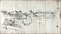 | Details | H.M. Board of Customs and Excise | 1883 |
| Manuscript Map of Thames Docks, Sufferance Wharves, and Uptown Warehouses |
|
H.M. Board of Customs and Excise |
|
| 1883 |
| LOC:0 |
| $0.00 | H-M--Board-of-Customs-and-Excise | Manuscript-Map-of-Thames-Docks--Sufferance-Wharves--and-Uptown-Warehouses | SOLD
<br></br>
Fascinating 19th century pen and ink manuscript map of the area now referred to as the <b>London Docklands</b>, a center for redevelopment and urban renewal. Includes the location of the recently constructed <b>Canary Wharf</b> business district in the bend of the Thames River called the Isle of Dogs (once referred to as Stepney Marsh). This antique manuscript map on linen covers the late 19th century quays, sufferage wharves, docks, and uptown warehouses that existed about 1883. Coverage of the upper map along the Thames River extends from above Southwark Bridge, past London Bridge and the Tower of London, and terminates at the entrance to the Royal Albert Dock about 11 miles south of London. An inset detailed map covers the City of London and Tower Hill districts to the east end of the London Docks.
<br></br>
Date of the map of 1883 is an estimate based on the fact that the Royal Albert Dock, which opened in 1880, is shown while the Tower Bridge, begun in 1886, is not shown. |
| 6667 |  | Details | Perry, Heather "Herry" | 1930 |
| Rare Art Deco map puzzle Imperial and International Communications Ltd |
|
Perry, Heather "Herry" |
|
| 1930 |
| LOC: |
| $0.00 | Perry--Heather-"Herry" | Rare-Art-Deco-map-puzzle-Imperial-and-International-Communications-Ltd | <br><br>This item has found a new home with a very serious west-coast collector, but please visit <a href="https://www.rarecharts.com/ShowDetail/Creator/Perry--Heather-%22Herry%22/Title/Rare-Art-Deco-Imperial-and-International-Communications-Ltd-Map-Puzzle/6724" target="_blank">another example of Herry Perry's beautiful puzzle map</a> now in RareCharts' inventory for only the second time in 13 years.
<br><br>
Fine 3-ply wooden promotional map puzzle, created during the Golden Age of pictorial maps for Imperial and International Communications Ltd. (IICL) by the Chad Valley Company. Designed by Herry Perry, London in 1930. Complete with all ~150 pieces. Includes the original cardboard box, which was manufactured in Holland.
<br><br>
<div id="0" align="center">
<a title="TITLE HERE"></a> <img id="3" src="/zoomifyimages/SC_6667/SC_6667_Box.jpg" alt="Herry Perry map puzzle for Imperial and International Communications Ltd, 1930, London." width="300"/> <br><small>Original box for Herry Perry's IICL map puzzle.</small>
</div><br>
This fine Art Deco style map of the IICL network predates McDonald Gill's Cable and Wireless Great Circle map by 15 years (1945). Art Deco style characters represent the Anemoi or mythological Roman wind Gods (Boreas, Zephyrus, Notus, and Eurus)) and the Greek wind gods, or Venti (Aquilo, Favonius, Auster, and Vulturnus). Green lines mark the cables of the I and ICL and the dotted green lines their wireless.
<br><br> |
| 6668 |  | Details | Bowles, Carington | 1785 |
| Bubblers Medley rare South Sea Bubble satirical etching |
|
Bowles, Carington |
|
| 1785 |
| LOC:1 |
| $0.00 | Bowles--Carington | Bubblers-Medley-rare-South-Sea-Bubble-satirical-etching | SOLD<br><br>"The Bubbler's Medley, or a Sketch of the Times: Being Europe's Memorial for the Year 1720" is a trompe l’oeil-style satirical print published by Carington Bowles (1724-1793) from London ca 1785. At top center this plate shows an unsuccessful speculator staring out from behind the bars of a debtors prison. Bottom center with the text of "A South Seas Ballad", a satirical poem by Jonathan Swift, written in response to the South Sea Bubble financial crisis. It criticizes the greed and folly of investors who were caught up in the speculative frenzy. One of several re-issues, this on wove paper thus ca. 1780 - 1790. Page 23.
<br><br>
<div id="0" align="center">
<a title=""></a> <img id="3" src="/zoomifyimages/SC_6668/SC_6668_Debtor.jpg" alt="Bowles' Debtor's Medley detail" width="300"/> <br><small>"Behold a poor dejected wretch<br>Who kept a sea-coach of late" ...</small>
</div>
<br>
In 1720, England experienced a financial crisis known as the South Sea Bubble. The South Sea Company was established in 1711 to consolidate and decrease the cost of the national debt. Its main business was initially to supply African slaves to the islands in the "South Seas" and South America, although this trade did not yield significant profits. Instead, the company expanded its operations to deal in government debt, and this led to the creation of a notorious economic bubble that ultimately collapsed suddenly, resulting in the ruin of numerous investors and a decline in the national economy.
<br><br>
<div id="0" align="center">
<a title=""></a> <img id="3" src="/zoomifyimages/SC_6668/SC_6668_Detail.jpg" alt="Bowles' Debtor's Medley detail with speech scrolls" width="300"/> <br><small>"A numerous family ruin'd without Remedy" ...</small>
</div> |
| 90 |  | Details | Becher, A.B. | 1852 |
| The Storm Compass or Seaman's Hurricane Companion |
|
Becher, A.B. |
|
| 1852 |
| LOC:0 |
| $0.00 | Becher--A-B- | The-Storm-Compass-or-Seaman-s-Hurricane-Companion | SOLD<br></br>
Interesting small antique booklet for the mariner explaining hurricanes with an emphasis on best practices to predict and avoid hurricanes. This hard-to-find practical guide includes log-book accounts of hurricanes as illustrative examples of the principles proposed by the author, a commander in the British Royal Navy.<BR> </BR>
Inside cover includes an illustrated advertisement for Henry Whipple and Son sellers of charts and nautical works. 56 pages including tables and diagrams. Embossed blue paper boards. |
| 465 | 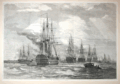 | Details | Anonymous | 1858 |
| The British Fleet at Spithead |
|
Anonymous |
|
| 1858 |
| LOC:0 |
| $0.00 | Anonymous | The-British-Fleet-at-Spithead | SOLD<br></br>
Very attractive woodblock engraving. Panoramic view shows warships from the British Navy under review at Spithead near the Isle of Wight at an early period in the transition from sail to steam power. Archivally matted. Dimensions with the mat are approx. 26" W x 20" H. Pages 146 and 147. From the London Illustrated News August 14, 1858. |
| 338 | 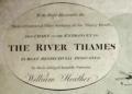 | Details | Heather, William | 1798 |
| The River Thames |
|
Heather, William |
|
| 1798 |
| LOC:0 |
| $0.00 | Heather--William | The-River-Thames | SOLD<BR> </BR>
Large colored antique navigational chart of the entrances to the Thames River with an inset showing the continuation of the Thames River from Erith to London. On heavy, chain laid paper. Numerous soundings and depictions of the well-knows sandbanks near the Thames mouth including "Kentish Knock", "Goodwin Sands", and the "Margate Sands". The Tower of London is noted and colored in red. Colored compass rose and rhumb lines. Coverage on this antique nautical chart includes parts of Essex, Kent, and Suffolk: Harwich, Dover, Milton, Stratford, Ipswich, Colchester and the entrance to the Medway river. <BR> </BR>
Dedication reads: "To the Right Honorable the Master, Wardens, and Elder Brethren of the Trinity Houfe, this Chart of the Entrances to the River Thames is Most Respectfully Dedicated by their obliged humble servant William Heather". Scales in English and French miles and Dutch Mylen. |
| 467 |  | Details | Hogg, Alexander | 1782 |
| System of Naval Architecture- Shipping |
|
Hogg, Alexander |
|
| 1782 |
| LOC:0 |
| $0.00 | Hogg--Alexander | System-of-Naval-Architecture--Shipping | SOLD
<br></br>
Several detailed steel-engraved drawings of a three-masted square-rigged ship.
<br></br>
Published as the Act directs by Alex. Hogg at the King's Arms, No. 16. Paternoster Row. Plate 126. |
| 1054 |  | Details | Gillray, James | 1851 |
| Fighting for the Dunghill |
|
Gillray, James |
|
| 1851 |
| LOC:0 |
| $0.00 | Gillray--James | Fighting-for-the-Dunghill | SOLD
<br></br>Re-strike satirical copperplate engraving of Gillray's famed "Fighting over the Dunghill". This caricature is by one of England's finest 18th century artists and satirists, James Gillray. Printed after Gillray's death from the original plate this engraving (recto) shows two colossal national figures sitting on the globe, Jack Tar, plump and hearty representing Britain, boxing an emaciated, half-naked Frenchman, possibly Napoleon, who has blood spouting from his nose, his torso and limbs heavily scarred with the tattooed name "Nelson", a British naval hero.
<br></br>
Hand-coloured etching with aquatint and attractive hand-coloring.
<br></br>
Originally published in 1798 by Hannah Humphrey this plate is from the Henry Bohn restrikes printed from the original plates during 1845 to 1851. Printed on both sides of heavy wove paper, the verso contains an unusable engraving due to trimming of the engraving on the recto. |
| 518 |  | Details | Greenwood, James | 1851 |
| The Sailor's Sea-Book |
|
Greenwood, James |
|
| 1851 |
| LOC:0 |
| $0.00 | Greenwood--James | The-Sailor-s-Sea-Book | SOLD
<br><br>
Three colored plates of flags (small loss to first page). **Contains a lone-star flag for Texas. Navigation treatise is comprised of two parts: 1) How to keep a log and work it off. 2) On finding the latitude and longitude.<BR> </BR>
Dictionary contains hundreds of definitions of terms used in ship building.
<BR> </BR> Published by John Weale. London. 59 High Holborn. |
| 287 |  | Details | Peake, James | 1851 |
| Rudiments of Naval Architecture |
|
Peake, James |
|
| 1851 |
| LOC:0 |
| $0.00 | Peake--James | Rudiments-of-Naval-Architecture | SOLD<br></br>
Rare antique book on wooden shipbuilding with dozens of in-line illustrations of construction details. Published in London in 1851 this small antique volume contains tables of scantlings and of relevant details for first-rate through sixth-rate ships of the line and for sloops. For each category of vessel: principal dimensions, number and weight of armament, weight of principal cables, description and weight of all masts and yards. 3 folding plates.<BR> </BR>
Tiny booksellers label on inside cover for "W. Campbell's Book and Stationery Warehouse, 324 Argyle Street, Glasgow. 174 pages. |
| 232 | 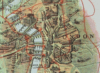 | Details | Bennet | 1900 |
| Sold--- Bennet's Map and Guide to the River Thames from Oxford to Gravesend |
|
Bennet |
|
| 1900 |
| LOC:0 |
| $0.00 | Bennet | Sold-------Bennet-s-Map-and-Guide-to-the-River-Thames-from-Oxford-to-Gravesend | SOLD<BR> </BR>
Scarce lithographed color map and advertising guide of the Thames River ca 1900. Fisherman's or traveller's map to this historic English river identifying numerous bridges, piers, and roads. Presence of the Tilbury Docks (built 1886) downstream from London dates the map to no earlier than 1886. |
| 3595 |  | Details | Laurie and Whittle | 1794 |
| Antique Tide Calculator for the North Sea, Bay of Biscay, and the English Channel |
|
Laurie and Whittle |
|
| 1794 |
| LOC:0 |
| $0.00 | Laurie-and-Whittle | Antique-Tide-Calculator-for-the-North-Sea--Bay-of-Biscay--and-the-English-Channel | SOLD <br></br>
Fine antique <b>volvelle for calculating the time of tides</b> at numerous locations in the UK and on the coast of Europe. A volvelle or wheel chart is a type of calculator constructed from paper. Essentially, a very early and simple analog computer. With a rotating dial for Locations and Minutes. Outside the rotating dial, are fixed a 30 Day Circle and a 12 Hours Circle and Names of Places including Lizard Point, The Coast of Flanders, Tinmouth Bar, Flamborough Head, Calais, the River of Bordeaux, and many more.
<br></br>
On this scarce device the instructions read <div class="indenttextblock">"To make use, you must place the Flower-de-Luce, or Index, to the Day of the Moon's age, on the circle of days and the Arrow, at the end of the line wherein the name is written, will point to the time of the Tides Flowing or Running that day, on the circle of hours."</div>
Published by Laurie & Whittle, 53 Fleet Street. March 12, 1794. |
| 274 |  | Details | Fisher, Susanna | 2001 |
| The Makers of the Blueback Charts |
|
Fisher, Susanna |
|
| 2001 |
| LOC:0 |
| $0.00 | Fisher--Susanna | The-Makers-of-the-Blueback-Charts | SOLD <br></br>
Fine reference book on mapmakers from the City of London from 1750's to present. |
| 1133 |  | Details | British Admiralty Hydrographical Office | 1925 |
| Old nautical chart of the west Mediterranean Sea |
|
British Admiralty Hydrographical Office |
|
| 1925 |
| LOC:0 |
| $0.00 | British-Admiralty-Hydrographical-Office | Old-nautical-chart-of-the-west-Mediterranean-Sea | SOLD
<br></br>
A fine folding British sea chart of the western Mediterranean sea. Based on a chart originally published at the Admiralty in 1878 under the superintendence of Captain F.J. Evans.
<br></br>
This handsome chart provides numerous depth soundings, lighthouse locations, coastal details, and other hydrographic information for the Mediterranean coastline of Spain, Morocco, and Algeria including the important Strait of Gibraltar.
<br></br>
Eighteen inset port and anchorage plans including:
<div class="indenttextblock">
<ul style="list-style-type: circle;">
<li>Salobrena Anchorage</li>
<li>Cala Honda</li>
<li>Ferro Castle Anchorage</li>
<li>Adra Anchorage</li>
<li>Almeria Road</li>
<li>Cape de Gata</li>
<li>Port Genoves and San Jose Bay</li>
<li>San Pedro Bay</li>
<li>Carboneras Bay</li>
<li>Port Aguilas</li>
<li>Cope Anchorage</li>
<li>Mazarron and Surida Bays</li>
<li>Porman Bay</li>
<li>Escuellos Bay</li>
<li>Nerja Anchorage</li>
<li>Herradura Bay</li>
<li>Berenguelas Bay</li>
<li>Alboran Island</li>
</ul>
</div>
Dissected and laid to fine linen. Early 20th century edition with numerous corrections, the last in correction in 1925. Sellers label on the verso for Sifton, Praed, & Co. Ltd. The Map House. 67 St. James Street, London S.W. Owners ink stamp on cover "H.F. Cronin." Marbled board covers. Number 2717. |
| 762 |  | Details | Depot de la Marine | 1878 |
| Antique French Nautical Chart of Spain, Ireland and England |
|
Depot de la Marine |
|
| 1878 |
| LOC:0 |
| $0.00 | Depot-de-la-Marine | Antique-French-Nautical-Chart-of-Spain--Ireland-and-England | SOLD
<br></br>
Antique navigation chart covering the approaches along the south and west coasts of Spain, Cornwall England and Southern Ireland. Includes the Gulf of Gascogne; the English Channel northeast to Chichester and le Harve; and the Irish Sea. This large chart is unusual in that it shows all the numerous lighthouses along those coastlines and through red overprinting shows for each light the expected range over which that light should be visible from sea. Lighthouses are shown as red dots with yellow highlights.
<br></br>
Inset at bottom shows five profile coastal views. Chart is the edition of 1867, first published in 1828 and 1829. This edition was updated last in 1878. Number 447. Published by France's Depot de la Marine. |
| 754 |  | Details | Depot de la Marine | 1775 |
| Antique French nautical chart of the eastern Bahamas and the Antilles |
|
Depot de la Marine |
|
| 1775 |
| LOC:0 |
| $0.00 | Depot-de-la-Marine | Antique-French-nautical-chart-of-the-eastern-Bahamas-and-the-Antilles | SOLD
<br></br>
Two antique French nautical charts of the Bahamas and Antilles islands. Dated to 1775 within both title cartouches and attributed to French Naval Captain Jean Rene-Antoine Verdun De La Crenne (1741-1805), Alexandre Guy Pingre, and Jean-Charles de Borda.
<br></br>
Both copper-plate engraved charts printed in a single impression on one large sheet of heavy wove paper. Soundings and navigational hazards noted on the charts attest to their expected use aboard ships of the French Navy.
<br></br>
Lower chart includes eastern Cuba (including Baracoa); the eastern Bahama islands; the Turks (les iles Turques) and Caicos Islands (Gran de Cayque de Nord); and the northwest portion of the island of Hispaniola (partie de l'Ile de St. Dominque). Within the Bahamas coverage includes part of Long Island, Rum Cay, (Wattelin) San Salvador Island, Crooked Island, Mayaguana, Little Inagua Island, and Inagua Island.
<br></br>
Upper chart of the Lesser Antilles extends from eastern Puerto Rico through the Leeward and Windward Islands. Coverage includes the Virgin Islands with Saint Croix, Saint John, and Saint Thomas; and the islands of St. Kitts, Nevis, Anguilla, St. Martin, St. Barts, Barbuda, Antigua, Montserrat, Guadeloupe, Marie-Galante, la Desirade, Dominica, Martinique, St. Lucia, Barbados, and St. Vincent. |
| 871 |  | Details | Depot de la Marine | 1878 |
| Chart of the Anambas Archipelago of Indonesia in the South China Sea |
|
Depot de la Marine |
|
| 1878 |
| LOC:0 |
| $0.00 | Depot-de-la-Marine | Chart-of-the-Anambas-Archipelago-of-Indonesia-in-the-South-China-Sea | SOLD
<br></br>
Scarce chart of the Anambas Islands of Indonesia found in the South China Sea between the Malaysian mainland to the west and the island of Borneo to the east. This antique French nautical chart published in 1878 is based on the exploration conducted aboard the French Frigate 'la Favorite' during March and April 1831 by Captain Cyrille Pierre Théodore Laplace. Major islands shown on the chart include Pulau Jemaja, Pulau Telaga, Pulau Siantan, Pulau Siantan, Pulau Bajau, Pulau Mubur, and Pulau Matak.
<br></br>
Contains a detailed inset at upper right of the tracks of earlier exploration in 1825 by Du Camper aboard the l'Esperance and Bougainville on la Thetis. |
| 873 |  | Details | Depot de la Marine | 1888 |
| Chart of the Natuna Archipelago of Indonesia in the South China Sea |
|
Depot de la Marine |
|
| 1888 |
| LOC:0 |
| $0.00 | Depot-de-la-Marine | Chart-of-the-Natuna-Archipelago-of-Indonesia-in-the-South-China-Sea | SOLD<BR></BR>
Large antique French sea chart of the Natuna Island Archipelago located in the South China Sea about 300 miles northeast of Singapore. The Natuna Islands, off the northwest coast of Borneo are technically part of Indonesia although China has included them inside its nine-dash line, an area of the South China Sea within which it claims sovereignty to all the islands, atolls, and reefs. The claims of China are disputed by Indonesia, Vietnam, the Philippines and other countries.
<br></br>
With the route of the French corvette La Favorite during their exploration of the area in 1831. This edition of the chart dates to August 1888. Published by the Depot de la Marine, France's official Hydrographic Agency. |
| 1009 |  | Details | Depot de la Marine | 1841 |
| Antique French chart of the Maldive Islands |
|
Depot de la Marine |
|
| 1841 |
| LOC:0 |
| $0.00 | Depot-de-la-Marine | Antique-French-chart-of-the-Maldive-Islands | SOLD
<br></br>
Fine antique nautical chart of the Maldive islands, a island country and archipelago located in the Indian Ocean. This large old chart "Carte des Isles Maldives" was published by the French Depot de la Marine in 1841 (dated within) based on hydrographical data from Moresby and Powell, both officers in the British East India Company.
<br></br>
With a blue ink octagonal overstamp from the seller Antoine Roux, fils. (probably Mathieu-Antoine Roux 1799-1872) from Marseille, France. Roux was a hydrographer and painter with premises at "Quai Rive l'avenue Pres le Pharmacien in Marseille. " The Roux family was active in Marseille as hydrograpers and marine painters over at least three generations beginning with Joesph Roux. Number 942. |
| 191 |  | Details | Tofino de San Miguel | 1786 |
| Plano Geometrico de la Bahia de Algeciras y Gibraltar |
|
Tofino de San Miguel |
|
| 1786 |
| LOC:0 |
| $0.00 | Tofino-de-San-Miguel | Plano-Geometrico-de-la-Bahia-de-Algeciras-y-Gibraltar | SOLD<br></br>
Scarce original Spanish antique nautical chart from Captain Vincente Tofiño de San Miguel y Van der Walle (1732-1795), Director of the Spanish Naval Academy in Cadiz. This old sea chart of the Bay of Gibraltar and Algeciras was one of 47 published in 1786 as part of the first scientific Spanish sea atlas: 'Atlas Maritimo de España' (Maritime Atlas of Spain) by the Dirección de Hidrografía, Spain's equivalent to the U.S. Coast Survey. Prior to the late 18th century Spain jealously guarded nautical maps and charts of its possessions, especially so for its overseas colonies.<br></br>
Attractive title cartouche at upper left contains a legend that identifies several dozen landmarks in and around the Bay of Gibraltar. <br></br>
Unlike other 18th century antique nautical charts that focus primarily on the coastal outline around the bay of Gibraltar, this old sea chart is notable for the extensive detailed engraving that is used to illustrate inland topographical details. This detail on inland areas, which is also evident in contemporary British charts from the same era (e.g. Faden), is likely related to the emphasis on land forces used in battles that occurred in this strategic location. During the siege of British occupied Gibraltar by Spanish and French forces during 1779 - 1783 , Spain and its allies are said to have fielded 35,000 ground troops in addition to the tens of thousands of sailors and marines aboard its naval fleet (80,000 spectators are said to have watched the grand assault of 1782 from locations in the surrounding hills). |
| 201 | 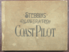 | Details | Stebbins, Nathaniel L. | 1896 |
| Stebbins' Illustrated Coast Pilot |
|
Stebbins, Nathaniel L. |
|
| 1896 |
| LOC:0 |
| $0.00 | Stebbins--Nathaniel-L- | Stebbins--Illustrated-Coast-Pilot | SOLD<br></br>
Important, late 19th century landmark in coastal navigation from the Boston-based marine photographer Nathaniel Stebbins. We are not aware of an earlier coast pilot containing photographic coastal images. This book demonstrated the practical application of photography to navigation, a field long dominated by man-made representations of coastal features. Photographs of key landmarks and navigational aids accompanied by textual sailing directions. Full coverage of U.S. East Coast and marginal coverage of the United States Gulf Coast . 2nd ed.<BR> </BR>
Already scarce, this overlooked volume with a sea-worthy canvas cover belongs in the collection of all those interested in 19th century U.S. coastal charts. Numerous nautical-related advertisements scattered throughout. The author describes this internal advertising as an effort to hold down the cost to the reader. |
| 202 |  | Details | Stebbins, Nathaniel L. | 1912 |
| The New Navy of the United States |
|
Stebbins, Nathaniel L. |
|
| 1912 |
| LOC:0 |
| $0.00 | Stebbins--Nathaniel-L- | The-New-Navy-of-the-United-States | <BR> </BR>
SOLD
<BR> </BR>
Black and white photographic record of U.S. Navy vessels published in 1912 by the noted Boston marine photographer Nathaniel Stebbins. Contains roughly 200 photographs that capture a transitional period in naval architecture and shows how some remnants of sailing ship design lingered well into the era of steam-power. Brief technical descriptions beneath each photo capture key dimensions and armament of each ship. <BR> </BR>
Contains a supplement and photographs on the Revenue Cutter Service by Capt. Preston Uberroth. Three years after the publication of this work the Revenue Cutter Service was merged with the Lifesaving Service to form the new United States Coast Guard. |
| 181 |  | Details | Laurie and Whittle | 1798 |
| Plymouth Sound---- SOLD |
|
Laurie and Whittle |
|
| 1798 |
| LOC:0 |
| $0.00 | Laurie-and-Whittle | Plymouth-Sound-----SOLD | This item has been sold. <br></br>
Very cool antique nautical chart by Laurie and Whittle from 1798 of the Hamoaze and Catwater rivers, port of Plymouth, England and Plymouth Sound. Plymouth has a long distinguished history as a maritime port. This old sea chart of Plymouth Sound shows the location of many historic locations including a hill known as the Hoe, where legend says Francis Drake was to have insisted on completed a game of bowls before setting out to meet the invading Spanish Armada of 1588 led by the Duke of Medina Sidonia (Drake knew the tide was not in his favor at the time he was notified of the approaching Spanish fleet).<br></br>
Attractive title cartouche with date. Copious sailing directions, soundings, landmarks (especially churches), and navigational hazards are noted. The chart is an attractive record of the days when the town Plymouth was smaller in size, but no less important to England. |
| 205 |  | Details | Guthorn, Peter | 1984 |
| United States Coastal Charts 1783-1861 |
|
Guthorn, Peter |
|
| 1984 |
| LOC:0 |
| $0.00 | Guthorn--Peter | United-States-Coastal-Charts--1783-1861 | SOLD <br></br>
Must-have reference guide for those interested in early nautical cartography of the U.S. coast. Numerous photographs and descriptions of coastal charts including blueback charts by historian Peter Guthorn make this a singular valuable resource for both collectors and researchers. 224 pages. Includes dust jacket. |
| 650 |  | Details | Bertius, Petrus | 1616 |
| Spitsbergen, Norway |
|
Bertius, Petrus |
|
| 1616 |
| LOC:0 |
| $0.00 | Bertius--Petrus | Spitsbergen--Norway | <br></br>
SOLD
<br></br>
Small decorative antique copperplate map of Spitsbergen, Norway by Petrus Bertius (1565-1629), a professor of mathematics and librarian from Holland. With two sailing vessels underway and penguins cavorting offshore in 'Oceanus Septentrionalis' (Northern Ocean) .
<br></br>
Probably from ''Tabularum geographicarum contractarum...' published by Jocodus Hondius in 1616. Latin text on verso. Page 60. |
| 1332 |  | Details | Bertius, Petrus | 1609 |
| Antique map of the Red Sea and Arabia |
|
Bertius, Petrus |
|
| 1609 |
| LOC:0 |
| $0.00 | Bertius--Petrus | Antique-map-of-the-Red-Sea-and-Arabia | SOLD<br></br>Fine small antique map of the Red Sea, Saudi Arabia, Aden, Yemen,and Egypt. This attractive copperplate engraved map covers numerous islands and villages including Aden, Suez, Mecca (Mecha), and Medina. By Petrus Bertius ca 1609. Text on verso is in French. |
| 712 | 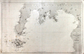 | Details | Direccion Hidrografia | 1875 |
| Isla de Mindanao |
|
Direccion Hidrografia |
|
| 1875 |
| LOC:0 |
| $0.00 | Direccion-Hidrografia | Isla-de-Mindanao | SOLD<br></br>Antique copper-plate engraved nautical chart of the southwest portion of the Philippine island of Mindanao and all of Sacol, Basilan, Olutanga, and Bongo islands. Key features include Zamboanga City, Bahia de Illana ( Illana Bay ) and Seno de Sibuguey ( Sibugay Bay ) and the Moro Gulf. The Zamboanga Peninsula is labeled "Reino de Sibuguey". Limited interior detail includes the Mindanao River, Panguil Bay, Mt. Tres Reyes, Mt. Kaladis, and Mount Silingan. On the tip of the peninsula is located a 'fuerza' or fort- the Real Fuerza de Nuestra Señora del Pilar de Zaragoza constructed by Spain beginning in 1635. With track lines shown for the course of steamship "Reina de Castilla" In 1862.
<br></br>
Published by Spain's Direccion Hidrografica from Madrid first in 1864, this issue is corrected to 1875. Plate 16 of a series of charts documenting the "Archipielago Filipino". Price when issued was 6 pesetas. Chart number 518. |
| 258 |  | Details | Randle, Charles | 1813 |
| Sold- Manuscript Chart - Portugal, Spain, Strait of Gibraltar |
|
Randle, Charles |
|
| 1813 |
| LOC:0 |
| $0.00 | Randle--Charles | Sold----Manuscript-Chart---Portugal--Spain--Strait-of-Gibraltar | This manuscript chart is sold.<br></br>
Small manuscript sea chart of Spain, Portugal and the Strait of Gibraltar. Signed and dated "C. Randle May 18, 1813". Despite the relatively small size of this manuscript chart, the author spent considerable time drawing fine detail of navigational hazards and features. The Guadalquivir River is shown past the bridge in Seville and the Guardiana River is shown to Alcoutin with some details that suggest the author was very familiar with its navigation. <br></br>
Charles Randle (fl. 1775 - 1813) served as an officer in the British Royal Navy during both the battle for American independence from Great Britain and
the war of 1812. Records show Randle held the rank of Lieutenant in 1783 and retired in 1820 with the rank of commander. <br></br>
Randle is best known for several watercolor drawings he produced during the time of the American Revolution. These include several drawings of the
battle of Valcour Island that show the British and American lines of battle . These and other drawings he made from that period are presumably based on his first-hand knowledge as a participant at those events. All are signed as C. Randle and are dated between 1775 and 1778.<br></br>
The Library of Congress records holding of 37 manuscript maps and 46 watercolor views signed C. Randle and dated to 1810 .<br></br> |
| 580 |  | Details | Homann, Johann | 1745 |
| Regnorum Hispaniae et Portugalliae |
|
Homann, Johann |
|
| 1745 |
| LOC:0 |
| $0.00 | Homann--Johann | Regnorum-Hispaniae-et-Portugalliae | SOLD
<br></br>
Old antique map of Spain and Portugal divided into provinces, with the Balearic Islands of Ibiza, Mallorca ( Majorca ), and Minorca ( Menorca ). Coverage includes the Strait of Gibraltar, southern France and the coast of North Africa. This antique, copperplate engraved map ca. 1745 has old hand color and a decorative title cartouche with coats of arms for many of the provinces shown on the map.
<br></br>
Drawn by famous German cartographer Johann Homann, the antique map was published by the firm Homann Heirs. Homann Heirs (also "Homannianis Heredibus" or "Homann Erben" or "Heritiers de Homann") was a company established after the death of Homann to carry on the map publishing business of the firm he started in the early 1700's. The designation "Homann Heirs" appears on maps published by that successor firm from about 1730 to 1848. |
| 5150 |  | Details | British Admiralty Hydrographical Office | 1925 |
| Antique Chart of Baja California and Sea of Cortez |
|
British Admiralty Hydrographical Office |
|
| 1925 |
| LOC:63 |
| $0.00 | British-Admiralty-Hydrographical-Office | Antique-Chart-of-Baja-California-and-Sea-of-Cortez | SOLD<br><br>This authentic British nautical chart includes the states of Baja California, Baja California Sur, Sonora, Mexico and the Sea of Cortez. This large chart will make a very attractive, unusual, and affordable gift for anyone with an interest in fishing or boating in the vicinity of Baja California. Numerous well-known fishing spots are noted including: San Jaime Bank, Golden Gate Bank, Outer Gorda Bank, Finger Bank, and Morgan Bank. Two inset profiles of Cabo San Lucas. Engraved by Davies and Company.
<br></br>
This is a later edition of a British Admiralty chart first engraved and published from London in 1879, and updated numerous times after that. Last corrections from 1925.
<br></br>
Coverage includes the entire Baja Peninsula and Gulf of California (Sea of Cortez) from San Diego, California to Cabo San Lucas, Mexico. Contains detailed names of the numerous rivers, lights, capes, and bays surrounding the Baja Peninsula. For example: Todos Santos Bay, Rosario Bay, Boca de Santo Domingo, Port San Bartolome, Cape San Lazaro, Santa Margarita Island, Lusitania Bank, Magdalena Bay, Pescadero Point, San Jose del Cabo Bay, Ceralbo Island, and San Jose Island.
<br></br>
This bold dark lithographed chart retains the cartographic look and style of the late 19th century. Logo of the British Hydrographical Office at top of the title block. Published from London on April 9, 1879 (1925). Number 2324 |
| 5187 | 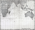 | Details | British Admiralty Hydrographical Office | 1895 |
| Atlas of 12 monthly current charts Indian Ocean 1895 |
|
British Admiralty Hydrographical Office |
|
| 1895 |
| LOC:0 |
| $0.00 | British-Admiralty-Hydrographical-Office | Atlas-of-12-monthly-current-charts-Indian-Ocean-1895 | SOLD<br></br>
Rare hydrographic atlas published by the British Admiralty with twelve charts (January-December) of the Indian Ocean showing the prevailing current direction and velocity for each month. The charts were all based on data collected as far back as 1830. Each chart was published at different dates in 1895 and 1896 under the Superintendence of Admiral Wharton, Hydrographer. Price when issued was ten shillings. |
| 5081 | 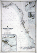 | Details | British Admiralty Hydrographical Office | 1929 |
| Antique chart of Florida Tortugas Cays to Cap San Blas |
|
British Admiralty Hydrographical Office |
|
| 1929 |
| LOC:61 |
| $0.00 | British-Admiralty-Hydrographical-Office | Antique-chart-of-Florida-Tortugas-Cays-to-Cap-San-Blas | SOLD<br><br>
Bold original British Admiralty nautical chart 1890 (1928) of the southwest coast of Florida along the Gulf of Mexico: "Tortugas Cays to Cape San Blas from the latest United States Coast Surveys". Includes extensive coastal detail with St. Andrews Sound, Cape San Blas, Apalachicola, Sea Horse Reef, Anclote Key, Tampa Bay, Punta Gorda, Cape Romano, Cape Sable, Key West, and the Tortuga Bank.
<br></br>
Published at the Admiralty, London on January 24, 1890 under the superintendence of Captain W. J. L. Wharton, Hydrographer. This is the edition of 1915 with last correction in 1929. Chart number 1274. Engraved by Davies and Company.
<br></br>
Includes three large inset charts of Florida ports and Harbors:
<div class="indenttextblocksingle">
<ul style="list-style-type: circle;">
<li>Apalachicola Bay: West Pass. 1911.</li>
<li>St. Marks River. 1909.</li>
<li>St. George Sound: East Pass. 1914.</li>
</ul>
</div> |
| 1350 | 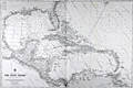 | Details | British Admiralty Hydrographical Office | 1925 |
| Old Authentic Admiralty Nautical Chart of the West Indies or Caribbean |
|
British Admiralty Hydrographical Office |
|
| 1925 |
| LOC:0 |
| $0.00 | British-Admiralty-Hydrographical-Office | Old-Authentic-Admiralty-Nautical-Chart-of-the-West-Indies-or-Caribbean | SOLD
<br></br>
Authentic British Admiralty nautical chart of the West Indies including Florida and the Gulf Coast. 1925.
<br></br>
Fine British Admiralty chart engraved and published from London first in 1903, this example with corrections to 1925. This bold, dark, engraved print retains the cartographic look and style of the late 19th century. More recent charts do not display the character of this beauty. Oval logo of the British Hydrographical office at lower left. Sold by J.D. Potter. Chart number 3273. |
| 781 | 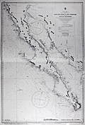 | Details | British Admiralty Hydrographical Office | 1971 |
| Chart of Baja California and the Sea of Cortez |
|
British Admiralty Hydrographical Office |
|
| 1971 |
| LOC:0 |
| $0.00 | British-Admiralty-Hydrographical-Office | Chart-of-Baja-California-and-the-Sea-of-Cortez | SOLD but… we have been able to acquire
<a href="https://www.rarecharts.com/ShowDetail/Creator/British-Admiralty-Hydrographical-Office/Title/Antique-Chart-of-Baja-California-and-Sea-of-Cortez/5150" target="_blank"> an earlier edition of the same chart from 1925 now in stock.
</a>
<br></br>
<hr>
<br></br>
British Admiralty chart first engraved and published from London in 1879, and updated numerous times after that. Coverage includes the entire Baja Peninsula and Gulf of California (Sea of Cortez) from San Diego, California to Cabo San Lucas, Mexico. |
| 3606 | 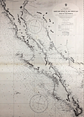 | Details | British Admiralty Hydrographical Office | 1965 |
| Chart of Baja California and Sea of Cortez |
|
British Admiralty Hydrographical Office |
|
| 1965 |
| LOC:0 |
| $0.00 | British-Admiralty-Hydrographical-Office | Chart-of-Baja-California-and-Sea-of-Cortez | SOLD
<br></br>
Later 1965 edition of a British Admiralty chart first engraved and published from London in 1879, and updated numerous times after that. Coverage includes the entire Baja Peninsula and Gulf of California (Sea of Cortez) from San Diego, California to Cabo San Lucas, Mexico.
<br></br>
Bold dark lithographed print retains the cartographic look and style of the late 19th century. Logo of the British Hydrographical Office at top of the title block. Published from London on April 9, 1879, but 1965. Number 2324 |
| 880 |  | Details | de Fer, Nicolas | 1702 |
| Nicolas de Fer's Map of Canada and New France |
|
de Fer, Nicolas |
|
| 1702 |
| LOC:0 |
| $0.00 | de-Fer--Nicolas | Nicolas-de-Fer-s-Map-of-Canada-and-New-France | SOLD
<br></br>
First state of two (1702) of Nicolas de Fer's early map of the eastern half of North America ( the second state dates to 1705 ). This antique copper-plate engraved map is characterized by an emphasis on French territories and discoveries. The placement of the <b>Mississippi River</b> is drawn hundreds of miles to the west of its actual geographic location, entering the Gulf of Mexico just above the Rio Grande River ( "Rio Bravo" ). The<b> Louisiana Territory</b> is identified as "la Louisianne" and notably the interior of most of the area west of the Atlantic Coast is labeled "Canada, ou Nouvelle France". The Florida Peninsula is labeled "Presque Isle de Tegeste", a name that dates back at least to 1571 when Velasco referred to the area as "Tequesta" in his "Geografia de las Indias".
<br></br>
Contains detailed locations for native American tribes and villages including the Tunica, Natchez, Iroquois, Algonquin, and Sioux. Numerous French forts that existed in the Mississippi Valley region are identified including Fort du Prudhomme, Fort Sauvage, and Fort de Crevecoer. Cities that de Fer identifed include Havana, Cuba; New York, St. Augustine, Port Royal, Jamestown, Quebec, and Boston,
<br></br>
This antique map was produced by the well known French geographer and cartographer, Nicolas de Fer (1646 - 1720) and was published in de Fer's atlas: "L'atlas curieux, ou Le monde réprésenté dans des cartes générales et particulières du ciel et de la terre… et orné par des plans et descriptions des villes capitales et principales ..."
<br></br>
Publication details are found In the lower right corner : <div class="indenttextblock">" A Paris. Chez l'Autheur dans l'Isle du Palais sur le Quay de l'Orloge a la Sphere Royale. Avec Privilege du Roy. 1702. " </div> |
| 861 |  | Details | U.S. Coast and Geodetic Survey | 1880 |
| Antique Nautical Chart of Penobscot Bay with Camden and Rockport, Maine |
|
U.S. Coast and Geodetic Survey |
|
| 1880 |
| LOC:0 |
| $0.00 | U-S--Coast-and-Geodetic-Survey | Antique-Nautical-Chart-of-Penobscot-Bay-with-Camden-and-Rockport--Maine | SOLD<br></br>
Antique hydrographical chart of Penobscot Bay in Maine by the U.S. Coast and Geodetic Survey published in 1880. This 19th century chart "is the first complete chart of Penobscot Bay published by the U.S. Government". (Penobscot Maritime Museum, "Penobscot Bay Chart 1880", Internet. Accessed 7/21/2015.) Although it was published 4 years earlier by the USCS, chart number 293 only contains the central part of the bay.
<br></br>
This old nautical chart covers an area in the State of Maine including West Penobscot Bay, East Penobscot Bay, Isle au Haut Bay, Deer Isle, Vinalhaven Island, Cape Rozier, and South Long Island. Towns in Maine that are covered by the chart include Rockland, Belfast, Searsport, Stockton, Rockport, Camden, and Castine
<br></br>
This old chart was made less than 20 years after the end of the U.S. Civil War and contains thousands of details including numerous islands, depth soundings, aids to navigation, and navigation hazards.
<br></br>
Printed by the electrotype method which was adopted by the Coast Survey in the mid-1800's to support increased production volumes with high quality charts very similar to a hand-engraved copper plate engraving. Electrotype copy number 3. Scale 1/80,000. |
| 725 |  | Details | U.S. Coast and Geodetic Survey | 1920 |
| Inside Route Pilot Coast of New Jersey |
|
U.S. Coast and Geodetic Survey |
|
| 1920 |
| LOC:0 |
| $0.00 | U-S--Coast-and-Geodetic-Survey | Inside-Route-Pilot-Coast-of-New-Jersey | SOLD
<br></br>
Old Coast Pilot for New Jersey coast with 3 charts on the "Inside Route", part of what we would today call the Intracoastal Waterway ( ICW ). Covers the the inlets and interior waterways on the coast of New Jersey between Sandy Hook and Cape May. Some of the geographic features covered include: Manasquan Inlet, Barnegat Bay, Manahawken Bay, Little Egg Inlet, Brigantine Inlet, Atlantic City, Absecon Bay, Ventnor, Great Egg Inlet, Longport, Wildwood, and Holly Beach.
<br></br>
Text sailing directions of 22 pages plus appendix and index. Three folding charts in very good conditions on thin paper. Length of the 3 charts totals 87 inches: Chart 1 - 28". Chart 2 - 31". Chart 3 - 28". Paper boards. Printed by the Government Printing Office, Washington, DC in 1920. Second Edition. Serial No. 139. |
| 517 |  | Details | Lloyd's Register | 1928 |
| American Yacht Flags |
|
Lloyd's Register |
|
| 1928 |
| LOC:0 |
| $0.00 | Lloyd-s-Register | American-Yacht-Flags | SOLD<br></br>
Colorful compendium of yacht flags produced by <b>Lloyd's Register of American Yachts</b> in 1928. Contains 14 colored plates of yacht club burgees and 53 colored plates of private signals of yachtsmen. Plates are organized by color and style to make it easier to lookup a flag graphically. Includes a full alphabetical index by first and last name to all the flags followed by more than a dozen pages of advertisements. |
| 1284 | 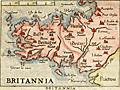 | Details | Ortelius, Abraham | 1599 |
| Antique Ortelius map of Brittany, France |
|
Ortelius, Abraham |
|
| 1599 |
| LOC:0 |
| $0.00 | Ortelius--Abraham | Antique-Ortelius-map-of-Brittany--France | SOLD
<br><br/>
Attractive, antique miniature map of Brittany in France with a stipple engraved sea, showing the region from Granville to the mouth of the Loire River. This fine map of Brittany in north west France suggests the importance of rivers and coasts for sixteenth century transportation. The rivers are exagerrated in their size as are the main settlements such as Rennes, St Malo, Brest, Vannes and Nantes.
<br></br>
Published by Giovanni Botero, an Italian priest and geographer, in 'Relationi Universali'. The 1599 edition of that work is noteworthy for using a complete set of Ortelius miniature maps engraved by Pietro Marchetti.
<br></br>
Set in a page of Italian text with text also on the verso. From Book I, page 48. |
| 1118 | 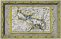 | Details | Aa, Pieter van der | 1713 |
| Antique Dutch Map of the Persian Gulf region |
|
Aa, Pieter van der |
|
| 1713 |
| LOC:0 |
| $0.00 | Aa--Pieter-van-der | Antique-Dutch-Map-of-the-Persian-Gulf-region | SOLD<br></br>
Beautiful intaglio-printed antique map by Peter van der Aa of the Persian Gulf region incorporating portions of present-day Saudi Arabia, Iran, Iraq, India, Bahrain ("Baharem"), Qatar ("Queximi"), Oman, Ormuz, and Kuwait. Key cities va der AA identified by name include: Mecca ("Mecha") , Medina ("Medina t Alnabi"), Basrah ("Bassora"), Muscat ("Mascate"), Ahmedabad ("Hamedebat"), and Khambhat ("Cambaya").
<br></br>
This fine map will make a handsome presentation when framed. An attractive cartouche with European ships in the background shows a local merchant negotiating with two dark, shirtless natives carrying a spear.
<br></br>
Pieter van der Aa (1659 - 1733) was a Dutch publisher working in Leiden during the early eighteenth century. He is best known for publishing maps and atlases, though he also printed pirated editions of foreign bestsellers and illustrated volumes. Van de AA's use of stock mock-frame borders is a characteristic for which he is well known. This map shows evidence of two plate marks, one for the mock-frame and the second interior platemark for the smaller map which was printed inside the mock-frame. From "Le nouveau theatre du monde. ou La geographie royale, composée de nouvelles cartes tres-exactes", published from Leiden in 1713. |
| 1185 | 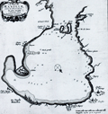 | Details | Aa, Pieter van der | 1719 |
| Bay of Manilla, Philippines Islands |
|
Aa, Pieter van der |
|
| 1719 |
| LOC:0 |
| $0.00 | Aa--Pieter-van-der | Bay-of-Manilla--Philippines-Islands | SOLD<br></br>
Rare Dutch map / chart of the Bay of Manilla, in the Philippine Islands. "De Stadt Manilha" is shown as a cluster of houses and churches. Details provided about depth soundings, and the relative location of rivers, habitations, and churches suggest that this small chart may have had its origin in a working nautical chart.
<br></br>
Pieter van der Aa (1659 - 1733) was a Dutch publisher working in Leiden during the early eighteenth century. He is best known for publishing maps and atlases, though he also printed pirated editions of foreign bestsellers and illustrated volumes. From "Nouvel atlas...contenant les principales cartes géographiques dressées suivant les nouvelles observations de Mr. de l'Académie royale des sciences" published in 1714 from Leiden by Van der Aa. Plate number 27 (in manuscript).
<br></br>
Printed on a large sheet measuring 19" W x 15" H. |
| 1380 | 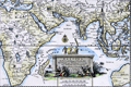 | Details | Aa, Pieter van der | 1713 |
| Antique framed map of Indian Ocean, Asia, Australia |
|
Aa, Pieter van der |
|
| 1713 |
| LOC:0 |
| $0.00 | Aa--Pieter-van-der | Antique-framed-map-of-Indian-Ocean--Asia--Australia | SOLD<br></br>
Very attractive copper-engraved antique map by Pieter van der Aa of Asia, Africa, Madagascar Java, Saudi Arabia, Philippines, western Australia, and much more. Matted and framed measures 17" x 13". Map itself, ca. 1713 within an elaborate and decorative printed border. Based on the voyage of Nuno de Cunha.
<br></br>
This beautiful old map with a fine title cartouche covers the Mediterranean Sea, the Red Sea, Persian Gulf, Arabian Sea, Gulf of Bengal, and the South China Sea.
<br></br>
Pieter van der Aa (1659 - 1733) was a Dutch publisher working in Leiden during the early eighteenth century. He is best known for publishing maps and atlases, though he also printed pirated editions of foreign bestsellers and illustrated volumes. Van de AA's use of stock mock-frame borders is a characteristic for which he is well known. The map shows evidence of two plate marks, one for the mock-frame and the second interior platemark for the smaller map which was printed inside the mock-frame. From "Le nouveau theatre du monde. ou La geographie royale, composée de nouvelles cartes tres-exactes", published from Leiden in 1713. |
| 504 |  | Details | Beaurain, Jean | 1760 |
| Carte de la Manche |
|
Beaurain, Jean |
|
| 1760 |
| LOC:0 |
| $0.00 | Beaurain--Jean | Carte-de-la-Manche | SOLD<br></br>
Highly decorative chart of the English Channel by Jean Chevalier de Beaurain after the observations of Edmund Halley. Coverage includes from the Scilly Islands off the tip of Cornwall to past the Pas du Calais and Gravelines. At 42" in width this two sheet chart is an impressive artifact of a time when Britain ruled the waves. With three colored compass roses, rhumb lines, numerous soundings, and eight diagrams of maritime and navigational subjects.<BR> </BR>
Locates hundreds of towns and geographical landmarks on the South Coast of England and West Coast of France including Southampton, Poole, Cape Lizard, the Isle of Wight, Beachy Head, Plymouth, Brest; the Isles of Jersey, Guernsey, and Sark; Rouen, and Amiens. Dated 1760 in a decorative cartouche covered in roses.<BR> </BR>
Clockwise from the top left are a number of insets containing nautical definitions and drawings including: <BR>
-The offshore and tidal currents and their visual representation on the chart with arrows.<BR>
-Ancient and modern nautical logs (used to approximate the speed of a vessel over water).<BR>
-The use of the mariner's cross staff (l'Arbalestre) for measuring the altitude of the sun.<BR>
-The ship's wake or 'sillage'.<BR>
-The sounding lead (la sonde) for measuring water depth and the composition of the sea floor.<BR>
-The planisphere and a description of the earth's rotation.<BR>
-A simple astrolabe.<BR>
-The compass and compass card.<BR>
Martinet Inv; Vallet Script. |
| 447 |  | Details | Justus, Roy Braxton | 1944 |
| Your fleet guarantees freedom (WWII lobby card) |
|
Justus, Roy Braxton |
|
| 1944 |
| LOC:0 |
| $0.00 | Justus--Roy-Braxton | Your-fleet-guarantees-freedom-(WWII-lobby-card) | <BR> </BR>
SOLD
<BR> </BR>
Medium-sized WWII Navy Day lobby card by Minneapolis Star editorial cartoonist Roy B. Justus (1901-1983). Titled "Your Fleet Guarantees Freedom. Navy Day, October 27, 1944" the item depicts a naval fleet and numerous aircraft circling the globe. No other examples of this smaller lobby card are found online but two larger format (28x40) posters are located in museums. This card was printed less than 4 months after the Allied forces landed in Normandy, France while the wars in Europe and Japan were still in progress. <BR> </BR>
Navy Day was first celebrated in 1922. October 27 was selected because it was the birthday of Theodore "Teddy" Roosevelt, President of the United States from 1901 - 1909.<BR> </BR>
At bottom: ORDER NO. 83 / NAVPERS-NRB-44115-6 SEP 44-90M. On medium-weight card stock. |
| 1261 | 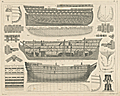 | Details | Heck, Georg | 1849 |
| Antique plans and architectural details for a three-decked warship ship-of-the-line. |
|
Heck, Georg |
|
| 1849 |
| LOC:0 |
| $0.00 | Heck--Georg | Antique-plans-and-architectural-details-for-a-three-decked-warship-ship-of-the-line- | <br><br><b>SOLD</b>, but see <a href="https://www.rarecharts.com/ShowDetail/Creator/Heck--Georg/Title/Antique-plans-for-a-three-decked-warship-ship-of-the-line-/6460" target="_blank">another example of the map</a> now in RareCharts' inventory.
<br></br>
Antique steel-engarved maritime print with details related to naval architecture. |
| 1229 | 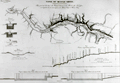 | Details | Poussin, Guillaume Tell | 1834 |
| Antique plan of the Tennessee River with Muscle Shoals Canal |
|
Poussin, Guillaume Tell |
|
| 1834 |
| LOC:0 |
| $0.00 | Poussin--Guillaume-Tell | Antique-plan-of-the-Tennessee-River-with-Muscle-Shoals-Canal | SOLD
<BR> </BR>
Antique plan of the Tennessee River and proposed canal in the vicinity of Muscle Shoals ca. 1834. By William Tell Poussin (1796 - 1876), French architect, author, engineer, and diplomat.
<BR> </BR>
Before the completion of the Wilson Dam in 1924, the Tennessee river was divided by a series of shoals near the Muscle Shoals area where the Tennessee fell over 100′ in approximately 30 miles. Between 1830 and 1890, adjacent to the river and around the shoals, a series of canals and locks were built and improved upon to provide for commercial navigation. This map captures some of the early planning for that work.
<BR> </BR>
Towns shown include Marathon, Tuscombia, Bainbridge, Havana, and Waterloo. Also depicts locations for Brown's Ferry, Lamb's Ferry, Furquhart's Ferry, and Florence Ferry. Other important topographical features include the Elk River, Melton's Bluff and the existing roads to Nashville, Columbus, and Huntsville. With a longitudinal cross section of the proposed canal
<BR> </BR>
Published in: "Travaux d'ameliorations interieures projetes ou executes par le Gouvernement General des Etats-Unis d'Amerique, de 1824 a 1831"; par Guillaume-Tell Poussin … Atlas. Paris, Anselin, Libraire, pour l'art militaire, les sciences et les arts, rue Dauphine, No. 36, dans le passage Dauphine. Carilian-Goeury, Libraire, des ponts et chaussees et des mines, Quai des Augustins, No. 41. 1834. Imprimerie de Lachevardiere, rue du Colombier, No. 30. |
| 3626 | 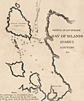 | Details | U.S. Coast and Geodetic Survey | 1875 |
| Early charts of ports on Adak and Amchitka in Aleutian Islands, Alaska |
|
U.S. Coast and Geodetic Survey |
|
| 1875 |
| LOC:0 |
| $0.00 | U-S--Coast-and-Geodetic-Survey | Early-charts-of-ports-on-Adak-and-Amchitka-in-Aleutian-Islands--Alaska | SOLD
<br></br>Interesting original US Coast Survey charts of harbors on two islands in Alaska, Adak and Amchitka, way out in the Bering Sea near the end of the Aleutian Island chain. Reason for publishing this scarce chart is likely because each harbor contains an indicated Astronomical Station.
<br></br>
Manuscript marginal notations in blue wax pencil. Rare to find old Coast Survey charts of this remote an area on such heavy paper. Chart is believed to be a file copy. |
| 431 | 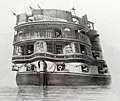 | Details | Cooke, E.W. | 1829 |
| The Circular Stern of His Majesty's Ship Asia. |
|
Cooke, E.W. |
|
| 1829 |
| LOC:0 |
| $0.00 | Cooke--E-W- | The-Circular-Stern-of-His-Majesty-s-Ship-Asia- | SOLD<BR> </BR>
Beautiful antique etching by Edward William Cooke (1811-1880) of the decorated stern of a Royal Navy ship, the HMS Asia. This fine, strong print from Cooke's "Fifty plates of Shipping and Craft" presents a view of the ship's stern with more than a dozen cannon run out , some obviously protruding from windows in the cabins of the Captain and other officers of rank.
<BR> </BR>
The Asia, a Canopus-class vessel, based on a French design, was built in 1824 by Bombay Shipyard. A ship-of-the-line, the Asia served at the Battle of Navarino in October 1827. The ship was the flagship of Vice-Admiral Edward Codrington. The Asia was broken up in 1908, a long lifetime for a wooden ship.
<BR> </BR>
From Cooke's early book of etchings of ships and other maritime subjects "Fifty Plates of Shipping and Craft". |
| 5281 |  | Details | U.S. Coast and Geodetic Survey | 1900 |
| Scarce nautical chart Apalachee Bay to St. Georges Sound Florida |
|
U.S. Coast and Geodetic Survey |
|
| 1900 |
| LOC:1403 |
| $0.00 | U-S--Coast-and-Geodetic-Survey | Scarce-nautical-chart-Apalachee-Bay-to-St--Georges-Sound-Florida | Sold
<br></br>
Scarce, very large antique rolled nautical chart of the northern Florida coast from Apalachee Bay to St. Georges Sound, Florida. Published by the U.S. Coast and Geodetic Survey. Date of first publication 1883 but this electrotype edition is updated with corrections to 1900. Notable features include Ocklockonee Bay, St. James Island, Oyster Bay, St. Marks and Port Leon, Florida.
<br></br>
Not a preliminary chart. Full-size antique nautical charts on heavy paper of Apalachee Bay are very scarce, whether by the U.S. Coast Survey or by any other publisher
<br></br>
Chart number 182. Price when issued 50 cents. J.E. Hilgard, (Washington, DC: United States Coast and Geodetic Survey, 1883)
<br></br>
This antique chart of the north Florida coast was printed in 1900 from an electrotype copy of the original hand-engraved copper plate, a process the U.S. Coast Survey first adopted around 1850. As a soft medium, copper plates could only withstand print runs of perhaps 200 copies before the plates wore down. To enable larger print runs, a mold of the original plate was created in wax or another soft medium. Then, using an electro-chemical process ( electrotyping ), the mold was coated with a metal layer, typically copper. Printers were then able to produce output from the new electrotype copper copy, while preserving the original. Electrotype copy no. 1. |
| 27 |  | Details | Blunt, Edmund | 1852 |
| North East Coast of North America (Blueback) |
|
Blunt, Edmund |
|
| 1852 |
| LOC:0 |
| $0.00 | Blunt--Edmund | North-East-Coast-of-North-America-(Blueback) | SOLD
<br></br>
Large, small-scale ante-bellum antique blueback nautical chart of northeast U.S. coast by E & G.W. Blunt. This 158 year old well-used blueback chart of U.S. northeast coast reveals a long and full life. <BR> </BR>
Coverage from Nova Scotia past New York city including Georges Shoal and Little Georges. Coastal detail shown with fine lines. Copious soundings off coasts of New Jersey and NYC. One faint manuscript calculation on this blueback chart that could easily be erased.
<BR> </BR>
For more information on the evolution of blueback charts we recommend this book by Susanna Fisher:
<a target="_blank" href="http://www.regattapress.com/The_Makers_of_the_Blueback_Chart.html">The Makers of Blueback Charts.</a> |
| 151 |  | Details | Jefferys, Thomas | 1774 |
| Coast of France from Callais to Fecamp |
|
Jefferys, Thomas |
|
| 1774 |
| LOC:0 |
| $0.00 | Jefferys--Thomas | Coast-of-France-from-Callais-to-Fecamp | SOLD
<br></br>
Neat chart of the English and French coasts along the "British Channel" near the Straits of Dover. On the British side coverage extends from Beachy Head past the South Foreland. Printed for Faden and Jefferys in 1774 the two volumes in the series contained 87 charts of the sea coast and fortifications. |
| 3592 |  | Details | Jefferys, Thomas | 1775 |
| Antique Chart of the Peninsula and Gulf of Florida. |
|
Jefferys, Thomas |
|
| 1775 |
| LOC:51 |
| $0.00 | Jefferys--Thomas | Antique-Chart-of-the-Peninsula-and-Gulf-of-Florida- | SOLD <br></br>
Fine first edition British navigational chart documents the Peninsula of Florida. Includes portions of the Bahamas with Grand Bahama Island, Great Abaco Island, Eleuthera, Nassau (Providence) and more. Tampa Bay clearly marked.
<br></br>
Much to inspect with a magnifying glass. Correctly shows the current from the Gulf Stream flowing from South to North.
<br></br>
From Sayer's and Bennett's atlas titled: "The West-India Atlas: or a compendious description of the West-Indies: illustrated with forty one correct charts and maps, taken from actual surveys."
<br></br>
Publishers attribution reads: "London. Printed for Rob.t Sayer, Map and Printseller. No 53 Fleet Street as the Act directs 20th Feb.y 1775. According to Rumsey <div class="indenttextblock">
"Sayer and Bennet acquired his [Jefferys'] materials in preparation for this atlas, and published the atlas posthumously under his name (as they did with the American Atlas) in 1775. The heart of this atlas and the most detailed part is the sixteen sheet large chart and index sheet of the whole of the West Indies. (
<a href="http://www.davidrumsey.com/luna/servlet/detail/RUMSEY~8~1~2795~310044:The-coast-of-Yucatan-from-Campeche-" target="_blank">Internet </a>)
</div> |
| 1452 |  | Details | Jefferys, Thomas | 1775 |
| Jefferys Sayers Chart of Caribbee Islands Virgin Islands to Barbados |
|
Jefferys, Thomas |
|
| 1775 |
| LOC:0 |
| $0.00 | Jefferys--Thomas | Jefferys-Sayers-Chart-of-Caribbee-Islands-Virgin-Islands-to-Barbados | SOLD <br></br>
Exciting antique British chart of the "Caribbee Islands" -- Caribbean Islands. Chart coverage includes the Virgin Islands (St. Thomas, St. Croix, St. John's, Tortola…), Antigua, Guadeloupe, Dominica, Martinique, St. Lucia, St. Vincent, and Barbados.
<br></br>
The chart is from the scarce <b>first issue of The West-India Atlas, 1775 by Sayer</b>, the other issues being 1781, 1787, 1794, 1796, 1807, and 1818 published by Sayer and then Laurie and Whittle. <a href="https://www.davidrumsey.com/home" target="_blank">(Online).</a>
<br></br>
One French online site of Martinique describes key features of Jefferys' nautical chart:
<hr>
<div class="indenttextblock">
C'est une carte marine à latitudes croissantes de 20 lieues marines au degré. Elle est très esthétiquement quadrillée de rhumbs, éléments indispensables à l'époque pour obtenir l'adhésion des utilisateurs. Elle est de plus joliment agrémentée de représentations, somme toute très sobres, de vaisseaux de diverses nations, qui n'entravent pas le caractère opérationnel de la carte.
</BR>
Quelques rares sondes indiquent dans les principaux canaux et passes les profondeurs marines. Elles sont parfois présentes sur les dangers reconnus. Entre Saint-Eustache et Avès, Jefferys met en évidence la longue barrière de hauts fonds dont la largeur atteindrait en moyenne deux lieues marines et la profondeur entre 10 et 20 fathoms.
</BR>
Jefferys y précise que certaines sondes ont été prises par les français, marins à bord du navire le «Toulouse», en 1720. La carte présente les itinéraires des principaux "débouquements", notamment celui des Vierges, qui était employé par la plupart des marines pour le retour en Europe. <a href="http://cartes-martinique.pagesperso-orange.fr/Car_gb.htm" target="_blank">(Online.)</a>
<hr>
</div> |
| 962 | 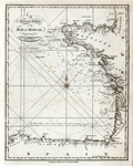 | Details | Malham, John | 1797 |
| A Correct Chart of the Coasts of the Bay of Biscay |
|
Malham, John |
|
| 1797 |
| LOC:0 |
| $0.00 | Malham--John | A-Correct-Chart-of-the-Coasts-of-the-Bay-of-Biscay | SOLD
<BR> </BR>
Antique engraved nautical chart of the Bay of Biscay, probably the earliest small-scale map of Biscay Bay to be printed in the United States (1797). Coverage extends from the coasts of Normandy and Brittany
past Bordeaux and Gascony and terminates in Galicia near Cape Ferrol. Key features include Ushant, Brest, la Rochelle, Rochefort, Bayonne; and the mouths of the Vilaine, Loire, and Gironde Rivers.
<BR> </BR>
Though small in size, the chart contains numerous soundings and descriptions of the composition of the sea-floor (e.g. "Broken Shells", "Grey Sand" or "Whitish Mixt Sand") .
<BR> </BR>
This chart comes from an early nautical gazetteer or geographical dictionary produced first in England and after 1796 in the United States by John Malham. Rev. John Malham was a prolific Yorkshire-born author who produced other diverse works that include "Navigation Made Easy and Familiar", "Twenty-Two Sermons on Doctrinal and Practical Subjects" and "The Scarcity of Wheat considered". Malham died near London in 1807. (Gentleman's Magazine, Vol 102, 1807, p. 568).
<BR> </BR>
Colophon at end of Volume 1 states that the work is "From the prefs of Samuel Etheridge, No. 9 Newbury Street, Boston, 1797"). |
| 103 |  | Details | Morisot, C.B. | 1643 |
| Navigium corum qui Cocorum et Proditorum Insulas habitant |
|
Morisot, C.B. |
|
| 1643 |
| LOC:0 |
| $0.00 | Morisot--C-B- | Navigium-corum-qui-Cocorum-et-Proditorum-Insulas-habitant | <BR> </BR>
SOLD
<BR> </BR>
Single sheet of chain laid paper with two illustrations from the first comprehensive work on maritime history by Charles Barthelemy Morisot- (1592-1661) "Orbis Maritimi siue Rerum". Set amid Latin text. Page 723 contains a 5 1/2" x 6" engraving of Guinean canoes. The obverse, page 724, contains a 6 1/2" x 8" engraving of a canoe like vessel (Cocos islands?) as they are fired on from a small boat of Europeans. This engraving is labeled: "Navigium corum qui Cocorum et Proditorum Insulas habitant." |
| 105 |  | Details | Morisot, C.B. | 1643 |
| Piraticum Malabarum |
|
Morisot, C.B. |
|
| 1643 |
| LOC:0 |
| $0.00 | Morisot--C-B- | Piraticum-Malabarum | <BR> </BR>
SOLD
<BR> </BR>
Single sheet of chain laid paper with two engraved illustrations from the first comprehensive work on maritime history by Charles Barthelemy Morisot- "Orbis Maritimi siue Rerum". Page 719 contains a 5 1/2" x 6 1/2" view of natives from the East Indies piloting small craft. The obverse contains a 5 1/2" x 5" print of a small European-style galley with a single sail and 20 oars. That illustration is titled: "Tabula tertia Piraticum Malabarum describit." |
| 106 |  | Details | Morisot, C.B. | 1643 |
| Coracora a siue Carcola |
|
Morisot, C.B. |
|
| 1643 |
| LOC:0 |
| $0.00 | Morisot--C-B- | Coracora--a-siue-Carcola | <BR> </BR>
SOLD
<BR> </BR>
Single sheet of chain laid paper with two engraved illustrations from this early work by Morisot (1592-1661) on maritime history. Page 721 contains a profile view of three small vessels, one labeled "Ioncos" and another "Paros" (5 1/2" x 6 1/2") . Page 722 contains a outrigger canoe containing many warriors with spears labeled "Coracola a siue Carcola" (5 1/2" x 5"). Both illustrations accompanied with Latin text. |
| 111 |  | Details | Morisot, C.B. | 1643 |
| Antiqua Triremis Nova Triremis |
|
Morisot, C.B. |
|
| 1643 |
| LOC:0 |
| $0.00 | Morisot--C-B- | Antiqua-Triremis-Nova-Triremis | <BR> </BR>
SOLD
<BR> </BR>
Single sheet of chain laid paper with two engraved illustrations from the first comprehensive work on maritime history by Charles Barthelemy Morisot- "Orbis Maritimi siue Rerum". First is titled "Antiqua Triremis" and shows a small galley in an ancient style (6 1/2" x 5 1/2"). On the obverse is an engraving of a 'modern' trireme "Nova Triremis quam dicimus, Galere" (6 1/2" x 6 1/2"). The depiction of this two masted 'nova' galley is noteworthy for its plan of the oarsmen's seating and 'alla scaloccio' rowing arrangement with four men to one oar. From "Orbis Maritimi siue Rerum in Mari et Littoribus Gestarum Generalis Historia". |
| 95 | 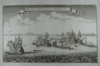 | Details | Merian, M. | 1707 |
| Pugna nautica inter Melitenses et Turcos in Mari Mediterraneo |
|
Merian, M. |
|
| 1707 |
| LOC:0 |
| $0.00 | Merian--M- | Pugna-nautica-inter-Melitenses-et-Turcos-in-Mari-Mediterraneo | SOLD.
<BR> </BR>
Finely engraved and labeled naval battle scene between Maltese galleys and the Ottoman Turks. Although labeled '1645' this detailed copperplate engraving certainly depicts an action on September 28, 1644 between six Maltese galleys and a fleet of Ottoman galleons. The galleys San Lorenzo, Santa Maria, Vittoria and others engaged a Turkish convoy carrying pilgrims bound for Mecca. The Maltese killed many pilgrims and took almost 400 prisoners as slaves including by some reports one of the Sultan's wives and her son.<BR> </BR>
On their voyage home the Maltese stopped in Crete, then a possession of Venice, for a few days. This apparent collusion between the Maltese and Venetians, previously at peace with the Turks, served as a pretense for the Cretan war between the Turks, Venice and Malta between 1645 and 1669. |
| 79 |  | Details | Malham, John | 1801 |
| A Correct Chart of the East Coast of North America 2nd. Ed. |
|
Malham, John |
|
| 1801 |
| LOC:0 |
| $0.00 | Malham--John | A-Correct-Chart-of-the-East-Coast-of-North-America-2nd--Ed- | SOLD
<br></br>
Antique small-scale copper-plate chart by John Malham. Coverage includes from the North Coast of Cuba, Florida and Bahamas past the Grand Bank to Labrador. Both latitude and longitude are clearly marked as well as numerous rhumb lines. Direction of prevailing current flow of the "Florida Stream" is shown by arrows. This later 1801 version of Malham's 1796 chart includes the label "St. Georges Bank, for that well-known fishing area, a feature missing from the earlier chart.
<br></br>
Rev. John Malham was a prolific Yorkshire-born author. Malham died near London in 1807. (Gentleman's Magazine, Vol 102, 1807, p. 568). |
| 278 |  | Details | Malham, John | 1797 |
| A Correct Chart of the West Coast of Africa |
|
Malham, John |
|
| 1797 |
| LOC:6 |
| $0.00 | Malham--John | A-Correct-Chart-of-the-West-Coast-of-Africa | SOLD<br></br>
Small antique nautical chart dated October 1796 showing the Straits of Gibraltar and the west coast of Africa from the Mediterranean Sea to the Gulf of Guinea. From the rare first American edition of Malham's Naval Gazetteer, published by Spotswood and Nancrede in Boston in 1797. Vol 1.<BR> </BR>
This sea chart comes from an antique nautical gazetteer or geographical dictionary produced first in England and after 1796 in the United States. Key noted features include Majorca, Minorca, Corsica, Sardinia, Barcelona, Spain; Madeira, Canary Islands, Cape Verde Islands, and Cape Bojador . Four broad geographical areas or "coasts" are identified: Grain Coast, Gold Coast, Slave Coast, and the Ivory Coast ("Tooth Coast").<BR> </BR>
Rev. John Malham was a prolific Yorkshire-born author who produced other diverse works that include "Navigation Made Easy and Familiar", "Twenty-Two Sermons on Doctrinal and Practical Subjects" and "The Scarcity of Wheat considered". Malham died near London in 1807. (Gentleman's Magazine, Vol 102, 1807, p. 568).<BR> </BR>
Colophon at end of Volume 1 states that the work is "From the prefs of Samuel Etheridge, No. 9 Newbury Street, Boston, 1797"). |
| 815 |  | Details | Malham, John | 1796 |
| A Correct Chart of the East Coast of North America |
|
Malham, John |
|
| 1796 |
| LOC:0 |
| $0.00 | Malham--John | A-Correct-Chart-of-the-East-Coast-of-North-America | SOLD
<br></br>
Antique small-scale copperplate map / chart of the U.S. East Coast published by Spotswood and Nacrede from Boston in September 1796 in Malham's Naval Gazetteer. Indian tribal names are shown, particularly along the St. Lawrence River. These include the Iroquois, Algonkin, and Teniskamings.
<br></br>
Coverage is from the North Coast of Cuba, Florida and Bahamas past the Grand Bank to Labrador. Both lattitude and longitude clearly marked as well as numerous rhumb lines. Direction of prevailing current flow for the "Florida Stream" (Gulf Stream) is shown by arrows. Georges Bank is not labeled as such, unlike the later 1801 edition.
<br></br>
This sea chart comes from John Malham's antique nautical gazetteer or geographical dictionary produced first in England and after 1796 in the United States.
<br></br>
Rev. John Malham was a prolific Yorkshire-born author who produced other diverse works that include "Navigation Made Easy and Familiar", "Twenty-Two Sermons on Doctrinal and Practical Subjects" and "The Scarcity of Wheat considered". Malham died near London in 1807. (Gentleman's Magazine, Vol 102, 1807, p. 568). |
| 104 |  | Details | Blunt, E and G.W. | 1841 |
| Plan of Portsmouth Harbour |
|
Blunt, E and G.W. |
|
| 1841 |
| LOC:0 |
| $0.00 | Blunt--E-and-G-W- | Plan-of-Portsmouth-Harbour | SOLD
<br></br>
Antique copperplate nautical chart of Portsmouth, New Hampshire harbor from this renowned American publisher of nautical charts and sailing directions. |
| 814 | 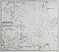 | Details | Blunt, E and G.W. | 1850 |
| Entrance to The Chesapeake Bay |
|
Blunt, E and G.W. |
|
| 1850 |
| LOC:0 |
| $0.00 | Blunt--E-and-G-W- | Entrance-to-The-Chesapeake-Bay | SOLD<br></br>
Pre Civil-war chart of the channels, banks, shoals, flats, and anchorages of the lower Chesapeake Bay between Mob Jack Bay and a line through Cape Henry and Cape Charles. The chart, created by Edmund Blunt, is from the 1850 edition of the "American Coast Pilot". 16th Edition.
<br></br>
Coverage includes: York River, James River, Hampton Roads, Lyn-Haven Roads, Fort Calhoun, and Smith's island. With numerous depth soundings and aids-to-navigation.
<br></br>
The American Coast Pilot with other harbor charts, was published by Edmund and George W. Blunt from New York. The Blunts were the most prolific private publisher of navigational charts in the United States at that time. The chart is based on earlier surveys by Adams and other members of the U.S. Navy.
<br><br/> |
| 958 | 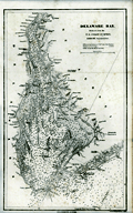 | Details | Blunt, E and G.W. | 1850 |
| Delaware Bay |
|
Blunt, E and G.W. |
|
| 1850 |
| LOC:0 |
| $0.00 | Blunt--E-and-G-W- | Delaware-Bay | SOLD<BR></BR>
Antique nautical chart of Delaware Bay from the Blunts in their 16th edition of the American Coast Pilot, published in 1850. This old chart is a reduced size version of a hydrographic chart originally published by the U.S. Coast Survey.
<br></br>
Extends from Reedy Point at the north end of Delaware Bay (near Salem, NJ) to Hen and Chickens shoal offshore of Cape Henlopen and Cape May, New Jersey.
<br></br>
The American Coast Pilot with other harbor charts, was published by Edmund and George W. Blunt from New York. The Blunts were the most prolific private publisher of navigational charts in the United States at that time. |
| 369 | 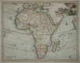 | Details | Tirion, Isaac | 1730 |
| Carta Generale Dell Africa |
|
Tirion, Isaac |
|
| 1730 |
| LOC:0 |
| $0.00 | Tirion--Isaac | Carta-Generale-Dell-Africa | SOLD- <BR> </BR>
Highly decorative map of the African continent with the Arabian peninsula, Turkey and Mediterranean. Coverage includes the Indian Ocean, Madagascar, and the Maldives to the east and to the west the Pacific Ocean islands as far as Brasil (Bresil). Decorative cartouche at upper right depicts men hunting a crocodile with elephant and ostrich in the foreground. |
| 1422 | 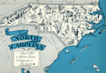 | Details | Johst, Paul Spener | 1931 |
| North Carolina Pictorial Map |
|
Johst, Paul Spener |
|
| 1931 |
| LOC:0 |
| $0.00 | Johst--Paul-Spener | North-Carolina-Pictorial-Map | SOLD
<br><br>
Pictorial map of the State of North Carolina in a cartoon-like style. Depicts industry (textile mills, furniture) and agriculture (tobacco, peanuts, cotton, corn) for the State of North Carolina in an exaggerated, stereotyped manner.
<br></br>
A decorative legend at bottom left identifies four locations within North Carolina: Charlotte, Winston Salem, Greensboro, and Raleigh. Coastal locations of Pamlico Sound, Albemarle Sound, Cape Hatteras, Cape Lookout, and Cape Fear are identieid in small type. Page 53.
<br></br>
Verso with text extolling the virtues of North Carolina geography and natural wonders.
<br></br>
From "Picture Map Geography of the United States" by Vernon Quinn. With Picture Maps by Paul Spener Johst. Publisher: Frederick A. Stokes Company. New York. 1931. Some picture maps in the book contain depictions that today might be considered politically incorrect or even racist. |
| 86 |  | Details | Eldridge, George | 1883 |
| Eldridge's Coast Pilot |
|
Eldridge, George |
|
| 1883 |
| LOC:0 |
| $0.00 | Eldridge--George | Eldridge-s-Coast-Pilot | This item has been sold
<BR> </BR>
536 pages of sailing directions from Chatham around the tip of Florida into the Gulf of Mexico as far as Rio Grande River. No charts or illustrations save an advertising supplement. Several corrections inserted on yellow paper. Final pages includes meager sailing directions for the Mississippi River passes, Barataria Bay, Timbalier Bay, Atchafalaya Bay, and Galveston Bay. <BR> </BR>
Includes a 45 page supplement from The American Ship Windlass Company that includes numerous fine steel engravings of anchor windlasses. |
| 1270 | 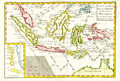 | Details | Bonne, Rigobert | 1780 |
| Attractive antique map of the East Indies and north Australia |
|
Bonne, Rigobert |
|
| 1780 |
| LOC:0 |
| $0.00 | Bonne--Rigobert | Attractive-antique-map-of-the-East-Indies-and-north-Australia | SALE PENDING <br></br>
Attractive antique copperplate-engraved map of the islands of Java, Sumatra, Celebes, Malaca, Borneo, New Guinea (shown only partially due to incomplete exploration in the late 18th century) as well as the tip of Australia's northern coast(s) with each side of the Cape York Peninsula or "Terre du Sud" named: Terre de Diemen (west) and Terre d'Arnheim (east).
<br></br>
Arrow notations depict the directions of the winds during the various months of the year. Includes an inset map of the Moluccan Islands - the Spice Islands.
<br></br>
From "Atlas de toutes les parties connues du Globe Terrestre, dressé pour l’histoire philosophique et politique des établissemens et du commerce des européens dans les deux Indes. "
<br></br>
Rigobert Bonne (1727-1794) was the successor to Jacques Nicolas Bellin as Royal Cartographer to France in the office of the Hydrographer at the Depôt de la Marine. Bonne first came to prominence when he published a number of charts in the Atlas Maritime in 1762. He is better known for later publications, including the Atlas Encyclopedique, which he collaborated on with Nicholas Desmarest, as well as the maps he produced for Raynal's Atlas de Toutes Les Parties Connues du Globe Terrestre, which was published in 1780. |
| 1308 |  | Details | Bonne, Rigobert | 1787 |
| Antique Northern Polar Projection |
|
Bonne, Rigobert |
|
| 1787 |
| LOC:0 |
| $0.00 | Bonne--Rigobert | Antique-Northern-Polar-Projection | SOLD
<br><br/>
Early antique North polar projection covering the Northern Hemisphere from the North Pole to the Equator. |
| 1293 |  | Details | Bonne, Rigobert | 1774 |
| Antique map of East Africa and Madagascar |
|
Bonne, Rigobert |
|
| 1774 |
| LOC:0 |
| $0.00 | Bonne--Rigobert | Antique-map-of-East-Africa-and-Madagascar | SOLD<br></br>
Antique copper-plate engraved map of East Africa, Madagascar, and the Comoros Islands engraved by Andre' and issued by Rigobert Bonne in 1774. Number 96.
<br></br>
Rigobert Bonne was the successor to Jacques Nicolas Bellin as Royal Cartographer to France in the office of the Hydrographer at the Depôt de la Marine. |
| 110 |  | Details | Norie, J.W. | 1840 |
| A Complete Epitome of Practical Navigation |
|
Norie, J.W. |
|
| 1840 |
| LOC:0 |
| $0.00 | Norie--J-W- | A-Complete-Epitome-of-Practical-Navigation | SOLD <BR> </BR>
Twelfth edition of this British nautical standard. |
| 213 |  | Details | Norie, J.W. | 1845 |
| Sailing Directions for the Coasts of Spain and Portugal |
|
Norie, J.W. |
|
| 1845 |
| LOC:0 |
| $0.00 | Norie--J-W- | Sailing-Directions-for-the-Coasts-of-Spain-and-Portugal | SOLD<br></br>
Small scarce 42 page booklet of sailing directions for the West coasts of Spain and Portugal compiled by J.W. Norie and published by Charles Wilson in 1845. Paper covers. Fascinating reading. With one and one half pages plus rear cover listing charts for sale with prices. Front cover contains signature of Sewell Strout, quite possibly Sewell Cushing Strout of Bridgton, Maine who served as an Associate Justice on the Maine Supreme Court (d. 1914). |
| 1036 | 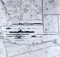 | Details | Norie, J.W. | 1836 |
| Huge 1830 Blueback Chart of the Coast of Brazil |
|
Norie, J.W. |
|
| 1836 |
| LOC:0 |
| $0.00 | Norie--J-W- | Huge-1830-Blueback-Chart-of-the-Coast-of-Brazil | SOLD
<br></br>
Spectacular six foot long antique blueback chart of the Brazilian Coast from 1836 first published in 1830. Updated with significant revisions based on of a chart by Steel & Co. in 1817. Contains nine attractive coastal elevation views and numerous inset harbor charts including:
<div class="indenttextblock">
<ul>
<span style= style="list-style-type: circle;">
<li>The Bay of Maranham</li>
<li>The Harbour of Pernambuco</li>
<li>The Harbour of Rio Grande</li>
<li> A Plan of the Harbour of Rio Janeiro </li>
<li>A Plan of Santos Harbor</li>
<li>The Bay of Espirito Santo</li>
<li> Plan of the ABROLHOS with the Track of Baron Roussin</li>
<li>Plan of Bahia of the Bay of All Saints</li>
<li>The Island of Fernand de Noronha</li>
</span>
</ul>
</div>
Attribution reads: " London, Published as the Act directs by J.W. Norie and Company August 24, 1830 at the Navigation Warehouse and Naval Academy, Number 157 Leadenhall Street. |
| 114 |  | Details | Ogilby, John | 1671 |
| Brasilia |
|
Ogilby, John |
|
| 1671 |
| LOC:0 |
| $0.00 | Ogilby--John | Brasilia | SOLD. .<BR> </BR>
Map of Eastern Brazil published after a work by Arnoldus Montanus. West is shown at top of map. |
| 119 | 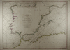 | Details | Rochette, Louis S. | 1780 |
| Coasts of Spain and Portugal |
|
Rochette, Louis S. |
|
| 1780 |
| LOC:0 |
| $0.00 | Rochette--Louis-S- | Coasts-of-Spain-and-Portugal | SOLD<br></br>
Small-scale antique nautical chart of the coasts of Spain and Portugal from Cabo Blanco along the African coast to the Bay of Gascogne. Includes the Western Mediterranean from Nice to the Strait of Gibraltar. As is typical for sea charts of that period the north coast of Africa is labeled "Barbary". Coverage of this antique chart of the western Mediterranean coast by Louis Rochette (1780) , includes the Balearic Islands of Ibiza, Majorca, Minorca, and Formentera. |
| 223 | 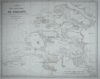 | Details | Tardieu, Ambroise | 1822 |
| SOLD--- Carte des Bouches de L'Escaut |
|
Tardieu, Ambroise |
|
| 1822 |
| LOC:0 |
| $0.00 | Tardieu--Ambroise | SOLD------Carte-des-Bouches-de-L-Escaut | This item is SOLD. <BR> </BR>
Tardieu's engraving of Zeeland , based on an earlier work of Beautemps-Beaupre, covers the many waterways associated with the mouth of the Scheldt (Fr. Escaut) river. Key cities in the Southern Netherlands included in the map include Sluis, Middelburg, and Berg Op Zoom, and Anvers. Most larger cities are shown still fortified with the Vauban-inspired defensive walls that were needed for protection during that period. This work is probably from one of a six-volume series published by General Count Mathieu Dumas: "Précis des Evénemens militaires. Recueil de plans et de cartes pour servir à l'intelligence des opérations militaires décrites dans le texte."<BR> </BR>
Amboise Tardieu (1788 - 1841) was descended from a family of famous French engravers that included Pierre Alexandre Tardieu and Nicolas Tardieu, a 17th century coppersmith from Paris. Tardieu is sometimes confused with his famous son Auguste Ambroise Tardieu, France's top expert in forensic pathology. |
| 1253 | 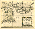 | Details | Bonne, Rigobert | 1778 |
| Antique miniature chart of the coasts of Normandy and Brittany |
|
Bonne, Rigobert |
|
| 1778 |
| LOC:0 |
| $0.00 | Bonne--Rigobert | Antique-miniature-chart-of-the-coasts-of-Normandy-and-Brittany | SOLD
<br></br>
Fine antique miniature nautical chart from 1778 of France's <b>Normandy and Brittany coastline</b> along the English Channel. Coverage at sea includes the Channel Islands of Guernsey, Jersey, and Alderney. Ports and towns shown include St. Malo, Avranche, Cherbourg, Barfleur, Bayeux, Caen, Havre du Grace (La Havre). This scarce chart was published during the golden age for miniature maps and is one of the few miniature charts printed during that period.
<br></br>
From Rigobert Bonne's miniature nautical atlas "Atlas maritime ou Cartes réduites de toutes les Côtes de France avec des cartes particulières des isles voisines les plus considérables, suivies des plans des principales villes maritimes de ce royaume." One of 12 miniature charts published in the Atlas Maritime. Published by Lattre from Paris. With the royal privilege. No. 3.
<br></br>
This scarce miniature copper-plate engraving contains much of the same information found on larger charts- rhumb lines; an adjustment for magnetic variation; numerous depth soundings; headlands, capes, navigation hazards and sand banks that are clearly identified.
<br></br>
Rigobert Bonne (1727-1794) was the successor to Jacques Nicolas Bellin as Royal Cartographer to France in the office of the Hydrographer at the Depôt de la Marine. Bonne first came to prominence when he published a number of charts in the Atlas Maritime in 1762. He is better known for later publications, including the Atlas Encyclopedique, which he collaborated on with Nicholas Desmarest, as well as the maps he produced for Raynal's Atlas de Toutes Les Parties Connues du Globe Terrestre, which was published in 1780. |
| 1236 | 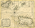 | Details | Bonne, Rigobert | 1778 |
| Antique miniature chart of Channel Islands Jersey Guernsey and Alderney |
|
Bonne, Rigobert |
|
| 1778 |
| LOC:0 |
| $0.00 | Bonne--Rigobert | Antique-miniature-chart-of-Channel-Islands-Jersey-Guernsey-and-Alderney | SOLD<br></br>
Fine antique miniature nautical chart of the <b>Channel Islands</b> (Îles de la Manche) in the English Channel off the French coast of Normandy. Coverage on this attractive miniature sea chart includes the islands of Jersey, Guernsey (Grenesey) , Alderney (Aurigni), Sark (Cers), Herm (Herms), Jethou (Gethou) and Brecqhou.
<br></br>
Despite its small size this scarce copper-plate engraving contains much of what is found on larger charts- anchorages are clearly marked; depth soundings are numerous; hazards and sand banks are clearly identified. In addition Bonne provides a great amount of detail about the interior topography and geography of the Channel Islands.
<br></br>
From Rigobert Bonne's miniature nautical atlas "Atlas maritime ou Cartes réduites de toutes les Côtes de France avec des cartes particulières des isles voisines les plus considérables, suivies des plans des principales villes maritimes de ce royaume." One of 12 charts published in the Atlas Maritime which are considered to among the very few miniature nautical charts published during the golden age of miniature maps . Published by Lattre from Paris. With the royal privilege. No. 10.
<br></br>
Rigobert Bonne (1727-1794) was the successor to Jacques Nicolas Bellin as Royal Cartographer to France in the office of the Hydrographer at the Depôt de la Marine. Bonne first came to prominence when he published a number of charts in the Atlas Maritime in 1762. He is better known for later publications, including the Atlas Encyclopedique, which he collaborated on with Nicholas Desmarest, as well as the maps he produced for Raynal's Atlas de Toutes Les Parties Connues du Globe Terrestre, which was published in 1780. |
| 1414 |  | Details | Bonne, Rigobert | 1787 |
| Northern Oblique Projection of eastern Hemisphere or Hemisphere Oriental. |
|
Bonne, Rigobert |
|
| 1787 |
| LOC:0 |
| $0.00 | Bonne--Rigobert | Northern-Oblique-Projection-of-eastern-Hemisphere-or-Hemisphere-Oriental- | SOLD<br></br>
Early antique projection covering the Eastern Hemisphere or "Hemisphere Oriental" taken from 45 degrees north latitude. Includes the North Pole, northern North America with Alaska; Africa, Madagascar, Europe, Japan, western Australia (Nouvelle Hollande"), and New Zealand. A very fine copper-plate engraved map produced by Rigobert Bonne and crisply and finely engraved by Andre to include mountain ranges and numerous place names. Includes two related views on the plate including one colorful view of the "Sphere Oblique" and another obtuse drawing labeled "Effet de Pesanteur".
<br></br>
Rigobert Bonne (1727-1794) was the successor to Jacques Nicolas Bellin as Royal Cartographer to France in the office of the Hydrographer at the Depôt de la Marine. Bonne first came to prominence when he published a number of charts in the Atlas Maritime in 1762, but Bonne is better known for later publications, including the Atlas Encyclopedique, which he collaborated on with Nicholas Desmarest, as well as the maps he produced for Raynal's Atlas de Toutes Les Parties Connues du Globe Terrestre. Published in Paris in 1787. Plate 24. |
| 1335 |  | Details | Bonne, Rigobert | 1787 |
| Western Hemisphere - Antique 45 Degree Southern Oblique Projection |
|
Bonne, Rigobert |
|
| 1787 |
| LOC:0 |
| $0.00 | Bonne--Rigobert | Western-Hemisphere---Antique-45-Degree-Southern-Oblique-Projection | SOLD
<br></br>
Early antique projection covering the Western Hemisphere taken from 45 degrees south latitude. Includes North America, South America, eastern Australia, New Zealand and the South Pacific Islands. The Hawaiian Islands are named the "Iles Sandwich."
<br></br>
An attractive copper-plate engraved map produced by Rigobert Bonne and crisply and finely engraved by Andre to include mountain ranges and numerous place names. Includes two related views on the plate including one colorful view of the "Sphere Oblique."
<br></br>
Rigobert Bonne (1727-1794) was the successor to Jacques Nicolas Bellin as Royal Cartographer to France in the office of the Hydrographer at the Depôt de la Marine. Bonne first came to prominence when he published a number of charts in the Atlas Maritime in 1762, but Bonne is better known for later publications, including the Atlas Encyclopedique, which he collaborated on with Nicholas Desmarest, as well as the maps he produced for Raynal's Atlas de Toutes Les Parties Connues du Globe Terrestre. Published in Paris in 1787. Plate 25. |
| 970 | 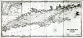 | Details | Blunt, E and G.W. | 1851 |
| Antique antbellum chart of Long Island Sound |
|
Blunt, E and G.W. |
|
| 1851 |
| LOC:0 |
| $0.00 | Blunt--E-and-G-W- | Antique-antbellum-chart-of-Long-Island-Sound | SOLD
<br></br>
Antique antebellum nautical chart of the coasts and islands comprising <b>Long Island Sound.</b> Coverage includes parts of the coasts of New York, Connecticut, and Rhode Island. Key features include Block Island, Fisher Island, <b>Mystic</b>, New London, New Haven, Darien, Stamford, Oyster Bay, Great Peconie Bay, Sag Harbor, Gardiners Bay, and Montauk Point. With numerous soundings, aids to navigation and, navigational hazards. Dated within at 1851.
<br></br>
With an inset map at upper right of New York City with <b>Manhattan</b>, the North River and East River.
<br></br>
From the 16th edition of the American Coast Pilot with other harbor charts, published by Edmund and George W. Blunt from New York. The Blunts were the most prolific private publishers of navigational charts in the United States in the mid 19th century. Page 41. |
| 36 | 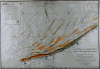 | Details | Beautemps-Beaupre, Charles-Francois | 1820 |
| Reconnoissance Hydrographique de la Cote Nord de France |
|
Beautemps-Beaupre, Charles-Francois |
|
| 1820 |
| LOC:0 |
| $0.00 | Beautemps-Beaupre--Charles-Francois | Reconnoissance-Hydrographique-de-la-Cote-Nord-de-France | SOLD<br></br>
Attractive large-scale antique copper-plate hydrographic chart of the French coast from Gravelines to Ostende by Charles-François Beautemps-Beaupré. Oriented with North at top of page indicated by a large compass circle (with shadow); surveyors lines and several sets of rhumb lines.
<BR> </BR>
Beautemps-Beaupre (1766-1854) was one of the earliest hydrographers to use isobaths to represent water depth. In this carefully colored chart he uses differently colored isobaths (light orange tones) to represent three depth categories : less than 10 feet ; between 10 and 16 feet; and between 17 and 24 feet. This detail along with hundreds of soundings demonstrates Beautemp-Beaupres' dedication to his profession, and suggests why he is considered by some to be the father of French hydrography.
<BR> </BR> |
| 44 | 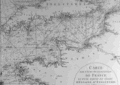 | Details | Mannevillette, d'Apres | 1780 |
| Carte des Cotes Occidentales de France |
|
Mannevillette, d'Apres |
|
| 1780 |
| LOC:0 |
| $0.00 | Mannevillette--d-Apres | Carte-des-Cotes-Occidentales-de-France | SOLD<BR> </BR>
Two-page black and white antique nautical chart of west France, northern Spain, southern Britain, and Ireland on chain-laid paper. Illegible watermark. Primary focus is coverage of the Gulf of Gascogne and the approaches to the English Channel. Small central compass rose with numerous rhumb lines. North at top of chart. Plate I. |
| 1206 | 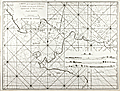 | Details | Mannevillette, d'Apres | 1775 |
| Chart of the Sunda Strait between Sumatra and Java |
|
Mannevillette, d'Apres |
|
| 1775 |
| LOC:59 |
| $0.00 | Mannevillette--d-Apres | Chart-of-the-Sunda-Strait-between-Sumatra-and-Java | SOLD
<br></br>
Fine original 18th century French nautical chart of the Sunda Strait ("Detroit de la Sonde") with Jakarta, Indonesia (Batavia) at extreme right. Very rare, no record of any sale of this chart is found in the AMPR, nor is any holding found online.
<br></br>
The Sunda Strait is a narrow waterway connecting the Java Sea to the Indian Ocean. Includes the Indonesian islands of Sumatra and Java. With four attractive inset elevation views of Sunda Strait and coast as seen from offshore. Numerous depth soundings and place names are provided. Engraved by Dheulland.
<br></br>
From J. B. d'Apres de Mannevillette's sea atlas "Le Neptune Oriental ou routier general des Cotes des Indes orientales et de la Chine." Jean-Baptiste d'Après de Mannevillette (1707 - 1780) was a French sailor, navigator, and hydrographer active in the mid-18th century. Mannevillette studied mathematics and navigation in Paris before winning a commission as an officer on a merchant vessel headed for the West Indies. Mannevillette collected and revised a number of regional nautical charts during numerous voyages around Africa to India and China.
<br></br>
Antique copper-engraving, published in Paris, ca. 1775. No folds. |
| 1207 | 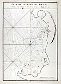 | Details | Mannevillette, d'Apres | 1775 |
| Early chart of Jeddah, Saudi Arabia |
|
Mannevillette, d'Apres |
|
| 1775 |
| LOC:0 |
| $0.00 | Mannevillette--d-Apres | Early-chart-of-Jeddah--Saudi-Arabia | <b>SOLD</b>, but see <a href="https://www.rarecharts.com/ShowDetail/Creator/Mannevillette--d-Apres/Title/Antique-chart-of-Jeddah-Gedda-Saudi-Arabia/4828" target="_blank">another example</a> now in stock.
<br></br>
Early French nautical chart of the anchorage of Jeddah, Saudi Arabia on the Red Sea. Shows the passage into the port of "Gedda" with a defensive wall. Curved elevation view of the coastline near Jeddah, Saudi Arabia. |
| 380 | 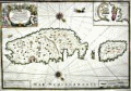 | Details | Michelot and Bremond | 1718 |
| Nouvelle Carte de 'lisle de Malthe (Malta) |
|
Michelot and Bremond |
|
| 1718 |
| LOC:0 |
| $0.00 | Michelot-and-Bremond | Nouvelle-Carte-de--lisle-de-Malthe-(Malta) | SOLD
<br></br>
Highly desirable antique nautical chart of the eastern Mediterranean islands of Malta ( Malthe ), Gozo ( Goze ), and Comino. The chart is the scarce, folio-sized nautical chart of Malta, Gozo, and Comino by French galley pilot Henry Michelot and Laurens Bremond dated 1718: "Nouvelle Carte de 'lisle de Malthe… ".
<BR> </BR>
A unique feature of this antique chart is the spouting sea serpent, not found on any of the other 17 charts by Michelot and Bremond, <a style=rel="nofollow" href= "/MichelotBremondBackground.aspx">Marseilles based cartographers</a> associated with the French Galley Service- the 'Corps des Galeres'.
<br></br>
Contains rhumb lines, two decorative compass roses and a large inset of the port of Valetta. Adorned with a decorative cartouche of unclothed captive Muslim slaves and numerous cannon, flags and other martial symbols. Contains extensive interior detail of towns, villages, hills, aqueducts, and defenses. |
| 403 |  | Details | Bellin, Jacques Nicolas | 1752 |
| Philippines |
|
Bellin, Jacques Nicolas |
|
| 1752 |
| LOC:0 |
| $0.00 | Bellin--Jacques-Nicolas | Philippines | SOLD<br></br>Early map of the Philippines Islands by Bellin after Velarde . Dated 1752 in cartouche |
| 739 | 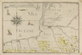 | Details | Tassin, Christophe Nicholas | 1634 |
| Antique Chart of the Basque Guyenne and Biscay Coasts |
|
Tassin, Christophe Nicholas |
|
| 1634 |
| LOC:0 |
| $0.00 | Tassin--Christophe-Nicholas | Antique-Chart-of-the-Basque-Guyenne-and-Biscay-Coasts | SOLD
<br></br>
Antique engraved and very scarce 380 year-old chart of the Basque Region (coastal areas of Spain and France directly north of the Pyrenees mountains) by French cartographer Christophe Nicholas Tassin. The chart was published in 1634 as part of Tassin's "Cartes Generale et Particulieres de toutes le costes de France Tant de la Mer Oceane que Mediterranee"... Coverage includes the "Coste de Guyenne" (archaic name for the Aquitane region of France) with Saint-Jean-de-Luz, Biarritz ,and Bayonne, France. In Spain, San Sebastien, Pasaia (le Pasage), Hondarribia (Funtarabie) on the Biscayan Coast.
<br></br>
This rare antique chart is not from the common series of town views in pocket atlas format published by Tassin but from the earliest atlas of charts specifically of coastal areas published by Tassin in France ca. 1634. Contains a beautifully desgned and intricately engraved compass rose with sixteen points. Surrounded by small sailing vessels and a fantastical sea monster.
<br></br>
See
<a href="http://gallica.bnf.fr/ark:/12148/btv1b77100033. " target="_blank">this page</a> at the Bibliotheque national de France for all the maps in Tassin's scare coastal atlas.
<br></br>
Nicholas Tassin's background included a long period of employment as a military engineer and his printed works often show militarily important sites, either sketched on site, composed from firsthand drawings by military engineers, or sometimes borrowed from other mapmakers. Additionally, Tassin also published several small sized atlases with inspired profiles of French towns and maps of the provinces.
<br></br>
Published in Paris: Chez Melchior Tavernier, en lisle du Palais, vis à vis la quay de la Megisserie. |
| 1000 |  | Details | Tassin, Christophe Nicholas | 1636 |
| Antique title page for Tassins French town atlas |
|
Tassin, Christophe Nicholas |
|
| 1636 |
| LOC:0 |
| $0.00 | Tassin--Christophe-Nicholas | Antique-title-page-for-Tassins-French-town-atlas | SOLD<br></br>
Beautiful antique title page for the "Premiere Partie" or first part of Tassin's small atlas of French towns. This hand-colored copper-engraved title page shows cherubs stretching a sheet bearing the title over a sleeping nude female figure. Resting near the nude are a globe, backstaff (an early navigational instrument), and a compass, each reflecting Tassin's interest in cartography. A substantially fine example of 17th century engraving craftsmanship and artistry.
<br></br>
Published in the small-sized atlas "Les Plans et profils de toutes les principales villes et lieux considerables de France" by Christophe Nicholas Tassin (d. 1660) . Tassin's background was as a military engineer, and he is best known for his nautical atlas of 30 sheets, dedicated to Richelieu, documenting France's coastline. Tassin's work contains topographic maps, often of militarily important sites, either sketched on site, composed from firsthand drawings by military engineers, or sometimes borrowed from other mapmakers. |
| 1365 |  | Details | Tassin, Christophe Nicholas | 1638 |
| NOT AVAILABLE Magnificent Antique Map of the Coast of Provence, France |
|
Tassin, Christophe Nicholas |
|
| 1638 |
| LOC:0 |
| $0.00 | Tassin--Christophe-Nicholas | NOT-AVAILABLE-------Magnificent-Antique-Map-of-the-Coast-of-Provence--France | What a stunning and special map! Spectacular large nautical map of the coastline of Provence, France and Languedoc. Beautiful decorative map (1638) by Christophe Nicolas Tassin shows the French coastline from Port-de-Bouc to Nice. Includes a large, decorative title cartouche, 18 galleys and other sailing vessels, several sea monsters and three gorgeous compass roses. Done in a style somewhat unique to Tassin, with outlandish creatures comprising the cartouches and numerous ships and aquatic sea monsters filling the empty spaces on the map.
<br></br>
In 3 sheets joined, now restored and laid to linen. Without the attribution to Tassin "Geographe ordinaire" or the date.
<br></br>
Tassin's background was as a military engineer. Tassin's work contains topographic maps, often of militarily important sites, either sketched on site, composed from firsthand drawings by military engineers, or sometimes borrowed from other mapmakers. Additionally, Christophe Tassin also published several small sized atlases with profiles of French towns and maps of the provinces.
<br></br>
A very early map from Tassin who authored the first atlas of the French coast "Cartes Generale et Particulieres de toutes le costes de France" in 1634. This map from Tassin's "Les cartes generales de toutes les provinces de France royaumes et provinces de l'Europe. Revues corrigées & augmentées par le Sieur Tassin geographe ordinaire de sa Magesté" |
| 24 | 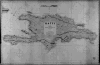 | Details | James Imray and Son | 1885 |
| Haiti (Blueback) |
|
James Imray and Son |
|
| 1885 |
| LOC:0 |
| $0.00 | James-Imray-and-Son | Haiti-(Blueback) | NOT AVAILABLE
<BR> </BR>
Large, handsome, original blueback nautical chart of Haiti / San Domingo (now the Dominican Republic) from James Imray and Son with the eastern-most tip of Cuba visible. Strong graphic composition. Profile view at top of "Port Paix or Valpariso, distant 3 miles". <BR> </BR>
The original, antique nautical chart is surrounded with six compass roses and is marked with the Imray globe / laurel wreath emblem . Four lighthouses are highlighted in yellow, while the title cartouche inset contains the following warning: "The lights are of inferior brilliancy and badly attended: some of them may not be shown." <br/><br/>
Verso contains complete yellow Imray publishers label: "Chart No. 119 Haiti or San Domingo".
<BR> </BR>
For more information on the evolution of blueback charts we recommend this book by Susanna Fisher:
<a target="_blank" href="http://www.regattapress.com/The_Makers_of_the_Blueback_Chart.html">The Makers of Blueback Charts.</a> |
| 837 | 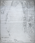 | Details | James Imray and Son | 1872 |
| Bay of Bengal with The Andaman and Nicobar Islands |
|
James Imray and Son |
|
| 1872 |
| LOC:0 |
| $0.00 | James-Imray-and-Son | Bay-of-Bengal-with-The-Andaman-and-Nicobar-Islands | SOLD<b></b>
Antique blueback nautical chart of the Eastern part of the Bay of Bengal. Includes the Myanmar ( Burma ) coast; a portion of the Thailand coast including Phuket; the Northwest coast of Sumatra including Banda Aceh; and the Andaman and Nicobar Islands, a territory of India. Ten inset charts of: Port Cornwallis, St. Georges Channel, Pulu Milu, Galatea Bay, Port Campbell, the Rangoon River, Amherst Road, Port Blair, Penang, and Nangcovri Harbor.
<br></br>
Chart includes North Sentinel Island off the West coast of South Andaman Island. That island is home to the Sentinelese people, one of the last paleolithic ( early stone age) tribes, of between 50 and 400 persons. The Sentinelese fiercely resist contact with the outside world and are reported to have survived the 2004 Tsunami by moving to higher ground in advance, almost as though they knew what to expect.. In 2006 the Sentinelese are reported to have fired arrows at two fishermen, kiling them after they were wrecked on the island.
<br></br>
During the 1800's there was a trend toward publication of very large small-scale charts with large-scale insets of key passages and harbors. The practice was adopted as much for economics as any other reason. James Imray and Son was one of a handful of British publishers who specialized in these charts which were often backed with canvas or linen cloth or heavy blue paper in order to help them withstand the frequent use and abuse aboard ship, hence the term "blueback chart".
<br></br>
With an oval-shaped blue ink over-stamp that reads: "Imray and Son 1872 London".
<br></br>
Published by James Imray and Son, 89 Minories and Tower Hill 1870. Laid to blue paper for protection. Yellow label from the Imray firm attached on verso that reads "James Imray and Son, Hydrographers." |
| 140 | 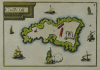 | Details | Tassin, Christophe Nicholas | 1636 |
| Chateau d'If |
|
Tassin, Christophe Nicholas |
|
| 1636 |
| LOC:0 |
| $0.00 | Tassin--Christophe-Nicholas | Chateau-d-If | SOLD<BR> </BR>
Scarce antique island map by Nicolas Tassin from 1636. Highly decorative map shows the island fortress, Chateau d'If, on the island of If located in the Bay of Marseilles, close offshore from the town of Marseilles. The engraving shows the island, surrounded by numerous galleys and other sailing vessels. At the time this engraving was made Marseille was the primary Mediterranean base for the French Corps des Galeres.
<br></br>
Published in the small-sized atlas "Les Plans et profils de toutes les principales villes et lieux considerables de France" by Christophe Nicholas Tassin (d. 1660) . Tassin's background was as a military engineer, and he is best known for his nautical atlas of 30 sheets, dedicated to Richelieu, documenting France's coastline. Tassin's work contains topographic maps, often of militarily important sites, either sketched on site, composed from firsthand drawings by military engineers, or sometimes borrowed from other mapmakers. |
| 870 | 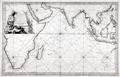 | Details | Bellin, Jacques Nicolas | 1757 |
| French sea chart of the Indian Ocean with Australia |
|
Bellin, Jacques Nicolas |
|
| 1757 |
| LOC:0 |
| $0.00 | Bellin--Jacques-Nicolas | French-sea-chart-of-the-Indian-Ocean-with-Australia | SOLD
<br></br>
Attractive antique French sea chart of the Indian Ocean with Australia, the southern half of Africa, Madagascar, Reunion Island ( "Île Bourbon" ), the Red Sea, Saudi Arabia and the Persian Gulf, India, Malaysia, Indonesia, the Philipines, and Taiwan. Key cities on this 1757 nautical chart include Macao, Manilla, Jakarta ( "Batavia" ), Mumbai ( "Bombay" ), Mecca ( "la Meque" ), and Cape Town.
<br></br>
Bellin's depiction of the west coast of of Australia ("Terres Australes" or "Nouvelle Hollande") is worth a few words. At the time the chart was produced in the mid-eighteenth century much the Australian coastline was poorly charted. The coast of Australia was first sighted and charted by by Willem Janszoon aboard the Dutch vessel Duyfken in 1606. Later Dutch, French and English explorers including William Dampier added to the outline of west Australia, but there was still significant uncertainty about coastal detail and location. Bellin conveys this ambiguity by the use of a very light and often broken outline for most of the south and west coastline. Where Bellin felt more certainty, as on the north coast he used a bold engraved outline with hachured coastal relief to convey a sense of certitude. Bellin provides three notes referring to his sources. Translated from French they are roughly:
<div class="indenttextblock">
<ul>
<li>Terre de Concorde discovered in 1628., </li>
<li>Bay of Sea-Dogs ( "Chiens Marines" ) [or Shark Bay], viewed by Dampier in 1699. , and</li>
<li>Coast viewed by Mr. Duquesne in 1687.</li>
</ul></div>
Attractive title cartouche with palm trees and African animals including a crocodile, elephant, and lion. As stated in the title the chart was produced for use by the French Navy. Unlike many other French charts there is no price noted, substantiating the premise that this copy was not intended for public consumption. |
| 830 | 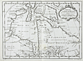 | Details | Bellin, Jacques Nicolas | 1757 |
| Antique French map of Hudson Bay |
|
Bellin, Jacques Nicolas |
|
| 1757 |
| LOC:0 |
| $0.00 | Bellin--Jacques-Nicolas | Antique-French-map-of-Hudson-Bay | SOLD<br></br>
Fascinating antique French map records Britain's dominions in the Northeast before the U.S. Revolutionary war. Coverage includes portions of the Canadian provinces of Nunavut, Manitoba, Ontario, and Quebec along with Hudson Bay, the second largest bay in the world after the Bay of Bengal. Noted features include Repulse Bay, James Bay, Labrador, the Isle de Bonne Fortune, Hudson Strait, and Cumberland Bay.
<br></br>
Along the shores of lower James Bay are several forts including Fort Albany, Fort de St. Louis, Fort Rupert. The bay is named after British explorer Henry Hudson who discovered the bay while searching for the Northwest Passsage under the auspices of the Virginia Company and the British East India Company. Hudson and a few of his men were set adrift and marooned in Hudson's Bay in June of 1611 by mutineers among the crew of his ship, the Discovery.
<br></br>
This map is from Bellin's Histoire Generale des Voyages. |
| 1395 | 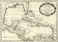 | Details | Bellin, Jacques Nicolas | 1754 |
| Gulf of Mexico and Caribbean Antique Original Map |
|
Bellin, Jacques Nicolas |
|
| 1754 |
| LOC:0 |
| $0.00 | Bellin--Jacques-Nicolas | Gulf-of-Mexico-and-Caribbean-Antique-Original-Map | SOLD<br></br>
Original mid 18th-century French map of the Texas, Louisiana, Alabama, Florida, coastline with the Gulf of Mexico, Central America, Caribbean islands and Antilles.
<br></br>
Framed, glazed, and double matted. Size with frame 20" x 17".
<br></br>
This original antique map by Nicolas Bellin contains the tracks of explorers including Cortez, Ponce de leon, and the lesser-known Francisco Hernández de Córdoba, an early explorer of Mexco's Yucatan peninsula.
<br></br>
Published in a French edition of L'Abbe Prevost's "Histoire Générale des Voyages". Tome 12, No. 1. |
| 176 |  | Details | Bellin, Jacques Nicolas | 1765 |
| Carte des Variations de la Boussole |
|
Bellin, Jacques Nicolas |
|
| 1765 |
| LOC:0 |
| $0.00 | Bellin--Jacques-Nicolas | Carte-des-Variations-de-la-Boussole | NOT AVAILABLE <BR> </BR> Spectacularly decorative antique nautical map of the World from the 'Hydrographie francoise' by Jacques Bellin. Displays compass variation and prevailing wind direction across the globe. Australia is shown with only a partial coastline as "Terres Australis" or "Nouvelle Hollande" and the U.S. Pacific Northwest with no coastal detail.<BR> </BR>
Winds are represented as small cherubs with puffed cheeks. Huge rococo cartouche at right is decorated with cornucopia and numerous floral elements; capped with a crowned globe bearing the three fleur-de-lis that have been an emblem on the French coat of arms from the 14th century. This antique map of the world was produced by J.N. Bellin, the first French "Ingenieur de la Marine" towards the end of his career in 1765. The dedicatory cartouche to the Minister of War, the Duke de Choiseul, is as much a tribute to Bellin as to the minister as it lists his several accomplishments: "Ingenieur de la Marine", "Censeur Royal de l'Academie de Marine et de la Societe Royale de Londres". |
| 255 |  | Details | Bellin, Jacques Nicolas | 1759 |
| Carte du Comte de Kent et du Pas de Calais |
|
Bellin, Jacques Nicolas |
|
| 1759 |
| LOC:0 |
| $0.00 | Bellin--Jacques-Nicolas | Carte-du-Comte-de-Kent-et-du-Pas-de-Calais | SOLD
<BR> </BR>
Full colored old antique nautical chart produced by the Depot de la Marine in 1759. This chart, produced by J.N. Bellin, covers many areas of historical importance including the English Channel, and the Thames river as far as London, Dover, Calais, Beachy Head, Dunkirk. Good coverage of inland cities, towns, and road in England including New Haven. Croydon, Bromley, Deal, Sandwich, Rochester and many, many more. Numerous soundings and details of the sandbanks near Dover, Dunkirk, and the entrance to the Thames River. Highly decorative dated cartouche at bottom right. |
| 1077 |  | Details | Anonymous | 1890 |
| Patriotic American Frontispiece with Berghaus's Star Projection |
|
Anonymous |
|
| 1890 |
| LOC:0 |
| $0.00 | Anonymous | Patriotic-American-Frontispiece-with-Berghaus-s-Star-Projection | SOLD<br></br>
Interesting small print reflecting the USA's perceived importance to the world. An American bald eagle hovers above a map of the world shown with Berghaus's Star Projection.
<div class="indenttextblock">
A variation of Petermann's map, Hermann Berghaus's star projection (1879) reduced the number of appendages to five uniform lobes, with boundary meridians at 160°W, 88°W, 16°W, 56°E and 128°E. Of all major land masses, Australia and Antarctica are interrupted. This design became much more popular than Petermann's, appearing in atlases and in the logo of the Association of American Geographers. (Retrieved 5/18/2016.
<a href="http://www.progonos.com/furuti/MapProj/Normal/ProjInt/ProjStar/projStar.html" target="_blank">Internet </a>)
</div>
<br></br>
Below the image is a ribbon with the motto of the United States: "e pluribus unum". Probably published in the last two decades of the 19th century. |
| 133 | 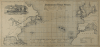 | Details | Anonymous | 1882 |
| Track Chart Norddentsher Lloyd, Bremen |
|
Anonymous |
|
| 1882 |
| LOC:0 |
| $0.00 | Anonymous | Track-Chart--Norddentsher-Lloyd--Bremen | SOLD
<br></br>
Small ship's track chart / nautical map of Atlantic Ocean produced by the Norddentsher Lloyd shipping company that was used by a passenger to track his progress on a Transatlantic cruise. Details the daily position and miles made good on a voyage from Sandy Hook, New Jersey to England between August 31 and September 8, 1887 with a Captain Richler. With an inset of a steamer underway. |
| 6727 |  | Details | Anonymous | 1937 |
| The Meridian Highway Main Street of North America |
|
Anonymous |
|
| 1937 |
| LOC:13 |
| $0.00 | Anonymous | The-Meridian-Highway-Main-Street-of-North-America | SOLD<br><br>Attractive, scarce, lithographed 1937 map of U.S. Highway 81 "The Meridian Highway, the Main Street of North America", Hadley Sumner, Selling Agent. Apparently a promotional insert as the bottom states: "For complete information inquire Chamber of Commerce at address on other side." Insert illustrations of the International Bridge at Laredo, Texas, the Meridian Bridge on the Missouri River as well as commercial exports: wheat, corn, cattle. and a lake.
<br><br>
The Meridian Highway was established in 1911-12 as a major north-south route through the Great Plains from Canada to Mexico, following the land division grid parallel to the sixth principal meridian. Originally known as the Meridian Road, it primarily served as a farm-to-market road, passing through each county seat along the way. The Meridian Highway Association was formed in 1911 to promote and map the highway, consisting of representatives from the states, counties, and cities along the route. The completion of the Meridian Highway Bridge in 1924 at the Missouri River between Yankton, South Dakota, and Nebraska marked a significant evolution of the route into a modern highway. Today, the Meridian Highway is the foundation of one of the busiest and most significant transportation corridors in the nation, crossing over 800 miles of Texas and passing through major cities such as Wichita Falls, Fort Worth, Waco, Austin, San Antonio, and Laredo.
<br><br>
Verso is blank. Executed by Epsten Litho. Co. Omaha. |
| 1337 | 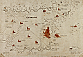 | Details | Anonymous | 1660 |
| Very old manuscript map of Guernsey Island |
|
Anonymous |
|
| 1660 |
| LOC:0 |
| $0.00 | Anonymous | Very-old-manuscript-map-of-Guernsey-Island | SOLD <br></br>
<br></br>
Very old manuscript map of the island of Guernsey ( "Gernsaye" ), one of the Channel Islands in the English Channel near the French coast. Estimated ca. 1660. Locates all the churches on the island. Saint Peter Port is referenced only as "the towne". The map shows the "Chastion Cornet" or Castle Cornet offshore where today it is but a short walk from town center.
<br></br>
Manuscript signature at bottom "Reginaldo Wolfio Autore". The map does not appear to be drawn with much skill, raising the possibility that this is a quick copy of another work, perhaps a map of Guernsey by Blaeu. Contains many of the guide lines used to construct the map, perhaps based on bearings from key points.
<br></br>
A few wormholes passing through the original and the backing paper suggest substantial age to the work. |
| 4775 | 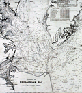 | Details | Anonymous | 1870 |
| Antique Chart Fragment of Chesapeake Bay |
|
Anonymous |
|
| 1870 |
| LOC:0 |
| $0.00 | Anonymous | Antique-Chart-Fragment-of-Chesapeake-Bay | SOLD<br /><br />Interesting antique fragment covering lower Chesapeake Bay cut from a large 19th-century nautical chart. This relic, formerly an inset chart in a much larger rolled sea chart, shows the entrance to Chesapeake Bay with parts of Virginia and Delaware.
<br></br>
Contains many interesting pencil manuscript compass bearings off the <b>Cape Henry lighthouse</b> which was the first such navigational aid to be built in the Chesapeake Bay. Built in 1792 at a cost of $24,076 the light at Cape Henry burned tuna fish oil, whale oil, colza oil, and lard oil. The light was only updated to burn kerosene in 1859 after petroleum oil was found in Pennsylvania. (Morrison and Hansen. Charting the Chesapeake).
<br></br>
As stated in the title, the topographic and hydrographic detail is from the U.S. Coast Survey, therefore this was likely a privately published chart. Coastal outline is very dark, suggesting that the author was George Eldridge.
<br></br>
Dated probably to the last half of the 19th century. The Willoughby Spit Lightship, off the entrance to Hampton Roads, has been crossed out in pencil. A bit of research reveals that in 1872 the lightship was replaced with what is now the Thimble Shoals light. That fact suggests the source chart was printed before 1872 and used at sea after 1872. |
| 4845 |  | Details | Anonymous | 1945 |
| WWII MS Cartoon Map of Vita Levu, Fiji Islands |
|
Anonymous |
|
| 1945 |
| LOC:200 |
| $0.00 | Anonymous | WWII-MS-Cartoon-Map-of-Vita-Levu--Fiji-Islands | SOLD<br><br>
Artistically produced manuscript G.I. pictorial map from World War 2 era of Fiji's largest island, Vita Levu. Full of small cartoonish drawings of island life, especially as related to the military with Div. HQ. Suva noted near Suva Bay and Natambua OCS (Officer Candidate School).
<br></br>
Some of the cartoons could suggest a feature in a specific geographic area on Vita Levu but other drawings seem to commemorate group events like a fishing expedition to the nearby Yasawa islands. Viewed as a graphical record of a trip to OCS, the map would document the group's arrival by cargo ship, their overland trip to the OCS by car and then train, passing an airbase; then their arrival and recreation at OCS including swimming and fishing. At mid right a grass-skirted long-haired native offers a G.I. a drink of Fiji's national beverage, Kava.
<br></br>
There was threat of Japanese invasion for the majority of 1942 and part of 1943, which resulted in a build up of military forces and defensive installations. However, World War 2 never reached Vita Levu or any Fijian Island in the South Pacific. In later years, Fiji was used as a forward base for the Allied forces, which resulted in the construction of transportation infrastructure, as well as an influx of Allied troops and supplies coming into the island. Dated as 1945 with the view that fishing expeditions would have been frowned upon in a potential combat theater, thus post-dates WWII. |
| 5249 |  | Details | Anonymous | 1910 |
| Cyanotype blueprint map Shaw Ranch Webb County Texas |
|
Anonymous |
|
| 1910 |
| LOC:10 |
| $0.00 | Anonymous | Cyanotype-blueprint-map--Shaw-Ranch-Webb-County-Texas | SOLD
<br></br>
Rare cyanotype or blueprint map of the Shaw Ranch along the Rio Grande River in Webb County, Texas. Date est ca. 1910 (possibly 19th C.). Includes the Huajolote (Guajolote) Ranch and pasture of 24,481 acres (near center), the Antonio Guerra tract of 13,000 acres and the Loza pasture of 15,942 acres.
<br></br>
At lower right a context or key map shows the location of the Shaw Ranch with respect to Texas' boundaries and to the town of San Antonio.
<br></br>
The Shaw ranch was originally the property of Felix Motlow Shaw (1859 - 1908) a trail driver, rancher, and cattleman. Shaw was known as one of two cattlemen who introduced shorthorn bulls to the Carizzo Springs area. After Felix Shaw's death in 1908, Shaw's wife, Florence Terry Shaw, took over and successfully managed the ranch, expanding her holdings to over 100,000 acres.
<br></br>
Remarried, Florence Terry Griswold (1875 – July 7, 1941) was the first woman delegate of the Texas Cattle Raisers Association and for several years the only female delegate. She was a staunch supporter of women's equality, worked as a suffragist for many years and later fought for equal pay for women. Florence T. Griswold is best known as the founder of the Pan-American Round Tables in 1916. |
| 6575 |  | Details | Douglass, Richard M. | 1981 |
| Scarce Scientology map, the First Theta Map of North America |
|
Douglass, Richard M. |
|
| 1981 |
| LOC: |
| $0.00 | Douglass--Richard-M- | Scarce-Scientology-map--the-First-Theta-Map-of-North-America | SOLD
<br><br>
Scarce second-edition (1) hand-colored lithographed pictorial "Theta Map of North America" created by Richard M. Douglass and published by the Friends of the Safe Environment Fund in 1981. Signed and numbered below the plate in pencil. Number 54 of 310. Provenance: the estate of Richard M. Douglass.
<br><br>
Outer border of the map is filled with names of contributors to the Friends of the Safe Environment Fund. Printed by Aberdeen Road Graphics.
<br><br>
In the 1970's Scientologists conducted "Operation Snow White", an effort to infiltrate and burglarize government offices, mainly in the United States, including the Drug Enforcement Administration, the Internal Revenue Service, and the Coast Guard, These organizations were considered to be enemies of Scientology. In 1977 the FBI raided Church of Scientology locations in Los Angeles, Hollywood and Washington, D.C. and as a result charged 11 members of Scientology including Mary Sue Hubbard, Cindy Raymond, Gerald Bennett Wolfe, Henning Heldt, Duke Snider, Gregory Willardson, Richard Weigand, Mitchell Herman, Sharon Thomas, Jane Kember, and Mo Budlong. ultimately resulting in jail time for five of the accused. The Friends of the Safe Environment Fund was established to help pay the legal expenses of the accused Scientologists. Signed on the original first monochrome edition by several of the individuals above who were charged by the government (e.g., not manuscript this edition).
<br><br>
Art and Design by Paul Breeden (Credited with artwork for Ability magazine by L. Ron Hubbard in 1961).
Cartography by Pati Armstrong.
<br><br>
(1) No copies of the colored version of Douglass's Theta Map are found online and only two copies of the first edition ( lacking color ) are known to exist. |
| 6577 |  | Details | Langwith, A. L. | 1930 |
| Langwiths Pictorial Map of Minnesota |
|
Langwith, A. L. |
|
| 1930 |
| LOC:400 |
| $0.00 | Langwith--A--L- | Langwiths-Pictorial-Map-of-Minnesota | SOLD
<br><br>
Fine lithographed pictorial map of the State of Minnesota ca. 1930 from the golden-age of pictorial maps. Rare.
<br><br>
Prominent advertisement for "Webb's high-test antiknock gasoline with tetraethyl" at upper right.
<br><br>
<img src="/ZoomifyImages/SC_6577/SC_6577_title.gif" alt="Key West navigational beacons (day marks)" width="300" align="center" style="margin: 0px 20px 0px 20px">
<br><br>
Copyright by A.L. Langwith, Minneapolis, Minnesota. Published by Langwith Map Company. Price when sold: $2.50. Folding map/mailer. Printing on verso. |
| 6683 |  | Details | Western Union | 1930 |
| Transatlantic Cables Western Union Thematic World Bathymetric Chart Art Deco |
|
Western Union |
|
| 1930 |
| LOC:150 |
| $0.00 | Western-Union | Transatlantic-Cables-Western-Union-Thematic-World-Bathymetric-Chart-Art-Deco | SOLD<br><br>
Scarce thematic map of the world with Western Union's routes for underwater telegraphy cables (1) between Western Europe and the United States during the period between the wars. Dated circa 1930 based on the attention given to the Art-Deco style Western Union Building in N.Y.C. that was built in 1930. Sub-title notes Western Union key communications nodes between France, Holland, Germany, and Great Britain to New York, Boston, Washington, Montreal, and Toronto.
<br><br>
<div id="0" align="center">
<a title="Western Union Communications Network Nodes in 1930"></a>
<img id="3" src="/ZoomifyImages/SC_6683/SC_6683_Detail.jpg" alt="Thematic world map Western Union's underwater telegraphy cable network in 1930." width="320"/> <br><small>Western Union Communications Network Nodes. 1930.</small>
</div>
<br>
The main focus of the work is a 1930 snapshot of Western Union's wireless network (dashed red lines) and the cable network, shown (solid red lines) overlayed on a bathymetric chart with a bird's eye view of the ocean floor (if birds had x-ray vision). The bathymetric chart is surrounded with text and images relating to cable-laying ships including the Great Eastern (2).
<br><br> |
| 6706 |  | Details | Taylor, H. E. | 1881 |
| Manuscript topographic map of Roque Island Archipelago, Maine |
|
Taylor, H. E. |
|
| 1881 |
| LOC:9999999 |
| $0.00 | Taylor--H--E- | Manuscript-topographic-map-of-Roque-Island-Archipelago--Maine | SOLD<br><br>
An unrecorded finely-executed pen and ink manuscript map of Roque Island, Maine by surveyor H.E. Taylor of Machias, Maine. A presentation-quality survey with careful lettering and light wash hand-color laid to linen and edged with red selvage.
<br><br>
The survey was probably commissioned by Gilbert Longfellow (1), as it credits assistance from H.W. Longfellow, who was most likely Henry, Gilbert's son. Additionally, the map was made less than a year before the Longfellow family sold Roque Island to the Gardner family. Numerous features are noted including:
<div class="indenttextblocksingle">
<ul style="list-style-type: circle;"></li>
<li>the "old tide mill dam"</li>
<li>"old camp , shell heaps" on Romney Point</li>
<li>"Inspiration Point"</li>
<li>"burial ground"</li>
<li>"Devil's stairway"</li>
<li>"Clam Cove</li>
<li>"Great Beach"</li>
<li>"Roaring Cavern"</li>
<li>"Indian Landing"</li>
</ul>
</div>
This is the earliest large-scale map of the Roque Island Archipelago I have been able to locate. No holdings of this map are recorded in WorldCat or elsewhere online. At Harvard there is another similar map by Taylor from 1881- "Longfellows Island (formerly Shorey's): with adjacent islands and part of Englishmans River Neck".
<br><br>
Note: The full title of the Roque Island map is: "Topographical Map of Roque Island, Maine area 1274 acres and including barred islands 1309.3 acres Surveyed August 1881 with assistance of H.W. Longfellow & J. U. Chandler. By H. E. Taylor Civil Engineer and Surveyor."
<br><br> |
| 6812 |  | Details | Bates, George T. | 1975 |
| Megumaage Micmac Indian Historical Map of Nova Scotia |
|
Bates, George T. |
|
| 1975 |
| LOC:10101 |
| $0.00 | Bates--George-T- | Megumaage-Micmac-Indian-Historical-Map-of-Nova-Scotia | SOLD<br><br>
A fine blueprint-style historical map of Nova Scotia, Canada with English and the Micmac (Mi'kmaq) Indian language place name translations. Scarce. Shows the locations of Micmac campsites and shell middens including the Indian Gardens and Gaspereaux River campsites.
<br><br>
Compiled, copyrighted, and drawn by Nova Scotia surveyor George T. Bates. Undated but ca. 1975. Apparently this map is a later edition of the map by Bates that was first issued in 1965. Bates is also credited with "A New Series of Historical Maps of Nova Scotia."
<br><br>
Contains tables with translations of Micmac names for the months and seasons, birds, numbers, trees, and the Lord's Prayer. Additional tables at bottom left with time series data for Micmac population in Nova Scotia and information about the land area and location of Micmac Indian Reserves in Nova Scotia.
<br><br>
Only two examples of this map are recorded in WorldCat.
<br><br>
The author describes the extent of Micmac habitation:
<div class="indenttextblocksingle">
"The Micmacs occupied not only the whole of the Province of Nova Scotia including Cape Breton but also the northern and eastern provinces of New Brunswick and the nearby Prince Edward Island. They are a branch of the Algonquins, which includes all the tribes along the Atlantic Coast from Virginia to Labrador. The Micmac territory was divided into separate districts, each having its own chief. The Indian name for their territory was Megumaage, meaning Micmacland or "the home of the Micmacs."
</div> |
| 6828 |  | Details | West, Beatrice | 1946 |
| Rare humorous pictorial map of Texas |
|
West, Beatrice |
|
| 1946 |
| LOC: |
| $0.00 | West--Beatrice | Rare-humorous-pictorial-map-of-Texas | Sold<BR><BR>Rare humorous pictorial map of Texas titled "The United States as seen through the eyes of Texas" by Beatrice West, Dallas, Texas. West's map depicts the State of Texas as occupying about a third of the area of the United States, with comic place names. The Pacific Ocean, Gulf of Mexico, and Atlantic Ocean are called Nimitz' River, Texas' Ocean, and Eisenhower's Lake respectively. Copyright 1946.
<br><br>
Only two examples of the map are recorded in WorldCat, one at LOC. No copies found on the Internet.
<br><br>
The Catalog of Copyright Entries shows an entry for January 28, 1947 at a size of 29 1/2 cm x 40 cm, precisely matching the dimensions of our example.
<br><br>
In 1948 West issued a similar copyrighted linen postal card containing significant changes in content, particularly in the text. (1)
<br><br>
Note: any fuzziness or misalignment in the displayed image is an artifact solely due to the joining of two photo images.
<br><br>
(1) Online. https://texashistory.unt.edu/ark:/67531/metapth121616/m1/1/ |
| 6607 |  | Details | Noville, George O. | 1933 |
| Antarctic Little America Aviation and Exploration Club Map |
|
Noville, George O. |
|
| 1933 |
| LOC:65 |
| $0.00 | Noville--George-O- | Antarctic-Little-America-Aviation-and-Exploration-Club-Map | SOLD<br><br>Apparently scarce polar map of Antarctica created and copyrighted by George O. Noville and published by the Tide Water Oil Company in 1933. Little America was a series of Antarctic exploration bases from 1929 to 1958, founded by Admiral Richard E. Byrd. Little America I and II were located south of the Bay of Whales on the Ross Ice Shelf.
<br><br>
<div class="indenttextblocksingle">
"… promotional map was issued with the claim that was used exclusively by Byrd on both his Antarctic Expeditions. Members of the Little America Aviation and Exploration Club received reports on expeditions, so that they could plot their progress on the map. Only the known, explored parts of the continent are depicted. Shaded areas indicate land permanently covered by ice and snow while white areas indicate unexplored land." (1)
</div>
<br>
No sales of this map are recorded in AMPR and only two institutional holdings are noted in WorldCat.
<br><br>
George Otto Noville (1890-1963), winner of the Distinguished Flying Cross, was an aviation pioneer who served with Admiral Byrd during Byrd's first and second expeditions to Antarctica.
<br><br>
(1) Online. Accessed 1/23. https://oshermaps.org/exhibitions/to-the-ends-of-the-earth/section-8 |
| 6623 |  | Details | Sundberg, Edwin L. | 1944 |
| Thematic Map Pulse of the Nation for U.S. Death Rates |
|
Sundberg, Edwin L. |
|
| 1944 |
| LOC:300 |
| $0.00 | Sundberg--Edwin-L- | Thematic-Map-Pulse-of-the-Nation-for-U-S--Death-Rates | SOLD<br><br>
This colorful map presents statistics for the relative death rate by state for six diseases in 1942:
<div class="indenttextblocksingle">
<ul style="list-style-type: circle;"></li>
<li>Heart diseases</li>
<li>Cancer and other malignant tumors</li>
<li>Intracranial lesions of vascular origins</li>
<li>Nephritis</li>
<li>Pneumonia</li>
<li>Tuberculosis</li>
</ul>
</div>
A WWII-era thematic Coloroto (1) or color rotogravure map by Edwin Sundberg dated within to January, 1945. Legend at bottom right uses color to indicate the death rate for each U.S. state per 1,000 population. Boxes within each state show detailed statistic by disease.
<br><br>
(1) Coloroto is a trade name for a rotogravure used to print multiple colors. According to Google a rotogravure printing system uses a rotary press with <b>intaglio cylinders</b>, typically running at high speed and used for long print runs of magazines and stamps. (Google Oxford languages dictionary. Online).
<br><br> |
| 6634 |  | Details | Oregon and Western Colonization Company | 1911 |
| Oregon military road land grant map |
|
Oregon and Western Colonization Company |
|
| 1911 |
| LOC:53 |
| $0.00 | Oregon-and-Western-Colonization-Company | Oregon-military-road-land-grant-map | SOLD
<br><br>
Lithographed map of Oregon grant lands featuring land grants available to settlers. Issued in 1911 as an advertising/marketing publication by the Oregon and Western Colonization Company, St. Paul, Minnesota. Scarce map. Shows several railroad lines including the Oregon Trunk Railway, Great Northern Railway, and the Oregon Electric Railway.
<br><br>
The Washington State University library concisely summarizes the history of this Military Road Land Grant:
<div class="indenttextblocksingle">
"A group of pioneers bent on constructing an east-west military wagon road across Oregon were, in 1866, awarded land grants consisting of alternate sections of land within six miles on either side of their road. The Santiam Wagon Road, as it became known, was reported finished in 1868 and opened that year as a toll road. After the grant lands passed through several hands, the Oregon & Western Colonization Co. purchased the rights to this land in 1908, and began selling the land shortly thereafter." (1) </div>
<br>
Dated within 3-11-11. Number 5307.
<br><br>
The area of the land grants include the summit of an extinct volcano- Three Fingered Jack and the towns of:
<div class="indenttextblocksingle">
<ul style="list-style-type: circle;">
<li>Lebanon, </li>
<li>Sisters,</li>
<li>Prineville</li>
<li>Paulina,</li>
<li>Burns, and</li>
<li>Skullspring.</li>
</ul>
</div>
(1) Online. Washington State University. https://content.libraries.wsu.edu/digital/collection/maps/id/659/
Accessed (January, 2023). |
| 6635 | 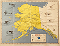 | Details | Lee, Eric and George Crowe | 1969 |
| Alaska Pictorial Flight Planning Map Published by Plan-a-Flight Pub |
|
Lee, Eric and George Crowe |
|
| 1969 |
| LOC:89 |
| $0.00 | Lee--Eric-and-George-Crowe | Alaska-Pictorial-Flight-Planning-Map-Published-by-Plan-a-Flight-Pub | SOLD<br><br>A very scarce original pictorial flight planning map for Alaska bush pilots complete with point-to-point routes, radio frequency and call sign for each airport. Compiled and Drawn by Eric Lee and George Crowe. Not in WorldCat or elsewhere online.
<br><br>
The area outside the route planning map is filled with sketches of aircraft and notes about early Alaskan bush pilots who flew them and their achievements in Alaska aviation history. <br>
<div class="indenttextblocksingle">
<ul style="list-style-type: circle;"></li>
<li>Lockheed Vega - Wilkins and Eielson - First trans-polar flight - 1928 </li>
<li>Fairchild - "Glacier Pilot" Bob Reeves</li>
<li>de Haviland - Ben Eielson - First airmail flight in Alaska - 1924</li>
<li>Cessna 180</li>
<li>Piper Super Club</li>
<li>"Jenny" - First flight- Fairbanks - 1923</li>
<li>Standard (Hisso Powered) - Noel Wain- first to cross the Arctic Circle and land on the north side of Alaska - 1925</li>
</ul>
</div>
This "Alaska Flight Planning Map" was published in 1969 by Plan-a-Flight Publishing. In 1968 Plan-a-Flight published a book- "Plan-a-Flight to Alaska- a complete flight guide book to the Alaska Highway." with a fold-out sequence map of airports and emergency airstrips along the Alaska Highway route. There are several institutions that hold the Plan-a-Flight guide book, while no holdings of this Alaska Flight Planning Map are found anywhere on the Internet.
<br><br>
Verso with a suggested survival equipment list, organized by season; mountain flying rules; and more than three dozen airport diagrams. |
| 6654 |  | Details | Phillips, Augustus D. and Son | 1965 |
| Pictorial Trail Map of Baxter State Park Maine |
|
Phillips, Augustus D. and Son |
|
| 1965 |
| LOC:53 |
| $0.00 | Phillips--Augustus-D--and-Son | Pictorial-Trail-Map-of-Baxter-State-Park-Maine | SOLD<br><br>
Fine pictorial map of Baxter State Park, Maine by Augustus D. Phillips & Son - Northeast Harbor Maine, dated within to 1965 and presumed first edition. As a dedication below the title Phillips wrote:
<br><br><div class="indenttextblocksingle"> For the heritage of this Mighty, Mountained, Wilderness Park the People of this State of Maine and their Children's Children will Forever be Grateful to the Honorable Percival P. Baxter, Governor of Maine ~ 1921 - 1924 ~ Who Conceived it and Gave the 201,018 Acres of Land for it."
</div>
<br>
<div id="0" align="center">
<a title="TITLE HERE"></a> <img id="3" src="/zoomifyimages/SC_6654/SC_6654_Detail
.jpg" alt="Gus Phillips pictorial map of Baxter State Park, Maine from 1965." width="300"/> <br><small>Baxter State Park map detail..</small>
</div>
<br>
Scarce, only 3 holdings are recorded in WorldCat but the map was apparently issued three times, in 1965, 1970, and 1972. |
| 6625 |  | Details | Keane, Bil | 1990 |
| Unrecorded Bil Keane's Arizona an Arizona's Highways Map Pictorial |
|
Keane, Bil |
|
| 1990 |
| LOC:150 |
| $0.00 | Keane--Bil | Unrecorded-Bil-Keane-s-Arizona-an-Arizona-s-Highways-Map-Pictorial | SOLD
<br><br>
Very fine unrecorded copy of "Bil Keane's Arizona an Arizona's Highways Map" by Bil Keane. Despite an extensive search of the Internet including WorldCat, WorthPoint, and the Arizona Highways magazine online archives, no copy of this map is found anywhere. There are numerous copies of a 1989 Arizona Highways coloring book of 32 pages by Bil Keane, but not this fine map. Copyright 1990 Arizona's Highways.
<div><img src="/ZoomifyImages/SC_6625/SC_6625_title_detail.jpg" alt="rare example of 'Bil Keane's Arizona an Arizona's Highways Map' by Bil Keane. " width="300" align="center" style="margin: 20px 0px 20px 20px"/>
<br>
A search of the archives of Arizona's Highways magazine found that Bil Keane's cartoons or articles about Keane appear in more than a dozen issues of Arizona's Highways between 1966 and 1989, but it appears that after 1989 Bil was no longer featured as extensively, perhaps due to advancing age (speculation).
<br><br> |
| 6422 |  | Details | Troper, William | 1985 |
| Rare 1985 thematic map of Grateful Dead U. S. concert locations |
|
Troper, William |
|
| 1985 |
| LOC:150 |
| $0.00 | Troper--William | Rare-1985-thematic-map-of-Grateful-Dead-U--S--concert-locations | SOLD
<br><br>
Extremely rare 1985 poster map for locations of concerts performed by the legendary rock group the <b>Grateful Dead</b>: "Where the Dead Play: Grateful Dead Concerts Throughout the United States".
<br><br>
Only one copy located in WorldCat, at the Library of Congress. According to the WorldCat LOC entry: " Shows number of concerts performed within 100 miles of the graduated symbol, from spring of 1965 through summer of 1984."
<br><br>
Produced by William Troper in 1985, the map uses differing sizes of the Grateful Dead red and blue lightning skull or, "Steal Your Face", logo [1] to indicate the range of the number of concerts held at cities throughout the continental US, Alaska, and Hawaii. Concert frequency data is credited within to the Hampshire College Grateful Dead Historical Society.
<br><br>
Inset maps of Alaska and Hawaii. Verso blank.
<br><br>
Concert date and publication information are recorded as available in accompanying text (not included). Predates by a decade a more commercially successful and common two-sided glossy wall map and tour guide poster from 1994 that is similar in concept.
<br><br>
[1] Grateful Dead Logo. 2021. Online: https://1000logos.net/grateful-dead-logo/ |
| 6407 |  | Details | Santos, George | 1959 |
| Rare pictorial map of Australia with local wildflowers for Shell Oil Company |
|
Santos, George |
|
| 1959 |
| LOC:89 |
| $0.00 | Santos--George | Rare-pictorial-map-of-Australia-with-local-wildflowers-for-Shell-Oil-Company | OH HOLD
<br><br>
An original and beautiful 1959 lithographed pictorial map of Australia decorated profusely with wildflowers. Guaranteed original. Scarce on today's market.
<br><br>
Artwork by George Santos for the Shell Oil Company of Australia. Shell Oil Company logo at upper left.
<br><br>
Overall dimensions: 17.5 in. x 22.25 or 45 cm. x 57 cm.
<br><br>
Legend contains an inset key map and a list that denotes the names of 87 wildflowers related numerically to positions on the key map.
<br><br>
Very rare. Only two institutional holdings are cataloged in WorldCat, both within Australia.
<br><br>
At extreme bottom right the imprint of McCarron Bird, Melbourne, Australia. |
| 6488 |  | Details | Pittsburgh Sun Telegraph | 1943 |
| WWII Japanese Invasion Scare Map |
|
Pittsburgh Sun Telegraph |
|
| 1943 |
| LOC:90 |
| $0.00 | Pittsburgh-Sun-Telegraph | WWII-Japanese-Invasion-Scare-Map | SOLD<br><br>
Newsprint map published on August 22, 1943 by the Pittsburg Sun-Telegraph in the Pictorial Review section detailing potential Japanese war plans to attack the US mainland.
<br><br>
<div class="indenttextblocksingle">
<strong>"JAPAN EXPECTS TO WIND UP HER WAR</strong> with occupation of Western United States to the Rocky Mountains, and with capture of the Panama Canal and all of Central America. That is indicated by a 1941 Tokyo war map stolen by a Korean cabin boy from a Japanese army officer traveling as a tourist to the United States. The map is represented on two pages herewith."
</div>
<br>
Even before the attacks on Pearl Harbor in December, 1941, and on the Aleutian Islands in August, 1942 the Los Angeles Examiner published a pictorial map by Howard Burke that detailed a potential invasion strategy that tracked fairly well to Japan's early moves in the Pacific.
<br><br>
In August, 1943 the Pittsburg Sun-Telegraph Pictorial Review, along with other newspapers, published this map, supposedly stolen by a Korean nationalist agent Kilsoo Haan, in 1941. A very similar map actually had been published in Japan during 1935 and detailed a plan to invade the United States and to occupy the West Coast. Although American military intelligence discounted the possibility of a full-scale invasion by Japan, news outlets published the map playing on the invasion fears of the public.
<br><br> |
| 4846 | 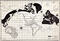 | Details | Zingg, Andrew | 1939 |
| Map of the Future by Andrew Zingg |
|
Zingg, Andrew |
|
| 1939 |
| LOC:0 |
| $0.00 | Zingg--Andrew | Map-of-the-Future-by-Andrew-Zingg | SOLD
<br></br>
A work, not of the display of quantitative information, but of pure imagination. Visually depicts Andrew Zingg's personal, apocalyptic "inspirational vision" for a transformative change of the Earth's surface and magnetic poles. The map was almost certainly self-published, a vanity map.
<br></br>
No other copy of this map is found anywhere on this planet.
<br></br>
By Andrew Zingg (1868-1954) of Wilton Junction, Iowa. 1939. The online Catalog of Copyright Entries shows that a copyright was granted to Andrew Zingg on January 21, 1939 for a "Map of Future Events".
<br></br>
Zingg's vision is documented in an included two-page typed letter titled: "A New Map of the World (There will be a Cycle Change of this Globe in the Near Future.)" The explanation defines the results of Zingg's hypothesis for imminent change in the earth's magnetic field along with climate changes and massive changes in the earth's landmass that might be expected with extreme tectonic forces.
<br></br>
<div class="indenttextblocksingle">
"We are now living in that age in which a physical change of the Globe will soon occur in which this world will roll (in its orb) to a new point of balance which will swing its axis unto new moorings, the North Pole will be shifted into Siberia east of the Ural Mountains and the South Pole in the South Pacific Ocean."
</div>
<br></br>
Contains blue ink hand-stamps referencing Zingg's copyright in 1939. Zingg signed his letter cryptically with "(A - Z - Alpha Omega)". Note: map is much larger that the two typed pages (not to same scale). |
| 5032 | 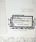 | Details | Allyn, Rube | 1960 |
| Lot of six river charts Suwannee River and Withlacoochee |
|
Allyn, Rube |
|
| 1960 |
| LOC:0 |
| $0.00 | Allyn--Rube | Lot-of-six-river-charts-Suwannee-River-and-Withlacoochee | SOLD
<br></br>
Lot of six Rube Allyn's river charts for the Withlacoochee and Suwanee Rivers copyrighted by the Great Outdoors Association ca. 1960's.
<br></br>
As described on the envelope covering the exterior of the chart, Allyn sold his Withlacoochee and Suwanee River charts in sets of three and four sheets:
<div class="indenttextblock">
"<b>Suwannee River</b>, with 210 miles of romance and delight, completely charted in four large maps. … Beautiful springs, delightful camping places. At some villages, modern air-conditioned motels."
<ul style="list-style-type: circle;">
<li>S1- Cedar Keys to Manatee Springs/Oldtown</li>
<li>S2 - Manatee Springs/Oldtown to Branford</li>
<li>S3 - Branford to White Springs</li>
</ul>
"<b>Withlacoochee River</b>, one of Florida's most beautiful and fishable streams. … 14 fishing resorts accurately placed and more that 100 secret fishing spots revealed."
<ul style="list-style-type: circle;">
<li>W1- Gulf of Mexico to Backwaters (Gulf to Dunnellon) </li>
<li>W2 - Dunnellon to Panasoffkee (Dunnellon to Inverness)</li>
<li>W3 - Panasoffkee to Headwaters (Inverness to St. Catherine)</li>
</ul>
</div>
Note: Chart titles on the Withlacoochee River Series differ between the folders and the charts.
</div> |
| 4917 | 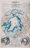 | Details | Mangles, James | 1852 |
| Book maps search Arctic explorer John Franklin |
|
Mangles, James |
|
| 1852 |
| LOC:0 |
| $0.00 | Mangles--James | Book-maps-search-Arctic-explorer-John-Franklin | Sold<br><br>
Relating to the Arctic Searching Expeditions of 1850, 1851, and 1852 for Sir John Franklin.
<br></br>
Papers and dispatches together with a few brief remarks as to the probable course pursued by Sir John Franklin by James Mangles (1786-1867).
<br></br>
Illustrated by a general map (in back pocket) of the polar regions, a chart of the field of search, and a special map of Beechy Island.
<br></br>
Published by Francis & John Rivington, London, 1852 - revised edition, hardbound, 94 pgs. |
| 4977 | 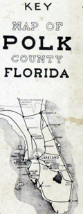 | Details | Dolph, Frank B. | 1952 |
| Land-atlas for Polk County, Florida by Dolph |
|
Dolph, Frank B. |
|
| 1952 |
| LOC:0 |
| $0.00 | Dolph--Frank-B- | Land-atlas-for-Polk-County--Florida-by-Dolph | Sold <br></br>
A original large land ownership atlas for Polk County, Florida. Published and copyrighted, Fort Lauderdale, Florida by Frank B. Dolph, 1952.
<br></br>
Scarce. With 1 key map of Polk County, Florida and 39 plat maps as called for, clean. No tears or condition issues. |
| 4988 |  | Details | Florida State Road Department | 1955 |
| Lot of 8 Florida County General Highway and Transportation Maps |
|
Florida State Road Department |
|
| 1955 |
| LOC:0 |
| $0.00 | Florida-State-Road-Department | Lot-of-8-Florida-County-General-Highway-and-Transportation-Maps | Sold <br></br>
Lot of eight (8) transportation maps of Florida, published by the Florida State Road Department, Traffic Planning Division in coordination with the U.S. Department of Commerce Bureau of Public Roads. Mid 20th-century.
<br></br>
<b>Five General Highway and Transportation Maps:</b>
<div class="indenttextblocksingle">
<ul style="list-style-type: circle;">
<li>De Soto County. 1936 / 1955</li>
<li>Osceola County . 1936. Revised 1954. (Sheet 2 of 2)</li>
<li>Osceola County . 1936. Revised 1954? (Sheet 1 of 2)</li>
<li>Hendry County. 1936. Revised 1955</li>
<li>Taylor County. 1936. Revised 1955</li>
</ul>
</div>
<b>Three General Highway Maps:</b>
<div class="indenttextblocksingle">
<ul style="list-style-type: circle;">
<li>Broward County (Sheet 2 of 2). 1948. Revised 1956.</li>
<li>Palm Beach County. (1949) </li>
<li>Okeechobee County 1954. Revised 1956.</li>
</ul>
</div> |
| 4997 | 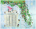 | Details | Kocab, Al | 1968 |
| 1970s Pictorial Florida Map Attractions pre-Disney |
|
Kocab, Al |
|
| 1968 |
| LOC:61 |
| $0.00 | Kocab--Al | 1970s-Pictorial-Florida-Map-Attractions-pre-Disney | SOLD
<br></br>
Fine and scarce pictorial map of Florida by businessman Al Kocab: "Florida Attractions in Florida's Vacation Regions".
<br></br>
Kocab is known to have authored one additional map for the Florida Development Commission: "Florida Four-star Attractions."
<br></br>
Only two institutional holdings of the map are recorded in WorldCat.
<br></br>
Al Kocab (1930 - 1994) was part owner and interior designer of the award-winning La Vielle Maison in Boca Raton and The Down Under and Go Fish! restaurants in Fort Lauderdale. Mr. Kocab, who arrived in Ft. Lauderdale in 1960, was a founding partner in Waterway Restaurants Inc., which owned three restaurants. In 1994 La Vielle Maison, with country French decor, was the only restaurant in Florida to be awarded a five-star rating by the Mobil Travel Guide. Kocab was co-author of "Restaurants & recipes of New York, New Jersey, Connecticut." (Research Unlimited. 1964) |
| 5030 |  | Details | Florida East Coast Railway | 1907 |
| Scarce Florida Railway and East Coast Hotel Co Point of Sale Advertisement |
|
Florida East Coast Railway |
|
| 1907 |
| LOC:0 |
| $0.00 | Florida-East-Coast-Railway | Scarce-Florida-Railway-and-East-Coast-Hotel-Co-Point-of-Sale-Advertisement | SOLD<br></br>
Rare point-of-sale advertising placard for Henry Flagler's Florida East Coast Railway (FEC) and the Florida East Coast Hotel Company with a map of Florida ca. 1905 - 1912. The map shows the locations of Flagler's hotel properties and the FEC railway system Flagler built that linked, by 1912, linked Jacksonville to Key West, Florida. The significance of this scarce placard is that Henry Flagler's contribution to the state of Florida was to open Florida's east coast through building a series of fine hotel properties supported by his railway network, the Florida East Coast Railway. Two sides on hard stock with red edging.
<br></br>
Legend on the map shows the railway segment between Homestead, and Key West as "under construction" dating the map between 1904, when the United States took over the Panama Canal project from France (that act gave Flagler confidence to expand to Key West), and 1912 when the Overseas Highway was completed. Copyright date of 1907 for a photo on the verso confirms the date.
<br></br>
Map shows the routes of steamers of Flagler's Peninsular and Occidental Steamship Company from Key West to Havana, Cuba, Miami, and Nassau. By 1912, rail passengers could go from NY to Key West in 3 days, then board a steamer to Cuba.
<br></br>
Verso with advertisement and photos for the Delaware and Hudson Railroad (to the Adirondacks, Lake Champlain, Montreal, etc.) No map on the verso. |
| 4999 |  | Details | Seaboard Air Line Railway | 1917 |
| WWI map Military Camps Winter Resorts Seaboard Airline Railway Florida |
|
Seaboard Air Line Railway |
|
| 1917 |
| LOC:0 |
| $0.00 | Seaboard-Air-Line-Railway | WWI-map-Military-Camps-Winter-Resorts-Seaboard-Airline-Railway-Florida | This item is sold. Please view the <a href="https://www.rarecharts.com/ShowDetail/Creator/Seaboard-Air-Line-Railway/Title/WWI-map-Military-Camps-Winter-Resorts-Seaboard-Airline-Railway-Carolinas/6648" target="_blank">second example </a> we have handled in twelve years.
<br><br>
Rare patriotic WWI map titled "Military Camps and Nearby Resorts. Winter Near Your Soldier Boy." published by Seaboard Airline Railway and connections, Florida. This full-size folding map shows twenty-eight locations (Army, Navy, and Aero training camps) served by the Seaboard Air Line Railway where a spouse (wife) could travel to spend the winter holidays with her soldier (husband) during 1917, the fourth year of WWI. |
| 5022 | 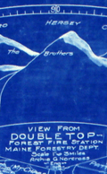 | Details | Maine Forestry Department | 1919 |
| Rare cyanotype Maine map for Double Top Fire Tower |
|
Maine Forestry Department |
|
| 1919 |
| LOC:53 |
| $0.00 | Maine-Forestry-Department | Rare-cyanotype-Maine-map-for-Double-Top-Fire-Tower | SOLD<br></br>
Rare 1919 cyanotype Maine Forest Service fire tower alidade plotting sheet: "View from Double Top Forest Fire Station Maine Forestry Department. 1919." Archie G. Norcross - Engineer. Map is 30" diameter to the outer circle. Next band- a scale from 0 to 360 degrees. Next band- shows an elevation profile matching that of the region in the far distance; flags denote other fire towers. Innermost circle- 24" diameter shows a birds eye view of the local area with the Double Top fire station located dead center in the circle.
<br></br>
From a series of circular fire tower maps commissioned by the Maine Forest Service, these circular maps display aerial and 360 degree panoramic views from many of the mountain top fire tower stations around the State of Maine. Circular map tables were oriented and fastened to the floor of the cabin of each fire tower. On each map table an alidade-type sighting device was attached which enabled the Fire Observer to more accurately pinpoint fires and record the location of a fire on the circular map laid onto the table. (https://www.aarch.org/preserve/fire-towers/)
<br></br>
One source states that the blueprint fire tower maps were used as batch master copies in the creation of multiple blue-line working maps. Of course, the inked trace diagram on tracing cloth would have been the true master copy as it was used to create each blueprint. |
| 5148 | 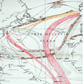 | Details | Somerville, Boyle T. | 1950 |
| Chart of routes used by ocean-going sailing ships. |
|
Somerville, Boyle T. |
|
| 1950 |
| LOC:0 |
| $0.00 | Somerville--Boyle-T- | Chart-of-routes-used-by-ocean-going-sailing-ships- | SOLD<br><br>
Large, colorful thematic nautical chart showing the most common routes utilized by sailing ships and the season of year each route was commonly used. The chart was compiled by Rear Admiral Boyle T. Somerville to illustrate routes described in the publication "Ocean Passages", 1950. Color is used to indicate both the direction and time of year routes are taken while the width of lines indicate the geographical limits of typical tracks taken by sailing vessels.
<br></br>
Issued by the British Admiralty in April 1946 under the under the superintendence of Rear-Admiral A.G.N. Wyatt, Hydrographer. Last correction in 1950. |
| 5155 | 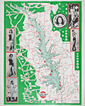 | Details | Texas Street Guide Service | 1969 |
| Rare map of Toledo Bend Reservoir with beauty pageant contestants 1969 |
|
Texas Street Guide Service |
|
| 1969 |
| LOC:63 |
| $0.00 | Texas-Street-Guide-Service | Rare-map-of-Toledo-Bend-Reservoir-with-beauty-pageant-contestants-1969 | SOLD
<br></br>
A classic bait-shop fishing-map poster for Toledo Bend Reservoir, containing photographs of contestants for a beauty pageant swimsuit competition, almost certainly the Miss Toledo Bend pageant. The map provides a documentary record of the numerous businesses that dotted the roads and highways along the shores and approaches to the Toledo Bend Reservoir in 1969, the year that the power plant at the Toledo Bend Dam (northeast of Burkeville) began operating.
<br></br>
Hundreds of businesses and other points of interest are identified in circular call-outs. The locations include:
<div class="indenttextblocksingle">
<ul style="list-style-type: circle;">
<li>Catfish House Motel and Cafe</li>
<li>Chambers Bait House Welding</li>
<li>Shamrock Marina</li>
<li>Huxley Bay Marina</li>
<li>Starlight Motel</li>
<li>Ford's Camp Boats, Bait and Tackle</li>
<li>Hook's Fishing Camp</li>
<li>Kickapoo No. 1 Café, Station, and Grocery</li>
</ul>
</div>
Toledo Bend Reservoir is located on the Sabine River spanning the border between Texas and Louisiana. The Toledo Bend Project, with an area of 185,000 acres and shoreline of 1,200 miles, was constructed primarily for the purposes of water supply, hydroelectric power generation, and recreation.
<br></br>
Published by Bill Hydrick, owner of the Texas Street Guide Service, P.O. Box 1043, Marshall, Texas. Map number 11. Map revised February 1969 (dated within). |
| 5292 | 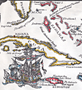 | Details | Island Workshop, Inc. | 1965 |
| Mid 20th-Century decorative Caribbean Map |
|
Island Workshop, Inc. |
|
| 1965 |
| LOC:87 |
| $0.00 | Island-Workshop--Inc- | Mid-20th-Century-decorative-Caribbean-Map | SOLD <br></br>Ahoy Matey! Here is a decorative, fun mid 20th-century "pirate treasure" chart of the West Indies and Caribbean Sea stretching from Florida to Trinidad and Tobago. Inset map of the region around Panama. With decorative compass roses and square-rigged sailing vessels. Shows the Panama Canal Zone, which did not exist in the early eighteenth century, but it's all in great fun. Artist's name may have been Lake (bottom left). Published in 1965 by Island Workshop, Inc.
<br></br>
Captain says hoist your wallet and heave your doubloons on this one before she sails away! |
| 5295 | 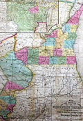 | Details | Hinman and Dutton | 1838 |
| Map of the Settled Part of Wisconsin Territory |
|
Hinman and Dutton |
|
| 1838 |
| LOC: |
| $0.00 | Hinman-and-Dutton | Map-of-the-Settled-Part-of-Wisconsin-Territory | SOLD
<br></br>
Very rare map of the nascent Wisconsin Territory from 1838, published by Hinman and Dutton, Philadelphia: "Map of the Settled Part of Wisconsin Territory compiled from the latest authorities." With an inset map: "The Entire Territory of Wisconsin: as established by act of Congress April 10, 1836." Engraved by J.H. Young.
<br></br>
One distinguishing feature between this map and a later similar map published by Mitchell is (1) the presence here of the Dubuque District (in blue) without county boundaries and (2) the inclusion of land owned and attributed to the Sacks and Foxe Indian tribes west of the Dubuque District, demarcated with "Indian Boundary."
<br></br>
First published "According to an act of Congress in the year 1837 by Hinman and Dutton in the Clerk's office of the District Court of the eastern district of Pennsylvania."
<br></br>
No record of any sale in AMPR. Only six institutional holdings in OCLC. No copies currently offered for sale elsewhere. |
| 5353 |  | Details | Standard Blueprint Map and Engineering Company | 1925 |
| Oilfield cadastral map of Bowie County, Texas |
|
Standard Blueprint Map and Engineering Company |
|
| 1925 |
| LOC:300 |
| $0.00 | Standard-Blueprint-Map-and-Engineering-Company | Oilfield-cadastral-map-of-Bowie-County--Texas | Scarce, unrecorded 1920's blue-line oilfield map of Bowie County, Texas from the early Texas oil boom that started with the Spindletop discovery near Beaumont, Texas in 1901. |
| 5354 |  | Details | Standard Blueprint Map and Engineering Company | 1925 |
| Oilfield cadastral map of Atascosa County, Texas |
|
Standard Blueprint Map and Engineering Company |
|
| 1925 |
| LOC:300 |
| $0.00 | Standard-Blueprint-Map-and-Engineering-Company | Oilfield-cadastral-map-of-Atascosa-County--Texas | SOLD
<br></br>
Large, scarce, unrecorded 1920's blue-line oilfield map of Atascosa County, Texas from the period of the early Texas oil boom that started with the Spindletop discovery near Beaumont, Texas in 1901. This antique thematic map shows land owners and locations for petroleum exploration in Atascosa County, Texas. Noted towns include Pleasanton, Campbellton, Ditto, Poteet, Amphion, Somerset and Gallinas. Includes several manuscript notations about oil wells in pencil and red crayon.
<br></br>
Note: Due to the large size the posted image is a composite of two photographs stitched together. Some misalignment or fuzziness may appear at the center join line as a result of this process.
<br></br>
A legend explains the types of oil exploration sites as:
<div class="indenttextblocksingle">
<ul style="list-style-type: circle;">
<li>Location</li>
<li>Rig Up</li>
<li>Drilling</li>
<li>Producing</li>
<li>Gas</li>
<li>Dry Hole</li>
<li>Abandoned Well</li>
<li>Abandoned Location</li>
</ul>
</div>
Map was printed on heavy paper by the Standard Blueprint Map and Engineering Company 515 Main Street, Fort Worth Texas in the mid-1920s. Bears several owner's red ink hand stamps that read: "Return to H. N. Harris, Fort Worth Nat'l Bank Building Fort Worth, Texas." Several lawsuits of the period reference a H.N. Harris, possibly associated with H.N. Harris Company or Inland Oil Company. |
| 5378 |  | Details | Army Orientation Branch | 1943 |
| WWII Training Map of Southeast Asia |
|
Army Orientation Branch |
|
| 1943 |
| LOC:300 |
| $0.00 | Army-Orientation-Branch | WWII-Training-Map-of-Southeast-Asia | SOLD
<br></br>
Large original WWII era U.S. Army orientation training map of east Asia (East Indies) ca. 1943.
<br></br>
Includes Vietnam ("French Indo-China"), Thailand, Myanmar ("Burma"), Philippine Islands, Singapore, New Guinea, Sumatra, and Australia. Major cities include Saigon, Bangkok, Batavia, Manila, and Darwin. |
| 5435 |  | Details | Horowitz, Reemes and Harrison | 1993 |
| Rare Map of Historic Sites of LSD Discovery, Research, and Culture |
|
Horowitz, Reemes and Harrison |
|
| 1993 |
| LOC:0 |
| $0.00 | Horowitz--Reemes-and-Harrison | Rare-Map-of-Historic-Sites-of-LSD-Discovery--Research--and-Culture | <br><br>This item is <b>SOLD</b> but we have found another example of this item that is <a href=" https://www.rarecharts.com/ShowDetail/Creator/Horowitz--Reemes-and-Harrison/Title/Rare-Map-of-Historic-Sites-of-LSD-Discovery-Research-Culture-by-Horowitz-et-al/6440" target="_blank">now in our inventory.</a>
<br></br>
Contains information relative to the discovery, usage and culture of LSD (and other drugs) for approximately forty locations spread across the world.</br> |
| 6440 |  | Details | Horowitz, Reemes and Harrison | 1993 |
| Rare Map of Historic Sites of LSD Discovery Research Culture by Horowitz et al |
|
Horowitz, Reemes and Harrison |
|
| 1993 |
| LOC:87 |
| $0.00 | Horowitz--Reemes-and-Harrison | Rare-Map-of-Historic-Sites-of-LSD-Discovery-Research-Culture-by-Horowitz-et-al | SOLD
<br></br>
Very scarce, original thematic world map of LSD historic sites published in 1993 on the 50th anniversary of the first use of the hallucinogenic drug LSD. Contains information relative to the discovery, usage and culture of LSD (and other drugs) for approximately forty locations spread across the world. For example:</br>
<div class="indenttextblocksingle">
<ul style="list-style-type: circle;">
<li><strong>SAN FRANCISCO: </strong>The Hippie-Xanadu (Haight-Asbury 1966-1970), Owsley tabs, windowpane, blotter acid, First Human Be-in (Jan. 1967), Fillmore and Avalon psychedelic dance concerts, poster art, Grateful Dead, Jefferson Airplane, Big Brother, Quicksilver, Blue Cheer, Ludlow Library, 1978-1980 Ecstasy, rave scene, early 1990's.</li>
<li><strong>BERKELEY: </strong>Telegraph Ave., counterculture scene, Psychedelic Venus Church, The Barb, The Tribe, A. Shulgin's research lab. Home mushroom cultivation started.</li>
<li><strong>VANCOUVER: </strong>Captain Al Hubbard manages Hollywood Hospital for LSD therapy, late 1950s-60s.</li>
<li><strong>CUERNAVACA: </strong> Site of Leary's first psychedelic trip.</li>
<li><strong>COPENHAGEN: </strong>Joint lecture of Huxley and Leary, 1961.</li>
<li><strong>SIBERIA: </strong>Ancient shamanic use of Amanita muscaria. Tree/mushroom/reindeer triad.</li>
<li><strong>NORFOLK ISLANDS: </strong>Hallucinogenic fish reported, 1960.</li>
</ul>
</div>
At the bottom of the map is a large canoe populated with human and animal passengers drawn in the style of ancient Mayan art. The map is surrounded by a wild assortment of icons, totems, pure decorative elements and drawings relative to psychedelic drugs and the psychedelic experience. Small scroll at the top center identifies the work as "Psychedelica cartographia." Copyright 1978, 1993 by Horowitz, et al. |
| 5439 | 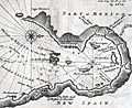 | Details | Dampier, Wllliam | 1704 |
| Rare chart of the Gulf of Nicoya Costa Rica |
|
Dampier, Wllliam |
|
| 1704 |
| LOC:78 |
| $0.00 | Dampier--Wllliam | Rare-chart-of-the-Gulf-of-Nicoya-Costa-Rica | SOLD<br><br>Rare chart from 1704 of the Gulf of Nicoya in Costa Rica from an account of his "Voyage Round the World" by William Dampier (1651 - 1715).
<br></br>
The Gulf of Nicoya lies on the west coast of Costa Rica, about 50 miles from San Juan, the capital city. |
| 1027 |  | Details | Woolsey, W.B. | 1869 |
| Lithograph of the Union Naval Gunboat Nipsic |
|
Woolsey, W.B. |
|
| 1869 |
| LOC:0 |
| $0.00 | Woolsey--W-B- | Lithograph-of-the-Union-Naval-Gunboat-Nipsic | SOLD<br></br>
Color lithograph of the 836-ton U.S. Navy screw gunboat Nipsic, launched June 1863 at Portsmouth Naval Yard in Kittery, Maine. In late 1863 and early 1864 Nipsic engaged in operations against Murrell's Inlet and Georgetown, South Carolina. In June 1864, she captured a sailing blockade runner.
</br></br>
From Charles Boynton's "The History of the Navy during the Rebellion". Printed by Major and Knapp Engraving, Manufacturing, and Lithograph Company, 71 Broadway, New York. |
| 1028 |  | Details | Woolsey, W.B. | 1869 |
| Lithograph of the U.S. Naval Frigate Wabash |
|
Woolsey, W.B. |
|
| 1869 |
| LOC:0 |
| $0.00 | Woolsey--W-B- | Lithograph-of-the--U-S--Naval-Frigate-Wabash | SOLD<br></br>
Attractive color lithograph of the 4808-ton U.S. Navy steam screw frigate Wabash. The Wabash was launched from Philadelphia Navy Yard in October 1855. During 1861 Wabash blockaded the Confederacy's Atlantic Coast and engaged in the capture of Hatteras Inlet, North Carolina, and Port Royal, South Carolina. The Wabash was flagship of the South Atlantic Blockading Squadron, an active force in the Blockade of Charleston, S.C., in 1862-64. She paricipated in the December 1864 and January 1865 assaults on Fort Fisher, North Carolina.
</br></br>
From Charles Boynton's "The History of the Navy during the Rebellion". Printed by Major and Knapp Engraving, Manufacturing, and Lithograph Company, 71 Broadway, New York. |
| 1001 | 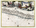 | Details | Montanus, Arnoldus | 1671 |
| Chile (Chile) South America |
|
Montanus, Arnoldus |
|
| 1671 |
| LOC:0 |
| $0.00 | Montanus--Arnoldus | Chile-(Chile)-South-America | SOLD<br></br>
Attractive map of coastal Chile ("Chili") in South America by Arnoldus Montanus, after Ogilby. From Montanus' "De Nieuwe en Onbekende Weereld: of Beschryving van America." Shows the major portion of Chile between 25 and 45 degrees south latitude. The Andes ("Sierra nevado de los Andes") are shown in profile, and most of the major bays and islands are identified by name. Key features include Arauco, Concepcion, la Mocha island, Santiago (St. Jago de la Nueva Estres madura), Rio Mapocho, la Serena, and Rio Copiapo.
<br></br>
Very decorative map with a large scene of industrious natives and cherubs. The ocean is filled with two Spanish galleons and a compass rose. |
| 1455 | 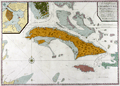 | Details | Mount and Page | 1746 |
| A New and Correct Chart of Cuba, Streights of Bahama Windward Passage Florida |
|
Mount and Page |
|
| 1746 |
| LOC:0 |
| $0.00 | Mount-and-Page | A-New-and-Correct-Chart-of-Cuba--Streights-of-Bahama-Windward-Passage-Florida | SOLD
<br></br>
You can smell the salt air! Mount & Page's impressive chart of the the island of Cuba, Florida Keys, and the Bahamas. This very fine antique nautical chart includes Grand Bahama island, Great Abaco, Eleuthera, Cat Island, Crooked Island and much more. With coverage between the southern part of Florida and Jamaica, centered on the Bahamas and Cuba. Includes the southern tip of Florida, Jamaica, east Cuba.
<br></br>
The map has been identifed as "An essential map for regional collectors." That may in part be related to the chart's massive mis-representation of the Gulf Stream which flows in a northerly direction through the Florida Strait. Arrows incorrectly show the flow from north to south, the opposite as is the case. In large engraved letters is stated: "The course of the current through the Gulf of Florida." In 1770 Benjamin Franklin published his map of the Gulf Stream with the correct course up the Eastern Seaboard and out into the Atlantic Ocean.
<br></br>
Large inset of Havana Harbor at upper left. Inset is titled: A plan of the Harbour and Town of Havana, taken on the spot by an officer in his Majesty's Navy.
<br></br>
The map includes a wonderful example of the Archipelago of Florida, as well as a detailed treatment of the Windward Passage and Bahamas. Within the Windward Passge a dotted line shows "The Course of the English Ships".
<br></br>
Key locations noted relative to Cuba include Havana, the capital and an important part of Spain's empire of domination, along with the Gulf of Zagua (See manucript map on this site). |
| 3684 |  | Details | Luffman, John | 1800 |
| Antique map Belle Isle, France engraved for Luffman's Select Plans |
|
Luffman, John |
|
| 1800 |
| LOC:0 |
| $0.00 | Luffman--John | Antique-map-Belle-Isle--France-engraved-for-Luffman-s-Select-Plans | SOLD
<br></br>
Neat antique engraved map of the Island of Belle Isle in the Bay of Biscay in France. With the headlands shown of Talifer Point, Corigan Point, Poulains Point, Grand Village Point and many more. Many small cities and towns are identified as well as a citadel near the town of Palais.
<br></br>
Key political divisions noted by Luffman include the four parishes of Sauzon, Locmaria, Bangor, and Palais.
<br></br>
From "Luffman's Select Plans of the Principal Cities, Harbors, Forts etc. in the World". Engraved and published by John Luffman, No. 28 Little Bell Alley, Coleman Street, August 1, 1800. Volume I, #54.
<br></br>
Luffman also provided similar engravings at about the same time for J.T. Serres' "The Little Sea Torch: or, True Guide for Coasting Pilots." Serres translated the Little Sea Torch from an earlier illustrated coasting pilot guide, based on Bougard's "Le petit flambeau de la mer", first published in 1684. Serres added his own magnificent views of headlands, ports, lighthouses, landmarks, topography, coastal scenes, ships and harbor entrances.
<br></br>
John Luffman (1751-1821) began his career as an engraver, trained by John Bayly, a noted map engraver in the Goldsmiths' Company, producing a fine map of Antigua, where he had resided in 1787 and 1789. Luffman shared the same sad fate as many publishers and was declared bankrupt on 9th March, 1793. Moving forward Luffman was more cautious and produced small format atlases and handy-sized maps of the theatres of war, principal towns and cities and battle-plans relating to the Wars of the French directorate and the subsequent Napoleonic War. |
| 4849 |  | Details | Luffman, John | 1800 |
| Antique map Morbihan, Brittany, France Luffman's Select Plans |
|
Luffman, John |
|
| 1800 |
| LOC:0 |
| $0.00 | Luffman--John | Antique-map-Morbihan--Brittany--France-Luffman-s-Select-Plans | SOLD
<br></br>
An original antique engraved and hand-colored map of the department of Morbihan in Brittany (Bretagne) near the Bay of Biscay, France. Includes the islands of Belle Isle, Hoat, Hoedic, and Dumet. Key cities include Vannes, Rochefort, Quiberon, Auray, and Bernard.
<br></br>
From "Luffman's Select Plans of the Principal Cities, Harbors, Fortresses, etc. in the World". Engraved and published by John Luffman, No. 28 Little Bell Alley, Coleman Street, February 1, 1800. Volume I. #30.
<br></br>
Luffman also provided similar engravings at about the same time for J.T. Serres' "The Little Sea Torch: or, True Guide for Coasting Pilots." Serres translated the Little Sea Torch from an earlier illustrated coasting pilot guide, based on Bougard's "Le petit flambeau de la mer", first published in 1684. Serres added his own magnificent views of headlands, ports, lighthouses, landmarks, topography, coastal scenes, ships and harbor entrances.
<br></br>
John Luffman (1751-1821) began his career as an engraver, trained by John Bayly, a noted map engraver in the Goldsmiths' Company, producing a fine map of Antigua, where he had resided in 1787 and 1789. Luffman shared the same sad fate as many publishers and was declared bankrupt on 9th March, 1793. Moving forward Luffman was more cautious and produced small format atlases and handy-sized maps of the theatres of war, principal towns and cities and battle-plans relating to the Wars of the French directorate and the subsequent Napoleonic War. |
| 128 |  | Details | Chatelain, Henry | 1695 |
| Gouvernement Militaire de France |
|
Chatelain, Henry |
|
| 1695 |
| LOC:0 |
| $0.00 | Chatelain--Henry | Gouvernement-Militaire-de-France | SOLD
<BR> </BR>
Folio-size antique copperplate engraving on chain-laid paper by Chatelain that records the state of France's land and naval forces in 1695. Contains detailed textual information on the finances and disposition of France's military not found elsewhere and a wealth of images related to those sea forces. Includes views of major naval ports, weapons, emblems, and flags associated with both the regular navy and the galley corps.
<BR> </BR>
There was considerable inter-service rivalry between the sailing navy (vaisseaux) and the galley corps (galeres) of which there were then 40 vessels. The lower left quadrant contains a breakdown by type of the total 665 vaisseaux then in service. The lower right quadrant is dedicated solely to the galley corps, which was then near the peak of its power, listing the number of officers of each rank and the count of each galley type- for instance 1 Galere Reale (Royal Galley, the premier vessel). From the information provided by Chatelain we learn that 6 galleys would have been stationed outside the Mediterranean or Levant: 2 each in Bordeaux, St Malo, and Dunkirk.
<BR> </BR>
Less than 30 years after this engraving was published the Corps des Galeres was disbanded (1748), not able to compete against larger, better armed ships of the line. This sheet provides detailed historical background for collectors of <a rel="nofollow" href= "/MichelotBremondBackground.aspx">Michelot and Bremond</a> charts which were created during the period represented by this plate. Plate 28. |
| 1298 | 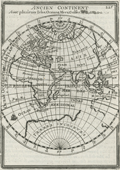 | Details | Mallet, Allain Manesson | 1683 |
| Ancien Continent or Eastern Hemisphere |
|
Mallet, Allain Manesson |
|
| 1683 |
| LOC:1 |
| $0.00 | Mallet--Allain-Manesson | Ancien-Continent-or-Eastern-Hemisphere | SOLD
<br></br>
Mallet's view of the "Ancien Continent" with its islands, oceans, seas, and gulfs. Striking and highly detailed copper engraved miniature map of the Eastern Hemisphere. A small galleon decorates the map in the "Ocean Meridionale".
<br></br>
The map shows a large unknown southern Continent. Australia is still in a conjectural form and there is a partial coastline , representing an unknown but pre-supposed land at the South Pole (later Antartica) labeled “Terres Incognues”. Mallet, drawing on geographic knowledge at his time shows an incomplete coastline for Western Australia which is not deemed important enough to even receive a label. Page 225. |
| 986 |  | Details | Mallet, Allain Manesson | 1683 |
| Du Globe Terrestre by Mallet |
|
Mallet, Allain Manesson |
|
| 1683 |
| LOC:0 |
| $0.00 | Mallet--Allain-Manesson | Du-Globe-Terrestre-by-Mallet | SOLD
<br></br>
Interesting illustration of 3 maps from Mallet's "Description de l'Univers" in 5 volumes of Paris, 1683. Figure LXVII . Contains three mapped representations of the known parts of the Eastern Hemisphere (Europe, Asia, and Africa) as envisioned by three cartographers: Mella, Posidonius, and Ptolemy (Ptolomee). French text on verso. |
| 947 |  | Details | Ruscelli, Girolamo | 1598 |
| Scarce antique map of the Greek Archipelago |
|
Ruscelli, Girolamo |
|
| 1598 |
| LOC:0 |
| $0.00 | Ruscelli--Girolamo | Scarce-antique-map-of-the-Greek-Archipelago | SOLD
<br></br>
Antique map of <b>Greece</b> published in 1598. The third state of Ruscelli's map of Greece and one of the earliest obtainable maps of modern Greece, derived from Gastaldi's map of 1548. Coverage includes Istanbul ("Costantinopili"), Turkey; Izmir ("Smirne"), Turkey; Crete, Negroponte, Corfu, and the Cycladic Greek Islands; Otranto and Gallipoli, Italy; and part of the Gulf of Venice.
<br></br>
This colorful, scarce map is from the sixth edition of <b>Girolamo Ruscelli's</b> translation of Claudio Ptolemy's Geografia with 27 Ptolemaic maps and 42 other maps based on modern sources.
<br></br>
Girolamo Ruscelli (1504 - 1566) was an Italian cartographer and writer who, under the pseudonym <b>Alexius Pedemontanus</b>, published the popular book "<i>The Secrets of Alexis of Piedmont</i>". That book was an early contribution to the scientific revolution that arose during the Rennaisance. |
| 948 | 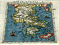 | Details | Ruscelli, Girolamo | 1598 |
| Scarce Ptolemaic map of Greece |
|
Ruscelli, Girolamo |
|
| 1598 |
| LOC:2 |
| $0.00 | Ruscelli--Girolamo | Scarce-Ptolemaic-map-of-Greece | SOLD
<br><br>Colorful engraved antique map of Greece on a trapezoidal projection published in 1598, based on the work of <b>Claudius Ptolemy</b>. Coverage includes mainland Greece, the <b>Peloponnese Peninsula</b>, Crete, Cyclades Archipelago, the Sporades and Ionian Islands, and the Gulf of Corinth.
<br></br>
This scarce map is from the sixth edition of Girolamo Ruscelli's translation of Claudio Ptolemy's <b>Geografia</b> with 27 Ptolemaic maps and 42 other maps based on modern sources. Ptolemy (ca. 100 AD - 170 AD) was a Greco-Egyptian cartographer who lived in Alexandria, Egypt. Ptolemy's Geografia was a a compilation of geographical coordinates of the world's locations and geographic features known to the Roman Empire in the second century AD.
<br></br>
Girolamo Ruscelli (1504 - 1566) was an Italian cartographer and writer who, under the pseudonym <b>Alexius Pedemontanus</b>, published the popular book "<i>The Secrets of Alexis of Piedmont</i>". That book was an early contribution to the scientific revolution that arose during the Rennaisance. |
| 806 | 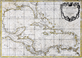 | Details | Rizzi Zannoni , Giovanni Antonio | 1762 |
| Gulf of Mexico and Caribbean Islands |
|
Rizzi Zannoni , Giovanni Antonio |
|
| 1762 |
| LOC:0 |
| $0.00 | Rizzi-Zannoni---Giovanni-Antonio | Gulf-of-Mexico-and-Caribbean-Islands | SOLD
<br></br>
Neat antique French map of the Gulf of Mexico, Southern United States, Mexico, Central America, Colombia and Venezuela with all the Caribbean islands described in French including Cuba, Porto Rico, St. Domingue, St. Croix, Antigua, la Martinique, la Barbade, and la Grenade. Florida is represented as an archipelago of islands, as was thought to be the case in the mid 18th century. Prominently marked habitations include Vera Cruz, Mexico; New Orleans, Louisiana; Pensacola, San Marcos ( Jacksonville ), and St. Augustine Florida; Port Royal, Jamaica; Cartagena, Colombia; and la Havane ( Havana ), Cuba.
<br></br>
Decorative 18th century cartouche with garland and a network of crossed rhumb lines gives this work a definitely nautical flavor. Engraved and published by Lattre from Rue St. Jacques, Paris. |
| 893 |  | Details | Moll, Herman | 1736 |
| Europe and the Near East |
|
Moll, Herman |
|
| 1736 |
| LOC:0 |
| $0.00 | Moll--Herman | Europe-and-the-Near-East | SOLD
<br></br>
Antique map of Europe, Greenland, Turkey, Persia, and North Africa by Herman Moll. Note for Groenland (Greenland) states: "Ice and Mountains covered with snow." Geographic relief is depicted in a simple pictorial style. This old map of Europe is from the 3rd edition of Moll's "Atlas Minor: or a New and Curious Set of Sixty-two Maps", published for Thomas and John Bowles in 1736. |
| 1091 |  | Details | Moll, Herman | 1699 |
| First printed map to focus on the Galapagos Islands |
|
Moll, Herman |
|
| 1699 |
| LOC:0 |
| $0.00 | Moll--Herman | First-printed-map-to-focus-on-the-Galapagos-Islands | SOLD<br></br>
Very scarce map of the Galapagos Islands and the earliest printed map of the Galapagos. |
| 1092 |  | Details | Moll, Herman | 1699 |
| First printed map of Peypses or Pepys Island. |
|
Moll, Herman |
|
| 1699 |
| LOC:5 |
| $0.00 | Moll--Herman | First-printed-map-of-Peypses-or-Pepys-Island- | SOLD <br></br>Four scarce views on one sheet based on a manuscipt maps drawn by <b>William Ambrosia Cowley</b>. The views are of: the Island Of John Ferdinando; the perhaps fictitious Peypses Island; Nutmegg Island; and the Cape of Good Hope, at the southern tip of the African continent.
<br></br>
Cowley was sailing master of a pirate ship captained by John Eaton in 1684 when they made landfall at the Galapagos Islands in the Pacific Ocean. Cowley's narrative of the voyage entitled 'Cowley's Voyage Around the Globe' was published in the 'COLLECTION OF ORIGINAL VOYAGES' by William Hacke from London in 1699.
<br></br>
In Cowley's manuscript journal he recorded his landing at an island he called <b>Pepyes Island</b>:
<div class="indenttextblock">
"We held our Course S. W. till we came into the lat. of 47 deg. where we saw Land; the same being an Island not before known, lying to the Westward of us. It was not inhabited, and I gave it the Name of Pepys Island. We found it a very commodious place for Ships to water at and take in Wood, and it has a very good Harbour, where a thousand sail of Ships may safely ride: Here is great plenty of Fowls, and we judge, abundance of Fish, by reason of the Grounds being nothing but Rocks and Sands. "
</div>
Of John Ferdinando (Isla Juan Fernandez or Más a Tierra) Cowley wrote:
<div class="indenttextblock">
"Capt. Bartholomew Sharpe was here in the Year 1680, and finding no People on it, he called it Queen Catherines Island; and when he sailed away did leave one Man on shoar, which was a Mosquito Indian, who lived here alone near 4 Years. … there being several of our Ships Company who were at the leaving of this Indian there by Capt. Sharpe, and among others Capt. Edmond Cook and Mr. William Dampier". (Cowley, W.A., "Cowley's Voyage Around the Globe" <a href="http://www.galapagos.to/TEXTS/COWLEY.HTM#GalapagosSection" target="_blank">Internet</a>)
</div> |
| 3637 | 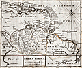 | Details | Moll, Herman | 1701 |
| Moll's fine map of Terra Firma or Northern South America |
|
Moll, Herman |
|
| 1701 |
| LOC:5 |
| $0.00 | Moll--Herman | Moll-s-fine-map-of-Terra-Firma-or-Northern-South-America | SOLD <br></br>Herman Moll's scarce map of Terra Firma and the Caribbean Islands. No sale of this item is recorded in AMPR in the last 17 years.
<br></br>
Covers from Cuba south as far as the Amazon River. Includes the modern day nations of Colombia, Venezuela, Ecuador, Guyana and Brazil. Moll notes the city of Manoa and the location of El Dorado (lost city of gold) west of the Prime or Parima Lake.
<br></br>
During Spain's New World Empire, its mainland coastal possessions bordering the Caribbean Sea and the Gulf of Mexico were referred to collectively as the Spanish Main. The southern portion of these coastal possessions were known as the Province of Tierra Firme ( Terra Firma ), or the "Mainland province".
(Source Wikipedia. https://en.wikipedia.org/wiki/Province_of_Tierra_Firme)
<br></br>
From Moll's "A System of Geography: Or A New and Accurate Description of the Earth In all its Empires, Kingdoms and States" (London), 1701. |
| 3599 | 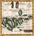 | Details | Moll, Herman | 1699 |
| First printed map focused on the Galapagos Islands (French ed.) |
|
Moll, Herman |
|
| 1699 |
| LOC:0 |
| $0.00 | Moll--Herman | First-printed-map-focused-on-the-Galapagos-Islands-(French-ed-) | SOLD <br></br>
French language version of this scarce map of the Galapagos Islands which is the <b>earliest printed map of the Galapagos</b>. This small antique engraved map was based on a manuscipt map drawn by <b>William Ambrosia Cowley</b>. Cowley was sailing master of a pirate ship captained by John Eaton in 1684 when they made landfall at the Galapagos Islands in the Pacific Ocean. Cowley's narrative of the voyage- 'Cowley's Voyage Around the Globe' was published in English in the 'COLLECTION OF ORIGINAL VOYAGES' by William Hacke from London in 1699.
<br></br>
In Cowley's manuscript journal he recorded his first observations of the Galapagos:
<div class="indenttextblock">
"Then we came to an Anchor in a very good Harbour, lying toward the Northernmost end of a fine Island, under the Equinoctial Line: Here being great plenty of Provisions, as Fish, Sea and Land Tortoises, some of which weighed at least 200 Pound weight, which are excellent good Food. Here are also abundance of Fowls, viz. Flemingoes and Turtle Doves; the latter whereof were so tame, that they would often alight upon our Hats and Arms, so as that we could take them alive, they not fearing Man, until such time as some of our Company did fire at them, whereby they were rendered more shy." (Cowley, W.A., "Cowley's Voyage Around the Globe" <a href="http://www.galapagos.to/TEXTS/COWLEY.HTM#GalapagosSection" target="_blank">Internet</a>)
</div>
<br>
<b>Cowley's Names of the Galapagos Islands from the English Edition </b>
<div class="indenttextblocksingle">
<ul style="list-style-type: circle;">
<li>King Charles's Island
<li>Crossman's Island
<li>Brattles Island
<li>Sir Anthony Dean's Island
<li>Eure's Island
<li>Dassigney's Island
<li>Bindlos's Island
<li>Duke of York's Island
<li>Duke of Norfolk's Island
<li>Duke of York's Island
<li>Duke of Albemarle's Island
<li>Sir John Narborough's
<li>Cowley's enchanted Island
<li>Earl of Abington's Island
</ul>
</div> |
| 585 |  | Details | Homann Heirs | 1740 |
| Regni Sinae vel Sinae Propriae |
|
Homann Heirs |
|
| 1740 |
| LOC:0 |
| $0.00 | Homann-Heirs | Regni-Sinae-vel-Sinae-Propriae | SOLD<br></br>Large hand-colored engraved antique map of China ca. 1740 divided into provinces. Coverage includes Shanghai, the large islands of Hainan and Taiwan, and the Pearl River delta with Hong Kong and Macau.
<br></br>
Decorative title cartouche at bottom right is flanked by a pair of "Chinamen" and Chinese dragons.
<br></br>
Published by the firm Homann Heirs. Homann Heirs (also "Homannianis Heredibus" or "Homann Erben" or "Heritiers de Homann") was a company established after the death of German cartographer J.B. Homann to carry on the publishing business of the firm he started in the early 1700's. The designation "Homann Heirs" appears on maps published by that successor firm from about 1730 to 1848. |
| 595 |  | Details | Allen, Lane, and Scott | 1898 |
| New Jersey Ocean Resorts on the Pennsylvania Railroad |
|
Allen, Lane, and Scott |
|
| 1898 |
| LOC:0 |
| $0.00 | Allen--Lane--and-Scott | New-Jersey-Ocean-Resorts-on-the-Pennsylvania-Railroad | SOLD
<br></br>
Antique lithographed birds-eye view / map of the area between Delaware Bay and New York city with a focus on the many beaches, coastal towns and inlets of New Jersey. Numeous connecting rail lines are shown in red, radiating from Philadelphia to the New Jersey beaches and outlying cities.
<br></br>
Dozens of towns and beaches and lighthouses are identified. Key noted features and many nautical points of interest along the coast include: Cape Henlopen, Cape May, Smile Beach, 7 Mile Beach, Ludlan's Beach, Peck's Beach, Absecon Beach, Atlantic City, Long Beach, Island Beach, South Beach, Little Egg Harbor Bay, Barnegat Bay, Manasquan, Sandy Hook, Staten Island, Brooklyn, Jersey City, Coney Island, Dover and Princeton.
<br></br>
This original antique foldout map originally accompanied the Pennsylvania Railroad's annual excursion route guide: "Summer Excursion Routes". This interesting and scarce map is a documentary artifact for the railroad's enduring impact on the area. According to a <a target="_blank" style="color:#9BAFCB" href="http://www.libraries.rutgers.edu/rul/exhibits/nj_railroads/njrr.php"> Rutger's University Exhibition on Railroads and New Jersey 1812-1930:</a> <i>"Overall, the success of New Jersey’s modern billion-dollar tourism industry owes a debt to patterns established by railroads in the 19th century".</i>
<br></br>
Decorative features on the map include a large inset of small gaff-rigged sailboats and smaller views of numerous small commerial and pleasure craft under sail and power in the waters of Raritan Bay and Delaware Bay.
<br></br>
Matted and framed in old quarter-sawn oak mission-style picture frame in good condition. 2" mitered, beveled frame shows evidence of age on the back; front with one small chip as the only issue. Size framed is 19"Wx23"H. |
| 609 | 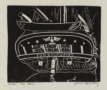 | Details | Bowling, Jack F. | 1942 |
| Under the Stern |
|
Bowling, Jack F. |
|
| 1942 |
| LOC:50 |
| $0.00 | Bowling--Jack-F- | Under-the-Stern | SOLD<br></br>
Original mid 20th-century nautical linocut print of the stern of the 18th century warship USS Constitution ( "Old Ironsides" ) by Admiral (USN retired) Jack Bowling. Signed by the artist. Probably pre 1942.
<br></br>
The Pennsylvania Historical and Museum Commission posts this brief biography of Admiral Bowling:
<dir class="indenttextblock">"Born in Bonham, Texas, Jack F. Bowling (1903-1979) graduated from the United States Naval Academy in 1927 and was named a Commanding Ensign in the United States Navy that same year. During World War II he served on the staff of Admiral King and also commanded the Anti-submarine Task Force in the North Atlantic from 1944-1945. Bowling graduated from the United States Naval War College in 1945, retiring from the Navy in 1947 with the rank of Rear Admiral. Prior to the War, Bowling had already achieved an international reputation as an engraver and printmaker. During the war, he taught himself the art of metal working and in 1958 became a silversmith in Philadelphia..."</dir> (Pennsylvania Historical and Museum Commission, 2013. "http://www.phmc.state.pa.us/bah/dam/mg/mg392.htm") |
| 610 |  | Details | Bowling, Jack F. | 1942 |
| Constitution |
|
Bowling, Jack F. |
|
| 1942 |
| LOC:0 |
| $0.00 | Bowling--Jack-F- | Constitution | SOLD
<br></br>
Original mid 20th-century nautical linocut print of the port bow of the 18th century warship USS Constitution ( "Old Ironsides" ) by Admiral (USN retired) Jack Bowling. Signed by the artist. Probably pre 1942.
<br></br>
The Pennsylvania Historical and Museum Commission posts this brief biography of Admiral Bowling:
<dir class="indenttextblock">"Born in Bonham, Texas, Jack F. Bowling (1903-1979) graduated from the United States Naval Academy in 1927 and was named a Commanding Ensign in the United States Navy that same year. During World War II he served on the staff of Admiral King and also commanded the Anti-submarine Task Force in the North Atlantic from 1944-1945. Bowling graduated from the United States Naval War College in 1945, retiring from the Navy in 1947 with the rank of Rear Admiral. Prior to the War, Bowling had already achieved an international reputation as an engraver and printmaker. During the war, he taught himself the art of metal working and in 1958 became a silversmith in Philadelphia..."</dir> (Pennsylvania Historical and Museum Commission, 2013. "http://www.phmc.state.pa.us/bah/dam/mg/mg392.htm") |
| 1080 |  | Details | George W. Walker Lithograph and Publishing Co | 1902 |
| Stunning Birds Eye View of Mt. Washington, New Hampshire |
|
George W. Walker Lithograph and Publishing Co |
|
| 1902 |
| LOC:40 |
| $0.00 | George-W--Walker-Lithograph-and-Publishing-Co | Stunning-Birds-Eye-View-of-Mt--Washington--New-Hampshire | SOLD
<br><br>
Stunning bird's-eye view from <b>Mt. Washington New Hampshire</b> in exquisite condition. The view centers on the summit of Mt. Washington, depicting the famous “Tip Top House” and other structures. The summit is shown surrounded by a ring of clouds that sets it apart from the other peaks. Shown in concentric circles falling away from Mt. Washington are the other major peaks of New Hampshire, Maine and Vermont, with numerous small towns and villages snuggled in the valleys. This colorful lithographed view of Mt. Washington is considered by many to be the most beautiful of all the birds-eye views published near the beginning of the 20th century.
<br></br>
Almost unused condition and still attached to its original folder. Very rare to find this view and cover in such fine condition. Photographs and text on the verso of the view about the history of Mount Washington, e.g.
<div class="indenttextblock"> … , the ancient "Agiochook" (mountain with snowy forehead) of the Indians
is the highest point of land in eastern North America. .."
</div>
<br></br>
Created by George W. Walker, Boston, MA.and issued ca. 1902 by the passenger department of the Boston and Maine Railroad. Numerous legend entries are keyed numerically to 189 locations are identified on the view.
<br></br>
<b>Key features (among 189 listed) include:</b>
<div class="indenttextblock">
<ul>
<span style="list-style-type: circle;">
<li> Mt. Washington R.R. Train</li>
<li>Summit House</li>
<li>Mount Eastman</li>
<li>Mount Doublehead</li>
<li>Mount Pleasant, Maine</li>
<li>Isle of Shoals, New Hampshire</li>
<li>Sebago Lake, Maine</li>
<li>Mount Madison</li>
<li>Baldface Mountain</li>
<li>Carter Dome</li>
<li>Mount Mansfield, Vermont</li>
<li>Connecticut River</li>
<li>Killington Peaks, Vermont</li>
<li>Lake Winnipesaukee</li>
<li>Mount Wachusett, Massachusetts</li>
<li>Squam Lake</li>
<li>Lake Sunapee</li>
</span>
</ul>
</div> |
| 657 |  | Details | Hulsius, Levinus | 1626 |
SOLD
Capture of Cacafuego |
|
Hulsius, Levinus |
|
| 1626 |
| LOC:1 |
| $0.00 | Hulsius--Levinus | SOLD-<br></br>Capture-of-Cacafuego | Nicely engraved antique depiction of the fierce battle between the Spanish treasure ship Nuestra Senora de Ia Concepcion ( Cacafuego ) and the Golden Hind ( Caca Plata ) of Sir Francis Drake near Esmereldas, Equador in March 1579. As a result of that battle Drake captured the Cacafuego with an immense treasure of gold, silver, and jewels. Drake was knighted by the Queen on his return to Plymouth with the treasure after a three year voyage.
<br></br>
Anonymous engraver for this copperplate engraved edition of 1626 after the work of Levinus Hulsius. |
| 666 | 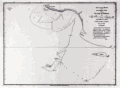 | Details | Dalrymple, Alexander | 1890 |
| Track of the ship Pearl in Persian Gulf 1797 |
|
Dalrymple, Alexander |
|
| 1890 |
| LOC:0 |
| $0.00 | Dalrymple--Alexander | Track-of-the-ship-Pearl-in-Persian-Gulf-1797 | SOLD <br></br>
Scarce copper plate engraved chart from 1797 of a portion of the coast in Hormozgan Province, Iran. Shows the Iranian coast near the island of Jezīrat Sheikh-Shuaib or Lavan Island ( Busheab Island ) and the present-day Nayband Marine-Coastal National Park. Other named feaures include Shitwa Island, Cape Nabon, Barn Hill, Cape Verdistan, Mongella Island, and Kenn Island. The chart contains soundings recorded by the Pearl during its exploration of the region during May 25 - 27, 1796.
<br></br>
Published by Alexander Dalrymple on May 7, 1797. This plate is a re-issue from the original copper plate bearing the stamp of the British Hydrographic Office; late 19th century or early 20th century.
<br></br>
In his doctoral thesis Cook wrote of Dalrymple that he was: <div class="indenttextblock"> "now generally regarded as the originator of official British hydrography… was cumulatively a private publisher of nautical charts and plans (from 1767), the 'examiner of ships' journals' and chart publisher for the East India Company (from 1779), and Hydrographer to the Admiralty (from 1795)". </div>
<br>
<div class="indenttextblock">Reference: Cook, Andrew S., <b>Alexander Dalrymple (1737 - 1808) Hydrographer to the East India Company and to the Admiralty; as publisher: A Catalogue of Books and Charts. </b> Vol. 3 .Doctoral Thesis, University of St. Andrews. 1992.</div> |
| 686 | 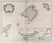 | Details | Santini, Paolo | 1776 |
| Balearic islands of Minorca, Majorca, Ibiza, Spain. |
|
Santini, Paolo |
|
| 1776 |
| LOC:0 |
| $0.00 | Santini--Paolo | Balearic-islands-of-Minorca--Majorca--Ibiza--Spain- | SOLD<BR> </BR>
Attractive old antique map of the Balearic Islands of Ibiza ( Catalan= Eivissa ), Majorca ( Mallorca ), and Minorca ( Menorca ). Coverage of dozens of villages and geographic features including: Isles Fromentieres, Ibiza village, Chateau St. Hilaire, Isle Cabraire, Baie d'Artas, Cap de Pedra, Isle Dragoniere, Cap Fromentelli, Port Colomb, Cap Mahon, Cap Bajoli, and Cap de Citadella. Sparse soundings and anchorages are identified.
<br></br>
Includes two inset maps: a) Detailed inset map (8" x 5") of the Port of Mahon, Majorca with Fort St. Philippe, Fort St. Charles, and the village of Mahon. 17 important locations are listed in a legend above the inset and tied to map locations though alphabetic references. b) Inset of the western Mediterranean showing the relative location of the three Balearic islands to other geographic features and to population centers. Contains a central compass rose with radiating rhumb lines.
<br></br>
By Paolo Santini after the work of Jacques Bellin of the French Depot de la Marine. From Santini's "Atlas Universel". Published from Venice, Italy ca. 1776. |
| 4732 | 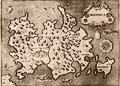 | Details | Porcacchi, Tomasso | 1572 |
| Very old antique map of Mallorca, Spain |
|
Porcacchi, Tomasso |
|
| 1572 |
| LOC:4 |
| $0.00 | Porcacchi--Tomasso | Very-old-antique-map-of-Mallorca--Spain | SOLD
<br></br>Authentic copperplate-engraved antique map (1572) of Maiorica (Mallorca, Majorca), Spain engraved by Girolamo Porro and drawn by Tomasso Porcacchi. Liberal usage of stippling in the seas.
<br></br>
Around the Balearic Island known for its beach resorts numerous fantastical sea serpents and monstrous fishes fill empty areas in the finely stippled seas. A few of the key features in this small map of Mallorca include the much smaller island of Dragonera, Palomera, Cala figuera, Monacur, Cabo della Prea, and Premontor. Interior details include simple illustrations of trees, mountains, and villages.
<br></br>
Printed in Tomasso Porcacchi's "Isolario" or island book "L'Isol Piu Famose Del Mondo". That work contains a number of finely engraved maps of islands and the continents at a reduced scale. Porcacchi (1530-1585) was born in Tuscany to a poor family and first settled in Florence. He wrote about history, geography, and archaeology and later published the Isolario from Venice, Italy in three editions beginning in 1572. |
| 831 | 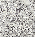 | Details | Munster, Sebastien | 1571 |
| Antique map of the island of Cephalonia, Greece |
|
Munster, Sebastien |
|
| 1571 |
| LOC:0 |
| $0.00 | Munster--Sebastien | Antique-map-of-the-island-of-Cephalonia--Greece | SOLD<br></br>Rare original 16th century wood cut map of Cephalonia ( Kefalonia ), Greece, the largest of the Ionian islands. In this decorative map from 1571 a half dozen towns are identified including Fiskardo ( "Viscardo" ), "Palis", Sami ( "Samos" ), "Cranis", and "S. Francifeus".
<br></br>
The Ionian islands are off the West coast of the Peloponnese peninsula in Southern Greece. The island of Lefkada ( "Levcas" ) is shown to the north.
<br></br>
From "Strabonis rerum geographicarum libri septemdecim" authored by Sebastien Munster and published by Heinrich Petri. Map is inset in a 8"x11"full page of text, both in Greek and Latin. Text on verso. |
| 724 | 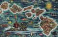 | Details | Feher, Joseph | 1950 |
| Dole Map of the Hawaiian Islands |
|
Feher, Joseph |
|
| 1950 |
| LOC:0 |
| $0.00 | Feher--Joseph | Dole-Map-of-the-Hawaiian-Islands | This map of Hawaii by Joseph Feher has been <b>sold</b> but in our inventory we now have one additional <a href=" https://www.rarecharts.com/ShowDetail/Creator/Feher--Joseph/Title/The-Dole-Map-of-the-Hawaiian-Islands/4983" target="_blank">Dole pictorial map of the Hawaiian Islands</a>.
<br></br>
Joseph Fehér (b. 1908) was a watercolorist active in Hawaii from about 1930 - 1960. Feher’s travel-related work was in demand for decades and included promotional posters and calendars for United Airlines and other corporate clients. |
| 1260 |  | Details | de Luque, Eduardo Malo | 1784 |
| Scarce Spanish Map of Australasia with Australia |
|
de Luque, Eduardo Malo |
|
| 1784 |
| LOC:0 |
| $0.00 | de-Luque--Eduardo-Malo | Scarce-Spanish-Map-of-Australasia-with-Australia | SOLD
<br></br>
Attractive and scarce antique Spanish map of Australasia with the Moluccas Islands, Philippines, Borneo, Java, Indonesia, New Guinea, and <b>Northern Australia</b> (Nueva Holanda). With an inset map of the "Verdaderas Malucas". Arrows show the prevailing winds. Covers portions of the Java Sea, Banda Sea, Timor Sea, and Celebes Sea and other bodies of water.
<br></br>
By Eduardo Malo de Luque and published 1784 from Madrid in "Historia política de los establecimientos ultramarinos de las naciones europeas". |
| 1389 | 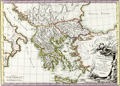 | Details | Pretot, Philippe | 1787 |
| Fine decorative antique map of Greece |
|
Pretot, Philippe |
|
| 1787 |
| LOC:0 |
| $0.00 | Pretot--Philippe | Fine-decorative-antique-map-of-Greece | SOLD<br></br>
Fine antique copper-plate engraved map centered on Greece with elements of the boot of Italy and Asia Minor. This attactive hand-colored engraving by Philippe Pretot includes Athens, Crete, Thera (Santorini), Rhodes, Kos, Naxos, and much more. Fine armorial and landscape-themed cartouche at bottom right. Number 83.
<br></br>
This antique map of Greece is from "Recueil de Cartes pour l'Etude de la Histoire de France." Published by Nyon from Paris in 1787. |
| 2561 | 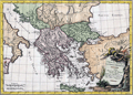 | Details | Pretot, Philippe | 1787 |
| Fine antique map of Greece and Asia Minor |
|
Pretot, Philippe |
|
| 1787 |
| LOC:0 |
| $0.00 | Pretot--Philippe | Fine-antique-map-of-Greece-and-Asia-Minor | SOLD
<br></br>
Fine antique copperplate-engraved map of mainland Greece and the Grecian archipelago. Noted locations include the Agean Sea, the Adriatic Sea (Mare Hadriaticum), the Black Sea (Pontus Euxinus) and Ionian Sea (Mare Ionium). Coverage includes many of the famed islands of Greece with Crete, Rhodes, Santorini (Thera), Mykonos (Mycone), and Samos to name a few.
<br></br>
With a very decorative title cartouche- ancient armor and implements of war resting on a landscape that includes plants and a waterfall. Lettered by Herault. Engraved by Moithey. Number 83. This antique map of Greece is from "Recueil de Cartes pour l'Etude de la Histoire de France." Published by Nyon from Paris in 1787. |
| 1437 | 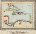 | Details | Thompson, Henry A. | 1850 |
| Manuscript naval student map of the Caribbean Islands |
|
Thompson, Henry A. |
|
| 1850 |
| LOC:0 |
| $0.00 | Thompson--Henry-A- | Manuscript-naval-student-map-of-the-Caribbean-Islands | SOLD <br></br>
Original mid 19th-Century manuscript map in black ink and watercolor, showing southern Florida, islands of the Caribbean/West Indies and part of Central and South America. Set within an elaborate border.
<br></br>
The creator has signed the map "Henry A. Thompson" and inscribed it "Elson House Academy / near Gosport June 9, 1850". "Near Gosport" suggests that Thompson may have drawn this map while aboard ship, perhaps during a summer training cruise.
<br></br>
It is likely that Henry Thompson was a student at a naval preparatory training establishment, as Gosport, near Portsmouth in Hampshire was a major sea port on the south coast of England at this time. The introduction in 1838 of an entrance examination for the Royal Navy, encouraged the development of specialised educational establishments like Elson House Academy, Dr. Burney's Academy, and nearby Stubbington House School. |
| 1461 |  | Details | Hurd, Thomas Hannaford | 1827 |
| Hurd's Very Rare Chart of Bermuda |
|
Hurd, Thomas Hannaford |
|
| 1827 |
| LOC:0 |
| $0.00 | Hurd--Thomas-Hannaford | Hurd-s-Very-Rare-Chart-of-Bermuda | SOLD <br></br>
Thomas Hurd's (1747-1823) rare reduced chart of Bermuda, the first exact survey of the island’s waters. This original antique chart was first issued 30 years after its completion in 1797. One reason the chart may have escaped publication for such a long period was that the Admiralty feared losing valuable hydrographic information to the United States.
<br></br>
After the Revolutionary War, British Canada was cut off from Britain's Caribbean colonies through the loss of access to American ports that once belonged to the British Crown. Bermuda's central position in the Atlantic became of strategic importance.
<br></br>
<div class="indenttextblock">"Hurd's charts revealed several deep channels and anchorages 'large enough for all the navies of the world to ride in," and in 1795 the seventy-four-gun Resolution became the first ship-of-the-line to shelter at Bermuda."
<br></br>
"The task took him nine years to complete and the results of his monumental study altered Bermuda for ever. Hurd’s survey underscored the maritime and strategic capability of Bermuda and by the early 19th century the island was becoming the Gibraltar of the Atlantic, remaining Britain’s largest overseas naval base until after WWII. "
<a href="http://www.royalgazette.com/editorials/article/20160415/bermudas-mapping-that-changed-atlantic-world" target="_blank">(Online.)</a>
</div>
<br></br>
Only two institutions are recorded as holding Hurd's chart: the Royal Museums Greenwich, and Princeton, University. No record of a sale of Hurd's map in AMPR and as of 1/20/18 this is the only copy of Hurd's chart offered for sale online.
<br></br>
With the oval fouled-anchor logo of the Hydrographical Office of the Admiralty. Attribution reads: "London : Published according to Act of Parliament at the Hydrographical Office of the Admiralty, 4th. Augt. 1827." Price two shillings. |
| 2494 | 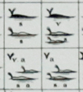 | Details | Maury, Matthew Fontaine | 1956 |
| Maury's Whale Chart 3rd. Ed |
|
Maury, Matthew Fontaine |
|
| 1956 |
| LOC:0 |
| $0.00 | Maury--Matthew-Fontaine | Maury-s-Whale-Chart-3rd--Ed | SOLD
<br></br>
Rare thematic chart of reported whale sightings by geographic area, whale species, and relative number of sightings.
<br></br>
Third issue (of four). Hydrographic Office of the US in the mid 20th century. Upper top left position with logo of eagle clutching items in claws surrounded by text: "Hydrographic Office U.S. Navy". Top right position is blank. Bottom right position reads "Price 20 cents / H.O. Miscel. No. 8514" Mid-20th-century electrotype on wove paper. This instance of Maury's whale chart carries a blue ink over-stamp from the U.S. Naval Supply Depot at Scotia, NY. "Corrected through Notice to Mariners No. 25 June 23, '56" that is- 1956. |
| 4935 | 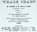 | Details | Maury, Matthew Fontaine | 1960 |
| Maury's Whale Chart 4th Edition |
|
Maury, Matthew Fontaine |
|
| 1960 |
| LOC:0 |
| $0.00 | Maury--Matthew-Fontaine | Maury-s-Whale-Chart-4th-Edition | SOLD
<br></br>
Rare thematic chart of reported whale sightings by geographic area, whale species, and relative number of sightings. An early example of the graphical display of quantitative information for decision making.
<br></br>
Matthew Maury's Whale Chart, was first issued by the United States Bureau of Ordnance & Hydrography in 1851. This is the fourth (4th.) edition, from the United State Hydrographical Office in the 1960s.
<br/></br/>
Upper top left position with logo of eagle over an anchor surrounded by text: "United States Hydrographical Office". Top right position reads "Catalog: Introduction. Part 1.". Bottom right position reads "Price 50 cents / H.O. Miscel. No. 8514" Mid-20th-century electrotype on wove paper. This instance of Maury's whale chart carries two unknown blue ink accession hand stamps in the far bottom right margin: "June 23, 1969." and "Accession no. [in MS] 763."
<br></br>
Shows best whaling areas and migration patterns for sperm whales and right whales, as well as the most densely populated areas and areas of "Straggling" Sperm Whales and Right Whales. |
| 2501 | 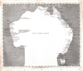 | Details | Arrowsmith, Aaron | 1804 |
| New Holland or Australia by Aaron Arrowsmith |
|
Arrowsmith, Aaron |
|
| 1804 |
| LOC:6 |
| $0.00 | Arrowsmith--Aaron | New-Holland-or-Australia-by-Aaron-Arrowsmith | SOLD
<br></br>
Antique map of Australia from Arrowsmith's large chart of the Pacific Ocean, published here in smaller format. (Published by John Conrad & Co., Philadelphia. 1804).
<br></br>
The odd shape of the Australian continent reflects the poor knowledge of that continent in 1804. Use of dark coloration for the sea makes this plate easily distinguishable from other maps of the era. Contains interesting comments about the geography and documents dates of exploration for the Australian coast. Edel's Land. 1619; C.F. de Wits Landt Discovered in 1628 Black Inhabitants;
<br></br>
This unusual antique map was published in A new and elegant general atlas, comprising all the new discoveries, to the present time. Containing sixty-three maps, drawn by Arrowsmith and Lewis. Published by John Conrad & Co. [and others]. Philadelphia . 1804.
(Source: davidrumsey.com). |
| 2516 |  | Details | Morden, Robert | 1688 |
| The Philippine Isles |
|
Morden, Robert |
|
| 1688 |
| LOC:0 |
| $0.00 | Morden--Robert | The-Philippine-Isles | (SOLD) <br></br>Scarce map of the Philippines by Robert Morden (1650 – 1703). Morden was an English bookseller, publisher, and mapmaker. Includes the disputed Paracel Islands, an archipelago in the South China Sea. The Paracel Islands are controlled by the People's Republic of China, and also claimed by Taiwan and Vietnam. |
| 2532 |  | Details | Gignilliat, Robert D. | 1898 |
| Manuscript Map of Sea Islands of Georgia and South Carolina [after U.S. Coast Survey] |
|
Gignilliat, Robert D. |
|
| 1898 |
| LOC:0 |
| $0.00 | Gignilliat--Robert-D- | Manuscript-Map-of-Sea-Islands-of-Georgia-and-South-Carolina-[after-U-S--Coast-Survey] | SOLD<br></br>
R.D. Gignilliat's personal manuscript map of the Sea Islands of Georgia and Sea Islands of South Carolina made during the Spanish-American war, ca. 1898, after U.S. Coast Survey charts. MS ink on surveyor's tracing cloth, also known as "tracing linen"
<br></br>
This MS map shows a novel focus on the Sea Islands as a distinct entity, with the group consisting of two parts, the Georgia and South Carolina Sea Islands on a single sheet but vertically stacked rather than linearly. Although each of the two maps were published separately the vertically stacked format employed here was an enhancement conceived by Gignilliat. On Tybee Island the structure labeled "Tower" by the Coast Survey is updated to a more descriptive "Omatello" or "Matello Tower"- local pronunciation of Old Martello Tower. This additional information on Tybee Island matches with the work history of Gignilliat. Inked stamp bottom left corner for "????? Engr Roadway".
<br></br>
Robert Deas Gignilliat, a civil engineer with experience in concrete construction, was born in McIntosh county, Georgia, 1873. Gignilliat managed work on fortifications at Fort Screven, <b>Tybee Island, Georgia</b>, (among the Sea Islands) which were in construction immediately preceding and during the war with Spain in 1898. Gignilliat worked constantly to ensure these important outposts could make an effective defense of the city of Savannah if it were attacked by the Spanish fleet. Preceding and following this public service, he was actively engaged in river, harbor, and railroad related work. (http://files.usgwarchives.net/ga/mcintosh/bios/gbs492gignilli.txt)
<br></br>
Not found listed in OCLC or the AMPR. Owner's name written in script hastily near the title block for each sub-chart reads Robt. D. Gignilliat. |
| 3654 |  | Details | Schultz, Christian | 1810 |
| Early Original Map of the Hudson and Mohawk Rivers |
|
Schultz, Christian |
|
| 1810 |
| LOC:0 |
| $0.00 | Schultz--Christian | Early-Original-Map-of-the-Hudson-and-Mohawk-Rivers | SOLD<br></br>
Schultz's very early map of the with the Hudson, Mohawk, Allegheny, and Ohio Rivers. Shows a water-based transportation route from New York City to Pittsburg via the system of rivers and lakes with only a single portage required at the southern portion of Lake Erie.
<br></br>
Includes portions of Lake Ontario and Lake Erie. Follows the rivers' course from New York City and the Hudson River to Lake Ontario, via the Hudson River and Mohawk River; then follows the Ohio River, via Fort Erie and the Allegheny river.
<br></br>
Published in 1810 for Christian Schultz's "Travels on an Inland Voyage Through the States of New York, Pennsylvania, Virginia, Ohio, Kentucky and Tennessee, and through the territories of Indiana, Louisiana, Mississippi, and New-Orleans; performed in the years 1807 and 1808…"
<br></br>
Schultz's work is one of the earliest works to give a detailed account of travel and the actual risks and dangers encountered in the west. Schultz's book is a compilation of his letters. The book was published in direct response to the negative reports in an earlier travel guide written by Englishman Thomas Ashe in 1806. |
| 3603 | 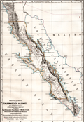 | Details | Perthes, Justus | 1868 |
| Map of Baja California |
|
Perthes, Justus |
|
| 1868 |
| LOC:0 |
| $0.00 | Perthes--Justus | Map-of-Baja-California | SOLD
<br></br>
Original geographical, German map of Baja California in 1868 for the Lower California Company with information taken from the expeditions of J. Ross Browne. In 1866 the Lower California Company purchased the Baja Peninsula from 24 degrees 20'
to 31 degrees including both coasts of the peninsula. The company's intent was to colonize and exploit the lands.
<br></br>
From "Mittheilungen aus Justus Perthes' Geographischer Anstalt uber Wichtige Neue Erforschungen auf dem Gessammtgebiete der Geographie von Dr. A. Petermann, 1868." Roughly: "Communications from Justus Perthes Geographical Institute Concerning Important New Studies in the Whole Field of Geography by Dr. Augustus Petermann, 1868. Drawn by C. Hellfarthin.
<br></br>
Finely printed by Justus Perthes in blues and greys.
<br></br> |
| 3610 | 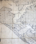 | Details | O'Neal, Robert | 1887 |
| Unusual antique cadastral map of St. Andrews Bay, Florida |
|
O'Neal, Robert |
|
| 1887 |
| LOC:0 |
| $0.00 | O-Neal--Robert | Unusual-antique-cadastral-map-of-St--Andrews-Bay--Florida | SOLD<br></br>
Early, scarce cadastral map of St. Andrews Bay and lands owned by the St. Andrews Bay Rail Road and Land Company. Florida related. Noted features include Spanish Shanty Point, two mills, a hotel, Redfish Point, Pearl Bayou, Laughton's Bayou, Grand Lagoon, Hurricane Isle, and a "Road to Chipley".
<br></br>
A report by Pamela Brown for the University of Florida’s Soil and Water Department notes:
<div class="indenttextblock">
"A Cincinnati mail-order company,the Saint Andrew Bay Railroad, Lands, and Mining Co., bought property in the Saint Andrew Bay area, and started nationally advertising 25 feet x 82 feet lots for $1.25. The advertisement attracted a lot of people and started a settlement boom as over 300,000 lots were sold. As the price for lots increased to $8.00, the company went bust." <a href="https://soils.ifas.ufl.edu/media/soilsifasufledu/sws-main-site/pdf/technical-papers/Brown--Pamela-Sue.pdf" target="_blank">Online, p. 46)</a>
</div>
</br>
Oyster bars shown with " |||| " symbols. Additional manuscript compass rose. Scale 1 inch = 1 mile. Copyrighted by Robert O'Neal May 27th, 1887.
<br></br>
Map is accompanied with an early Warranty Deed issued by the St. Andrews Bay Railroad, Land, and Mining Co. in 1877 for a lot in a specified Block, Township, and Range on the map. Price for the lot in 1887 was $1.25. |
| 2547 | 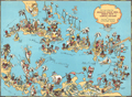 | Details | White, Ruth Taylor | 1935 |
| Amusing Pictorial Map of the Caribbean Islands |
|
White, Ruth Taylor |
|
| 1935 |
| LOC:88 |
| $0.00 | White--Ruth-Taylor | Amusing-Pictorial-Map-of-the-Caribbean-Islands | SOLD
<br></br>
Decorative, playful map of the Caribbean Islands by Ruth Taylor White. Coverage includes south Florida, Cuba, the Bahamas, the Windward and Leeward Islands, Central America, and portions of Colombia and Venezuela. The Caribbean Islands are shown in a cartoon-like style complete with palm trees, flamingos, cruise ships and numerous stylized native inhabitants in local costumes. At the Panama Canal Zone a United States soldier stands guard with gun at shoulder. Page 85. |
| 2549 | 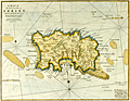 | Details | Stockdale, John | 1810 |
| A Map of the Island of Jersey in the English Channel. |
|
Stockdale, John |
|
| 1810 |
| LOC:88 |
| $0.00 | Stockdale--John | A-Map-of-the-Island-of-Jersey-in-the-English-Channel- | SOLD<br></br>
Early original copper-plate engraved map of Jersey Island one of the Channel Islands and a Crown dependency. Attractive antique engraved sheet.
<br></br>
The map was published by John Stockdale in London on the 26th of March 1805. This is a later printing ca. 1810 as demonstrated by the watermark "1809". Engraved by the prolific John Cary. |
| 2551 | 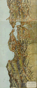 | Details | Rhea, J.J. | 1915 |
| Tourist Association Travel Map of Central California |
|
Rhea, J.J. |
|
| 1915 |
| LOC:0 |
| $0.00 | Rhea--J-J- | Tourist-Association-Travel-Map-of-Central-California | SOLD<br></br>
Early 20th century travel map of Central California by the Tourist Association of Central California. Shows early automobile and railroad transportation routes. Map coverage ranges from Pieta and Kelseyville in the north, extending down past Jolon to the south. Folds to 8 3/4 to 9 3/16.
<br></br>
Legend at side states "Auto roads in orange. Railroads in black and white. Waterways in blue." |
| 3674 |  | Details | Price, Charles | 1743 |
| Chart of the Island of Hispaniola and Windward Passage |
|
Price, Charles |
|
| 1743 |
| LOC:0 |
| $0.00 | Price--Charles | Chart-of-the-Island-of-Hispaniola-and-Windward-Passage | SOLD <br></br>
Fine British chart of Hispaniola (Haiti/Dominican Republic) with eastern Cuba and the southern Bahamas. Contains two compass half roses. By Charles Price, a publisher, globe and instrument maker, and engraver.
<br></br>
Although printed in 1743, the chart has cartographic inspiration back to "Chart if the Iland of Hispaniola with the Windward Passage from Jamaica…" by William Fisher (1689), John Thornton (1698), several Mounts and Pages."
<br></br>
Charles Price apprenticed to John Seller and he planned to published a maritime atlas covering the whole world, but the venture was not a success and was never completed. Price was a debtor in Fleet Street Prison at the end of 1731. After Price's death (ca. 1733) his plates passed to Mount & Page, who added their names lower left. Sold by William Mount and Thomas Page, Tower Hill, London.
<br></br>
This map is from the English Pilot. The Fourth Book "Describing the West-India Navigation, from Hudson’s Bay to the River Amazones. Particularly Delineating The Coasts, Capes, Headlands, Rivers, Bays, Roads, Havens, Harbours, Streights, Rocks, Sands, Shoals, Banks, Depths of Water, and Anchorage, with all the Islands therein; as Jamaica, Cuba, Hispaniola, Barbadoes, Antigua, Bermudas, Porto Rico, and the Rest of the Caribee and Bahama Islands." The first edition of the English Pilot in 1689 was the first English atlas up to that time to include charts solely of American waters. |
| 4731 | 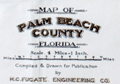 | Details | Fugate, H.C. | 1923 |
| Authentic old map of Palm Beach County, Florida |
|
Fugate, H.C. |
|
| 1923 |
| LOC:0 |
| $0.00 | Fugate--H-C- | Authentic-old-map-of-Palm-Beach-County--Florida | SOLD<br></br>
Authentic old map of <b>Palm Beach County, Florida</b> made in a slower time but presaging the large scale development to follow. Numerous features of historical interest include the Lake Worth Casino (Lake Worth Casino and Baths opened in 1922), <b>Central Dixie Highway</b>, the Hanson Grant, the Gomez Grant, and Big Mound.
<br></br>
In 1815, the King and Queen of Spain and the Governor of Florida awarded Don Eusebio Gomez a Royal Land Grant of roughly 12,000 acres known as the <b>“Gomez Grant”</b>. The huge plot surrounded the Loxahatchee and Indian Rivers, as well as a narrow strip of barrier island between the St. Lucie Inlet and the Jupiter Inlet.
<br></br>
<b>Big Mound City</b> is the site of a complex of Native American earthworks built in the Lake Okeechobee Basin area of southeastern Florida circa 1000 A.D.
<br></br>
On the Atlantic Ocean, coverage extends from Boca Ratone (Boca Raton) at the south to Stuart at the north end and includes Port Sewall, Bon Air Beach, Olympia, Jupiter Inlet, Palm Beach, Lake Worth, Boynton, Delray, and Ferncliff. Numerous golf links are noted
<br></br>
Compiled and drawn for publication in 1923 by Fugate Enineering. Co. 119 N. Olive Street. West Palm Beach, Florida. Useful legend at bottom left corner. Numerous depth soundings and course-to-steer shown within Lake Okeechobee. Price when issued 60 cents. Horizontal and vertical scale based on township and range notation. Scale 4 miles to one inch. |
| 1355 | 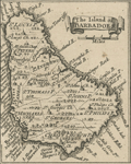 | Details | Popple, Henry | 1742 |
| Antique maps of the islands of Barbados and Antigua. |
|
Popple, Henry |
|
| 1742 |
| LOC:0 |
| $0.00 | Popple--Henry | Antique-maps-of-the-islands-of-Barbados-and-Antigua- | SOLD
<br></br>
Two small scarce antique copper-plate engraved maps of the islands <b>Barbados and Antigua</b> in the Caribbean Sea. These two neat maps, are after Henry Popple (1733). Popple's charts predate the later charts of Bellin and Bowen who based their geography on Durrell. Popple's map was titled: "A Map of the British Empire in America with the French, Spanish and the Dutch Settlements adjacent thereto".
<br></br>
This fragment was originally part of a sheet published by Covens and Mortier in 1742 in "Les Principales Forteresses Ports etc. de L'Amerique Septentrionale"; a larger engraved sheet containing harbor and island maps and plans of the Americas. The maps were trimmed from the larger sheet originally containing the two as shown.
<br></br>
Covens and Mortier published that single sheet of 18 maps and plans of islands and harbors in order to replace Popple's original large map of 20 sheets with a more manageable six-sheet version. |
| 4805 | 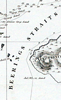 | Details | von Kotzebue, Otto | 1821 |
| Kotzebue Chart of Beerings Straits on Mercators Projection |
|
von Kotzebue, Otto |
|
| 1821 |
| LOC:88 |
| $0.00 | von-Kotzebue--Otto | Kotzebue-Chart-of-Beerings-Straits-on-Mercators-Projection | SOLD
<BR> </BR>
Scarce antique map of the <b>Bering Strait (Beering's Strait)</b> from exploration by <b>Otto von Kotzebue</b> (1787-1846) after the exploration of Russian navigator Vitus Bering. Includes the track and dates of Kotzebue's ship, the brig <b>RURIK</b>, as well as numerous named locations including Kotzebue Sound, Cape Krusentern, the St. Lawrence Islands, Cape Lowenstern, Cape Deceit, and Eschholtz Bay. Von Kotzebue was a German officer in the Imperial Russian Navy.
<br></br>
This fine map is based on von Kotzebue's voyage around Cape Horn to Alaska during the early 19th century. After rounding Cape Horn and visiting Chile, Easter Island, Hawaii, and the Marshall Islands, Kotzebue explored the North American west coast and searched unsuccessfully for a passage to the Arctic Ocean. Graff called the expedition, the second Russian scientific expedition into the Pacific, "one of the great early nineteenth-century voyages of discovery."
<br></br>
The Bering Strait is a strait of the Pacific Ocean, which separates Russia and Alaska south of the Arctic Circle.
<br></br>
Scarce. From Otto von Kotzebue's "A Voyage of Discovery into the South Sea and Beering's Straits, for the Purpose of Exploring a North-East Passage, Undertaken in the Years 1815-1818."
London. Longman, Hurst, Rees, Orme & Brown. 1821.
<br></br>
Printed in 1821 in English, Russian, and German editions. |
| 1107 | 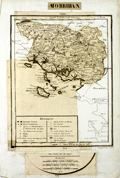 | Details | Dezauche, J.C. | 1800 |
| Unique and unusual paste up engraver's copy of an unpublished Dezauche map |
|
Dezauche, J.C. |
|
| 1800 |
| LOC:9 |
| $0.00 | Dezauche--J-C- | Unique-and-unusual-paste-up-engraver-s-copy-of-an-unpublished-Dezauche-map | SOLD<br></br>
A very unusual 216 year old paste-up map-engraver's working copy before the era of photographic reproduction. The paste-up provides a rare glimpse into the map-making thought process and the cartographic design process of the early 19th century during the French Revolution.
<br></br>
The paste-up is a composite of cut-out portions of J.C. Dezuache's "Carte Itineraire" along with fresh manuscript geographic outlines and neatlines as required. The end result of the effort is the model for a new map of only the Morbihan department with detail from the earlier Dezauche map and showing Morbihan in context with its closest neighboring areas. No record exists that this new revised map was ever published. Bears the signature and date at bottom in manuscript "Dezauche 1800".
<br></br>
In 1800 Jean-Claude Dezauche published a map of Brittany (Bretagne) and its several departments:
"Carte itinéraire de la Bretagne, contenant les départements du Finistère, du Morbihan, des Côtes-du-Nord, d'Isle-et-Vilaine et de la Loire-Inférieure, avec les routes de postes et autres routes de communications / dressée par Dezauche." It is from this map that Dezauche or his publisher extracted the bulk of the image that was to be repurposed into a new map of Morbihan. |
| 1122 |  | Details | Arrrowsmith, John | 1838 |
| Australia according to the proposed divisions |
|
Arrrowsmith, John |
|
| 1838 |
| LOC:0 |
| $0.00 | Arrrowsmith--John | Australia-according-to-the-proposed-divisions | SOLD <br></br>
This small antique map by John Arrowsmith (1790-1873) is an early record of Australian history as it documents a proposed naming convention and geographical boundaries for states in the continent of Australia.
<br></br>
Published for the Journal of the Royal Geographical Society to accompany an article "Considerations on the Political Geography and Geographical Nomenclature of Australia".
<br></br>
These proposed states were geometric divisions of the continent, and did not take into account soil fertility, aridity or population. This meant that central and western Australia were divided into several states, despite their low populations both then and now.
<br></br>
<h3>Proposed Divisions of Australia</h3>
<br />
<div class="indenttextblock" style="list-style-type: circle;">
<ul>
<li>Dampiera</li>
<li>Victoria</li>
<li>Tasmania (not to be confused with the modern Tasmania).</li>
<li>Nuytsland</li>
<li>Carpentaria</li>
<li>Flindersland</li>
<li>Torresia</li>
<li>Cooksland</li>
<li>Guelphia</li>
<li>Vam Dieman's Land (modern-day Tasmania)</li>
</ul>
</div>
John Arrowsmith was a cartographer to both the Royal Geographical Society and the Parliamentary Reports. Those roles gave Arrowsmith access to information on the latest discoveries and he created numerous maps of Australia and other areas, revising the maps with results of later information. Published by John Murray, Albemarle Street. London. |
| 1096 |  | Details | Pacific Steam Whaling Company | 1901 |
| Pacific Steam Whaling Company's Map of Alaska |
|
Pacific Steam Whaling Company |
|
| 1901 |
| LOC:0 |
| $0.00 | Pacific-Steam-Whaling-Company | Pacific-Steam-Whaling-Company-s-Map-of-Alaska | SOLD <br></br>
Antique map of Alaska featuring the routes of steamers, canneries, and whaling stations belonging to the <b>Pacific Steam Whaling Company</b>. The map served as a promotional tool for the firm with numerous notations (in red) designed to appeal to speculators and fortune seekers for example: "Gold", <b>"Gold Placer Diggings"</b>, "Gold and Copper Deposits", "Silver Ahead" and "Cape Nome Gold Field".
<br></br>
Published by the Pacific Steam Whaling Company, 30 California Street, San Francisco and Corner of 1st Ave and Yesler Way, Seattle.
<br></br>
According to the cover the coverage includes "Nome, Teller City, Behring City, Golofnin, Western Alaska, Cooks Inlet and Copper River gold diggings." Manuscript ink annotation with "Waldez" and a circle just below the town of Valdez.
<br></br>
Routes include the whaling steamer's route to Port Clarence,; the mail steamer's route to Cape Nome from Unalaska; routes to <b>Bristol Bay</b>, Prince William's Sound, and Seattle to Unalaska.
<br></br>
Folding map of Alaska unfolds to its full extent of 22" W x 17" H. |
| 1440 |  | Details | Popple, Henry | 1742 |
| Antique plan of Curacao in the Caribbean Sea |
|
Popple, Henry |
|
| 1742 |
| LOC:0 |
| $0.00 | Popple--Henry | Antique-plan-of-Curacao-in-the-Caribbean-Sea | SOLD <BR> </BR>
Antique chart fragment ca. 1742 of the island of Curacao in the Caribbean Sea. Noted locations include Cassarts Landing Plaats, Valentyn's bay, Porto Maria, Willemstad, Fort Beekenburg, Fort Collenburg, St. Jeris, and Verse Bay droog. Attractive compass rose and rhumb lines.
<br></br>
This antique map was originally published by Covens and Mortier in 1742 in "Les Principales Forteresses Ports etc. de L'Amerique Septentrionale" a sheet containing harbor and island maps and plans of the Americas. This map is a fragment trimmed from the larger sheet.
<br></br>
That sheet of 18 maps and plans of islands and harbors was published by Covens and Mortier to replace Popple's original large map of 20 sheets with a more manageable six-sheet version. Popple's original map was titled: "A Map of the British Empire in America with the French, Spanish and the Dutch Settlements adjacent thereto". |
| 1280 |  | Details | Brue, Adrien Hubert | 1822 |
| Large antique world map of the east and west hemispheres. |
|
Brue, Adrien Hubert |
|
| 1822 |
| LOC:0 |
| $0.00 | Brue--Adrien-Hubert | Large-antique-world-map-of-the-east-and-west-hemispheres- | Sold
<br></br>
Attractive large antique dual-hemisphere map of the world by Adrien Brue. Presented as two joined views of the eastern and of the western hemispheres. Nice and careful hand-coloring. |
| 1296 | 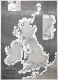 | Details | Hardinge, Woolfield | 1874 |
| Large rare antique British Lighthouse Chart |
|
Hardinge, Woolfield |
|
| 1874 |
| LOC:0 |
| $0.00 | Hardinge--Woolfield | Large-rare-antique-British-Lighthouse-Chart | SOLD <br></br>Very scarce and visually appealing "British Lighthouse Chart of General Coast Lights. Compiled from authentic sources by Woolfield H.F. Hardinge. 1874." This large ( 23" W x 32" H ) informational chart graphically displays these characteristics of the light: the range over which the light could be seen; frequency and duration of the light; and color of light. Includes lighthouses on both the Irish and British coastlines, with nearby French lighthouses shown along the English Channel.
<br></br>
Can not find any copy of this chart on the Internet or in AMPR.
<br></br>
Lithographed by Robert J. Cook and Hammond 29 Charing Cross S. W. Published by J. D. Potter, Admiralty Chart Agent 31 Poultry London, E.C. |
| 1480 |  | Details | Cutler and Halley | 1728 |
| Halley's Antique Chart with coasts of America Europe and Africa |
|
Cutler and Halley |
|
| 1728 |
| LOC:0 |
| $0.00 | Cutler-and-Halley | Halley-s-Antique-Chart-with-coasts-of-America-Europe-and-Africa | Please view another <a href="https://www.rarecharts.com/ShowDetail/Creator/Cutler-and-Halley/Title/Halleys-chart-Atlantick-Ocean-on-a-Globular-Projection/4952" target="_blank">copper-engraved chart</a> of the Atlantick Ocean by Nathaniel Cutler and Edmund Halley. |
| 1393 |  | Details | U.S. War Department | 1846 |
| First Map of the State of Florida |
|
U.S. War Department |
|
| 1846 |
| LOC:0 |
| $0.00 | U-S--War-Department | First-Map-of-the-State-of-Florida | SOLD <br></br>
A very large (40" x 42"), comprehensive, original map of Florida that was published in 1846<b>, one year after Florida gained statehood</b>. An important, and informative map of Florida, one of the first produced after Florida’s admission to the Union on March 3, 1845, carrying much useful military information particularly regarding the <b>Seminole tribe</b>.
<br></br>
This antique map exhibits great detail and precision, especially in the coastline, and gives much information on the physical and cultural geography of the state. Numerous forts and military camps are located. The surveys extend along the coast south of Cape Canaveral, with the majority of the southern interior portion of the state still unsurveyed.
<br></br>
The Florida Everglades are identified along with a notation regarding the land assigned to native Americans: "District assigned to the Seminoles by the arrangement of Gen.' Macomb May 18th 1839." Three large inset maps fill the Gulf of Mexico: "Key West as surveyed February 1829"; "Mouths of Swanee R. and Cedar Keys showing the Western terminus of a proposed railroad"; and "A General Map of part of Florida included between Cedar Keys and St. John's River."
<br></br>
The map was drawn by Joseph Goldsborough Bruff and finely engraved by D. McClelland of the Topographical Engineers. Bruff was a draftsman and cartographer who served as a mapmaker for the Bureau of Topographical Engineers. The Library of Congress notes: <div class="indenttextblock">" … J. Goldsbourough Bruff, was a native of Washington, D.C. At an early age he was admitted to West Point, but after only two years he was forced to leave the prestigious military academy after participating in a duel. He later became a professional cartographer and draftsman, as well as an amateur artist and adventurer. <a href="http://www.loc.gov/exhibits/mapping-a-growing-nation/online-exhibition.html#obj017" target="_blank"> (Internet). </a></div> |
| 1339 |  | Details | Mentelle and Chanlaire | 1798 |
| Fine antique map of the Americas |
|
Mentelle and Chanlaire |
|
| 1798 |
| LOC:0 |
| $0.00 | Mentelle-and-Chanlaire | Fine-antique-map-of-the-Americas | SOLD
<br></br>
Beautifully engraved and hand-colored map of the western hemisphere focused on North America and South America. The combination of the curved map projection and the fine coloring work act synergistically to emphasize the curvature of the earth's surface. The map projection allows the inclusion of Africa and Europe at right, and New Zealand and the Pacific Islands at left.
<br></br>
The date of "An VI" dates the map to the sixth year of the French Revolution or 1798 in the Gregorian calendar. Interesting bit of land shown north of the Arctic Circle outside the neatline.
<br></br>
Political subdivisons shown in red. Published from Paris by French cartographers E. Mentelle and Pierre-Giles Chanlaire. Number 155. |
| 3609 | 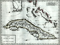 | Details | Mentelle and Chanlaire | 1798 |
| Attractive antique map of Florida, Cuba, and Bahamas |
|
Mentelle and Chanlaire |
|
| 1798 |
| LOC:0 |
| $0.00 | Mentelle-and-Chanlaire | Attractive-antique-map-of-Florida--Cuba--and-Bahamas | SOLD
<br></br>
Beautifully engraved and hand-colored map of southern Florida, Cuba, and the Bahama Islands (or Lucayes) from 1798. Points of interest in Floida include the Florida Keys (les Martyres), Port St. Lucie (Punta de Santa Lucia), Palm Beach (Cap della Floride), Cape Biscayne (Cap Biscaino). Beautifully engraved by Pierre Tardieu.
<br></br>
Published from Paris by French cartographers E. Mentelle and Pierre-Giles Chanlaire. Edme Mentelle (1730 - 1816) was a French geographer and historian in Paris who studied under the historian Jean-Baptiste Louis Crevier at the College of Beauvais. After accepting a position as professor of Geology and History at the Ecole Militaire he tutored students including the young Napoleon Bonaparte. Mentelle published a number of important geographical works including the 1778 Geographie Comparee, the 1779 Atlas Universel, and the 1801 Cours Complet de Cosmographie, de Chronologie, de Geographie et d'Histoire. Plate 3. |
| 1349 | 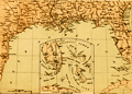 | Details | Wells and Smith | 1863 |
| Civil War era map of states bordering the Gulf of Mexico |
|
Wells and Smith |
|
| 1863 |
| LOC:0 |
| $0.00 | Wells-and-Smith | Civil-War-era-map-of-states-bordering-the-Gulf-of-Mexico | SOLD<br></br>Neat map from 1863 of the southern states bordering the Gulf of Mexico with Florida, Georgia, Mississippi, Alabama, and Texas. Numerous bays, rivers, and cities are identified including Charlotte Harbor, Key West, Indian River Inlet, Galveston, New Orleans, Madisonville, Pensacola, Tampa, Amelia Island, St. Simons Island, and Port Royal. Inset at bottom includes and extension for south Floria and the Keys.
<br></br>
Locations of key forts include: Fort St. Philip, Fort Barrancas, Fort Pike, Fort Pickens, Fort Morgan, Fort Dade, Fort Clinch, Fort Taylor, Fort Jefferson (Tortugas).
<br></br>
Publisher's attribution at bottom reads: "Entered according to act of Congress AD 1863 by Virtue Yorston & co. in the clerk's office of the district court of the United States for the Southrn. Dist. Of N. York." |
| 1364 |  | Details | Mornas and Desnos | 1761 |
| Copernican solar-system model- an attractive antique engraving. |
|
Mornas and Desnos |
|
| 1761 |
| LOC:0 |
| $0.00 | Mornas-and-Desnos | Copernican-solar-system-model--an-attractive-antique-engraving- | SOLD
<br></br>
A fine representation of Copernicus' astronomical theory of our solar system where the planets revolve around the sun. The Copernican theory eventually came to replace an earlier geocentric theory in which the Earth was the center of the universe and all celestial bodies orbited it. Image is surrounded by French text on both sides.
<br></br>
Original antique copper-plate engraved sheet issued in Paris in 1761. Nicely hand colored.
<br></br>
Sold by Buy de Mornas (d. 1783), geographer to Louis XVI, and Louis-Charles Desnos, artist, (1725-1805), who ran one of the most important French map-making enterprises.
<br></br>
From "La Manniere de Reconnoitre les Principales Etoiles dans le Ciel". The topics covered by prints in that work include the seasons, the Sun, our solar system and its various conceptions over history, the stars and phenomena such as eclipses. |
| 693 |  | Details | Munster, Sebastien | 1580 |
| Antique early map of Greece with Istanbul |
|
Munster, Sebastien |
|
| 1580 |
| LOC:2 |
| $0.00 | Munster--Sebastien | Antique-early-map-of-Greece-with-Istanbul | SOLD
<br><br>
Antique woodcut map of Greece published ca. 1578 by Sebastien Munster in a French edition of his Cosmographie. At extreme upper right Munster denotes the triple-walled city of Constantinople (modern Istanbul, Turkey) astride the Bosphorus Strait. In addition to Constantinople, small iconized dwellings represent the towns of Edirne ( Adrianople ), Modon, Corinth, and Salonica. Other geographical features include: Mount Olympus, Thrace, Albania, Macedonia, and the Greek Islands of Crete, Corfu, Lemnos, Lesbos, Samos, Melos, and Negroponte.
<br></br>
Woodcut is inset into French text. Verso contains French text and a small woodcut of a 16th century nobleman. Page 1052. |
| 730 | 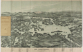 | Details | George W. Walker Lithograph and Publishing Co | 1903 |
| Birdseye View of Lake Winnipesaukee, New Hampshire |
|
George W. Walker Lithograph and Publishing Co |
|
| 1903 |
| LOC:0 |
| $0.00 | George-W--Walker-Lithograph-and-Publishing-Co | Birdseye-View-of-Lake-Winnipesaukee--New-Hampshire | SOLD <br></br>
Attractive antique birds-eye view map of Lake Winnipesaukee, New Hamphire from 1903. Sidewheel steamers puff along at center with the snowy peak of Mount Washington at the background framed by Carter Dome, Mount Lafayette, Mount Passaconaway, Mount Paugus and many others in the White Mountain Range. Named towns include Lakeport, Belknap Point, Lakeshore Park, Springhaven, Alton Bay, Wolfboro, Moultonboro, Center Harbor, Ashland. Shows two branches of the Boston and Maine Railroad and contains a legend at bottom with names of 59 islands and 26 mountains displayed on the map. Noted islands include Rattlesnake, Red Head, Kenniston, Stone Dam, and Long Island.
<br></br>
Original two stone lithograph folding map from 1903 published by George H. Walker of Boston, who also published similar birdseye view maps of Casco Bay, Boston Harbor, Narragansett Bay and other locations in the Northeast.
<br></br>
Still attached to a brown card cover as issued, this map folds to a compact 3.5 x 6.6 inches. |
| 598 | 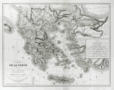 | Details | Dezauche, A.G. | 1829 |
| Carte De la Grece ou Theatre de la Guerre Entre les Grecs et les Turcs |
|
Dezauche, A.G. |
|
| 1829 |
| LOC:0 |
| $0.00 | Dezauche--A-G- | Carte-De-la-Grece-ou-Theatre-de-la-Guerre-Entre-les-Grecs-et-les-Turcs | SOLD<br></br>Antique map of Greece and Turkey with the Aegean Sea and its archipelago of islands, the Sea of Marmara, and portions of the Adriatic and Black Seas. This map is specifically focused on the "Theater of War" during the<a href="http://www.britannica.com/EBchecked/topic/244575/War-of-Greek-Independence" target="_blank"> War of Greek Independence </a> ( from Turkey ) between 1821 and 1832.
<br></br>
Specific geographical features include the Greek islands of Corfu, Crete, Rhodes, Negropont (Euboea), and Santorini; cities of Preveza, Gallipoli, Athens, Salonique ( Thessalonika ); with Smyrne ( Izmir ) and Constantinople ( Istanbul ), Turkey.
<br></br>
This large beautifully engraved, steel-plate engraved antique map was originally produced ca. 1780 by the French catographer and former "Ingenieur-Hydrographe de la Marine" A.G. Dezauche. This edition is a published by his son J.A. Dezauche from Paris in 1829.
<br></br> |
| 600 | 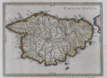 | Details | Jansson, Jan | 1657 |
| Het Eylandt Corsica |
|
Jansson, Jan |
|
| 1657 |
| LOC:8 |
| $0.00 | Jansson--Jan | Het-Eylandt-Corsica | SOLD<br><br>
Antique Dutch map of the French island of Corsica ( Corse ), in the Mediterranean Sea from ca. 1657 by Jan Jansson. Jansson (1588-1664) was a Dutch publisher and map maker from Amsterdam.
<br></br>
This nautical map is an original antique, over 350 years old and is oriented with North to the left. Prominent coastal details that are featured include: San Bonifacio strait, Golfo S. Fiorenzo, Golfo de Genarca, Golfo Aiazzo, Gollfo de Talabo, and at the far West, Capo Corsa.
<br></br>
On a folio-sized page with Dutch text on both the recto and verso related to the geography of that island.
<br></br>
Page 21. |
| 602 | 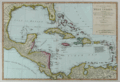 | Details | Dunn, Samuel | 1786 |
| Compleat Map of the West Indies |
|
Dunn, Samuel |
|
| 1786 |
| LOC:0 |
| $0.00 | Dunn--Samuel | Compleat-Map-of-the-West-Indies | SOLD<br></br>
Scarce antique nautical map focused on the Caribbean and the Gulf of Mexico. Interesting representation of Florida with the southern portion of that state shown as an archipelago of islands. Map coverage includes New Orleans, <b>Pensacola</b>, St. Augustine, <b>Amelia Island</b>, The Bahama Islands, Cuba, Jamaica, Puerto Rico, Virgin Islands, Leeward and Windward Islands, North Coasts of Colombia and Venezuela, Bay of Honduras, and Bay of Campeche. Earlier editions of this antique map are commonly found in the "The American Military Pocket Atlas" nicknamed the "Holster Atlas", issued to British Officers during the American Revolutionary War.
<br></br>
An interesting note on the map explains the derivation of terms "Windward" and "Leeward" to differentiate among two groups of islands in the southern Caribbean: <br><div class="indenttextblock ">
"The distinction between the Leeward and Windward Islands which is not commonly understood arose from the following circumstances. It was a custom going to the West Indies to make Island Desirada, the wind from the tropics blowing always from the East. All the islands to ye N. and W. of Desirada lay to the Leeward and all ye islands to the E. or S. lay to Windward of such ship's course T.P."</div>
<br></br>
The author, Samuel Dunn (d. 1794), taught navigation and other mathematical subjects and published several works on navigation, nautical science, and on astronomy. Published for Robert Sayer in June 1786. London. No. 53 Fleet Street. Plate 41. |
| 799 |  | Details | Robiquet, Aime | 1863 |
| Antique nautical chart of Sri Lanka or Ceylon |
|
Robiquet, Aime |
|
| 1863 |
| LOC:0 |
| $0.00 | Robiquet--Aime | Antique-nautical-chart-of-Sri-Lanka-or-Ceylon | SOLD
<br></br>
Antique French sea chart of the island of Sri Lanka, or as it was known before 1972- Ceylon. A large separately published steel plate navigational chart by French hydrographer and publisher Aime Robiquet. Includes the Southeast coast of India from Puducherry ("Pondicherry") extending south-westward, past Tuticorin ("Tutacorin") to Tiruchendur ("Trichindore"). Large French nautical chart encompasses the full extent of Sri Lanka and its offshore waters with numerous soundings, hazards, and coastal geographic features noted and named.
<br></br>
Includes two large inset harbor plans: of Colombo (1838), and Pointe de Galle (1858). Single horizontal fold as issued. Sparse interior detail is as common for many sea charts. |
| 4836 | 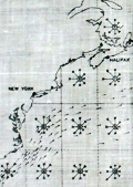 | Details | Navigators and Engineer Officers Union | 1942 |
| WWII Atlantic Survival Chart NEOU |
|
Navigators and Engineer Officers Union |
|
| 1942 |
| LOC:88 |
| $0.00 | Navigators-and-Engineer-Officers-Union | WWII-Atlantic-Survival-Chart-NEOU | SOLD<br><br>
Scarce, waterproof privately-published WWII survival map for the north Atlantic Ocean from 1942. Only one other copy of this chart is found online, attributed as a lifeboat chart. Odd that we don't see more of these charts. Published by the Navigators and Engineer Officers Union.
<br></br>
Although the Battle of the Atlantic had been underway since 1939 it was in January, 1942 that the first U.S. forces arrived in Britain and the first U-boats reached US waters, in total sinking almost 6,266,000 tons of shipping in 1942 alone. This chart, on waxed linen, was intended for use in a lifeboat or raft of an Allied vessel.
<br></br>
The front chart contains current indicators and arrow diagrams for indicating wind directionality and average wind speed. The chart was to be used:
<div class="indenttextblocksingle">
"1) By men on rafts to estimate their drift from a known position and to help in choosing a course of action. 2) By officers directing air-sea rescue operations to help in choosing the search area and the method of search."
</div>
<br />
The verso of the chart contains textual descriptions of "Average Fog Conditions Over the North Atlantic".
<div class="indenttextblocksingle">
"Issued by the Navigators and Engineer Officers Union in War-time service to Members with grateful acknowledgement to Messrs. Kelvin, Bottomley & Baird, Ltd. And Henry Hughes & Son for their assistance and help."
</div>
<br />
Published by the Navigators and Engineer Officers Union, 78 Leadenhall Street, London, E.C.3. The Navigators and Engineer Officers Union was formed in 1935 to take on the trade union functions of its predecessor Navigators and General Insurance Company Ltd. William Harry Coombs(1893-1969) served as the organization's General Secretary until 1943. (Longford, Mark. Navigators & General. Spring, 2011. Online). Bottom right corner: "M.B.F." |
| 1157 | 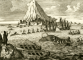 | Details | Anonymous | 1744 |
| Antique Greenland offshore whaling engraving |
|
Anonymous |
|
| 1744 |
| LOC:0 |
| $0.00 | Anonymous | Antique-Greenland-offshore-whaling-engraving | SOLD
<br></br>
Fine antique copper-plate engraving of the ships and boats engaged in the whaling process ca 1620. Illustrates John Monck's "Account of a Most Dangerous Voyage to Greenland" based on his voyage in 1619 and 1620.
<br></br>
Monck described the scene:
<div class="indenttextblock">
"The manner of catching and killing of the whales is performed thus: As soon as they spy a whale either from the shore or ship they put out three chalops manned with six men each, among whom is one being called the Harpuner, is the person who is first to wound the whale with his harpun." [Note: A chalop or shallop is a light sailing boat mainly used as a fishing tender].
</div>
</br>
Originally published in 1619, this state is from Churchill's Collection of Voyages & Travel (1744) vol. I. Page 442. |
| 53 | 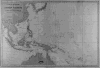 | Details | Vincedon-Dumoulin | 1865 |
| Carte Generale de l'Ocean Pacifique |
|
Vincedon-Dumoulin |
|
| 1865 |
| LOC:0 |
| $0.00 | Vincedon-Dumoulin | Carte-Generale-de-l-Ocean-Pacifique | This chart is SOLD. <BR> </BR>
French navigational chart of Japan, Southern China and the Pacific Islands including New Guinea, Solomon Islands, Borneo, Samoa, Tonga, and many more. Based on the voyages of French explorer Dumont D'Urville in the 1820's and 1830's . With a black over-stamp for Cartes de la Marine Impériale. Debrie Libraire au Harve, Seul Depositaire. Price: two Francs. Plate 1. Edition of 1865. |
| 251 |  | Details | Michelot and Bremond | 1727 |
| Partie de l'Isle d'Yvice et des Isles Fromentieres (Ibiza and Formentera islands) |
|
Michelot and Bremond |
|
| 1727 |
| LOC:0 |
| $0.00 | Michelot-and-Bremond | Partie-de-l-Isle-d-Yvice-et-des-Isles-Fromentieres-(Ibiza-and-Formentera-islands) | <a rel="nofollow" href= "http://www.rarecharts.com/ShowDetail/Creator/Michelot-and-Bremond/Title/Antique-chart-of-the-Balearic-Islands-of-Ibiza-and-Formentera/819"> SOLD, but see another copy in our stock.</a> <BR> </BR>
Original small engraved nautical chart of the Balearic islands of Ibiza and Formentera which now belong to an autonomous unit and province of Spain. Shows the port and the town of Elvissa which is labeled "Yvice". This chart is one of 37 port plans published by <a style="color:#9BAFCB" rel="nofollow" href= "/MichelotBremondBackground.aspx">Henry Michelot and Laurens Bremond</a> ca. 1730 in their atlas of small scale Mediterranean ports: "Recueil de Plusieurs Plans de Ports et Rades de la Mer Mediterranée" . <BR> </BR>
Contains a carefully colored compass rose. |
| 327 | 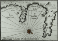 | Details | Michelot and Bremond | 1730 |
| Plan de la Baye de Poyance et de Celle d'Alcudia |
|
Michelot and Bremond |
|
| 1730 |
| LOC:0 |
| $0.00 | Michelot-and-Bremond | Plan-de-la-Baye-de-Poyance-et-de-Celle-d-Alcudia | SOLD<BR> </BR>
Scarce antique chart / plan of the Bays of Poyance (Pollensa or Pollenca) and Alcudia with Cap Fromentel (Formentor) on the island of Mallorca (Majorca). The villages of Alcudia and Poyance are each depicted as perched atop a hill and the surrounding area is protected by several guard towers which also would have served as navigational aids to the coastwise navigator. Composition of beaches, anchorages, and soundings are noted along with a water source. These details would have been of special interest to passing galleys.<BR> </BR>
This plan was produced ca. 1730 by French hydrographer and pilot of the French royal galley "La Reale" <a style="color:#9BAFCB" rel="nofollow" href= "/MichelotBremondBackground.aspx">Henry Michelot</a>. The port plan was one of 37 original plans published in Marseilles by Michelot and Laurens Bremond in a volume titled "Recueil de Plusieurs Plans de Ports et Rades de la Mer Mediterranée." Later in the 18th century the plans were copied and reprinted by Roux, Allezard, Kitchin and others. |
| 737 | 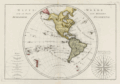 | Details | Bonne, Rigobert | 1787 |
| 18th Century Antique World Map of the Western Hemisphere |
|
Bonne, Rigobert |
|
| 1787 |
| LOC:0 |
| $0.00 | Bonne--Rigobert | 18th-Century-Antique-World-Map-of-the-Western-Hemisphere | SOLD <br></br>
Antique French map of the Western Hemisphere by cartographer Rigobert Bonne from Paris. The copper-plate engraving includes a very decorative compass rose, "Rose de Boussole", at right with all 32 compass points attributed to their named winds in the Mediterranean Sea (e.g., Levante, Syroco, Greco, Ostro, Ponente, Tramontana, etc.) At left is a representation of the globe divided into imaginary climatic zones by the Equator, Tropic of Cancer, Tropic of Capricorn and the Arctic and Antarctic polar circles. Key features include New Zealand, North America, Bering Strait, South America, the Sandwich Islands (Hawaii), numerous islands in the Pacific Ocean, and the Azores Islands. The southernmost point depicted consists of the South Sandwich island group including South Georgia Island.
<br></br>
Rigobert Bonne was the successor to Jacques Nicolas Bellin as Royal Cartographer to France in the office of the Hydrographer at the Depôt de la Marine. This engraved 18th-century plate was published in 1787 in Bonne's ATLAS ENCYCLOPEDIQUE CONTENANT LA GEOGRAPHIA ANCIENNE, ET QUELQUES CARTES SUR LA GEOGRAPHIE DU MOYEN AGE, LA GEOGRAPHIE MODERNE, ET LES CARTES RELATIVES A LA GEOGRAPHIE PHISIQUE…. . Plate 21. |
| 738 |  | Details | Bonne, Rigobert | 1787 |
| Antique World Map of the Eastern Hemisphere including Australia |
|
Bonne, Rigobert |
|
| 1787 |
| LOC:0 |
| $0.00 | Bonne--Rigobert | Antique-World-Map-of-the-Eastern-Hemisphere-including-Australia | SOLD<br></br>
Antique French map of the Eastern Hemisphere by cartographer Rigobert Bonne from Paris. Key features include a misshapen, elongated Australian continent, and Africa, China, and Europe. Significantly, no land mass is shown south of the Antarctic circle as the first sighting of land below 60 degrees south latitude did not occur until 1820.
<br></br>
The copper-plate engraving includes a very decorative compass rose: "Rose de Boussole avec les noms des Vents en usage sur le Ocean.", at left with all 32 compass points attributed to their named winds in the Ocean Sea (e.g., Nord, Sud, Est, Ouest, etc.)
<br></br>
Rigobert Bonne was the successor to Jacques Nicolas Bellin as Royal Cartographer to France in the office of the Hydrographer at the Depôt de la Marine. This engraved 18th-century plate was published in 1787 in Bonne's ATLAS ENCYCLOPEDIQUE CONTENANT LA GEOGRAPHIA ANCIENNE, ET QUELQUES CARTES SUR LA GEOGRAPHIE DU MOYEN AGE, LA GEOGRAPHIE MODERNE, ET LES CARTES RELATIVES A LA GEOGRAPHIE PHISIQUE…. . Plate 20. |
| 420 | 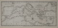 | Details | Malham, John | 1797 |
| A Correct Chart of the Mediterranean Sea engraved for Malham's Naval Gazetteer |
|
Malham, John |
|
| 1797 |
| LOC:0 |
| $0.00 | Malham--John | A-Correct-Chart-of-the-Mediterranean-Sea-engraved-for-Malham-s-Naval-Gazetteer | SOLD<BR> </BR>
Scarce sea chart showing the entire Mediterranean Sea and the Black Sea including the west coast of Spain, Strait of Gibraltar, Majorca, Minorca, Crete, Cyprus, Corsica, Sardinia, Sicily, and Malta . From the rare first American edition of Malham's Naval Gazetteer, published by Spotswood and Nancrede in Boston. Vol 2.<BR> </BR>
This chart comes from an early nautical gazetteer produced first in England and after 1796 in Boston, Massachusetts. Major cities shown include Gibraltar, Cadiz, Seville, Valencia, Barcelona, Florence, Rome, Naples, Venice, Constantinople (Istanbul), Acre, Gaza, and Tunis. With three sets of rhumb lines.
Rev. John Malham was a prolific Yorkshire-born author. Malham died near London in 1807. (Gentleman's Magazine, Vol 102, 1807, p. 568). Archivally matted.<BR> </BR> |
| 17 |  | Details | Collins, Greenvile | 1760 |
| The Isle of Man |
|
Collins, Greenvile |
|
| 1760 |
| LOC:0 |
| $0.00 | Collins--Greenvile | The-Isle-of-Man | SOLD<BR></BR>
This beautiful antique nautical chart of the Isle of Man c. 1760 is depicted with rhumb lines, soundings, an ornamental title cartouche and two sailing vessels. Features a view of Peel Castle in upper right. From one of the many editions of Greenville Collin's 'Great Britain's Coasting Pilot', published from 1693 to 1792.<BR> </BR>
Strong graphic composition and attractive subdued coloring make this nautical chart an excellent candidate for display and decoration. Inscribed: "To the Right Honorable William Earle of Derby, Lord of Ye Isle of Man & This map is humbly dedicated by Capt. G. Collins." Oriented North to right of chart. |
| 264 |  | Details | Jefferys, Thomas | 1762 |
| Plan of the Colorado Rocks near the west end of Cuba. |
|
Jefferys, Thomas |
|
| 1762 |
| LOC:0 |
| $0.00 | Jefferys--Thomas | Plan-of-the-Colorado-Rocks-near-the-west-end-of-Cuba- | SOLD<br></br>
Antique copperplate engraved harbor chart of the barrier reef of Colorado's Archipelago on the westernmost point on the island of Cuba. This detailed chart covers the far west point of the Guanahacabibes Peninsula, Cape San Antonio and was published in 1762 by the prolific British engraver and publisher Thomas Jefferys (ca.1710-1771) in "A Description of the Spanish Islands and Settlements on the Coast of the West Indies, compiled from Authentic Memoirs, Revised by Gentlemen who have Resided Many Years in the Spanish Settlements".<br></br>
The amount and type of detail on this antique chart , lacking in many charts of this series, indicates as great familiarity with the area. Noted points of interest include an Isle of Pines (Pinos), Cape Corrientes, several watering places, a grove of date trees, and a beach with "white sands with cockle shells" near an "old ruined castle" where several soundings and the symbol of an anchor indicate a landing might be made. There is an interesting notation at top center of chart that identifies a rock offshore "Seen by the Cornwall Sept 8th 1748". <br></br>
Scale in sea leagues. Plate 25. Page 88. |
| 265 |  | Details | Jefferys, Thomas | 1762 |
| Plan of Puerto de Cavanas |
|
Jefferys, Thomas |
|
| 1762 |
| LOC:0 |
| $0.00 | Jefferys--Thomas | Plan-of-Puerto-de-Cavanas | SOLD ... but see an antique hand-colored example of this "Plan of Cavanas, Cuba" <a href="https://www.rarecharts.com/ShowDetail/Creator/Jefferys--Thomas/Title/Antique-British-Plan-of-Puerto-de-Cavanas-or-Caba%C3%B1as--Cuba/1385" target="_blank">we just added to our stock: </a>
<br></br>
Antique chart / plan of Puerto Cabanas (Cavanas), Cuba. |
| 266 | 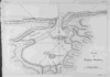 | Details | Jefferys, Thomas | 1762 |
| Plan of Bahia Honda |
|
Jefferys, Thomas |
|
| 1762 |
| LOC:0 |
| $0.00 | Jefferys--Thomas | Plan-of-Bahia-Honda | SOLD<br></br>
Antique nautical chart shows Bahia Honda, Cuba in Artemisa province on the Northwestern coast of that island nation, about 70 km west of Havana, Cuba. Copperplate engraved harbor chart published in 1762 by the prolific British engraver and publisher Thomas Jefferys (ca.1710-1771) in "A Description of the Spanish Islands and Settlements on the Coast of the West Indies, compiled from Authentic Memoirs, Revised by Gentlemen who have Resided Many Years in the Spanish Settlements".<br></br>
Two fishing spots are identified on the chart, one at the confluence of several creeks with the notation: "Here is plenty of fish to be caught". Scale in miles. Plate 26. Page 89. |
| 434 |  | Details | Anonymous | 1804 |
| The Mariner |
|
Anonymous |
|
| 1804 |
| LOC:0 |
| $0.00 | Anonymous | The-Mariner | SOLD
<br></br>
Small etching depicting a British sailor holding an octant, titled "The Mariner". From "The Book of Trades, or Library of the Useful Arts"; Part 1. Published by Tabart & Co. London 1804. Matted with archival materials. |
| 435 |  | Details | Anonymous | 1804 |
| The Shipwright |
|
Anonymous |
|
| 1804 |
| LOC:0 |
| $0.00 | Anonymous | The-Shipwright | <BR> </BR>
SOLD
<BR> </BR>
Small etching depicting a British ship-yard worker with a caulking hammer at work pounding pegs into the hull of a wooden vessel. Titled "The Shipwright" this 200+ year old work is from "The Book of Trades, or Library of the Useful Arts"; Part 1. Published by Tabart & Co. London 1804. Matted with archival materials. Overall size with the mat is about 8"x10". |
| 439 |  | Details | Anonymous | 1744 |
| A Whale Female and the Windlass |
|
Anonymous |
|
| 1744 |
| LOC:0 |
| $0.00 | Anonymous | A-Whale-Female-and-the-Windlass | SOLD<br></br>
Copper-plate engraving of a dead whale lying on the Greenland shore prior to butchering. A worker has marked a grid on the whale and is about to begin work removing the blubber with a large flensing tool. Shows windlasses and a sled used to haul the carcass ashore. Originally published in 1619, this state is from Churchill's Collection of Voyages & Travel (1744) vol. I. Page 444. |
| 521 |  | Details | U.S. Coast and Geodetic Survey | 1881 |
| Narragansett Bay from a Trigonometrical Survey |
|
U.S. Coast and Geodetic Survey |
|
| 1881 |
| LOC:0 |
| $0.00 | U-S--Coast-and-Geodetic-Survey | Narragansett-Bay-from-a-Trigonometrical-Survey |
SOLD, but see another <a href="http://www.rarecharts.com/ShowDetail/Creator/U-S--Coast-and-Geodetic-Survey/Title/Antique-chart-of-Cuttyhunk-to-Block-Island-with-Narragansett-Bay/980"_blank">similar item</a> |
| 1269 | 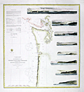 | Details | U.S. Coast and Geodetic Survey | 1864 |
| Western Coast of U.S. from Umpqua River to the Boundary |
|
U.S. Coast and Geodetic Survey |
|
| 1864 |
| LOC:63 |
| $0.00 | U-S--Coast-and-Geodetic-Survey | Western-Coast-of-U-S--from-Umpqua-River-to-the-Boundary | SOLD<br></br>
Rare, rolled, separately issued antique nautical chart ( 1864 ed. ) of the western coast of California focused on the Pacific coastline between the <b>Umpquah River, Oregon</b> north to the Canadian border. Noted with several habitations including Seattle, Astoria, and Olympia, Washington; Victoria, British Columbia; and Fort Langley. Many of the San Juan Islands are identified by name including Vancouver Island, San Juan, Lopez, Fidalgo, and <b> Guemes Island</b>.
<br></br>
This antique sea chart is enlivened with eight attractive engraved inset coastal profile views including: the Entrance to Columbia River / Cape Disappointment, Tatoosh Island, Flattery Rocks, Destruction Island, Tillamook Head, Cape Perpetua, and Cape Lookout.
<br></br>
The chart was first produced by the U.S. Coast Survey in 1855, a point in time when A.D. Bache was Superintendent.
<br></br>
This is a scarce, separately issued, rolled nautical chart of the area, not the more common folded version on thin paper that was issued with other charts in an annual report to Congress from the Coast Survey.
<br></br>
This chart was printed in 1864 from an electrotype copy of the original hand-engraved copper plate, a process the U.S. Coast Survey adopted around 1850. As a soft medium, copper plates could only withstand print runs of perhaps 200 copies before the plates wore down. To enable larger print runs, a mold of the original plate was created in wax or another soft medium. Then, using an electro-chemical processs ( electrotyping ), the mold was coated with a metal layer, typically copper. Printers were then able to produce output from the new electrotype copper copy, while preserving the original. Electrotype copy no. 6, corrected to 1864. Sheet size 30"x30". Scale 1 / 1,200,000. |
| 323 | 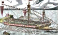 | Details | Wagner, Johann Christoph | 1684 |
| Untitled - Maltese galley |
|
Wagner, Johann Christoph |
|
| 1684 |
| LOC:0 |
| $0.00 | Wagner--Johann-Christoph | Untitled---Maltese-galley | SOLD<BR> <BR>
Highly decorative, whimsical, rare antique wood-block print of a Maltese galley . This detailed plate shows a galley with 27 oars per side and 5 men to each oar, making it among the largest galleys of its time. Soldier mass on the bow platform above cannon as the oarsmen are motivated by overseers threatening them with long poles. (The union shop-steward is not identified :) . An opportunity to own a plate that was first published in Furttenbach's very scarce 1629 classic of naval architecture "Architectura Navalis" . Early depictions of galleys from Malta are uncommon. <BR> </BR>
Note: Original seller has attributed the source as Wagner's "Delineatio Provinciarum Pannoniae et Imperii Turcici in Oriente Eine Grundrichtige Beschreibung deß ganzen Aufgangs", published in Augsburg 1684. "N1" at upper left. |
| 544 | 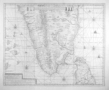 | Details | van Keulen, Gerard | 1728 |
| Nova Tabula Terrarum Cucan, Canara, Malabaria, Madura, Coromandelia |
|
van Keulen, Gerard |
|
| 1728 |
| LOC:0 |
| $0.00 | van-Keulen--Gerard | Nova-Tabula-Terrarum-Cucan--Canara--Malabaria--Madura--Coromandelia | SOLD<br></br>
Scarce Dutch chart of the Laccadive Islands, southern India, northern Sri Lanka (Ceylon) including the capital of Colombo. Based on the work of Adriaan Reland (Reelant) (1676-1718), a Dutch scholar and cartographer. The chart is decorated with numerous vignettes of sailing vessels and five compass roses.
<br></br>
Published by Gerard van Keulen in the fifth part of the sea-atlas "Zee-Fakkel" or Sea Torch which was issued by the House of Keulen in various editions from 1678 - 1753. According to C. Koeman this specific chart first appeared in the 1728 edition of the Zee-Fakkel. |
| 405 |  | Details | Poussin, Guillaume Tell | 1834 |
| Plans hydrographiques des baies, rades, ports et detroits des Florides |
|
Poussin, Guillaume Tell |
|
| 1834 |
| LOC:0 |
| $0.00 | Poussin--Guillaume-Tell | Plans-hydrographiques-des-baies--rades--ports-et-detroits-des-Florides | SOLD-
<a href="https://www.rarecharts.com/ShowDetail/Creator/Poussin--Guillaume-Tell/Title/Scarce-French-antique-charts-of-Florida-bays--anchorages-and-ports/1211" target="_blank">See a similar item in stock. </a>
<br></br>
Very scarce antique nautical chart of Gulf Coast bays, passes, and port entrances from Mobile, Alabama past Apalachicola, Florida and the Ochlocknee River. Unusual large copperplate engraved French hydrographic chart by French cartographer Guillaume Tell Poussin from 1834. Contains ten insets of north U.S. Gulf Coast ports in Alabama and Florida. These inset charts show soundings and isobaths (contour lines) in English feet. Text in French. Plate # 8. <BR> </BR>
Insets include the following areas: </BR>
Fig. 1. Entrée de la Baie de la Mobile (Entrance to Mobile Bay, Alabama with Dauphin Island and Fort Gaines to the west and Mobile Point with Fort Morgan on the east) </BR>
Fig. 2. Entrée de la Rade de Pensacole (Entrance to Pensacola Bay, Florida with Santa Rosa Island and Fort Pickens to the right. Also noted are Fort Barrancas and a Navy shipyard near Point Tartar) </BR>
Fig. 3. Entrée orientale du Detroit ou Canal de Santa Rosa (Entrance to Santa Rosa sound, Florida from the east side of Santa Rosa Island) </BR>
Fig. 4. Entrees du Detroit de St. Andre </BR>
Fig. 5. Entrée de la Baie ou Rade de St. Joseph </BR>
Fig. 6. Entrée principale du Detroit de St. Georges </BR>
Fig. 7. Entrée du milieu du Detroit de St. Georges </BR>
Fig. 8. Entrée orientale du Detroit de St. Georges </BR>
Fig. 9. Entrée de la Baie d'Appalachicola (Entrances to Apalachicola Bay, Florida and river) </BR>
Fig. 10. Entrée de la Baie d'Ocklockony (Entrance to Ochlocknee Bay, Florida)<BR> </BR>
Published in: "Travaux d 'ameliorations interieures projetes ou executes par le Gouvernement General des Etats-Unis d 'Amerique, de 1824 a 1831"; par Guillaume-Tell Poussin. |
| 1211 |  | Details | Poussin, Guillaume Tell | 1834 |
| Scarce French antique charts of Florida bays, anchorages and ports |
|
Poussin, Guillaume Tell |
|
| 1834 |
| LOC:61 |
| $0.00 | Poussin--Guillaume-Tell | Scarce-French-antique-charts-of-Florida-bays--anchorages-and-ports | SOLD
<br><br>
Ten very scarce antique nautical charts of Gulf Coast bays, passes, and port entrances from Mobile, Alabama past Apalachicola, Florida and the Ochlocknee River. An attractive copperplate-engraved French hydrographic composite chart printed in 1834 by French cartographer Guillaume Tell Poussin. Contains ten insets of north U.S. Gulf Coast ports in Alabama and Florida. These inset charts show soundings and isobaths (contour lines) in English feet. Text in French. Plate # 8. <BR> </BR>
Insets include the following areas: </BR>
Fig. 1. Entrée de la Baie de la Mobile (Entrance to Mobile Bay, Alabama with Dauphin Island and Fort Gaines to the west and Mobile Point with Fort Morgan on the east) </BR>
Fig. 2. Entrée de la Rade de Pensacole (Entrance to Pensacola Bay, Florida with Santa Rosa Island and Fort Pickens to the right. Also noted are Fort Barrancas and a Navy shipyard near Point Tartar) </BR>
Fig. 3. Entrée orientale du Detroit ou Canal de Santa Rosa (Entrance to Santa Rosa sound, Florida from the east side of Santa Rosa Island) </BR>
Fig. 4. Entrees du Detroit de St. Andre </BR>
Fig. 5. Entrée de la Baie ou Rade de St. Joseph </BR>
Fig. 6. Entrée principale du Detroit de St. Georges </BR>
Fig. 7. Entrée du milieu du Detroit de St. Georges </BR>
Fig. 8. Entrée orientale du Detroit de St. Georges </BR>
Fig. 9. Entrée de la Baie d'Appalachicola (Entrances to Apalachicola Bay, Florida and river) </BR>
Fig. 10. Entrée de la Baie d'Ocklockony (Entrance to Ochlocknee Bay, Florida)<BR> </BR>
After a chart by W.H. Swift from 1829.
<BR> </BR>
Published in: "Travaux d 'ameliorations interieures projetes ou executes par le Gouvernement General des Etats-Unis d 'Amerique, de 1824 a 1831"; par Guillaume-Tell Poussin … Atlas. Paris, Anselin, Libraire, pour l 'art militaire, les sciences et les arts, rue Dauphine, No. 36, dans le passage Dauphine. Carilian-Goeury, Libraire, des ponts et chaussees et des mines, Quai des Augustins, No. 41. 1834. |
| 1212 |  | Details | Poussin, Guillaume Tell | 1834 |
| Scarce French antique chart of the Florida Territory with proposed canals |
|
Poussin, Guillaume Tell |
|
| 1834 |
| LOC:0 |
| $0.00 | Poussin--Guillaume-Tell | Scarce-French-antique-chart-of-the-Florida-Territory-with-proposed-canals | SOLD <br></br>Beautiful antique chart of the United States Gulf Coast extending from the Atchafalaya River, past Bayou Lafourche and the Mississippi passes in Louisiana, Mobile Bay, Alabama, to the Florida east coast including most of what was then known as the Florida Territories (1822 - 1845). A scarce engraved French hydrographic chart by French cartographer Guillaume Tell Poussin from 1834.
<br></br>
<u>Insets include the following areas:</u> </BR>
Fig. 1. <b>Entrance to St. John's River.</b> "Entrée du Fleuve St. Jean". (Includes Fort George Island, Talbot Island and a feature noted as "General's Mount".)</BR>
Fig. 2. <b>Vicinity of Fernandina Beach and upper Amelia Island.</b> "Entrée de la Rade et de la Riviere St. Marie". </BR>
Fig. 3. <b>Plan of St. Augustine, Florida .</b> "Entrée orientale du Port St. Augustine". (Includes the Matanzas River and Anastasia Island.)
<BR> </BR>
Noted features include Lake Pontchartrain; New Orleans; Madisonville; Chandeleur Sound; Dauphin Island; Canal du Santa Rosa; Choctawhatchee Bay; Cape San Blas; Apalachicola Bay; Tallahassee; Cumberland Island; Tampa Bay; and Cape Canaveral. Includes boundaries and notations relating to the Seminole American Indian tribe. Dotted lines show the projected route of two proposed canals linking the Gulf and Atlantic coasts. Twin detailed elevation profiles at bottom are keyed alphabetically to the canal routes.
<BR> </BR>
Published in: "Travaux d 'ameliorations interieures projetes ou executes par le Gouvernement General des Etats-Unis d 'Amerique, de 1824 a 1831"; par Guillaume-Tell Poussin … Atlas. Paris, Anselin, Libraire, pour l 'art militaire, les sciences et les arts, rue Dauphine, No. 36, dans le passage Dauphine. Carilian-Goeury, Libraire, des ponts et chaussees et des mines, Quai des Augustins, No. 41. 1834. Text in French. Plate # 7. |
| 342 |  | Details | U.S. Geological Survey | 1892 |
| Marquesas Keys (Florida) |
|
U.S. Geological Survey |
|
| 1892 |
| LOC:0 |
| $0.00 | U-S--Geological-Survey | Marquesas-Keys-(Florida) | SOLD
<br></br>
Small lithographed chart of Marquesas Keys, Florida. This antique chart, from the U.S. Geological Survey, is derived from a U.S. Coast Survey chart (no. 70) and overlaid with hachured topographic details. Soundings, and navigational aids are shown. Water shown in blue. Some of the features shown include Couch Key and Round Island. <BR> </BR>
Produced for the U.S. Geological Survey Thirteenth Annual Report. Produced by George S. Harris Lithographers, Philadelphia. Plate 36. |
| 442 |  | Details | Duché de Vancy, Gaspard | 1797 |
| Insulaires et monumens de l'lle de Paque |
|
Duché de Vancy, Gaspard |
|
| 1797 |
| LOC:0 |
| $0.00 | Duché-de-Vancy--Gaspard | Insulaires-et-monumens-de-l-lle-de-Paque | SOLD<BR> </BR>
View of inhabitants and monuments on Easter Island, in the Pacific Ocean, now a possession of Chile. Two of the famous stone heads are shown along with crew members and islanders.<BR> </BR>
Drawn by Gaspard Duchè de Vancy, a French artist of the 18th century. From the "Atlas du Voyage de La Perouse" published by Jean-Francois La Perouse. La Perouse led a scientific exploration to the Pacific from 1785, accompanied by Duchè de Vancy, and sent the drawing on which this engraving is based to France in 1788 with the intention of returning home by 1789. Departing Botany Bay, Australia in March, 1788 neither La Perouse, his ships the Boussole or Astrolabe, nor his men were ever seen again. Number 11.<BR> </BR>
Believe the engraving is an early 20th century re-strike from the original copper plate produced by the French Chalcographie du Louvre. La Chalcographie du Louvre is a repository of more that 13,000 original plates from the Louvre's archives, housed upstairs above the Louvre's Paris galleries . Upon request visitors can have a engraving produced on museum-quality paper from the original plate by a master printer. V.15 <BR> </BR> |
| 407 |  | Details | Jenkins, James | 1816 |
| Capture of La Vestale |
|
Jenkins, James |
|
| 1816 |
| LOC:0 |
| $0.00 | Jenkins--James | Capture-of-La-Vestale | SOLD
<br></br>
The hand-colored antique aquatint depicts the capture near Rochefort of the 36 gun French frigate Vestale by the British 38 gun 5th rate vessel Clyde. On paper watermarked "Whatman 1812".
<BR> </BR>
One of 55 plates from Jenkins' famous volume: "The Naval Achievements of Great Britain, From the Year 1793 to 1817" after a painting by T. Whitecombe. Attribution at bottom of plate reads: "Published Aug 1st, 1816 at 48 Strand for J. Jenkins' Naval Achievements". |
| 408 |  | Details | Jenkins, James | 1816 |
| Capture of La Tribune |
|
Jenkins, James |
|
| 1816 |
| LOC:50 |
| $0.00 | Jenkins--James | Capture-of-La-Tribune | SOLD
<br><br>
Antique hand-colored engraving depicts the capture of the 44-gun French frigate La Tribune by HMS Unicorn on June 8, 1796.
<br><br>
One of 55 hand-colored aquatint plates from Jenkins' famous volume: "The Naval Achievements of Great Britain, From the Year 1793 to 1817" after a painting by T. Whitecombe. Attribution at bottom of plate reads: "Published Feb 1st, 1817 at 48 Strand for J. Jenkins' Naval Achievements". |
| 414 |  | Details | Ralfe, James | 1820 |
| Capture of La Thetis |
|
Ralfe, James |
|
| 1820 |
| LOC:0 |
| $0.00 | Ralfe--James | Capture-of-La-Thetis | SOLD
<BR> </BR>
Hand-colored aquatint engraving depicts the capture of 40-gun French frigate La Thetis by the British 36-gun frigate Amethyst. From James Ralfe's 'The Naval Chronology of Great Britain'.<BR> </BR>
Attribution line: "Pub'd. By Pyall & Stroud, 19 Hanway Street Oxford Street." On wove paper . |
| 416 | 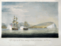 | Details | Ralfe, James | 1820 |
| The Imperieuse and Thames attacking a Castle and Gunboats |
|
Ralfe, James |
|
| 1820 |
| LOC:0 |
| $0.00 | Ralfe--James | The-Imperieuse-and-Thames-attacking-a-Castle-and-Gunboats | SOLD<br></br>
Hand-colored aquatint engraving depicts two British ships, 38-gun frigate Imperieuse and 32-gun Frigate Thames, in the harbour of Palinuro on the coast of Calabria in November 1811. The ships sank two gunboats and captured the fort after a just 15 minutes of shelling, and took two gunboats and 22 smaller vessels as prizes.<BR> </BR>
From James Ralfe's 'The Naval Chronology of Great Britain'. Attribution line: "Pub'd. By Pyall & Stroud, 19 Hanway Street Oxford Street." On wove paper . |
| 417 | 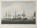 | Details | Ralfe, James | 1820 |
| Situation of the Temeraire |
|
Ralfe, James |
|
| 1820 |
| LOC:0 |
| $0.00 | Ralfe--James | Situation-of-the-Temeraire | SOLD
<br></br>
Matted and framed.
<BR> </BR>
Hand-colored aquatint engraving depicts the 98-gun British ship HMS Temeraire on October 21, 1805 at the battle of Trafalgar off the coast of Cape Trafalgar, Spain.<BR> </BR>
From James Ralfe's 'The Naval Chronology of Great Britain'. Attribution line: "Pub'd. By Pyall & Stroud, 19 Hanway Street Oxford Street." On wove paper . |
| 426 |  | Details | U.S. Army Engineers | 1878 |
| Water Routes from Norfolk to the Cape Fear River |
|
U.S. Army Engineers |
|
| 1878 |
| LOC:0 |
| $0.00 | U-S--Army-Engineers | Water-Routes-from-Norfolk-to-the-Cape-Fear-River | SOLD
<BR> </BR>
Attractive map of the Virginia and North Carolina coasts including the Outer Banks. This 130 year-old hand-colored lithograph from the Army Corps of Engineers accompanied the Chief Engineer's report to the U.S. 46th Congress. Key cities and features include Pamlico Sound and River (spelled Pamplico), Wilmington, Cape Lookout, Cape Hatteras, Washington D.C., Albemarle Sound, the Dismal Swamp Canal, Norfolk, and the entrance to Chesapeake Bay. Numerous lighthouses and inlets dot this 15" x 22" late 19th century chart. <BR> </BR>
With a table of distances in statute miles. Senate Document Number 73. Surveyed under the direction of Captain Charles B. Phillips. Drawn by G.P. Strums. |
| 427 | 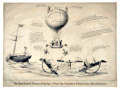 | Details | Gildersleave, Charles F. | 1860 |
| Steam Ship Commodores and United States Mail Contractors |
|
Gildersleave, Charles F. |
|
| 1860 |
| LOC:0 |
| $0.00 | Gildersleave--Charles-F- | Steam-Ship-Commodores-and-United-States-Mail-Contractors | SOLD<br></br>
Pre-civil war lithographed political cartoon on the topic of awarding contracts to carry the mail by steamboat from New York to San Francisco via Nicaragua. Many of the references in the cartoon are now opaque but in the 1850's contracts to carry the U.S. Mail were the subject of great controversy and competition. This cartoon reflects that competition in the context of the leading-edge technologies of that time.<BR> </BR>
At center a gas-filled balloon labeled "California Mail Balloon via Nicaragua" rises above the sea. Mail transport by balloon was first attempted in the United States in 1859 by John Wise aboard the balloon 'Jupiter'. Not a commercial success, nevertheless it was doubtless a major topic of conversation in that period. <BR> </BR>
Below another figure balances two steamboats (Star of the West and Moses Taylor) on a pole as he walks a high-wire strung between two steamships shaped as rocking horses. One ship is labeled U.S.M. (U.S. Mail Steamship Company) and the other Cornelius Vanderbilt's Independent Line steamer 'Northern Light' which operated between Nicaragua and New York City.
At left, aboard the ship 'Baltic' a gentleman in top hat (Edward Knight Collins ?) watches through a telescope. The 'Baltic' a 282 foot wooden-hulled sidewheel steamboat was owned by the American Collins Line, a competitor to Vanderbilt, and was for five years the fastest steamship in the Atlantic.
Ships mentioned include: 1) The 'San Francisco' a 280 foot steamship owned by the Pacific Mail Steamship Company . 2) S.S. Moses Taylor owned by the U.S. Mail Steamship Company. 3) The 'Star of the West' , a paddlewheel steamer owned by Cornelius Vanderbilt (known as the 'Commodore') one of the richest men in the United States with extensive interests in steamboats. The vessel was launched in 1852 and from July 1853 to March 1856 was operated on a mail route between New York City and San Juan de Nicaragua.<BR> </BR> |
| 512 | 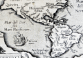 | Details | Ortelius, Abraham | 1598 |
| America sive Novus Orbis |
|
Ortelius, Abraham |
|
| 1598 |
| LOC:0 |
| $0.00 | Ortelius--Abraham | America-sive-Novus-Orbis | SOLD
<br><br/>
Small decorative map of North and South America, from the Philippe Galle edition of the miniature Ortelius atlas, Epitome Theatri Orteliani. Latin text on verso. |
| 301 | 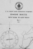 | Details | U.S. Coast and Geodetic Survey | 1916 |
| 1916 Inside Route New York to Key West |
|
U.S. Coast and Geodetic Survey |
|
| 1916 |
| LOC:0 |
| $0.00 | U-S--Coast-and-Geodetic-Survey | 1916-Inside-Route-New-York-to-Key-West | <BR> </BR>
This item has been sold but please see <a
href="https://www.rarecharts.com/ShowDetail/Creator/U-S--Coast-and-Geodetic-Survey/Title/8-Charts-Inside-Route-New-York-to-Key-West-or-ICWW-1916/6553">another example, our first in eleven years.</a>
<BR> </BR>
Complete set of eight U.S. Coast and Geodetic Survey folding navigational charts for the inside route for maritime traffic on the eastern coast of the United States from New York South. These historical charts from 1916 predate the U.S. Government's ownership of the route which later became part of the Intracoastal Waterway (ICW) . Placed end to end, the charts would extend over 18 feet long. |
| 665 | 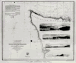 | Details | U.S. Coast and Geodetic Survey | 1853 |
| Northwest Coast of Washington State |
|
U.S. Coast and Geodetic Survey |
|
| 1853 |
| LOC:0 |
| $0.00 | U-S--Coast-and-Geodetic-Survey | Northwest-Coast-of-Washington-State | SOLD
<br><br/>
Attractive original chart of the Olympic Peninsular coast of the Washington territory in the year it was established - 1853. The Washington territory was not admitted to the Union until 1889. Includes coastline both along the Pacific Ocean and the Strait of Juan de Fuca. Very fine condition.
<br><br/>
Detailed soundings and hydrographic detail of the Washington coast including Gray's Harbor, Cape Flattery, Fresh Water Bay, False Dungeness, Protection Island, Point Hudson, Callam Bay, and Admiralty Inlet. These additional areas are shown in outline only : Vancouver Island, Victoria Harbor, Haro Strait, San Juan Island, Port San Juan, Lopez Island, Rosario Strait, and Smith's Island.
<br><br/>
With finely engraved inset views of these features: Duncan's Rock, Tatoosh Island, Cape Flattery, Flattery Rocks, White Rock, Destruction Island, Sail Rock, Pt. Grenville.
<br><br/>
This antique chart should not be confused with those similar copies issued with dozens of other maps as part of a Report to Congress, most on thin paper with folds that often show condition issues. This original mid 19th century survivor is a large, separately issued chart on thick wove paper that has been stored either rolled of flat with no folds.
<br><br/>
Engraved by McCoy, Woodward, and Smith. Includes sailing directions. With the circular logo of the Coast Survey Depot. |
| 1035 |  | Details | U.S. Coast and Geodetic Survey | 1881 |
| Narragansett Bay |
|
U.S. Coast and Geodetic Survey |
|
| 1881 |
| LOC:0 |
| $0.00 | U-S--Coast-and-Geodetic-Survey | Narragansett-Bay | SOLD<br></br>
Large, antique rolled nautical chart of Narragansett Bay on heavy paper. Includes the surrounding bays, rivers, and islands of Connecticut, Massachusetts, and Rhode Island. This scarce, detailed chart is comprised of two conjoined sheets. Price has been adjusted for known condition issue.
<BR> </BR>
First produced in 1873, this chart was reprinted in 1881 with corrections to the aids to navigation. Contains great detail of topographic and hydrographic features with hundreds of soundings and numerous aids to navigation. The chart is finely engraved and will display beautifully.
<BR> </BR>
Noted points of interest include Providence, Fall River, Bristol, Warren, Newport, Wickford, East Greenwich, Apponaug, and the Old Colony and Newport RR. At bottom of the chart is a profile view of Narragansett Bay, Beavertail Light bearing N by E. With the circular stamp of the United States Coast and Geodetic Survey. Electrotype copy No. 2. Price 75 cents when issued. |
| 525 | 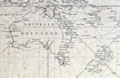 | Details | Depot de la Marine | 1818 |
| Carte Reduite du Grand Ocean comprise L'Asie et L'Amerique |
|
Depot de la Marine |
|
| 1818 |
| LOC:0 |
| $0.00 | Depot-de-la-Marine | Carte-Reduite-du-Grand-Ocean-comprise-L-Asie-et-L-Amerique | SOLD
<br><br/>
Antique rare 'brown-back' navigation chart issued by the French Depot de la Marine in 1818. Coverage extends from Sumatra in the far west to the Antilles and Gulf of Mexico. Includes: Vietnam, Korea, Philippines, Japan, Australia (Nouvelle Hollande), New Zealand, the "Sandwich Islands" [Hawaii (Owhywi) , Mowi, Oahu (Woahua)...], Easter Island (Isle de Paques), Port St Francois (San Francisco), California and most of the Pacific Islands. <br><br/>
With the circular stamp of the Depot General de la Marine at bottom left. Chart is covered with brown linen; probably contemporary to its issue based on the wear pattern. No. 420. Price 2 Francs. |
| 766 | 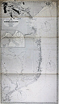 | Details | British Admiralty Hydrographical Office | 1898 |
| Antique Chart for coastal Mozambique Africa south of the Zambezi River |
|
British Admiralty Hydrographical Office |
|
| 1898 |
| LOC:0 |
| $0.00 | British-Admiralty-Hydrographical-Office | Antique-Chart-for-coastal-Mozambique-Africa-south-of-the-Zambezi-River | SOLD
<br></br>
Antique 1898 British Admiralty navigation chart of Mozambique, Africa, until 1975 a Portugese colony. Coverage includes the east coast of Africa from Maputo, Delagoa Bay (Maputo Bay) northward past the Zavalla River, Cape Corrientes, Innamban River, Burra, Bazaruto Island, Moromone Bay, Beira, and terminating at the mouths of the Zambezi River.
<br></br>
Near the Zavalla River about 3 miles offshore are noted two wrecks: the Courland and the Countess of Carnarvon. The Countess of Carnarvon was a steamer, owned by the British South African Company that briefly attained fame for her role in a gun-running operation during February 1891. She was seized by the Portugese government after steaming up the Limpopo River and landing rifles in Portugese territory. After protestations by the British government she was released. [1]
<br></br>
With purple inked stamp from the charts's owner with the vessel's name: Vapor Jose Gallart, Barcelona. The steamship Ramon Alonso R. was originally launched in 1898 by British shipbuilder Elder and Dempsey. She was sold in 1901 to Catalan shipping firm A. Folch y Cia who renamed her the 'Jose Gallart'. [2]
<br></br>
<img src="http://lh3.ggpht.com/-si2Cuv4gu2M/VEpxAyFRhYI/AAAAAAAAQqk/MvQQPEuoluA/s0/Vapor%252520JOSE%252520GALLART%252520en%252520el%252520dique%252520flotante%252520y%252520deponente%252520de%252520Barcelona.%252520Memoria%252520del%252520puerto%252520de%252520Barcelona.%252520Fecha%252520indeterminada.jpg" alt="Steamship JOSE GALLART in drydock ca. 1901" width="345" alt="French steamship Jose Gallart circa 1898">
<br></br>
[1] Galbraith, John S. Crown and Charter: The Early Years of the British South Africa Company; http://books.google.com .
<br>
[2] Vida Maritima. http://vidamaritima.com/2007/08/ramon-alonso-ramos-charcos/ |
| 829 | 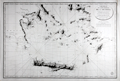 | Details | Depot de la Marine | 1827 |
| Southern Aegean Archipelago, Cyclades |
|
Depot de la Marine |
|
| 1827 |
| LOC:0 |
| $0.00 | Depot-de-la-Marine | Southern-Aegean-Archipelago--Cyclades | SOLD<br></br>
Antique French nautical chart of the coast and the islands of the Southern Aegean Sea from 1827 centered on the Cyclades islands with Crete, Greece ( Candie ) at bottom. Geographic features covered by this antique chart include these locations in Greece and Turkey: Athens, Corinth, Izmir ( "Smyrna" ), Kusadasi ( "Scala-Nova" ), Bodrum, the Cesme and Datca peninsulas, and the islands of: Chios, Delos, Kythira ( "Cerigo" ), also spelled Cythera, Kythera and Kithira ; Antikythira ( "Cerigotte" ), Mykonos, Santorini, Milos, Naxos, Rhodes, Kos, and Crete (and all the other islands surrounding).
<br></br>
This scarce chart was issued by the French Depot de la Marine. Attractive old engraved copperplate engraved chart documenting the tracks of the exploration of that area by Gauttier in 1818 and 1819. Extensive fine hachuring of coastal mountains, some soundings, and no interior details. Dated to 1827 at bottom of the oval cartouche. With the circular stamp of the Depot General de la Marine. Attribution reads: "Publiée par Ordre du Roi sous le Ministère de Son Excellence M. le Comte Chabrol de Crousol. Dépôt Générale de la Marine." |
| 635 |  | Details | Stebbins, Nathaniel L. | 1896 |
| Stebbins' Illustrated Coast Pilot with Sailing Directions |
|
Stebbins, Nathaniel L. |
|
| 1896 |
| LOC:0 |
| $0.00 | Stebbins--Nathaniel-L- | Stebbins--Illustrated-Coast-Pilot-with-Sailing-Directions | SOLD<BR> </BR>Important, late 19th century landmark in coastal navigation from the well-known Boston-based marine photographer Nathaniel Stebbins. Stebbins provides sailing directions and plentiful photographs of key landmarks and navigational aids. Full coverage of U.S. East Coast and marginal coverage of the United States Gulf Coast. We are not aware of an earlier Coast Pilot containing photographic coastal images. This book demonstrated the practical application of photography to navigation, a field long dominated by man-made representations of coastal features. 249 pages. 2nd ed.<BR> </BR>
Already scarce, this overlooked volume with a sea-worthy canvas cover belongs in the collection of all those interested in 19th century U.S. coastal charts. Numerous nautical-related advertisements scattered thoughout. The author describes this internal advertising as an effort to hold down the cost to the reader. |
| 776 |  | Details | Stebbins, Nathaniel L. | 1896 |
| The Yachtsmans Album 1896 |
|
Stebbins, Nathaniel L. |
|
| 1896 |
| LOC:0 |
| $0.00 | Stebbins--Nathaniel-L- | The-Yachtsmans-Album-1896 | SOLD
<br><br>
Scarce volume of photographic images of sail and power yachts at the end of the 19th century by American marine photographer Nathaniel L. Stebbins (1847-1922). The pictured yachts represent the toys of America's super-rich of that era: the Corsair- J. Pierpont Morgan; Nourmahal - John Jacob Astor IV; Alicia - Henry M. Flagler. Other notables include members of families with names that are recognzable even today: Dows, DuPonts, Carnegies, and Vanderbilts.
<br></br>
With two tabular lists: 'Steam Yachts', and 'Sail Yachts' both containing these data fields describing each of the pictured yachts: page; name; owner; K or CB [Note: for sail yachts only]; length overall; waterline length; beam; draft; designer; builder; date. Contains 240 images, 4 to a single page, printed on the recto only. Versos are blank.
<br></br>
N.L. Stebbins was a Boston-based photographer specializing in maritime subjects. Among Stebbins' other works are : 'The New Navy of the United States' (1896) and 'Illustrated Coast Pilot with Sailing Directions: The Coast of New England from New York to Eastport, Maine, including Bays and Harbors' (1891). |
| 1394 |  | Details | Stebbins, Nathaniel L. | 1896 |
| Stebbins' Illustrated Coast Pilot 2nd. Ed. |
|
Stebbins, Nathaniel L. |
|
| 1896 |
| LOC:0 |
| $0.00 | Stebbins--Nathaniel-L- | Stebbins--Illustrated-Coast-Pilot-2nd--Ed- | SOLD
<br></br>
Important, late 19th century landmark in coastal navigation from the well-known Boston-based marine photographer Nathaniel Stebbins. Remarkable for a total absence of maps or charts, Stebbins provides sailing directions and plentiful photographs of key landmarks, lighthouses, and navigational aids.
<BR> </BR>
Full coverage of U.S. East Coast and marginal coverage of the United States Gulf Coast. We are not aware of an earlier Coast Pilot containing photographic coastal images. This book demonstrated the practical application of photography to navigation, a field long dominated by man-made representations of coastal features. 249 pages. 2nd ed.
<BR> </BR>
Scarce, this overlooked volume with a sea-worthy canvas cover belongs in the collection of all those interested in 19th century U.S. coastal charts. Numerous nautical-related advertisements scattered thoughout. The author describes this internal advertising as an effort to hold down the cost to the reader.
<BR> </BR>
Nathaniel Livermore Stebbins (1847 - 1922) was a well-known American marine photographer, whose photographs documented the technological and social changes during a pivotal era in the development of American maritime activities. Stebbin's photography appeared in such well-known magazines as The Rudder and Yachting. Stebbin's maritime works include:
<div class="indenttextblock">
<ul style="list-style-type: circle;">
<li>American & English Yachts (Charles Scribner's Sons, 1887)</li>
<li>Yacht Portraits of the Leading American Yachts (Boston, 1887)</li>
<li>The Yachtsman's Album (1896)</li>
<li>Illustrated Coast Pilot with Sailing Directions: The Coast of New England from New York to Eastport, Maine, including Bays and Harbors (1891, 1st. Ed.)</li>
</ul>
</div> |
| 477 |  | Details | Yacht Racing Assn. of Massachusetts | 1898 |
| Racing Rules and Chart |
|
Yacht Racing Assn. of Massachusetts |
|
| 1898 |
| LOC:0 |
| $0.00 | Yacht-Racing-Assn--of-Massachusetts | Racing-Rules-and-Chart | SOLD<br></br>
Small hard-back book and map published by the Yacht Racing Association of Massachusetts (YRAM) in 1898. Contains association by-laws and racing rules for yachts 35 feet and under along with plates of YRAM burgees, schedules of races, many photographs of club yachts, and dozens of nautical-related advertisements. 134 pages.<BR> </BR>
Attached at back of the book is a folded nautical chart of Boston Harbor in near-mint condition measuring 11" W x 12" H published by S. Thaxter and Son, 125 State Street, Boston. Coverage includes Boston, north to Nahant and south to Hingham. Numerous soundings and navigational aids would have made this a useful chart for the local yachtsman. Map is on medium weight stock, with no flaws whatsoever. Nice! |
| 813 |  | Details | Blunt, E and G.W. | 1850 |
| Boston Harbour Chart |
|
Blunt, E and G.W. |
|
| 1850 |
| LOC:0 |
| $0.00 | Blunt--E-and-G-W- | Boston-Harbour-Chart | SOLD
<br><br/>
Small, clean, nautical chart of Boston Harbor, Massachusetts from the 1850 edition of the "American Coast Pilot" 16th Edition. Numerous soundings, marked aids-to-navigation, and anchorages would have made this a useful tool for navigators attempting to navigate in the area, one of the few mass-produced, affordable charts of the area that were available at that time.
<br><br/>
The American Coast Pilot with other harbor charts, was published by Edmund and George W. Blunt from New York. The Blunts were the most prolific private publisher of navigational charts in the United States at that time. The chart is based on earlier surveys by A.S. Wadsworth around 1818 and of Joseph Frederick Wallet Des Barres (1721-1824) during the American Revolutionary War. |
| 751 |  | Details | Blondeau, Alexandre | 1837 |
| Boston and Vicinity |
|
Blondeau, Alexandre |
|
| 1837 |
| LOC:0 |
| $0.00 | Blondeau--Alexandre | Boston-and-Vicinity | SOLD<br></br>
Antique steel engraving titled "Boston et ses Environs" - Boston and vicinity. Includes outlying towns of Roxbury, Dorchester, Cambridge and Charles Town. This early hand-colored map of the city, at that time largely located on only the Shawmut Peninsula, makes it clear just how much of Boston's current land area is the result of landfill and reclamation. It is said that upwards of 65% of Boston's land area did not exist when the city was founded around 1630.
<br></br>
From 1st edition of Jean B.G. Roux de Rochelle's Etats-Unis d'Amérique. Paris: Firmin Didot Freres. Plate number 45. |
| 565 |  | Details | Finn, W.J. | 1917 |
| Birds Eye View of Boston Harbor |
|
Finn, W.J. |
|
| 1917 |
| LOC:0 |
| $0.00 | Finn--W-J- | Birds-Eye-View-of-Boston-Harbor | SOLD <br></br>
Folding antique colored harbor excursion map from ca. 1917 of South Boston, Boston Harbor, Dorchester Bay, Quincy Bay, and Cape Cod Bay to Provincetown. Shows steamship routes to coastal towns and identifies many nearby islands. This map could have been purchased by passengers aboard any steamboat plying the routes shown on the attached map. <BR> </BR>
Without the advertisements sometimes found on the cover. Price is noted on the front as "10 cents". |
| 608 | 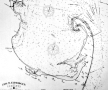 | Details | Eldridge, George W. | 1924 |
| Massachusetts Bay and Coast from Chatham to Gloucester |
|
Eldridge, George W. |
|
| 1924 |
| LOC:0 |
| $0.00 | Eldridge--George-W- | Massachusetts-Bay-and-Coast-from-Chatham-to-Gloucester | SOLD
<BR> </BR>
Extra-large old nautical chart of <b>Cape Cod</b>, Massachusetts Bay, and the Massachusetts coast from Chatham north past Boston. Created by George Washington Eldridge (d. 1914) and published by Eldridge's widow, Sydna Eldridge a decade after George's passing. Coverage includes the coastal margins near the towns of Provincetown, Truro, Wellfleet, Brewster, Yarmouth, Plymouth, Scituate, Cohasset, Marblehead, Salem, Gloucester, and the town and harbor of <b>Boston</b>, Massachusetts.
<br></br>
Printed on thin, rolled paper, this nautical chart was probably destined to be backed with linen which would have provided the strength needed to withstand rigors of day to day use at sea. This chart is a survivor, perhaps one of the last copies of a chart whose origins extends back at least 30 years.
<br></br>
G.W. Eldridge was the son of well-known cartographer and hydrographer George Eldridge, whose first charts were of the area off Chatham, Mass. including Pollock Rip and the sandbars from Stone Horse to Handkerchief Shoals<sup>1</sup>. This chart carries a warning notation at the Chatham Bar: <dir class="indenttextblock" > "Chatham Bars are rapidly extending seaward and should be approached with caution at night."</dir>
<br>
Copyright Sydna Eldridge, Vineyard Haven, 1924. Published by Wilfrid O. White, Boston Massachusetts in 1924. Drawing by A.N. Houghton, Boston, Mass.<br></br>
<sup>1</sup> (Nickerson, Joseph A. and Geraldine Nickerson, "Chatham Sea Captains in the Age of Sail". Google Books. 2008.) |
| 1083 | 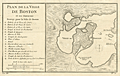 | Details | Bellin, Jacques Nicolas | 1757 |
| Antique French Map and Plan of Boston, Massachusetts |
|
Bellin, Jacques Nicolas |
|
| 1757 |
| LOC:0 |
| $0.00 | Bellin--Jacques-Nicolas | Antique-French-Map-and-Plan-of-Boston--Massachusetts | SOLD
<br></br>
One of the earliest obtainable town plans of <b>Boston, Massachusetts</b>. This antique French plan shows the area as it was 12 years before the American Revolutionary War. This fine copper-plate engraved plan from Bellin's Histoire General des Voyages shows the <b>back bay</b> as a true bay, before it was filled and built up in the 19th century. Includes <b>Charles Town</b> across the bay.
<br></br>
In Boston Bay the key features are an anchorage, Ronde Island, and a single dotted line denoting the navigational channel. Very sparse soundings and hydrographic details. Includes at left an index of 16 locations identified alphabetically on the map.
</br>
<b> These 16 key locations include:</b>
<div class="indenttextblock">
<ul>
<span style="list-style-type: circle;">
<li>2 batterys, each with 25 pieces of cannon </li>
<li> Two Presbyterian churches</li>
<li>A Quaker church </li>
<li>An Anabaptist church</li>
<li>The armory</li>
<li>A wharf </li>
<li>The powder magazine </li>
<li> A "Petit Bassin qui asseche de basse mer" (the Back Bay area)</li>
<li> The fortified and defended city gate</li>
</span>
</ul>
</div> |
| 206 |  | Details | Anonymous | 1889 |
| Brochure- Boston Gloucester Steamboat Co. |
|
Anonymous |
|
| 1889 |
| LOC:0 |
| $0.00 | Anonymous | Brochure--Boston-Gloucester-Steamboat-Co- | SOLD
<br><br/>
Highly decorative and collectible antique folding coastal map / brochure from the Boston and Gloucester Steamboat Company 1889 season. Colorful, quaint map with ships wheel decoration (far right) is a full 7" x 15" when folded out from the brochure and would frame beautifully. Map covers the coast between Boston and Portland Maine including Salem, Marblehead, Newburyport, and Cape Ann. Includes steamer schedule and pier locations. <BR> </BR>
Front cover page contains a picturesque view of a steamboat with sails underway. Two pages include descriptions of sights along the route: Swampscott, Nahant, Marblehead… One-page advertisement for a new residential development near the Gloucester harbor- Eastern Point. |
| 2487 |  | Details | Anonymous | 1851 |
| Mount Auburn Cemetery |
|
Anonymous |
|
| 1851 |
| LOC:0 |
| $0.00 | Anonymous | Mount-Auburn-Cemetery | SOLD
<br></br>
Mount Auburn Avenues and Paths. Boston 1851 Vintage Map. Collectible. Fabric Bkg |
| 1143 |  | Details | George W. Walker Lithograph and Publishing Co | 1910 |
| Walker's Bird's Eye Map Boston to St. John, New Brunswick |
|
George W. Walker Lithograph and Publishing Co |
|
| 1910 |
| LOC:0 |
| $0.00 | George-W--Walker-Lithograph-and-Publishing-Co | Walker-s-Bird-s-Eye-Map-Boston-to-St--John--New-Brunswick | SOLD
<br></br>
This scarce antique bird's eye map extends from Nantucket Sound north and includes portions of the Canadian provinces of Quebec, Nova Scotia, New Brunswick and Prince Edward Island. Locates Portsmouth, Portland and Cape Elizabeth, Deer Island, East Port, St. John, and Charlottetown on the distant horizon. Includes Cape Cod Bay, Bay of Fundy, and Northumberland Strait. The map extends inland as far as Lake Champlain, including all of Vermont, New Hampshire, Maine and Massachusetts, as well as parts of Connecticut and Rhode Island. Shows Worcester, Montpelier, Lewiston, Augusta, Bangor, St. Albans, Burlington, Rutland, Concord, Springfield, Hartford, and Providence.
<br></br>
Chromolithograph bird's eye view map sold by the Union News Company of Boston ca. 1910. The pocket map folds into paper covers with title: "Bird's-Eye View Map of Boston to St. John, N.B. Showing all Steamboat Routes. Price 10 cents."
<br></br>
Ferry and ship routes are shown from Boston to points north including routes for these lines:
<div class="indenttextblock">
<ul style="list-style-type: circle;">
<li>Eastern Steamship Company (routes shown to Portland, Bangor and Eastport)</li>
<li>Dominion Atlantic Line (routes shown to Digby, St. John and Yarmouth</li>
<li>Plant Line (route to Halifax, Nova Scotia)</li>
</ul>
</div>
On the inside cover is an extensive list of maps available from Walker Lithograph & Publishing Company, 400 Newbury Street, Boston. George H. Walker was a Boston based publisher of books, views, and maps active in the late 19th and early 20th centuries. Walker began publishing in 1878 when he partnered with an unknown New York Firm. Two years later, Walker brought the operation in house by partnering with his brother, Oscar W. Walker, in the opening of a lithography studio at 81 Milk Street, Boston. The Walker brothers produced a large corpus of works, most of which focused on travel and tourism in New England. |
| 633 |  | Details | Murphy, John F. | 1915 |
| Birds Eye View of Boston Harbor and South Shore |
|
Murphy, John F. |
|
| 1915 |
| LOC:0 |
| $0.00 | Murphy--John-F- | Birds-Eye-View-of-Boston-Harbor-and-South-Shore | <a href="https://www.rarecharts.com/ShowDetail/Creator/Murphy--John-F-/Title/Early-Birds-Eye-View-of-Boston-Harbor-and-the-South-Shore/1141" target="_blank">This item is sold, but see another similar item in our stock</a>
<br></br>
Original, early 20th-century folding harbor excursion map of South Boston, Nantasket Beach, Hough's Neck, South Bay, Pleasure Bay, Boston Harbor, Dorchester Bay, Quincy Bay, Hingham, Squantum, and Cape Cod Bay to Provincetown. Verso is blank. Index on inside cover with 35 points of interest.
<BR> </BR>
Published by John F. Murphy, South Station, Boston. That firm is listed on the cover as: " News Agent Eastern District, N.Y.N.H & H.R.R. and Fall River Line Steamers and ROWES WHARF". Price is noted on the front cover as "10 cents". |
| 1141 |  | Details | Murphy, John F. | 1905 |
| Early Birds Eye View of Boston Harbor and the South Shore |
|
Murphy, John F. |
|
| 1905 |
| LOC:0 |
| $0.00 | Murphy--John-F- | Early-Birds-Eye-View-of-Boston-Harbor-and-the-South-Shore | SOLD <BR> </BR>Original 1905 folding harbor birds-eye of South Boston, Nantasket Beach, Hough's Neck, South Bay, Plymouth Bay, Pleasure Bay, Boston Harbor, Dorchester Bay, Quincy Bay, Hingham, Squantum, and Cape Cod Bay to Provincetown, Massachusetts. Verso is blank. Index on inside cover with 35 points of interest is keyed to locations on the map. With its simple cover still attached, <b>the map is in excellent condition</b> with bright colors.
<BR> </BR>
This colorful lithographed chart is the earlier, and more scarce portrait bird's eye view of the area and not the more common landscape view published later by the Union News Corp. The view is also distinguished as an earlier edition of the same view printed later in 1915 with more detail. This very early birds-eye view of Boston bears a copyright attribution: <div class="indenttextblock"> "Copyright 1905 by the Federal Engraving and Publishing Co., Boston, Mass."</div>
Shows steamship routes to coastal towns and identifies many nearby islands including: Moon Island, Pleasure Bay, Governor's Island, Thompson Island, Deer Island, Lovell's Island, Peddock's Island, Georges Island, and Long Island.
<BR> </BR>
This informative map could have been purchased by passengers aboard any steamboat plying the routes shown on the attached map. Published by John F. Murphy, South Station, Boston. That firm is listed on the cover as: " News Agent Eastern District, N.Y.N.H & H.R.R. and Fall River Line Steamers and ROWES WHARF". Price is noted on the front cover as "10 cents". |
| 742 | 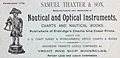 | Details | Thaxter, Samuel and Son | 1900 |
| Trade card of Samuel Thaxter and Son |
|
Thaxter, Samuel and Son |
|
| 1900 |
| LOC:0 |
| $0.00 | Thaxter--Samuel-and-Son | Trade-card-of-Samuel-Thaxter-and-Son | SOLD .
<a href="https://www.rarecharts.com/ShowDetail/Creator/Thaxter--Samuel-and-Son/Title/Samuel-Thaxter-and-Son--Boston--trade-card/1219" target="_blank">See an earlier card by Thaxter in stock.</a>
<br><br/>
Very scarce trade card for the Boston, Massachusetts firm of Samuel Thaxter and Son. Samuel Thaxter sold sextants, charts, compasses and other nautical items that occasionally are found on the antiques market today.
<br></br>
Overprinting in red at bottom of card suggests a date of approx 1900. Verso carries the following historical information about the firms' genesis:<br></br>
<div class="indenttextblock">
<b>One Hundred Years Under One Sign</b>
<br></br>
(From the Boston Evening Transcript, February 2d 1873.)
<br></br>
In 1779 William Williams carried on the Nautical-Instrument business in King, now State Street, having as a sign an image called "Admiral Vernon". In 1794 Samuel Thaxter, who married his niece, succeeded him and carried on the business in his own name thirty years. Then, taking his son a partner, the style of the firm was changed to S. THAXTER & SOn, under which name it has continued the last fifty-one years at 125 State Street, corner Broad Street. Samuel Thaxter Cushing, grandson of S. Thaxter has been connected with the business thirty-eight years, and for the last thirty-three years, the only surviving partner. For all that time the "Admiral" with his quadrant has stood guard and stands guard now, on State Street, fit prototype of the smart little image displayed by Walter's uncle as chronicled in "Dombey & Son".</div> |
| 1227 | 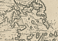 | Details | Popple, Henry | 1742 |
| Antique chart of Boston Harbor ca. 1742 |
|
Popple, Henry |
|
| 1742 |
| LOC:0 |
| $0.00 | Popple--Henry | Antique-chart-of-Boston-Harbor-ca--1742 | SOLD
<br></br>
Antique engraved harbor chart of the coastal areas near <b>Boston, Massachusetts</b>. Contains numerous depth soundings, navigation hazards and marked sand banks and sand bars. Popple identifies by name dozens of islands, peninsulas, rivers, and towns.
<br></br>
Key features named on the Popple's map of Boston harbor include:
<div class="indenttextblock">
<ul style="list-style-type: circle;">
<li>A ship channel</li>
<li>Roxbury</li>
<li>Dorchester</li>
<li>Squantum Neck</li>
<li>Hull</li>
<li>Hingham</li>
<li>Charles Town</li>
<li>Hangman's Island</li>
</ul>
</div>
This antique map was originally published by Covens and Mortier in 1742 in "Les Principales Forteresses Ports etc. de L'Amerique Septentrionale" a sheet containing harbor and island maps and plans of the Americas. This map is a fragment trimmed from a large single sheet of 18 maps and plans of islands and harbors was publihed by Covens and Mortier to replace Popple's original large map of 20 sheets with a more manageable six-sheet version. Popple's original map was titled: "A Map of the British Empire in America with the French, Spanish and the Dutch Settlements adjacent thereto". |
| 5318 |  | Details | Fuller and Whitney | 1886 |
| Fenway Park land manuscript engineering studies Boston Back Bay |
|
Fuller and Whitney |
|
| 1886 |
| LOC:1000 |
| $0.00 | Fuller-and-Whitney | Fenway-Park-land-manuscript-engineering-studies-Boston-Back-Bay | One of a kind engineer's manuscript trace map and planning studies in the Back Bay of Boston, Massachusetts for land that now includes the site for <b>Fenway Park</b>. This is an important record for the development of the Boston Back Bay that provides insight into Back Bay land making project priorities and planning at the end of the 19th century.
<br></br>
The base map with associated eight planning studies encompass an area bounded by Brookline Avenue, the Boston and Albany railroad right-of-way, and Audubon Road. In 1886 Fenway Park (built in 1912) was not yet planned, therefore all the land was considered for residential purposes. An engineering study that includes a ball park does not exist.
<br></br>
One manuscript pen and ink master map on 'surveyors cloth' paper with nine manuscript overlays- one reflecting land ownership as it was and eight studies or future design options for alternate land plat options on 'surveyors cloth'. Each overlay 'study' presents an alternative layout for platting the land. With each study the waste percentage is prominently displayed next to the index number for the study. The inferred reason is that the purpose of the studies was to arrive at a configuration that minimized land waste.
<br></br>
No blueprints of the finished product are known to exist nor are there any other copies of this planning study.
<br></br>
Manuscript pen and ink with blue outline under color to provide dimension for the Back Bay Fens on the finished product for which this trace was intended- blueprint copies.
<br></br>
Fuller and Whitney's MS surveyor's index number in pencil: "1335" at lower left.
<br></br>
Note on photographs: (1) Shows the base map on which the 9 overlays could be placed. (2) Shows the base map with the overlay for the existing cadastral plat in 1886. (3) Shows the base map, original plat, and the eight planning studies arrayed around the base map. |
| 2534 | 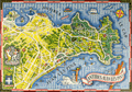 | Details | Syndicat d'Initiative d'Antibes Juan Les-Pins | 1949 |
| A fine pictorial promotional map for Antibes Juan Les-Pins |
|
Syndicat d'Initiative d'Antibes Juan Les-Pins |
|
| 1949 |
| LOC:0 |
| $0.00 | Syndicat-d-Initiative-d-Antibes-Juan-Les-Pins | A-fine-pictorial-promotional-map-for-Antibes-Juan-Les-Pins | SOLD<br></br>
Very colorful and visually stimulating map of the town and resort at Juan Les-Pins in the commune of Antibes on France's Mediterranean Côte d'Azur. Situated west of the town of Antibes, in the past it had been an area with many stone pine trees (pins), where the inhabitants of Antibes used to go for a promenade, for a picnic in the shadow of the stone pine trees or to collect tree branches and cones for their stoves. Verso is blank.
<br></br>
Created by Vic Raymon. |
| 66 |  | Details | Dumont, Jean | 1729 |
| Plan de Toulon |
|
Dumont, Jean |
|
| 1729 |
| LOC:0 |
| $0.00 | Dumont--Jean | Plan-de-Toulon | SOLD<br></br>
Large detailed antique map / plan shows the siege of Toulon in 1707. Focus is on the fortifications, disposition of troops, and lines of fire. Depiction of the walled, moated, city of Toulon with the old port, new port and all associated forts and emplacements. With a bird's eye inset of Toulon in the lower left corner. |
| 168 | 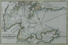 | Details | Roux, Joseph | 1764 |
| Toulon (Sold) |
|
Roux, Joseph |
|
| 1764 |
| LOC:0 |
| $0.00 | Roux--Joseph | Toulon-(Sold) | SOLD<BR> </BR>
Antique engraving of the French port of Toulon from the atlas of Mediterranean ports produced by Joseph Roux. The old nautical chart concentrates on the harbor around Toulon and its surrounding area, including forts St. Louis, Balaguie, Leguillette, and the larger Fort de la Marque.<BR> </BR>
There were at least four small atlases of port and coastal charts that originated from Marseille hydrographers in the 18th century. Between approximately 1720 and 1760 these atlases included works by cartographers
<a rel="nofollow" href= "/MichelotBremondBackground.aspx"> Michelot and Bremond</a>,
<a rel="nofollow" href= "/Creator/Ayrouard--Jacques"> Jacques Ayrouard</a>,
<a rel="nofollow" href= "/Creator/Roux--Joseph"> Joseph Roux</a>
, and Jean Allezard. |
| 779 | 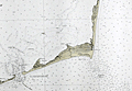 | Details | U.S. Coast and Geodetic Survey | 1919 |
| Cape Hatteras Outer Banks North Carolina |
|
U.S. Coast and Geodetic Survey |
|
| 1919 |
| LOC:0 |
| $0.00 | U-S--Coast-and-Geodetic-Survey | Cape-Hatteras-Outer-Banks-North-Carolina | SOLD<br></br>
Old U.S. nautical chart of Cape Hatteras, and the outer banks in North Carolina. This 96-year old large two-color navigation chart of the barrier islands near Cape Hatteras includes Portsmouth Island, Ocracoke Island, Gull Island, Hatteras Inlet, Ocracoke Inlet, Sandy Bay, and the towns of Portsmouth, Ocracoke, Hatteras, Buxton, and Kinnakeet ( Avon ). On the mainland side of the sound coverage includes the vicinity of Wyesocking ( Wysocking ) Bay, with small towns of Nebraska and Middleton, and also the Middleton Anchorage.
<br></br>
Detailed delineation of lights, buoys, and soundings and emphasis on the numerous reefs and shoals both inside and outside the Hatteras barrier islands. These features include Diamond Shoal, Wimble Shoals, Clam Shoal, Long Shoal, Oliver Reef, Clarks Reef, and dozens more. This area has become known as the 'Graveyard of the Atlantic' because more than 600 ships have sunk in the waters since 1526. The schooner Carrol A. Deering, dicussed elsewhere on this site, went aground a few miles from the Cape Hatteras lighthouse in 1921.
<br></br>
Originally published at Washington, D.C. in 1918 this edition sports a purple hand-stamp bearing the date of presumably the last corrections: November 8, 1919. Number 1232. |
| 966 | 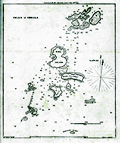 | Details | Blunt, E and G.W. | 1850 |
| Antique chart of the Isles of Shoals in Massachusetts and New Hampshire |
|
Blunt, E and G.W. |
|
| 1850 |
| LOC:0 |
| $0.00 | Blunt--E-and-G-W- | Antique-chart-of-the-Isles-of-Shoals-in-Massachusetts-and-New-Hampshire | SOLD<br></br>
Antique antebellum nautical chart of the islands comprising the <b>Isles of Shoals</b> offshore the town of Portsmouth, New Hampshire. Published by well known American publisher's of nautical charts and sailing directions, Edmund and George Blunt. Dated within the bottom attribution at 1850. Blunt's chart is probably the earliest hydrographic chart to focus solely on the Isles of Shoals.
<br></br>
There are nine islands that make up the Isles of Shoals, not all are named in Blunt's chart. In Maine the islands are: <b>Appledore ("Hog Island")</b>, Duck, Lunging ("Londoners"), Malaga (not named by Blunt), Smuttynose, and Cedar. In New Hampshire there are Seaveys (not named by Blunt), Star, and White.
On Star Island, <b>Gosport</b> (not named by Blunt) is shown as simply three structures and a church, but the chart does show the breakwater built in 1821 between Smuttynose and Cedar Islands.
<br></br>
From the 16th edition of the American Coast Pilot with other harbor charts, published by Edmund and George W. Blunt from New York. The Blunts were the most prolific private publishers of navigational charts in the United States in the mid 19th century. Page 41. |
| 1149 | 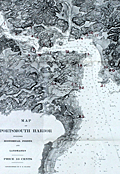 | Details | F.O. Ellery | 1900 |
| Chart of Portsmouth, New Hampshire harbor including historical points and landmarks |
|
F.O. Ellery |
|
| 1900 |
| LOC:0 |
| $0.00 | F-O--Ellery | Chart-of-Portsmouth--New-Hampshire-harbor-including-historical-points-and-landmarks | SOLD
<BR></BR>
Scarce folding chart of the harbor of Portsmouth, New Hampshire printed about 1900 in Boston by Skinner, Kidder & Co. Overprinted in large red numerals keyed to a legend below with 25 key points including:
<div class="indenttextblock">
<ul style="list-style-type: circle;">
<li>Badger's Island</li>
<li>Kittery, Maine</li>
<li>The United States Navy Yard</li>
<li>Fort Washington on Pierce Island</li>
<li>Seavey's Island</li>
<li>New Castle</li>
<li>Fort Constitution and the Portsmouth Lighthouse</li>
<li>Champernowne Hotel</li>
<li>Gerrish Island</li>
<li>Pocahontas Hotel</li>
<li>Whale's Back Light</li>
<li>Jaffrey's Point</li>
<li>U.S. Life Saving Station</li>
<li>Hotel Wentworth</li>
<li>Odiorne's Point, first place settled in New Hampshire</li>
</ul>
</div>
With numerous soundings and navigational features identified. Good detail of the near-shore margins. Includes a very small inset map of the Isle of Shoals. Folds into a heavy paper cover at 4.5" x 6". Cover contains ads for local businesses. Price when issued 10 cents. Copyrighted by F.O. Ellery. |
| 888 | 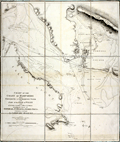 | Details | Knight, John | 1799 |
| Antique nautical chart of the coast of Hampshire, England from Portsmouth to Southampton Water |
|
Knight, John |
|
| 1799 |
| LOC:0 |
| $0.00 | Knight--John | Antique-nautical-chart-of-the-coast-of-Hampshire--England-from-Portsmouth-to-Southampton-Water | SOLD<br></br>
Antique folding sea chart of the Coast of Hampshire, England from Portsmouth to Southampton. With the northwest portion of the Isle of Wight and <b>Portsmouth Harbor</b>. Coverage includes the noted features of Calshot Castle, Gosport, Fareham, Porchester Castle, Hilsea Barracks, Langston Harbor, Portsea Island, <b>Spithead</b>, South Sea Castle, Cumberland Fort. Fort Monckton, Culver Cliffs, and Stokes Bay. Numerous sand banks are identifed including Dean Sand, Horse Sand, Spit Bank, Bembridge Ledge, Mother Bank, and Bramble. With numerous soundings, buoys, anchorages and bearing lines.
<br></br>
Based on the surveys of <b>Captain John Knight, R.N.</b> (1747 - 1831) and published by William Faden from London in 1799. In 1815, after ten years commanding the garrison on Gibraltar, Captain Knight retired a full admiral to Woodend House in Soberton, Hampshire about 10 miles north of the area covered by this chart.
<br></br>
Dissected into nine segments and laid to linen with light blue satin selvage. London. Published by W Faden Geographer to His Majesty and to H.R.H. the Prince of Wales. Charing Cross, January 1, 1799. |
| 121 |  | Details | Collins, Greenvile | 1763 |
| Newcastle upon Tyne |
|
Collins, Greenvile |
|
| 1763 |
| LOC:0 |
| $0.00 | Collins--Greenvile | Newcastle-upon-Tyne | SOLD <BR> </BR>
Three hand colored charts on a single sheet of heavy wove paper. Largest section is devoted to the Tyne river from the sea to the town of Newcastle. Two inset charts continue provide additional coverage on either side of the Tyne River: one of the coast near Sunderland and the other of Blyth Harbor. <BR> </BR>
With a large dedicatory cartouche to Trinity House. Trinity House, founded under royal charter in 1514 had three primary functions: maintenance of lighthouses and other aids to navigation, pilotage authority for more than 40 ports, and was a charitable organization for mariners. This chart clearly locates daymarks and buoys, information that is often not included in charts from this period. |
| 126 |  | Details | Anonymous | 1660 |
| Untitled - Stockholm mid 17th century |
|
Anonymous |
|
| 1660 |
| LOC:0 |
| $0.00 | Anonymous | Untitled---Stockholm-mid-17th-century | SOLD<BR> </BR>
Antique view of Stockholm with 'Admiralty Island' in the background records a procession of robed Senators and other nobles including King Carolus. In the distance to the left is the "Palatium Admiralitatis", the Skeppsholmen Admiralty palace built in 1650 and to the right- Kastellholmen. Depicts numerous naval vessels firing a salute. Contains emblems for Livonia, Scania, Finnonia Meridionalis, Finnonia Septentrionalis, and Uplandia. <BR> </BR>
It is unclear what occasion this engraving commemorates but it is likely after 1658 when Denmark was forced to cede control of Scania to Sweden. Possibly records the coronation procession of King Charles XI in 1672. |
| 624 |  | Details | Depot de la Marine | 1822 |
| Mouth of Cayenne River, French Guiana and Anchorages |
|
Depot de la Marine |
|
| 1822 |
| LOC:0 |
| $0.00 | Depot-de-la-Marine | Mouth-of-Cayenne-River--French-Guiana-and-Anchorages | SOLD <br></br>
Large antique nautical chart of of the mouth of the Cayenne River, the town of Cayenne, French Guiana and the surrounding coastline and offshore environs. Coverage centers on the island and town of Cayenne with numerous soundings and some hachured topographical relief. This excellent original copper-plate engraved sea chart includes the mouths of the Mahury and Cayenne Rivers, Mt. Cabasson, Mt. des Tigres, Mt. Dupont, Mt. de Mahury, Rentontabo, Pointe du Diamant ( Diamond Point ), and the islands of Malingre, Le Pere, La Mere, and Les Mamelles, and alone about 5 miles offshore, L'Enfant Perdue (Lost Child ). <br></br>
Issued by the French Depot de la Marine and containing the circular mark of that body at lower left within an "Avertissement" containing sailing directions. Engraved by Ambroise Tardieu.<br></br>
Inset at upper right of the "Plan des Isles du Salut", a French penal colony in the mid 19th century. Features Ile du Diable, Ile St. Joseph, and Ile Royale. Of these Ile du Diable is the infamous Devil's Island, designated for political prisoners and featured in the 20th century film 'Papillion', starring Steve McQueen and Dustin Hoffman. No 199 with a later stamp "29" in red. Dated within oval cartouche to 1822. |
| 154 |  | Details | de la Jaisse, Pierre | 1736 |
| St. Tropez |
|
de la Jaisse, Pierre |
|
| 1736 |
| LOC:0 |
| $0.00 | de-la-Jaisse--Pierre | St--Tropez | SOLD<br></br>
Scarce antique plan of this Cote d'Azur vacation hot spot from the unusual military and maritime port atlas produce by French author Pierre Lemau de la Jaisse in 1736. Front contains a copperplate-engraved circular view of St. Tropez and an armorial shield of "Saint Tropez" inset into a woodblock-engraved frame of standardized design that is repeated across the series. <BR> </BR>
Verso contains information about the "Frontiere Ancienne" Isle Ste. Marguerite, it longitude and latitude, and a brief description of the surrounding fortifications including a mention of three forts: Fortin, d'Arragon, and Royal. |
| 156 |  | Details | de la Jaisse, Pierre | 1736 |
| La Rochelle |
|
de la Jaisse, Pierre |
|
| 1736 |
| LOC:0 |
| $0.00 | de-la-Jaisse--Pierre | La-Rochelle | Scarce antique plan of La Rochelle from the military and maritime port atlas produced by French author Pierre Lemau de la Jaisse in 1736. Front contains a copperplate-engraved circular view of Brest harbor and fortifications and an armorial shield both inset into a woodblock-engraved frame of standardized design that is repeated across the series. <BR> </BR>
Verso contains a very brief history about the "Frontiere Moderne" village of Rochefort, its longitude and latitude, and a list of the major military and government officials including the Capitaine de Vaisseau and Capitaine de Port- M. de Bailliveau. |
| 1271 | 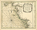 | Details | Bonne, Rigobert | 1778 |
| Antique miniature chart of the French coast at the Bay of Biscay |
|
Bonne, Rigobert |
|
| 1778 |
| LOC:0 |
| $0.00 | Bonne--Rigobert | Antique-miniature-chart-of-the-French-coast-at-the-Bay-of-Biscay | SOLD
<br></br>
Fine antique French miniature nautical chart of the French coast on the <b>Bay of Biscay</b> or Golfe de Gascogne (Fr.) (also Golfo de Biscaia or Gollfo de Vizcaya (Sp.)) in the provinces of Poitou, Aunis, and Brittany (Bretagne). Coverage includes the Quiberon Peninsula, Belle Isle, Nantes, Ile de Re, la Rochelle, Rochefort, mouth of the Loire River, and the Ile de Oleron.
<br></br>
From Rigobert Bonne's miniature nautical atlas "Atlas maritime ou Cartes réduites de toutes les Côtes de France avec des cartes particulières des isles voisines les plus considérables, suivies des plans des principales villes maritimes de ce royaume." One of 12 charts published in the Atlas Maritime which are considered to among the very few miniature nautical charts published during the golden age of miniature maps . Published by Lattre from Paris. With the royal privilege. No. 5.
<br></br>
This scarce miniature copper-plate engraving contains much of the same information found on larger nautical charts- rhumb lines; an adjustment for magnetic variation; numerous depth soundings; anchorages, headlands, capes, navigation hazards and sand banks that are clearly identified.
<br></br>
Rigobert Bonne (1727-1794) was the successor to Jacques Nicolas Bellin as Royal Cartographer to France in the office of the Hydrographer at the Depôt de la Marine. Bonne first came to prominence when he published a number of charts in the Atlas Maritime in 1762. He is better known for later publications, including the Atlas Encyclopedique, which he collaborated on with Nicholas Desmarest, as well as the maps he produced for Raynal's Atlas de Toutes Les Parties Connues du Globe Terrestre, which was published in 1780. |
| 1238 | 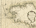 | Details | Bonne, Rigobert | 1778 |
| Antique miniature nautical chart of Brittany, France |
|
Bonne, Rigobert |
|
| 1778 |
| LOC:0 |
| $0.00 | Bonne--Rigobert | Antique-miniature-nautical-chart-of-Brittany--France | SOLD
<br></br>
Fine antique miniature nautical chart of the coast of <b>Brittany, France</b> (Bretagne) in the northwest of that country. Coverage on this attractive miniature sea chart includes Île-de-Bréhat, Morlaix, Ushant, Brest, l'Orient, Port Louis, and Quiberon.
<br></br>
Despite its small size this scarce copper-plate engraving contains much of what is found on larger charts- numerous headlands are noted; depth soundings are provided; hazards and sand banks are clearly identified; and rhumb lines are provided with a 19 degree compass adjustment for magnetic variation. Unlike other charts in the series, on this particular miniature chart Bonne provides very little detail about the interior topography and geography of Brittany.
<br></br>
From Rigobert Bonne's miniature nautical atlas "Atlas maritime ou Cartes réduites de toutes les Côtes de France avec des cartes particulières des isles voisines les plus considérables, suivies des plans des principales villes maritimes de ce royaume." One of 12 charts published in the Atlas Maritime which are considered to among the very few miniature nautical charts published during the golden age of miniature maps . Published by Lattre from Paris. With the royal privilege. No. 4.
<br></br>
Rigobert Bonne (1727-1794) was the successor to Jacques Nicolas Bellin as Royal Cartographer to France in the office of the Hydrographer at the Depôt de la Marine. Bonne first came to prominence when he published a number of charts in the Atlas Maritime in 1762. He is better known for later publications, including the Atlas Encyclopedique, which he collaborated on with Nicholas Desmarest, as well as the maps he produced for Raynal's Atlas de Toutes Les Parties Connues du Globe Terrestre, which was published in 1780. |
| 5023 | 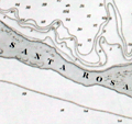 | Details | British Admiralty Hydrographical Office | 1883 |
| Scarce large Admiralty nautical chart of the Entrance to Pensacola Bay Florida |
|
British Admiralty Hydrographical Office |
|
| 1883 |
| LOC:0 |
| $0.00 | British-Admiralty-Hydrographical-Office | Scarce-large-Admiralty-nautical-chart-of-the-Entrance-to-Pensacola-Bay-Florida | SOLD<br></br>
Scarce large rolled sea chart on heavy paper of the entrance to Pensacola Bay, Florida (after the U.S. Coast Survey 1857) published at the Admiralty on May 30, 1861 under the superintendence of Captain Washington, R.N. Last correction 1883. No folds.
<br></br>
Not a preliminary chart. Full-size nautical charts on heavy paper of the Entrance to Pensacola Bay are very scarce, whether by the U.S. Coast Survey or the Admiralty.
<br></br>
Sold by J.D. Potter. Engraved by J & C Walker. Chart number 2820. |
| 6757 | 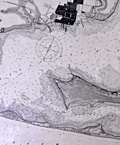 | Details | U.S. Coast and Geodetic Survey | 1892 |
| Scarce original antique nautical chart of Pensacola, Florida |
|
U.S. Coast and Geodetic Survey |
|
| 1892 |
| LOC:11111 |
| $0.00 | U-S--Coast-and-Geodetic-Survey | Scarce-original-antique-nautical-chart-of-Pensacola--Florida | SOLD<br><br>Quite scarce original nautical chart of the entrance to Pensacola Harbor, Florida. The map was first published by the United States Coast and Geodetic Survey (U.S.C.G.S.) in 1859 but this updated edition dates from May, 1892. The map shows Big Lagoon, ruins of Fort McRee, Fort Pickens on Santa Rosa Island, Woolsey, Warrington, and English Navy Cove. Pensacola is depicted laid out in a grid pattern while the entire tip of Fairpoint Peninsula including Gulf Breeze is shown forested as "United States Live Oak Plantations".
<br><br>
Rare. Over the last decade a resurgent interest in nautical charts and in Floridiana has made this chart increasingly difficult to obtain. 31" x 25" inside the neatlines.
<br><br>
Price of this chart when issued was 25 cents. Electrotype Copy No. 5. (1) U.S.C.G.S. Chart No. 490.
<br><br>
(1) Electrotyping is a reprographic printmaking method that was especially important in the 19th century, as it allowed for high-quality, high-volume reproduction of texts and images. Electrotype printing involves creating a metal plate via electroplating for printing. The process starts by forming a mold of the original work with a soft material like wax. This mold is dusted with graphite powder for conductivity, then submerged in a copper sulfate solution. An electric current is applied, causing copper ions to deposit onto the mold. The process continues until a sufficient copper layer forms. The new copper shell or 'electrotype' is separated from the mold and its back is filled with a type metal like lead for strength.
<br><br>
After cooling, the electrotype is finished and trimmed for use. It is inked and pressed against paper to produce prints of the original plate. This process was significant in the 19th century for high-quality, high-volume reproduction. |
| 590 | 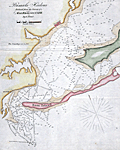 | Details | Blunt, E and G.W. | 1841 |
| Pensacola Harbor |
|
Blunt, E and G.W. |
|
| 1841 |
| LOC:11 |
| $0.00 | Blunt--E-and-G-W- | Pensacola-Harbor | Sold<br><br>Sold<br><br>
Small folding chart / map of Pensacola Harbor, Florida from 1841 published with other maps in Blunt's American Coast Pilot, 14th edition. The map include numerous soundings in feet. Named features on this copper-plate engraved antique chart include: one lighthouse ("revolving") , Santa Rosa Island, Deer Point, Tartar Point, Sandy Point and the very small town of Pensacola, Florida.
<br></br>
Printed by W. Hooker. Published by E. and G.W. Blunt, New York, 1841. Scale is displayed in statute miles. |
| 169 |  | Details | Anonymous | 1849 |
| SOLD Reconnaissance of Pensacola and Perdido Bays |
|
Anonymous |
|
| 1849 |
| LOC:0 |
| $0.00 | Anonymous | SOLD-Reconnaissance-of-Pensacola-and-Perdido-Bays | SOLD<BR> </BR>
Small coastal survey chart of Florida from Bonsecour Bay to the East end of Santa Rosa Island. |
| 643 | 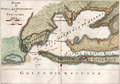 | Details | Masi, Tommaso Gio. | 1763 |
| Piano del Porto e degli Stabilimenti di Pensacola. |
|
Masi, Tommaso Gio. |
|
| 1763 |
| LOC:0 |
| $0.00 | Masi--Tommaso-Gio- | Piano-del-Porto-e-degli-Stabilimenti-di-Pensacola- | SOLD
<br></br>
Beautifully engraved antique plan of Pensacola, Florida. |
| 3584 | 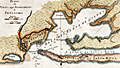 | Details | Masi, Tommaso Gio. | 1763 |
| Piano del Porto e degli Stabilimenti di Pensacola by Masi |
|
Masi, Tommaso Gio. |
|
| 1763 |
| LOC:200 |
| $0.00 | Masi--Tommaso-Gio- | Piano-del-Porto-e-degli-Stabilimenti-di-Pensacola-by-Masi | SOLD <br><br>
Beautifully engraved antique plan of Pensacola, Florida and the sourrounding bays and sounds created in 1763 when Pensacola was not much more than a tiny village. Coverage includes areas of present day Gulf Islands National Seashore, Gulf Breeze, Pensacola Beach, Navarre, Navarre Beach, Blackwater Bay, Escambia Bay, Santa Rosa Sound and Santa Rosa Island.
<br></br>
Two old forts are noted, Fort Santa Rosa, a long-destroyed log fort built by the Spanish on the western end of Santa Rosa Island near present day Fort Pickens, and Fort Santa Maria de Galres (Galves/Galve) , near present day Fort Barrancas. Other features noted that reflect Spanish/Italian place names are"Baia di Santa Maria de Galres" - Pensacola Bay; "Golfo dell Ostriche", now Escambia Bay; "Canale di Santa Rosa" or Santa Rosa Sound; "Fiume del Governatore" and "Fiume del Almirante" - the Yellow and Blackwater Rivers. Siguenca Point at the western tip of Santa Rosa Island is named after Dr. Carlos de Siguenza y Gongora, a member of a Spanish reconnaisance expedition in 1693 who was one of the first to map Pensacola Bay.
<br></br>
Orignally published in the Gazzetiere Americano, from Livorno, Italy. Contains many soundings and notations of the composition of the sea bottom, important to navigators who had to rely heavily on lead-line measurements for safe passage. Engraved by Giusepe Pazzi and drawn by Viol. Vanni. |
| 1265 |  | Details | Leslie, Frank | 1884 |
| Antique map of south Pensacola, Florida and Navy Yard |
|
Leslie, Frank |
|
| 1884 |
| LOC:0 |
| $0.00 | Leslie--Frank | Antique-map-of-south-Pensacola--Florida-and-Navy-Yard | SOLD
<br></br>
Antique map ''The United States Navy Yard. Pensacola Bay, Fla. Santa Rosa Island, and the Gulf of Mexico and Bay Forts''. This very attractive old map features the south <b>Pensacola</b> area during the Civil War, showing Fort McRae, Fort St. Carlos de Barrancas ( Barancas ), and <b>Fort Pickens</b>, barracks, marine hospital, cemetery, and U.S.Navy Yard. Shows the nearby communities of Warrington and Woolsey and a single road following the coastline to Pensacola.
<br></br>
Cartography after an earlier 1861 map published in Harper's Weekly. This later, updated map shows the Marine Hospital built in 1870. Source is Frank Leslie's <b>The Soldier in our Civil War</b>, one of the most lavish pictorial histories of the Civil War ever published.
<br></br>
The Pensacola Navy Yard was a shipyard at the site of present-day Naval Air Station (NAS) Pensacola. Originally constructed in 1826, it was decommissioned in 1911. The site was reopened three years later as Naval Air Station Pensacola.
<br></br> |
| 4827 | 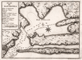 | Details | Laval, Antoine | 1728 |
| Rare early map of Pensacola for collectors |
|
Laval, Antoine |
|
| 1728 |
| LOC:0 |
| $0.00 | Laval--Antoine | Rare-early-map-of-Pensacola-for-collectors | SOLD
<br></br>
Similar to, but substantially different from Bellin's later chart of Pensacola, Florida. A rare, early (1728) chart of Pensacola Bay and Escambia Bay by Father Antoine Laval. Laval's chart could be considered a foundational map for collectors as it is the first detailed printed chart of the area. The three attributes of the map that differ most between Laval's map of 1728 and Bellin's later 1744 map are:
<div class="indenttextblocksingle">
<ul>
<li>Number of depth soundings. (Laval has many more soundings.)</li>
<li>Number of places named. (Bellin has more names.)</li>
<li>Alignment of Santa Rosa Island. (Laval's chart does not show the curvature that Bellin's later chart proposes.)</li>
</ul>
</div>
This map was included in the report of French astronomer Father Antoine Laval: "Journal d'un voyage de la Louisiane", an account of the 1720 expedition to the Florida and Louisiana coasts led by Valette Laudun. Laval is recorded as mathematician or astronomer on that voyage. The account included astronomical observations taken by Laval from a point on nearby Dauphin Island. (Source: oldmaps.com) From 1718 Laval was a Royal Professor of Hydrography based in the city of Toulon, France.
<br></br>
Boran explains the historical context for viewing Laval’s decision to provide his readers with a map of Pensacola:
<div class="indenttextblocksingle">
"… should be viewed in the light of military and political developments in France during the period 1718-1720. The War of the Quadruple Alliance had broken out in 1718 and Pensacola, was now deemed a strategic target (presumably because of its proximity to their base at Dauphin Island). In May 1719 the Lemoyne brothers ... took the port for the French. The Company of the West … decided to move their headquarters to Pensacola, given its potential as a port." (Boran, Elizabethanne. Travelling to Louisiana in 1720. Online: edwardworthlibrary.ie).</div> |
| 3664 | 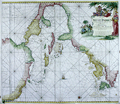 | Details | van Keulen, Johannes | 1687 |
| Surprising Dutch Chart of the West Indies and Gulf Coast |
|
van Keulen, Johannes |
|
| 1687 |
| LOC:51 |
| $0.00 | van-Keulen--Johannes | Surprising-Dutch-Chart-of-the-West-Indies-and-Gulf-Coast | SOLD
<BR> </BR>
Visually disconcerting and exciting Dutch nautical chart of the Gulf Coast and West Indies. This fine and very collectable sea chart is oriented with north to the right. By Johannes van Keulen. Second state. |
| 1071 |  | Details | Smiley, Russ | 1966 |
| Mid 20th-century Pictorial Map of The Islands of the Bahamas |
|
Smiley, Russ |
|
| 1966 |
| LOC:0 |
| $0.00 | Smiley--Russ | Mid-20th-century-Pictorial-Map-of-The-Islands-of-the-Bahamas | SOLD
<br></br>
Retro-style pictorial fishing map/print of the Bahama Islands. A very decorative nautically themed work that would make a great gift for any fisherman of yachtsman with an interest in the Bahamas.
<br></br>
The map is a nautical chart of the area from Miami, Florida at center left encompassing the Great Bahama Bank and extending to Grand Inagua Island at bottom right. The map is surrounded by an array of fishes of the area, many of them listed with their common name beside them. These fishes include permit, jack, hogfish, queen triggerfish, nassau grouper, yellowfin tuna, sailfish, and blue marlin.
<br></br>
Hundreds of noted features include: Miami, Lucaya Freeport, Spanish Wells, Biscayne Bay, Andros Island, Grand Bahama Island, Man of War Channel, North and South Bimini, Crooked Island Passage, and Rum Cay.
<br></br>
Created by Miami, Florida artist Russ Smiley and published by the Miami Post Publishing Company in 1966.
Currently this item is framed in an old 1/2" wide black frame with chips, and will be shipped framed if desired (only within the USA). Outside the USA, frame is not included. Not examined out of frame |
| 5043 |  | Details | Smiley, Russ | 1956 |
| Variant edition of Russ Smileys Fishing Map of Miami and the Florida Keys |
|
Smiley, Russ |
|
| 1956 |
| LOC:61 |
| $0.00 | Smiley--Russ | Variant-edition-of-Russ-Smileys-Fishing-Map-of-Miami-and-the-Florida-Keys | SOLD <a href="https://www.rarecharts.com/ShowDetail/Creator/Smiley--Russ/Title/Regal-Beer-edition-of-Russ-Smileys-Fishing-Map-of-Miami-and-the-Florida-Keys/6509" target="_blank"> but please see another example of Smiley's map we just added to our inventory</a>
<br></br>
Russ Smiley's Fishing chart of Miami and the Florida Keys ca. 1956. Scarce advertising variant edition for Regal Beer packed with information. |
| 5075 |  | Details | Smiley, Russ | 1987 |
| Russ Smiley's South Florida Map Ft. Lauderdale to Key West |
|
Smiley, Russ |
|
| 1987 |
| LOC:87 |
| $0.00 | Smiley--Russ | Russ-Smiley-s-South-Florida-Map--Ft--Lauderdale-to-Key-West | This item is sold but see another copy of <a href="https://www.rarecharts.com/ShowDetail/Creator/Smiley--Russ/Title/Russ-Smiley-s-Fishing-Map-South-Florida-Miami-Fort-Lauderdale-Key-West/6517" target="_blank">Smiley's chart now in stock. </a>
<br><br>
Late 1980's very decorative fishing chart of the Everglades, South Florida, and the Florida Keys. |
| 6509 |  | Details | Smiley, Russ | 1956 |
| Regal Beer edition of Russ Smileys Fishing Map of Miami and the Florida Keys |
|
Smiley, Russ |
|
| 1956 |
| LOC:400 |
| $0.00 | Smiley--Russ | Regal-Beer-edition-of-Russ-Smileys-Fishing-Map-of-Miami-and-the-Florida-Keys | SOLD<br><br>
A scarce mid-20th century pictorial fishing map: "Russ Smiley's Fishing Map of Miami and the Florida Keys", ca. 1956. Scarce advertising variant edition of Smiley's map for Regal Beer packed with information. "Enjoy fishing more, take along ice-cold Regal Premium Beer. Available anywhere and throughout the Florida Keys."
<br></br>
Includes several tables with long lists of fishing guides for Marathon, Key West. and Islamorada, Florida.
<br></br>
Folding brochure with photographs and text on verso. Green tones with note at bottom that a "deluxe edition" was available for $1.00. More fishing areas are identified on this edition of the chart than other Smiley charts we have seen.. |
| 708 | 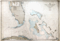 | Details | U.S. Navy Hydrographic Office | 1958 |
| Straits of Florida and Bahama Islands |
|
U.S. Navy Hydrographic Office |
|
| 1958 |
| LOC:0 |
| $0.00 | U-S--Navy-Hydrographic-Office | Straits-of-Florida-and-Bahama-Islands | SOLD
<br></br>
Decorative and colorful mid 20th-century U.S. naval chart of the southern Florida peninsula, cape Canaveral, Florida Keys, Marquesas Keys, northern Cuba, and Bahama Islands. Covers Miami, Biscayne Bay, West Palm Beach, and stretches as far north as Titusville Florida on the Atlantic coast. On the west Florida coast Cape Sable, Fort Meyers, and Tampa Bay. Other notable features covered by this old naval chart include Havana, Cuba; Crooked Island, Rum Cay, Long Island, San Salvador, Cat Island, Eleuthera, Andros Island, Great Abaco Island, and Grand Bahama Island.
<br></br>
The chart was printed during the cold-war period shortly after the Soviet Union launched its Sputnik satellite in 1957. In response to that perceived threat, during 1958 President Dwight Eisenhower signed the National Aeronautics and Space Act, which established NASA. Although Cape Canaveral became identified with NASA and best-known as the launch site for the U.S. space exploration program, the area had been used as a launch site for the early U.S. rocket program as far back as 1950 with the test of a V-2 rocket.
<br></br>
Because Cape Canaveral juts into the Atlantic Ocean and is in an area of swift currents it was the landing place for explorers and many shipwrecked mariners including the famous English privateer John Hawkins. Hawkins ship sank off Cape Canaveral in 1564. It is ironic that the same location that saw the the end of many sailing voyages should be used as the launch site for a new mode of exploration many centuries later.
<br></br>
With the circular logo of the Department of the Navy Hydrographic Office. Bottom right in margin is a blue rubber-stamp ink impression stating that this sheet was corrected to August 2, 1958. Scale 1:875,960. Number 944. Price when issued $1.05. |
| 5002 | 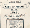 | Details | Dolph, Frank B. | 1946 |
| Dolph's Subdivision and Zoning Atlas of Miami, Florida 1946 |
|
Dolph, Frank B. |
|
| 1946 |
| LOC:0 |
| $0.00 | Dolph--Frank-B- | Dolph-s-Subdivision-and-Zoning-Atlas-of-Miami--Florida-1946 | SOLD<br><br>
Dolph's Subdivision and Zoning Atlas of Miami, Florida. Includes Miami Shores Village, Biscayne Park, and El Portal. Published in 1946 by Frank B. Dolph Company 861 N.E. Third Street Fort Lauderdale and 307 N.W. Second Avenue, Miami, Florida. Includes a subdivision index and an index map to the City of Miami, Florida 1946.
<br></br>
Numerous manuscript updates, notations, and changes, along with a few pasted clippings and plans reflecting many years of productive use. Maps have been re-ordered but are all present.
<br></br>
Pages 1 - 48 all present. |
| 4939 | 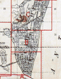 | Details | G.M. Hopkins Company | 1925 |
| Hopkins' plat book of Greater Miami Florida and Suburbs 1925 |
|
G.M. Hopkins Company |
|
| 1925 |
| LOC:0 |
| $0.00 | G-M--Hopkins-Company | Hopkins--plat-book-of-Greater-Miami-Florida-and-Suburbs-1925 | SOLD<br/><br/>
Original plat book of Greater Miami, Florida and Suburbs from official records, private plans, and actual surveys. Compiled under the direction of and published by G.M. Hopkins Co. Civil Engineers … 1925.
<br/><br/>
In two sections: Greater Miami, Florida and Suburbs (list of revisions; street index; 2 index maps; and 41 sheets of plats) and City of Miami Beach (with six sheets containing plats labeled B-G; Sheet "A" missing.) Verso of each sheet is blank.
<br/><br/>
Earliest of three plat books of Miami by the Hopkins Co, the latter two being 1936 and 1957.
G.M. Hopkins Company was a map-making publishing company founded in 1865 in Philadelphia, Pa., by brothers G.M. and Henry Hopkins. The name of the company was changed to G.M. Hopkins Company in 1902. The company was bought by the Franklin Survey Company of Philadelphia in 1943, which continued to issue maps and atlases under the G.M. Hopkins name. |
| 4903 | 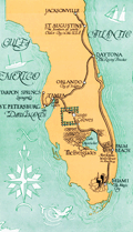 | Details | Florida Motor Lines | 1929 |
| Map Brochure for a Circle Tour of Florida $37.50 |
|
Florida Motor Lines |
|
| 1929 |
| LOC:0 |
| $0.00 | Florida-Motor-Lines | Map-Brochure-for-a-Circle-Tour-of-Florida-$37-50 | SOLD<br></br>
A Circle Tour of Florida brochure with map, printed during the Florida land boom of the late 1920's. Tour duration could last "Four days to four months depending upon the stopovers." By Florida Motor Lines, later the first subsidiary of Greyhound Bus Lines.
<br></br>
With locations and telephone numbers for bus stations and terminals including Miami, where the phone number was "8888". Folds to 3" x 9".
<br></br>
<div class="indenttextblock">
"FLORIDA MOTOR LINES, INC. was formed in January 1926 by the firm Stone and Webster by buying and consolidating Florida Motor Transportation Company and White Stage Line Company. Based in Orlando, Florida, the company owned 150 coaches and ran some 1,290 route miles. On October 24, 1929 “a Certificate of Public Convenience and Necessity was issued to Florida Motor Lines to operate motor busses for compensation in transporting passengers on all the highways of the state then being operated upon by the applicant, and especially over State Highway No. 4, between Jacksonville and Miami.” In 1933 the company moved its office to Jacksonville. In January 1946 Florida Motor Lines was sold to The Greyhound Corporation, which renamed it Florida Greyhound Lines. The new Florida Greyhound Lines was the first wholly owned subsidiary of The Greyhound Corporation." (Online: https://transitbadges.com/def/)
</div> |
| 5384 |  | Details | G.M. Hopkins Co. | 1943 |
| Real Estate Plat-book of the City of Miami Beach Florida |
|
G.M. Hopkins Co. |
|
| 1943 |
| LOC: |
| $0.00 | G-M--Hopkins-Co- | Real-Estate-Plat-book-of-the-City-of-Miami-Beach-Florida | SOLD<br></br>
Rare real estate atlas or plat-book of the City of Miami Beach, Florida. Miami Beach was incorporated on March 26, 1915. The city is located on Florida's southeast coast in Miami-Dade county on natural and man-made barrier islands between the Atlantic Ocean and Biscayne Bay.
<br></br>
Index sheet and 26 linen-backed plat sheets each 34" W x 23" H.
<br></br>
Published during WWII (1943) by G. M. Hopkins Co. 328 Chestnut Street, Philadelphia, PA. Between 1870 and 1940, the G. M. Hopkins Co. produced more than 175 atlases and real estate plat maps including cities, counties, and townships in 18 different states and the District of Columbia. Revisions and additions to the atlases could be ordered from the G.M. Hopkins Company and then pasted over the original map plates. |
| 5123 | 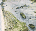 | Details | Miami Beach Casino | |
| Scarce birds eye view of Miami Beach |
|
Miami Beach Casino |
|
|
| LOC:0 |
| $0.00 | Miami-Beach-Casino | Scarce-birds-eye-view-of-Miami-Beach | SOLD
<br></br>
Two bird's-eye views (airplane views) of Miami Beach on a single folding sheet:
<div class="indenttextblocksingle">
<ul style="list-style-type: circle;">
<li>An airplane view of Miami Beach showing its relation to the adjacent Florida Keys and the mainland. </li>
<li>Miami Beach from an airplane with the Gulf Stream in the distance Belle Isle and Star Island in the foreground.</li>
<ul>
</div>
The views were produced by Meinzinger Studios, Detroit, Michigan. From a promotional booklet by the Miami Beach Casino titled "America's Winter Playground: Mid-winter life at Miami Beach- Miami's ocean front. On the larger view biplanes circle Miami Beach as numerous steamers make their way inbound through the channel.
</br></br>
Advertising copy could not possibly be more favorable to the area. For example:
<div class="indenttextblocksingle">
"Children develop robust physiques and vigorous mentality at Miami Beach because of the ideally equable climate and a constant call to play in the ocean; and cases of illness are almost unknown."
</div> |
| 6680 | 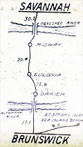 | Details | National Highway Roller Map co. | 1930 |
| Highway 1 Roller Strip Map Maine to Miami Florida |
|
National Highway Roller Map co. |
|
| 1930 |
| LOC: |
| $0.00 | National-Highway-Roller-Map-co- | Highway-1-Roller-Strip-Map-Maine-to-Miami-Florida | SOLD<br><br>
Before Google Maps and Apple Maps there were Roller Maps. This boxed hand-held rotating roller map, copyright 1930, is stated to be 19 feet long x 2 3/4 inches high (1). The roll on this unusual roller road strip map traces the route of Highway 1 from Maine to Miami, Florida. In a heavy windowed cardboard box with two wooden spool handles for each axle. Based on an entry to the Catalog of Copyright Entries the item is dated to March, 1930. Apparently scarce.
<br><br>
Highway 1, also referred to as the Eastern Seaboard Highway, is a significant highway that runs along the East Coast of the United States. It stretches for almost 2,400 miles, from Maine to Florida. The highway passes through several major cities, including Boston, New York City, Philadelphia, Washington D.C., and Miami. Highway 1 has a rich history, as it was originally established in the early 20th century as a network of small roads that connected coastal towns and cities.
<br><br>
Box has a circular steel disc attached to the back. The disc mostly likely was used to attach the roller map to a dashboard holder magnetically.
<br><br>
Similar in function to the metal-cased Rota-ray Map of New York at the David Rumsey Collection (2) but the cardboard roller map probably had much lower manufacturing cost than the Rota-ray roller map. Scarce. Only one copy found in WorldCat, at the Library of Congress. Oh, I just got it- rotary!
<br><br>
Produced by the National Highway Roller Map Company, Augusta, Georgia.
<br><br>
(1) https://www.davidrumsey.com/. Search term: "Rota Ray".<br>
(2) Catalogue of Copyright Entries. Online. Google. New Series Volume 27, No. 1, 1930. page 588. |
| 5325 | 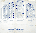 | Details | Anonymous | 1938 |
| Rare plat map of Sunset Islands, Miami, Dade Florida |
|
Anonymous |
|
| 1938 |
| LOC:61 |
| $0.00 | Anonymous | Rare-plat-map-of-Sunset-Islands--Miami--Dade-Florida | SOLD<br><br>Rare original blueline plan and plat map of the four Sunset Islands in Miami, Dade County, Florida. Contains a inset location sketch, or context map of the islands, at a scale of 1" - 2640 feet. This plat map would have been used in the post-Depression era when sales on the Sunset Islands were rebounding. Date included for each lot to be sold included lot dimensions and price.
<br></br>
Note this an original 1938 one-of-a-kind blueline plat. It is not a modern reprint, copy, facsimile or giclee. Guaranteed.
<br></br>
Sunset Islands (I,II,III,IV) are four man-made islands located in Biscayne Bay and are home to some of Miami's richest and best known residents.
<br></br>
The Sunset Islands were developed by the Sunset Islands Company, headed by Steven. A. Lynch (1882-1969), President of Paramount Pictures. The islands were first platted in 1925. The Sunset Canals were dredged in 1926. Just as the Great Depression struck, Lynch finished filling the islands.
<br></br>
Despite Lynch's early start during the Florida 1920's land boom, construction of new homes on The Sunset Islands did not start in earnest until a decade later, in part because of delaying tactics employed by rival Miami developer Carl Fisher and also due to the slowdown in development during the land-boom crash of the Great Depression. Lynch built a residence on the southwest corner of Sunset Island II named "Sunshine Cottage."
<br></br>
The Sunset Islands were among the last man-made islands created in Biscayne Bay. This plat of the Sunset Islands from 1938 shows only about 25% of the lots with homes on them and almost 50% of the lots left unsold at that time Prices ranged from as low as $2,000 for small interior lots to $29,000 or even $30,000 for a .85 acre lot with 183 feet of waterfront on Sunset Island II. |
| 1420 |  | Details | Johst, Paul Spener | 1931 |
| Florida Pictorial Map |
|
Johst, Paul Spener |
|
| 1931 |
| LOC:0 |
| $0.00 | Johst--Paul-Spener | Florida-Pictorial-Map | SOLD
<br></br>
Pictorial map of the State of Florida in a cartoon-like style. Depicts transportation (dog sledding) , nature palm trees, alligators, turtles) and recreations (auto racing, sailing) for the State of Florida in an exaggerated, stereotyped manner. The Florida keys are signified by door keys. A decorative legend identifies six locations within Florida: Jacksonville, Miami, Tallahassee, St. Augustine, Key West, and Palm Beach. Page 65.
<br></br>
Verso with text extolling the virtues of Florida's resorts and natural wonders, its swamps, and its 30,000 lakes.
<br></br>
From "Picture Map Geography of the United States" by Vernon Quinn. With Picture Maps by Paul Spener Johst. Publisher: Frederick A. Stokes Company. New York. 1931. Some picture maps in the book contain depictions that today might be considered politically incorrect or even racist. |
| 179 | 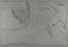 | Details | Depot de la Marine | 1851 |
| Carte des Canaux de la Providence et de Bahama |
|
Depot de la Marine |
|
| 1851 |
| LOC:0 |
| $0.00 | Depot-de-la-Marine | Carte-des-Canaux-de-la-Providence-et-de-Bahama | <BR> </BR>
SOLD
<BR> </BR>
Fine antique nautical chart from 1851 of Southern Florida and the Keys to Cuba including the Bahamas to Eleuthera. This scare old chart after a work by Edmund Blunt in 1847 was produced by the French Depot-General de la Marine and includes the circular imprint of that organization. Points of interest include "Havane" (Havana, Cuba) and Fort Dallas (est. 1836), at the mouth of the Miami River. Notably absent is any mention of the towns of Miami, Palm Beach or any other population center in that area. Insets at upper right and upper left contain profiles of topographic features. <BR> </BR> <BR> </BR>
Old maps of Florida by the Depot de la Marine are uncommon and should be prized both by the collector and by those interested in their use as nautical décor. |
| 175 |  | Details | Chedel | 1754 |
| Ville de St. Domingo |
|
Chedel |
|
| 1754 |
| LOC:0 |
| $0.00 | Chedel | Ville-de-St--Domingo | SOLD
<br></br>
Colorful antique engraving shows a birds-eye view of the Port of Santo Domingo with a small fort off to the right guarding the entrance channel. |
| 1313 | 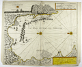 | Details | Loots, Johannes | 1705 |
| Very rare battle plan of the 1704 Capture of Gibraltar. |
|
Loots, Johannes |
|
| 1705 |
| LOC:200 |
| $0.00 | Loots--Johannes | Very-rare-battle-plan-of-the-1704-Capture-of-Gibraltar- | SOLD<br></br><br>Very rare first edition broadsheet chart / view of the Capture of Gibraltar in 1704 by Dutch cartographer Johannes Loots (w. 1693-1726). On 4th August 1704, during the war of the Spanish Succession, an Anglo-Dutch fleet under the command of Admiral George Rooke seized Gibraltar from the Spanish. From dawn on that day and for the next five hours, some 15,000 canons were fired from the fleet into the city. The English majority captors, landed the same morning and not surprisingly encountered little opposition.
<br></br>
Antique Map Price Record has no record of a sale of this chart by Johannes Loots. Charts by Loots are very scarce; only 11 charts by Loots are recorded in the Antique Map Price Record covering 210,000 map and chart sales in the last 35 years. Only two copies of this chart are listed in OCLC World Cat, both at Harvard.
<br></br>
From Koeman's biography of Johanne's Loots (1665[6] - 1726) we know Loots was born in Amsterdam and is not as is sometimes believed one of the two sons of Anthonie (Theunisz) Jacobsz who named themselves Lootsman to confuse cartographic researchers in future centuries. Loots served an apprenticeship under Hendrick Doncker as a maker of mathematical and nautical instruments including cross-staffs. Loots was accepted into the Guild of Booksellers in 1693 and settled into a shop in the Nieuebrugsteeg 'In de Jong Lootsman'.
<br></br>
Title reads: " Tot Amsterdam by Ionnes Loots Boek Zeekard Verkooper en Graadboog Maker inde Nieuwe brugsteed Ionge Lootsman." |
| 199 | 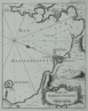 | Details | Bellin, Jacques Nicolas | 1764 |
| Plan de Bayes et Poussole |
|
Bellin, Jacques Nicolas |
|
| 1764 |
| LOC:0 |
| $0.00 | Bellin--Jacques-Nicolas | Plan-de-Bayes-et-Poussole | SOLD
<br></br>
Clean copy of this small 18th century antique chart of the Italian coast including the city of Pozzouli (Poussole) from La Petit Atlas Maritime. Coverage includes the Mediterranean coast from Cap Mizene to Cap Coroille. Highlights include a small volcano "Souffriere" and the island of Nizita south of Pozzouli. Tome 4. No. 85. |
| 209 |  | Details | Sawtell, Alfred E. | 1874 |
| Sawtells Nautical Almanac |
|
Sawtell, Alfred E. |
|
| 1874 |
| LOC:0 |
| $0.00 | Sawtell--Alfred-E- | Sawtells-Nautical-Almanac | SOLD<br><br>
Small extremely scarce antique 64 page nautical almanac published by Alfred E. Sawtell of Port Adelaide, Australia in 1874 less than 40 years after colonists founded the city. Probably a relatively early printing as an Adelaide newspaper advertisement from 1901 lists the Almanac still for sale, although now updated with colored plates and enlarged at 324 pages.<BR> </BR>
Very interesting early Australian nautical reference would be a good fit for collectors of 19th century Australian sea charts or nautical books. Along with an ephemeris and tide tables the contents include information on courses and distances, sailing directions, pilotage dues, a 7 page list of Australian vessels and their tonnage, and ships regulations for bathing, sanitation and gunpowder. <BR> </BR>
Back cover advertisement describes A.E. Sawtell as: "Chronometer, Watchmaker, Nautical Optician, Chart and Nautical Bookseller". An enclosed stock list includes nautical books, charts, chronometers and "transparent dipping needle and plain compass cards all sizes". 32 page advertising supplement contains ads for many nautical services and goods including : "J. Hill and Co. Omnibus Proprietors", "J. Lavin Steam Biscuit Manufactory" and the "80 HORESPOWER steam tugs Eleanor and Sophia". Feel the power! |
| 683 | 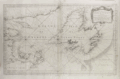 | Details | Depot de la Marine | 1754 |
| Gulf of St. Lawrence |
|
Depot de la Marine |
|
| 1754 |
| LOC:0 |
| $0.00 | Depot-de-la-Marine | Gulf-of-St--Lawrence | SOLD<br></br>
Large antique mid 18th century French nautical chart of the entire Gulf of St. Lawrence. Published by the French Depot des Cartes, Plans et Journaux de la Marine in 1754, this variant example of the chart does not contain an attribution to J.N. Bellin, uncovering Pinquin ( Penguin ) Island in the space previously occupied by the cartouche.
<br></br>
Includes the Island of Newfoundland ( Isle de Terre-Neuve ) with the town of St. John ( St. Jean ), Anticosti Island, the Grand Banks, and Isle Royale. Very interesting is the addition of several very small manuscript? annotations to the chart very near to the Islands of Miquelon and St. Pierre- the only two French possessions in the area. The annotations include the addition of a name to a very small island "Isle Verte" (Green Island) and the overwriting / obscuring of the name for one of the headlands- "le Chapeau Rouge'.
<br></br> |
| 238 | 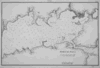 | Details | Direccion Hidrografia | 1809 |
| Bahia de Jagua (Cienfuegos) |
|
Direccion Hidrografia |
|
| 1809 |
| LOC:5 |
| $0.00 | Direccion-Hidrografia | Bahia-de-Jagua-(Cienfuegos) | Enquire for price.
<BR> </BR>
Beautiful antique, black and white engraved copperplate port plan of Jagua Bay, (now Cienfuegos) on the southern coast of Cuba. Published in 1809, this chart of Cienfuegos Bay was one of 34 charts of Cuban ports published by the Spanish Admiralty, the Direccion Hidrografia, in the sea atlas "Portolano de la America Setentrional Construido en la Direccion Detrabajos Hidrograficos". <BR> </BR>
Highlights include a fortress, 'Castillo de Nuestra Señora de los Angeles', built in 1745 at the mouth of the bay for protection from pirates. Unlike many other port plans, very few structures are noted and the position of the Castillo is hardly noticeable as it represented with only a very small double circle and even smaller lettering. A fine example with careful, delicate engraving and a wide platemark on high-quality paper. Distance scale is in cables. Engraved by T.G. Part 3. Plate #33.<BR> </BR>
Reference: Materiales para una Cartografia Mexicana. Manuel Orozco y Berra. 1871. p. 216.
<br></br>
<a href="/DireccionHidrografiaBackground.aspx" > See all items by Spain's Direccion de Hidrografia.</a> |
| 601 |  | Details | U.S. Coast and Geodetic Survey | 1851 |
| Hell Gate and its Approaches |
|
U.S. Coast and Geodetic Survey |
|
| 1851 |
| LOC:0 |
| $0.00 | U-S--Coast-and-Geodetic-Survey | Hell-Gate-and-its-Approaches | <br><br>This item is <b>SOLD</b> but we have found another example of this item that is <a href="https://www.rarecharts.com/ShowDetail/Creator/U-S--Coast-and-Geodetic-Survey/Title/Rare-chart-of-Hell-Gate-and-its-approaches-New-York-City/6531" target="_blank">now in our inventory.</a>
<br></br>
Rolled, antique navigational and hydrographic chart of Hell Gate at the East River of New York City.
With sailing directions and numerous depth soundings. Copper-plate engraving with fine detail. |
| 466 | 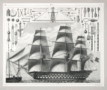 | Details | Heck, Georg | 1851 |
| Sailing Ship and Rigging |
|
Heck, Georg |
|
| 1851 |
| LOC:0 |
| $0.00 | Heck--Georg | Sailing-Ship-and-Rigging | <br><br><b>SOLD</b>, but see <a href="https://www.rarecharts.com/ShowDetail/Creator/Heck--Georg/Title/19th-century-engraving-sailing-ship-and-rigging/6459" target="_blank">another example of the map</a> now in RareCharts' inventory.
<br></br>
Antique steel-plate engraving depicting a triple-decked ship-of-the-line with its related rigging and equipment. |
| 1164 |  | Details | Anonymous | 1880 |
| Antique trade card for the sloop yacht Emma Wicks |
|
Anonymous |
|
| 1880 |
| LOC:0 |
| $0.00 | Anonymous | Antique-trade-card-for-the-sloop-yacht-Emma-Wicks | SOLD
<br></br>
Rare antique lithographed trade card for the sloop yacht "Emma Wicks" ca. 1880. Captain Charles Adams & Jason Wicks advertised that "parties desiring a pleasant sail on the ocean or bays or to Cape May, or Long Beach will be cheerfully accommodated."
<br></br>
The illustration is of a moonlit night regatta of small gaff-rigged <b>catboats</b> off Long Island Light, Boston Harbor. Catboats are characterized by their simplicity, ease of handling, shallow draft, and large capacity. Historically, the origin of the catboat type was in New York around 1840. Cat-rigged boats were used for fishing and transport in the coastal waters around Cape Cod, Narragansett Bay, New York and New Jersey. Size is about 3 1/2" x 2 1/2". Verso blank. |
| 597 |  | Details | Buache, Jean Nicolas | 1807 |
| Ile de New-York Partie de Long-Island ou de l'Ile Longue |
|
Buache, Jean Nicolas |
|
| 1807 |
| LOC:0 |
| $0.00 | Buache--Jean-Nicolas | Ile-de-New-York-Partie-de-Long-Island-ou-de-l-Ile-Longue | SOLD<br></br>
Detailed topographic map of New York, Long Island and surrounding areas with positions of American and British military forces during the Battle of Brooklyn during August 22-27, 1776. This antique copperplate engraved map is attributed to J.N. Buache and includes many nautical points of interest, as during that period access from the sea was often faster than by land.
<br></br>
Named features include Fort Independence, Fort Lee, Hudson River, York Bay, Oyster Bay, Hell Gate, Governor's Island, the East River, Staten Island, Bergen, Flushing, Brooklyn, East Chester and West Chester. Numerous roads and the position of several named ships are also noted including the Roebuck, the Rose, the Greyhound, and the Thunder.
<br></br>
From John Marshall's "Vie de George Washington". Plate VII. |
| 5100 |  | Details | Youth International Party Information Service | 1983 |
| World Cannabis March on the U.N. Poster |
|
Youth International Party Information Service |
|
| 1983 |
| LOC:88 |
| $0.00 | Youth-International-Party-Information-Service | World-Cannabis-March-on-the-U-N--Poster | SOLD<br></br>
World Cannabis March on the U.N. Poster on good-quality newsprint from a Yipster underground newspaper. The march was sponsored by the 5th Avenue Pot Parade Coalition.
<br></br>
Purpose was to advertise a protest parade in New York City against the Reagan Administration's policies on cannabis. The gathering The march was to start at 11 A.M. May 7, 1983 at Washington Square Park. |
| 5400 |  | Details | Marsh, Frederick Dana | 1912 |
| F.D. Marsh original mosaic design with a 1600s Manhattan view |
|
Marsh, Frederick Dana |
|
| 1912 |
| LOC:3 |
| $0.00 | Marsh--Frederick-Dana | F-D--Marsh-original-mosaic-design-with-a-1600s-Manhattan-view | SOLD
<br><br>
Original decorative pencil and watercolor design "New Netherlands" by famed artist Frederick Dana Marsh. Initialed F.D.M. on the recto and stamped on the verso "Fred Dana Marsh | Wykagyl Park | New Rochelle, N.Y."
<br></br>
This sketch ca. 1913 is likely an early conceptual design for one of six terracotta (15 feet wide and 10 feet tall) murals installed during 1912 in the Marine Grill of the McAlpin Hotel in Herald Square, New York City [1]. The murals are now displayed near the William Street entrance of New York's Fulton Street Subway Station [2].
<br></br>
<FIGURE>
<IMG SRC="/ZoomifyImages/SC_5400/FDMarshMural.gif" width="200" alt="Marsh's McAlpin Hotel mural.">
<FIGCAPTION ><small>Marsh's McAlpin Hotel 'New Amsterdam' mural.</small></FIGCAPTION>
</FIGURE>
</br>
<FIGURE>
<img SRC="/ZoomifyImages/SC_5400/Marsh_stamp.jpg" width="200" alt="Frederick Marsh's ink stamp for Wykagyl Park">
<FIGCAPTION ><small>Marsh's ink stamp on verso.</small></FIGCAPTION>
</FIGURE>
</br>
Seller stated that provenance of the art is from the collection of Fred J. Johnson.
<br></br>
[1] https://tilesinnewyork.blogspot.com/2018/09/a-possible-early-sketch-for-one-of.html </br>
[2] https://www.atlasobscura.com/places/the-marine-grill-murals-of-the-mcalpin-hotel-new-york-new-york |
| 5418 |  | Details | Franzen, Dana | 1984 |
| Fine 1984 World Cannabis March on the U.N. Poster |
|
Franzen, Dana |
|
| 1984 |
| LOC:87 |
| $0.00 | Franzen--Dana | Fine-1984-World-Cannabis-March-on-the-U-N--Poster | SOLD<br></br>
Original, scarce and very colorful poster "World Cannabis March on the U.N." from 1984 on heavier and higher-quality newsprint by the 5th Avenue Pot Parade Coalition. Designed by Dana Franzen for A Yipster Times Publication. The poster was a center-fold insert.
<br></br>
Purpose was to advertise a protest parade in New York City against the Reagan Administration's policies on cannabis. The march was to start at 11 A.M. May 5, 1984 at Washington Square Park.
<br></br>
Verso with a black and white poster for "Rock Against Racism." |
| 1174 |  | Details | Marsily and Christiansen | 1845 |
| Trade card for Antwerp ship chandlers Marsily and Christiansen |
|
Marsily and Christiansen |
|
| 1845 |
| LOC:0 |
| $0.00 | Marsily-and-Christiansen | Trade-card-for-Antwerp-ship-chandlers-Marsily-and-Christiansen | SOLD
<br></br>
Rare porcelain trade card for Antwerp ship chandlers Marsily and Christiansen. On coated card stock. English text touts " Marine Stores of all descriptions" including:
<div class="indenttextblock">
<ul style="list-style-type: circle;">
<li>Charts</li>
<li>Instruments</li>
<li>Sheathing, copper and zinc</li>
<li>Sugars</li>
<li>Gin</li>
<li>Wines for exportation</li>
<li>Assortment of fowling pieces and pistols.</li>
<li>Chain cables and anchors</li>
</ul>
</div>
The process of coating paper stock was developed in England, but was used most extensively in continental Europe, particularly Belgium. The 1840s and 1850s saw the advent of the Belgian "porcelain cards," sumptuously designed and beautifully printed trade cards whose high-gloss finish had the look of porcelain.
<br></br>
The firm Marsily and Christiansen was located at 1st Dock Antwerp. (Date is calculated as 20 years after the 1825 publishing date of a Norrie nautical chart where the Marsily and Christiansen seller's stamp is present.) |
| 337 |  | Details | U.S. Geological Survey | 1892 |
| Provincetown Harbor |
|
U.S. Geological Survey |
|
| 1892 |
| LOC:0 |
| $0.00 | U-S--Geological-Survey | Provincetown-Harbor | SOLD
<br><br/>
Small antique lithographed nautical chart of northern Cape Cod, Provincetown, Massachusetts and the harbor derived from U.S. Coast Survey chart No. 10 and overlaid with topographic details. Lifesaving stations, lighthouses, soundings, and navigational aids are shown. Water shown in blue. Features include Race Point, Wood End Light, Long Point Light, and Peaked Hill Bar lifesaving station. <BR> </BR>
Produced for the U.S. Geological Survey Thirteenth Annual Report. Produced by George S. Harris Lithographers, Philadelphia. Plate 35. |
| 1268 | 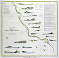 | Details | U.S. Coast and Geodetic Survey | 1853 |
| Antique rolled U.S. Coast Survey chart from San Francisco to San Diego |
|
U.S. Coast and Geodetic Survey |
|
| 1853 |
| LOC:0 |
| $0.00 | U-S--Coast-and-Geodetic-Survey | Antique-rolled-U-S--Coast-Survey-chart-from-San-Francisco-to-San-Diego | SOLD<br></br>
Attractive antique nautical chart of the western coast of California focused on the coastline between <b>San Francisco</b> and <b>San Diego</b>, California. Includes Los Coronados (Coronado Islands), San Clemente Island, Alcatraz Island, San Nicholas Island, Point Loma, Point Conception and many other geographic locations.
<br></br>
This is a scarce, separately issued, rolled chart of the California coast, not one of the common folded versions on thin paper that were issued with other charts in an annual report to Congress from the Coast Survey.
<br></br>
The antique chart was produced by the U.S. Coast Survey in 1853, a time when the United States Pacific coastal states were lightly populated (by settlers). In fact, one of the settlements noted above San Diego in a wide coastal plain is referred to on the map as <b>"El Pueblo de Los Angeles". </b> That settlement had been created by the Spanish only in 1781.
<br></br>
Noted habitations include Monterrey, the Mission of Carmel, San Diego, and San Francisco. The chart is decorated with 17 decorative nicely-engraved coastal profile views including Catalina Harbor, Moro Rock, Point Sur, and the Entrance to San Francisco Bay.
<br></br>
This antique chart was printed in 1853 from an electrotype copy of the original hand-engraved copper plate, a process the U.S. Coast Survey adopted around 1850. As a soft medium, copper plates could only withstand print runs of perhaps 200 copies before the plates wore down. To enable larger print runs, a mold of the original plate was created in wax or another soft medium. Then, using an electro-chemical processs ( electrotyping ), the mold was coated with a metal layer, typically copper. Printers were then able to produce output from the new electrotype copper copy, while preserving the original. Electrotype copy no. 10. Sheet size 30"x30". Scale 1 / 1,200,000. |
| 520 | 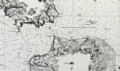 | Details | U.S. Coast and Geodetic Survey | 1877 |
| Entrance to San Francisco Bay California |
|
U.S. Coast and Geodetic Survey |
|
| 1877 |
| LOC:0 |
| $0.00 | U-S--Coast-and-Geodetic-Survey | Entrance-to-San-Francisco-Bay-California | SOLD
<BR> </BR>
Stunning, large, antique rolled chart of San Francisco Bay on heavy paper. Coverage includes San Francisco and surrounding area as it existed in 1859, reprinted in 1881 with corrections to the aids to navigation. Very good condition. Bottom of chart contains two views of the entrance to the bay from the south and the north showing both steam and sail-powered vessels underway and at anchor. Noted points of interest include Oakland, Sausalito, Alcatraz Island, Yerba Buena Island, the Presidio, Mission de Delores, Table Mountain, San Leandro, Brooklyn, Alameda, and of course the Golden Gate (no bridge).<BR> </BR>
Produced under the supervision of A.D. Bache, Superintendent of the U.S. Coast Survey. Electrotype copy 3. |
| 606 |  | Details | U.S. Coast and Geodetic Survey | 1853 |
| Western Coast of U.S. San Francisco to San Diego 1853 |
|
U.S. Coast and Geodetic Survey |
|
| 1853 |
| LOC:0 |
| $0.00 | U-S--Coast-and-Geodetic-Survey | Western-Coast-of-U-S--San-Francisco-to-San-Diego-1853 | SOLD <br></br>
Antique chart focused on the coastline between San Francisco and San Diego, California. Produced by the U.S. Coast Survey in 1853, a time when the United States Pacific coastal states were lightly populated. Scarce, separately issued, electrotype copy. A rolled chart of the California coast, not one of the common folded versions on thin paper that were issued with other charts in an annual report from the U.S. Coast Survey to Congress. |
| 731 | 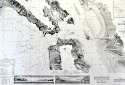 | Details | U.S. Coast and Geodetic Survey | 1881 |
| Entrance to San Francisco Bay California 1877 |
|
U.S. Coast and Geodetic Survey |
|
| 1881 |
| LOC:0 |
| $0.00 | U-S--Coast-and-Geodetic-Survey | Entrance-to-San-Francisco-Bay-California-1877 | SOLD<BR> </BR>
Superb, large, antique U.S. Coast Survey chart of San Francisco Bay, the city of San Francisco, and lower Marin County, California on heavy paper. Shows numerous soundings and aids to navigation including Fort Point Light, Point Bonita Light, Yerba Buena Light, and Alcatraz Light.
<BR> </BR>
Coverage includes San Francisco and Sausalito and the surrounding areas as existed in 1859. This chart was reissued in October 1877 with corrections to the aids to navigation made in 1881. Very good condition. Bottom of chart contains two views of the entrance to the bay from the south and the north showing both steam and sail-powered vessels underway and at anchor. Named points of interest include the Presidio, Oakland, Cliff House, Ocean House, Sausalito, Alcatraz Island, Mission Bay, San Leandro, Yerba Buena Island, Mission de Delores, Table Mountain, Brooklyn, Alameda, and of course the Golden Gate (with no bridge).
<BR> </BR>
This antique chart should not be confused with those similar copies issued as part of an annual Report to Congress, most on thin paper with folds that often show condition issues. This issue is very large, rolled, and on heavy paper with no folds. With the circular stamp of the U.S. Coast Survey. Produced under the supervision of A.D. Bache, Superintendent of the U.S. Coast Survey first published in 1859. Electrotype copy 3. |
| 1026 | 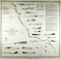 | Details | U.S. Coast and Geodetic Survey | 1853 |
| Western Coast of U.S. San Francisco to San Diego |
|
U.S. Coast and Geodetic Survey |
|
| 1853 |
| LOC:0 |
| $0.00 | U-S--Coast-and-Geodetic-Survey | Western-Coast-of-U-S--San-Francisco-to-San-Diego | SOLD
<br><br/>
Fascinating old antique nautical chart of the western coast of California focused on the coastline between <b>San Francisco</b> and <b>San Diego</b>, California. Includes Los Coronados (Coronado Islands), San Clemente Island, Alcatraz Island, San Nicholas Island, Point Loma, Point Conception and many other geographic locations.
<br></br>
The antique chart was produced by the U.S. Coast Survey in 1853, a time when the United States Pacific coastal states were lightly populated (by settlers). In fact, one of the settlements noted above San Diego in a wide coastal plain is referred to on the map as <b>"El Pueblo de Los Angeles". </b> That settlement had been created by the Spanish only in 1781.
<br></br>
Noted habitations include Monterrey, the Mission of Carmel, San Diego, and San Francisco. The chart is decorated with 17 decorative nicely-engraved coastal profile views including Catalina Harbor, Moro Rock, Point Sur, and the Entrance to San Francisco Bay.
<br></br>
This is a scarce, separately issued, rolled chart of the California coast, not one of the common folded versions on thin paper that were issued with other charts in an annual report to Congress from the Coast Survey.
<br></br>
This antique chart was printed in 1853 from an electrotype copy of the original hand-engraved copper plate, a process the U.S. Coast Survey adopted around 1850. As a soft medium, copper plates could only withstand print runs of perhaps 200 copies before the plates wore down. To enable larger print runs, a mold of the original plate was created in wax or another soft medium. Then, using an electro-chemical processs ( electrotyping ), the mold was coated with a metal layer, typically copper. Printers were then able to produce output from the new electrotype copper copy, while preserving the original. Electrotype copy no. 10. Sheet size 30"x30". Scale 1 / 1,200,000. |
| 2556 | 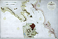 | Details | British Admiralty Hydrographical Office | 1886 |
| 19th Century Chart of San Francisco Harbour by the British Admiralty |
|
British Admiralty Hydrographical Office |
|
| 1886 |
| LOC:0 |
| $0.00 | British-Admiralty-Hydrographical-Office | 19th-Century-Chart-of-San-Francisco-Harbour-by-the-British-Admiralty | SOLD <br></br>
Large and striking antique chart of San Francisco Bay and harbor by the British Admiralty. This scarce old chart is after the U.S. Coast Survey chart of the area. Coverage includes San Francisco and surrounding area as it existed in 1877, reprinted in 1886 with corrections. Top of chart contains two views of the entrance to the bay from the south and the north showing both steam and sail-powered vessels underway and at anchor.
<BR> </BR>
Noted points of interest include Oakland, Sausalito, Alcatraz Island, Yerba Buena Island, the Presidio, Mission de Delores, Table Mountain, San Leandro, Brooklyn, Alameda, and of course the Golden Gate (no bridge).
<BR> </BR>
London. Published at the Admiralty 1st Feb. 1883 Under the Superintendence of Captain Sir Frederic J. Evans R.N., K.C.B., F.R.S. Hydrographer.
<BR> </BR>
With the British Admiralty logo. Number 591. Last corrections 1886. |
| 6430 |  | Details | Anonymous | 1986 |
| Decorative silk-screen poster San Francisco Bay Golden Gate Bridge |
|
Anonymous |
|
| 1986 |
| LOC: |
| $0.00 | Anonymous | Decorative-silk-screen-poster-San-Francisco-Bay-Golden-Gate-Bridge | SOLD
<br><br>
Fine decorative nautical-themed limited-edition serigraph poster of San Francisco Bay and the Golden Gate Bridge from the seventh-annual users conference held by Data Design Associates in 1986. Deep rich colors. Signed within (illegible). Number 522 of 600 copies.
<br><br>
Data Design Associates, Inc., was a Sunnyvale, Calif-based developer of mainframe financial software. |
| 946 | 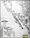 | Details | James Imray and Son | 1881 |
| West Coast of North America San Blas San Francisco |
|
James Imray and Son |
|
| 1881 |
| LOC:0 |
| $0.00 | James-Imray-and-Son | West-Coast-of-North-America-San-Blas-San-Francisco | SOLD, but have an <a href="https://www.rarecharts.com/ShowDetail/Creator/James-Imray-and-Son/Title/West-Coast-of-North-America-from-San-Blas-to-San-Francisco/3680" target="_blank" >earlier example </a> (1876) of the same chart. Spectacular blueback nautical chart from <b>California's post Gold-Rush era</b> in superb condition. |
| 1101 |  | Details | de Vaugondy, Robert | 1774 |
| Carte de La Californie et des Pays Nord Ouest |
|
de Vaugondy, Robert |
|
| 1774 |
| LOC:0 |
| $0.00 | de-Vaugondy--Robert | Carte-de-La-Californie-et-des-Pays-Nord-Ouest | SOLD, but we have an an additional uncolored similar engraving in stock by Vaugondy.
<br></br>
Two maps of the West Coast of North America, from the Strait of Anian to Cabo San Lucas and the southern tip of Baja California in Mexico. |
| 1245 |  | Details | Bill, Henry | 1852 |
| Early birds-eye view of San Francisco |
|
Bill, Henry |
|
| 1852 |
| LOC:0 |
| $0.00 | Bill--Henry | Early-birds-eye-view-of-San-Francisco | SOLD
<br></br>
An attractive and desirable birds-eye view of San Francisco, California published in 1852 during the height of the California Gold Rush. In that year gold exports exceeding $45,587,000 were reported. Also, poles for the first magnetic telegraph service were installed at Montgomery and Merchant streets. The telegraph was to connect San Francisco with San Jose, Stockton, Sacramento and Marysville.
<br></br>
A legend at bottom of the lithograph identifies 13 points of interest. Among these important locations in and around San Francisco are:
<div class="indenttextblock">
<ul style="list-style-type: circle;">
<li>Marine Telegraph</li>
<li>Contra Costa</li>
<li>California Exchange</li>
<li>North Bay</li>
<li>Yerba Buena island</li>
<li>Leonards Warehouse</li>
<li>Market Street Pier</li>
<li>Central Wharf</li>
<li>Anjill Island (Angel Island)</li>
</ul>
</div>
Noted in the lower margin: "Entered according to Act of Congress, District of Connecticut in 1852"
<br></br>
This fine lithographed print is from Volume II of Henry Bill’s History of the World |
| 3662 |  | Details | Frick, W.P. | 1926 |
| Birdseye view of Mount Diablo, California |
|
Frick, W.P. |
|
| 1926 |
| LOC:0 |
| $0.00 | Frick--W-P- | Birdseye-view-of-Mount-Diablo--California | SOLD<br></br>
Folding birdseye view of the area stretching from Sacramento to Hayward, California including Mount Diablo and Oakland, California. Copyright 1915 by Worthington Gates.
<br></br>
Part of a folding brochure for tourists issued by the Mount Diablo Scenic Boulevard Company in 1926. At the time of issue (March, 1926) the Mount Diablo Scenic Boulevard was operated as a toll road with a charge of 75 cents per car and 25 cents per passenger. View includes San Pablo Bay, Berkeley, Alameda, Suisun Bay, and in the far background, the Sierra Nevada Mountains. Front of brochure with a scene of a Model A Ford climbing a very scenic country road. |
| 846 | 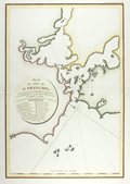 | Details | La Perouse, Jean François Galaup | 1797 |
| Antique French Chart of San Francisco Bay, California |
|
La Perouse, Jean François Galaup |
|
| 1797 |
| LOC:0 |
| $0.00 | La-Perouse--Jean-François-Galaup | Antique-French-Chart-of-San-Francisco-Bay--California | SOLD<br></br>
This antique French chart is the earliest available chart (1797) for collectors of the San Francisco Bay area, in California. The map was produced by Jean François Galaup la Perouse after a 10 day exploration of the San Francisco area in 1786 and published posthumously in 1797. Earlier manuscript charts do exist, by Cañizares in 1776 and 1781, but these are extremely rare and generally not available to collectors.
<br></br>
A legend with 20 items is keyed to locations on the map including "Presidio de San Francisco", Mission de San Francisco", "Ile de Alcatraces" ( Alcatraz Island ), and "Pte. de Reyes". Depth soundings and anchorages are marked generally in the lower bay only.
<br></br>
As a French explorer and naval officer la Perouse (1741-1788?) was tasked by King Louis XVI of France with completing the Pacific exploration begun by British Captain James Cook. Aboard the ships Astrolabe and Boussole, la Perouse and his crew mapped the west coast of North America and Alaska in 1786 and visited Easter Island and the Sandwich Islands ( Hawaii ). After reaching Australia's Botany Bay in 1788 his ships were lost at sea while searching for the Solomon Islands.
<br></br>
This map is from the French edition of the "Atlas du voyage de La Perouse". L. Aubert scripsit. Plate 33. |
| 5423 |  | Details | Franzen, Dana | 1984 |
| Poster Bastille Day Marijuana Parade on the Democratic Convention |
|
Franzen, Dana |
|
| 1984 |
| LOC:300 |
| $0.00 | Franzen--Dana | Poster-Bastille-Day-Marijuana-Parade-on-the-Democratic-Convention | SOLD
<br></br>
An artists view of San Francisco, California. Fine, very scarce, original 1984 cannabis-related poster promoting a Bastille Day Marijuana Parade in San Francisco. The event was a march on the Democratic Convention, to be held at the Moscone Center, the largest convention complex in San Francisco. The colorful, imaginative, scene of the march shows cannabis growing like shrubs from every rooftop. The marchers were to assemble at the corner of Oak Street and Cole at 1:00 p.m. and then march to the Moscone Center.
<br></br>
Presumably by Dana Franzen but unattributed. Franzen was the artist on several other similar posters. Offset lithograph. Dated within at 4/29/84. Printed for a Yipster Times Publication.
<br ></br>
A sign above the Moscone Center in San Francisco reads:
<div class="indenttextblocksingle"><i>
"Welcome to Yerba Buena Center and don't forget "Yerba Buena" is Spanish for "Good Weed." Also, "Free the half-billion."
</i>
</div> |
| 6817 |  | Details | Schussler, Hermann | 1911 |
| San Francisco Twin Peaks Tunnel maps and proposal |
|
Schussler, Hermann |
|
| 1911 |
| LOC: |
| $0.00 | Schussler--Hermann | San-Francisco-Twin-Peaks-Tunnel-maps-and-proposal | SOLD
<br><br>
This lot is a report: "The Twin Peaks Tunnel Problem", produced by Civil Engineer Hermann Schussler on June 1, 1911, one of five competing proposals for the San Francisco Twin Peaks Tunnel that were considered by the San Francisco Board of Supervisors in 1912. Schussler's report consists of a two-page text summary of his tunnel plan along with three lithographed maps, all disbound but in excellent condition, along with the original report cover. Rare on the market.
<br><br>
The Twin Peaks Tunnel is a 2.27-mile-long light rail/streetcar tunnel in San Francisco, California built over a three-year period beginning in 1914. The tunnel was constructed in order to support the growth of San Francisco by developing roughly 5,000 acres in the southwest part of the county that were then lightly inhabited.
<br><br>
The three fine lithographed maps in Schussler's report are:<br>
1. Rapid Transit Tunnel System. (Birdseye topographic map of San Francisco with Schussler's proposed route). 20' contour intervals. 16" x 13". <br>
2. Plan for Rapid-Transit System which, while closely connecting the Mission with Golden Gate Park, - at the same time connects both, jointly with the easterly part of Richmond and the Westerly part of the Western Addition,- with Ocean Avenue, Sloat Boulevard, and Great Highway. 39" x 26". <br>
3. Continuation of #2. Details of Construction of open cuts, tunnels, and of transfer station under crossing of 17th and Shrader streets, etc. 27" x 24". <br> |
| 6330 |  | Details | Burke, John William | 1976 |
| Original S.F. Mardi Gras Carnival Bacchanal Poster |
|
Burke, John William |
|
| 1976 |
| LOC:87 |
| $0.00 | Burke--John-William | Original-S-F--Mardi-Gras-Carnival-Bacchanal-Poster | SOLD<br></br>
Scarce original 12" x 18" poster for the 1976 Mardi Gras Carnival Bacchanal held on March 5, 1976 at the Longshoreman's Hall in San Francisco, California. The benefit concert was sponsored by radio station KPFA.
<br></br>
Copyright 1976 by jb (John Burke) at Rasta Grafix.
<br></br>
Scarce. Only one similar example found online at a smaller size than this fine example. |
| 4831 | 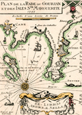 | Details | Sella, Andrea | 1930 |
| Rare Ex-libris la Rade du Gourjan Antibes for Sella |
|
Sella, Andrea |
|
| 1930 |
| LOC:13 |
| $0.00 | Sella--Andrea | Rare-Ex-libris-la-Rade-du-Gourjan-Antibes-for-Sella | SOLD<br></br>
Not 1727, but an early 20th century ex-libris or bookplate for Andreae (Andre') Sella after a early 18th-century nautical port plan by Henri Michelot and Laurens Bremond of the Cap d'Antibes. Circa 1930s.
<br></br>
Engraved by Georges Gorvel, active during the 1920's and 1930's.
<br></br>
Apparently from André Sella, manager of the Grand Hotel on Cap d'Antibes who had a large collection of documents and objects from the Napoleonic era. In 1952, the Navy granted him permission to use a site on the Cap d'Antibes site to house his growing collection. More than a decade later André Sella accepted the post of manager of the Association of Friends of Maritime Museums.
<br></br>
André Sella donated his collection to the Maritime Museum. With financial aid from the Antibes council, the museum grew and became the Napoleonic Museum (Le musée Napoléonien), opened on May 30, 1964. |
| 459 | 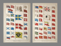 | Details | Diderot, Denis | 1730 |
| Marine Pavillons (Flags) |
|
Diderot, Denis |
|
| 1730 |
| LOC:0 |
| $0.00 | Diderot--Denis | Marine-Pavillons-(Flags) | SOLD
<BR> </BR>
Very decorative pair of 18th century copper-plate engraved prints depicting naval flags, pennants, and ensigns from across the world. Several flags contains the coat-of-arms of a royal family. Archivally matted, and ready for framing. With matting, each engraving measures approximately 14" W x 19" H. <BR> </BR>
A scarce and colorful grouping. Source: Diderot & D'Alembert. L'Encyclopédie. Plate 18 and Plate 19. |
| 1003 | 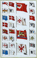 | Details | Diderot, Denis | 1730 |
| Marine Pavillons (Flags) Plate XIX |
|
Diderot, Denis |
|
| 1730 |
| LOC:0 |
| $0.00 | Diderot--Denis | Marine-Pavillons-(Flags)-Plate-XIX | SOLD
<BR> </BR>
Desirable and very decorative early 18th century copper-plate engraved print depicting naval flags, pennants, and ensigns from across the world. Several flags contains the coat-of-arms of a royal family. Two of the more interesting flags include one with the lion of St. Marks, presumably from Venice and another red flag with an an arm wielding a curved scimitar, possibly related to Hamburg.
<BR> </BR>
Published by Diderot & D'Alembert in L'Encyclopédie. Plate 19. |
| 353 |  | Details | Naval War Records Office | 1881 |
| Order of Battle and Plan of Attack Nov. 7th 1861 |
|
Naval War Records Office |
|
| 1881 |
| LOC:0 |
| $0.00 | Naval-War-Records-Office | Order-of-Battle-and-Plan-of-Attack-Nov--7th-1861 | SOLD
<BR> </BR>
Antique map from 1881 depicting Fort Walker on Hilton Head Island and Fort Beauregard on St. Helena Island as U.S. Navy forces attacked in 1861, one of the earliest naval battles of the Civil War. With a summary of the disposition of both Union and Rebel naval forces and their movements. Other notable features include Paris (Parris) Island, Daw Island, Pinckney Island, and Capers Island, the Beaufort, Broad, and Chechessee Rivers
<BR> </BR>
From "Official Records of the Union and Confederate Navies in the War of the Rebellion". United States. Naval War Records Office, United States. Printed by The Norris Peters Co., Photo-Litho, Washington, D.C. |
| 354 | 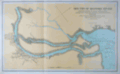 | Details | Naval War Records Office | 1881 |
| Mouths of Roanoke River |
|
Naval War Records Office |
|
| 1881 |
| LOC:0 |
| $0.00 | Naval-War-Records-Office | Mouths-of-Roanoke-River | SOLD<br></br>Old nautical map from 1881 depicting Union defenses near Plymouth N.C. on the Roanoke River during the attack of Confederate ironclad gunboats in 1864. Notable features Batchelor's Bay, Warren Neck, Fort Gray, Fort Wessells, Fort Williams, and the location of the wreck of the USS Southfield.<BR> </BR>
From "Official Records of the Union and Confederate Navies in the War of the Rebellion". United States. Naval War Records Office, United States. Printed by The Norris Peters Co., Photo-Litho, Washington, D.C. |
| 367 | 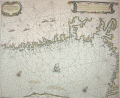 | Details | Goos, Pieter | 1664 |
| Cuften van Noorwegen |
|
Goos, Pieter |
|
| 1664 |
| LOC:0 |
| $0.00 | Goos--Pieter | Cuften-van-Noorwegen | SOLD<br></br>
Beautiful antique engraved chart of the Skagerrak with Swedish and Norwegian coast and fjords centered on Oslo. Produced by Dutch cartographer Pieter Goos in Amsterdam in 1664. <BR> </BR>
Primary coverage includes the south coast of Norway from "Der Neus" east of Kristiansand, past Oslo fjord to Pater Nosterskärgårdens naturreservat on the southwest coast of Sweden. Slight coverage of northwest Jutland includes Skagen. Place names on this antique nautical chart are in Dutch so matching place names to their current equivalent is challenging: Anfloo = Oslo; Tonfberger = Tonsberg; Laerwyck = Larvik; Schagen = Skagen; Trom = Tromoy; Vlecker = Flekkerøy. Most other place names difficult (for me) to identify. Other unknown cities include Coperwyck, Akershuys, De Buy, Hefnes . Plate number 8.<BR> </BR>
Probably derived from the earlier work by Willem Janszoon Blaeu in 1619. |
| 736 | 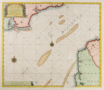 | Details | van Keulen, Gerard | 1730 |
| Dutch chart of the English Channel from Calais to Dover |
|
van Keulen, Gerard |
|
| 1730 |
| LOC:64 |
| $0.00 | van-Keulen--Gerard | Dutch-chart-of-the-English-Channel-from-Calais-to-Dover | SOLD <br></br>
Original antique Dutch nautical chart ca. 1730 of the English Channel by Gerard van Keulen with a title cartouche written in English, French, and Dutch. On the English side of the Channel in Kent the shoreline extends from Rye and Socket with the Rye Camber past Hyth, Sandgate Castle, Dover and Dover Castle, ending at the South Foreland. Just east of the mouth of the Rye is shown a lighthouse on a large sandbar- the Dungeness ( Dungines of Singel ) . This is probably the structure known as 'Lamplough's Tower' originally constructed in 1635 that would have still been standing 100 years later.
<br></br>
Across the Channel the coast of France is shown from Dannes to Pointe d' Alpree, Boulogne, Fort d'Ordre, Ambleteuse, Wissant ( Wisam ) Cap Grines, Cap Blanet, and ends at Calais ( Cales ), France. Features noted on the chart include the Forest d' Mardelot, La Liane, Moulin de Ramseau, Moulin de Coquelle, and Fort Nieulay.
<br></br>
By Gerard van Keulen (1678–1726), son of Johannes van Keulen (d 1715), founder of the Dutch publishing house that produced "the largest and finest marine atlases in Holland". Gerard possessed mathematical, scientific, and engraving skills that enabled him to build the firm started by his father into a substantial and respected business venture. (C. Koeman. "The Sea on Paper: The Story of the Van Keulens and their 'Sea Torch'."Theatrum Orbis Terrarum Ltd. Amsterdam, 1972). |
| 457 | 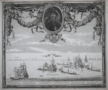 | Details | Pontault, Sébastien Beaulieu de | 1694 |
| Combat Naval 1645 |
|
Pontault, Sébastien Beaulieu de |
|
| 1694 |
| LOC:0 |
| $0.00 | Pontault--Sébastien-Beaulieu-de | Combat-Naval-1645 | SOLD
<BR> </BR>
Interesting, scarce depiction of the "Action of 28 September 1644" when six Maltese galleys (galère / pl. galères; Fr.) attacked and defeated several sailing vessels of the Ottoman Sultan. This attractive original copperplate engraving contains an elaborate border and garland wrapped with ribbons and a central portrait of Gabrielle Chambres de Boisbaudran, the leader of the Maltese contingent and a Knight of Malta, who was killed in that engagement. From Paris, 1694.
<BR> </BR>
The engraved battle scene includes the island of Rhodes, Greece in the distance as Christian galleys engage with Greek and Turkish square-rigged sailing vessels. The six galleys depicted include" "La Capitaine de Malte, St. Jean, St. Laurent, St. Joseph, Ste. Marie, and La Victoire.
<BR> </BR>
The Christian galleys engaged a Ottoman convoy carrying pilgrims bound for Mecca. The Maltese killed many pilgrims and took almost 400 prisoners as slaves including by some reports one of the Sultan's wives and her son. On their voyage home the Maltese stopped in Crete, then a possession of Venice, for a few days. This apparent collusion between the Maltese and Venetians, previously at peace with the Turks, served as a pretense for the Cretan war between the Ottomans, Venice and Malta between 1645 and 1669.
<BR> </BR>
From the book "Les glorieuses Conquêtes de Louis-le-Grand: ou Recueil, de Plans et Vues des places assiegeés, et de celles ou se sont douneés des batailles…" produced from the drawings of the Sébastien Pontault de Beaulieu (1612-1674). Pontault, a French engineer, is considered to have been the inventor of the art of military topography. |
| 5060 |  | Details | Old Colony Railroad Company | 1887 |
| Historical Map of Nantucket Surveyed and Drawn by the Rev. F. C. Ewer. D. D. 1869 |
|
Old Colony Railroad Company |
|
| 1887 |
| LOC:0 |
| $0.00 | Old-Colony-Railroad-Company | Historical-Map-of-Nantucket-Surveyed-and-Drawn-by-the-Rev--F--C--Ewer--D--D--1869 | NOT AVAILABLE <br></br>Map of Nantucket Island, 1887 after Reverend F.C. Ewer in 1869. Printed on very thin paper with a section of Nantucket Island identified in red as property of the <b>Nantucket Surf Side Land Co.</b>
<br></br>
Historical Map of Nantucket Surveyed and Drawn by the Rev. F. C. Ewer. D. D. Produced by Old Colony Line "the shortest, quickest, best and only direct route between Boston or New York and Nantucket and Martha's Vineyard." With red ink notations advertising the Nantucket Surf Side Land Company, 46 School Street, Boston, Massachusetts, offering for sale lots for $10 and upwards.
<br></br>
Contains three columns of historical information about Nantucket, arranged chronologically for the seventeenth, eighteenth, and nineteenth centuries. Latest entry is for 1886:
<div class="indenttextblock">
Cable communication with Nantucket by the U.S. Signal Service. Consolidation of the N. & C. C. Steamboat Company with the N. B., V. & Nant. Steamboat Co. with corporate name "New Bedford, Martha's Vineyard and Nantucket Steamboat Company." Steamer Nantucket built by the same Company, and placed upon the route in July.
</div> |
| 511 |  | Details | Lochtefeld, John | |
| Tidal River |
|
Lochtefeld, John |
|
|
| LOC:0 |
| $0.00 | Lochtefeld--John | Tidal-River | SOLD<br></br>
Modern 20th/21st century etching in blue ink by Nantucket artist John Lochtefeld. Number 37 of a series of 100 prints.<BR> </BR>
Lochtefeld operates a studio and gallery on the island where he has worked since 1969. Lochtefeld's work is influenced by the architecture, nature and history of Nantucket. Matted. Dimensions with mat are 9"x11". |
| 562 |  | Details | Lochtefeld, John | 2005 |
| Far Side of The Sea |
|
Lochtefeld, John |
|
| 2005 |
| LOC:0 |
| $0.00 | Lochtefeld--John | Far-Side-of-The-Sea | SOLD<br><br/>Late 20th or 21st century black and white etching "Far Side of the Sea" by John Lochtefeld. Signed in pencil by the author.<br><br/>
Lochtefeld operates a studio and gallery on the island of Nantucket where he has worked since 1969. Lochtefeld's work is influenced by the architecture, nature and history of Nantucket. <br><br/>
Matted and framed. Size with frame is 26" W x 21" H. Number 110 from a series of 200 copies. |
| 563 | 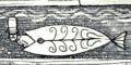 | Details | Lochtefeld, John | 2005 |
| Moon Watch |
|
Lochtefeld, John |
|
| 2005 |
| LOC:0 |
| $0.00 | Lochtefeld--John | Moon-Watch | SOLD<br><br/>Original late 20th or 21st century monochrome serigraph etching "moon Watch" by John F. Lochtefeld. Signed by the author in pencil. <br><br/>
Lochtefeld operates a studio and gallery on the island of Nantucket where he has worked since 1969. Lochtefeld's work is influenced by the architecture, nature and history of Nantucket. <br><br/>
Matted. Number 89 from a series of 100 copies. |
| 564 |  | Details | Lochtefeld, John | 2005 |
| The Whale Fishery |
|
Lochtefeld, John |
|
| 2005 |
| LOC:0 |
| $0.00 | Lochtefeld--John | The-Whale-Fishery | SOLD<BR> </BR>
Original late 20th or 21st century monochrome serigraph etching by John F. Lochtefeld titled "The Whale Fishery". Signed by the author in pencil. <br><br/>
Lochtefeld operates a studio and gallery on the island of Nantucket where he has worked since 1969. Lochtefeld's work is influenced by the architecture, nature and history of Nantucket. <br><br/>
Matted. Number 30 from a series of 50 copies. |
| 1170 | 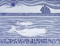 | Details | Lochtefeld, John | 1995 |
| On the Back of the Broad Sea |
|
Lochtefeld, John |
|
| 1995 |
| LOC:0 |
| $0.00 | Lochtefeld--John | On-the-Back-of-the-Broad-Sea | NOT AVAILABLE<br><br/> Late 20th or 21st century etching "On the Back of the Broad Sea" by Nantucket artist John Lochtefeld. Signed in pencil by the artist at bottom right. A beautiful piece in Very Good condition.
<br><br/>
In Lochtefeld's dream-like scene two humpback whales glide in the depths below a four-masted sailing ship with all sails set.
<br><br/>
Lochtefeld operates a studio and gallery on the island of Nantucket where he has worked since 1969. Lochtefeld's work is influenced by the architecture, nature and history of Nantucket.
<br><br/>
Number 64 from a series of 260. |
| 1299 |  | Details | Eldridge, George W. | 1909 |
| Fine antique navigation chart for Martha's Vineyard and Nantucket MA |
|
Eldridge, George W. |
|
| 1909 |
| LOC:0 |
| $0.00 | Eldridge--George-W- | Fine-antique-navigation-chart-for-Martha-s-Vineyard-and-Nantucket-MA | <br><br>This item is <b>SOLD</b> but we have found another example of this item that is <a href="https://www.rarecharts.com/ShowDetail/Creator/Eldridge--George-W-/Title/G--W--Eldridge-navigation-chart-for-Martha-s-Vineyard-and-Nantucket-MA/6562" target="_blank">now in our inventory.</a>
<br></br>
George W. Eldridge's very desirable "Chart C" including both Martha's Vineyard and Nantucket in Massachusetts.
<br></br>
This large linen-backed chart includes the following ports and towns: Edgartown, Siasconset, Woods Hole, Nantucket town and more. The chart shows numerous coastal islands including Chappaquiddick Island, Cuttyhunk Island, Nashawena Island, Pasque Island, Naushon Island, No Man's Land, Tuckernut Island, Muskeget Island, and Monomoy Island. |
| 6562 |  | Details | Eldridge, George W. | 1913 |
| G. W. Eldridge navigation chart for Martha's Vineyard and Nantucket MA |
|
Eldridge, George W. |
|
| 1913 |
| LOC:1406 |
| $0.00 | Eldridge--George-W- | G--W--Eldridge-navigation-chart-for-Martha-s-Vineyard-and-Nantucket-MA | SOLD<br><br>
A fine intact antique example of Eldridge's very desirable "Chart C" including the islands of Martha's Vineyard and Nantucket in Massachusetts. Once relatively plentiful, this splendid lithographed nautical chart by George Washington Eldridge is becoming increasing hard to find for sale.
<br><br>
Copyright by George W. Eldridge, 1912.
<br><br>
A very "user friendly" nautical chart that would have been appreciated by mariners in the early 20th century who lacked today's electronic navigational aids. This large linen-backed chart includes the following ports and towns: Edgartown, Siasconset, Nantucket town, Vineyard Haven, Oak Bluffs, Falmouth, Cotuit, Osterville, Hyannis, West Dennis, Harwich Port, and Chatham.
<br></br>
Shown numerous islands along the coast including Chappaquiddick Island, Cuttyhunk Island, Nashawena Island, Pasque Island, Naushon Island, No Man's Land, Tuckernut Island, Muskeget Island, and Monomoy Beach, now Monomoy Island.
<br></br>
Dotted with interesting comments and observations including:
<div class="indenttextblocksingle">
<ul style="list-style-type: circle;">
<li>"In passing Chatham in thick weather or night time bound to the Northward or Southward make use of the lead and do not go into less than 7 or 8 fathoms of water to avoid the bars that are rapidly extending from the shore and are dangerous."</li>
<li>"Vessels passing Nobska in either direction displaying signals will be reported by telegraph to the Boston Chamber of Commerce."</li>
<li>About the Nantucket Head of Harbor entrance: "Strangers should enter this place with caution as it changes with every storm from seaward."</li>
</ul>
</div>
Charles C. Hutchinson 152 State Street Boston General Agent. |
| 1195 | 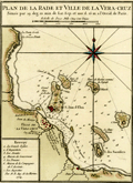 | Details | Bellin, Jacques Nicolas | 1754 |
| Plan de la Rade et Ville de la Veracruz, Mexico. |
|
Bellin, Jacques Nicolas |
|
| 1754 |
| LOC:0 |
| $0.00 | Bellin--Jacques-Nicolas | Plan-de-la-Rade-et-Ville-de-la-Veracruz--Mexico- | SOLD<br></br>One of the earliest available port plans of Veracruz, Mexico, the harbor of Veracruz and nearby islands. Notations of numerous depth soundings, sandbanks (ex: Banc de Roches; le Banc Forain; le Grand Banc de Roches) , and an anchorage attest to the nautical heritage of this small antique French port plan. From the 15-volume "Histoire Generale des Voyages" of Antoine François Prévost published from Paris in 1754. Tome XII. Number 7.
<br></br>
It was on the island of San Juan de Ulúa that Spanish captain Juan de Grijalva first arrived in 1518, along with conquistador and author Bernal Díaz del Castillo ("The True History of the Conquest of New Spain"). That island was also the scene of a battle in 1569 between the Spanish Navy and a fleet led by John Hawkins that included Francis Drake. The treachery that the English perceived on the part of Spain at that battle helped to fuel antagonism between the two powers for many decades.
<br></br>
In Veracruz several key points are identified on a legend at bottom right including:
<div class="indenttextblock">
<ul style="list-style-type: circle;">
<li>La Grande Eglise</li>
<li>L 'Inquisition</li>
<li>Les Jesuits</li>
<li>Maison de Gouverneur </li>
<li>La Douane (the customs house)</li>
<li>Maison de Compagnie de l'Assiente</li>
<li>Les Augustins</li>
</ul>
</div> |
| 406 |  | Details | Humboldt, Alexander von | 1811 |
| Plan du Port de Veracruz |
|
Humboldt, Alexander von |
|
| 1811 |
| LOC:0 |
| $0.00 | Humboldt--Alexander-von | Plan-du-Port-de-Veracruz | <BR> </BR>
SOLD
<BR> </BR>
Chart and plan of the walled city of Veracruz, Mexico and surrounding area by scientist and explorer Alexander von Humboldt after a chart by Spain's Deposito Hidrograficos. Important features include: Isla de Sacrificios; Chateau de St. Juan de Ulua; the Cathedral; Chapelle du Santo Christo et Cimetiere, and several suggested courses for ships entering the harbor. Delicate, fine stippled engraving and numerous soundings. Inset profile view at upper left from Villa Rica to Punta Delgada. An excellent example.<BR> </BR>
From: "Atlas Géographique Et Physique Du Royaume De La Nouvelle-Espagne, Fonde Sur Des Observations Astronomiques, Des Mesures Trigonometriques Et Des Nivellemens Barometriques." Par Al. De Humboldt. Paris, Chez F. Schoell, Rue Des Fosses-Saint-Germain -L'Auxerrois, No. 29. 1811. De L'Imprimerie De J.H. Stone.<BR> </BR> |
| 440 |  | Details | Duché de Vancy, Gaspard | 1797 |
| Vue de Macao en Chine |
|
Duché de Vancy, Gaspard |
|
| 1797 |
| LOC:0 |
| $0.00 | Duché-de-Vancy--Gaspard | Vue-de-Macao-en-Chine | SOLD
<br></br>
Very attractive copperplate engraved view of the former Portuguese colony of Macau as it existed in 1787. Macau is now a special administrative region of China. <BR> </BR>
Drawn by Gaspard Duchè de Vancy, a French artist of the 18th century. From the "Atlas du Voyage de La Perouse" published by Jean-Francois La Perouse. La Perouse led a scientific expiration to the Pacific from 1785, accompanied by Duchè de Vancy, and sent the drawing on which this engraving is based to France in 1788 with the intention of returning home by 1789. Departing Botany Bay, Australia in March 1788 neither La Perouse, his ships the Boussole or Astrolabe, nor his men were ever seen again. Number 40.<BR> </BR>
Believe the engraving is an early 20th century re-strike from the original copper plate produced by the French Chalcographie du Louvre. La Chalcographie du Louvre is a repository of more that 13,000 original plates from the Louvre's archives, housed upstairs above the Louvre's Paris galleries . Upon request visitors can have a engraving produced on museum-quality paper from the original plate by a master printer. V. 26.<BR> </BR> |
| 4760 |  | Details | British Admiralty Hydrographical Office | 1907 |
| China From Hailing Island to Hong Kong with Macao |
|
British Admiralty Hydrographical Office |
|
| 1907 |
| LOC:59 |
| $0.00 | British-Admiralty-Hydrographical-Office | China-From-Hailing-Island-to-Hong-Kong-with-Macao | SOLD<br></br>
Fine, very scarce original British Admiralty nautical chart of the coast of China west of <b>Hong Kong</b> by Belcher. Published in 1853 (1907), this fine sea chart was engraved by J & C Walker.
<br></br>
Coverage extends from Hailing Island (Hui Ling Island) past Macau and ends with Hong Kong. Includes three detailed inset charts and plans: Macao Harbour, Namo Harbour, and Hui-Ling (Hailing) Harbour.
<br></br>
First published Sept 4, 1853 according to an Act of Parliament at the Hydrographic Office of the Admiralty. Corrections to 1883 by Captain J. Calder of the Chinese Gunboat Sui-Tsing. Numerous minor corrections, with the last small correction in 1907. This chart 2212 is a later edition of Belcher's Admiralty chart 1625 "Mongchow to Hong Kong".
<br></br>
Verso with several MS chart collation numbers including a stenciled "143". Sold by J.D. Potter Agent for Admiralty Charts, 146 Minories. Chart number 2212. Two sheets joined; one vertical fold.
<br></br>
Admiral Sir Edward Belcher (1799 – 1877) was born in Nova Scotia and at age 13 enlisted as a volunteer in the British Royal Navy. Belcher went on to a long career as a British naval officer, hydrographer, and explorer. Belcher is credited with producing the first detailed map of Hong Kong in 1841, one year before the island was handed over to Britain. |
| 452 |  | Details | Anonymous | 1880 |
| Chart of Portions of Beaufort River |
|
Anonymous |
|
| 1880 |
| LOC:0 |
| $0.00 | Anonymous | Chart-of-Portions-of-Beaufort-River | SOLD
<BR> </BR>
Corps of Engineers hydrographic chart of several portions of the Beaufort River, near Beaufort S.C., the second oldest city in South Carolina, behind Charleston. Noted features include Battery Creek, the "site of old fort", and "site of Fort Charlotte". With depth contours and numerous soundings. Archivally matted with total size approximately 25" x 27".<BR> </BR>
Accompanied Senate doc. 195, 46th Cong., 2nd Sess. |
| 462 | 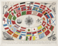 | Details | Brockhaus, F.A. | 1870 |
| Naval Flags |
|
Brockhaus, F.A. |
|
| 1870 |
| LOC:0 |
| $0.00 | Brockhaus--F-A- | Naval-Flags | SOLD<br></br>
German lithograph ca. 1870 of naval flags and ensigns. |
| 472 |  | Details | Luyken, Jan | 1694 |
| de Bootsgesel |
|
Luyken, Jan |
|
| 1694 |
| LOC:0 |
| $0.00 | Luyken--Jan | de-Bootsgesel | SOLD
<br></br>
Small engraved print from a book of professions produced in 1694. Shows a Venetian sailor, with glass in hand (discarded bottles below) on shore with his sea chest. With a small poem below that ends in ' Myn Godt ! '. (Dutch translations accepted :] ).
<br><br/>
By Amsterdam artists Jan and Casper Luyken in 'Spiegel van het Menselyk Bedryf.' Page 298. |
| 489 |  | Details | Sylvester, Israel | 1642 |
| Altra veduta della due piazza di San Marco visto dell'Orloge |
|
Sylvester, Israel |
|
| 1642 |
| LOC:0 |
| $0.00 | Sylvester--Israel | Altra-veduta-della-due-piazza-di-San-Marco-visto-dell-Orloge | SOLD<br></br>
Rare antique etching of St Mark's Square in Venice, Italy, looking much as it does today. The lagoon in the foreground, at left the Biblioteca Marciana with the campanile behind, and at right the Doge's palace; with some gondolas moored to the quay. Far right shows the stern of a large sailing vessel covered with a cloth awning.
<BR> </BR>
Engraved and drawn by artist Israel Sylvestre (1621-1691). Published by Pierre Mariette (1634-1716) 'avec privilege du Roy' in Paris. The print was likely published after 1663 when Sylvestre was appointed court painter and engraver by Louis XIV and would have been able to claim royal privilege. Number 10. |
| 4929 |  | Details | Mosby Engineering Associates | 1954 |
| Warm Mineral Springs Venice Florida Master Plan 1954 |
|
Mosby Engineering Associates |
|
| 1954 |
| LOC:0 |
| $0.00 | Mosby-Engineering-Associates | Warm-Mineral-Springs-Venice-Florida-Master-Plan-1954 | SOLD<br></br>
The 1954 master development plan for Warm Mineral Springs. With manuscript notations related to access road conditions and to existing construction as far in the past as 1949. Based on the notations it appears that in 1954 the site was in the very early stage of development, with only a few structures existing.
<br/><br/>
Warm Salt Springs, Inc. later Warm Mineral Springs, Inc. controlled 748 acres with ownership by Leo and Margarete Scharf , Dr. J.A. Mease and H.W. Meyer. In order to enhance the property and expedite its development the Scharfs approached Dr. Mease concerning the possibility of constructing a therapeutic clinic on-site. In 1954 Dr. Mease, agreed that for a share in the corporation he would build a clinic on land granted to him near the springs and that he should have "exclusive use of the waters for therapeutic purposes." The clinic's proposed location lies at the southeast corner of the main spring, labeled "Warm Mineral Springs".
<br/><br/>
Dated within at 7-19-54 for Mr. Leo. Scharf of Venice, Florida. By Mosby Engineering Associates, 2190 Ringling Blvd. Sarasota, Florida. Drawn by C.G. Scale: 1 inch= 300 feet.
<br/><br/>
Source online: ( Mease v. Warm Mineral Springs, Inc., 128 So. 2d 174 (Fla. Dist. Ct. App. 1961)
https://www.courtlistener.com/opinion/1923999/mease-v-warm-mineral-springs-inc/ ). |
| 761 |  | Details | Langenes, Barent | 1600 |
| Antique map of the Gulf of Venice and Veneto, Italy |
|
Langenes, Barent |
|
| 1600 |
| LOC:0 |
| $0.00 | Langenes--Barent | Antique-map-of-the-Gulf-of-Venice-and-Veneto--Italy | SOLD
<br></br>
Attractive antique map of a portion of the Veneto region of Italy including most of the Gulf of Venice and Venetian lagoon from south of Chioggia ( Cioza ) extending northward past Venice ( Venetia ). The title of the map 'Patavinum', ca. 1600 reflects the fact that it is more or less centered on Padua, called Patavium by the Romans. Named features include towns and islands of Padua, Murano, Torcello, Porto de Sant Erasmo , Porto de Malamocco, Porto de San Nicolò al Lido, Cavarzere, Piove di Sacco, and Monselice.
<br></br>
Map carries the signature of Dutch engraver and globe maker Peter Kaerius (1571-1646) at lower right corner. French text on verso. Probably from one of three editions of the French version of the 'Thresor de Chartes Contenant les Tableaux de Tous le Pays du Monde' published in the early 17th century (1600, 1602, and 1609)
(Source: http://www.septentrionalium.com/Book2_entry1.pdf). |
| 6467 |  | Details | U.S. Coast and Geodetic Survey | |
| USCGS poster for Nautical Charts |
|
U.S. Coast and Geodetic Survey |
|
|
| LOC:90 |
| $0.00 | U-S--Coast-and-Geodetic-Survey | USCGS-poster-for-Nautical-Charts | SOLD<br><br>Surprisingly scarce poster ca 1970s, originally published in 1959, advertising nautical charts sold by the U.S. Coast and Geodetic Survey in Washington, D. C. A later re-issue published by the National Ocean and Atmospheric Administration (NOAA), National Ocean Service. At one time paper copies of the poster were available by order from the NOAA Distribution Branch but after 2013 products have been only available in PDF print-on-demand delivery.
<br><br>
A map dealer's dream meta-poster!
<br><br>
WorldCat contains only one record of the re-issued poster, at the University of Maryland. No copies of the original 1959 poster are known to me.
<br><br>
Selected dates useful for dating U.S. Coast Survey charts:
<div class="indenttextblocksingle">
<ul style="list-style-type: circle;"></li>
<li>1807 - President Thomas Jefferson establishes Survey of the Coast.</li>
<li>1836 - Survey of the Coast was renamed U.S. Coast Survey. </li>
<li>1878 - U.S. Coast Survey renamed as Coast and Geodetic Survey.</li>
<li>1970 - Coast and Geodetic Survey included within the NOAA and renamed National Geodetic Survey.</li>
<li>2013 - NOAA ends printing of lithographic charts in favor of PDF.</li>
</ul>
</div> |
| 6468 |  | Details | U.S. Coast and Geodetic Survey | 1975 |
| USCGS poster for Aeronautical Charts |
|
U.S. Coast and Geodetic Survey |
|
| 1975 |
| LOC:90 |
| $0.00 | U-S--Coast-and-Geodetic-Survey | USCGS-poster-for-Aeronautical-Charts | SOLD<br><br>Surprisingly scarce poster ca 1970s, originally published in 1959, advertising aeronautical charts sold by the U.S. Coast and Geodetic Survey in Washington, D. C. A later re-issue published by the NOAA, National Ocean and Atmospheric Administration, National Ocean Service. At one time paper copies of the poster were available by order from the NOAA Distribution Branch but by 2013 products were only available in PDF or print-on-demand format.
<br><br>
A map dealer's dream meta-poster!
<br><br>
WorldCat contains only one record of the poster, at the University of Maryland. No example of the original 1959 poster are known to me.
<br><br>
Selected dates useful for dating U.S. Coast Survey charts:
<div class="indenttextblocksingle">
<ul style="list-style-type: circle;"></li>
<li>1807 - President Thomas Jefferson establishes Survey of the Coast.</li>
<li>1836 - Survey of the Coast was renamed U.S. Coast Survey. </li>
<li>1878 - U.S. Coast Survey renamed as Coast and Geodetic Survey.</li>
<li>1970 - Coast and Geodetic Survey included within the NOAA and renamed National Geodetic Survey.</li>
<li>2013 - NOAA ends printing of lithographic charts in favor of PDF.</li>
</ul>
</div> |
| 1129 |  | Details | British Admiralty Hydrographical Office | 1924 |
| West Coast of Spain and Portugal |
|
British Admiralty Hydrographical Office |
|
| 1924 |
| LOC:0 |
| $0.00 | British-Admiralty-Hydrographical-Office | West-Coast-of-Spain-and-Portugal | <br></br>
SOLD
<br></br>
<br></br>
A fine folding British sea chart of the Atlantic coastline of Spain and Portugal from a chart originally published at the Admiralty in 1873, but this a later edition corrected to 1924.
<br></br>
This handsome chart provides numerous depth soundings, lighthouse locations, coastal details, and other hydrographic information from the Algarve coastline near Lagos, Portugal working northward past Lisbon and Oporto and ending near Cape Finisterre in Spain.
Six inset port plans including:
<div class="indenttextblock">
<ul style="list-style-type: circle;">
<li>Port Leixoes</li>
<li>Sines Bay</li>
<li>Cezimbra Bay</li>
<li>Peninsula of Peniche</li>
<li>Port Figueria</li>
<li>River Douro</li>
</ul>
</div>
Dissected and laid to fine linen. Early 20th century edition with last correction in 1924. Sellers label on the verso for Sifton, Praed, & Co. Ltd. The Map House. 67 St. James Street, London S.W. Owners ink stamp on cover "H.F. Cronin." Marbled board covers. |
| 514 |  | Details | Melish, John | 1822 |
| Charleston and Adjacent Country |
|
Melish, John |
|
| 1822 |
| LOC:0 |
| $0.00 | Melish--John | Charleston-and-Adjacent-Country | SOLD<BR> </BR>
Early (1822) copperplate engraved map of Charleston, South Carolina by John Melish. Coverage includes Kiawah Island, Folly Island, Sullivan's Island, Long Island, Castle Pinckney, Wood Island, Daniel's Island, Goose Creek, Fort Johnson, Fort Moultrie, and numerous rivers and creeks.<BR> </BR>
From Melish's "A Geographical Description of the United States, with the Contiguous British and Spanish Possessions." Philadelphia, 1822. |
| 1039 |  | Details | Blunt, E and G.W. | 1850 |
| Charleston Harbor, South Carolina |
|
Blunt, E and G.W. |
|
| 1850 |
| LOC:0 |
| $0.00 | Blunt--E-and-G-W- | Charleston-Harbor--South-Carolina | SOLD
<br></br>
Antique harbor chart (1850) for Charleston, South Carolina from the <b>Blunt's "American Coast Pilot" </b>. Noted features include Sullivan's Island, Rebellion Road, Light House Island, and Breach Inlet. Numerous beacons, depth soundings and contour lines are recorded.
<br></br>
<hr />
Special attention is due <b>Castle Pinckney</b> on Shutes Folly island shown between Charleston and Hog Island. "Fort Pinckney", the original log and earthen fort, named after the Revolutionary War hero Charles Pinckney, was built beginning in 1797 and was intended to protect the city from a possible naval attack. The log fort was destroyed by a severe hurricane in September 1804. A replacement brick-and-mortar structure called "Castle Pinckney" was erected in 1809 and was garrisoned throughout the War of 1812, but it saw no action.
<br></br>
By the late 1850s, Castle Pinckney was part of a array of defensive positions in the harbor, which included the strategically placed Forts Sumter and Moultrie, and other, smaller fortifications. In 1860, Castle Pinckney's artillery included fourteen 24-pounders, four 42-pounders, four 8-inch howitzers, and one 10-inch mortar.
<br></br>
On December 27, 1860, one week after South Carolina seceded from the Union, the fort was surrendered to South Carolina (S.C.) militia by its small U.S. Army garrison, which retired to Fort Sumter to join Major Robert Anderson. Castle Pinckney became the first Federal military installation seized forcefully by a Southern state government.
<hr />
<br />
The American Coast Pilot with other harbor charts and sailing directions, was published by Edmund and George W. Blunt from New York. The Blunts were the most prolific private publisher of navigational charts in the United States at that time. 179 Water Street New York. |
| 566 |  | Details | Blunt, E and G.W. | 1827 |
| Charleston Harbour |
|
Blunt, E and G.W. |
|
| 1827 |
| LOC:0 |
| $0.00 | Blunt--E-and-G-W- | Charleston-Harbour | SOLD
<br><br/>
Small, clean, nautical chart of Charleston Harbor, South Carolina from the 11th edition of the "American Coast Pilot" (1827). One of the earliest obtainable charts of Charleston Harbor by an U.S.-based cartographer. Noted features include Fort Johnson, a lighthouse and beacon, Cooper River, Hog Island, Sullivan's Island, Cummin's point, Colonel River's house, Lambell's house, and the Rattlesnake.
<br><br/>
The American Coast Pilot with other harbor charts, was published by Edmund and George W. Blunt from New York. The Blunts were the most prolific private publiser of navigational charts in the United States at that time.
<br><br/>
With numerous soundings and two profile views annotated with interesting comments regarding using the Charleston church steeples as an aid to navigation. The first profile states: "Charleston Churches appearing to Northward of Sullivan's I. there will be 5 1/2 fathoms on the Rattlesnake" and the lower profile: "Charleston Churches appearing to Southward of Sullivans I. you clear the Rattlesnake." |
| 691 |  | Details | Buache, Jean Nicolas | 1807 |
| Charleston, South Carolina 1780 |
|
Buache, Jean Nicolas |
|
| 1807 |
| LOC:3 |
| $0.00 | Buache--Jean-Nicolas | Charleston--South-Carolina-1780 | SOLD
<br></br>
Antique engraved map of "Charlestown" ( Charleston, South Carolina ) in 1780 produced ca. 1807 in the French edition of John Marshall's "Life of Washington" (Vie De George Washington). The map depicts the general disposition of forces during the Siege of Charleston (March - May 1780) during the American Revolution . Shows a defensive wall partially surrounding the city and booms placed both at Fort Moultrie and near the Charleston harbor that were designed to deny passage to British naval vessels. Fort Sumter, which today guards the entrance to Charleston Bay and figures prominently in the U.S. Civil War as the site where the first shots were fired, is absent from the map because it was not constructed until 1829.
<br></br>
Noted points of interest identified on this antique map of Charleston include: James Island with Fort Johnson; Fort Moultrie at the West end of Sullivan's Island; Wappoo Creek; Pointe Cummin with a nearby hospital; Shutes Folly, Town Creek; Cooper River; and Hog Island. Fort Moultie is of special interest as it was one in a series of defensive structures at that location on Sullivan's Island. The original fort built of palmetto logs at that spot inspired both the flag and nickname of South Carolina: "The Palmetto State".
<br></br>
Copper-plate engraved map, 200+ years old in good condition. Publisher: Dentu, Imprimeur-Libraire. Plate XIII. |
| 1226 |  | Details | Popple, Henry | 1742 |
| Antique plan of the Harbor of Charleston South Carolina |
|
Popple, Henry |
|
| 1742 |
| LOC:3 |
| $0.00 | Popple--Henry | Antique-plan-of-the-Harbor-of-Charleston-South-Carolina | SOLD
<br></br>
Scarce antique copper-plate engraved harbor plan of <b>Charleston</b> ( Charles Town ), South Carolina after Herman Moll. This antique map shows the defensive walls and cannon batteries that surrounded Charleston in the early 18th century. Popple identifies by name more than 20 key locations on the map.
<br></br>
Key features named on the map include:
<div class="indenttextblock">
<ul style="list-style-type: circle;">
<li>The Ashley River</li>
<li>Marsh Island</li>
<li>Cooper River</li>
<li>Johnson's Fort</li>
<li>Granville Battery and several other batteries</li>
<li>The Half Moon</li>
<li>Hog Island Creek</li>
<li>Quaker's Meeting Place</li>
</ul>
</div>
Popple's early map Includes named locations of properties and homes of some of the early settlers in the Charleston area including:
<div class="indenttextblock">
<ul style="list-style-type: circle;">
<li>Gilbertson</li>
<li>Underwood</li>
<li>Stobow</li>
<li>Ferguson</li>
<li>Vandros</li>
<li>Garnets</li>
<li>Johnson</li>
</ul>
</div>
This antique map was originally published by Covens and Mortier in 1742 in "Les Principales Forteresses Ports etc. de L'Amerique Septentrionale" a sheet containing harbor and island maps and plans of the Americas. This map is a fragment trimmed from the larger sheet.
<br></br>
That sheet of 18 maps and plans of islands and harbors was publihed by Covens and Mortier to replace Popple's original large map of 20 sheets with a more manageable six-sheet version. Popple's original map was titled: "A Map of the British Empire in America with the French, Spanish and the Dutch Settlements adjacent thereto". |
| 5456 |  | Details | Elliot and Ames | 1861 |
| Antique Civil-war era map of Charleston Harbor and fortifications |
|
Elliot and Ames |
|
| 1861 |
| LOC:53 |
| $0.00 | Elliot-and-Ames | Antique-Civil-war-era-map-of-Charleston-Harbor-and-fortifications | Sold
<br></br>
Rare early Civil War era map of Charleston Harbor, South Carolina and vicinity with local harbor defenses including a "Battery Erected By Secessionists" at the north side of Morris Island. Compiled by Elliot & Ames from U.S. government surveys, the plan was published by A. Williams & Co., Boston in 1861. Lithographed by C.D. Andrews.
<br></br>
This map was published in the same year as the bombardment of Fort Sumter on April, 12th, 1861. It depicts the main ship channel into Charleston, at the confluence of the Ashley and Cooper Rivers and shows Hog Island and Sullivan Island, many channels and low-water marks, and a street map of the city of Charleston, South Carolina. South Carolina was the first state to secede from the Union in December, 1860. |
| 6847 |  | Details | Weaver, Ron | 1985 |
| Pictorial poster map of Marathon Florida |
|
Weaver, Ron |
|
| 1985 |
| LOC:61 |
| $0.00 | Weaver--Ron | Pictorial-poster-map-of-Marathon-Florida | SOLD<br><br>
Scarce and beautiful pictorial advertising poster map of Marathon, Florida by Ron Weaver in 1985 - "Marathon, the Heart of the Florida Keys." One of the more attractively illustrated Florida advertising maps I have found. The poster contains large illustrations of Florida Keys wildlife- mosquitos, cormorant, manatees, osprey, and fishing/boating activities well integrated into the design. <br><br>
<div id="0" align="center">
<a title="Marathon, Florida, 1985."></a>
<img id="3" src="/ZoomifyImages/SC_6847/SC_6847_detail1.jpg" alt="Pictorial advertising poster map of Marathon, Florida by Ron Weaver in 1985" width="300"/> <br><small>Details from Ron Weaver's Marathon, Florida poster.</small>
</div><br>
Quite a nice advertisement for Marathon, Florida and the Florida Keys. A few of the many Marathon, Florida area locations Weaver has noted include:
<div class="indenttextblocksingle">
<ul style="list-style-type: circle;"></li>
<li>Key Colony Beach</li>
<li>Fat Deer Key</li>
<li>Grassy Key</li>
<li>Vaca Cut</li>
<li>Marathon Airport</li>
<li>Overseas Highway</li>
<li>Boot Key Harbor</li>
<li>Old 7 Mile Bridge</li>
</ul>
</div>
Design graphics and illustration in a distinctive free-hand style by the talented Ron Weaver. Published by Key Exposure, 1223 Royal Street, Key West. |
| 6537 |  | Details | Weaver, Ron | 1985 |
| Pictorial poster map of Marathon, Florida. |
|
Weaver, Ron |
|
| 1985 |
| LOC:61 |
| $0.00 | Weaver--Ron | Pictorial-poster-map-of-Marathon--Florida- | <b>SOLD</b>, but see <a href="https://www.rarecharts.com/ShowDetail/Creator/Weaver--Ron/Title/Pictorial-poster-map-of-Marathon-Florida/6847" target="_blank">another example of the map</a> now in RareCharts' inventory.
<br><br>
Beautiful pictorial advertising poster map of Marathon, Florida by Ron Weaver in 1985 - "Marathon, the Heart of the Florida Keys." One of the more attractively illustrated Florida advertising maps I have found. The poster contains large illustrations of Florida Keys wildlife- mosquitos, cormorant, manatees, osprey, and fishing/boating activities well integrated into the design. <br><br>
<div id="0" align="center">
<a title="Marathon, Florida, 1985."></a>
<img id="3" src="/ZoomifyImages/SC_6537/SC_6537_Detail.jpg" alt="Pictorial advertising poster map of Marathon, Florida by Ron Weaver in 1985" width="300"/> <br><small>Details from Ron Weaver's Marathon, Florida poster.</small>
</div><br> |
| 629 | 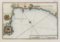 | Details | Roux, Joseph | 1764 |
| Antique harbor chart of Palma, Mallorca |
|
Roux, Joseph |
|
| 1764 |
| LOC:0 |
| $0.00 | Roux--Joseph | Antique-harbor-chart-of-Palma--Mallorca | SOLD
<BR> </BR>
Small and colorful mid 18th-century antique nautical chart of the harbor at Palma, Mallorca ( Majorca ), Spain. Coverage of this original copperplate-engraved harbor chart includes the walled village of Palma ( Palme ), the 'Tour de Lazaret' , Port Pin ( Porto Pi ), and the Vauban-style Fort de Port Pin. Several windmills are located as are soundings with suggested anchorages to aid early navigators unfamiliar with the area. Plate 8. <BR> </BR>
There were at least four small atlases of port and coastal charts that originated from Marseille hydrographers in the 18th century. Beginning in approximately 1727 these atlases included works by cartographers
<a rel="nofollow" href= "/MichelotBremondBackground.aspx"> Michelot and Bremond</a>,
<a rel="nofollow" href= "/Creator/Ayrouard--Jacques"> Jacques Ayrouard</a>,
<a rel="nofollow" href= "/Creator/Roux--Joseph"> Joseph Roux</a>
, and Jean Allezard. This small original chart is from the atlas of Mediterranean ports produced by Joseph Roux - "Recueil des Principaux Plans des Ports et Rades de la Mer Méditerranée". |
| 899 | 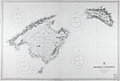 | Details | British Admiralty Hydrographical Office | 1930 |
| Balearic Islands of Majorca and Minorca |
|
British Admiralty Hydrographical Office |
|
| 1930 |
| LOC:0 |
| $0.00 | British-Admiralty-Hydrographical-Office | Balearic-Islands-of-Majorca-and-Minorca | SOLD<br></br>
Bold, authentic British sea chart of two of Spain's Balearic Islands: Majorca (Mallorca) and Minorca (Menorca). In excellent condition. Originally engraved and published in 1897 from London by the Admiralty under the superintendence of Rear Admiral W.J.L. Wharton. Lighthouses and other navigational aids are hand colored in yellow. This large chart will make a very attractive, unusual, and affordable gift for anyone with an interest in fishing or boating in the vicinity of Mallorca or Menorca in the Mediterranean Sea. Thousands of depth soundings, numerous bays, headlands, and villages pack this old pre-war nautical chart. Key habitations include Palma, Pollensa, Arta, Manacor, and Santany, Mallorca.
<br></br>
This version of the Balearic Island chart dates to 1930 when it was published with corrections. This bold dark lithographed print retains the sharp cartographic look and style of the late 19th century. More recent charts do not display the character of this beauty. Logo of the British Hydrographical Office at top of the title block. Number 1317. Sold by J. D. Potter, 145 Minories. |
| 5290 |  | Details | Anonymous | 1949 |
| Unrecorded comical map related to the Communist Revolution in China |
|
Anonymous |
|
| 1949 |
| LOC:9 |
| $0.00 | Anonymous | Unrecorded-comical-map-related-to-the-Communist-Revolution-in-China | SOLD
<br></br>
Unrecorded, and somewhat puzzling comical map of East Asia (China, Korea, Japan) inspired by Al Capp's "Lower Slobbovia" cartoon map from Capp's Li'l Abner comic book series (1949). In crude Russian and Chinese-inflected dialect the map documents (in manuscript red ink) the exodus of American workers from Shanghai, China to the United States during the last two years of the Chinese Civil War. This is a U.S. artifact from the early establishment of the People's Republic of China after WWII with a probable connection to the U.S. military [1]. Very rare. Not found anywhere else on this planet.
<br></br>
After the end of WWII United States companies built lucrative businesses within China. During 1948 and 1949, it became clear that the Chinese Nationalist forces under Chiang Kai-shek (supported by the U.S.A.) would be defeated by Chinese Communist forces, led by Mao Zedong and supported by Russia. U.S. diplomats and civilian business leaders began an exodus [2] from China. By May, 1949 the stream of foreigners leaving China was concentrated in Shanghai, China where most caught ships to the U.S.A [3], [4].
<br></br>
Includes a depiction of the Trans Manchuria Railway with an unknown connection to salt. The railway is shown extending from Saltport (Dalian), past Saltograd, Staffograd, past the Rad (Red) River and ending near Slobbovian Salt Mines.
<br><br>
Note:<br>
Humerican = American<br>
Pitchavich=Peretychika, Russia<br>
Havaveto = Pyongyang, North Korea<br>
<br>
[1]"You is here you lucky dogs" = Zama, Japan, the earliest U.S. Army barracks in Japan and the former site of the Imperial Japanese Army Academy.
[2] "Where Rad (Red) revolution is ending Humerican blue platt specials."
[3] "Is showing route of 'Vanishink Humerican' class of 1948 and 1949."
[4] Shows a sea route in MS red ink connecting Gimpo (Kimpo), Korea; Shanghai, China; and the United States. |
| 641 | 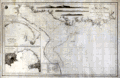 | Details | Direccion Hidrografia | 1815 |
| Mouth of the Plate River to Buenos Aires |
|
Direccion Hidrografia |
|
| 1815 |
| LOC:0 |
| $0.00 | Direccion-Hidrografia | Mouth-of-the-Plate-River-to-Buenos-Aires | SOLD<br></br>
Antique Spanish nautical chart of the Plate River, Montevideo and Buenos Aires, Argentina. This scarce sea chart is the 1815 corrected version of a chart first published in 1812 by Spain's Direccion Hidrographia. Laid to brown linen, probably when issued, in order to help the chart stand the rigors of a life at sea.
<br><br/>
With two detailed inset port plans: Plano del Puerto de Maldonado and Plano del Puerto de Monte-video. Also, at top are three profile coastal views.
<br><br/>
With the emblem of the Direccion Hidrographia. |
| 4914 | 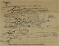 | Details | Anonymous | 1939 |
| Large fold-out tourist handbill with map Saint Augustine, Florida |
|
Anonymous |
|
| 1939 |
| LOC:0 |
| $0.00 | Anonymous | Large-fold-out-tourist-handbill-with-map-Saint-Augustine--Florida | SOLD<br></br>
Scarce tourists' handbill with a map from St. Augustine Florida, ca. 1938. On very thin paper almost certainly designed to be discarded, hence a rare survivor.
<br /><br />
Recto filled with information about points of interest on the map including the:
<div class="indenttextblocksingle">
<ul style="list-style-type: circle;">
<li>Fort Marion National Monument</li>
<li>Indian Burial Ground</li>
<li>Llambias House</li>
<li>Slave Market</li>
<li>Plaza de la Constitution</li>
<li>St. Augustine Ostrich-Alligator Farm</li>
<li>Marine Studios</li>
</ul>
</div>
Verso with facts and statistics about St. Augustine, and St. John's County, Florida. |
| 4915 |  | Details | Anonymous | 1863 |
| MS Civil War map St. Augustine Florida |
|
Anonymous |
|
| 1863 |
| LOC:0 |
| $0.00 | Anonymous | MS--Civil-War-map-St--Augustine-Florida | SOLD
<br></br>
Manuscript map of St. Augustine Florida ca. 1863. The lighthouse is the old light, not used after 1874.
<br></br>
Under magnification, notations on the map identify positions of Union forces- the 7th Connecticut near the Hospital, and the 7th New Hampshire volunteers at the entrenchments where the full description reads “Entrenchments thrown up by the 7th N.H. Vol.” With online sources we can tie the seventh New Hampshire to St Aug from September 3, 1862 to May 10, 1863. The Seventh Connecticut was in St. Aug from April 13, 1863 to August 2, 1863. |
| 5001 |  | Details | Jacksonville St. Augustine and Indian River Railwa | 1893 |
| Map of Florida Railroads by Jacksonville St. Augustine and Indian River Railway |
|
Jacksonville St. Augustine and Indian River Railwa |
|
| 1893 |
| LOC:0 |
| $0.00 | Jacksonville-St--Augustine-and-Indian-River-Railwa | Map-of-Florida-Railroads-by-Jacksonville-St--Augustine-and-Indian-River-Railway | SOLD
<br></br>
Rare large railway map of Florida from 1893: "Peninsula of Florida and Adjacent Islands published by the Jacksonville St. Augustine and Indian River Railway and Connections. East Coast Line. The St. Augustine Route."
<br></br>
Inset map of the Bahama Islands and a larger context map of the Caribbean Basin, Central America and South America presented in a large scroll-work inset map at bottom.
<br></br>
Early Florida railway route map supported increasing interest in trade with Cuba, and the Caribbean Sea. Printed by the Matthews Northrup Co, Buffalo, NY. Limited holdings at only 4 institutions according to WorldCat. |
| 646 | 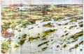 | Details | George W. Walker Lithograph and Publishing Co | 1906 |
| Birdseye View of Casco Bay, Portland, Maine and Surroundings |
|
George W. Walker Lithograph and Publishing Co |
|
| 1906 |
| LOC:0 |
| $0.00 | George-W--Walker-Lithograph-and-Publishing-Co | Birdseye-View-of-Casco-Bay--Portland--Maine-and-Surroundings | SOLD
<br></br>
Large antique lithographed map of coastal Maine north of Portland, including Casco Bay. Original, not a re-print. This folding birds eye view published ca. 1906 by Walker shows dozens of islands, coves, lighthouses, railroad and ferry routes, and other points of nautical interest. Bright colors. Folds to 3 3/4" x 7".
<br></br>
Named features include Cape Elizabeth, Portland Head light, Fort Preble, Cushing Island, Great Diamond Island, Long Island, Great Chebeague Island, Presumpscot River, Mt. Washington, Sebago Lake, Falmouth, Underwood, Harraseeket River, Casco Castle, Cousins Island, Bailey's Island, Harpswell Harbor, Maquoit Bay, Freeport Landing, Brunswick and Lewiston. Routes of the Casco Bay Lines shown in solid black. Lines for the Maine Central R.R. and other railroads shown in solid red lines.
<br></br>
Simple, brown cardboard cover with green title printing. Published by Walker Lithography and Publishing Company, Lithographers. 400 Newberry Street, Boston, Mass. |
| 689 | 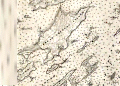 | Details | U.S. Coast and Geodetic Survey | 1901 |
| Casco Bay, Maine |
|
U.S. Coast and Geodetic Survey |
|
| 1901 |
| LOC:0 |
| $0.00 | U-S--Coast-and-Geodetic-Survey | Casco-Bay---Maine | SOLD.
<br></br>
Original old, rolled antique sea chart of the inside passages for Casco, Bay Maine that has seen usage afloat based on the light pencil course plot lines. This large old navigation chart on heavy paper, first published in 1870 by the U.S. Coast and Geodetic Survey, carries the patina of age while retaining almost all its original beauty. Numerous lights and aids to navigation are captured along with a host of nautical hazards: Temple's Ledge, Ram Island Ledge, Halibut Rocks, Dick's Shoal, Sisters Ground, and many more. Lots of opportunity to run aground… or worse.
<br></br>
Coverage includes the geographical features of Cape Elizabeth, Peak's Island, Cushing Island, Luckse's Sound, Presumscott River, Fort Gorges, Fort Preble, Fort Scammel, Portland Head Light, Whaleboat Island, Great Chebeag Island, Quohog Bay, Crotch Island, Cape Small, Maquoit Bay, Bald Head, Sebascodegan Island, Harpswell Neck, New Meadows River. Poulation centers include: Portland, Maine, Falmouth Corner, Yarmouth, Freeport Landing, and South Freeport. Chart number 315.
<br></br>
This chart (Electroype copy No. 2) was printed on or after 1901 from an electrotype plate of the original hand-engraved copper plate, a process the U.S. Coast Survey adopted around 1850. As a soft medium, copper plates could only withstand print runs of perhaps 200 copies before the plates wore down. To enable larger print runs, a mold of the original plate was created in wax or another soft medium. Then, using an electro-chemical processs ( electrotyping ), the mold was coated with a metal layer, typically copper. Printers were then able to produce output from the new electrotype copper copy, while preserving the original. |
| 649 |  | Details | Merrill, Capt. William E. | 1863 |
| Jasper, Tennessee Field Map Printed by Margedant's Quick Method |
|
Merrill, Capt. William E. |
|
| 1863 |
| LOC:0 |
| $0.00 | Merrill--Capt--William-E- | Jasper--Tennessee-Field-Map-Printed-by-Margedant-s-Quick-Method | SOLD<br></br>
Very rare and important Union Civil War "black map" or "sun map" printed in the field with a photographic process utilizing a mobile laboratory and darkroom. The map is centered on Jasper, Tennessee, which lies 19 miles west of Chattanooga. Less than one half dozen copies of "black maps" are recorded that were printed with Margedant's (then) revolutionary photographic process. Only one other copy of this field map of Jasper and Vicinity is recorded (University of Michigan).
<br></br>
This rare civil-war era field map was produced in support of the Chickamauga Campaign preceeding the Battle of Chickamauga fought September 19-20, 1863. The battle was fought between the Army of the Cumberland under Major General William Rosecrans and the Confederate Army of Tennessee under General Braxton Bragg, and was named for Chickamauga Creek, which curves near the battle area.
<br></br>
William Margedant's photographic process (today we would call it a "contact print") was employed early in the war by a team of topographical engineers and draftsmen to provide commanders with maps that could be updated frequently using: <div class="indenttextblock"> ..."a fac-simile photo-printing device invented by Captain Margedant, chief assistant. This consisted of a light box containing several india-rubber baths, fitting into one another, and the proper supply of chemicals. Printing was done by tracing the required map on thin paper and layng it over a sheet coated with nitrate of silver. The sun's rays passing through the tissue paper blackened the prepared paper except under the ink lines, thus making a white map on black ground. … The process, however, was expensive, and did not permit the printing of a large number of copies ; therefore these maps were only issued to the chief commanders. " (Van Horne, Thomas B., History of the Army of the Cumberland. Cincinnati: Robert Clarke & Co., 1875, vol. 2, p. 456 -8. ) </div> |
| 655 | 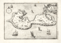 | Details | Tassin, Christophe Nicholas | 1634 |
| Isle de Noirmoutier |
|
Tassin, Christophe Nicholas |
|
| 1634 |
| LOC:0 |
| $0.00 | Tassin--Christophe-Nicholas | Isle-de-Noirmoutier | SALE IS PENDING
<br></br>
Small, attractive map of the island of Noirmoutier, France in the Pays de Loire region of Western France, just off the coast in the Atlantic Ocean. Price includes standard international shipping.
<br></br>
The map shows a great deal of interior detail as small as individual buildings, churches, windmills, and gardens. Offshore, small sailing vessels fill up the empty space. This map is a variant similar to but substantially different from the version published by Tassin in "Les Plans et profils de toutes les principales villes et lieux considerables de France" . This more scarce version contains a compass rose, the cartouche appears at top right, and the ships and interior island details are different. This version of the map is also a variant of the copy held by the Bibliothèque nationale de France. Plate 28.
<br></br>
Published by Tavernier in one of the many small-sized atlases created by Christophe Nicholas Tassin (d. 1660) . Tassin's background was as a military engineer, and he is best known for his nautical atlas of 30 sheets, dedicated to Richelieu, documenting France's coastline. Tassin's work contains topographic maps, often of militarily important sites, either sketched on site, composed from firsthand drawings by military engineers, or sometimes borrowed from other mapmakers. |
| 5250 |  | Details | Anonymous | 1940 |
| Cyanotype map of Annapolis, Maryland and Naval Academy |
|
Anonymous |
|
| 1940 |
| LOC:10 |
| $0.00 | Anonymous | Cyanotype-map-of-Annapolis--Maryland-and-Naval-Academy | SOLD
<br></br>
Rare anonymous blueprint or cyanotype map of Annapolis, Maryland. Coverage includes the Severn River, Spar Creek, College Creek and the grounds of the United States Naval Academy. Includes an area of "proposed extension of Academy grounds." Dated within to 1940.
<br></br>
Scale 1" = 2000 feet. Drawn by E.W.H. |
| 663 | 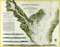 | Details | U.S. Coast and Geodetic Survey | 1874 |
| The Harbor of Annapolis |
|
U.S. Coast and Geodetic Survey |
|
| 1874 |
| LOC:53 |
| $0.00 | U-S--Coast-and-Geodetic-Survey | The-Harbor-of-Annapolis | SOLD
<br></br>Fine orginal electrotype copperplate engraved nautical chart of Annapolis, Maryland and vicinity first published in 1846. On strong, thick paper with no folds. Coverage extends from Forked Creek and the Narrows at the North past Annapolis and terminates near Oyster Creek and the modern community of "Arundel on the Bay". Numerous soundings, lighthouses, bouys, and navigational hazards are noted. Electrotype copy no. 3 by G. Mathiot U.S.C.S.
<br></br>
Key named features include the Severn River, Kent Island, Greensberry's Neck, Annapolis, Fort Nonsense, Fort Madison, Mount Misery, Sullivan's Cove, Round Bay, Mt. Pleasant, St. Helena Island, Weem's Creek, Graveyard Creek, St. John's College, Spa Creek, Windmill Point, Horn Point, Cat Hole Creek, Black Walnut Creek, Thomas' Point, Price's Point, Whitehall Poplars, Whitehall Creek, Goose Pond, Sandy Point.
<br></br>
With sailing directions, tidal notes, and four attractive inset coastal profile panoramic views of the approaches to Annapolis featuring the state house as the primary point of reference.
<br></br>
This chart was printed in 1874 from an electrotype copy of the original hand-engraved copper plate, a process the U.S. Coast Survey adopted around 1850. As a soft medium, copper plates could only withstand print runs of perhaps 200 copies before the plates wore down. To enable larger print runs, a mold of the original plate was created in wax or another soft medium. Then, using an electro-chemical processs ( electrotyping ), the mold was coated with a metal layer, typically copper. Printers were then able to produce output from the new electrotype copper copy, while preserving the original.
<br><br/>
This antique chart should not be confused with those similar copies issued as part of an annual Report to Congress, most on thin paper with folds that often show condition issues. With the circular stamp of the U.S. Coast Survey Depot. Number 385. |
| 667 |  | Details | Dalrymple, Alexander | 1890 |
| Plan of the Harbor of Nangasaky ( Nagasaki ) |
|
Dalrymple, Alexander |
|
| 1890 |
| LOC:0 |
| $0.00 | Dalrymple--Alexander | Plan-of-the-Harbor-of-Nangasaky-(-Nagasaki-) | SOLD <br></br>
Very early and scarce chart of the harbor of Nagasaki, Japan by British hydrographer Alexander Dalrymple. Shows a palace complex, the Cavalles, Nombo Point, and a few buildings, along with several dozen soundings. In his doctoral thesis Cook wrote of Dalrymple that he was: <div class="indenttextblock"> "now generally regarded as the originator of official British hydrography… was cumulatively a private publisher of nautical charts and plans (from 1767), the 'examiner of ships' journals' and chart publisher for the East India Company (from 1779), and Hydrographer to the Admiralty (from 1795)". </div>
<br>
Dalrymple attributed the chart to a manuscript by Captain Alexander Hume. That manuscript chart was likely created by Hume while leading a commercial voyage of the East India Company ship "Fox" of 499 tons from March 1761 to July 1763.
<br></br>
First published by Alexander Dalrymple on August 31, 1788. This plate is a re-issue from Dalrymple's original copper plate and bears the stamp of the British Hydrographic Office: late 19th century or possibly early 20th century. Production of Dalrymple's charts continued after his death in 1808. Cook lists this chronology for publication of the chart: <div class="indenttextblock">"[The chart was] re-issued by Hurd after 1810; included in Admiralty Chart catalogues 1825-1855, and allocated chart number 1035; withdrawn before 1857.The printing plate is preserved in the Hydrographic Office."</div>
<br>
<div class="indenttextblock">Reference: Cook, Andrew S., <b>Alexander Dalrymple (1737 - 1808) Hydrographer to the East India Company and to the Admiralty; as publisher: A Catalogue of Books and Charts. </b> Vol. 3 .Doctoral Thesis, University of St. Andrews. 1992.</div> |
| 875 |  | Details | Valentijn, Francois | 1724 |
| Antique Dutch View of Acapulco Harbor in Mexico |
|
Valentijn, Francois |
|
| 1724 |
| LOC:0 |
| $0.00 | Valentijn--Francois | Antique-Dutch-View-of-Acapulco-Harbor-in-Mexico | SOLD
<br></br>
Fascinating antique panoramic view of the harbor of <b>Acapulco, Mexico</b> ("Aquapulco") from the early eighteenth century. This copperplate-engraved view has a legend at bottom left corner keyed to six locations on the scene:
<div class="indenttextblock">
<ul>
<li>Acapulco village</li>
<li>Fort San Diego (with lattitude and longitude coordinates)</li>
<li>Grote mont. (harbor entrance)</li>
<li>Punta el Grifo</li>
<li>Kleyne mont. (channel between the mainland and la Roqueta island)</li>
<li>Haven van Marques (Puerto Marques Bay)</li>
</ul>
</div>
This colorful old view of the Acapulco area is by <b>Francois Valentijn</b> (or Valentyn) from 'Oud en Nieuw Oost Indien' published from Amsterdam in 1724 by Joannes van Braam. Valentijn ( 1666–1727 ) was a Dutch minister and naturalist who worked in the East Indies for the V.O.C. (Vereenigde Oost-Indische Compagnie). It is likely that Valentijn's access to V.O.C. maps and documents provided much source material for the eight volumes with over one thousand engravings. However, the basis for this relief map of Acapulco is an earlier watercolor by Dutch artist Johannes Vingboons who derived his work from drawings made in New Spain by Juan Gómez de Trasmonte and Adrian Boot before 1628.
<div class="indenttextblock"> (Connolly, Priscilla. "Vingboons, Trasmonte and Boot: European Cartography of Mexican Cities in the Early Seventeenth Century". 2014. <a href="http://www.researchgate.net/publication/249029290_Vingboons_Trasmonte_and_Boot_European_Cartography_of_Mexican_Cities_in_the_Early_Seventeenth_Century">Internet</a>)</div>
<br></br>
Two interesting graphical elements are the compass atop the title block at left which gives the orientation of the site and also in the far right bottom corner is a barely visible image of a woodsman with axe, removing a limb from the tall tree. |
| 6530 | 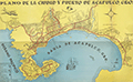 | Details | Anonymous | 1950 |
| Scarce plan of the city of Acapulco, Mexico |
|
Anonymous |
|
| 1950 |
| LOC:86 |
| $0.00 | Anonymous | Scarce-plan-of-the-city-of-Acapulco--Mexico | SOLD
<br><br>
Very unusual and scarce folding map or plan of Acapulco, Mexico on the Pacific Ocean ca. 1950: "Plano de la Ciudad y Puerto de Acapulco". A street plan of Acapulco in the mid-20th century with images of fish, Spanish galleons, and a twin-engine propellor-driven aircraft. Legend at bottom left identifies, government offices, hotels, schools, churches and local public transportation routes identified with red outline color.
<br><br>
Just below the title is a representation of the shield of the city of Acapulco, symbolizing two hands that break a leafy reed.
<br><br>
Numerous subdivisions (fraccionamientos) are noted in bold black headings including:
<div class="indenttextblocksingle">
<ul style="list-style-type: circle;"></li>
<li>Fraccionamiento Mozimba</li>
<li>Fraccionamiento Vista Allegre</li>
<li>Fraccionamiento Magallanes</li>
<li>Fraccionamiento Deportivo</li>
<li>Fraccionamiento Costa Azul</li>
</ul>
</div> |
| 1134 | 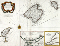 | Details | Santini, Paolo | 1776 |
| Antique Chart of the Balearic Islands of Minorca, Majorca, Ibiza, Formentera |
|
Santini, Paolo |
|
| 1776 |
| LOC:0 |
| $0.00 | Santini--Paolo | Antique-Chart-of-the-Balearic-Islands-of-Minorca--Majorca--Ibiza--Formentera | SOLD<br></br>Very attractive antique chart by Santini of Spain's Balearic Islands: Ibiza ( Yvice ), Majorca ( Maillorque ), Minorca ( Minorque ) and Formentera and other smaller islands in the archipelago. The archipelago forms an autonomous community and a province of Spain, with <b>Palma de Mallorca</b> as the capital.
<br></br>
Coverage on this scarce old map includes dozens of villages and geographic features including: Ibiza village, Chateau St. Hilaire, Isle Cabraire, Baie d'Artas, Cap de Pedra, Isle Dragoniere, Cap Fromentelli, Port Colomb, Cap Mahon, Cap Bajoli, and Cap de Citadella. Sparse soundings and anchorages are identified. Contains a central compass rose with radiating rhumb lines.
<br></br>
Includes two inset maps:
<div class="indenttextblock">
<ul style="list-style-type: circle;">
<li>Detailed inset map (8" x 5") "Plan du port et de la ville de Mahon". The inset includes the Port of Mahon, Majorca with Fort St. Philippe, Fort St. Charles, and the village of Mahon. 17 important locations are listed in a legend above the inset and tied to map locations though alphabetic references.
</li>
<li>
Inset of the western Mediterranean showing the relative location of the three Balearic islands to other geographic features and to population centers.
</li>
</ul>
</div>
By Paolo Santini after the cartography of J.N. Bellin of the French Depot de la Marine ca. 1740. From Santini's " Atlas Universal Dresse-Cartes Moderne". Published from Venice, Italy in 1776. |
| 850 | 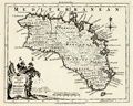 | Details | Kitchin, Thomas | 1756 |
| Antique Map of the Balearic Island of Menorca or Minorca |
|
Kitchin, Thomas |
|
| 1756 |
| LOC:0 |
| $0.00 | Kitchin--Thomas | Antique-Map-of-the-Balearic-Island-of-Menorca-or-Minorca | SOLD<br></br>
Detailed antique map of the island of Menorca ("Minorca"), one of Spain's Balearic Islands in the Mediterranean Sea. Some of the features that are noted on the map include: Governor of the Castles House, a Signal House, Mahon Harbor, Marlborough Redoubt, and St. Stephen's Cove.
<br></br>
From the London Magazine of March 1756 just a few months before the Battle of Minorca fought between the French and British fleets on May 20, 1756. The French won the battle. British Vice-Admiral John Byng had orders to relieve the garrison protecting Fort St. Philip in Port Mahon, but was court-martialed and later executed for failing to do enough to try to relieve the fort.
<br></br>
With text detached from the map for "A Description of the Island of Minorca" containing brief details of the history, geography, and inhabitants of the island. Published by R. Baldwin Pater Noster Row, London. 1756. Scale is 69 British Statute Miles to one degree of latitude. |
| 720 | 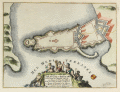 | Details | de Fer, Nicolas | 1693 |
| Syracuse or Siracuse, Sicily |
|
de Fer, Nicolas |
|
| 1693 |
| LOC:4 |
| $0.00 | de-Fer--Nicolas | Syracuse-or-Siracuse--Sicily | SOLD<br><br>
Beautiful antique plan of the fortifications at Syracuse ( Siracuse ) on the Mediterranean island of Sicily. Title cartouche at bottom surrounded by putti engaged in agricultural and food gathering activities. Text in French describes the location precisely with Lattitude and Longitude. By Nicolas de Fer, in "Introduction à la fortification." Paris 1693. |
| 853 | 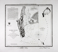 | Details | U.S. Coast and Geodetic Survey | 1853 |
| Antique engraved nautical chart of the entrance to San Diego, California |
|
U.S. Coast and Geodetic Survey |
|
| 1853 |
| LOC:0 |
| $0.00 | U-S--Coast-and-Geodetic-Survey | Antique-engraved-nautical-chart-of-the-entrance-to-San-Diego--California | SOLD<br></br>
Engraved antique nautical chart of the entrance to San Diego Bay, in California on a large sheet of heavy paper with no folds . Noted features include Point Loma, Ballast Point, Zuniga Shoal, and "La Playa" the original harbor where goods were transferred to and from ships calling at the port. At right is a sketch of the wider area including the San Diego Bay area and extending to the Coronados Islands, four islands belonging to Mexico between 15 and 20 miles south of San Diego.
<br></br>
Considered to be one of the best natural harbors on the west coast of North America, San Diego was colonized by Spain beginning in 1769 and served as base headquarters of major ships of the United States Navy in the Pacific until just before the United States entered World War II.
<br></br>
Early electrotype copy. Never folded, this is a seperately issued chart of the harbor with 4" wide margins and a prominent platemark. Total size is 21" x 18".
<br></br>
Relief shown by hachures; soundings in feet. Includes sailing directions. In upper margin "Presented under authority of an act of Congress of the United States of June 3d 1844 by direction of the Treasury Department, A.D. Bache Superintendent Coast Survey." "J No. 4."
<br></br>
Electrotype copy number 1 by Mathiot. |
| 963 | 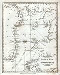 | Details | Malham, John | 1797 |
| A Correct Chart of the Coasts of the Irish Sea and St. Georges Channel |
|
Malham, John |
|
| 1797 |
| LOC:0 |
| $0.00 | Malham--John | A-Correct-Chart-of-the-Coasts-of-the-Irish-Sea-and-St--Georges-Channel | SOLD
<br><br/>
Antique engraved nautical chart of the Irish Sea with the coasts of Scotland, Wales, and Ireland. From the rare first American edition of <b>Malham's Naval Gazetteer</b>, published by Spotswood and Nancrede in Boston in 1797. Probably the earliest small-scale map of the coasts along the Irish Sea to be printed in the United States (1797). Chart coverage extends from Rathlin Island in the North, with the Isle of Man and Angelsey, Solway Firth, Cardigan Bay, and St. Georges Channel terminating past Milford Haven. Key cities include Belfast and Dublin, Ireland; Liverpool, Lancaster; and Carmarthen, Wales.
<BR> </BR>
Adorned with decorative compass rose and three sets of rhumb lines. Unlike several other charts in Malham's volume this example contains no depth soundings or descriptions of the sea-floor composition.
<BR> </BR>
This chart comes from an early nautical gazetteer or geographical dictionary produced first in England and after 1796 in the United States by John Malham. Rev. John Malham was a prolific Yorkshire-born author who produced other diverse works that include "Navigation Made Easy and Familiar", "Twenty-Two Sermons on Doctrinal and Practical Subjects" and "The Scarcity of Wheat considered". Malham died near London in 1807. (Gentleman's Magazine, Vol 102, 1807, p. 568).
<BR> </BR>
Colophon at end of Volume 1 states that the work is "From the prefs of Samuel Etheridge, No. 9 Newbury Street, Boston, 1797"). |
| 1006 |  | Details | Holden, George | 1843 |
| Approaches to Liverpool 1843 |
|
Holden, George |
|
| 1843 |
| LOC:0 |
| $0.00 | Holden--George | Approaches-to-Liverpool-1843 | SOLD
<br></br>
Scarce, well illustrated, and very 'nautical' chart of Liverpool Bay and the Mersey estuary with the entrance to the Mersey River. An unusual, information-dense navigational chart from 1843 of the Mersey Estuary packed with details on buoys, lights, channels, range markers, soundings and sailing directions. The chart is surrounded by enlarged profile views of lights, lightships, and range marks to aid in their identification. Working clockwise from top right these objects include: Bootle Marks, Rock Light, Leasowe Light, N.W. Formby, N.W. Lightship, Formby Lightship, Crosby Lightship, Bell Beacon, Hoylake lower and upper light, Bidston Light, New C. Mark, Crosby Light, Point of Ayre Light, and S.E. Mark.
<br></br>
Verso with a view attributed to B.C. Watts showing the arrangement of general communications signals about the lighthouses, made by hoisting flags, pendants, or balls to poles each with a specific purpose.
<br></br> |
| 1067 |  | Details | Mount Hope Bridge Corporation | 1937 |
| 1937 Pictorial Map of Newport, RI and Ten Mile Drive |
|
Mount Hope Bridge Corporation |
|
| 1937 |
| LOC:0 |
| $0.00 | Mount-Hope-Bridge-Corporation | 1937-Pictorial-Map-of-Newport--RI-and-Ten-Mile-Drive | SOLD
<br></br>
Charming pictorial maps of the topography, key features, and residences around Narragansett Bay, the Sakonet River, Buzzards Bay and Vineyard sound, on front and back of a folding pamphlet. Folds into a compact 4.5" x 9". Six vertical folds and one horizontal fold, as issued.
<br></br>
Consists of 4 maps total plus a description of the area and a title page. Two significant maps are of most interest:
<ul>
<li style="margin:2em; list-style-type: circle; line-height: 1.2em;">The largest map, a full 25" x 17", shows numerous points of interest in and near Newport, Portsmouth, Tiverton and Bristol, RI; New Bedford, Dartmouth, Onset, Bourne, and Falmouth, MA with Martha's Vineyard at bottom right.</li>
<li style="margin:2em; list-style-type: circle; line-height: 1.2em;">On the verso, a half-page detailed map of the 10-mile drive titled: "Newport's Famous Ten Mile Drive Along the Oceanfront" shows the "beautiful summer residences of many prominent people". Coverage includes Aquidneck Island with Newport and Portsmouth.</li>
</ul>
Arranged by historian John W. Haley and designed by H.W. Hetherington of Newport Rhode Island. The lithograph was published by the J.C. Hall Company of Providence, RI. Copyright 1937 by Mount Hope Bridge Corporation. |
| 1038 |  | Details | Blunt, E and G.W. | 1847 |
| Newport Harbor, Rhode Island |
|
Blunt, E and G.W. |
|
| 1847 |
| LOC:0 |
| $0.00 | Blunt--E-and-G-W- | Newport-Harbor--Rhode-Island | SOLD<br></br>
Antique nautical chart of Newport Harbor, Rhode Island from the Blunts in their 16th edition of the American Coast Pilot, dated within to 1847. Noted features include Fort Adams, Castle Hill, Miantinomy Hill, Government Islands, and Lime Rocks.
<br></br>
The American Coast Pilot with other harbor charts and sailing directions, was published by Edmund and George W. Blunt from New York. The Blunts were the most prolific private publisher of navigational charts in the United States at that time. 179 Water Street New York. |
| 2557 |  | Details | Eldridge, George W. | 1914 |
| Bold Antique Chart of Newport Rhode Island |
|
Eldridge, George W. |
|
| 1914 |
| LOC:0 |
| $0.00 | Eldridge--George-W- | Bold-Antique-Chart-of-Newport-Rhode-Island | SOLD<br></br>
Elegant, simple and useful early 20th-century antique nautical chart of Newport, Rhode Island harbor ca. 1914. Nearby points of interest include the Brenton Reef light-ship, Pirate's Cave, Castle Hill, Fort Dumpling, Coaster's Harbor Island, Dutch Island, Beaver Head, Jamestown and Sanderstown . Cartography by George W. Eldridge. Watermarked paper "Resolute Ledger".
<br></br>
Much useful information including soundings, anchorages, ranges, buoys, and bottom composition are presented by Eldridge in a clear graphic style that would have been appreciated by and helpful to mariners. For instance, this chart of Newport, R.I. is printed with bold black coastal outlines that would have been much easier to read under poor lighting conditions. Lighthouses, buoys, and other aids to navigation are highlighted in red or green.
<br></br>
Published by Wilfrid O. White of Boston, Massachusetts. White was G. W. Eldridge's son-in-law who continued to sell Eldridge's charts after his death until 1932.
<br><br>
Attribution reads: 'AUTHORIZED and PUBLISHED By Geo. W. Eldridge, Kelvin & Wilfrid O. White Co. 112 State Street, Boston. 38 Water Street, New York ' Number 34 in Eldridge's book of harbor charts. |
| 734 |  | Details | Le Rouge, George | 1778 |
| Antique Chart of Narragansett Bay with Newport Rhode Island |
|
Le Rouge, George |
|
| 1778 |
| LOC:0 |
| $0.00 | Le-Rouge--George | Antique-Chart-of-Narragansett-Bay-with-Newport-Rhode-Island | SOLD
<br></br>
Scarce original antique sea chart of Narragansett ( Narraganset ) Bay, parts of Rhode Island and Massachusetts. Geographic features include Mount Hope Bay, Bristol Bay, Providence River, and Taunton River. Named towns include Swansea and Dighton, Massachusetts; Bristol, Providence, Warren, Barrington, and East Greenwich, Rhode Island. Fall River, Mass. is not named, but in its place are shown two dwellings atop a hill by the side of the "Fals River ou Riviere des Sauts".
<br></br>
Published by George Le Rouge in Volume 1 of his rare sea-atlas "Pilote Americain Septentrional " (below) from Paris, France in 1778. Large inset plan of Newport, Rhode Island at top center with street and structures shown in great detail and with many key landmarks about Newport described by a legend.
<br></br>
This scarce chart is derived from J.F.W. des Barres’ 1776 chart which was based on surveys made by Charles Blaskowitz on behalf of the British Board of Trade in the early 1770s. Le Rouge's sea-atlas was intended for use by British Navy navigators at sea and few copies have survived that harsh environment.
<img src="/ZoomifyImages/SC_734/PiloteAmericain_400x300.jpg" align="left" style="PADDING-RIGHT: 8px; PADDING-Top: 15px" alt="Title page: Pilote Americain Septentrional." title="Title page for le Rouge's atlas: Pilote Americain Septentrional. Source: www.europeana.eu" width="160"> |
| 771 | 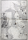 | Details | Depot de la Marine | 1922 |
| Chart of the Oresund from Baltic Sea to Kattegat |
|
Depot de la Marine |
|
| 1922 |
| LOC:0 |
| $0.00 | Depot-de-la-Marine | Chart-of-the-Oresund-from-Baltic-Sea-to-Kattegat | SOLD
<br></br>
Large 90+ year old nautical chart of the Oresund or sound connecting the Baltic Sea to the Kattegat and separating Sweden from Denmark. This plate is a 1922 edition of a French navigational chart first published in 1892. Large inset at left of the Port de Copenhague ( Copenhagen ) Denmark; small insets of Landskrona, Port d'Hoganas, Port de Raa, Port d'Elseneur, Port de Skanor, and Port d'Helsingborg.
<br></br>
Published by the French Naval Hydrographic Service which was the successor to the Dépôt des cartes et plans de la Marine, founded in 1720. In 1971 it became known as the Naval Hydrographicand Oceanographic Service (service hydrographique et océanographique de la marine or SHOM).
<br></br>
Aids to navigation are highlighted in orange. Lower left corner contains two stamps: One inked stamp from the Service Hydrographique and the other a purple sticker from the mapseller: "V. Weizsaeker, Opticien de la Marine. 13 Rue du Quai, Dunkerque" |
| 902 | 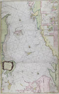 | Details | Lous, Christian Carl | 1794 |
| Chart of the Kattegat, Denmark and Sweden |
|
Lous, Christian Carl |
|
| 1794 |
| LOC:57 |
| $0.00 | Lous--Christian-Carl | Chart-of-the-Kattegat--Denmark-and-Sweden | SOLD
<br></br>
Large, bold sea chart of the Kattegat (Cattegat or Kattegatt), a shallow sea separating Denmark from Sweden. Coverage on this scarce, attractive, and colorful antique British chart includes the Jutland Peninsula, east coast of Denmark from Skagen to past Aarhus and includes the islands of Samsø or Samsoe, Læsø ("Laesso"), and Zealand with Copenhagen at the extreme bottom right. On the opposite side of the Kattegat the west coast of Sweden extends northward past Halstad, Warburg, and Gothenburg and includes the islands of Hisingen ("Hysingen") and Tjorn ("Tiorn").
<br></br>
Includes several coastal profile recognition views in the approaches to Copenhagen, Denmark. During the early 19th century the British fleet twice battled the Danes at Copenhagen, once in 1801 and again in 1807. With three inset small scale port and habor charts including:
<ul>
<div class="indenttextblock">
<li>A Plan of Maarstrand Harbor with the Neighboring Channels </li>
<li>A Plan of the Entrances into Gothenburg.</li>
<li>The Entrances into Malo Sound within Nidingen.</li>
</div>
</ul>
This edition of the chart is based on the work of Christian Carl (or "Charles") Lous, (1724-1804) a professor and cartographer. Published by Laurie and Whittle. Fleet Street. London. 12th May, 1794. |
| 5475 | 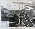 | Details | George W. Walker Lithograph and Publishing Co | 1895 |
| Vineyard Haven birds eye view 1893 1895 |
|
George W. Walker Lithograph and Publishing Co |
|
| 1895 |
| LOC:10 |
| $0.00 | George-W--Walker-Lithograph-and-Publishing-Co | Vineyard-Haven-birds-eye-view-1893-1895 | ON APPROVAL
<br></br>
Original lithographed bird's-eye view of Vineyard Haven and Vineyard Haven Harbor on the Island of Martha's Vineyard. Second state of this view, ca. 1895, by George W. Walker, lithographer, first issued in 1893 [1]. Looking east, Walker's view takes in the wharf, the waterfront, and the harbor with many sailing vessels. Measures 18" x 14" within the neat lines.
<br></br>
This view is quite scarce on the market. No sales recorded in AMPR; no holdings in WorldCat.
<br></br>
Vineyard Haven, is a working harbor village in the town of Tisbury, Massachusetts a year-round port for Martha’s Vineyard island. Locations in Vineyard Haven that Walker included in his list of references include: the East Chop light; Mansion House; Windmill; sailor's free reading room; and Lagoon Heights. Walker also identifies by name the homes of important Vineyard Haven residents including Dr. William Leach, Captain Benjamin C. Cromwell, Captain Clough, Captain P.L. Smith, and Captain Owens.
<br></br>
The second state of Walker's view of Vineyard Haven is easily identified as it contains two additional location names on the bottom roll of the scroll of references: 'Grove Hill House' and 'Association Hall'. Also, in the upper right quadrant there are numerous street additions and deletions as compared to the first edition. The second edition also contains marginal text denoting the four compass directions.
<br></br>
[1] Online. Vineyard Haven bird's-eye view. 1st. Walker. 1893. |
| 788 | 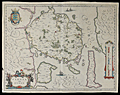 | Details | Blaeu, Johannes | 1640 |
| Antique map of the Danish Island of Fyn in the Baltic Sea |
|
Blaeu, Johannes |
|
| 1640 |
| LOC:0 |
| $0.00 | Blaeu--Johannes | Antique-map-of-the-Danish-Island-of-Fyn-in-the-Baltic-Sea | SOLD
<br></br>
Price includes shipping. Antique map of Fyn ( Funen ) in Denmark. Coverage includes the islands of Fyn ( Funen ), Denmark's third largest island; Langeland; Aeroe / Ærø ( Arr ) ; Als ( Alsen ); and the Western coast of Zeeland. Key cities noted include Odense ( Ottonia or Odensee ); Nyborg; Nackeby; Bogense ( Bowens ); and Hinsgagel, just below Middelfart. To the south lies the Baltic Sea ( Mare Balticum ). Dozens of smaller islands are each colored and are named, most encircling the island of Fyn.
<br></br>
This mid-seventeenth century copper-plate engraved map is characterized by beautiful flowing calligraphy, a vertical mileage scale, French text on the verso, and a title cartouche with two cow-herds surrounded by a herd of cattle. Three small ships under sail fill in the empty areas of the sea. Within the islands, numerous, villages, hills, lakes, rivers are identified by name. Created by prolific Dutch cartographer J. Blaeu from Amsterdam ca. 1640. |
| 969 | 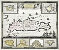 | Details | de Wit, Frederick | 1690 |
| Frederick de Wit's map of Crete with Heraklion, Chania and more |
|
de Wit, Frederick |
|
| 1690 |
| LOC:0 |
| $0.00 | de-Wit--Frederick | Frederick-de-Wit-s-map-of-Crete-with-Heraklion--Chania-and-more | SOLD
<br></br>
Highly decorative antique hand-colored map by de Wit of the island of Crete (Creta), Greece with six attractive insets plans showing the fortifications of Canea/ Chania, Candia / Heralkion, Spinalonga / Kalydon, Retimo/ Rethimnon, Thine / Tinos and Suda. The insets are after drawings of Sébastien Pontault de Beaulieu (1612-1674). Pontault, a French engineer, is considered to have been the inventor of the art of military topography.
</br></br>
For the insets of both Chania and Iraklio Wit has included a legend of key place names keyed alphabetically to locations on the plans. In the interior of this lovely map of Crete Wit includes mountains, rivers, villages, lakes, forts, and he records an extensive road network ranging widely across the island. Decorative elements include square-rigged ships, galleys, and putti carrying a sheet containing the title block.
</br></br>
At upper left are portions of the nearby islands of Kythera ("Cerigo") and Antikythera ("Cecerigo"). Fortifications of Spinalonga Island or Kalydon (just north of the Spinalonga Peninsula, near Elounda and Agio Nikolaos) are shown at bottom right. During the Venetian occupation of Crete Spinalonga Island was home to a fortress controlled by the Ventians until 1715.
</br></br>
From Amsterdam ca. 1690. Attribution reads: "by Frederick de Wit inde Kalverstraat inde Witte Paskaert".
Plate 23. Manuscript numeric "60" in top right corner. |
| 821 | 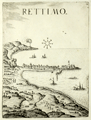 | Details | Boschini, Marco | 1651 |
| Rethymno in Crete, Greece |
|
Boschini, Marco |
|
| 1651 |
| LOC:0 |
| $0.00 | Boschini--Marco | Rethymno-in-Crete--Greece | SOLD<br></br>
Rare profile view of the Cretan village of Rettimo (Rethimno), Crete in Greece . The town is shown as it then existed, a narrow peninsula with the port and its jetties jutting out to the East. The great Fortress of Rethymno is clearly visible high and well protected at the northern end of the peninsula. Galleys and sea serpents fill empty space in the sea.
<br></br>
By Marco Boschini (1613-1678) from Venice in 1651. Published in Boschini's atlas of 59 engraved views and city plans and 2 maps of Crete at a time when the island of Crete, then a Venetian territory, was under siege from Ottoman forces.
<br></br>
Boschini derived his engravings from the manuscript works of others including Angelo degli Oddi, Francesco Basilicata, and especially Georgio Corner. Although he never visited Crete, Boschini's unique contribution is that his atlas was the first published atlas to focus solely on Crete and it provided information about that embattled island to a thirsty public. (Porfyriou, Heleni. The Cartography of Crete in the First Half of the 17th Century: a Collective Work of a Generation of Engineers, Web; http://ine-notebooks.org/index.php/te/article/viewFile/109/165) |
| 822 | 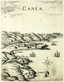 | Details | Boschini, Marco | 1651 |
| Chania in Crete, Greece |
|
Boschini, Marco |
|
| 1651 |
| LOC:0 |
| $0.00 | Boschini--Marco | Chania-in-Crete--Greece | SOLD<br></br>
Rare view of the walled town of Chania on the Greek island of Crete in context with the surrounding geographic features and villages. The small walled town on the North coast of Crete can be seen have the same harbor structure and covered workshops of the Grand Venetian Arsenal as still exist today. Noted nearby features include : Galata ( Galatas ), S. Fanavro,and S. Chiriaci. A simple wind rose is found in the sea along with images of a galley under oars and three square-rigged ships under sail.
<br></br>
By Marco Boschini (1613-1678) from Venice in 1651. Published in Boschini's atlas of 59 engraved views and city plans and 2 maps of Crete at a time when the island of Crete, then a Venetian territory, was under siege from Ottoman forces.
<br></br>
Boschini derived his engravings from the manuscript works of others including Angelo degli Oddi, Francesco Basilicata, and especially Georgio Corner. Although he never visited Crete, Boschini's unique contribution is that his atlas was the first published atlas to focus solely on Crete and it provided information about that embattled island to a thirsty public. (Porfyriou, Heleni. The Cartography of Crete in the First Half of the 17th Century: a Collective Work of a Generation of Engineers, Web; http://ine-notebooks.org/index.php/te/article/viewFile/109/165) |
| 1104 |  | Details | de Fer, Nicolas | 1705 |
| Veue de la ville et du port de Constantinople |
|
de Fer, Nicolas |
|
| 1705 |
| LOC:0 |
| $0.00 | de-Fer--Nicolas | Veue-de-la-ville-et-du-port-de-Constantinople | SOLD<br></br>
Very detailed and attractive antique engraving of Constantinople or Istanbul, Turkey published from Paris in 1705. Minute detail of all the numerous towers, lighthouses, minarets and mosques that filled the city in the early 18th century.
<br></br>
Two settlements outside the well-fortifed walls are noted: Galata, and on the Anatolian side of the Bosphorous Strait- Scutari, which today is a municipality of Istanbul called Üsküdar. A few hundred meters off the coast of Scutari, on a small rocky islet is pictured the "Tour de Leander" or Maiden's Tower (Turkish: Kız Kulesi) , which over many centuries has served as watchtower, quarrantine station, lighthouse, and defensive structure. Today the tower has been converted into a café and restaurant.
<br></br>
Other named features include the Tower of Belisarius ("Tour de Bellissaire"), le Serail, the Seven Towers ("Les 7 Tours"), le Solimanie, Constantine's Palace, les Magazines de Pera, and Calcedoine.
<br></br>
This antique view was produced by the well known French geographer and cartographer, Nicolas de Fer (1646 - 1720). De Fer was a prolific producer of maps and prints who among other honors, was appointed as official geographer to the Spanish King in 1702. Published in de Fer's atlas: "L'atlas curieux, ou Le monde réprésenté dans des cartes générales et particulières du ciel et de la terre… et orné par des plans et descriptions des villes capitales et principales ...". |
| 955 |  | Details | Davison, Harry K. | 1955 |
| Estero Island, Fort Meyers Beach, Lee County Florida |
|
Davison, Harry K. |
|
| 1955 |
| LOC:0 |
| $0.00 | Davison--Harry-K- | Estero-Island--Fort-Meyers-Beach--Lee-County-Florida | SOLD<br></br>
Nine foot long cadastral map of Estero Island, Florida from the heyday of island land development, the 1950's. The map is based on an original blue-line printed plat map by surveyor Harry K. Davison. Davison, a Civil Engineer, conducted some of the earliest surveys of Estero island and built a beachfront home on Fort Meyers beach in 1921. Today that cottage has been moved to 161 Bay Road in Fort Meyer's beach where it serves as the headquarters of the Estero Island Historic Society Museum and Nature Center.
<br></br>
Map is marked up with numerous manuscript notations and property line marks related perhaps to zoning, taxation and or property sales. Map is rolled on two wooden rollers probably contemporary with its use. Some of the notable features are the bridge across Matanzas Pass, Estero Boulvevard extends the length of the island (dates map to after 1950) and the absence of a bridge at the island's south end (dates the map to before July 1965). Named features include Estero Bay, Big Carlos Pass, Matanzas Pass, Mangrove Key, the Gulf of Mexico, Laguna Shores and many other subdivisions, numerous government lots, and individual land holdings.
<br></br>Attribution block reads: "Compiled from public records and private surveys by Harry K. Davison, CE. Fort Meyers, Fla." Emerging from the large smudge at bottom is the bow of an old-style powerboat with flag flying in the breeze.
<br></br>
IMAGE NOTE: Because of its long size the photograph of Davison's map has been pieced together electonically from three photographs. The map is one solid straight length of paper. Some anomalies shown in the photo are artifacts only of that photographic re-combination. |
| 1327 |  | Details | Davison, Harry K. | 1975 |
| Estero Island, Fort Meyers Beach, Lee County Florida |
|
Davison, Harry K. |
|
| 1975 |
| LOC:0 |
| $0.00 | Davison--Harry-K- | Estero-Island--Fort-Meyers-Beach--Lee-County-Florida | SOLD<BR></BR>
Nine foot long cadastral map of Estero Island, Florida from ca. 1975. The map is based on an original blue-line printed plat map by surveyor Harry K. Davison. Davison, a Civil Engineer, conducted some of the earliest surveys of Estero island and built a beachfront home on Fort Meyers beach in 1921. Today that cottage has been moved to 161 Bay Road in Fort Meyer's beach where it serves as the headquarters of the Estero Island Historic Society Museum and Nature Center. |
| 917 | 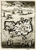 | Details | Mallet, Allain Manesson | 1683 |
| Antique map of Iceland with Greenland |
|
Mallet, Allain Manesson |
|
| 1683 |
| LOC:0 |
| $0.00 | Mallet--Allain-Manesson | Antique-map-of-Iceland-with-Greenland | SOLD
<br><br/>
Charming antique map of Iceland (Islande) with a profile view of Greenland (Groenland) in the background. Between the two islands is a scene of several whaling vessels hunting and harpooning very large whales from whaleboats. By Allain Mallet, Paris, 1683.
<br></br>
Towns depicted include Reykjavík ("Rikiaves"), Holar ("Hola"), Kopavogur ("Koplavnik"), and "Bestede". Mount Hekla ("Mont Hecla") is shown erupting vigorously and numeous other vocanic cones are depicted in the interior. A recorded eruption of Mount Hekla that began in May 1636 lasted over one year.
<br></br>
Published by Mallet in "Description de l'Univers" . Allain Mallet (1630-1706) was a French engineer, soldier, and cartographer. He served in the court of King Louis XIV as a techer of mathematics. In addition to "Description de l'Univers" Mallet also published "Les Travaux de Mars ou l'Art de la Guerre". |
| 1326 | 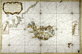 | Details | Bellin, Jacques Nicolas | 1767 |
| Fine antique chart of Iceland and Faroe Islands ... Whaling related |
|
Bellin, Jacques Nicolas |
|
| 1767 |
| LOC:0 |
| $0.00 | Bellin--Jacques-Nicolas | Fine-antique-chart-of-Iceland-and-Faroe-Islands-----Whaling-related | SOLD
<br></br>
Very large antique French sea chart published by France's Depot de la Marine to serve whaling interests near Iceland ("pour servir a la peche de la balaine"). After the work of Horrebows and of Knopf. Contains all of Iceland and portions of the Greenland coast, the Faroe Islands, and Jan Mayen Island. A long stretch of the Greenland coast is noted as speculative: "Toute cette coste n'est tracee que sur des conjectures".
<br></br>
At left an inset correction of a part of Iceland's west coast south of Cap Nord (near today's Hornstrandir Nature Reserve) based on the exploration of Kerguelen in 1707. Inset to right contains coastal details of the east coast of Iceland based on Dutch charts. With a very decorative title cartouche and the circular anchor logo of France's Depot de la Marine. Dated 1767 within but printed ca. 1789 - 1799, based of the "R.F." ( République française ) within the logo.
<br></br>
This scarce and highly decorative chart is annotated with information about re-supply points that could have been useful to whalers and other mariners:
<div class="indenttextblock">
<ul style="list-style-type: circle;">
<li>"Ville et port a viande."</li>
<li>"Ville et port a poisson."</li>
<li>"Ville et port a viande y a aussi boucherie."</li>
<li>"Ville et port ou l'on charge du poisson et de la graisse de poisson."</li>
</ul>
</div>
Contains a diagram noting the high magnetic variation experienced in the area (32 degrees west). Interesting detail is the knitted fisherman's cap directly below the North direction arrow. |
| 945 |  | Details | Lister, James Wren | 1948 |
| Pictorial map of Avalon Town |
|
Lister, James Wren |
|
| 1948 |
| LOC:0 |
| $0.00 | Lister--James-Wren | Pictorial-map-of-Avalon-Town | SOLD but see another example now in stock.<br></br>
Interesting pictorial 40's birds-eye view of the town of Avalon on Catalina Island. |
| 4711 |  | Details | Lister, James Wren | 1948 |
| Avalon, Catalina Island, California Pictorial Map |
|
Lister, James Wren |
|
| 1948 |
| LOC:88 |
| $0.00 | Lister--James-Wren | Avalon--Catalina-Island--California-Pictorial-Map | SOLD
<br></br>
Very cool pictorial mid-century birds-eye view of the town of Avalon on Catalina Island off the coast of Los Angeles, California. This original view of Avalon contains numerous named roads including Pebbly Beach Road, Wrigley Road, Chimes Road, Whittley Ave., and Metropole. Key facilities noted include a casino; Chimes Tower; the steamer pier and pleasure pier; Christian Science Church; country club; bird park; ballpark; and post office. Map is surrounded by vignettes typical to the area including ships, flying fish, a seaplane, and numerous recreational activities.
<br></br>
Verso contains a two-page directory of Catalina island businesses with telephone numbers and a large map of the entire island of Santa Catalina, CA. A sampling of the businesses listed includes: "Archie's Sip and Bite", "Scari's Cocktail Lounge", "Amphibian Air Transport", "Las Casitas Bungalows" and "Catalina Pin-Ups". The town directory is surrounded by small images of the signs of local business.
<br></br>
James Wren Lister (1897-1952) was born in England but settled in Los Angeles in 1925. Published by the L.C.B. Co. P.O. Box 146, Avalon, California. |
| 2505 |  | Details | Lister, James Wren | 1948 |
| Pictorial map of Avalon Town on Catalina Island, California |
|
Lister, James Wren |
|
| 1948 |
| LOC:0 |
| $0.00 | Lister--James-Wren | Pictorial-map-of-Avalon-Town-on-Catalina-Island--California | SOLD<br></br>
Very cool pictorial mid-century birds-eye view of the town of Avalon on Catalina Island off the coast of Los Angeles, California. This original view of Avalon contains numerous named roads including Pebbly Beach Road, Wrigley Road, Chimes Road, Whittley Ave., and Metropole. Key facilities noted include a casino; Chimes Tower; the steamer pier and pleasure pier; Christian Science Church; country club; bird park; ballpark; and post office. Map is surrounded by vignettes typical to the area including ships, flying fish, a seaplane, and numerous recreational activities.
<br></br>
Verso contains a two-page directory of Catalina island businesses with telephone numbers and a large map of the entire island of Santa Catalina, CA. A sampling of the businesses listed includes: "Archie's Sip and Bite", "Scari's Cocktail Lounge", "Amphibian Air Transport", "Las Casitas Bungalows" and "Catalina Pin-Ups". The town directory is surrounded by small images of the signs of local business.
<br></br>
James Wren Lister (1897-1952) was born in England but settled in Los Angeles in 1925. Published by the L.C.B. Co. P.O. Box 146, Avalon, California. |
| 934 | 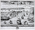 | Details | Kip, Johannes | 1724 |
| Antique birds-eye view of Harwich, England in Essex |
|
Kip, Johannes |
|
| 1724 |
| LOC:0 |
| $0.00 | Kip--Johannes | Antique-birds-eye-view--of-Harwich--England-in-Essex | SOLD
<br></br>
Large, very attractive antique engraved birds-eye view of Harwich, England in the county of Essex. Published in 1724 by well-known British engraver Johannes (Jan) Kip.
<br></br>
Legend at bottom is keyed alphabetically to the important features in the view, specifically:
<div class="indenttextblock">
<ul style="list-style-type:none">
<li>A. The Queen's yard and store house</li>
<li>B. The Queens Key</li>
<li>C. St. Nicholas Church</li>
<li>D. The Towne Hall</li>
<li>E. The Gate leading to London and the Fire Light house over it</li>
<li>F. The Candle Light house</li>
<li>G. Landguard Fort</li>
<li>H. The harbour behind the Towne and the river leading to Maningtree</li>
<li>I. Orvell Station</li>
<li>K. The river leading to Ipswitch</li>
<li>L. The Pacquett Boat (Packet boat)</li>
<li>M. The breakers</li>
<li>N. West street</li>
<li>O. Shotley Gate house</li>
<li>P. Shotley Church</li>
</ul>
</div>
Seller's attribution reads: "Sold by Thomas Taylor at the Golden Lyon near the Horn Tavern, Fleet Street and by Robert Hulton at the corner of Pall Mall over against the Hay Market St. Jameses. |
| 1329 | 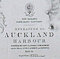 | Details | British Admiralty Hydrographical Office | 1876 |
| Antique chart of Auckland Harbor, New Zealand |
|
British Admiralty Hydrographical Office |
|
| 1876 |
| LOC:0 |
| $0.00 | British-Admiralty-Hydrographical-Office | Antique-chart-of-Auckland-Harbor--New-Zealand | SOLD
<br></br>
Scarce antique British nautical chart of the entrances to Auckland Harbour, New Zealand based on the <b>first complete hydrographic survey of New Zealand waters</b> which was conducted by Captain J.L. Stokes, Commander B. Drury and the Officers of H.M.S. Acheron and Pandora 1849-1855. This edition contains corrections up to 1876. Chart number 1896.
<br></br>
This detailed chart of Auckland, New Zealand is based on surveys of <b>Captain J. L. Stokes</b> and Commander R. Drury of the HMS Acheron and the Pandora respectively. Among his many accomplishments, Stokes served as assistant surveyor aboard the <b>HMS Beagle</b> during its well-known voyage around the world with Charles Darwin in 1833-36. Hooker's brief biography of Stokes includes a portrait and this entry:
<div class="indenttextblock"> "Stokes, John Lort (1812-86) - Royal Navy officer and hydrographer, was chosen by Beaufort, the British Hydrographer for the 'Great New Zealand Survey.' Stokes had joined the navy as a ‘volunteer first class’ in 1824 and by 1843, he was an experienced surveyor with the rank of commander. In 1846, he was promoted to captain and in the following year was given command of HMS Acheron. Between 1848 and 1855, Stokes surveyed extensively in New Zealand waters. With Drury’s surveys they were the most complete investigations carried out to that time. Over forty-five New Zealand charts were published in the years following Stokes’ and Drury’s surveys. Some of Stokes' data were also incorporated in maps published by Arrowsmith." (Hooker, Brian. Dictionary of New Zealand Map-Makers.<a href="http://zeehaen.tripod.com/dictionary_map_m/dictionary_part_c_bh.htm " target="_blank">Internet</a>)</div>
</BR>
See also: ( Hargreaves, R.P. "Nineteenth Century Hydrographic Charts: A Preliminary Checklist." <a href="https://evols.library.manoa.hawaii.edu/bitstream/10524/55278/1/v27n07_1964_Hargreaves.pdf" target="_blank">Online</a>.) |
| 1025 | 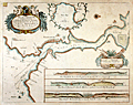 | Details | Collins, Greenvile | 1757 |
| Greenville Collins Chart of the Dart River and Dartmouth, England |
|
Collins, Greenvile |
|
| 1757 |
| LOC:0 |
| $0.00 | Collins--Greenvile | Greenville-Collins-Chart-of-the-Dart-River-and-Dartmouth--England | SOLD <br></br>Attractive, colorful antique nautical chart of the Dart River and the small village of Dartmouth along the western bank. An inset chart of Tarr Bay at top center surrounded by a leafy border. At bottom are three inset coastal elevation views of the entrance to the Dart River as seen from offshore. Notable features include Dartmouth Castle, Kingsward Castle, Old Mill Bay, Combe Point, Blackstone rock, the small village of Dittason, and Gemton Bay.
<br></br>
From one of the many editions of Greenville Collin's 'Great Britain's Coasting Pilot', published from 1693 to 1792. Captain Greenville Collins began his career as an officer in the Royal Navy. Charles II appointed Collins to the role of Hydrographer to the King in 1683 and placed him in command of the Royal yacht, Merlin. Collins was subsequently appointed by Samuel Pepys to record the coastline of Britain. The Merlin is cited as the first British warship dedicated to marine survey work. |
| 5355 |  | Details | Woodruff, S.H. | 1928 |
| First large format subdivision map of Dana Point California |
|
Woodruff, S.H. |
|
| 1928 |
| LOC:300 |
| $0.00 | Woodruff--S-H- | First-large-format-subdivision-map-of-Dana-Point-California | SOLD<br></br>
First large format subdivision map of Dana Point, in Orange County, California. Only other two known copies; one copy at Yale. This remarkable map was made less than 90 years after Richard Henry Dana Jr. first described the area:
<div class="indenttextblocksingle">
"San Juan [Dana Point] is the only romantic spot in California. The country here for several miles is high table-land, running boldly to the shore, and breaking off in a steep hill, at the foot of which the waters of the Pacific are constantly dashing." (Dana, R.H. Jr., Two Years Before the Mast. 1840.)
</div>
<br></br>
Sheet size 33" W x 26" H. |
| 1047 |  | Details | Dovarinoff, Jean | 1973 |
| Pictorial map of St. Barths with roads and beaches |
|
Dovarinoff, Jean |
|
| 1973 |
| LOC:0 |
| $0.00 | Dovarinoff--Jean | Pictorial-map-of-St--Barths-with-roads-and-beaches | SOLD<br></br>
Decorative, large, pictorial map of the Caribbean island of Saint Barthelemy (Saint Barths or St. Barts). Dated within to 1971/1973. St. Barts is a French territory located in the Caribbean Sea about 25 miles southeast of St. Martin. The capital of St. Barts is Gustavia. Details many of the fine beaches on the island including: Anse a Colombier, Anse de Grande Saline, Anse de Grand Cul de Sac, Anse de Lorient, and Anse du Gouvereur.
<br></br>
This scarce pictorial map of St. Barths, out of print for many decades, is decorated with sailing ships, fanciful sea creatures, pirates, and mermaids. A legend at far right explains the cartographic conventions used on this map. French text. Attribution reads: "Dressee par Jean Dovarinoff, le 30.3.1971 a l'anse des cayes, Saint Barthelemy, Guadeloupe." |
| 1078 | 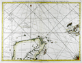 | Details | Jefferys, Thomas | 1775 |
| Antique Chart of the Yucatan Peninsula and Western Cuba |
|
Jefferys, Thomas |
|
| 1775 |
| LOC:0 |
| $0.00 | Jefferys--Thomas | Antique-Chart-of-the-Yucatan-Peninsula-and-Western-Cuba | SOLD<br></br>See another example of
<a href="https://www.rarecharts.com/ShowDetail/Creator/Jefferys--Thomas/Title/Jefferys-excellent-1775-antique-chart-of-the-Yucatan-Peninsula-to-western-Cuba/4807" target="_blank">
Jeffery's chart</a> for sale from our collection. |
| 1075 | 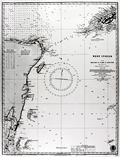 | Details | British Admiralty Hydrographical Office | 1927 |
| Chart of the eastern Yucatan Peninsula with Cozumel and Tulum |
|
British Admiralty Hydrographical Office |
|
| 1927 |
| LOC:0 |
| $0.00 | British-Admiralty-Hydrographical-Office | Chart-of-the-eastern-Yucatan-Peninsula-with-Cozumel-and-Tulum | SOLD<br></br>Very cool antique British chart of the east side of Mexico's Yucatan Peninsula with the Yucatan Channel and the west end of Cuba. Produced decades before the building boom of the 1970s and beyond. Several areas offshore carry the printed note: "Good Fishing" . Key features include: Cozumel Island, Tulum, Isla Blancilla, Yalahau Fort, Cabo Catoche, Puerto de Mujeres, Bahia de la Ascension, Arrowsmith Bank, Bahia del Espititu Santo, Banco Chinchorro, Turneffe, Lighthouse Reef, and Swan Island.
<br></br>
Lighthouses and aids to navigation are highlighed in orange. Steel engraved nautical chart with the oval logo of the "Hydrographic Office" at bottom right.
<br></br>
Frequent updates noted at bottom left. Large corrections to 1915. Small corrections to 1925 with an additional hand written correction to 1927. Sold by J. D. Potter, Agent for the Sale of the Admiralty Charts. Chart number 1204. Price when issued was two shillings. |
| 1117 | 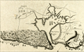 | Details | Anonymous | 1766 |
| A Plan of the Siege of the Havana 1762 |
|
Anonymous |
|
| 1766 |
| LOC:0 |
| $0.00 | Anonymous | A-Plan-of-the-Siege-of-the-Havana-1762 | SOLD<br></br>Antique map or plan of Havana, Cuba. This concise engraved harbor plan shows the disposition of British forces as they besieged and captured the city of Havana, Cuba in 1762, which at the time was a very important Spanish naval base in the Spanish West Indies. Shows two forts at the entrance channel: Castillo de los Tres Reyes del Morro (or Morro Castle) and Castillo de San Salvador de la Punta. A chain to block the channel is shown stretching between the two forts.
<br></br>
The Anglo-Spanish War of 1761-1763 saw Spain drawn into a global war, entering on the side of France during the Seven Years’ War, itself an outgrowth of the French and Indian War in North America. The siege of Havana, during the Anglo-Spanish War of 1761-1763, began in June 1762, led by George Keppel, 3rd Earl of Albemarle, and lasted until August 1762, with the surrender of Governor Juan de Prado.
<br></br>
As a result of the 1763 Treaty of Paris, Havana was returned to Spain but Spain was required to cede Florida and the Balearic Island of Minorca to Great Britain in return. Spain also received Louisiana as a payment for intervening in the war on the side of the French and as compensation for having lost Florida. Antonio Ulloa, who had taken part in a Spanish-French astronomical mission to South America, was appointed the first Governor of Louisiana, arriving in 1766 but ultimately was driven out of Louisiana in 1768 by French creoles and Acadians.
<br></br>
Published from London in Britannia Triumphant. |
| 1442 | 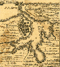 | Details | Popple, Henry | 1742 |
| Antique coastal chart of Havana And Santiago, Cuba |
|
Popple, Henry |
|
| 1742 |
| LOC:0 |
| $0.00 | Popple--Henry | Antique-coastal-chart-of-Havana-And-Santiago--Cuba | SOLD
<br></br>
Interesting and uncommon chart fragment with both Havana, Cuba and Santiago de Cuba, the first-largest and second-largest cities on that island.
<br></br>
This antique map was originally published by Covens and Mortier in 1742 in "Les Principales Forteresses Ports etc. de L'Amerique Septentrionale" a sheet containing harbor and island maps and plans of the Americas. This map is a fragment trimmed from the larger sheet.
<br></br>
That sheet of 18 maps and plans of islands and harbors was published by Covens and Mortier to replace Popple's original large map of 20 sheets with a more manageable six-sheet version. Popple's original map was titled: "A Map of the British Empire in America with the French, Spanish and the Dutch Settlements adjacent thereto". |
| 1225 | 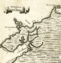 | Details | Popple, Henry | 1742 |
| Antique plan of the Harbor of Portobelo Panama |
|
Popple, Henry |
|
| 1742 |
| LOC:0 |
| $0.00 | Popple--Henry | Antique-plan-of-the-Harbor-of-Portobelo-Panama | SOLD
<br></br>
Scarce antique copper-plate engraved harbor plan of Portobelo, <b>Panama</b> (Portobello) after Henry Popple (1733). Popple's chart predates the later charts of Bellin and Bowen who based their geography on Durrell.
<br></br>
<b>Portobelo</b> was founded in March 1597 as "San Felipe de Portobelo". A military compound, Portobelo belonged to a larger defensive system, including Veracruz (Mexico), Cartagena (Colombia), and Havana (Cuba), to protect the route of commercial trade between the Americas and Spain. Portobelo, where the annual late summer trade fairs were held, was one of the principal Caribbean ports and played a leading role controlling Spain's imperial trade in the Americas. <a href="http://whc.unesco.org/en/list/135 " target="_blank"> Source. </a>
<br></br>
Key features named on the map include:
<div class="indenttextblock">
<ul style="list-style-type: circle;">
<li>Castilo de St. Goronimo ( San Geronimo Fort ) </li>
<li>Castilo de Fierro ( Actually the Castillo de Hierro or Iron Castle ) </li>
<li>Castilo de la Gloria ( Fort Santiago de Gloria )</li>
<li>Rio de Cascasal (Rio Cascaja)</li>
<li>Savanilla</li>
<li>Ferrelon de Duarte</li>
<li>Ferrelon Negro</li>
</ul>
</div>
This antique map was originally published by Covens and Mortier in 1742 in "Les Principales Forteresses Ports etc. de L'Amerique Septentrionale" a sheet containing harbor and island maps and plans of the Americas. This map is a fragment trimmed from the larger sheet.
<br></br>
That sheet of 18 maps and plans of islands and harbors was publihed by Covens and Mortier to replace Popple's original large map of 20 sheets with a more manageable six-sheet version. Popple's original map was titled: "A Map of the British Empire in America with the French, Spanish and the Dutch Settlements adjacent thereto". With depth soundings, anchorages, and navigation hazards. Notation by engraver at bottom right: I.K. f. |
| 1112 |  | Details | Royal Geographical Society of London | 1832 |
| Western Australia from the latest documents received in the Colonial Office, 1832 |
|
Royal Geographical Society of London |
|
| 1832 |
| LOC:0 |
| $0.00 | Royal-Geographical-Society-of-London | Western-Australia-from-the-latest-documents-received-in-the-Colonial-Office--1832 | SOLD<br></br>
This antique map of Western Australia is the earliest available map to show the new state of Western Australia, renamed from the "Swan River Colony" in 1832. The map shows the Swan River estuary, the topography of the southwestern coastline, and features the exploration tracks of the Surveyor General (J.S. Roe), R. Dale, Capt. Bannister, Lieut. Preston, Capt. A. Collie and Capt. Currie, members of the Swan River colony whose efforts assisted in the founding of the towns of Perth and Fremantle.
<br></br>
Key features include the port city of Albany on King George's sound, founded in 1826; Rottnest Island and Garden Island off the west coast near Freemantle; Port Vasse, Cape Naturaliste, and Port Leschenault all near Geographe Bay named by French explorer Nicolas Baudin in 1801.
<br></br>
The first European settlement of Western Australia occurred following the landing by Major Edmund Lockyer in 1826. In January 1827 Lockyer took possession of the western third of the continent for the British Crown. This was followed by the establishment of the Swan River Colony in 1829, including the site of the present-day capital, Perth. In 1832 the Swan River Colony was officially renamed "Western Australia".
<br></br>
The map accompanied an article "Recent Information from Australia" by T.L. Mitchell and A.C. [A. Cunningham] V2 of the Journal of the Royal Geographical Society by John Murray, Albemarle St., September. 1832. |
| 1138 |  | Details | U.S. Coast and Geodetic Survey | 1850 |
| Antique Rolled Chart of Hyannis Harbor, Massachusetts |
|
U.S. Coast and Geodetic Survey |
|
| 1850 |
| LOC:200 |
| $0.00 | U-S--Coast-and-Geodetic-Survey | Antique-Rolled-Chart-of-Hyannis-Harbor--Massachusetts | SOLD
<br></br>
Fine and quite scarce antique chart of the Harbor of <b>Hyannis, Massachusetts</b> published in 1850 by the U.S. Coast Survey on heavy paper. Contains a list of dangers, a tide table, sailing directions, and two long elevation views of the East and West entrances to Hyannis Harbor as seen from sea. Key features include: Bishop and Clerks Rocks, Point Gammon, Gazette Rock, Gallatin Rocks, Senator Shoal, and Harbor Bluff. With numerous depth soundings and fine topographical detail on the coastal margins. Electrotype copy no. 2 by Mathiot.
<br></br>
Hyannis is the largest of seven villages comprising the town of Barnstable on <b>Cape Cod</b>. The town is best known as the presidential retreat for the Kennedy clan who spent any available downtime at the family compound in Hyannis Port.
<br></br>
This is a scarce, separately issued, rolled nautical chart of Hyannis, MA. on heavy paper, not the more common folded version on thin, trimmed paper that was issued with other charts in an annual report to Congress from the Coast Survey.
<br></br>
Under magnification fine detail is visible assuring the buyer of it's origin as an copperplate (electrotype) engraving. This chart was printed by the U.S. Coast Survey in 1850 from an electrotype copy of the original hand-engraved copper plate, a process the U.S. Coast Survey newly adopted in mid-century and that resulted in incredibly fine detail without the work of re-engraving after every few hundred copies.
<br></br>
As a soft medium, copper plates could only withstand print runs of perhaps 200 copies before the plates wore down. To enable larger print runs, a mold of the original plate was created in wax or another soft medium. Then, using an electro-chemical process ( electrotyping ), the mold was coated with a metal layer, typically copper. Printers were then able to produce output from the new electrotype copper copy, while preserving the original. |
| 1155 |  | Details | U.S. Coast and Geodetic Survey | 1853 |
| Antique Rolled Chart of Cape Fear, North Carolina |
|
U.S. Coast and Geodetic Survey |
|
| 1853 |
| LOC:0 |
| $0.00 | U-S--Coast-and-Geodetic-Survey | Antique-Rolled-Chart-of-Cape-Fear--North-Carolina | SOLD
<br></br>
Scarce separately issued rolled antique chart (no folds) from 1853 of <b>Cape Fear, North Carolina</b> with extensive sailing directions. Coverage on this fine old engraving includes "Smith's Island", now Bald Head Island; "Smithville", now <b>Southport, NC</b>; Federal Point; Champagne Creek; Zeek's Island, Battery Island and Striking Island. Numerous small waterways are charted including Dozier's Creek, Elizabeth Creek, Dutchman Creek, and Price's Creek.
<br></br>
Depicts <b>Fort Caswell</b> on Oak Island protecting the entrance to the Cape Fear River. That pentagonal shaped structure, completed in 1836, was designed to house 61 cannon. Fort Caswell was named for Governor Richard Caswell, a North Carolina hero of the American Revolution. A lawyer and surveyor by training, Caswell represented North Carolina in the Continental Congress of 1774 and 1775. As a Patriot officer in the American Revolutionary War, Caswell led North Carolina militiamen in the Battle of Moore's Creek Bridge.
<br></br>
The chart would have facilitated navigation from the Atlantic Ocean past Cape Fear though the Main Ship Channel to the Cape Fear River and Wilmington through its use of numerous depth soundings, buoy locations, sandbars, isobaths, and bearing lines.
<br></br>
This is a scarce, separately issued, rolled nautical chart of Cape Fear, NC on heavy paper, not the more common folded version on thin, trimmed paper that was issued by the Coast Survey with other charts in an annual report to Congress. With the circular logo of the Coast Survey Office. Price when issued was 15 cents.
<br></br>
Very fine detail on the chart and lack of attribution to electrotype reproduction suggest that this chart is based on the Coast Survey's original hand-engraved copper plate . |
| 1159 |  | Details | Bellin, Jacques Nicolas | 1747 |
| Plan du Fort Anglois de Juida |
|
Bellin, Jacques Nicolas |
|
| 1747 |
| LOC:0 |
| $0.00 | Bellin--Jacques-Nicolas | Plan-du-Fort-Anglois-de-Juida | SOLD
<br><br/>
French antique engraved plan from 1747 of Fort Williams, the English <b>"slave fort"</b> at "Juida" (Ouidah or Whydah) in the Kingdom of Dahomey, now the Republic of Benin, Africa.
<br></br>
The general layout of the lower fort is instructive. The layout defines a central square- the Place d'Armes"; large apartments and at the back of the fort lie fourteen small, windowless, <b>cramped holding cells</b> labeled "Lieu ou se tiennent les Negres" for the slaves in transit.
<br></br>
Fort Williams was <b>trans-shipment point</b> for cargoes of slaves shipped from the fort to points west including the West Indies, North and South America. For defense, the fort provided three triangular bastions and one circular bastion that could mount up to nineteen cannon.
<br></br>
From Prevost's 'Histoire Generale des Voyages'. Tome IV No.11. |
| 4919 |  | Details | Helman Hurley Charvat Peacock Architects | 1999 |
| Earth Station One - Proposed Development on Florida's Space Coast |
|
Helman Hurley Charvat Peacock Architects |
|
| 1999 |
| LOC:0 |
| $0.00 | Helman-Hurley-Charvat-Peacock-Architects | Earth-Station-One---Proposed-Development-on-Florida-s-Space-Coast | SOLD<br></br>
Florida's theme and amusement parks flourish and serve as attractions for millions of out-of-state tourists: Walt Disney World, SeaWorld, Universal Studios, and many more. This 16"x11" presentation plan represents the proposal for one such theme park that failed to gain traction, Earth Station One (ES-1), a concept from the firm of Helman Hurley Charvat Peacock Architects, Inc.
<br></br>
The ES-1 idea was conceived by Winston W. "Bud" Gardner as way of exploring the potential development of a 345 acre site on Florida's Space Coast near Cape Canaveral. ES-1 was to be a tourist attraction "emphasizing the unique co-existence of nature and technology in the area."
<br></br>
As conceived in the presentation plan, the development would support a mixed use attraction with retail, food, beverage, and lodging.
<div class="indenttextblocksingle">
"Earth Station One is a fictional interplanetary gateway between worlds that allows visitors to be teleported to far away planets and civilizations. The concept focuses on the emphasis and understanding of ecological conditions of the earth through the entertaining exposure to other worlds."
</div>
<br /> Cartographic artifacts include pages containing:
<div class="indenttextblocksingle">
<ul style="list-style-type: circle;">
<li>1. A site location context map of the Space Coast area and a small detail inset map of the site location, all superimposed on a birds-eye view photographic image of the proposed site and nearby roads.</li>
<li>2. A site relationship diagram (map) showing the general location of the key conceptual features of the park including a space concourse, a time share village, parking, a conference center, an eco-adventure zone and more.</li>
<li>3. A master plan with detailed design and landscape for the attraction.</li>
<li>4. A oblique birds-eye view of the proposed development as seen facing west.</li>
</ul>
</div> |
| 6328 | 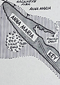 | Details | Allyn, Rube | 1960 |
| Allyns Fishing Map 2C Lower Tampa Bay |
|
Allyn, Rube |
|
| 1960 |
| LOC:61 |
| $0.00 | Allyn--Rube | Allyns-Fishing-Map-2C-Lower-Tampa-Bay | SOLD<br></br>
DESCRIPTION: Original Rube Allyn's Authentic Fishing Map (ca. 1960), for lower Tampa Bay - Manatee River, Florida. Key features include Terra Ceia Bay, Snead Island, McGill Island, Anna Maria Key, Perico Island, Palma Sola Bay, Bradenton Beach, Cortez, the Holmes Yacht Basin and the northern-most point of Sister Key.
<br></br>
Map # 2C. Ca. 1960. |
| 4883 |  | Details | Allyn, Rube | 1955 |
| 2nd ed. Fishing Map Upper Tampa Bay |
|
Allyn, Rube |
|
| 1955 |
| LOC:0 |
| $0.00 | Allyn--Rube | 2nd-ed--Fishing-Map-Upper-Tampa-Bay | SOLD
<br></br>
Scarce presumed <b>second edition</b> [1] of Rube Allyn's Authentic Fishing Map (ca. 1955), for upper Tampa Bay, Florida. Changes made on the 2nd edition not on the 1st edition include:
<div class="indenttextblocksingle">
<ul style="list-style-type: circle;">
<li>A "nice beach" and a new (dredged?) channel in Tampa Bay, both in the vicinity of Sky Harbor Airport</li>
<li>Several new additions to the Gandy Blvd. west peninsula including two new boat launches and a TV tower.</li>
<li>Reclassification of spoil banks as Treasure Island and Lookout Island.</li>
</ul>
</div>
The changes on this second edition are easily identifiable from the different font used to the new / changed items. The newer changes appear to have been made by pasting typewritten location names to the 1st edition master copy before reproduction.
<br></br>
When multiple editions of Allyn's fishing map exist for the same area, as in this case, they may provide a good source information about the effects of development and changes over time to the aquatic environment and to fish populations. Allyn's chart # 1C.
<br></br>
[1] Rube Allyn's Authentic Fishing Map Upper Tampa Bay. 1st ed. Touchton Map Library. Tampa Bay History Center. 2016.010.003. |
| 6829 | 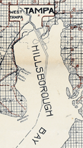 | Details | Bettis, R. F. | 1909 |
| Large engineers map of Hillsborough and Pinellas Counties Florida |
|
Bettis, R. F. |
|
| 1909 |
| LOC: |
| $0.00 | Bettis--R--F- | Large-engineers-map-of-Hillsborough-and-Pinellas-Counties-Florida | SOLD
<br><br>Large, very rare lithographed map of Hillsborough County and Pinellas County, Florida including the coastal margins and islands along the Gulf of Mexico. The map was compiled and copyrighted November, 1909 by engineer R. F. Bettis. Drawn by Percy Rigsbee and Guy Platt Johnson. Scale 1" = 1 mile.
<br><br>
<div id="image-container" align="center">
<a title="Reference to Jules Verne from Bettis' 1909 map of Hillsborough County, Florida"></a>
<img id="6829" src="/ZoomifyImages/SC_6829/SC_6829_JulesVerne.jpg" alt="" width="340"/>
<div class="title">Earliest Florida map to reference Jules Verne's trip to the moon?</div>
</div>
<br>
This is a large-format map (21" x 32"), covering a larger surface area, but similar in concept and execution to several smaller examples in the Touchton Map Library (14" x 14"). This fine example extends westward to range 14 and includes not only Hillsborough County but also Pinellas County and St. Petersburg, where the Touchton examples extend westward only to range 17 east and lacks Pinellas County.
<br><br>
No example is found in WorldCat.
<br><br>
Includes St. Joseph Sound, Hog Island, Sand Key, Clearwater Bay, Long Key, St. Petersburg, Hillsborough Bay, St. Joseph Sound, Boca Ciega Bay, and all of Tampa Bay. Shows steamship routes and routes for Long's Boat Line from the Port of Tampa to St. Petersburg and to Green Springs.
<br><br>
An inset advertisement for Bettis at bottom left corners states:
<div class="indenttextblocksingle">
"My business is compile maps- survey and subdivide lands. Send me your land number and I will tell you its character. I neither buy nor sell land. Reference any efficient business man or bank in Tampa. R. F. Bettis, Engineer, Tampa"
</div> |
| 2503 |  | Details | Plant Steamship Line | 1895 |
| Plant Steamship Line (Tampa) brochure with route map |
|
Plant Steamship Line |
|
| 1895 |
| LOC:0 |
| $0.00 | Plant-Steamship-Line | Plant-Steamship-Line-(Tampa)-brochure-with-route-map | SOLD<br></br>
Late 19th century brochure for the Plant System of railroads and steamboats with its terminus in Tampa, Florida. Henry Bradley Plant, began his early career as deckhand and mate on a steamboat out of New York City. Late a railroad magnate, hotelier, businessman, and founder of the Plant System, Plant brought the railroad to Tampa, Florida in 1884. Plant’s railroad connected downtown Tampa to the rest of the east coast and to Port Tampa, where people could board a Plant steamship to Havana, Jamaica, New Orleans, New York, Bermuda, or other destinations.
<br></br>
Verso with a large advertisement for for Plant's flagship Tampa Bay Hotel. Map is set within the larger brochure which unfolds to a full 32"W x 16"H. |
| 1172 |  | Details | Gentlemans Magazine | 1779 |
| Revolutionary War era chart of Delaware Bay and River |
|
Gentlemans Magazine |
|
| 1779 |
| LOC:0 |
| $0.00 | Gentlemans-Magazine | Revolutionary-War-era-chart-of-Delaware-Bay-and-River | SOLD
<br></br>
Small antique chart of Delaware Bay and River. Derived from the larger chart of Delaware Bay and River up to Philadelphia, Pennsylvania by Joshua Fisher (1707-1783) in 1776. Shows the location of a Pilot's Town near Cape Henlopen. Identifies the ship channels from Cape May and Cape James up the Delaware River past Salem Mass., Wilmington, Newcastle, and Chester to the small town of Philadelphia, Pennsylvania. Key features include Mud Island, the Schuylkill River, Stony Point, Egg Island Flats, Fortescue's Island, Cold Spring Inlet, Turtle Gut Inlet, and Rehoboth Bay. The mouths of numerous creeks are named including Clark's Ditch, Motherkiln Creek, and Nantuxet Creek.
<br></br>
Published in the "Gentleman's Magazine", July 1779, volume 49, page 369.
<br></br>
Joshua Fisher's early chart of Delaware Bay from the Sea-Coast to Reedy-Island was published during the French & Indian War, and was immediately suppressed by the Assembly, fearing that its falling into enemy hands would make Philadelphia a target of the French navy. Fisher's chart showed the lower part of the bay and was intended to be used as a navigational aid for ships sailing toward Philadelphia. In 1775, Fisher produced an expanded chart that showed the bay and the Delaware River to just beyond Philadelphia. This was the most important map of the bay and river in the 18th century. |
| 1175 | 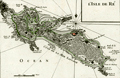 | Details | Le Rouge, George | 1756 |
| Antique map of Isle de Re, France |
|
Le Rouge, George |
|
| 1756 |
| LOC:0 |
| $0.00 | Le-Rouge--George | Antique-map-of-Isle-de-Re--France | SOLD
<br></br>
Fine antique map of the Île de Re in the Charente-Maritime department of western France. Much emphasis on the numerous rocky outcrops, and points that endangered shipping. Contains detailed depictions of the redoubts and forts protecting the island's beaches. Features include Redoutte de Sablanceau, Fort de la Pree, la Flotte, and the walled village of Saint-Martin. The island's south coast is ominously labeled "Cote de la Mer Sauvage". From George le Rouge's "Atlas Nouveau Portatif à l'usage des militaires et du voyages."
<br></br>
The main port of the Île de Ré, Saint-Martin, was fortified by Vauban in 1681 as a one of many forts and citadels built to protect the military harbour of Rochefort. The island was later used as a depot for convicts on their way to the penal settlements of New Caledonia and French Guiana. The old city of Saint-Martin, within the walls of the citadel, was added in 2008 to the World Heritage Site list, along with 11 other fortifications of Vauban across France.
<br></br>
George Le Rouge was a Paris-based engineer and surveyor who had a shop on the Rue Des Grands Augustins, Paris. Le Rouge's tireless work earned him the title "Geographe du Roi". Number 48. |
| 6469 | 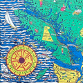 | Details | Page, Peter Hugh | 1936 |
| Fine pictorial maps of British Columbia for Home Gas |
|
Page, Peter Hugh |
|
| 1936 |
| LOC:150 |
| $0.00 | Page--Peter-Hugh | Fine-pictorial-maps-of-British-Columbia-for-Home-Gas | SOLD<br><br>Unrecorded, extraordinary, even spectacular pictorial map of British Columbia for Home Gas. The map was produced by artist Peter Hugh Page toward the end of the Great Depression (1936).
<br><br>
<div class="indenttextblock"><strong>
"Home Gas here offers you a map sensational!! <br>British Columbia is the province shewn. <br>And when you're feeling thoroughly vacational. <br>Pay us a visit and treat the place like home."</strong>
</div><br>
<div id="0" align="center">
<a title="Peter Hugh Page B.C. map details"></a>
<img id="1" src="/ZoomifyImages/SC_6469/SC_6469_details.jpg" alt="Hugh Page B.C. pictorial map details." width="330"/> <br><small>Pictorial B.C. road map details by Peter Hugh Page</small>
</div><br>
Folding brochure (max. 26" x 20") with two similarly attractive smaller pictorial maps (each map 13" x 10") on the verso for Victoria, B.C. and for Vancouver, B.C.
<br><br>
<div id="0" align="center">
<a title="Peter Hugh Page map of Vancouver"></a>
<img id="1" src="/ZoomifyImages/SC_6469/SC_6469_Vancouver.jpg" alt="Hugh Page pictorial map of Vancouver from 1836." width="300"/> <br><small>Pictorial road map of Vancouver, B.C. by Peter Hugh Page</small>
</div><br>
<div id="0" align="center">
<a title="Hugh Page map of Victoria B.C."></a>
<img id="1" src="/ZoomifyImages/SC_6469/SC_6469_Victoria.jpg" alt="Hugh Page pictorial map of Victoria from 1936." width="300"/> <br><small>Pictorial road map of Victoria, B.C. by Peter Hugh Page</small>
</div><br> |
| 1200 | 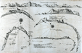 | Details | Thevenot, Melchisedech | 1663 |
| Rare chart of Table Bay and the Bay of Saldagne |
|
Thevenot, Melchisedech |
|
| 1663 |
| LOC:0 |
| $0.00 | Thevenot--Melchisedech | Rare-chart-of-Table-Bay-and-the-Bay-of-Saldagne | SOLD<br></br>
Very scarce mid 17th-century antique copper engraving including 6 coastal elevation views of anchorages and bays favored by Dutch and French vessels on their way to Asia.
<br></br>
These views include:<br></br>
Two views of the coast of Sierra Leone, Africa "Tagrin" opposite Freetown-
<div class="indenttextblock">
<ul style="list-style-type: circle;">
<li> "Carte de Serlionne, ou Tagrin a vue lieue et demie d'elle"</li>
<li>Quatriesme ance de la coste ancreage ordinaire de François. </li>
</ul>
</div>
A view of the coast of Aceh on the northern coast of Sumatra and a further unidentified anchorage "Baye de l'Encau".
<div class="indenttextblock">
<ul style="list-style-type: circle;">
<li>Poulo clauis</li>
</ul>
</div>
A view of the African coast including the Bay of Saldagne and Table Bay.
<div class="indenttextblock">
<ul style="list-style-type: circle;">
<li>Figure de la Terre de Saldagne</li>
</ul>
</div>
A coastal view at Tiku in West Sumatra. <div class="indenttextblock">
<ul style="list-style-type: circle;">
<li>Figure de la Rade de Ticou en l-isle de Sumatra <br />
(Identifies the two mountains of Pagaman and Priaman with Ticou nestled below. Interesting descriptions of 7 points on the view include "Illets a pigouins de table bay"- An island with penguins.)</li>
</ul>
</div>
This creaky old chart truly reflects its likely origins in the commercial world, perhaps first published privately by the VOC. The charts are characterized by a scarcely used 360 degree birds-eye oblique coastal view.
<br></br>
Melchisédech (or Melchisédec) Thévenot (c. 1620 – 1692) was a French author, scientist, traveler, and cartographer. Thévenot was the inventor of the spirit level and is also famous for his popular 1696 book- The Art of Swimming.
<br></br>
Many of Thévenot's maps were published in his Relations de Divers Voyages Curieux (Paris, 1663), a collection of translations of voyages of discovery. |
| 1249 | 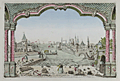 | Details | Anonymous | 1750 |
| Jeddah, Saudi Arabia antique vue d'optique |
|
Anonymous |
|
| 1750 |
| LOC:0 |
| $0.00 | Anonymous | Jeddah--Saudi-Arabia-antique-vue-d-optique | SOLD
<br></br>
Antique optical print or vue d'optique of Jeddah, Saudi Arabia the port for Mecca or Lamekk (la Mecque) ca 1750. This attractive engraved print is one of the earliest available views of Jeddah, an important trading port city on the Red Sea coast of Saudi Arabia.
<br></br>
With a population currently at 4.2 million people, Jeddah is the largest city in Makkah Province, the largest sea port on the Red Sea, and the second-largest city in Saudi Arabia. |
| 1237 | 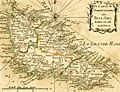 | Details | Bonne, Rigobert | 1778 |
| Antique miniature nautical chart of Belle Ile, France |
|
Bonne, Rigobert |
|
| 1778 |
| LOC:0 |
| $0.00 | Bonne--Rigobert | Antique-miniature-nautical-chart-of-Belle-Ile--France | SOLD
<br></br>
Fine antique miniature nautical chart of <b>Belle Île</b> (Belle-Isle), France in the English Channel off the French coast of Brittany. Coverage on this attractive miniature sea chart includes geographical and topographical detail within the four communes of Sauzon, Bangor, Le Palais, and Locmaria (Lomaria).
<br></br>
Despite its small size this scarce copper-plate engraving contains much of what is found on larger charts- numerous headlands are noted; depth soundings are numerous; hazards and sand banks are clearly identified; and rhumb lines are provided with a compass adjustment for magnetic variation.
<br></br>
From Rigobert Bonne's miniature nautical atlas "Atlas maritime ou Cartes réduites de toutes les Côtes de France avec des cartes particulières des isles voisines les plus considérables, suivies des plans des principales villes maritimes de ce royaume." One of 12 charts published in the Atlas Maritime which are considered to among the very few miniature nautical charts published during the golden age of miniature maps . Published by Lattre from Paris. With the royal privilege. No. 11.
<br></br>
Rigobert Bonne (1727-1794) was the successor to Jacques Nicolas Bellin as Royal Cartographer to France in the office of the Hydrographer at the Depôt de la Marine. Bonne first came to prominence when he published a number of charts in the Atlas Maritime in 1762. He is better known for later publications, including the Atlas Encyclopedique, which he collaborated on with Nicholas Desmarest, as well as the maps for Raynal's Atlas de Toutes Les Parties Connues du Globe Terrestre, published in 1780. |
| 1262 |  | Details | Depot de la Marine | 1868 |
| Antique sea chart of the Falkland Islands or Islas Malvinas |
|
Depot de la Marine |
|
| 1868 |
| LOC:0 |
| $0.00 | Depot-de-la-Marine | Antique-sea-chart-of-the-Falkland-Islands-or-Islas-Malvinas | SOLD<br></br>
Fine and scarce antique French nautical chart of the <b>Falkland Islands</b> after earlier surveys by Fitz-Roy, Robinson, and Sullivan of the British Admiralty. This large mid nineteenth-century navigation chart makes a very attractive presentation with its clean and bright appearance.
<br></br>
Originally published in 1850, this edition contains corrections to 1868. Contains inset elevation views of the Falklands coast. |
| 1267 | 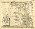 | Details | Bonne, Rigobert | 1778 |
| Isle de Re and Isle d'Oleron, France |
|
Bonne, Rigobert |
|
| 1778 |
| LOC:0 |
| $0.00 | Bonne--Rigobert | Isle-de-Re-and-Isle-d-Oleron--France | SOLD
<br></br>
Antique miniature nautical chart of the Atlantic west coast of France near Rochefort and la Rochelle. Includes the <b>Isle de Re</b> and the <b>Isle d'Oleron</b>. The Pertuis d'Antioche, a strait on the western coast of France lies between the two islands.
<br></br>
From Rigobert Bonne's miniature nautical atlas "Atlas maritime ou Cartes réduites de toutes les Côtes de France avec des cartes particulières des isles voisines les plus considérables, suivies des plans des principales villes maritimes de ce royaume." One of 12 charts published in the Atlas Maritime which are considered to among the very few miniature nautical charts published during the golden age of miniature maps .
<br></br>
Published by Lattre from Paris. With the royal privilege. No. 12.
<br></br>
This scarce miniature copper-plate engraving contains much of the same information found on larger charts- rhumb lines; an adjustment for magnetic variation; numerous depth soundings; headlands, capes, navigation hazards and sand banks that are clearly identified.
<br></br>
Rigobert Bonne (1727-1794) was the successor to Jacques Nicolas Bellin as Royal Cartographer to France in the office of the Hydrographer at the Depôt de la Marine. Bonne first came to prominence when he published a number of charts in the Atlas Maritime in 1762. He is better known for later publications, including the Atlas Encyclopedique, which he collaborated on with Nicholas Desmarest, as well as the maps he produced for Raynal's Atlas de Toutes Les Parties Connues du Globe Terrestre, which was published in 1780. |
| 5204 | 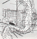 | Details | British Admiralty Hydrographical Office | 1930 |
| Nautical chart of St. Andrew Sound to St. John River, Florida |
|
British Admiralty Hydrographical Office |
|
| 1930 |
| LOC:61 |
| $0.00 | British-Admiralty-Hydrographical-Office | Nautical-chart-of-St--Andrew-Sound-to-St--John-River--Florida | SOLD
<br><br>
This scarce original British Admiralty sea chart of the Florida east coast retains the look and feel of a fine late 19th-century chart. Chart coverage stretches southward from St. Andrew Sound, near Jekyll Island and Cumberland Island Georgia, to the St. John River, near Jacksonville, Florida. Includes the Cumberland Sound, St. Mary River, Amelia Island, Nassau River, and Jacksonville.
<br></br>
This fine nautical chart of the Florida coast was published at the Admiralty April 22, 1879 under the superintendence of Captain F.J. Evans. Sold by J.D. Potter. Engraved by Edward Weller. Chart number 853. Edition of 1916. Last minor correction in 1930. |
| 5294 | 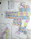 | Details | Sanborn Map Company | 1913 |
| Insurance Atlas for Jacksonville Florida Vol. 2 |
|
Sanborn Map Company |
|
| 1913 |
| LOC: |
| $0.00 | Sanborn-Map-Company | Insurance-Atlas-for-Jacksonville-Florida-Vol--2 | SOLD
<br></br>
Sanborn's Insurance Atlas Volume two for Jacksonville, Florida with 1913 copyright date and pasted updates from 1920's, 1940's - 1950's. The manuscript correction record shows 12 sets of corrections between April 1949 and April 1960, but earlier updates appear to have been made. A very heavy atlas published by Sanborn Map Company, Broadway New York.
<br></br>
Volume two coverage includes downtown north Jacksonville with almost all important river frontage along the St. John's River south of Long Branch Creek. A quick sampling of features includes Jacksonville Memorial Stadium- the GATOR BOWL, City Hall, Jacksonville Gas Company, Sinclair Refining Company storage plant, Merrill-Stevens Dry Dock and Repair.
<br></br>
Pages have not been counted or checked for completeness but the sheets are generally in good condition with linen binder's tabs still holding all tightly in place in the metal binder. Built to last! Many sheets are original to 1913 (see bottom right corner) with pasted updates; some sheets have been replaced over time.
<br></br>
Numerous (hundreds) of pasted updates over five decades make this an invaluable cartographic researcher's reference source for Jacksonville, Florida in the first half of the 20th century. In some cases entire new updated sheets are pasted over old sheets. It is possible, in theory, to perform an "archaeological" unpasting all the way down to the original base maps from 1913. For example sheets 171 and 172 show pasted overlays of an new East Expressway laid over the original 1913 base maps, potentially providing a clear picture of urban renewal in action. |
| 1322 | 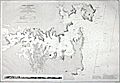 | Details | Depot de la Marine | 1869 |
| Rare Antique Nautical Chart of Port Jackson, Australia (Sydney) |
|
Depot de la Marine |
|
| 1869 |
| LOC:0 |
| $0.00 | Depot-de-la-Marine | Rare-Antique-Nautical-Chart-of-Port-Jackson--Australia-(Sydney) | SOLD <br></br>Rare and early large Gold-Rush era nautical chart of Port Jackson (Sydney, Australia) published by France's Depot de la Marine in 1861 (last corrections in 1869) based on the 1857 British Admiralty survey made under the command of Captain Denham. Large early nautical charts of Sydney / Port Jackson are very scarce. No record of a sale of this large chart (British or French) is found in the Antique Map Price Record. Includes a elevation view of Port Jackson as seen from offshore.
<br></br>
In his analysis of the accuracy of early charts of Sydney Harbor, Mulhearn noted:
<div class="indenttextblock">"The 1857 British Admiralty survey was carried out by Hutchison under the direction of a Captain Henry Mangles Denham F.R.S. who had been tasked with surveying parts of the south-west Pacific in HMS Herald. The chart of this survey, engraved in 1859, had the high soundings density one would expect with a modern hydrographic survey and it clearly marks a significant departure from earlier mapping efforts of Sydney Harbour. The area covered was from 1.5 miles (2.4 km) seawards of the harbour entrance west to Five Dock Bay. However sounding densities were relatively sparse west of Cockatoo Island, where a new dry dock, Fitzroy Dry Dock, was opened in late 1857. The survey and initial chart production took approximately two months." <a href="http://www.e-perimetron.org/Vol_9_2/Mulhearn.pdf " target="_blank">Online.</a></div>
<br></br>
The total population of Sydney and its suburbs in 1861 is estimated at 95,000 persons. |
| 4753 |  | Details | Depot de la Marine | 1837 |
| Early French-surveyed Chart of Sydney, Australia |
|
Depot de la Marine |
|
| 1837 |
| LOC:0 |
| $0.00 | Depot-de-la-Marine | Early-French-surveyed-Chart-of-Sydney--Australia | SOLD<br></br>
Fine first edition French Chart of the Harbor at <b>Sydney, Australia</b> (Port Jackson) based on surveys carried out by French Captain Bougainville . Baron Hyacinthe de Bougainville was the son of the famous French Pacific navigator Louis-Antoine de Bougainville. An officer of the French navy, in 1825 he commanded an expedition that took the ships Thetis and Esperance to Macau, Manila and New South Wales.
<br></br>
This French survey, by Baron de Bougainville, was the fourth state-sponsored delineation of the topography and hydrography of Port Jackson. Oval seller's stamp "Cercle Maritime. Brest".
<br></br>
The first depiction was after a compass survey conducted over just nine days by John Hunter and William Bradley, published by George Raper in 1791. During an expedition to the south-west coast of Australia, de Freycinet (1802) updated Hunter's chart with additional soundings from his own survey of Port Jackson. John Septimus Roe led the third survey in 1822 followed with this chart published in 1828 by French explorer Hyacinthe de Bougainville.
<br></br>
An original, treasured gift for anyone with interests in boating or sailing near Sydney. At top, a fine, engraved vue or "View of the Entrance to the Harbor at Port Jackson." Dated 1828 but 1837 with its publication as Plate 52 from:
<div class="indenttextblock">Journal de la navigation autour du globe de la fregate la Thetis et de la corvette l'Esperance pendant les annees 1824, 1825 et 1826 /Publie par ... M. le Baron de Bougainville. Paris : Arthus Bertrand, 1837. Grave par Ambroise Tardieu d'apres les dessins de M.E.B. de la Touanne, Lieutenant de Vaisseau. Ecrit par Besancon. Prix un franc.
</div></BR>
(Fr. Rare et grande carte marine de Port Jackson (Sydney, Australie) publiée par le Depot de la Marine de France.) Port Jackson, aussi appele Sydney Harbour, est le port naturel de Sydney en Australie.
<br></br>
Top left-hand corner: Voyage de la Thetis et de l'Esperance. |
| 6801 |  | Details | British Admiralty Hydrographical Office | 1933 |
| Original Nautical Chart Baja Cabo San Lucas |
|
British Admiralty Hydrographical Office |
|
| 1933 |
| LOC: |
| $0.00 | British-Admiralty-Hydrographical-Office | Original-Nautical-Chart-Baja-Cabo-San-Lucas | SOLD
<br><br>
Fine British Admiralty nautical chart of lower or Baja California published by the Admiralty on July 25, 1903 (last correction in 1933). Shows the Baja California Peninsula south of Ameljas Bay (24 degrees 38 minutes N latitude). The southernmost 15 miles of the Baja Peninsula with Cape Falso, San Lucas Bay, and Cabo San Lucas are shown in an inset or "compartment" at bottom right. Chart number 3327.
<br><br>
Numerous soundings in fathoms. Fine topographic detail for the coastal interior of the peninsula. |
| 1360 | 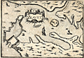 | Details | Tassin, Christophe Nicholas | 1636 |
| Antique map of the Port of Blavet, France |
|
Tassin, Christophe Nicholas |
|
| 1636 |
| LOC:0 |
| $0.00 | Tassin--Christophe-Nicholas | Antique-map-of-the-Port-of-Blavet--France | SOLD
<br></br>
Antique copper-plate engraved map of the Port of Blavet by C.N. Tassin. The map covers a small area in the southern Brittany region of France, near Lorient at the mouth of the Canal du Blavet. One of the earlest available maps to feature a plan of the Citadelle de Port-Louis, built in the 16th century. Alain Mallet's engraving titled "Plan de la Ville et du Fort de Blavet" is amost an exact copy of Tassin's earlier work.
<br></br>
Archivally matted. With mat measures 12" W x 10" H.
<br></br>
Published in the small-sized atlas "Les Plans et profils de toutes les principales villes et lieux considerables de France" by Christophe Nicholas Tassin (d. 1660) . Tassin's background was as a military engineer, and he is best known for his nautical atlas of 30 sheets, dedicated to Richelieu, documenting France's coastline. Tassin's work contains topographic maps, often of militarily important sites, either sketched on site, composed from firsthand drawings by military engineers, or sometimes borrowed from other mapmakers. |
| 1367 | 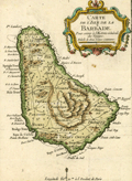 | Details | Bellin, Jacques Nicolas | 1754 |
| Small antique map of Barbados in the Caribbean |
|
Bellin, Jacques Nicolas |
|
| 1754 |
| LOC:0 |
| $0.00 | Bellin--Jacques-Nicolas | Small-antique-map-of-Barbados-in-the-Caribbean | SOLD <br></br>
Small antique map of Barbados by J.N. Bellin. This hand-colored map shows the island of Barbados, a Caribbean island in the Lesser Antilles. Barbados was an English colony at the time this little map was printed. Depicts the capital city of Barbados- Bridgetown as well as many other towns, island parishes and attractive interior topographic detail.
<br></br>
Published in the 15-volume "Histoire Generale des Voyages" of Antoine François Prévost. Published from Paris in 1754. Tome 15. Page 567. |
| 1451 | 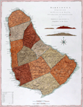 | Details | Jefferys, Thomas | 1775 |
| Mayo Jefferys Sayers Chart of Barbados West-India Atlas |
|
Jefferys, Thomas |
|
| 1775 |
| LOC:0 |
| $0.00 | Jefferys--Thomas | Mayo-Jefferys-Sayers-Chart-of-Barbados-West-India-Atlas | SOLD<BR></BR>
Fine antique British chart of the Island of Barbados in the Caribbean Sea. With two inset coastal elevation views of Barbados as seen from W.N.W. at a distance of 9 leagues (27 mi.) offshore and 7 leagues (21 mi.) offshore. Barbados is an island country in the Lesser Antilles, in the Caribbean region of North America. After a survey by William Mayo. Sheet X.
<br></br>
The chart is from the scarce <b>first issue of The West-India Atlas, 1775 by Sayer</b>, the other issues being 1781, 1787, 1794, 1796, 1807, and 1818 published by Sayer and then later by Laurie and Whittle. <a href="https://www.davidrumsey.com/home" target="_blank">(Online).</a>
<br></br>
"The West-India Atlas: or, A Compendious Description of the West-Indies: illustrated with Forty Correct Charts and Maps, taken from Actual Surveys. Together with An Historical Account of the Several Countries and Islands which compose that part of the world. Their Discovery, Situation, Extent, Boundaries, Product, Trade, Inhabitants, Strength, Government, Religion, &c."
<br></br>
Authors: William Mayo, Thomas Jefferys.
Publishers: Robert Sayer.
Jefferys died in 1771; Sayer acquired Jefferys' materials in preparation for this atlas, and published the atlas posthumously under his name.
Publisher's attribution reads: London, Printed for Robert Sayer, Map and Printseller Number 53 in Fleet Street as the act directs 20 February 1775. |
| 5102 |  | Details | Anonymous | 1910 |
| Key West, Florida Bird's-eye View from Lighthouse Showing the Harbor. |
|
Anonymous |
|
| 1910 |
| LOC:0 |
| $0.00 | Anonymous | Key-West--Florida-Bird-s-eye-View-from-Lighthouse-Showing-the-Harbor- | SOLD
<br></br>
Scarce, framed color panoramic photograph ca. 1910 "Key West, Florida Bird's-eye View from Lighthouse, Showing the Harbor." Shows Key West homes before they were electrified. A horse and buggy are shown driving down Whitehead Street. Not examined out of frame but believed to be a scarce, 3-panel folding postal card, never folded.
<br></br>
In period bubble-glass and wood frame with original black backing and seller's label for Babberger Studio, Canon City, Colorado. Babberger's photography studio in Colorado burned on December 14, 1915, destroying all the contents [1]. William Babberger was a noted bee keeper whose apiary was featured in the January 1913 edition of the American Bee Journal.
<br></br>
Not found for sale online.
<br></br>
[1] Source: Online. Bulletin of Photography, Volume 17. p. 793. |
| 4893 | 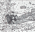 | Details | British Admiralty Hydrographical Office | 1920 |
| Antique Chart of Key West Harbor, Florida |
|
British Admiralty Hydrographical Office |
|
| 1920 |
| LOC:0 |
| $0.00 | British-Admiralty-Hydrographical-Office | Antique-Chart-of-Key-West-Harbor--Florida | SOLD
<br></br>
Fine engraved British Admiralty navigation chart of the Key West Florida area, from 1920. With Hawk Channel, Key West Harbor, Man of War Harbor, Rock Cay Channel, the Florida Strait and much more extending to the west past Boca Grande Cay, and Man Cay. Edition of February 1916 with last corrections in September 1920. A large, scarce chart of Key West before the Overseas Highway and the Florida land boom of the 1920's changed the face of the Sunshine State.
<br></br>
Shows the Overseas Railroad ("Flagler's Folly") which operated from 1912 to 1935.
<br></br>
Inset charts of North West Channel Bar and Key West Harbor. Inset table of tidal information for Sand Key Bar, Fort Taylor, and the Northwest Channel Bar.
<br></br>
First published at the Admiralty, 19 August 1907 under the superintendence of Rear Admiral A. Mostyn Field, F.R.S. Hydrographer. Sold by J.D. Potter. Engraved by Davies & Company. Chart number 2881. |
| 1454 | 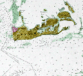 | Details | U.S. Coast and Geodetic Survey | 1852 |
| Antique Chart of Key West, Florida |
|
U.S. Coast and Geodetic Survey |
|
| 1852 |
| LOC:0 |
| $0.00 | U-S--Coast-and-Geodetic-Survey | Antique-Chart-of-Key-West--Florida | SOLD
<br></br>
Very cool hydrographic survey chart of the vicinity of Key West, Florida long before any bridges. This antique chart, based on a trigonometrical survey, was released by the U.S. Coast Survey in 1852. Includes a tide table and very interesting cross-sectional views of elevation of coral heads, (water depth) recorded across several lines on the chart at Sand Key and the reefs at the East Channel. Other noted points include Fleming's Key, Francfort Bank, East Crawfish Key, West Crawfish Key, Mangrove Keys, and Raccoon Key.
<br></br>
A trigonometrical survey of a portion of the earth's surface is conducted by measuring a single base distance, and connecting it with various points in the tract surveyed by a series of triangles, the angles of which are carefully measured. Relative positions and distances of all parts are computed from these data.
<br></br>
With extensive sailing directions for several key approaches to Key West including: the East Channel, the Main Ship Channel ("At Night. Bring the North Stat to range after Key West Light House and stand for it when Sand Key (or Sound Key Light Boast bears S.W. by W. S. 62 degrees W) a vessel drawing over 16 feet of water had better anchor and wait for a pilot".); Rock Key Channel; Sand Key Channel; West Channel; and North West Channel. Second Edition. |
| 1458 | 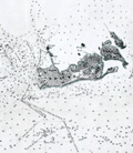 | Details | U.S. Coast and Geodetic Survey | 1851 |
| Antique Preliminary Nautical Chart of Key West, Florida |
|
U.S. Coast and Geodetic Survey |
|
| 1851 |
| LOC:0 |
| $0.00 | U-S--Coast-and-Geodetic-Survey | Antique-Preliminary-Nautical-Chart-of-Key-West--Florida | SOLD
<br></br>
See another copy of this chart in stock now.
<br></br>
Detailed first-edition original antique hydrographic survey chart of the vicinity of Key West, Florida. |
| 3645 | 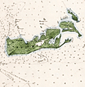 | Details | U.S. Coast and Geodetic Survey | 1851 |
| First Edition Antique Nautical Chart of Key West, Florida |
|
U.S. Coast and Geodetic Survey |
|
| 1851 |
| LOC: |
| $0.00 | U-S--Coast-and-Geodetic-Survey | First-Edition-Antique-Nautical-Chart-of-Key-West--Florida | SOLD
<br></br>
Detailed first-edition original antique hydrographic survey chart of the vicinity of Key West, Florida. Includes extensive sailing directions with landmarks, courses, bearings and instructions for entering Key West via several channels. This antique chart, based on a thorough trigonometrical survey, was released by the U.S. Coast Survey in 1851. Contains literally hundreds of depth soundings.
<br></br>
A trigonometrical survey of a portion of the earth's surface is conducted by measuring a single base distance, and connecting it with various points in the tract surveyed by a series of triangles, the angles of which are carefully measured. Relative positions and distances of all parts are computed from these data.
<br></br>
Includes a tide table and very interesting cross-sectional views of elevation of coral heads, (water depth) recorded across several lines on the chart at Sand Key and the reefs at the East Channel. Other noted points include Fleming's Key, Francfort Bank, East Crawfish Key, West Crawfish Key, Mangrove Keys, and Raccoon Key.
<br></br>
With extensive sailing directions for several approaches to Key West, Florida including: the East Channel, the Main Ship Channel ("At Night. Bring the North Stat to range after Key West Light House and stand for it when Sand Key (or Sound Key Light Boat bears S.W. by W. S. 62 degrees W) a vessel drawing over 16 feet of water had better anchor and wait for a pilot".); Rock Key Channel; Sand Key Channel; West Channel; and North West Channel. |
| 5084 |  | Details | Oldacre, Ann | 1949 |
| Pictorial map of Key West, Florida with pirates |
|
Oldacre, Ann |
|
| 1949 |
| LOC:11 |
| $0.00 | Oldacre--Ann | Pictorial-map-of-Key-West--Florida-with-pirates | SOLD
<br></br>
Pictorial folding map of Key West, Florida with pirates, Indians, and sailing ships in "Major and Minor Keys of the Florida Reef", a 56-page illustrated booklet (5" x8"). Fourth printing, 1949 by Riviera Publishing Company, Coral Gables, Florida. Booklet by Mary Helm Clarke.
<br></br>
Map includes the Overseas Highway from Miami to Key West and the Tamiami trail to Naples, Florida. Map attached inside rear cover. |
| 7865 | 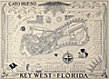 | Details | Suchy, Arthur Bartholomew | 1940 |
| Stunning Map Cayo Hueso Key West Florida Collectors Edition |
|
Suchy, Arthur Bartholomew |
|
| 1940 |
| LOC:141 |
| $0.00 | Suchy--Arthur-Bartholomew | Stunning-Map-Cayo-Hueso-Key-West-Florida-Collectors-Edition | SOLD<br><br>
Large original Arthur Suchy pictorial birds-eye map of Cayo Hueso or Key West, Florida. Printed in black ink. Designed, executed, produced and first copyrighted by Arthur Suchy ca. 1938. Purchased from Suchy's estate liquidation. Watermarked "Linweave TEXT Made in USA". Rarely have we seen a map of this age in such pristine condition.
<br><br>
Suchy identifies alphabetically and numerically over 70 locations that surround the view including:
<div class="indenttextblocksingle">
<ul style="list-style-type: circle;"></li>
<li>Cigar factories</li>
<li>P.A.A. Airport</li>
<li>Turtle crawls</li>
<li>Fish market</li>
<li>Warbler (helpful tug)</li>
<li>Pepe's coffee shop</li>
<li>Delmonico's</li>
<li>Key West radio station</li>
</ul>
</div>
Arthur Bartholomew Suchy (1901 - 1995) produced two editions of his famous map of Cayo Hueso- this, the first larger-size Collectors Edition was produced in a limited quantity of 100 copies dated to 1940. As Suchy received orders for the maps he would hand color each map before shipment.
<br><br>
The second and smaller edition was printed in red ink to 1941. [1] Includes numerous historical notes about Key West.
<br><br>
Suchy was issued a copyright for the Collectors Edition on Dec. 14, 1938.
<br><br>
[1] David Rumsey Map Collection at Stanford University Libraries |
| 4985 | 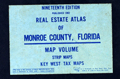 | Details | Real Estate Data Inc. | 1983 |
| Real Estate Atlas of Monroe County, Florida 19th ed. |
|
Real Estate Data Inc. |
|
| 1983 |
| LOC:0 |
| $0.00 | Real-Estate-Data-Inc- | Real-Estate-Atlas-of-Monroe-County--Florida-19th-ed- | Sold <br></br>
Monroe County, Florida real estate atlas covering the Florida Keys. 19th edition. 418 pages total with index maps and strip maps containing cadastral (land ownership) information for the Florida Keys in 1983. With map of the city of Key West (in five sheets). Map data include subdivision name, street name, lot number, owners' name, lot size and more. Plastic 4-hole binder.
<br></br>
Published by Real Estate Data, Inc. of Miami, Florida. |
| 5464 | 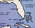 | Details | Dornbush, Adrian | 1935 |
| Depression-era pictorial map of The Coral Isle of Key West |
|
Dornbush, Adrian |
|
| 1935 |
| LOC:0 |
| $0.00 | Dornbush--Adrian | Depression-era-pictorial-map-of-The-Coral-Isle-of-Key-West | <b>SOLD</b>, but see <a href="https://www.rarecharts.com/ShowDetail/Creator/Dornbush--Adrian/Title/Depression-era-pictorial-brochure-1st-Edition-map-The-Coral-Isle-of-Key-West/5047" target="_blank">another Dornbush item</a> now in stock.
<br></br>
Two scarce maps of Key West, Florida in a visitor's guide booklet simply titled "Key West" published by the Key West Administration in 1935. The booklet is a product of the Public Works of Art Project (PWAP) during the New Deal that was succeeded by the Federal Art Project of the Works Progress Administration (WPA).
<div class="indenttextblocksingle">
"Public Works of Art Project artists from other parts of the country were brought in and put to work creating paintings, murals or public places, and other projects, such as tourist brochures and postcards." [1]
</div>
</br>
The brochure includes a fine pictorial map (9" x 6") of Key West, Florida: "The Coral Isle of Key West" by artist Adrian Dornbush, 1935. The map was engraved on a "miraculous" scale and shows key landmarks such as Duval Street, the lighthouse, the Martello Towers, and the yacht basin. |
| 7867 | 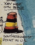 | Details | Weaver, Ron | 1987 |
| Pictorial Poster Map Key West Florida Conch Republic |
|
Weaver, Ron |
|
| 1987 |
| LOC:61 |
| $0.00 | Weaver--Ron | Pictorial-Poster-Map-Key-West-Florida-Conch-Republic | SOLD
<br><br>
Scarce and beautiful pictorial advertising poster map of Key West, Florida by Ron Weaver in 1987 - "The Conch Republic."
<br><br>
Design graphics and illustration in a distinctive free-hand style by the talented Ron Weaver. |
| 6535 |  | Details | Wright, David Harrison | 1988 |
| Pictorial Map Treasures of Key West Florida |
|
Wright, David Harrison |
|
| 1988 |
| LOC:61 |
| $0.00 | Wright--David-Harrison | Pictorial-Map-Treasures-of-Key-West-Florida | SOLD<br><br>
Pictorial advertising map of Key West ca. 1988 by David Harrison Wright- "Treasures of Key West Florida".
Combines historical facts about the island with small images for paid advertisers.
<br><br>
Copyright by Key Exposure 1223 Royal Street, Key West.<br><br>
<div id="0" align="center">
<a title="TITLE HERE"></a>
<img id="3" src="/ZoomifyImages/SC_6535/SC_6535_Detail.jpg" alt="Compass rose from a pictorial map of Key West by David Harrison Wright" width="300"/> <br><small>Fine compass rose looking north from Key West.</small>
</div><br> |
| 6536 |  | Details | Baeza, Ron | 1985 |
| Pictorial advertising map Conch Republic Key West Florida Ron Baeza |
|
Baeza, Ron |
|
| 1985 |
| LOC:61 |
| $0.00 | Baeza--Ron | Pictorial-advertising-map-Conch-Republic-Key-West-Florida-Ron-Baeza | SOLD
<br><br>
Colorful pictorial advertising map of Key West Florida by Ron Baeza from 1985 in the early formative period of the Conch Republic.
<br><br>
On April 23, 1982 Key West Mayor Dennis Wardlow and the city council declared Key West's independence in response to inconvenient US Border Patrol roadblocks searching for illegal immigrants and narcotics. Local citizens were known for many years as Conchs, and the new "independent nation" became known as the Conch Republic.
<br><br>
<div class="indenttextblocksingle">
"Key West Mayor Dennis Wardlow and several determined Key Conchs went to Federal court in Miami to seek an injunction to stop the federal blockade. When their plea was denied, the Mayor told TV reporters that the following day the Florida Keys would secede from the Union. The next day, as promised, Mayor Wardlow stood in Mallory Square and led the Conch Republic Rebellion which lasted approximately one minute and was followed by a surrender to the US Navy Admiral in Key West." [1]
<br><br>
[1] What is a Key West Conch? Conch Tour Train Internet Site. https://www.conchtourtrain.com/conch.html
</div><br>
<div id="0" align="center">
<a title="TITLE HERE"></a>
<img id="3" src="/ZoomifyImages/SC_6536/SC_6536_Detail.jpg" alt="Pictorial advertising map of the Conch Republic or Key West Florida by Ron Baeza in 1985." width="300"/> <br><small>Conch Republic map detailed view</small>
</div><br>
Advertisers on Baeza's Conch Republic map of Key West include:
<div class="indenttextblocksingle">
<ul style="list-style-type: circle;"></li>
<li>Fast Buck Freddies</li>
<li>Mel Fishers Treasure Exhibit</li>
<li>Moped Hospital</li>
<li>Captain Bob's Shrimp Dock</li>
<li>Billie's Bar and Restaurant</li>
<li>the end on the line kites</li>
</ul>
</div>
Designed and illustrated by Ron Baeza of Solares Hill Design Group in Key West Florida. Copyright White Mountain Graphics, Jackson, New Hampshire. |
| 1373 |  | Details | Patten, Richard | 1823 |
| A Rediscovered Chart- Sheet 5 from Richard Patten's Block Island Sound to Cuba |
|
Patten, Richard |
|
| 1823 |
| LOC:0 |
| $0.00 | Patten--Richard | A-Rediscovered-Chart--Sheet-5-from-Richard-Patten-s-Block-Island-Sound-to-Cuba | SOLD <br></br>A singular U.S. privately-printed copper-engraved coastal chart on two joined sheets sold by Richard Patten, "Mathematical Instrument Maker", 180 Water Street, NY. (Cartographer unknown). This sheet of Patten's epic chart covers the Florida Keys, Cuba, and Jamaica.
<br></br>
Believed to be sheet 5 and the only known example of any sheet of Patten's 5 sheet chart of the U.S. East Coast extending from Block Island Sound down the US coast to Cuba. orientation.
<br></br>
Features suggesting this is #5 of Patten's large chart include:
<div class="indenttextblock">
<ul style="list-style-type: circle;">
<li>Oblique chart orientation is 30 degrees east of North (unusual). A rough layout drawn to match orientation, proportions, and # sheets confirms potential coverage from Block Island to Cuba in 5 sheets.</li>
<li>Patten's trade card on verso confirms author/seller.</li>
<li>Latitude and longitude scales on both sides and bottom margins. Lack of scale markings at the top margin suggests it was the joined edge.</li>
<li> This sheet lacks title (assumed on Sheet 1).</li>
</ul>
</div>
Holdings: No sheet of Patten's 5 sheet chart are recorded in OCLC, Antique Map Price Record, LOC, Internet, Guthorn. Charts by Richard Patten are rare.
<br></br>
Richard Patten is listed as a mathematical instrument maker in the New York Directories from 1813-1840.
(Smart, The Makers of Surveying Instruments in America since 1700, Vol. I, p. 114)
<br></br>
<div style="margin:auto"><img src="/PageImages/PattenSurveyingCompass.jpg" alt="Smiley face" width="200" > </div>
Surveying compass by Patten with 4 1/4-in. dia. engraved silvered dial signed 'Rich d Patten, New York', engraved star pattern with compass points in block lettering. |
| 3617 |  | Details | Millspaugh, Charles F. | 1904 |
| Field Chartbook of an Early Botanical Survey of the Florida Keys |
|
Millspaugh, Charles F. |
|
| 1904 |
| LOC:0 |
| $0.00 | Millspaugh--Charles-F- | Field-Chartbook-of-an-Early-Botanical-Survey-of-the-Florida-Keys | SOLD <br></br> Field chartbook of the Florida Keys owned by Charles Frederick Millspaugh (1854-1923) a botanist, and from 1894 curator of the Department of Botany for the Field Museum of Natural History, Chicago, Illinois. Used during the research season of 1904.
<br></br>
The chartbook is organized with a small-scale fragment overview of the entire Florida Keys, a neatly typed 3-page index, followed by 34 sections each neatly labeled in manuscript. Each section contains a rectangular chart fragment dissected from a chart(s) of the Florida Keys, a page of ruled paper, and a sheet of tracing paper that likely was intended as an overlay onto which the field researcher could trace map notations. Some few manuscript notes occur scattered throughout.
<br></br>
Millspaugh's personal chart book for use during a research trip during February, 1904 to the West Florida Keys by O.E. Lansing, Jr. During that trip Lansing conducted a survey of the flora of selected islands. In 1907 results of the fieldwork were published as distribution maps. The charts in this volume would have guided the researcher between sites on the generally low islets.
<br></br>
In the index of our chartbook several MS checkmarks next to the names of keys correspond to the specific keys that Millspaugh notes Lansing explored.
<div class="indenttextblock">Mr. Lansing faithfully carried out his instructions, making a thorough investigation of each islet, during which he collected each species … together with his comprehensive notes and maps made on the spot, form the basis of the detailed consideration of the islets in the following pages". (Millspaugh, Charles F. Flora of the Sand Keys of Florida. Field Columbian Museum. Pub 118. Vol 2. No 5. February, 1907.)
</div>
<BR/>
Though the volume was once a part of the library of the Field Museum where Millspaugh worked, the front cover contains a ink stamp in blue proving the volume was deaccessioned ("withdrawn") from the Field Museum. |
| 1403 |  | Details | Bellin, Jacques Nicolas | 1754 |
| Antique Map of Central Mexico |
|
Bellin, Jacques Nicolas |
|
| 1754 |
| LOC:0 |
| $0.00 | Bellin--Jacques-Nicolas | Antique-Map-of-Central-Mexico | Not available
<BR></BR>
Original mid 18th-century French map of the Central Mexico region. This early cartographic artifact covers an area from roughly south of Durango to a line north of Acapulco. In all, a fine copperplate-engraved antique map of Mexico by N. Bellin that includes the towns of "Mazatland" (Mazatlan), "Guadalaxara" (Guadalajara), Zacatecas, Veracruz, "Mechoacan", and many more. Shows mountains in relief, many rivers, and small villages. Dated within an elaborate cartouche to 1754.
<br></br>
Framed, glazed, and double matted. Size with frame 18.5" x 15".
<br></br>
Published in a French edition of L'Abbe Prevost's "Histoire Générale des Voyages". Tome 12, No. 8. |
| 1412 |  | Details | Strickland, R. | 1990 |
| Decorative map of Penobscot Bay, Maine |
|
Strickland, R. |
|
| 1990 |
| LOC:0 |
| $0.00 | Strickland--R- | Decorative-map-of-Penobscot-Bay--Maine | SOLD<br></br>
Very attractive etched map of west and east Penobscot Bay, Maine. On this very fine late 20th-century intaglio engraved print by R. Strickland geographic coverage includes Deer Island, Vinalhaven Island,and North Haven Island, with Camden, Rockport, and Rockland, Maine. The artist features lighthouses, breaching humpback whales, a fine compass rose, and in the upper right a puffing wind head. The Owls Head Light Station a 30-foot tall granite lighthouse built in 1826, marks the southern entrance of Rockland Harbor.
<br></br>
Beautifully conceived, engraved, and printed on heavy art paper resulting in a print of the finest quality. It is difficult to overstate the fine quality of this engraving, a truly beautiful item executed to the highest standards. Number 72 in a limited edition of 100. |
| 4865 |  | Details | Quebec and Lake St. John Railway | 1898 |
| Antique Quebec and Lake St. John Railway map |
|
Quebec and Lake St. John Railway |
|
| 1898 |
| LOC:13 |
| $0.00 | Quebec-and-Lake-St--John-Railway | Antique-Quebec-and-Lake-St--John-Railway-map | SOLD
<br></br>
Antique panoramic birds-eye view of the Quebec and Lake St. John Railway route between those two locations. A folding lithographed brochure (closed 8" x 3") filled with interesting pictorial
Illustrations including steamboats, waterfalls, native Montagnais Indians and:
<div class="indenttextblocksingle">
<ul style="list-style-type: circle;">
<li>Chateau Frontenac Quebec</li>
<li>Princess Louise Basic and Dock, Quebec</li>
<li>Lake Saint Joseph</li>
<li>Batiscan River</li>
<li>Jeannotte River. Outlet of Lake Edward</li>
<li>Wharf at Chicoutimi and By Station</li>
<li>The Sidewheel Steamer Mistassini</li>
</ul>
</div>
Printed in Canada.
<br></br>
Shows the entire railway route as it stretches east with key locations as far east as Ha-Ha Bay, Chicoutimi, Grand Discharge, and St. Felicien.
<br></br>
<img src="/ZoomifyImages/SC_4865/SC_4865_Cover.jpg" alt="Fine cover with a fish bearing a railway route map." width="120" align="right" style="margin: 0px 0px 10px 0px">
Be sure to take a good look at the cover, it’s a work of art. Dated within to 1898. Verso with train schedules, timetables and general information. |
| 2488 | 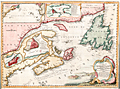 | Details | Bellin, Jacques Nicolas | 1744 |
| Fine decorative chart of eastern Canada |
|
Bellin, Jacques Nicolas |
|
| 1744 |
| LOC:0 |
| $0.00 | Bellin--Jacques-Nicolas | Fine-decorative-chart-of-eastern-Canada | SOLD
<br></br>
Bellin's attractive map of New England and eastern Canada. With insets of the fortified town of Quebec, Fort Dauphin, the city and Port of Louisbourg, and the eastern United States and Canada from Cape Fear northward. The map includes New England as far south as Boston, the St. Lawrence River just beyond Quebec, and north to Cape Round. Very attractive title cartouche with ships and land batteries firing cannon.
<br></br>
Prince Edward Island, one of Canada's three maritime provinces, is labeled "St. Johns" after the original French name "Île Saint-Jean". The island is named for Prince Edward, Duke of Kent, the fourth son of King George III.
<br></br>
Coastal detail features soundings and the fishing banks. This attractive map of Canada was published by N. Bellin in 1744. |
| 2548 | 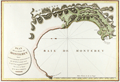 | Details | La Perouse, Jean François Galaup | 1797 |
| Antique French Chart of Monterey Bay and Carmel Bay, California |
|
La Perouse, Jean François Galaup |
|
| 1797 |
| LOC:0 |
| $0.00 | La-Perouse--Jean-François-Galaup | Antique-French-Chart-of-Monterey-Bay-and-Carmel-Bay--California | SOLD, but we have a similar item of Monterey Bay available in stock.
<br></br>
First French edition of this original antique early plan of Monterey Bay, Carmel, and Carmel Bay in California. This map is the earliest obtainable map of the Monterey and Carmel region. |
| 2571 |  | Details | Schultz, Christian | 1810 |
| Early Original Map of the Ohio River Between Pittsburgh and St. Louis |
|
Schultz, Christian |
|
| 1810 |
| LOC:0 |
| $0.00 | Schultz--Christian | Early-Original-Map-of-the-Ohio-River-Between-Pittsburgh-and-St--Louis | SOLD<br></br>Finely executed original antique map of the Ohio River between Pittsburgh, Pennsylvania and St. Louis, Missouri. This fine antique copper-plate engraved map is one of the earliest maps of the Ohio River published in America. Drawn by Christian Schultz.
<br></br>
Published in 1810 for Christian Schultz's "Travels on an Inland Voyage Through the States of New York, Pennsylvania, Virginia, Ohio, Kentucky and Tennessee, and through the territories of Indiana, Louisiana, Mississippi, and New-Orleans; performed in the years 1807 and 1808…"
<br></br>
Schultz's work is one of the earliest works to give a detailed account of travel and the actual risks and dangers encountered in the western country. Schultz crossed upstate New York and western Pennsylvania, then went down the Ohio and Mississippi rivers to New Orleans, traveling inland along the way. Schultz's book is a compilation of his letters, and was published in direct response to an earlier travel guide written by Englishman Thomas Ashe in 1806. Ashe had traveled on both of these rivers and wrote mostly negative reports, arousing much bitterness among Americans toward British visitors. |
| 3598 |  | Details | Anonymous | 1880 |
| 19th century cadastral survey of lands near Lake Weir, Florida |
|
Anonymous |
|
| 1880 |
| LOC:0 |
| $0.00 | Anonymous | 19th-century-cadastral-survey-of-lands-near-Lake-Weir--Florida | SOLD<br></br>
19th century manuscript cadastral survey map of lands near Lake Weir and Ocklawaha, Florida, about 16 miles southeast of Ocala. Ocklawaha, on the north coast of Lake Weir is notorious as the location where the Barker-Karpis gang also known as the <b>Ma Barker gang maintained a hideout</b> at 3250 East Highway C-25. On January 16, 1935 the FBI opened fire on the house killing Ma Barker and her son Fred. The house has recently been moved off the property.
<br></br>
Surveys of the Florida Peninsula from this era are scarce.
<br></br>
Named locations on this old survey include nearby Little Lake Weir, Bower Lake, Hamock Pond, Coon Pond, Silver Lake, Fig Lake, Saddleback Lake, Prospect Lake, and a railroad depot. Ocklawaha is not named. Dates on this MS map including 1880 and 1898 suggest usage of the map over a long period. Names of property owners include Mitchell, Cooper, Taylor, Williams, and many more.
<br></br> |
| 3625 |  | Details | Churchill, Awnsham | 1744 |
| Earliest engraved view of Hanoi, Vietnam |
|
Churchill, Awnsham |
|
| 1744 |
| LOC:0 |
| $0.00 | Churchill--Awnsham | Earliest-engraved-view-of-Hanoi--Vietnam | SOLD<br></br>
A fine example of the earliest engraved view of Hanoi, Vietnam. |
| 3636 | 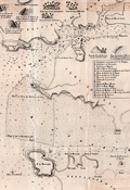 | Details | Anonymous | 1844 |
| Rare antique chart of the Port of Goa and Mormugao, India |
|
Anonymous |
|
| 1844 |
| LOC:0 |
| $0.00 | Anonymous | Rare-antique-chart-of-the-Port-of-Goa-and-Mormugao--India | SOLD<br></br>
Scarce Portugese chart of the Port of Goa, on the southwest coast of India. which was under Portugese rule from 1510 to 1961. By Antonio Lopes da Costa Almeida (1784-1859), barão de Reboredo. Among his many credits Antonio da Costa Almeida was associated with the Academy of Guardas-Marinhas and the Naval Artillery.
<br></br>
The most interesting portion on this lithographed antique chart are the eight charming and naïve elevation views placed at the top of the print. These views include: Vistas das casas das Freiras, Vistas das casas de D. Joanna, and Vista das cruz du Betim.
<br></br>
Our chart, "Carta Hydrographica do Porto de Goa e Entrada das Barras de Agoada de Mormugao", was printed in 1844 just one year after the Portuguese moved the capital to Panaji from Velha Goa. By the mid-18th century, Portuguese Goa had expanded to most of the present-day state limits.
<br></br>
Key topographic features on the chart include Panaji, the Mandovi River, Zauri River, Provincia de Salcette, and Provincia de Bardez. Seventeen important locations on the map are identied alphabetically on the chart and are explained in a legend at right.
<br></br>
Our chart of Goa accompanied the work: "Esclarecimentos Hydrographicos para intelligencia e uso do Plano dos Portos de Goa e Mormogao" in Annaes Maritimos e Colonias. Quinta Serie. No 7, 1844, Lisboa. Lithographed in 1844 by A.C. Lemos, Largo do Quintella no. 1. Lisbon. |
| 2567 | 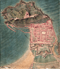 | Details | Anonymous | 1823 |
| Manuscript Plan of San Sebastian, Spain. Basque region |
|
Anonymous |
|
| 1823 |
| LOC:0 |
| $0.00 | Anonymous | Manuscript-Plan-of-San-Sebastian--Spain--Basque-region | SOLD
<BR> </BR>
Manuscript plan of San Sebastian, Spain a resort town on the Bay of Biscay.
<br></br>
Anonymous manuscript pen and ink plan of shows a well-fortified cape jutting into a body of water. Military orientation and focus. Much small fine detail. Many important places are numbered but no legend is present. French text.
<br></br>
A structure overlooks a fortified town, several batteries, and a small protected harbor. In text is the obscured author's name beginning with letter "P", date "1823", the scale "1/5000". The three identified location descriptions read "Redoute du Rondeau" and "Batterie St. Elme" and "Aqueduc". |
| 5164 | 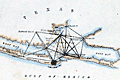 | Details | U.S. Coast and Geodetic Survey | 1848 |
| Antique Map of Galveston Bay and City Bolivar Survey Progress |
|
U.S. Coast and Geodetic Survey |
|
| 1848 |
| LOC:3 |
| $0.00 | U-S--Coast-and-Geodetic-Survey | Antique-Map-of-Galveston-Bay-and-City-Bolivar-Survey-Progress | SOLD
<br></br>
Small antique hand-colored map of southern Galveston Bay showing the progress of an early triangulation survey of the area around Galveston, Texas. The composition of the lines show which lines were between occupied vs. unoccupied survey stations and lines between primary versus secondary stations.
<br></br>
Coverage of this Galveston survey map includes Galveston City, Bolivar Point, Smith's Point, Edward's Point, Highland Bayou, Heron Grove, Parr's Grove and more locations. |
| 4880 | 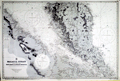 | Details | British Admiralty Hydrographical Office | 1956 |
| Original Chart Malay Peninsula Malaysia and Singapore |
|
British Admiralty Hydrographical Office |
|
| 1956 |
| LOC:59 |
| $0.00 | British-Admiralty-Hydrographical-Office | Original-Chart-Malay-Peninsula-Malaysia-and-Singapore | SOLD <br><br>
British Admiralty (United Kingdom Hydrographic Office) chart of the Strait of Malacca with portions of coastal Sumatra and Malaysia (corrected state). Published May 21, 1954 but this sheet with corrections to 1956. This chart is on a slightly larger scale (1 / 500,000) than chart 1388 'Pandang and One Fathom Bank to Singapore' (1 / 885,000).
<br></br>
<b>Singapore</b> at bottom right. Covers portions of the east coast of Malaysia as well as the west coast. Fine topographic detail of the interior of Malaysia.
<br></br>
Engraved in 1898 and published on June 30, 1898 by the Admiralty. Last corrections in 1956. Chart # 1355. |
| 4772 | 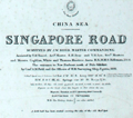 | Details | British Admiralty Hydrographical Office | 1906 |
| Singapore Road |
|
British Admiralty Hydrographical Office |
|
| 1906 |
| LOC:0 |
| $0.00 | British-Admiralty-Hydrographical-Office | Singapore-Road | SOLD
<br></br>
Rare early engraved 1906 antique nautical chart of Singapore Road or anchorage surrounding the Singapore River. No copy of the Singapore Road 1906 edition is recorded in AMPR or elsewhere online. Engraved by the well-used engravers J & C Walker.
<br></br>
First published at the Admiralty January 7th, 1865 under the superintendence of Captain G.H. Richards Royal Navy Hydrographer. This, the result of the 4th major correction, is the edition of February 7, 1906 based largely after the work of John William Reed and officers aboard the H.M.S. Rifleman in 1864. Sold by J.D. Potter Agent for the Admiralty, London. |
| 5269 | 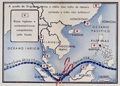 | Details | Anonymous | 1942 |
| German propaganda poster of Japanese capture of Singapore WWII |
|
Anonymous |
|
| 1942 |
| LOC:59 |
| $0.00 | Anonymous | German-propaganda-poster-of-Japanese-capture-of-Singapore-WWII | SOLD<br><br>Folding German propaganda poster from WWII related to the fall of Singapore, once thought to be the "Gibraltar of the East", to the Japanese in February 1942. This broadside propaganda poster was produced by the German Army's Department of Wehrmacht Propaganda to mock the British for their failure to protect Singapore from Japanese attack.
<br></br>
In "Singapura em poder dos japoneses" four views show Japanese soldiers stalking through the jungle and marching in formation with tanks, and Japanese warplanes strafing the airport. Inset map at center shows the supply lines from the Allies to Singapore interrupted or cut (shows scissors) and numerous British and American bases captured throughout the South China Sea , the Philippines, and Malaya.
<br></br>
At bottom: "A castello forte britanico na Grande Asia foi desbarratado Churchill e Roosevelt tambem ali perderam a jogo" reflecting the magnitude and impact of the defeat.
<br></br>
Verso with text related to Singapore and details of the conflict in Asia. Portuguese text.
<br></br>
[Singapora, Singapura, Singapour] |
| 4922 | 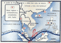 | Details | Anonymous | 1942 |
| Poster of Singapore captured and occupied by the Japanese |
|
Anonymous |
|
| 1942 |
| LOC:59 |
| $0.00 | Anonymous | Poster-of-Singapore-captured-and-occupied-by-the-Japanese | This item is sold, but see <a href="https://www.rarecharts.com/ShowDetail/Creator/Anonymous/Title/German-propaganda-poster-of-Japanese-capture-of-Singapore-WWII/5269" target="_top"> another copy in our inventory </a> with an updated description.
<br /><br />
Folding German propaganda poster from WWII related to the fall of Singapore to the Japanese in February 1942. |
| 4786 | 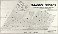 | Details | Davison, J. A. and Son | 1924 |
| 1924 cadastral plat of Sanibel Shores Subdivison, Sanibel Island, Florida |
|
Davison, J. A. and Son |
|
| 1924 |
| LOC:0 |
| $0.00 | Davison--J--A--and-Son | 1924-cadastral-plat-of-Sanibel-Shores-Subdivison--Sanibel-Island--Florida | SOLD
<br></br>
Folding cadastral map of a proposed subdivision "Sanibel Shores" on the southeast end of Sanibel Island, Florida platted with several hundred lots and over 3500 linear feet of Gulf frontage. With a smaller-scale inset map of the island placing the development in geographic context relative to the entire island. Surveyor's written location description states:
<div class="indenttextblock">
"Being a subdivision of Government lots 6-7-8 and that portion of lot 2 and the west 618.2 ft. of lot 1 that lies between the Gulf of Mexico and a bayou which is parallel with about 1800 feet from the meanders of the Gulf of Mexico, Section 30 T. 46 SR 23 E."
</div>
<BR/>
Today, Sanibel Shores would occupy a space roughly bounded to the south by the Gulf of Mexico; to the east by Nerita Street; to the north by Junonia Street, and to the west by Old Middle Gulf Drive. That area encompasses what has become the Sanibel Island Golf Club and a large portion of Beachview Country Club Estates. Major feeder road was Donax Street.
<br></br>
Frank P Bailey & C.R. Bailey Owners and Developers. Map based on survey by J.A. Davison & Son, Engineers, Fort Meyers, Florida Dec. 1924. Del. (drawn by) A.P. Vaughn.
<br></br>
Reybold & Gates Exclusive Sales Agents, Fort Meyers, Florida.
<br></br>
The old cadastral map is from the estate of the Mitchell C. Lilley family. The Lilley family owned an Gulf-front lot in this Sanibel Island subdivision, an un-numbered double-sized lot which is marked "Exception" on map. The Baileys are one of Sanibel's most notable families who arrived on the Island in the Mid-1890's. Frank and Ernest Bailey began farming on the Island and started the Sanibel Packing House in 1899 which became the Bailey General Store.
<br></br>
Scale 200 ft. to an inch. North oriented to upper right. |
| 5231 |  | Details | Floyd, Marla | 1987 |
| Original Marla Floyd Pictorial Map Sanibel Captiva Islands Florida |
|
Floyd, Marla |
|
| 1987 |
| LOC:87 |
| $0.00 | Floyd--Marla | Original-Marla-Floyd-Pictorial-Map-Sanibel-Captiva-Islands-Florida | SOLD<br></br>
Original pictorial advertising map of Sanibel and Captiva Islands, on the Gulf Coast of Florida. Drawn and copyrighted by Marla Floyd and published in 1987 by A.C. Graphics of Miami, Florida. This scarce cartoon-like map includes a legend of almost sixty commercial locations on the two islands that appear on Floyd's map including: She Sells Sea Shells, Dairy Queen, Cheeburger Cheeburger, Buttonwood Bar B-Q, and the Chapel Cemetery & Library. Major geographic and touristic features include: Red Fish Pass, Blind Pass, Turner Beach, Bowman's Beach, and Buck Key.
<br></br>
On this interesting slice of Florida history seashells, waterfowl and fish abound along with drawings of local interest such as sea-shell collecting, snorkeling and of raccoons rifling a tin garbage can.
<br></br>
Today Marla Floyd works in the insurance industry in Delray Beach, Florida. Her past accomplishments include writing and illustrating a children's book: The Pink Poodle. Map is not drawn to scale. |
| 5086 | 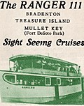 | Details | Winters, David and Irene | 1961 |
| Map route Ranger III sightseeing tour Mullet Key Treasure Island Bradenton Florida |
|
Winters, David and Irene |
|
| 1961 |
| LOC:11 |
| $0.00 | Winters--David-and-Irene | Map-route-Ranger-III-sightseeing-tour-Mullet-Key-Treasure-Island-Bradenton-Florida | SOLD
<br></br>
Chart of the routes for sightseeing tours by the vessel Ranger III from St. Petersburg, Florida ca. 1961. The cruises all departed at 10:30 a.m. six days a week from slip 8 at Vinoy Basin. The chart shows the prospective route for cruises to Mullet Key, to Treasure Island, and to Bradenton Florida. Each cruise aboard the 64 foot diesel-powered tour boat carried up to one-hundred passengers at $2.00 per person.
<br></br>
In January 1961, three vessels operated excursions out of the St. Petersburg Yacht Basin: the Florida Queen, the Miss Florida III and the Ranger III. In 1961 aboard the Ranger III on a tour to Mullet Key, Captain Winters provided commentary on the local sights and Charlie Holdsworth, an ex-vaudevillian, entertained sightseers with his banjo and singing. (Branch, Dave. "Is this the day for a boat ride down the bay?" St. Petersburg Times. January 1. 1961. p. 41.).
<br></br>
The Ranger III route chart occupies 2 panels on a 4-panel folding brochure. Verso with photographs and a description for each of the three cruise options. |
| 6843 |  | Details | Titcomb, J. P. | 1908 |
| Rare reverse-image blueprint or cyanotype of St. Petersburg Florida |
|
Titcomb, J. P. |
|
| 1908 |
| LOC: |
| $0.00 | Titcomb--J--P- | Rare-reverse-image-blueprint-or-cyanotype-of-St--Petersburg-Florida | SOLD<br><br>Introducing an extraordinary piece of cartographic history, this rare 1908 mirror-image blueprint cadastral map of St. Petersburg, Florida, showcases the city's early waterfront development, with the railroad running through the heart of the city along First Avenue. In 1908, a non mirror-image edition of this map could be purchased for just $1.00, either directly from its creator, J.P. Titcomb, or at the local pharmacy owned by W. A. Holhouser.
<br><br>
Today, this particular instance of Titcomb's mirror-image blueprint is an exceptionally rare find, with the only other known copy presumably in a large Florida institution. This map would have served as the input for a photo-reprographic process, such as photo-lithography, to create a series of smaller copies featuring black lines on a white background.
<br><br>
<div id="0" align="center">
<a title=""></a> |
| 6439 |  | Details | Sprague, R. B. | 1952 |
| Big Game pictorial map San Francisco Oakland Berkeley Bowl |
|
Sprague, R. B. |
|
| 1952 |
| LOC: |
| $0.00 | Sprague--R--B- | Big-Game-pictorial-map-San-Francisco-Oakland-Berkeley-Bowl | SOLD <br><br>
An absorbing pictorial map of the San Francisco Bay Area by R. B. Sprague. Supports the "Big Game" [1]. Packed with sophomoric cartoons, puns ("fisherman's barf"), graphic exaggerations, and post-WWII references. Some of the references could only be appreciated by someone familiar with local geography and/or early 1950s Bay Area college culture.
<br><br>
Not drawn to scale and limited only by Sprague's imagination, the cartoonish map depicts local highways snaking from the California Redwoods at top left (decorated with Christmas ornaments), to Lake Mead, down past the Bay Area ("sighted sub, sank same"), to Palo Alto, Watsonville, Mt. Hamilton with a final road sign at bottom right pointing to the Rose Bowl.
<br><br>
Published 1952 in the Stanford Chapparal magazine. The Stanford Chaparral is a humor magazine published by students of Stanford University since 1899. In 1952 the Big Game was played at Berkeley where the California Golden Bears shut out Stanford 26 - 0.
<br><br>1952
[1] The Big Game is the oldest college football rivalry. Dating back to 1892, the Big Game pits the University of California Berkeley Golden Bears football team against the Stanford University Cardinals. |
| 4796 |  | Details | Barker, Curtis M. | 1925 |
| Fine antique cyanotype map of Corita Vineyard, Palo Alto California |
|
Barker, Curtis M. |
|
| 1925 |
| LOC:62 |
| $0.00 | Barker--Curtis-M- | Fine-antique-cyanotype-map-of-Corita-Vineyard--Palo-Alto-California | SOLD
<br></br>
Rare and desirable original cyanotype (blueprint) topographic survey map of the <b>Corita Vineyard</b>, then located in Los Altos Hills, about 4 miles south of Stanford University and Palo Alto, California. The map is dominated by Page Mill Road and by Moody Road; a course table is inset for each thoroughfare. Dated within at 1905 but later, developed from a well-worn surveyor's trace. Little information is available online on Corita Vineyard, consistent with the apparent scarcity of this old cartographic artifact.
<br></br>
Title reads:
<b>"Map of the Corita Vineyard. Being lots 3 & 4 of the Briones Partition of the la Purissima Conception Rancho the property of A.B. Blanco Surveyed in Feb. and Mar. 1905. Curtis M. Barker, Surveyor and C.E. San Jose, Cal."</b> 547 acres. Scale: 3600:1 . Contour interval: 25 feet.
<br></br>
<div class="indenttextblock">
<b>La Purissima Conception Rancho</b> - 4439 acre Mexican land grant given in 1840 by Governor Juan Alvarado to José Gorgonio and his son José Ramon. In 1844 Gorgonio sold the one square league Rancho La Purísima Concepción to Juana Briones de Miranda. <BR/>
<b>Briones Partition</b> - Juana Briones (b. 1802) sold about three quarters of her rancho in 1861 to Martin Murphy Jr. of Sunnyvale, who had come to California with the Stephens-Townsend-Murphy Party in 1844. Briones gave the remaining 1,130 acres (4.6 km2) of her rancho to her children, who bore their father’s name, Miranda. Until it was demolished in 2011, the Juana Briones home, a California registered landmark, stood at 4155 Old Adobe Road.<BR/>
<b>A.B. Blanco</b> - owner of the Corita Vineyard in 1905.<BR/>
<b>Curtis M. Barker</b> - Licensed surveyor and Civil Engineer (b. 1861). Employed as assistant civil engineer by Leland Stanford University in 1885-1893. Surveyor and civil engineer in San Jose, CA from 1894.</b>
</div> |
| 4859 | 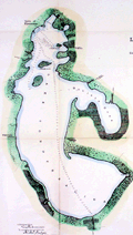 | Details | U.S. Army Engineers | 1901 |
| Antique charts of Lakes Tohopekaliga Hatcheneha and Cypress Florida |
|
U.S. Army Engineers |
|
| 1901 |
| LOC:0 |
| $0.00 | U-S--Army-Engineers | Antique-charts-of-Lakes-Tohopekaliga-Hatcheneha-and-Cypress-Florida | SOLD
<br></br>
One page with three charts of Lake Tohopekaliga, Cypress lake, and Lake Hatcheneha (Hatchineha) Florida. This antique chart was produced by the U.S. Engineer's Office Tampa, Florida December 14, 1901.
<br></br>
The three lakes are part of a larger chain of lakes and canals known as the Kissimmee Waterway. Boaters can travel the 56-mile long waterway connecting Lake Tohopekaliga to the north to Lake Okeechobee to the south, passing through Cypress Lake and Lake Hatchineha and along the Kissimmee River through a series of canals and man-made locks. Lakes in the Waterway’s upper basin are fairly shallow with average depths ranging from 6 to 13 feet. (https://www.sfwmd.gov/sites/default/files/documents/kisswaterway.pdf)
<br></br>
The chart of Lake Tohopekaliga (Tohopeka) includes numerous soundings and identifies key locations including:
<br></br>
<div class="indenttextblocksingle">
<ul style="list-style-type: circle;">
<li>Edgewater Landing</li>
<li>Shingle Creek</li>
<li>Town of Kissimmee</li>
<li>Fish Lake Canal North Branch</li>
<li>St. Elmo Landing</li>
<li>St. Cloud Canal</li>
<li>McCool's Landing</li>
<li>Poorhouse Landing</li>
<li>Lee's Landing</li>
<li>Southport Canal</li>
<li>Edgewater Landing</li>
<li>Paradise, Flemings, and Cypress Islands</li>
</ul>
</div>
Date and initials at bottom left within "W.F.J. 10-25-90 (1890)" |
| 5031 | 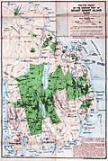 | Details | Bates, Waldron and others | 1922 |
| Path Map of the Eastern Part of Mount Desert Island, Maine |
|
Bates, Waldron and others |
|
| 1922 |
| LOC:53 |
| $0.00 | Bates--Waldron-and-others | Path-Map-of-the-Eastern-Part-of-Mount-Desert-Island--Maine | SOLD<br></br>Scarce map of the eastern portion of Mount Desert Island by Waldon Bates, Edward Rand, and Herbert Jaques after the U.S. Coast Survey. In 1922 Acadia National Park (in green) was known as Lafayette National Park. Includes coastal areas of Mount Desert Island on Frenchman's Bay and Somes Sound.
<br></br>
Waldron Bates began exploring Mount Desert Island in the 1880's. From 1900 to 1909, Bates was chairman of the Path Committee of the Bar Harbor Village Improvement Association (VIA). VIA's in each of the four island towns created most of the Mount Desert Island's trail system we know today, adding twenty-five miles of trails under Bate's leadership, including the Giant Slide, Canon Brook, Gorham Mountain, and Cadillac Cliffs Trails. (Source: https://www.nps.gov/acad/learn/historyculture/waldron-bates-pathmaker.htm)
<br></br>
Bates is well-known for the Bates cairn, a rock-constructed trail indicator which he designed:
<div class="indenttextblocksingle">
"The cairns are built on two base columns of between 2 and 4 rocks, with a lintel stone, or platform, across the two columns and a pointer rock on top. The cairns help orient hikers and steer them in the right direction, while protecting the environment by keeping people on the trail." Over times the Bates cairns suffered damage from human or environmental forces. Starting in 2001, an effort began to rebuild the cairns and to educate the public about their design and importance." (Source: https://acadiaonmymind.com/2016/01/message-rocks-acadia-bates-cairns-new-focus/) </div> |
| 4876 | 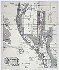 | Details | Allyn, Rube | 1955 |
| 2nd ed. Map Lake Seminole Florida Fresh Water |
|
Allyn, Rube |
|
| 1955 |
| LOC:61 |
| $0.00 | Allyn--Rube | 2nd-ed--Map-Lake-Seminole-Florida-Fresh-Water | SOLD <br><br>
Scarce <b>second edition</b> [1] of Rube Allyn's Authentic Fishing Map (ca. 1955), for Boca Ciega Bay and Lake Seminole, Florida. When multiple editions of Allyn's fishing map exist for the same area, they may provide a good source of information about changes over time to the aquatic environment and to fish populations. Allyn's chart # 1B.
<br></br>
Clearly shows the immediate effect of a new dam across Long Bayou built in the 1940's at Park Blvd. N., then Oakhurst. The dam was intended to turn part of a salt-water estuary into a freshwater lake, Lake Seminole, with water level controlled by a weir along the south side of the lake. When this fishing chart is compared to Allyn's first edition made before the dam was constructed, it is clear chart that the dam was a huge success. Lake Seminole is shown swollen with water, and Allyn notes abundant fresh-water fish rather than the trout and redfish that previously inhabited the salt-water Long Bayou.
<br></br>
<img src="/ZoomifyImages/SC_4876/SC_4876_Detail.gif" alt="Comparison Photographs of Allyn's Seminole Lake" width="350px" align="left" style="margin: 0px 0px">
<br></br>
As is often the case with projects that change the environment, after decades they bring about unexpected consequences. Today, water quality is a concern on Lake Seminole because of the low volume of water flowing into the lake, coupled with excess nutrients and pollution runoff from the surrounding urban areas. The Lake Seminole Restoration Project will dredge 900,000 cubic yards of accumulated organic sediment from the lake to include 54 tons of phosphorus and 311 tons of nitrogen. (Source: http://www.pinellascounty.org/publicworks/pdf/lake-seminole-restoration-project.pdf)
<br></br>
[1] Rube Allyn's Authentic Fishing Map (Upper) Boca Ciega Bay and Gulf Beaches. 1st ed. Touchton Map Library. Tampa Bay History Center. 2016.010.002 . |
| 4879 | 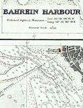 | Details | British Admiralty Hydrographical Office | 1944 |
| Plans on the North East Coast of Bahrein Island |
|
British Admiralty Hydrographical Office |
|
| 1944 |
| LOC:54 |
| $0.00 | British-Admiralty-Hydrographical-Office | Plans-on-the-North-East-Coast-of-Bahrein-Island | SOLD
<br></br>
Very scarce nautical charts of Bahrain (Bahrein) Harbor, Khor Kaliya, and Manama. 1936 / 1944. Charts are based on surveys by the British Admiralty's surveying ship "Ormonde" in 1932. Shows Bahrain's major population center, port and harbors before most of the massive construction that now fills the area.
<br></br>
No other example of this map is found online and only one sale of the 1905 edition in 2008.
<br></br>
Three charts / plans on one page:
<div class="indenttextblocksingle">
<ul style="list-style-type: circle;">
<li>Approaches to Bahrein Harbor and Khor Kaliya</li>
<li>Bahrein Harbour</li>
<li>Khor Kaliya</li>
</ul>
</div>
Last correction 1944. Chart # 3792. Published at the Admiralty 14th Aug. 1936 under the
Superintendence of Rear Admiral J.A. Edgell. |
| 4932 | 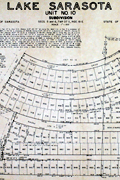 | Details | Mosby Engineering Associates | 1955 |
| Lake Sarasota Florida Unit 10 Plat and Survey |
|
Mosby Engineering Associates |
|
| 1955 |
| LOC:0 |
| $0.00 | Mosby-Engineering-Associates | Lake-Sarasota-Florida-Unit-10-Plat-and-Survey | SOLD<br></br>
Plat and survey for Unit 10 of the Lake Sarasota Subdivision at Lake Sarasota, Florida.
<br/><br/>
By Mosby Engineering Associates, 2190 Ringling Blvd. Sarasota, Florida. |
| 6331 | 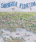 | Details | Rees, Jack | 1988 |
| Large original birds eye view of Sarasota, Florida |
|
Rees, Jack |
|
| 1988 |
| LOC:61 |
| $0.00 | Rees--Jack | Large-original-birds-eye-view-of-Sarasota--Florida | SOLD<br><br>Original pictorial birds-eye view map / poster of Sarasota, Florida. Copyright by Jack Rees (1988).
<br></br>
Includes Siesta Key, Longboat Key, Lido Key, Indian Beach and much more. |
| 4933 | 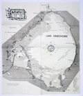 | Details | Allyn, Rube | 1960 |
| Scarce Rube Allyns Authentic Fishing Map Lake Okeechobee Florida |
|
Allyn, Rube |
|
| 1960 |
| LOC:61 |
| $0.00 | Allyn--Rube | Scarce-Rube-Allyns-Authentic-Fishing-Map-Lake-Okeechobee-Florida | SOLD
<br></br>
Scarce, presumed first edition of Rube Allyn's Authentic Fishing Map (ca. 1960), for Lake Okeechobee, Florida. Drawn by Erland M. Larson. Published by the Great Outdoors Association, Pier 63, Central Basin, St, Petersburg, Fla. Price when issued 25 cents.
<br/><br/>
Includes Moore Haven, Clewiston, Lake Harbor, Pahokee. Much interesting local detail such as Peanut Shirling's Camp, Dewey's Camp, Fish Eating Creek, Bill Johnson's Fishing Camp, Slim's Fish Camp, Port Mayaca, and the cross-state waterway. |
| 4938 | 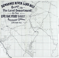 | Details | Live Oak, Perry, and Gulf Railroad Company | 1915 |
| Suwannee River Land Belt allotment certificate |
|
Live Oak, Perry, and Gulf Railroad Company |
|
| 1915 |
| LOC:0 |
| $0.00 | Live-Oak--Perry--and-Gulf-Railroad-Company | Suwannee-River-Land-Belt-allotment-certificate | SOLD<br></br>
Scarce map ca. 1915 of land offered for sale by the Live Oak, Perry, and Gulf Railroad Company Land Commissioners: "Suwannee River Land Belt Offered by the Land Department of the Live Oak, Perry and Gulf Railroad Company, Live Oak - Fla."
<br/><br/>
Coverage includes a large portion of Florida in the vicinity of Perry, Mayo, Live Oak, Branford, and the Steinhatchee Conservation Area.
<br/><br/>
Map lies on the verso of a sheet designated an "Allotment Certificate", a blank document for a real-estate buyer containing details of an offer to sell land from property surrounding their rail line the: "Suwannee Land Belt ." Recto with front and back of the "Allotment Certificate" with blanks to be filled. Date field reads "… for a period of Sixty Days from ______ 191_ ." |
| 4943 | 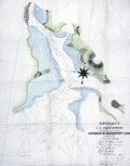 | Details | U.S. Coast and Geodetic Survey | 1835 |
| First chart issued Coast Survey Bridgeport, Conn. |
|
U.S. Coast and Geodetic Survey |
|
| 1835 |
| LOC:53 |
| $0.00 | U-S--Coast-and-Geodetic-Survey | First-chart-issued-Coast-Survey-Bridgeport--Conn- | SOLD<br><br> This "EXTRACT from the U.S. Coast Survey... Harbour of Bridgeport, Conn." <b>is the first navigational chart published by the Coast Survey.</b> It was privately printed in lithography by P. Haas of Washington from the drawing of T.A.M. Craven." (Guthorn. United States Coastal Charts 1783-1861. p. 61.)
<br></br>
Two other charts are notable as early Coast Survey charts printed outside the government: New Haven Harbor (1838) and Newark Bay (1839). Each are distinguished from later printings by the presence of the word "Extract" in the chart's title.
<br></br>
In 1835 the Coast Survey had not fully hit its stride and did not possess printing equipment. This chart was not published in-house but was sent out for printing. It was not until 1844 / 1845 that the Coast Survey printed a chart on their own, that of New York Harbor, in six sheets measuring 63" x 64". Lithographed by P. Haas.</br>
(Burroughs, Charles A. Hassler's First Chart. 1987. https://www.govinfo.gov/content/pkg/GOVPUB-C13-205178772c3ec101c76282e5b214d28e/pdf/GOVPUB-C13-205178772c3ec101c76282e5b214d28e.pdf ) |
| 5178 | 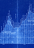 | Details | Canadian Pacific Railroad | 1915 |
| Cyanotype transcontinental elevation profile for Canadian Pacific Railroad |
|
Canadian Pacific Railroad |
|
| 1915 |
| LOC:62 |
| $0.00 | Canadian-Pacific-Railroad | Cyanotype-transcontinental-elevation-profile-for-Canadian-Pacific-Railroad | SOLD
<br></br>
Fascinating cyanotype, or blueprint, transcontinental elevation profile for the Canadian Pacific Railroad (CPR) ca. 1915. Shows the elevation of the CPR line stretching Montreal (bottom right) to Vancouver, Canada (top left). At a horizontal scale of 1" = 30 miles and vertical scale of 1" = 1000 feet the chart clearly represents the vast distance across Canada as well as the challenges imposed by the Rocky Mountains and the Selkirk Mountain Range.
<br></br>
Date was obtained by analysis of the profile at Rogers Pass on the Selkirk Range where a tunnel is shown under construction. The tunnel at that point fits the Connaught Tunnel which was built to replace the route over Roger's Pass. The Connaught Tunnel is known to have been under construction from April 2, 1914 until December 16, 1916 when it began operational service. |
| 4965 | 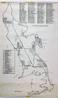 | Details | Major H.D. Moorman | 1970 |
| Map of Big Pine Key Florida |
|
Major H.D. Moorman |
|
| 1970 |
| LOC:0 |
| $0.00 | Major-H-D--Moorman | Map-of-Big-Pine-Key-Florida | SOLD<br></br>
Large rolled map of Big Pine Key, Florida prepared by Major Henry Dean Moorman for Big Pine Key Civic Association ca. 1970. Obviously locally prepared, the map contains a large list of streets and a list of 50 local businesses and locations on Big Pine Key that appears to be based on typewritten copy.
<br></br>
A history of the island (http://www.keyshistory.org/bigpinekey.html) states that Les Cunningham and Dwight Pettit operated the Big Pine Key Glassworks at the west end of the island from 1967 - 1973. Our map shows the glassworks as location #20 on the index of 50 key locations. |
| 4972 | 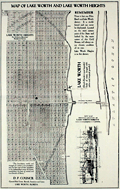 | Details | Council, D.P. | 1925 |
| Map of Lake Worth and Lake Worth Heights Palm Beach County Florida |
|
Council, D.P. |
|
| 1925 |
| LOC:0 |
| $0.00 | Council--D-P- | Map-of-Lake-Worth-and-Lake-Worth-Heights-Palm-Beach-County-Florida | Sold <br></br>
Folding sales brochure from Florida's 1920's land boom with photographs including <b>Lake Worth Heights</b> entrance and The Royal Poinciana "fronting on beautiful Lake Worth". On the verso a lot plan or map of Lake Worth and Lake Worth Heights, in Palm Beach County, Florida. Printed by D.P. Council Owner & Developer Lake Worth, Fla.
<br></br>
Cute manuscript notation on the outer row of homes along Lake Worth, an "X" next to a small rectangle, filled in with pencil as on an S.A.T. exam, and the proud words in neat script: "Our Bungalow". Awwww.
<br></br>
Inset map on lower right with a "Key Map Showing Locations of Lake Worth Heights" relative to other features such as The Breakers, Royal Poinciana, Lantana, Lake Osborne Park, and West Palm Beach.
<br></br>
The copy on the last page of the brochure nicely sums up the offering:
<div class="indenttextblock">
The Key Map on the inside page has been accurately compiled to give you an indelible picture of the important developments between the world-famed Palm Beaches and the Wonder City of Lake Worth, and the close relation of Lake Worth Heights in the ultimate unity of those two cities.<br></br>
…
<br></br>
With the attractive, rustic entrances, the wide avenues and boulevard parked with the tropical Australian pins, cleared of unsightly undergrowth. Lake Worth Heights commands the attention of those anxious to locate in a restricted residential section enjoying the advantages of spacious building estates, uniform building lines, building and residential restrictions, making a high-class development for attractive homes.
</div>
On November 19, 1920, Model Land Company a portion of the lands they owned to D.P. Council, who platted in into Lake Worth Heights Subdivision. |
| 4981 | 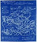 | Details | Architects and Engineers Supply Company | 1928 |
| Rare Key Map Canoe Routes in Minnesota Ontario Lakes Region |
|
Architects and Engineers Supply Company |
|
| 1928 |
| LOC:200 |
| $0.00 | Architects-and-Engineers-Supply-Company | Rare-Key-Map-Canoe-Routes-in-Minnesota-Ontario-Lakes-Region | SOLD<br></br>
Very rare cyanotype (blueprint) key map / advertisement, by C. & S. map, showing the coverage of 15 larger-scale sectional maps of canoe routes in the Minnesota and Canadian wilderness including the Superior National Forest. No copy of this key map is found online and the associated sectional maps (blue-line) are seldom found individually.
<br></br>
C. & S. canoe maps became so treasured and scarce that a cloth replica of C. & S.'s smallest-scale map is now offered online under the name "Greggar's Map" .
<div class="indenttextblocksingle">
<i>"Greggar's Map is a cloth replica map of the 1928 Canoe Country Map, which is a unique remnant of navigating what we now know as the BWCAW and Quetico Provincial Park In its original form, the 1928 cloth map includes hand drawn lakes and written information like portages, rapids and unique author notes." </i> (https://www.truenorthmapco.com/shop/Greggars-Map-1928-Canoe-Country-p142448343)
</div>
</br>
Title reads:
<div class="indenttextblocksingle">
"Announcing our new map of The Greatest Canoe Route Country in America 'In the Heart of the Wilderness.' "
</div>
</br>
Printed by Architects and Engineers Supply Company of Duluth, Minnesota. Sectional maps could be purchased individually for $0.85 on paper or $1.25 on cloth. Only one sectional map was found online attributed to C. & S. map and AESC, a blue-line print.</br> (Source: https://photos.bwca.com/l/LMILLER3129-120419-200203.JPG).
<br></br>
A. Bernard Gustfason (b. 1893) founded Architects and Engineers Supply Company in 1917 to provide quick production of blue prints, blue line prints, and black line prints to architects, engineers, draftsmen and surveyors in the Duluth, Minnesota area. |
| 5059 | 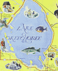 | Details | Rikers Trip Tour Guide | 1968 |
| Map of Greater Palm Beach County and Lake Okeechobee by Rikers |
|
Rikers Trip Tour Guide |
|
| 1968 |
| LOC:87 |
| $0.00 | Rikers-Trip-Tour-Guide | Map-of-Greater-Palm-Beach-County-and-Lake-Okeechobee-by-Rikers | SOLD
<br></br>
Pictorial map of Greater Palm Beach County and Lake Okeechobee, Florida. This colorful late 1960's map is on Riker's Trip Tour Guide. In this pictorial map the cartography is ringed with images, not with saints or with dignitaries but ringed with paid advertisements for area businesses like the Sailfish Center Marina Motel and the Kentucky Fried Chicken in Lake Worth. Map is on verso of a folding brochure titled: "Riker's Trip Tour Guide, A Scenic Recreational Map West Palm Beach - Lake Okeechobee"
<br></br>
Copyright 1968 by H. Riker. Illustrated and Designed by H. Riker. Published by Riker's Scenic Map Company. Historical, Scenic, and Recreational Maps. P.O. Box 3006, West Palm Beach, Florida.
<br></br>
Seller's black ink stamp: Forrest Shontz, Dixie "66" Service, 3515 South Dixie, West Palm Beach, Florida. |
| 4990 |  | Details | Fort Wayne Printing Company | 1929 |
| Florida map and calendar for Palm Beach Mercantile Company, Florida |
|
Fort Wayne Printing Company |
|
| 1929 |
| LOC:0 |
| $0.00 | Fort-Wayne-Printing-Company | Florida-map-and-calendar-for-Palm-Beach-Mercantile-Company--Florida | Sold <br></br>
Rare Florida map and calendar for the Palm Beach Mercantile Company, Florida published in 1929, the first year of the Great Depression (the stock market crash began in October, 1929). Established in 1896, by 1929 the Palm Beach Mercantile Company was Palm Beach County's largest and oldest hardware and furniture store. Published by the Fort Wayne Printing Co. of Fort Wayne, Indiana.
<br></br>
Map is Clason's Road Map of Florida with an inset map of the western end of the state. Map # R-240 AA.
<br></br>
The Palm Beach Mercantile Company is a historic site in West Palm Beach, Florida located at 206 Clematis Street. On January 28, 1994, it was added to the U.S. National Register of Historic Places. The Palm Beach Mercantile Company Building, was built as a single story, 2-room structure in Vernacular style in 1902. Three additional floors were added in 1916 and the partial sixth floor was added in 1923. The structure had the Palm Beach's first elevator. The Palm Beach Mercantile Company, the first large business block in the city, went out of business in the late 1950's. Today the site is known as the Harris Building.
<br></br> |
| 6854 |  | Details | Garden Club of Palm Beach | 1930 |
| The Plan of Palm Beach |
|
Garden Club of Palm Beach |
|
| 1930 |
| LOC:2001 |
| $0.00 | Garden-Club-of-Palm-Beach | The-Plan-of-Palm-Beach | On Reserve<br><br>
Rare book containing "The Plan of Palm Beach", Florida commissioned and funded by the Garden Club of Palm Beach (1). This was the first plan for Palm Beach and it was not until 1970 that the town adopted a revised plan. The plan was approved by the Palm Beach town council on December 19, 1929 as a guide for future public improvements in light of the rapid growth the area was then experiencing. The original drawings contained in the book were hung in the Palm Beach Town Hall.
<br><br>
<div class="indenttextblocksingle"><i>"One attractive and well managed public bath and beach, the concentration of general traffic upon a limited number of streets, beautification without especial reference to main arteries of travel and a system of leisurely and convenient by-ways free from automobiles, punctuated by gardens: this is a plan which will localize recreation-seeking crowds, discourage trespassing, and provide safety and quiet for residents of Palm Beach."</i>
</div>
<br>
Rare. The only copy we could locate is in the Palm Beach Town Hall. Not in WorldCat. Contains more than one dozen illustrations plus aerial photographs and photographic vignettes. Twenty-six pages. List of Garden Club members.
<br><br>
<div id="0" align="center">
<a title=""></a>
<img id="6648" src="/ZoomifyImages/SC_6854/SC_6854_detail1.jpg" alt="Very rare first plan of Palm Beach, Florida. 1930." width="300"/> <br><br> <font size="-2">Rare Presentation Plan for Palm Beach, Florida</font>
</div><br>
This thin limited-edition book, number 272 of 400, was printed by the Lakeside Press, R.R. Donnelly & Sons Company. Chicago. Copyright 1930 by The Garden Club of Palm Beach. Bennet, Parsons, Frost. Consulting Architects. Chicago.
<br><br> |
| 5125 |  | Details | Nowotny-Burrell Company | 1960 |
| Pictorial Map of Texas and the Loyal Colonies Sometimes Referred to as the United States |
|
Nowotny-Burrell Company |
|
| 1960 |
| LOC:200 |
| $0.00 | Nowotny-Burrell-Company | Pictorial-Map-of-Texas-and-the-Loyal-Colonies-Sometimes-Referred-to-as-the-United-States | SOLD<br></br>
Souvenir scarf printed with a humorous pictorial "Map of Texas and the Loyal Colonies Sometimes Referred to as the United States." Somewhat similar in concept to Wither's "A Texan's Map of U.S.A." but the humor is much more likely to brag about Texas than to make fun of their neighboring states with derogatory labeling. Copyright 1956 by Nowotny-Burrell Company (bottom left corner). Scarce.
<br></br>
Contains a direction indicator near upper right that was copyrighted by Nowotny-Burrell and Company, San Antonio on July 31, 1952. The copyright is for a "Texan's direction Indicator. Five pointed star indicating, north, east, south, Texas, and west." The history of cartography took a great leap forward with the invention of this novel and humorous compass rose.
<br></br>
100 percent rayon. Made in Japan. Probably a later edition of the map ca. 1960, not a silk and rayon blend. Green edging. |
| 5020 | 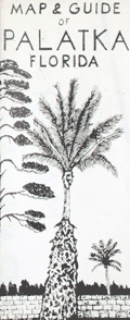 | Details | Bailey, John | 1965 |
| Map and guide of Palatka, Florida |
|
Bailey, John |
|
| 1965 |
| LOC:0 |
| $0.00 | Bailey--John | Map-and-guide-of-Palatka--Florida | SOLD<br></br>
Fine printed brochure with a map of Palatka Florida, by commercial artist John Bailey ca. 1965 . Printed from hand laid up and hand-lettered copy, giving this scarce artifact very much a folk-art feeling.
<br></br>
With business advertisements including Mathew's Moving and Storage, the Exchange Bank of Palatka and Middleton Realty Company. In 1948 Clyde D. Littleton Jr. graduated from high school in Palatka, FL. After several years in the Navy and Coast Guard, during the decade of the 1960's Middleton developed several properties in central Florida such as Big Scrub Campsites, Hog Valley, Woods and Lakes and many others.
<br></br>
Another ad for Frank Hancock Insurance Agency. Frank M. Hancock (1912-2007) owned Hancock Insurance Agency in Palatka for 39 years (1950-1989) and he was mayor of Palatka for two terms. |
| 6449 |  | Details | Great Wall Poster Company | 1982 |
| 1982 Pictorial Advertising Map of Hong Kong |
|
Great Wall Poster Company |
|
| 1982 |
| LOC:1404 |
| $0.00 | Great-Wall-Poster-Company | 1982-Pictorial-Advertising-Map-of-Hong-Kong | SOLD<br><br>
Scarce 1982 thematic pictorial advertising map for Hong Kong published by Great Wall Poster Company. Shows geographical locations around the city with numerous small pictorial advertisements for local businesses. A snapshot of the frenetic commercial activity surrounding Hong Kong in the last decade of the 20th century. Businesses of all sizes and sectors are represented on the map including transportation, hospitality, banking, and entertainment. For example:
<div class="indenttextblocksingle">
<ul style="list-style-type: circle;"></li>
<li>Colosseum Disco</li>
<li>Japan Air Line</li>
<li>Royal Hong Kong Jockey Club</li>
<li>Far East Hydrofoil Co. Ltd.</li>
<li>Beefy's Bistro</li>
<li>Credit Suisse</li>
<li>Kowloon's number one nightspot 'Bottoms Up' (the basement)</li>
</ul>
</div>
<div id="0" align="center">
<a title="Compass rose Hong Kong pictorial map, 1982."></a>
<img id="3" src="/ZoomifyImages/SC_6449/SC_6449_CompassRose.jpg" alt="Compass rose 1982 Annual Poster of Hong Kong by Tom Briggs." width="300"/> <br><small>1982 Hong Kong map compass rose "for Australian readers." </small>
</div><br>
The creator uses humor to enliven the company descriptions and shows that at an early date there was concern about the reversion of Hong Kong to Chinese rule: "Buy your poster now, it may be smaller after 1997." Compass rose rotated 180 degrees with north oriented to bottom. Map has an antique appearance by design.
<br><br>
In this pictorial map pictograms are used along with text to identify specific commercial enterprises conducting business in Hong Kong. Based on a statement from a self-portrait of the copyright holder and author, Tom Briggs, the size of the advertisement was correlated to the amount that advertisers were willing to pay for a spot on the map "Well, how much do you want on the poster for sixteen bucks?" |
| 6484 |  | Details | Great Wall Poster Company | 1990 |
| 1990 Pictorial Advertising Map of Hong Kong |
|
Great Wall Poster Company |
|
| 1990 |
| LOC:1404 |
| $0.00 | Great-Wall-Poster-Company | 1990-Pictorial-Advertising-Map-of-Hong-Kong | SOLD<br><br>
Thematic pictorial advertising map of Hong Kong from 1990. One of a series of annual advertising posters of Hong Kong published by Great Wall Poster Company. Printed by Pronto Print, LTD. Copyright 1980 by Tom Briggs.
<br><br>
Shows geographical locations around the city with interesting historical notes "In 1942 a tiger was shot by a Japanese patrol near Stanley" or "In 1887 the Hong Kong College of Medicine was established and one of its first students was Sun Yat Sen." Contains numerous small pictorial advertisements for local businesses with an attempt at levity in some cases.
<br><br>
The pictorial map is a snapshot of the frenetic commercial activity surrounding Hong Kong in the last decade of the 20th century. Businesses of all sizes and sectors are represented on the map including retail, transportation, hospitality, banking, and entertainment. The numerous commercial enterprises include:
<div class="indenttextblocksingle">
<ul style="list-style-type: circle;"></li>
<li>Hong Kong & Shanghai Banking Corporation</li>
<li>Water tours of Hong Kong, Ltd.</li>
<li>Overseas Containers Limited</li>
<li>George Wimpey H.K. Ltd.</li>
<li>British Caledonian Airline</li>
<li>Singapore Club Coffee House</li>
</ul>
</div>
<div id="0" align="center">
<a title="Detail from Hong Kong pictorial map, 1990."></a>
<img id="3" src="/ZoomifyImages/SC_6484/SC_6484_Detail.jpg" alt="Detail from 1990 Annual Poster of Hong Kong by Tom Briggs." width="330"/> <br><small>1990 Hong Kong pictorial advertising map detail. </small>
</div> |
| 5033 |  | Details | Fryhofer, George | 1915 |
| Antique auction broadside for Boca Ratone Raton Florida |
|
Fryhofer, George |
|
| 1915 |
| LOC:200 |
| $0.00 | Fryhofer--George | Antique-auction-broadside-for-Boca-Ratone-Raton-Florida | SOLD
<br></br>
One-of-a-kind foundational auction broadside with a charming <b>zoomorphic</b> map (verso) of <b>Boca Raton, Florida</b>. The broadside and map advertise the auction of several hundred lots in "Boca Ratone" by owner George Long (1), and conducted by George Fryhofer, auctioneer on Washington's birthday, Feb 22, 1915, eight years before the town of Boca Raton was incorporated. No holdings of this map are found in WorldCat, AMPR, or elsewhere.
<br></br>
This rare broadside clearly shows the location of the Boca Raton Post Office and of the home of George Long, a home that formerly belonged to Henry Flagler. Map also has a zoomorphic scene of a rat and a cat at the entrance to Lake Boca Raton; the land encompassed within the cat is labeled "<b>Black Cat Plantation</b>" (2).
<br></br>
As described online "The Youngs heard that George Fryhofer was holding a lot auction in Boca Raton, so Mrs. Young and her friend, Mr. Muhle, came up to attend the auction. Peg [Young] surprised herself by buying four lots on East Palmetto Park Road [previously Ocean Boulevard] where the 7-11 store is located".
<br><br>
(1) George Ashley Long (d. 1929) was a retired farmer, civil engineer, and commissioner from South Palm Beach County, Florida as well as the first mayor of Boca Raton. In the same year as this sale (1915) Long developed the three-block <b>Pearl City</b> subdivision for African Americans near today’s Dixie Highway and Glades Road. Pearl City, about 3/4 mile from this property, was named for a variety of pineapple, the Hawaiian Pearl.<br><br>
(2) <b>Black Cat Plantation</b> was a parcel of land owned by the first settler in Boca Raton, <b>Captain Thomas Moore Rickards</b>. Rickards bought 50 acres in Lake Boca Raton in the 1880's when he worked as a railway agent to survey the state. Rickards is credited with drawing the first known map of the area in 1900. |
| 5034 | 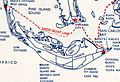 | Details | Ladd's Mail Boat | 1960 |
| Map of route Ladd's mail boat Santiva Cape Coral Sanibel Captiva Florida |
|
Ladd's Mail Boat |
|
| 1960 |
| LOC:11 |
| $0.00 | Ladd-s-Mail-Boat | Map-of-route-Ladd-s-mail-boat-Santiva-Cape-Coral-Sanibel-Captiva-Florida | SOLD<br><br>On December 9, 1963 the last mail boat in the U.S. made it’s final trip. Ladd's Mail Boat "Santiva" operated from Fort Meyers, Florida by Captain Palmer Ladd of Ladd Boat Line was the last in a series of vessels to provide water-borne mail service to Captiva and Sanibel Islands. The Santiva followed the Dixie, the Gladys, the stern-wheelers Success and Grey Eagle, and numerous sailing vessels that brought ice, fresh meat, livestock, and building materials to the islands. On the return trips the vessels carried away fresh produce including prized Sanibel tomatoes. Since 1938 the mail route was combined with a sightseeing tour . (Source: Sanibel-Captiva Record, Dec 12, 1963). |
| 5046 | 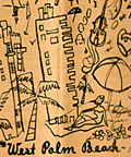 | Details | City of West Palm Beach | 1950 |
| 50s pictorial map of West Palm Beach Florida. Tropical Florida's First Resort. |
|
City of West Palm Beach |
|
| 1950 |
| LOC:0 |
| $0.00 | City-of-West-Palm-Beach | 50s-pictorial-map-of-West-Palm-Beach-Florida---Tropical-Florida-s-First-Resort- | SOLD<br></br>
Fine stylized pictorial map ca. 1950 of Lake Worth, the Intracoastal Waterway, Hypoluxo Island, Loxahatchee River, and West Palm Beach, Florida. With mention of Boca Raton, Boynton, Delray Beach, and the northerly communities in the Palm Beaches: Jupiter, Juno, etc. Each Florida locality is represented by a series of pictorial icons representing the business and recreational activities significant to the area. The brochure describes the map:
<div class="indenttextblocksingle">
"A pictorial pleasure map gives you thumbnail impressions of life in tropical Florida's first resort area, with interesting characteristics of West Palm Beach and her sister communities."
</div>
</br>
Mentions the auto production of the B.S. Cunningham Company (est. 1950) in West Palm Beach, Florida.
<br></br>
Folds to 4" x 9". Remainder of booklet is packed with photographs and text about the area, complemented by attractive color images sketched in the same breezy, informal style as the map. 16 pages. Published by the City of West Palm Beach in cooperation with the West Palm Beach Chamber of Commerce. |
| 5111 |  | Details | Key Biscayne Chamber of Commerce | 1961 |
| Street map of Key Biscayne, Florida from 1961. |
|
Key Biscayne Chamber of Commerce |
|
| 1961 |
| LOC:11 |
| $0.00 | Key-Biscayne-Chamber-of-Commerce | Street-map-of-Key-Biscayne--Florida-from-1961- | SOLD
<br></br>
Street map of Key Biscayne, Florida from 1961. Published by the Key Biscayne Chamber of Commerce with a 17-point key to points of interest on the island including the Cape Florida Lighthouse on the southernmost tip of the island. |
| 5133 |  | Details | Anonymous | |
| Manuscript map of the Marche and Cold Springs, Arkansas |
|
Anonymous |
|
|
| LOC:0 |
| $0.00 | Anonymous | Manuscript-map-of-the-Marche-and-Cold-Springs--Arkansas | SOLD
<br></br>
Manuscript map of the Marche and Cold Springs, Arkansas ca. 1890. The map is related to early Polish emigration to the area and was drawn or owned by "Helen Ch." (assumed Helen Choinski). Helen Choinski was the daughter of Timothy Choinski, a Polish nobleman, who founded the community at Warren, Arkansas in 1877. Helen Choinski worked as local Postmistress and telegrapher and in 1894 Helen married M. Schnable who worked for the Cotton Belt Railway. The map shows considerable skill and training in surveying and map making, but there is no indication Helen Choinski possessed such skills.
<br></br>
While in Wisconsin, Count Timothy von Choinski, a nobleman and political refuge from Poland, became concerned with the suffering of many of his fellow Polish immigrants who were residing in the slums of large cities such as New York and Chicago. Choinski wished to improve the working and living condition of these immigrants and began the search for a farming environment that was more familiar to these Poles. After meeting with the land agent for the Little Rock and Fort Smith Railway in March 1877, Choinski purchased 22,000 acres ten miles northwest of Little Rock.
<br></br>
Polish resettlement began in 1877 at Old Warren, Arkansas ten miles north of Little Rock. Later renamed the "Marche" after the French word for market, the community became a magnet for Polish emigres. The settlement of Marche is one of the most successful efforts to resettle immigrants in Arkansas history.
<br></br>
Sources:
https://encyclopediaofarkansas.net/entries/marche-pulaski-county-3295/
</br>
https://honors.uca.edu/wiki/index.php/Marche |
| 5134 |  | Details | Andreas, S. T. | 1885 |
| Antique birds eye view of the Battle of Shiloh Tennessee |
|
Andreas, S. T. |
|
| 1885 |
| LOC:88 |
| $0.00 | Andreas--S--T- | Antique-birds-eye-view-of-the-Battle-of-Shiloh-Tennessee | SOLD<br></br>
Circular lithographed bird's-eye view of the U.S. Civil War Battle of Shiloh, Tennessee on April 6 and 7, 1862. The fine, detailed view is based on a large painted panorama of the battle designed by French panorama artist Theophile Francois Henri Poilpot (1848-1915). The panorama was commissioned by A. T. Andreas and displayed in Chicago in 1885.
<br></br>
From the Manual of the Panorama of the Battle of Shiloh published in 1885 by A.T. Andreas, 602 Opera House. Topographic survey for the panorama was conducted by M.B. Hewson and F.J. McIntosh, Civil Engineers and Surveyors. The Manual was given out to visitors who viewed the panorama in Chicago during the summer of 1885. |
| 5168 |  | Details | Batson, E. Bert | 1948 |
| Cyanotype Map Sable Island Graveyard of the Atlantic Shipwrecks |
|
Batson, E. Bert |
|
| 1948 |
| LOC: |
| $0.00 | Batson--E--Bert | Cyanotype-Map-Sable-Island-Graveyard-of-the-Atlantic-Shipwrecks | <a href="https://www.rarecharts.com/ShowDetail/Creator/Batson--E--Bert/Title/Sable-Island-Canada-Map-Graveyard-of-Atlantic-Shipwrecks-Cyanotype/5404" target="_blank">This chart is SOLD but see another example of the Sable Island chart in our inventory.</a>
<br></br>
Interesting, original cyanotype map "Sable Island Graveyard on the Atlantic Shipwrecks Since 1800", sold by E. Bert Batson, but after a design by Donald S. Johnson, a member of the Sable Island Lifeboat Organization. |
| 5404 | 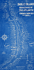 | Details | Batson, E. Bert | 1948 |
| Sable Island Canada Map Graveyard of Atlantic Shipwrecks Cyanotype |
|
Batson, E. Bert |
|
| 1948 |
| LOC: |
| $0.00 | Batson--E--Bert | Sable-Island-Canada-Map-Graveyard-of-Atlantic-Shipwrecks-Cyanotype | SOLD<br><br>
Scarce, original cyanotype chart <strong>"Sable Island, Graveyard on the Atlantic, Shipwrecks Since 1800"</strong>, only the second copy we have seen in 12 years!
<br><br>
Sold by E. Bert Batson, but after a design by Donald S. Johnson, a member of the Sable Island Lifeboat Organization. Copyrighted by R. Ian McDonald; in Canada 1938; in U.S.A. June 1948. Only one holding in WorldCat.
<br></br>
In 1916 E. Bert Batson started in Halifax, Nova Scotia as a junk dealer after a varied career as a soldier, sailor, and bank messenger. Batson bought from estate and Admiralty sales, auctions and other secondhand sources, selling his wares from a location on the Halifax waterfront, later moving to 36-38 Lower Water Street. His motto was <b>"Everything from a needle to an anchor."</b><br></br>
<div id="0" align="center">
<a title="TITLE HERE"></a>
<img id="3" src="/zoomifyimages/SC_5404/BertBatson.gif" alt="Bert Batson's store in Halifax, Nova Scotia." width="300"/> <br><small>Bert Batson's storefront in Halifax, Nova Scotia.</small>
</div><br>
Here's a few paragraphs from a 1946 profile of Bert from Maclean's magazine:
<div class="indenttextblock">
You may know of Bert. A lot of people do. He’s the “Needle To An Anchor” man. His store on Lower Water Street in Halifax is a fabulous place... it’s a combination junk yard, ship chandler’s, department store, antique dealer’s, curio collector’s heaven and commission broker’s. Its customers include shipping men, souvenir hunters, antique collectors and a lot of other people in America and Europe and everybody in Halifax. And it’s likely to sell them anything from secondhand rolled oats, discarded gold mines, kidney pills or unmarketable fish, to shower curtains, ship’s lanterns, conveyer belts, Epsom salts and used bathtubs.
</br>
(Online: O'Hearn, D. P. Maclean's Magazine, November 15, 1946.)
</div> |
| 6662 |  | Details | Batson, E. Bert | 1948 |
| Bert Batson Sable Island Canada Map Graveyard of Atlantic Shipwreck |
|
Batson, E. Bert |
|
| 1948 |
| LOC:53 |
| $0.00 | Batson--E--Bert | Bert-Batson-Sable-Island-Canada-Map-Graveyard-of-Atlantic-Shipwreck | SOLD<br><br>
Original blueprint chart <strong>"Sable Island, Graveyard on the Atlantic, Shipwrecks Since 1800"</strong>, only the third copy we have seen in 12 years!
<br><br>
Sold by E. Bert Batson, but after a design by Donald S. Johnson, a member of the Sable Island Lifeboat Organization. Copyrighted by R. Ian McDonald; in Canada 1938; in U.S.A. June 1948. Only one holding in WorldCat.
<br></br>
In 1916 E. Bert Batson started in Halifax, Nova Scotia as a junk dealer after a varied career as a soldier, sailor, and bank messenger. Batson bought from estate and Admiralty sales, auctions and other secondhand sources, selling his wares from a location on the Halifax waterfront, later moving to 36-38 Lower Water Street. His motto was <b>"Everything from a needle to an anchor."</b><br></br>
<div id="0" align="center">
<a title="TITLE HERE"></a>
<img id="3" src="/zoomifyimages/SC_5404/BertBatson.gif" alt="Bert Batson's store in Halifax, Nova Scotia." width="300"/> <br><small>Bert Batson's storefront in Halifax, Nova Scotia.</small>
</div><br>
Here's a few paragraphs from a 1946 profile of Bert from Maclean's magazine:
<div class="indenttextblock">
You may know of Bert. A lot of people do. He’s the “Needle To An Anchor” man. His store on Lower Water Street in Halifax is a fabulous place... it’s a combination junk yard, ship chandler’s, department store, antique dealer’s, curio collector’s heaven and commission broker’s. Its customers include shipping men, souvenir hunters, antique collectors and a lot of other people in America and Europe and everybody in Halifax. And it’s likely to sell them anything from secondhand rolled oats, discarded gold mines, kidney pills or unmarketable fish, to shower curtains, ship’s lanterns, conveyer belts, Epsom salts and used bathtubs.
</br>
(Online: O'Hearn, D. P. Maclean's Magazine, November 15, 1946.)
</div> |
| 5179 | 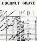 | Details | Coconut Grove Citizen's Committee | 1949 |
| Broadside with map of the Re-zoning Plan for Coconut Grove Florida Colored Town |
|
Coconut Grove Citizen's Committee |
|
| 1949 |
| LOC:0 |
| $0.00 | Coconut-Grove-Citizen-s-Committee | Broadside-with-map-of-the-Re-zoning-Plan-for-Coconut-Grove-Florida-Colored-Town | SOLD<br></br>
<br></br>
<div style="text-align: center;font-size:140%;">
Citizens Take Initiative for First Time in Miami's History
</div>
<br>
Broadside (10" x 16") by the Coconut Grove Citizens' Committee for Slum Clearance, Inc. Includes a map of the "Re-zoning Plan Coconut Grove Colored Town" a neighborhood in Miami, Florida. With an <b>article by Marjorie Stoneman Douglas</b> reviewing the history of a Coconut Grove slum ("colored town") from over-development and the efforts to enact a zoning plan that the Committee believed would benefit the community rather than solely benefit developers. Published Feb 24, 1949. |
| 5226 | 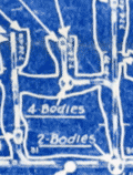 | Details | Sonman Shaft Coal Company | 1940 |
| Unrecorded cyanotype map Sonman Mine Explosion Portage PA |
|
Sonman Shaft Coal Company |
|
| 1940 |
| LOC:62 |
| $0.00 | Sonman-Shaft-Coal-Company | Unrecorded-cyanotype-map-Sonman-Mine-Explosion-Portage-PA | SOLD<br></br>
Unrecorded cyanotype (blueprint) map of the Sonman Mine disaster in Portage Township near Portage, Pennsylvania. On July 15, 1940 sixty-three miners were killed as the result of a methane explosion in the Sonman "E" mine. Some of the miners suffocated slowly after the explosion; a few had time to write notes to their families before they expired.
<br></br>
The trace used for this blueprint map was produced by the Sonman Shaft Coal Company on July 31, 1940, a short two weeks after the explosion. From the presentation of the artifact, it was generated from the trace at some point after July 1940 (shows evidence the trace was torn and folded).
<br></br>
The map shows locations of the miners' bodies and notes numerous other items found and the status of the mine in many locations, all providing clues as to the cause of the explosion. Bodies of numerous mules are shown, a reminder of their importance in mining operations a bit more than eighty years ago.
Among the numerous notes are:
<div class="indenttextblocksingle">
<ul style="list-style-type: circle;">
<li>"8 sticks explosives undisturbed in box"</li>
<li>"2 shirts blown in bye not burnt"</li>
<li>"Hangers broken off. Trolley wire thrown on run-a-way switch lever considerable coke around lever"</li>
<li>"Distance from broken light to trolley wheel is 7.5 feet. Trolley was resting on sleeve..."</li>
<li>"C.H4 = 0.05 at cave" [CH4 is the chemical compound Methane]</li>
</ul>
</div>
Scale 1" = 100' . No. F-649. Drawn and traced 7-31-40 by J.M.B.
<br></br>
A cyanotype or blueprint map is produced by overlaying an inked trace map over a piece of specially treated blueprint paper and exposing to sunlight for up to 20 minutes. The paper is then washed, and any areas that have not been exposed to sunlight (like lines and print) wash clean, revealing the white base of the paper. All areas that were exposed to sunlight turn a shade of blue. |
| 5230 | 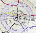 | Details | Calvin, F. F. | 1916 |
| WWI map promoting Salt Lake City as an Army Depot |
|
Calvin, F. F. |
|
| 1916 |
| LOC:62 |
| $0.00 | Calvin--F--F- | WWI-map-promoting-Salt-Lake-City-as-an-Army-Depot | SOLD<br></br>
Colorful, unrecorded thematic map made during WWI with the objective of presenting Salt Lake City, Utah as a great choice for a future Army Depot based on its proximity to war materials. In 1920 the Ogden Ordnance Reserve Depot was established (with 1410 acres) as a general storage depot for left-over ordnance from WWI, less than 35 miles north of Salt Lake City.
<br></br>
No copies found anywhere online, thus rare.
<br></br>
Printed base map with a circular scale at 50 mile intervals showing the distance from Salt Lake City, Utah to numerous commodities necessary for conducting the war effort. Hand color to the outline of the USA and the distance scale. Colorful ink coloring hand applied to highlight national and interstate highways and railroads.
<br></br>
At upper right a Table of Production in the Vicinity of Salt Lake City. Table shows three data elements arranged in columns:
<div class="indenttextblocksingle">
<li>The Industry or Product e.g. coal, potash, horses, mules, creameries.</li>
<li>Annual production capacity or head count for that product.</li>
<li>Distance from Salt Lake City for that product.</li>
</div>
Prepared by F.F. Calvin February 1, 1916. Scale 1" = 115 miles. |
| 5312 | 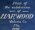 | Details | Rogers, P. D. | 1888 |
| Antique cyanotype cadastral map Harwood Volusia County Florida Old Kings Road |
|
Rogers, P. D. |
|
| 1888 |
| LOC:53 |
| $0.00 | Rogers--P--D- | Antique-cyanotype-cadastral-map-Harwood-Volusia-County-Florida-Old-Kings-Road | SOLD<br><br>Rare early cyanotype (blueprint) cadastral plat map of the subdivision of <b>Harwood</b> in Volusia County, Florida (near Bulow Creek State Park), bounded to the west by the <b>Old King's Road</b>. Only known cadastral map that locates the failed "Harwood" settlement. The plat is the oldest of two known reference sources for the location of the Old King's Road in Volusia County. A valuable historic reference, the map shows land use: marsh, hammocks, islands, and groves.
<br></br>
The Harwood settlement was planned by orange grower Norman B. Harwood who in 1880 purchased 4,000 acres in Volusia County, including the Ormond Plantation "Damietta" [1]. The Harwood settlement was a failure. Deeply in debt, Norman Harwood died in May, 1885.</b>
<br></br>
During the second Spanish occupation of Florida, Spain granted large tracts of land in the Tomoka basin to settlers as an inducement to move to the region. These settlers included the Ormonds, Bulows [2], McHardys [3], and Dummitts [4].
<br></br>
Surveyed in 1888 by Civil Engineer P. D. Rogers of Daytona, Florida. North oriented at right. Manuscript notations.
<br></br>
The plat shows the tomb of James Ormond II who died September 30, 1829 (now Ormond Tomb State Park). Includes an inset context map of the Florida coast from Jacksonville to Mosquito Inlet with the St. Johns River. The context map shows the settlement of Harwood prominently near the coast just north of Ormond, Fla.
<br></br>
<b>NOTES:</b><br>
[1] The landmark Fairchild Oak and the Ormond Tomb (see plat) are both located on land shown on this plat. The Spanish granted sea captain James Ormond 2,000 acres in 1807.<br>
[2] Bulow Creek bounds the property to the northeast alongside a now lost "Atlantic Avenue".<br>
[3] Robert Mc Hardy, a surveyor, received a Spanish grant of 1,100 acres in 1808. <br>
[4] Dummitt Plantation, directly south of this plat, was the site of the first steam-powered sugar mill in the area. |
| 5316 | 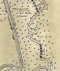 | Details | Stuart, C.W. | 1925 |
| Antique cadastral plat for Moundgrove Fruit Company Ormond Florida |
|
Stuart, C.W. |
|
| 1925 |
| LOC:87 |
| $0.00 | Stuart--C-W- | Antique-cadastral-plat-for-Moundgrove-Fruit-Company-Ormond-Florida | SOLD
<br></br>
Blueline plat map, with MS additions, of agricultural lands in Volusia County northwest t of Ormond Beach, Florida. The plat was created by surveyor C. W. Stuart during the 1920's Florida land boom.
<br></br>
The lands, in several tracts, were owned primarily by the Moundgrove Fruit Company and the Halifax Grove Company. From a lot of plats related to the Wetumpka Fruit Company. Shows Halifax Avenue at the west and John Anderson Highway spanning Moundgrove Fruit Company lands at bottom center. Other landholders include George Beed, H. T. Cook, W. R. McElroy; Raymond and Anita Tassinari.
<br></br>
Dated within at September, 1925. North oriented to the upper left corner.
<br></br>
With red ink stamp for the office of Alex D. Littlefield Realtor, 416 Seabreeze Blvd. Daytona Beach, Florida.
<br></br>
Lands shown on this plat are bounded to the west and south by Bulow Creek and to the east by the Intracoastal Waterway and Smith Creek. |
| 5315 | 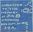 | Details | Anonymous | 1918 |
| Plat map Halifax Company Lands Ormond Volusia Florida |
|
Anonymous |
|
| 1918 |
| LOC:53 |
| $0.00 | Anonymous | Plat-map-Halifax-Company-Lands-Ormond-Volusia-Florida | SOLD<br><br>A plat map for Halifax Company Lands in Volusia County, Florida. This plat reflects the desire to subdivide the land into smaller lots for residential and commercial use . Shows manuscript crayon notations (in red) "Bunnell 9 mi." and "Rt. 1", for Ridgewood Avenue a stretch of the Dixie Highway, as it turned west to Bunnell, Florida through what is today the Halifax Plantation area.
<br></br>
Rare early cyanotype (blueprint) plat of the subdivision of Halifax in Volusia County, Florida (near Bulow Creek State Park and northwest of Ormond Beach), bounded to the west by the <b>Old King's Road</b>. An updated plat of the area <b>previously platted as the Harwood Subdivision in 1888 by Norman Harwood</b> (see our stock number 5314). In comparison to P. D. Roger's 1888 plat of the same area, this map shows no indication of land use (hammocks, islands, marsh) suggesting that the land was drier by this date.
<br></br>
The plat shows the tomb of James Ormond II who died September 30, 1829 (now Ormond Tomb State Park).
<br></br>
Some of the differences between this plat and the earlier plat of Harwood (1888) include:<br></br>
<div class="indenttextblocksingle">
<ul style="list-style-type: circle;">
<li>Most of the streets are re-named. What is today "the Old Dixie Highway" was named Ridgewood Avenue. The Dixie Highway was constructed between 1915 and 1929.</li>
<li>Bead, Knox & Bead canal is shown entering Bulow Creek.</li>
<li>Many new building sites are platted north of Ormond Tomb on both sides of Ridgewood Avenue.</li>
<li>Plat clearly shows the north and south boundaries of the Ormond Grant.</li>
<li>This plat shows in more detail and names the extent of the Mary Kunner grant.</li>
<li>Harwood Grove Company plot is now labeled Halifax Grove Reservation, reflecting a change in ownership.</li>
</ul>
</div> |
| 5341 | 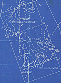 | Details | Goodrich, James J. | 1930 |
| Cyanotype map of oilfields north of Round Rock Austin Texas |
|
Goodrich, James J. |
|
| 1930 |
| LOC:88 |
| $0.00 | Goodrich--James-J- | Cyanotype-map-of-oilfields-north-of-Round-Rock-Austin-Texas | SOLD
<br></br>
Original cyanotype (blueprint) map of "massive beds of buda limestone" and associated oil wells drilled in the area between 1915 and 1925. The blueprint map "Reconnaissance Map of Part of Williamson, Texas" covers an area extending north from Round Rock, Texas, terminating at Georgetown, Texas a distance of approximately 8 miles.
<br></br>
Owners of the tracts of land shown on this map include: Francis A, Hudson, B. C. Low, A. L. Eaves, N. B. Anderson, and Thomas Glasscock.
<br></br>
From 1854 to 1882, the Texas state legislature gave each railroad company 16 sections of land out of its public domain for every mile of railroad constructed and put into use anywhere in the state. The map shows the lines for two railways: the International and Great Northern Railroad (I. & G. N. R. R.) and the Missouri, Kansas, and Texas Railroad (M. K. & T. R. R. ) which encircle the area covered in this map.
<br></br>
Signed within by H. B. Goodrich, Petroleum Geologist. Tulsa, Oklahoma. June 18, 1930. |
| 6418 |  | Details | Leon, Eli | 1968 |
| Unreleased fish-eye birds-eye view poster 1968 California Berkeley Centennial |
|
Leon, Eli |
|
| 1968 |
| LOC:87 |
| $0.00 | Leon--Eli | Unreleased-fish-eye-birds-eye-view-poster-1968-California-Berkeley-Centennial | SOLD<br><br>Very rare and extremely fine 60's-era poster view of the campanile and campus of the University of California Berkeley, a dizzying birds-eye view taken with a fish-eye lens. This masterful poster was designed by Eli Leon and printed in 1968 for the centennial of Berkeley's founding. According to the Oakland Museum of California's web site, who owns the only other known copy of this poster: <br><br>
<div class="indenttextblocksingle">
"According to the artist, this poster was commissioned by U.C. Berkeley <u>but never released</u>. [LMC] [1]"
</div>
<br>
Robert Stanley Leon (1935-2018) was best known as a collector of African American quilts, but is credited with the creation of this rare poster despite having no known training in the visual arts.
<div class="indenttextblocksingle">
"Eli Leon was an Oakland-based collector, scholar, and champion of African American quiltmakers whose gift of nearly 3,000 quilts to BAMPFA <i>[UC Berkeley Art Museum and Pacific Film Archive]</i> has made possible an inspiring future of scholarship and presentation here in Berkeley. In addition to collecting artwork, Leon also compiled a massive–and unruly–collection of raw materials and textiles." [2]
</div>
<br><br>
Sources:
<br><br>
[1] Eli Leon ~ artist. 2022. Online: http://collections.museumca.org/?q=collection-item/201054808<br>
[2] BAMPFA. From the Estate of Eli Leon: Textile Improvisations. Online: "https://bampfa.org/event/estate-eli-leon-textile-improvisations |
| 6408 | 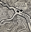 | Details | Lister, James Wren | 1949 |
| Pictorial map of Laurel Canyon Hollywood Sunset Boulevard |
|
Lister, James Wren |
|
| 1949 |
| LOC:87 |
| $0.00 | Lister--James-Wren | Pictorial-map-of-Laurel-Canyon-Hollywood-Sunset-Boulevard | SOLD
<br><br>
Very rare and desirable Wren Lister pictorial map of <b>Laurel Canyon</b> This is a rare cartographic record of the Canyon and the Hollywood Hills before they became the haunt and home to 70's counterculture figures and music stars such as Joni Mitchel, James Taylor, Jim Morrison, Neil Young, and Brian Wilson.
<br><br>
A California cartographic rarity, no holdings of Wren's map are found anywhere including in WorldCat, AMPR, or the Internet. Only one record of a past sale of this item.
<br><br>
Laurel Canyon is a mountainous neighborhood in the Hollywood Hills of the Santa Monica Mountains, near Los Angeles, California.
<br><br>
Artist James Wren Lister (1897-1952) was born in England but settled in Los Angeles in 1925. Lister is also credited with a fine, colorful birds-eye view of <b>Avalon Town on Santa Catalina Island California</b> in 1948, a year before this item was created. |
| 6475 |  | Details | Prewitt, Jim | 1980 |
| Pictorial advertising map of 6th Street in Austin Texas |
|
Prewitt, Jim |
|
| 1980 |
| LOC:53 |
| $0.00 | Prewitt--Jim | Pictorial-advertising-map-of-6th-Street-in-Austin-Texas | SOLD
<br><br>
Scarce, humorous, pictorial advertising map of <b>6th Street in Austin Texas</b> by Texas graphic artist and illustrator Jim Prewitt. The cheerful map shows Austin's 6th Street as it was more than 40 years ago. Alongside dozens of advertisements for local businesses like Maggie Mae's, Santiago's, and Ravens Garage the detailed map is dotted with interesting cartoons typical to Austin daily life including snakes, armadillos, longhorn cattle, UFO's, and a police chase with dynamite along Interstate 35.
<br><br>
<div id="0" align="center">
<a title="TITLE HERE"></a>
<img id="3" src="/ZoomifyImages/SC_6475/SC_6475_330w.jpg" alt="Pictorial fun map of Austin's 6th Street in 1980." width="300"/> <br><small>6th Street, Austin, Texas. 1980. Jim Prewitt.</small>
</div><br>
With an advertisement for the first Pecan Street Festival held on Saturday and Sunday, May 3rd and 4th, 1980 (left center). Austin's Pecan Street Festival was inaugurated in 1980 by the non-profit Pecan Street Association with the goal of highlighting and beautifying the historical heritage of the district. In 1997 President of the Pecan Street Association Lynn Raridon explained "We like to think that our event was helping to <b>Make Austin Weird</b>, long before it was a trendy catch phrase/bumper sticker!" [1]
<br><br>
Copyright Jim Prewitt Design, 1023 West San Antonio Street, San Marcos, Texas. Printed by Futura Press, Austin Texas. Verso blank.
<br><br>
A local boy, Jim graduated Texas A&M-Kingsville. Other Jim Prewitt pictorial advertising maps of Texas towns include Wimberly, San Marcos, New Braunfels, Kingsville and Corpus Christi. [2]
<br><br>
Sources
<br><br>
[1] Salizar, Marisa. 37th Annual Pecan Street Festival. September 24, 2017. Jim Bowie High School Dispatch. Online.<br>
[2] Walraven, Bill. Cartoonist turns fun maps into profitable venture. January 17, 1985. Online: http://archives.tamuk.edu/uploads/A2019-016.0125E.pdf |
| 6818 | 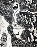 | Details | Landacre, Paul Hambleton | 1932 |
| The Gold Fields |
|
Landacre, Paul Hambleton |
|
| 1932 |
| LOC: |
| $0.00 | Landacre--Paul-Hambleton | The-Gold-Fields | This Item Is no longer in our inventory. Please enquire about other examples.
<br><br>
A beautiful map of west-central California after a wood-block print by acclaimed wood-block engraver Paul Landacre: "The Gold Fields". Based on my research, I have been able to discover only two cartographic works attributed to Landacre, the other is the very rare "Cinema Heaven" produced by Landacre in 1932. This map was issued in 1933.
<br><br>
From the book "A Gil Blas in California" (1) where Landacre provided not only this fine map, but also the wood-block engraved chapter vignettes. The book, by Alexander Dumas, author of The Count of Monte Cristo and The Three Musketeers, describes a Frenchman's voyage to San Francisco and his disappointing attempt to get rich prospecting for gold near Stockton, California during the 1849 gold rush. <br><br>
<div id="0" align="center">
<a title=""></a>
<img id="6818" src="/ZoomifyImages/SC_6818/SC_6818_detail_1.jpg" alt="" width="150"/> <br><br> <font size="-2">Chapter vignette by Paul Landacre.</font>
</div>
<br>
(1) A Gil Blas in California. Alexander Dumas. Translated by Marguerite Eyer Wilbur. Primavera Press. Los Angeles. 1933. |
| 6753 | 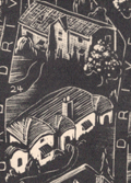 | Details | Landacre, Paul Hambleton | 1932 |
| Rare Pictorial Map of Beverly Hills with homes of the stars |
|
Landacre, Paul Hambleton |
|
| 1932 |
| LOC:89 |
| $0.00 | Landacre--Paul-Hambleton | Rare-Pictorial-Map-of-Beverly-Hills-with-homes-of-the-stars | SOLD <br><br> Rare lithographed pictorial map of Beverly Hills, California, 1932, with homes of movie stars by California artist and printmaker Paul Landacre. Should be a foundational item for Landacre collectors as it is his most ambitious known single work of commercial advertising and is the earliest and only the second cartographic creation of Landacre I have found (1). Signed in the plate by Landacre. Key at bottom references movie stars by name to homes on the map. These stars include Douglas Fairbanks, Buster Keaton, Marion Davies, Mary Pickford, Lionel Barrymore, Stan Laurel, Jack Warner, and Charles Chaplin. The map is after a wood-block engraving, by Landacre "Cinema Heaven", now cracked and held in the Clark Memorial Library at UCLA.
<br><br>
Reviewing numerous online images by Landacre it is apparent that the map is a departure from Landacres' usual output of landscapes, still life's, nudes, and abstractions. However, in 1932 the U.S. was in the depth of the Great Depression and Landacre was probably pleased to have the income from this commercial commission.
<br><br>
Verso with the Francis Nicholl Pictograph Guide of Los Angeles, including Pasadena, Culver City, Brentwood, Long Beach, and San Pedro. Includes alphabetic list of movie stars with their addresses.
<br><br>
No examples of "Cinema Heaven" or this publication of Landacre's "Newe Mappe" map is found online. No record of a sale found on WorthPoint.
<br><br>
(1) Landacre, Paul. The Gold Fields. 1933.<br>
Reference: https://www.themagazineantiques.com/article/paul-landacres-world/ |
| 6572 |  | Details | Newspaper Art League | 1915 |
| Marin County California Pictorial Cadastral Map of La Verne Heights Subdivision |
|
Newspaper Art League |
|
| 1915 |
| LOC: |
| $0.00 | Newspaper-Art-League | Marin-County-California-Pictorial-Cadastral-Map-of-La-Verne-Heights-Subdivision | SOLD
<br><br>
Rare cadastral map of La Verne Heights, a newly platted subdivision in Marin County, California circa 1915. Only two other copies of this scarce cadastral map are known, both at institutions. No sales of the map are recorded.
<br><br>
J. W. Wright & Co of San Francisco were the exclusive agents for the land. Bears the attribution and the logo of the Newspaper Art League.
<br><br>
At top of the plan is a depiction of the Park Avenue Station and the lines for a "Fast Electric Train" of the Northwestern Pacific Railroad (NWP) that claimed a one way commute of "15 minus to Sausalito" and "1/2 hour to San Francisco. The NWP operated a network of electric rail lines in Marin County from 1903 to 1941.
<br><br>
At upper left is an inset view of Mt. Tamalpais from Laverne Heights. Inset of Marin County High School, actually Tamalpais High School with an optimistic note: "12 minutes.. walk to Marin County High School."
<br><br>
Homes are depicted of some prominent existing families who lived nearby including: Captain Robinson, Dr. Allen, the Armstrong Home, the Isted and the Stolte residences, the Dobbs, Wises, Gruenhagens, and Lillian Ferguson. Ferguson was a reporter on the San Francisco Examiner, later she edited paper's Sunday edition.
<br><br>
The developer included lot dimensions, square footage, and lot number.
<br><br>
(1) Online. December 2022. https://www.mvhistory.org/history-of/history-of-homestead-valley/laverne-heights-maps/ |
| 6788 | 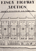 | Details | Jordan, T. M. | 1938 |
| First map after incorporation of Myrtle Beach South Carolina |
|
Jordan, T. M. |
|
| 1938 |
| LOC: |
| $0.00 | Jordan--T--M- | First-map-after-incorporation-of-Myrtle-Beach-South-Carolina | Sold<BR><BR>Long folding map of Myrtle Beach, South Carolina published during 1938, the year Myrtle Beach was incorporated as a town . The map was compiled in July, 1938 by Civil Engineer T. M. Jordan, an early resident of the area. North is oriented to the upper right. |