| | Thumbnail | | Creator | Date | Title / Author / Date / Location | Price | | | Description |
| 6703 | 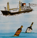 | Details | Prevoteau, Gerard | 1980 |
| Pictorial Map Aruba Pearl in the Caribbean |
|
Prevoteau, Gerard |
|
| 1980 |
| LOC:51 |
| $350.00 | Prevoteau--Gerard | Pictorial-Map-Aruba-Pearl-in-the-Caribbean | Very scarce out-of-print advertising-oriented pictorial map, circa 1980, of the island of Aruba in the Caribbean Sea. Illustrated by Gerard Prevoteau and published by Imprimerie Berger-Bellepage, Fort de France, Martinique (1). Prevoteau is known to have created more than thirty illustrations of towns and islands including Reims, the isle of Oleron, and a pair of maps or plans of the French town of St. Malo, France. Not in WorldCat.
<br><br>
Captions for many illustrations in either Dutch, English, or Spanish.
<br><br>
Aruba is a small Caribbean island located just off the coast of Venezuela. The island has a rich history, having been inhabited by indigenous tribes before being colonized by the Spanish in the 16th century. Today, Aruba is an autonomous territory of the Netherlands, and its culture is a unique blend of Dutch, Caribbean, and Latin American influences. Aruba is known for its beautiful beaches and also boasts a variety of outdoor activities, including snorkeling, scuba diving, hiking, and horseback riding. The island is also home to a number of historic landmarks and cultural attractions, including the California Lighthouse, the Arikok National Park, and the vibrant capital city of Oranjestad.
<br><br>
(1) Berger Bellepage company was created on August 1st, 1964, and it is one of the oldest printing companies in Martinique. The current printing facility has been located in Fort-de-France since 1969. |