| | Thumbnail | | Creator | Date | Title / Author / Date / Location | Price | | | Description |
| 6803 | 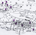 | Details | British Admiralty Hydrographical Office | 1974 |
| Original Admiralty Nautical Chart of Providence Island, Bahamas |
|
British Admiralty Hydrographical Office |
|
| 1974 |
| LOC: |
| $255.00 | British-Admiralty-Hydrographical-Office | Original-Admiralty-Nautical-Chart-of-Providence-Island--Bahamas | A fine British Admiralty nautical chart of the Bahamas Island of New Providence, first published in August, 1843. Retains the look of a mid-19th century copper-engraved sea chart. Admiralty chart # 1489.
<br><br>
At top of chart is a coastal elevation view of the Town of Nassau, on the Island of New Providence, from a distance offshore.
<br><br>
This item is the sixth edition of 1914 with corrections to 1974. |