| | Thumbnail | | Creator | Date | Title / Author / Date / Location | Price | | | Description |
| 8037 | 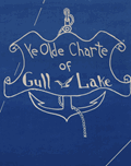 | Details | Conrad, Maynard | 1955 |
| Ye Olde Charte Of Gull Lake Kalamazoo County Michigan |
|
Conrad, Maynard |
|
| 1955 |
| LOC:130 |
| $375.00 | Conrad--Maynard | Ye-Olde-Charte-Of-Gull-Lake-Kalamazoo-County-Michigan | Mid twentieth century blueprint pictorial map of Gull Lake in Kalamazoo and Barry Counties, Michigan, with hand-drawn shorelines, compass rose, and whimsical period lettering. The sheet captures the resorts, parks, beaches, and cottages that once ringed this deep spring-fed lake north of Kalamazoo, documenting the area as a regional leisure destination. The artist, Dr. Maynard Conrad (d. 1998) uses simple white linework on blue background to present an engaging portrait of the lake at a time when summer colonies, canoe clubs, and motor launches were beginning to reshape the shoreline.
<br><br>
The map highlights a tight cluster of neighboring lakes that define the Gull Lake region. Little Long Lake and Miller's Lake appear to the northwest, while Grassy Lake is shown just beyond the isthmus that separates Gull Lake from its smaller companions. These lakes form part of a distinctive kettle-lake chain created by the region's glacial geography, a landscape that helped establish Gull Lake as one of the most celebrated inland waters of southwest Michigan. The sheet also notes well known features of the day, including Idlewild, Ross Township Park, Island Park, Crescent Beach, the Country Club grounds, and the string of cottages along Lover's Lane.
<br><br>
This pictorial blueprint serves equally as a regional souvenir and a record of community identity around Gull Lake. Resorts such as Bayberry Inn, Hickory Point, and Walnut Inn, together with family parks, bird sanctuaries, and boat landings, illustrate a thriving recreational culture. Surviving large format blueprints of local lakeside development are scarce, and this example offers collectors an attractive combination of graphic charm, local history, and early twentieth century Michigan cartographic style. |