| | Thumbnail | | Creator | Date | Title / Author / Date / Location | Price | | | Description |
| 6506 | 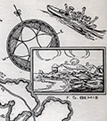 | Details | Dummer, H. Boylston | 1929 |
| Rare unrecorded pictorial historical map Boston South Shore |
|
Dummer, H. Boylston |
|
| 1929 |
| LOC: |
| $450.00 | Dummer--H--Boylston | Rare-unrecorded-pictorial-historical-map-Boston-South-Shore | Unrecorded and very scarce <strong>pictorial map of Boston's South Shore</strong> including the towns of Hingham and Cohasset. The map includes the locations of Bumkin Island, Weir River, World's End, Planters Hill, Sandy Beach, and Hominy Point. Inset illustrations of historical structures including the Garrison House, "Old Ship Church" and "The Old Ordinary" as well as named homes of local families including Ulman, Beal, Reilly, Donovan, Bolles, Foss and the entrance to the estate of Mrs. Thomas J. Plant and Mrs. E.R. Thayer's Weir River Farm.
<br><br>
No examples of the map in WorldCat, OWA, or AMPR. No other copies found online. An online search turned up another map by Dummer in a very similar style and format: "Points of Interest in Quaint Marblehead, published by the Marblehead Craft Shop.
<br></br>
Signed, and dated within to August 4, 1929, |