| | Thumbnail | | Creator | Date | Title / Author / Date / Location | Price | | | Description |
| 3597 | 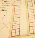 | Details | Multiple Authors | 1870 |
| Lot 1. MULTIPLE 19th C. survey lot and street plans CAMBRIDGE, Massachusetts |
|
Multiple Authors |
|
| 1870 |
| LOC:0 |
| $14,650.00 | Multiple-Authors | Lot-1---MULTIPLE-19th-C--survey-lot-and-street-plans-CAMBRIDGE--Massachusetts | A lot consisting of twenty-five lot and street plans from Cambridge, Massachusetts and nearby areas. An opportunity for a serious collector to expand his collection with items he cannot find elsewhere. <a href="https://www.rarecharts.com/Content/Lot_1_Cambridge_Survey_Artifacts_Locked.pdf" target="_blank">See full detailed lot description.</a>
<br></br>
These plans represent surveys performed in the 1840’s through the 1900’s by local Cambridge area surveyors and engineers William A. Mason, Joseph Whitney, J.G. Chase, E.F. Bowker, W.S. Barbour, and Alex Wadsworth. Artifacts include manuscript surveys, manuscript survey traces, and rare 19th century cyanotype (blueprints). Many of the items in this lot are unrecorded and for the others the few known holdings are in institutions. Condition and size vary by item.
<br></br>
The lot highlight is:
SC_Cam_1. Osgood Carleton [after]. PLAN OF THE CAUSEWAY OVER THE MARSH IN CAMBRIDGE EXHIBITING THE NAMES OF THE OWNERS AND THE QUANTITY OF LAND THROUGH WHICH IT PASSES INCLUDING MR JARVIS’S UPLAND SURVEYED AND PLATTED (by a scale of one chain to an inch) NOV 12TH 1792 BY OSGOOD CARLETON. COPIED FROM THE ORIGINAL BY W.A. MASON & CO. DEC. 20, 1855. MS ink surveyor’s collation number “1637”.
Unrecorded antebellum manuscript cadastral plan of great historical value after an earlier plan in 1793 by well-known Boston surveyor Osgood Carleton. This is the best and only available detailed plan of the West Boston Bridge causeway from the Charles River to Pelham island. This is Mason’s true signed MS surveyor’s copy from a survey made by Osgood Carleton contemporaneously with the Causeway construction. Numerous and detailed pencil notations of ownership record based on Carleton's original survey. Measurements recorded in chains and links.
<br></br>
A very rare plan of the old Causeway stretching 3344 feet over wet marshland largely owned by Leonard Jarvis. |
| 3613 | 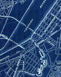 | Details | Multiple Authors | 1885 |
| Lot 2. MULTIPLE antique surveyors plans BACK BAY, BOSTON , Massachusetts |
|
Multiple Authors |
|
| 1885 |
| LOC:0 |
| $6,200.00 | Multiple-Authors | Lot-2---MULTIPLE-antique-surveyors-plans-BACK-BAY--BOSTON---Massachusetts | A lot consisting of twenty lot and street plans from Boston, Massachusetts generally from the decade of the 1880's. Most items by surveyors and engineers William H. Whitney or the firm of Fuller and Whitney, Back Bay Engineers. An opportunity for a serious collector of Boston cartography to expand his collection with items he cannot find except in institutions. <a href="https://www.rarecharts.com/Content/Lot_2_Boston_Survey_Artifacts_Locked.pdf" target="_blank">See full detailed lot description.</a>
<br></br>
From the mid 1850’s through 1890 Boston conducted the most ambitious land-making of the era in the U.S. by transporting and placing gravel, ashes, and sand in an area that was previously a tidal marsh of the Charles River. The landfill of Boston’s Back Bay was fueled by a shortage of suitable land for new construction and the desire to remediate water pollution resulting from earlier bad decisions that placed profit ahead of citizen’s health and welfare.
<br></br>
Over a period of 35 years more than 450 acres of new land was added to Boston by filling the Back Bay with an average of 20 feet of fill. Much of this land was purchased by well-to-do Bostonians and today the Back Bay remains one of the most prestigious locations within that city.
<br></br>
We have been able to obtain 20 rare late 19th century artifacts that document the last decade of the 35 year land-making project in Boston’s Back Bay, for an area from Charlesgate Park to past Kenmore Square.
<br></br>
These maps and plans shed light on some of the decision-making factors and design options for Boston real-estate developers. These artifacts in this lot are of three types: hand-drawn or manuscript survey maps, manuscript traces of those surveys, and blueprints. The artifacts represent a very early application and adaptation of a cutting-edge technology: blueprinting. |