| | Thumbnail | | Creator | Date | Title / Author / Date / Location | Price | | | Description |
| 1141 |  | Details | Murphy, John F. | 1905 |
| Early Birds Eye View of Boston Harbor and the South Shore |
|
Murphy, John F. |
|
| 1905 |
| LOC:0 |
| $0.00 | Murphy--John-F- | Early-Birds-Eye-View-of-Boston-Harbor-and-the-South-Shore | SOLD <BR> </BR>Original 1905 folding harbor birds-eye of South Boston, Nantasket Beach, Hough's Neck, South Bay, Plymouth Bay, Pleasure Bay, Boston Harbor, Dorchester Bay, Quincy Bay, Hingham, Squantum, and Cape Cod Bay to Provincetown, Massachusetts. Verso is blank. Index on inside cover with 35 points of interest is keyed to locations on the map. With its simple cover still attached, <b>the map is in excellent condition</b> with bright colors.
<BR> </BR>
This colorful lithographed chart is the earlier, and more scarce portrait bird's eye view of the area and not the more common landscape view published later by the Union News Corp. The view is also distinguished as an earlier edition of the same view printed later in 1915 with more detail. This very early birds-eye view of Boston bears a copyright attribution: <div class="indenttextblock"> "Copyright 1905 by the Federal Engraving and Publishing Co., Boston, Mass."</div>
Shows steamship routes to coastal towns and identifies many nearby islands including: Moon Island, Pleasure Bay, Governor's Island, Thompson Island, Deer Island, Lovell's Island, Peddock's Island, Georges Island, and Long Island.
<BR> </BR>
This informative map could have been purchased by passengers aboard any steamboat plying the routes shown on the attached map. Published by John F. Murphy, South Station, Boston. That firm is listed on the cover as: " News Agent Eastern District, N.Y.N.H & H.R.R. and Fall River Line Steamers and ROWES WHARF". Price is noted on the front cover as "10 cents". |
| 633 |  | Details | Murphy, John F. | 1915 |
| Birds Eye View of Boston Harbor and South Shore |
|
Murphy, John F. |
|
| 1915 |
| LOC:0 |
| $0.00 | Murphy--John-F- | Birds-Eye-View-of-Boston-Harbor-and-South-Shore | <a href="https://www.rarecharts.com/ShowDetail/Creator/Murphy--John-F-/Title/Early-Birds-Eye-View-of-Boston-Harbor-and-the-South-Shore/1141" target="_blank">This item is sold, but see another similar item in our stock</a>
<br></br>
Original, early 20th-century folding harbor excursion map of South Boston, Nantasket Beach, Hough's Neck, South Bay, Pleasure Bay, Boston Harbor, Dorchester Bay, Quincy Bay, Hingham, Squantum, and Cape Cod Bay to Provincetown. Verso is blank. Index on inside cover with 35 points of interest.
<BR> </BR>
Published by John F. Murphy, South Station, Boston. That firm is listed on the cover as: " News Agent Eastern District, N.Y.N.H & H.R.R. and Fall River Line Steamers and ROWES WHARF". Price is noted on the front cover as "10 cents". |
| 4736 | 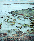 | Details | Murphy, John F. | 1915 |
| Birds Eye View of Boston Harbor and South Shore to Provincetown |
|
Murphy, John F. |
|
| 1915 |
| LOC:88 |
| $275.00 | Murphy--John-F- | Birds-Eye-View-of-Boston-Harbor-and-South-Shore-to-Provincetown | ON HOLD
<br><br>A fine, original, early 20th-century folding harbor excursion map of Boston Harbor ready for framing. This fine antique birds-eye view is bright, in great condition with no holes or tears as is common.
<BR> </BR>
Coverage includes South Boston, Nantasket Beach, Hough's Neck, South Bay, Pleasure Bay, Boston Harbor, Dorchester Bay, Quincy Bay, Hingham, Squantum, and Cape Cod Bay to Provincetown. Verso is blank. Index on inside cover with 35 points of interest keyed on the map.
<BR> </BR>
Published by Union News Company , South Station, Boston, Massachusetts. Price is noted on the front cover as "10 cents". Manuscript owner's name on cover, detached but present. |