| | Thumbnail | | Creator | Date | Title / Author / Date / Location | Price | | | Description |
| 6793 | 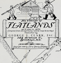 | Details | Nelson, Catherine and E. Theodore | 1944 |
| Pictorial, historical, advertising map of the Village of Flatlands in 1870 |
|
Nelson, Catherine and E. Theodore |
|
| 1944 |
| LOC:89 |
| $275.00 | Nelson--Catherine-and-E--Theodore | Pictorial--historical--advertising-map-of-the-Village-of-Flatlands-in-1870 | Fine historical pictorial promotional map of The Village of Flatlands, as it was in 1870 - compiled from "old and musty maps, records and surveys" by Catherine & Theodore Nelson. The map was commissioned, copyrighted, and published in 1944 by George L. Clark, Inc., "A complete real estate institution", 142 Avenue "U" Brooklyn, N.Y.
<br><br>
Rare. Only two copies recorded in WorldCat.
<br><br>
This historical map of Flatlands encompasses the area of Canarsie, extending eastward from Ocean Avenue to Fresh Creek and northward from Jamaica Bay to Hunters Fly Road. The map provides a detailed representation of the region, showcasing the names of various property owners, as well as the locations of important landmarks such as dams, hotels, schools, shops, public buildings, cemeteries, and churches. Additionally, the map also features the route of the Brooklyn and Rockaway Branch Railroad, which played a significant role in the development and connectivity of the area.
<br><br>
George L. Clark, Inc., formerly Clark Realty Co., is a family real estate firm founded in 1870 that spans five generations of Clarks. John J. Clark began the family business on Long Island in 1870. His son, Patrick L. Clark, relocated the business to Brooklyn in 1907. George L. Clark Sr. joined the family business in 1919 and served the Brooklyn community as a Realtor for 67 years. Clark was active on many New York real estate organizations and was President of the Brooklyn Board of Realtors, the Bay Ridge Real Estate Board and the Flatbush Real Estate Board.
<br><br> |