| | Thumbnail | | Creator | Date | Title / Author / Date / Location | Price | | | Description |
| 6714 | 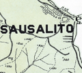 | Details | Northwestern Pacific Railroad | 1931 |
| Hiking Map Marin County California |
|
Northwestern Pacific Railroad |
|
| 1931 |
| LOC:68 |
| $375.00 | Northwestern-Pacific-Railroad | Hiking-Map-Marin-County-California | Original Hiking Map of Marin County California copyrighted and first issued by the Northwestern Pacific Railroad Company (NWPRR) in 1925 [1931]. Shows both hiking trails and fire trails with the greatest concentration around the area of Mt. Tamalpais, Muir Woods, Lagunitas Lake, and Alpine Lake. Scarce on the market. Only 5 institutional holdings of the map are listed in WorldCat.
<br><br>
Includes an inset detail map of Mill Valley with an approx. 1/2 mile walking route from the NWPRR station to the trailhead of the Pipeline Trail. No contour lines but the map does show the elevation at many points. The map shows many identified hiking trails including:
<br>
<div class="indenttextblocksingle">
<ul style="list-style-type: circle;"></li>
<li>Boot Jack Trail</li>
<li>Rock Spring Trail</li>
<li>Hidden Lake Fire Trail</li>
<li>Cataract Trail</li>
<li>Bolinas Ridge Trail</li>
<li>Woodacre Fire Trail</li>
<li>Lagunitas Fire Trail</li>
<li>Indian Fire Trail</li>
</ul>
</div>
This a revised edition from 1931. Edward Denny & Co. Publishers, San Francisco. Manuscript marginal note: "1939."
<br><br> |