| | Thumbnail | | Creator | Date | Title / Author / Date / Location | Price | | | Description |
| 1112 | 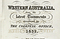 | Details | Royal Geographical Society of London | 1832 |
| Western Australia from the latest documents received in the Colonial Office, 1832 |
|
Royal Geographical Society of London |
|
| 1832 |
| LOC:0 |
| $0.00 | Royal-Geographical-Society-of-London | Western-Australia-from-the-latest-documents-received-in-the-Colonial-Office--1832 | SOLD<br></br>
This antique map of Western Australia is the earliest available map to show the new state of Western Australia, renamed from the "Swan River Colony" in 1832. The map shows the Swan River estuary, the topography of the southwestern coastline, and features the exploration tracks of the Surveyor General (J.S. Roe), R. Dale, Capt. Bannister, Lieut. Preston, Capt. A. Collie and Capt. Currie, members of the Swan River colony whose efforts assisted in the founding of the towns of Perth and Fremantle.
<br></br>
Key features include the port city of Albany on King George's sound, founded in 1826; Rottnest Island and Garden Island off the west coast near Freemantle; Port Vasse, Cape Naturaliste, and Port Leschenault all near Geographe Bay named by French explorer Nicolas Baudin in 1801.
<br></br>
The first European settlement of Western Australia occurred following the landing by Major Edmund Lockyer in 1826. In January 1827 Lockyer took possession of the western third of the continent for the British Crown. This was followed by the establishment of the Swan River Colony in 1829, including the site of the present-day capital, Perth. In 1832 the Swan River Colony was officially renamed "Western Australia".
<br></br>
The map accompanied an article "Recent Information from Australia" by T.L. Mitchell and A.C. [A. Cunningham] V2 of the Journal of the Royal Geographical Society by John Murray, Albemarle St., September. 1832. |