| | Thumbnail | | Creator | Date | Title / Author / Date / Location | Price | | | Description |
| 5345 | 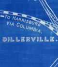 | Details | Snyder, Antes | 1896 |
| Antique blueprint map of Lancaster, Pennsylvania with railroads |
|
Snyder, Antes |
|
| 1896 |
| LOC:300 |
| $1,220.00 | Snyder--Antes | Antique-blueprint-map-of-Lancaster--Pennsylvania-with-railroads | Fine unrecorded 19th century cyanotype or blueprint map of Lancaster, Pennsylvania by the Pennsylvania Railroad Company . This original, large (34" x 24") blueprint from 1896 shows Lancaster, PA streets along with the route of the Philadelphia and Columbia Railroad passenger line and the Lancaster cut off freight line, both owned by the Pennsylvania Railroad Company. Additional key features include the Lancaster PRR station, the city limits, Big Conestoga Creek (Conestoga River), Dillersville, and two reservoirs.
<br></br>
The Pennsylvania Railroad (PRR) was established in 1846, with headquarters in Philadelphia, Pennsylvania. By 1882, the Pennsylvania Railroad had become the largest railroad by traffic and revenue, and the largest corporation in the world. Its budget was second only to the U.S. government.
<br></br>
Drawn under the direction of Antes Snyder, Right of Way Engineer, P.R.R. Blairsville, Indiana County, Pennsylvania. J. V. Kilgore, draftsman. 1896. Scale 400 feet = one inch. North is oriented to top. [Penn., railway] |