| | Thumbnail | | Creator | Date | Title / Author / Date / Location | Price | | | Description |
| 4971 | 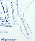 | Details | Withers, James Harlan | 1947 |
| Humorous map of Texas from a Texan perspective |
|
Withers, James Harlan |
|
| 1947 |
| LOC:63 |
| $700.00 | Withers--James-Harlan | Humorous-map-of-Texas-from-a-Texan-perspective | Scarce original blue-line, politically incorrect, map of the state of Texas from the 'humorously' distorted perspective of a Texan looking outward at the rest of the country. Believed to be the earliest recorded version of later similar 'humorous' maps of Texas inspired by Wither's design. Only one holding is found online, at the University of Texas, Arlington, where it is described:
<div class="indenttextblocksingle">
Map shows distortion of boundaries of the state of Texas in comparison to its U.S. neighbors with humorous bragging and derogatory relabeling. Relief shown by hachures. (Source: https://texashistory.unt.edu/ark:/67531/metapth252139/)
</div>
<br></br>
The Catalog of Copyright Entries for 1947 records a copyright for "A Texan's Map of U.S.A.", held by James Harlan Withers of San Angelo , Texas. Predates by two years the derivative but substantially different "A Texan's Map of the United States" by Frank Oliver published in 1949 for TexOak flooring.
<br></br>
The blue-line, or diazo process is a chemical method of document reproduction that fell out of use in the early 2000's. |
| 5097 |  | Details | Withers, James Harlan | 1958 |
| A Texan's Map of U.S.A. |
|
Withers, James Harlan |
|
| 1958 |
| LOC:0 |
| $500.00 | Withers--James-Harlan | A-Texan-s-Map-of-U-S-A- | A Texan's Map of U.S.A. A derivative edition of a classic pictorial "humorous" map with more than a whiff of the intolerance that some believe permeates the state of Texas today. Tablecloth-sized map of the United States on Indian Head cloth [1] based on a design copyrighted by J.H. Withers in 1947 and branded with the imprint of Lackland Air Force Base in San Antonio, Texas.
<br></br>
Wither's distinctive design elements include a revised shape for Texas which extends to the west coast to provide Texas with a space for a "future seaport" and the appellation "damm' Yankee territory" for most of the northeast U.S.A.
<br></br>
The Catalog of Copyright Entries for 1947 records a copyright for "A Texan's Map of U.S.A.", held by James Harlan Withers of San Angelo, Texas. Wither's 1947 pictorial map is the earliest documented example of a genre of pictorial map with many derivative versions that begin with the fact that Texas was, at the time, the largest state in the U.S. and extend that simple premise to exaggerate the importance and quality of the state of Texas over the every other state in the U.S.A.
<br></br>
Early 50's date is supported by the fact that neither Alaska nor Hawaii, which both attained statehood in 1959, are mentioned on the map.
<br></br>
[1] Indian Head cloth was not manufactured after 1962. Indian Head Cloth Permanent Finish Sanforized stamping on a single line is associated with cloth produced from the late 1940s to early 1950s. (Source: http://info.fabrics.net/indian-head-remembered-revisiting-an-american-institution/) |