| | Thumbnail | | Creator | Date | Title / Author / Date / Location | Price | | | Description |
| 833 |  | Details | James Imray and Son | 1868 |
| West Coast of India from Kanyakumari (Cape Comorin) to Mumbai (Bombay) |
|
James Imray and Son |
|
| 1868 |
| LOC:0 |
| $600.00 | James-Imray-and-Son | West-Coast-of-India-from--Kanyakumari-(Cape-Comorin)-to-Mumbai-(Bombay) | Scarce antique blueback nautical chart of the West coast of India, including Mumbai ( Bombay ) and Goa, trending southward to Kanyakumari ( Cape Comorin ). Cape Comorin is the southern-most point of the Indian subcontinent, surrounded by the Laccadive Sea. This scarce nineteenth-century blueback nautical chart contains detailed inset port plans of Cochin Harbor, Calicut Roads, Bombay Harbor, and the Approach to Bombay.
<br></br>
During the 1800's there was a trend toward publication of very large small-scale charts with large-scale insets of key passages and harbors. The practice was adopted as much for economics as any other reason. James Imray and Son was one of a handful of British publishers who specialized in these charts which were often backed with canvas or linen cloth or heavy blue paper in order to help them withstand the frequent use and abuse aboard ship, hence the term "blueback chart".
<br></br>Due to changing conditions charts could become outdated quickly and it was important for mariners to understand the accuracy of their navigational charts. The British Admiralty and later the U.S. Coast Survey responded by recording the dates of each update on the map, in some cases maintaining a historical record of updates spanning many decades. Private publishers of sea charts like Imray or Laurie fulfilled the same need by providing the date of the last update with an inked overstamp. On this chart we find an example of that practice, an oval-shaped blue ink over-stamp that reads: "Imray and Son 1869".
<br></br>
Published by James Imray and Son, 89 and 102 Minories. Laid to blue paper for protection with cloth selvage. Original cloth map ties. Yellow label from the Imray firm attached on verso that reads "James Imray and Son, Hydrographers.". James Imray and Son is one of the three firms that over the last two centuries combined to form Imray Laurie Norie & Wilson Ltd. |
| 23 | 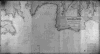 | Details | James Imray and Son | 1868 |
| The Coasts of France, Spain and Portugal (Blueback) |
|
James Imray and Son |
|
| 1868 |
| LOC:0 |
| $750.00 | James-Imray-and-Son | The-Coasts-of-France--Spain-and-Portugal-(Blueback) | Very attractive, imposing, and desirable 140+ year old blueback nautical chart of the Atlantic coast of Europe. Contains the blue stamp from the firm of "Imray 1869". Coverage includes the Strait of Gibraltar and western Mediterranean. This wide antique nautical chart of the West coat of Europe would have been useful to any navigator sailing eastward as it covers all the approaches to the Mediterranean, Bay of Biscay, English Channel and the Bristol and Irish Channels.<BR> </BR>
A six- foot working blueback nautical chart by Imray that has seen its time at sea and exudes history. You can almost smell the salt air! Several manuscript navigator's tracks plotted in pencil include notation: "8th day July 1877 from (illegible) to Falmouth 133 days out". 9 insets including rivers Tagus, Douro and Gironde. Lighthouses indicated in red.<BR> </BR>
On verso is original yellow publishers label from James Imray and Son with price of 10s 6d. Also on verso is a sellers label from "D. Eggert and Sons, manufacturers and importers of chronometers, fine watches, nautical instruments, charts, books, &c. 127 Pearl Street, New York between Wall Street and Old Slip."
<BR> </BR>
For more information on the evolution of blueback charts we recommend this book by Susanna Fisher:
<a target="_blank" style="color:#9BAFCB" href="http://www.regattapress.com/The_Makers_of_the_Blueback_Chart.html">The Makers of Blueback Charts.</a>
<BR> </BR> |
| 837 |  | Details | James Imray and Son | 1872 |
| Bay of Bengal with The Andaman and Nicobar Islands |
|
James Imray and Son |
|
| 1872 |
| LOC:0 |
| $0.00 | James-Imray-and-Son | Bay-of-Bengal-with-The-Andaman-and-Nicobar-Islands | SOLD<b></b>
Antique blueback nautical chart of the Eastern part of the Bay of Bengal. Includes the Myanmar ( Burma ) coast; a portion of the Thailand coast including Phuket; the Northwest coast of Sumatra including Banda Aceh; and the Andaman and Nicobar Islands, a territory of India. Ten inset charts of: Port Cornwallis, St. Georges Channel, Pulu Milu, Galatea Bay, Port Campbell, the Rangoon River, Amherst Road, Port Blair, Penang, and Nangcovri Harbor.
<br></br>
Chart includes North Sentinel Island off the West coast of South Andaman Island. That island is home to the Sentinelese people, one of the last paleolithic ( early stone age) tribes, of between 50 and 400 persons. The Sentinelese fiercely resist contact with the outside world and are reported to have survived the 2004 Tsunami by moving to higher ground in advance, almost as though they knew what to expect.. In 2006 the Sentinelese are reported to have fired arrows at two fishermen, killing them after they were wrecked on the island.
<br></br>
During the 1800's there was a trend toward publication of very large small-scale charts with large-scale insets of key passages and harbors. The practice was adopted as much for economics as any other reason. James Imray and Son was one of a handful of British publishers who specialized in these charts which were often backed with canvas or linen cloth or heavy blue paper in order to help them withstand the frequent use and abuse aboard ship, hence the term "blueback chart".
<br></br>
With an oval-shaped blue ink over-stamp that reads: "Imray and Son 1872 London".
<br></br>
Published by James Imray and Son, 89 Minories and Tower Hill 1870. Laid to blue paper for protection. Yellow label from the Imray firm attached on verso that reads "James Imray and Son, Hydrographers." |
| 828 |  | Details | James Imray and Son | 1876 |
| Rice Ports of India |
|
James Imray and Son |
|
| 1876 |
| LOC:0 |
| $1,800.00 | James-Imray-and-Son | Rice-Ports-of-India | Privately published blueback chart of the Myanmar ( Burma ) coast including the entire Irawaddy River delta and the Gulf of Martaban. In the 1860's and 1870's as a result of Britain's investment in flood control projects in the Irawaddy River Basin, Burma was transformed into the world's largest rice exporter. This large antique chart would have provided ship owners and sailing masters in the rice trade with a single sheet that offered both small-scale and large-scale navigational information for many of the destinations they sailed from. Inset charts of: Kyouk Phyou, Aracan River, Bassein River, Rangoon River, Bentick Sound and Amherst Road.
<br></br>
Blueback charts are recognizable from the blue paper backing that was attached to a nautical chart to provide the needed strength to withstand hard usage at sea. Published by James Imray and Son, 89 Minories and Tower Hill, London, 1876. James Imray and Sons is one of the firms that over the last two centuries combined to form Imray Laurie Norie & Wilson Ltd.
<br></br>
The following description of the chart was published by Rosser and Imray in the Catalog section of their 1867 "Seaman's Guide" : <div class="indenttextblock">A chart on two large sheets of the coasts of the Bay of Bengal between latitudes 13° and 21° N, longitudes 92° and 98° E. With plans of Akyab, Kyou, Phiouk, Bassein River, Rangoon River, Maulmain, and Kalegouk Island anchorage. A very useful chart for Shipmasters bound to Akyab, Rangoon, or Maulmain as it exhibits the navigation on a larger scale than any hitherto published. (Rosser, William H. and Imray, James F. <b>"The Seaman's Guide to the Navigation of the Indian Ocean and China Sea."</b> <a href="https://books.google.com/books?id=_8BBAAAAIAAJ">Internet</a>. 6/11/2015)
</div>
</br>
Laid to blue paper for protection with cloth selvage. Original cloth map ties. Yellow label from the Imray firm attached on verso. |
| 931 | 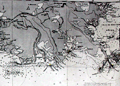 | Details | James Imray and Son | 1876 |
| Gulf of Mexico New Orleans to Tampico Mexico |
|
James Imray and Son |
|
| 1876 |
| LOC:1409 |
| $4,800.00 | James-Imray-and-Son | Gulf-of-Mexico-New-Orleans-to-Tampico-Mexico | A spectacular, huge (6' foot) antique British privately-published blueback nautical chart of the western Gulf of Mexico in very fine condition. Scarce to find this chart, especially an example kept in such great shape as this one. Chart coverage includes United States coastal areas from New Orleans, Louisiana trending west and then south to Tampico, Mexico. Contains the oval blue inked over-stamp that reads "James Imray and Son, 1876, London."
<br></br>
<b>Note:</b> Because of its large size the photo is stitched together from 2 halves. Some abberations in the image may appear.
<br></br>
This old chart is dotted with numeous inset large-scale charts of key ports and important bays, rivers and harbors including: Galveston, Texas; Atchafalya Bay, Louisiaana, Sabine Pass, Matagorga Bay, Rio Grande, and Tampico, Mexico.
<br></br>
During the 1800's there was a trend toward publication of very large small-scale charts with large-scale insets of key passages and harbors. The practice was adopted as much for economics as any other reason. James Imray and Son was one of a handful of British publishers who specialized in these charts which were often backed with canvas or linen cloth or heavy blue paper in order to help them withstand the frequent use and abuse aboard ship, hence the term "blueback chart".
<br></br>
Outer blue paper contains yellow a large seller's label with the logo of James Imray amd Son.
Price when sold 10 s. |
| 3680 | 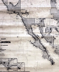 | Details | James Imray and Son | 1876 |
| West Coast of North America from San Blas to San Francisco |
|
James Imray and Son |
|
| 1876 |
| LOC:0 |
| $2,400.00 | James-Imray-and-Son | West-Coast-of-North-America-from-San-Blas-to-San-Francisco | Spectacular and large blueback nautical chart from <b>California's post Gold-Rush era</b> . Published five years before the establishment of the San Francisco Stock Exchange at 312 California Street, this antique sea-faring chart documents all the ports, harbors, and towns along the west coast of North America from Mendocino City, CA. to past Cabo Corrientes, Mexico and includes the Baja Peninsula with full coverage of all the areas surrounding <b>Cabo San Lucas</b> and <b>Mazatlan</b>, MX.
<br></br>
This blueback chart contains numerous inset charts including: San Francisco Bay; Santa Barbara; Bodega Bay; San Diego Bay; Ballena Bay; Mangles Road; San Jose del Cabo Bay; Tamales Bay; Magdalena Bay; San Lucas Bay; Mazatlan.
<br></br>
Verso consists of the original blue-paper backing as issued to strengthen the chart for its expected hard life at sea. Also on the verso is the original yellow publisher's label from the Imray firm that reads "COAST OF CALIFORNIA. James Imray and Son. London. Chart 135."
<br></br>
Due to changing conditions charts could become outdated quickly and it was important for mariners to understand the accuracy of their navigational charts. The British Admiralty and later the U.S. Coast Survey responded by recording the dates of each update on the map, in some cases maintaining a historical record of updates spanning many decades. Private publishers of sea charts fulfilled the same need by providing the date of the last update with an inked over stamp. |
| 946 | 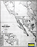 | Details | James Imray and Son | 1881 |
| West Coast of North America San Blas San Francisco |
|
James Imray and Son |
|
| 1881 |
| LOC:0 |
| $0.00 | James-Imray-and-Son | West-Coast-of-North-America-San-Blas-San-Francisco | SOLD, but have an <a href="https://www.rarecharts.com/ShowDetail/Creator/James-Imray-and-Son/Title/West-Coast-of-North-America-from-San-Blas-to-San-Francisco/3680" target="_blank" >earlier example </a> (1876) of the same chart. Spectacular blueback nautical chart from <b>California's post Gold-Rush era</b> in superb condition. |
| 24 | 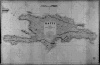 | Details | James Imray and Son | 1885 |
| Haiti (Blueback) |
|
James Imray and Son |
|
| 1885 |
| LOC:0 |
| $0.00 | James-Imray-and-Son | Haiti-(Blueback) | NOT AVAILABLE
<BR> </BR>
Large, handsome, original blueback nautical chart of Haiti / San Domingo (now the Dominican Republic) from James Imray and Son with the eastern-most tip of Cuba visible. Strong graphic composition. Profile view at top of "Port Paix or Valpariso, distant 3 miles". <BR> </BR>
The original, antique nautical chart is surrounded with six compass roses and is marked with the Imray globe / laurel wreath emblem . Four lighthouses are highlighted in yellow, while the title cartouche inset contains the following warning: "The lights are of inferior brilliancy and badly attended: some of them may not be shown." <br/><br/>
Verso contains complete yellow Imray publishers label: "Chart No. 119 Haiti or San Domingo".
<BR> </BR>
For more information on the evolution of blueback charts we recommend this book by Susanna Fisher:
<a target="_blank" href="http://www.regattapress.com/The_Makers_of_the_Blueback_Chart.html">The Makers of Blueback Charts.</a> |